U.S. 92 generally parallels Interstate 4 between the Tampa Bay Area and Daytona Beach via Plant City, Lakeland, Osceola County, Orlando, Sanford and DeLand. Crossing the Florida peninsula in a southwest to northeast direction, U.S. 92 follows several state roads along its route:
- SR 687 (4th Street N) from St. Petersburg City Hall (SR 595 / 5th Avenue N) at Downtown north to the exchange with SR 694 (Gandy Boulevard).
- SR 600 (Gandy Boulevard) east from the Gateway area in St. Petersburg to South Tampa over the Gandy Bridge. U.S. 92/SR 600 turn north along Dale Mabry Highway and east across Tampa along Hillsborough Avenue. U.S. 92/SR 600 continue east to Seffner, Dover and Plant City in Hillsborough County.
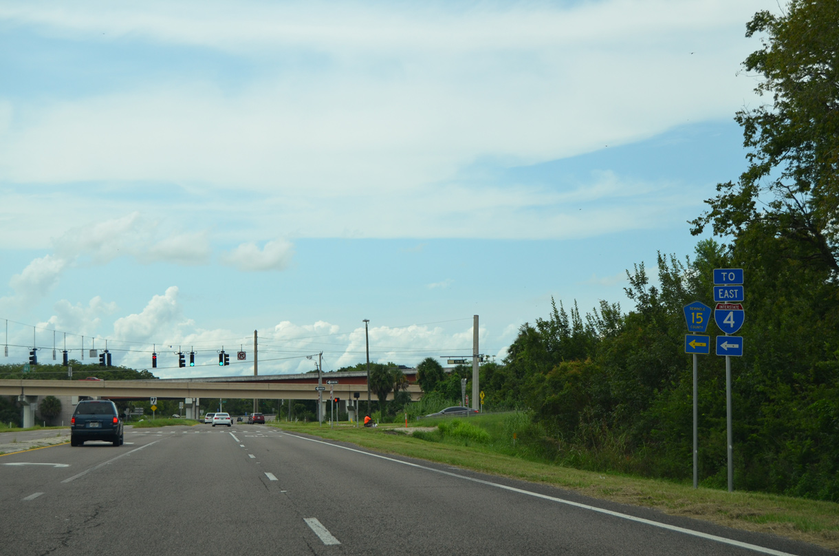
- Within Lakeland and Polk County, U.S. 92 seprates from SR 600 along SR 517 north and SR 546 (Lake Parker Boulevard / Memorial Parkway) east. SR 600 (George Jenkins Boulevard) through Lakeland was previously designated as U.S. 92 Business.
- SR 600 resumes as the counterpart to U.S. 92 from east Lakeland (SR 546) to U.S. 441 in Kissimmee.
- SR 500 and SR 600 travel jointly from U.S. 441 in Kissimmee north to Orlando, where U.S. 17-92 split from U.S. 441
- SR 15 and SR 600 then head north from U.S. 441 in Orlando to DeLand along the U.S. 17-92 overlap
- SR 600 from DeLand east to Daytona Beach - a distance of 23.132 miles in Volusia County.
U.S. 92 Florida Guides
Two fifths of the overall route of U.S. 92 overlaps with U.S. 17. U.S. 17/92 combine between Lake Alfred and DeLand. Parts of the route through Orange County are known as the Orange Blossom Trail. Both U.S. 92 and its branch U.S. 192, are intrastate routes located entirely within the state of Florida and are less than 300 miles long. So under the guidelines set forth by the American Association of Highway and Transportation Organization (AASHTO), U.S. 92 and U.S. 192 should have been decommissioned. However, given the geography of the Florida peninsula, an exception seems warranted in order to allow west to east U.S. routes.
US-Highways.com indicated that the lone business route for U.S. 92 along Florida State Road 600 was decommissioned in 1998, but many maps continued to acknowledge this urban route through the 2000s.
Gandy Bridge
The Gandy Bridge was the longest automobile bridge in the world when it opened on November 20, 1924. The vision of Tampa businessman George "Dad" Gandy, who sought an easier link with St. Petersburg to improve area business, led to its construction. When it was completed, the driving distance between Tampa and St. Petersburg dropped from 42 to 19 miles.1
The original two lane Gandy Bridge was tolled until 1944, when the federal government paid $2.4 million to the bridge management company in an effort to help the war. The original span remained in service until 1956, when a replacement bridge opened. A second span was added by 1976 for eastbound traffic, doubling the capacity between St. Petersburg and South Tampa.1 Deterioration of the westbound 1956 bridge resulted in construction for its replacement in 1994 as part of a $31.2 million bridge improvement project.2
2.6 miles in length, the new westbound span for U.S. 92 opened on December 21, 1996 at a height of nine feet above its precedesser.1 The 1956 bridge was then closed to vehicular traffic and later reopened as the Friendship Trail for pedestrians and bicyclists. Dangerous deterioration due to steel corrosion of support elements led to its permanent closure on November 6, 2008.3 The Friendship Trail Bridge was subsequently demolished.
|
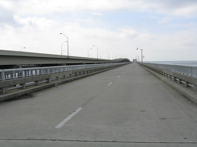
| Standing on the Friendship Trail bridge, the repurposed 1956-built roadway bridge for U.S. 92 across Tampa and Old Tampa Bays. This span was retained as a popular walking / pedestrian path from 1999 to 2008, when it closed due to structural damage, age and increasing upkeep costs. The bridge was subsequently demolished. 11/20/03 |
|
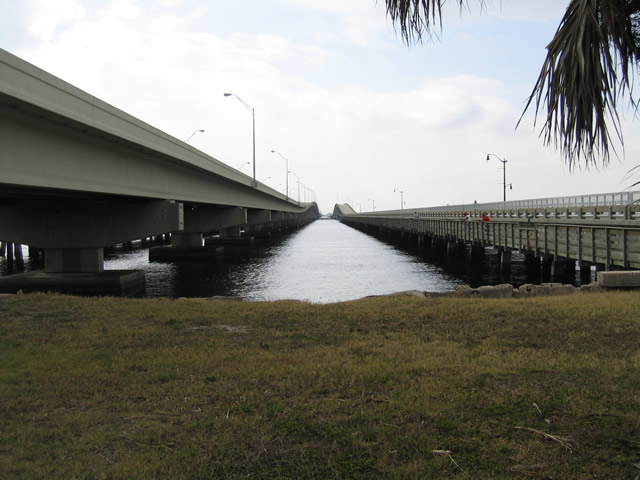
| Looking at the 1996-built westbound Gandy Bridge for U.S. 92 and the former Friendship Trail bridge from the eastern shore of Tampa Bay. 11/20/03 |
|
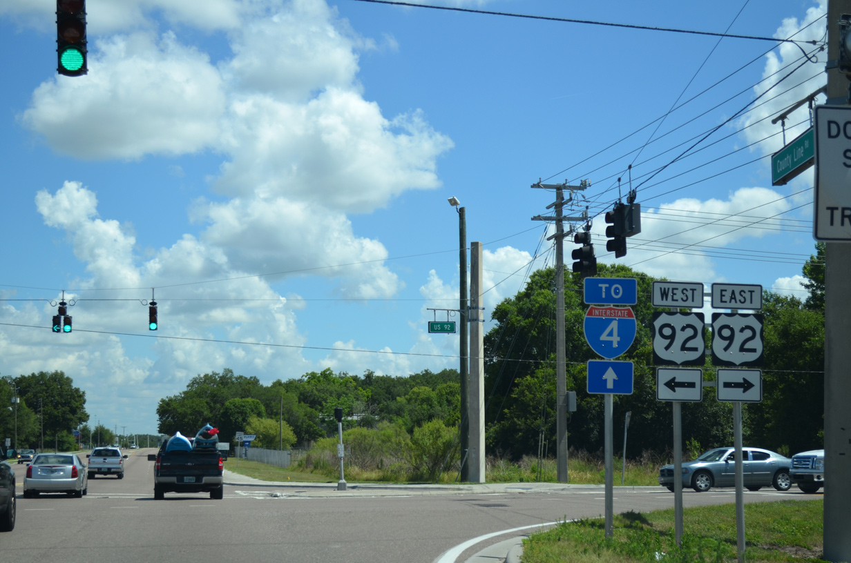
| County Line Road north at U.S. 92 along the border of Hillsborough and Polk Counties. 05/31/15 |
|
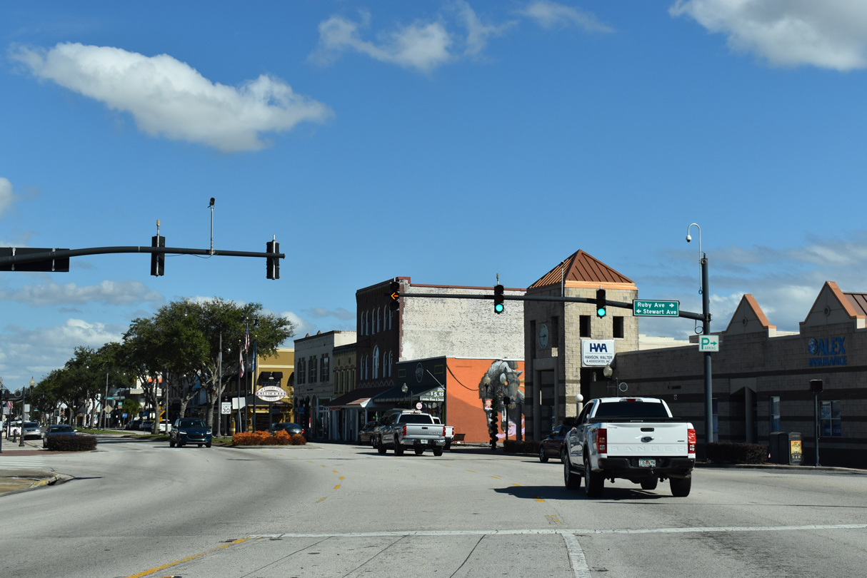
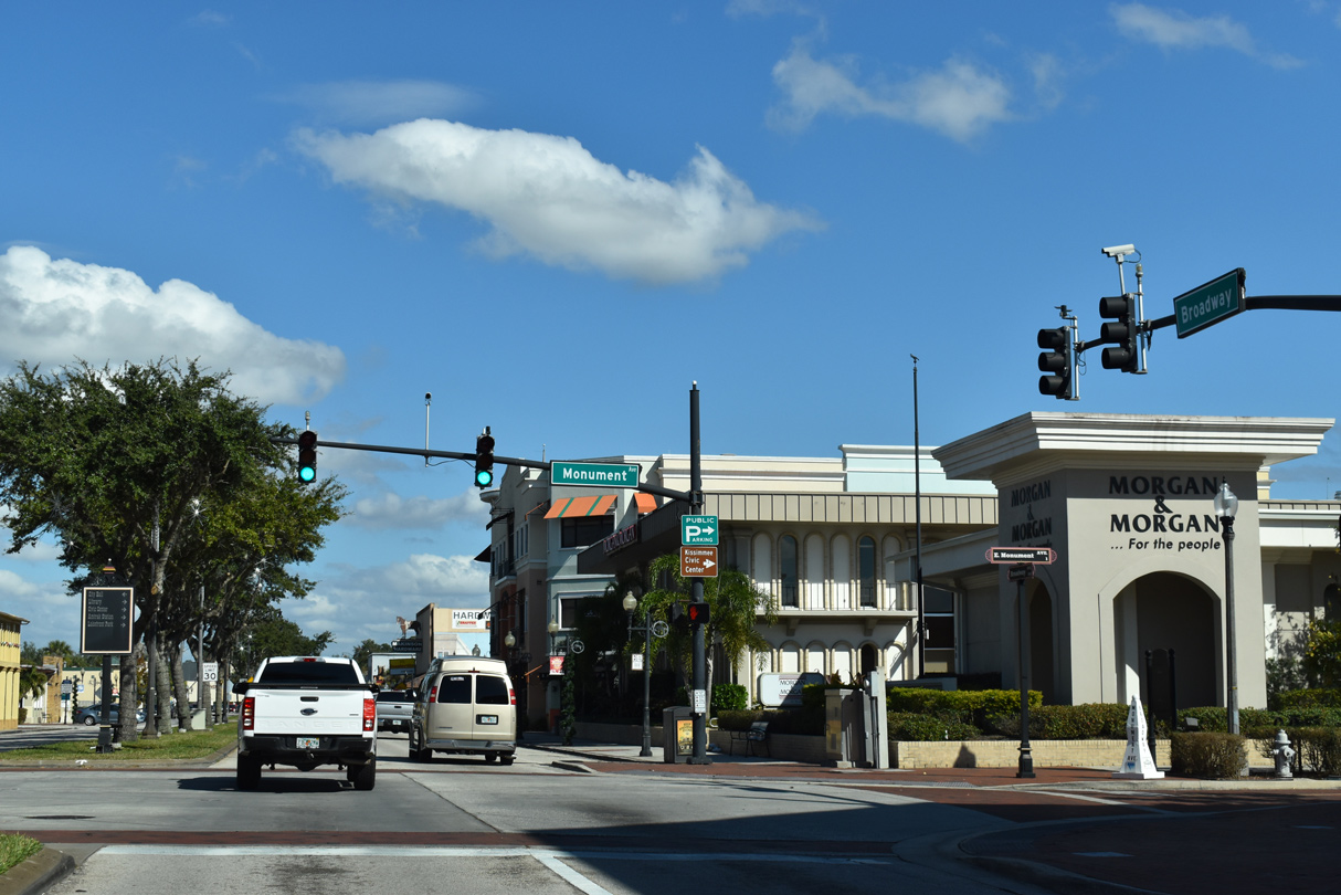
| Representing the former alignment of U.S. 17/92 through Downtown Kissimmee, Emmett Street, Broadway Avenue and Main Street form a 1.46 mile long loop east from U.S. 17/92 (John Young Parkway) to U.S. 192/441 at Vine Street. Emmett Street curves northeast to become Broadway Avenue at Stewart Avenue. 12/05/21 |
|
| Monument Avenue intersects Broadway Avenue northwest from the Monument of States and Kissimmee Lakefront Park to Sumner Street. 12/05/21 |
|
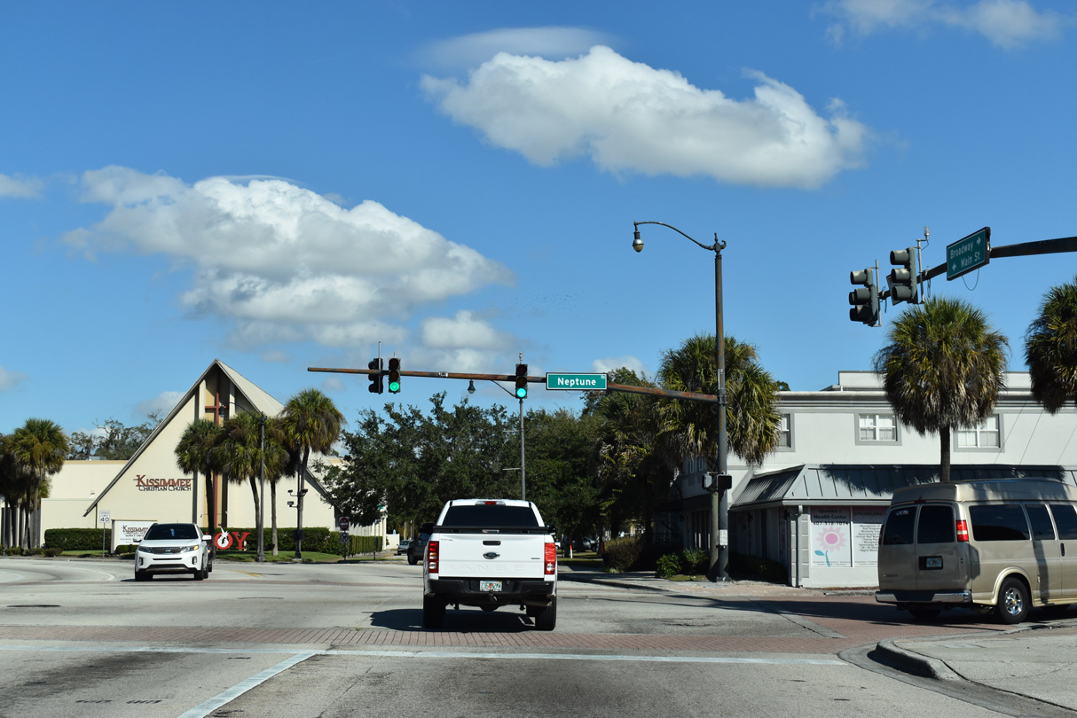
| Broadway Avenue turns north onto Main Street at Neptune Road and the historic west end of U.S. 192. Neptune Road (CR 525) runs east from Kissimmee to U.S. 192/441 at St. Cloud. 12/05/21 |
|
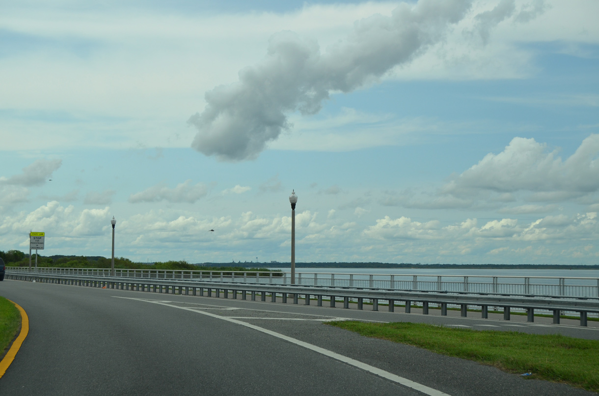
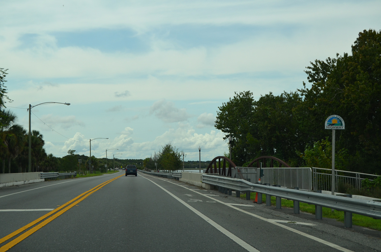
| Prior to 2018, U.S. 17/92 followed Seminole Boulevard directly alongside Lake Monroe for three miles between French Avenue in Sanford and I-4. The two lane highway is part of the River of Lakes Heritage Scenic Highway, a 120 mile system of roads extending northward to Putnam County and the St. Johns River.4 09/03/17 |
|
| The entrance to Central Florida Zoo & Botanical Gardens ties into Seminole Boulevard (former U.S. 17/92) just to the east of I-4 in a wooded area. 09/03/17 |
|
| U.S. 17/92 converged with the north end of County Road 15 (Monroe Road) at a three-quarter cloverleaf interchange with I-4 adjacent to the St. Johns River. 09/03/17 |
|
| County Road 15 (Monroe Road) connected U.S. 17/92 with the eastbound on-ramp to Interstate 4. U.S. 17/92 overtook CR 15 along the five lane boulevard south to SR 46 east in 2018. 09/03/17 |
Sources:
- "Bridges." Bayciti - Tampa Bay Urban Blog. Cozart, Justin, October 26, 2004. August 27, 2015.
- "Gandy is dandy." St. Petersburg Times (FL), December 22, 1996.
- "Treasured Tampa Bay Link Shut." St. Petersburg Times (FL), November 7, 2008.
- River of Lakes Heritage Scenic Highway.
http://www.sanfordfl.gov/departments/ planning-and-development-services/river-of-lakes -heritage-scenic-highway City of Sanford web site.
- 11/20/03 by Justin Cozart.
- 05/31/15 by AARoads.
- 09/03/17 by AARoads.
- 12/05/21 by AARoads.
Connect with:
Interstate 4
Interstate 95
Interstate 275
U.S. 1
U.S. 17
U.S. 27
U.S. 41
U.S. 98
U.S. 129
U.S. 192
U.S. 441
State Road 46
State Road 50
State Road 60
State Road 417 - Central Florida GreeneWay / Seminole Expressway
State Road 538 - Poinciana Parkway
State Road 570 - Polk Parkway
State Road 580
State Road 618 - Lee Roy Selmon Expressway
Page Updated 11-11-2022.

 scenes