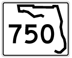
Originally just the easternmost 0.58 miles of Airport Boulevard, State Road 750 was extended west on June 30, 20111 to U.S. 29 in a mileage swap with Escambia County for Olive Road (State Road 290). Airport Boulevard constitutes a busy arterial throughout its route, serving the terminal of Pensacola International Airport (PNS), Cordova Mall, and Interstate 110 at a 2009-opened diamond interchange.
|
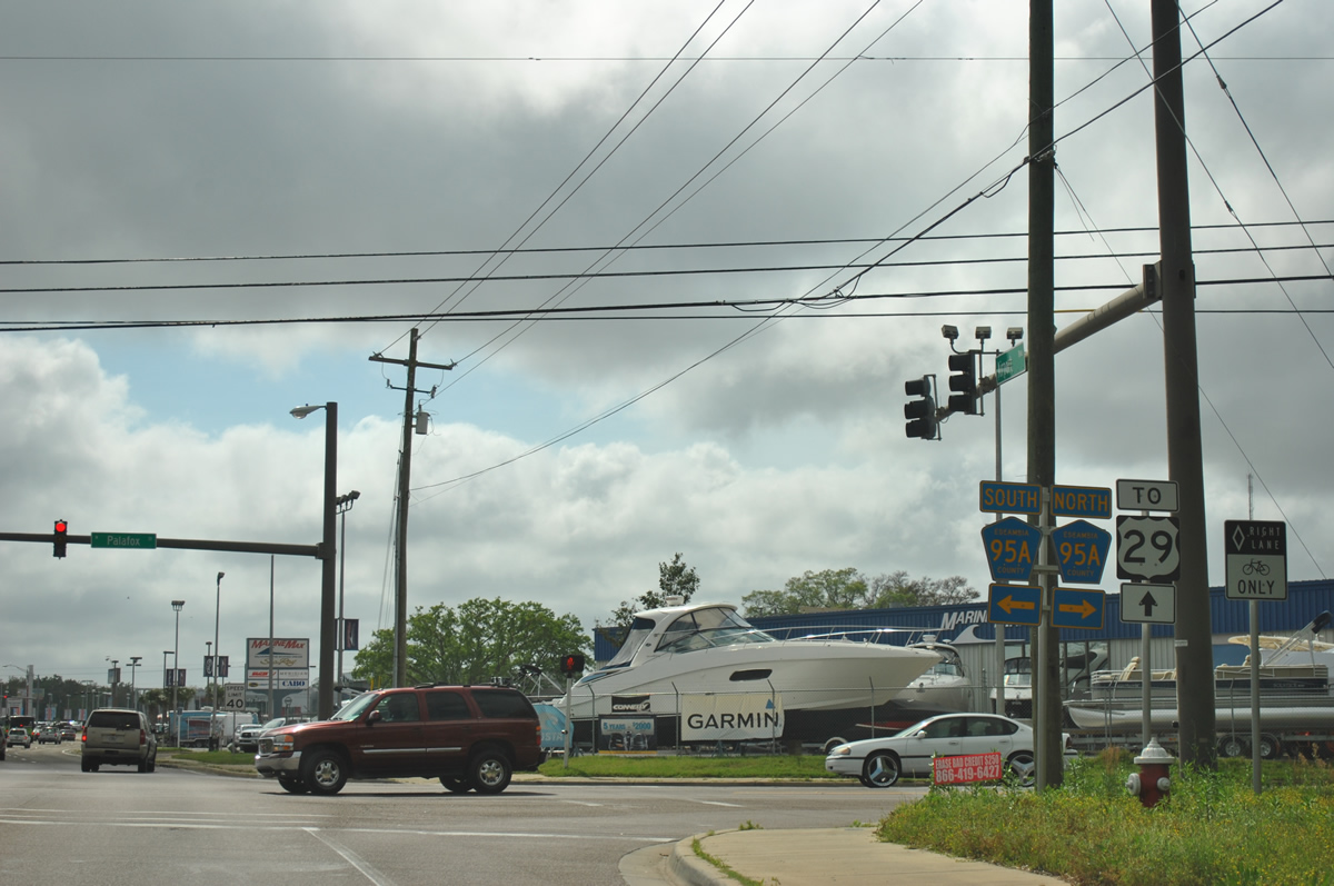
| Just east of its beginning, SR 750 (Airport Boulevard) crosses Escambia County Road 95A (Palafox Street). 05/17/14 |
|
| CR 95A south ends nearby while northbound provides a back way to Ensley. CR-95A is a numbering remnant from State Road 95, the hidden counterpart of U.S. 29. 11/17/12 |
|
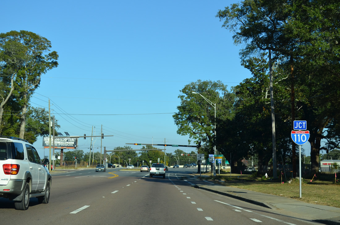
| Airport Boulevard next meets Interstate 110 at a diamond interchange opened in 2009. 11/17/12 |
|
| Hancock Lane ties into Airport Boulevard along the west side of Interstate 110 at a separate traffic light from the southbound on-ramp. The local road connects with residential areas of north Brent and a middle school. 11/17/12 |
|
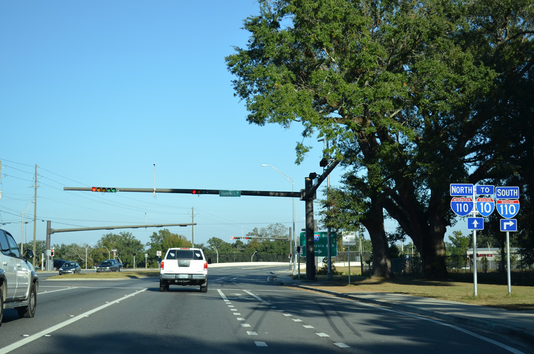
| The on-ramp to downtown Pensacola and Pensacola Beach first intersects SR 296 (Brent Lane) before joining the Interstate 110 southbound mainline. 11/17/12 |
|
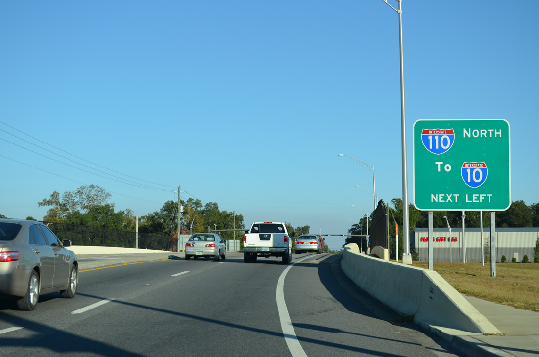
| The northbound I-110 ramp from SR 750 to Interstate 10 follows from the left. 11/17/12 |
|
| Interstate 110 ends 1.5 miles northward at a modified trumpet interchange with Interstate 10. Northbound commuters are provided with a ramp to SR 291 (Davis Highway) as well. 11/17/12 |
|
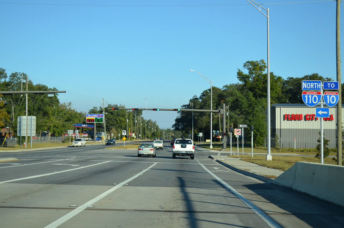
| The first shield for SR 750 east appears after Interstate 110. 11/17/12 |
|
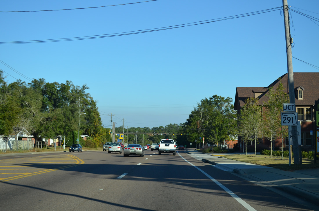
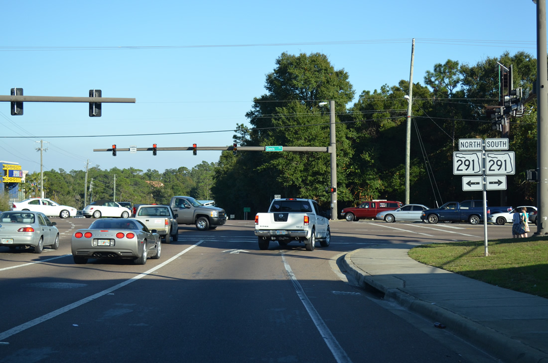
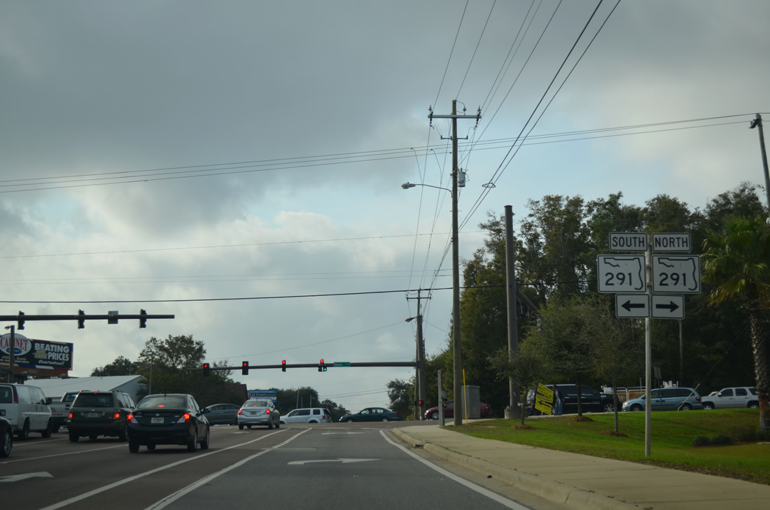
| Heading away from I-110, Airport Boulevard quickly approaches SR 291 (Davis Highway). Davis Highway comprises one of Pensacola's busiest commercial corridors, with retail lining the state road southward to SR 295 (Fairfield Drive) and northwest to West Florida Hospital. 11/17/12 |
|
| SR 291 travels 1.4 miles north to Interstate 10 (Exit 13) and a short distance from there to University Parkway. The parkway provides the main route to the University of West Florida campus. 11/17/12 |
|
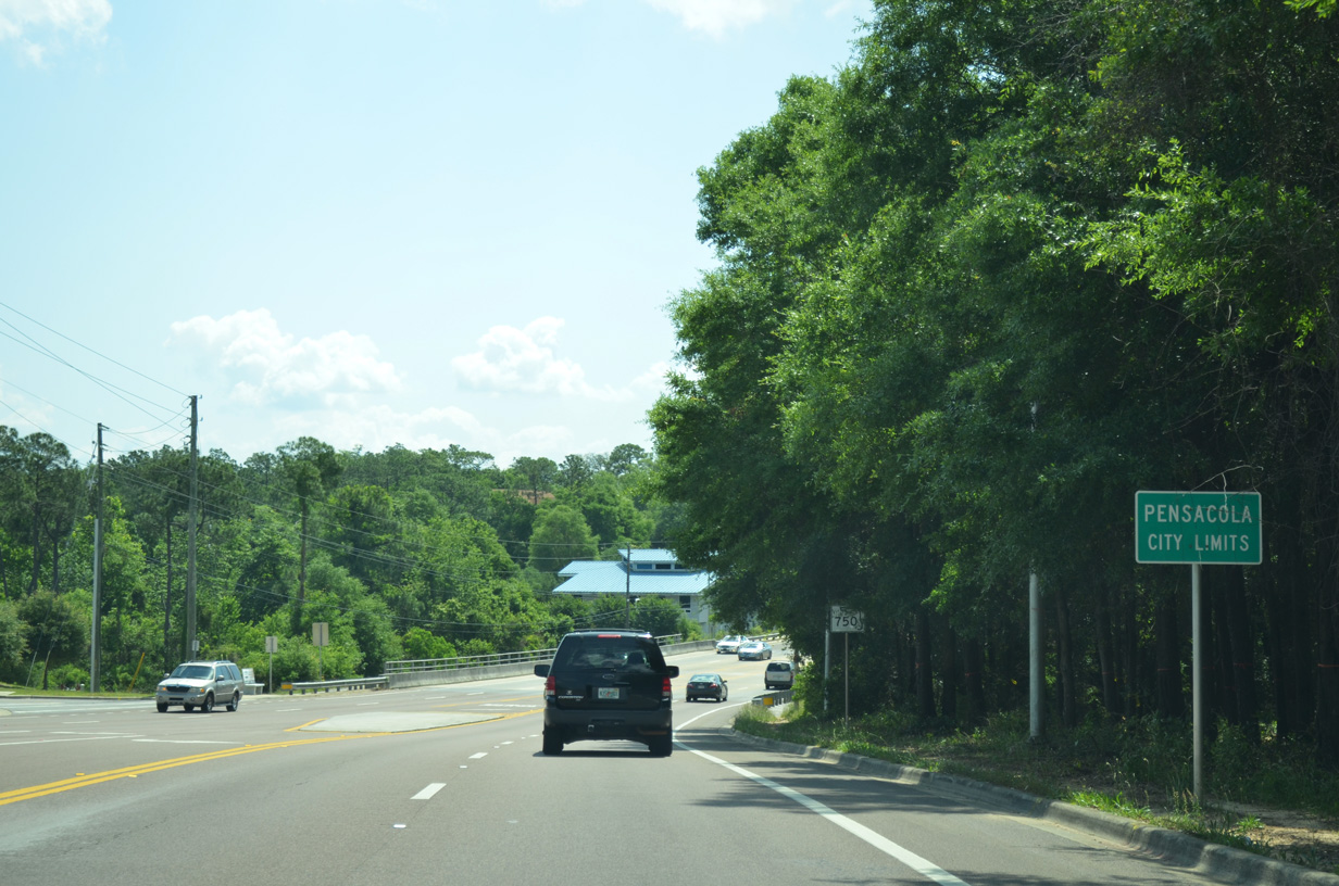
| Airport Boulevard enters the Pensacola city limits and drops 25 feet in elevation from Davis Highway to Carpenter Creek. 05/17/14 |
|
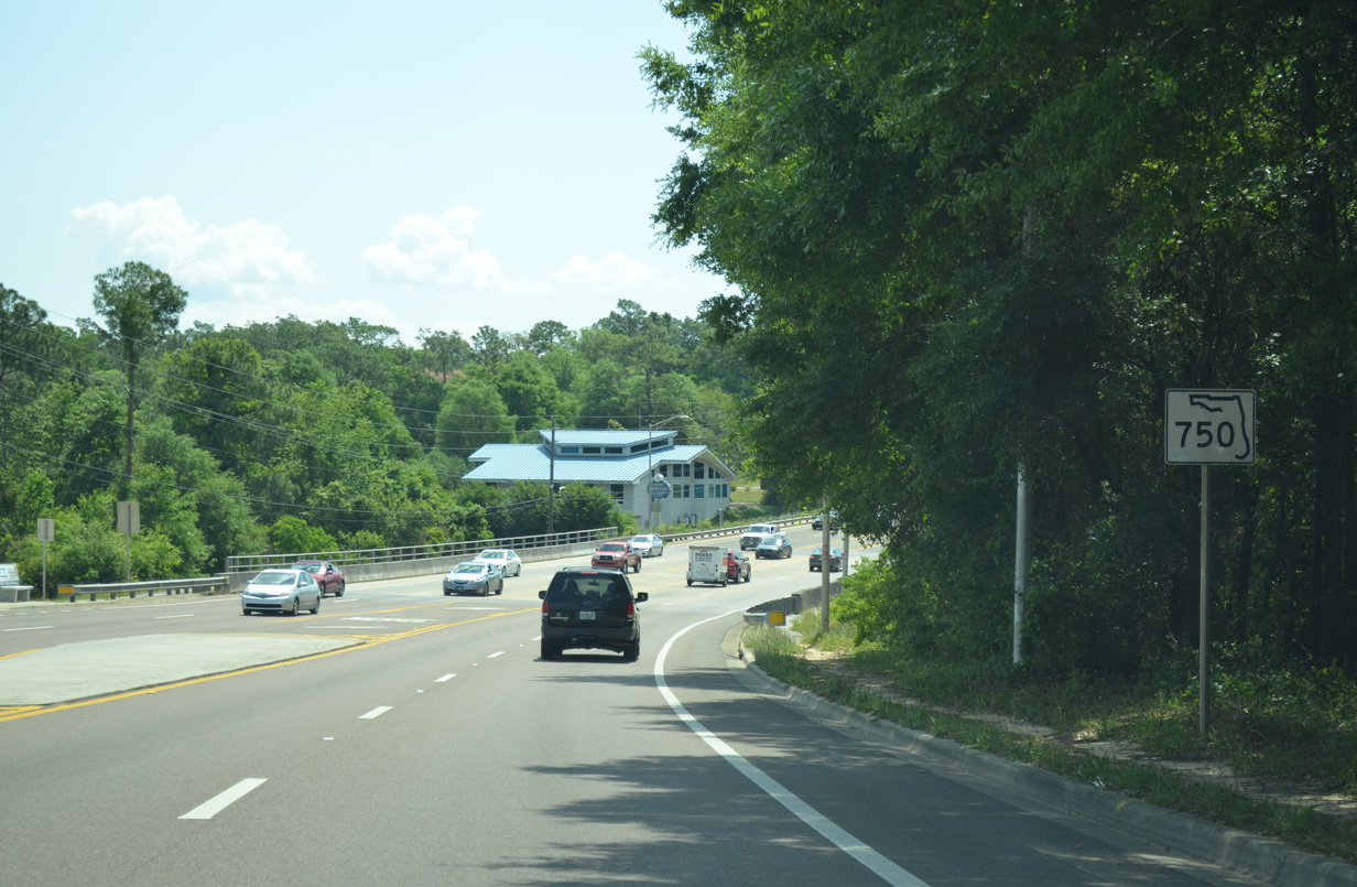
| Am SR 750 reassurance marker appears ahead of Carpenter Creek. This sign was installed in 2011. 05/17/14 |
|
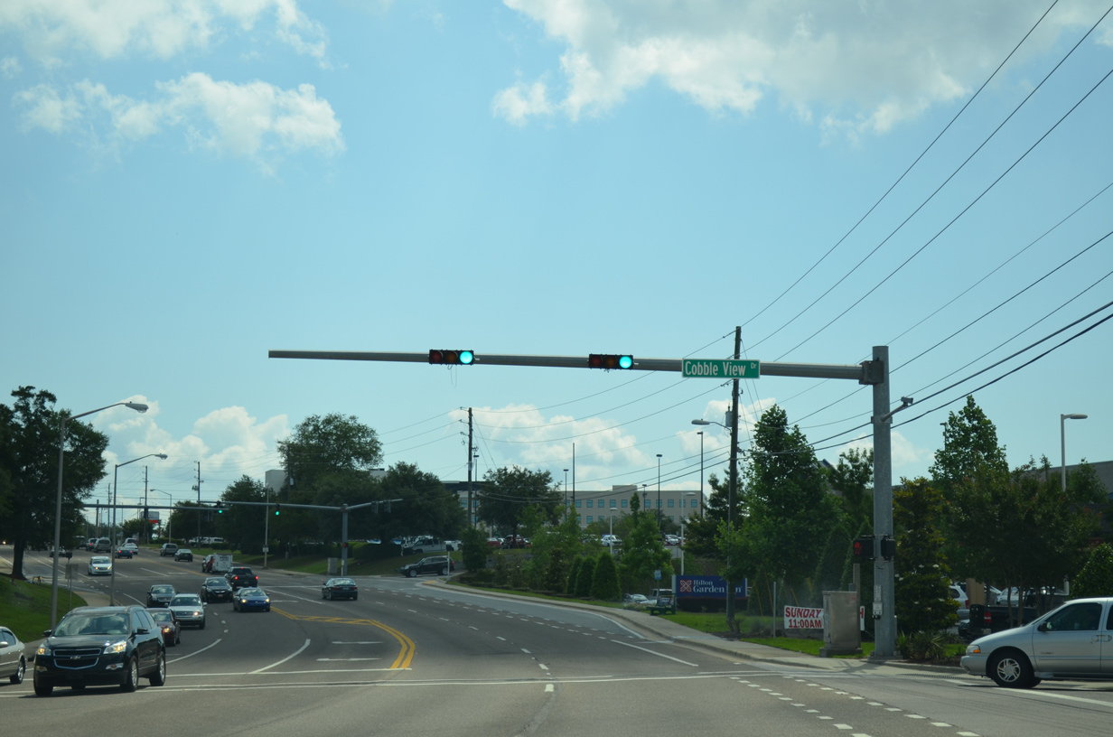
| The first in a series of three traffic lights in a row joins Airport Boulevard with Cobble View Drive and adjacent retail. 05/17/14 |
|
| College Parkway winds northward from Airport Boulevard to Booker T. Washington High School and a residential area along Langley Avenue. 05/17/14 |
|
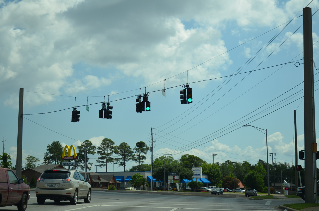
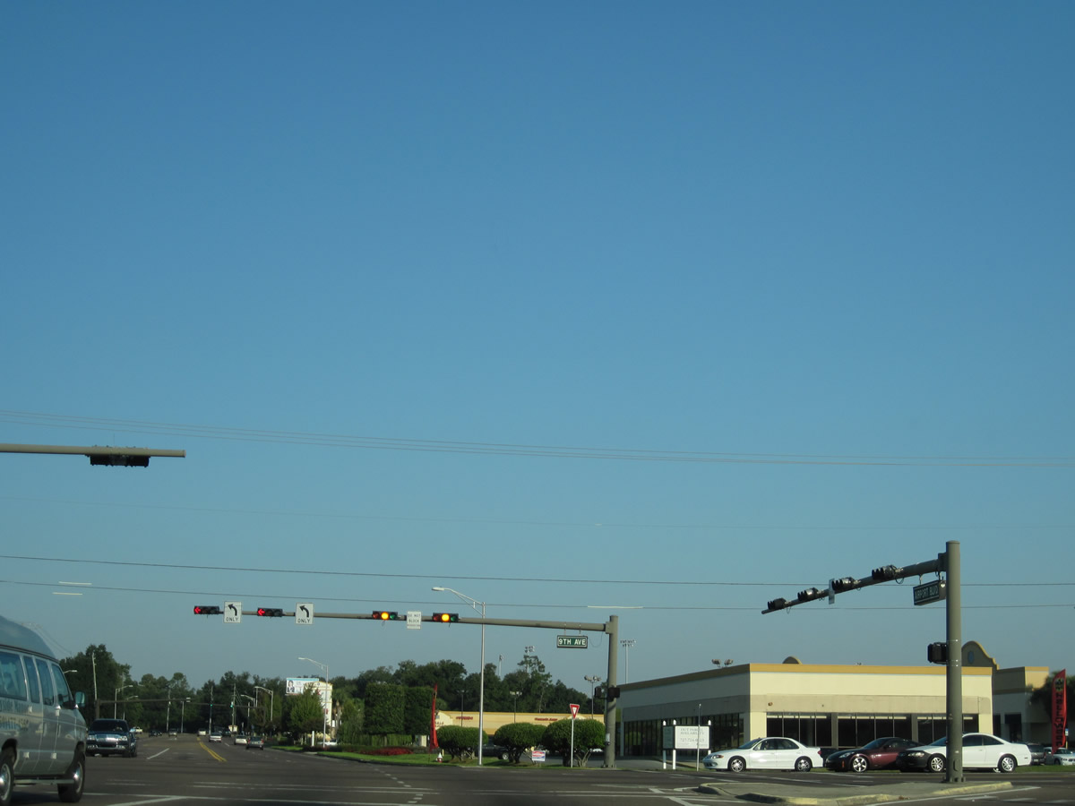
| Passing by Sacred Heart Airport Medical Park and Cordova Commons shopping center, SR 750 (Airport Boulevard) enters the busy intersection with SR 289 (Ninth Avenue). No signs are posted for the 7.28 mile route between U.S. 98 (Chase Street) and Olive Road. 05/17/14 |
|
| What was the lone shield posted along SR 750 eastbound until the 2011 extension was this assembly found along Airport Boulevard after Ninth Avenue.
Note the replacement made by 2014. 04/09/09, 05/17/14 |
|
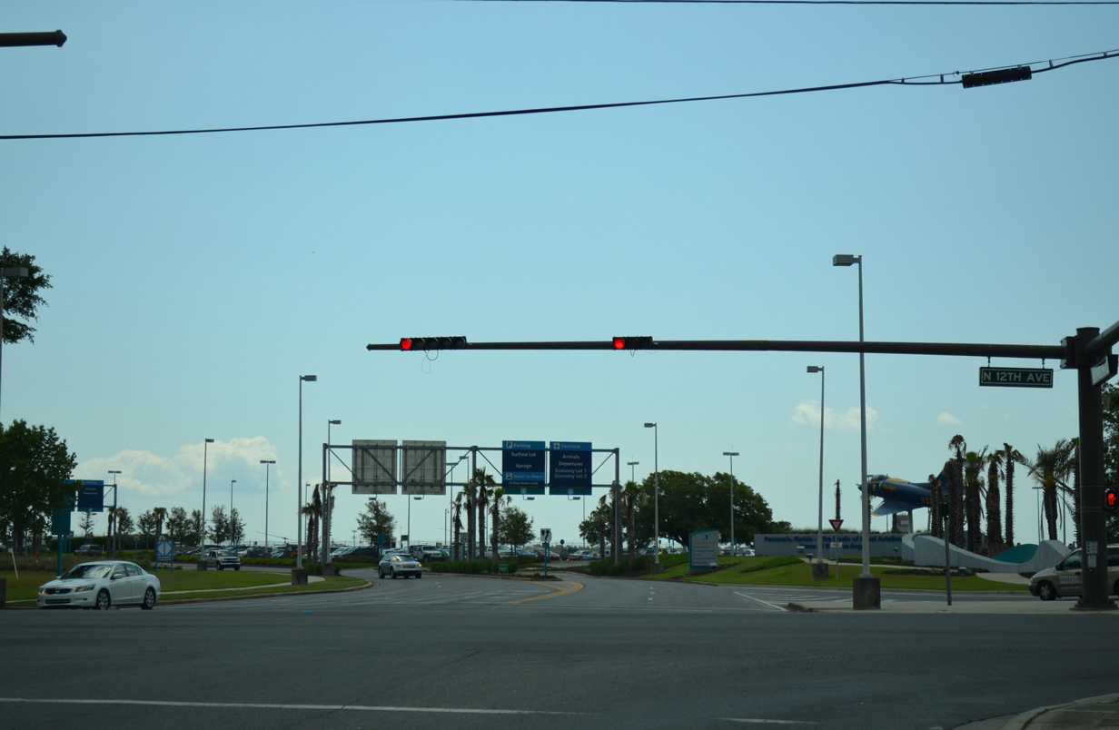
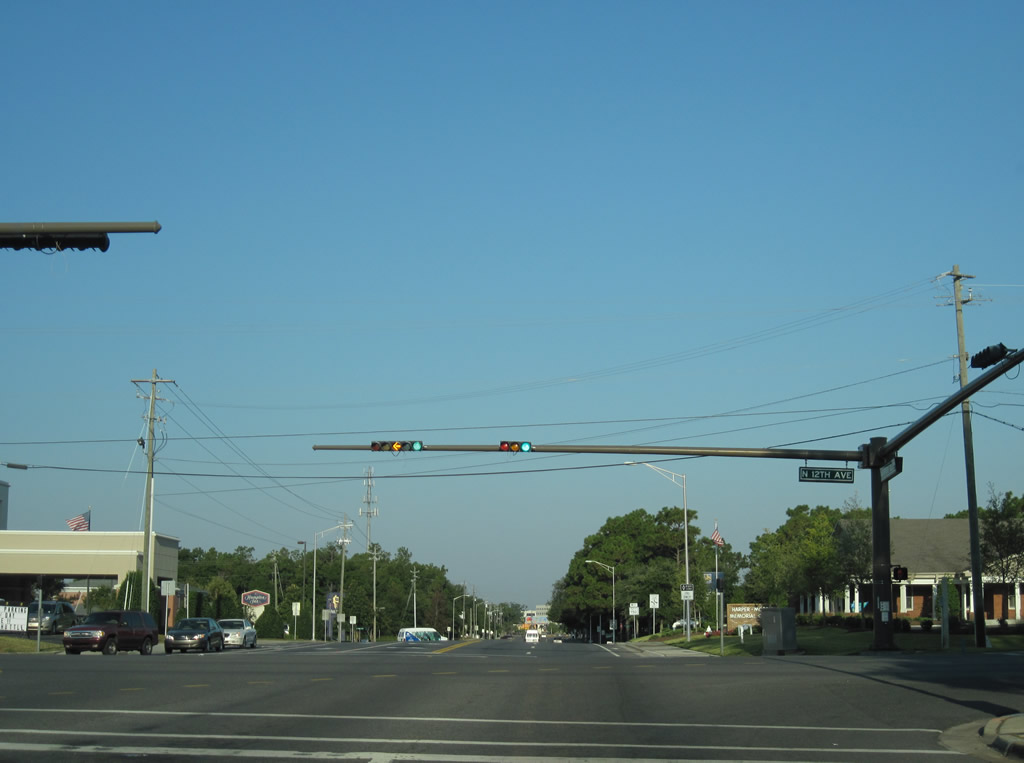
| SR 750 east concludes at the terminal road for Pensacola International Airport (PNS) and 12th Avenue. 05/17/14 |
|
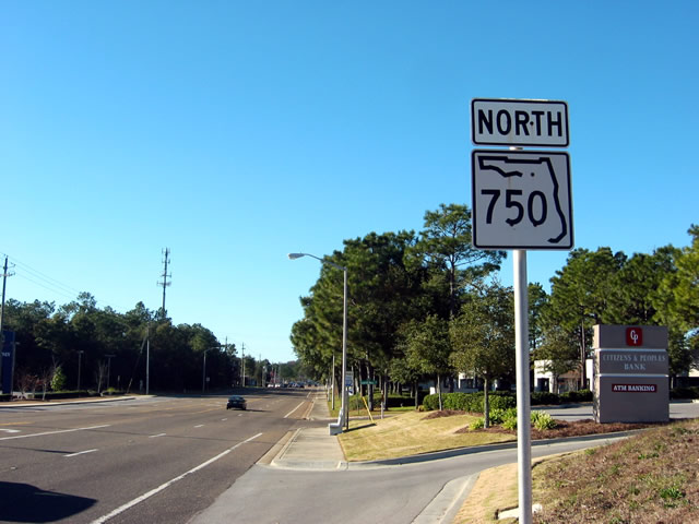
| SR 750 commences west from the intersection of Airport Boulevard and 12th Avenue, opposite the entrance to Pensacola International Airport (PNS). 10/19/12 |
|
| Original SR 750 signs referred to the state road as a north-south route. There was only one shield per direction between 12th and 9th Avenues, with this marker representing the lone westbound entry after 12th Avenue. 12/20/03 |
|
| A replacement shield for SR 750 updated the cardinal direction to west, which was always more accurate given the routing of Airport Boulevard. 04/15/09 |
|
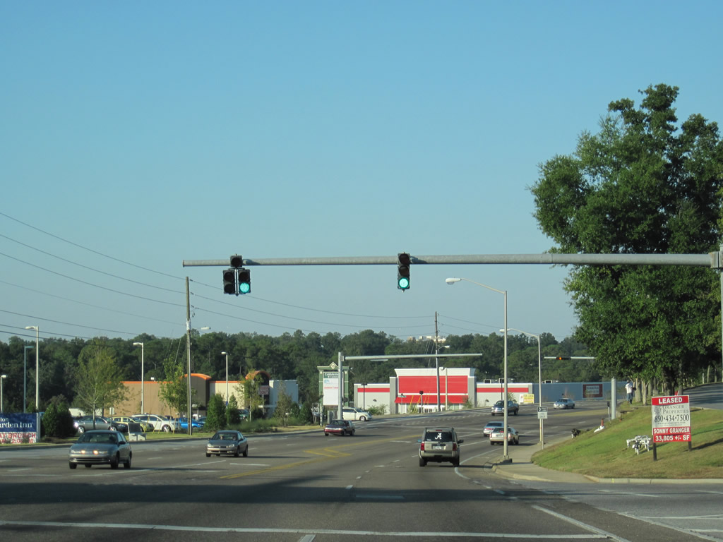
| Airport Boulevard passes between Cordova Mall and Pensacola State College. The state road meets SR 289 (Ninth Avenue) at a busy intersection beyond the mall and college. Signs for SR 289 are not posted, but a set of I-10 and 110 trailblazers direct motorists westward along SR 750 for the 2009 opened ramps to Interstate 110. Before that interchange opened, motorists bound for the freeway were directed onto Ninth Avenue south and Brent Lane (SR 296) west. 10/19/10 |
|
| Mast-arm supported traffic lights govern the movements between SR 750 (Airport Boulevard) west at SR 289 (Ninth Avenue). SR 289 links U.S. 90 and 98 near the Pensacola Bayfront with Pensacola State College and the Ferry Pass area north of Interstate 10. 10/19/10 |
|
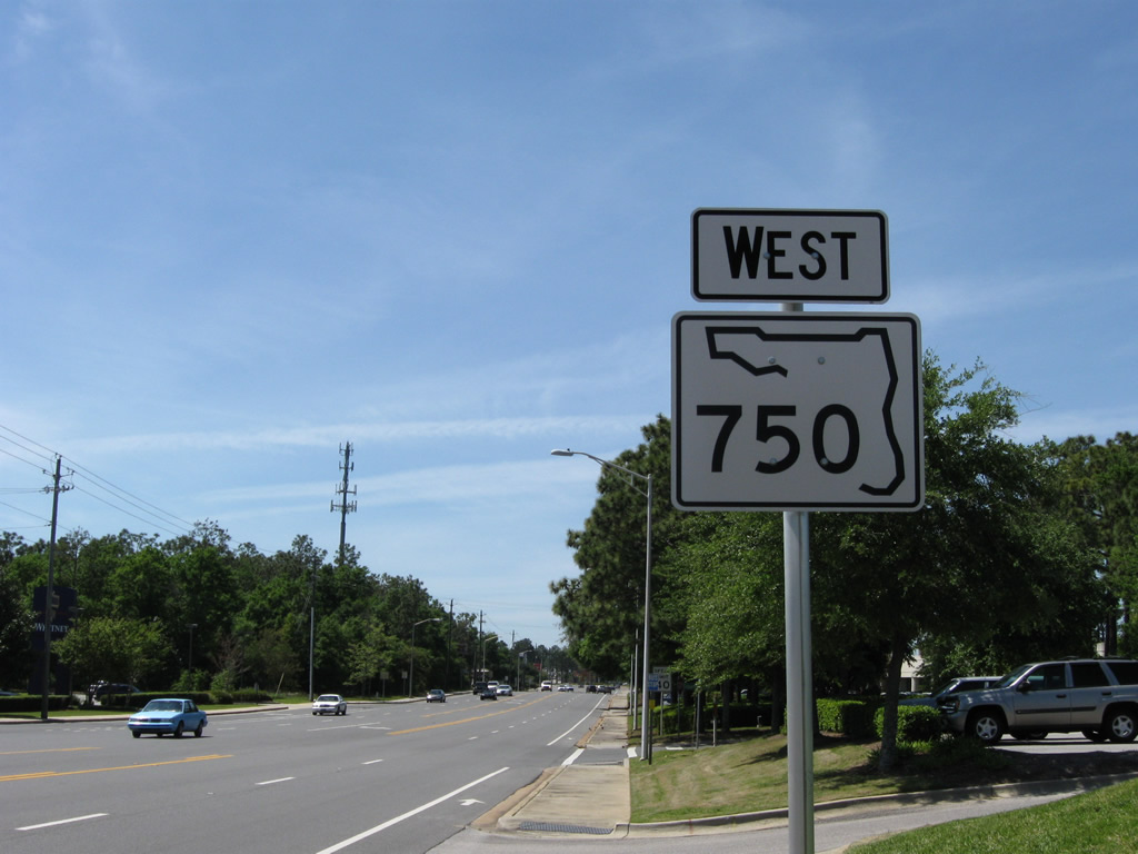
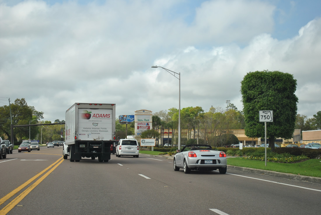
| Shields for SR 750 were posted by fall 2011 along Airport Boulevard west of SR 289. The next marker resides between Ninth Avenue and the signalized entrance to Cordova Commons shopping center. 03/20/12 |
|
| Three straight signals line Airport Boulevard west from College Parkway to Otter Point Road serving retail interests. The latter of the two were added by the late 2000s. 10/19/10 |
|
| Motorists along SR 750 west rise from a crossing of Carpenter Creek to meet SR 291 (Davis Highway). Another set of trailblazers for Interstates 10 and 110 direct drivers to remain along SR 750 for the freeway. SR 291 north meets I-10 in 1.4 miles otherwise. 03/20/12 |
|
| Shields for SR 291 posted at Davis Highway on Airport Boulevard west. SR 291 totals 8.67 miles between U.S. 90 Alternate near the University of West Florida campus to U.S. 98 (Gregory Street) near downtown Pensacola. The busy route generally serves local interests. 12/15/12 |
|
| Continuing west along Airport Boulevard from Davis Highway. This stretch of roadway was expanded from two to four lanes in 1996. 04/11/12 |
|
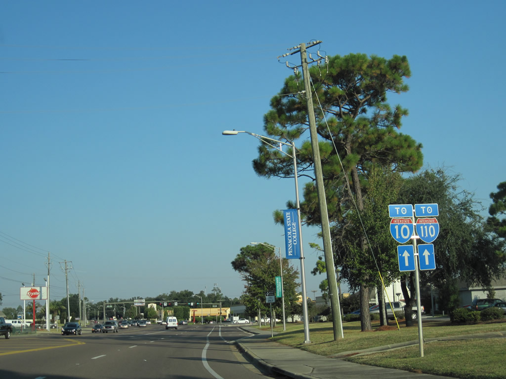
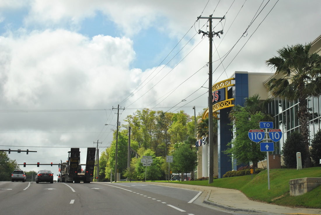
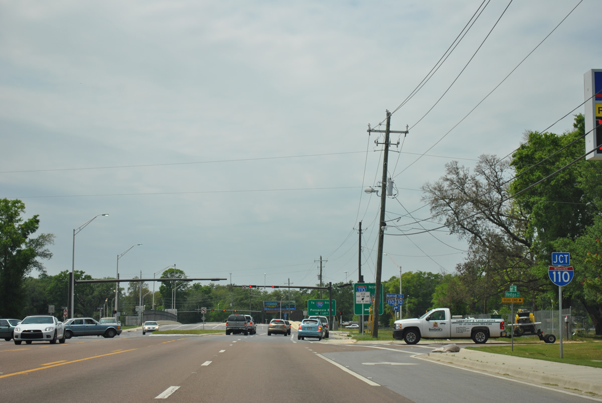
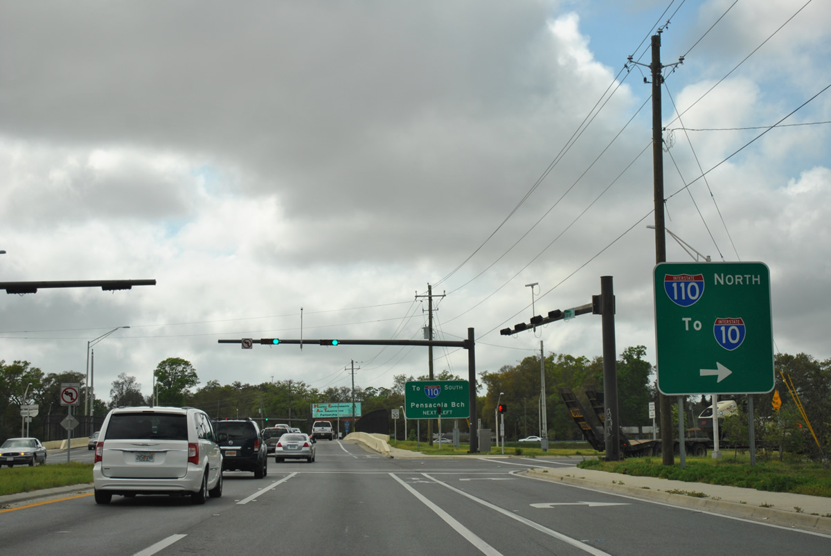
| A diamond interchange joins SR 750 (Airport Boulevard) with Interstate 110 (Exit 5) after Hedge Road. The ramps opened in 2009 during the final phase of the I-110 widening from Maxwell and Jordan Streets north to Interstate 10. That work coincided with a widening and modernization of I-10 at I-110 between 2002 and 2008. 04/11/12 |
|
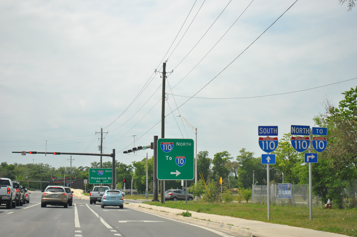
| Drivers joining the northbound ramp to Interstate 110 merge onto the freeway ahead of the modified trumpet interchange with Interstate 10 (Exit 6). 04/11/12 |
|
| No control city is used for I-110 since the route defaults onto I-10 next. Interstate 10 continues west from the freeway end to Mobile and east to Tallahassee. 03/20/12 |
|
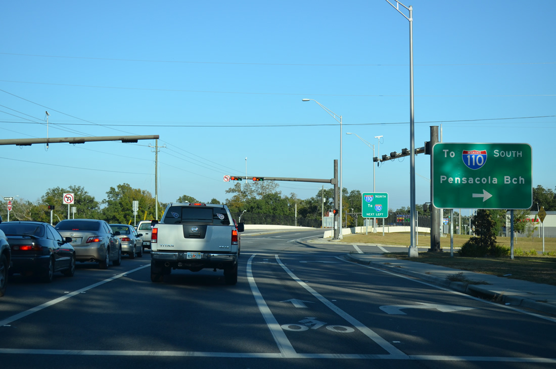
| Crossing over Interstate 110, Airport Boulevard approaches the southbound on-ramp to downtown. Connections with U.S. 98 (Chase Street) east lead to the Three Mile Bridge, Gulf Breeze and Pensacola Beach. 03/20/12 |
|
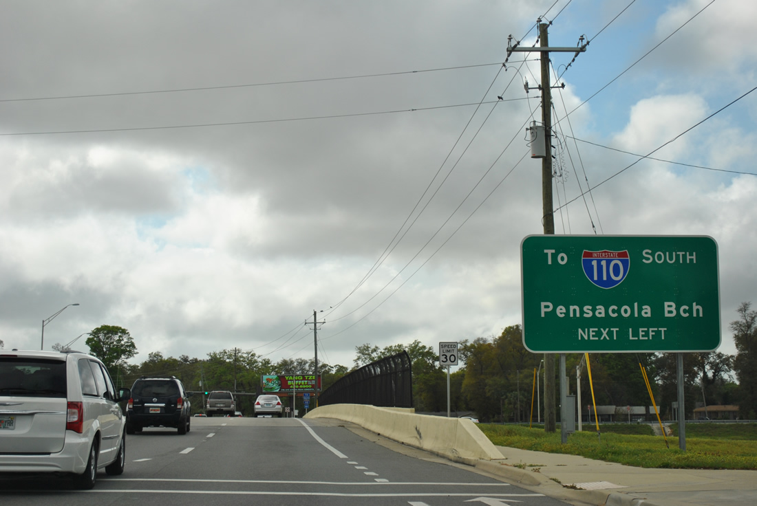
| The southbound on-ramp joins a distributor roadway to SR 296 (Brent Lane). Traffic utilizing this ramp must pass through a traffic light at SR 296 before joining the freeway ahead of SR 295. 03/20/12 |
|
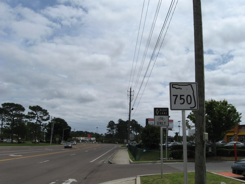
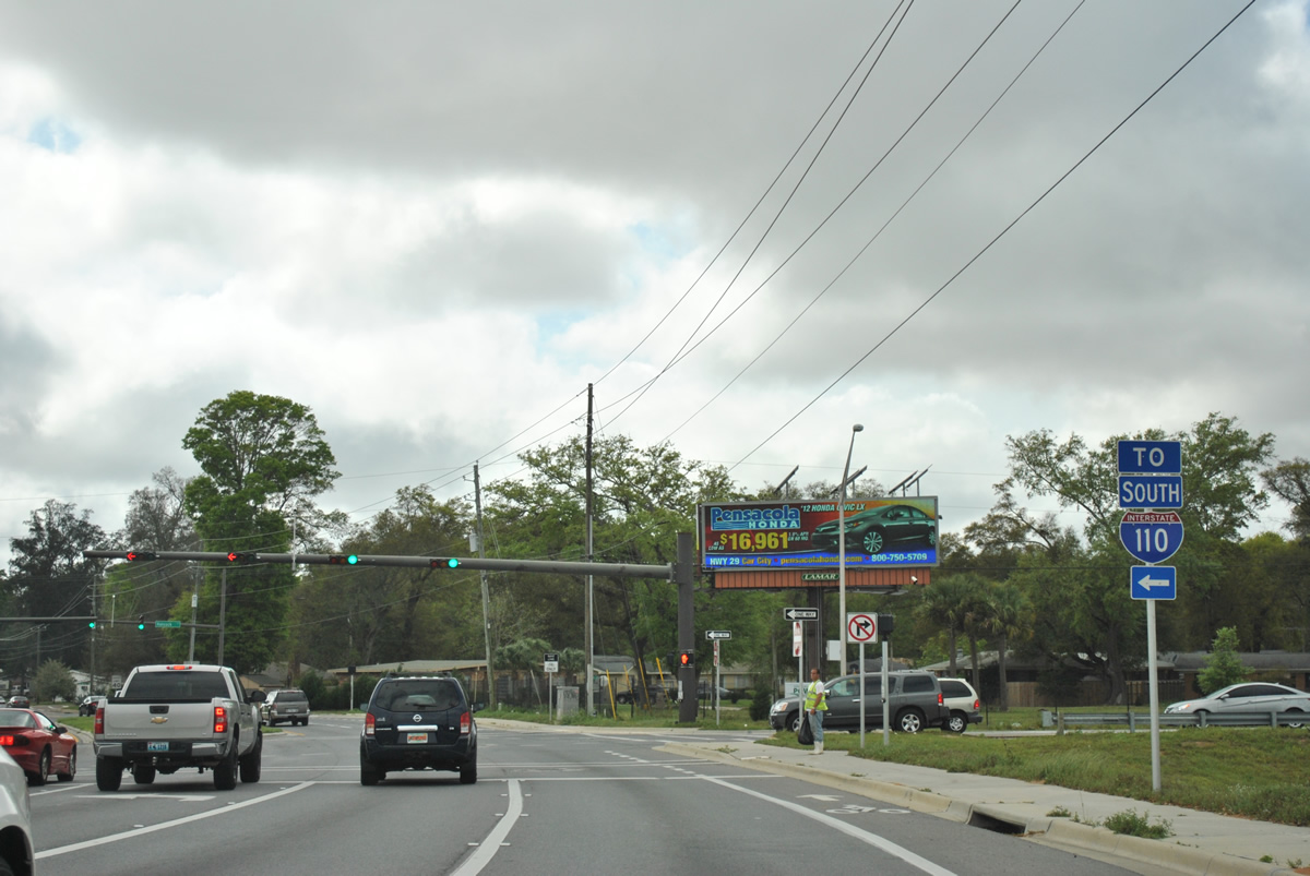
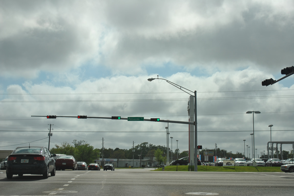
| A short distance west of Interstate 110 is the SR 750 intersection with Palafox Street (Escambia County Road 95A). Palafox Street splits from U.S. 29 nearby as the old route between Pensacola and Ensley. 03/20/12 |
|
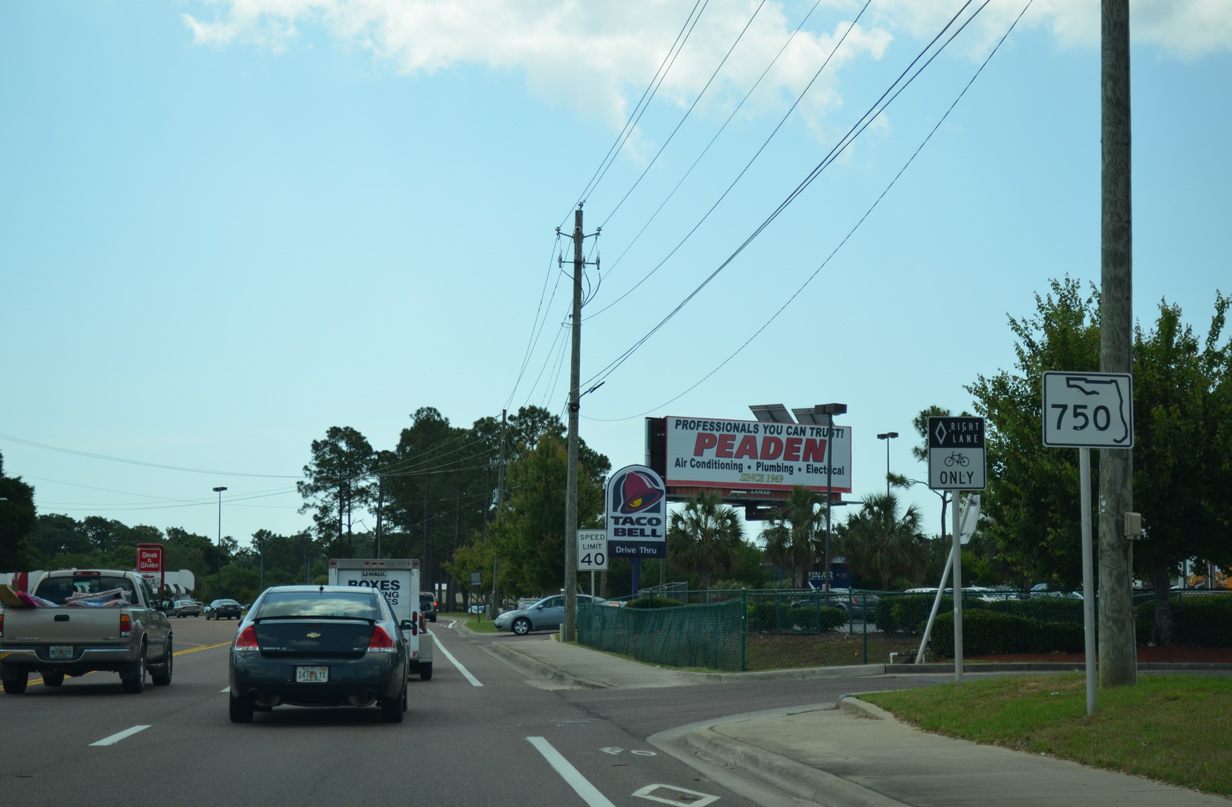
| SR 750 concludes at U.S. 29 (Pensacola Boulevard). Pensacola Boulevard varies between six and eight lanes fro its split with Palafox Street north to Ensley, serving a number of car dealerships and retail establishments along the way. 03/20/12 |
|
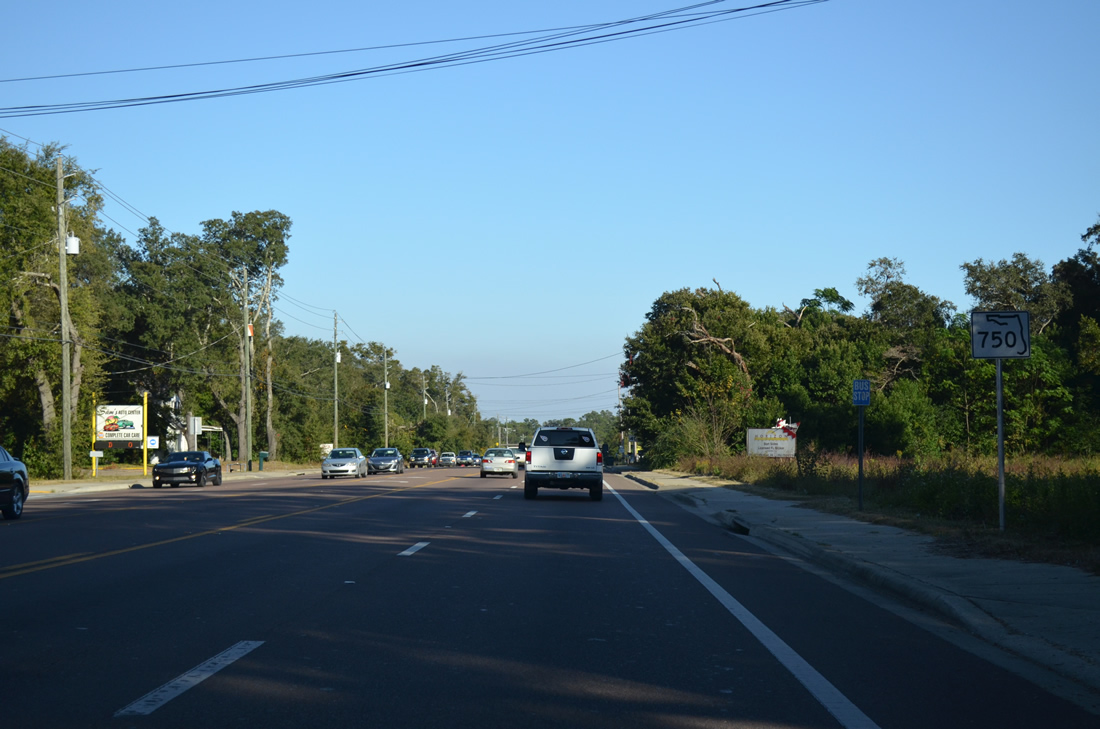
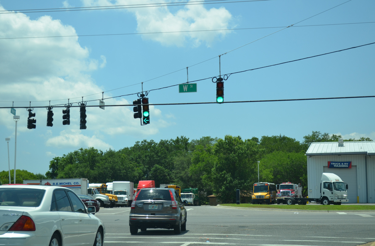
| Airport Boulevard continues as a local road to W Street (County Road 453). 05/17/14 |
|
| An older set of signs (since replaced) directed traffic departing the Pensacola International Airport terminal away from the terminal. Three exits are available, the first to Francis Taylor Boulevard from the Air Cargo facilities. The second follows onto College Boulevard while the third is the general exit onto SR 750 (Airport Boulevard) west at 12th Avenue. 04/15/09 |
|
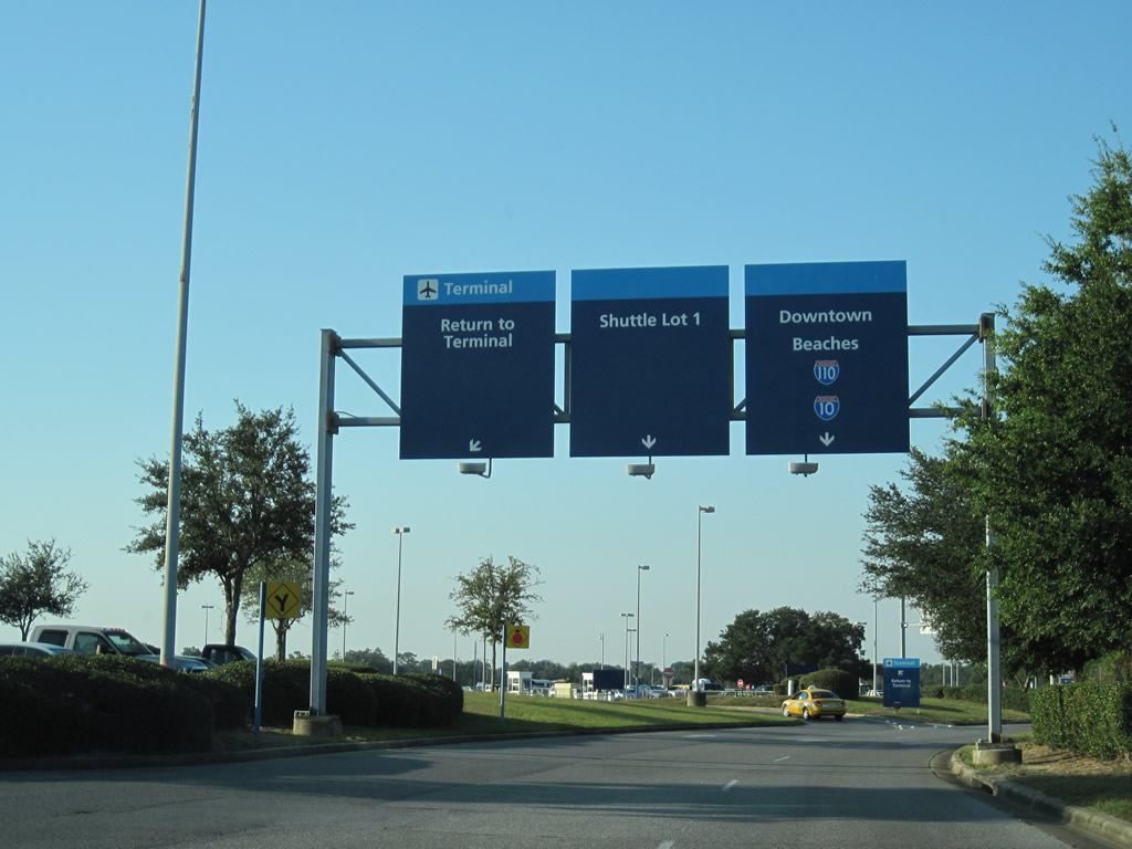
| New signs were installed by 2010 along the airport access road. This set of signs follows the intersection with College Boulevard. Shields for Interstates 10 and 110 direct all traffic onto Airport Boulevard west. 10/19/10 |
|
| Until the 2009 opening of the Interstate 110 interchange with Airport Boulevard, signs posted along the airport access road partitioned traffic between SR 750 west and 12th Avenue south. Now drivers are simply directed to remain on SR 750. 07/18/07, 10/19/10 |
|
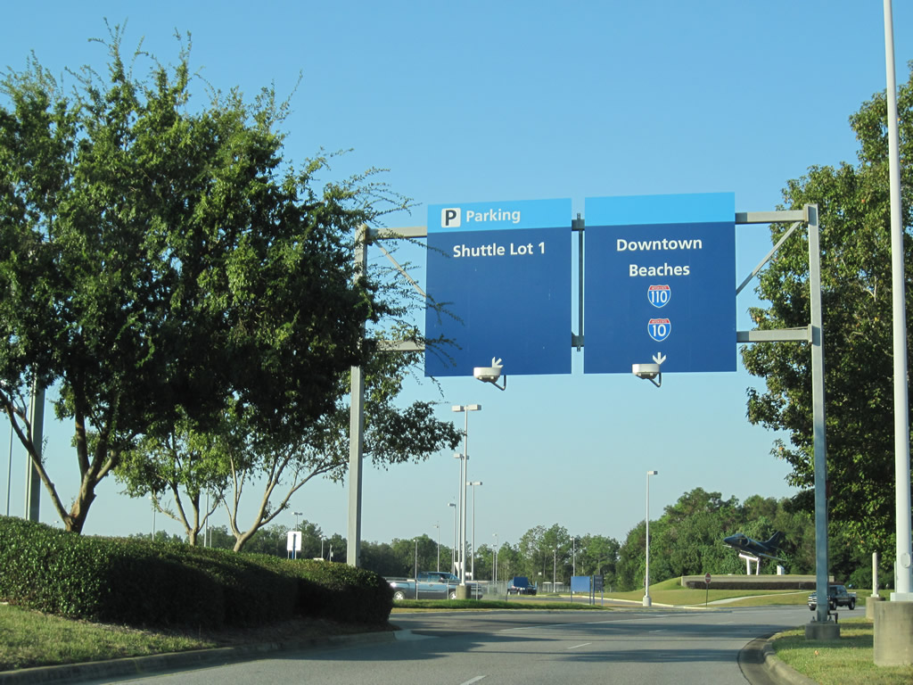
| The airport access road reaches the turn for Shuttle Lot 1 / Col. J. McHenry Jones Boulevard and return access to the passenger terminal. 07/18/07, 10/19/10 |
|
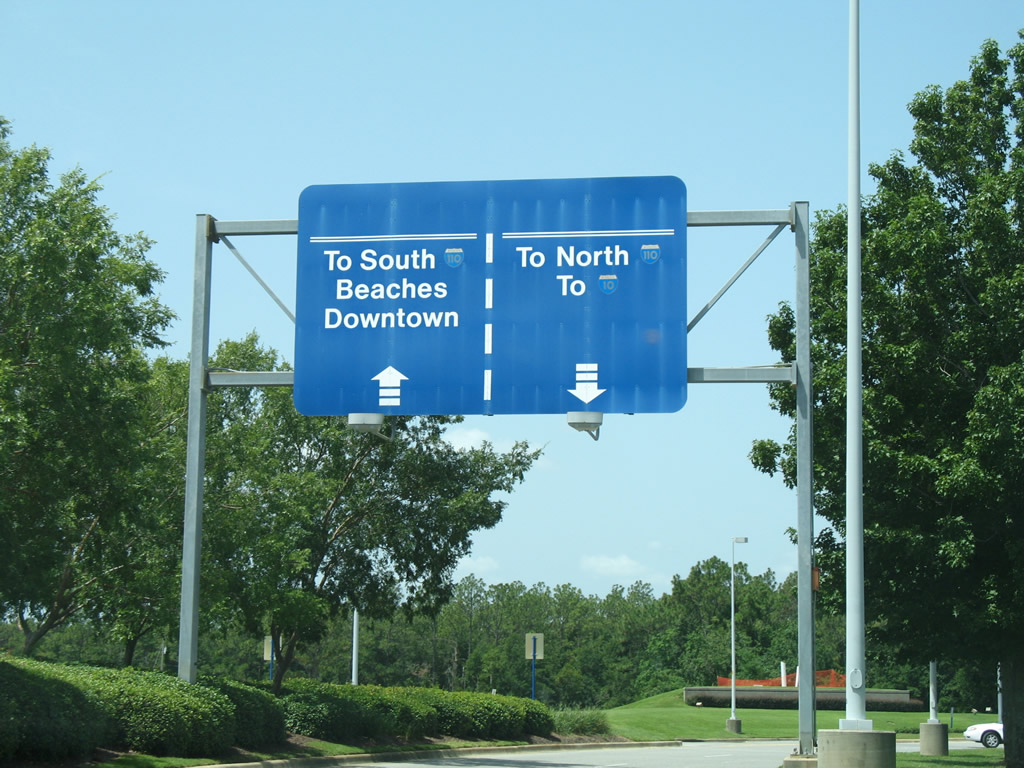
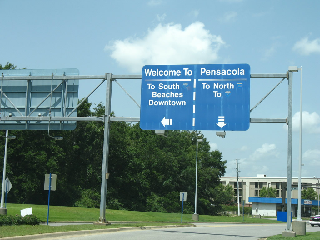
| Airport Boulevard approaches 12th Avenue. Signs split traffic to Downtown and Pensacola Beach via 12th Avenue and Interstates 10 and 110 via SR 750 west. While I-110 south from SR 750 provides a direct route to the central business district, a combination of 12th and 9th Avenues is equally fast from the airport. 07/18/07, 10/19/10 |
Photo Credits:12/20/03, 07/18/07, 04/09/09, 04/15/09, 10/19/10, 03/20/12, 04/11/12, 10/19/12, 11/17/12, 12/15/12, 05/17/14 by AARoads
Connect with:
Interstate 110
U.S. 29
State Road 289 - Ninth Avenue
State Road 291
Page Updated 05-29-2013.