|
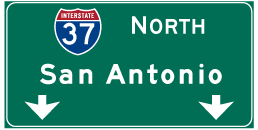
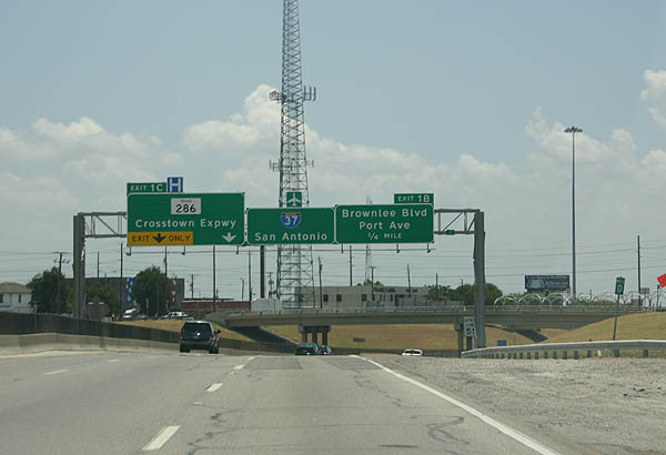
| The Interstate 37 boulevard transitions into a freeway at the intersection with Mesquite Street north of Downtown Corpus Christi. Traffic immediately splits into ramps for U.S. 181 & SH 35 north across the Harbor Bridge and the freeway beginning west to the Crosstown Expressway (SH 286). 09/29/07 |
|
| U.S. 181 & SH 35 overlap along a ten mile long freeway north to Corpus Christi Beach, Portland and Gregory. The Harbor Bridge Replacement Project, from 2016 to 2021, will realign the highways further west onto a new span across the Corpus Christi Ship Channel. 09/29/07 |
|
| When the new Harbor Bridge is completed, the former span will be dismantled. Both the freeway for U.S. 181 north and the easternmost half mile of IH 37 will be converted into surface boulevards as part of the project. 09/29/07 |
|
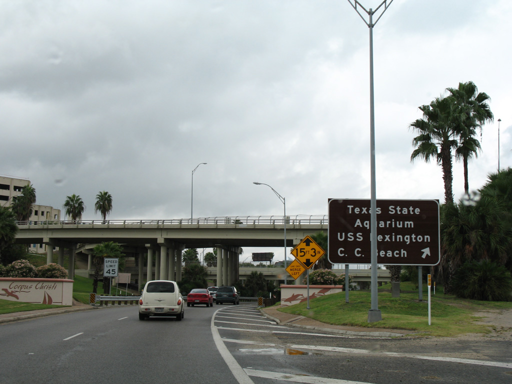
| Traffic from the ending U.S. 181 & SH 35 south merges from the north as IH 37 officially begins. Milepost zero appears at the adjacent Padre Street on-ramp. 07/11/05 |
|
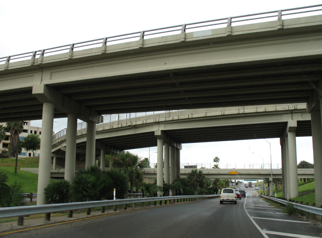
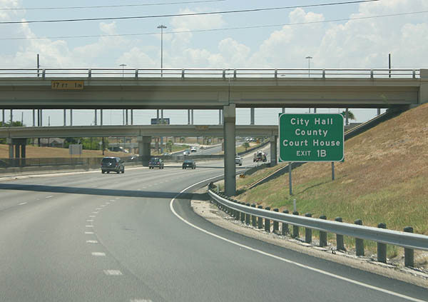
| Interstate 37 initially travels below grade, passing below Staples Street and Alameda Street north of the Nueces County Courthouse and Corpus Christi City Hall. Staples Street will be lowered to intersect the converted IH 37 boulevard, with the freeway beginning west from there. 07/11/05 |
|
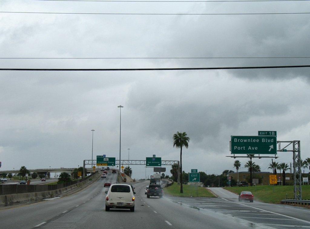
| A split diamond interchange (Exit 1B) for Brownlee Boulevard and Port Avenue frames the adjacent ramps joining IH 37 with the Crosstown Expressway (SH 286) south. 09/29/07 |
|
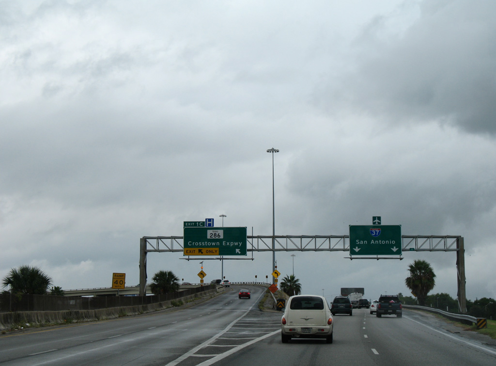
| SH 285 stems 15.21 miles south from a directional T interchange (Exit 1C) with IH 37 to FM 70 at Chapman Ranch. The Crosstown Expressway serves commuters south to SH 358 (Padre Island Drive). The freeway extends 8.5 miles south across Oso Creek. 09/29/07 |
|
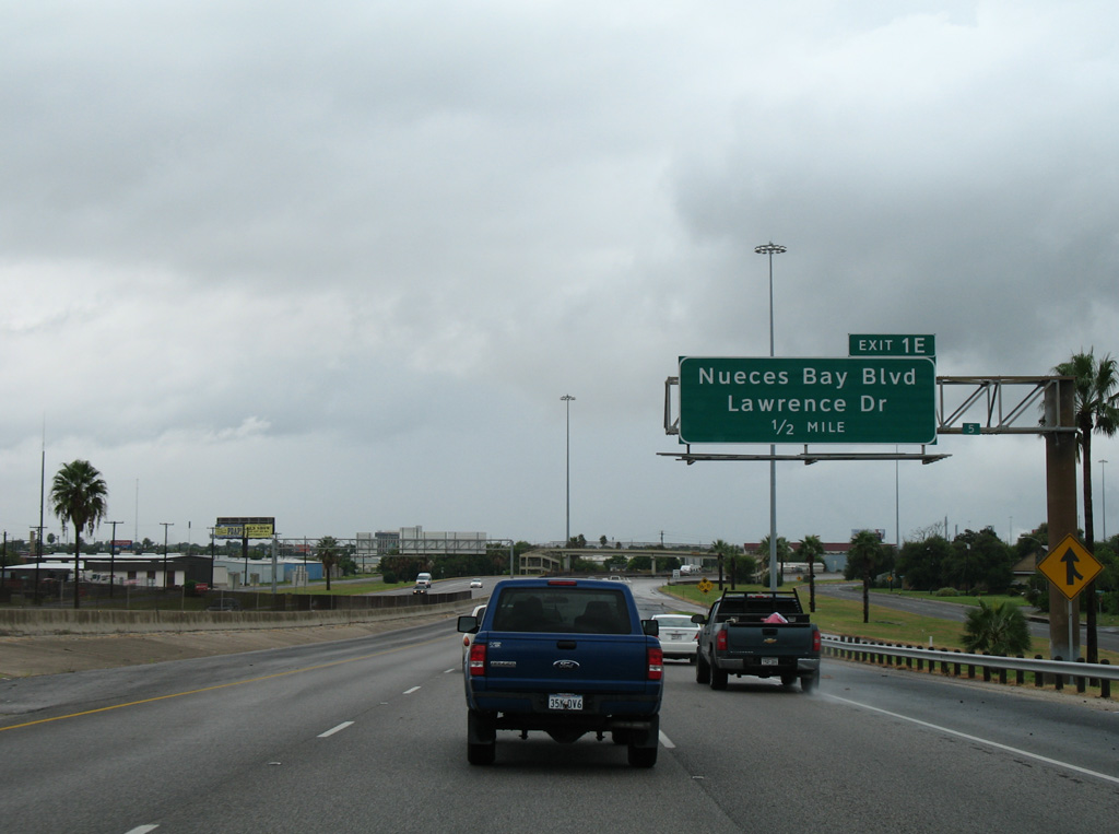
| Interstate 37 bends northward to cross paths with Nueces Bay Boulevard and Buddy Lawrence Drive over succeeding mile west from the Crosstown Expressway. 09/29/07 |
|
| Exit 1E departs IH 37 north for Nueces Bay Boulevard and Buddy Lawrence Drive north to the Citgo Refinery and associated industrial areas. The two roads intersect just south of Exit 1E before tying into parallel Leopard Street (Spur 407). 09/29/07 |
|
| Interstate 37 makes a gradual curve westward over Nueces Bay Boulevard, separating residential areas to the south from the Citgo refinery to the north. 09/29/07 |
|
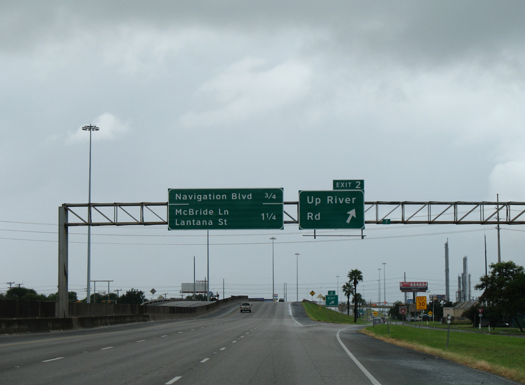
| Up River Road branches north from Leopard Street (old SH 9) to meet IH 37 at a diamond interchange (Exit 2). Up River Road continues northwest and west through industrial areas along Tule Lake Channel. IH 37 and Up River Road converge again at Exit 9. 09/29/07 |
|
| The Up River Road on-ramp adds a short auxiliary lane to the adjacent diamond interchange (Exit 3A) for Navigation Boulevard. 09/29/07 |
|
| Navigation Boulevard heads south to FM 665 (Old Brownsville Road) and north to a dead end beyond the Union Pacific Railroad. Navigation Boulevard formerly crossed Tule Lake Channel north on a draw bridge. 09/29/07 |
|
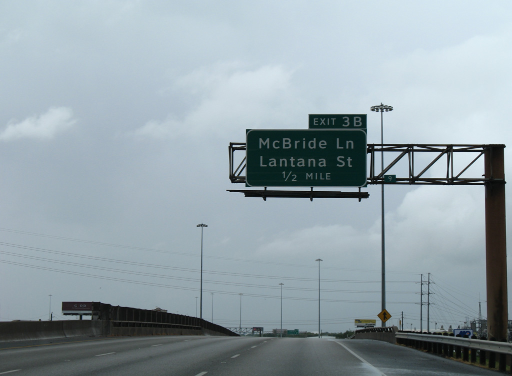
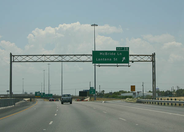
| IH 37 spans the Corpus Christi Terminal Railroad just ahead of the off-ramp (Exit 3B) to McBride Lane. McBride Lane is a major collector north to Up River Road and south to Agnes Street (State Spur 544). 09/29/07 |
|
| The north side frontage road leads drivers west from Exit 3B to Lantana Street. 07/11/05 |
|
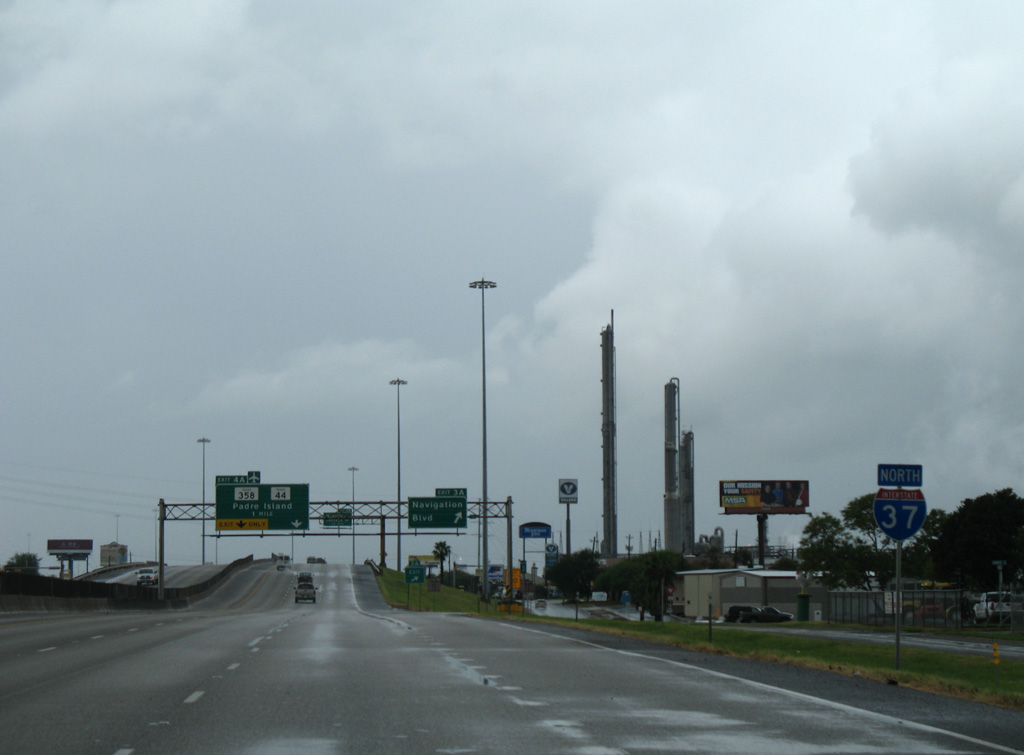
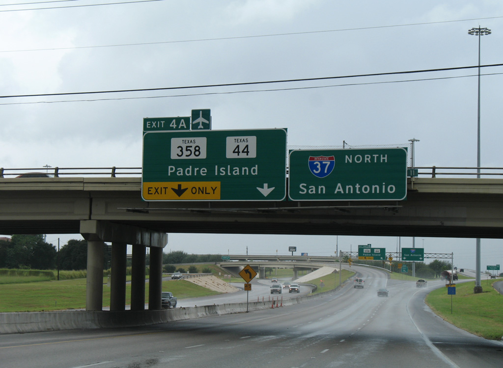
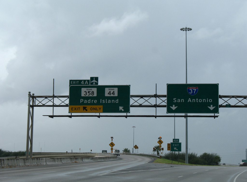
| Exit 4A follows from IH 37 north as a left side ramp with two lanes for SH 358 (Padre Island Drive) south. Padre Island Drive forms a freeway wrapping around the west and south sides of central Corpus Christi while linking the barrier island. 09/29/07 |
|
| SH 358 leads 1.5 miles south from the directional T interchange (Exit 4A) with Interstate 37 to meet the westbound beginning of SH 44. SH 44 travels 128.85 miles overall from Corpus Christi to Alice. The initial stretch west toward Robstown is a full freeway, while the overall highway was incorporated in the IH 69 corridor. 09/29/07 |
|
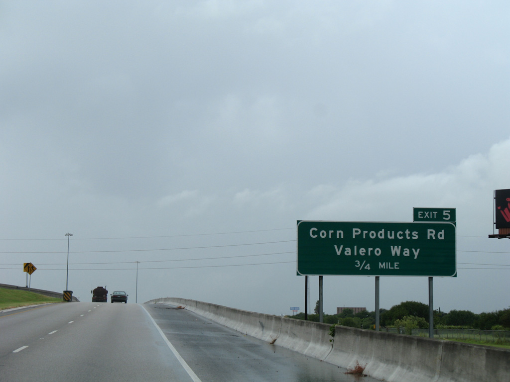
| The ensuing exit along IH 37 northbound joins the freeway with Valero Way north and Corn Products Road south. 09/29/07 |
|
| Advancing west from SH 358, 2015 traffic counts recorded by TXDOT for IH 37 increased from 59,356 vehicles per day (vpd) ahead of Padre Island Drive to 84,915 vpd after Corn Products Road. 09/29/07 |
|
| Exit 5 leaves Interstate 37 north for Valero Way north to Up River Road and the Valero refinery. Corn Products Road angles southwest to link the freeway with parallel Leopard Street (SS 407). 09/29/07 |
|
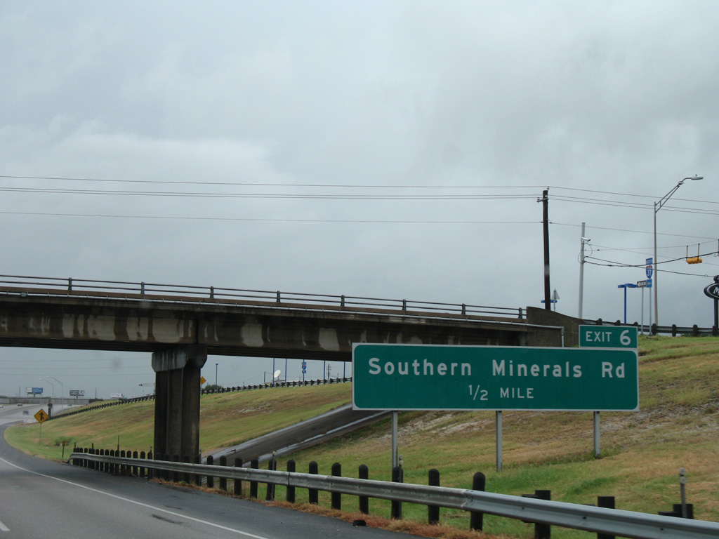
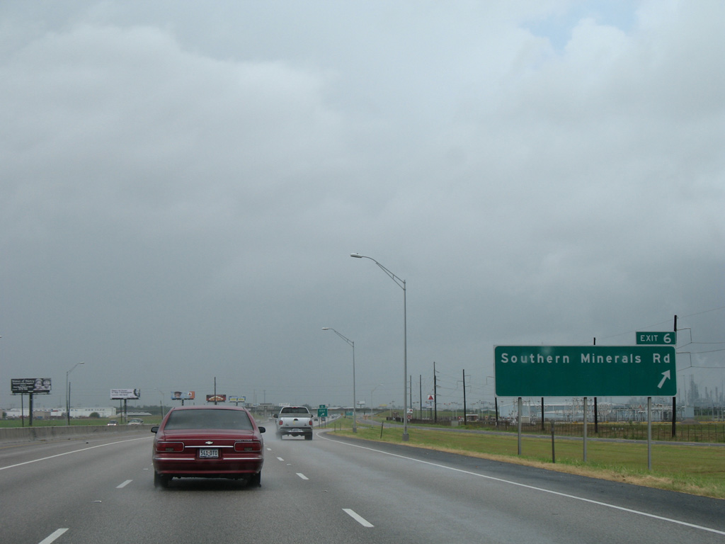
| Interstate 37 gradually shifts northward, remaining parallel to both Up River Road and Leopard Street (old SH 9). The next off-ramp (Exit 6) departs in a half mile for Southern Minerals Road. 09/29/07 |
|
| Southern Minerals Road comprises a major collector serving industrial areas between Up River Road and Leopard Streets. 09/29/07 |
|
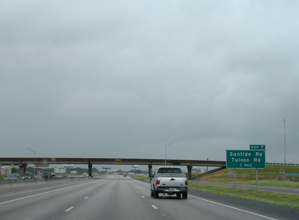
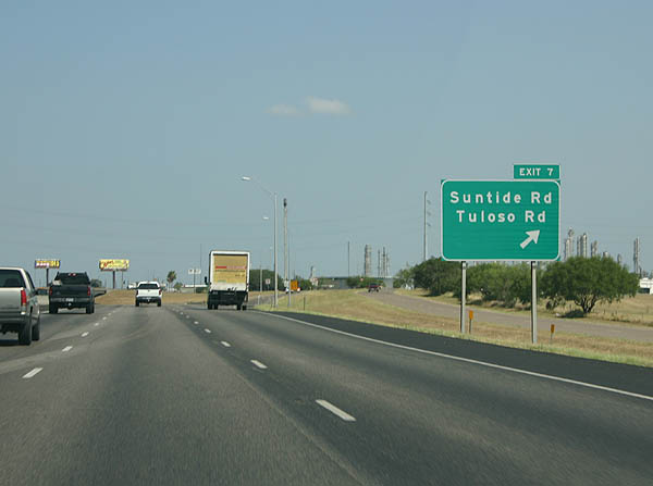
| Southern Minerals Road spans IH 37, one mile ahead of the split diamond interchange (Exit 7) for Suntide and Tuloso Roads. 09/29/07 |
|
| Exit 7 joins the adjacent frontage road ahead of Suntide Road. Suntide Road extends to the Flint Hills Resources refinery north of Up River Road. Tuloso Road parallels to the west between Leopard Street and Up River Road. 07/11/05 |
|
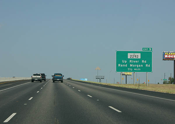
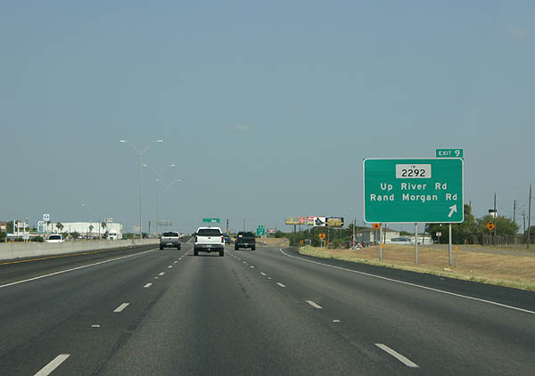
| Elevating across Tuloso Road, Interstate 37 maintains three northbound lanes with a wide shoulder for use in hurricane evacuations. UR 2292 (Rand Morgan Road) lies 1.5 miles ahead. 07/11/05 |
|
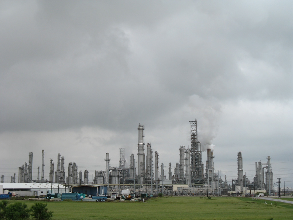
| The Flint Hills Resources refinery along the north side of parallel Up River Road. 09/29/07 |
|
| Exit 9 parts ways from IH 37 west for Up River Road just east of Urban Road 2292 (Rand Morgan Road) south. UR 2292 lines Rand Morgan Road south 3.48 miles to SH 44 Business at Clarkwood. FM 2292 extends south from there 4.12 miles to FM 665. 07/11/05 |
|
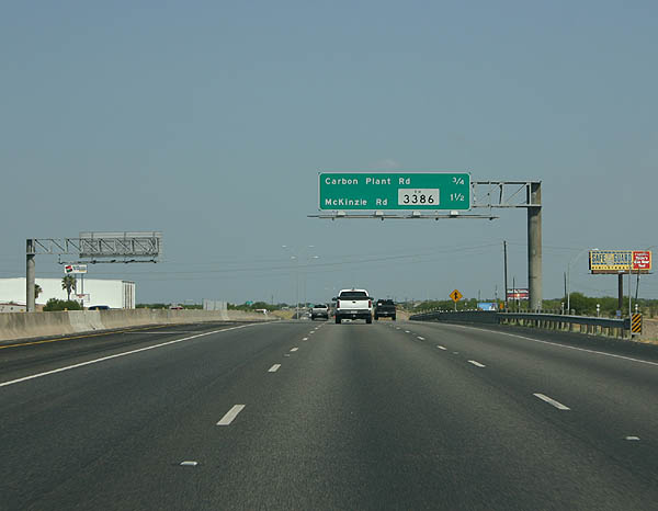
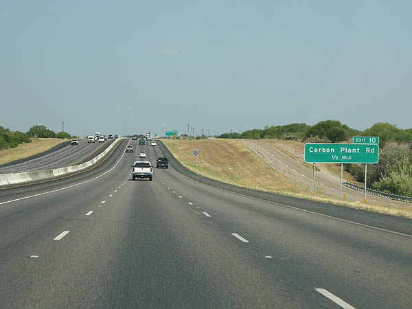
| The succeeding northbound off-ramps depart over the course of 1.5 miles for Carbon Plant Road (Exit 9) and Up River Road west to FM 3386 (Exit 10). 07/11/05 |
|
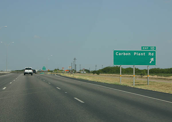
| Sign changes made for Exit 10 added Joe Fulton International Trade Corridor. A $24 million project constructed a new flyover linking IH 37 southbound with Carbon Plant Road north to the trade corridor. The two-phase project through winter of 2012 included a number of other changes, including swapping the location of the Carbon Plant Road on-ramp and McKinzie Road off-ramp along IH 37 northbound.1 07/11/05 |
|
| Carbon Plant Road stems north from Up River Road to connect with the Joe Fulton Corridor north to the port and the Texas State Veterans Cemetery. The adjacent cemetery was completed in December 2011.1 07/11/05 |
|
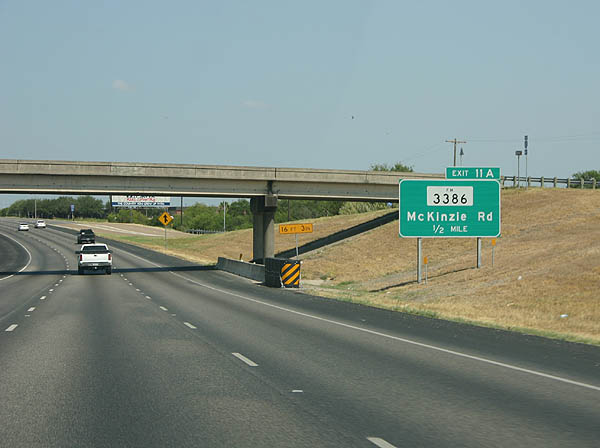
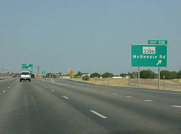
| Exit 11A departs from IH 37 northbound below the Joe Fulton flyover, to the immediate west of the Carbon Plant Road overpass now. 07/11/05 |
|
| FM 3386 constitutes a two-segment route overlaying McKinzie Road from IH 37 to a point south of Haven Drive for 1.55 miles, and along the southern 1.81 miles leading to the SH 44 freeway. 07/11/05 |
|
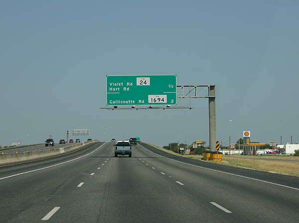
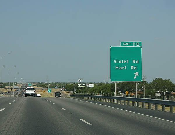
| The subsequent off-ramp along IH 37 northbound departs in a half mile for Up River Road west to FM 24 (Violet Road) south. 07/11/05 |
|
| Violet Road leads FM 24 south 5.06 miles from IH 37 to SH 44. Hart Road links Leopard Street (Spur 407) and Up River Road, 0.7 miles to the west. 07/11/05 |
|
| Interchange sequence sign outlining the three exits from IH 37 north to the Calallen district of west Corpus Christi. 07/11/05 |
|
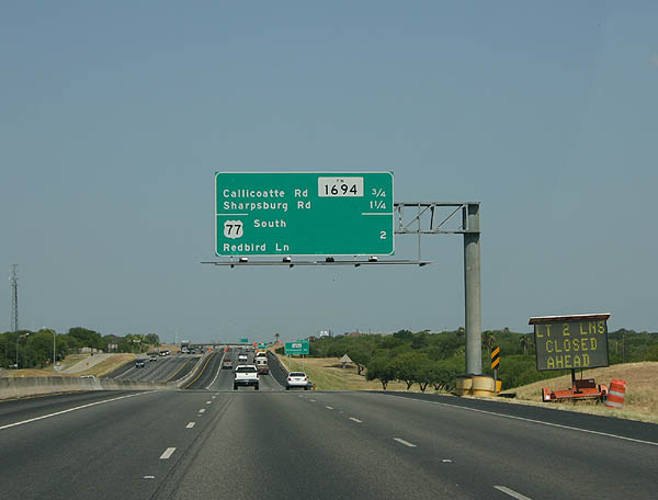
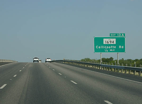
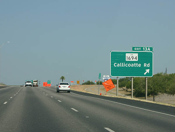
| Forthcoming FM 1694 totals 12.06 miles south from IH 37 at Exit 13A to FM 665, two miles northeast of Petronila. 07/11/05 |
|
| Entering the half diamond interchange (Exit 13A) with Callicoatte Road (FM 1694) on Interstate 37 north. 07/11/05 |
|
| Three off-ramps depart over the ensuing 1.25 mile stretch, as IH 37 north approaches IH 69E & U.S. 77 at Calallen. 09/29/07 |
|
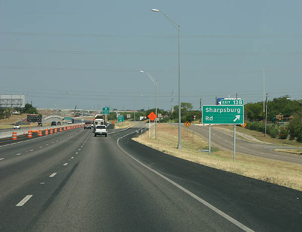
| Exit 13B partitions from the IH 37 mainline for the frontage road west ahead of Up River Rod east and Sharpsburg Road north. 07/11/05 |
|
| Interstate 69 was designated along U.S. 77 south to Robstown in December 2011. This changed to Interstate 69E per AASHTO approved on October 21, 2013. IH 69E was lengthened another 1.6 miles from SH 44 south to FM 892 by the Texas Transportation Commission in November 2014. 09/29/07 |
|
| U.S. 77 travels south from Robstown and IH 69E to Kingsville, Harlingen and Brownsville in the Rio Grande Valley. A separation section of IH 69E overlays U.S. 77 from Raymondville southward. 09/29/07 |
|
| Button copy signs formerly posted at the three wye interchange (Exit 14A) with U.S. 77 south. 07/11/05 |
|
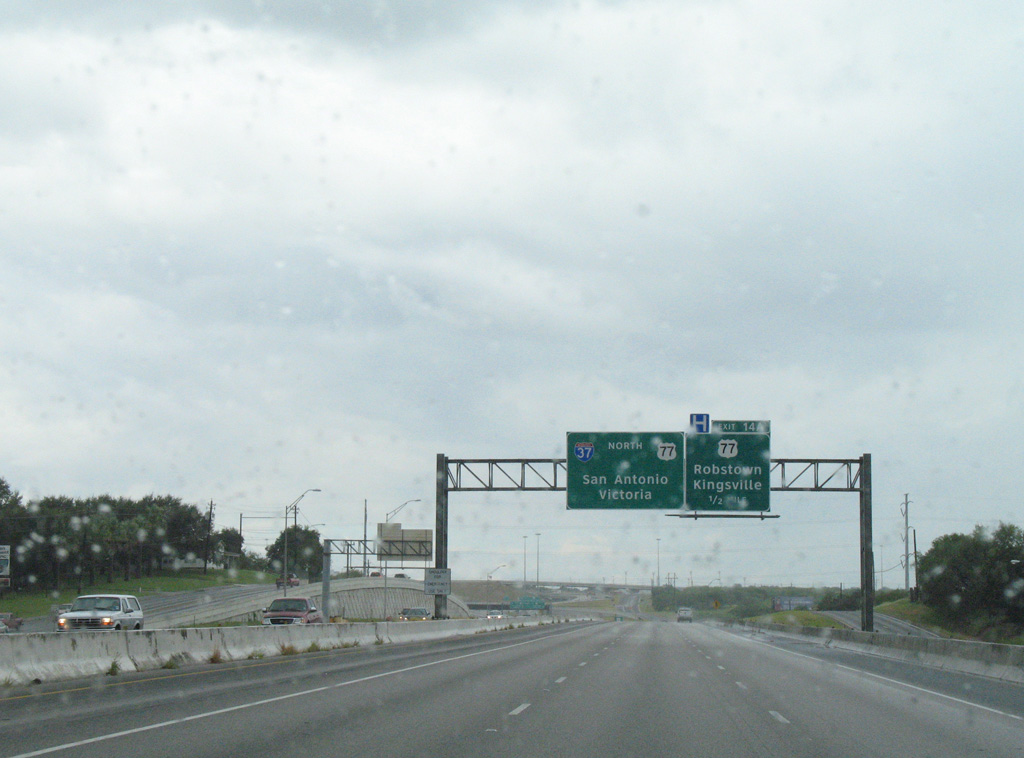
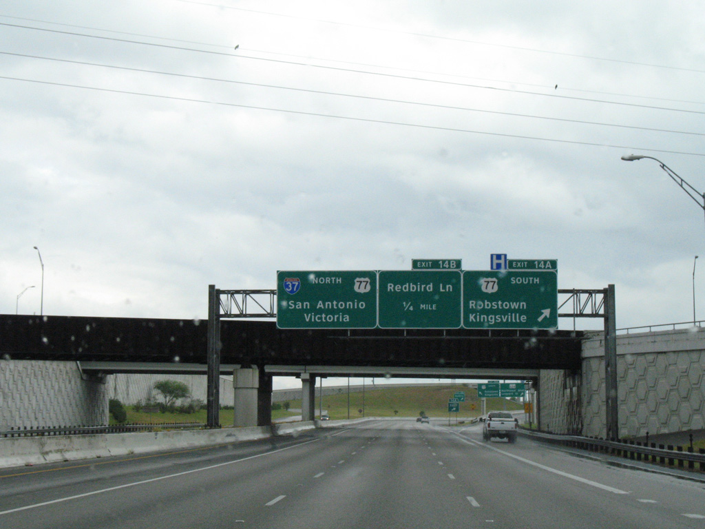
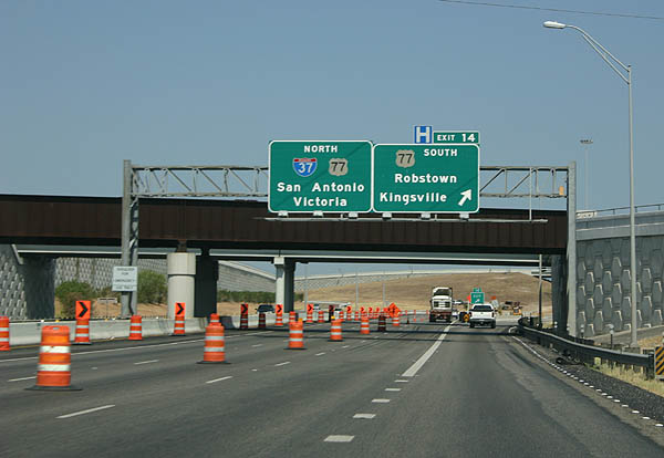
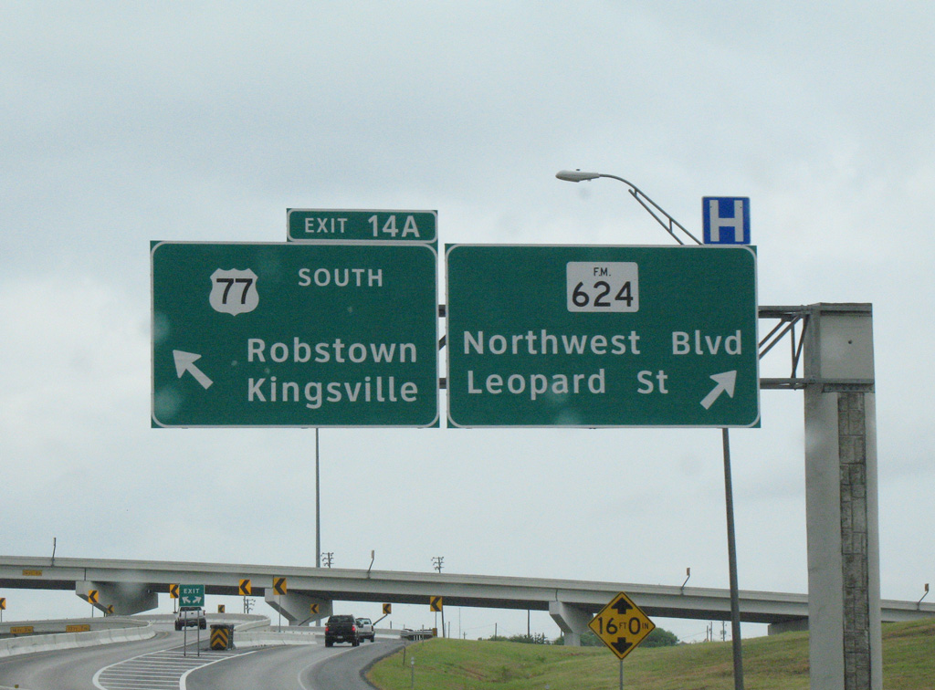
| Exit 14A partitions into separate flyovers for both IH 69E & U.S. 77 south to Robstown and the west side frontage road to FM 624 (Northwest Boulevard) west and Leopard Street east. 09/29/07 |
|
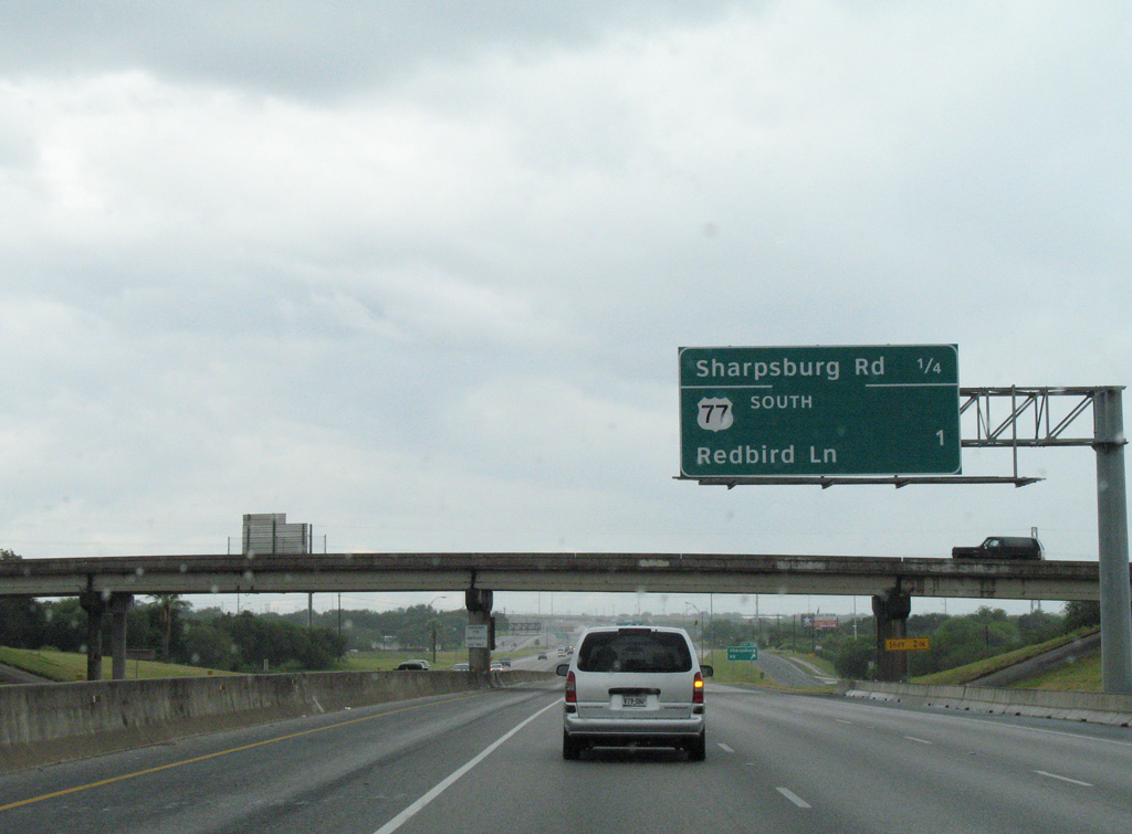
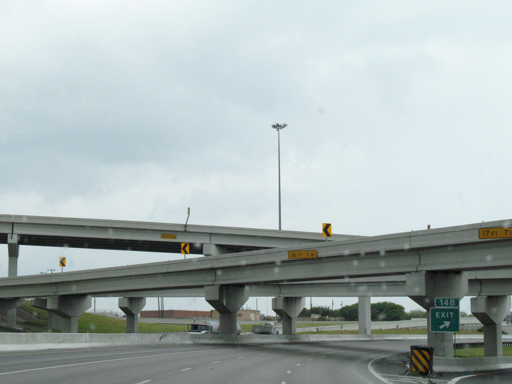
| Exit 14B quickly follows for Redbird Lane and residential areas of north Calallen. The three-wye interchange between Interstate 37 and U.S. 77 was rebuilt between 1988 and 1991 to eliminate left side ramps. Further upgrades were made to accommodate IH 69 in 2005. 09/29/07 |
|
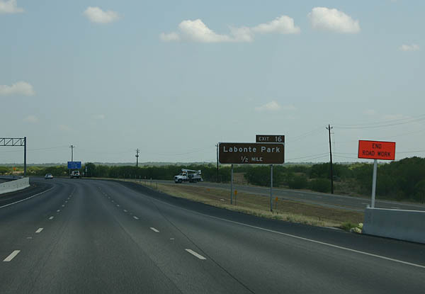
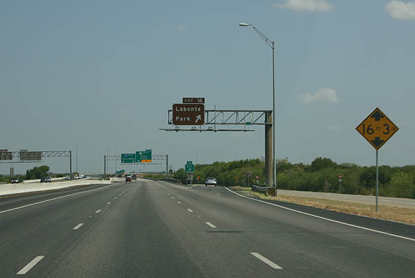
| Traffic from IH 69E & U.S. 77 north combines with IH 37 one half mile ahead of Exit 16 for Labonte Park. 07/11/05 |
|
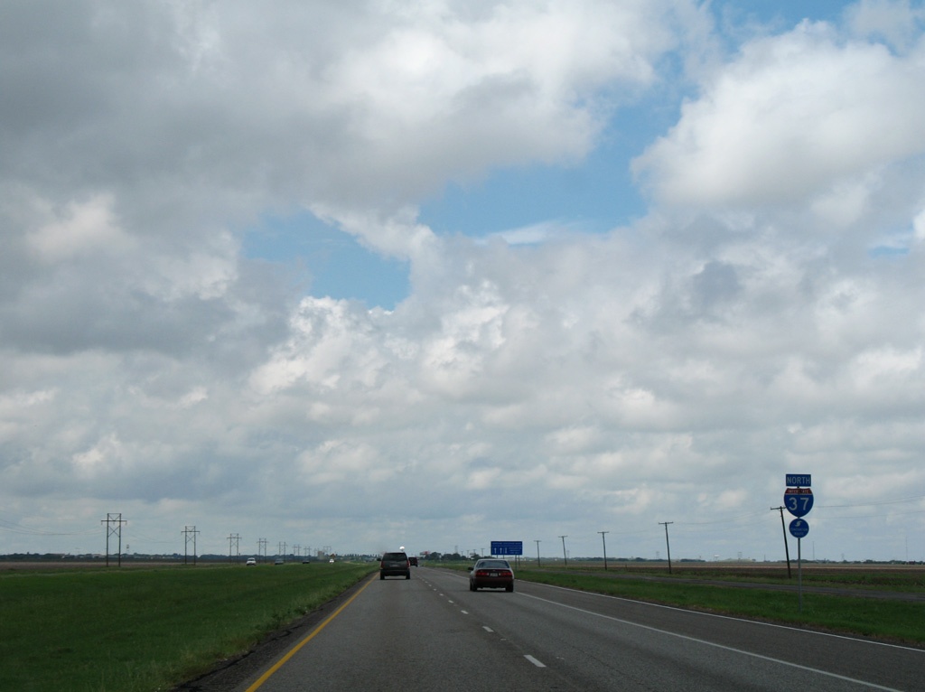
| U.S. 77 north overlaps with IH 37 for 2.3 miles to cross the Nueces River. 09/29/07 |
|
| Exit 16 serves Labonte Park (formerly Nueces River Park) by looping under the Nueces
River bridge to follow the west frontage road south to the park. 07/11/05 |
|
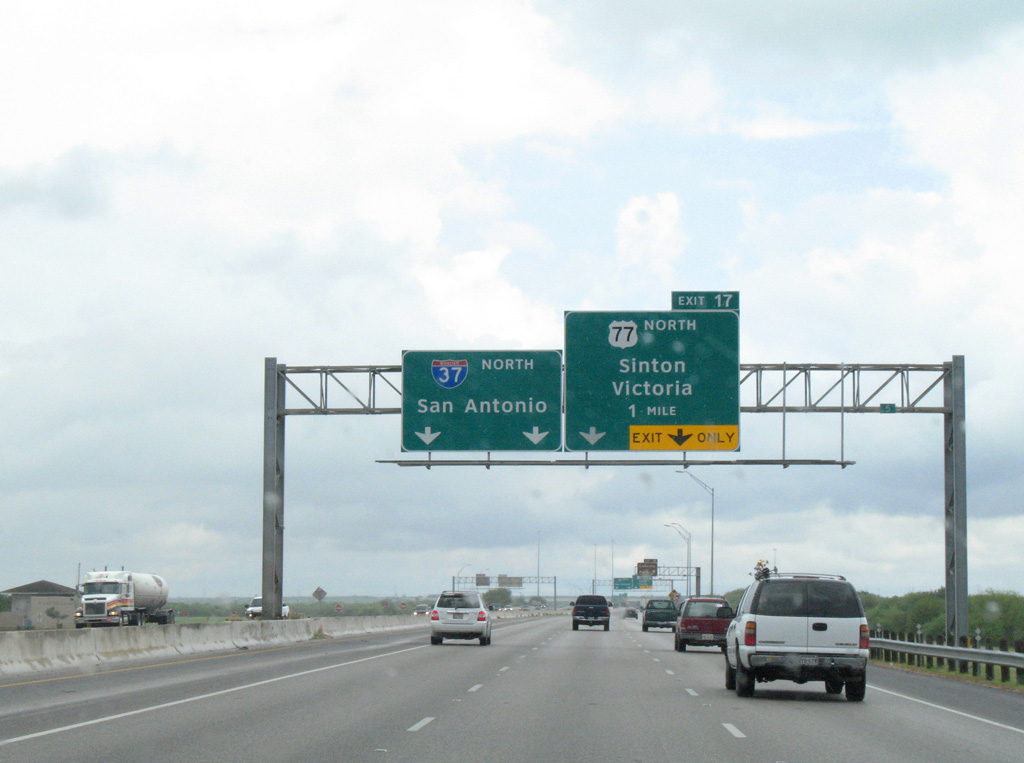
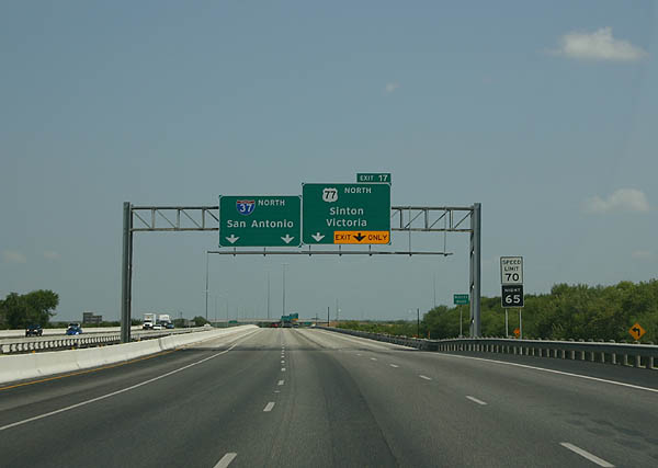
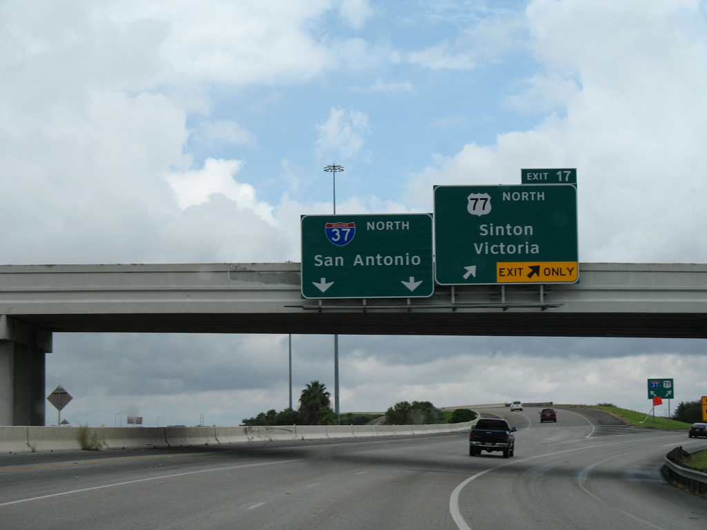
| The bridge across the Nueces River was identified as a hurricane evacuation chokepoint, prompting discussion to build a parallel bridge as part of IH-69E to avoid the overlap. U.S. 77 and Future IH 69E otherwise branch east from the ensuing wye interchange (Exit 17). 07/11/05 |
|
| Northeast from Exit 17, U.S. 77 travels at-grade to the city of Odem and the Sinton bypass. 09/29/07 |
|
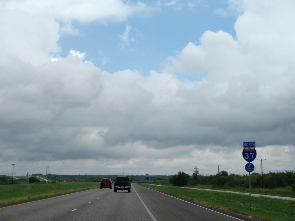
| Confirming marker for IH 37 north, posted as the freeway turns northwest from U.S. 77. 09/29/07 |
|
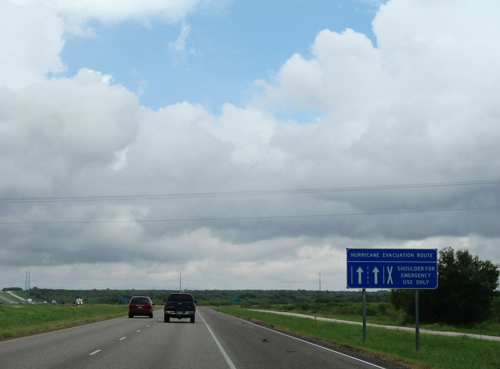
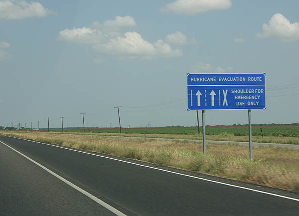
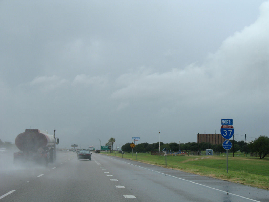
| During hurricane evacuations, the outside shoulder can be converted as a third northbound lane to increase the capacity of IH 37 leaving Corpus Christi. The evacuation lane previously extended north to SH 72 near Three Rivers. 09/29/07 |
|
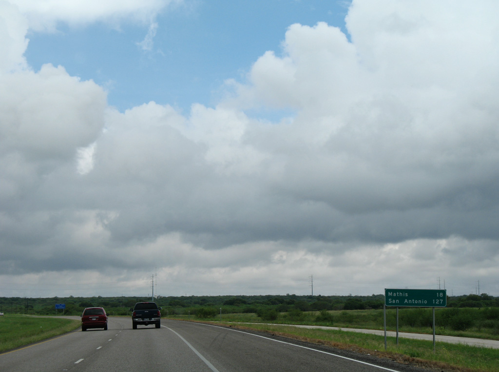
| The city of Mathis lies 20 miles to the northwest, followed by San Antonio in 127 miles. 09/29/07 |
|
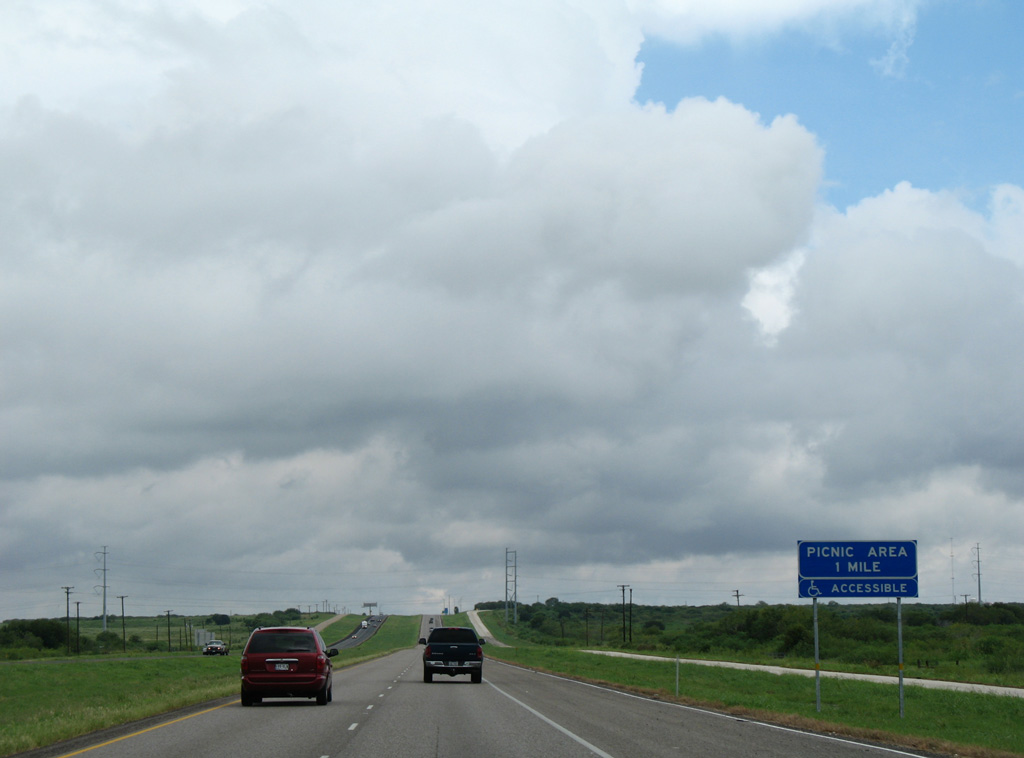
| Interstate 37 gains 70 feet in elevation leading to the first of two picnic areas along northbound. 09/29/07 |
|
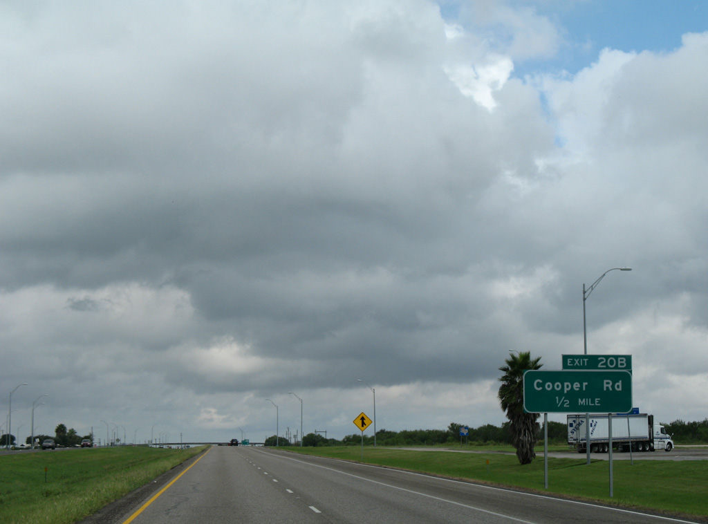
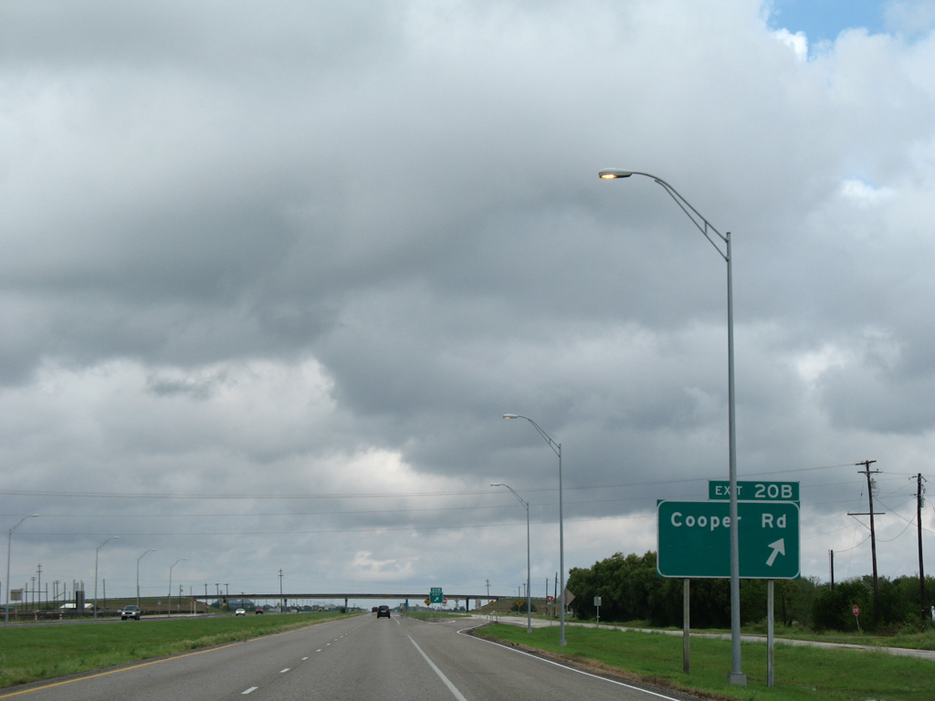
| A diamond interchange (Exit 20A) joins IH 37 with Cooper Road just north of the picnic areas. 09/29/07 |
|
| Cooper Road serves agricultural areas south of Edroy and east to the city of Odem. 09/29/07 |
|
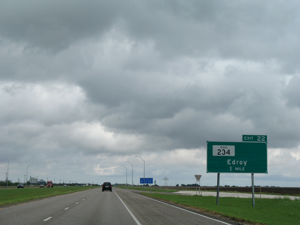
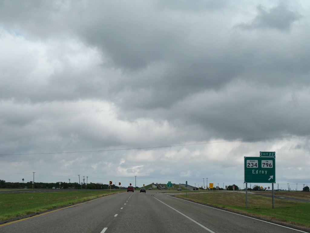
| Interstate 37 runs along the east side of Edroy. Exit 22 serves the unincorporated community via SH 234. 09/29/07 |
|
| SH 234 forms an L-shaped route through Edroy, ending at FM 796 and IH 37. The state highway totals just 6.41 miles east to U.S. 77 in Odem. FM 796 extends north along a 33.43 mile stair stepped route to U.S. 59 in western Bee County. 09/29/07 |
|
| Heading northwest from Edroy, Interstate 37 directly overlaid State Highway 9 to Mathis. 09/29/07 |
|
| The seven mile exit less stretch between Edroy and SH 188 is the longest along Interstate 37. 09/29/07 |
|
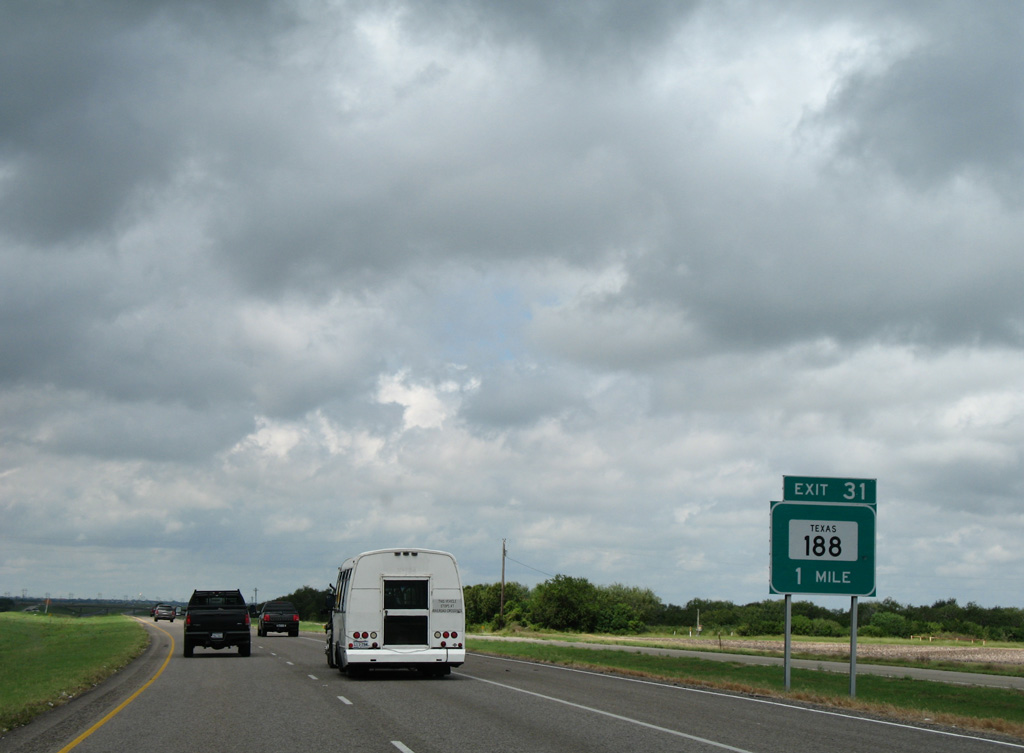
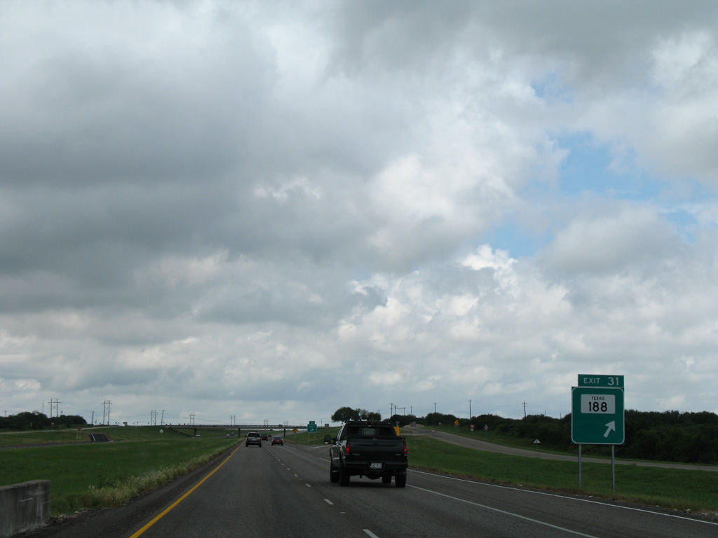
| One mile south of Exit 31 and SH 188 on IH 37 north. SH 188 originates at SH 35 Business near Estes, and south of Rockport. 09/29/07 |
|
| SH 188 concludes its 41.33 mile route at the diamond interchange (Exit 31) with Interstate 37. County Road 1136 extends the road west 1.23 miles to FM 666. 09/29/07 |
|
| 2015 TxDOT traffic counts along Interstate 37 north from SH 188 reduced to 25,668 vpd. 09/29/07 |
|
| The Hurricane Evacuation route signs are posted every five to ten miles along IH 37. 07/11/05 |
|
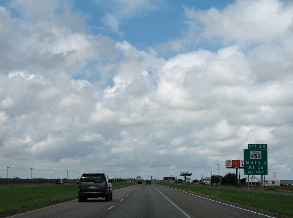
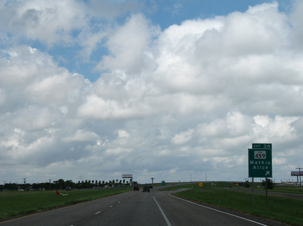
| State Spur 459 branches west from IH 37 at Exit 34 to link IH 37 with SH 359 north of the Mathis city center. SH 359 travels 28 miles southwest to Alice. 09/29/07 |
|
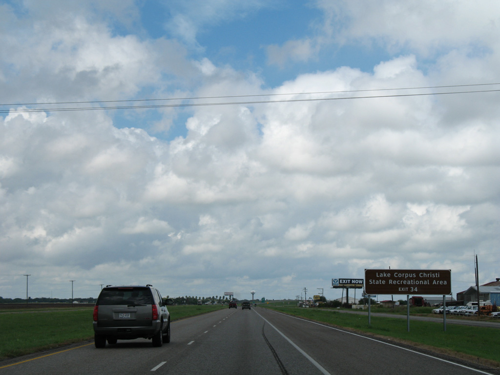
| Exit 34 is the first of four interchanges along IH 37 serving Lake Corpus Christi. Formed by a dam on the Nueces River, Lake Corpus Christi is a reservoir for the city of Corpus Christi. Lake Corpus Christi State Park lies southwest of Mathis along FM 1068. 09/29/07 |
|
| The modified diamond interchange (Exit 34) with Spur 459 connects with Lamar Street south to FM 666 and CR 17 northeast. Spur 459 follows old State Highway 9, and was previously signed as SH 359 on IH 37 guide signs. 09/29/07 |
|
| SH 359 begins in Laredo and travels east to Hebbronville and then northeast to San Diego, Orange Grove and Mathis. 09/29/07 |
|
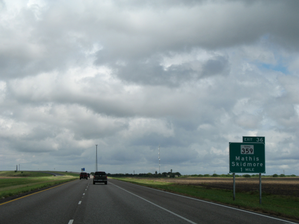
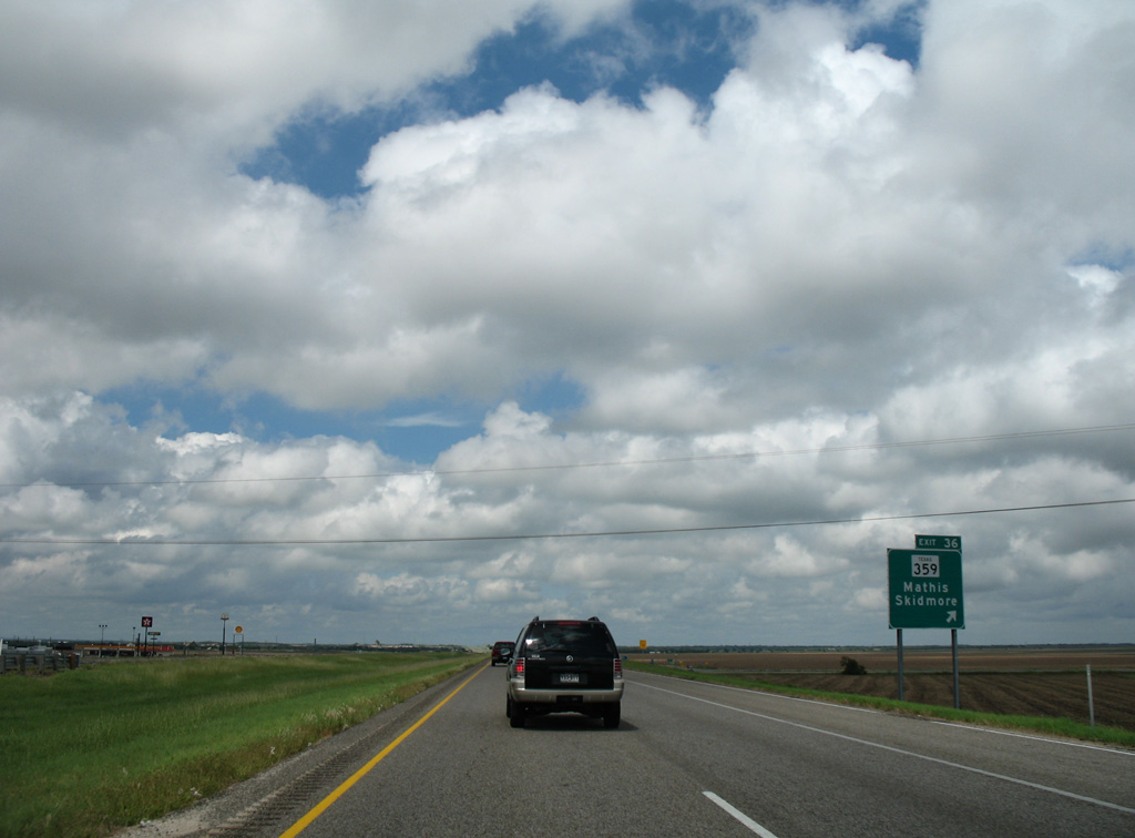
| The 135.03 mile route of SH 359 concludes 12.4 miles north of Exit 36 at U.S. 181 in Skidmore. 09/29/07 |
Page Updated 08-30-2017.

 North
North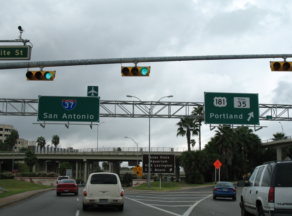


 North
North