|
| Interstate 55 north enters the diamond interchange (Exit 193) with Meramec Bottom Road beyond the Meramec River. Meramec Bottom Road connects the freeway with Lower Meramec River Park to the west and U.S. 61/67 (Lemay Ferry Road) at Oakville to the east. 05/03/12 |
|
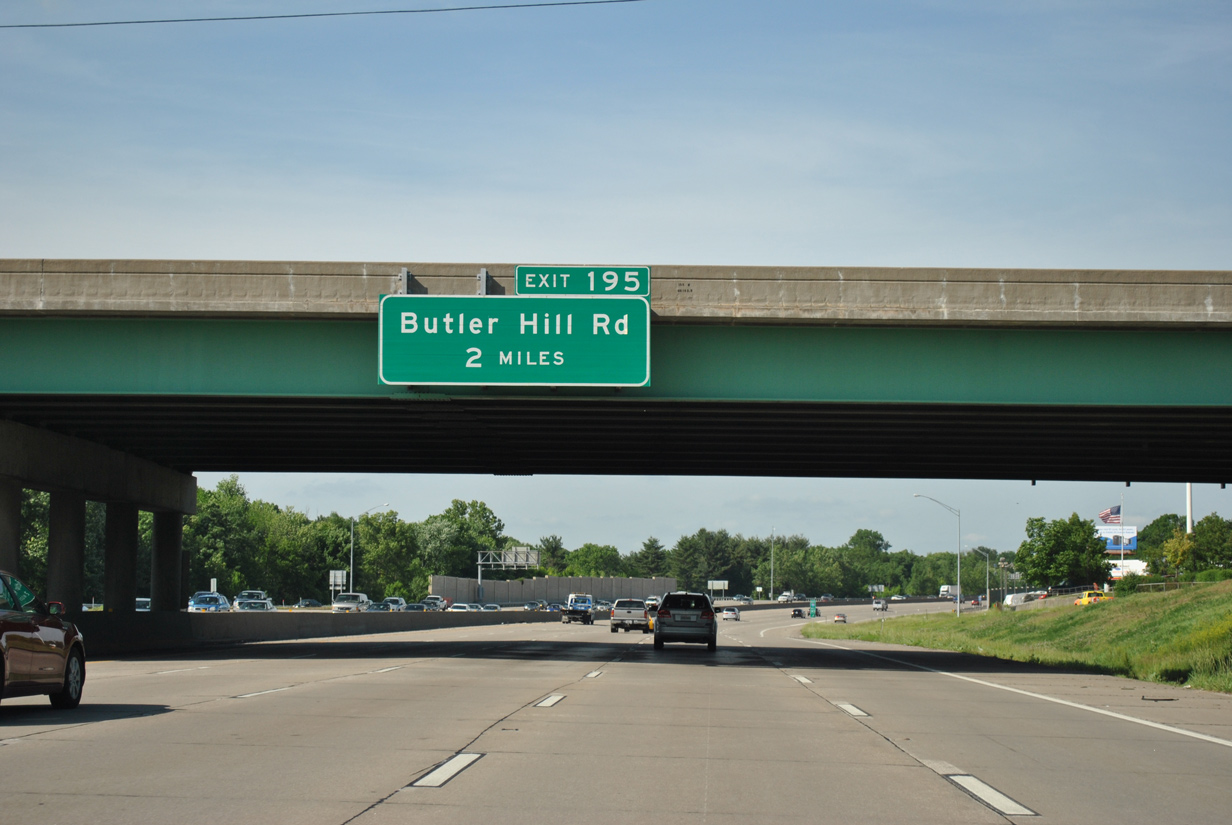
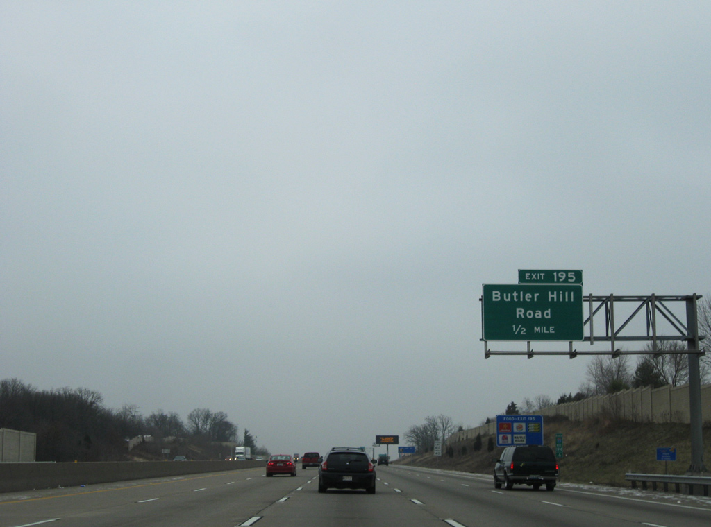
| Interstate 55 stays west of Oakville to Exit 195 with Butler Hill Road in two miles. 05/03/12 |
|
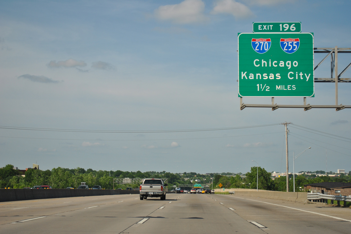
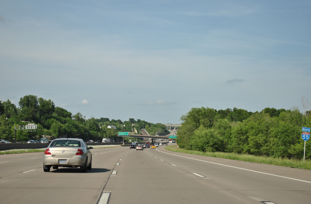
| Reassurance marker posted beyond the on-ramp from Meramec Bottom Road. I-55 carries ten overall lanes to the exchange with I-255 and I-270. 05/03/12 |
|
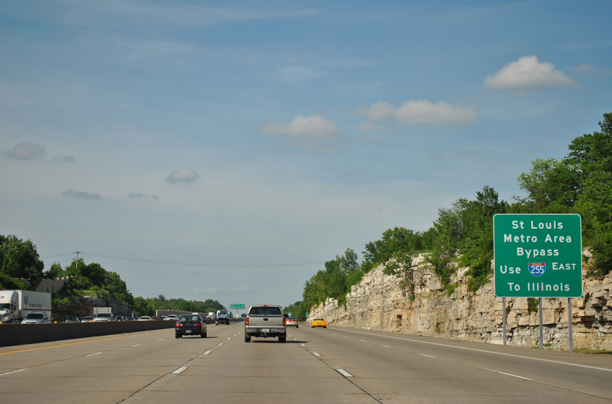
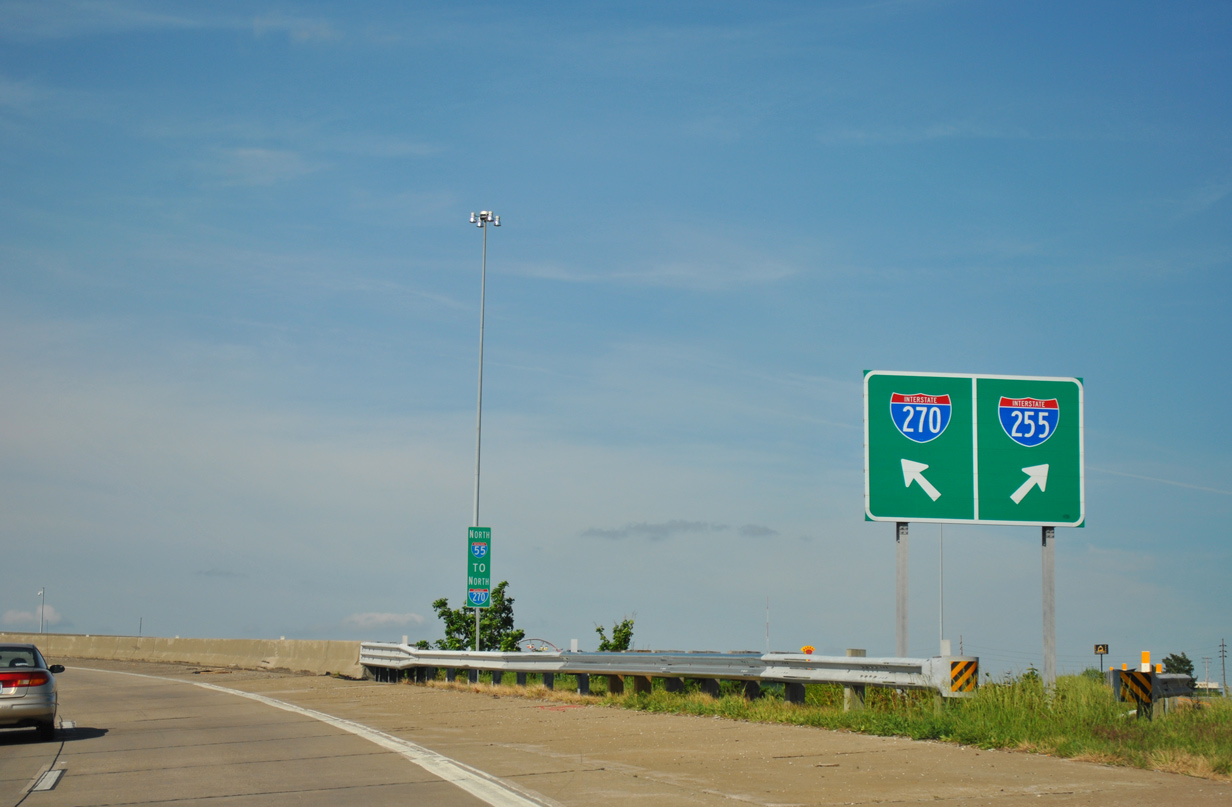
| Beyond Exit 193 is the directional cloverleaf interchange (Exit 196) with I-255 east and I-270 north. I-255 provides a bypass route of St. Louis for interests north to Springfield and Chicago. 05/03/12 |
|
| Interstate 270 lines the western and northern third of the St. Louis beltway from I-55 to I-70 at Bridgeton and east across the Chain of Rocks Bridge to near Troy, Illinois. 05/03/12 |
|
| One half mile south of the diamond interchange (Exit 195) with Butler Hill Road on I-55 north. 12/20/09 |
|
| Butler Hill Road stems west from adjacent U.S. 61/67 at Mattese through suburban areas to Missouri Route 21 (Tesson Ferry Road). 05/03/12 |
|
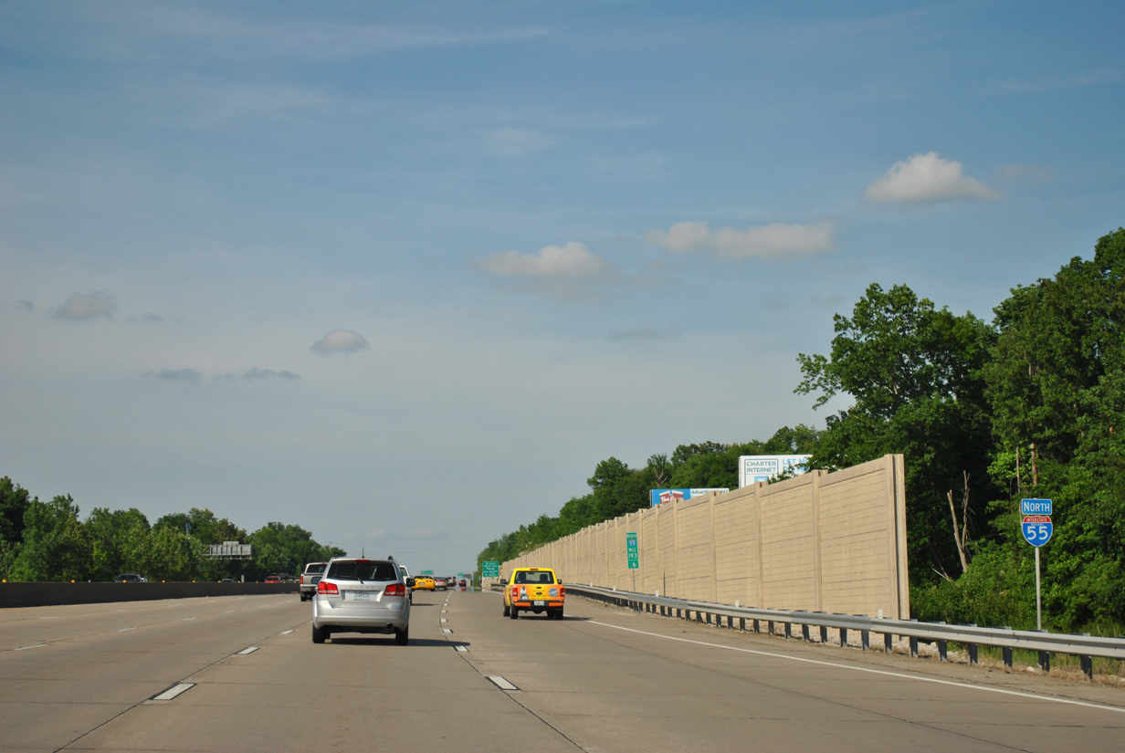
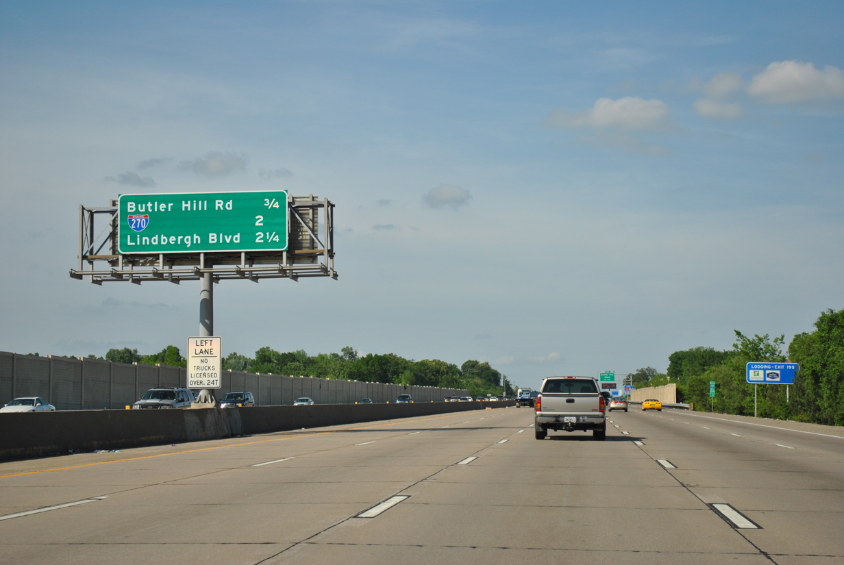
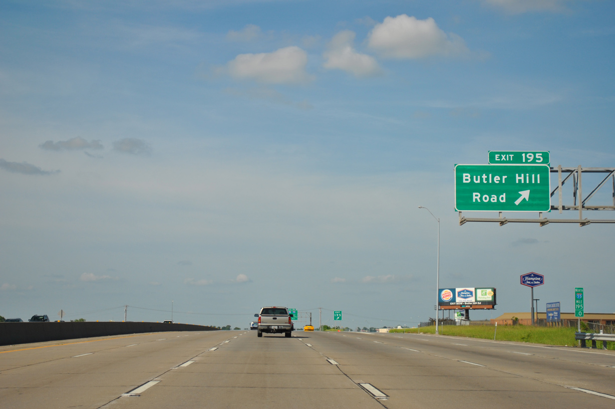
| I-55 spans Butler Hill Road 1.5 miles ahead of Exit 196 to both I-270 north to Sunset Hills and I-255 east to Columbia, Illinois. 05/03/12 |
|
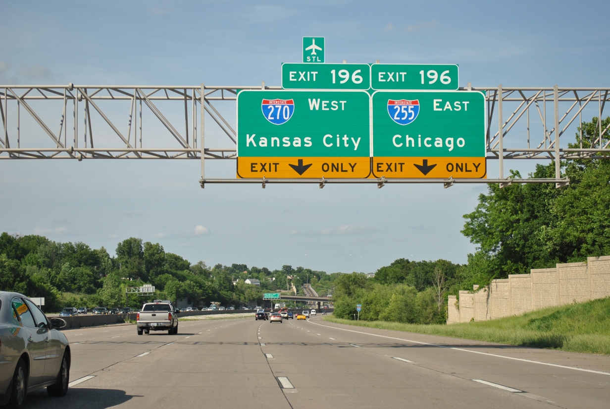
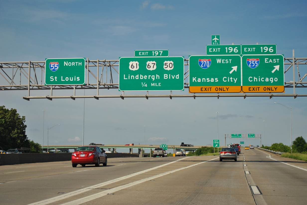
| A double lane drop occurs on I-55 north at Exit 196. Completed in 1988 between Mehlville and Edwardville, Illinois, Interstate 255 crosses the Jefferson Barracks Bridge over the Mississippi River in three miles. 05/03/12 |
|
| Interstate 55 passes just west of Lemay by this shield assembly. 05/03/12 |
|
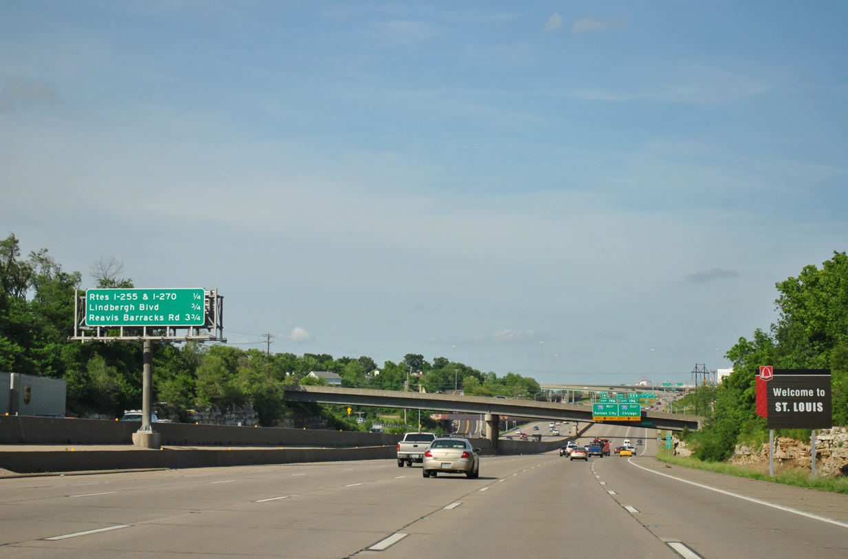
| Welcome to St. Louis sign posted a quarter mile south of Exit 196. Wayfinding signs of this format are posted on several of the area freeways. 05/03/12 |
|
| Exit 196 separates beyond Mattis Road for Chicago via I-255 to I-55 north and Kansas City via I-270 to I-70 west. The St. Louis beltway uses control points for connecting routes versus any of the suburban cities it runs through. 05/03/12 |
|
| Rising from a valley at Mattese Creek, Exit 196 leaves I-55 north for Interstate 270 north to Kirkwood, Town And Country and Maryland Heights and I-255 east to Cahokia, Collinsville and Glen Carbon, Illinois. 05/03/12 |
|
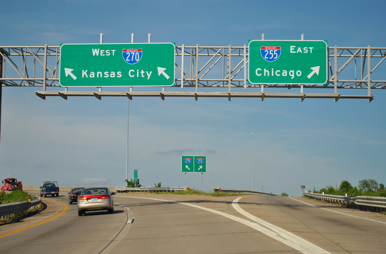
| A two lane flyover links with Interstate 270, 20 miles south of I-70 in Bridgeton.
The beltway north to I-70 was designated as Interstate 244 until 1974, when AASHTO approved the redesignation to I-270. The June 26, 1974 approval also included renumbering I-255 as I-270, but that decision was later reversed. 05/03/12 |
|
| Motorists taking I-255 east reach I-64 in 20 miles and I-55/70 in 24 miles. 05/03/12 |
|
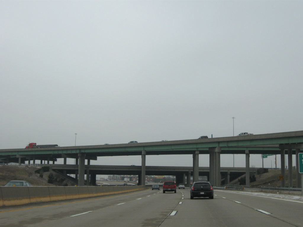
| A lengthy collector distributor roadway (Exit 197) to Lindbergh Boulevard departs from within the cloverstack interchange at I-255/270. 12/20/09 |
|
| Road work upgraded the previous cloverleaf interchange at the St. Louis beltway with two new flyovers between 1991 and 1994. 12/20/09 |
|
| A loop ramp joins the c/d roadway to Lindbergh Boulevard from the south end of I-270. Two lanes proceed to U.S. 50-61-67 at Mehlville while two pass underneath Lindbergh Boulevard for return access to I-55 north. 12/20/09 |
|
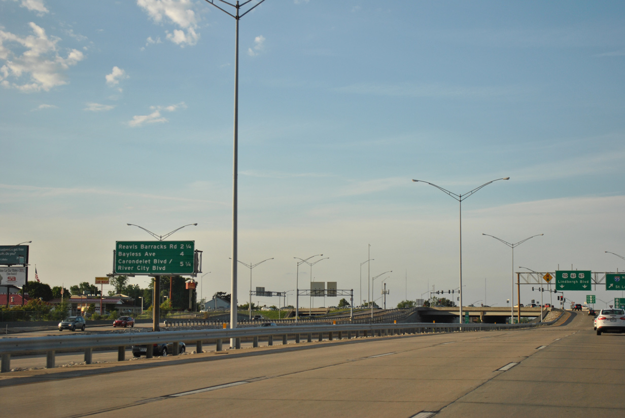
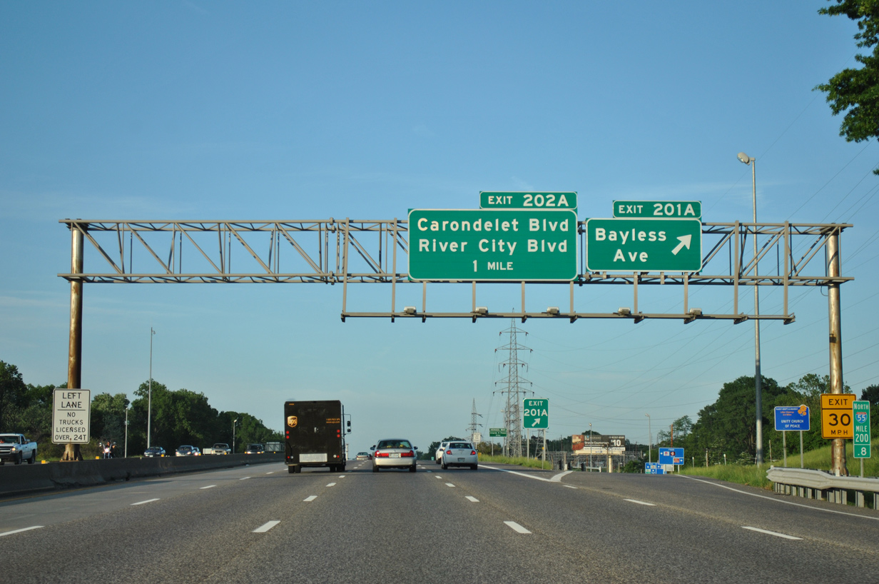
| The next three exits serve areas of unincorporated St. Louis County and the Patch neighborhood of south St. Louis. A sign change made between 2009 and 2012 added River City Boulevard for the third entry (Exit 202A). 05/03/12 |
|
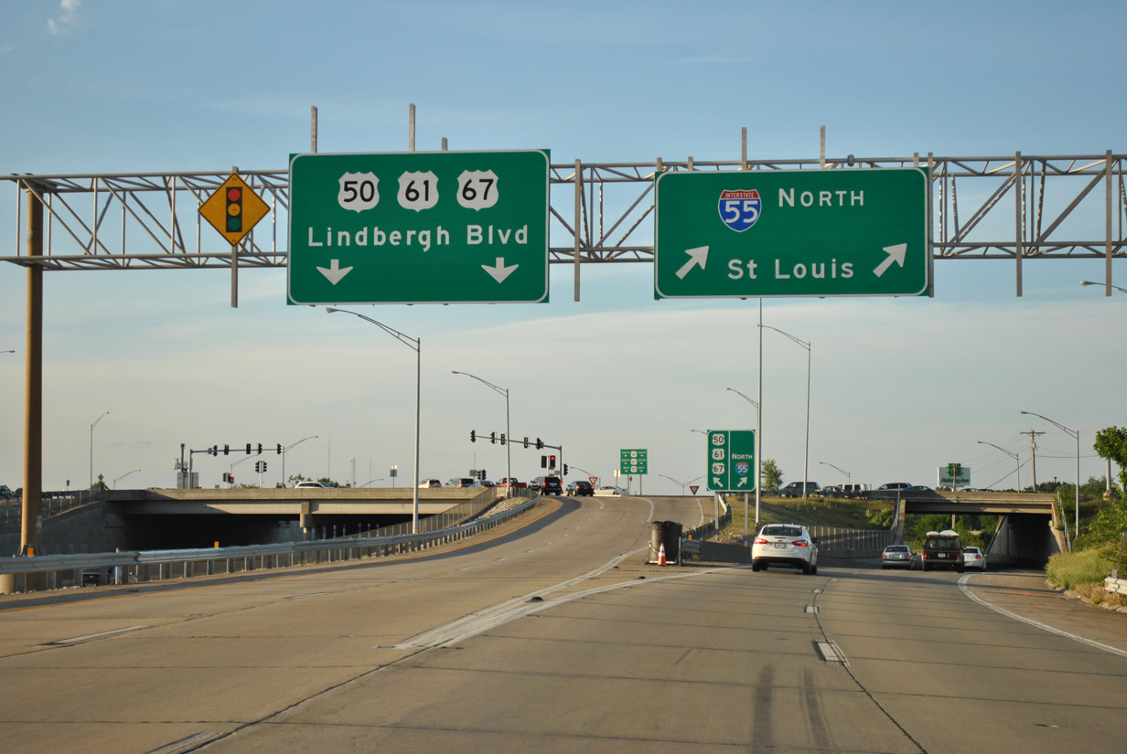
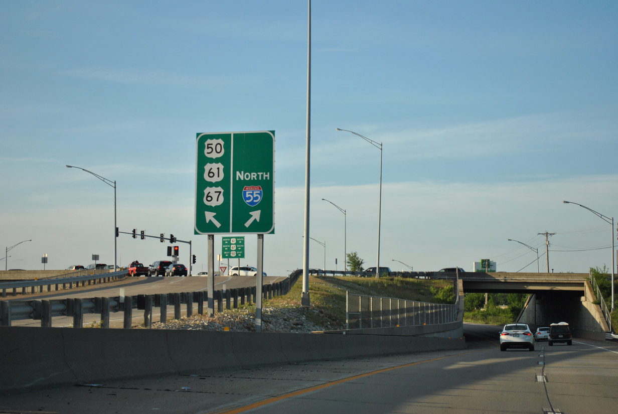
| U.S. 50 combines with I-255 east from the end of Lindbergh Boulevard to Caseyville, Illinois. Lindbergh Boulevard north constitutes an arterial belt route encircling St. Louis between Mehlville and north St. Louis County near Fort Bellefontaine. U.S. 67 runs along the entire length of the route, while U.S. 61 takes the boulevard to I-64/U.S. 40 west at Frontenac. 05/03/12 |
|
| A single point urban interchange joins Lindbergh Boulevard and Interstate 55. The exit serves South County Center mall and the city of Green Park. 05/03/12 |
|
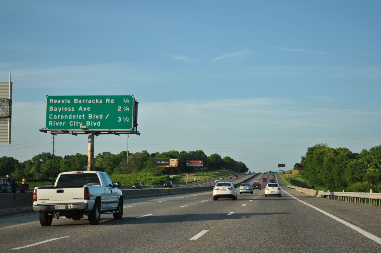
| Interstate 55 winds east of an industrial park in Green Park to cross Gravois Creek 0.75 miles ahead of Exit 199 with Reavis Barracks Road. 05/03/12 |
|
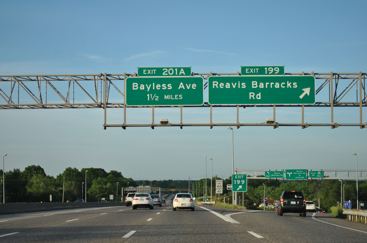
| Reavis Barracks Road heads south from the diamond interchange (Exit 199) with I-55 to Route 231 (Kingston Drive) near Jefferson Barracks Historic Park. West from Exit 199, the road passes through St. George to become Mackenzie Road north to Route 30 (Gravois Road) near Affton. 05/03/12 |
|
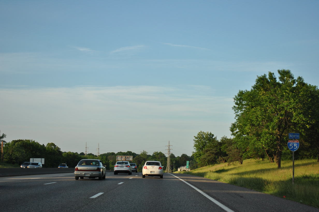
| Union Road parallels I-55 north to a half diamond interchange (Exit 200 on southbound). 05/03/12 |
|
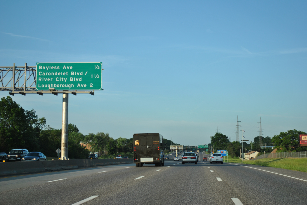
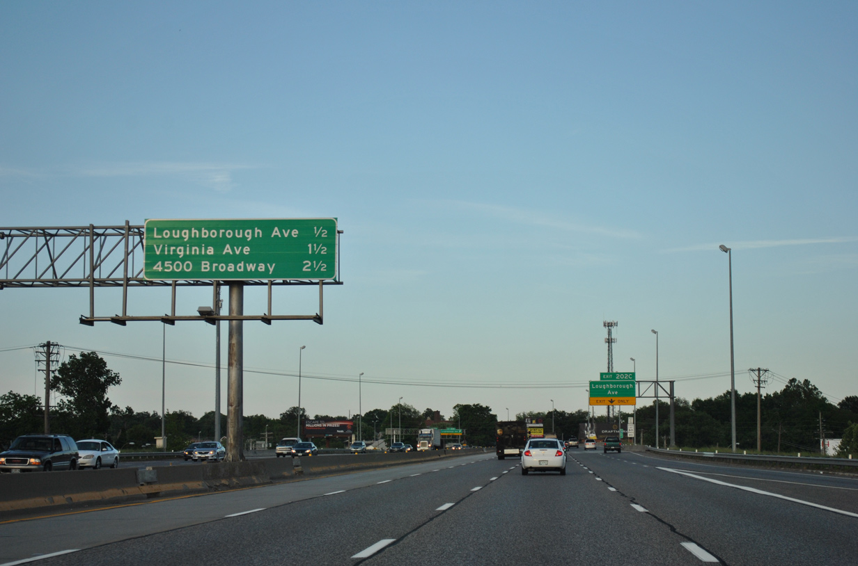
| The second St. Louis exit appears on this distance sign two miles out. Loughborough Avenue connects I-55 with the Carondelet neighborhood. 05/03/12 |
|
| Exit 201 A leaves I-55 north for Bayless Avenue. Bayless Avenue comprises a four lane boulevard southeast through the small city of Belle Villa. Weber Road extends the road northwest from Union Road to the village of Wilbur Park and Route 30. 05/03/12 |
|
| This reassurance marker precedes a half diamond interchange (Exit 201B on I-55 south) with a section of Weber Road separate from Bayless Avenue. 05/03/12 |
|
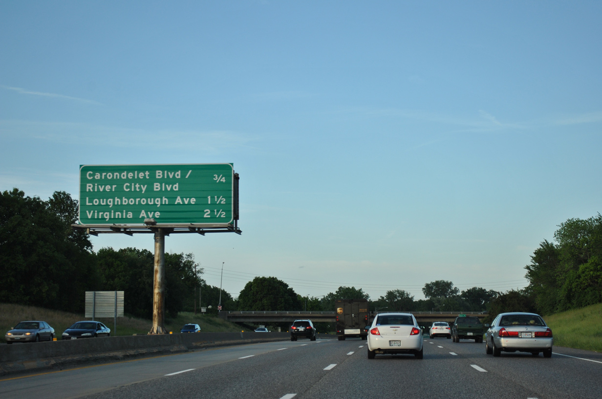
| A split diamond interchange joins Interstate 55 with Carondelet Boulevard / River City Boulevard northbound at Exit 202 A and Germania Avenue southbound at Exit 202 B in 0.75 miles. 05/03/12 |
|
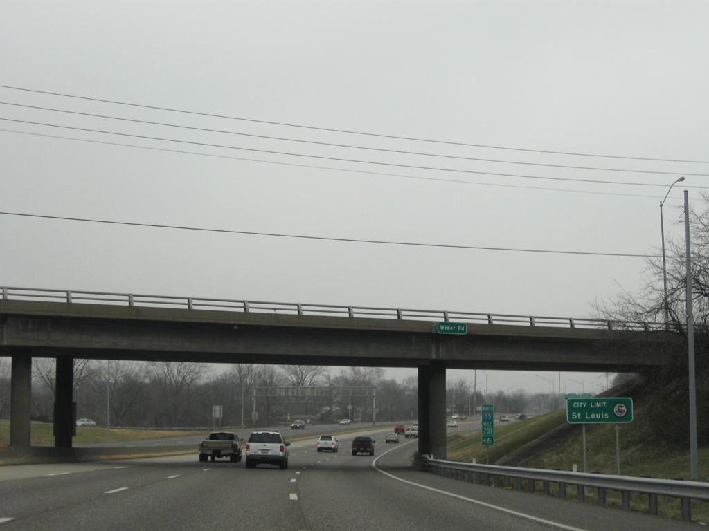
| Northbound I-55 traffic formally enters the independent city of St. Louis at the Weber Road overpass. 12/20/09 |
|
| Carondelet Boulevard south and River City Boulevard north come together at Exit 202A. Together the two roads parallel the Des Peres Drainage Channel between River City Casino Boulevard to the Mississippi River and Morgan Ford Road at Willmore Park. 05/03/12 |
|
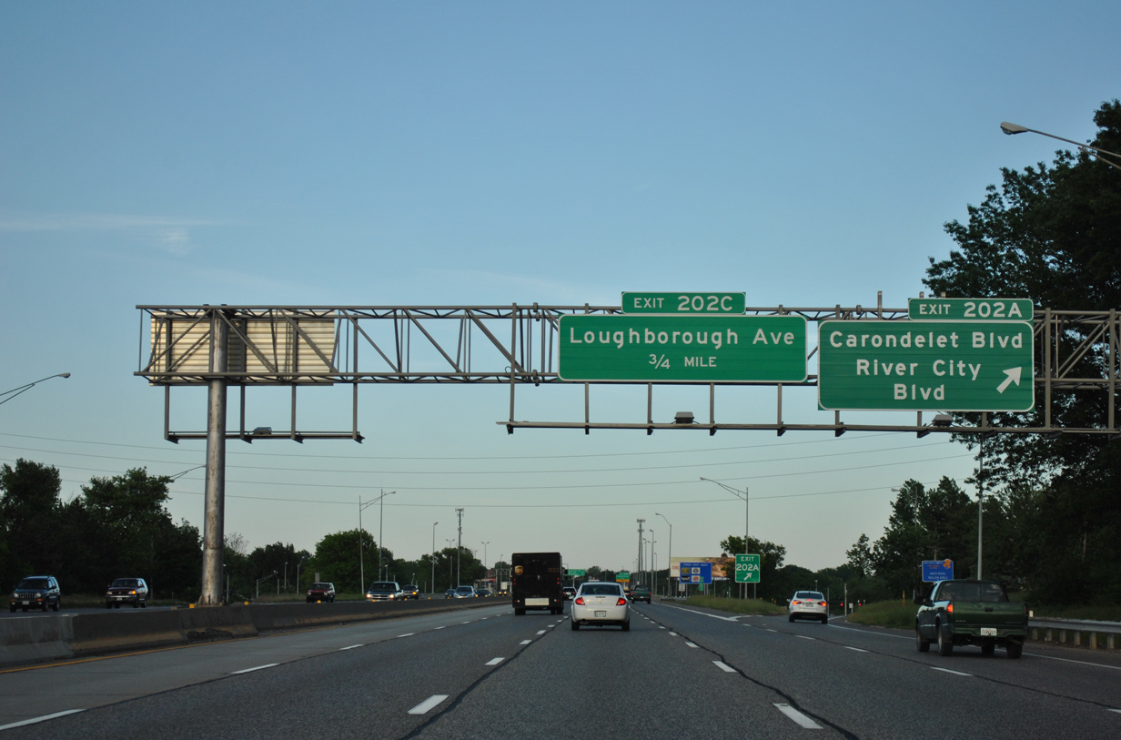
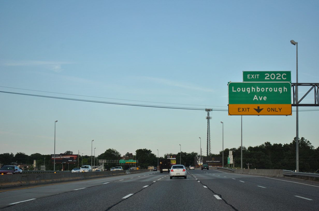
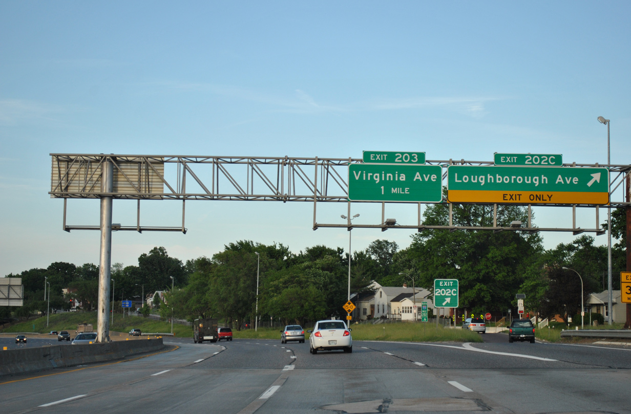
| Curving eastward through the Patch community of St. Louis, I-55 next reaches Loughborough Avenue at Exit 202 C and Virginia Avenue at Exit 203. 05/03/12 |
|
| A fifth northbound lane opens along I-55 from the Germania Street on-ramp to Exit 202 C for Idaho Avenue. Idaho Street parallels the freeway north two blocks to Loughborough Avenue. 05/03/12 |
|
| Loughborough Avenue east ends at an industrial area by the Mississippi River while heading northwest along Carondelet Park to the Boulevard Heights neighborhood. 05/03/12 |
|
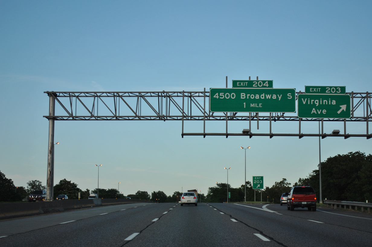
| Interstate 55 weaves through Carondelet to Mount Pleasant over the next 1.75 miles to Broadway / Exit 204. 05/03/12 |
|
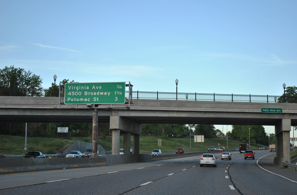
| Northbound shield assembly posted for I-55 between the Holly Hills Avenue overpass and split diamond interchange (Exit 203) with Virginia Avenue and Bates Street. 05/03/12 |
|
| Virginia avenue stems north from Michigan Avenue and Dover Street in Carondelet to the Dutchtown neighborhood and Marquette Park. 05/03/12 |
|
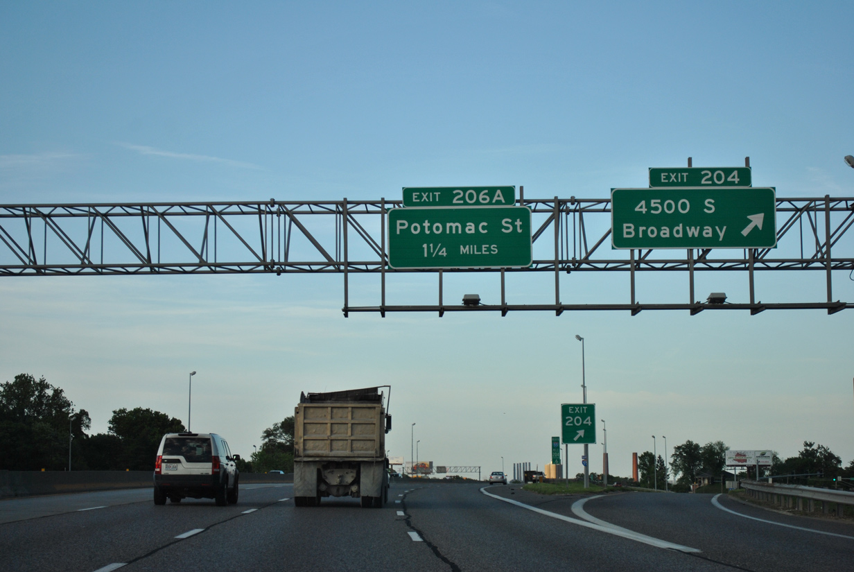
| Broadway (former U.S. 67 Alternate / Route 231) and Interstate 55 north come together at a diamond interchange (Exit 204) in 0.75 miles. The two roadways meet again at Exit 206 B and the south side of the Kosciusko industrial area. 05/03/12 |
|
| Lowering to pass under Delor Street, this shield for I-55 north was missing by 2011. 12/20/09 |
|
| Interstate 55 travels close to the Mississippi River before shifting westward to Exit 204 for Broadway. Broadway loops north from Exit 204 through the Marine Villa neighborhood. 05/03/12, 12/20/09 |
|
| A half diamond interchange (Exit 205 for southbound) adds traffic from Gasconade Street beyond this shield. 05/03/12 |
|
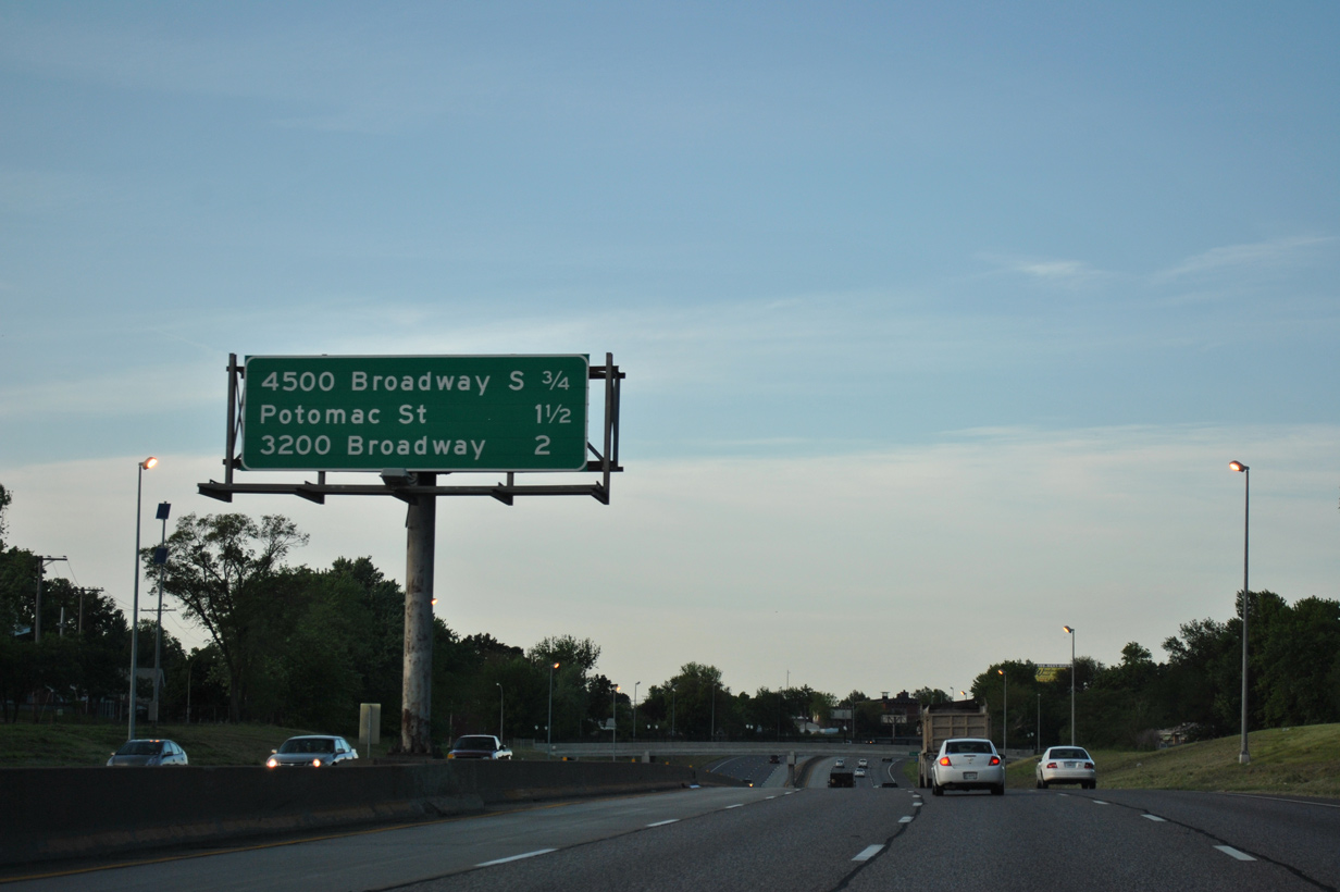
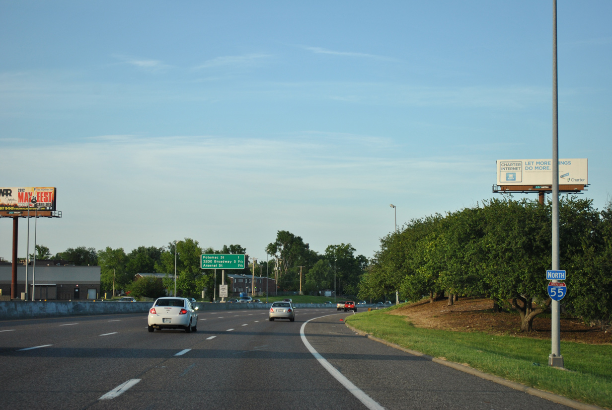
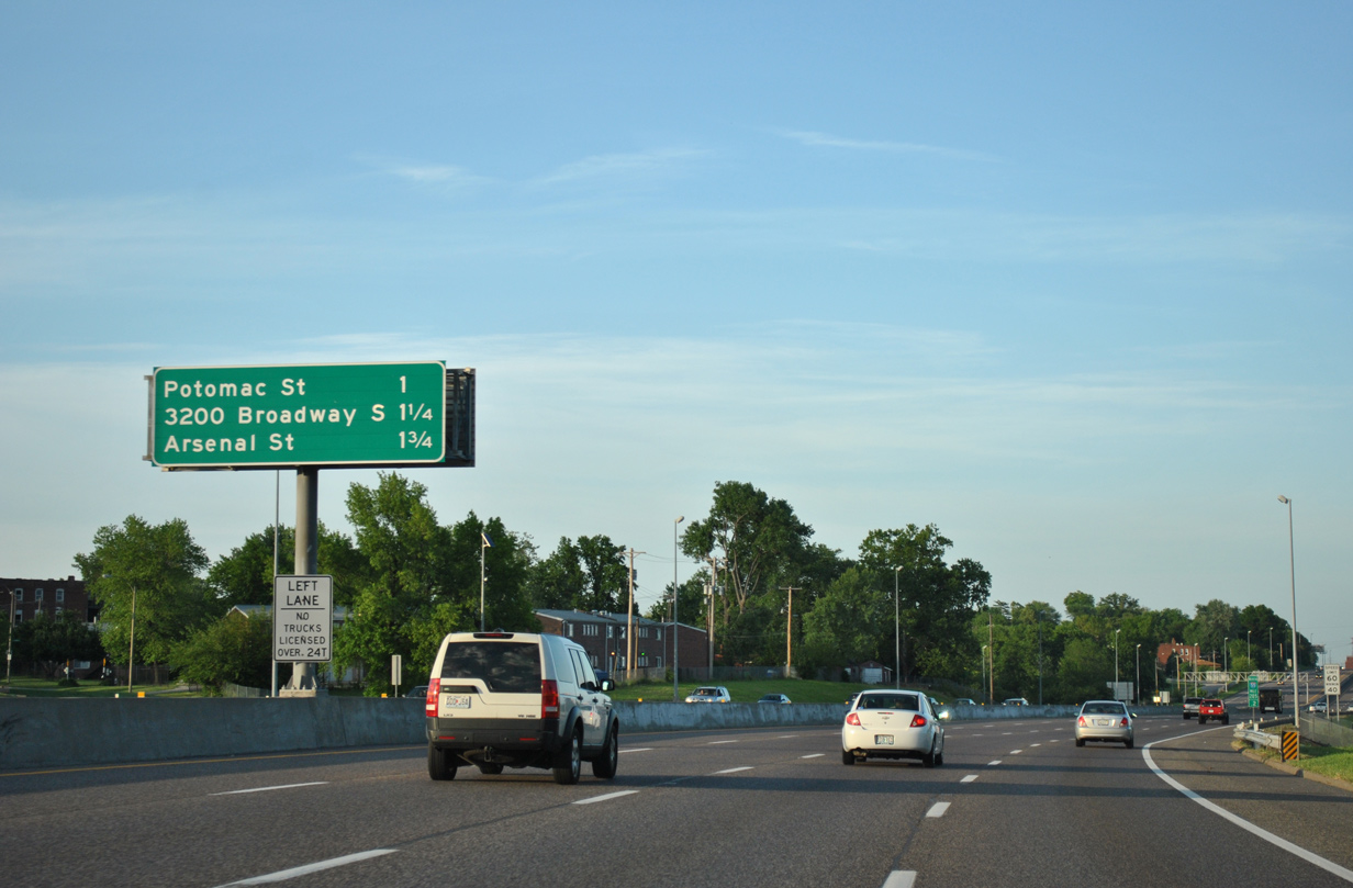
| Exit 206 A departs in one mile for Potomac Street at S 1st Street. Exit 206 B quickly follows onto Broadway north at Utah Street. 05/03/12 |
|
| Potomac Street stems north from S 1st Street to Broadway in Marine Villa. 05/03/12 |
|
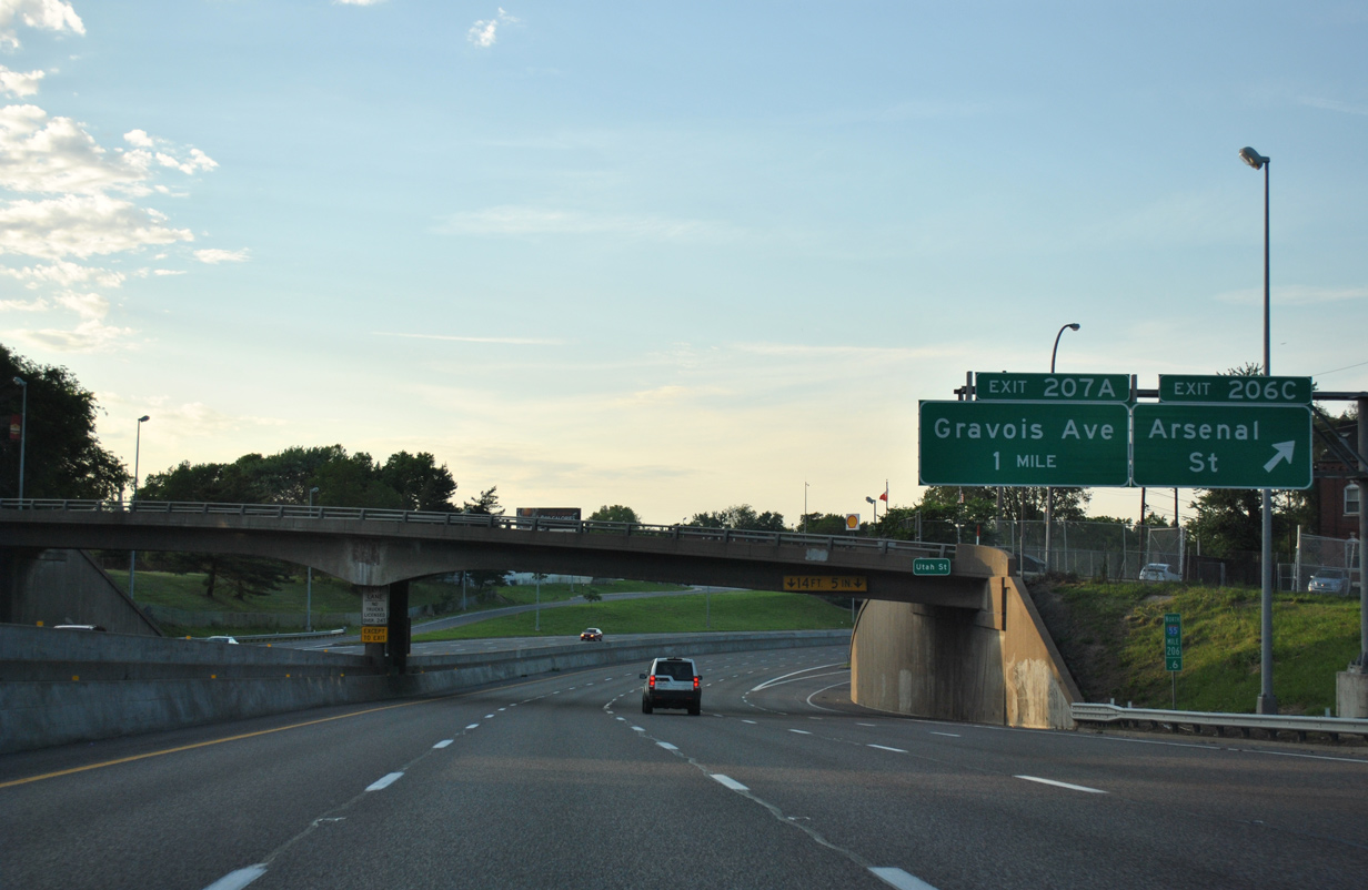
| A viaduct carries I-55 across S 2nd Street to the off-ramp for Broadway. The freeway separates the Benton Park and Soulard neighborhoods northward to Gravois Avenue / Exit 207 A. 05/03/12 |
|
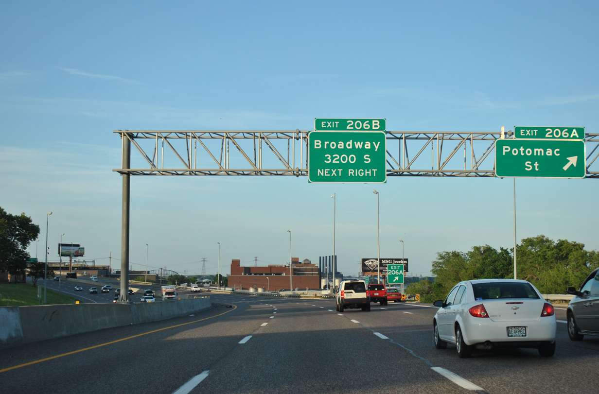
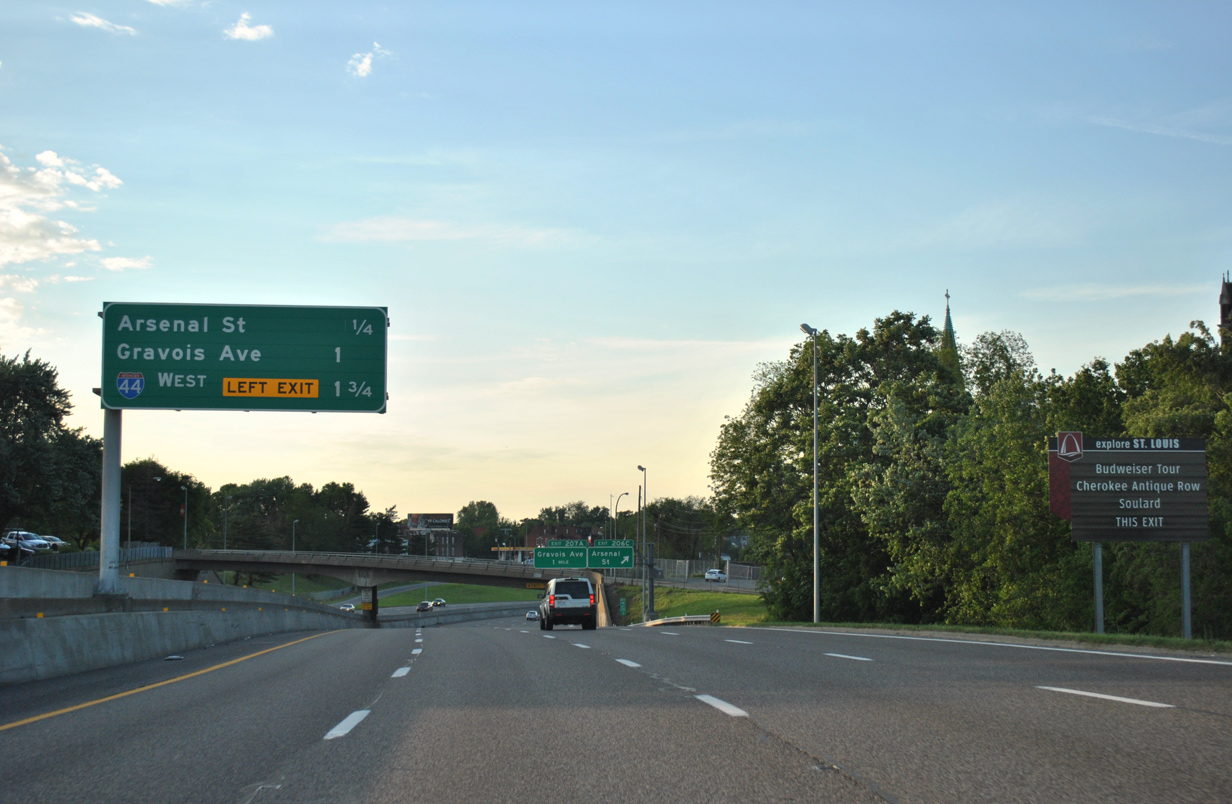
| Broadway (old U.S. 67 Alternate) runs north along the Kosciusko industrial area to meet I-55 again at LaSalle Park. Arsenal Street stems west from Kosciusko to a diamond interchange (Exit 206 C) with the freeway next. 05/03/12 |
|
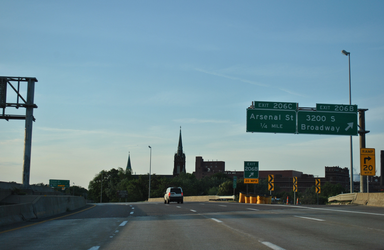
| Exit 206C leaves Interstate 55 north in one quarter mile to intersect Arsenal Street at 13th Street by the Anheuser-Busch Brewery. I-44 debuts to northbound motorists at 1.75 miles out. 05/03/12 |
|
| The Anheuser-Busch Brewery lies between I-55 and Broadway to the east. Arsenal Street continues west to the Benton Park West community and Tower Grove Park. 05/03/12 |
|
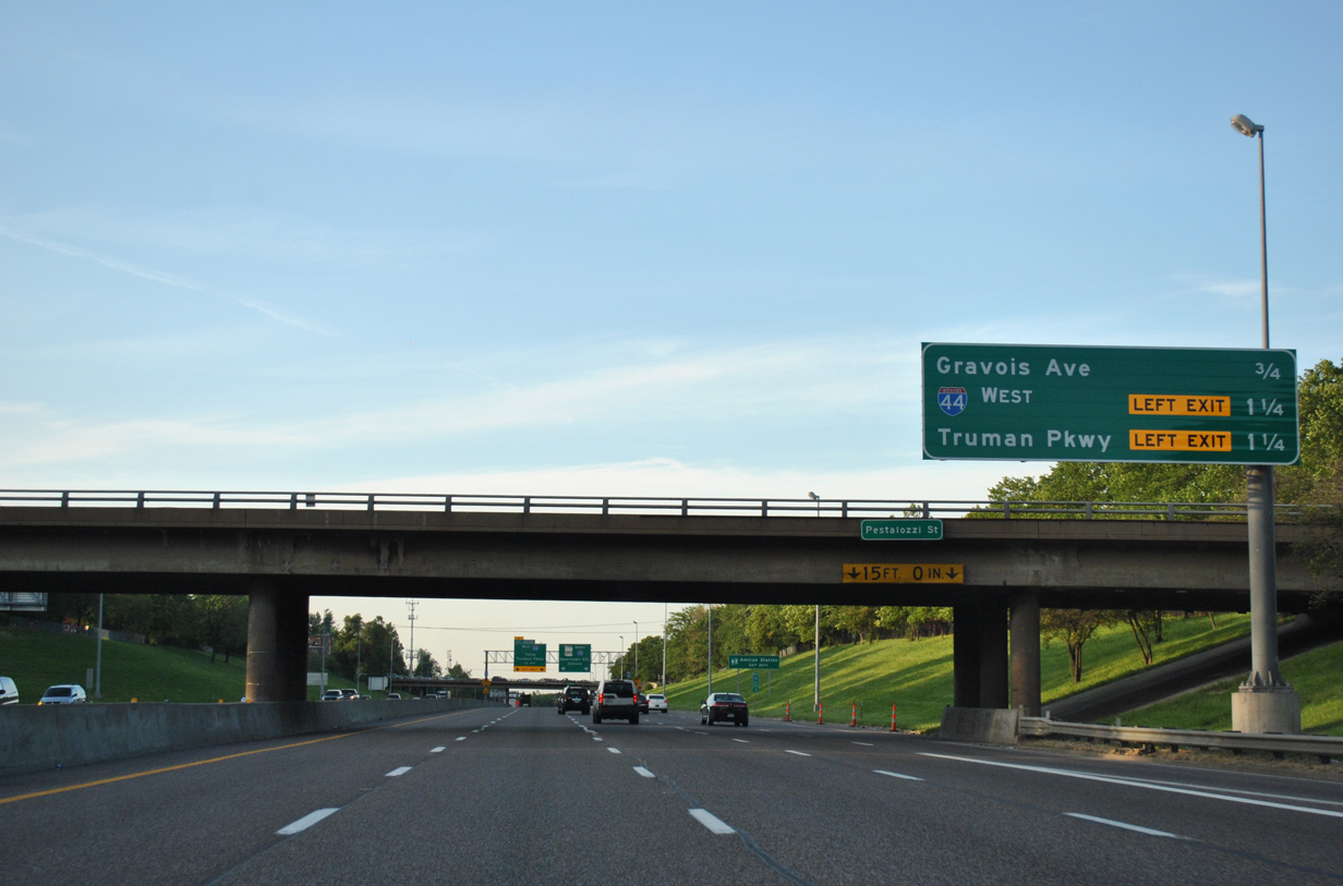
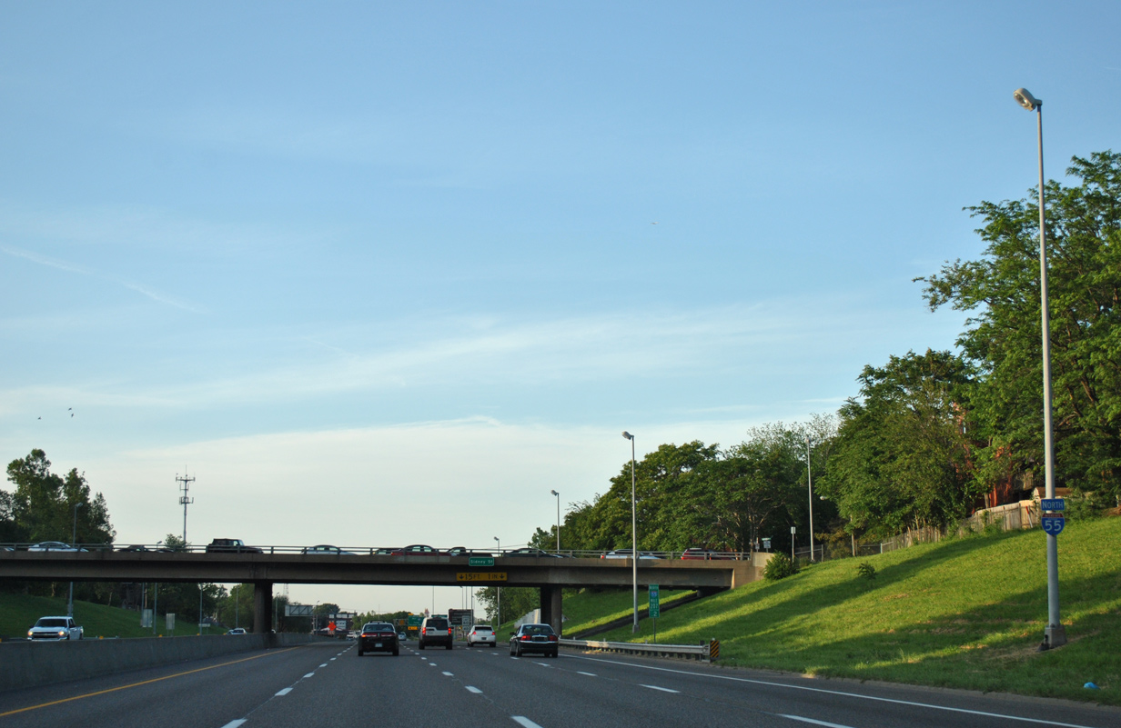
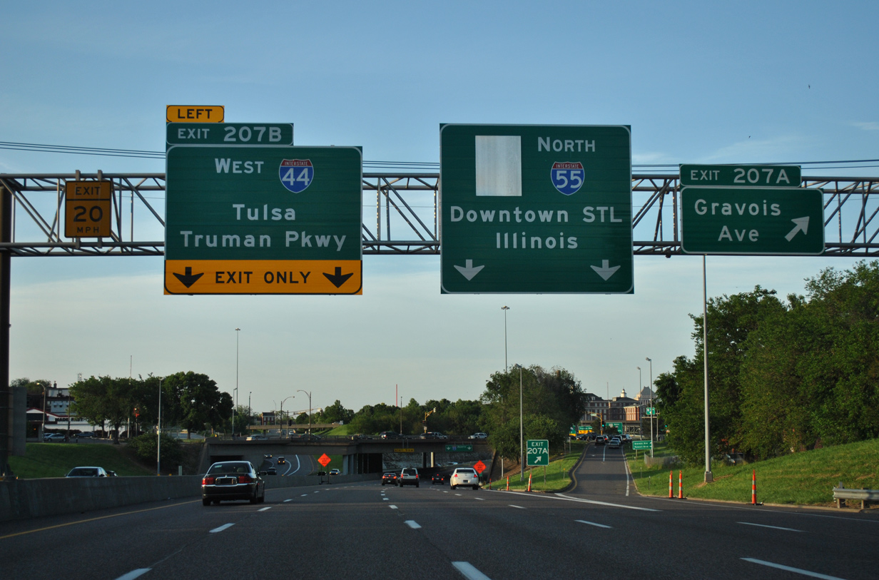
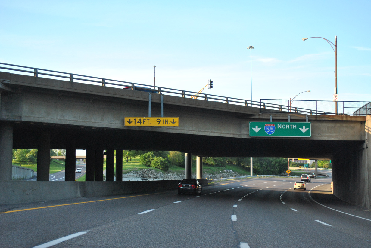
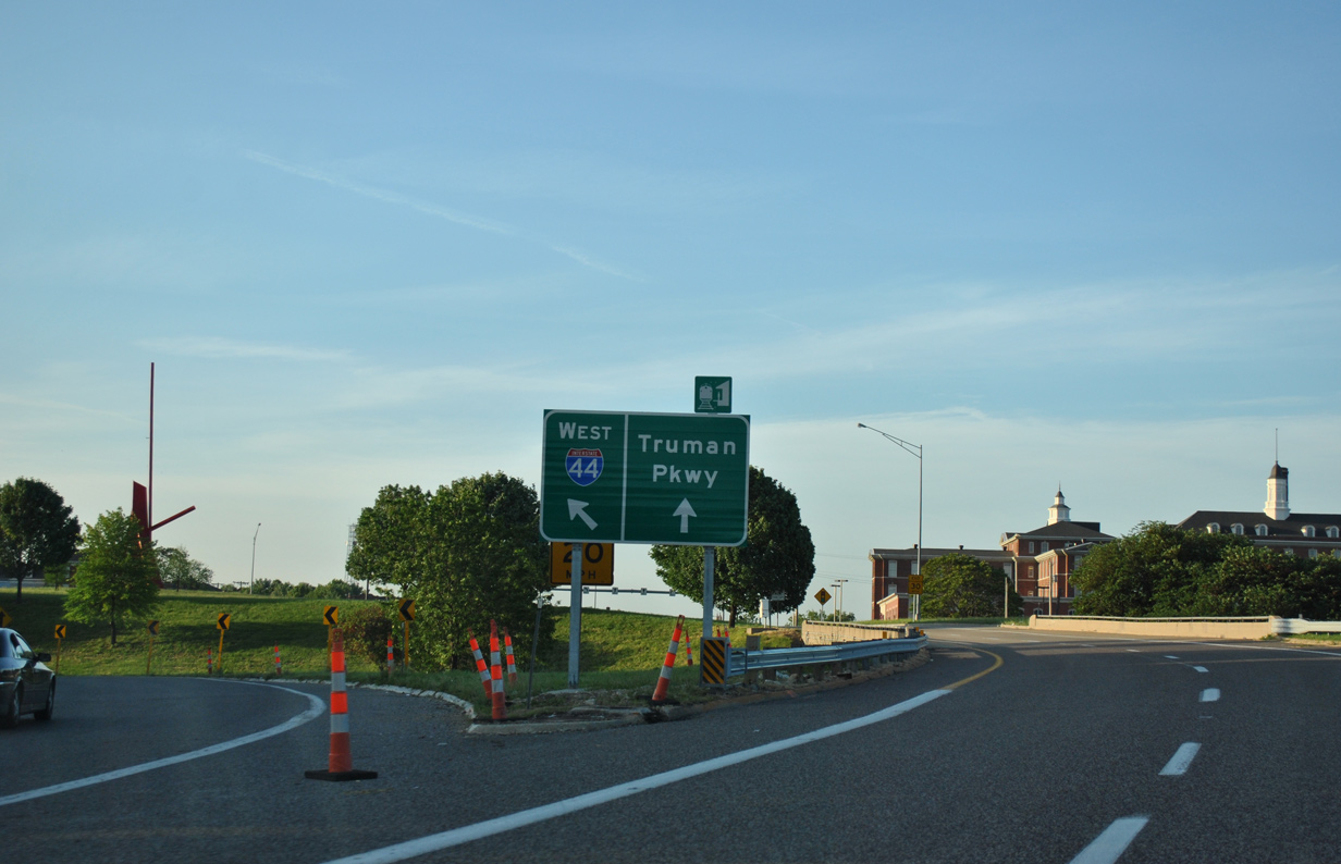
| Pestalozzi Street spans I-55, 1.25 miles south of the directional interchange with Interstate 44 west and Truman Parkway north. Exit 207 A departs next for Gravois Avenue (Route 30 west). 05/03/12 |
|
| The new panel added for Exit 207 B was replaced again by August 2014 to show the separation for Truman Parkway from I-44 west. Truman Parkway stems north Exit 207 B to Route 100 (Chouteau Avenue) at the Lafayette Square and Peabody Darst Webbe communities. 05/03/12 |
|
| Sidney Street spans Interstate 55 beyond this northbound shield assembly. 05/03/12 |
|
| Gravois Avenue doubles as Route 30 from Exit 207 A southwest to Tower Grove South, Bevo Mill and Princeton Heights in south St. Louis. The state highway also represents historic U.S. 50/66 southwest to Chippewa Street. 05/03/12 |
|
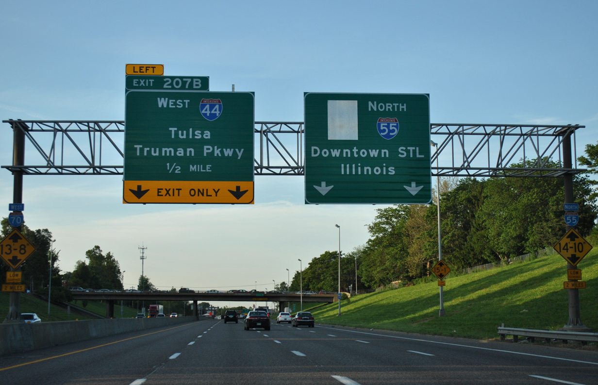
| Gravois Avenue and Russell Boulevard intersect above I-55 as the freeway turns to combine with Interstate 44 east. 05/03/12 |
|
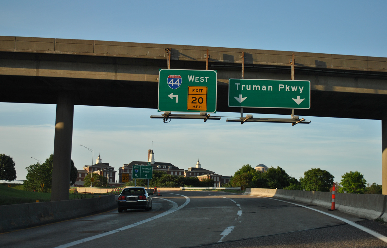
| Interstate 44 west joins St. Louis with Rolla, Springfield and Joplin in southwest Missouri. Tulsa, 391 miles to the southwest in Oklahoma, is generally the control city for I-44 in the St. Louis area. 05/03/12 |
|
| A single lane ramp turns sharply to merge onto the left lane of Interstate 44 west. I-44 travels west to The Gate District, Shaw and The Hill before curving southwest to exit the city at Lindenwood Park. 05/03/12 |
|
| The Truman Parkway ramp expanded to two lanes as separated from I-55 north. Ramps to the parkway were built originally for Missouri Route 755 (North-South Distributor), an unconstructed freeway planned to encircle Downtown St. Louis northward to I-70. 05/03/12 |
|
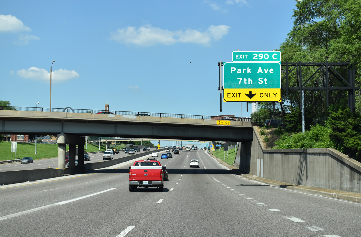
| Interstate 44 joins I-55 north with two lanes to expand the northbound freeway to five lanes to Exit 290 C with Park Avenue at 7th Street. All succeeding exits were renumbered to use the mileage of I-44 instead of I-55 by 2014. 05/24/18 |
|
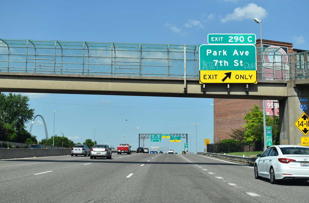
| Exit 290 C branches away from I-44/55 north for Park Avenue. Park Avenue links the LaSalle Park neighborhood with the Kosciusko industrial area at Broadway. 7th Street stems north from Broadway to Busch Stadium, home of the St. Louis Cardinals MLB franchise. 05/24/18 |
|
| I-44/55 elevate onto a viaduct from Park Avenue north to their split at the west end of the Poplar Street Bridge (PSB).
Interstate 55 previously overlapped with I-70 across the PSB, but that changed in February 2014 when I-70 shifted northward onto the new Stan Musial Veterans Memorial Bridge. 05/24/18 |
|
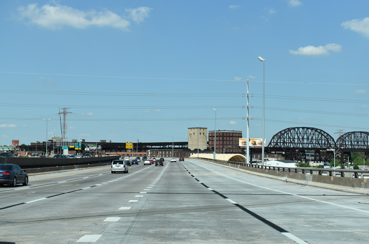
| The MacArthur Bridge across the Mississippi River comes into view east of the viaduct on I-44/55. The double decked steel truss bridge opened in 1917 to automobile bridge and by 1928 with railroad traffic. The aging structure was converted to railroad only use in 1981.1 05/24/18 |
|
| A substandard ramp relegated the Interstate 55 northbound mainline to a single lane at the Poplar Street Bridge. Construction underway through 2017 replaced three of the four directional ramps between Interstate 64, the PSB and I-44 leading north with two lane ramps. 05/24/18 |
|
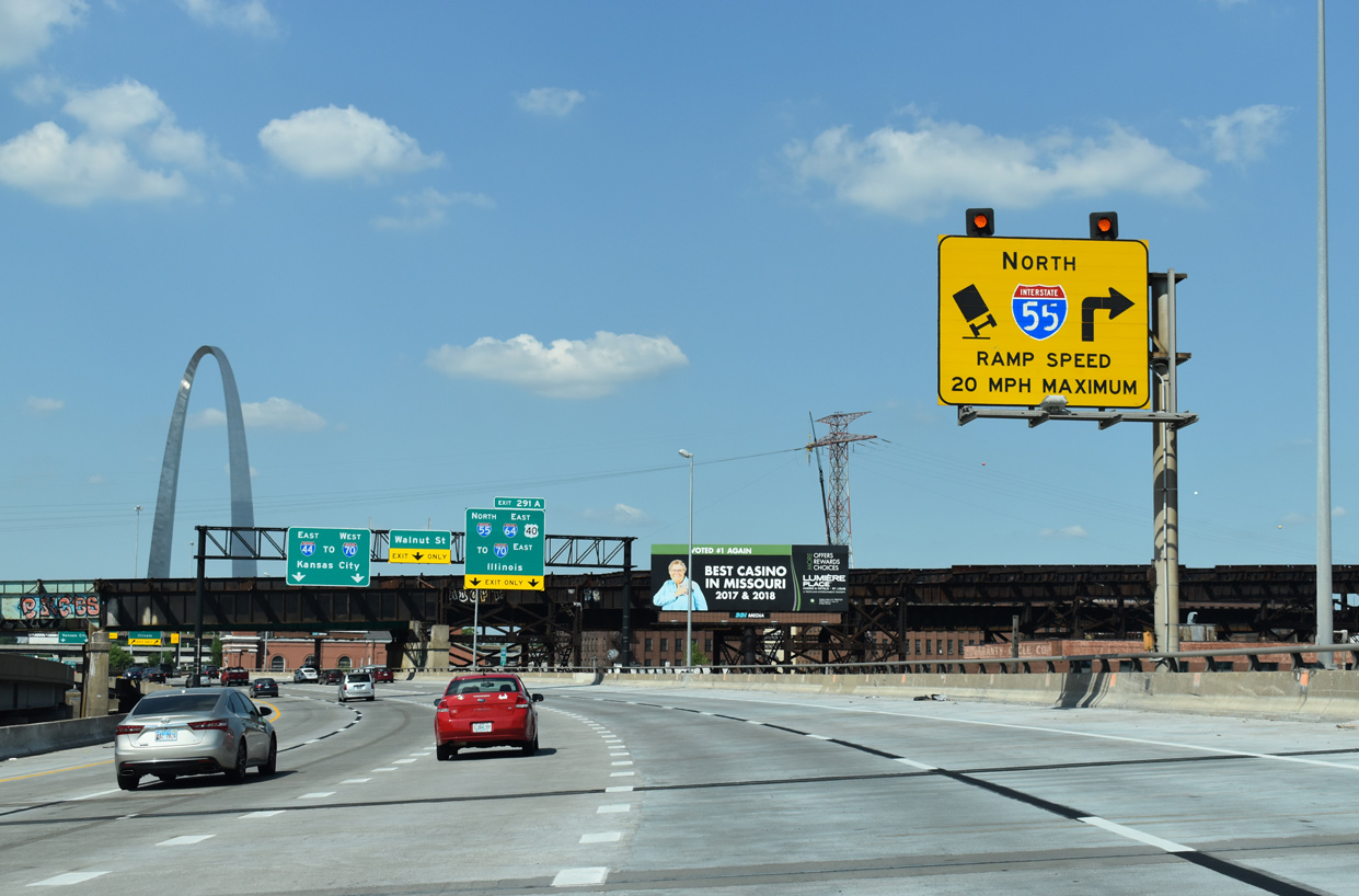
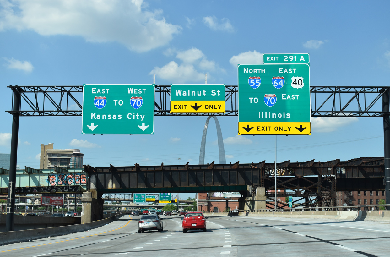
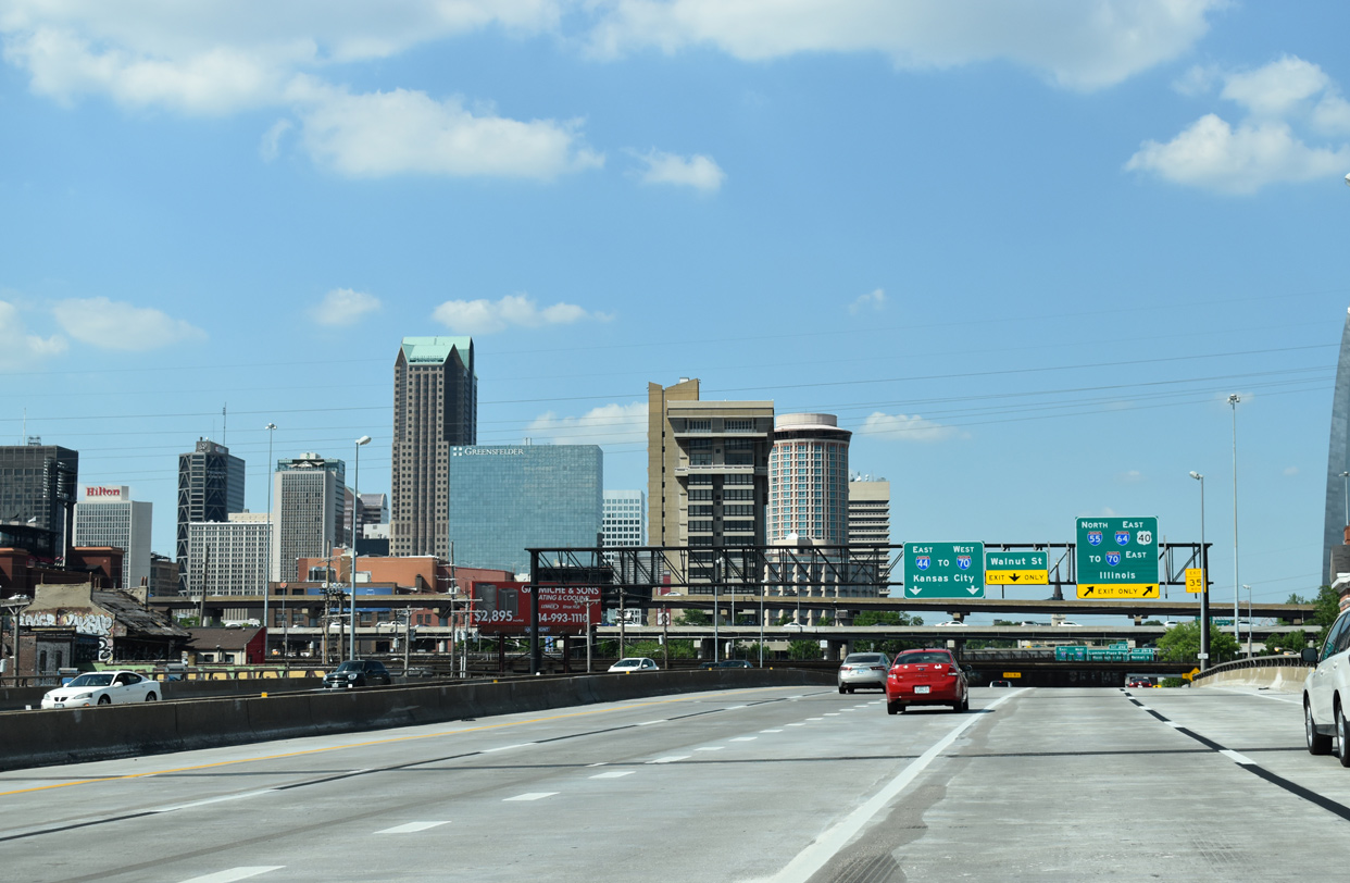
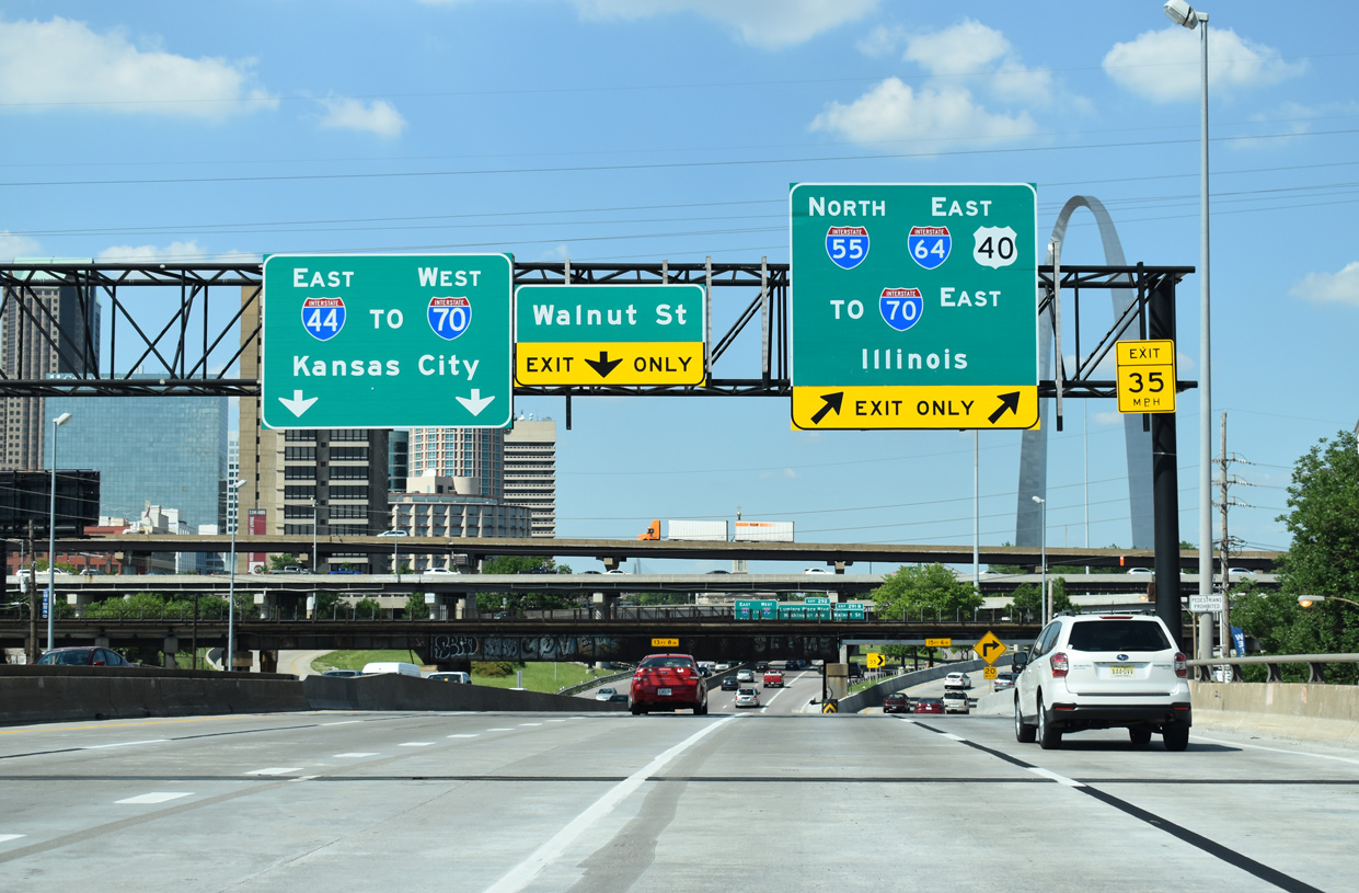
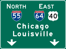
| Interstate 55 departs beyond the MacArthur Bridge for the eight lane wide PSB (formerly I-70) alongside I-64/U.S. 40 east.
There is no access to I-64/U.S. 40 west. 05/24/18 |
|
| The Downtown St. Louis skyline spreads to the northwest opposite The Gateway Arch. 05/24/18 |
|
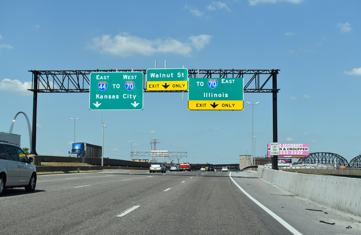
| Formerly Exit 209 B and the I-70 mainline, I-44 extends north through a trenched freeway between Downtown and the Jefferson National Expansion Memorial. I-55/64 combine for 2.8 miles east to I-70, where I-64 splits for Fairview Heights and O'Fallon while I-55 overlaps with I-70 northeast to Collinsville and Troy. 05/24/18 |
Page Updated 05-12-2018.

 North
North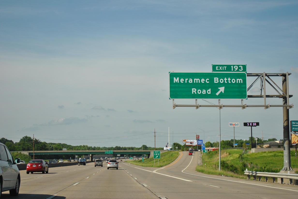


 East
East