|
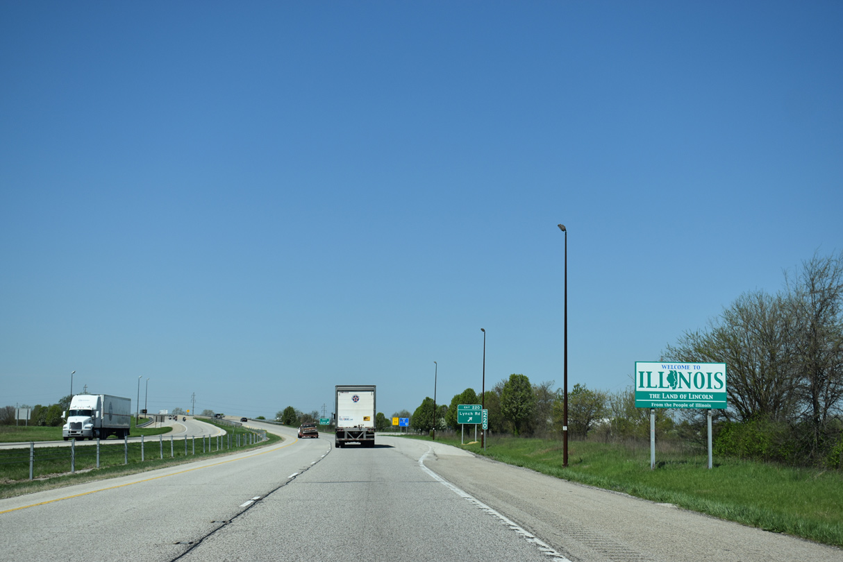
| Illinois welcome sign posted just ahead of Exit 220 to Lynch Road. Much of the freeway in the Land of Lincoln is rural outside of urban stretches through Danville, Urbana, Champaign, Bloomington and Peoria. 05/07/18 |
|
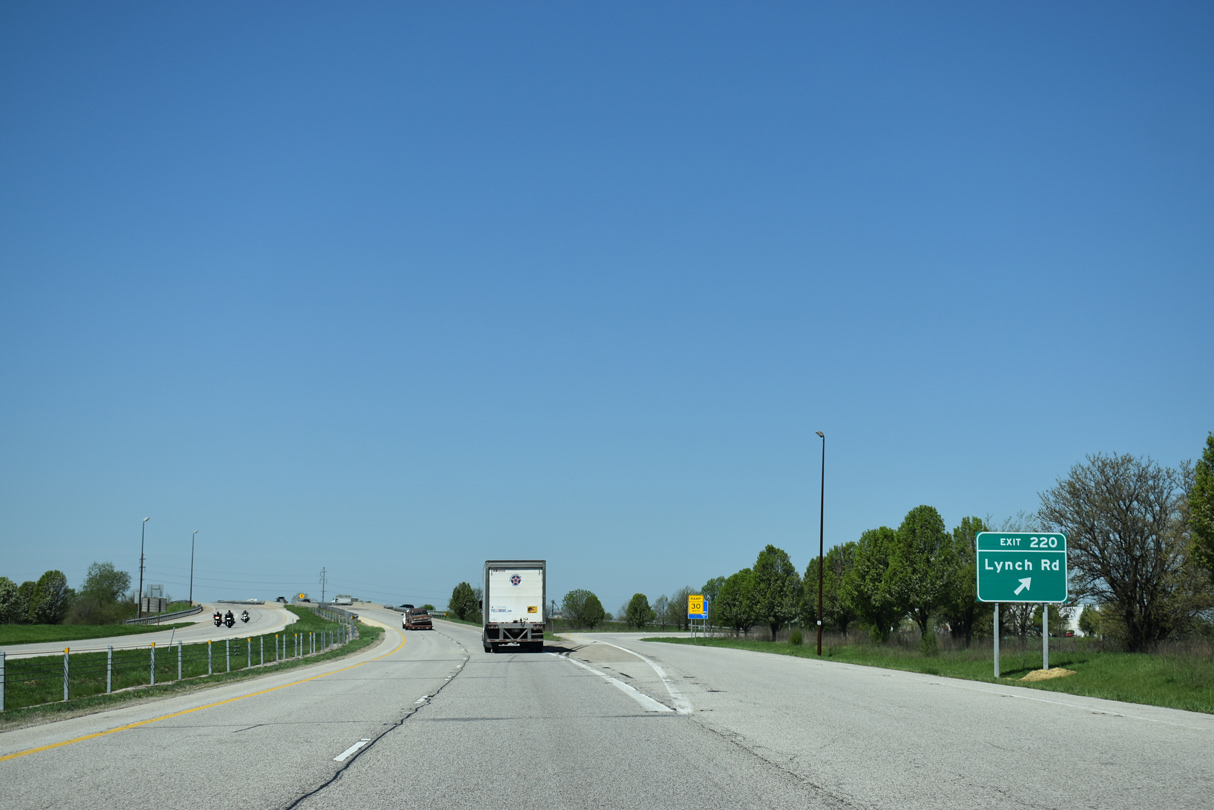
| Lynch Road loops northwest from Southgate Drive and the diamond interchange at Exit 220 to become Voorhees Street west to the industrial north side of Danville. 05/07/18 |
|
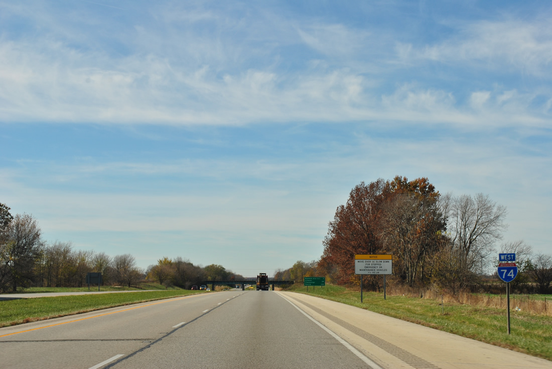
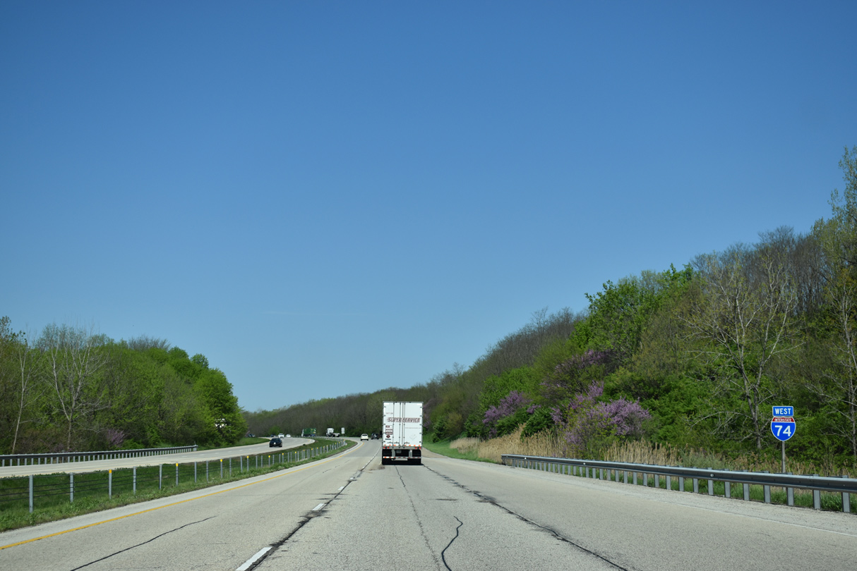
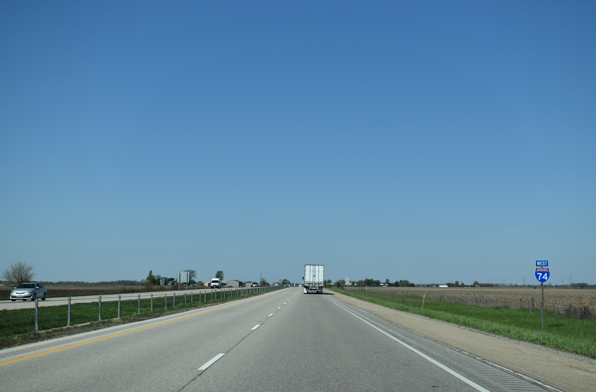
| The first westbound shield for Interstate 74 in Illinois follows the CSX Railroad underpass in a southeastern swath of Danville. 11/04/11 |
|
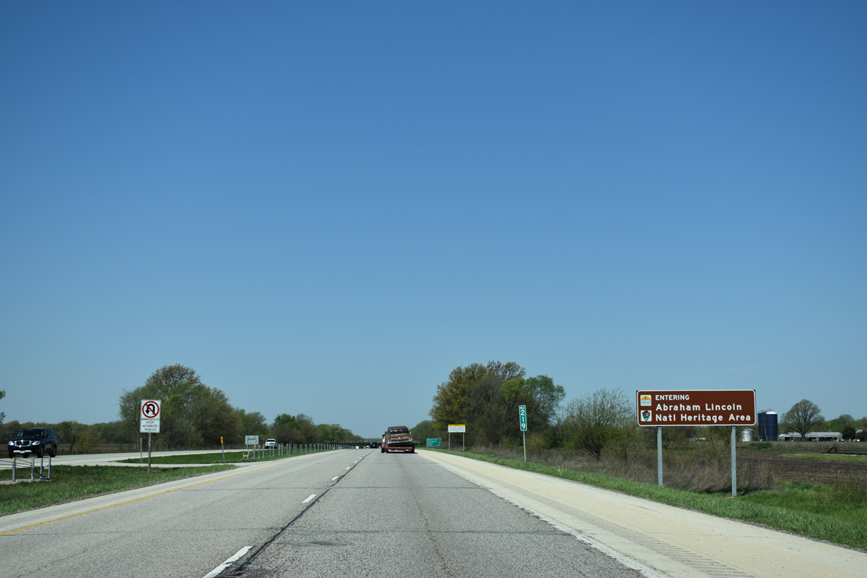
| Honoring the 16th President of the United States, Danville is a part of the Abraham Lincoln National Heritage Area. 05/07/18 |
|
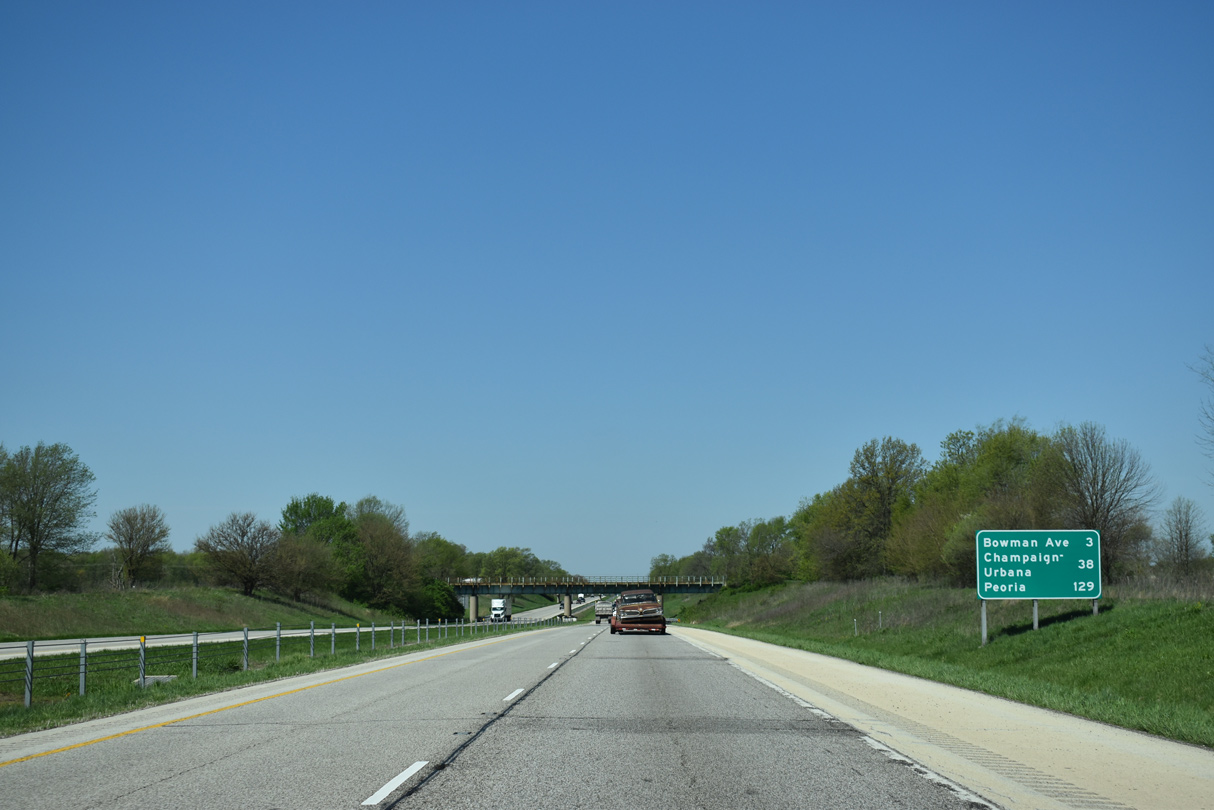
| Starting with Bowman Avenue, the next two exits serve the city of Danville, while Urbana-Champaign is 38 miles west from the Indiana state line. An abandoned Chicago, Milwaukee, St. Paul and Pacific Railroad overpass appears on this stretch. 05/07/18 |
|
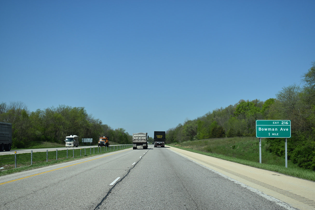
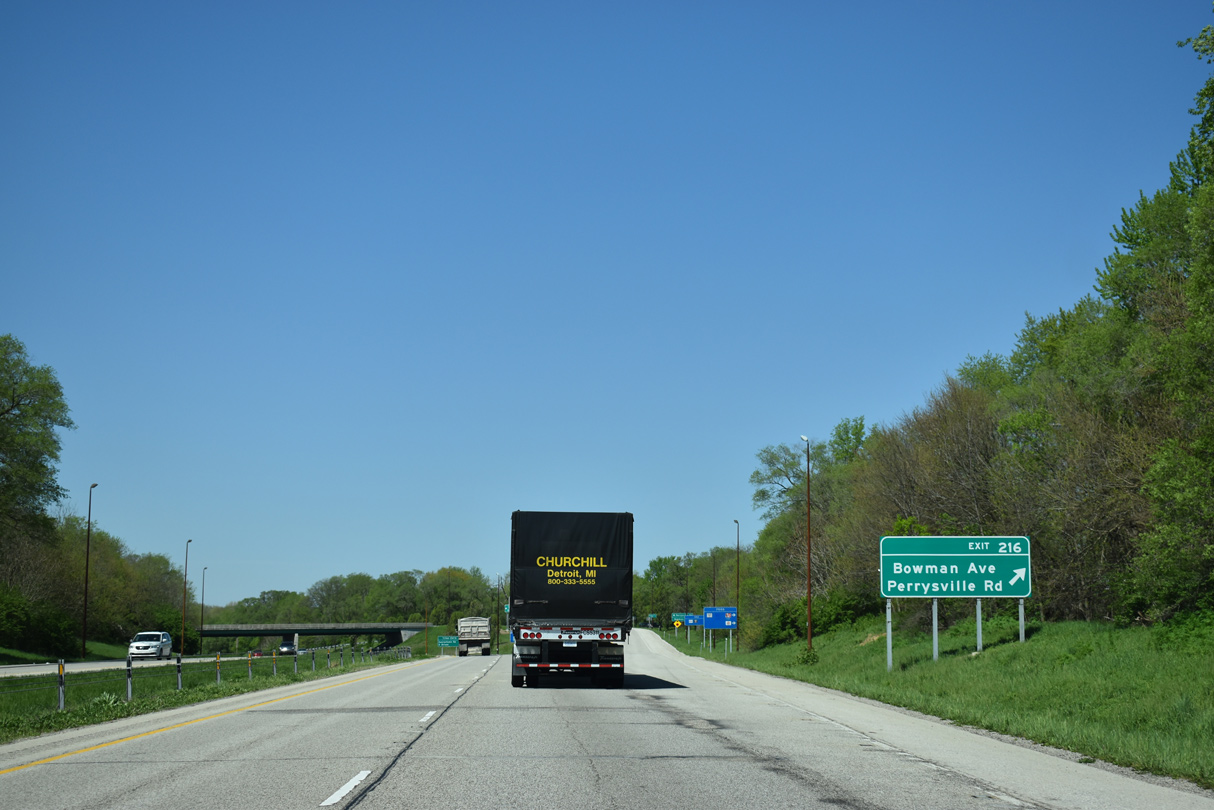
| Exit 216 is a parclo interchange linking I-74 west with Bowman Avenue between Stony Creek and the Vermilion River. The exchange originally was a trumpet onto Bowman Avenue north only, but was modified when Bowan Avenue was extended south to Perrysville Road. 05/07/18 |
|
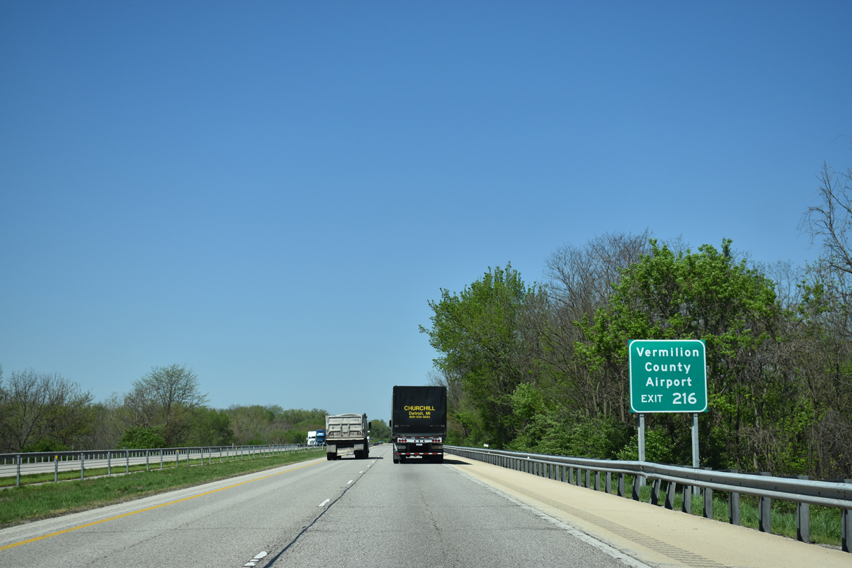
| Bowman Avenue leads north from adjacent Perrysville Road to U.S. 136 (E Main Street) and the east side of Danville to Vermilion Regional Airport (DNV) and Bismark. 05/07/18 |
|
| Exit 216 to Bowman Avenue leaves I-74 west beyond Stony Creek. 05/07/18 |
|
| Perrysville Road (CR 6 outside Danville) enters the area from the southeast, tying into the west end of SR 32 at the state line. The road continues northwest to U.S. 136 (E Main Street), east of Downtown. 05/07/18 |
|
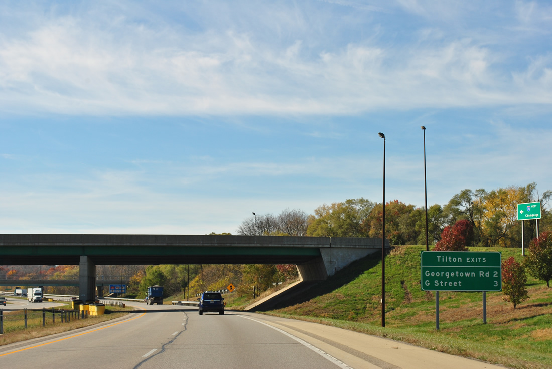
| Tilton is a village adjacent to the south side of Danville at Exits 215 and 214 along Interstate 74. The community of around 2,700 was named after a friend of Abraham Lincoln who worked in the railroad industry.1 11/04/11 |
|
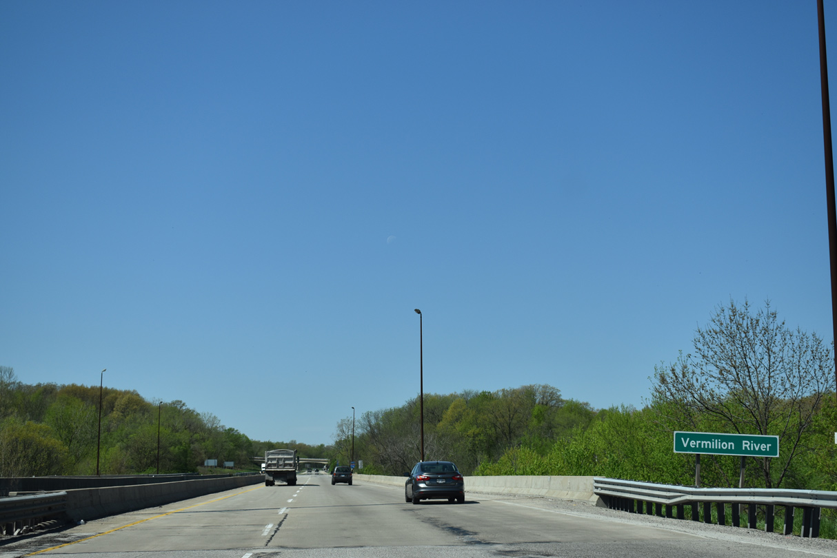
| Spanning the Vermilion River along Interstate 74 just west of the Perrysville Road overpass. 05/07/18 |
|
| A reassurance marker follows the Vermilion River as Interstate 74 travels through a forested area east of Greenwood Cemetery Road. 05/07/18 |
|
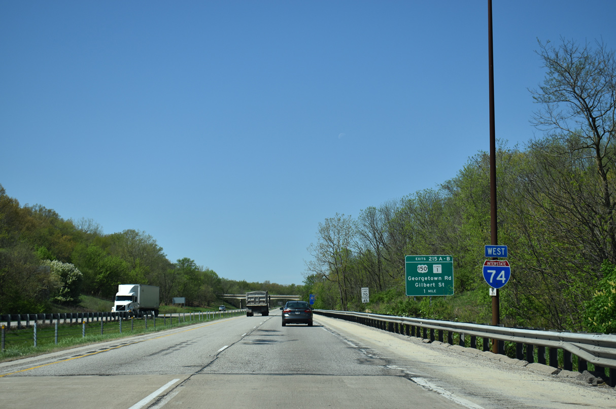
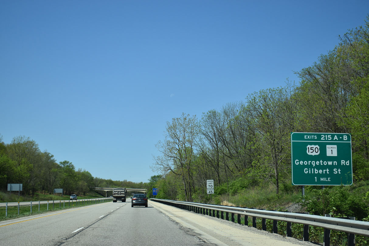
| U.S. 150 enters Tilton and Danville as a multi lane arterial from Georgetown with IL 1 from the south. The pair follow Georgetown Road through Tilton and Gilbert Street through South Danville. 05/07/18 |
|
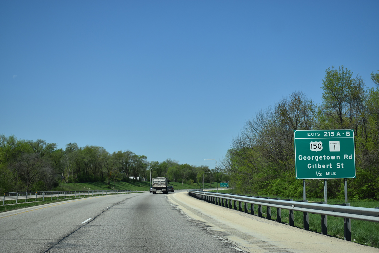
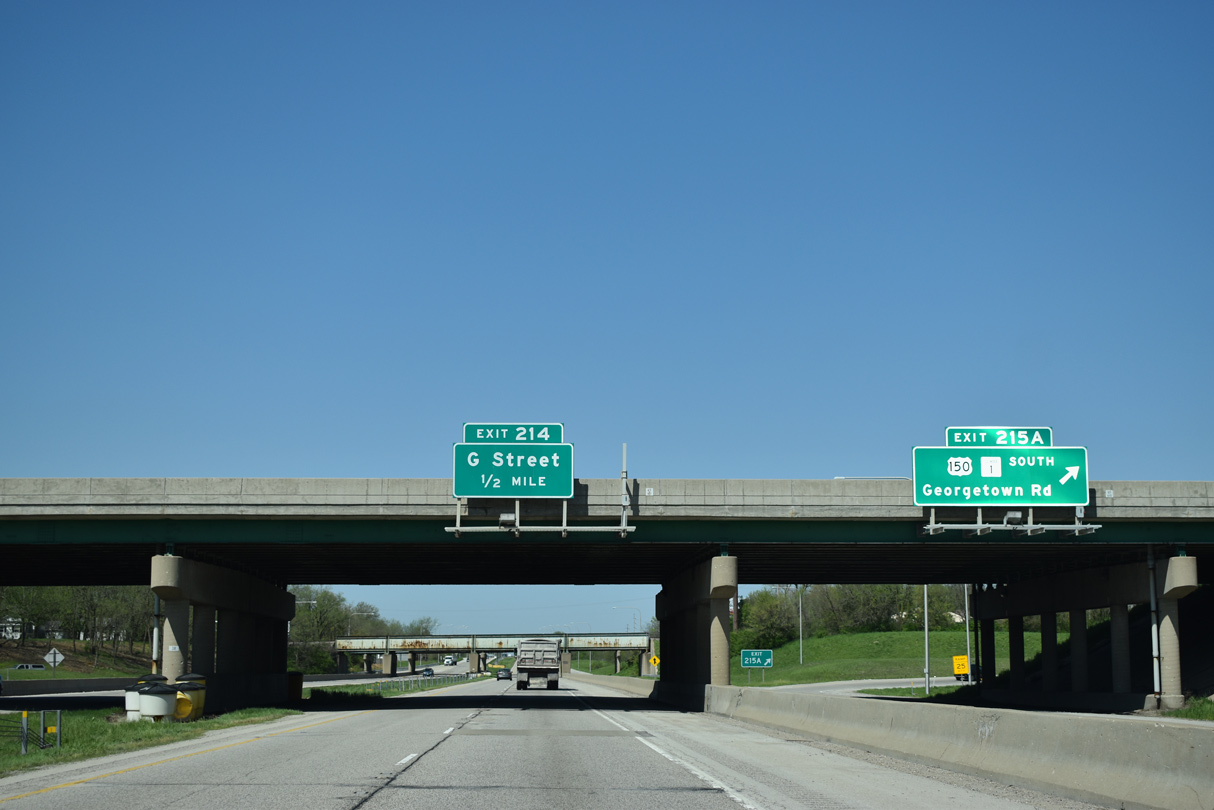
| A cloverleaf interchange joins Interstate 74 with U.S. 150/IL 1 at Exits 215 B/A. 05/07/18 |
|
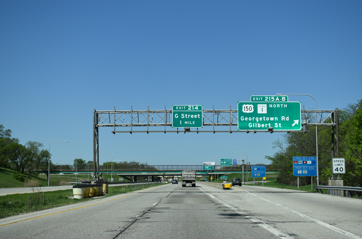
| Exit 215 separates from the I-74 westbound mainline as a collector distributor roadway to U.S. 150/IL 1 (Georgetown Road south / Gilbert Street north). A diamond interchange (Exit 214) with G Street follows in one mile. 05/07/18 |
|
| U.S. 150/IL 1 travel another 1.25 miles north to U.S. 136 (Main Street), where U.S. 150 turns west and U.S. 136 turns north. IL 1 coincides with U.S. 136 to Moores Corner and a split east of Henning. U.S. 150 departs Danville on a parallel course to I-74 and the Quad Cities. 11/04/11 |
|
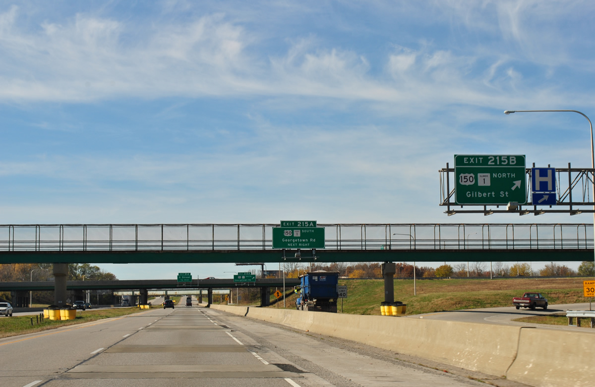
| A pedestrian overpass spans Interstate 74 ahead of the loop ramp at Exit 215 A for U.S. 150/IL 1 (Georgetown Road) south through Tilton. The two continue 32.5 miles south through Westville, Chrisman and Paris. 05/07/18 |
|
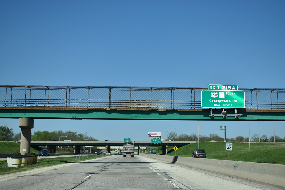
| Exit 215 A leaves the c/d roadway for U.S. 150/IL 1 south. IL 1 travels nearly the length of the state for 309 miles from the Cave-In-Rock Ferry across the Ohio River to I-57 in Chicago.
The I-74 mainline continues a half mile to Exit 214 for G Street. 05/07/18 |
|
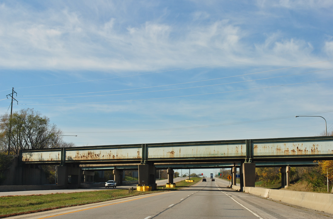
| Tilton Street and a parallel Norfolk Southern Railroad pass above Interstate 74 beyond the cloverleaf interchange with U.S. 150/IL 1. 11/04/11 |
|
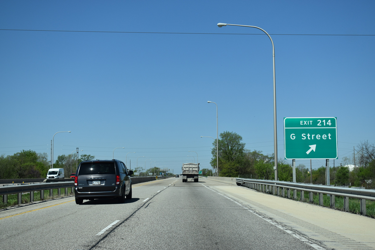
| Another CSX Railroad line crosses Interstate 74 ahead of Exit 214 to G Street. G Street leads south from an industrial area on the north side of I-74 to W 5th Street and the Tilton residential street grid. 5th Street becomes Catlin Tilton Road southwest to the village of Catlin. 05/07/18 |
|
| Interstate 74 leaves Tilton and bends northwest across a swath of farm land to Hillery. The speed limit between Exits 216 and 210 were increased from 55 to 65 miles per hour on August 1, 2006.2 05/07/18 |
|
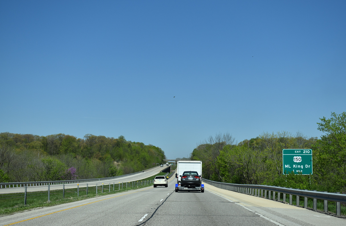
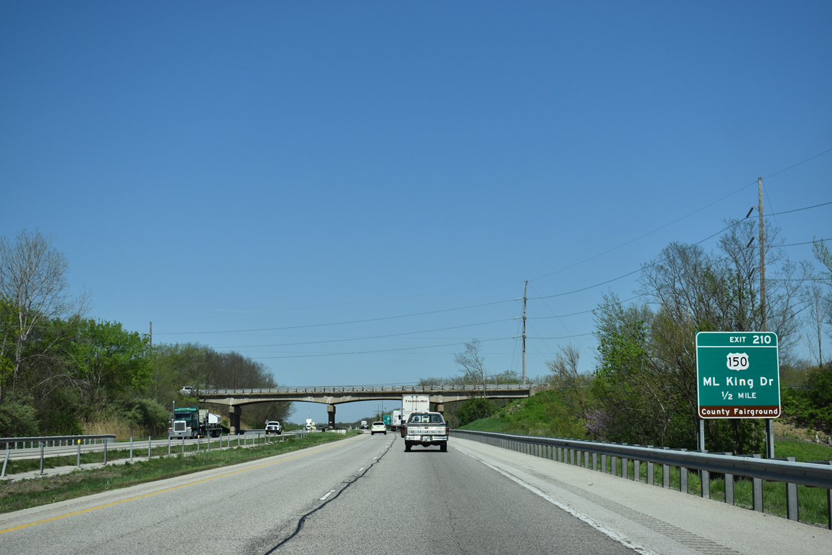
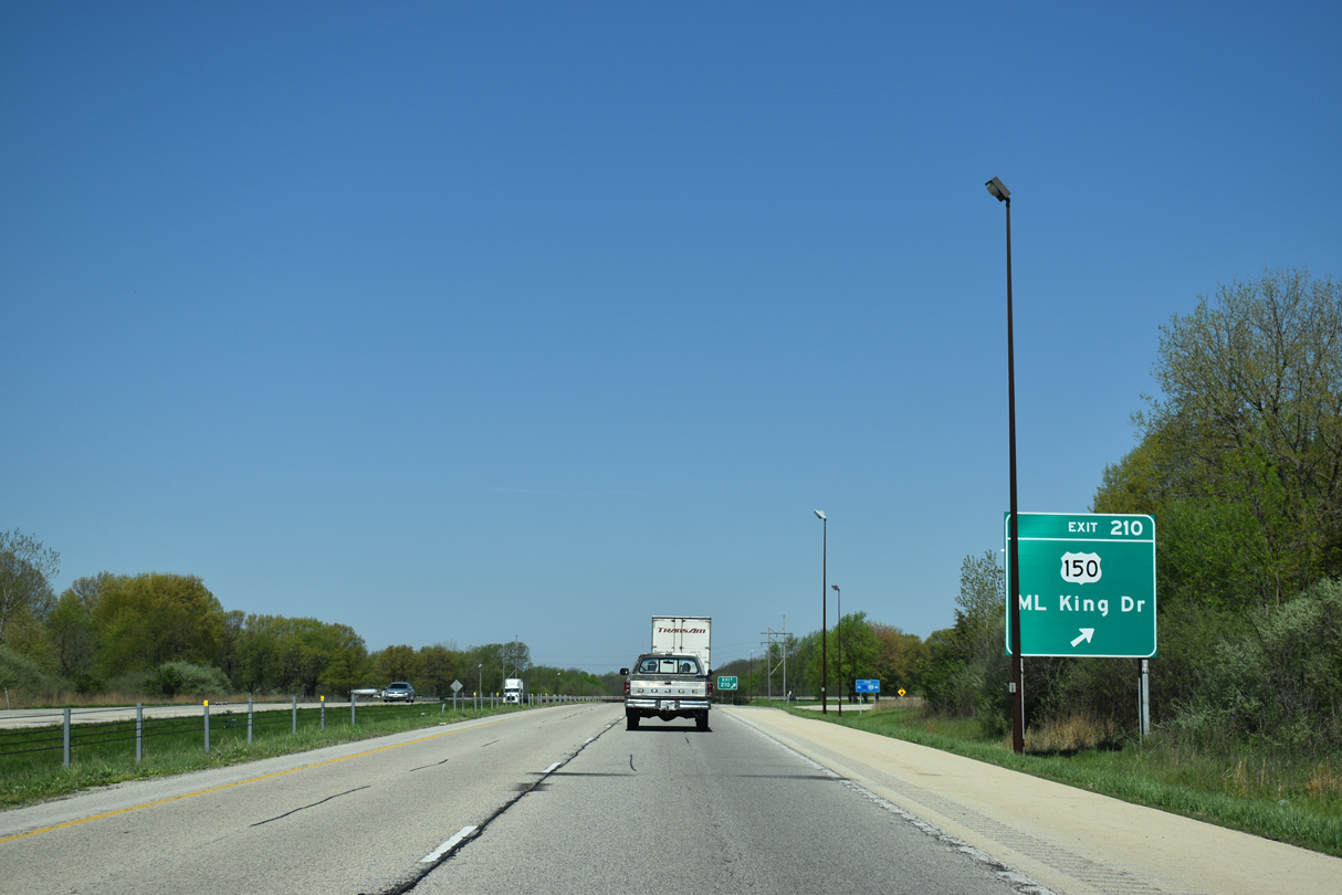
| U.S. 150 (Martin Luther King Drive) meets Interstate 74 between Hillery and Bucktown in one mile. 05/07/18 |
|
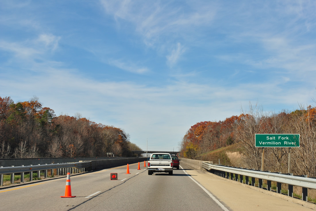
| Waters from the Salt Fork of the Vermilion River flow under Interstate 74 near Batestown. The Salt Fork and North Fork combine in Danville. 11/04/11 |
|
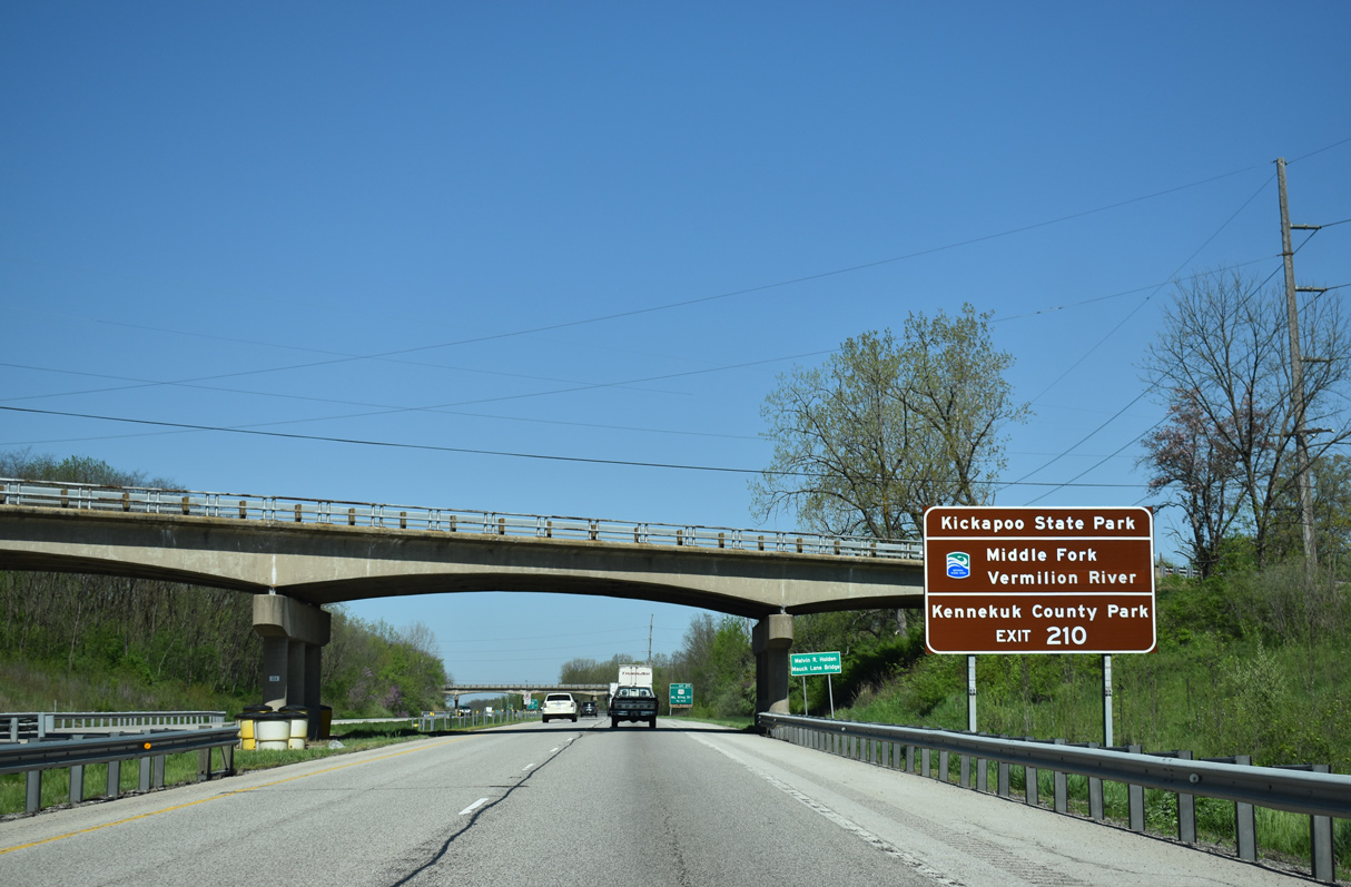
| U.S. 150 west serves interests to Kickapoo State Park along the Middle Fork of the Vermilion River. The 2,842 acre preserve offers hiking, canoeing, fishing, camping and hunting among other activities. CR 1 (Henning Road) leads north from U.S. 150 at Hillery for interests to Kennekuk County Park, a 3,000 acre park along the east side of the Middle Fork Vermilion River. 05/07/18 |
|
| A parclo interchange joins U.S. 150 (Martin Luther King Drive) and Interstate 74 at Exit 210. Batestown Road, the original alignment of U.S. 150, passes over the freeway in the background. 05/07/18 |
|
| U.S. 150 heads east from Exit 210 four miles back into Danville. West from Interstate 74, U.S. 150 shifts south of the freeway on the four miles leading to Oakwood. 05/07/18 |
|
| Turning back to the west, Interstate 74 advances across a portion of Kickapoo State Recreation Area. 05/07/18 |
|
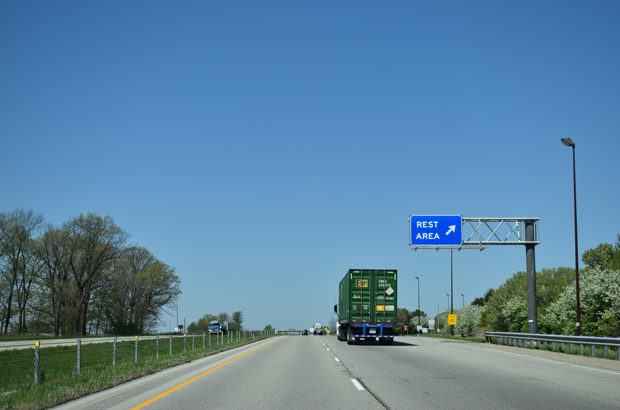
| The Salt Kettle Rest Area is the first facility along I-74 in Illinois. The second rest area is located near Farmer City, over 20 miles beyond Interstate 57. 05/07/18 |
|
| Long Pond comes into view alongside Interstate 74 west, two miles out from the Oakwood exit. Peoria is under a two hour drive away. 05/07/18 |
|
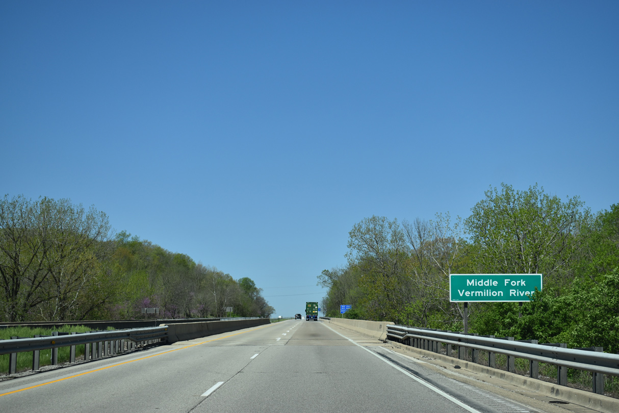
| The Middle Fork of the Vermilion River flows just west of Long Pond. 05/07/18 |
|
| Westbound Interstate 74 at the Salt Kettle Rest Area outside Oakwood. There is no state welcome center for the freeway. 05/07/18 |
|
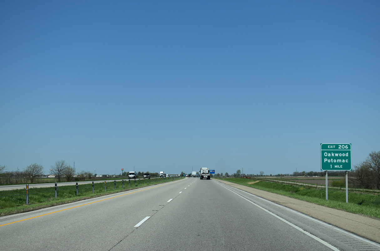
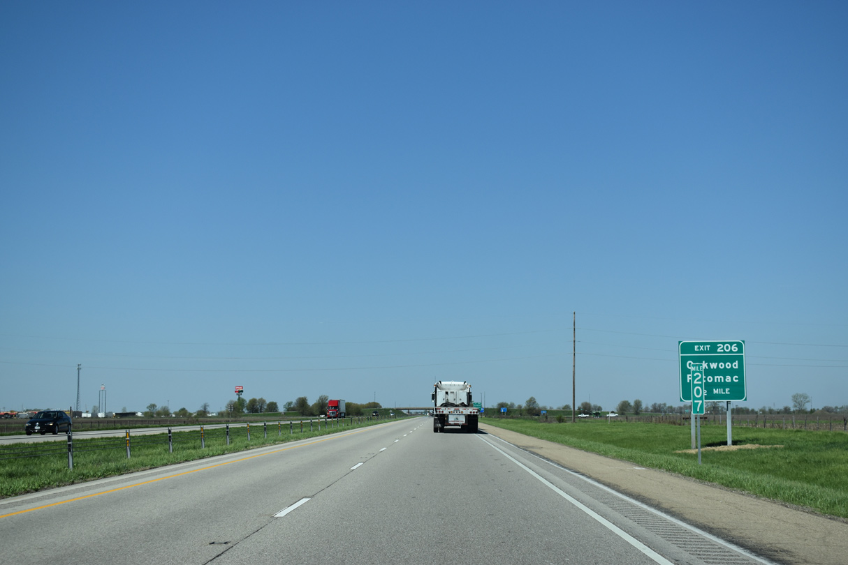
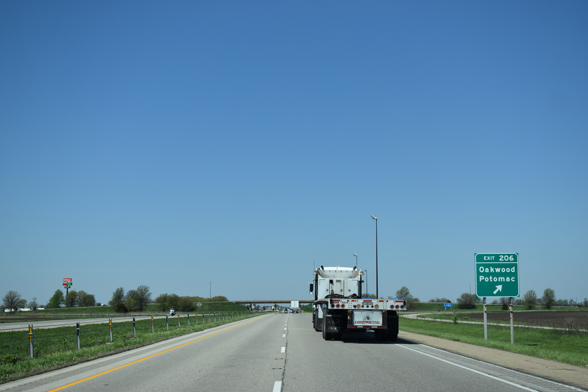
| Newtown Road travels north from the village of Oakwood to meet Interstate 74 at a diamond interchange (Exit 206) in one mile. 05/07/18 |
|
| Heading north from Exit 206, Newtown Road becomes Vermilion County Route 10 en route to Collison and Potomac, where the highway intersects U.S. 136. 05/07/18 |
|
| Exit 206 departs Interstate 74 west for Oakwood Street south into Oakwood and Newtown Road north to Glenburn and Newtown. 05/07/18 |
|
| 26,200 vehicles per day (vpd) were recorded by IDOT west of Oakwood in 2017. 05/07/18 |
|
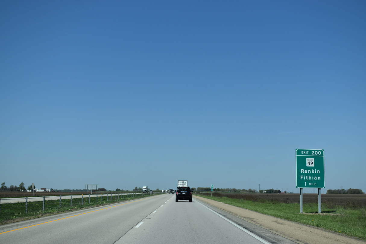
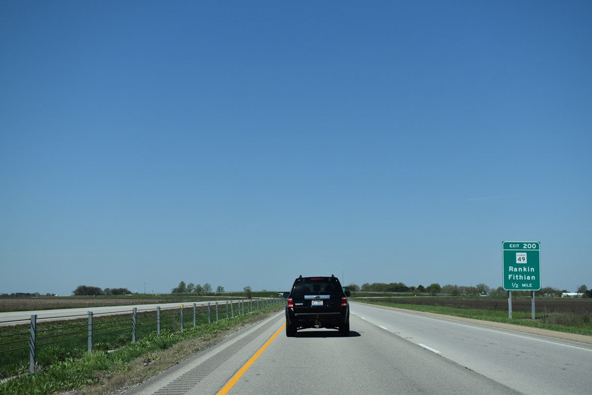
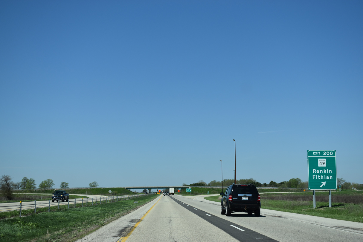
| Distance signs posted on Illinois freeways reference the next exit, even if there is no town directly served by the interchange. This is the case with IL 49 at Exit 200, five miles west of Oakwood. Urbana is 24 miles away. 05/07/18 |
|
| The villages of Rankin and Fithian are the control points for IL 49 from Exit 200. Rankin lies 23 miles to the north at the crossroads with IL 9. 05/07/18 |
|
| One half mile east of the diamond interchange (Exit 200) with IL 49. Fithian lies just east of the IL 49 overlap with U.S. 150 west. U.S. 150 and IL 49 combine for three miles to Ogden. 05/07/18 |
|
| IL 49 constitutes a 137 mile long route from Willow Hill in Jasper County and U.S. 45/52 in northern Iroquois County. More locally, the state route travels five miles north from Exit 200 to Hope. 05/07/18 |
|
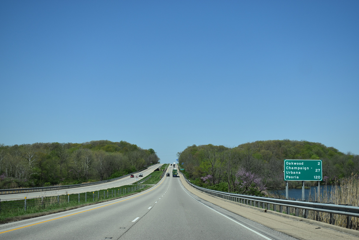
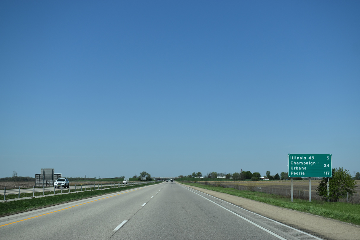
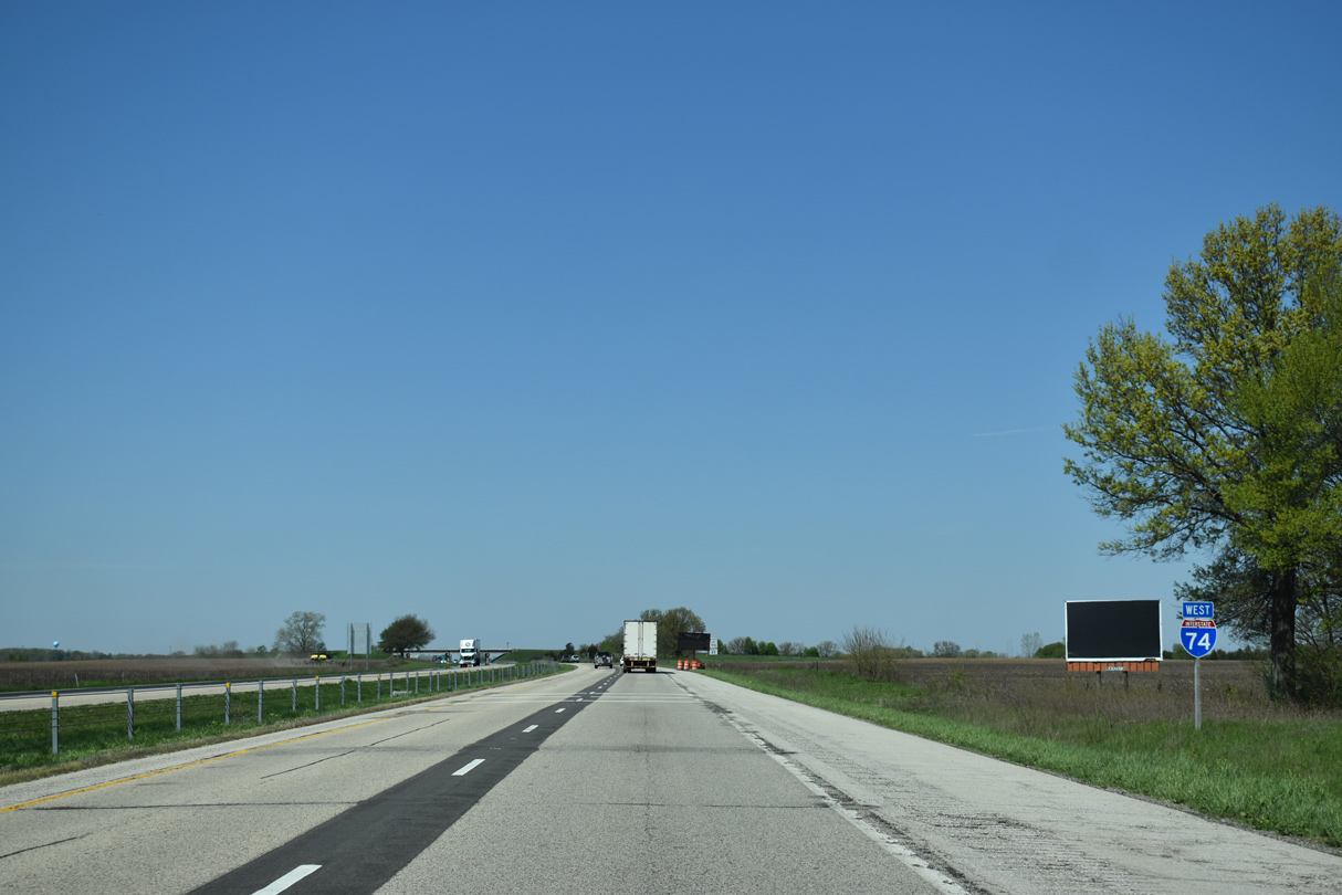
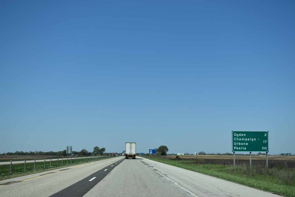
| Wide open farm lane spreads along both sides of Interstate 74 for the remainder of the 17 miles to Urbana. Peoria is 110 miles to the west. 05/07/18 |
|
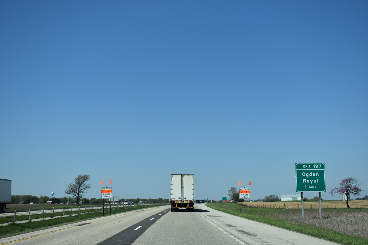
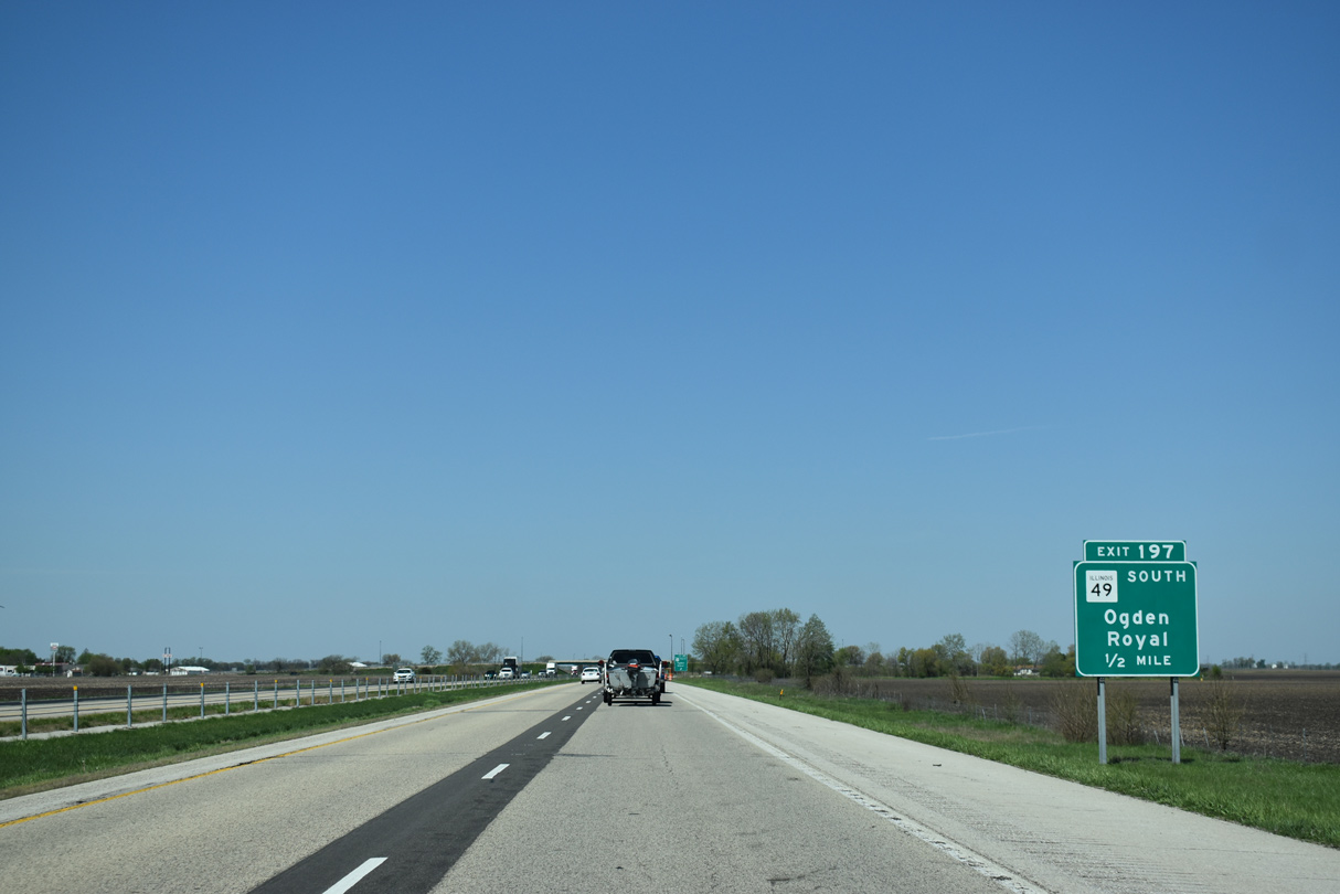
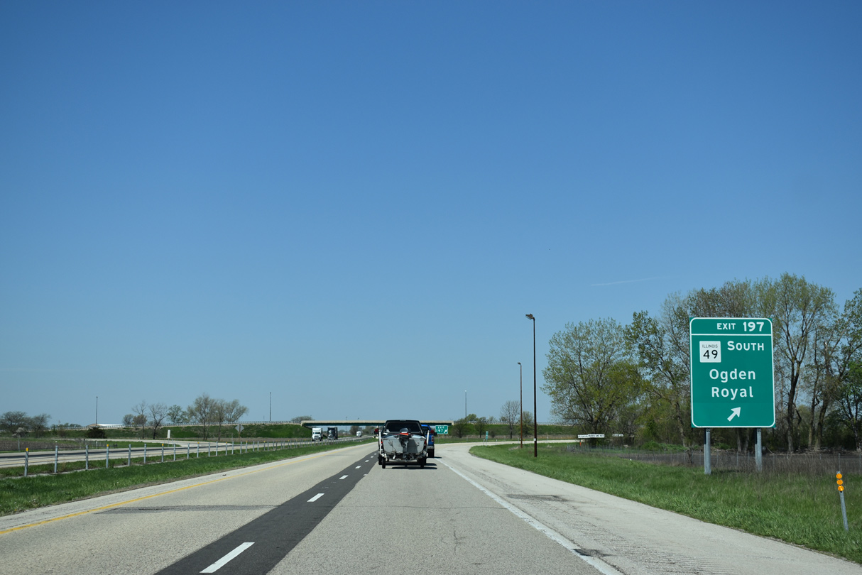
| Omitted on the first guide sign, Exit 197 is signed as IL 49 south for the Market Street connection with the west split of U.S. 150 and IL 49 at Lincoln Street. 05/07/18 |
|
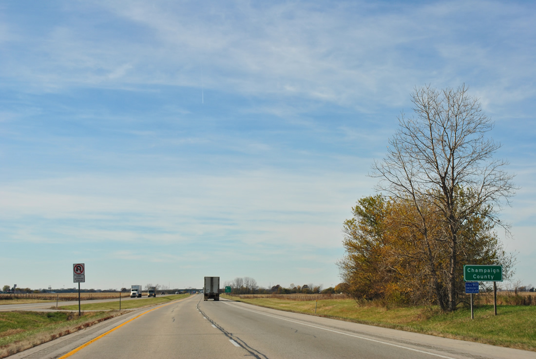
| I-74 west leaves Vermilion County after 22.31 miles and continues 29.61 miles across Champaign County. 11/04/11 |
|
| Interstate 74 enters the north side of Ogden at the diamond interchange (Exit 197) with Market Street south and CR 2700 East north. 05/07/18 |
|
| IL 49 travels south from Ogden five miles to Homer. CR 2700 N extends north from Exit 197 and Market Street five miles to Champaign County Route 20 west to Royal. 05/07/18 |
Page Updated 12-11-2023.

 West
West