A regional service center for northeastern Nevada, the city of Elko lies along Interstate 80 between Exits 298 and 303. Idaho Street to the city center is the historic alignment of U.S. 40. Business Loop I-80, and two segments of Nevada State Route 535 follow Idaho Street between the west and east Elko interchanges along a 5.5 mile long course.
|
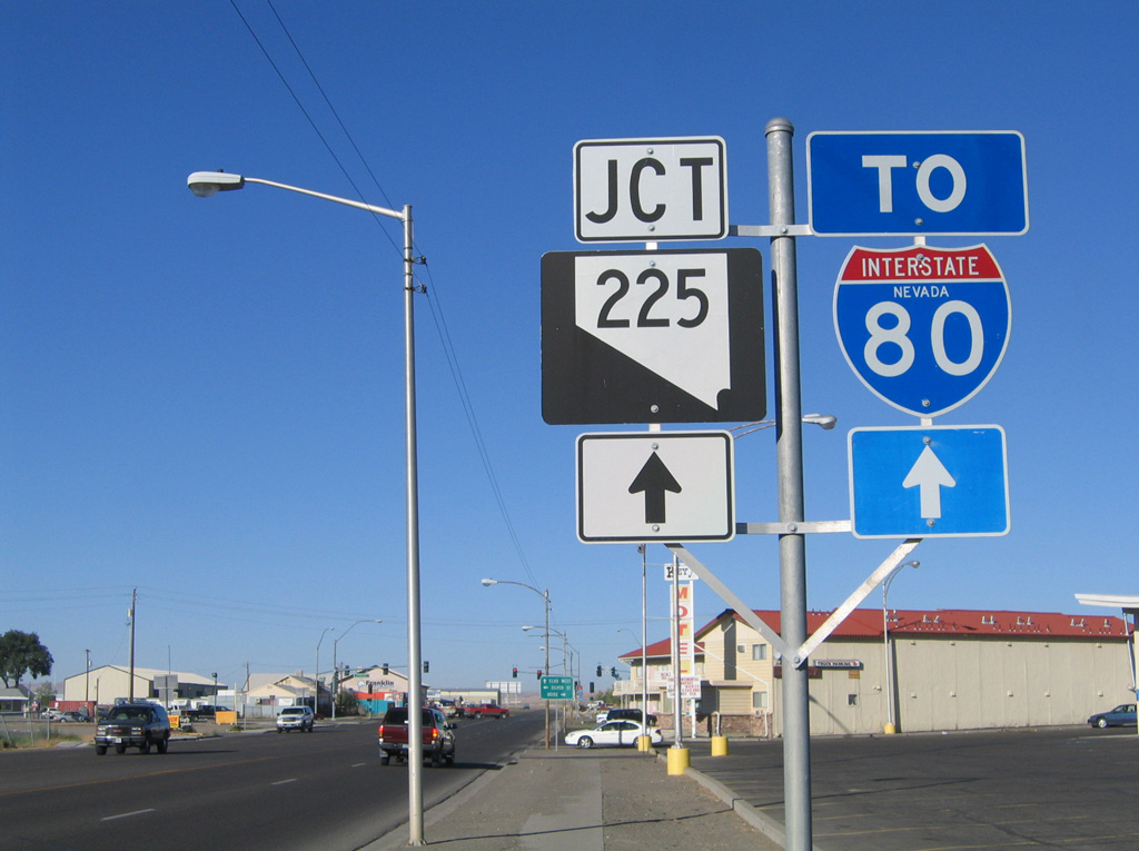
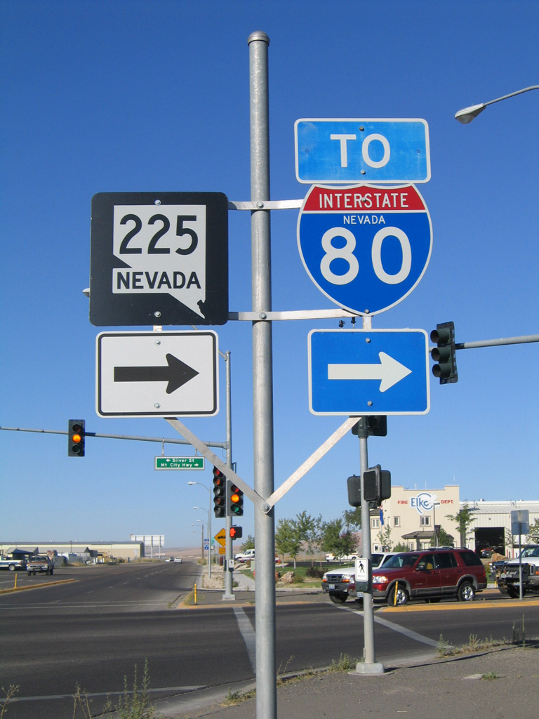
| Business Loop I-80 (Idaho Street) eastbound at the southern terminus of SR 225 (Mountain City Highway). SR 225 meets Interstate 80 (Exit 301) in 0.9 miles. Silver Street stems southeast a short distance from Idaho Street to Main and 3rd Streets. 09/09/05 |
|
| Idaho Street advances east along a five lane boulevard from SR 225 (Mountain City Highway) toward 3rd Street. 05/16/12 |
|
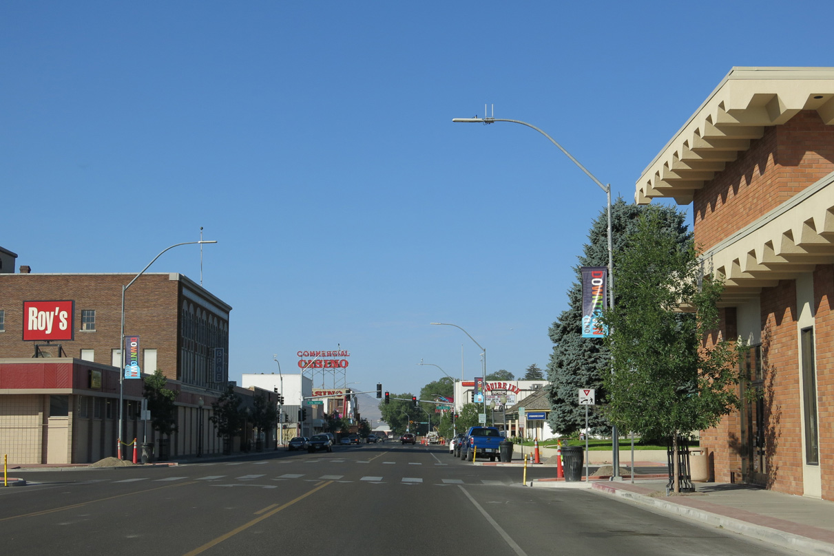
| Business Loop I-80 and SR 535 east (Idaho Street) enter the Elko business district at the intersection with Third Street. 09/09/05 |
|
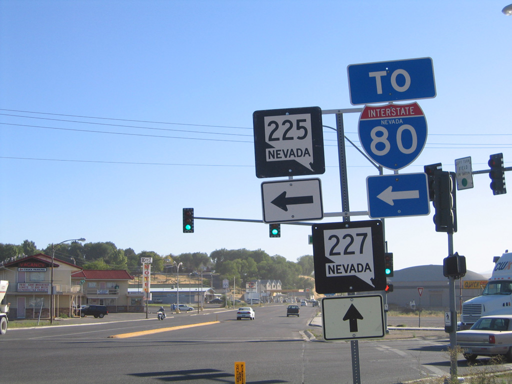
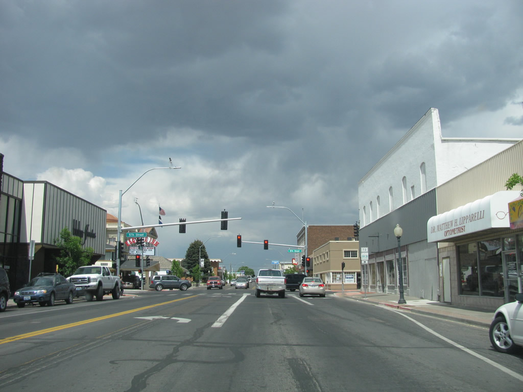
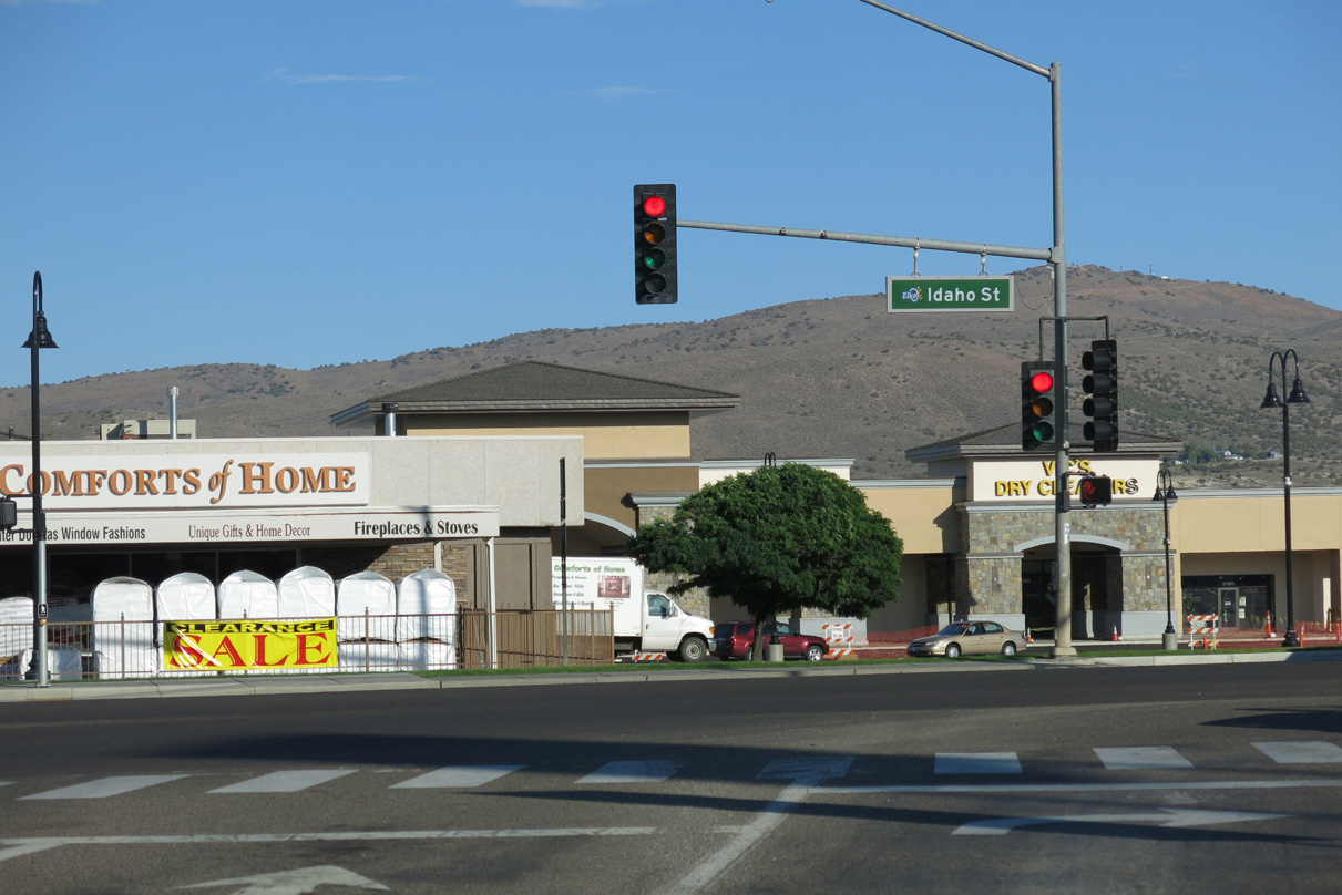
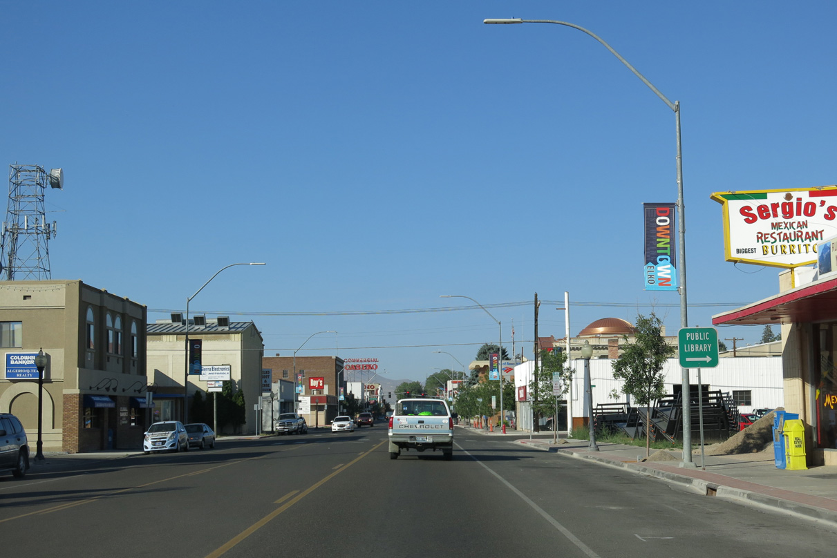
| Eastbound Business Loop I-80/SR 535 (Idaho Street) advance to the north end of SR 227 (Fifth Street) in Downtown Elko. 09/09/05 |
|
| SR 227 travels along Fifth Street southeast across the Union Pacific Railroad tracks and the Humboldt River to east Elko. Lamoille Highway continues the route across the Elko Hills to Spring Creek. 05/16/12 |
|
| A confirming marker for Business Loop I-80 stands on the block of Idaho Street between 5th and 6th Streets. 09/09/05 |
|
| SR 535 was decommissioned from SR 227 (5th Street) and the Elko County Courthouse along the remainder of Idaho Street to Jennings Way. 09/09/05 |
|
| Twelfth Street provides an alternate route between Idaho Street and SR 227 (Lamoille Highway) to the Ruby Mountain Recreational Areas. 12th Street spans the Humboldt River on the 0.9 mile course to Lamoille Highway. 09/09/05 |
|
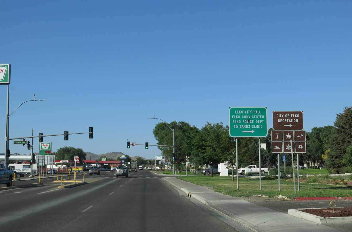
| College Avenue arcs west from the succeeding traffic light along Idaho Street (old U.S. 40) eastbound to Elko City Hall, Elko Convention Center and 13th Street north to Great Basin College. 09/09/05 |
|
| Business Loop I-80 returns to I-80 from Idaho Street by way of Jennings Way. 0.25 miles of Jennings Way is state maintained and inventoried by NDOT as FREL17 (Elko County Frontage Road #17). 08/04/13 |
|
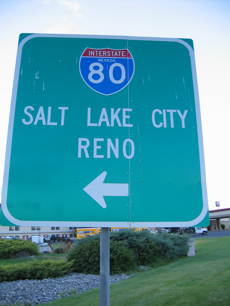
| An erroneous black and white Interstate 80 shield directs traffic to the adjacent freeway. I-80 stretches over 410 miles across the Silver State, connecting Elko with Reno and Salt Lake City, Utah. 08/04/13 |
|
| Although not quite the freeway entrance, Jennings Way links Idaho Street with the eastbound entrance ramp to Wells and West Wendover in a tenth of a mile. Old U.S. 40 (Idaho Street) otherwise continues east adjacent to the freeway to Osino. 08/04/13 |
|
| A smaller guide sign stands at the northeast corner of Idaho Street and Jennings Way for I-80. 09/08/05 |
|
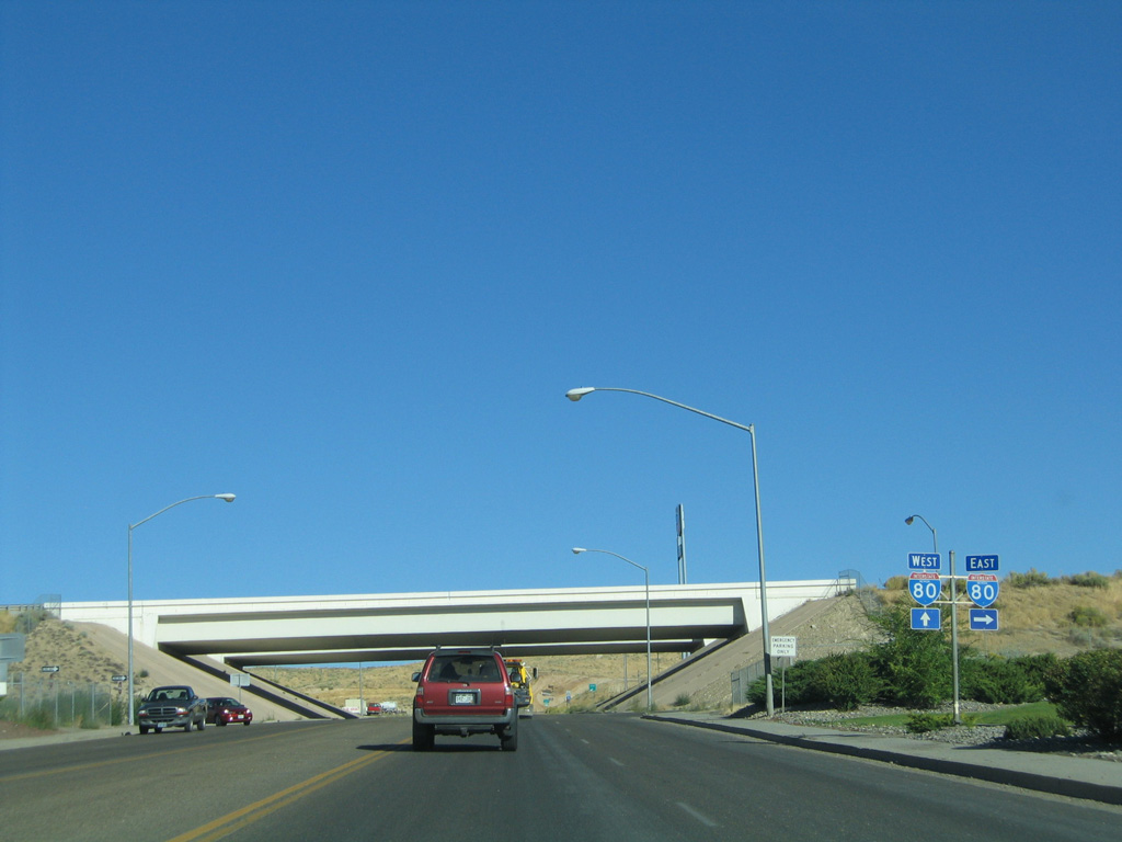
| Business Loop I-80 concludes as Jennings Way enters I-80's east Elko interchange. 09/09/05, 08/04/13 |
|
| Jennings Way extends north from the westbound on-ramp to Interstate 80 to Ruby Vista Drive, the north side freeway frontage road, and the Ruby Vista Apartment community developed in 2015. 09/09/05 |
|
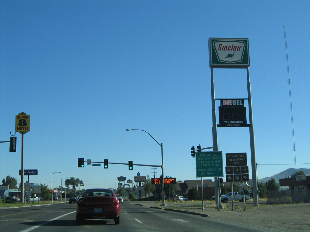
| Jennings Way (FREL17) links Business Loop I-80 with Idaho Street (old U.S. 40) from the east Elko interchange along Interstate 80. A small guide sign directs motorists bound for the Ruby Mountain Recreation Areas onto Idaho Street west for SR 228 (Fifth Street) south. SR 228 stems south from Downtown Elko to Spring Creek, Lamoille and the Ruby Mountains 08/04/13 |
|
| A lone Business Loop I-80 shield directs motorists toward Downtown Elko via Idaho Street (former SR 535). A Nevada tourist information center is located along Idaho Street nearby. 08/04/13 |
|
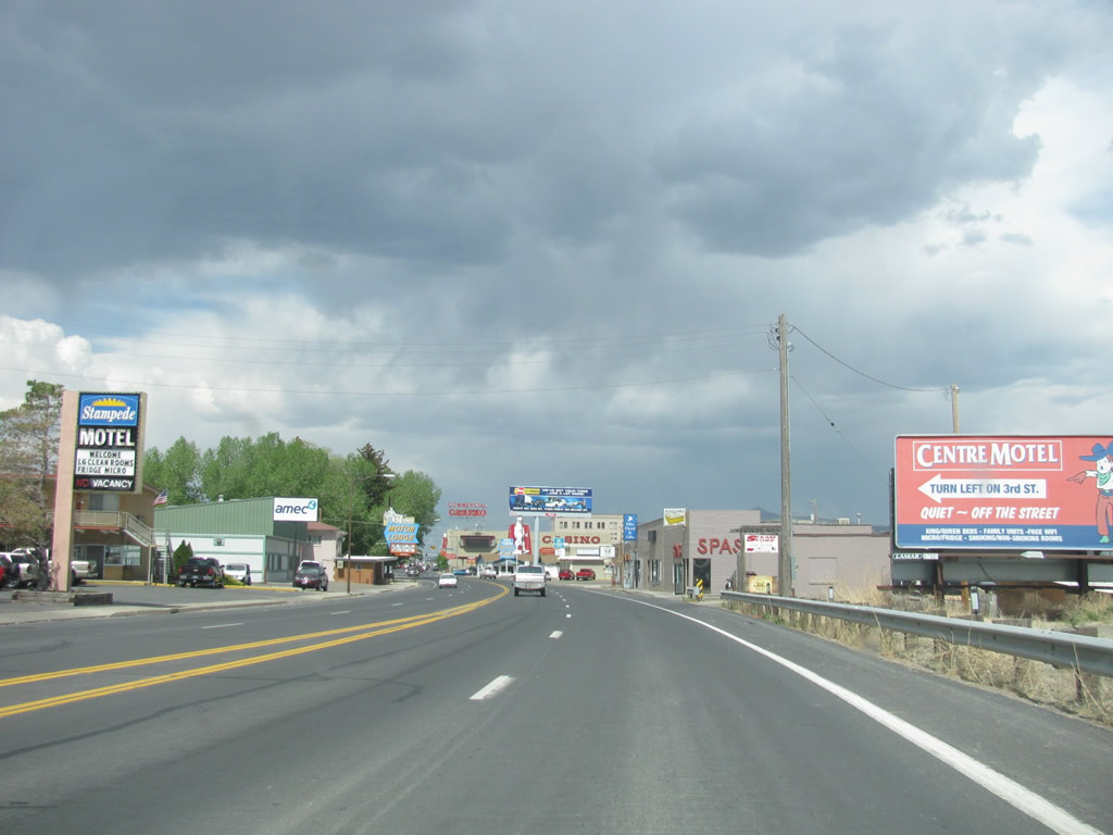
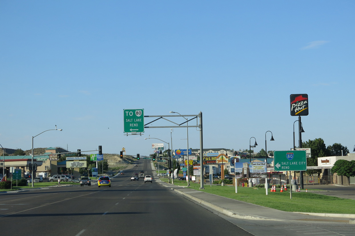
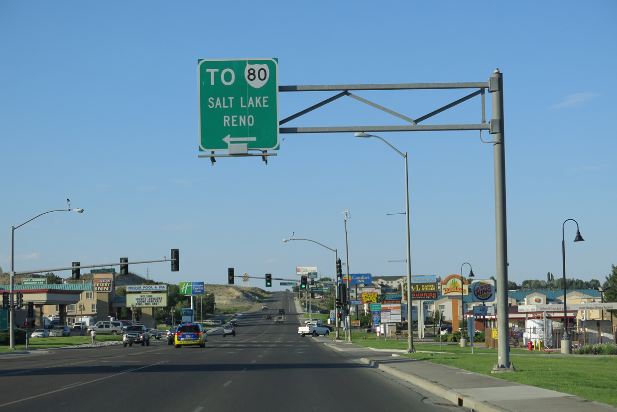
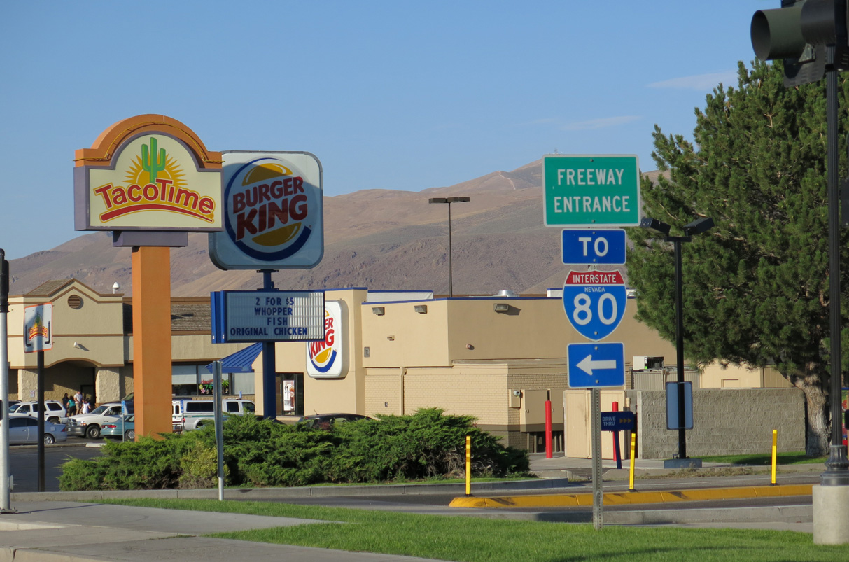
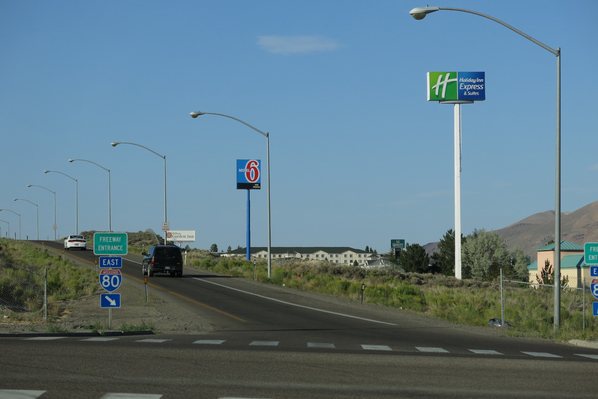
| Idaho Street meets Jennings Way along a commercial strip at Sunrise Shopping Center. An array of lodging establishments and fast food franchises line this stretch of old U.S. 40. 08/04/13 |
|
| An I-80 trailblazer directs motorists along Idaho Street (old U.S. 40) westbound to Jennings Way. 09/08/05 |
|
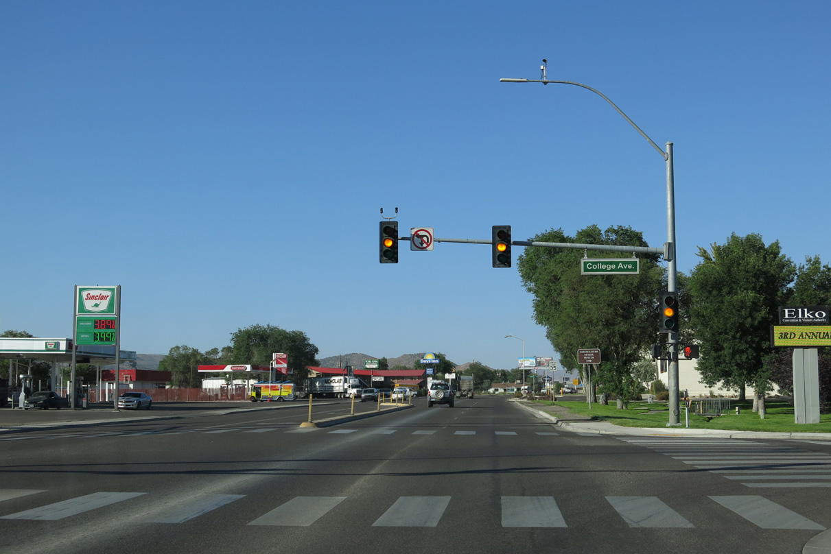
| Heading southwest along Idaho Street, Business Loop I-80 intersects College Avenue at the ensuing traffic light. College Avenue arcs southwest around Main City Park. Elko City Hall and Elko Convention Cener lie just to the west. 08/05/13 |
|
| Idaho Street varies between a four and five lane boulevard through northeast Elko. College Avenue parallels Business Loop I-80 to the west, connecting with 13th Street to Great Basin College. 08/05/13 |
|
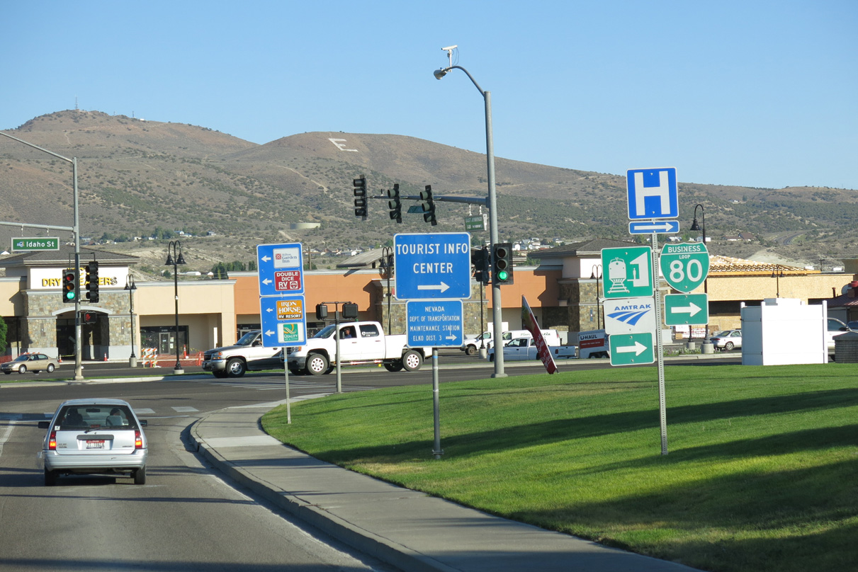
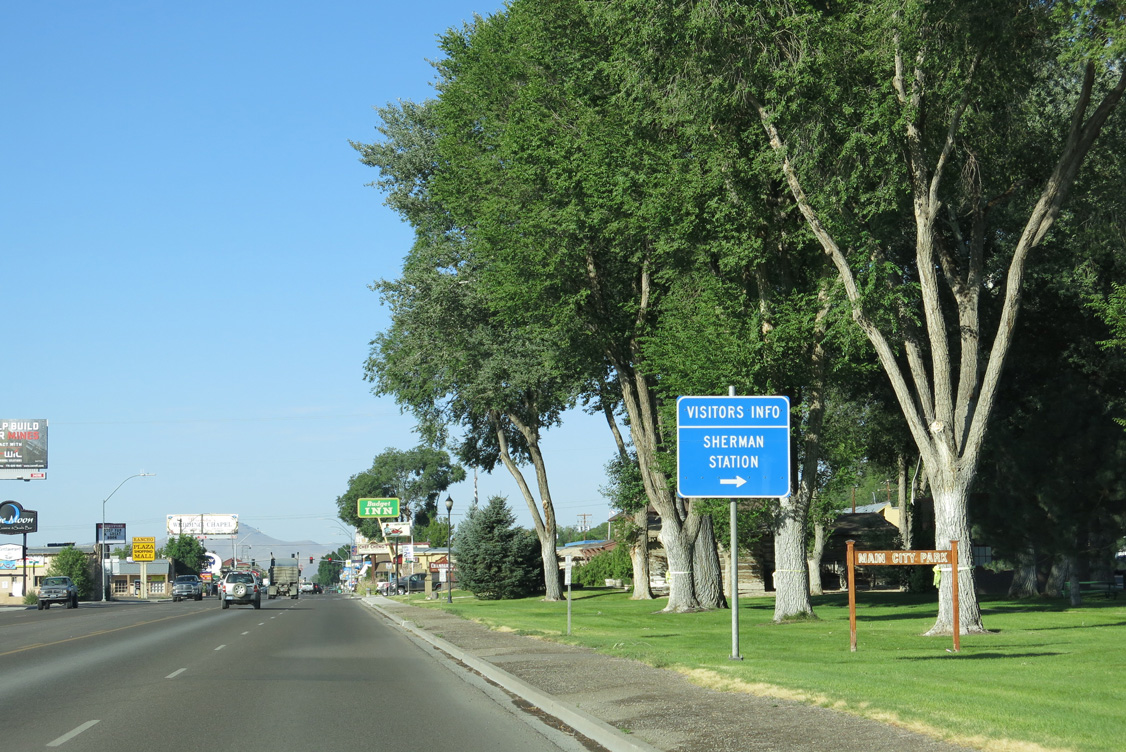
| Tourist information is available at the Chamber of Commerce Visitor Center at Sherman Station. Sherman Station lies at the northwest corner of Idaho and 14th Streets within Main City Park. 08/05/13 |
|
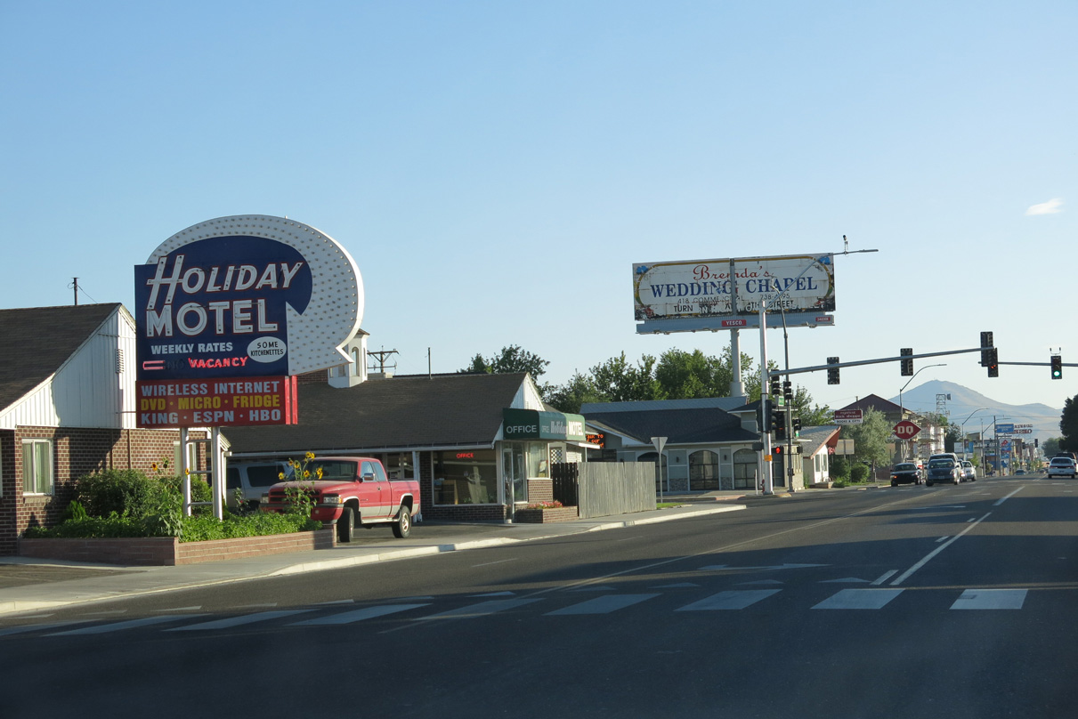
| A vintage motel marquee along Business Loop I-80 (Idaho Street) west at 13th Street. 08/04/13 |
|
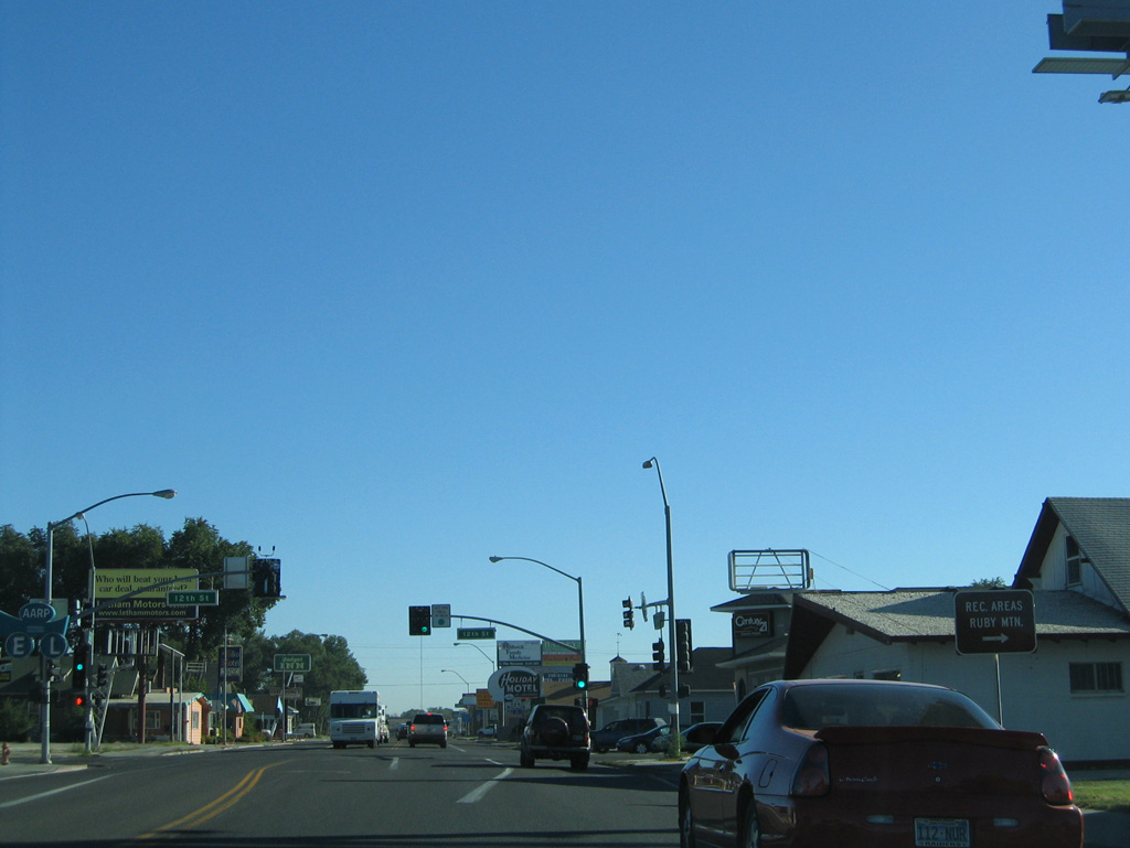
| 12th Street east provides a cutoff from Business Loop I-80 to SR 227 (Lamoille Highway). The Elko AMTRAK Station is located just off 12th Street at Water Street. 08/05/13 |
|
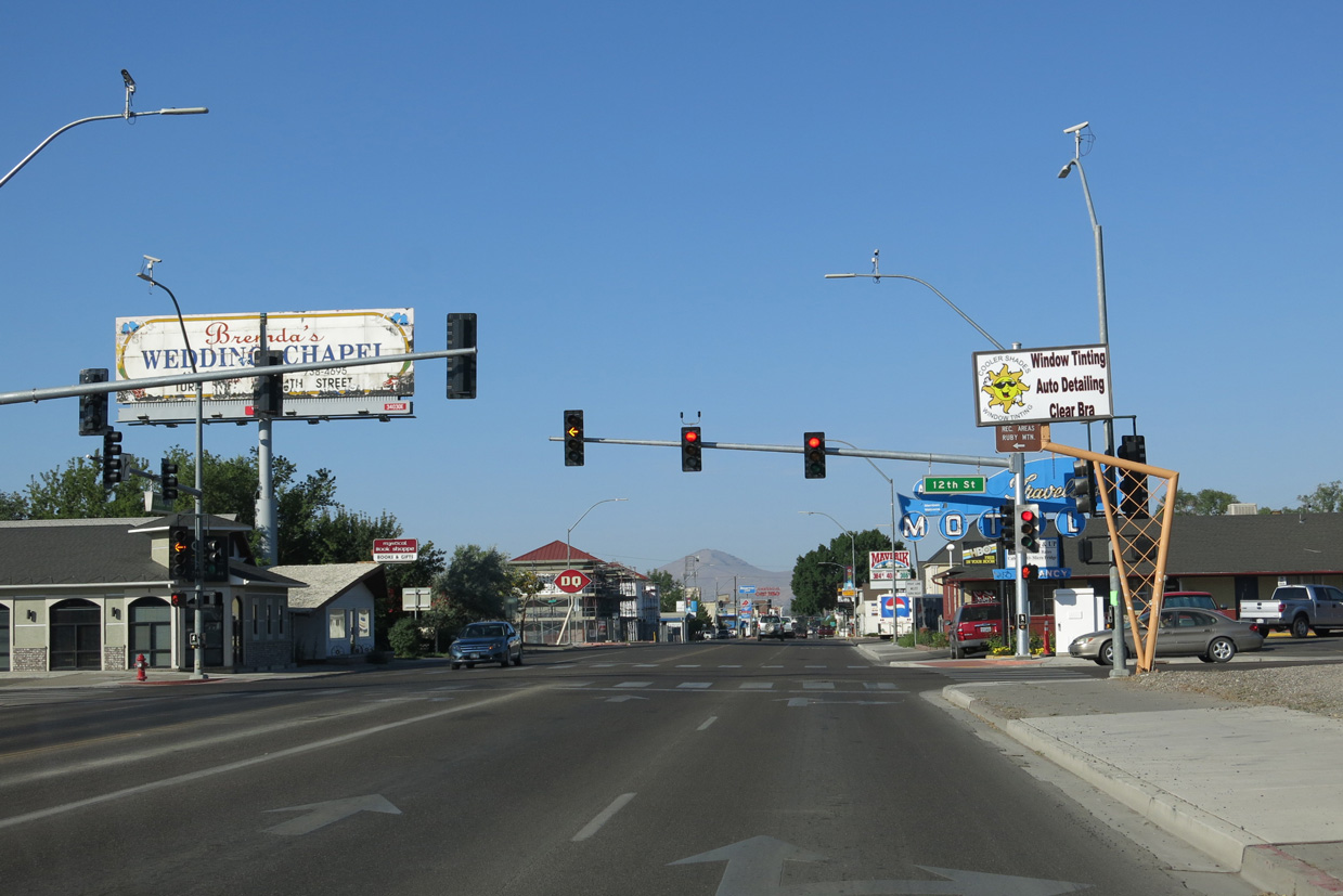
| A lane drop occurs along Idaho Street (old U.S. 40) westbound beyond 12th Street. The succeeding signal operates at 9th Street. 08/05/13 |
|
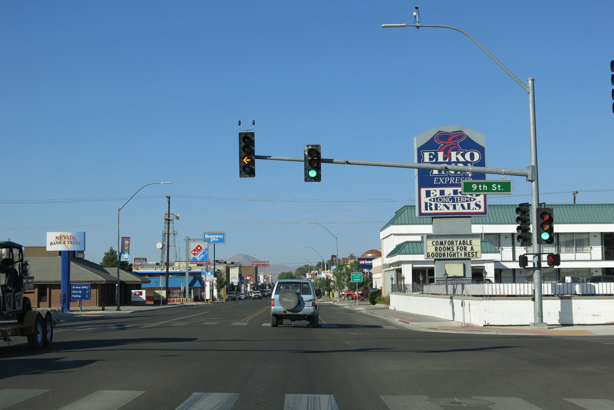
| Entering Downtown Elko along Business Loop I-80 (Idaho Street) westbound. 08/05/13 |
|
| Business Loop I-80 (Idaho Street) west at 6th Street in Downtown Elko. 08/05/13 |
|
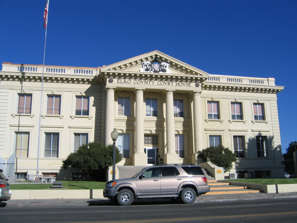
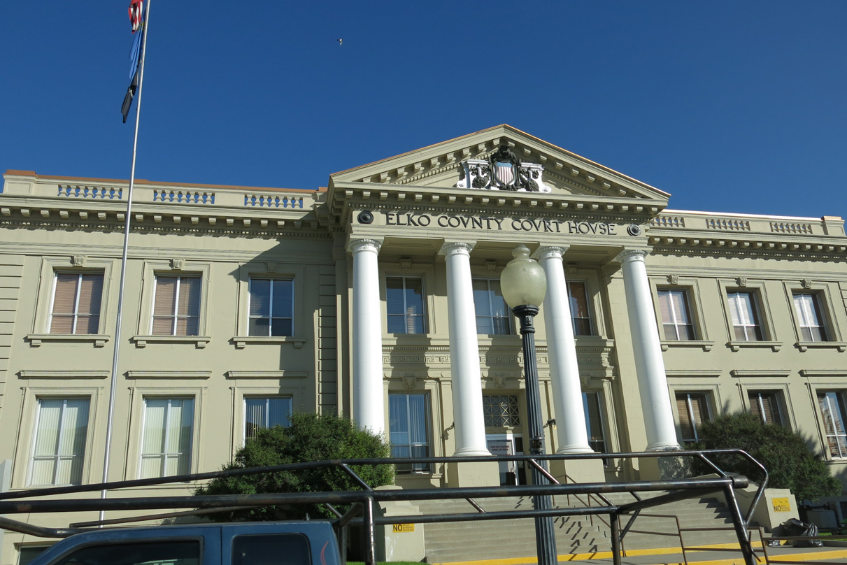
| The Elko County Courthouse lies on the southwest corner of Idaho Street (old U.S. 40) and 6th Street in Downtown. 08/05/13 |
|
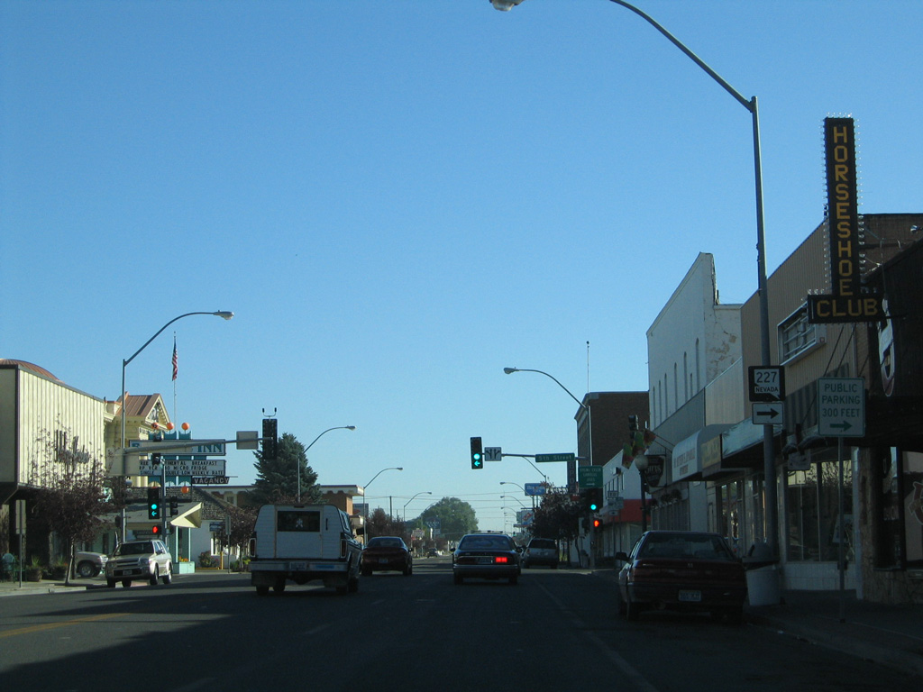
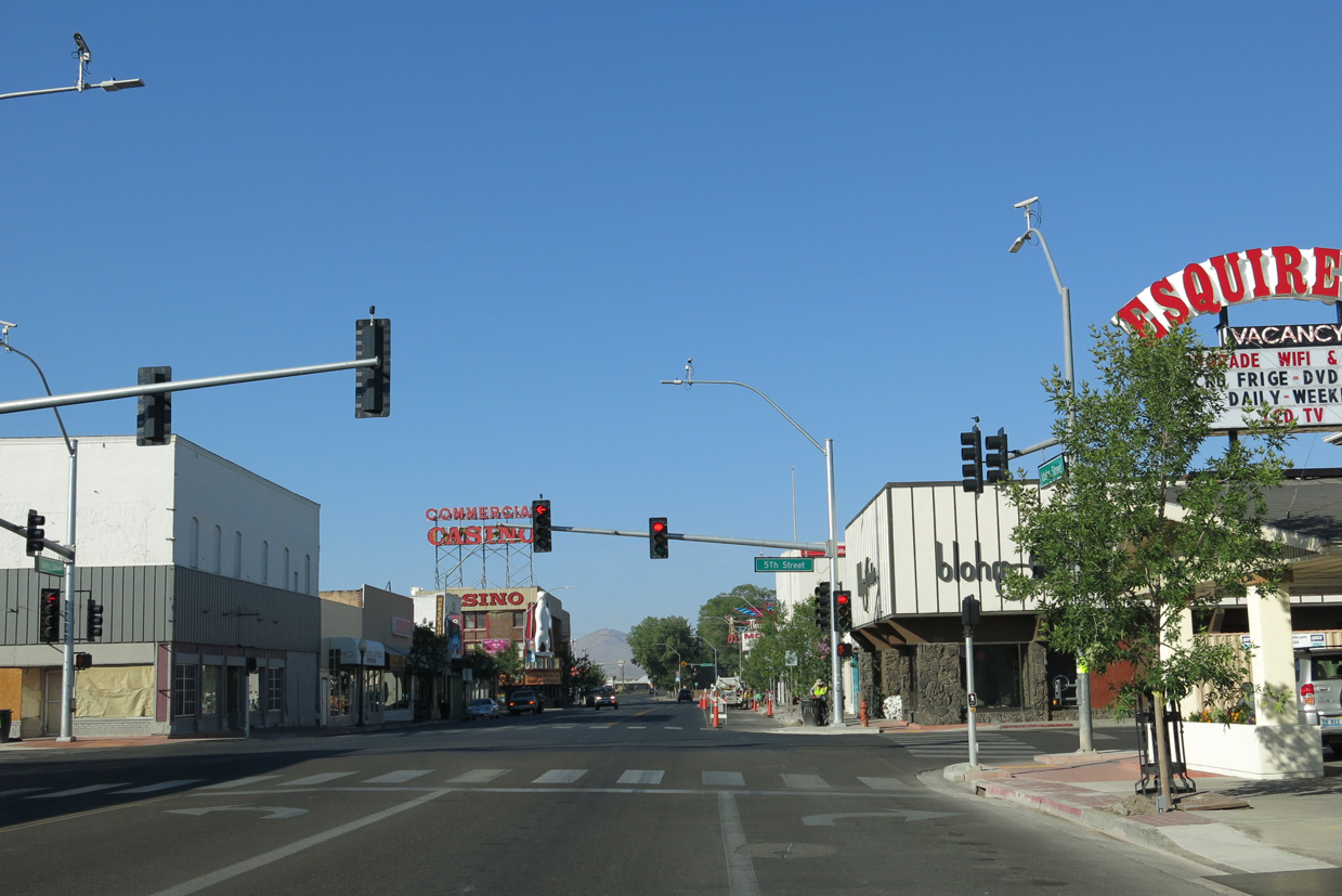
| SR 227 ends at the Idaho Street intersection with 5th Street. Unmarked from Business Loop I-80 west, the state route connects Elko with the communities of Spring Creek, Lamoille, and Jiggs (via SR 228) beyond the Elko Hills. 08/05/13 |
|
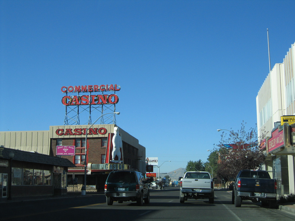
| Business Loop I-80 is state maintained between SR 227 (5th Street) and SR 225 (Mountain City Highway). The 0.79 mile stretch is the eastern segment of SR 535, which formerly followed all of the business route. Pictured here is the Idaho Street intersection with 4th Street. 09/09/05 |
|
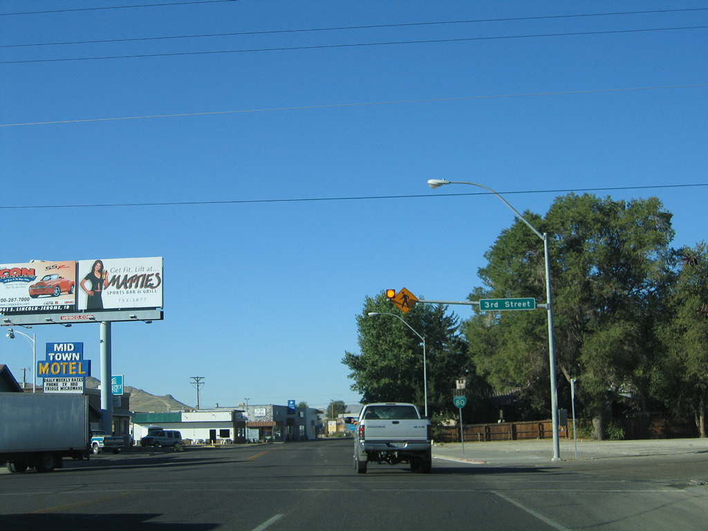
| The first reassurance marker for Business Loop I-80 west along Idaho Street in Elko stands beyond 3rd Street. 09/09/05 |
|
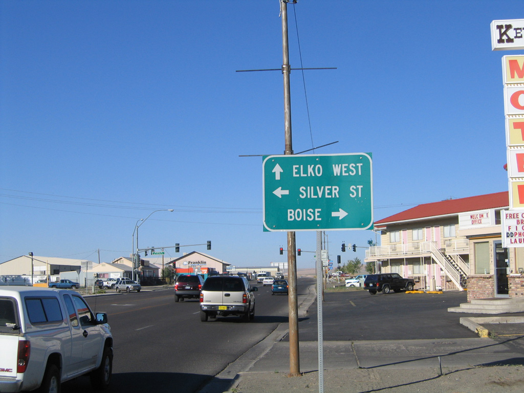
| Continuing west along Business Loop I-80 and SR 535 (Idaho Street), the next major intersection after leaving Downtown Elko is with SR 225 (Mountain City Highway) at Silver Street. 09/09/05 |
|
| SR 225 (Mountain City Highway). in conjunction with Idaho State Highway 51, provides the most direct route between northeastern Nevada and Boise. Silver Street ties into the intersection from across the Union Pacific Railroad tracks. 09/09/05 |
|
| A diamond interchange joins SR 225 (Mountain City Highway) with Interstate 80 in less than a mile. SR 225 otherwise meets SR 226 in 27 miles. SR 226 spurs northwest from there 29 miles to Jack Creek. 09/09/05 |
|
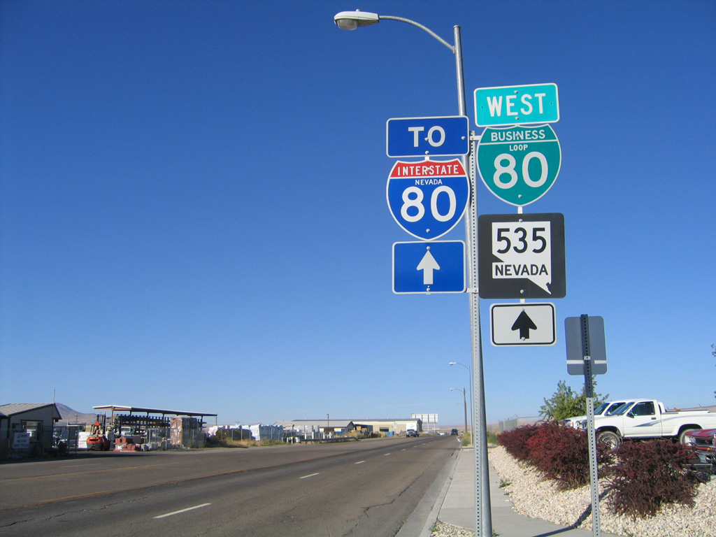
| SR 535 is discontinuous between SR 225 (Mountain City Highway) and the west Elko city line. Posted ahead of Elko Regional Airport (EKO), this SR 535 shield assembly remained along Idaho Street westbound as of 2015. 09/09/05 |
|
| SR 535 overlays the western 2.41 miles of Business Loop I-80. Idaho Street transitions into a rural highway beyond Elko Regional Airport to I-80. Grindstone Mountain rises to the far southwest. 09/09/05 |
|
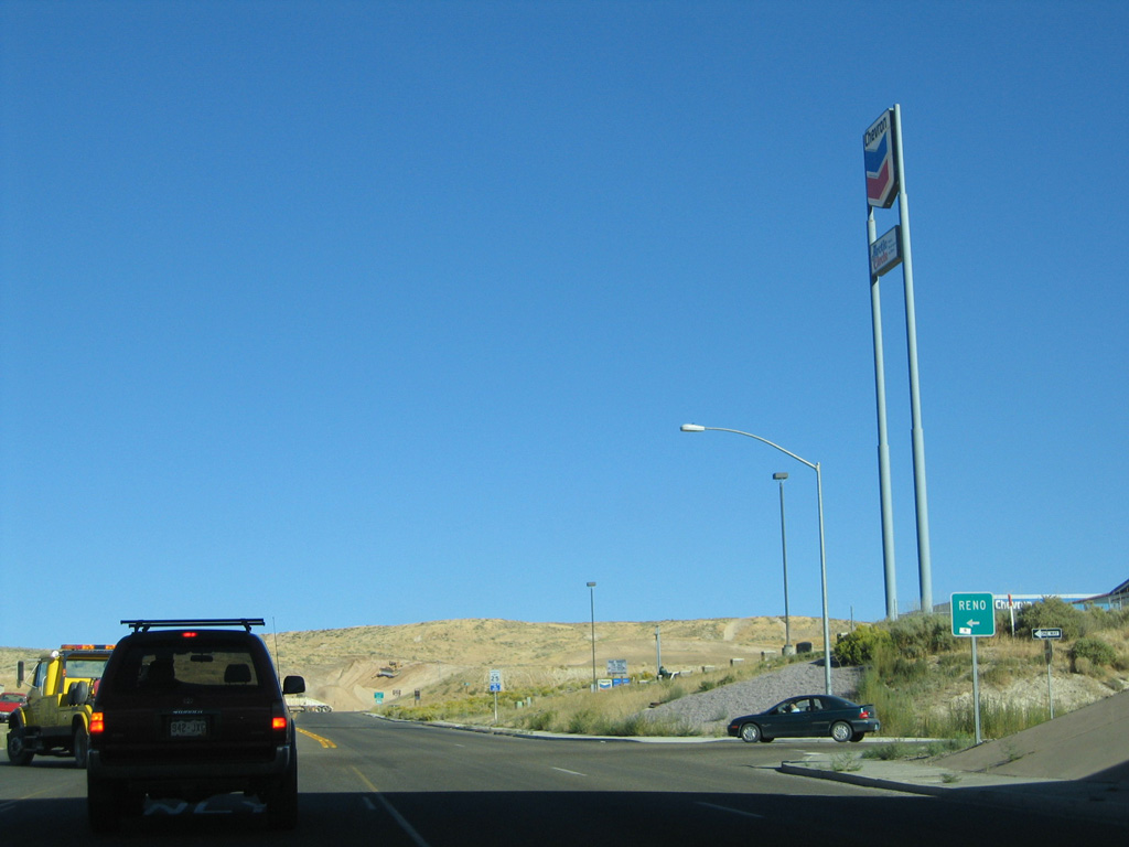
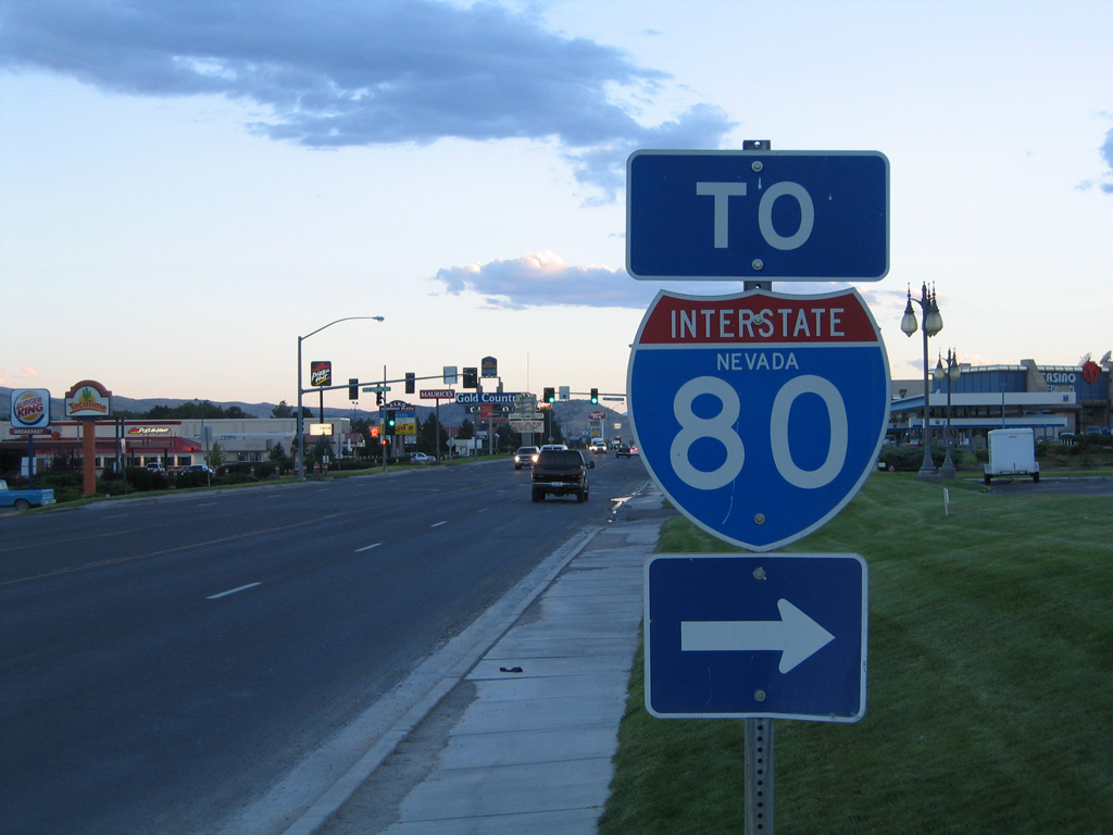
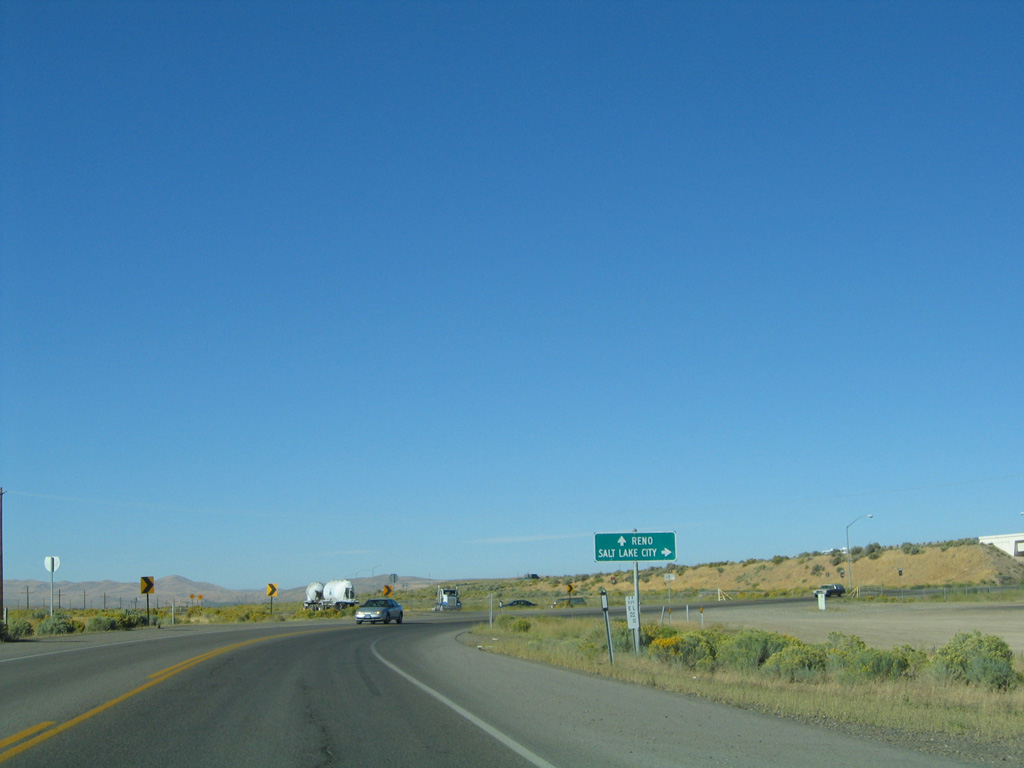
| Business Loop I-80 and SR 535 bend west to conclude at a diamond interchange (Exit 298) with Interstate 80. I-80 travels 286 miles west to Reno and 229 miles back to Salt Lake City, Utah. 09/09/05 |
|
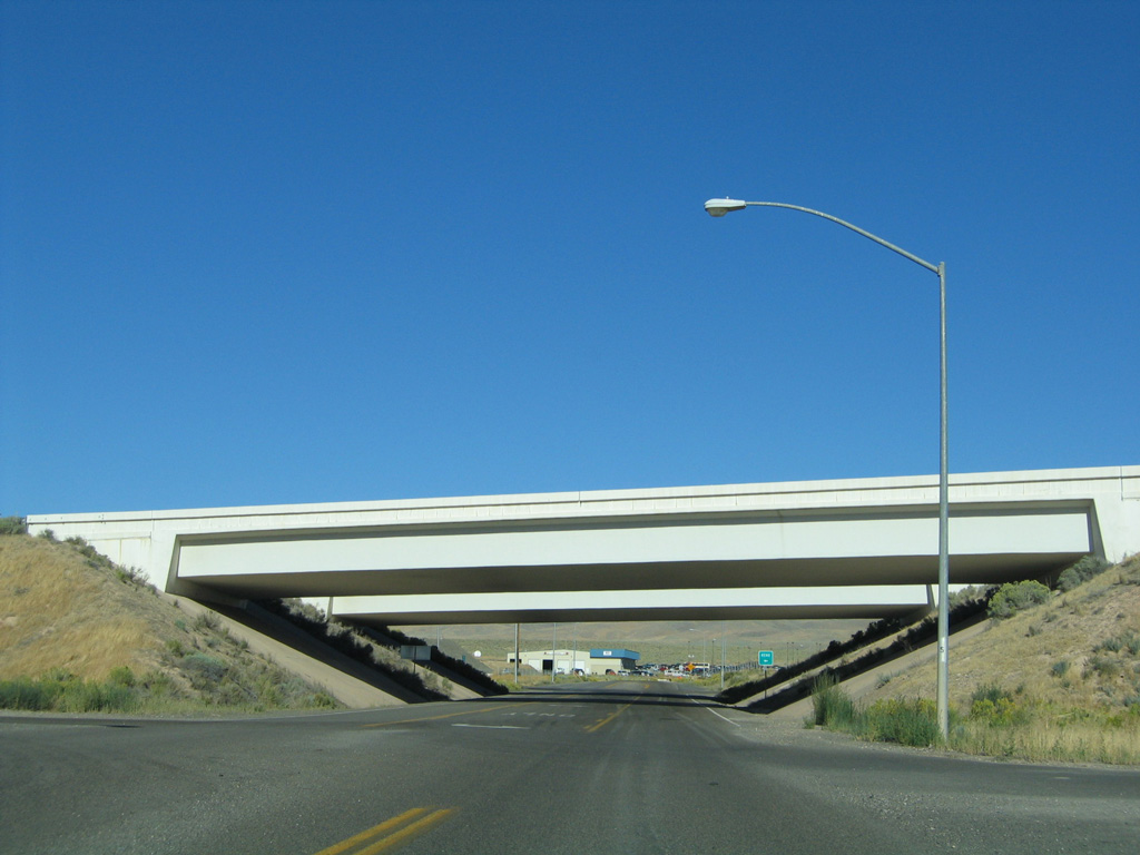
| Prior to the completion of Interstate 80 around Elko, U.S. 40 (Idaho Street) continued west along a linear course and defaulted onto the temporary freeway beginning to the Hunter interchange. 09/09/05 |
Page Updated 07-25-2018.


 East
East