|
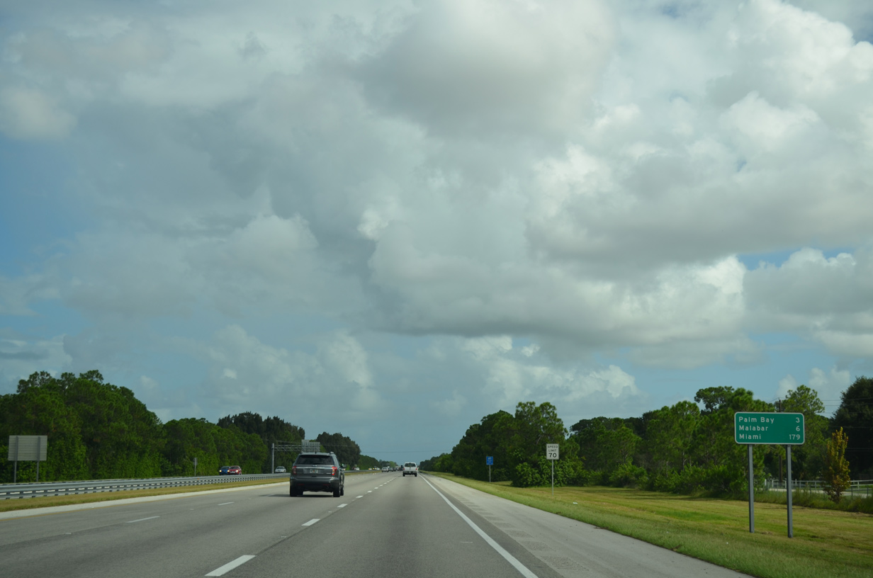
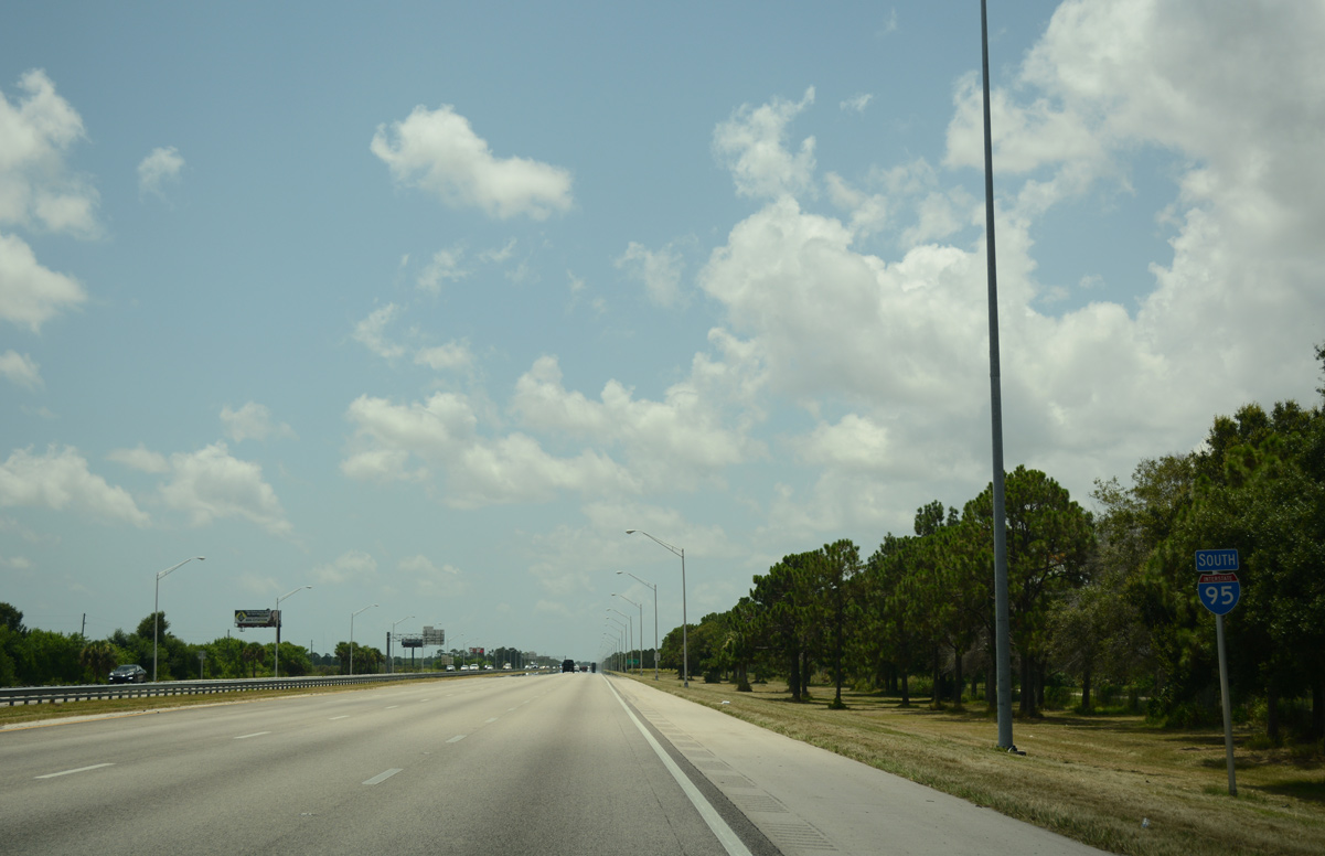
| The ensuing exit lies three miles to the southeast along the West Melbourne and Palm Bay city line. Miami is 179 miles away. 09/28/13 |
|
| Minton Road (CR 509) spans Interstate 95 one mile northwest of the diamond interchange with CR 516 (Palm Bay Road). 07/27/16 |
|
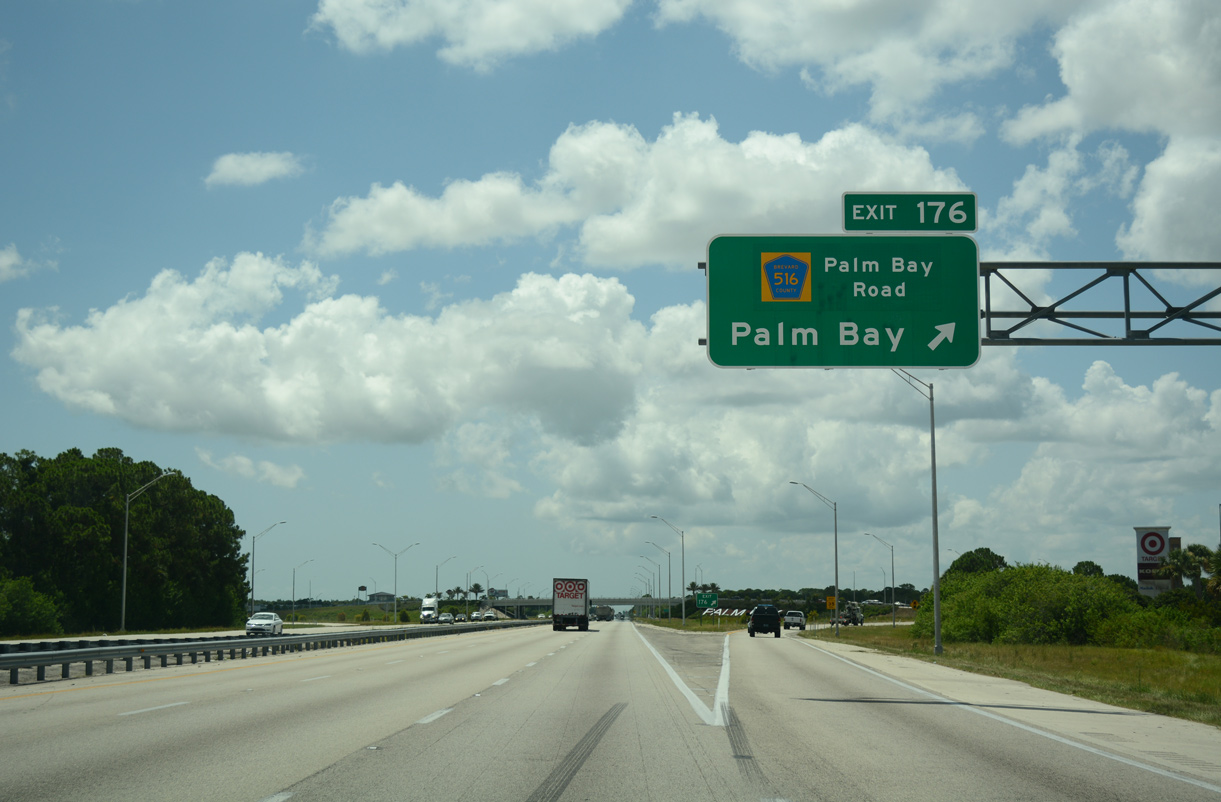
| Exit 176 is the first of two interchanges for the city of Palm Bay. An unsigned route, CR 516 (Palm Bay Road) travels 5.48 miles overall from CR 509 (Minton Road) to U.S. 1 at the original Palm Bay street grid. 07/27/16 |
|
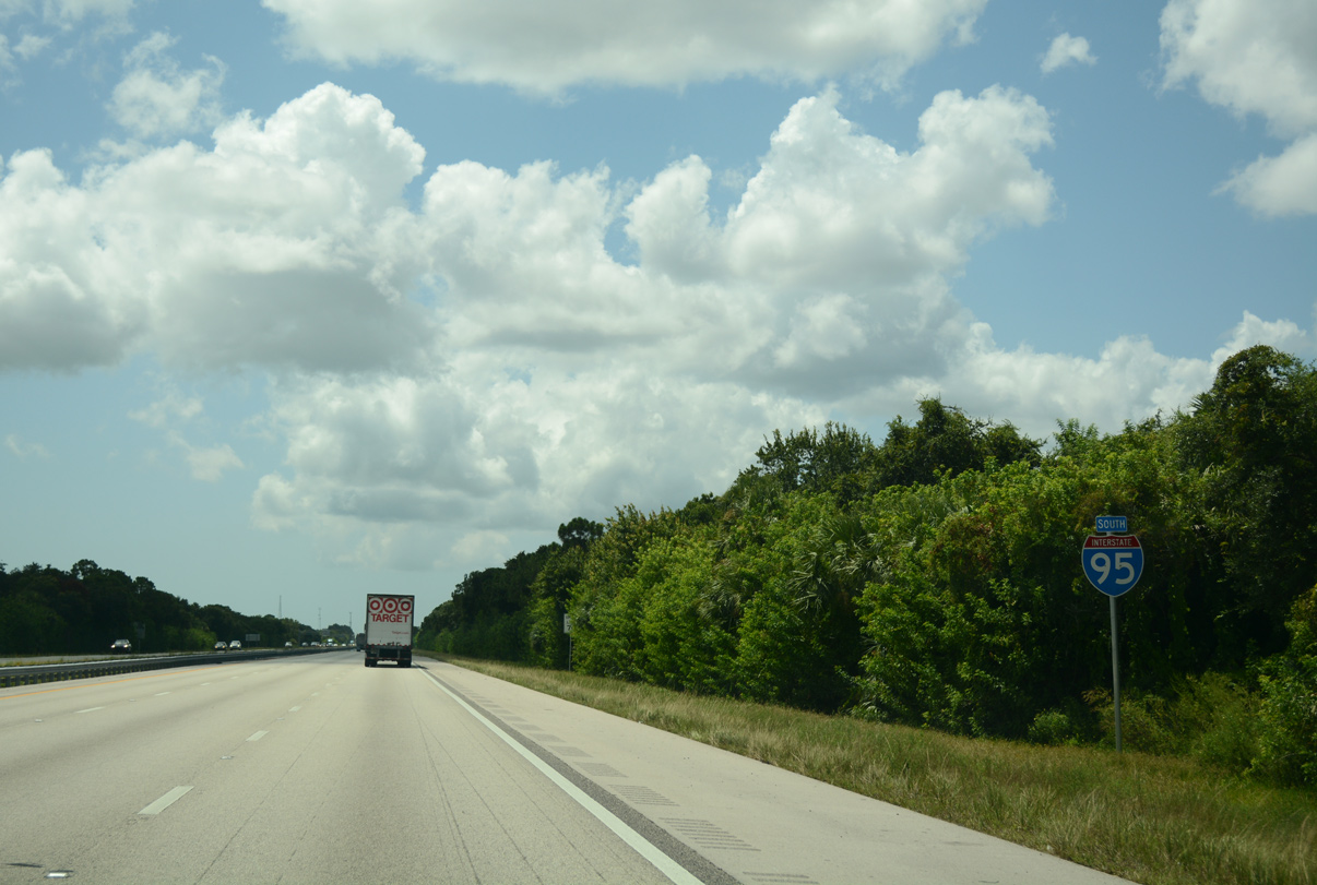
| Continuing southeast through Palm Bay, I-95 travels between the Port Malabar and Port Malabar Country Club communities. 07/27/16 |
|
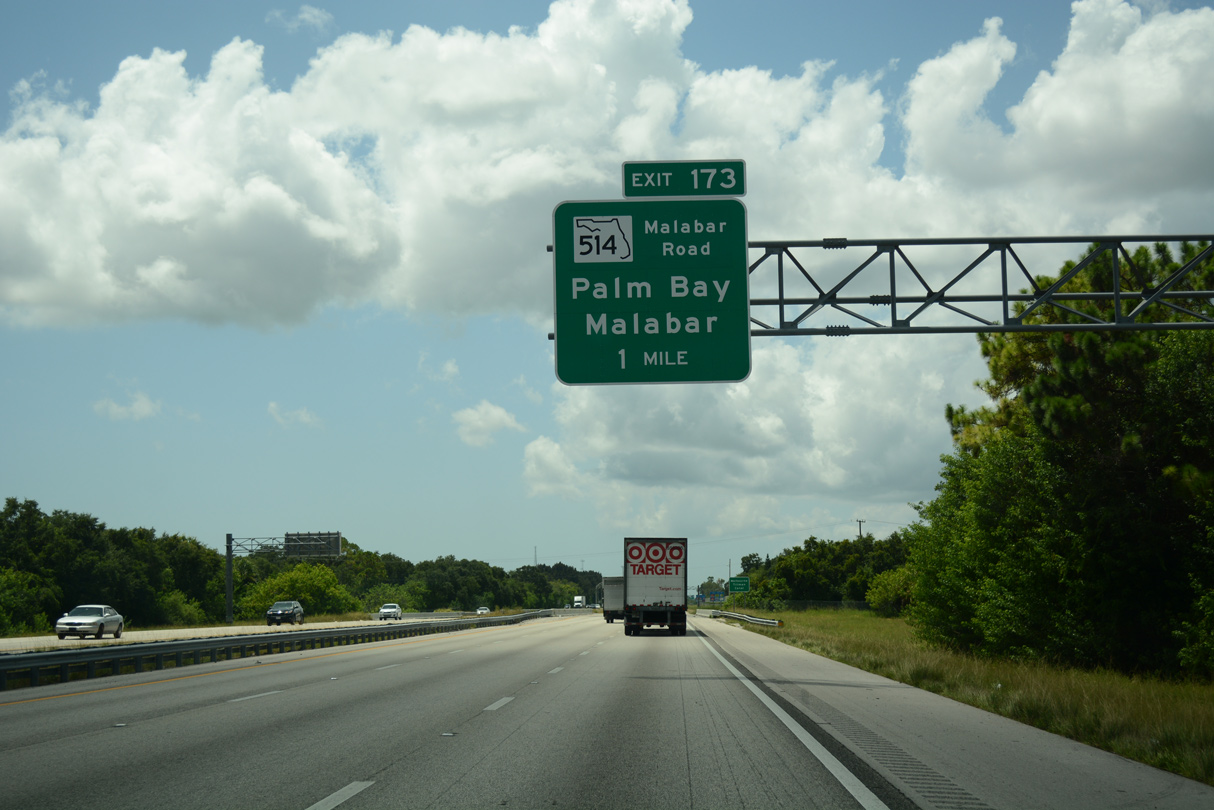
| Malabar Road meets Interstate 95 along a commercial strip at Exit 173 in one mile. 07/27/16 |
|
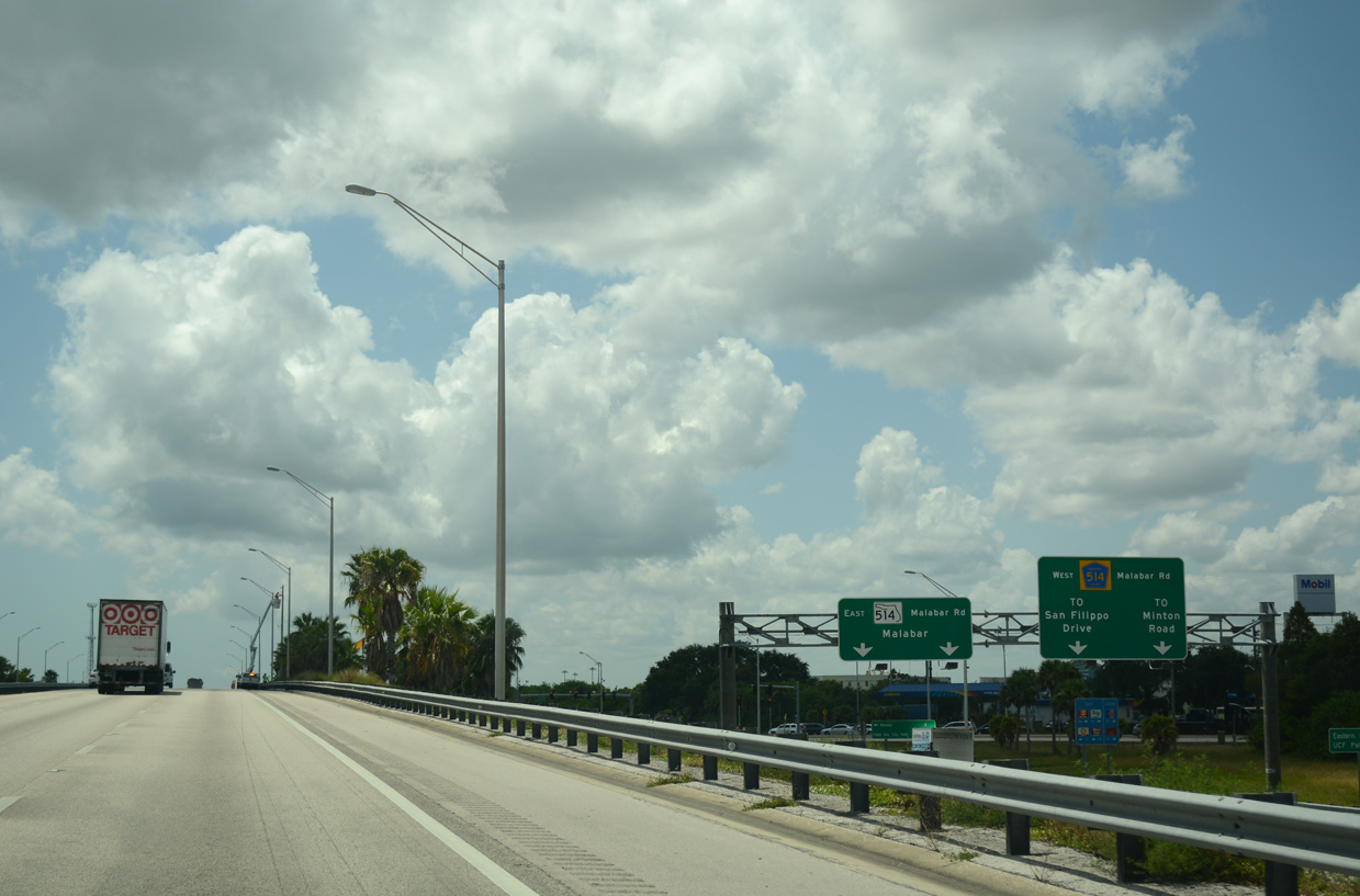
| Collectively 6.74 miles in length, Malabar Road leads west from I-95 as County Road 514 to Minton Road (CR 509) in Palm Bay and east as SR 514 to U.S. 1 in the city of Malabar. 07/27/16 |
|
| Progressing south from SR 514, I-95 passes through the western city limits of Malabar before entering the rural town of Grant-Valkaria over the succeeding two miles. 07/27/16 |
|
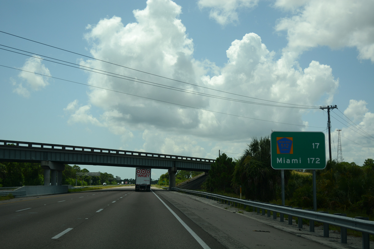
| The first interchange along I-95 in Indian River County is with CR 512 (Sebastian Boulevard) in 17 miles. Miami is 155 miles further. 07/27/16 |
|
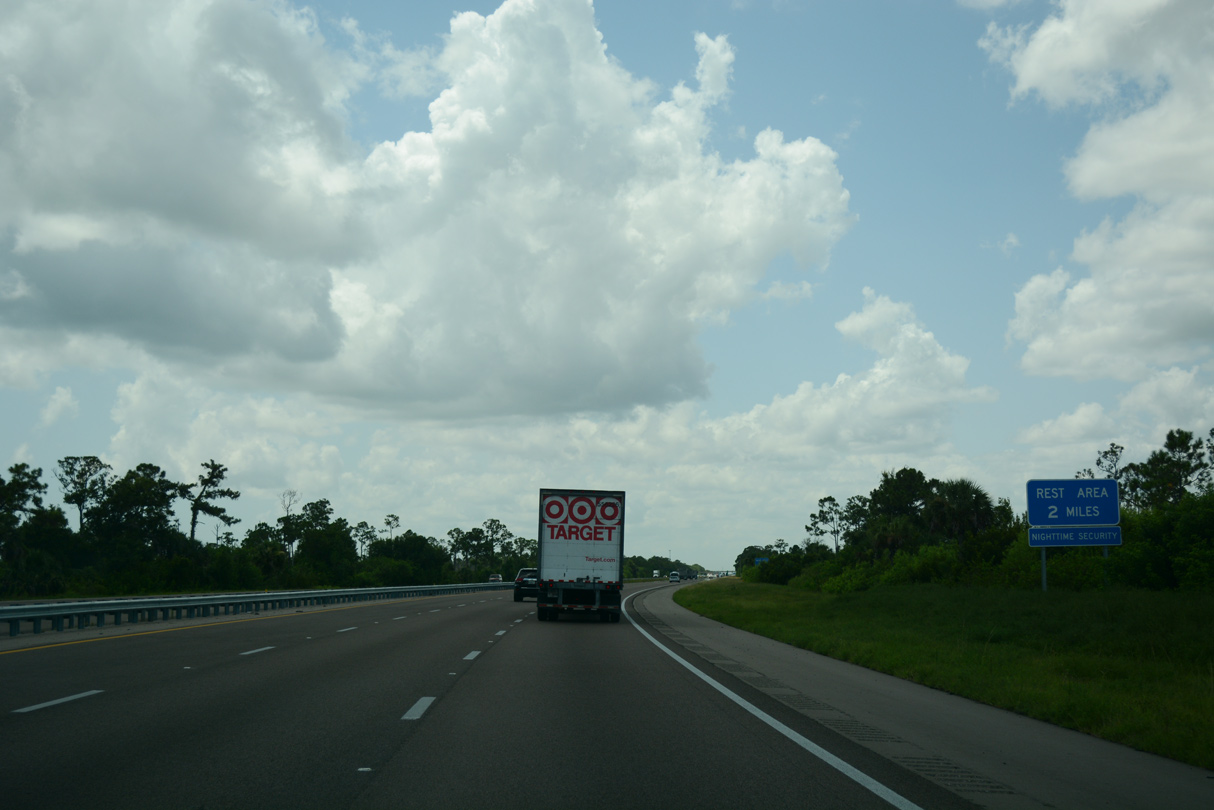
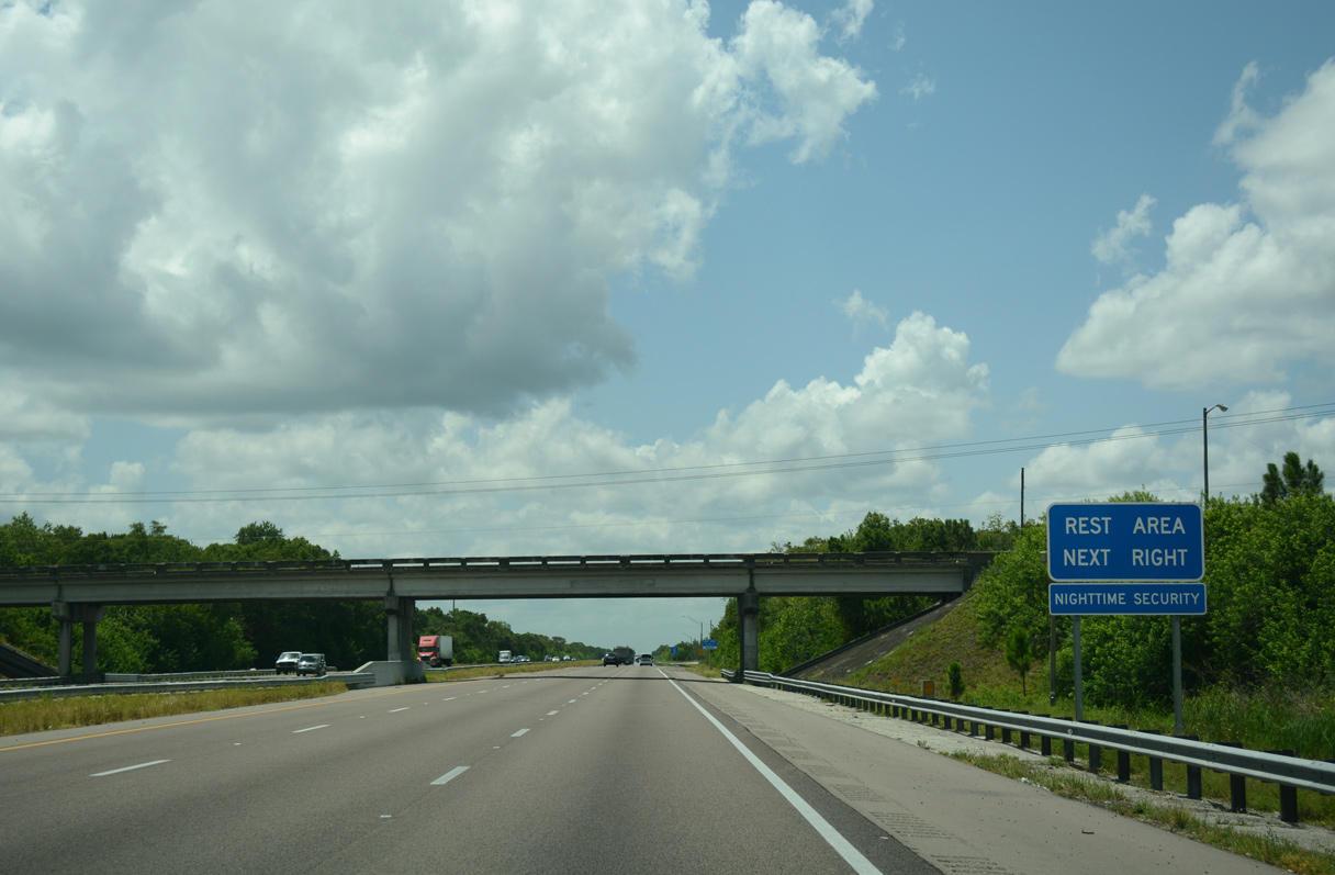
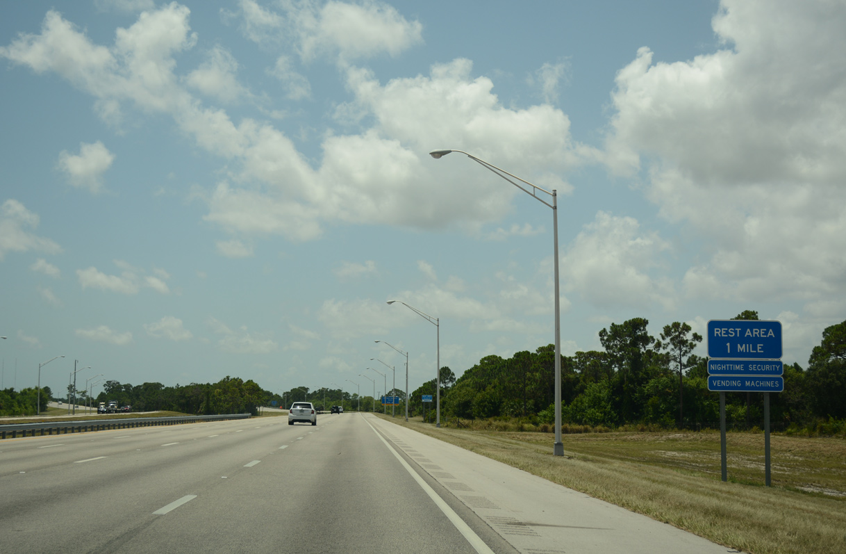
| Staggered rest areas line both sides of Interstate 95 between the Valkaria and Grant Road overpasses. 07/27/16 |
|
| The initial stretch of Interstate 95 south in Indian River County passes through St. Sebastian River Preserve State Park. The roadways separate on the southward turn toward Fellsmere. 09/28/13 |
|
| The fifth rest area along Interstate 95 south in Florida is located at milepost 169. 07/27/16 |
|
| The initial stretch of Interstate 95 south in Indian River County passes through St. Sebastian River Preserve State Park. The roadways separate on the southward turn toward Fellsmere. 09/28/13 |
|
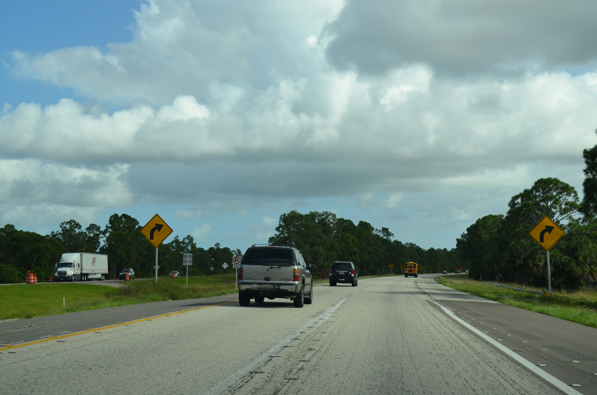
| Reassurance marker posted south of the Grant-Valkaria rest area. I-95 reenters Palm Bay ahead of a diverging diamond interchange (DDI) with the south section of St. Johns Heritage Parkway west to CR 507 (Babcock Street). Opened to traffic on August 11, 2020, the $26.7 million exchange1 supports the Cypress Bay development, with 1,058 units, among others.2 07/27/16 |
|
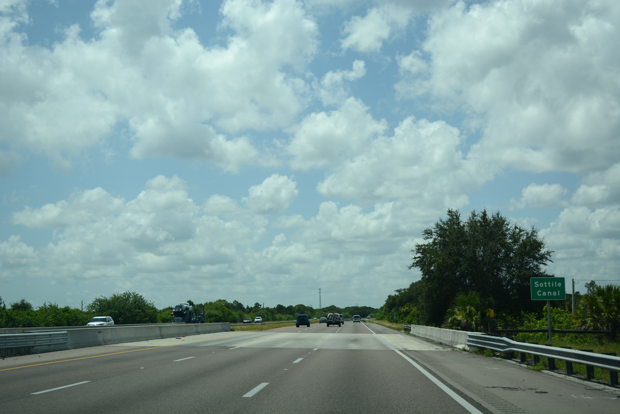
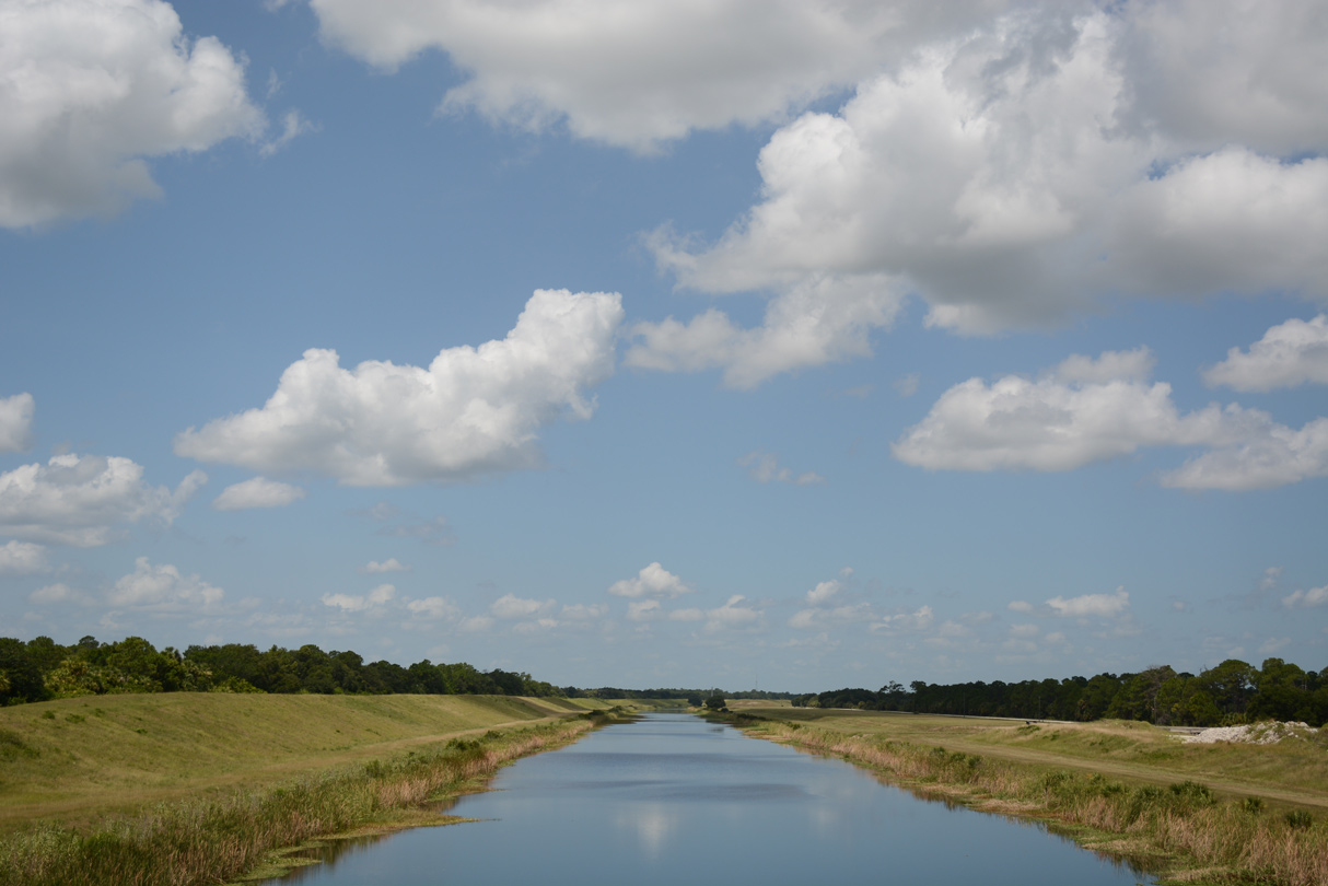
| Crossing Sottile Canal south of the St. Johns Heritage Parkway entrance ramp. 07/27/16 |
|
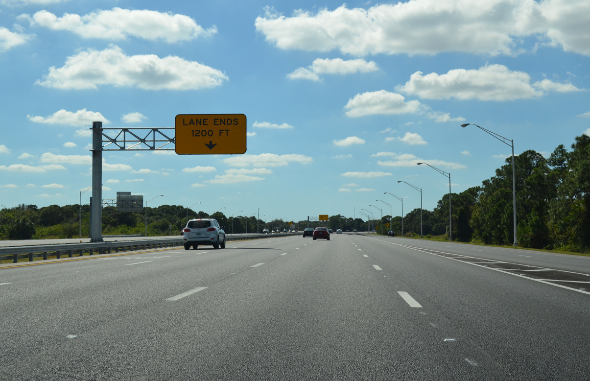
| I-95 was widened to six overall lanes from SR 514 (Malabar Road), 12.44 miles south to the Indian River County line, during a $51.8 million project finished in Spring 2014.3 07/27/16 |
|
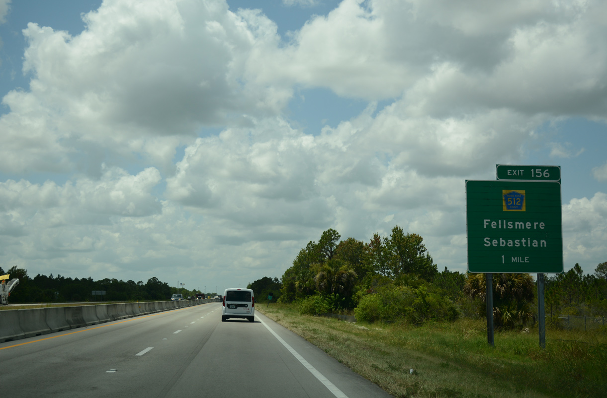
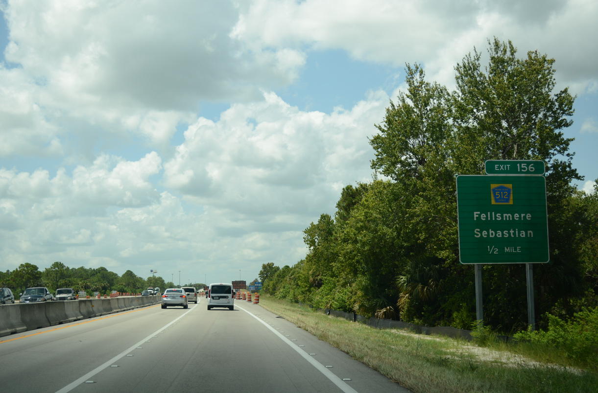
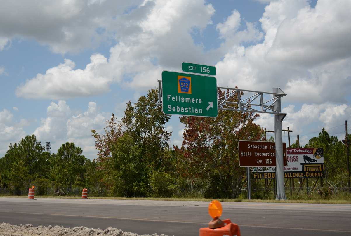
| Leaving St. Sebastian River Preserve State Park, I-95 straddles the Fellsmere city line southward to a diamond interchange (Exit 156) with CR 512 at Brookside. 07/27/16 |
|
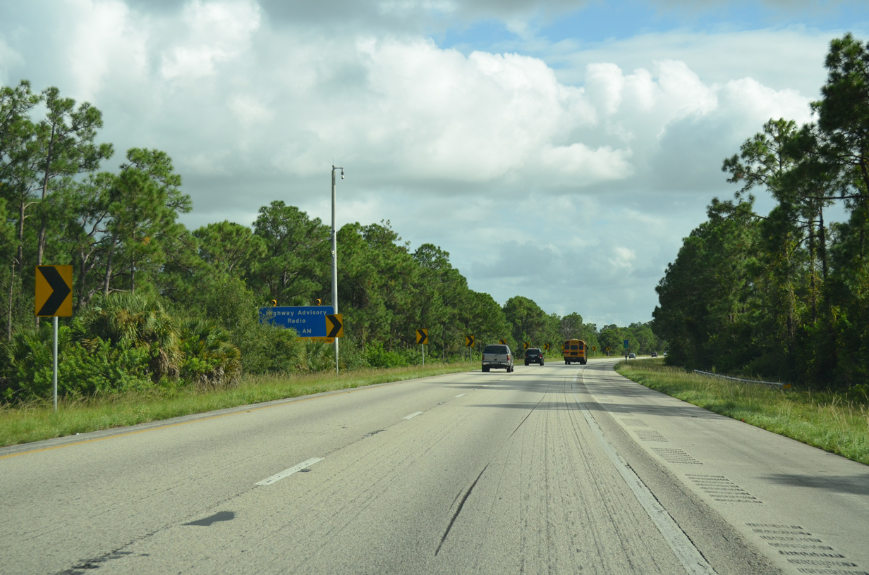
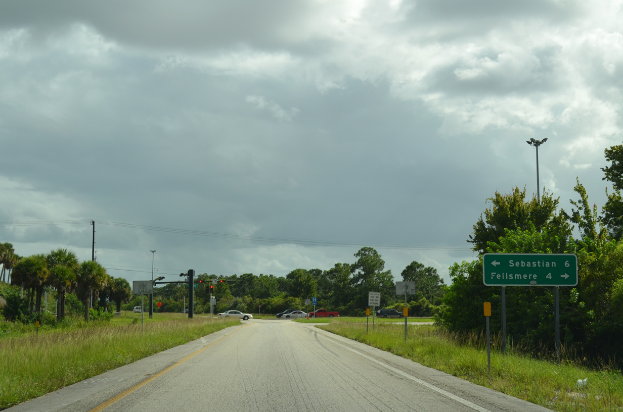
| CR 512 is a 20.46 mile long highway arcing southwest through Fellsmere and Upper St. Johns Marsh Wildlife Management Area to SR 60. East from Exit 156, CR 512 expands to a four lane arterial along Sebastian Boulevard to U.S. 1 in the city of Sebastian. 07/27/16 |
|
| Exit 156 departs I-95 southbound along the Fellsmere Preserve. This exchange was rebuilt during 2013-17 widening of I-95.3 07/27/16 |
|
| CR 512 (Sebastian Boulevard) leads east by the Vero Lakes Estates community to CR 510 (90th Avenue), which follows an L-shaped route south and east around Sebastian to Wabasso and Orchid along the Atlantic coast. CR 512 travels three miles west to CR 507 (Broadway Street) at the Fellsmere city center. 09/28/13 |
|
| The northern 12.51 miles of I-95 through Indian River County was expanded from four to six lanes during a $50.6 million project started on May 28, 2013. Work wrapped up in Spring 2017.5 07/27/16 |
|
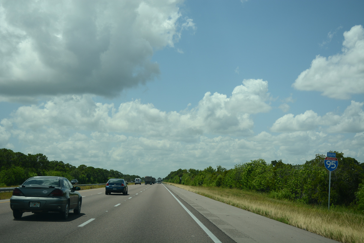
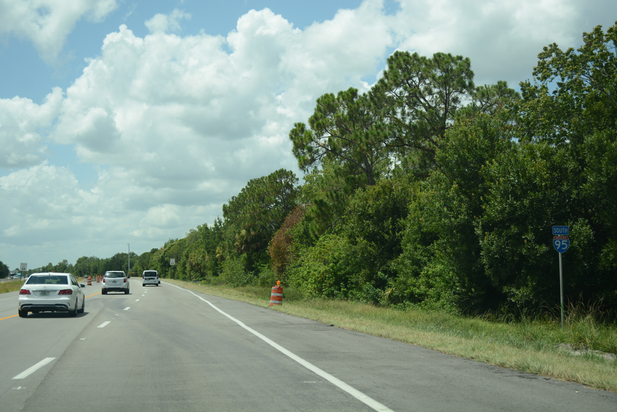
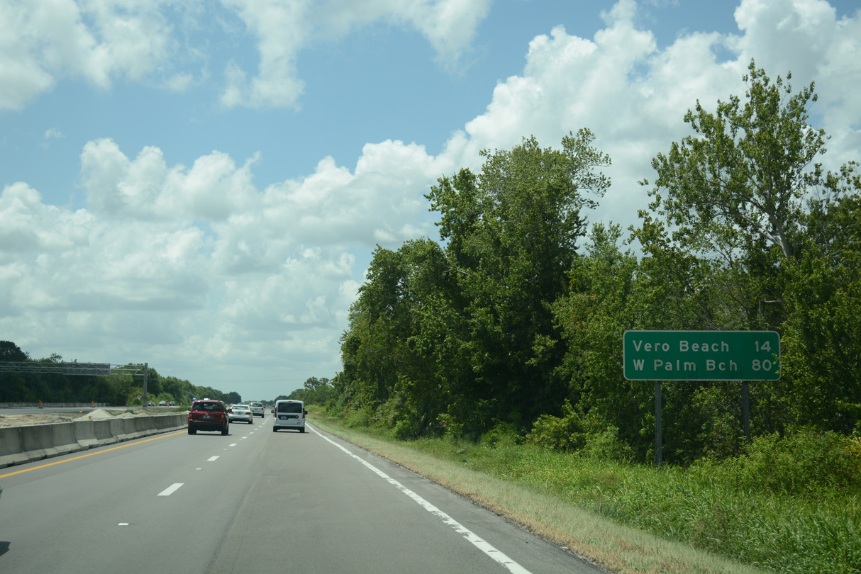
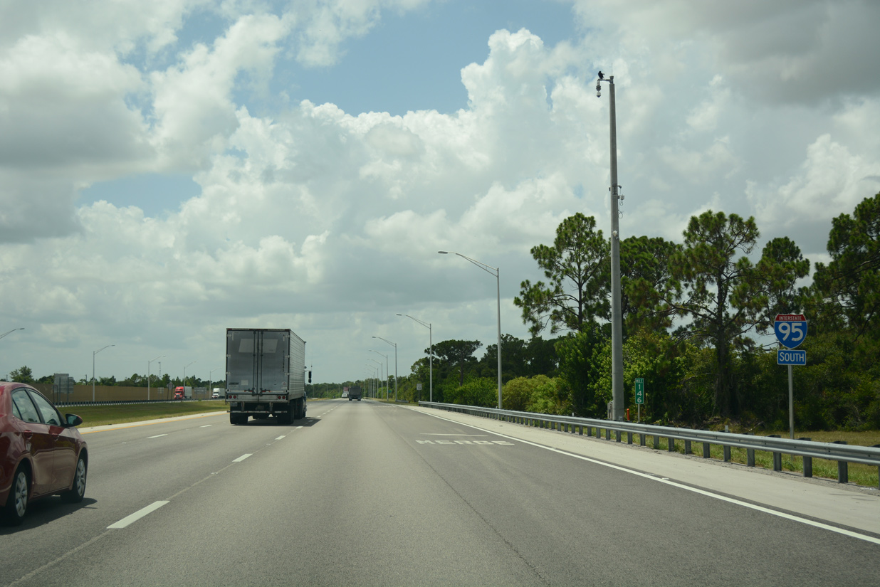
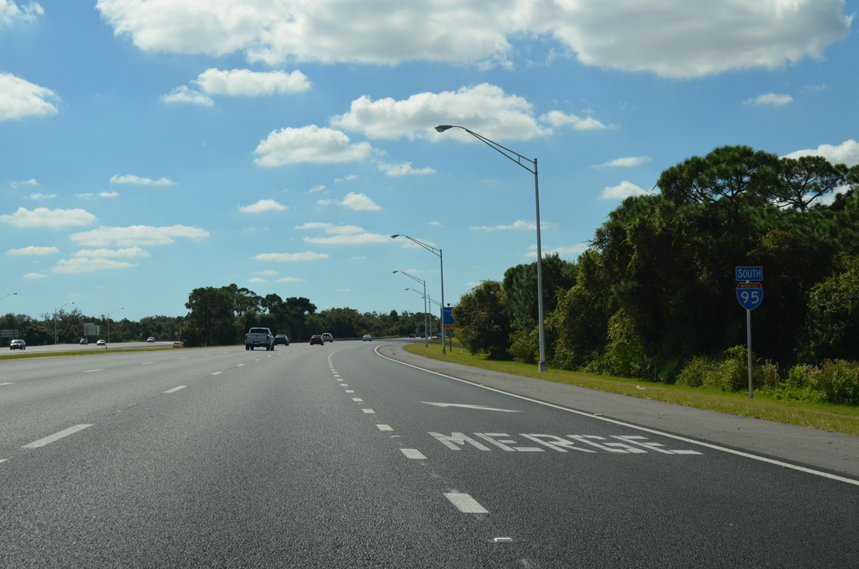
| Distance signs along Interstate 95 in FDOT District 4 use West Palm Beach in place of Miami. The rural freeway through Indian River County passes west of Vero Beach next. 07/27/16 |
|
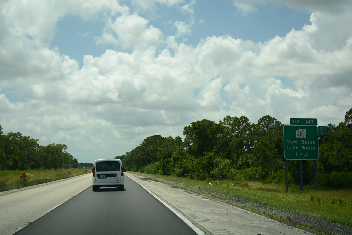
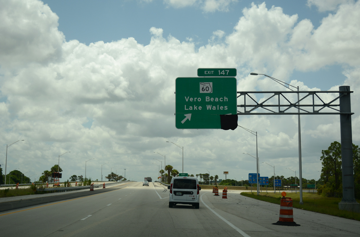
| SR 60, a cross peninsular highway between Clearwater Beach and Vero Beach, meets Interstate 95 at the succeeding exit in one mile. 07/27/16 |
|
| SR 60 constitutes a four lane corridor west from Vero Beach to U.S. 441 and Florida's Turnpike at Yeehaw Junction. Lake Wales, a city along U.S. 27 in Polk County, lies 70 miles to the west. 07/27/16 |
|
| Two lanes depart at Exit 147 for SR 60 (20th Street) east to Vero Beach and west across Upper St. Johns River Marsh WMA to Osceola County. SR 60 extends 10.8 miles east to Downtown Vero Beach and SR A1A at Beachland Boulevard. 07/27/16 |
|
| The southern 6.84 miles of I-95 in Indian River County was expanded to six lanes during a $54.4 million project. Work ran from September 29, 2011 to August 3, 2015.6 07/27/16 |
|
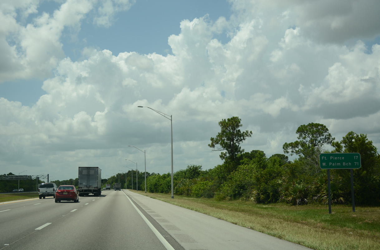
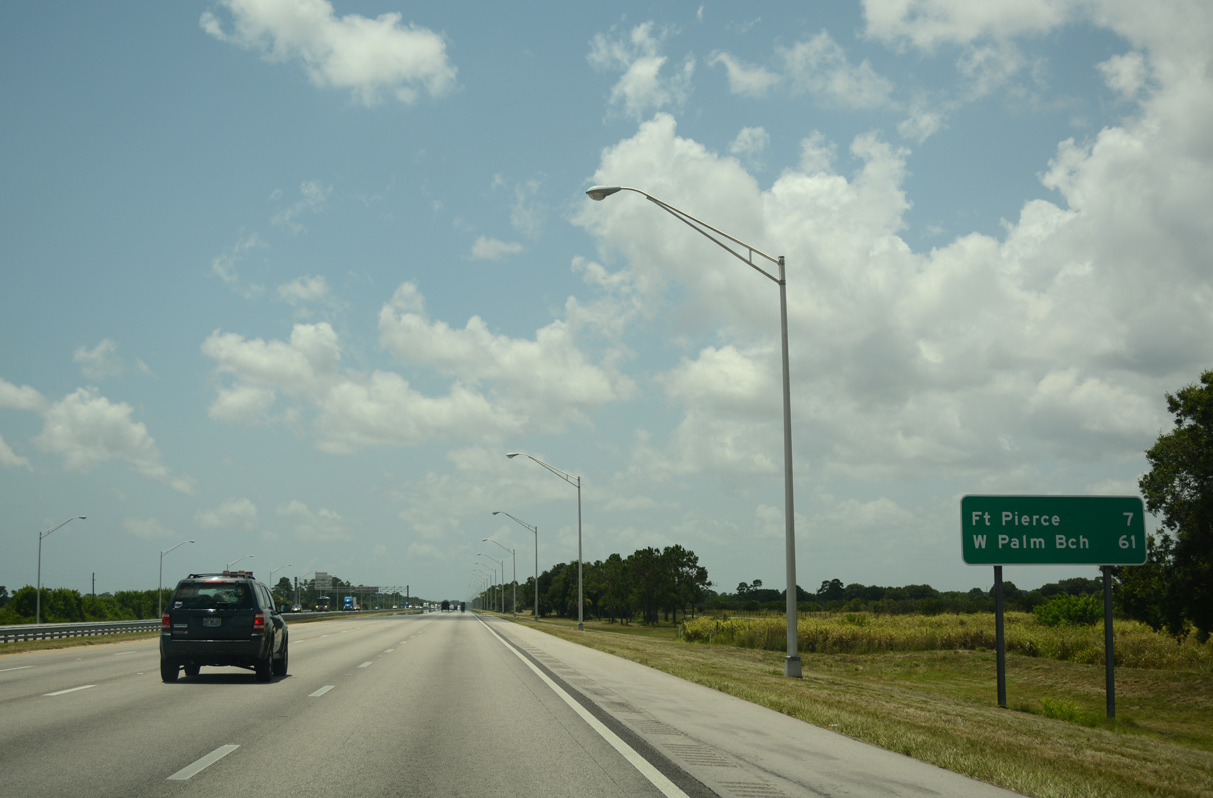
| I-95 shifts eastward toward the coast and advances 17 miles to the city of Fort Pierce. A proposed six-ramp parclo interchange will join the rural freeway with CR 606 (Oslo Road). Estimated to cost $29.9 million, work on the new exchange is forecast for fiscal year 2027.7 07/27/16 |
|
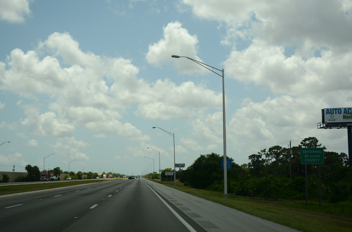
| Interstate 95 crosses into St. Lucie County and runs along the west side of the Spanish Lakes Fairways manufactured home community. 07/27/16 |
|
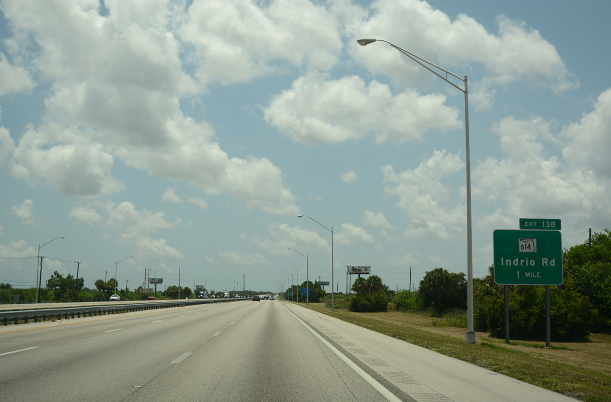
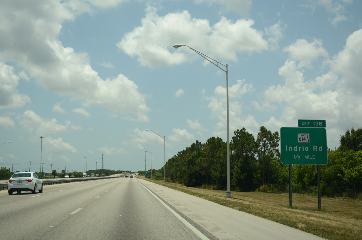
| Continuing southeast toward the diamond interchange (Exit 138) with SR 614 (Indrio Road) on I-95. Six lane expansion of the freeway south from the Indian River County line to Exit 138 took place between August 15, 2011 and May 31, 2013. The 4.069 mile long project cost $17.2 million.8 07/27/16 |
|
| State Road 614 lines Indrio Road 3.584 miles east from Interstate 95 to SR 713 (Kings Highway) at Lakewood Park. 07/27/16 |
|
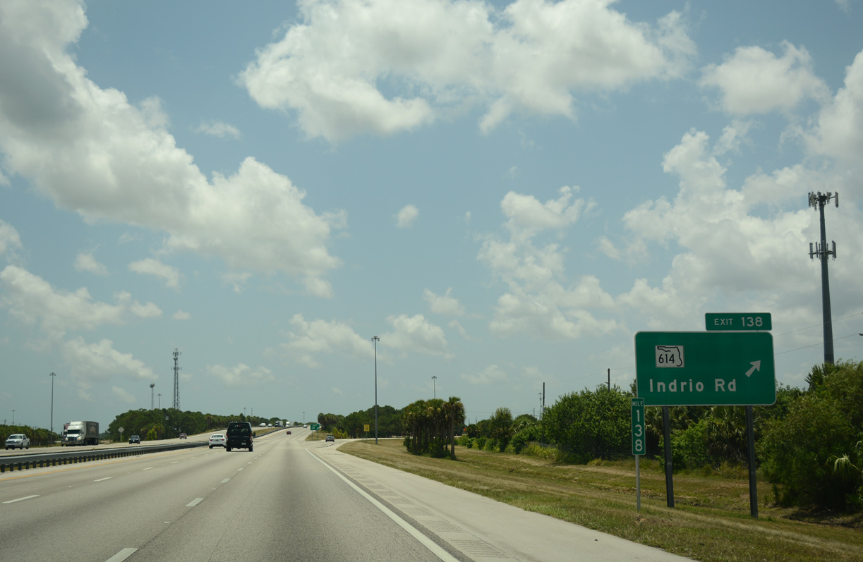
| Exit 138 leaves I-95 south for SR 614 (Indrio Road). Indrio Road spurs west to agricultural areas. CR 614 extends Indrio Road east from SR 713 (Kings Highway) 2.762 miles to U.S. 1 and CR 605 (Old Dixie Highway) at Indrio. 07/27/16 |
|
| Expansion of I-95 south from SR 614 (Indrio Road) to SR 70 (Okeechobee Road) took place between June 15, 2011 and early 2015. The $78.3 million work included improvements at interchanges with both SR 68 and SR 68.9 07/27/16 |
|
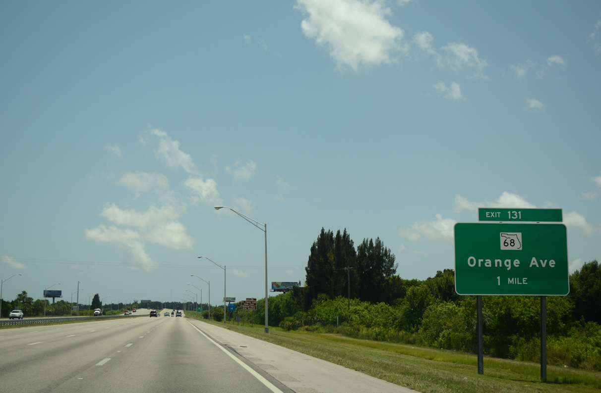
| The ensuing exit is with SR 68 east to Fort Pierce in six miles. West Palm beach is 55 miles further south via I-95. 07/27/16 |
|
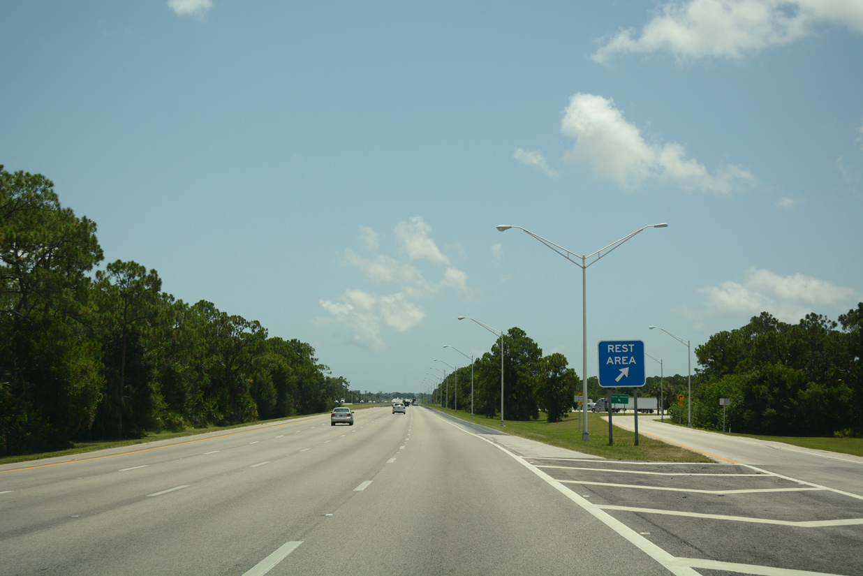
| The sixth rest area along Interstate 95 southbound in the Sunshine State is located at mile marker 133. 07/27/16 |
|
| I-95 crosses Belcher Canal and Angle Road just ahead of the St. Lucie County rest area off-ramp. 07/27/16 |
|
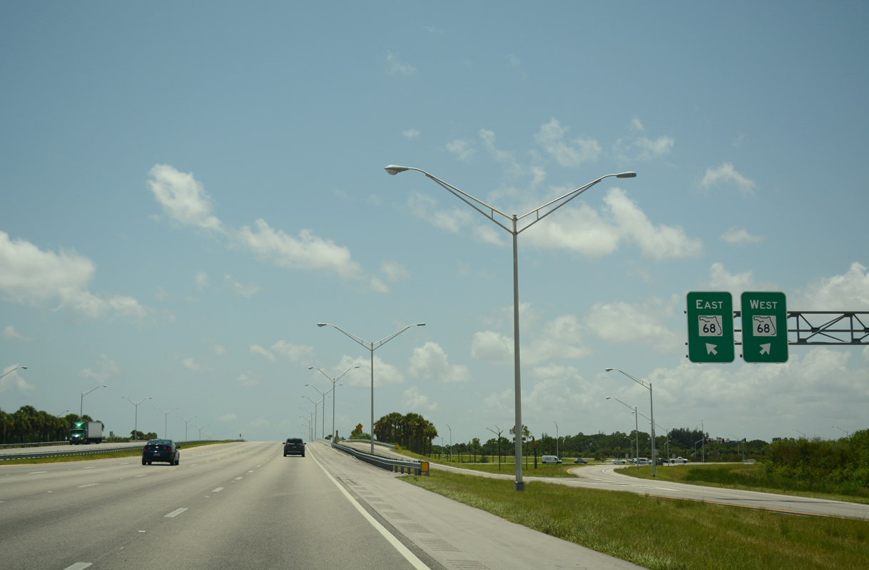
| Forthcoming SR 68 and CR 68 is a linear route traveling nearly the width of St. Lucie County along Orange Avenue. 07/27/16 |
|
| Passing over SR 713 (Kings Highway), one half mile north of the six-ramp parclo interchange (Exit 131) with SR 68 (Orange Avenue) on I-95 south. 07/27/16 |
|
| SR 68 follows Orange Avenue east from adjacent SR 713 (Kings Highway) 4.70 miles to U.S. 1 (4th Street) in Downtown Fort Pierce. U.S. 1 north links with SR A1A to both Hutchinson Island and Ft. Pierce Shores and otherwise heads north to Fort Pierce Inlet State Park. 07/27/16 |
|
| County Road 68 extends 25.26 miles west from SR 713 (Kings Highway) to U.S. 441 in Okeechobee County. 07/27/16 |
|
| Confirming marker posted south of the SR 68 (Orange Avenue) entrance ramp. I-95 enters the Fort Pierce city limits in 1.4 miles. 07/27/16 |
|
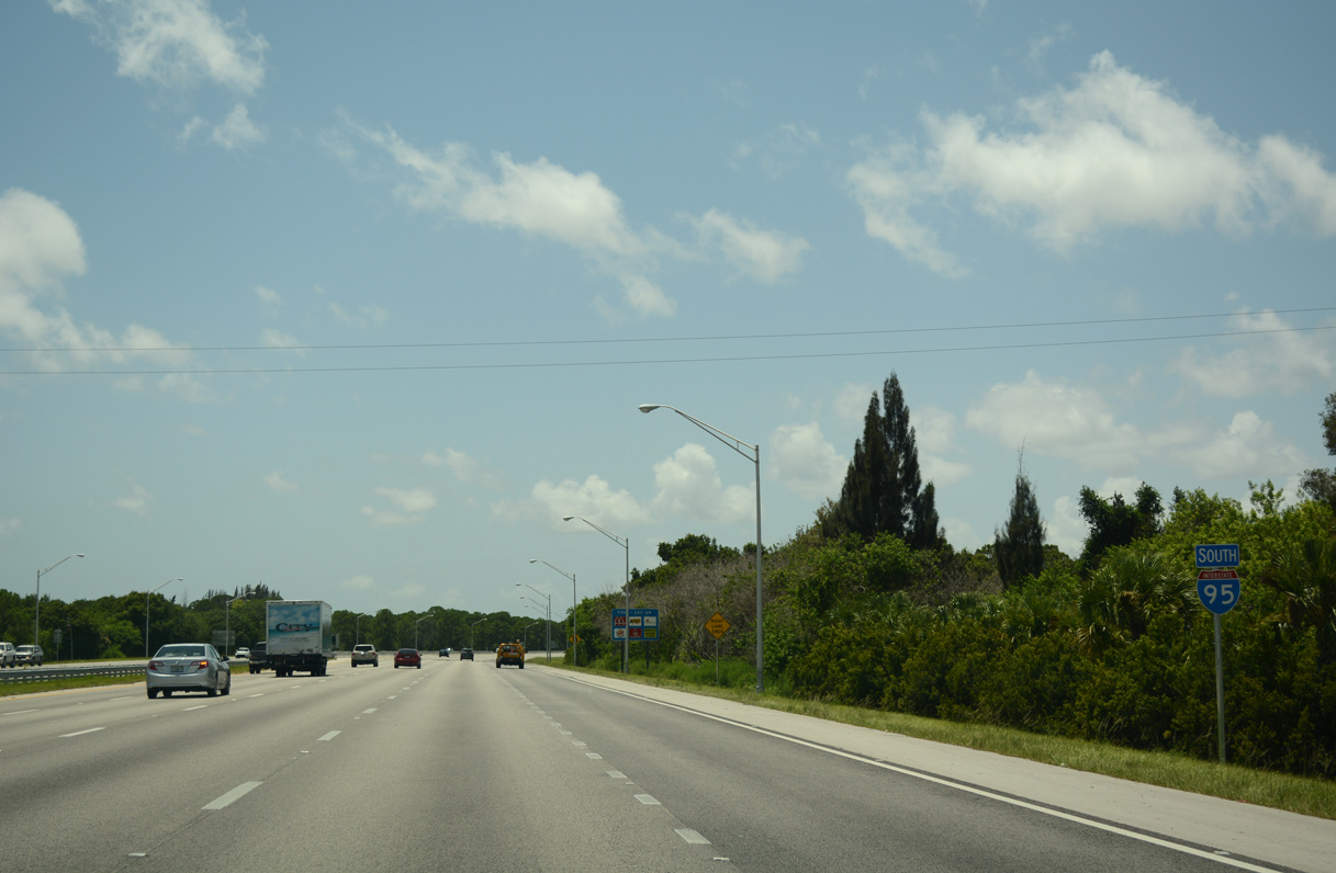
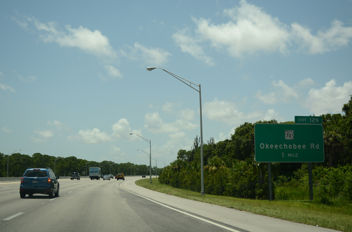
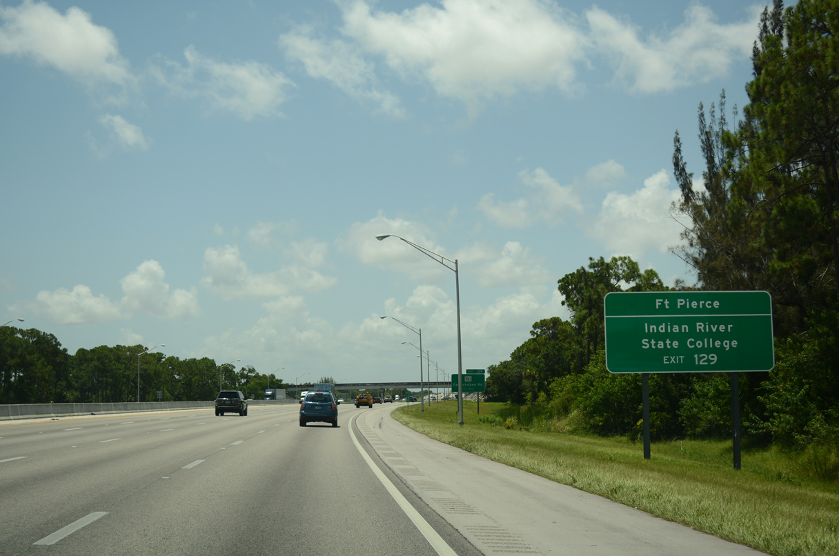
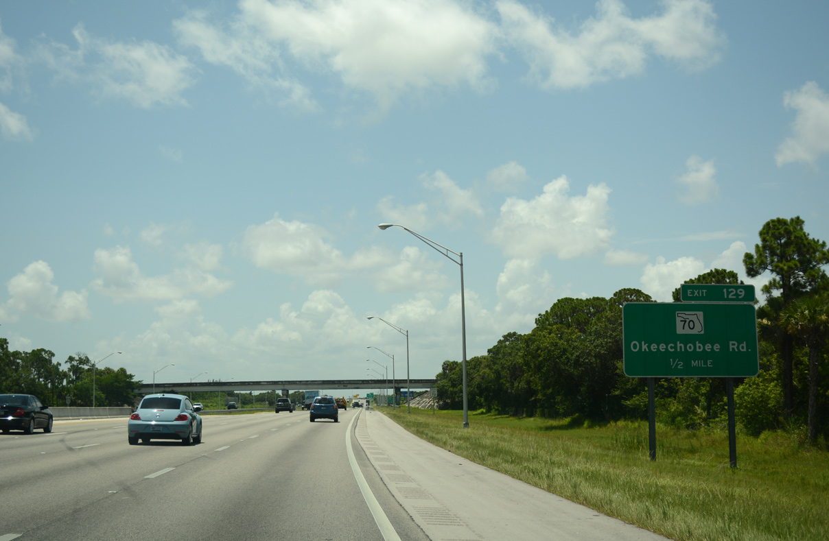
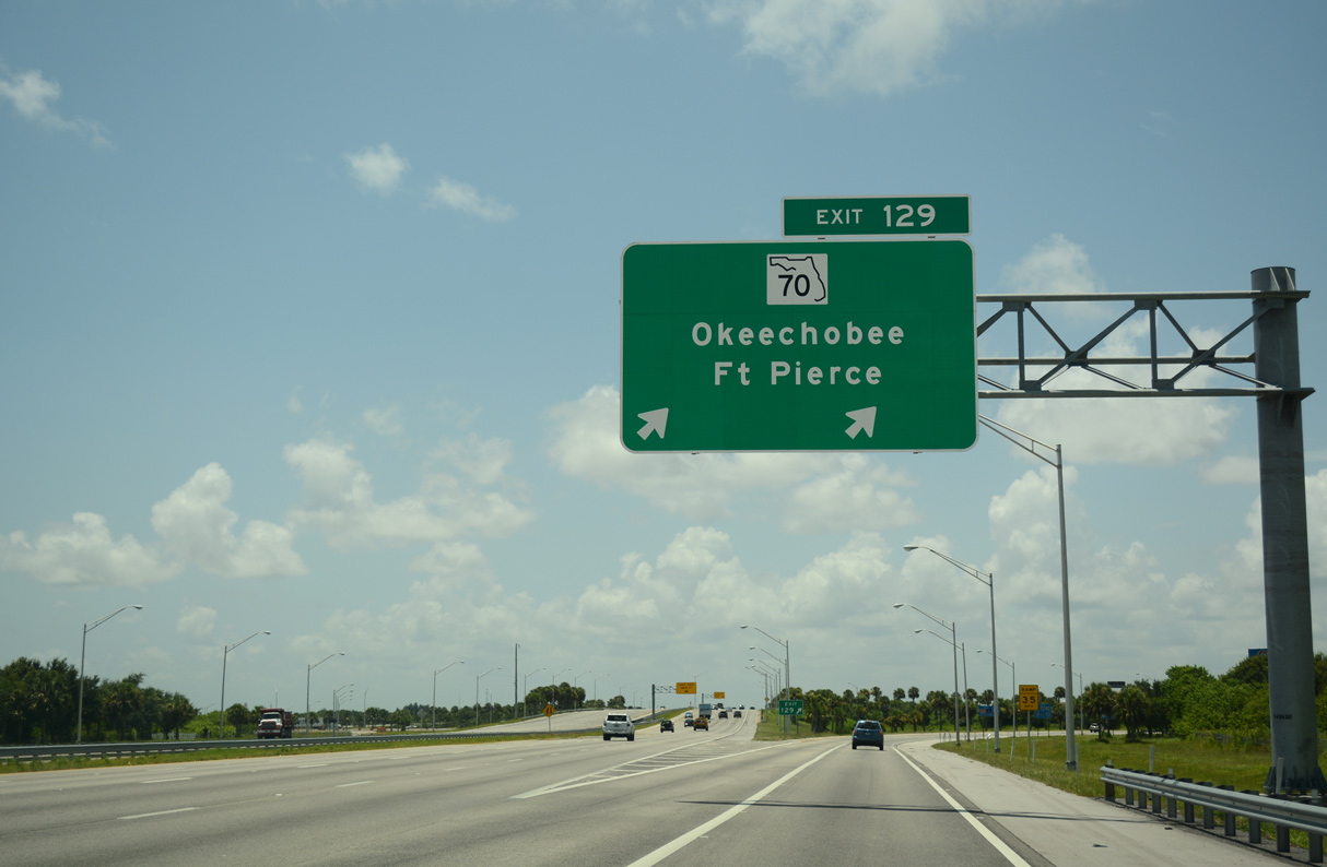
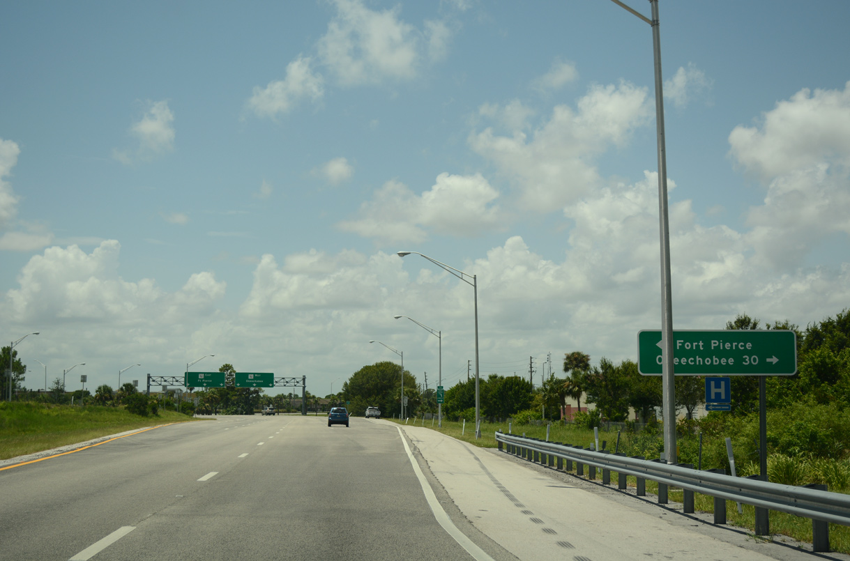
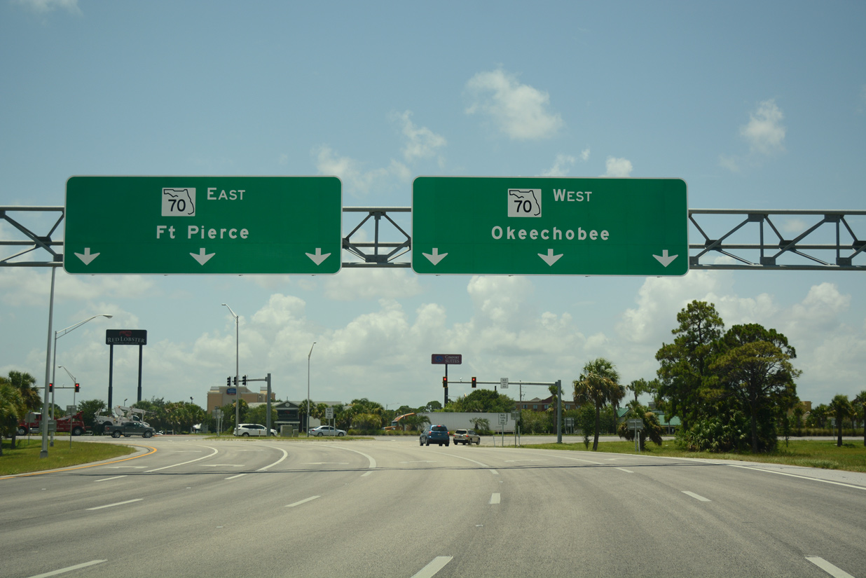
| A six-ramp parclo interchange (Exit 129) connects Interstate 95 with SR 70 along the west side of Fort Pierce. 07/27/16 |
|
| Downtown Fort Pierce lies 4.4 miles to the northeast from Exit 129 via Okeechobee Road and Delaware Avenue. SR 70 stays south of the city center along Virginia Avenue east to U.S. 1 while its former route continues northeast as CR 770. 07/27/16 |
|
| Prior to November 1982, I-95 temporarily ended at the exchange with SR 70 (Okeechobee Road). Opening at that time was an 11 mile section south to Gatlin Boulevard in Port. St. Lucie. The $41 million roadway took two years to build.10 07/27/16 |
|
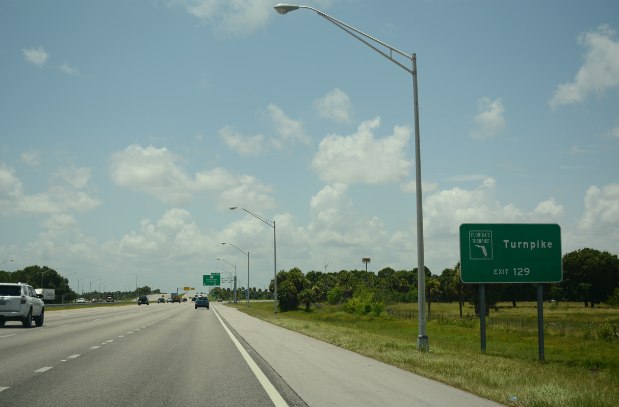
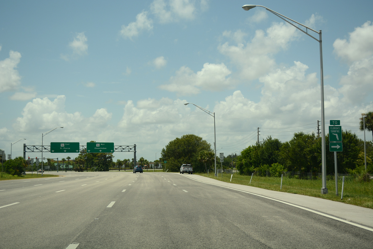
| Florida's Turnpike, which originated from I-75 at Wildwood far to the northwest, finally converges with I-95 at Fort Pierce. The Turnpike mainline travels 40 miles southeast from Yeehaw Junction in southern Osceola County and crosses paths with I-95 just south of their respective interchanges with SR 70 (Okeechobee Road). 07/27/16 |
|
| Exit 129 partitions from I-95 south with two lanes for SR 70 (Okeechobee Road). With the last section widened in 2012, the state road provides a four lane, divided highway 30 miles west from Fort Pierce to city of Okeechobee. 07/27/16 |
|
| The access road to Florida's Turnpike stems south from SR 70 (Okeechobee Road) and SR 713 (Kings Highway) in a half mile. 07/27/16 |
|
| Heading west to SR 713 (Kings Highway) and east to Orange Blossom Business Center and Virginia Avenue, Okeechobee Road comprises a six lane commercial arterial within the vicinity of I-95. 07/27/16 |
|
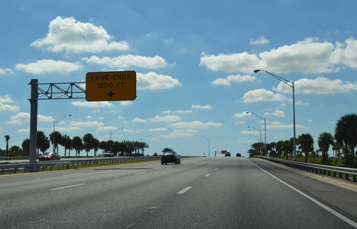
| Interstate 95 reduces from eight overall lanes to six through the exchange (Exit 129) with SR 70. 10/18/14 |
|
| Curving southwest, I-95 continues through portions of the Fort Pierce city limits to Exit 126 with Midway Road. $13.46 million in construction along this section from July 10, 2017 to Summer 2019 replaced the bridge deck in each direction across Ten Mile Creek.11 10/18/14 |
|
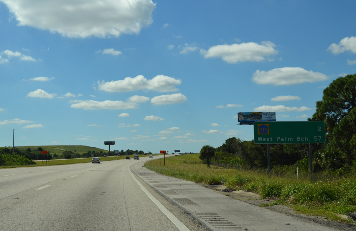
| The ensuing two mile stretch spans Florida's Turnpike and passes between Ten Mile Creek State Preserve and the St. Lucie County Sanitary Landfill. West Palm Beach is 57 miles from this point. 10/18/14 |
|
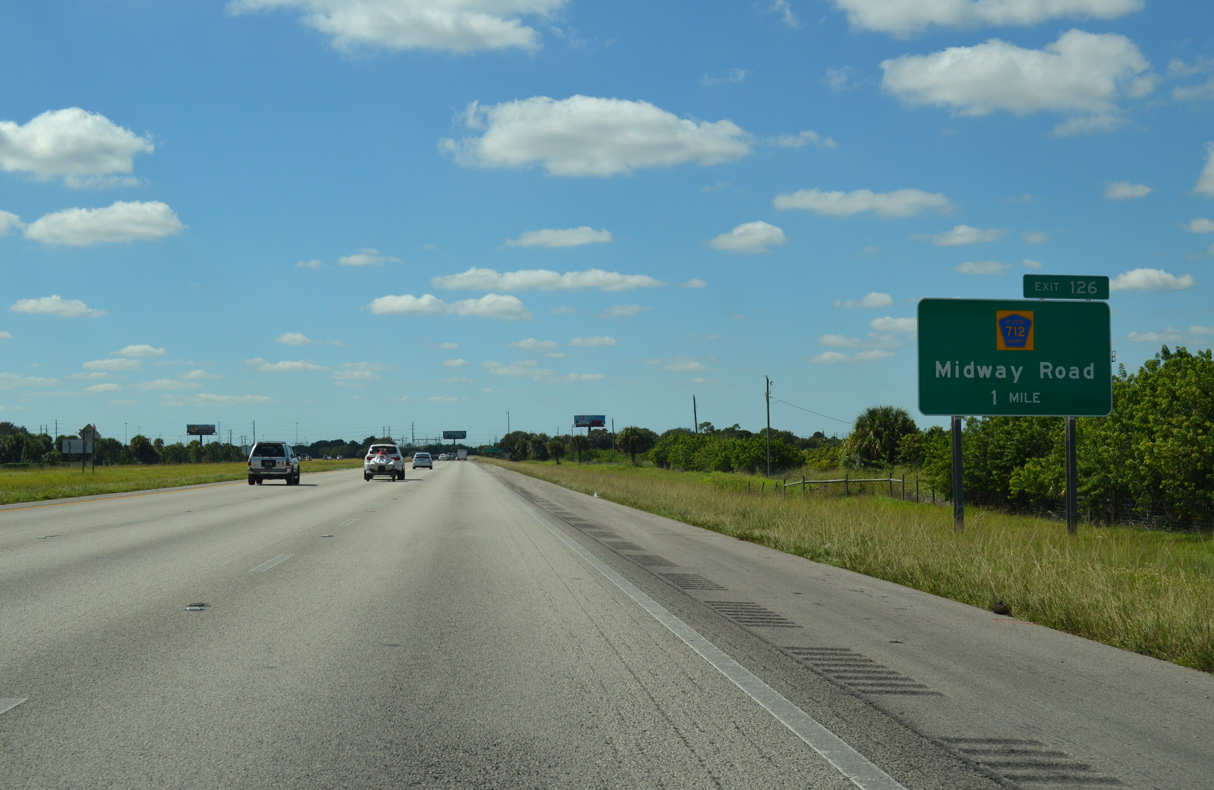
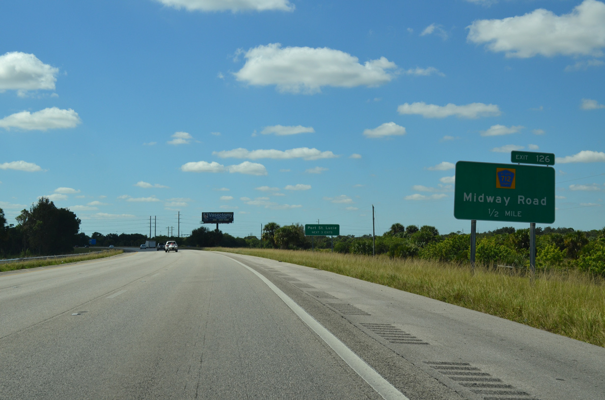
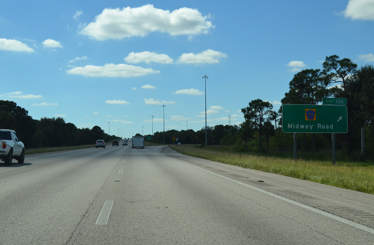
| A diamond interchange (Exit 126) joins I-95 with CR 712 (Midway Road) in one mile at the Fort Pierce and Port St. Lucie city line. 10/18/14 |
|
| County Road 712 branches east from SR 70 (Okeechobee Road) at the St. Lucie County Fairgrounds. The rural highway runs along the Port St. Lucie city line 4.7 miles east to Exit 126. 10/18/14 |
|
| East from Exit 126, CR 712 (Midway Road) travels to White City, Indian River Estates and CR 707 (Indian River Drive). The county road is 11.94 miles in length. 10/18/14 |
Page Updated 09-30-2020.

 South
South