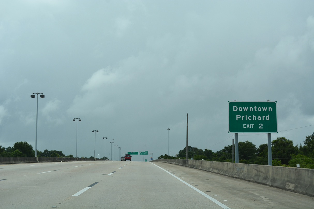
Opened to traffic October 28, 1994, Interstate 165 joins I-65 with Prichard and Downtown Mobile. The bulk of the freeway is elevated, passing over arterial streets in Prichard and wetland areas between Conception Street and the Alabama State Docks. Three lane service roads accompany I-165 between Exit 1C and Exit 2.
The alignment of Interstate 165 was originally part of a planned urban loop (I-210) connecting I-10 at the George C. Wallace Tunnel in Mobile with I-65 in Prichard. Due to the high costs for constructing an elevated roadway along Water Street through Downtown Mobile and local opposition, the portion of Interstate 210 south of Beauregard Street (U.S. 43) was dropped.
|
| Prior to 2001, U.S. 43 branched north from Conception Street Road / I-165 onto Telegraph Road to the Plateau community in Mobile. Conception Street Road leads northwest to Bay Bridge Road near the Prichard city line. 06/05/17 |
|
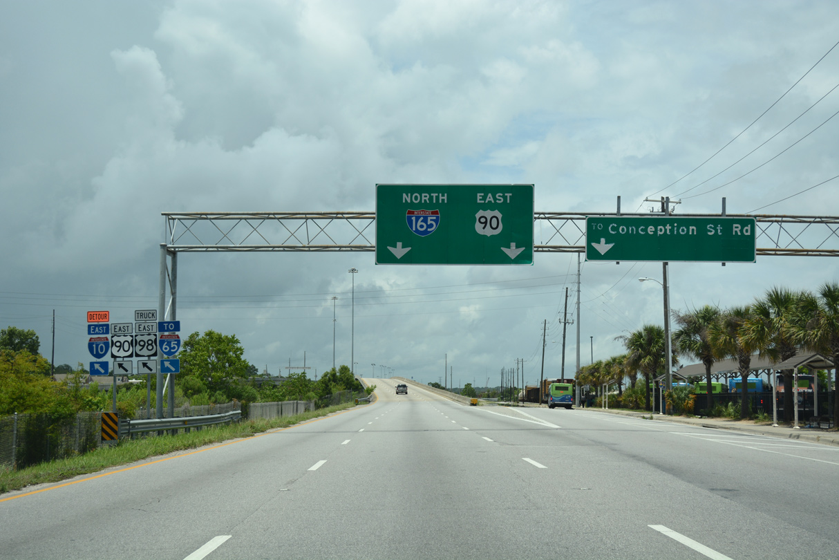
| Interstate 165 north / U.S. 90 east rise onto a viaduct crossing Conception Street Road and Alabama State Docks railroad lines. 06/05/17 |
|
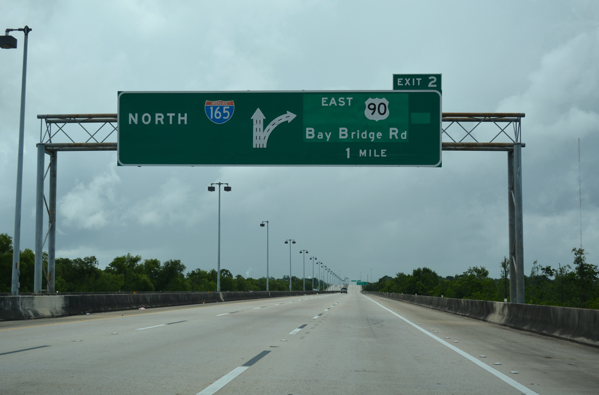
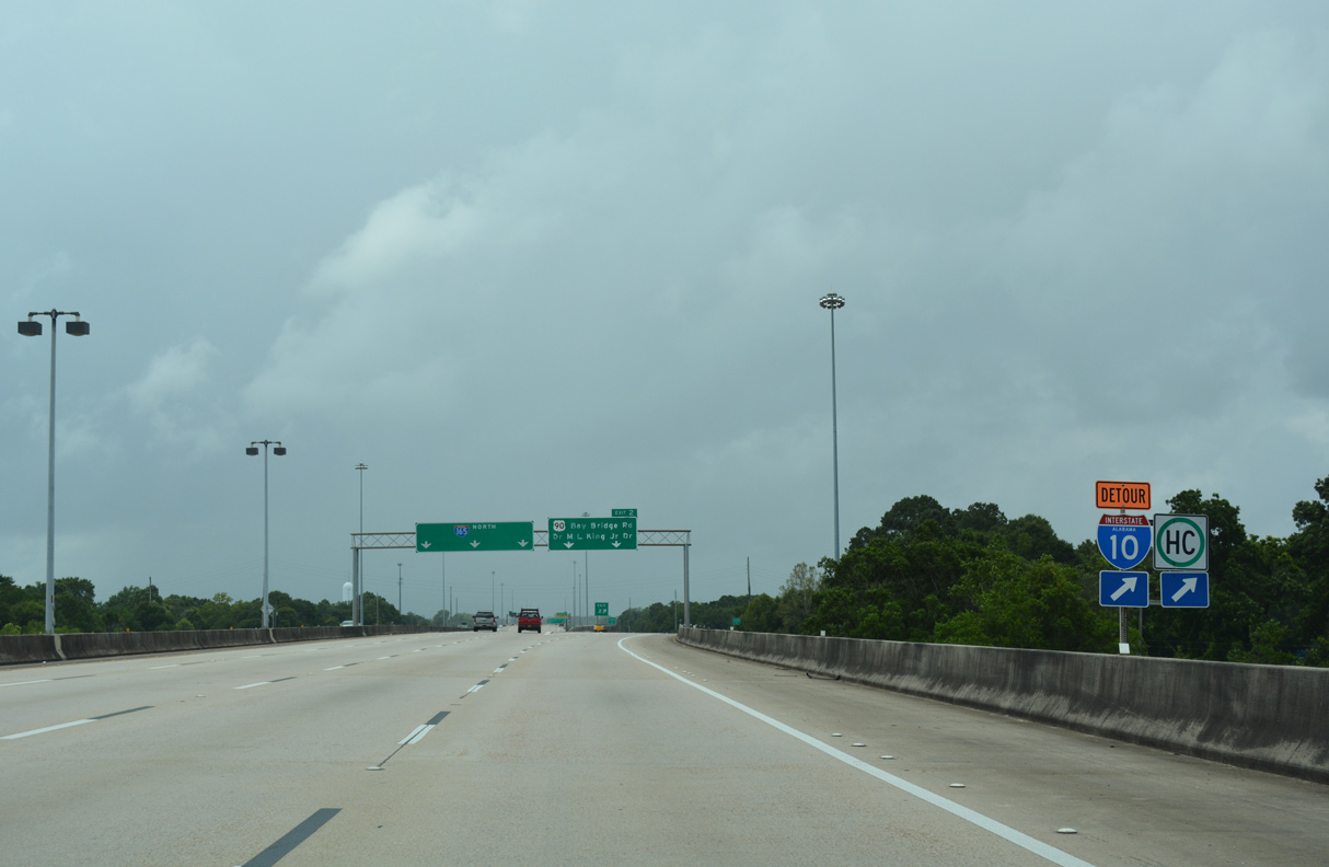
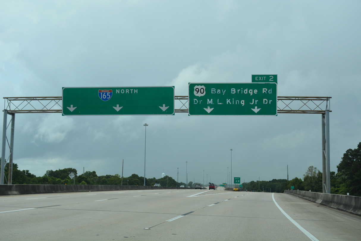
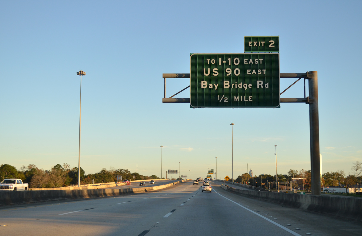
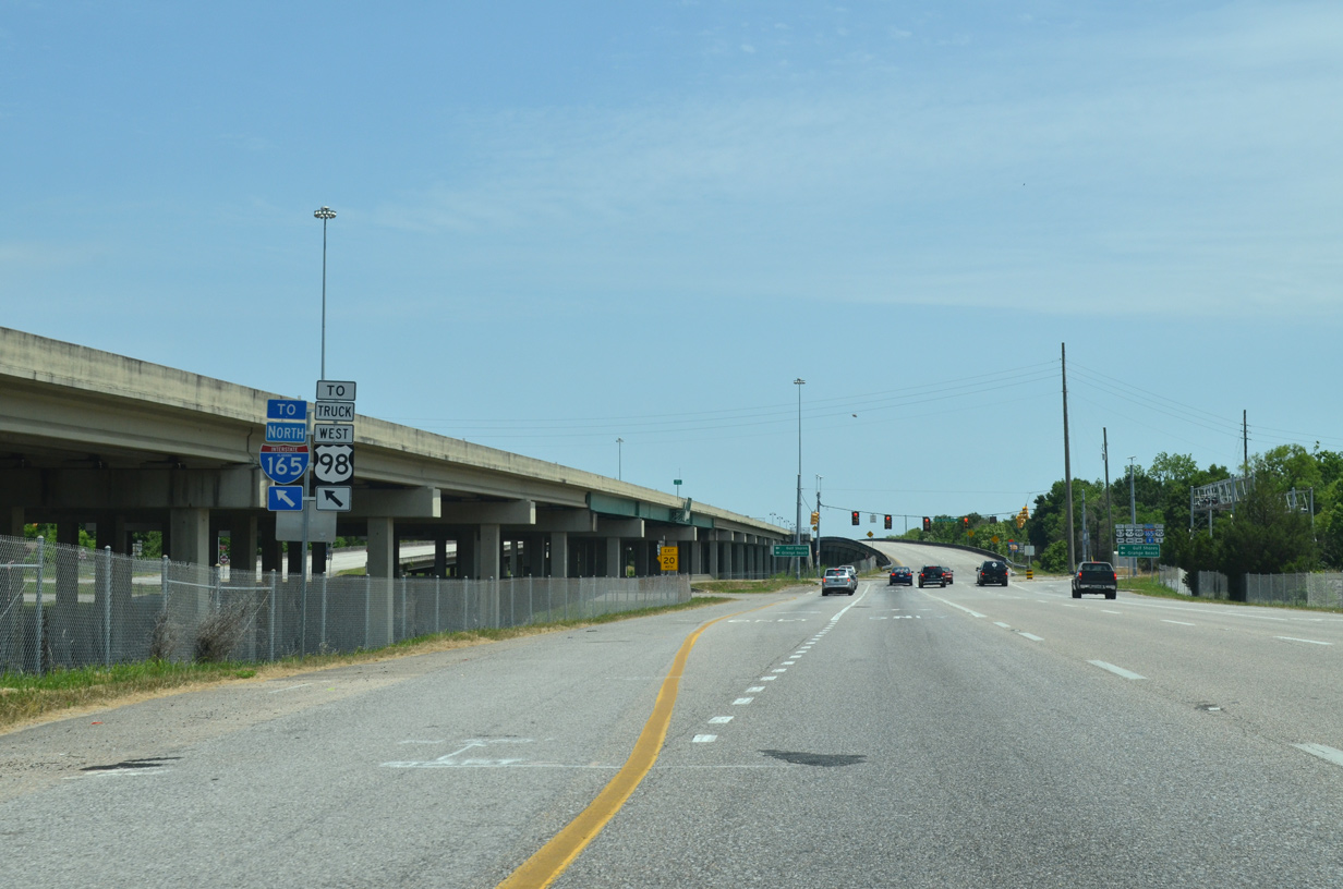
| U.S. 90 splits with I-165 north at Bay Bridge Road in one mile. Combining with U.S. 98 Truck, U.S. 90 loops southeast from Exit 2 across the Cochrane-Africatown Bridge to U.S. 98 on Blakeley Island. 06/05/17 |
|
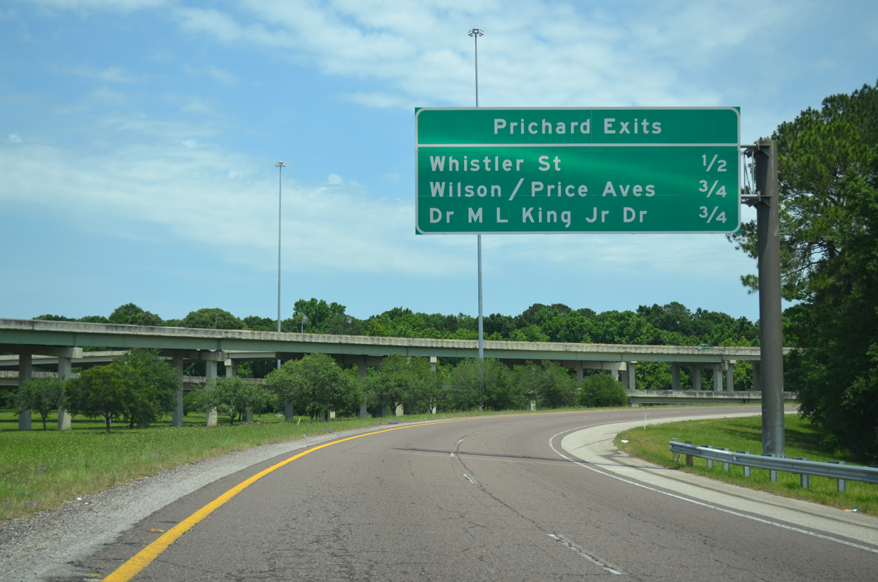
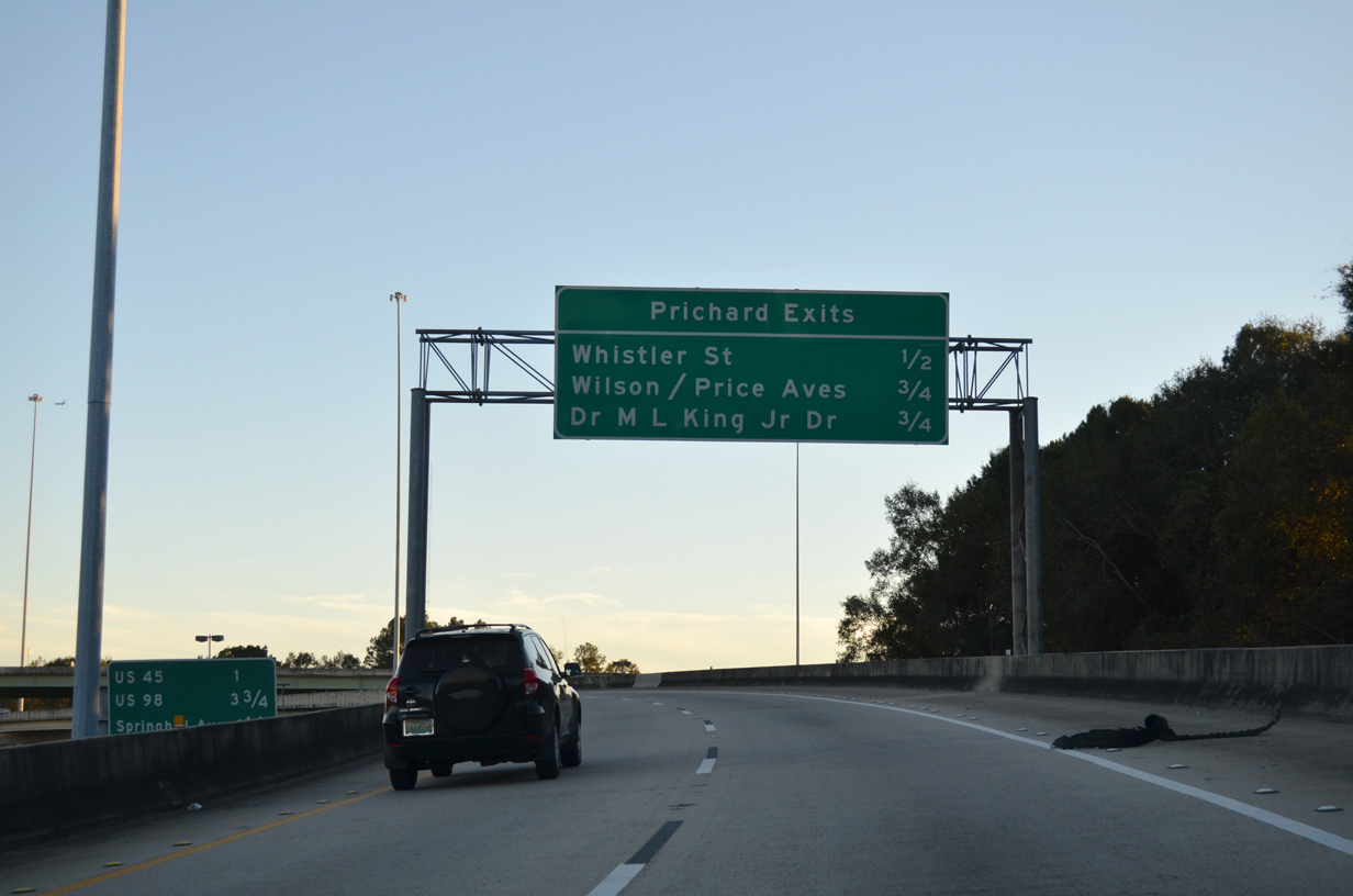
| The I-165 frontage road system extends north from Exit 2 and Bay Bridge Road to connect with Dr. Martin Luther King, Jr. Drive, Wilson Avenue, Price Avenue and Whistler Street. 06/05/17 |
|
| Bay Bridge Road west merges with S Craft Highway (old U.S. 43) west of Conception Street Road. Craft Highway connects with Dr. Martin Luther King, Jr. Drive north to Downtown Prichard. 06/05/17 |
|
| U.S. 90/98 Truck run along Bay Bridge Road east through the Plateau and Magazine sections of north Mobile. The routes are part of the Hazmat detour for the George Wallace Tunnel along I-10, 06/05/17 |
|
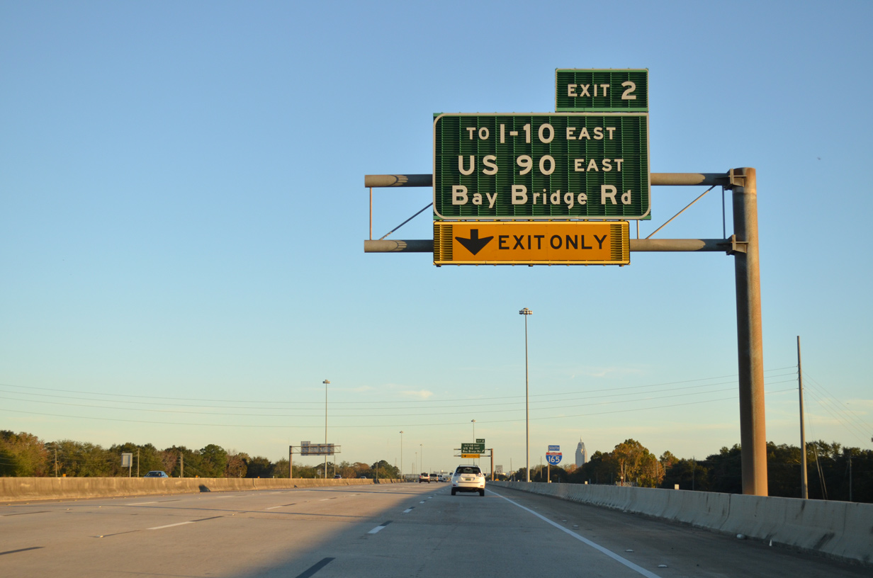
| U.S. 90 east departs from I-165 north at Exit 2. Dr. Martin Luther King, Jr. Drive continues Craft Highway north to the Summerville section of Prichard, eventually merging with Wilson Avenue (former U.S. 43 Alternate) ahead of U.S. 43 in Chickasaw. 06/05/17 |
|
| Several U-turn ramps are placed between the north and southbound service roads from Exit 2 northward. The south end of U.S. 43 is 0.6 miles east via U.S. 90 (Bay Bridge Road) east to Telegraph Road. 06/05/17 |
|
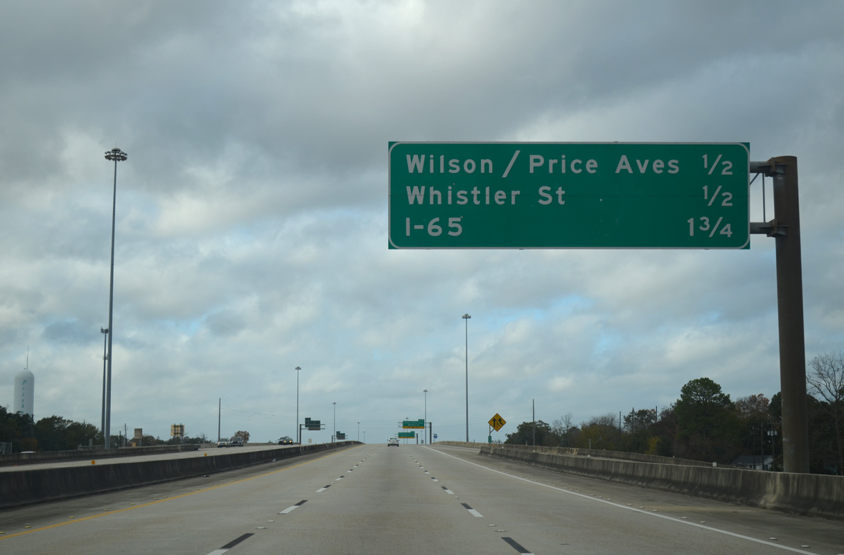
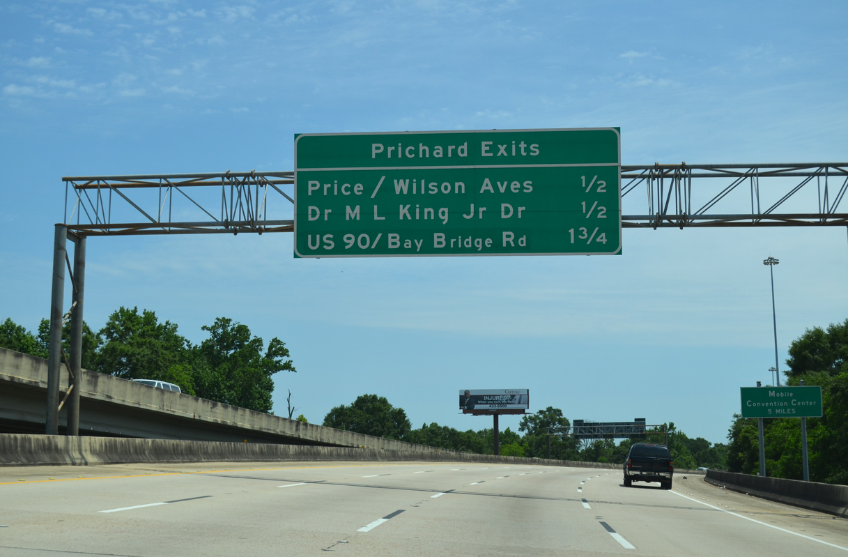
| I-165 passes over Bay Bridge Road one half mile south of the diamond interchange (Exit 1C) for Wilson Avenue, Price Avenue and Whistler Street. Despite two entries on this interchange sequence sign, only one ramp provides access to all three cross streets. 11/23/14 |
|
| An auxiliary lane opens from the Bay Bridge Road entrance ramp to Exit 1C. 11/23/14 |
|
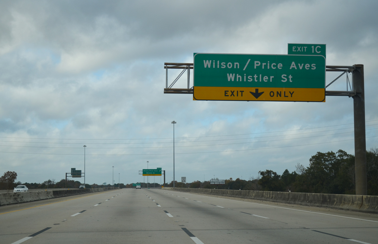
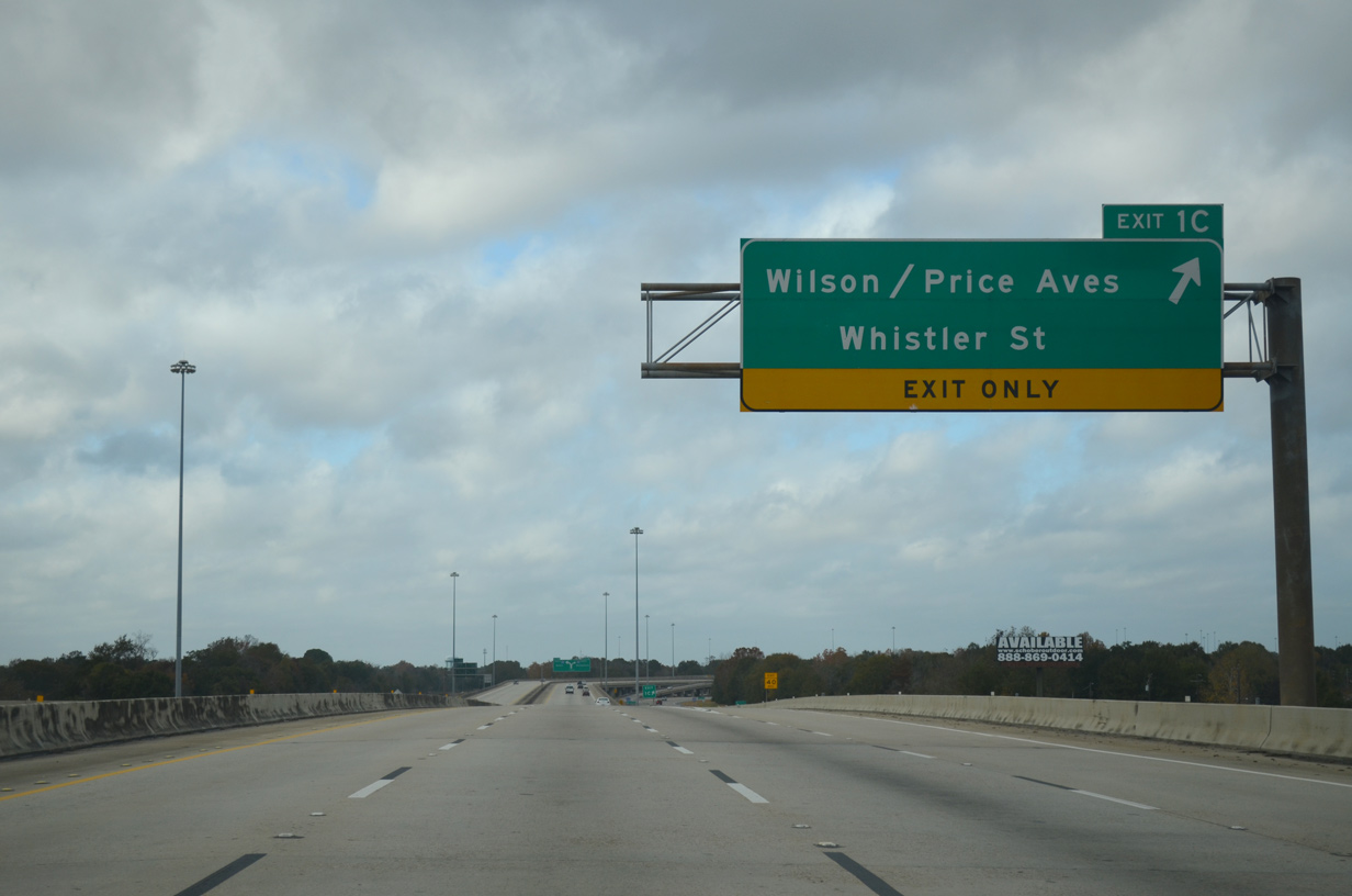
| Exit 1C connects the viaduct with the northbound service road ahead of Price Avenue and Whistler Street. A U-turn ramp connects with the southbound service road to Wilson Avenue. 11/23/14 |
|
| Leading south to U.S. 45 (St. Stephens Road) in Mobile and north to U.S. 43 in Chickasaw, Wilson Avenue (former U.S. 43 Alternate/SR 193) constitutes the main commercial route through Prichard. Price Avenue connects Mt. Cavalry Avenue with Main Street. Whistler Street provides a through road northwest from Elm Street to Wasson Avenue and SR 213 (Shelton Beach Road). 11/23/14 |
|
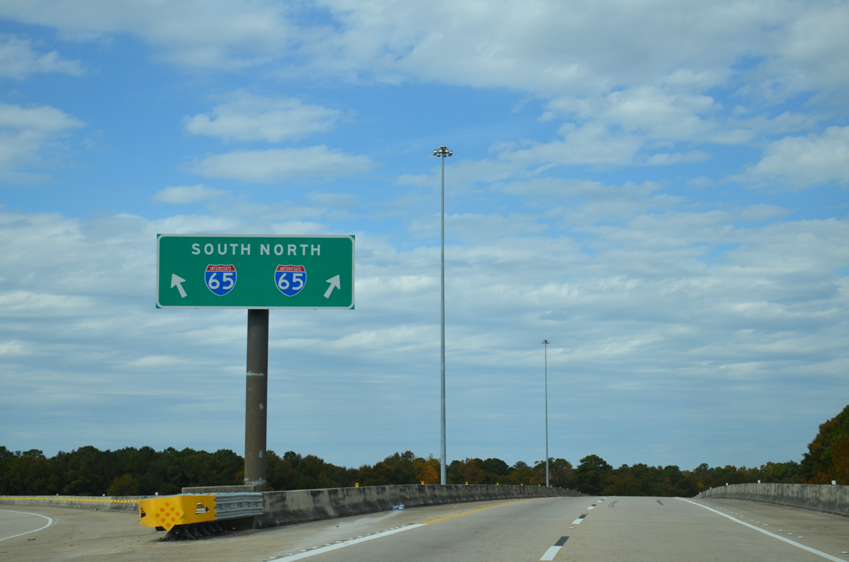
| I-165 curves northward to Exit 1B/A with Interstate 65. Entrance ramps merge from the service road, expanding the northbound roadway to four lanes. 11/25/14 |
|
| Passing over Turner Road, I-165 advances northward to the directional T interchange (Exit 1) with Interstate 65 over Gum Tree Branch. 11/25/14 |
|
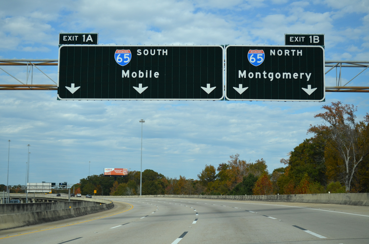
| Exit 1A provides access to I-65 south with three overall lanes to Mobile. Exit 1B joins I-65 northbound at the city of Chickasaw. 11/25/14 |
|
| I-65 ends nine miles to the south at Interstate 10 in Mobile. Montgomery is 162 miles to the northeast. 11/25/14 |
|
| An interchange sequence sign appears along the ramp from I-65 north to I-165 south outlining the distances to Exit 1A (Whistler Street) and Exit 1B for Wilson Avenue, Price Avenue and Dr. Martin Luther King, Jr. Drive within the city of Prichard. 05/15/16 |
|
| Interchange sequence sign for Prichard along the flyover joining I-65 south with Interstate 165. 11/20/15 |
|
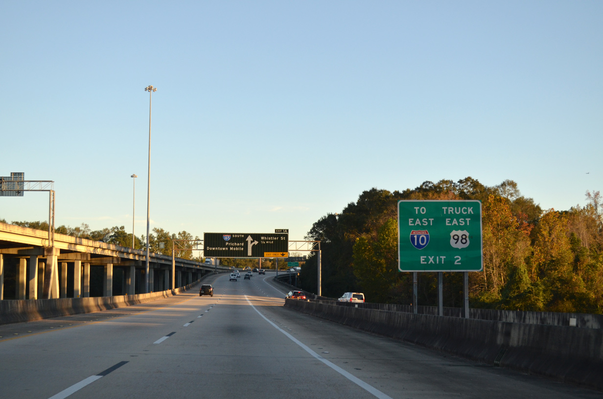
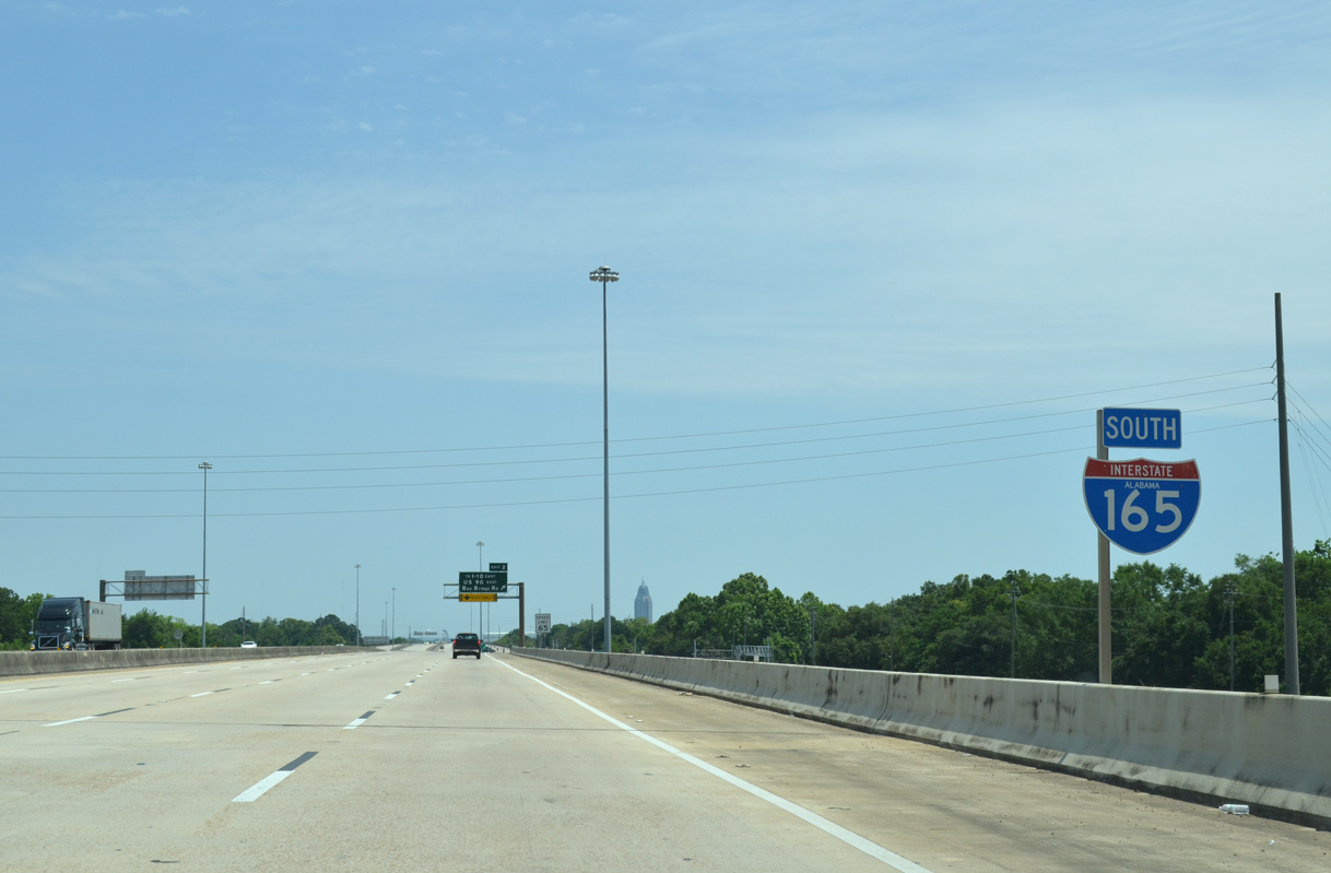
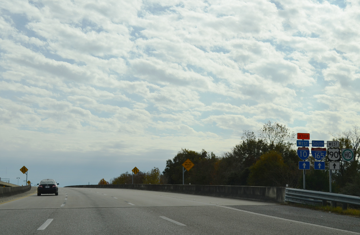
| The Truck route for U.S. 98 accompanies I-165 south from I-65 to U.S. 90 (Bay Bridge Road) at Exit 2. Hazardous materials cargo is prohibited from the Bankhead and George C. Wallace Tunnels under the Mobile River. 11/20/15 |
|
| Ramps from Interstate 65 converge a quarter mile ahead of the two lane off-ramp (Exit 1A) for Whistler Street. 05/15/16 |
|
| Interstate 165 turns southeast across Gum Tree Branch and Turner Road a half mile ahead of Exit 1B for Price and Wilson Avenues. Exit 1A departs next for Whistler Street. 05/15/16 |
|
| The I-165 service road system extends south from Exit 1A at Whistler Street to U.S. 90 (Bay Bridge Road). Whistler Street parallels the viaduct east to Elm Street and Wilson Avenue. Heading northwest, the street continues to Chickasabogue Park, Wasson Avenue to Chickasaw, and SR 213 (Shelton Beach Road). 05/15/16 |
|
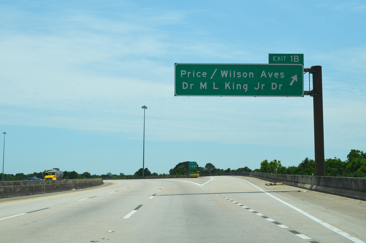
| Exit 1B lowers from I-165 south to a U-turn ramp for Price Avenue, and the service road to Wilson Avenue and Dr. Martin Luther King, Jr. Drive. Wilson Avenue angles south through Downtown Prichard. 05/15/16 |
|
| Price Avenue leads southwest from I-165 to Main Street. A historic alignment of U.S. 43, Dr. Martin Luther King, Jr. Drive parallels Wilson Avenue to the east. 05/15/16 |
|
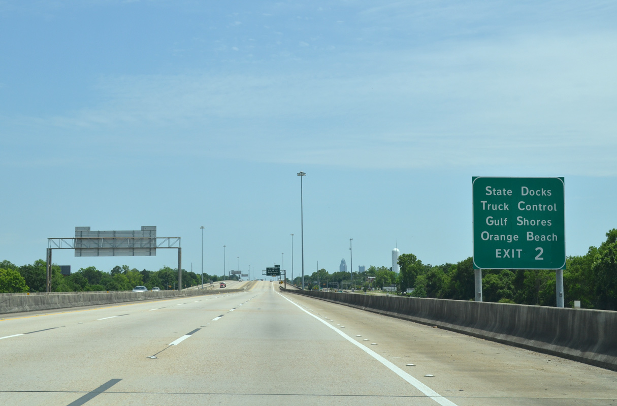
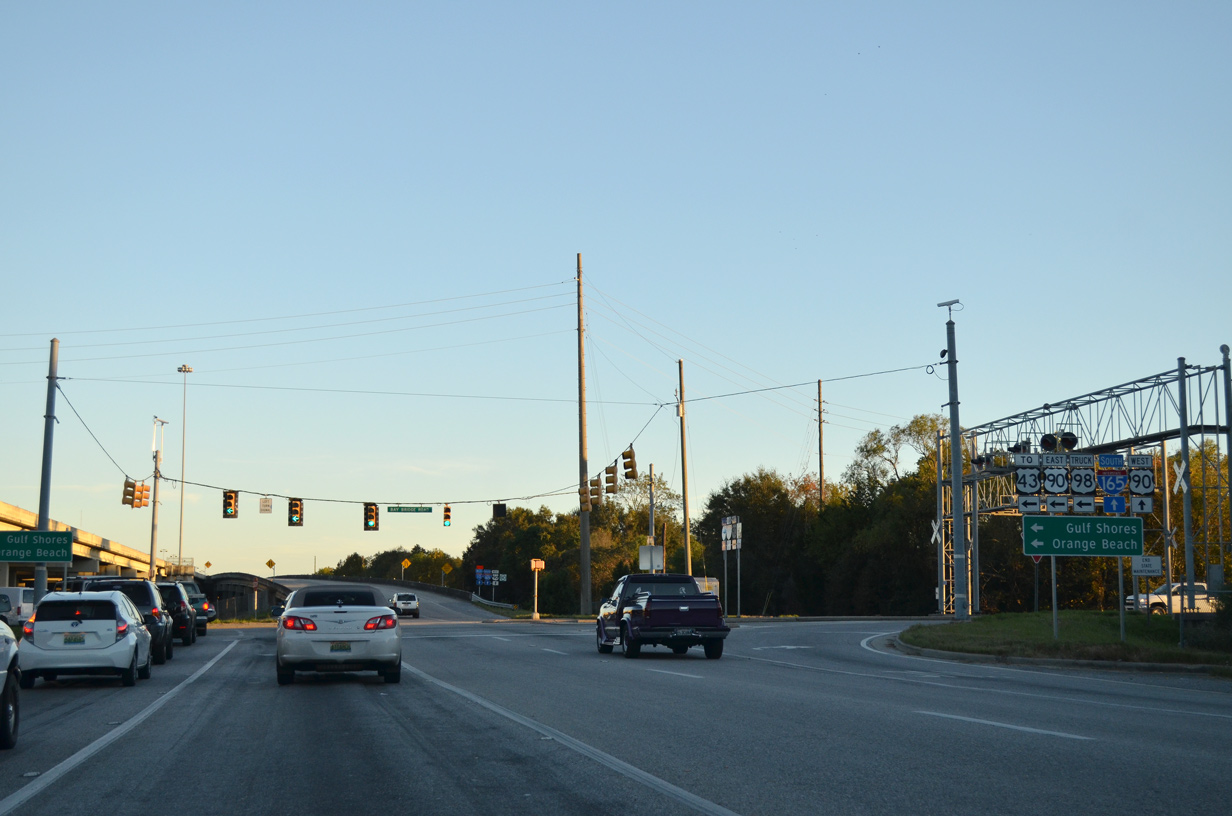
| Exit 2 serves the Alabama State Docks Truck Control in addition to providing an alternate route for I-10 east to the Gulf Shores and Orange Beach in Baldwin County. 05/15/16 |
|
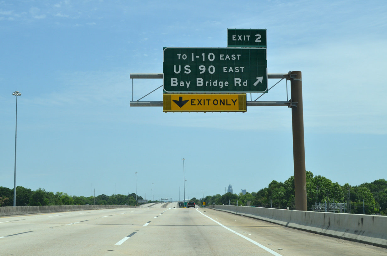
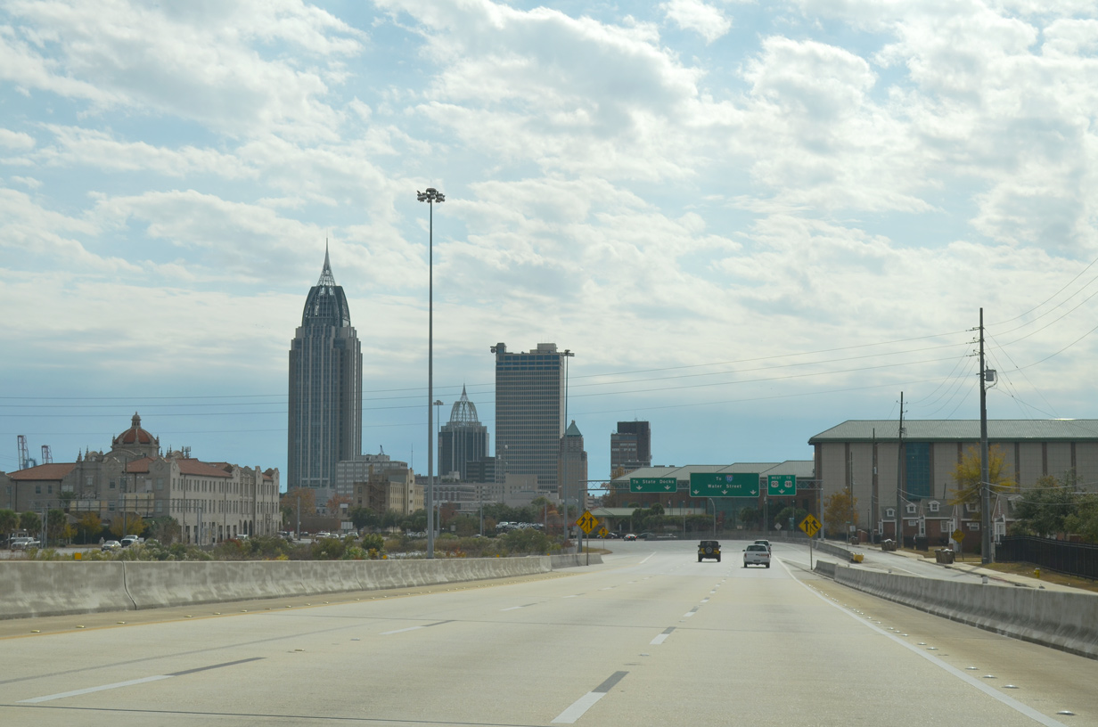
| Continuing south, I-165 travels a linear route to Exit 2 (U.S. 90/98 Truck) and the merge with Conception Street Road in Mobile. 11/20/15 |
|
| U.S. 90 was relocated from an overlap with U.S. 98 along Government Street in 1999 to loop north along Broad Street, Beauregard Street, I-165, Bay Bridge Road, the Cochrane-Africatown Bridge and Cochrane Causeway. 11/20/15 |
|
| Southbound confirming marker for Interstate 165 posted above Dr. Martin Luther King, Jr. Drive. 05/15/16 |
|
| Exit 2 leaves I-165 south for the parallel frontage road, one fifth of a mile ahead of U.S. 90/98 Truck (Bay Bridge Road). Bay Bridge Road stems east from S Craft Highway near Downtown Prichard to the Plateau and Magazine sections in north Mobile. 05/15/16 |
|
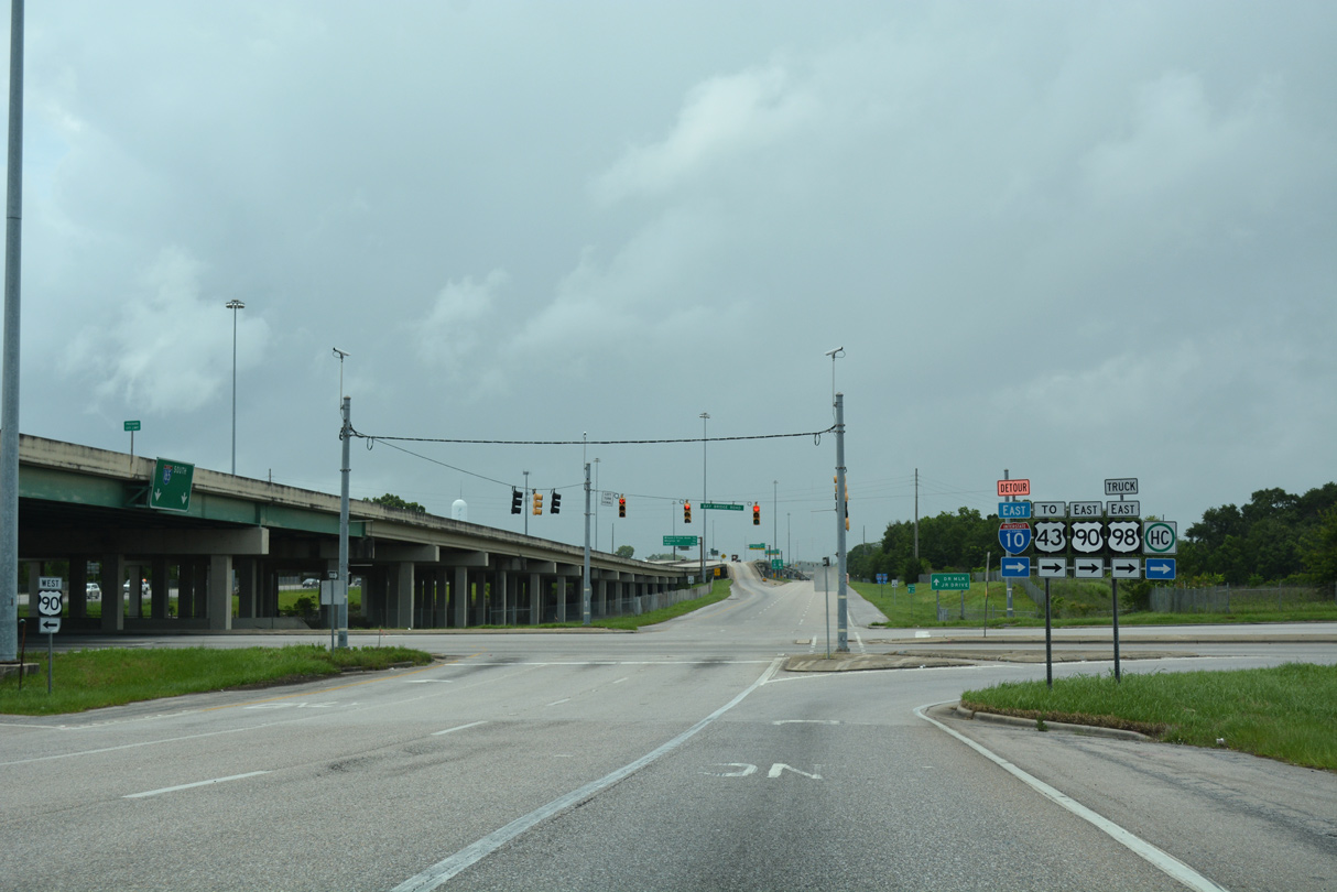
| A pair of turn lanes connect the service road with U.S. 90/98 Truck east to the Cochrane-Africatown Bridge. Bay Bridge Road west meets Conception Street Road south and Craft Highway within one quarter mile. Craft Highway was a part of U.S. 43 until 1947. 05/15/16 |
|
| The south end of U.S. 43 is two thirds of a mile east from I-165 at the one-quadrant interchange joining Bay Bridge Road with Telegraph Road. The route formerly extended south on Telegraph Road to I-165 at Water Street. 11/20/15 |
|
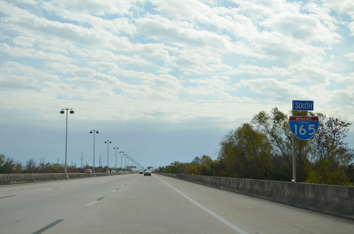
| U.S. 90 west combines with the remainder of Interstate 165 south. 11/25/14 |
|
| Interstate 165 south enters the city of Mobile above Bay Bridge Road. 11/25/14 |
|
| Paralleling a State Docks railroad line and Conception Street Road nearby, the six lane viaduct continues over wetlands associated with Three Mile Creek. 11/25/14 |
|
| Interstate 165 turns southward over Alabama State Docks railroad lines to run alongside Conception Street Road one mile south to Beauregard and Water Streets. 11/25/14 |
|
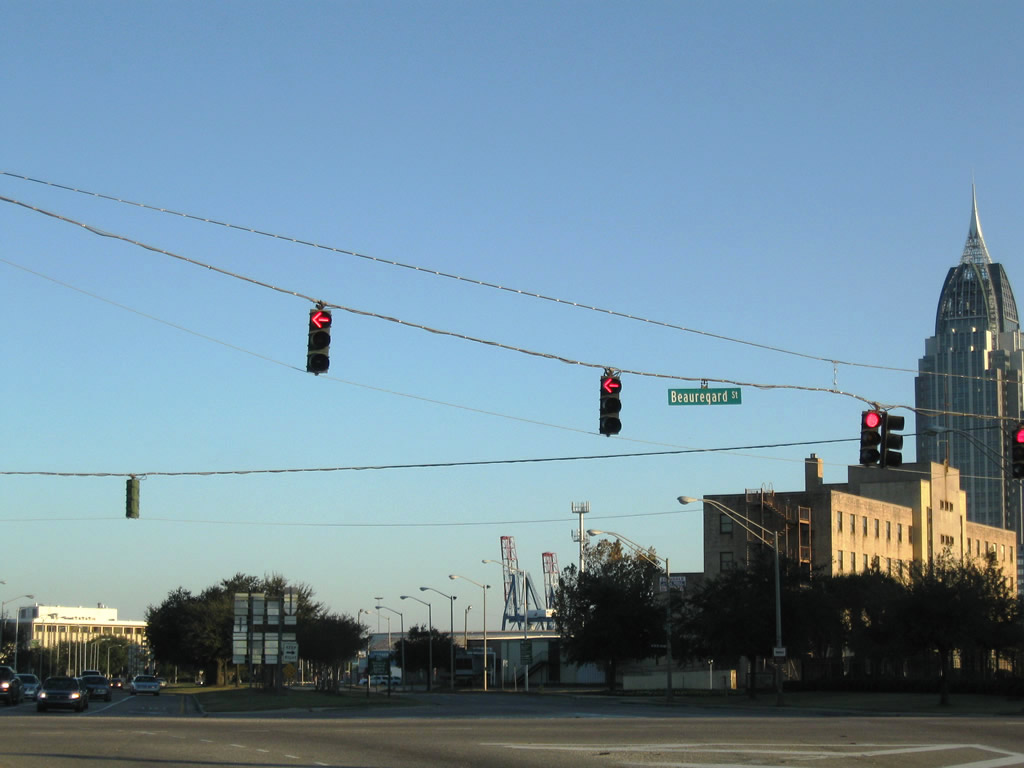
| U.S. 90/98 Truck turn west from I-165 onto Beauregard Street to Broad Street and U.S. 98 (Spring Hill Avenue). Water Street extends south to Downtown Mobile and the Arthur R. Outlaw Mobile Convention Center. 11/25/14 |
|
| Roadways of Interstate 165 expanded to accommodate the former southbound entrance ramp from Telegraph Road (old U.S. 43). 11/25/14 |
|
| I-165/U.S. 90 south lower to grade level ahead of the traffic light with Beauregard and Water Streets west of the GM&O Transit Center and Alabama State Docks. 11/25/14 |
|
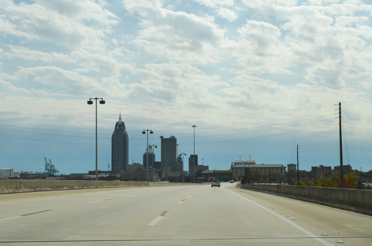
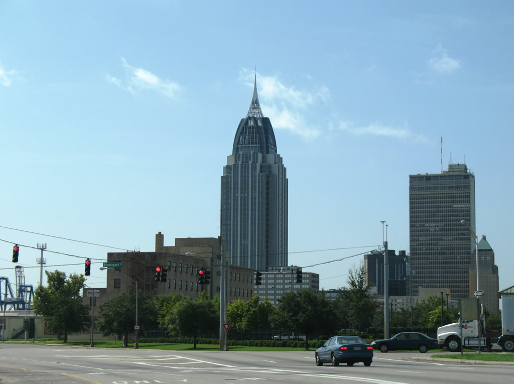
| RSA Tower, completed in 2006, represents the highest skyscraper in Alabama. It replaced the GM Building (formerly the AmSouth Bank Building) as the tallest building in Mobile. 11/25/14 |
|
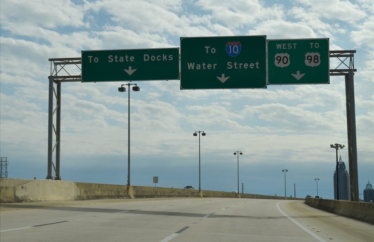
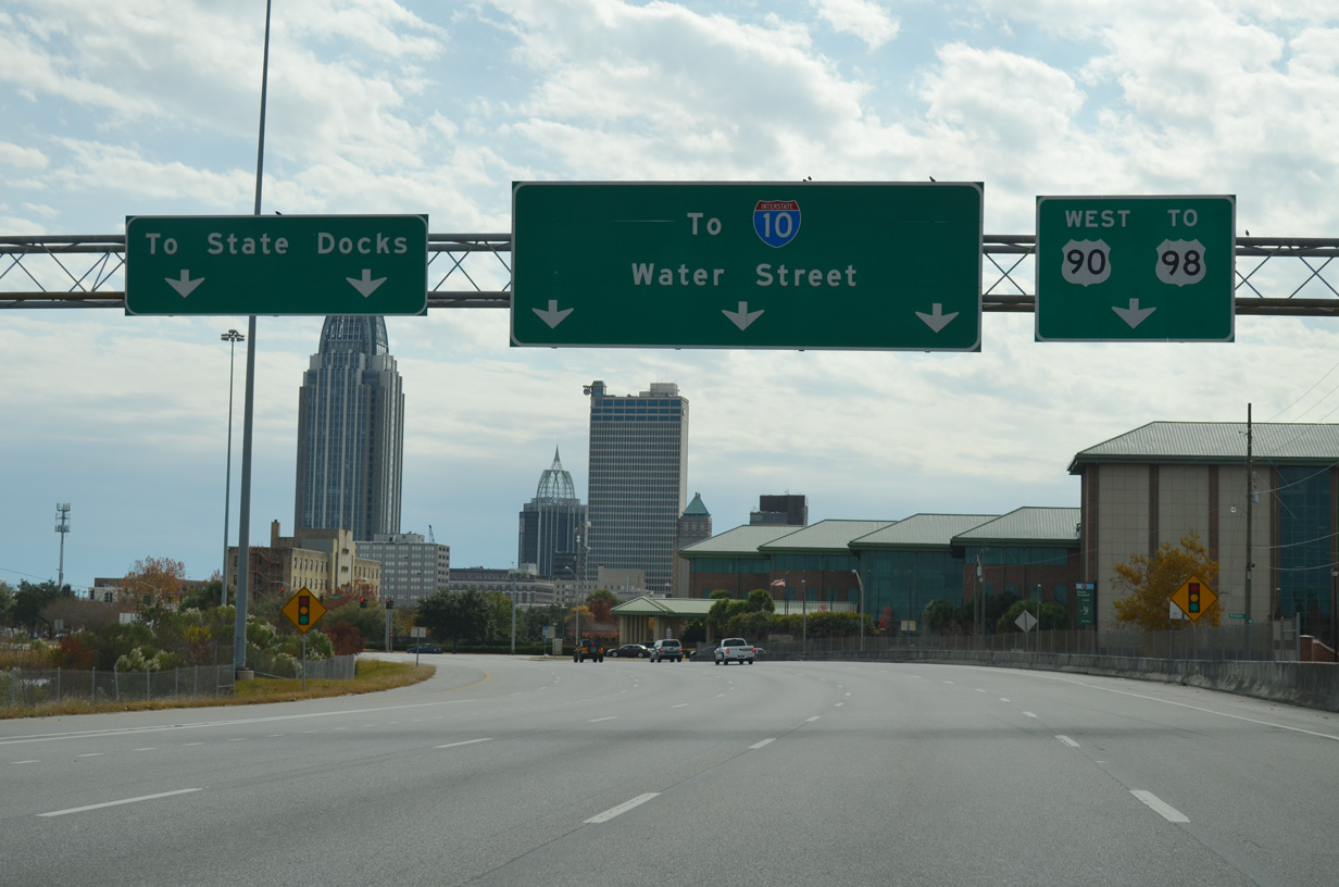
| Expanding the southbound roadway to six lanes, Conception Street Road merges with I-165/U.S. 90 across from a U-turn ramp formerly bringing U.S. 43 south onto Water Street. Formerly a six lane boulevard, Water Street leads south to I-10 at Exit 26B outside the George C. Wallace Tunnel. 11/23/14 |
|
| U.S. 90/98 Truck turn west onto Beauregard Street to Bishop State Community College and U.S. 98 (Spring Hill Avenue). Water Street runs along the Mobile Riverfront to I-10 and Canal Street.. The two streets constitute one half of the Henry Aaron Loop encircling Downtown Mobile along with Broad and Canal Streets. 07/17/07, 11/21/08 |
Photo Credits:07/17/07, 11/21/08, 11/23/14, 11/25/14, 11/20/15, 05/15/16, 06/05/17 by AARoads
Connect with:
Interstate 65
U.S. 90
U.S. 98
Page Updated 11-25-2020.


 North
North  East
East