|
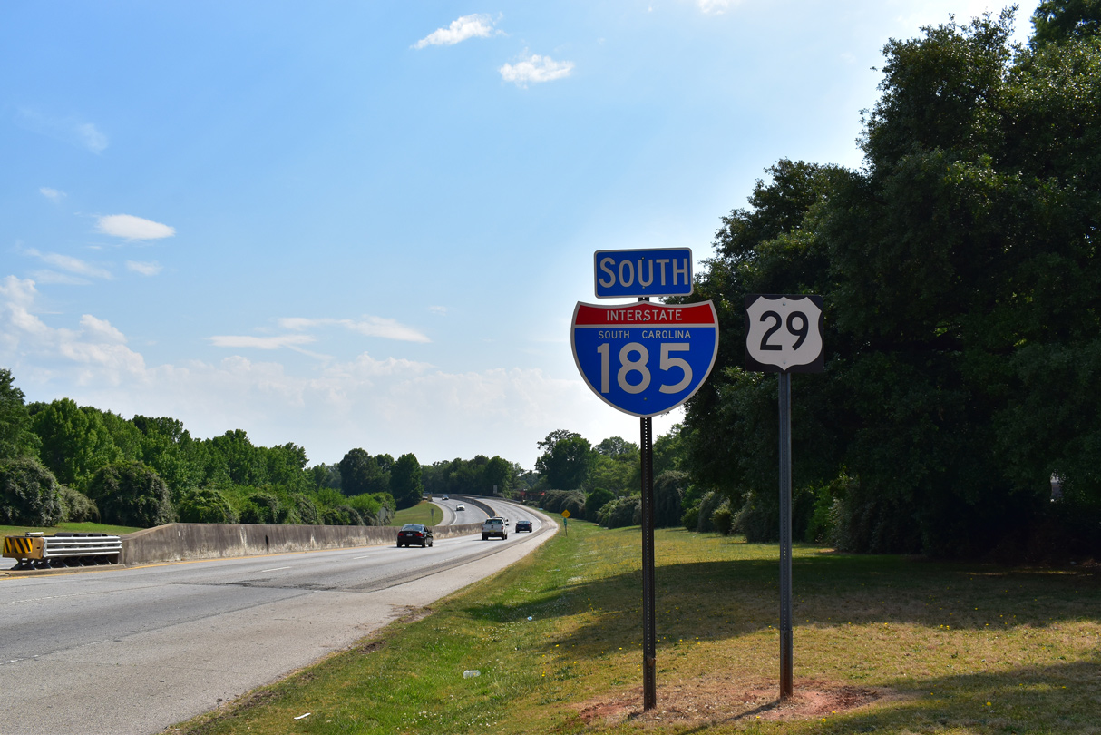
| U.S. 29 (Mills Avenue) transitions into Interstate 185 south beyond Henrydale Avenue at the community of Dunean. 05/25/21 |
|
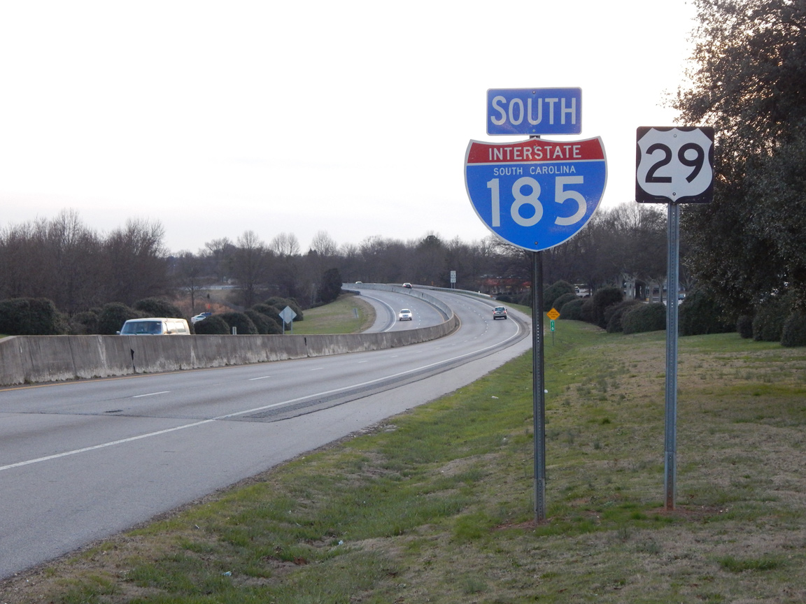
| The first shield for Interstate 185 south stands adjacent to a shopping center off Marue Drive. 01/14/16 |
|
| The spur along I-185 southwest from Greenville was completed in 1959 and previously designated as U.S. 29 Business. 05/25/21 |
|
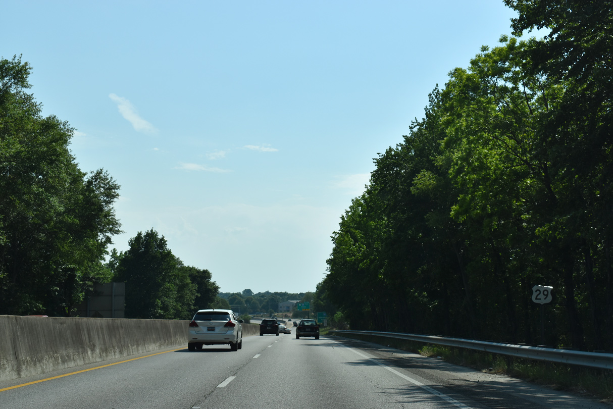
| I-185/U.S. 29 span W Faris Road (Road 149) a half mile from the wye interchange (Exit 14) with adjacent S.C. 20 (Grove Road). 05/25/21 |
|
| S.C. 20 (Grove Road) parallels I-185/U.S. 29 south to U.S. 25 (White Horse Road) between Gantt and White Horse. 07/23/04 |
|
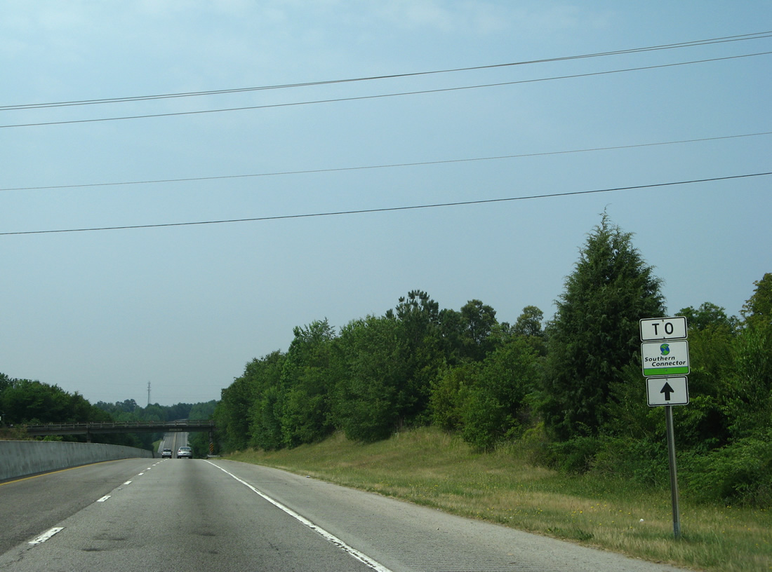
| Removed by 2021, a trailblazer for the tolled Southern Connector toll road preceded the Butternut Road overpass along I-185/U.S. 29 south. 05/31/07 |
|
| S.C. 20 follows the pre-freeway alignment of U.S. 29 south from Greenville along Grove Road and Piedmont Highway. S.C. 20 meets I-185 along the Southern Connector while en route to Piedmont. 05/25/21 |
|
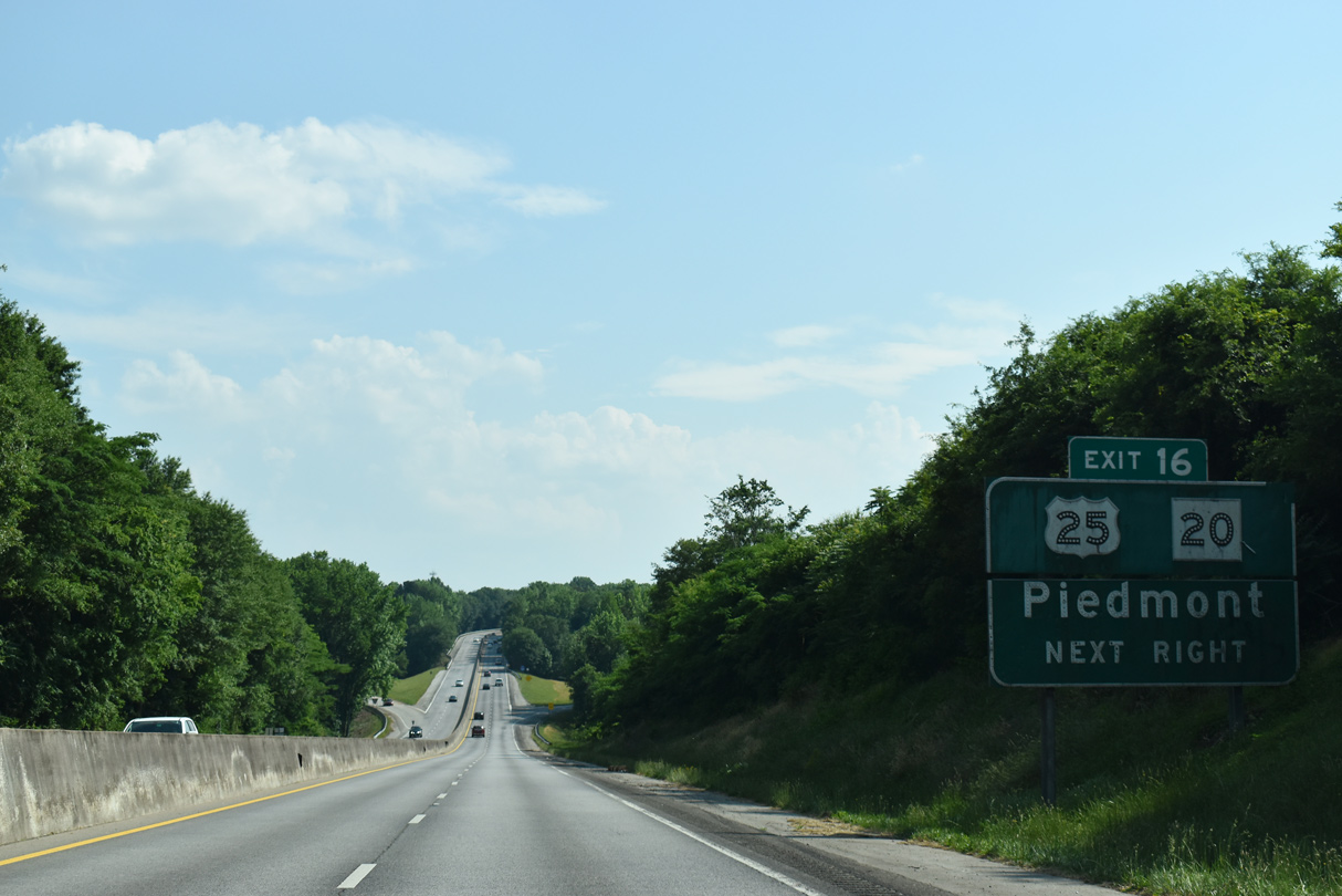
| I-185/U.S. 29 shift westward over Old Piedmont Highway and a Norfolk Southern Railroad line to the half diamond interchange with U.S. 25 (White Horse Road). 05/25/21 |
|
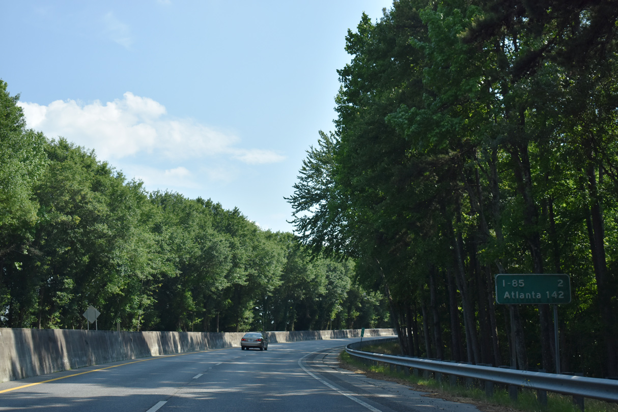
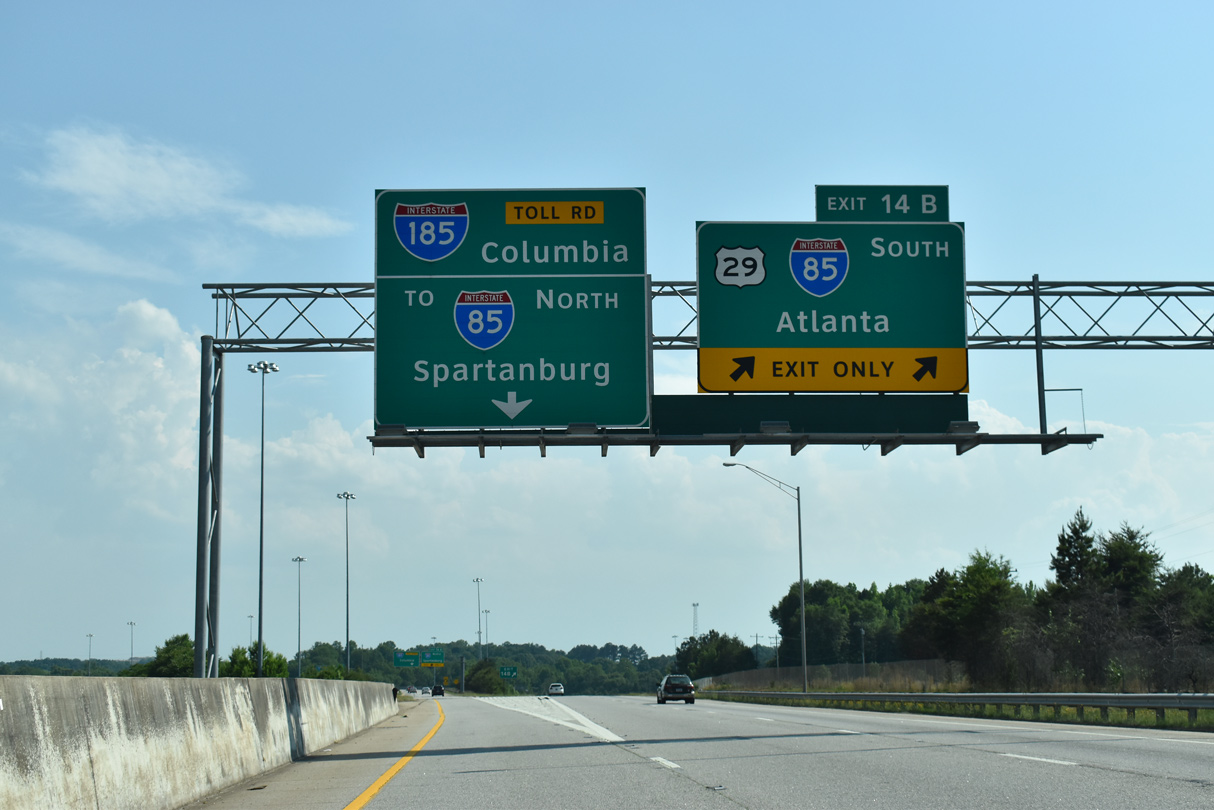
| Button copy sign posted two miles north of Exit 14 to Interstate 85 and 142 miles from Atlanta, Georgia. 05/25/21 |
|
| A lone U.S. 29 shield assembly follows the entrance ramp from U.S. 25 (White Horse Road) and the CSX Railroad / Frontage Road underpass. 05/25/21 |
|
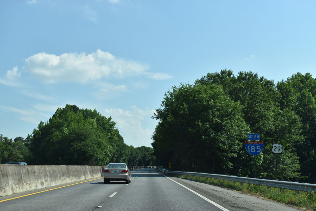
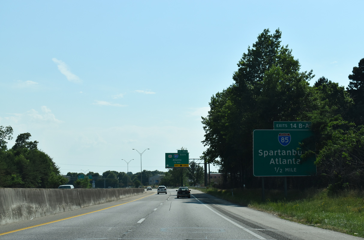
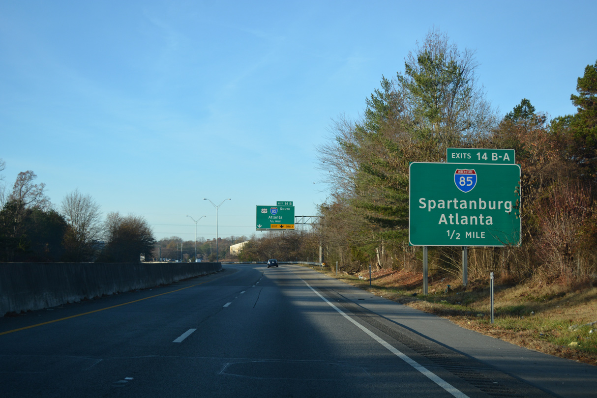
| I-185/U.S. 29 converge with Interstate 85 at a directional cloverleaf interchange (Exits 14 B/A) in a half mile. 05/25/21 |
|
| U.S. 29 combines with Interstate 85 south for 7.60 miles along part of the expressway completed in 1959. 12/15/16 |
|
| Interstate 85 constitutes a six lane freeway southwest to Exit 19 with U.S. 76/SC 28. 05/25/21 |
|
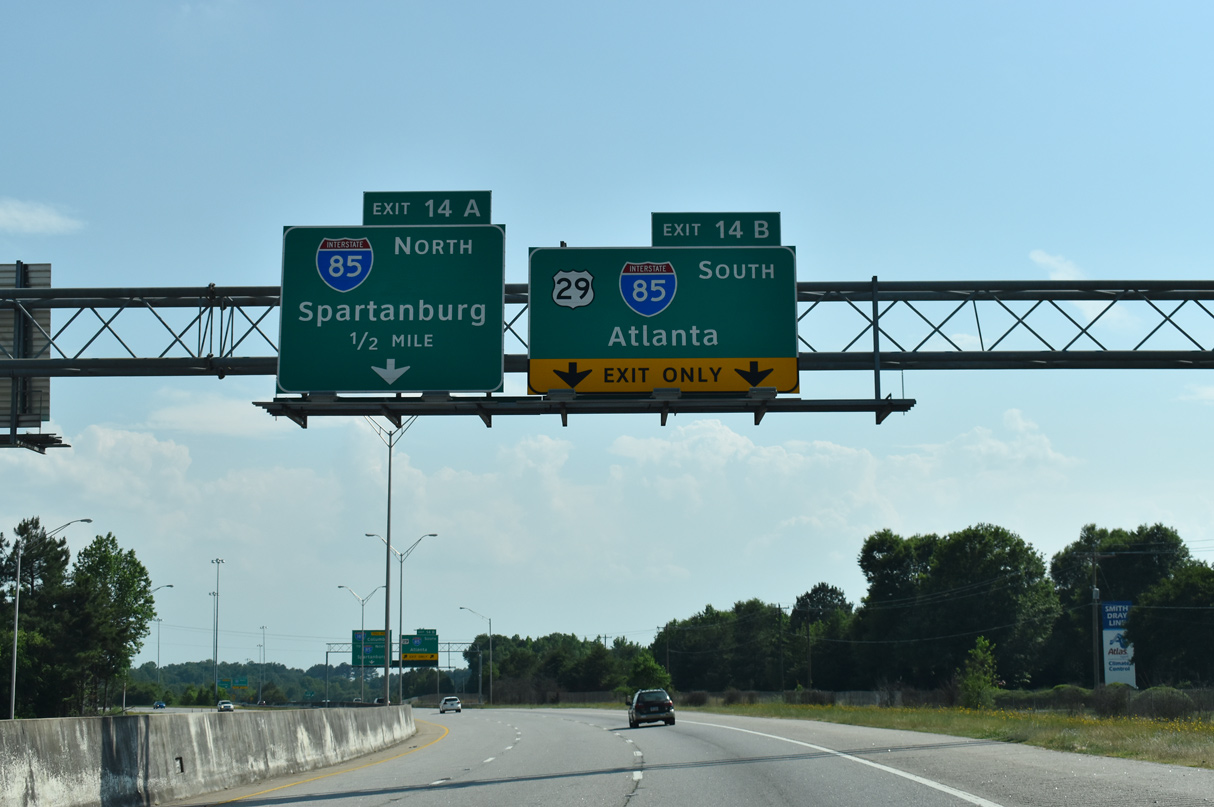
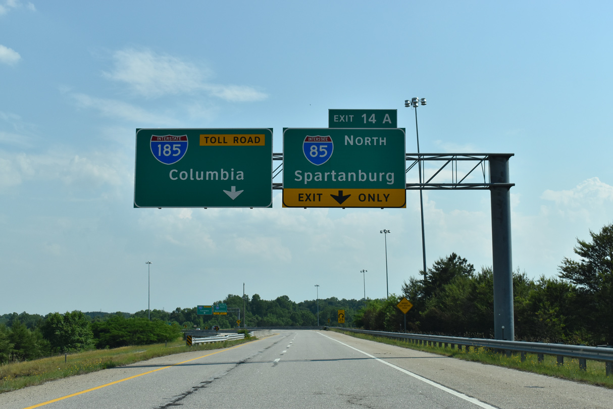
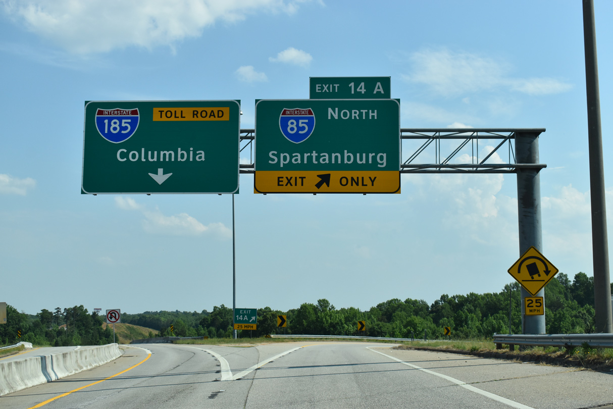
| A loop ramp (Exit 14A) links I-185/U.S. 29 south with Interstate 85 north for Spartanburg, Gastonia, and Charlotte, North Carolina in a half mile. 05/25/21 |
|
| U.S. 29 branches southwest from I-85 through Anderson, 25 miles away. U.S. 29 continues west from there to Athens, Georgia before returning to the I-85 corridor at Lawrenceville. 05/25/21 |
|
| I-185 reduces to a single through lane ahead of Exit 14A to Interstate 85 north. The freeway originally ended at a wye interchange with access only to I-85 south. Expansion of the exchange with northbound access to I-85 was completed in 1999. 05/25/21 |
|
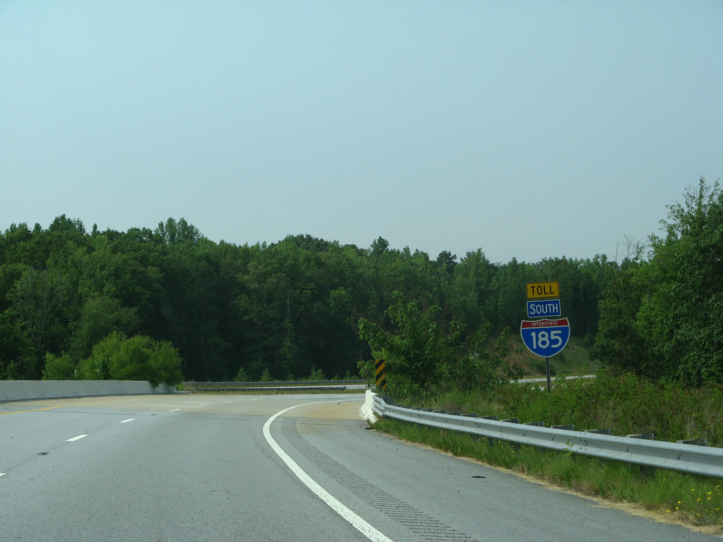
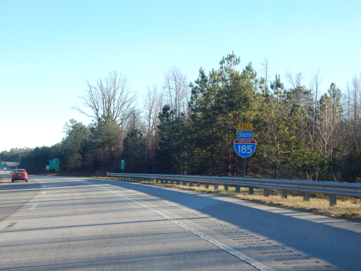
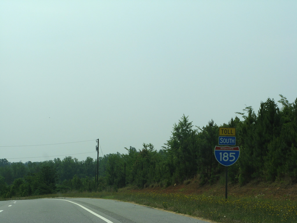
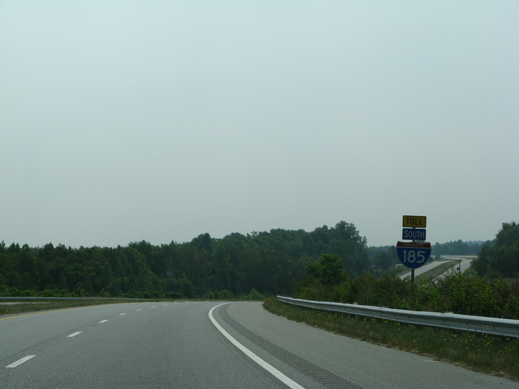
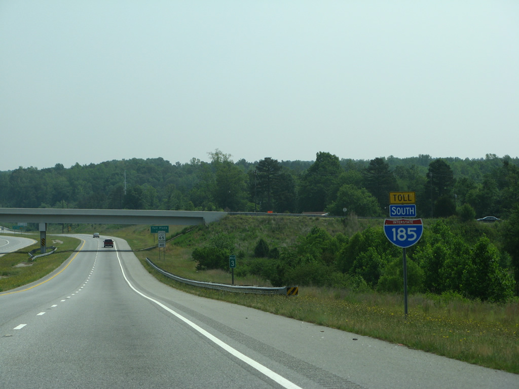
| Exit 14A leaves Interstates 185 south as the South Connector begins. The 13.69 mile long toll road east to Mauldin opened to traffic on February 27, 2001. 05/25/21 |
|
| Toll banners accompany Interstate 185 shield assemblies along the Southern Connector. This assembly precedes the Stables Road underpass. 05/31/07 |
|
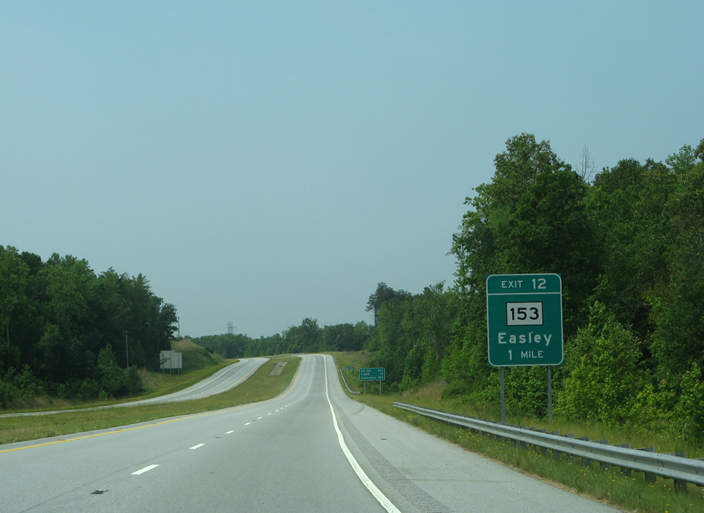
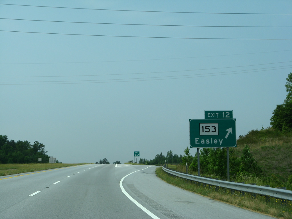
| Interstate 185 runs between the Saluda River and Lakeside Quarry southwest to a parclo interchange (Exit 12) with S.C. 153 north and Brown Road east. 05/31/07 |
|
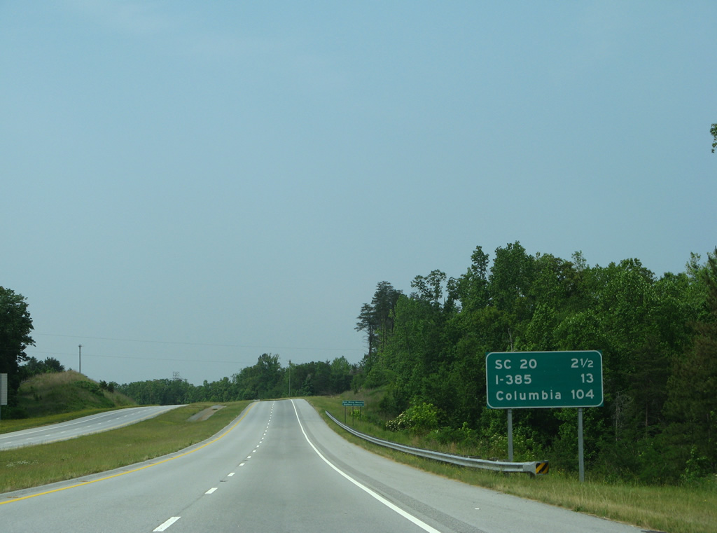
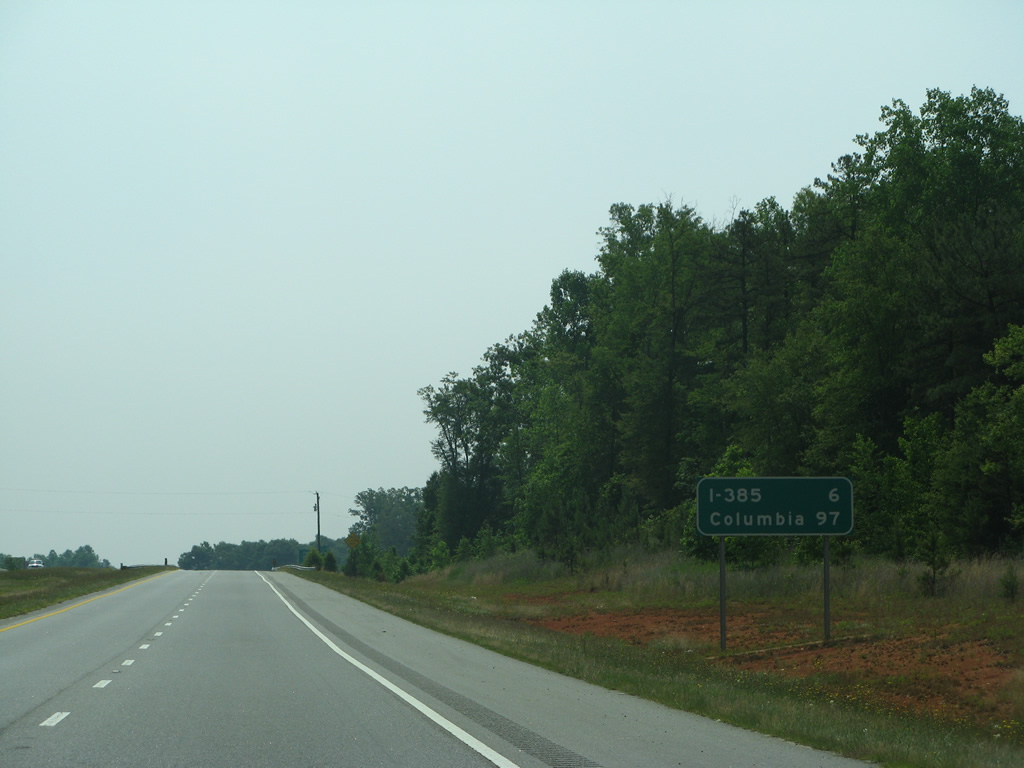
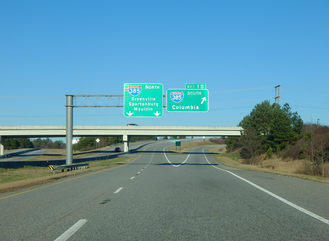
| I-185 (Southern Connector) curves eastward 13 miles to I-385. Columbia is 104 miles away via I-385 south and I-26 east. 05/31/07 |
|
| The Southern Connector 1.26 miles south from the exchange with I-85 and Exit 12 to S.C. 153 is toll free. 05/31/07 |
|
| S.C. 153 was extended 1.44 miles east from Interstate 85 to I-185 and Brown Road when the Southern Connector was constructed. The 7.11 mile long highway angles northwest to Powderville and U.S. 123 (Calhoun Memorial Highway) outside Easley. 05/31/07 |
|
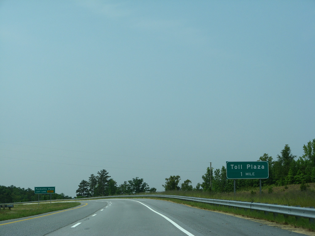
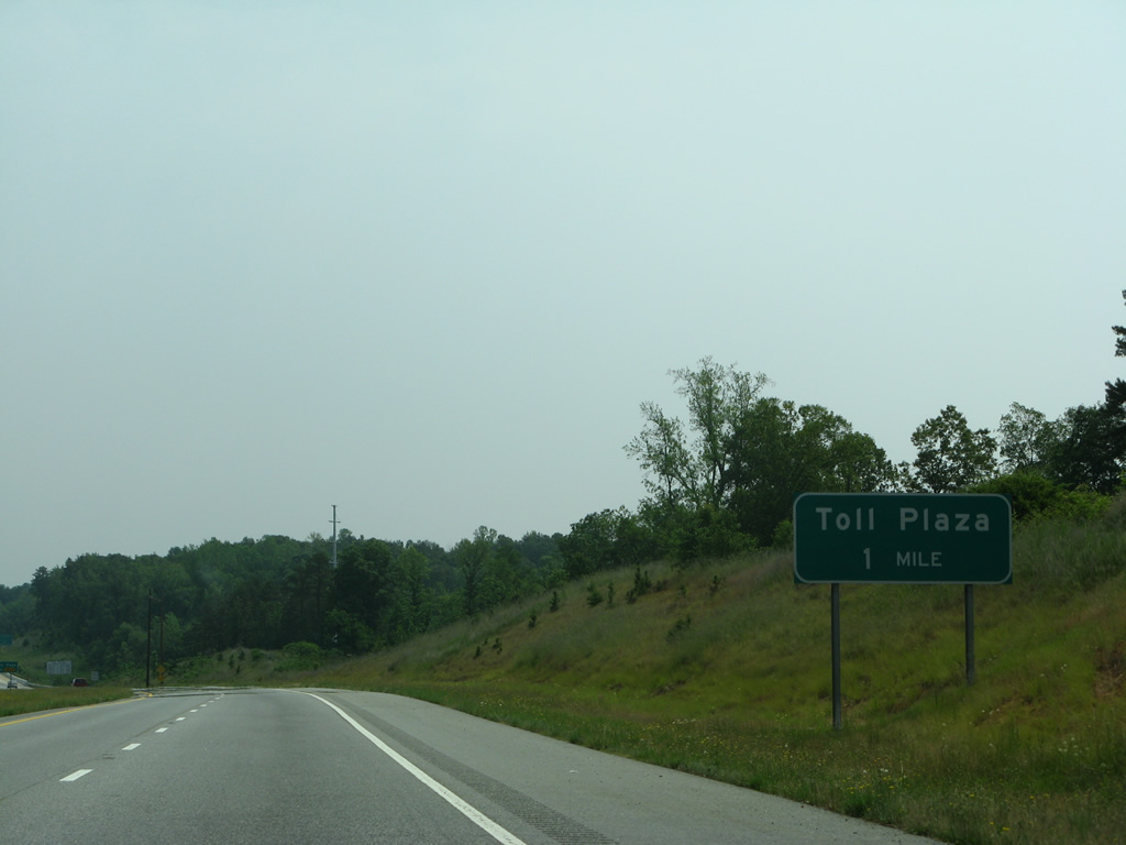
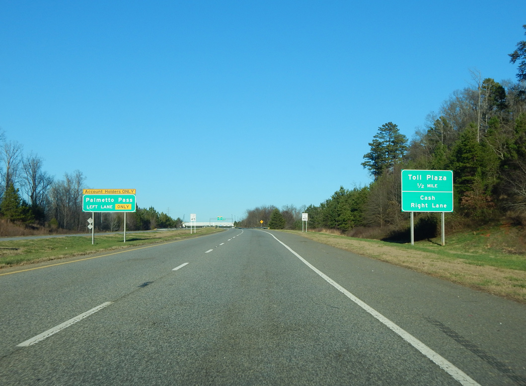
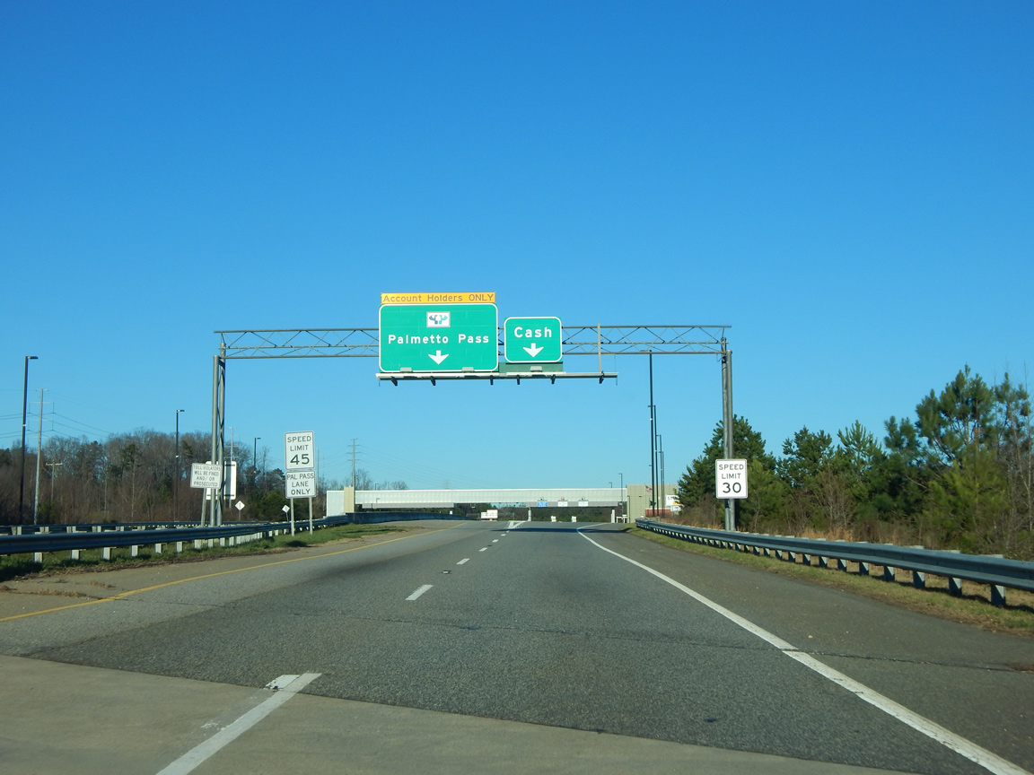
| Turning southeast by the Acadia neighborhood, Interstate 185 advances to the first of two main line toll plazas along the Southern Connector. 05/31/07 |
|
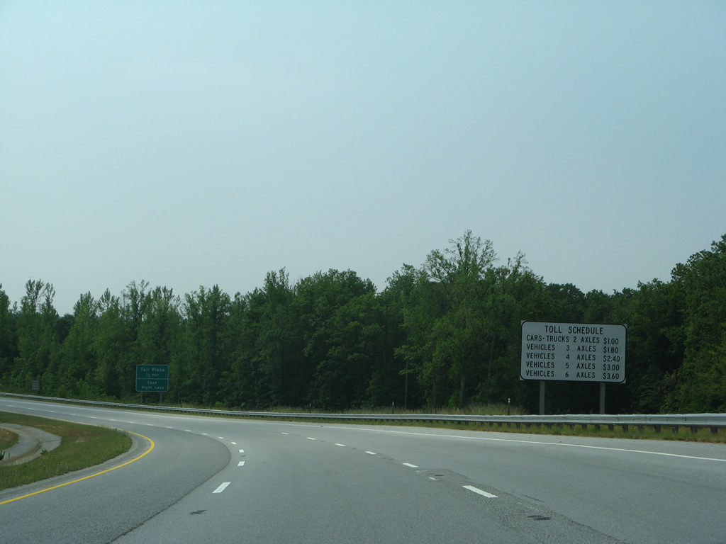
| Rates on the Southern Connector increased on January 3, 2012 to a $1.50 cash rate for passenger vehicles. Tolls rose to $2.00 at the West Plaza by January 2020. 05/31/07 |
|
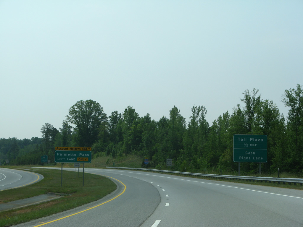
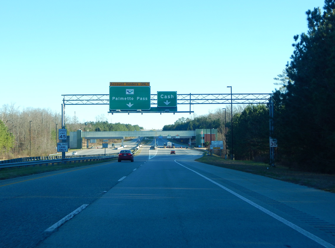
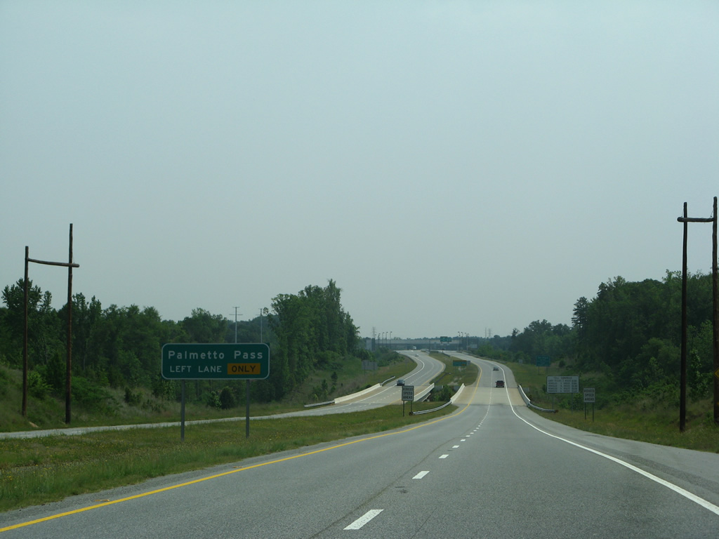
| An all electronic toll (AET) lane separates to the left for Palmetto Pass account holders. Palmetto Pass is South Carolina's electronic transponder network. 05/31/07 |
|
| A reassurance shield follows for motorists that joined the Southern Connector from Brown Road or S.C. 153 east. 01/13/16 |
|
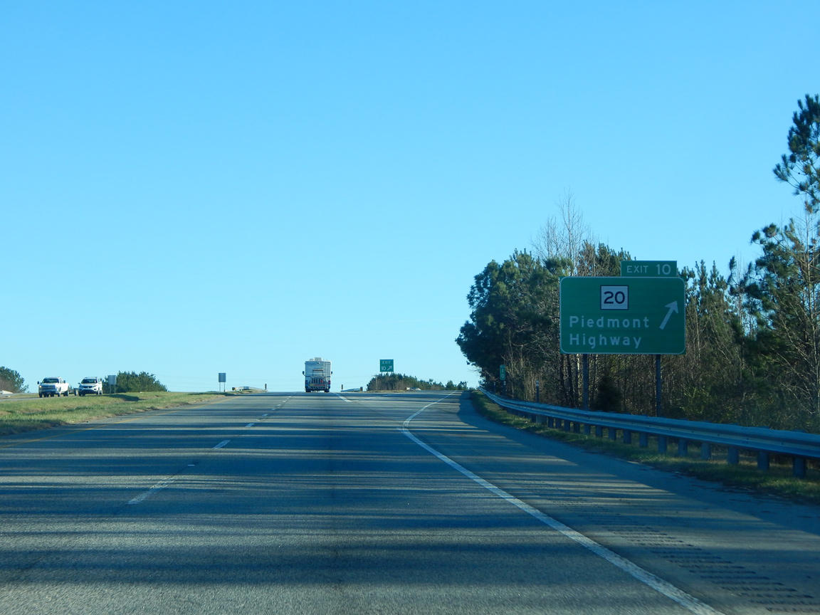
| Exit 10 with S.C. 20 (Piedmont Highway) lies one mile beyond the West Toll Plaza. S.C. 20 leads north from I-185 to Lakeside and south to Golden Grove nearby. 01/13/16 |
|
| The Palmetto Pass lane continues through the West Toll Plaza with a 45 mile per hour speed limit. 01/13/16 |
|
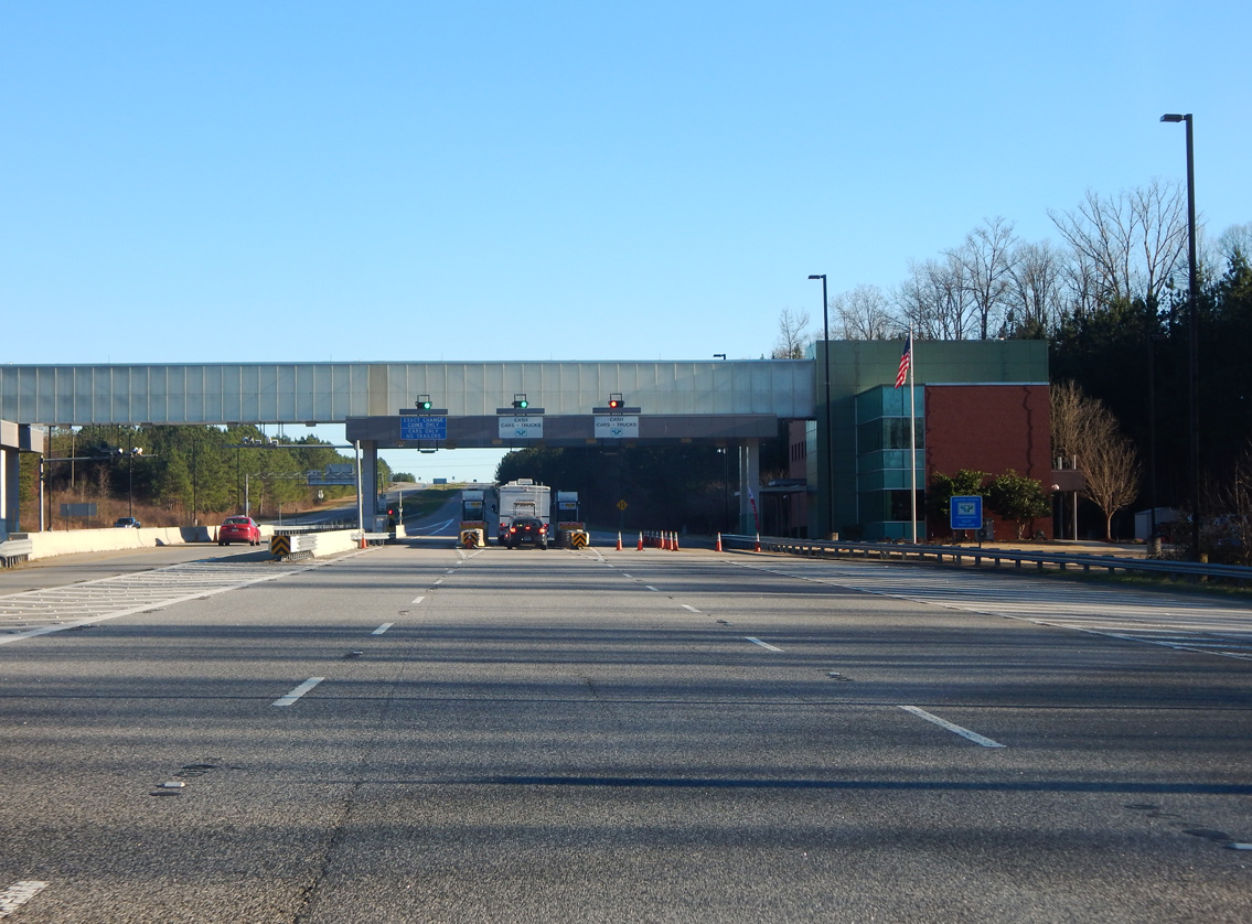
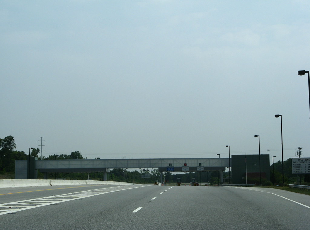
| Entering the cash lanes at the West Toll Plaza for the Southern Connector. The speed limit resumes at 70 miles per hour beyond the toll barrier. 01/13/16 |
|
| S.C. 20 (Piedmont Highway) continues along the pre-1959 route of U.S. 29 south to Piedmont, Pelzer and Williamston. 01/13/16 |
|
| Interstate 185 remains rural east from S.C. 20 to U.S. 25 at Moonville. 05/31/07 |
|
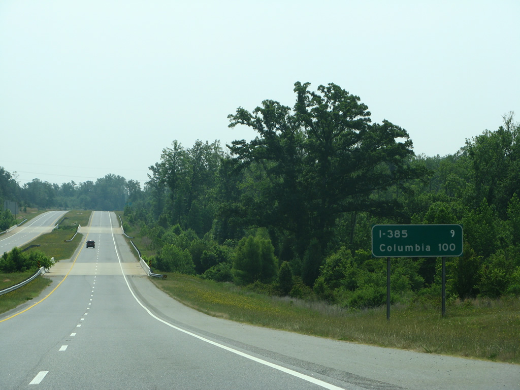
| Lowering to cross Grove Creek and one of its tributaries, I-185 is nine miles from Interstate 385 and 100 miles from the capital city. 05/31/07 |
|
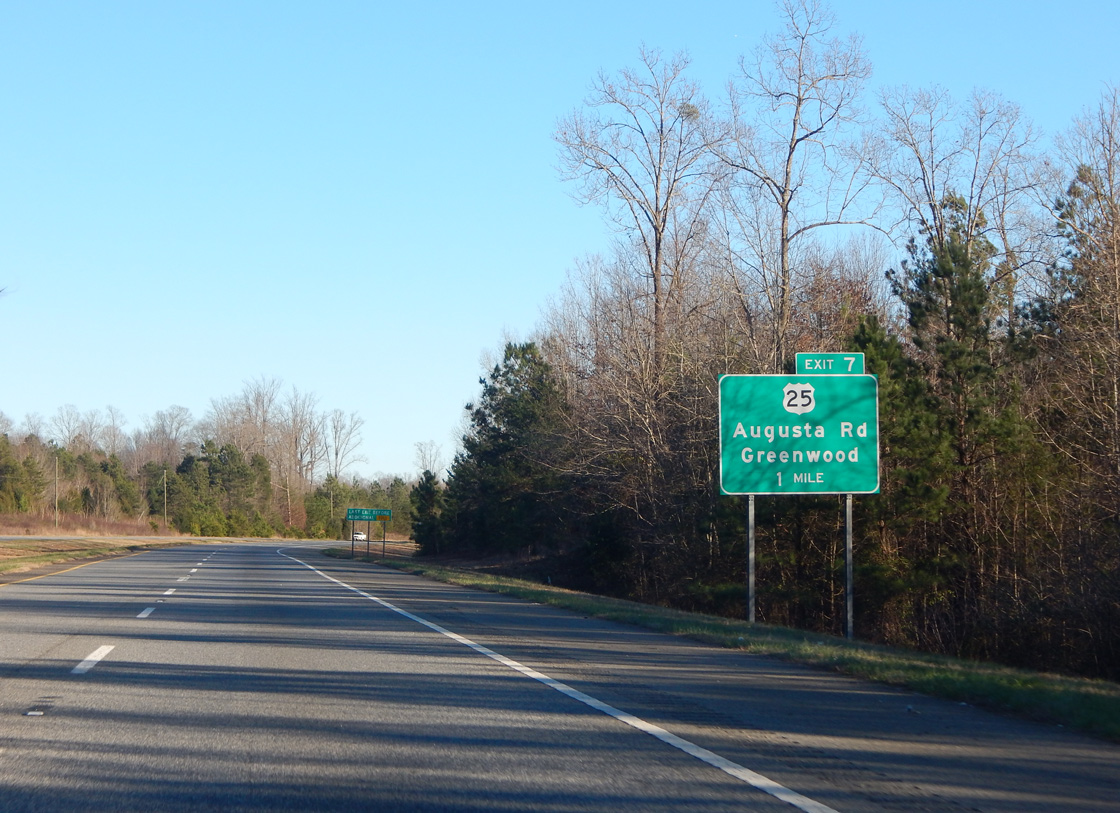
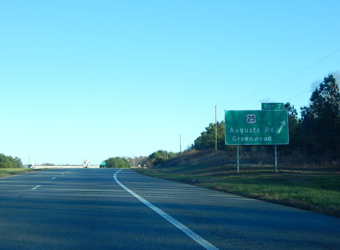
| U.S. 25 (Augusta Road) meets Interstate 185 (Southern Connector) in one mile at a parclo interchange (Exit 7). 01/13/16 |
|
| The East Toll Plaza lies beyond Exit 7. 05/31/07 |
|
| U.S. 25 (Augusta Road) leads north from Exit 7 to the South Carolina Technology and Aviation Center (SCTAC), Donaldson Center Airport (GYH). and White Horse Road. Prior to 1995 apart of U.S. 25 Business, Augusta Road continues as S.C. 291 north. 05/31/07 |
|
| Exit 7 leaves Interstate 185 south for U.S. 25 (Augusta Road). U.S. 25 constitutes a four lane corridor south to Greenwood. Within the Palmetto State, U.S. 25 runs 140 miles from Augusta, Georgia to the North Carolina line beyond Lima. 01/13/16 |
|
| Interstate 185 crosses industrial area east from U.S. 25 to Huff Creek. 05/31/07 |
|
| Six miles remain before I-185 (Southern Connector) ties into Interstate 385 at Mauldin. 05/31/07 |
|
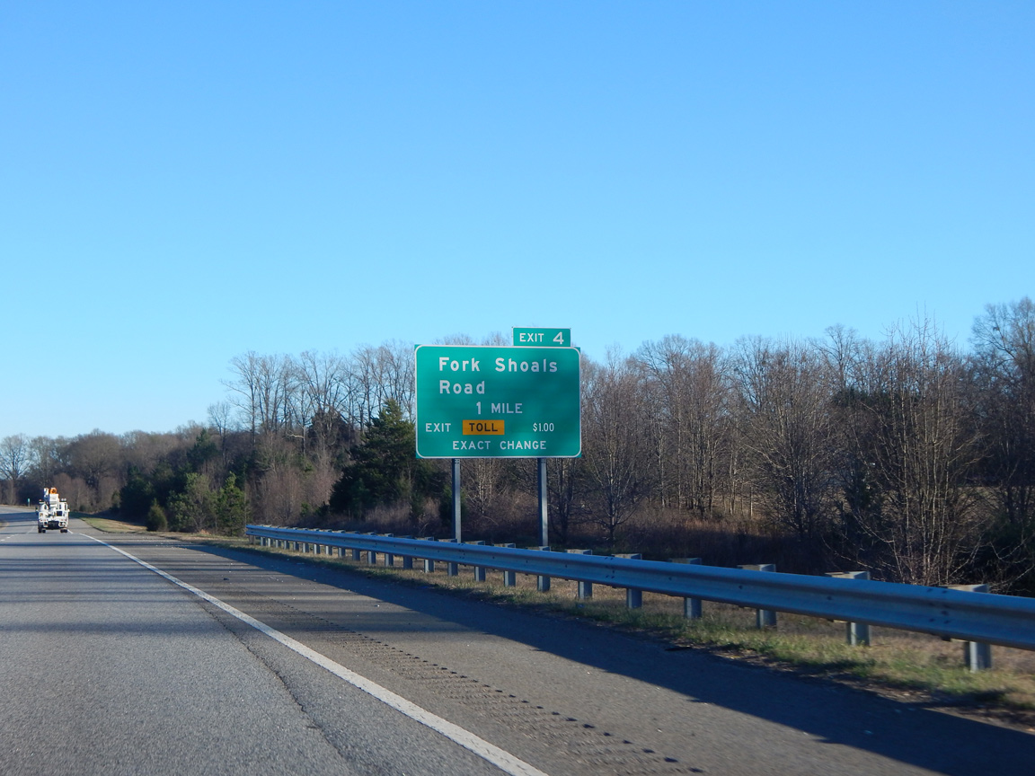
| Fork Shoals Road (Road 146) crosses paths with the Southern Connector at a diamond interchange (Exit 4) in one mile. 01/13/16 |
|
| Exit 4 departs I-185 south after Huff Creek to Fork Shoals Road. Fork Shoals Road leads north along the east side of Donaldson Center Airport (GYH) to Conestee and south to far reaching suburban tracts west from Simpsonville. 01/13/16 |
|
| The final reassurance marker for Interstate 185 south precedes the Standing Springs Road (Road 84) overpass. 05/31/07 |
|
| Interstate 185 south lowers to cross the Reedy River ahead of the East Toll Plaza. 05/31/07 |
|
| The Palmetto Pass lane separates from the left through the East Toll Plaza. 01/13/16 |
|
| Crossing over Ranch Road, Interstate 185 south reaches the East Toll Plaza. 01/13/16 |
|
| I-185 south partitions with a single Palmetto Pass lane and three cash lanes. 05/31/07 |
|
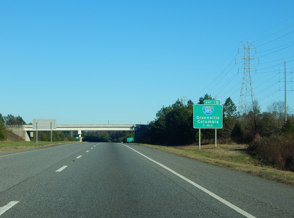
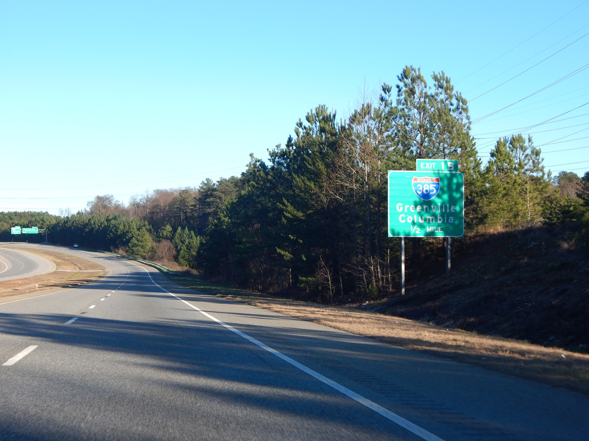
| Advancing east, I-185 reaches the wye interchange (Exit 1B) with Interstate 385 south to Simpsonville, Fountain Inn, Laurens and Columbia. 01/13/16 |
|
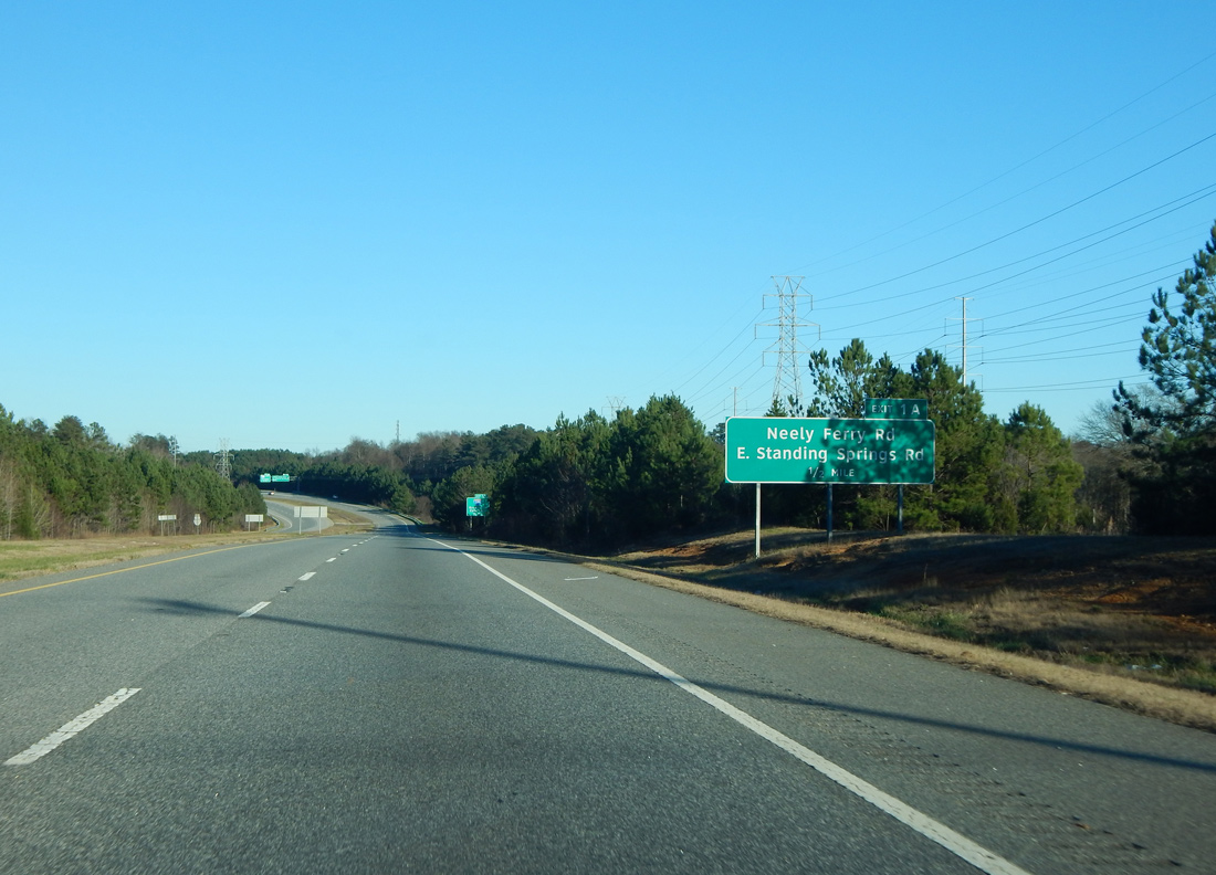
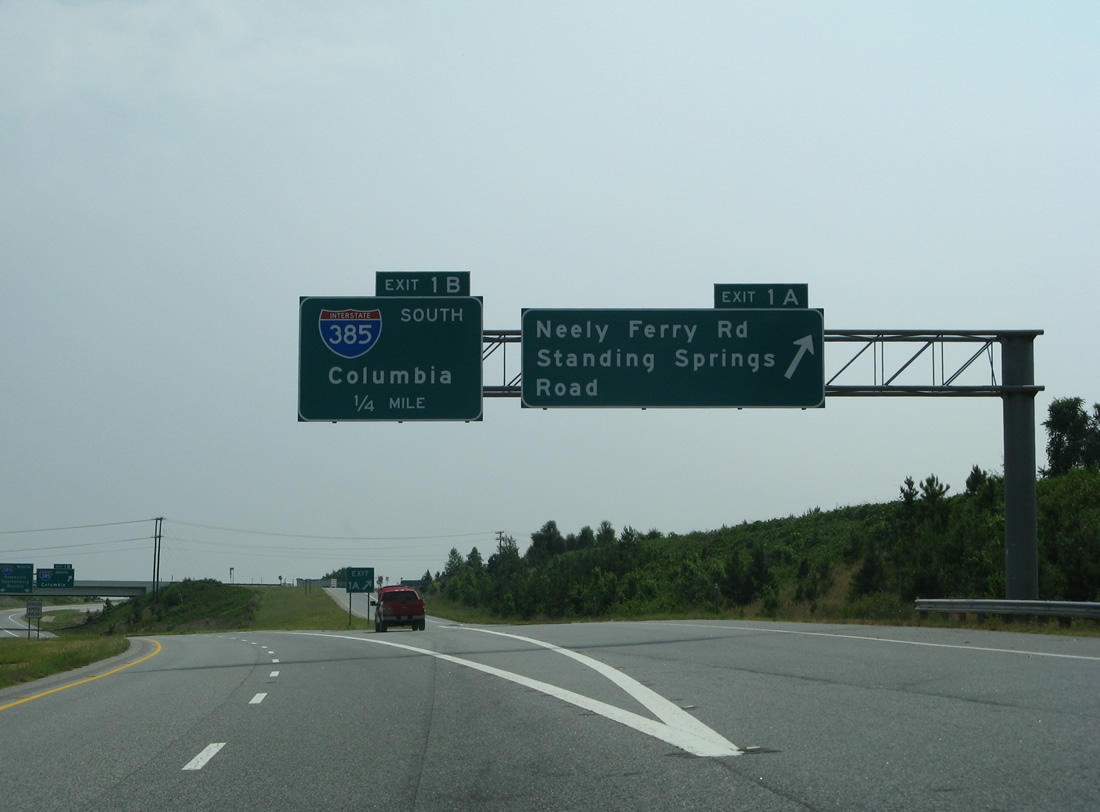
| Exit 1A provides access from the Southern Connector to Neely Ferry Road, which connects I-185 with adjacent Standing Springs Road. 01/13/16 |
|
| A commuter route southeast to Fountain Inn, Interstate 385 links Greenville with I-26 at Clinton. 01/13/16 |
|
| Neely Ferry Road winds around the exchange joining I-185, I-385 and U.S. 276 and parallels U.S. 276 northward to the Mauldin city center. Standing Springs and Neely Ferry Roads south serve a number of businesses and subdivisions on the west side of Simpsonville.
The overhead for Exit 1A was replaced by 2015 to reference East Standing Springs Road. 05/31/07 |
|
| Exit 1B links with the south end of U.S. 276, where it joins Interstate 385 south toward Laurens. The Southern Connector extends east to S.C. 417 before merging with I-385 north around Mauldin. 01/13/16 |
Page Updated 06-21-2021.


 South
South