|
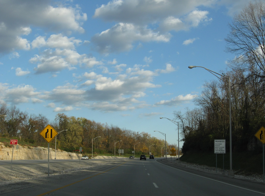
| KY 841 begins at US 42 and heads eastward as a two lane road, with rumble strips in the center. The two lane section will be upgraded to four lanes as part of the East End Bridge project that will extend the freeway across Ohio River into Indiana. This work is slated for completion in 2017 or 2018. 11/04/09 |
|
| A partially built half diamond interchange originally joined U.S. 42 with KY 841 at Preston. The westbound ramp was closed by the late 2000s and all traffic sent down the temporary mainline. 11/04/09 |
|
| A grassy hill alludes to the eventual eastbound roadway that will span U.S. 42 once the East End Bridge is finished and Interstate 265 extended west. 11/04/09 |
|
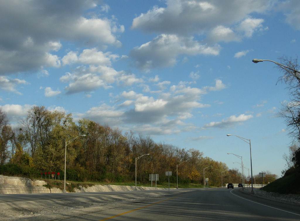
| The first southbound shield of KY 841 posted along the super two freeway by Green Spring. 11/04/09 |
|
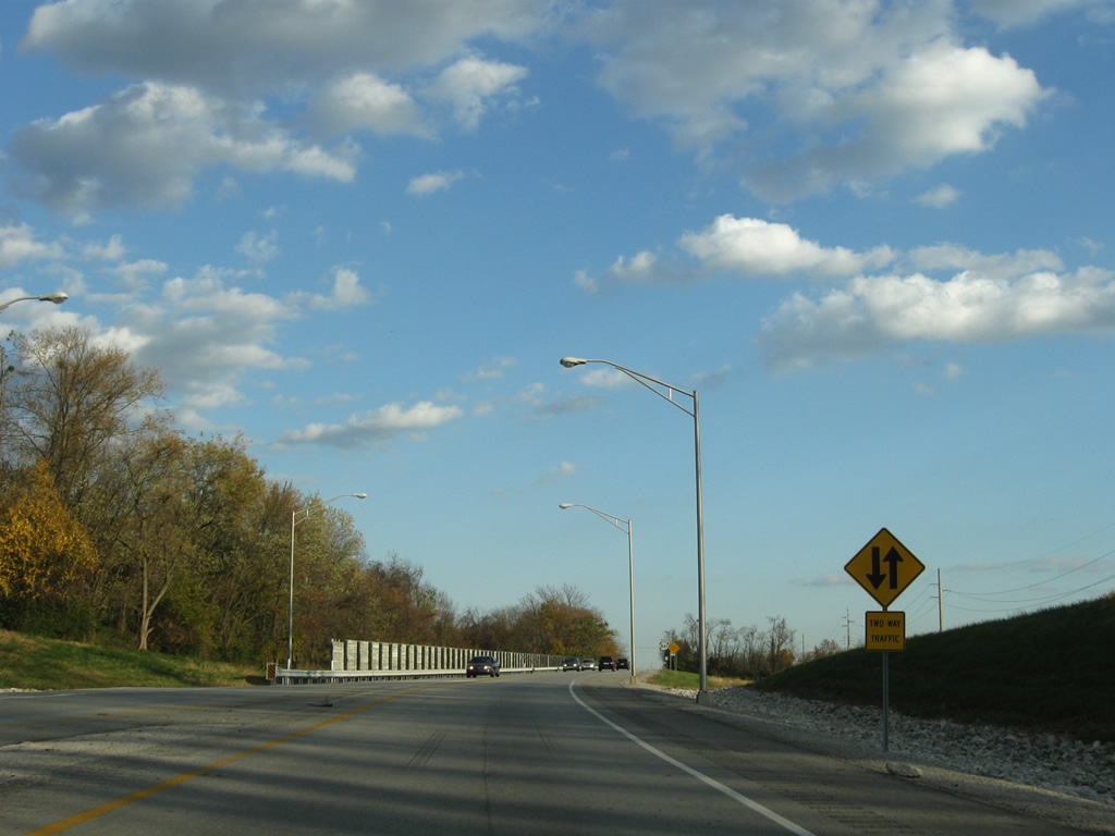
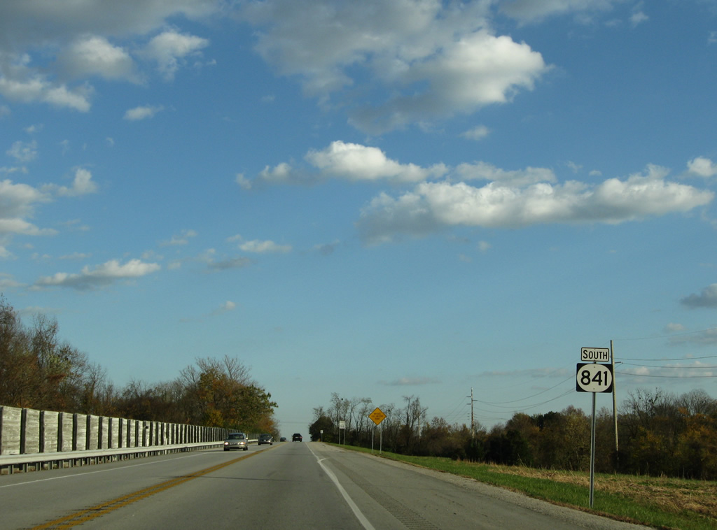
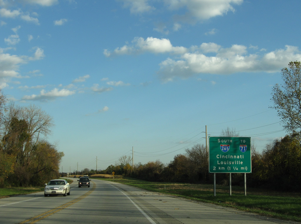
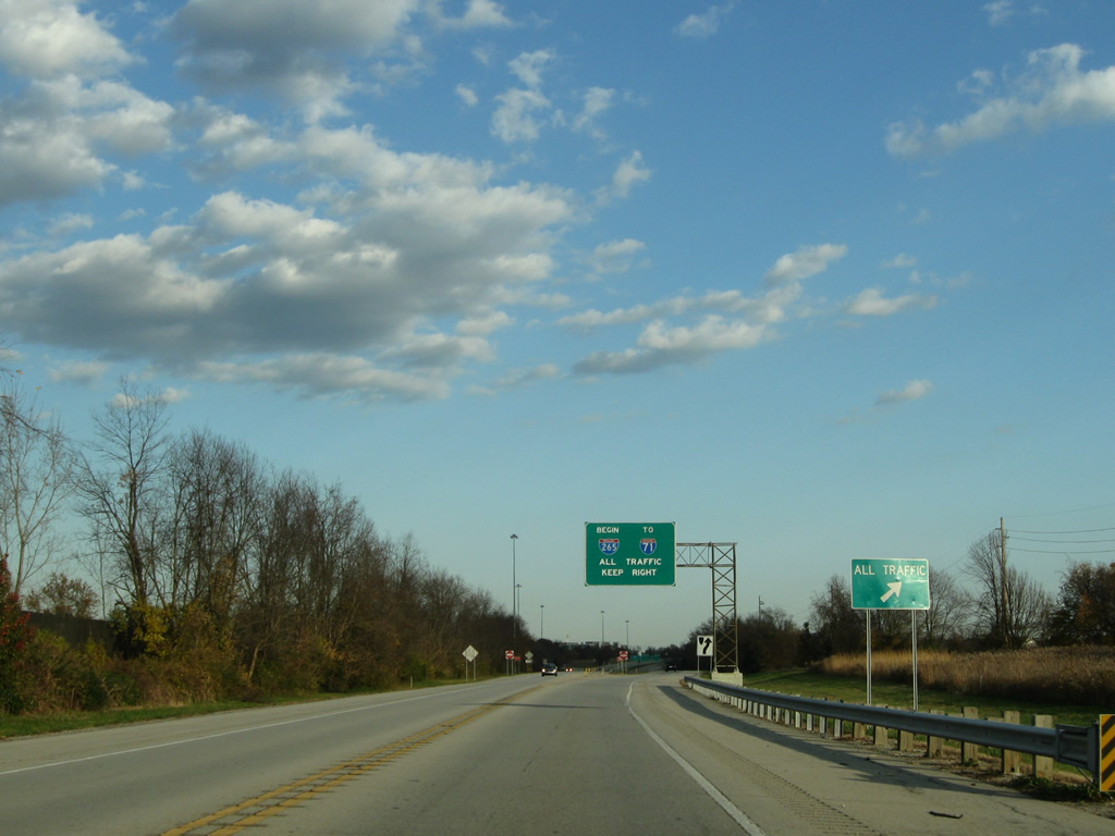
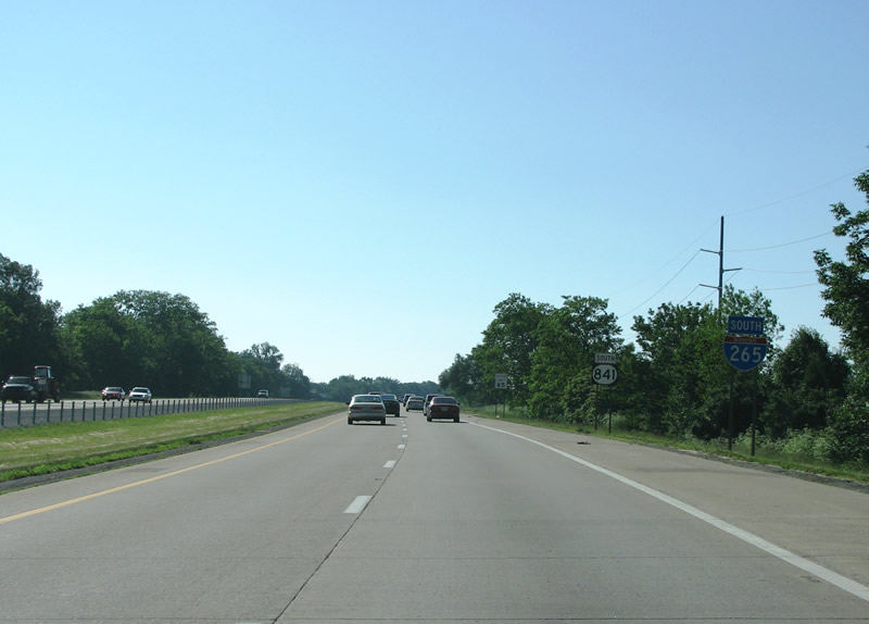
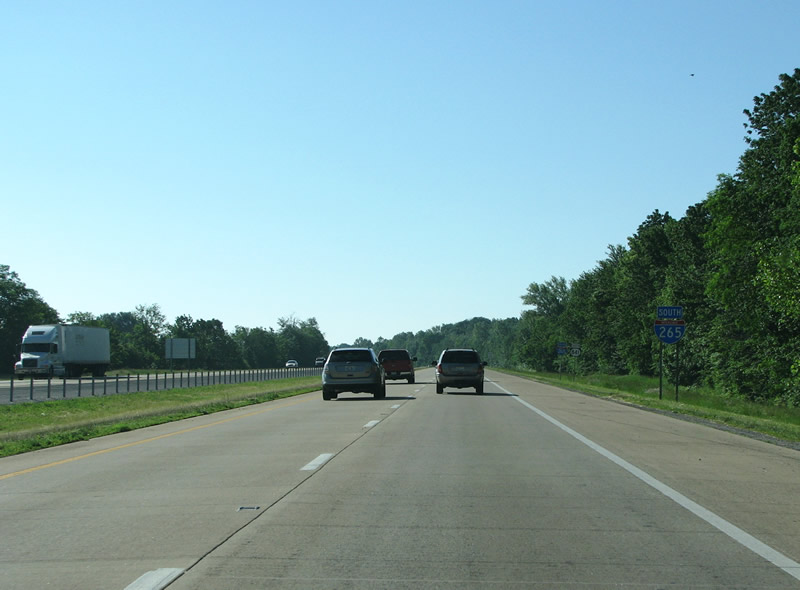
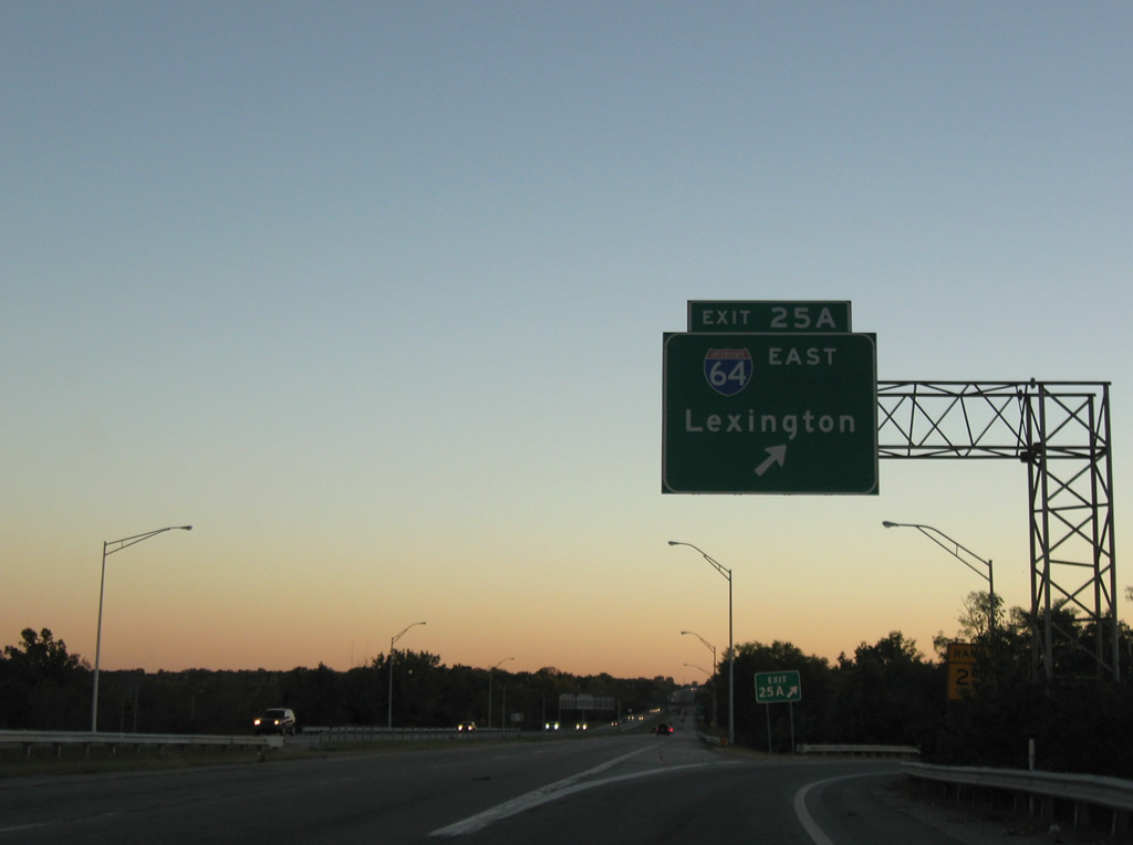
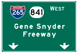
| Signs for the cloverleaf interchange between KY 841, Interstate 265 and Interstate 71 utilize metric units. The forthcoming junction sees the super two of KY-841 expand into four lanes as Interstate 265 commences southward. 11/04/09 |
|
| All traffic is directed to stay to the right on signs posted at the Interstate 265 southbound beginning. I-265 consists of 24.477 of the 34.727 mile KY 841 freeway. 11/04/09 |
|
| An Interstate 71 Kentucky trailblazer resides beyond the divided portion beginning. 11/04/09 |
|
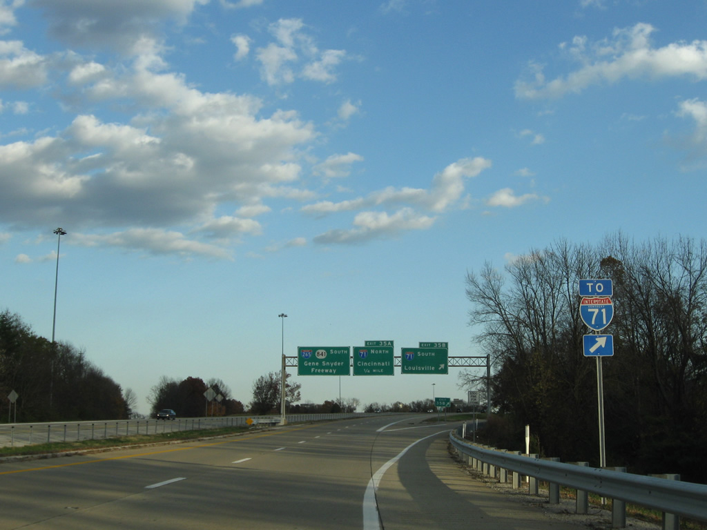
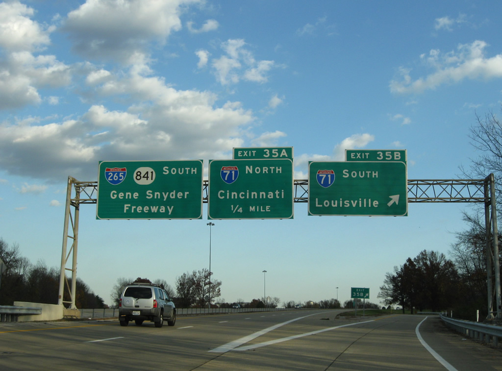
| Exit 35B joins KY 841 south with the final nine miles of Interstate 71 leading toward downtown Louisville.
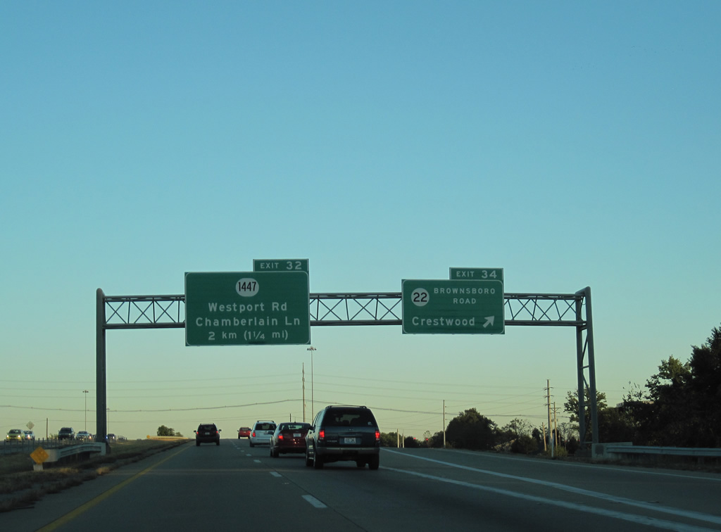
This section of Interstate 265 roadway opened as KY 841 in the mid 1960s. Originally called the Jefferson Freeway, the road opened in two sections. This first section runs from US 42 to Westport Road (Exit 32). 11/04/09 |
|
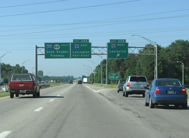
| I-265/KY 841 arrive at the Exit 35A loop ramp onto Interstate 71 north. I-71 travels 345 miles overall from Louisville to Covington, Cincinnati, Columbus and Cleveland, Ohio.
KY 841 was the original designation for this 36 mile outer loop of Louisville, which was originally constructed as a bypass to serve suburban traffic. The interstate designation came later, in 1970 - however I-265 did not cover the entire route (it only runs from I-71 to I-65) and thus the KY 841 signs remain. 10/01/10 |
|
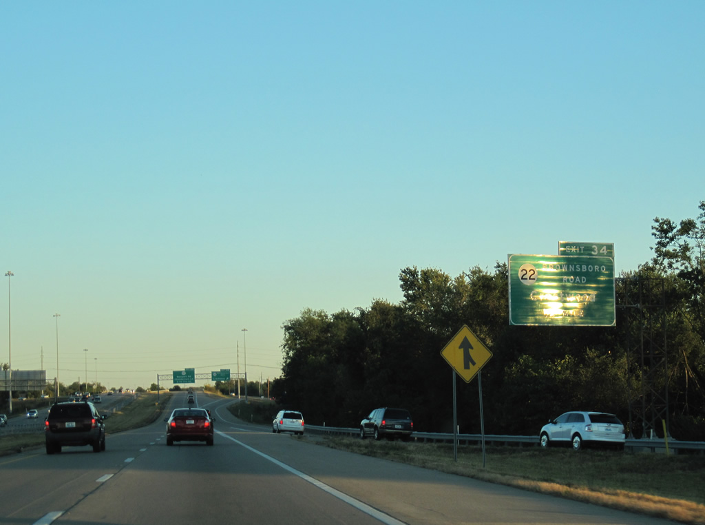
| Brownsboro Road is the first exit east of I-71. Also signed as KY 22, the road varies between two and four lanes with forested sections as it heads into Louisville. 10/01/10 |
|
| The parclo interchange between I-265/KY 841 (Gene Snyder Freeway) and KY 22 (Brownsboro Road) serves large retail areas on both sides of the freeway. KY-22 begins at U.S. 42 in Northfield to the west and continues east to Crestwood and Ballardsville in Oldham County. 10/01/10 |
|
| This section of roadway from I-71 south to Westport Road was repaved in 1999, but was not widened. Today this is one of the most overcrowded stretches of freeway in Louisville, often backing up at any hour of the day. 06/06/08 |
|
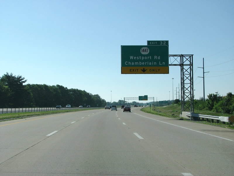
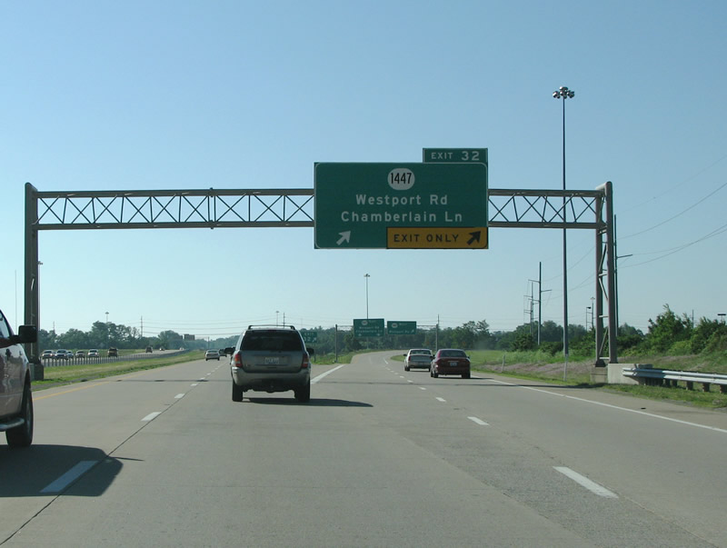
| Westport Road is the next exit along I-265 and is also signed as KY 1447. 06/06/08 |
|
| Westport Road is one of the busiest arterial roads in the city, and runs east from St. Matthews. The road was widened to five lanes from here to an April 2010 opened interchange at I-264. This part of Westport has some of Louisville's newer upscale retail and condo complexes. Additionally, the Ford Motor Truck plant sits just east of the exit. 06/06/08 |
|
| Shields for Interstate 265 and KY 841 are posted separately after Westport Road. 06/06/08 |
|
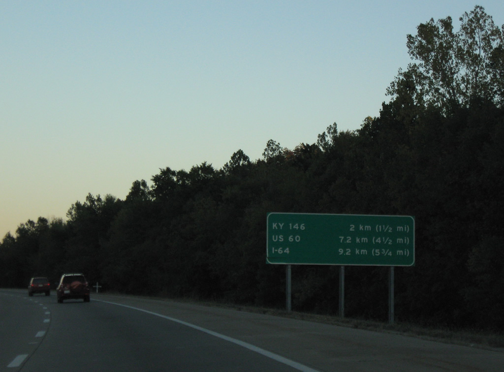
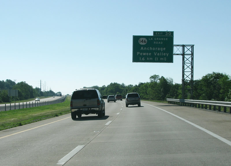
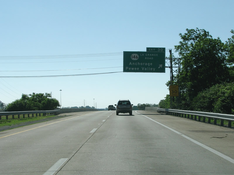
| KY 146 is the next exit at La Grange Road; this is the final exit before I-265 turns from east to south. U.S. 60 and Interstate 64 follow within 5.75 miles. 10/01/10 |
|
| KY 146 begins from US 60 at St. Matthews, near I-264, and runs east through Lyndon to Pewee Valley. The state route parallels I-71 before hitting the town of La Grange, the county seat of adjacent Oldham County. 06/06/08 |
|
| Exit 30 carries all traffic in unison from Interstate 265 south; a directional ramp ties directly into Westport Road east and Chamberlain Lane south. KY 146 runs west from here through the suburb of Anchorage. The town is over 12 miles from the Ohio River, and thus its name is a little bit strange. The origins of Anchorage's name go back to 1878 when residents incorporated and named the area after the home of a riverboat captain they admired. Anchorage is also notable as the home of Papa John's Pizza founder John Schnatter, who owns a good bit of land in town. 06/06/08 |
|
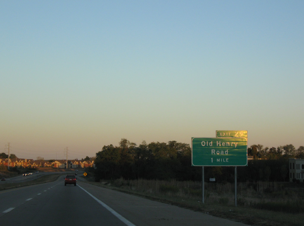
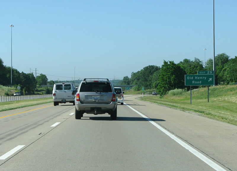
| Old Henry Road, which is one of only two exits along this freeway that is not with a numbered route (the other is Smyrna Road), comes next just after the freeway turns towards the south. 10/01/10 |
|
| The Old Henry exit only recently opened, in 1999. This view looks at the curve towards the south and west. 10/01/10 |
|
| Old Henry Road was the scene in 2008 of several bitter battles between developers and residents with government caught in the middle. In 2004, Old Henry Crossing began as a huge mixed-use development along the east side of the freeway. The road itself was widened and realigned from the freeway to the northeast in 2005/2006. The plan currently is to widen the road to a parkway even further out to the county line. Of all of the interchanges in metro Louisville, this one has seen the most development and new building within the five years leading toward 2008. 06/06/08 |
|
| From Old Henry Road towards the south, the Gene Snyder Freeway runs in a nearly perfect straight line for six miles. 06/06/08 |
|
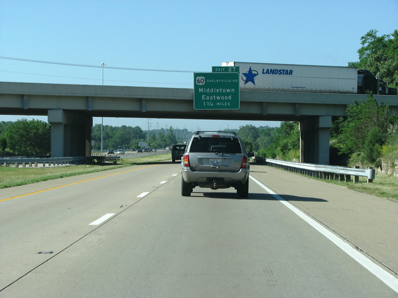
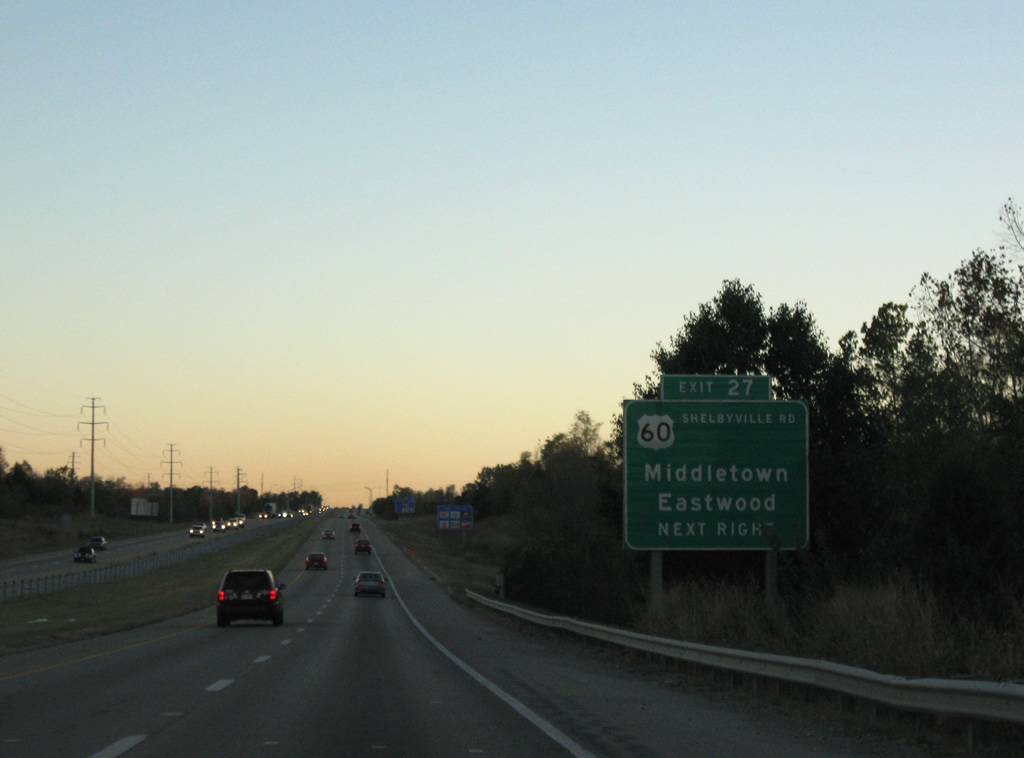
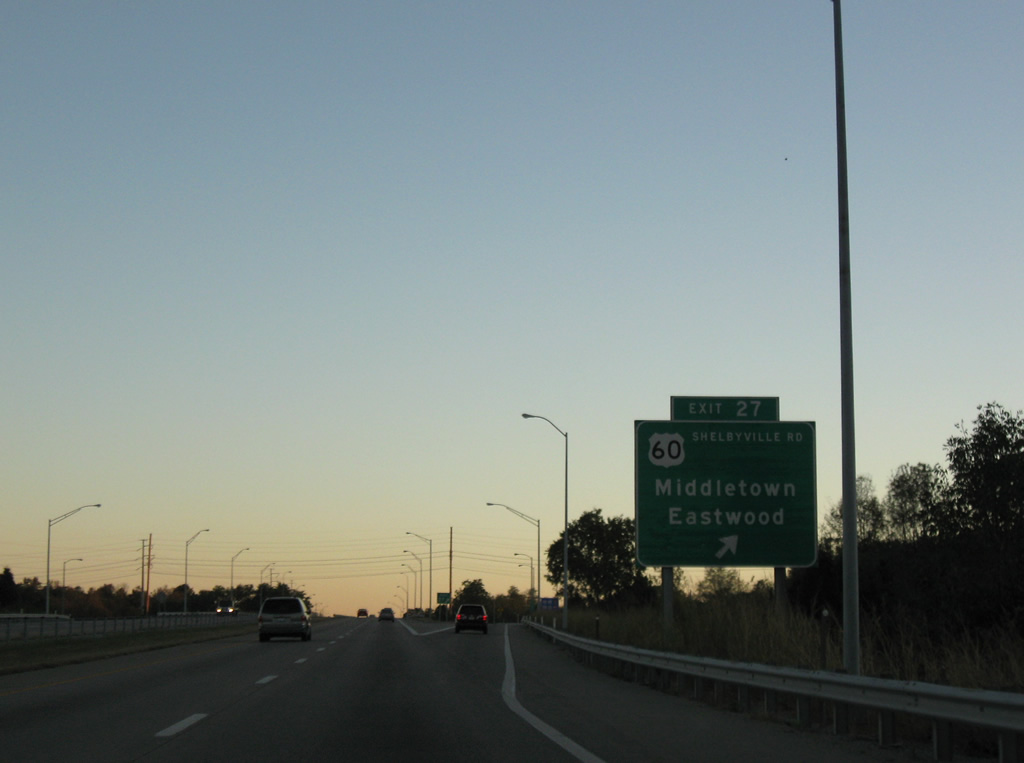
| US 60, also known as Shelbyville Road, is the last exit before I-64. This particular junction (Exit 27) is a diamond interchange. From this point south begins another very old and generally very busy section of freeway. 10/01/10 |
|
| US 60 is the main pre-interstate east/west road in Louisville. From there, it runs east through the suburbs of St. Matthews and Middletown before it ends up here at the Gene Snyder Freeway. Middletown has about 5,700 people and became a city in 1797. It's noted for its historic central district and upscale residential areas. 10/01/10 |
|
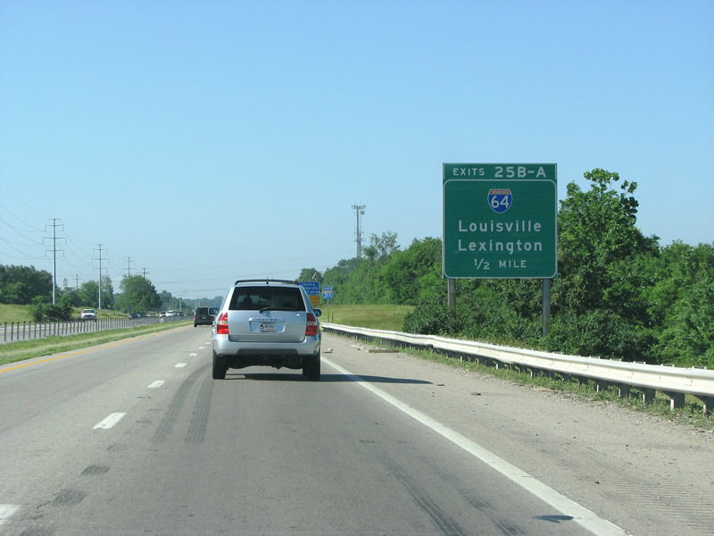
| I-64 replaced US 60 as the most important east/west route in the state, and connects the two largest cities in Kentucky. Additionally, it forms the southern section of Kentucky's "Golden Triangle", a region that contains over half the population in less than one quarter of the land area. 06/06/08 |
|
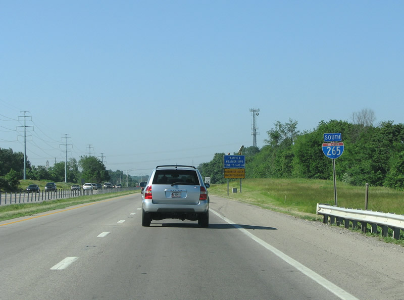
| A southbound I-265 shield posted north of the I-64 interchange. 06/06/08 |
|
| I-64 runs west from here into downtown Louisville as a six lane expressway. It continues through downtown as the Riverfront Expressway before heading over the Ohio River and into Indiana. The interchange here is a rather underwhelming cloverleaf. Plans are underway to upgrade it with collector distributor lanes between US 60 and I-64 and with better angled ramps, similar to what was done where I-64 meets I-264. 06/06/08 |
|
| I-64's eastbound control point is Lexington, which sits about an hour east of this point along I-64 and I-75. These exits generally mark the eastern limits of urbanization, although there are still quite a few suburban communities further out. This exit also marks the end of the built up, upper middle class area of Louisville and begins a transition towards more rural southern areas of the city. 10/01/10 |
|
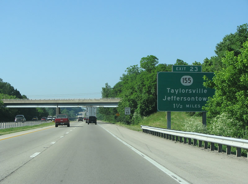
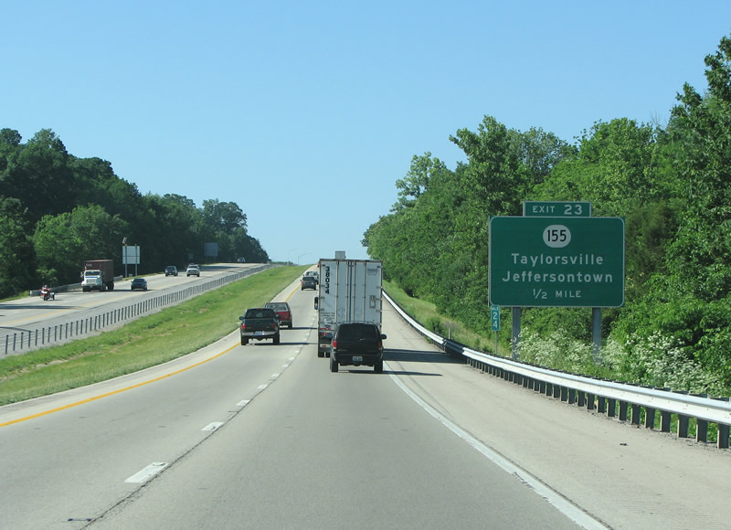
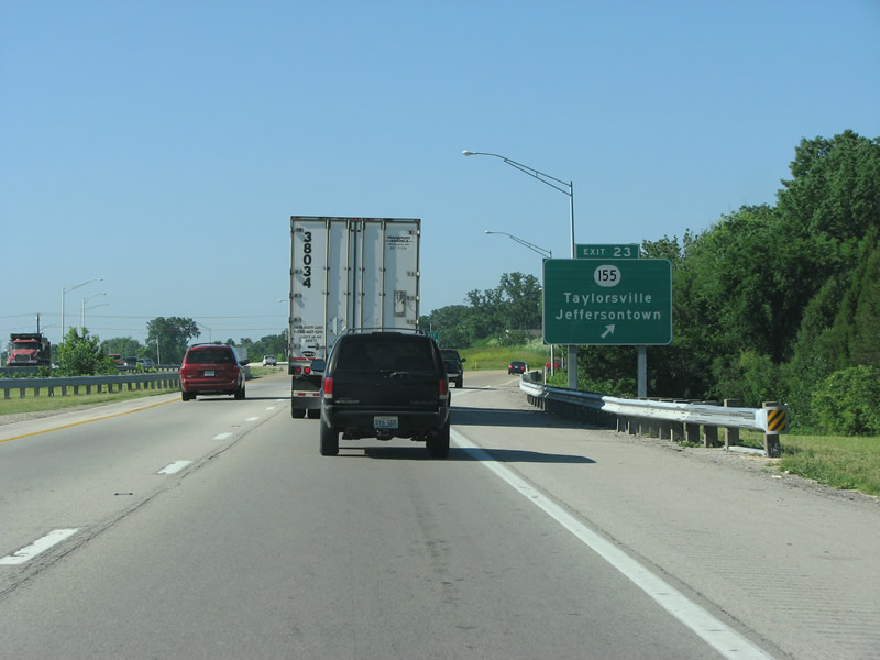
| KY 155 has a long history. The numbered route begins at US 31E in Louisville and continues southeast towards town of Taylorsville, for a distance of about 20 miles. As such, it is signed as Taylorsville Road and is generally called that locally. The route began in 1848 when legislation called for a spur from existing turnpikes towards Taylorsville, and the road was completed before 1890. Much of it was widened to 4 lanes by 1970. 06/06/08 |
|
| Taylorsville is the county seat of Spencer County and the region is a semi-built up exurban area connected to Louisville. KY 155 west of here also forms the main route into the center of Jeffersontown. The town has about 27,000 making it the 11th largest city in Kentucky. When Louisville merged with its county, J-town stayed separate and now forms Louisville's largest incorporated suburb in Kentucky. From this exit westwards to Smyrna Road, the freeway is it's newest - with this section opening in 1987. 06/06/08 |
Page Updated 03-06-2012.