|
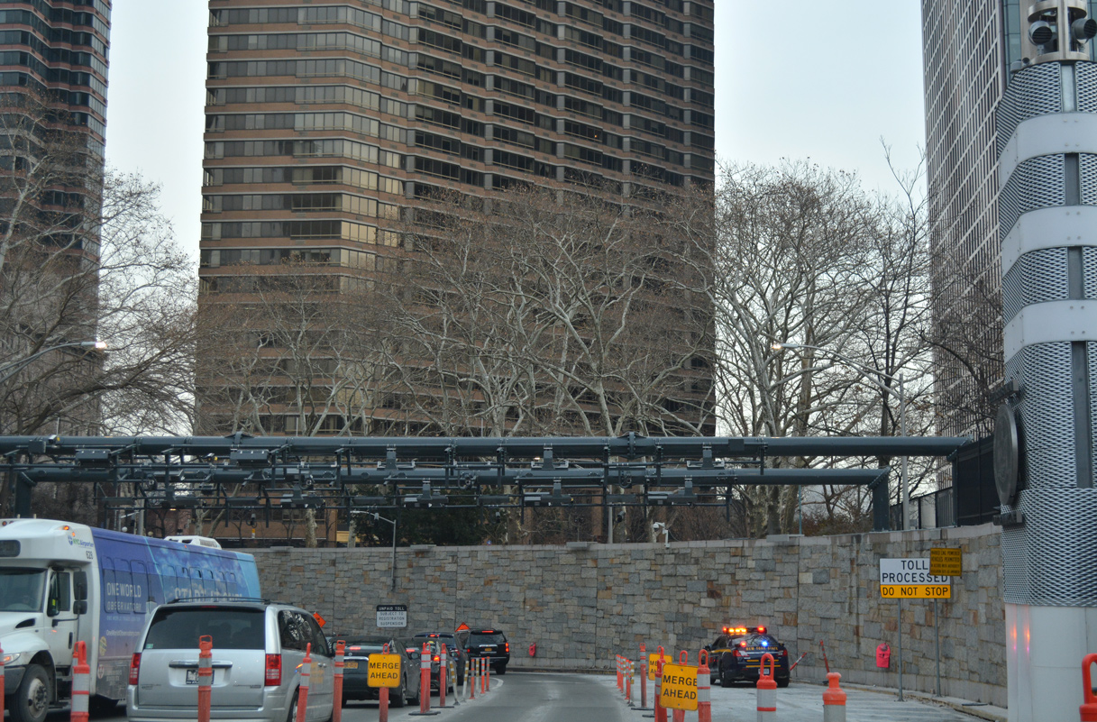
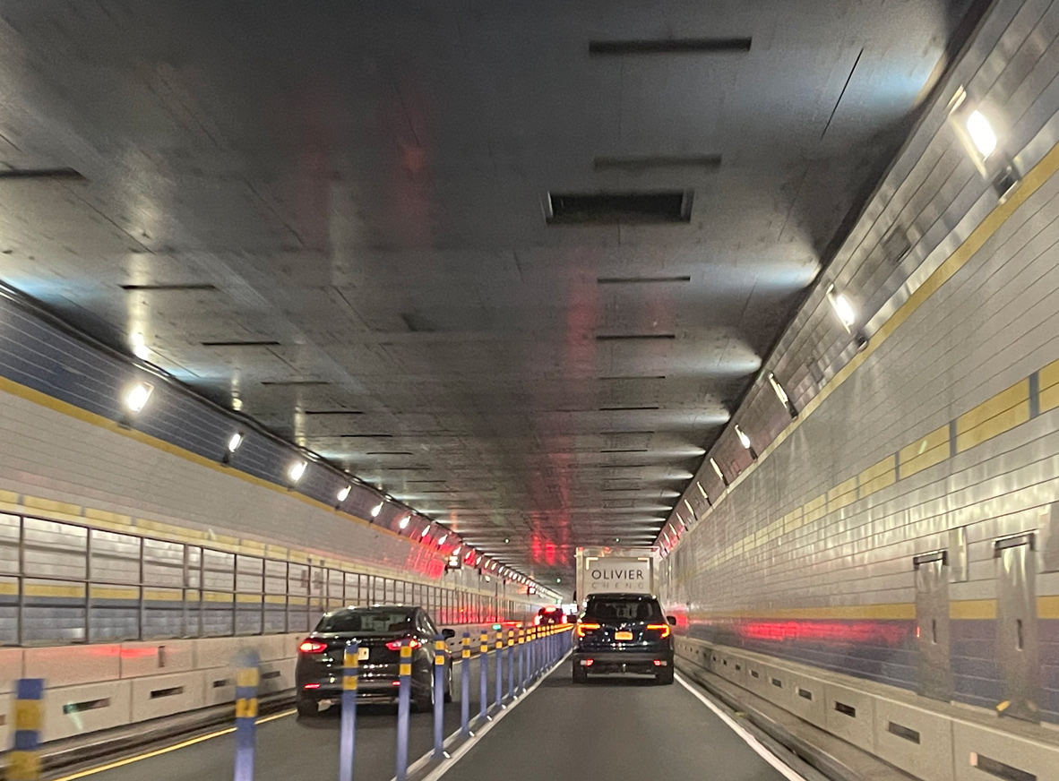
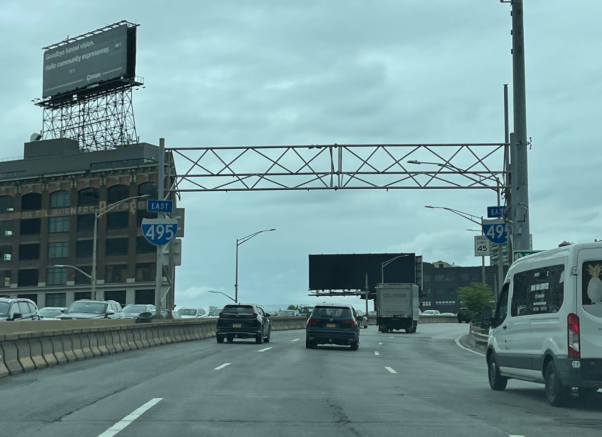
| Tolls for the Queens-Midtown Tunnel are collected electronically from gantries preceding the eastbound portal. 12/17/17 |
|
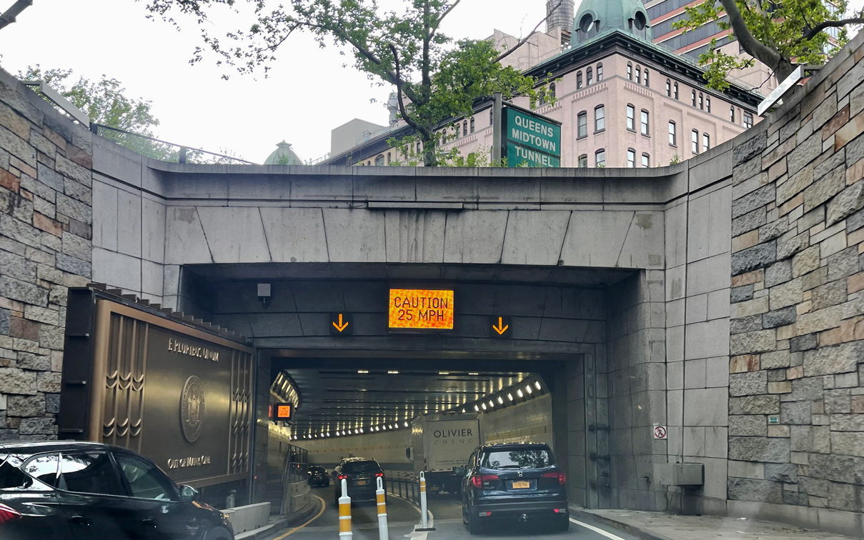
| Two lanes enter the Queens-Midtown Tunnel eastbound below 1st Avenue from 2nd Avenue, E 36th Street and Tunnel Approach Street. 06/12/21 |
|
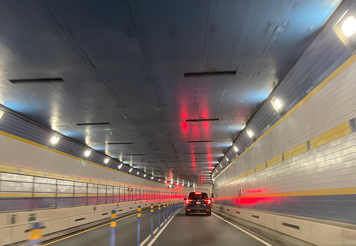
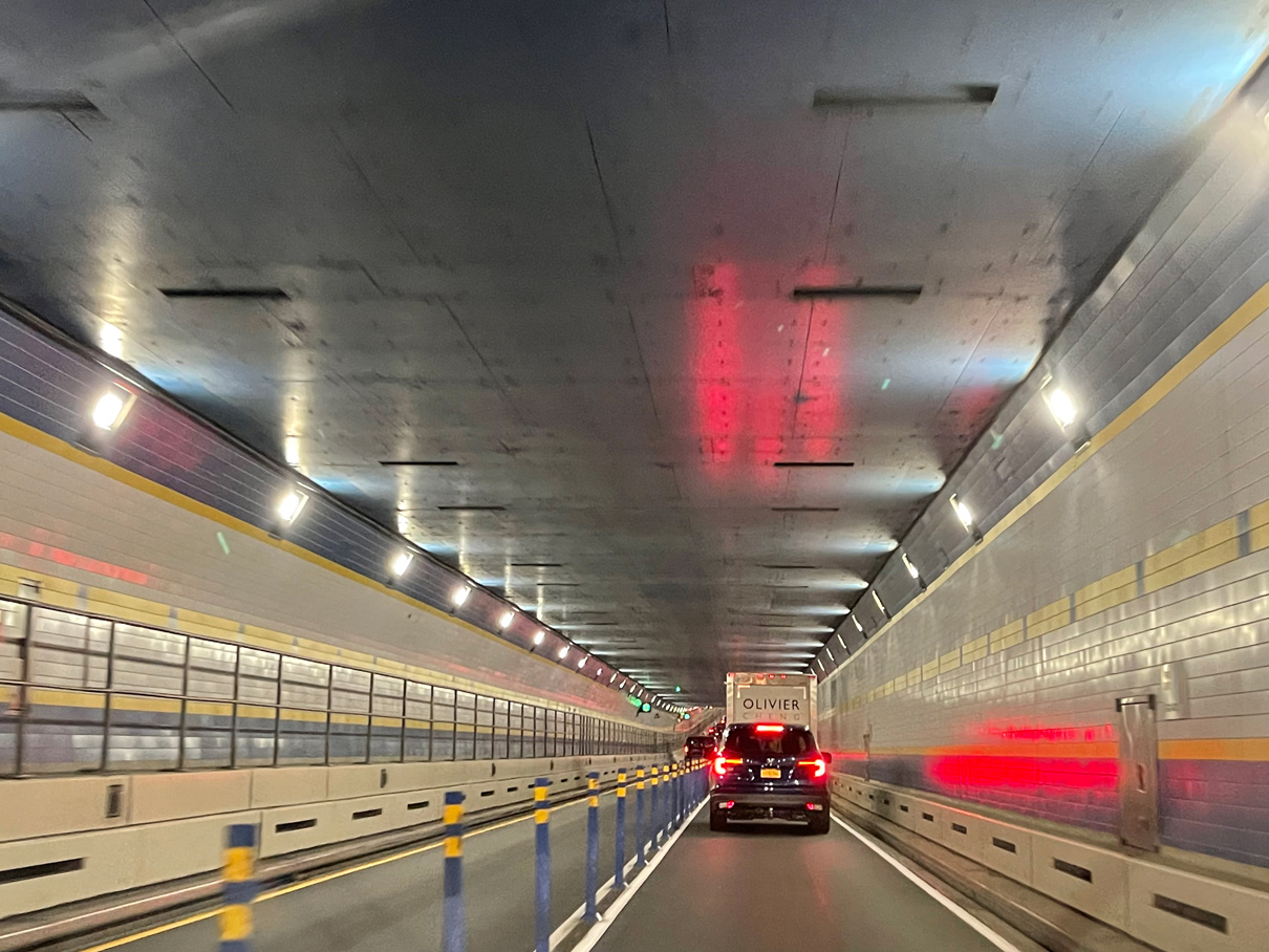
| The twin tube Queens-Midtown Tunnel opened to traffic on November 15, 1940.1 06/12/21 |
|
| The New York City Tunnel Authority was created by Mayor Fiorello LaGuardia. The organization constructed the Queens-Midtown Tunnel between 1936 and 1940, which was backed by President Franklin D. Roosevelt.1 06/12/21 |
|
| The $58 million project to build the Queens-Midtown Tunnel, in conjunction with other citywide highway projects, necessitated a merge with the Robert Moses' Triborough Bridge Authority to cover the costs in 1938. The acceptance of the Queens Midtown Tunnel into the Authority was finalized in 1946.1 06/12/21 |
|
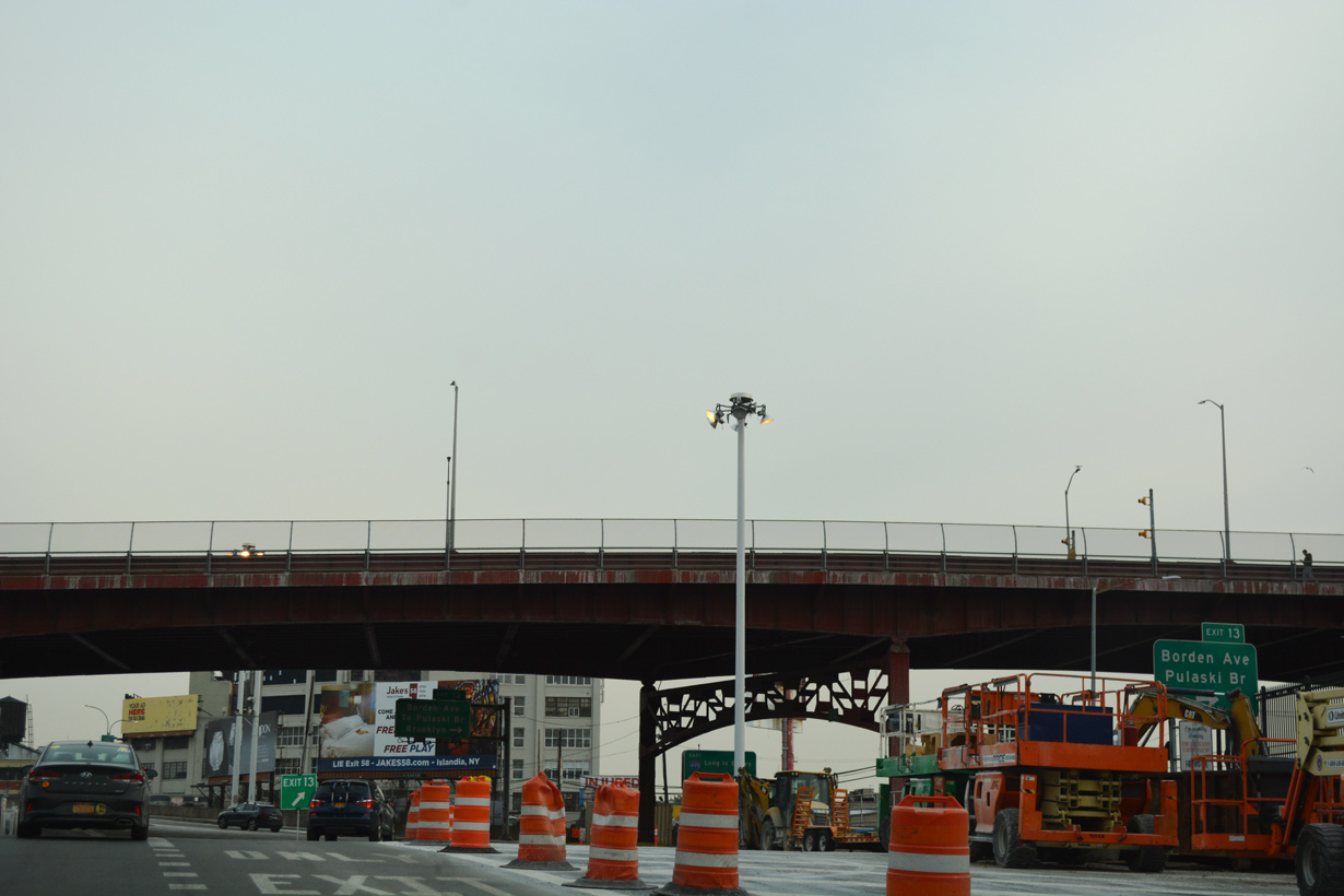
| Demolished in 2017, the Queens-Midtown Tunnel toll plaza was located just beyond the tunnel and ahead the Pulaski Bridge at Long Island city. 12/17/17 |
|
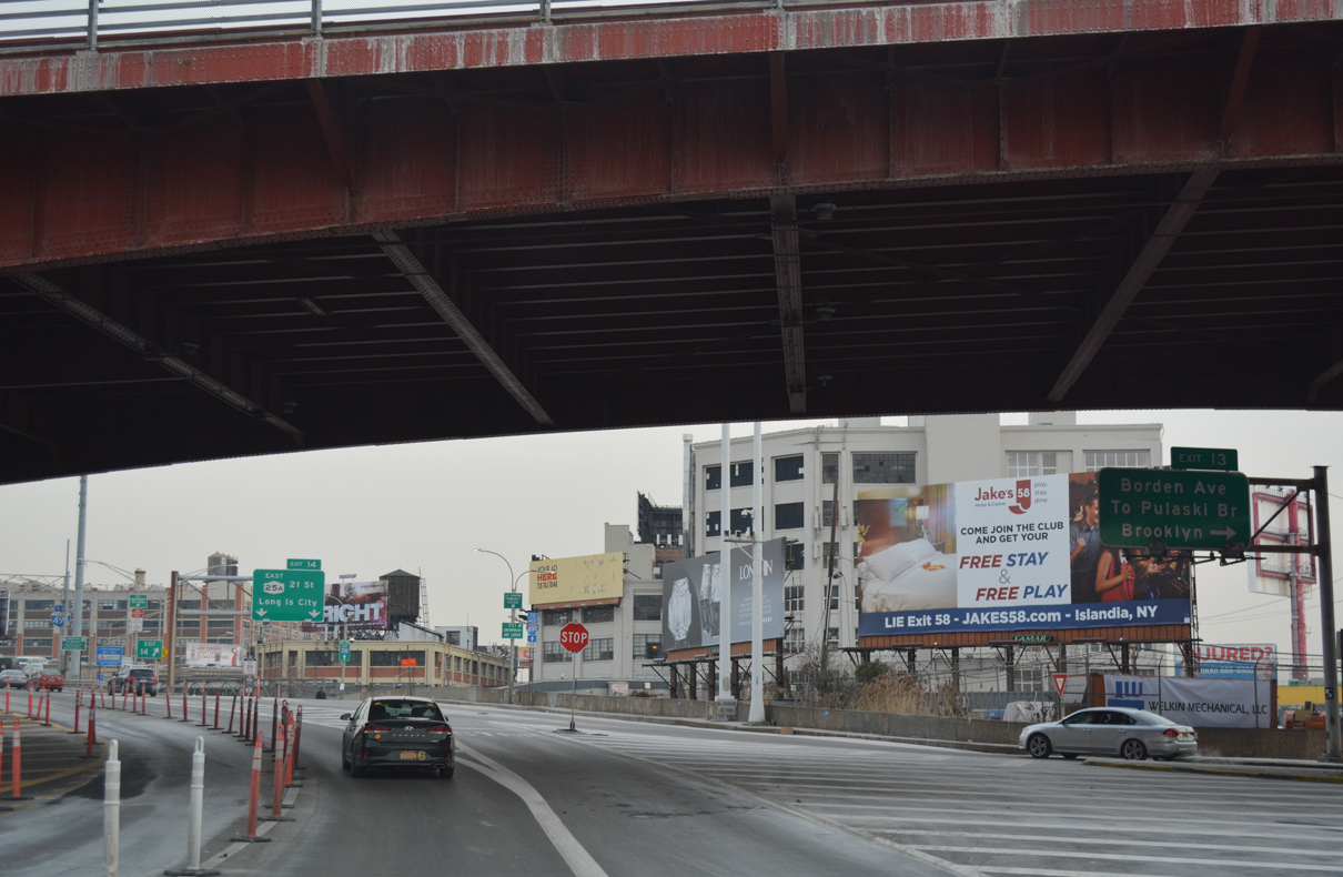
| Exit 13 departs below the Pulaski Bridge for Borden Avenue to Long Island City. Jackson Avenue connects with the Pulaski Bridge south to Green Point in Brooklyn. 12/17/17 |
|
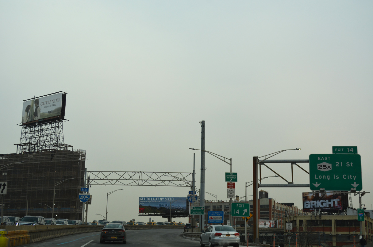
| Exit 14 follows immediately below the Pulaski Bridge for NY 25A (21st Street) east ahead of 49th Avenue. NY 25A shifts onto Jackson Avenue from Hunters Point en route to Northern Boulevard and Astoria in Queens. 12/17/17 |
|
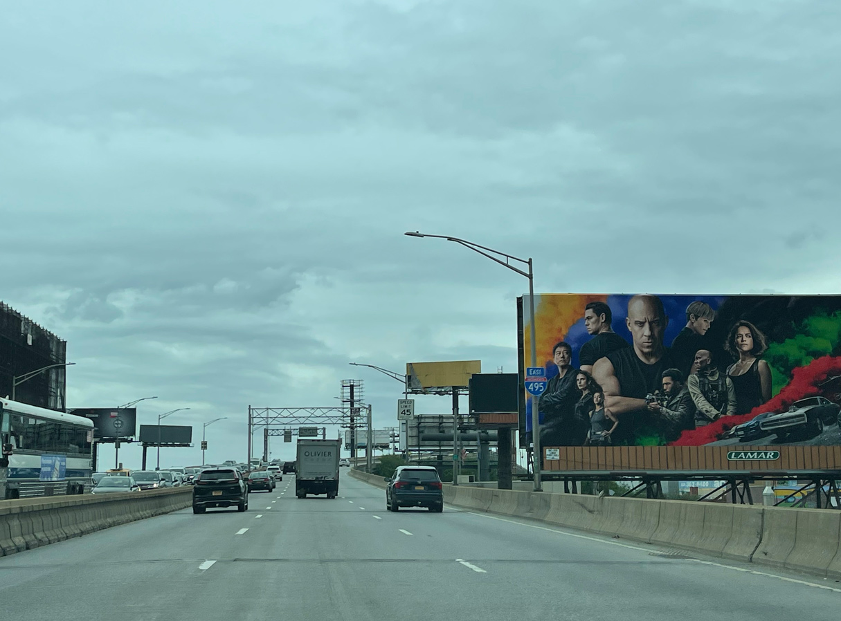
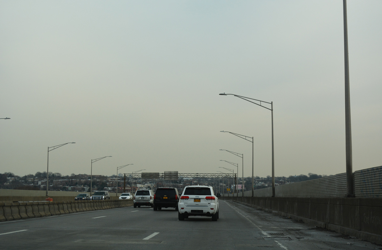
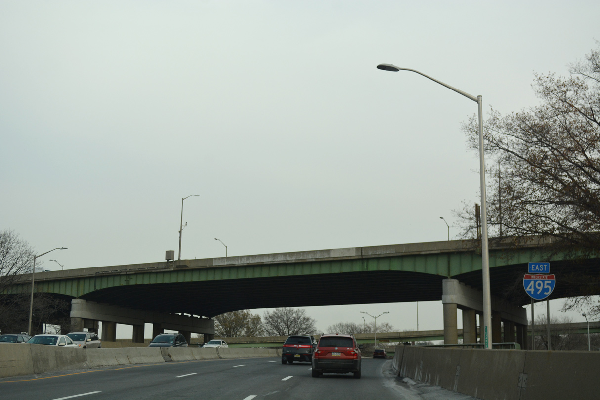
| I-495 (Long Island Expressway) ascends onto a viaduct leading east across Dutch Kills between 21st and Van Dam Streets. The number of lanes per direction between the Queens-Midtown Tunnel and Exit 17 for I-278 (BQE) can be modified with a movable (zipper) barrier. 06/12/21 |
|
| Interstate 495 (Long Island Expressway) continues east between 50th and 51st Avenues in Long Island City. 06/12/21 |
|
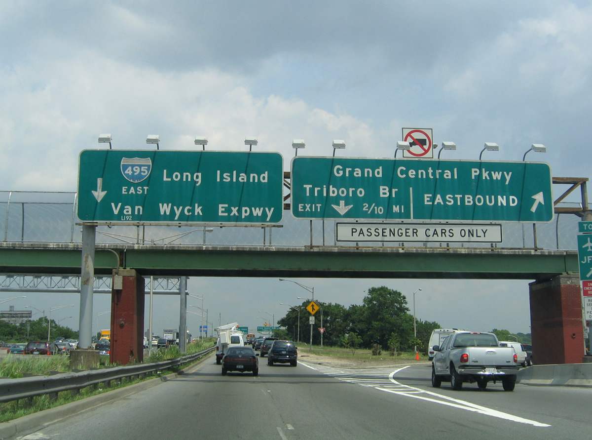
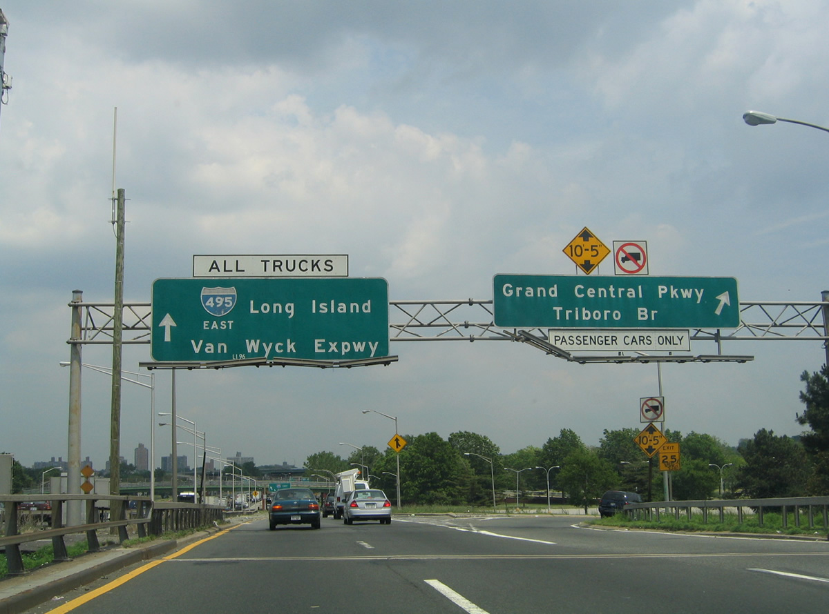
| Service roads, Queens Midtown Expressway and Borden Avenue, parallel I-495 below from Dutch Kills eastward to the exchange with Interstate 278 (BQE) at Exit 17. Queens-Midtown Expressway was the original name for I-495 east from Manhattan. 12/17/17 |
|
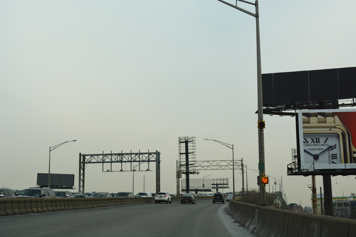
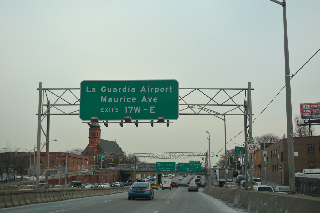
| Advancing east from Dutch Kills, I-495 proceeds a half mile through Sunnyside to the cloverstack interchange (Exit 17) with Interstate 278 (Brooklyn-Queens Expressway). I-278 runs north to the RFK (Triborough) Bridge and the Bronx and south to Brooklyn and the Verrazzano-Narrows Bridge. 12/17/17 |
|
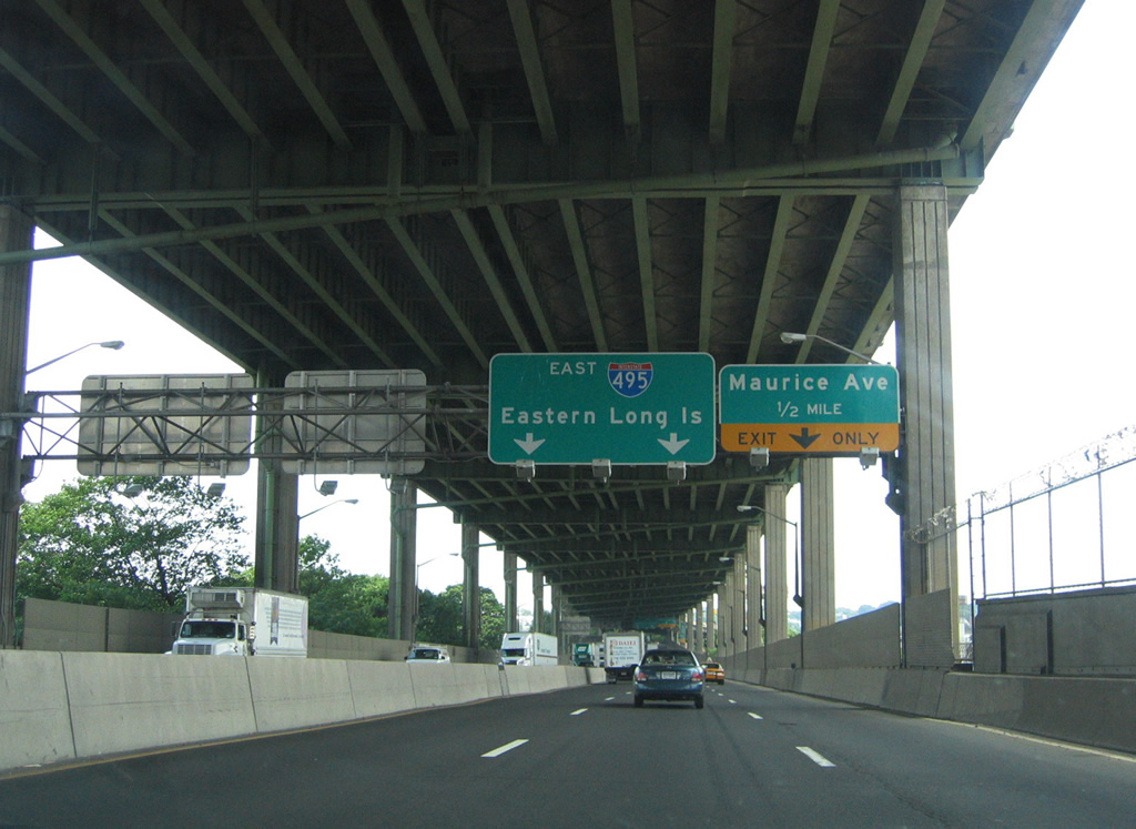
| The c/d roadway at Exit 17 forms the lower level of I-495 eastbound, which provides access to Maurice Avenue (Exit 18). Interstate 278 (BQE) east to Grand Central Parkway leads to La Guardia Airport (LGA) to the northeast. 12/17/17 |
|
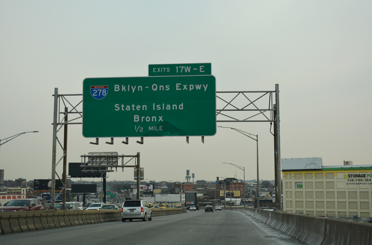
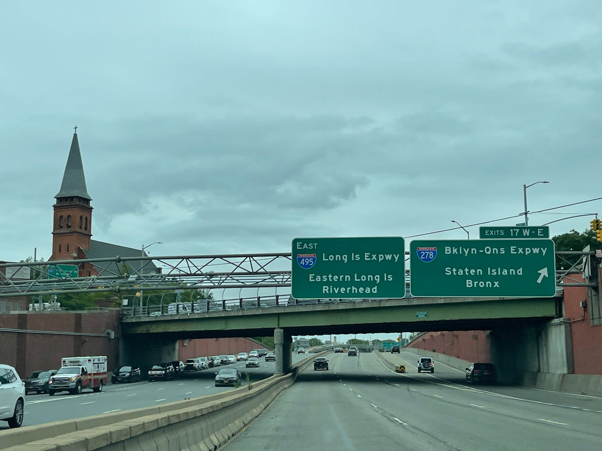
| Exit 17W/E leaves I-495 (Long Island Expressway) eastbound at the Greenpoint Avenue overpass. I-278 follows the BQE northward from the Hugh L. Carey Tunnel (I-478) and Gowanus Expressway in Brooklyn to Grand Central Parkway at Astoria in Queens. 06/12/21 |
|
| The c/d roadway at Exit 17 combines with Borden Avenue ahead of Exit 17W for Interstate 278 (BQE) west to Williamsburg in Brooklyn and Staten Island. 12/17/17 |
|
| A loop ramp follows at Exit 17E for Interstate 278 east to Woodside, Jackson Heights and Steinway. I-278 extends northeast to the Bruckner Interchange with I-95, I-295, I-678 and Hutchinson River Parkway in the Bronx. 12/17/17 |
|
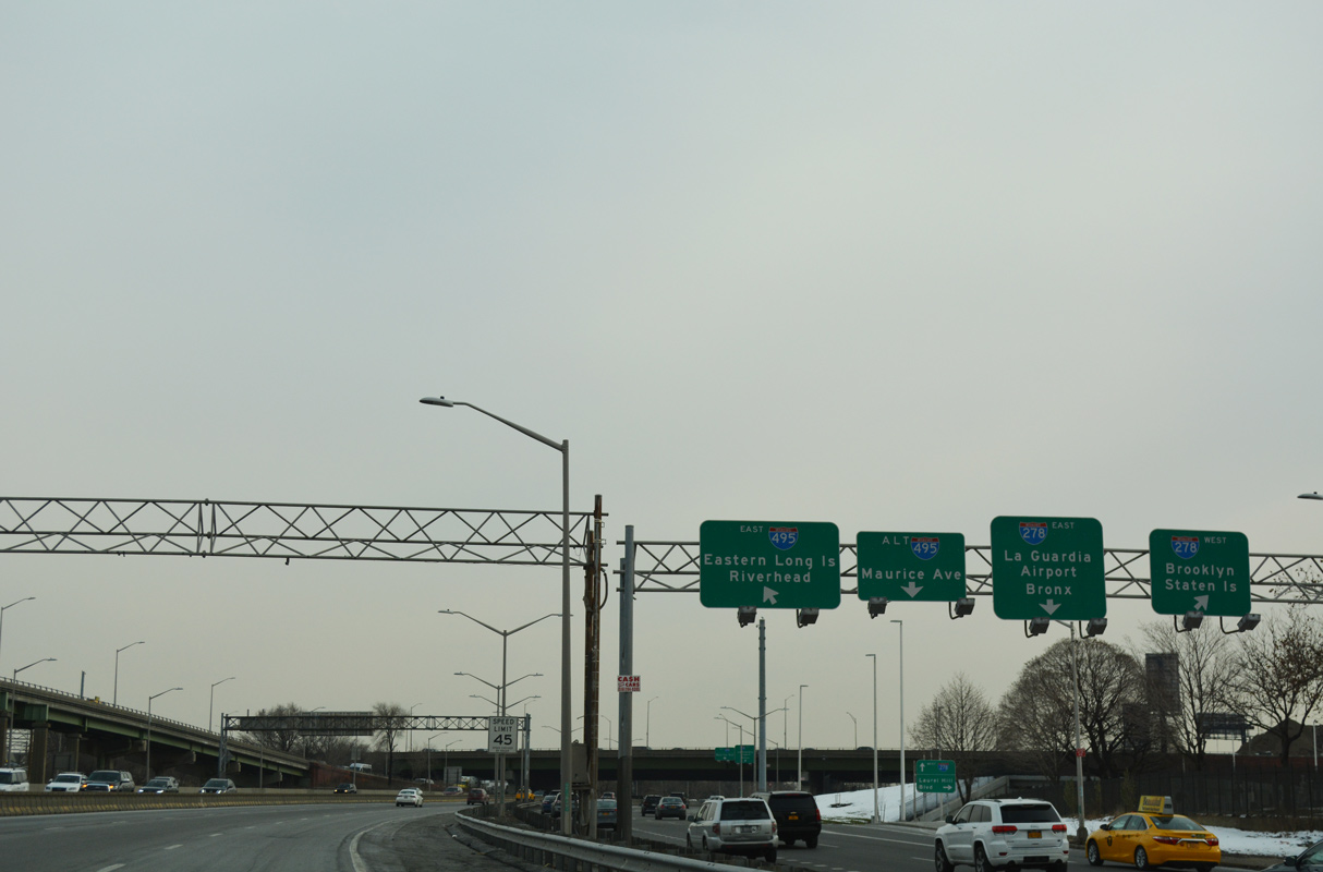
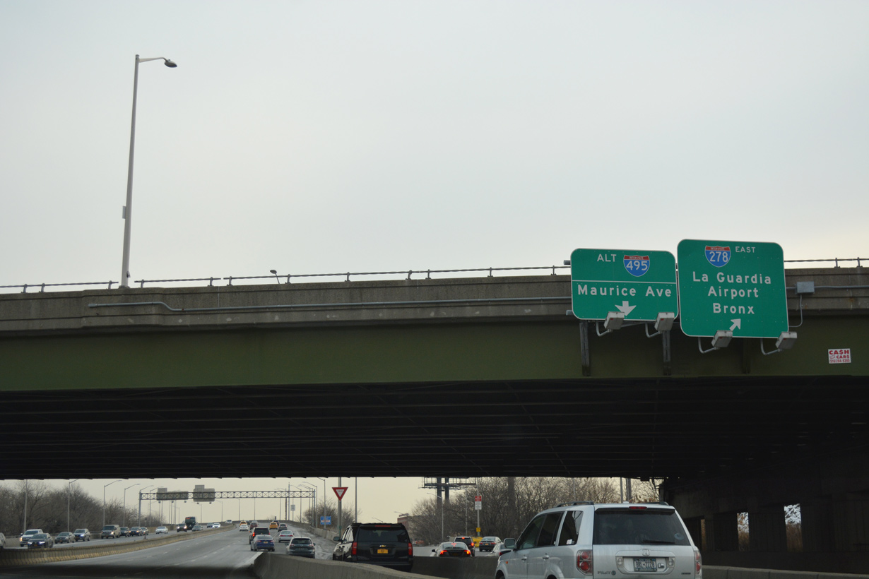
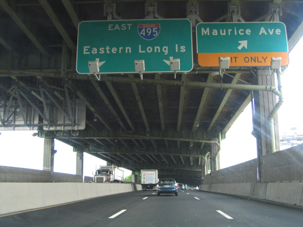
| Referenced at Exit 17 as Interstate 495 Alternate, the Long Island Expressway lower level extends east to Maurice Avenue and the Maspeth neighborhood. 12/17/17 |
|
| The upper deck of Interstate 495 continues the Long Island Expressway mainline east from I-278 toward Exit 19 for NY 25 (Queens Boulevard). 12/17/17 |
|
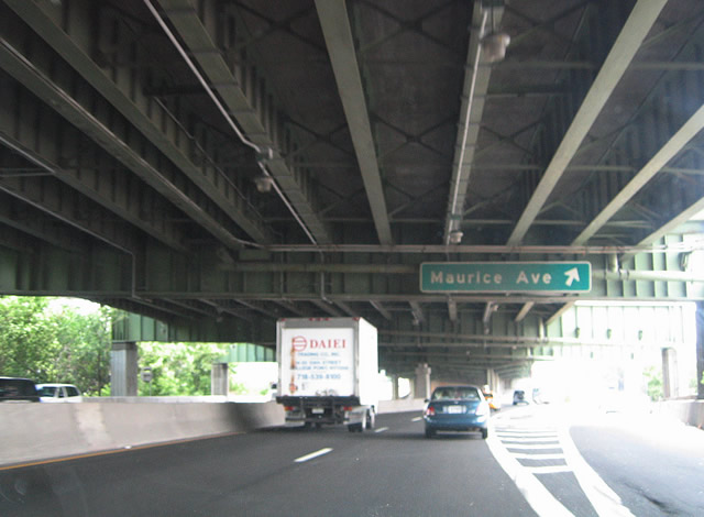
| The lower level of the Long Island Expressway continues a half mile east to a diamond interchange (Exit 18) with Maurice Avenue. 06/13/05 |
|
| Constructed as part of a four year $75 million project started in 1966, the L.I.E. upper deck consists of a 1.5 mile long, six lane viaduct.2 The lower level also accommodates six overall lanes. 06/13/05 |
|
| Ramps at Exit 18 comprise slip ramps onto adjacent Borden Avenue and Queens-Midtown Expressway. Maurice Avenue angles northeast through the Maspeth neighborhood to 51st Avenue alongside Mt. Zion Cemetery. 06/13/05 |
|
| Maurice Avenue south ties into the five way intersection with 55th Drive and 59th Street nearby. 06/13/05 |
|
| Two lanes from the lower level converge with two from the I-495 upper level ahead of the Hamilton Place overpass. Traveling below grade, eight overall lanes are maintained on the L.I.E. east to Exit 19 for NY 25 (Queens Boulevard). 12/17/17 |
|
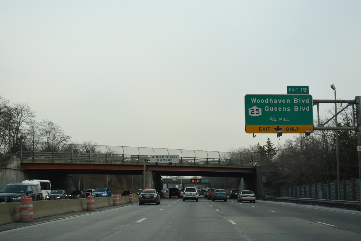
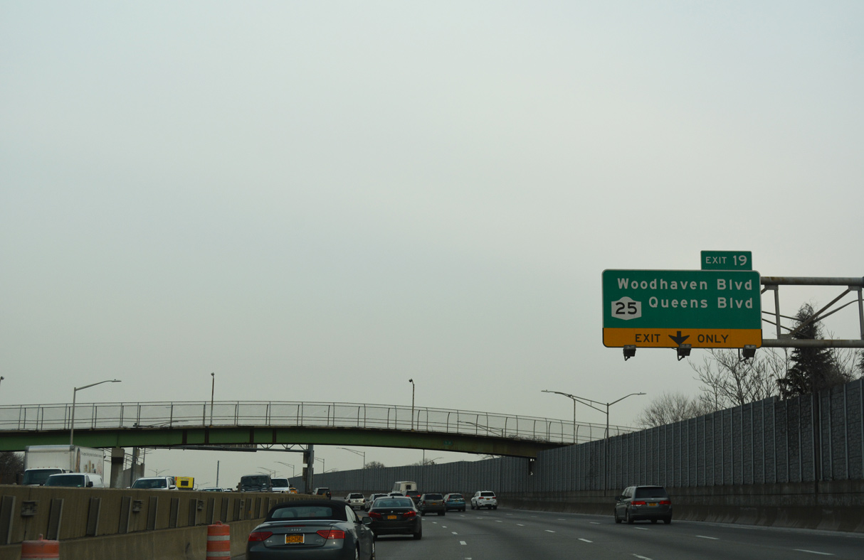
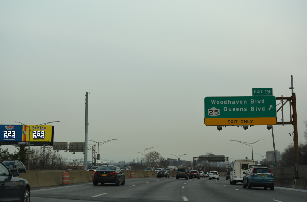
| Grand Avenue and 69th Street converge just north of I-495 in Maspeth. Forthcoming Exit 19 connects with Woodhaven Boulevard south to Cross Bay Boulevard at Ozone Park. Cross Bay Boulevard extends south to Rockaway Beach. 12/17/17 |
|
| Exit 19 joins a c/d roadway one mile ahead of Woodhaven Boulevard. Woodhaven Boulevard north ties into NY 25 (Queens Boulevard) at 59th Avenue and Queens Center mall. 12/17/17 |
|
| Woodhaven Boulevard stems south from I-495 to the Rego Park, Middle Village and Woodhaven communities in Queens. 12/17/17 |
|
| Separate ramps depart from the c/d roadway at Exit 19 for Woodhaven Boulevard at Wetherole Street and Eliot Avenue to NY 25 (Queens Boulevard). 12/17/17 |
|
| Back to back parclo interchanges join Interstate 495 with Woodhaven Boulevard south and NY 25 (Queens Boulevard) at Elmhurst. 06/13/05 |
|
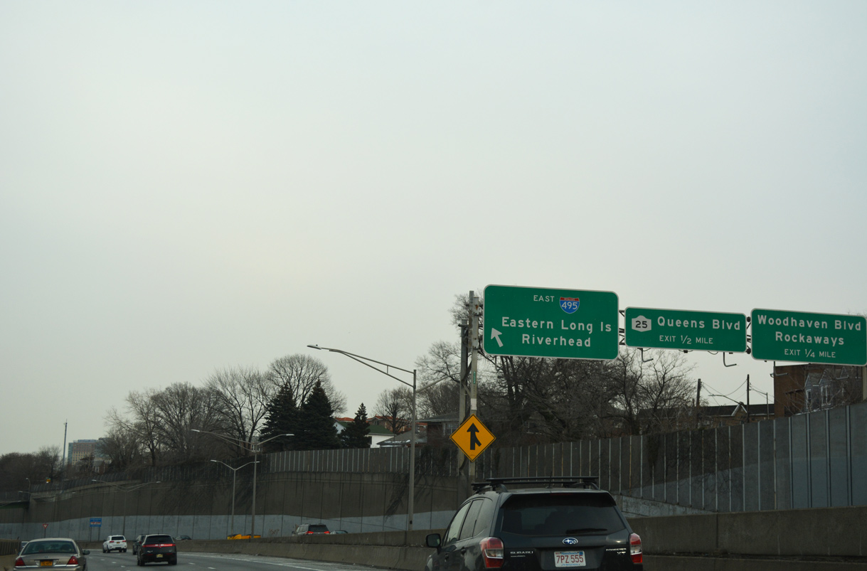
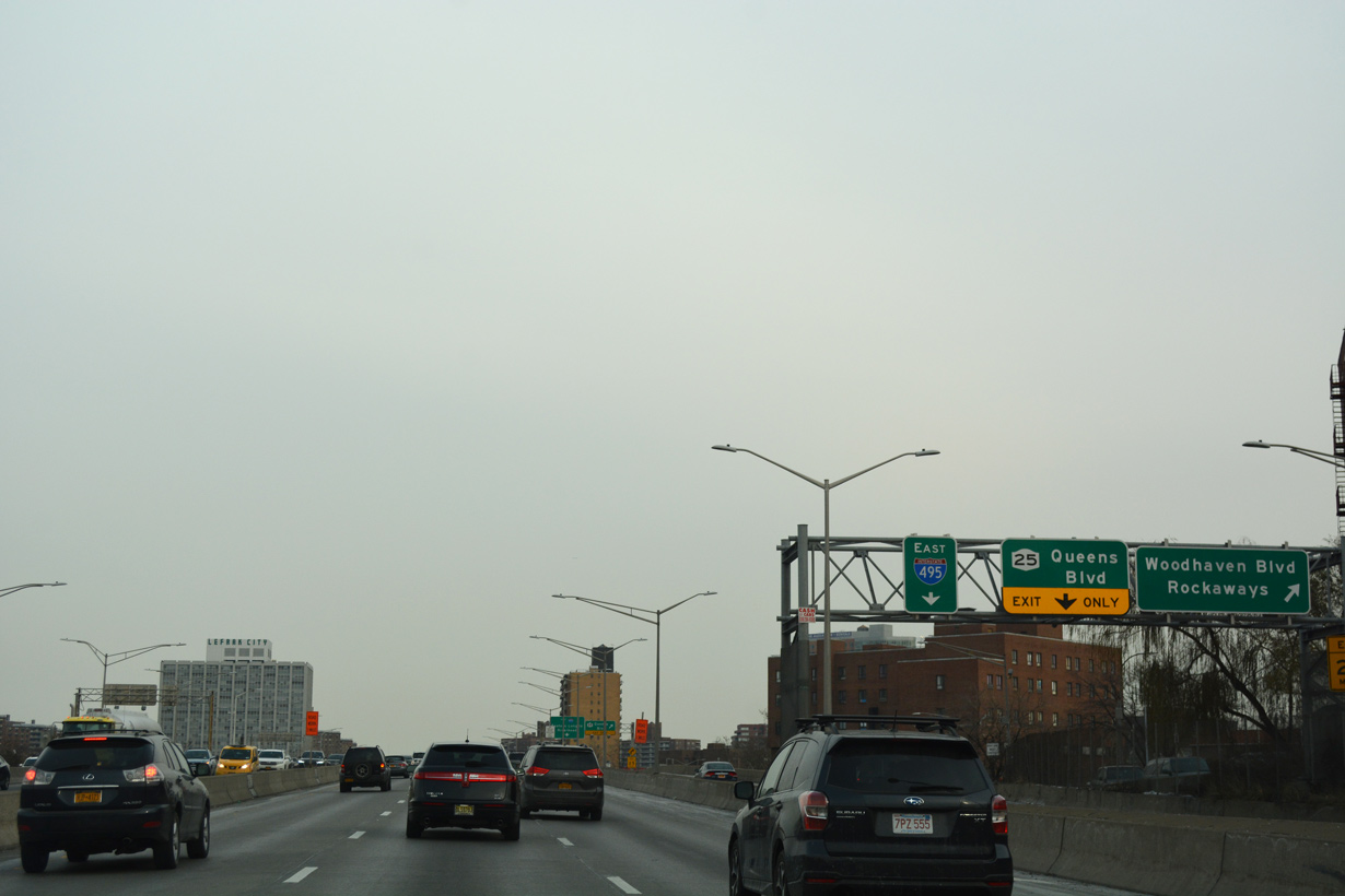
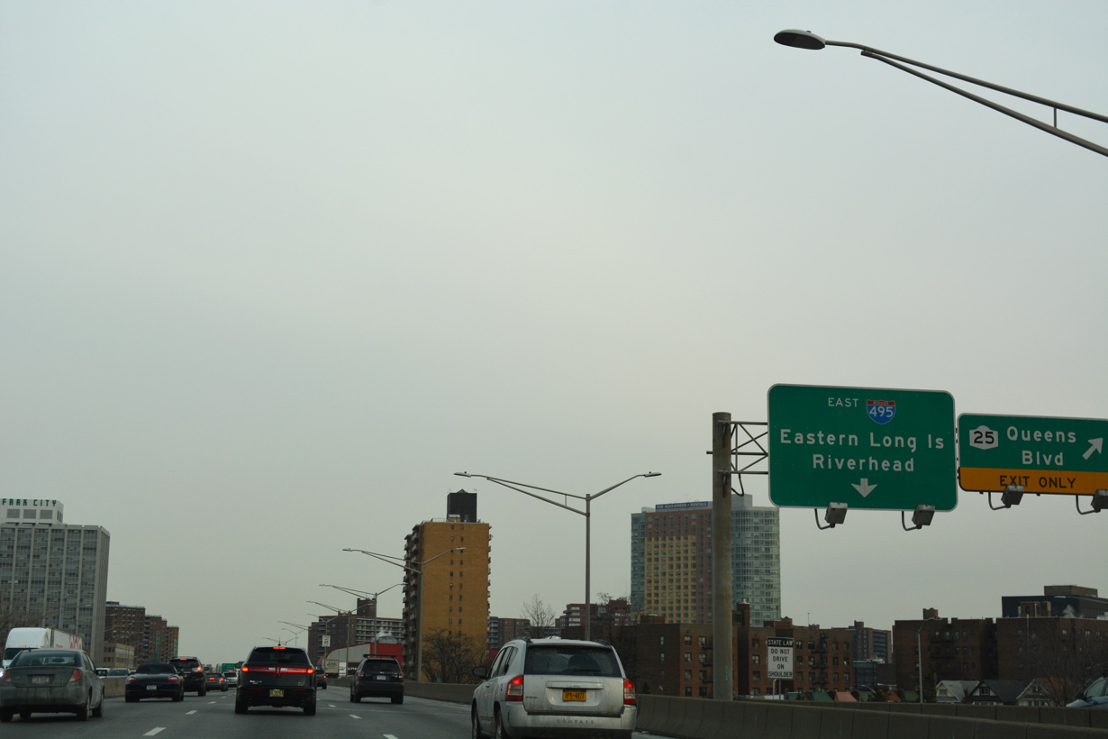
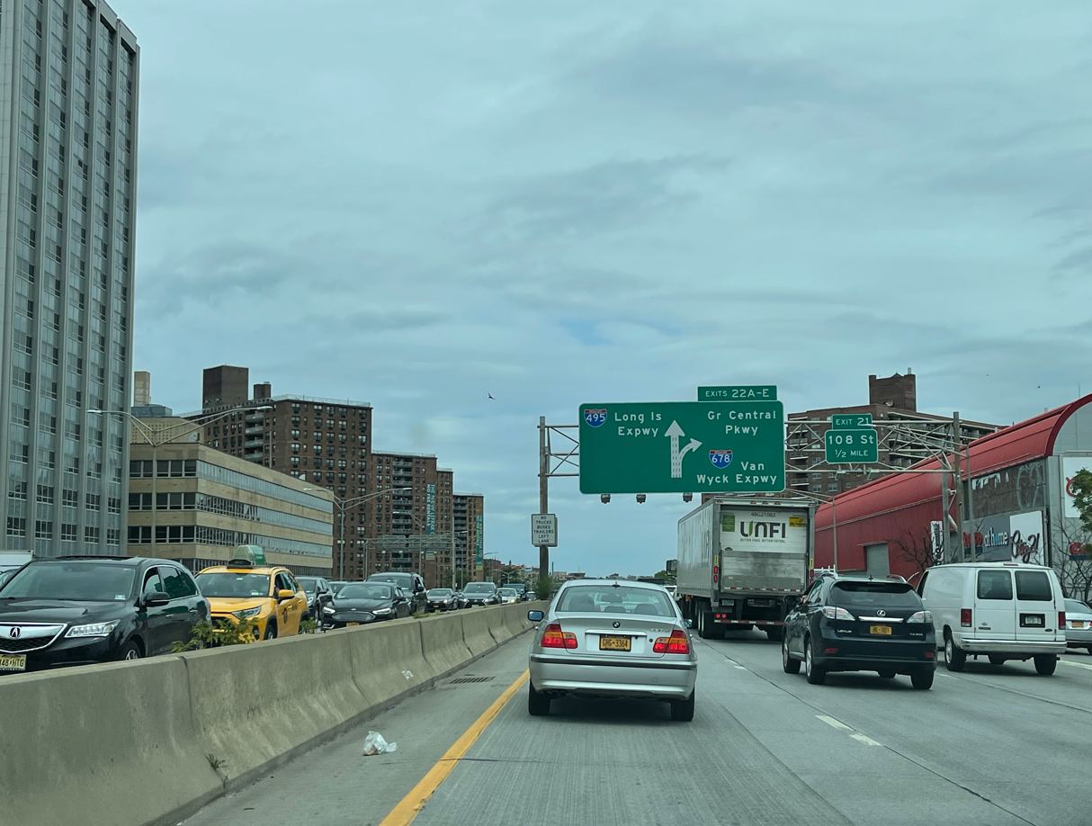
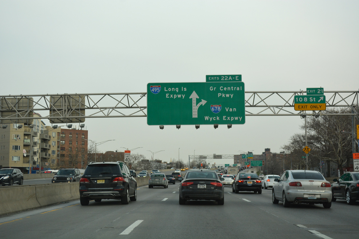
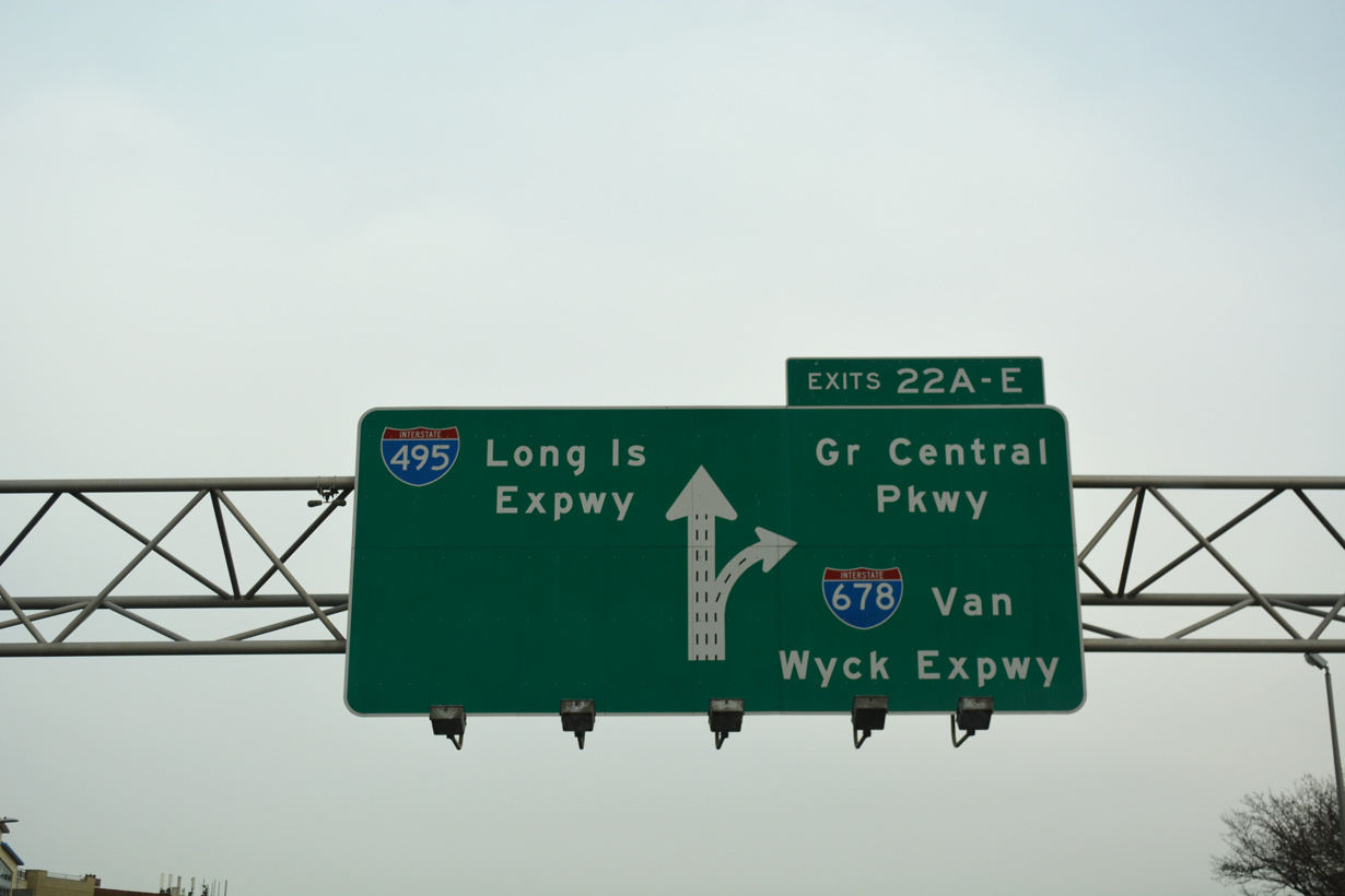
| I-495 continues east between Corona and Rego Park to Exit 21 for 108th Street. The cloverleaf interchange (Exit 22) with Grand Central Parkway at Flushing Meadows-Corona Park follows. 12/17/17 |
|
| Woodhaven Boulevard links I-495 east with NY 25 (Queens Boulevard) west through Elmhurst. NY 25 heads west through Sunnyside to the Queensboro Bridge spanning the East River to Lenox Hill in Manhattan. 12/17/17 |
|
| NY 25 (Queens Boulevard) continues southeast to Forest Hills, Kew Gardens and Jamaica in Queens. A 105.1 mile long route along the length of Long Island to Orient Point, NY 25 meets I-495 again at Exit 40 in Jericho. 12/17/17 |
|
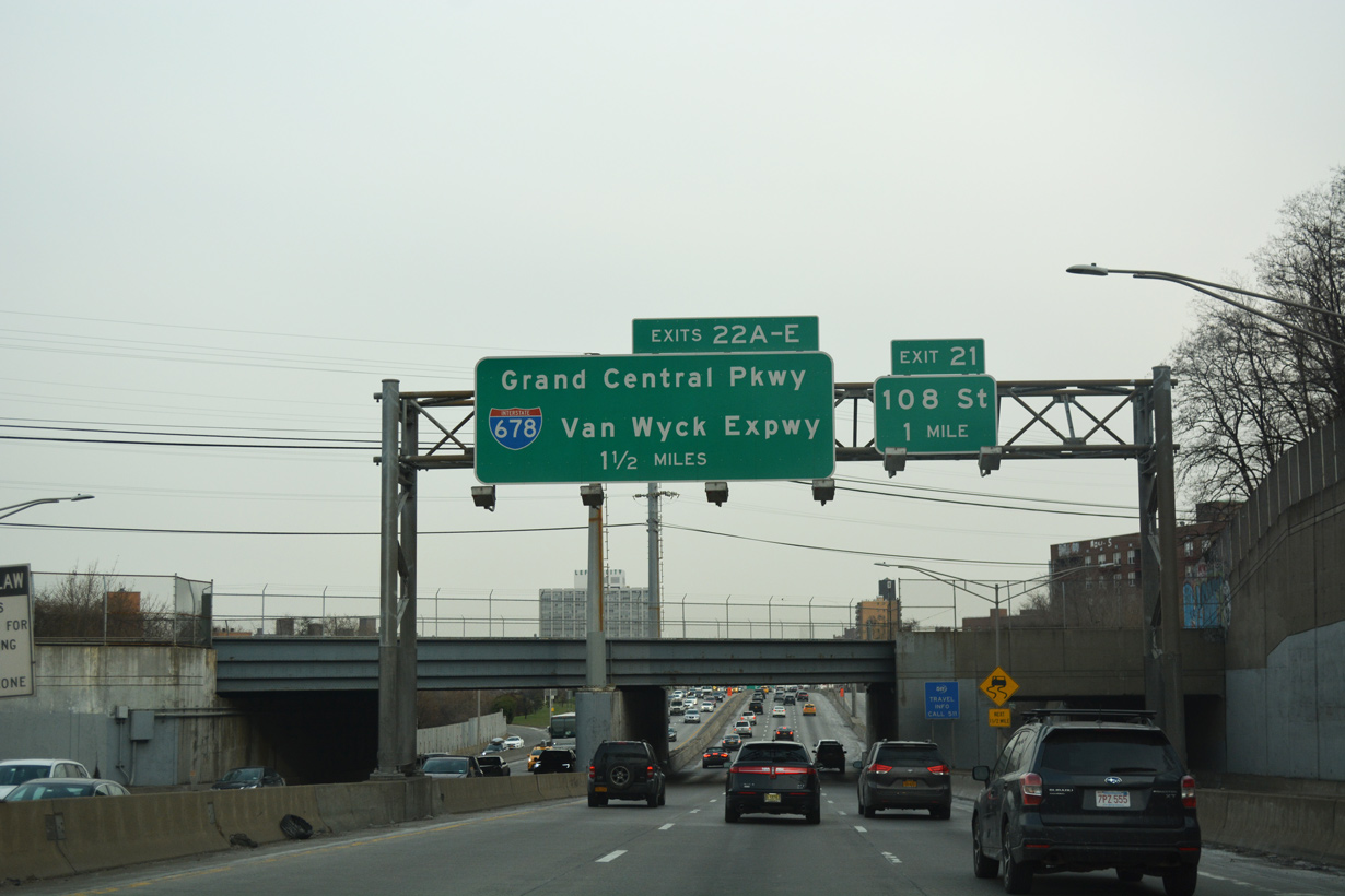
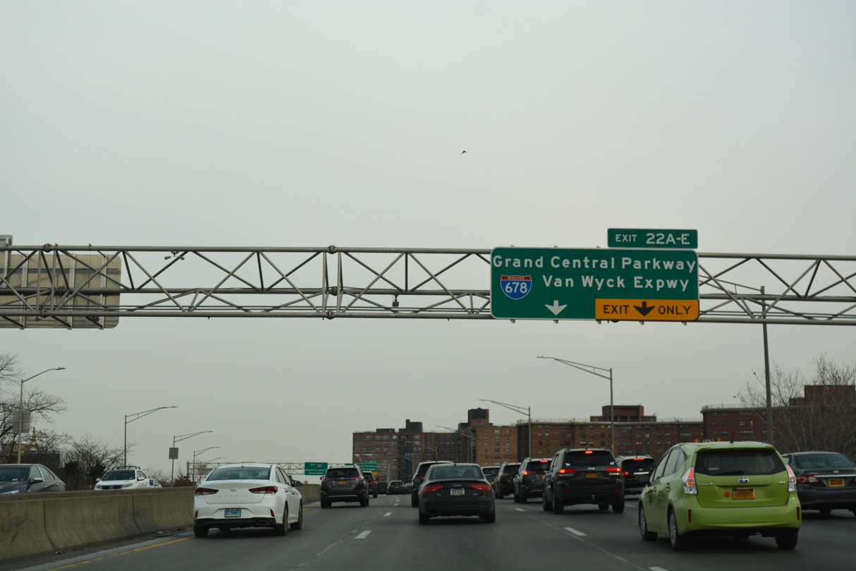
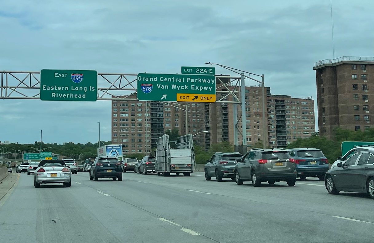
| An auxiliary lane opens along I-495 east from NY 25 to the c/d roadway (Exit 22) for Grand Central Parkway and Interstate 678 (Van Wyck Expressway). 06/12/21 |
|
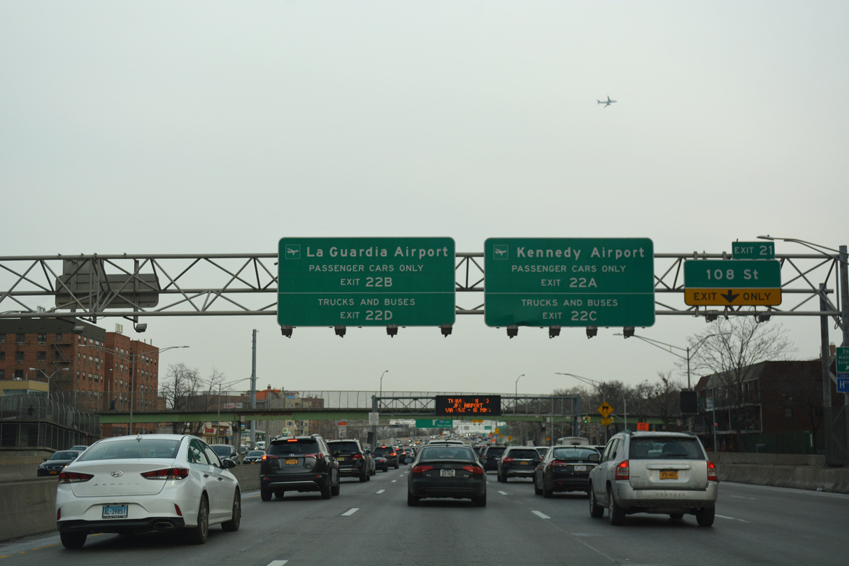
| Trucks and buses are prohibited from using Grand Central Parkway (GCP). GCP and I-678 (Van Wyck Expressway) run parallel south to the Kew Gardens Interchange and north to the Whitestone Expressway. I-678 spurs south into John F. Kennedy International Airport (JFK). 12/17/17 |
|
| Exit 21 links with Horace Harding Expressway, the service road system for I-495, east ahead of 108th Street to Corona, Forest Hills, Queens Zoo and the New York Hall of Science. 12/17/17 |
|
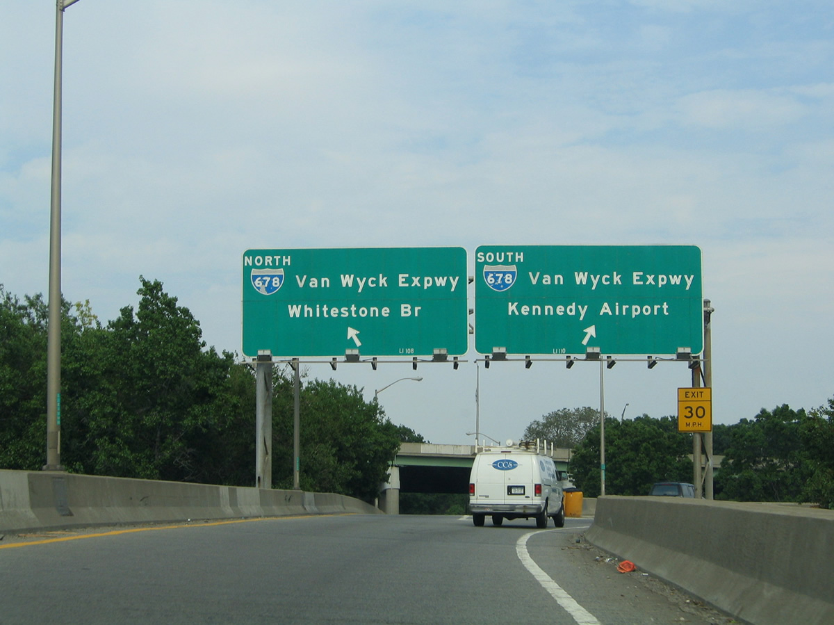
| A two lane c/d roadway (Exit 22) separates from I-495 east next for GCP, I-678 (Van Wyck Expressway) and College Point Boulevard. GCP travels northwest to I-278 and the RFK (Triborough) Bridge. I- 678 continues northeast to Flushing, Malba and the Whitestone Bridge to the Bronx. 12/17/17 |
|
| I-678 (Van Wyck Expressway) and GCP run south through Flushing Meadows Corona Park to the Kew Gardens Interchange with Jackie Robinson Parkway. 12/17/17 |
|
| Grand Central Parkway turns from east from Kew Gardens to Jamaica, Utopia, Terrace Heights and Queens Village. Leaving New York City, GCP becomes Northern Parkway between Lake Success and North New Hyde Park. 06/12/21 |
|
| Former button copy overheads posted at Exit 22A for Grand Central Parkway south to John F. Kennedy Airport (JFK). 06/13/05 |
|
| Exit 22B leaves the c/d roadway for Grand Central Parkway north to East Elmhurst, LaGuardia Airport (LGA) and Astoria Heights. These signs were replaced by 2011. 06/13/05 |
|
| The Meadow Lake Bridge spans the Long Island expressway at a slip ramp joining 108th Street and GCP with I-495 eastbound. 12/17/17 |
|
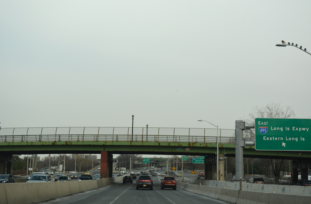
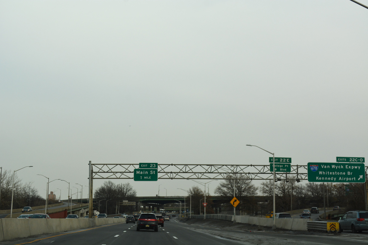
| Exits 22C/D partition from the c/d roadway for I-678 (Van Wyck Expressway) ahead of College Point Boulevard (Exit 22E). College Point Boulevard stems north from Horace Harding Expressway to Queens Botanical Garden, Flushing and College Point. 12/17/17 |
|
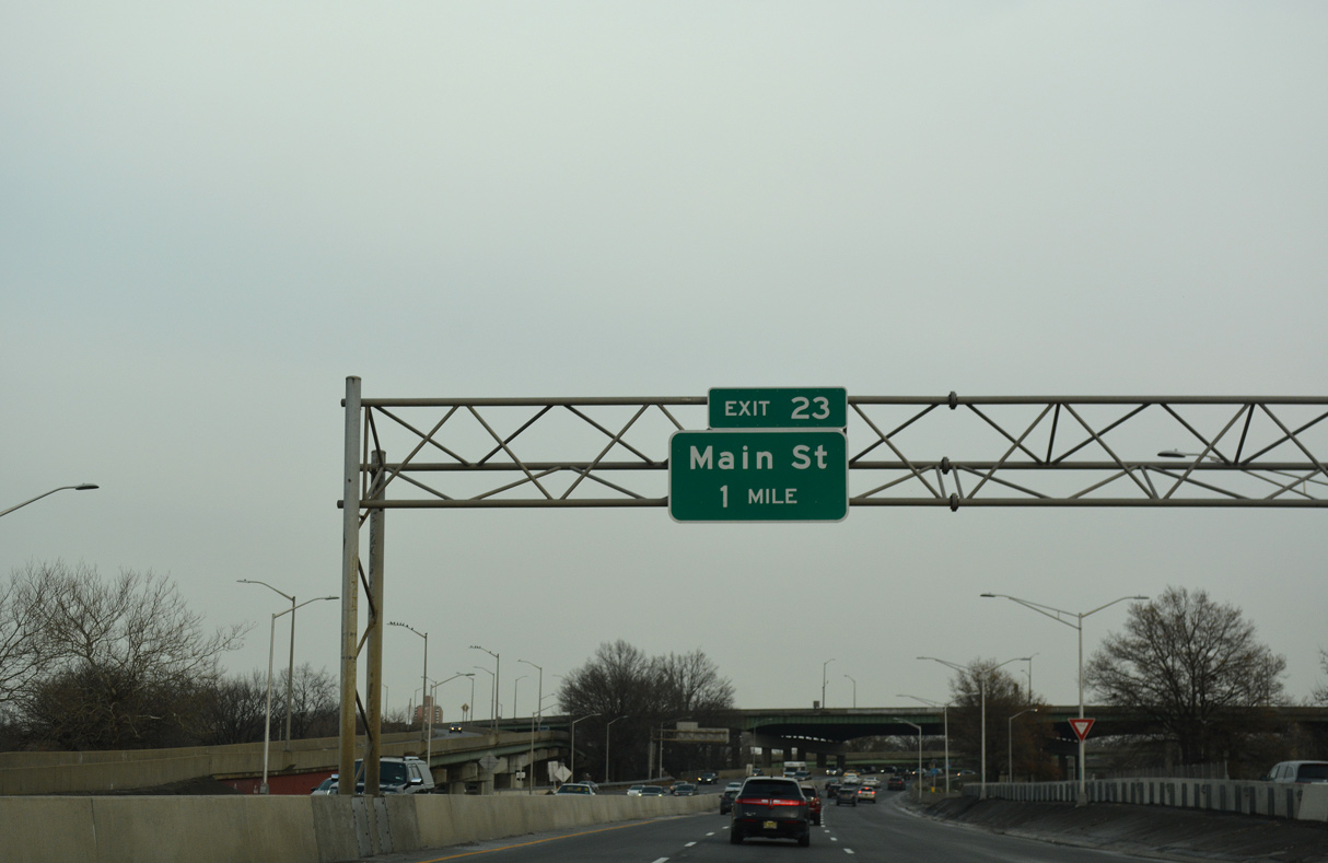
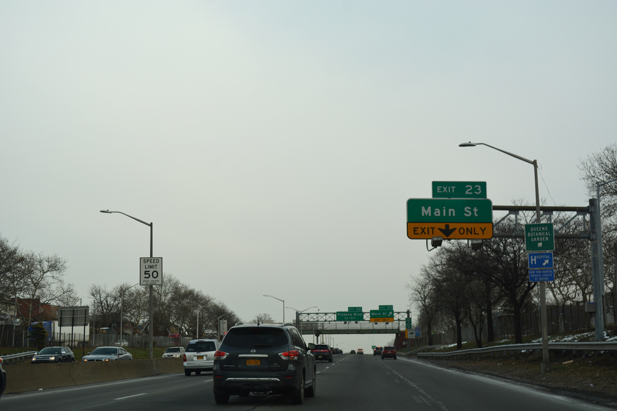
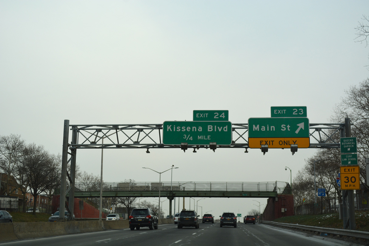
| I-495 proceeds east from Interstate 678 (Van Wyck Expressway) to a diamond interchange (Exit 23) with Main Street. 12/17/17 |
|
| I-678 (Van Wyck Expressway) heads south from I-495 to South Jamaica, South Ozone Park and the passenger terminals at JFK International Airport. 14.33 miles in length, I-678 north concludes at the Bruckner Interchange at Schuylerville in the Bronx. 06/13/05 |
|
| A reassurance marker stands at the half turbine interchange (Exit 22 D/E) with Interstate 678 (Van Wyck Expressway). 12/17/17 |
|
| Exit 23 joins I-495 east with Horace Harding Expressway ahead of 61st Road and Main Street in the Queensboro Hill community. 12/17/17 |
|
| Main Street heads north from Interstate 495 to Downtown Flushing and NY 25A (Northern Boulevard). Southward the arterial street passes by CUNY Queens College ahead of Kew Gardens Hills. 12/17/17 |
|
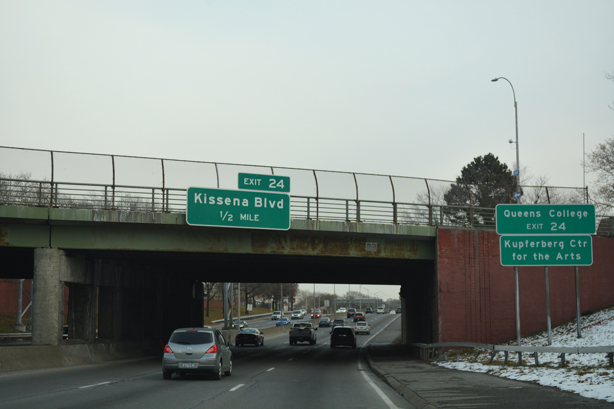
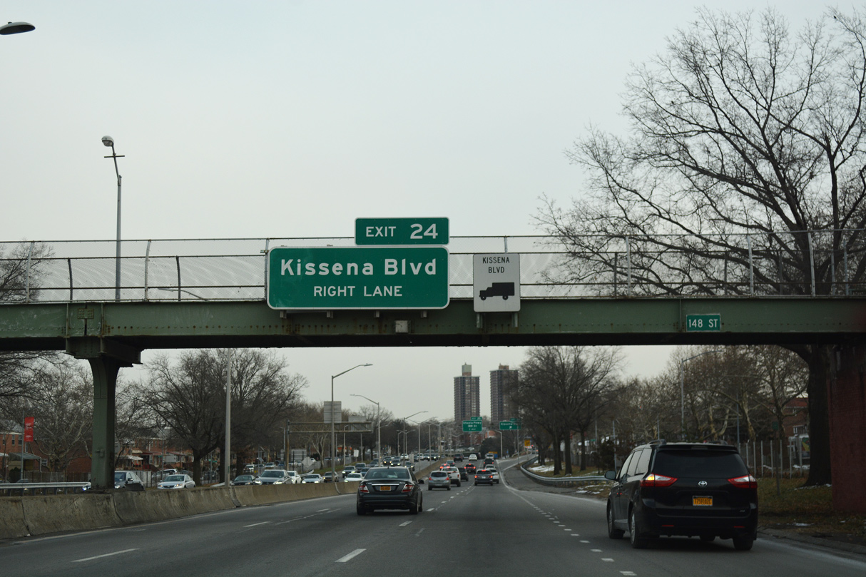
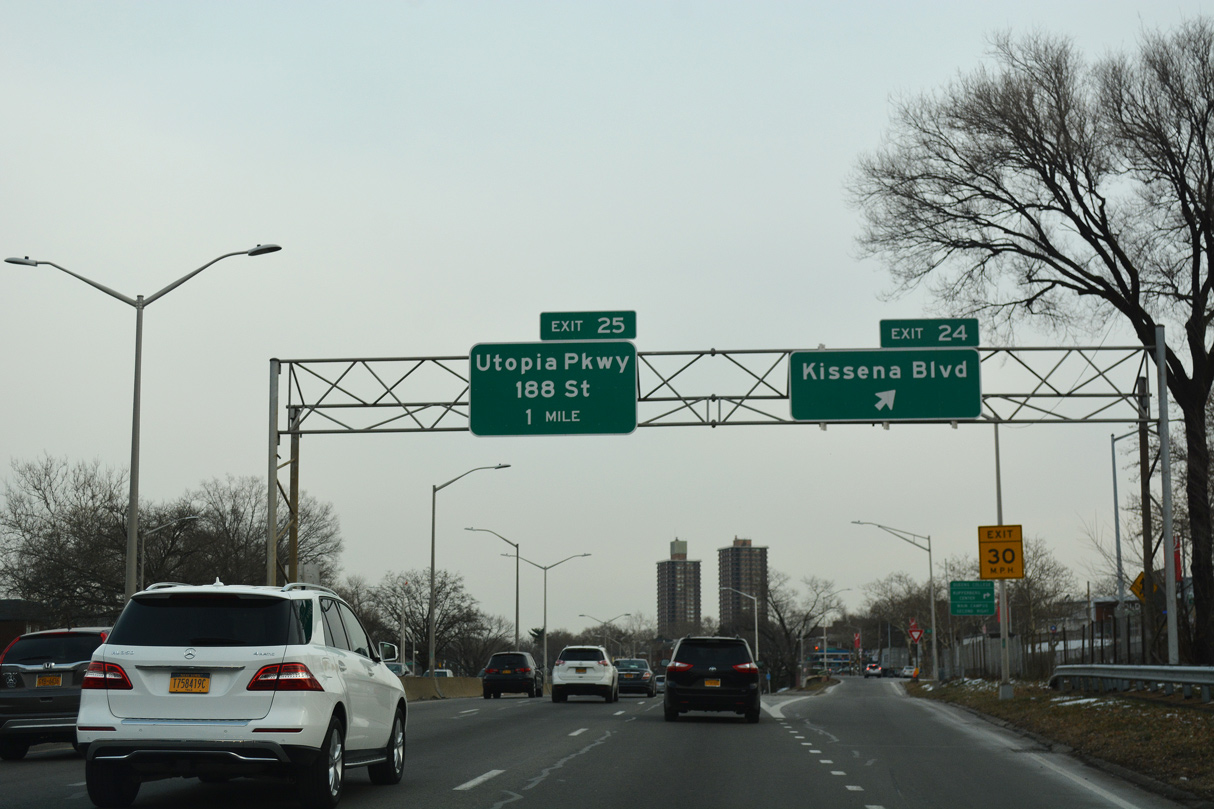
| Kissena Boulevard meets Interstate 495 at a diamond interchange (Exit 24) adjacent to CUNY Queens College in one half mile. 12/17/17 |
|
| The 148th Street pedestrian overpass precedes Exit 24 for Pomonok and Kissena Park. 12/17/17 |
|
| Kissena Boulevard branches northwest from Parsons Boulevard at Key Gardens Hills to CUNY Queens College, I-495 and Main Street in Downtown Flushing. 12/17/17 |
|
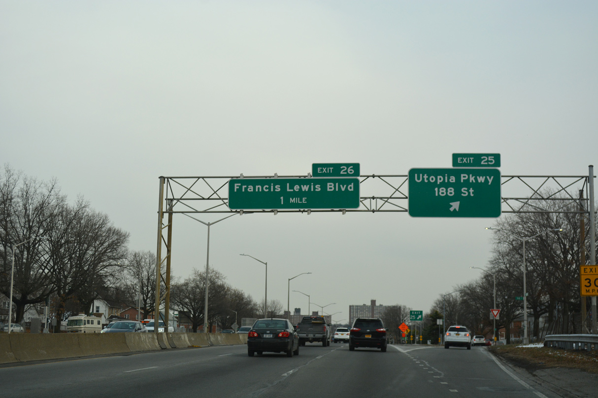
| Exit 25 departs for Horace Harding Expressway east at 169th Street. Utopia Parkway connects the Hillcrest, Utopia and Auburndale neighborhoods while 188th Street branches southeast to the Fresh Meadows and Jamaica Estates communities. 12/17/17 |
|
| A slip ramp adds traffic from Horace Harding Expressway at 182nd Street onto the eastbound L.I.E. Ramp meters are used along this stretch of Interstate 495. 12/17/17 |
|
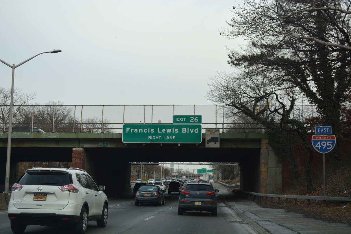
| The succeeding exit from the L.I.E. eastbound is for Francis Lewis Boulevard and Cunningham Park. 12/17/17 |
|
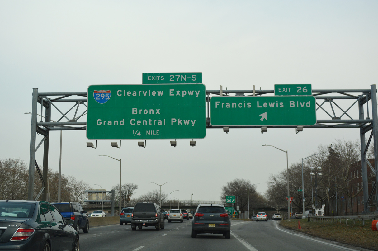
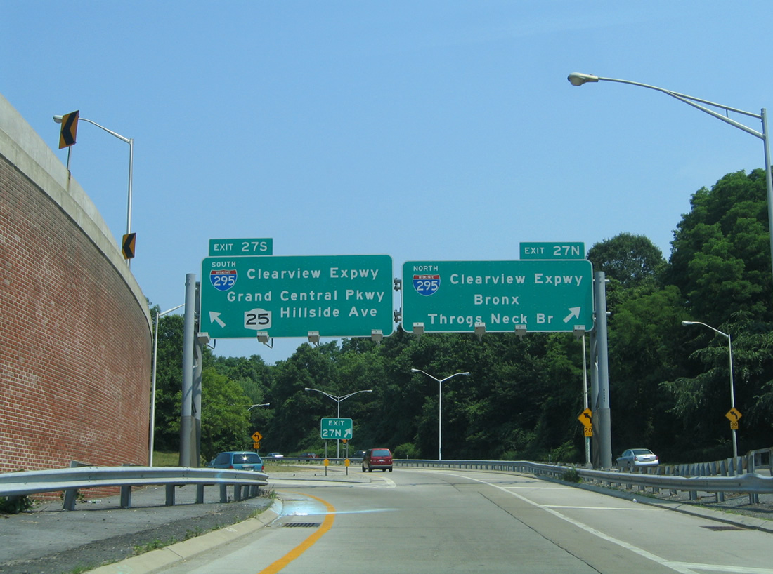
| Exit 26 is a split diamond interchange with Horace Harding Expressway outside the turbine interchange (Exit 27) with I-295 (Clearview Expressway). Francis Lewis Boulevard constitutes an arterial north through the Auburndale street grid and south alongside Cunningham Park to Holliswood. 12/17/17 |
|
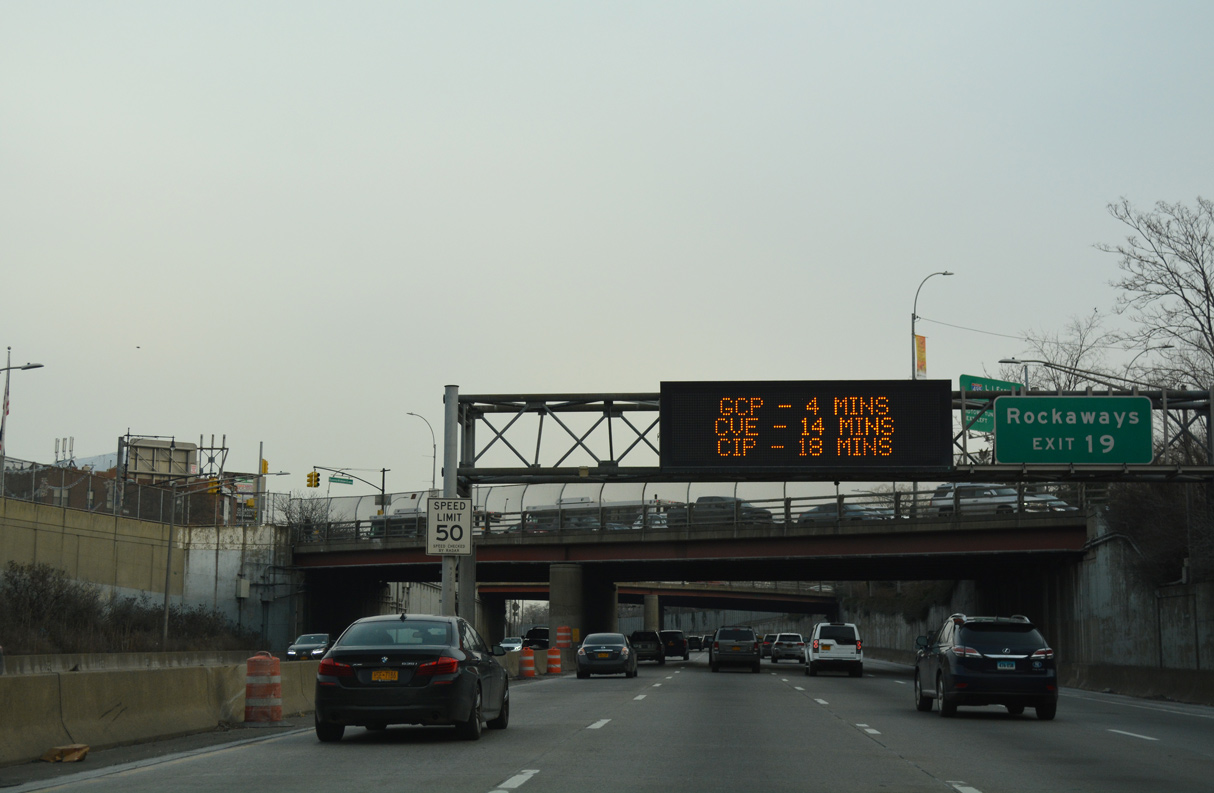
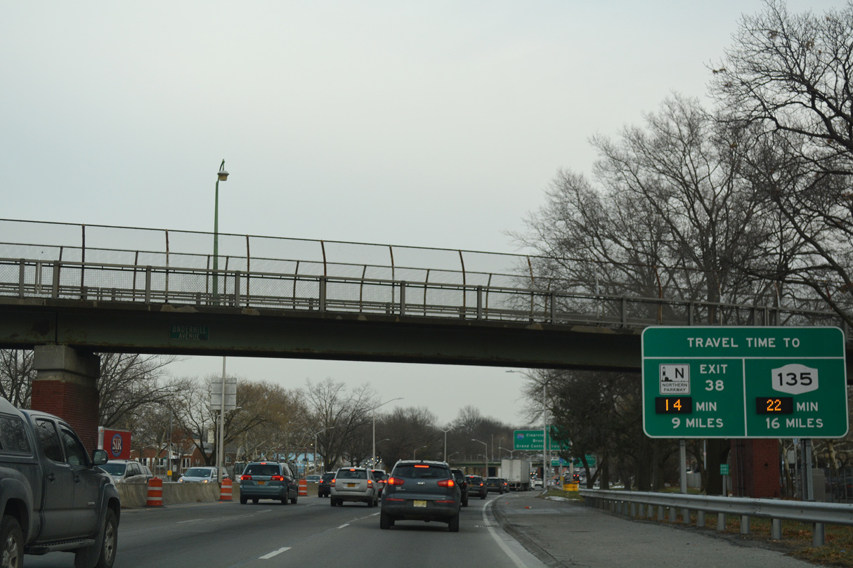
| Travel times to Northern Parkway and NY 135 are provided on this dynamic sign at the Underhill Avenue pedestrian bridge and Kissena Corridor Park. 12/17/17 |
|
| Interstate 295 (Clearview Expressway) is a 9.1 mile long route north from NY 25 (Hillside Avenue) at Queens Village to the Bruckner Interchange with I-95, I-278, I-678 and Hutchinson River Parkway in the Bronx. 12/17/17 |
|
| The Clearview Expressway was previously numbered I-78 between 1958 and 1971, based upon the planned alignment of I-78 east from the Williamsburg Bridge along the proposed Bushwick and Nassau Expressways. When the southern extension of the Clearview Expressway was cancelled, I-78 was renumbered as I-295.3 12/17/17 |
|
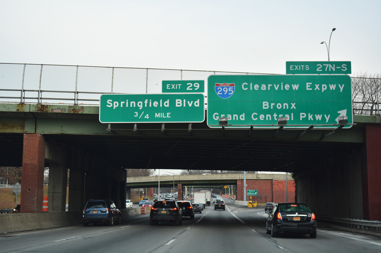
| Exits 27N/S partition for Interstate 295 (Clearview Expressway) south through Cunningham Park to Oakland Gardens and Grand Central Parkway and north for Bayside, the Throgs Neck Bridge and Edgewater Park in the Bronx. 06/13/05 |
|
| Return access from Francis Lewis Boulevard follows onto Interstate 495 east from Horace Harding Expressway at 212th Street. 12/17/17 |
|
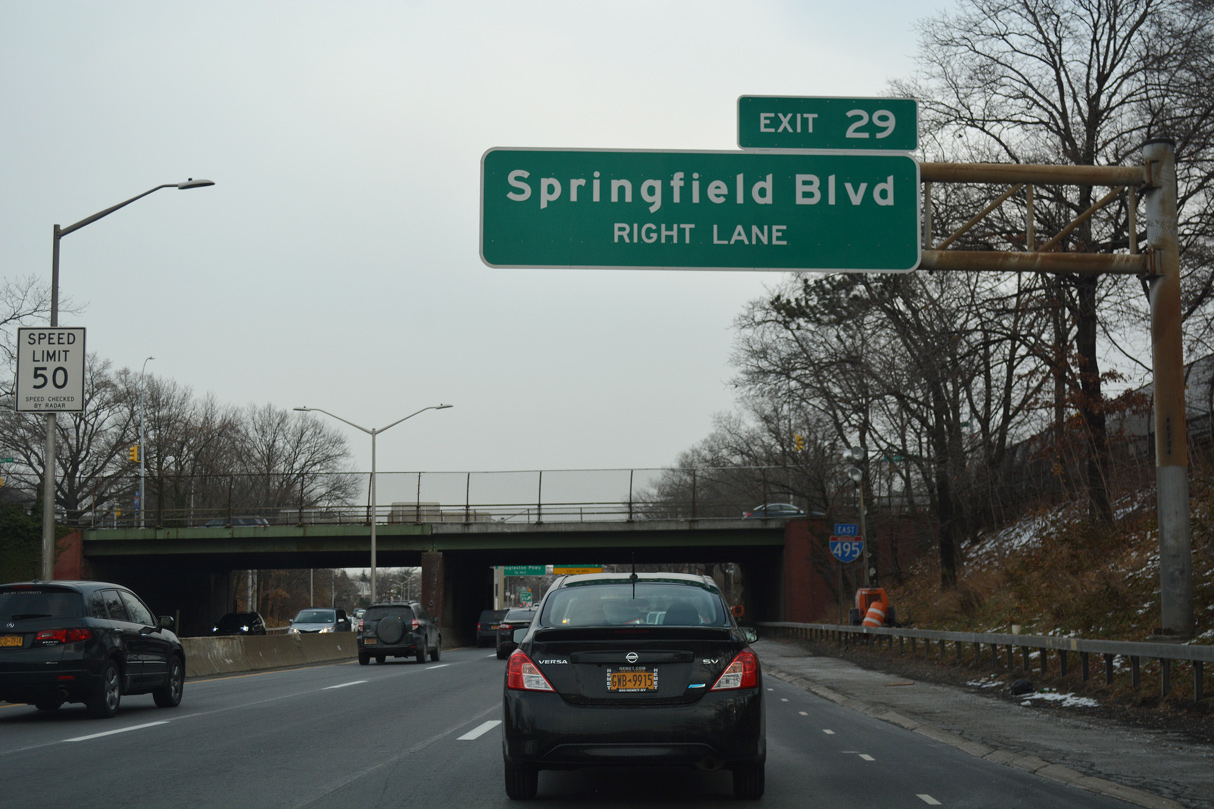
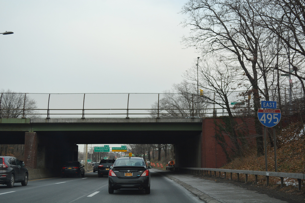
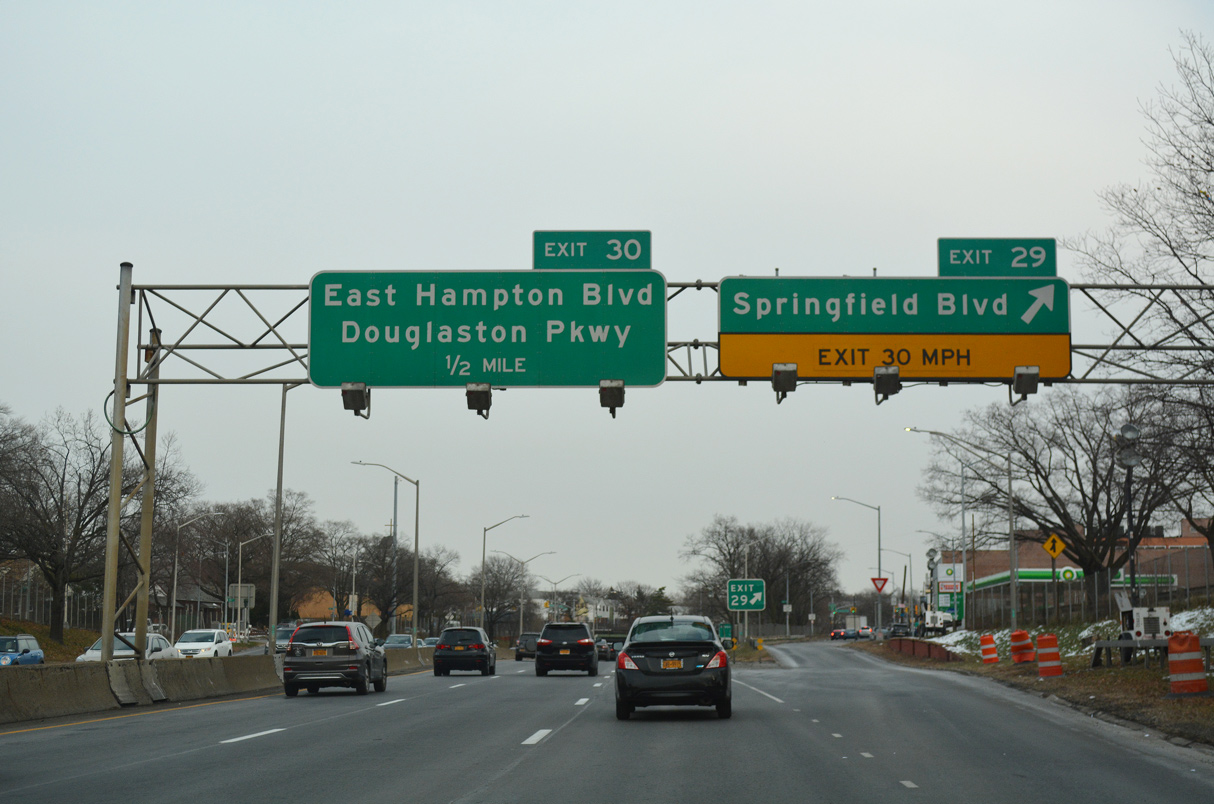
| Advancing east, Interstate 495 meets Springfield Boulevard at a diamond interchange (Exit 29) near Queensborough Community College. 12/17/17 |
|
| Confirming marker posted eastbound at the Bell Boulevard overpass. 12/17/17 |
|
| Springfield Boulevard heads south from Exit 29 to Oakland Gardens and north to Bayside Hills, Bayside and NY 25A (Northern Boulevard) beyond Oakland Lake. 12/17/17 |
|
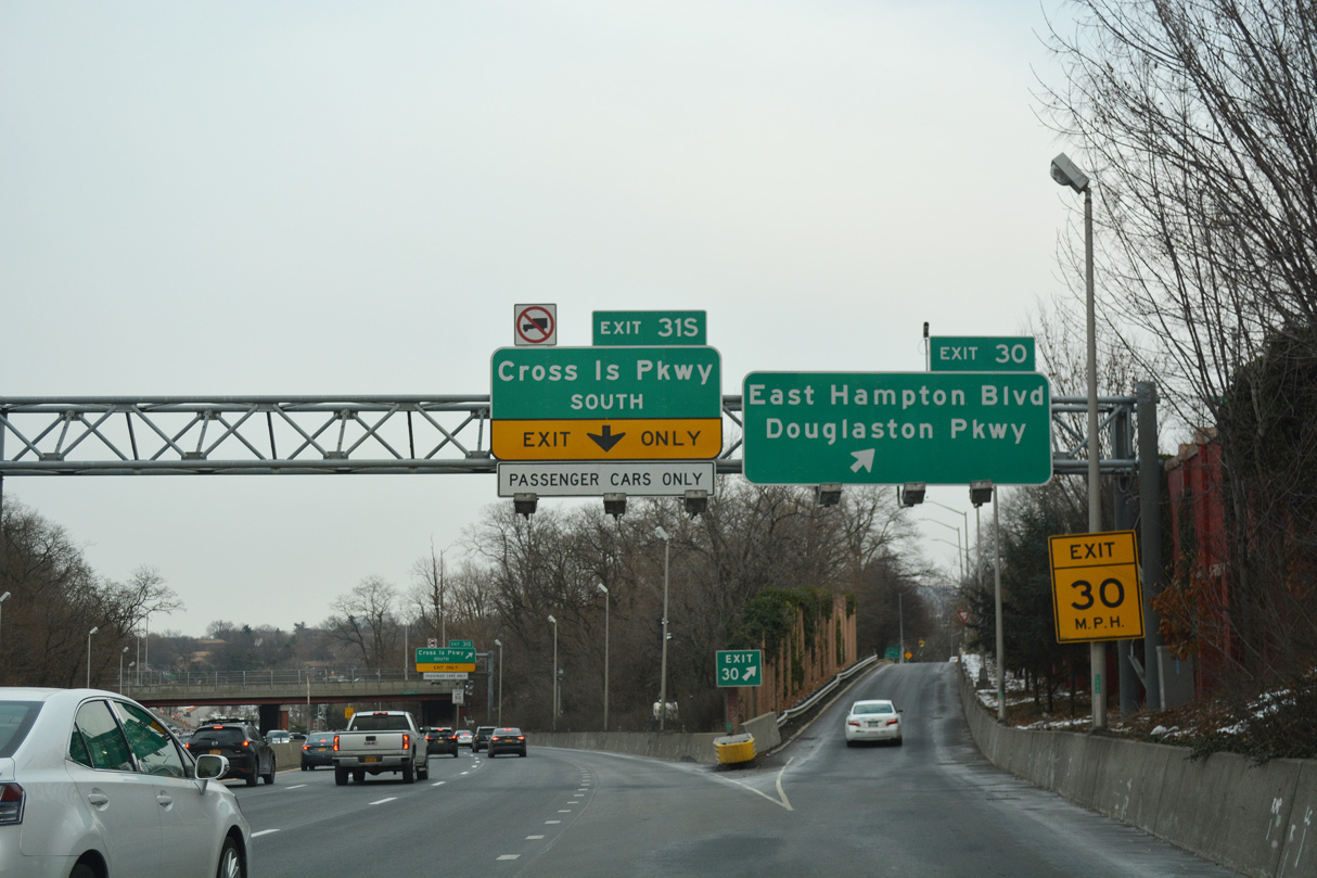
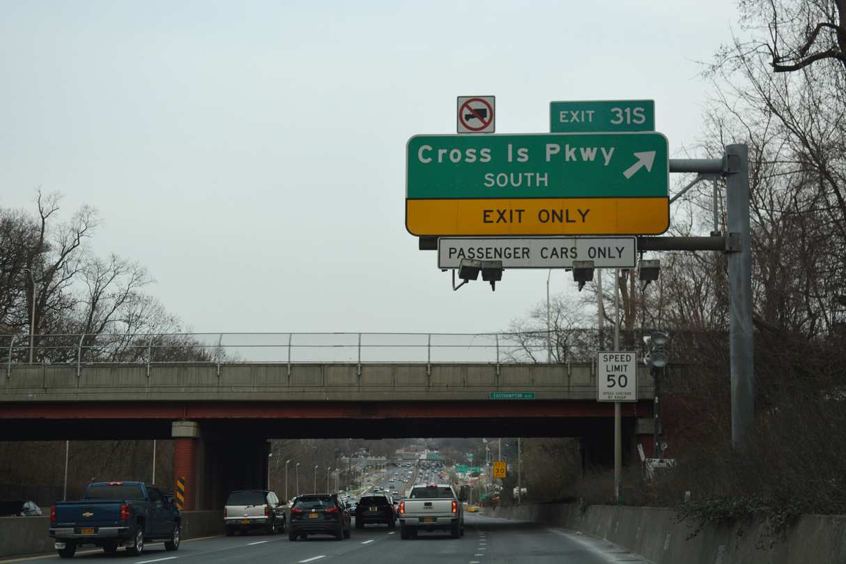
| Three years of construction completed in 2003 rebuilt the cloverleaf interchange (Exit 31) with Cross Island Parkway. The $130 million project also redirected Exit 30 to Douglaston Parkway via Alley Road east from E Hampton Boulevard while adding Exit 31S for Cross Island Parkway south.2 12/17/17 |
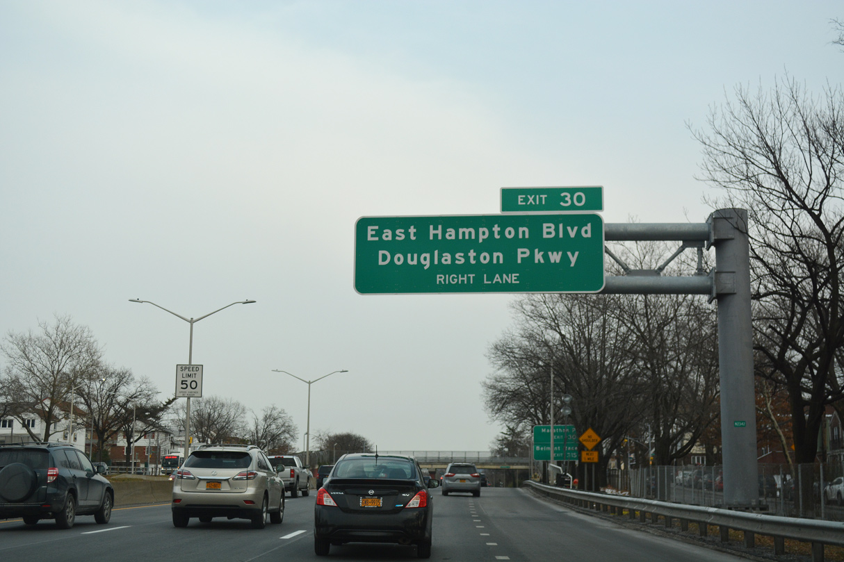
|
| E Hampton Boulevard leads north from Horace Harding Expressway and Alley Road at Exit 30 to southeast Bayside while Douglaston Parkway parallels Cross Island Parkway south to Bellaire. 12/17/17 |
|
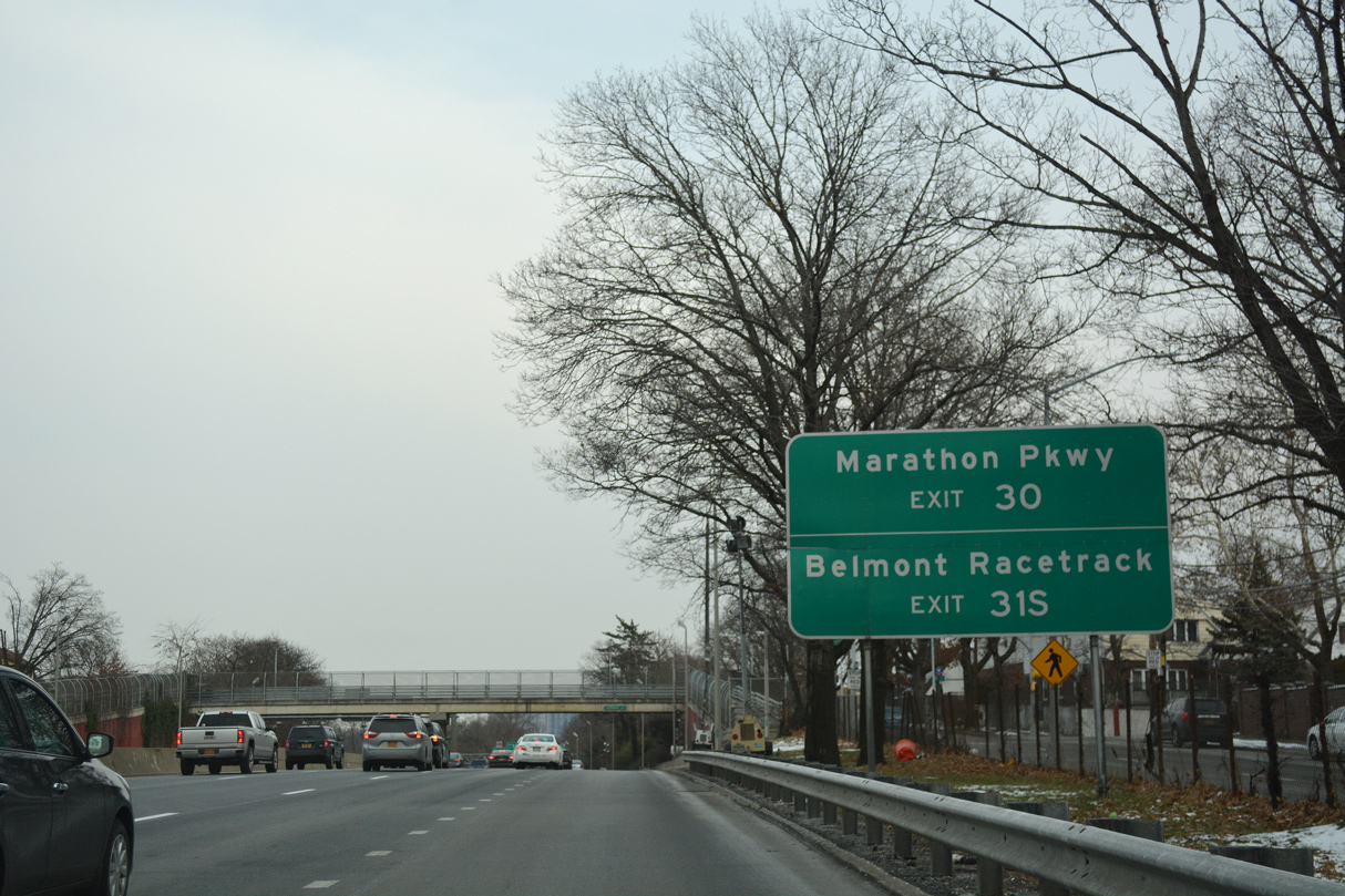
| Douglaston Parkway north connects I-495 with Douglaston in east Queens. Horace Harding Parkway resumes east to Marathon Parkway at the Little Neck neighborhood. 12/17/17 |
|
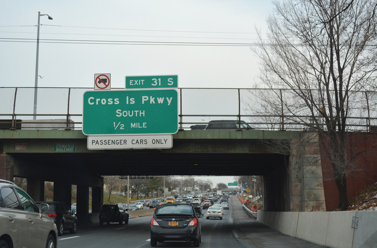
| Exit 31S leaves Interstate 495 east beyond the E Hampton Boulevard overpass for Cross Island Parkway south. Restricted to passenger vehicles, the parkway arcs northwest to Beechhurst and I-678 at Malba and continues south to Southern State and Belt Parkways at Cambria Heights. 12/17/17 |
|
| Cross Island Parkway makes up the eastern third of the Belt Parkway system encircling Queens and Brooklyn. Belt Parkway concludes at the Whitestone Bridge to the north and at the Gowanus Expressway (I-278) to the southwest. 12/17/17 |
|
| A loop ramp connecting the eastbound L.I.E. with Cross Island Parkway north was removed sometime before 1994. Two additional loop ramps were replaced with directional ramps during 2000-03 road work. 06/13/05 |
|
| Utilizing a portion of the former ramp system at Exit 31, Exit 30E from Cross Island Parkway connects with both I-495 east and Douglaston Parkway. 06/13/05 |
|
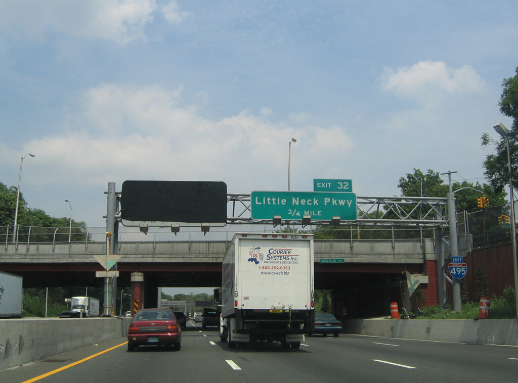
| The final exit for Queens, New York from Interstate 495 east departs in three quarters of a mile for Little Neck Parkway at Little Neck. 06/13/05 |
|
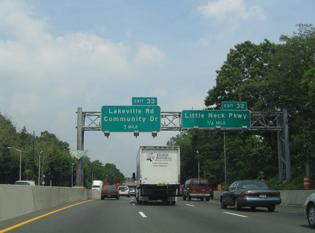
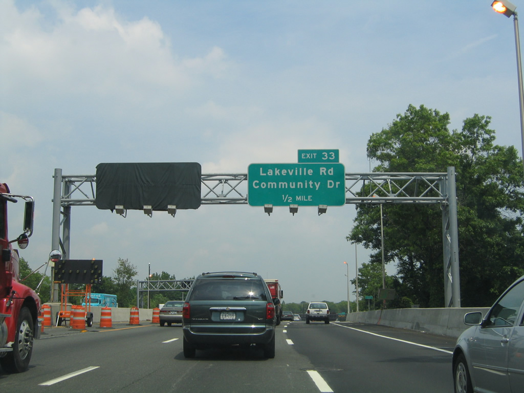
| I-495 again drops below grade ahead of Marathon Parkway. The forthcoming diamond interchange (Exit 32) with Little Neck Parkway serves Douglaston Park and Glen Oaks to the south. Exit 33 follows at Lake Success for Lakeville Road and Community Drive. 06/13/05 |
|
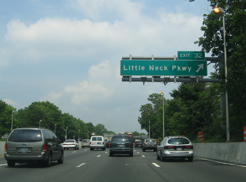
| Exit 32 joins Horace Harding Expressway ahead of 256th Street for Little Neck Parkway. Little Neck Parkway meanders northward through the Little Neck community to Virginia Point off Little Neck Bay. 06/13/05 |
|
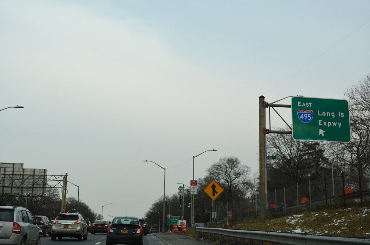
| Entering Nassau County, the left lane of I-495 transitions into an HOV lane. Completing the HOV system leading east to Exit 64 at Medford, the HOV lane between Exits 32 and 41 opened to traffic on June 30, 2005, 06/13/05 |
|
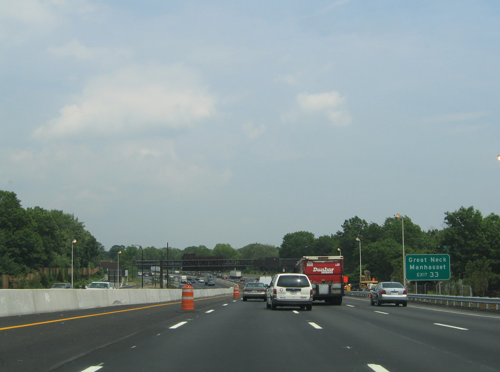
| I-495 crosses the Nassau County line just beyond the Little Neck Parkway underpass. Upcoming Exit 33 joins the Long Island Expressway with Community Drive north to Manhasset while Great Neck is reached via Lakeville Road north to Middle Neck Road. 06/13/05 |
Page Updated 07-13-2021.

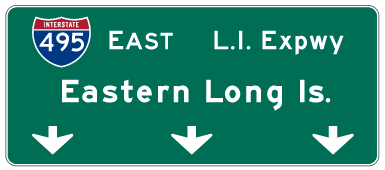
 East
East