|
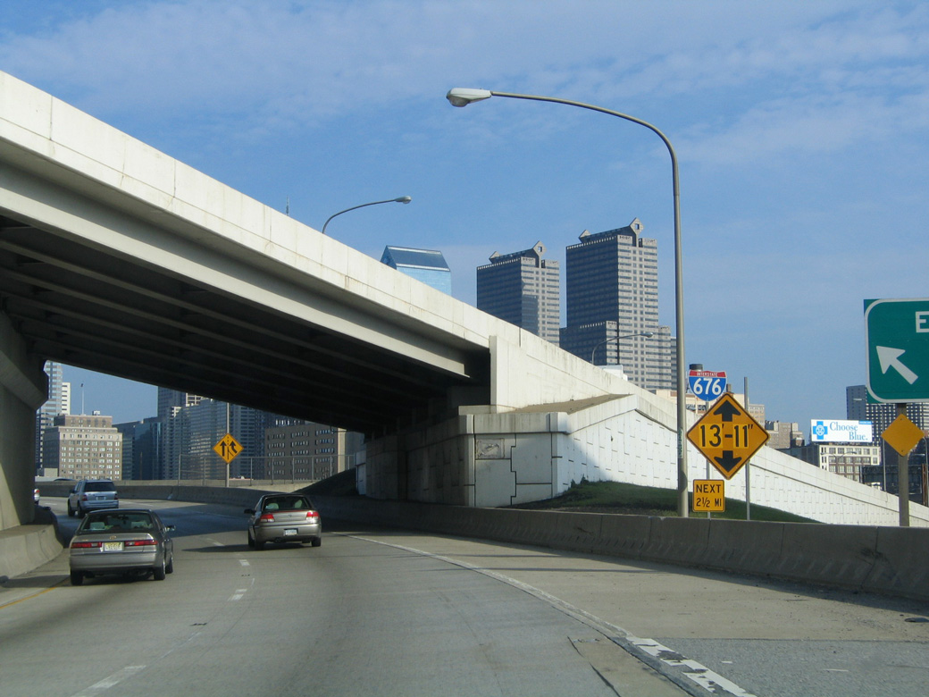
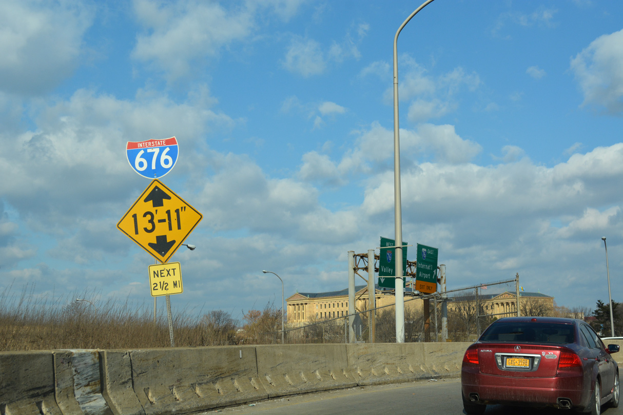
| Low clearance signs appear along both ramps connecting the Schuylkill Expressway with Interstate 676/U.S. 30 east. 04/10/04, 12/19/17 |
|
| Ramps from I-76 (Schuylkill Expressway) converge over the Schuylkill River to form the Vine Street Expressway. 12/19/17 |
|
| Removed by 2012, the lone confirming marker for Interstate 676 was posted on the Vine Street Expressway Bridge. 04/10/04 |
|
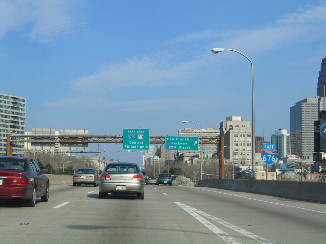
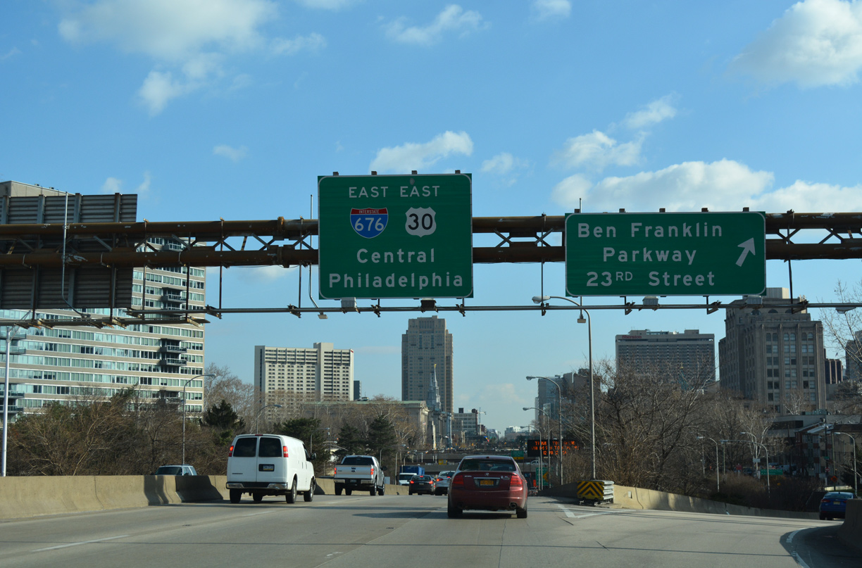
| The first I-676 exit departs for 23rd Street and Benjamin Franklin Parkway. Ben Franklin Parkway constitutes a wide boulevard southeast from Spring Garden Street and the Philadelphia Museum of Art to Logan Square and Arch Street at JFK Plaza. 12/19/17 |
|
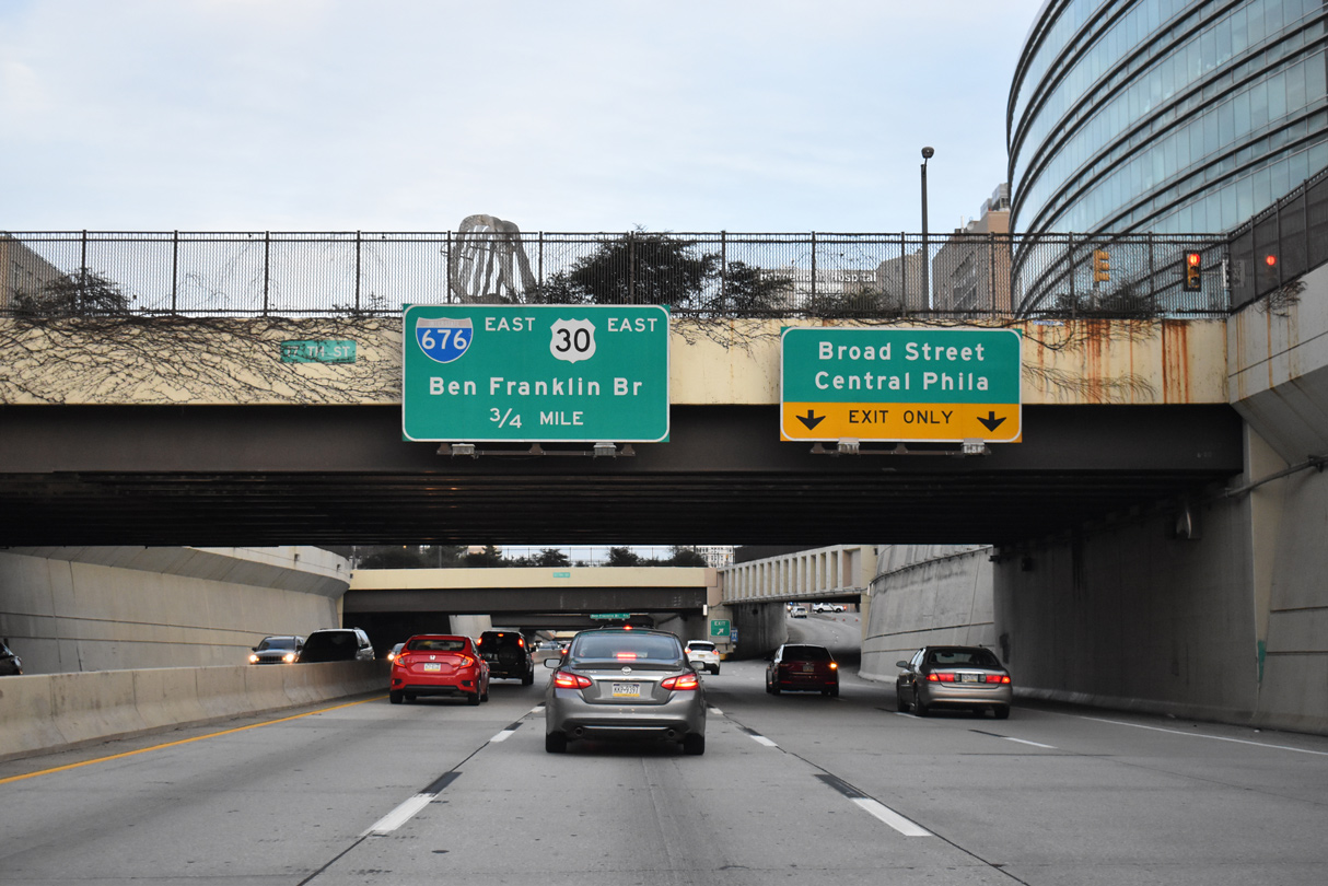
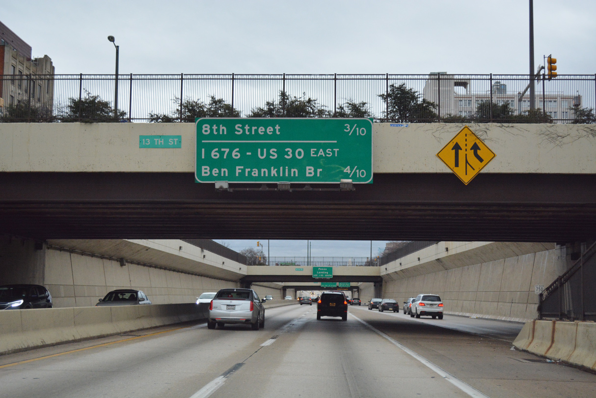
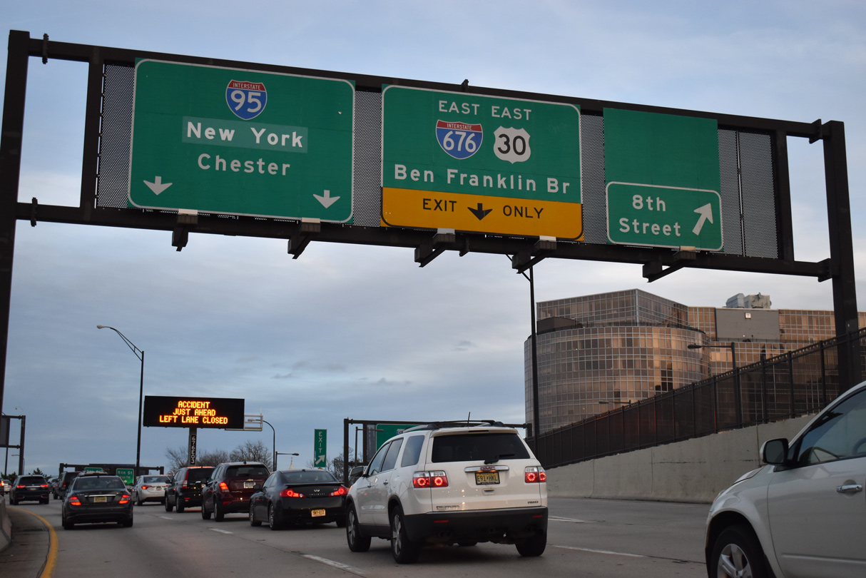
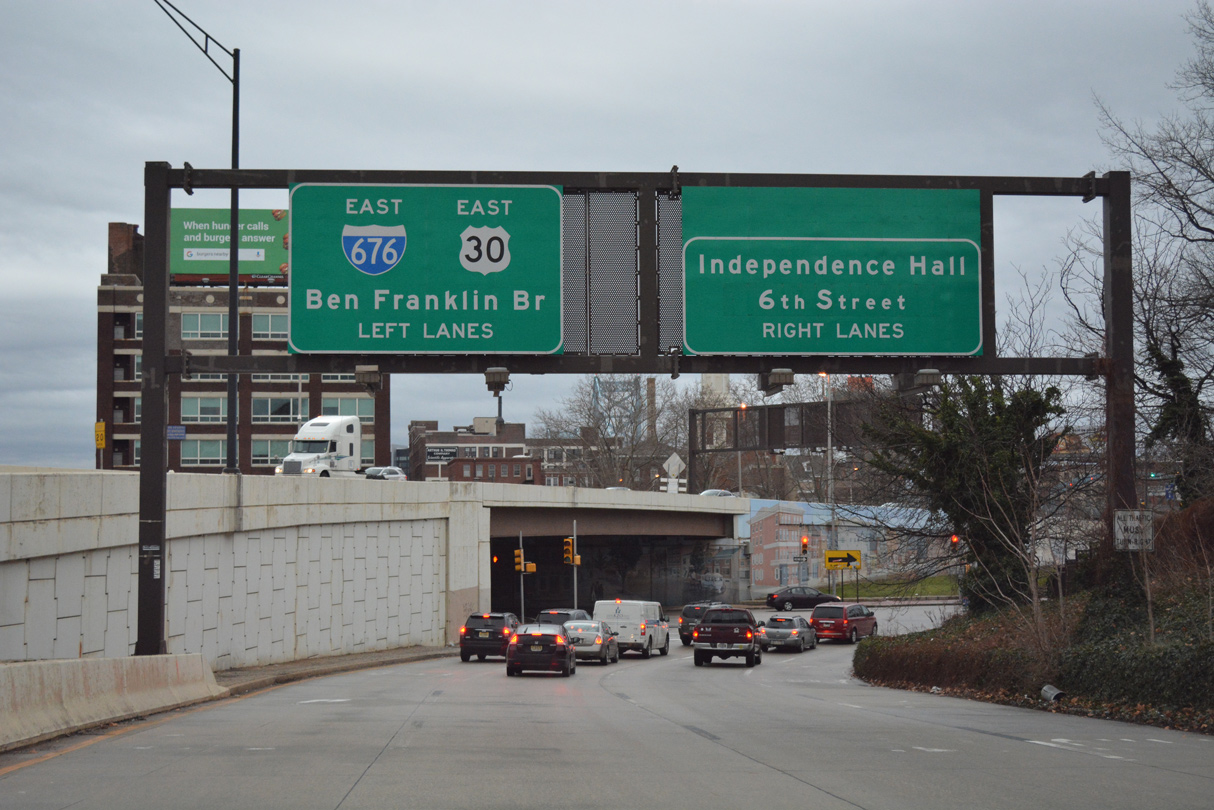
| Interchanges along Interstate 676 in Pennsylvania are unnumbered. The succeeding ramp departs in a half mile for 15th Street and PA 611 (Broad Street) south to Downtown Philadelphia. 01/01/19 |
|
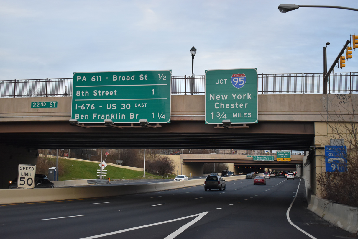
| The right lane defaults onto Vine Street east at 15th Street in a half mile. Vine Street east or PA 611 (Broad Street) south lead motorists to the Pennsylvania Convention Center. Tourists bound for Independence Mall are directed onto 8th Street south to Race Street east in 1.25 miles. 01/01/19 |
|
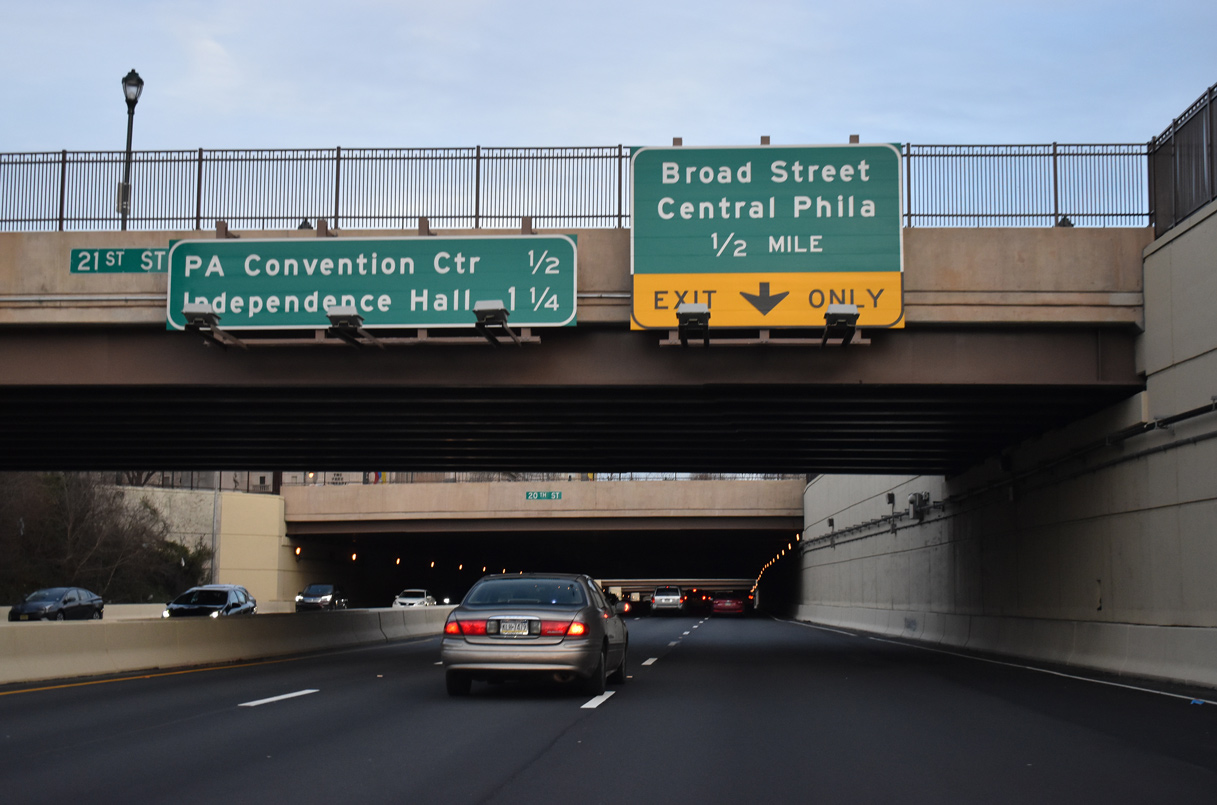
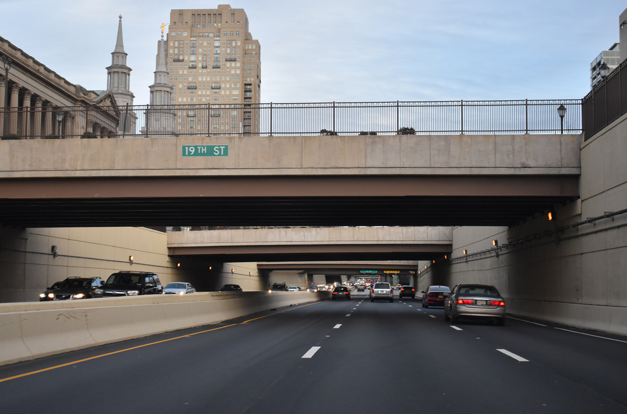
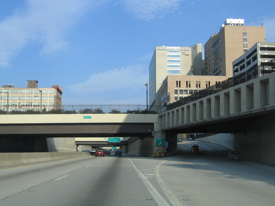
| A series of overpasses follow the cut and cover tunnels at Ben Franklin Parkway along eastbound Interstate 676/U.S. 30. 01/01/19 |
|
| I-676/U.S. 30 remain below grade east to 10th Street. A second lane opens for the PA 611 (Broad Street) off-ramp below 17th Street. Vine Street intersects PA 611 one block east of 15th Street. The state route travels 110 miles from South Philadelphia to I-380 outside Scranton. 01/01/19 |
|
| Vine Street east passes over the Broad Street exit ramp. Vine Street parallels both directions of I-676/U.S. 30 as frontage streets throughout Central Philadelphia. 04/10/04 |
|
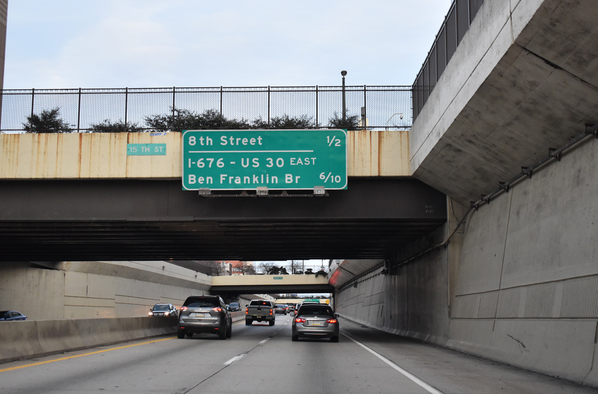
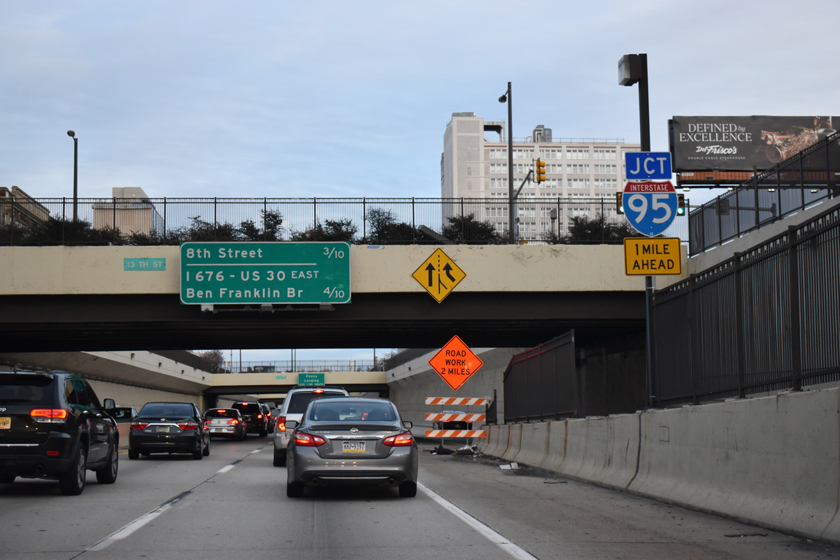
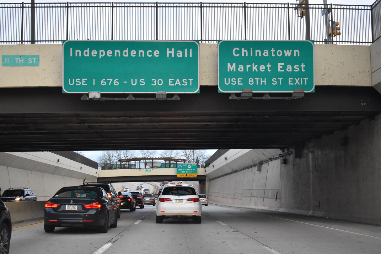
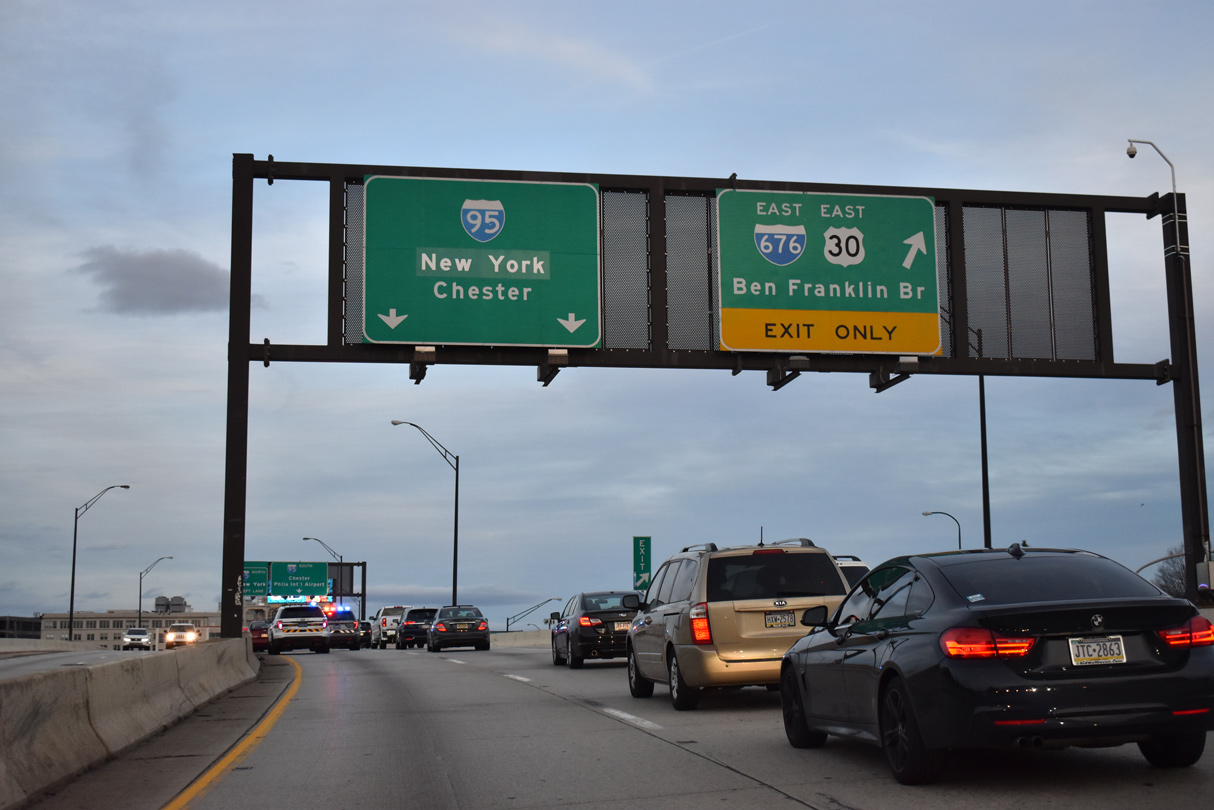
| Two ramps remain along I-676 before the Vine Street Expressway separates for Interstate 95 (Delaware Expressway). The succeeding exit departs in a half mile for 8th Street to Chinatown and Market East. 01/01/19 |
|
| A return ramp from Vine Street east at PA 611 (Broad Street) lowers to join I-676/U.S. 30 east at the 13th Street overpass. 01/01/19 |
|
| In lieu of independent guide signs, a second interchange sequence sign advises motorists of the forthcoming 8th Street and Benjamin Franklin Bridge off-ramps. 12/18/16 |
|
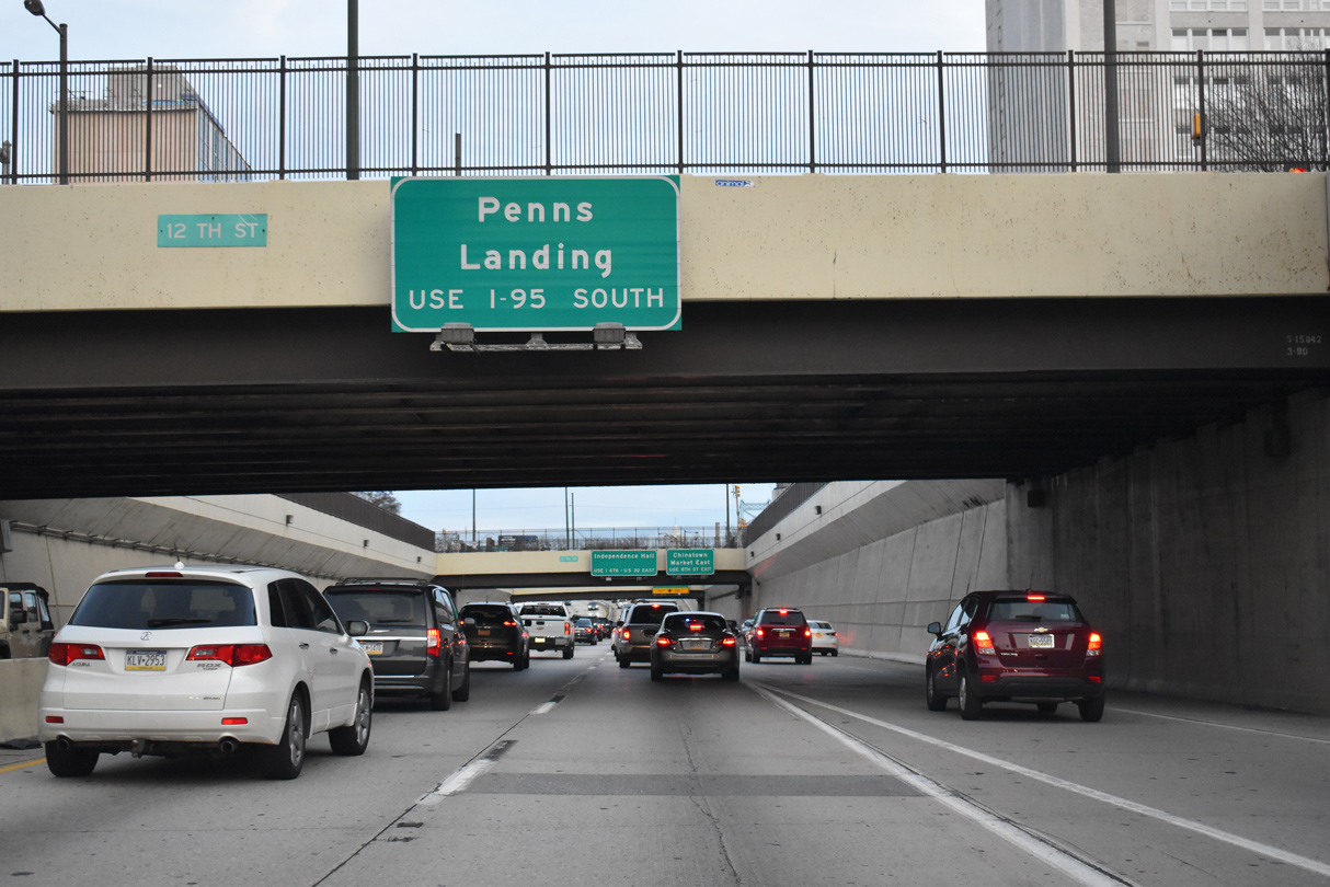
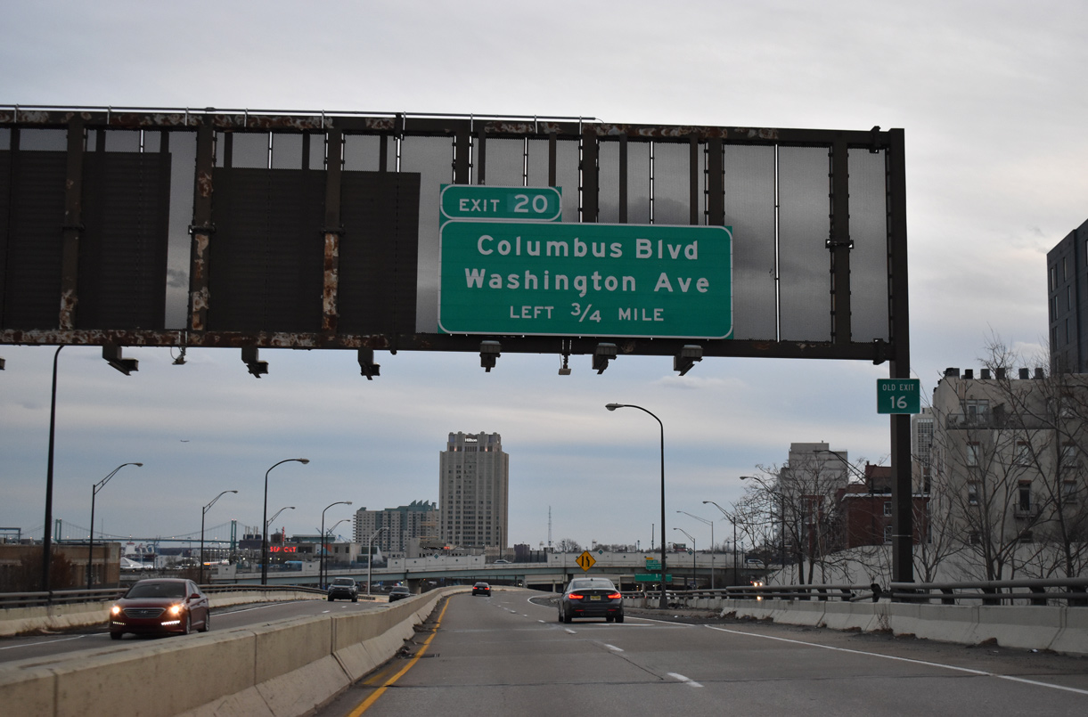
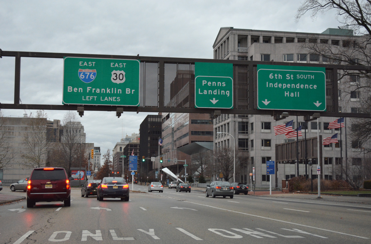
| The first exit south of I-676 and the Ben Franklin Bridge on I-95 connects with Columbus Boulevard at Penns Landing. 01/01/19 |
|
| The Broad Street entrance ramp adds an auxiliary lane to 8th Street. 8th Street flows south to Market East, a commercial district located along Market Street, and Chinatown, Old City and Society Hill. 01/01/19 |
|
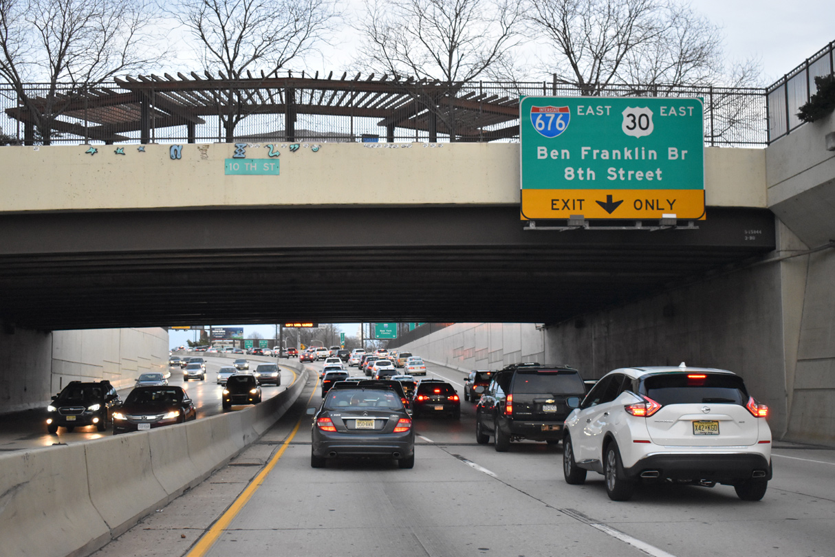
| The Vine Street Expressway emerges from below 10th Street to split with Interstate 676/U.S. 30 east just beyond the 8th Street off-ramp. 01/01/19 |
|
| Two lanes branch away from the Vine Street Expressway for Interstate 676/U.S. 30 east across the Ben Franklin Bridge while a single lane ramp parts ways for 8th Street south and 7th Street north. 01/01/19 |
|
| Separating with the Vine Street Expressway, the I-676/U.S. 30 eastbound mainline spans 8th and Franklin Streets onto 6th Street south at Franklin Square. 01/01/19 |
|
| The Vine Street Expressway ascends onto a viaduct from 8th Street east to a directional T interchange with Interstate 95. This was the last portion of I-676 to open to traffic. 01/01/19 |
|
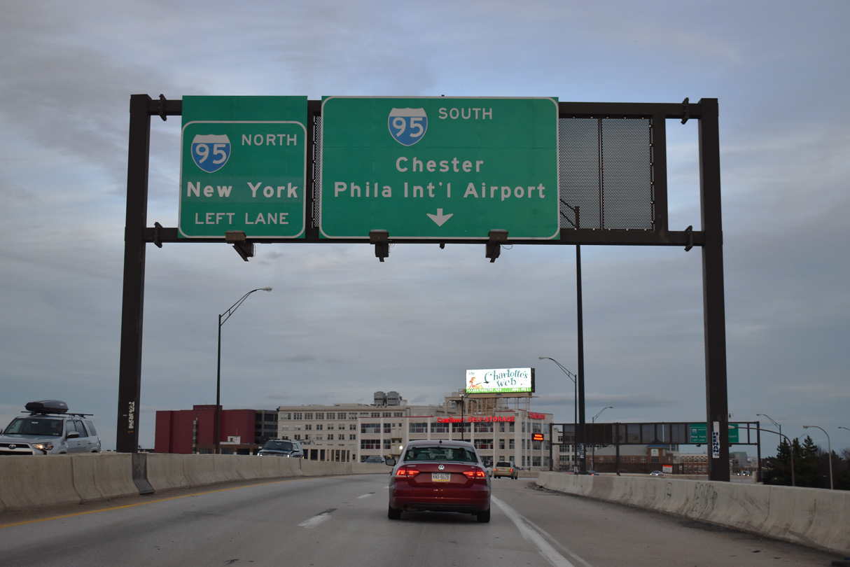
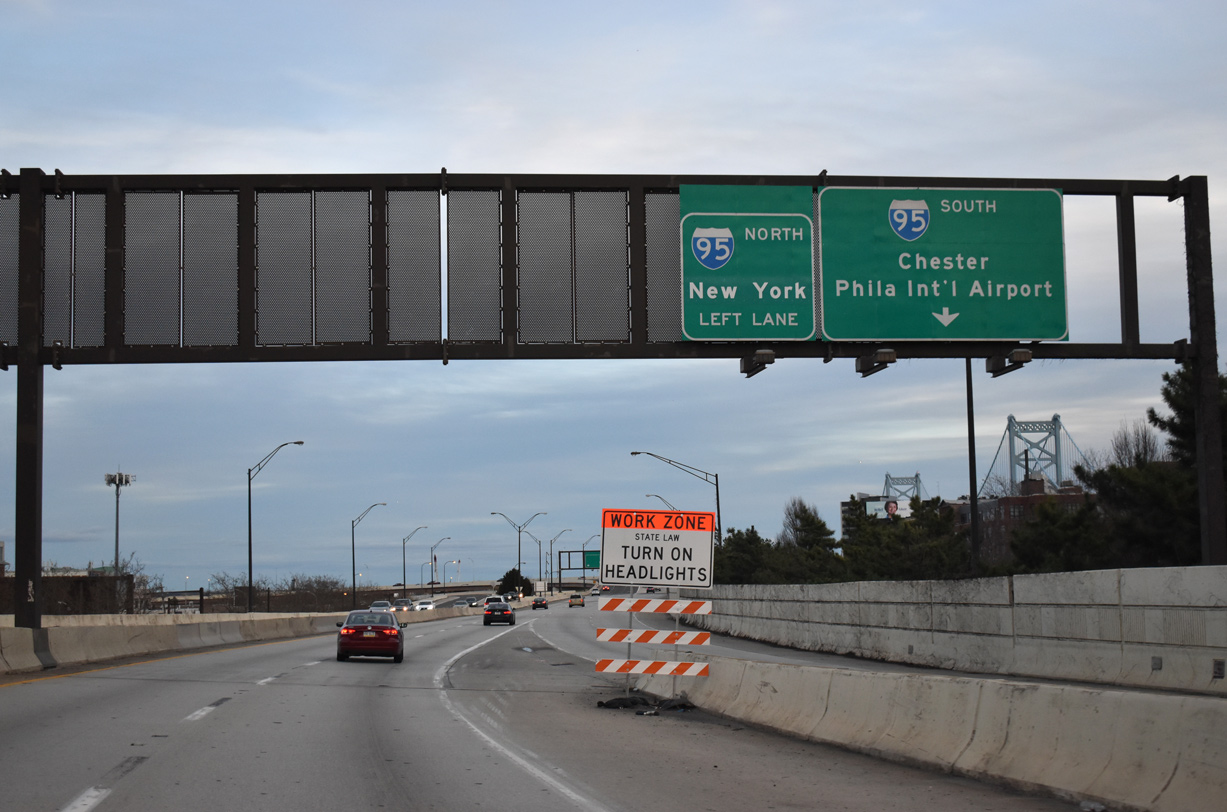
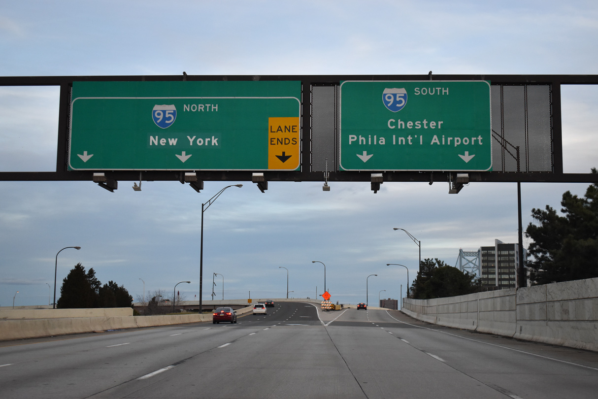
| Ramps from Franklin Street north and the Ben Franklin Bridge west combine ahead of the Vine Street Expressway above 6th Street. Forthcoming I-95 leads southwest to Philadelphia International Airport (PHL), Chester, and Wilmington, Delaware and northward to Northeast Philadelphia and New York, New York. 01/01/19 |
|
| High speed ramps carry two lanes from the Vine Street Expressway east onto both directions of Interstate 95 (Delaware Expressway). This interchange opened in July 1991. 01/01/19 |
|
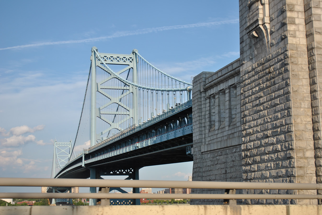
| Flyovers with Interstate 95 curve below the Ben Franklin Bridge. Blue lights accent the suspension bridge during the evening hours. 06/03/12 |
|
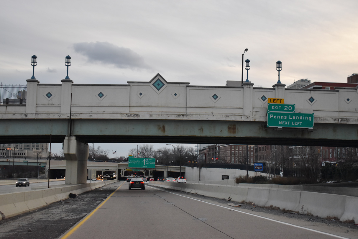
| Traffic taking the Vine Street Expressway east to I-95 south merges on the inside lanes of the Delaware Expressway ahead of Left Exit 20 for Columbus Boulevard and Penns Landing. 01/01/19 |
|
| Continuing from the Vine Street Expressway, I-676/U.S. 30 east span N 8th Street and Franklin Street along a flyover to N 6th Street south at Franklin Square. 12/18/16 |
|
| I-676/U.S. 30 turns south onto N 6th Street between Franklin Square and Monument Plaza. 12/18/16 |
|
| I-676/U.S. 30 splits with N 6th Street along a three lane ramp to the Ben Franklin Bridge approach. 12/18/16 |
|
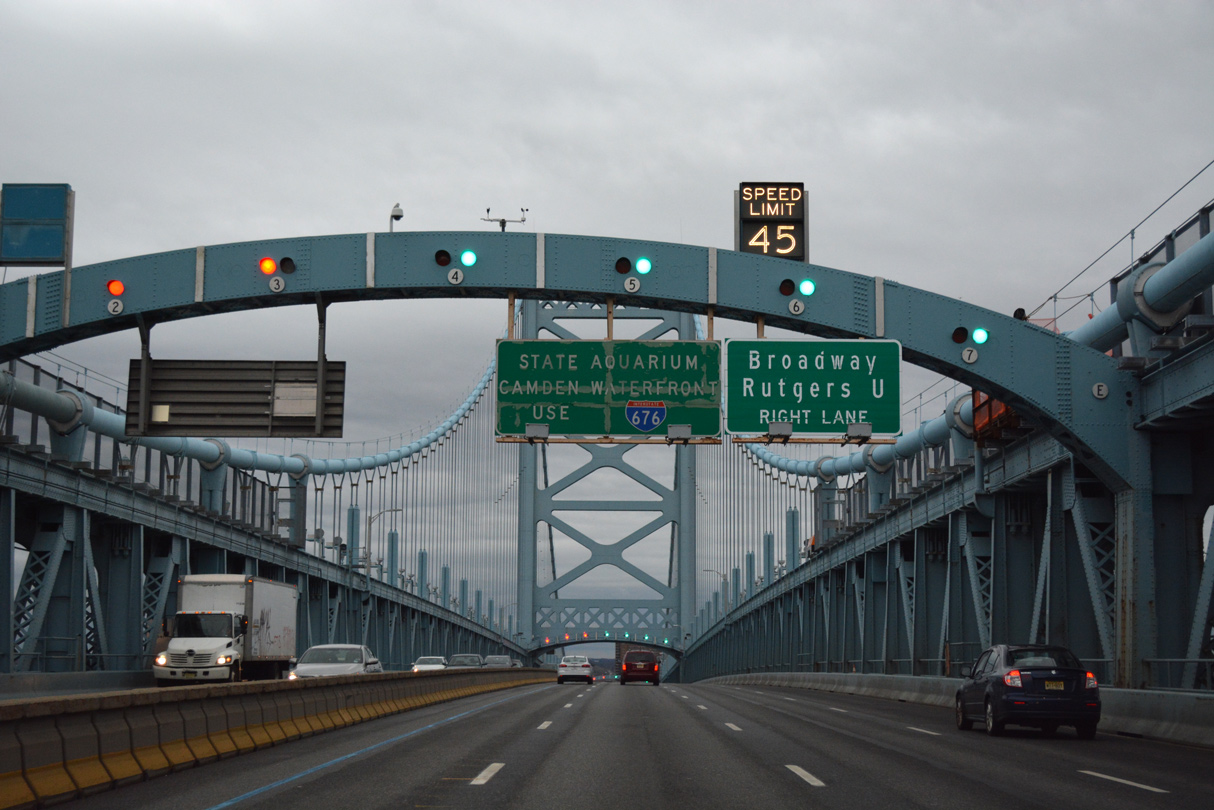
| An entrance ramp adds traffic to I-676 and the Ben Franklin Bridge via Race Street east from Chinatown. 12/18/16 |
|
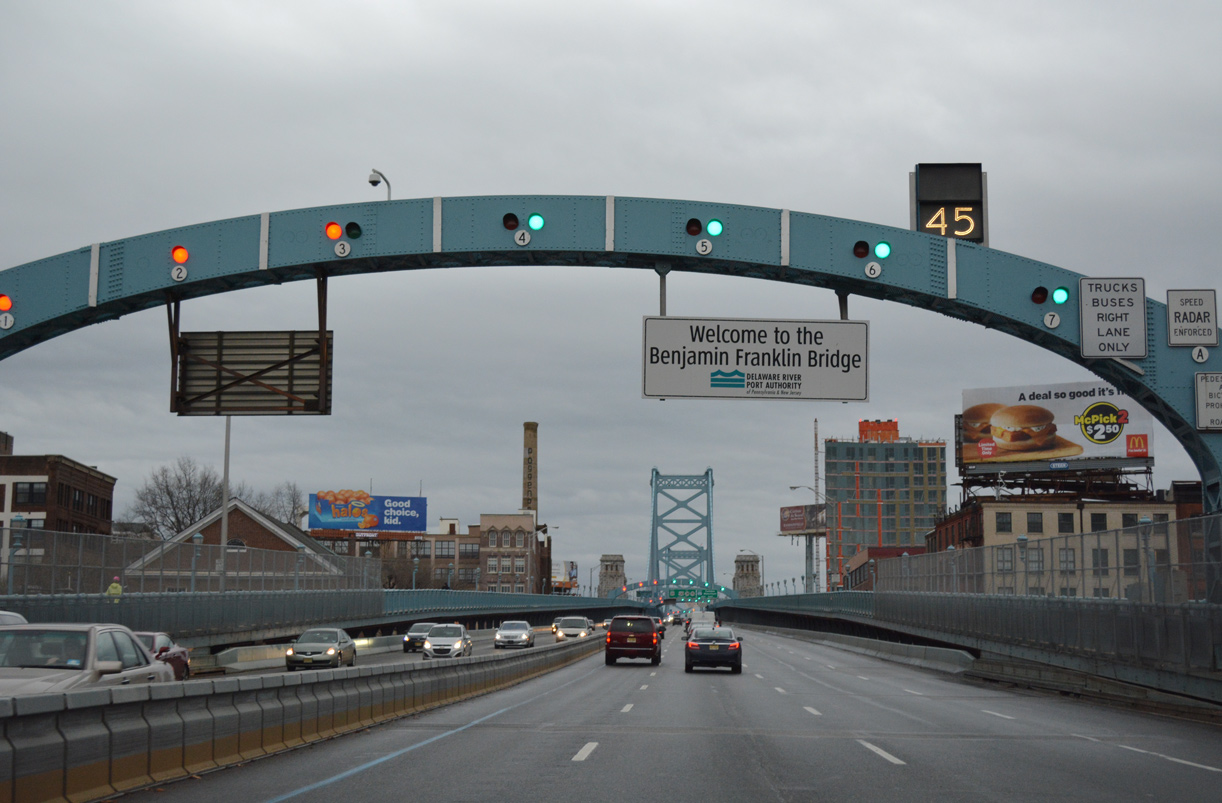
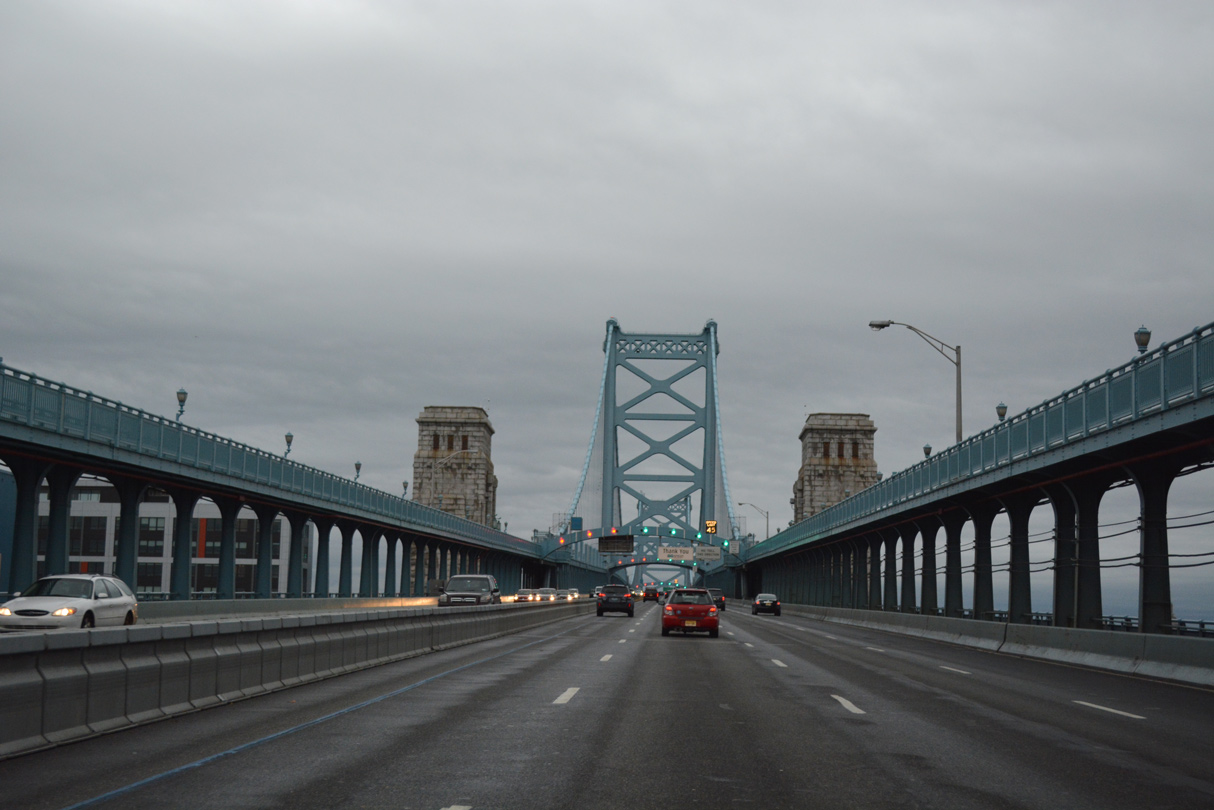
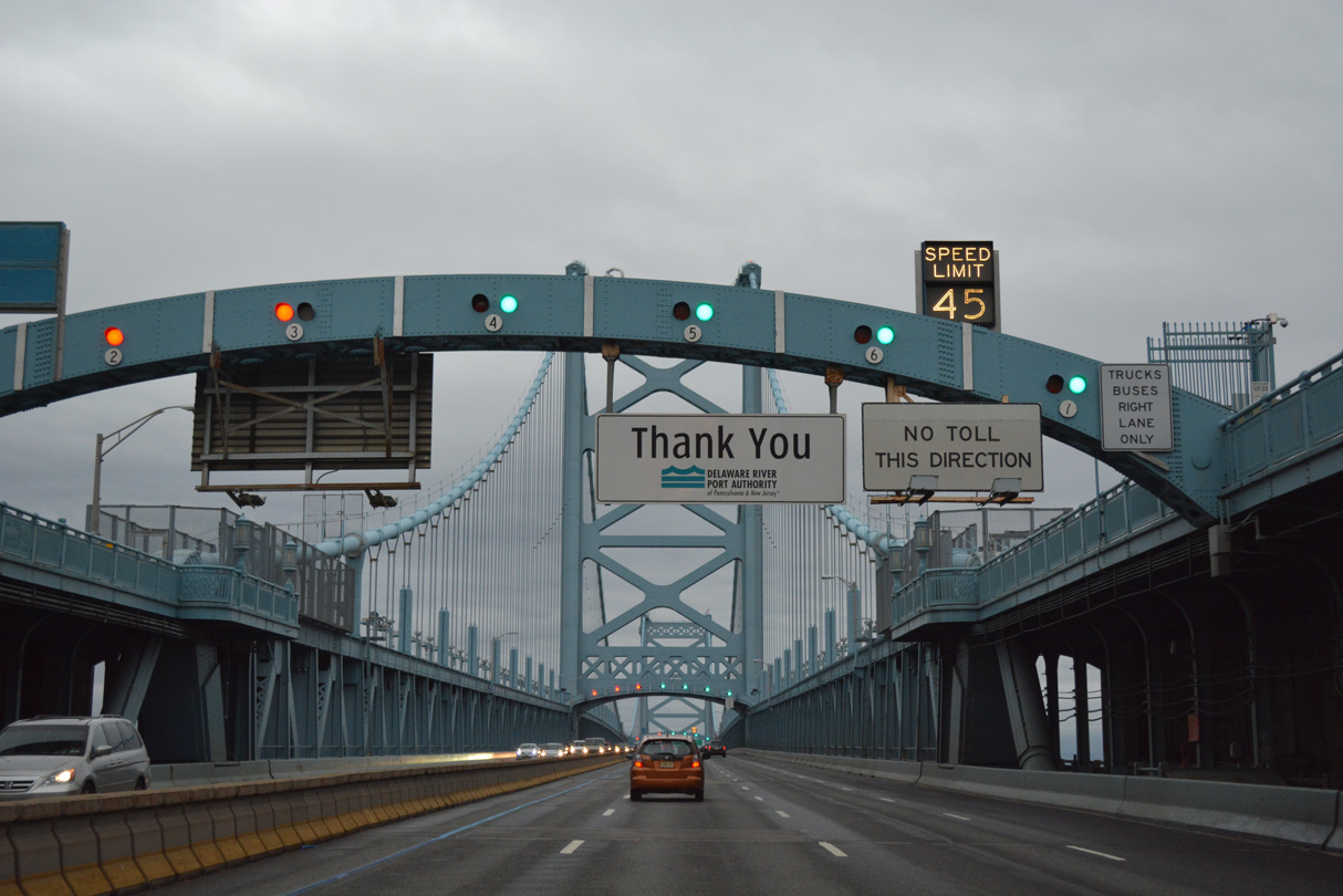
| Interstate 676/U.S. 30 rise onto the Benjamin Franklin Bridge from 6th and Race Streets to cross the Delaware River. The suspension bridge accommodates seven overall lanes with a movable barrier and variable speed limits. 12/18/16 |
|
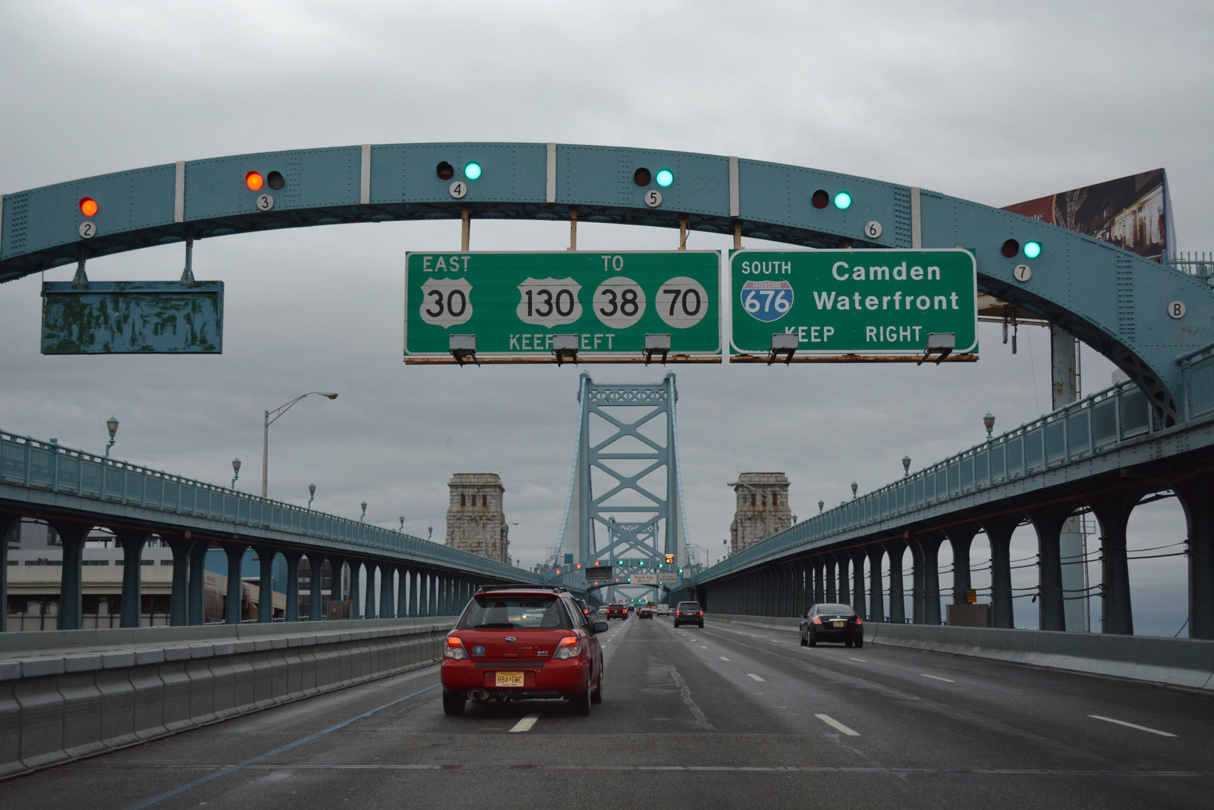
| U.S. 30 (Admiral Wilson Boulevard) partitions with Interstate 676 just beyond the Benjamin Franklin Bridge north of Downtown Camden. 12/18/16 |
|
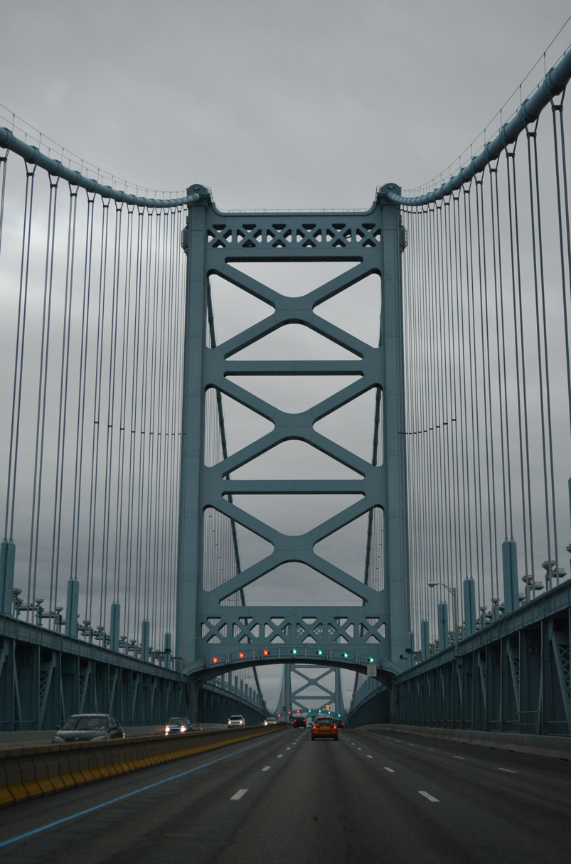
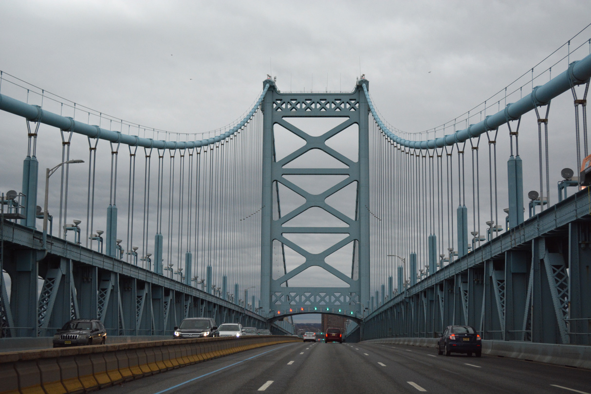
| Pedestrian walkways line both sides of the Ben Franklin Bridge above the main travel lanes. 12/18/16 |
|
| Tolls along the Ben Franklin Bridge eastbound were discontinued in 1992. 12/18/16 |
|
| Built as a cost of $45.2 million, the Ben Franklin Bridge measures 7,456 feet in length.1 12/18/16 |
|
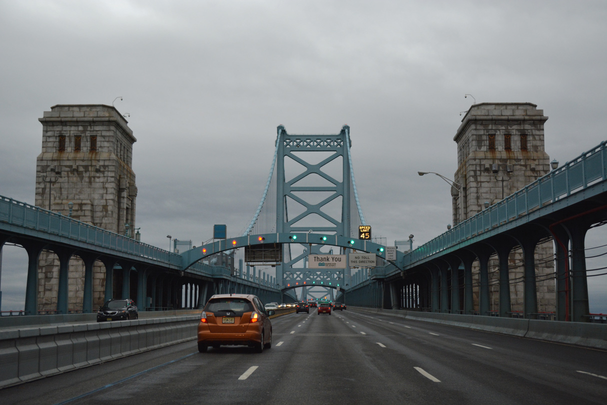
| Two 380 foot high towers support the 128 foot wide bridge.1 12/18/16 |
|
| Motorists along I-676/U.S. 30 eastbound enter Camden County, New Jersey midway between the two towers. 12/18/16 |
|
| The first New Jersey exit joins I-676/U.S. 30 east with 6th Street to the Rutgers University Camden Campus and Broadway (CR 551) south into Downtown Camden. 12/18/16 |
|
| Construction on the Ben Franklin Bridge commenced on January 6, 1922. The suspension bridge opened to traffic on July 1, 1926.1 12/18/16 |
|
| Speed reduces as I-676/U.S. 30 start the descent into Camden. In addition to carrying vehicular traffic, the span also carries two tracks of the PATCO Subway line. The mass transit lines cross the bridge underneath the road deck. 12/18/16 |
|
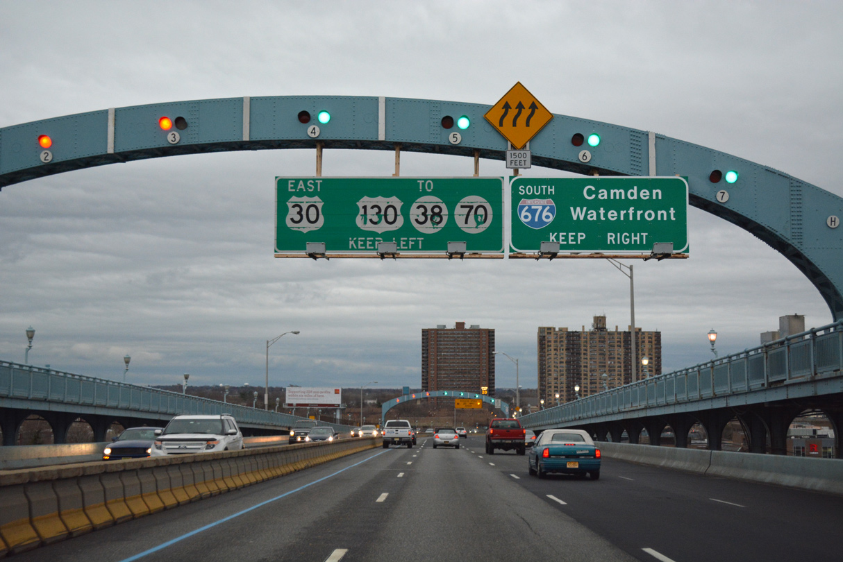
| U.S. 30 splits with Interstate 676 east from the left at a wye interchange for Admiral Wilson Boulevard. Admiral Wilson Boulevard initially travels as a freeway to the Cooper River and then at-grade east to Pennsauken Township and the junction with U.S. 130 (Crescent Boulevard) and Route 38 (Kaighn Avenue) east to Route 70. 12/18/16 |
|
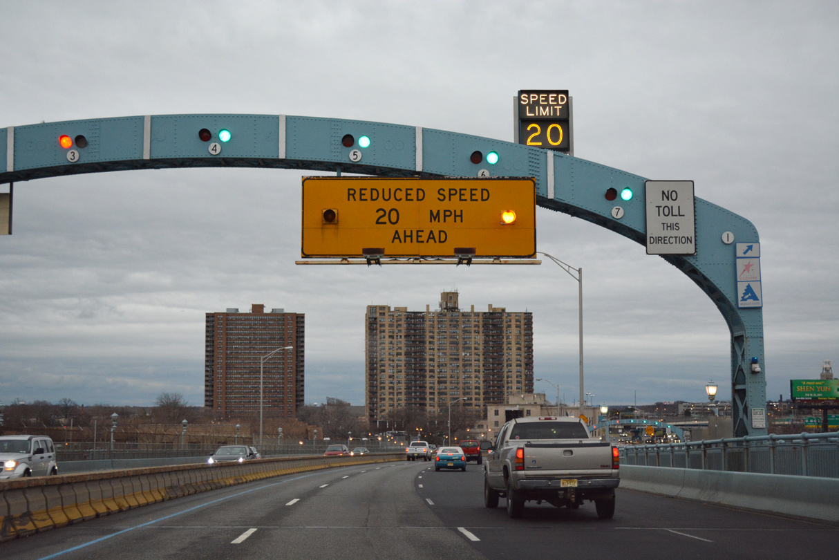
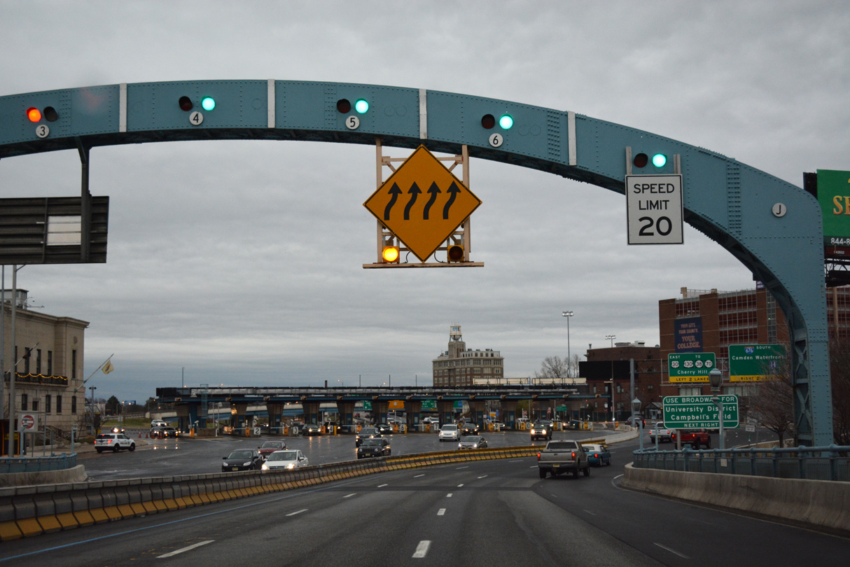
| Traffic slows to 20 miles per hour as the eastbound lanes circumvent the westbound toll plaza ahead. 12/18/16 |
|
| Four lanes of I-676/U.S. 30 east pass by the toll plaza for a two-pronged off-ramp serving 6th Street south and Broadway (CR 551) to Downtown Camden. County Route 551 begins here and travels 34.57 miles southwest to Pennsville Township in Salem County. 12/18/16 |
|
| U.S. 30 continues east along Admiral Wilson Boulevard to combine with U.S. 130 (Crescent Boulevard) south in Pennsauken Township. Route 38 begins east there and travels to Cherry Hill while U.S. 130 north follows Crescent Boulevard to Cinnaminson Township toward Trenton. 12/18/16 |
|
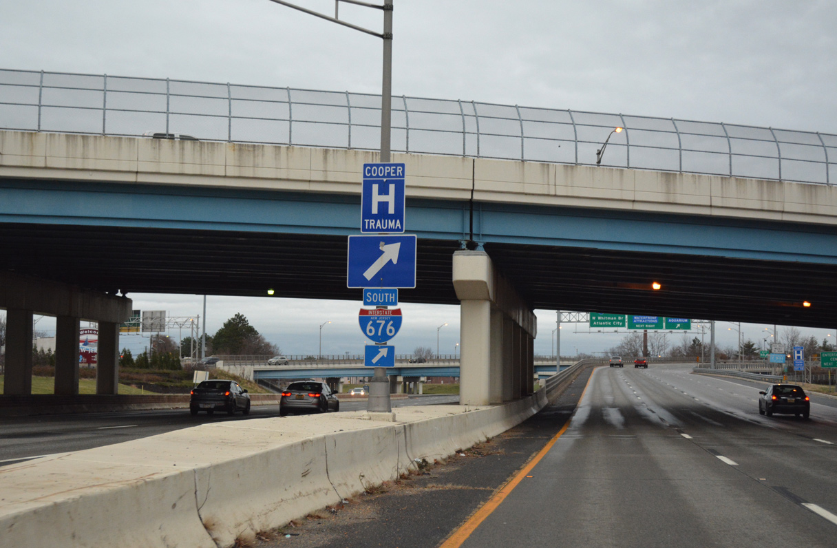
| Interstate 676/U.S. 30 eastbound partition below 7th Street. 12/18/16 |
|
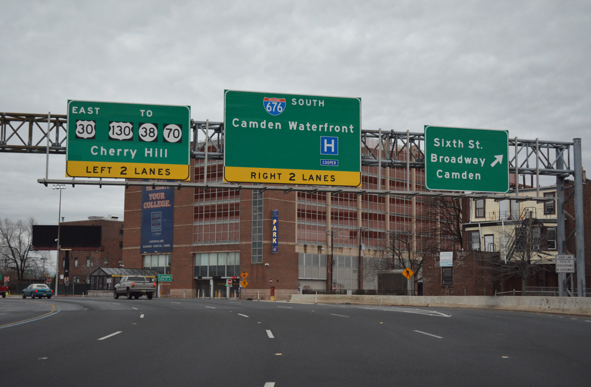
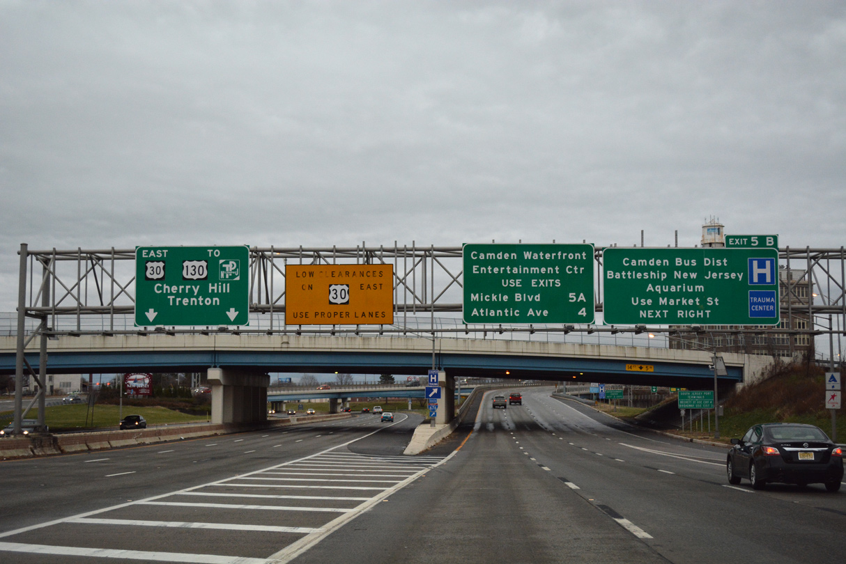
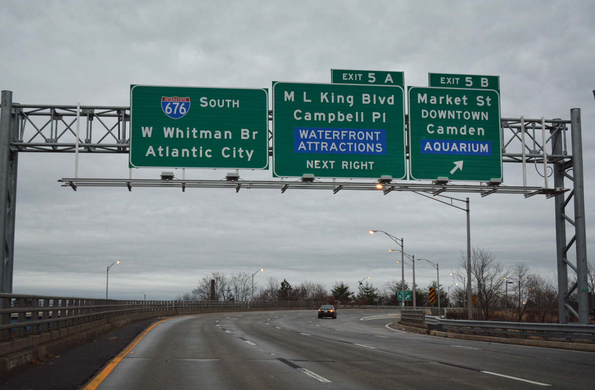
| Exit 5B parts ways next from Interstate 676 south onto Market Street (CR 537 Spur) west. Market Street ventures west through Downtown Camden toward Adventure Aquarium. 12/18/16 |
|
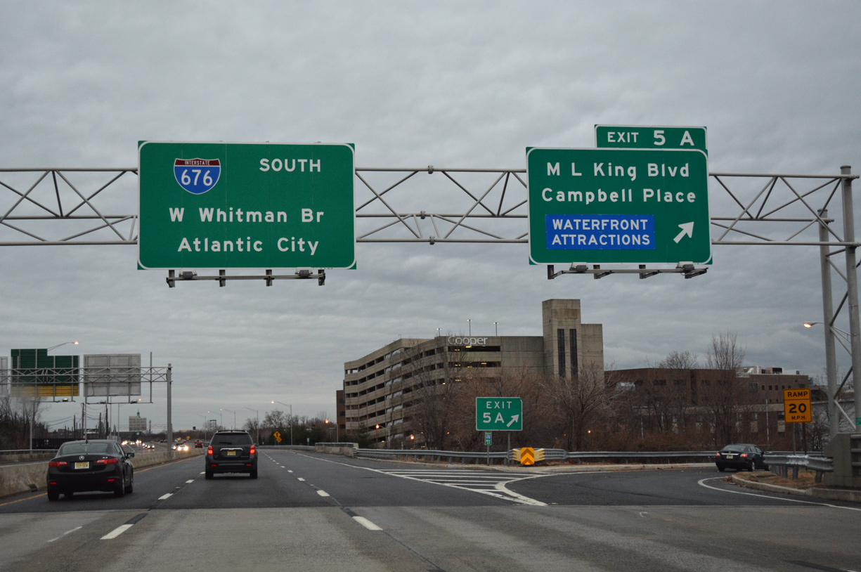
| CR 537 follows Federal Street from Delaware Street on the Camden Waterfront to pass under I-676. Exit 5A joins CR 537 east ahead of the Cooper River. Newton Avenue directs motorists southwest to 11th Street for both Martin Luther King Boulevard (former Mickle Boulevard) west and Campbell Place. 12/18/16 |
|
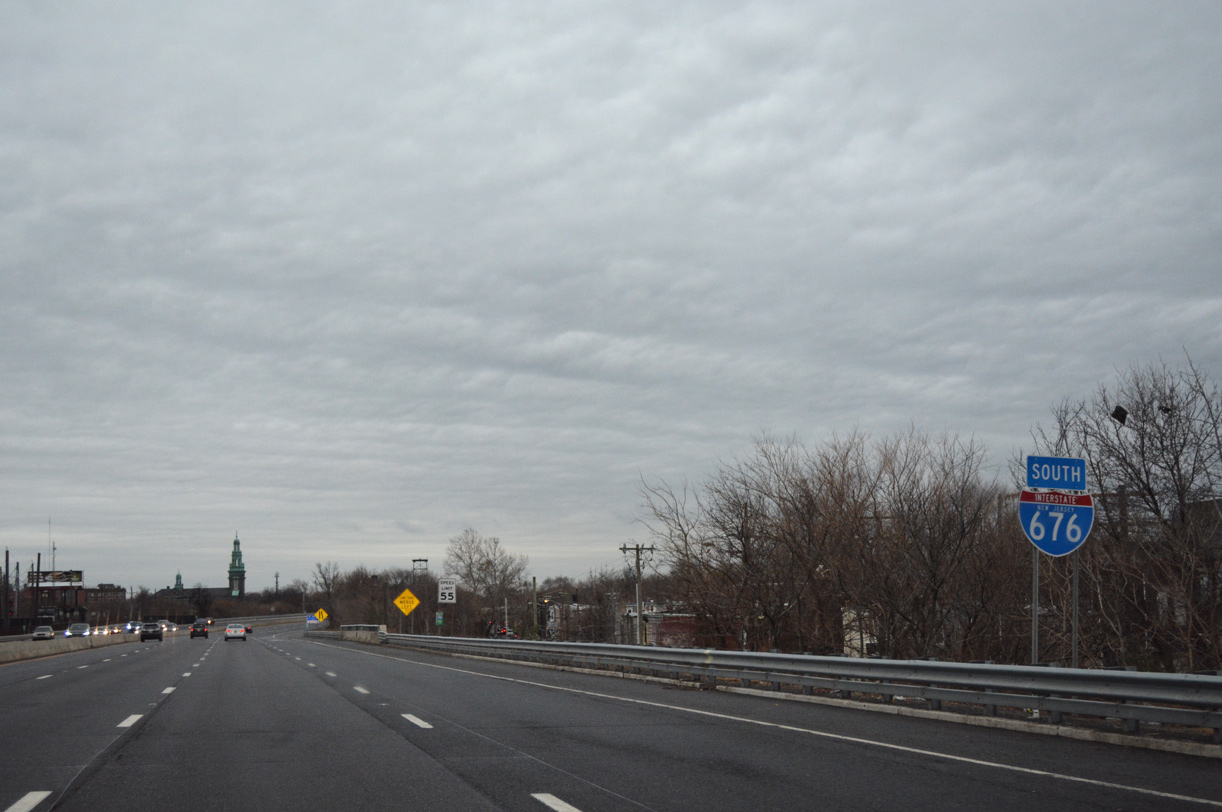
| Interstate 676 reassurance marker posted after the on-ramp from Martin Luther King Boulevard. I-676 maintains six lanes southward to Interstate 76. 12/18/16 |
|
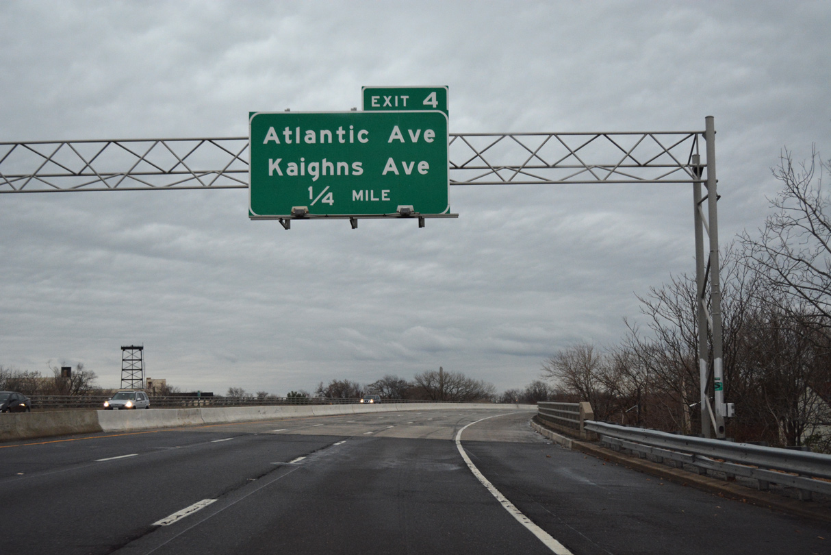
| Next in line for southbound travelers is a parclo interchange (Exit 4) serving Atlantic and Kaighns Avenue. Atlantic Avenue travels east from Kaighn Point along the Delaware River to Mt. Ephraim Avenue by the Liberty Park neighborhood. 12/18/16 |
|
| The Walt Whitman Bridge comes into view as Exit 4 drops from I-676 south to Atlantic Avenue. Kaighns Avenue parallels Atlantic Avenue three blocks to the north between the riverfront and the confluence of U.S. 30 (Admiral Wilson Boulevard), U.S. 130 (Crescent Boulevard), and Route 38. Route 38 continues Kaighns Avenue east to Cherry Hill. 12/18/16 |
|
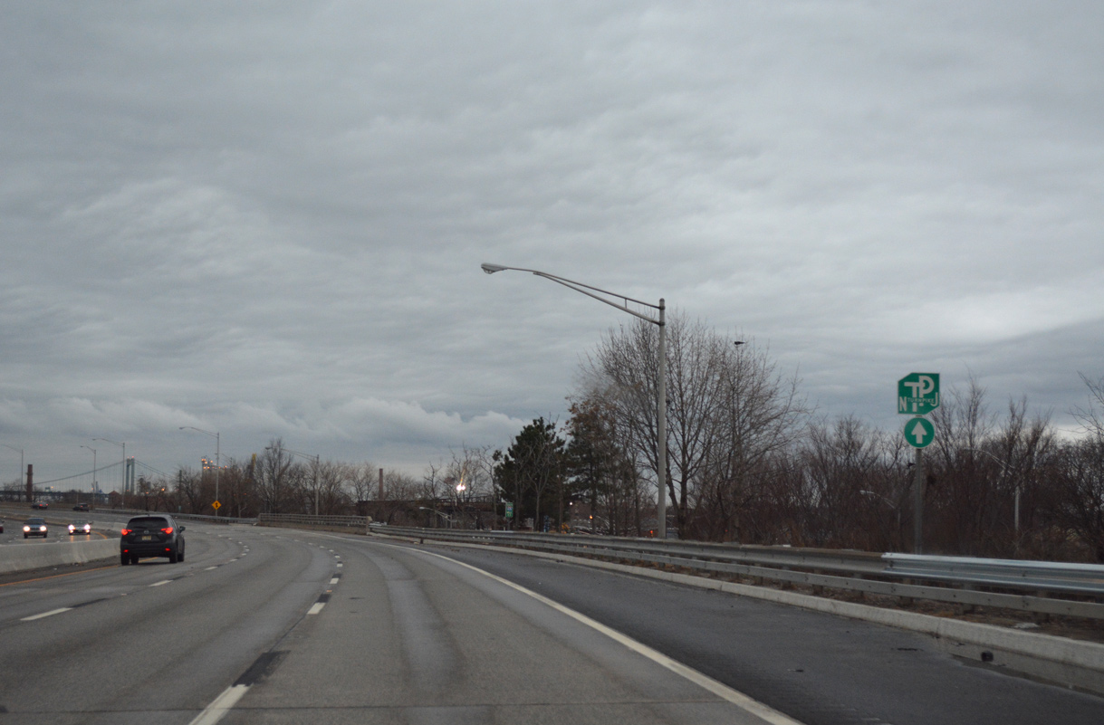
| New Jersey Turnpike trailblazer posted beyond the gore point for Exit 4. 12/18/16 |
|
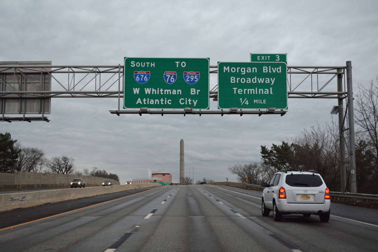
| Continuing southward on Interstate 676 toward a six-ramp parclo interchange (Exit 6) with Morgan Boulevard. Morgan Boulevard serves south Camden at CR 551 (Broadway) to the west and the Morgan Village neighborhood to the east. 12/18/16 |
|
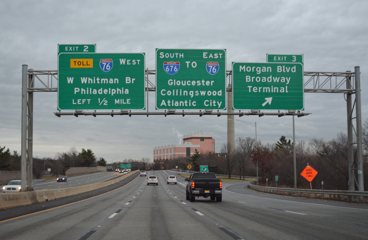
| Exit 3 leaves I-676 for Morgan Boulevard, one half mile ahead of the exchange with Interstate 76 to the Walt Whitman Bridge and North South Freeway. 12/18/16 |
|
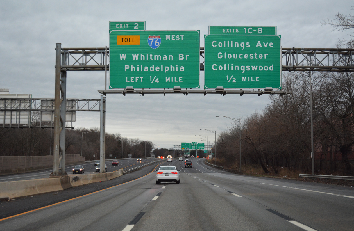
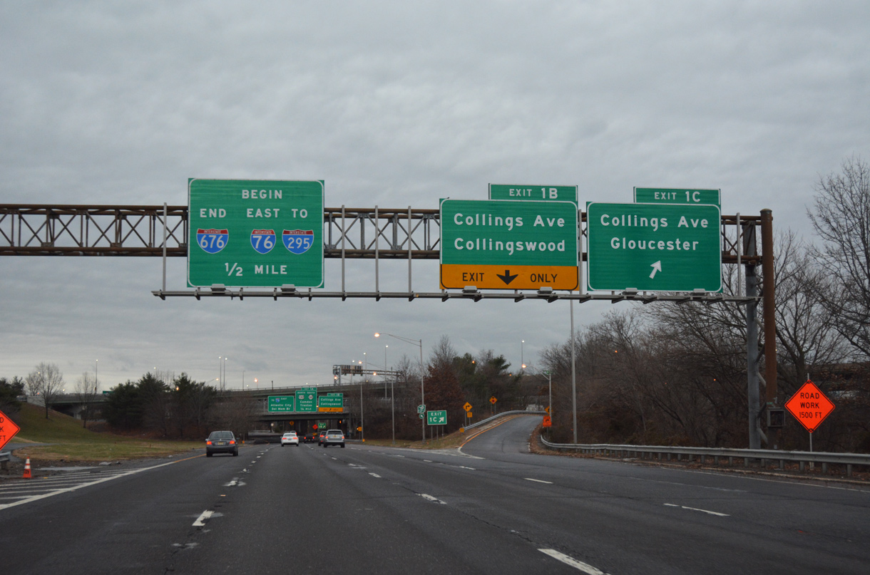
| Left Exit 2 to I-76 west departs from Interstate 676 next. Exits 1C and 1B follow on the right for Collings Road (CR 630) to the Fairview community, Collingswood and Gloucester City. 12/18/16 |
|
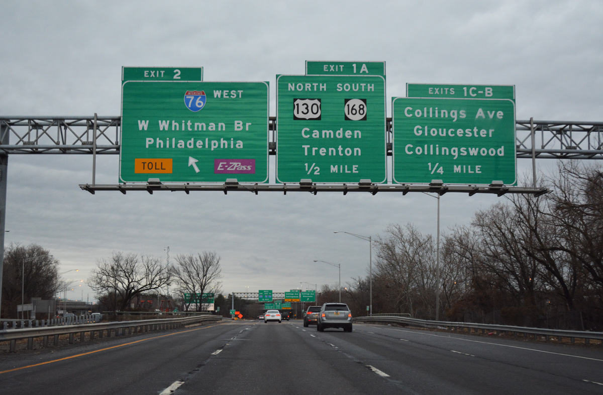
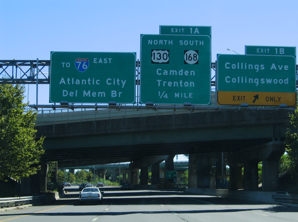
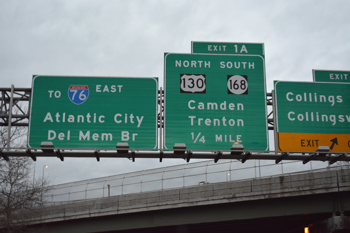
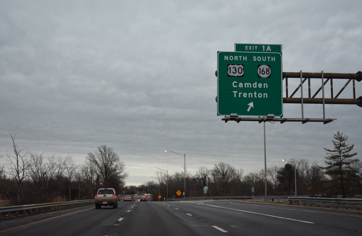
| Interstate 676 crosses the North Branch of Newton Creek ahead of Exit 2 for the Walt Whitman Bridge to South Philadelphia. Exit 1A connects with Interstate 76C east to U.S. 130 north and Route 168 south in a half mile. 12/18/16 |
|
| Interstate 676 southbound defaults onto I-76 (North South Freeway) east to I-295 and Route 42. Exit 1C leaves for Collings Avenue (CR 630) west to Essex Street (CR 755) in Gloucester City. 12/18/16 |
|
| Exit 1B loops onto Collings Avenue east to Fairview in south Camden. CR 630 extends east from Route 168 (Mt. Ephraim Avenue) to Collingswood and CR 561 (Haddon Avenue). 09/19/04, 12/18/16 |
|
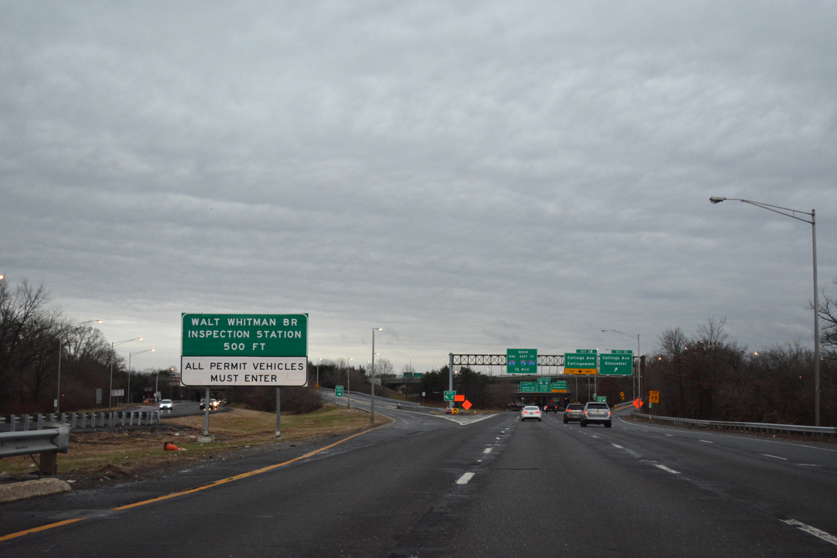
| Interstate 76C spurs 1.22 miles east from the Walt Whitman Bridge end to U.S. 130 north and Route 168 south at Audubon Park. 12/18/16 |
Page Updated 01-08-2020.


 East
East