The MDTA switched to cashless tolling in March 2020 due to COVID-19. The change was subsequently made permanent. Started on January 12, 2021, construction demolished the former toll plaza along eastbound and added a AET gantry at the east end of the span on Kent Island.1
|
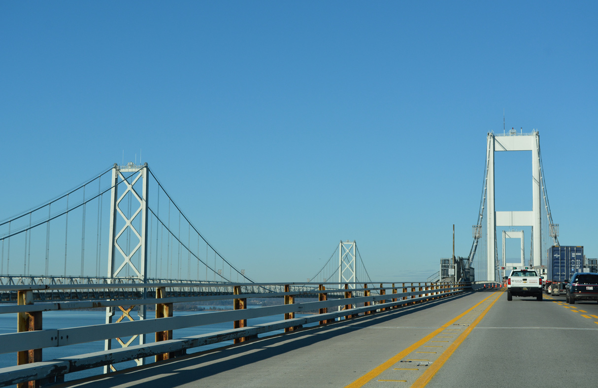
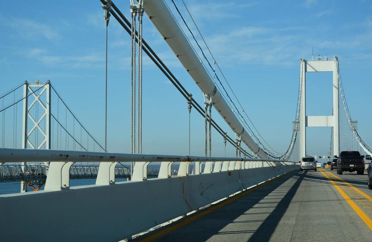
| The Chesapeake Bay Bridge westbound span opened to traffic on June 18, 1973. It cost $148 million to construct.2 12/21/22, 12/27/22 |
|
| The Chesapeake Bay Bridge was rededicated as the William Preston Lane, Jr. Memorial Bridge on November 9, 1967. Governor Lane pushed legislation that resulted in the State Roads Commission proceeding with building the crossing in 1947.2 12/21/22 |
|
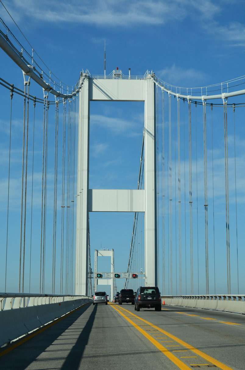
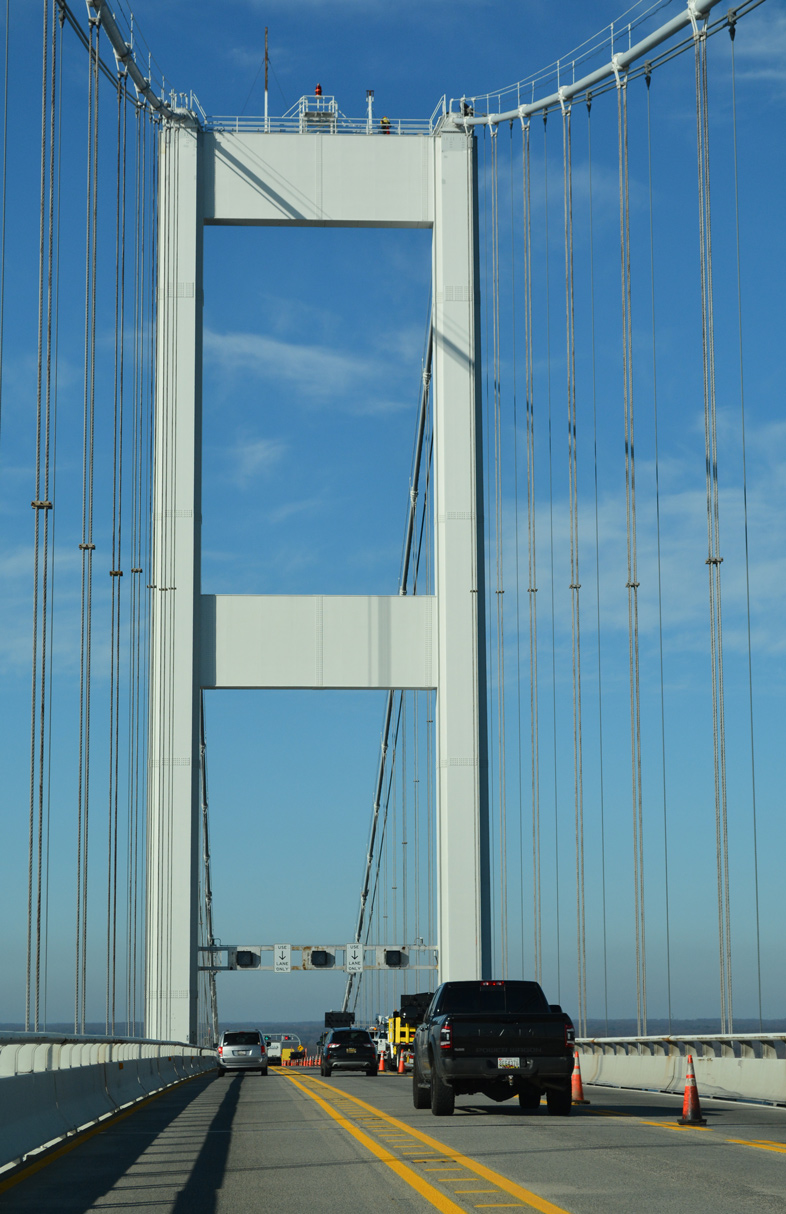
| The suspension bridge towers top out at 379 feet on the westbound span and 354 feet on the eastbound crossing.2 12/31/16, 12/21/22 |
|
| The Chesapeake Bay Bridge westbound span is 4.33 miles long; the eastbound bridge is 4.35 miles in length.2 12/21/22, 12/31/16 |
|
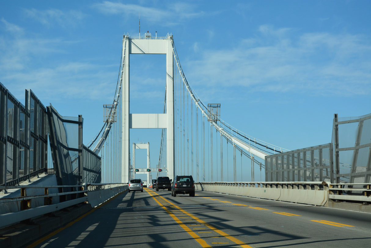
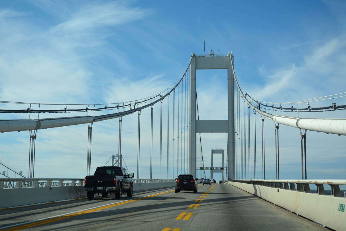
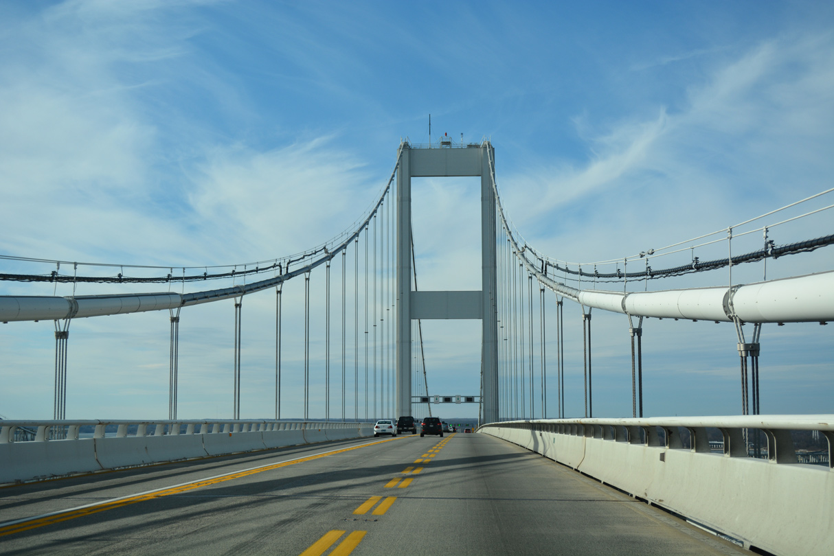
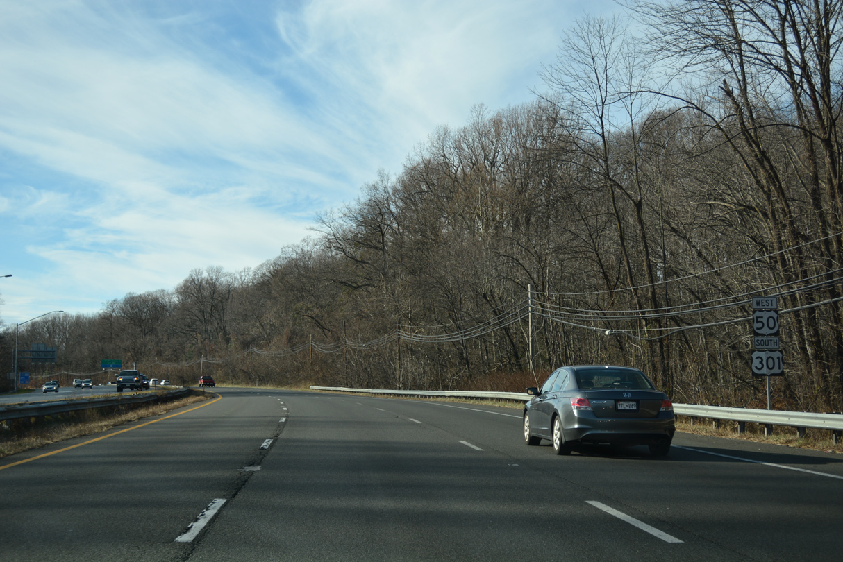
| U.S. 50/301 curve northward toward Sandy Point beyond the second bridge tower over Chesapeake Bay. 12/21/22 |
|
| A Northrop Grumman facility and Moss Pond appear along the west shore of Chesapeake Bay between Hackett Point and the bridge end near Mezick Ponds. 12/21/22 |
|
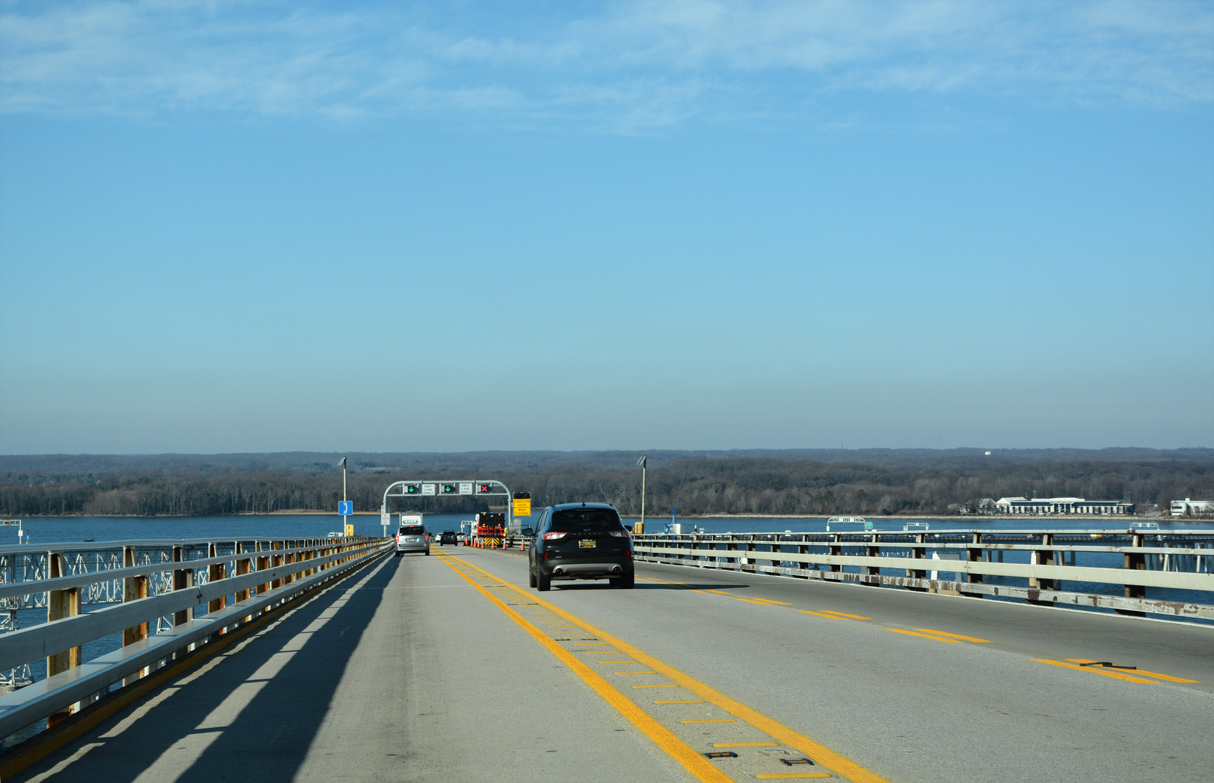
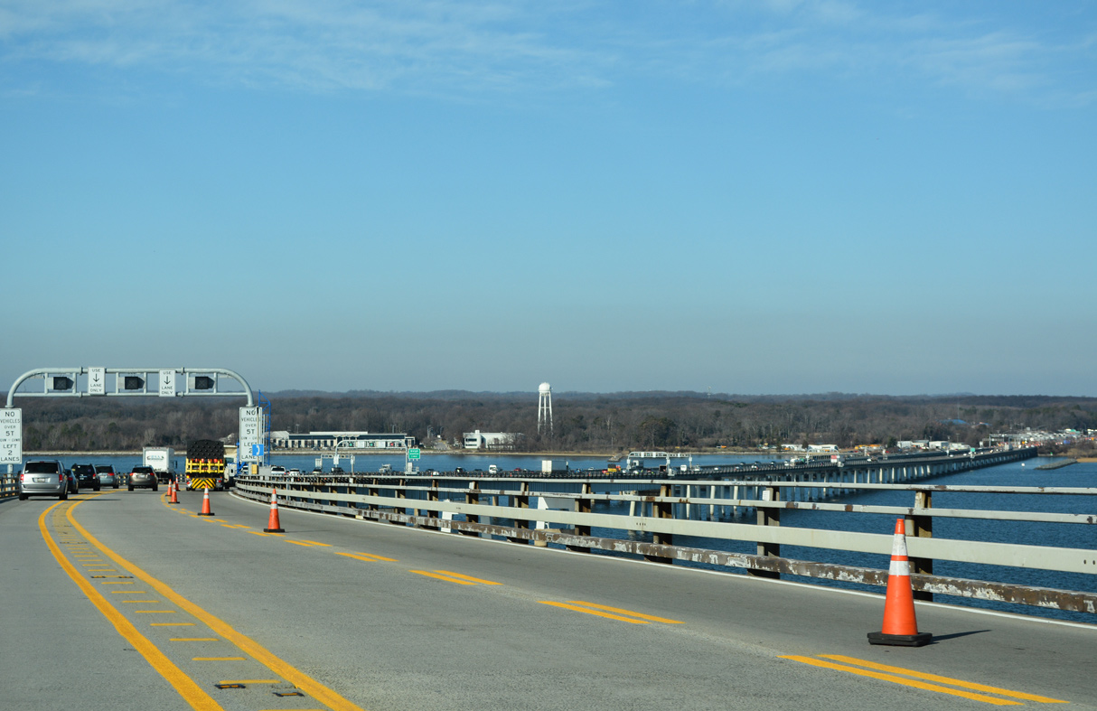
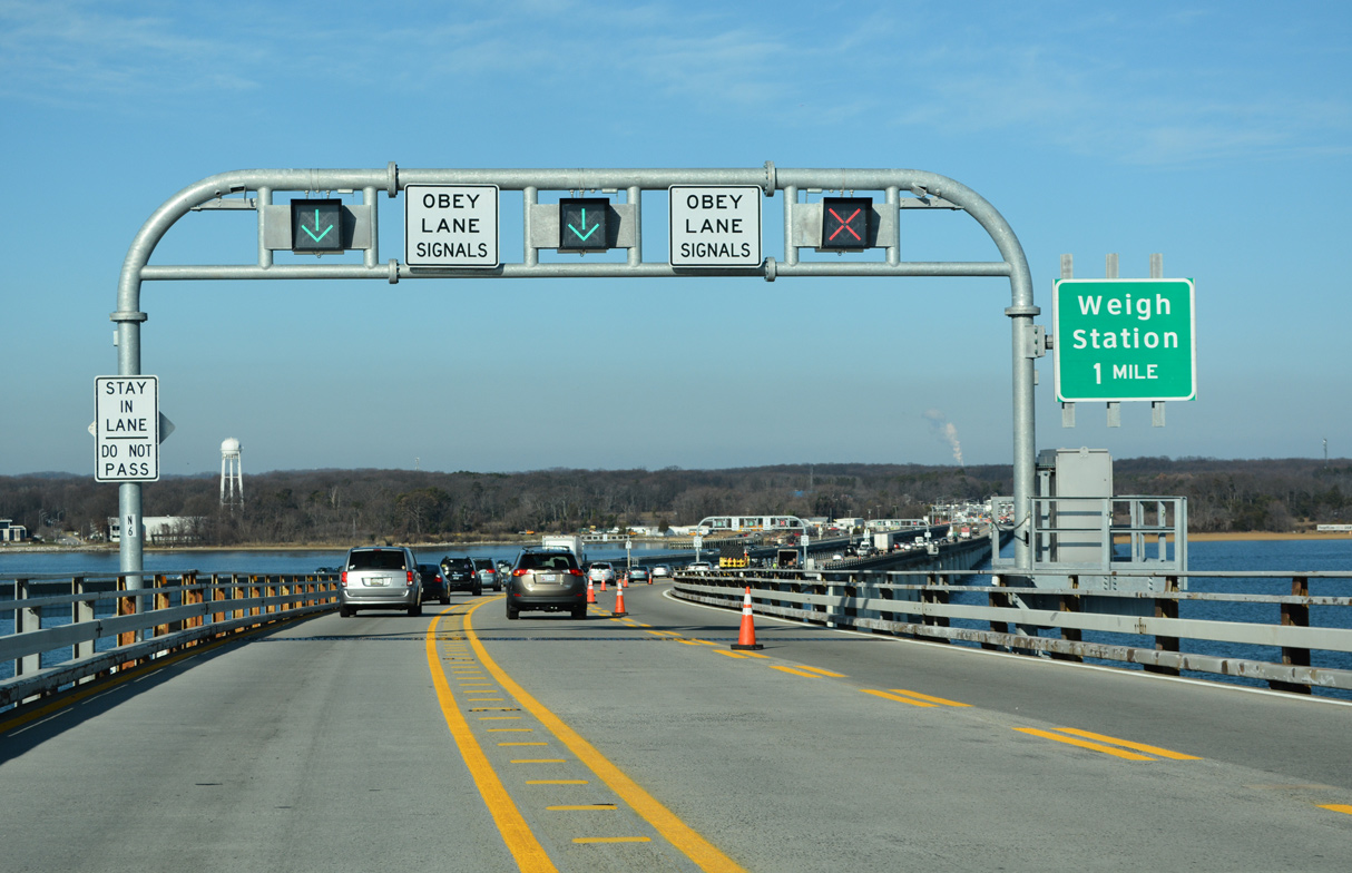
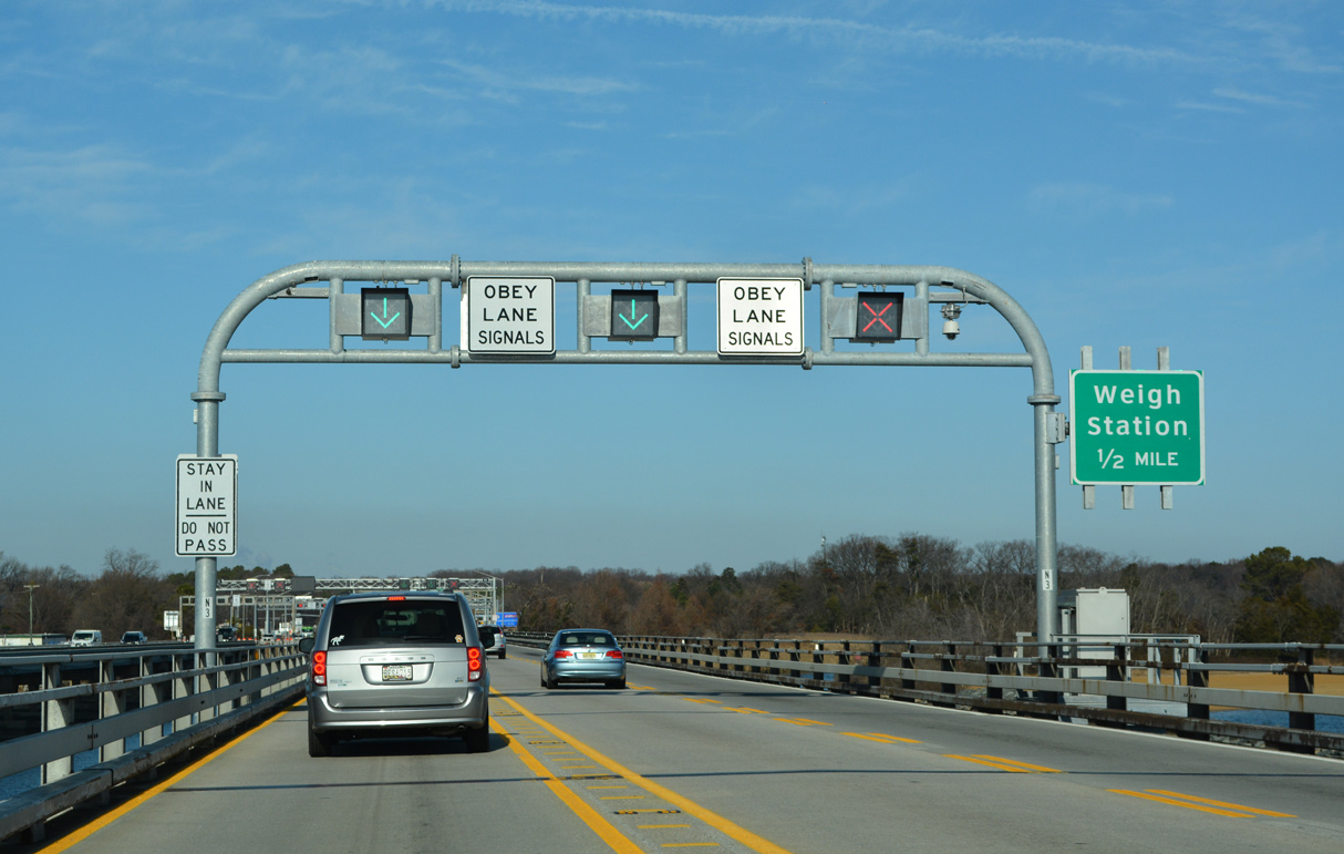
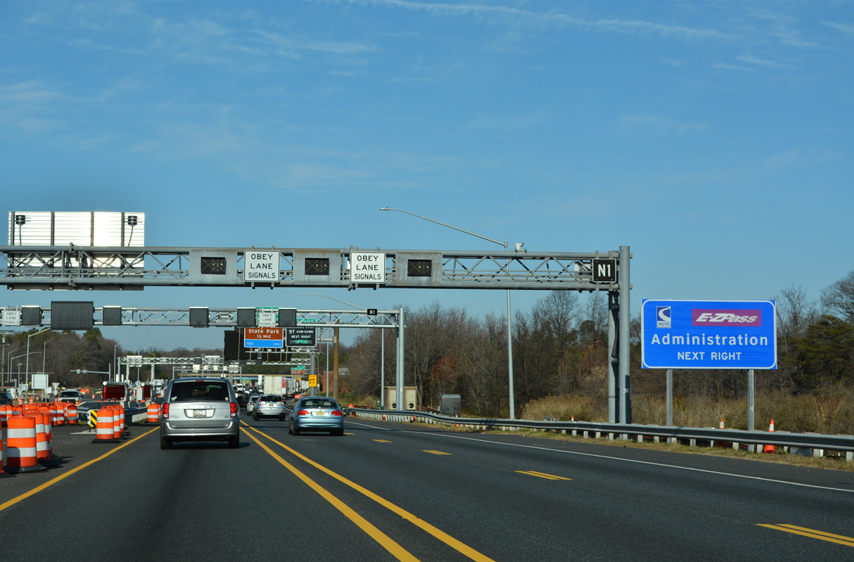
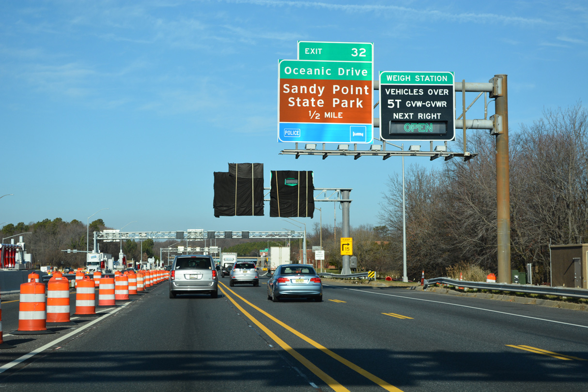
| A truck weigh station operates along U.S. 50/301 westbound opposite the eastbound toll collection point in one mile. 12/21/22 |
|
| U.S. 50/301 westbound leave Chesapeake Bay beside the South Beach at Sandy Point State Park and the inlet to Mezick Ponds. 12/21/22 |
|
| The second crossover for use during contraflow on the westbound span precedes the toll collection point. 12/21/22 |
|
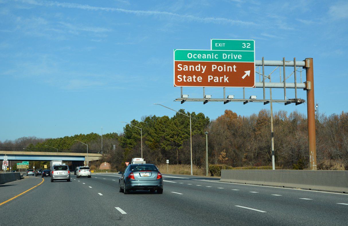
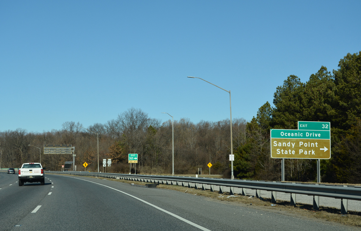
| A collector distributor roadway (Exit 32) for Oceanic Drive (MD 908D) separates from U.S. 50/301 west after the weigh station and MDTA Administration building. 12/21/22 |
|
| A three quarter cloverleaf interchange joins U.S. 50/301 (Blue Star Memorial Highway) with Ocenic Drive (MD 908D) north to Sand Point State Park and south to Skidmore Drive (MD 908C). 12/21/22 |
|
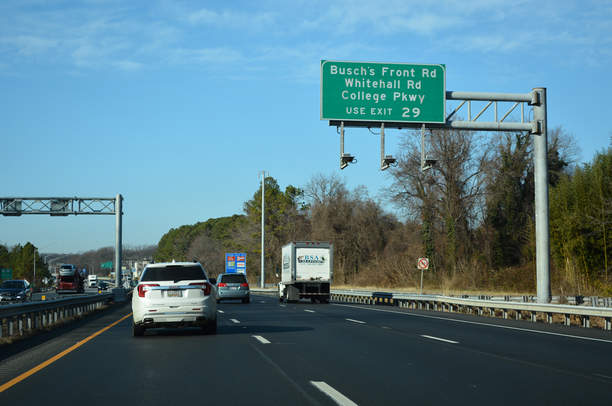
| E College Parkway (MD 908B) and Skidmore Drive (MD 908C) comprise frontage roads for U.S. 50/301 west from Oceanic Drive to MD 179 at Exit 29. E College Parkway and Whitehall Road were referenced at Exit 32 until 2008 sign replacements. 12/21/22 |
|
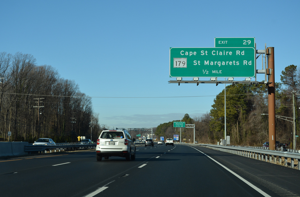
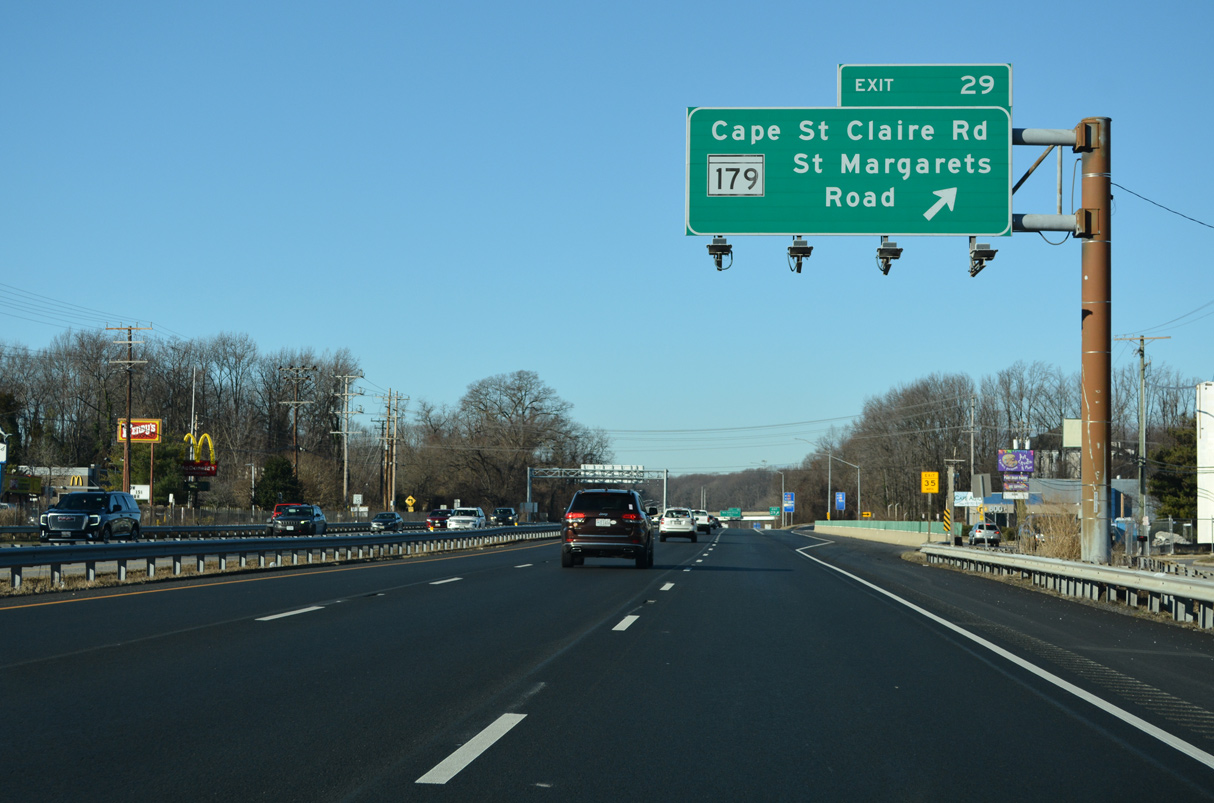
| U.S. 50/301 advance a half mile west to a parclo interchange (Exit 29) with MD 179. 12/27/22 |
|
| MD 179 connects with College Parkway (MD 931Q) east, Whitehall Road (MD 908C) east and Busch's Frontage Road (MD 908A) west, all part of the U.S. 50/301 frontage road system. 12/21/22 |
|
| MD 179 extends 0.59 miles northeast from U.S. 50/301 along Cape St. Claire Road to a point just past Saint Claire Court and the Walnut View subdivision. Southwest from Exit 29, MD 179 follow St. Margarets Road 2.58 miles to MD 648 (Baltimore Annapolis Boulevard) at Dulls Corner. 12/27/22 |
|
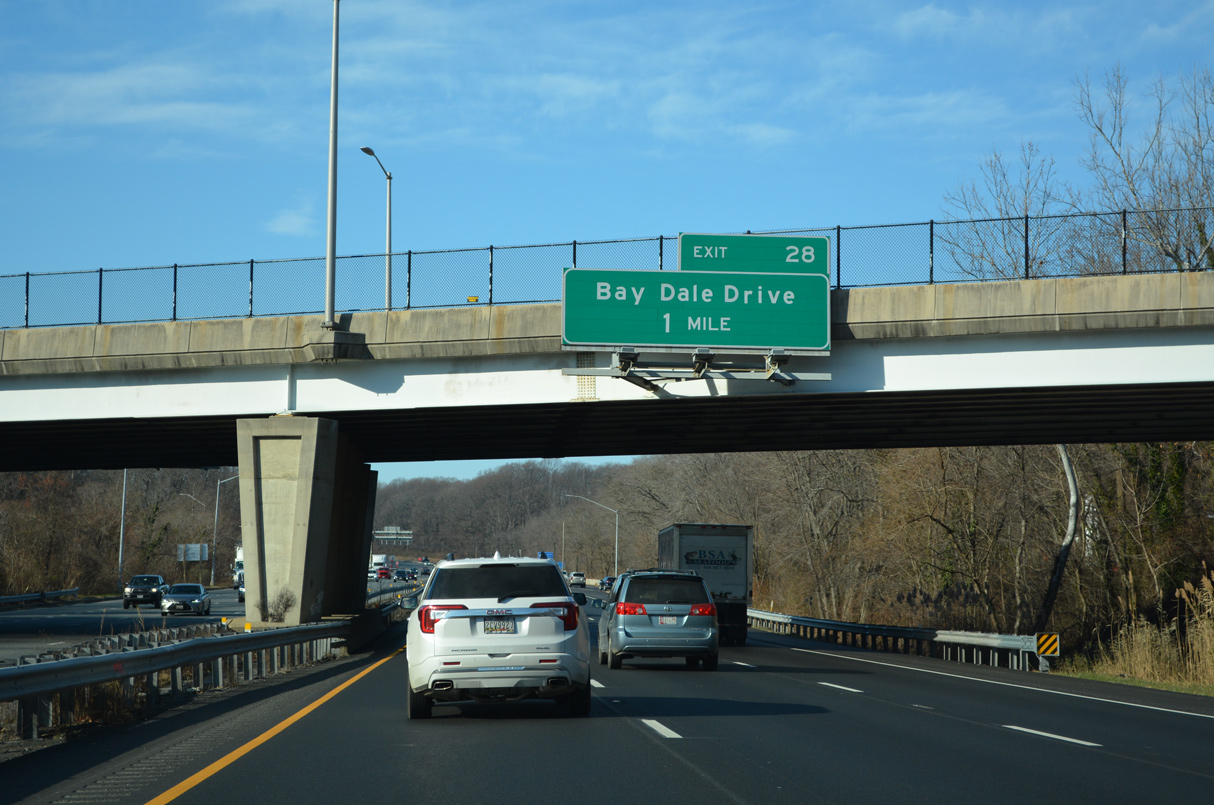
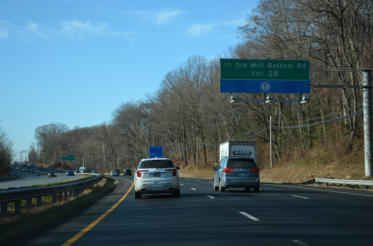
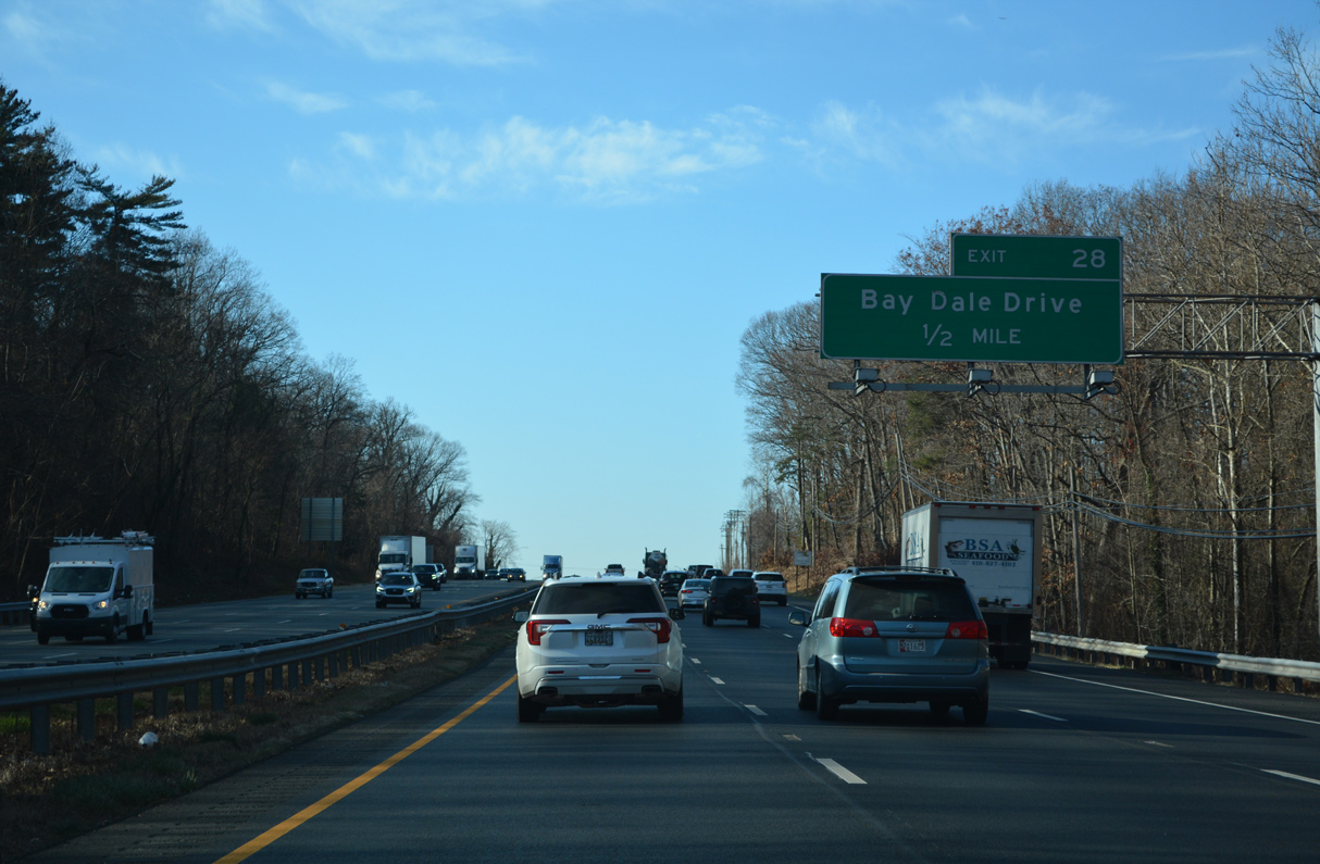
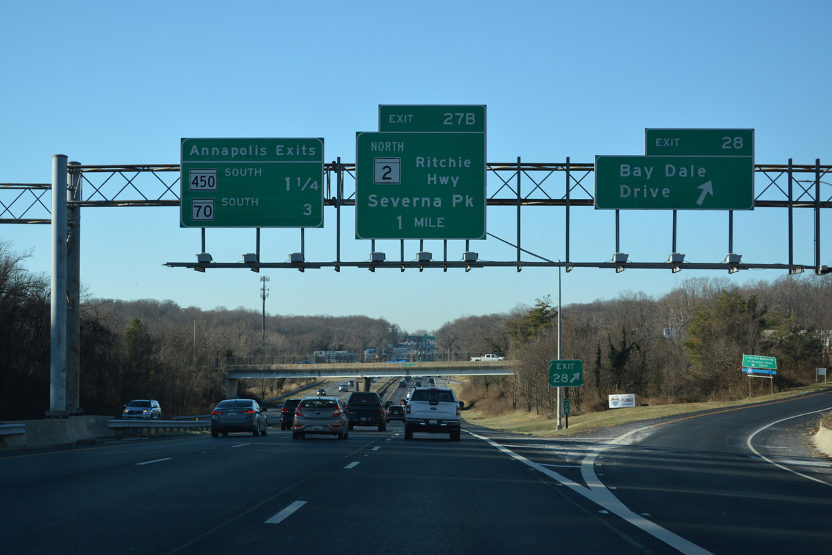
| Continuing west across Broad Neck, U.S. 50/301 meet Bay Dale Drive at a parclo interchange (Exit 28) in one mile. 12/21/22 |
|
| Removed by 2018, these confirming markers were posted west of Whitehall Creek. 12/31/16 |
|
| Prior to 1944, Old Mill Bottom Road was a through road west from St. Margarets Road to Baltimore Annapolis Boulevard (former MD 2) at Winchester. Construction of MD 179, the predecessor to U.S. 50 east to the Sand Point Ferry Terminal, replaced alignment. 12/21/22 |
|
| Bay Drive Road constitutes a major collector leading 1.23 miles north from Ferguson Road by U.S. 50/301 to College Parkway near Bay Hills Golf Course. 12/21/22 |
|
| Exit 28 departs U.S. 50/301 west for Bay Dale Drive north and Ferguson Road east to Old Mill Bottom Road S and MD 179 (St. Margarets Road). The succeeding three exits serve the capital city of Annapolis. 12/27/22 |
|
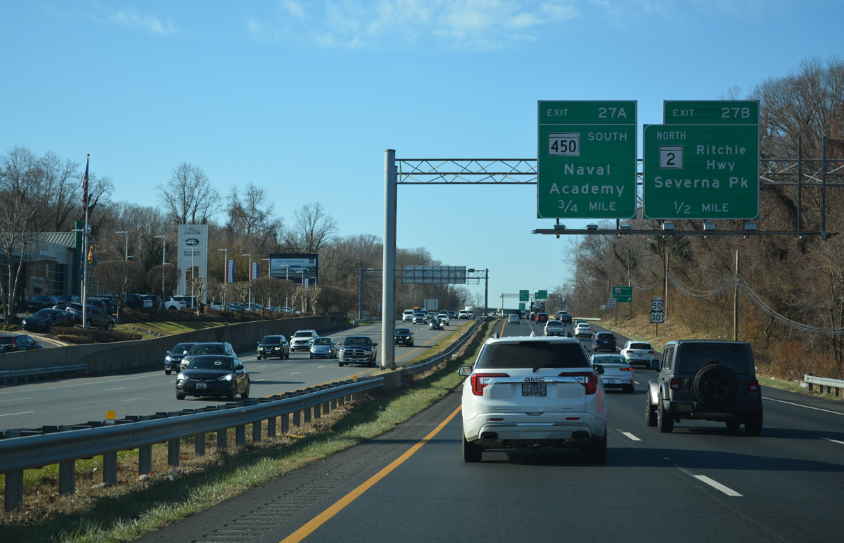
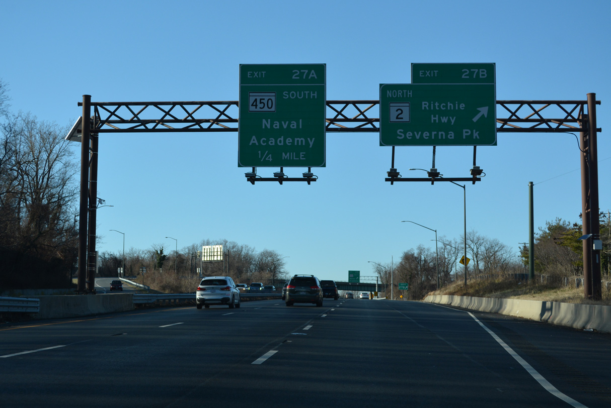
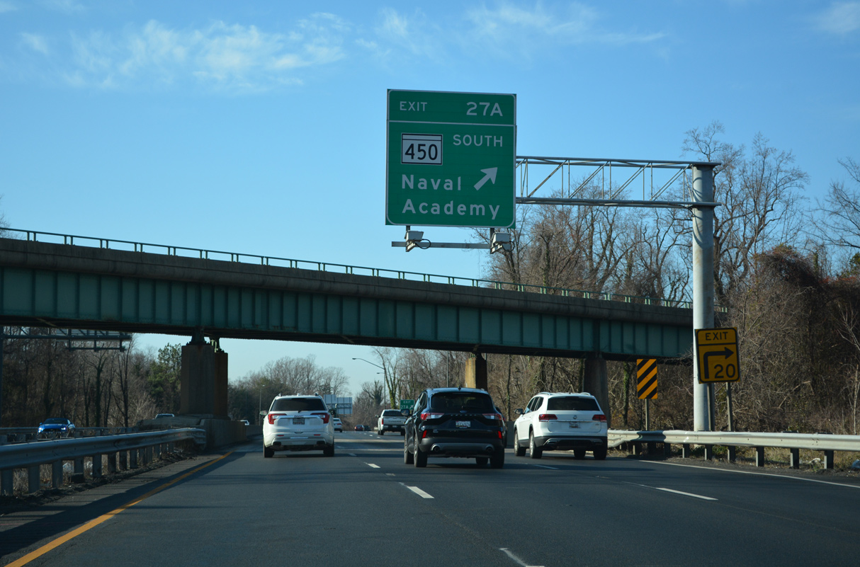
| U.S. 50/301 heads southwest toward a cloverstack interchange (Exit 27) with Governor Ritchie Highway: MD 2 north and MD 450 south. 12/21/22 |
|
| U.S. 50/301 cross Mill Creek ahead of Exit 27. 12/31/16 |
|
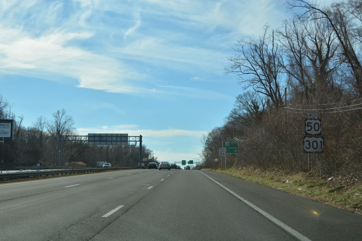
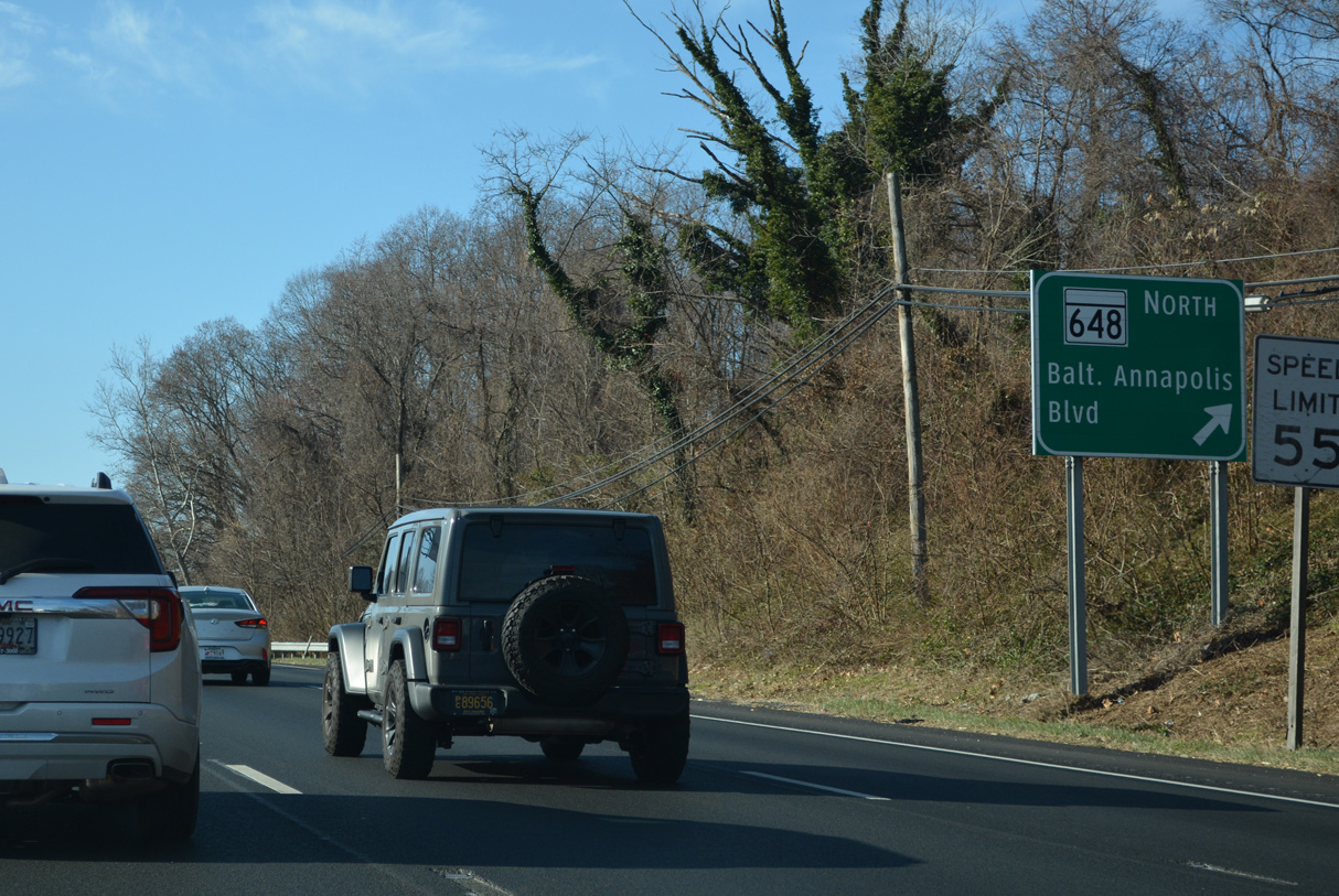
| Several old sections of MD 2 along Baltimore Annapolis Boulevard are designated as MD 648. Connecting with MD 672 (Greenbury Point Road) east to Naval Support Activity Annapolis, MD 648A loops east from MD 450 (Gov. Ritchie Highway). 12/21/22 |
|
| Exit 27 B leaves U.S. 50 west / U.S. 301 south for MD 2 (Governor Ritchie Highway) north to Arnold, Severna Park and Glen Burnie. MD 2 south overlaps with the freeway to Exit 23 A. 12/27/22 |
|
| MD 450 (Governor Ritchie Highway) represents the original alignment of U.S. 50 through Annapolis. MD 450 loops southward across the Naval Academy Bridge spanning the Severn River en route to the Maryland State House, Downtown and Parole. 12/21/22 |
|
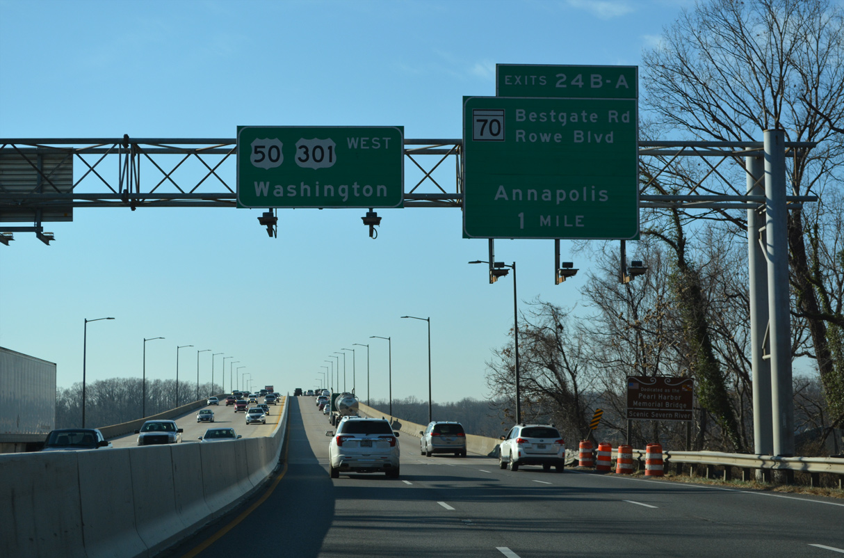
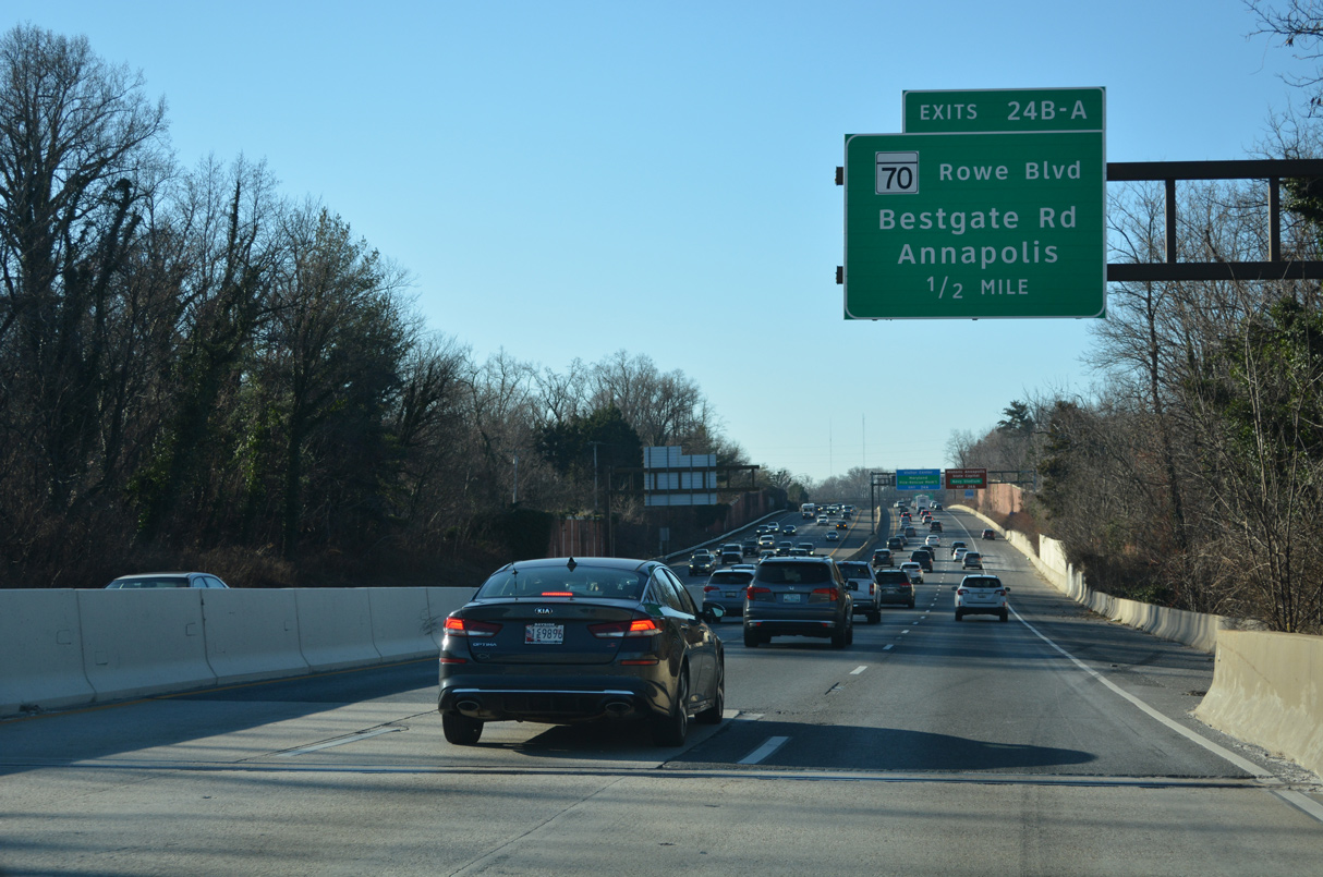
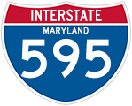
| The Pearl Harbor Memorial Bridge carries U.S. 50 west / U.S. 301-MD 2 south across the Severn River between Winchester and Weems Creek. Unsigned Interstate 595 begins at the ensuing parclo interchange (Exit 24) with MD 70 (Roscoe C. Rowe Boulevard). 12/21/22 |
|
| MD 70 (Rowe Boulevard) heads south to MD 450 (College Avenue) at the Maryland State House in Annapolis and 0.27 miles west along Bestgate Road at Parole. 12/27/22 |
|
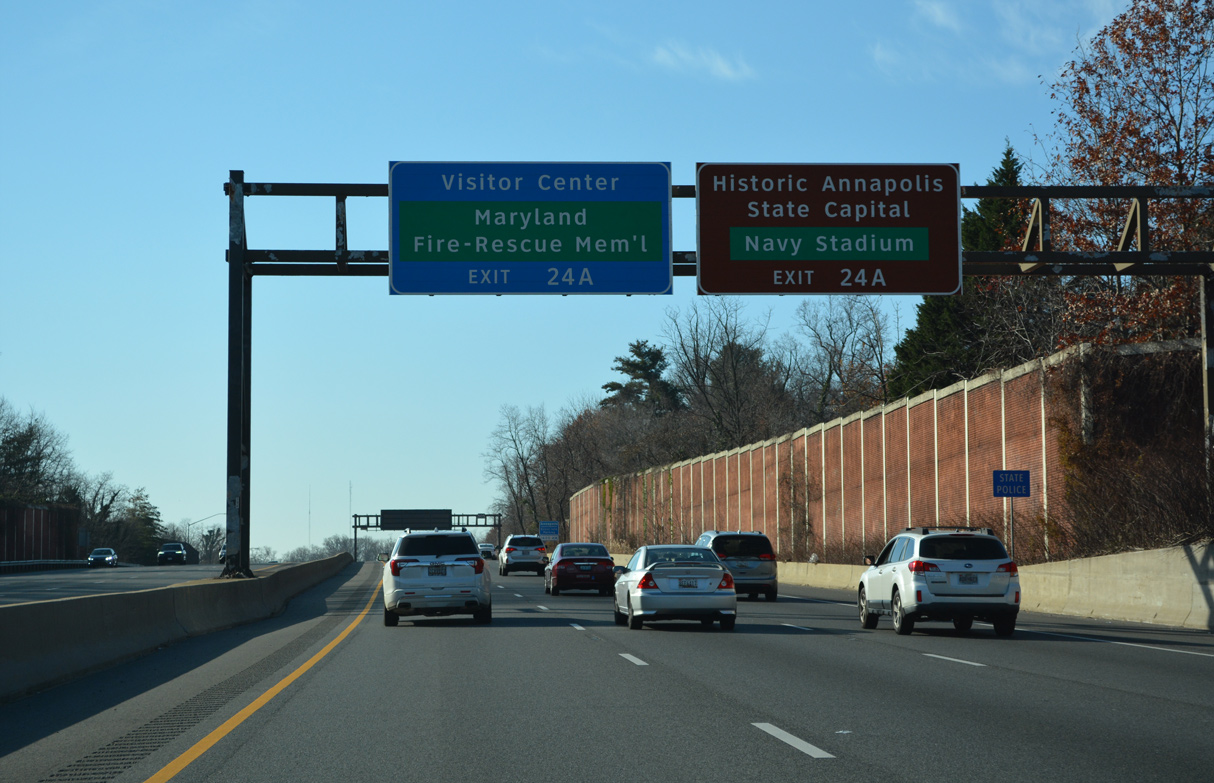
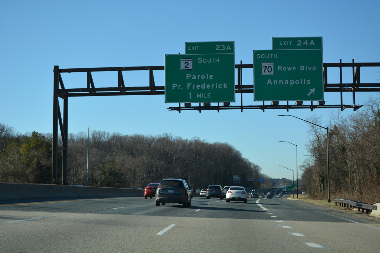
| Exit 24 A loops onto MD 70 (Rowe Boulevard) south to Navy-Marine Corps Memorial Stadium, the United States Naval Academy and the Annapolis Historic District. 12/21/22 |
|
| Bestgate Road extends 1.30 miles west from the end of MD 70 to Westfield Annapolis Mall and MD 178 (Generals Highway) in Parole. 12/27/22 |
|
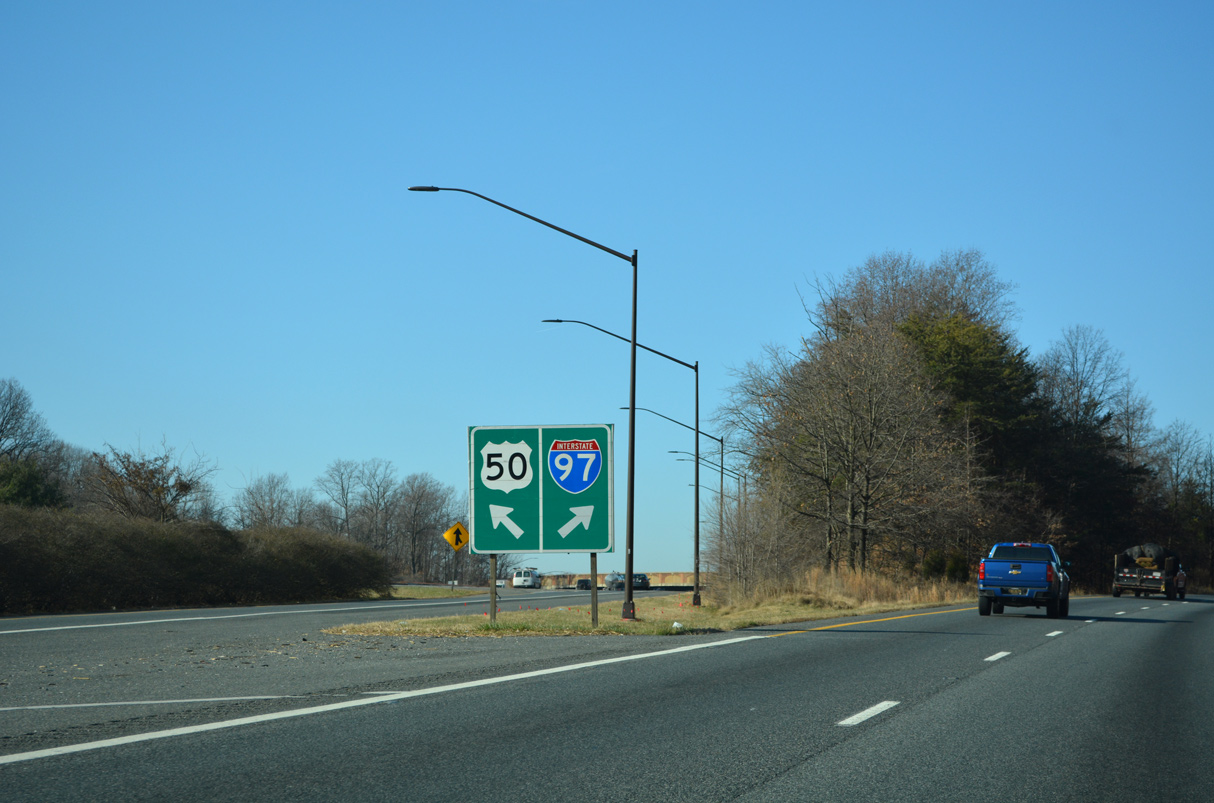
| Interstate 595 accompanies U.S. 50 (John Hanson Highway) west to I-95/495 (Capital Beltway) at Exit 7. MD 2 separates from U.S. 50/301 at the succeeding exit with Solomons Island Road. MD 70 comprises a 2.31 mile long arterial route. 12/27/22 |
|
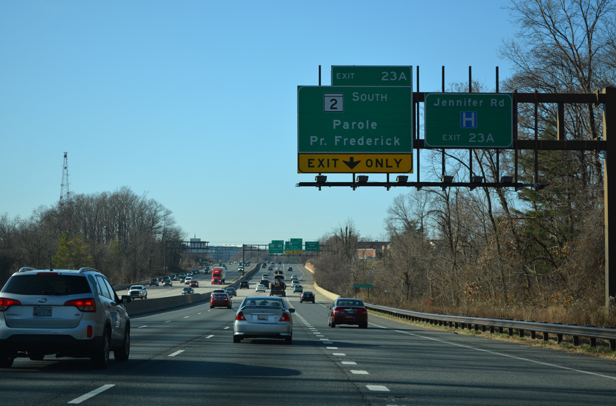
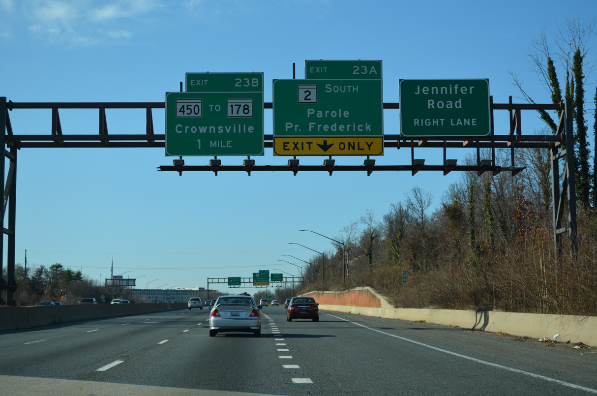
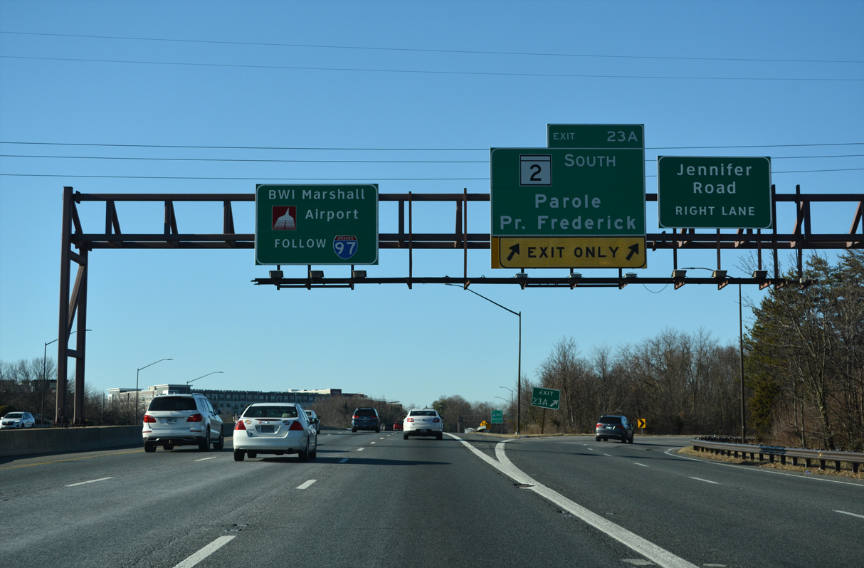
| U.S. 50/301 and MD 2 part ways at a parclo A2 interchange (Exit 23) west of Weems Creek. MD 2 (Solomons Island Road) travels south to the Calvert County seat of Prince Frederick and Solomons Island. 12/21/22 |
|
| Construction between 2004 and 2008 extended Solomons Island Road 0.20 miles north from what was a trumpet interchange with U.S. 50/301 to Medical Parkway at Jennifer Road and Anne Arundel Medical Center (AAMC). 12/21/22 |
|
| Exit 23 A separates into ramps for parallel Jennifer Road west to Medical Parkway and Westfield Annapolis Mall and MD 2 south. MD 2 originates in Baltimore to the north and at Johnstown in southern Calvert County. 12/27/22 |
|
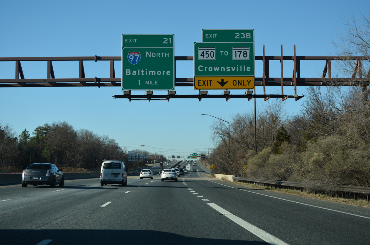
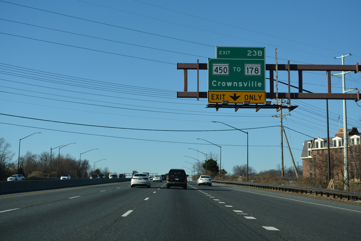
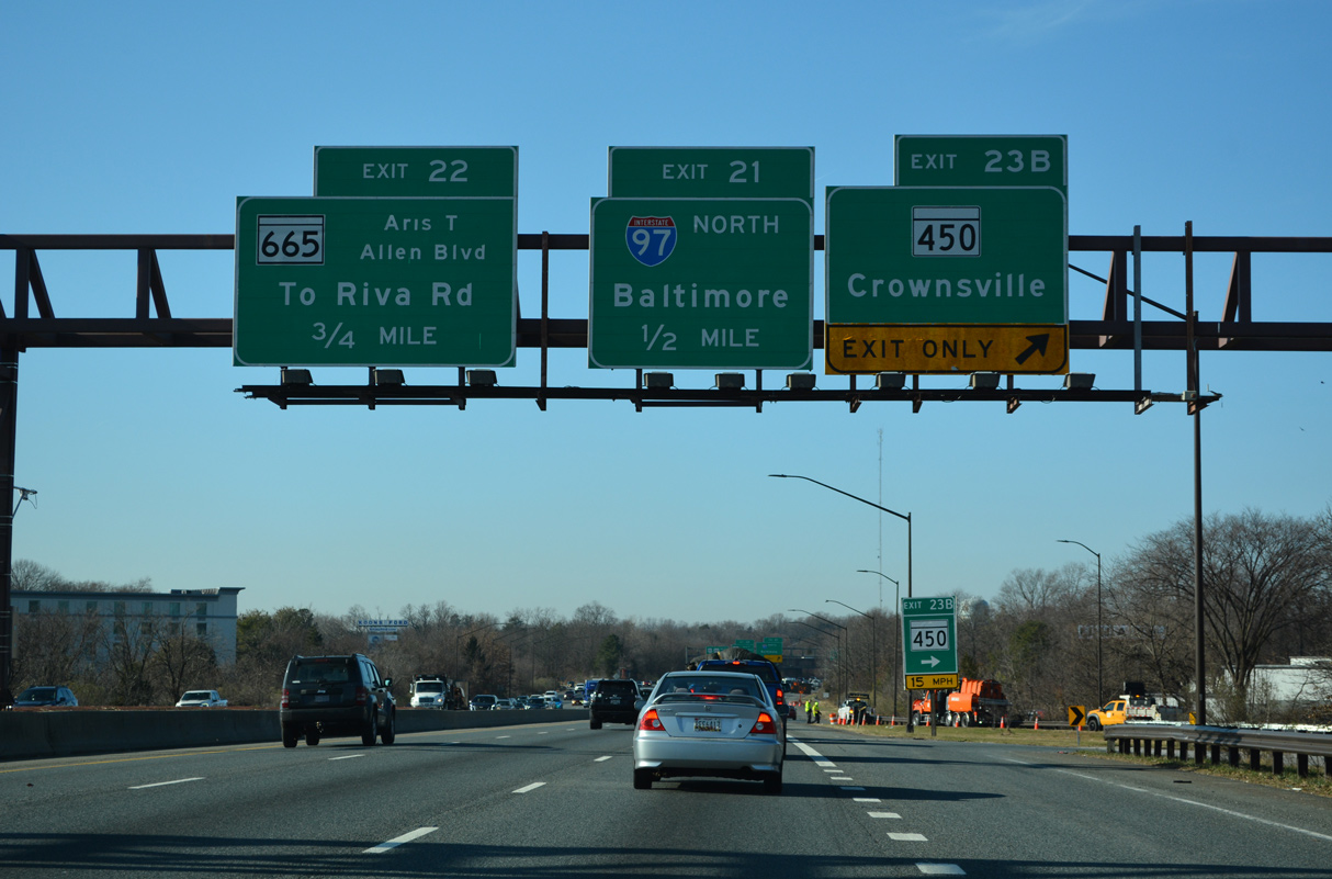
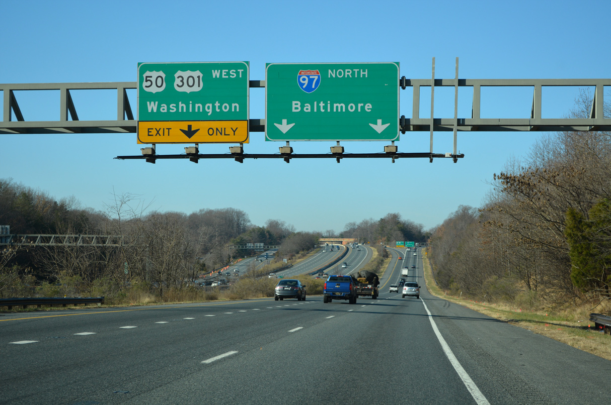
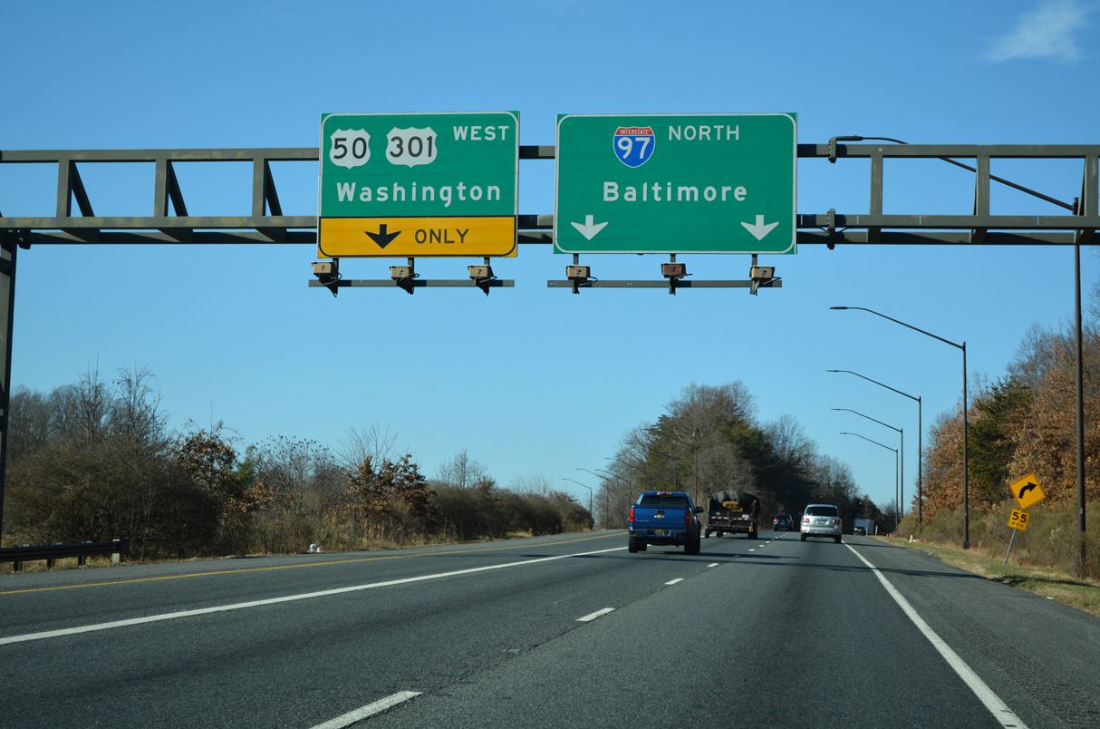
| MD 450 (West Street) converges with U.S. 50/301 at Exit 23 B, just south of MD 178 (Generals Highway) north to Crownsville. A 1.31 mile long c/d roadway separates for Interstate 97 north at Exit 21. 12/27/22 |
|
| Shifting west at MD 178 onto Defense Highway, MD 450 continues along the original route of U.S. 50 from Parole to the District of Columbia. MD 178 (Generals Highway) parallels I-97 northwest 8.06 miles to Veterans Highway at Doors Corner. 12/27/22 |
|
| Ramps at the parclo B2 interchange (Exit 23 B) with MD 450 tie into Jennifer Road by Westfield Annapolis Mall and Riva Road by Annapolis Town Center at Parole. Forthcoming I-97 travels northwest to MD 32 for Fort Meade and Columbia. 12/21/22 |
|
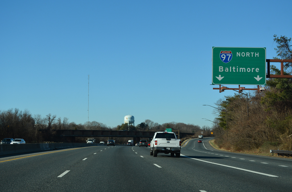
| Two lanes follow from U.S. 50/301 (John Hanson Highway) west to Interstate 97 north. I-97 measures just 17.62 miles overall from Parole to I-695 and I-895 Spur A (Harbor Tunnel Thruway) into Baltimore. 12/27/22 |
|
| Interstate 97 constitutes a commuter freeway north from Annapolis to Baltimore through Glen Burnie. 12/27/22 |
|
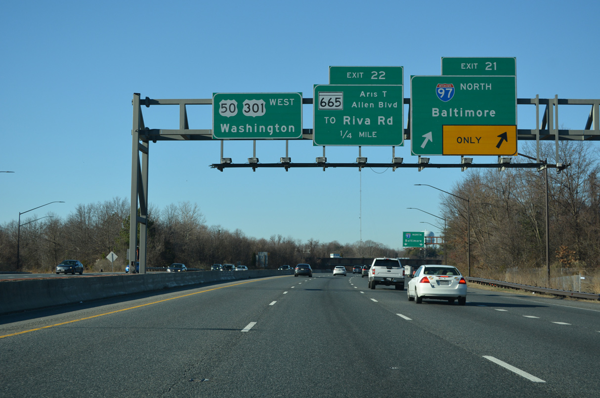
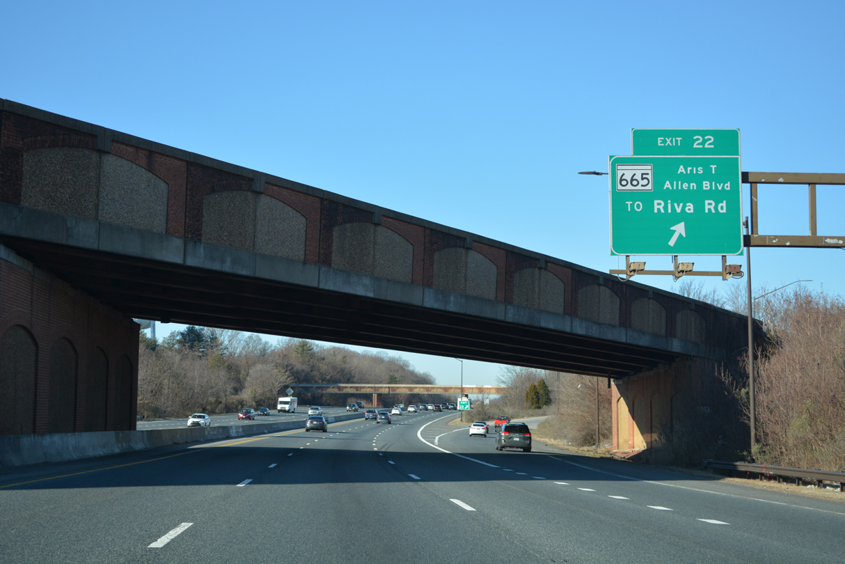
| A loop ramp (Exit 22) joins I-595/U.S. 50-301 west with MD 665 (Aris T. Allen Boulevard), an expressway branching 2.68 miles southeast to Forest Drive at Bywater Road in Annapolis. 12/27/22 |
|
| The west end of MD 665 (Aris T. Allen Boulevard) ties into the c/d roadways linking U.S. 50/301 (John Hanson Highway) with Interstate 97. 12/21/22 |
|
| Interstate 97 replaced MD 2 as the main route from Annapolis north to Baltimore and MD 3 directly from Millersville into Glen Burnie. 12/21/22 |
|
| Advancing west through the two-wye interchange (Exit 21) with the south end of Interstate 97. 12/21/22 |
|
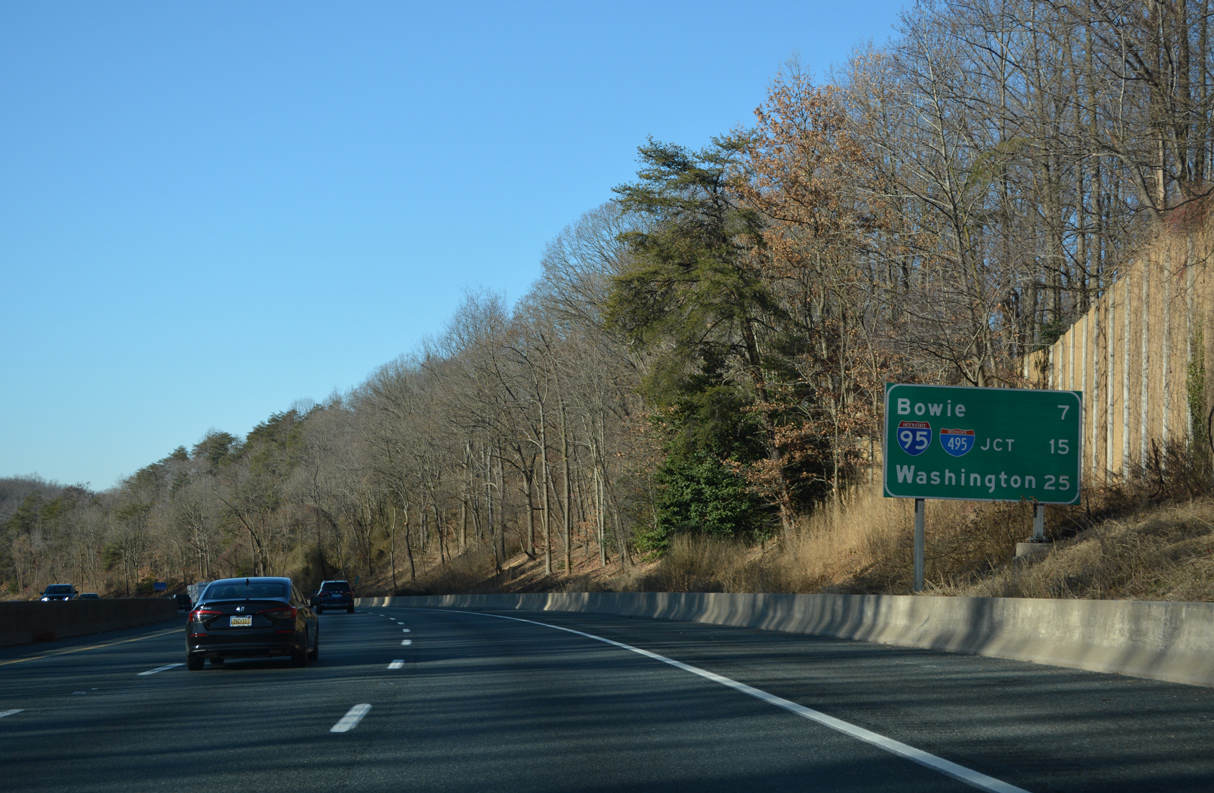
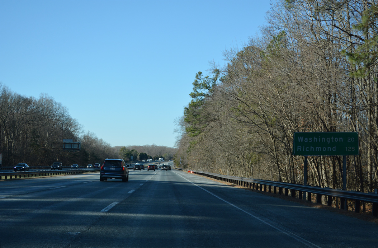
| Crossing the South River beyond this distance sign, U.S. 50 west and U.S. 301 south part ways in 6.8 miles at the city of Bowie. Downtown Washington, DC lies 25 miles to the west along U.S. 50. 12/27/22 |
|
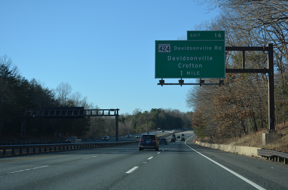
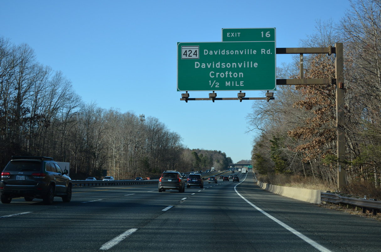
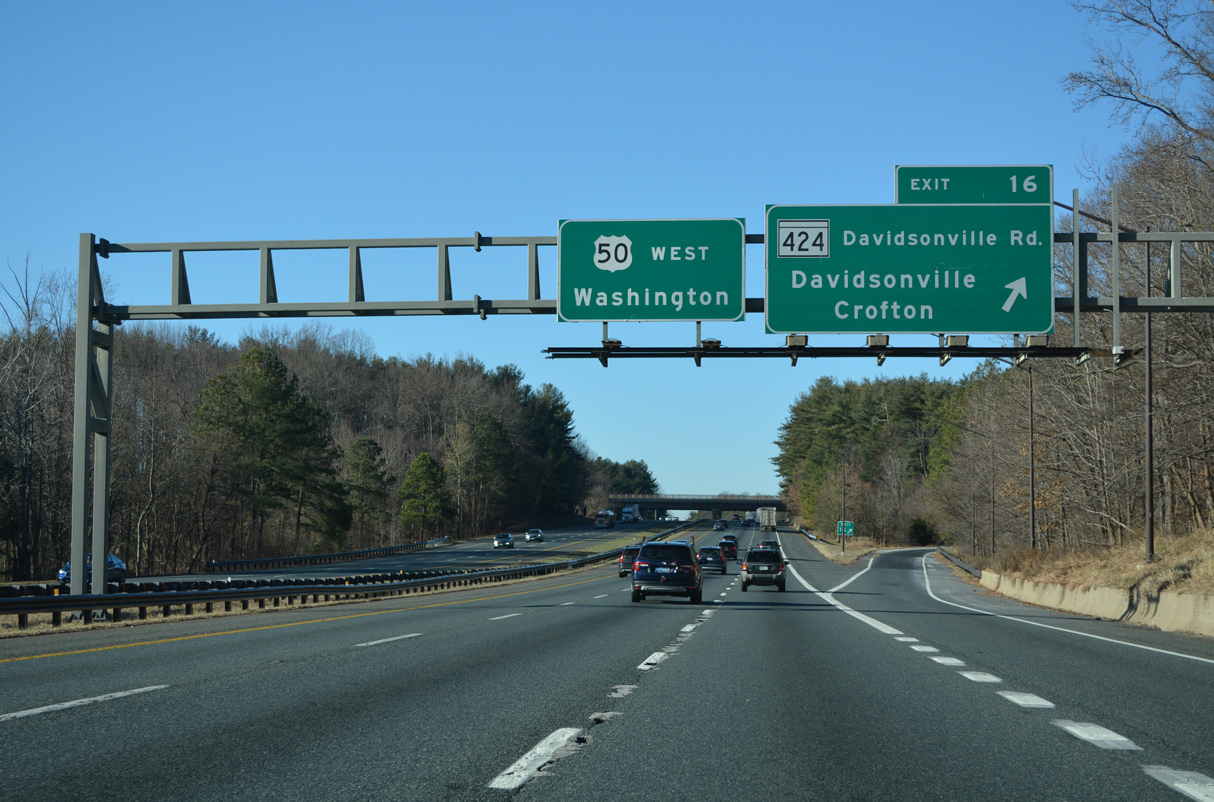
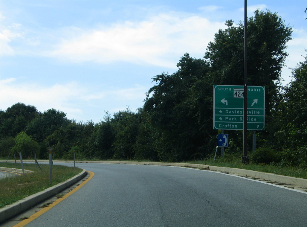
| MD 424 (Davidsonville Road) converges with U.S. 50/301 (John Hanson Highway) in a rural area between MD 214 (Central Avenue) at Davidsonville and MD 450 (Defense Highway) at Staples Corners. 12/27/22 |
|
| An 8.24 mile long minor arterial, MD 424 (Davidsonville Road) extends north to MD 3 (Crain Highway) and Conway Road at Crofton and south to MD 214 at Birdsville Road. 12/27/22 |
|
| A parclo A2 interchange connects I-595/U.S. 50-301 with MD 424 (Davidsonville Road). 12/27/22, 09/25/04 |
|
| Proceeding west from MD 424, U.S. 50/301 (John Hanson Highway) pass south of the U.S. Air Force Transmitter Station. 01/04/19 |
|
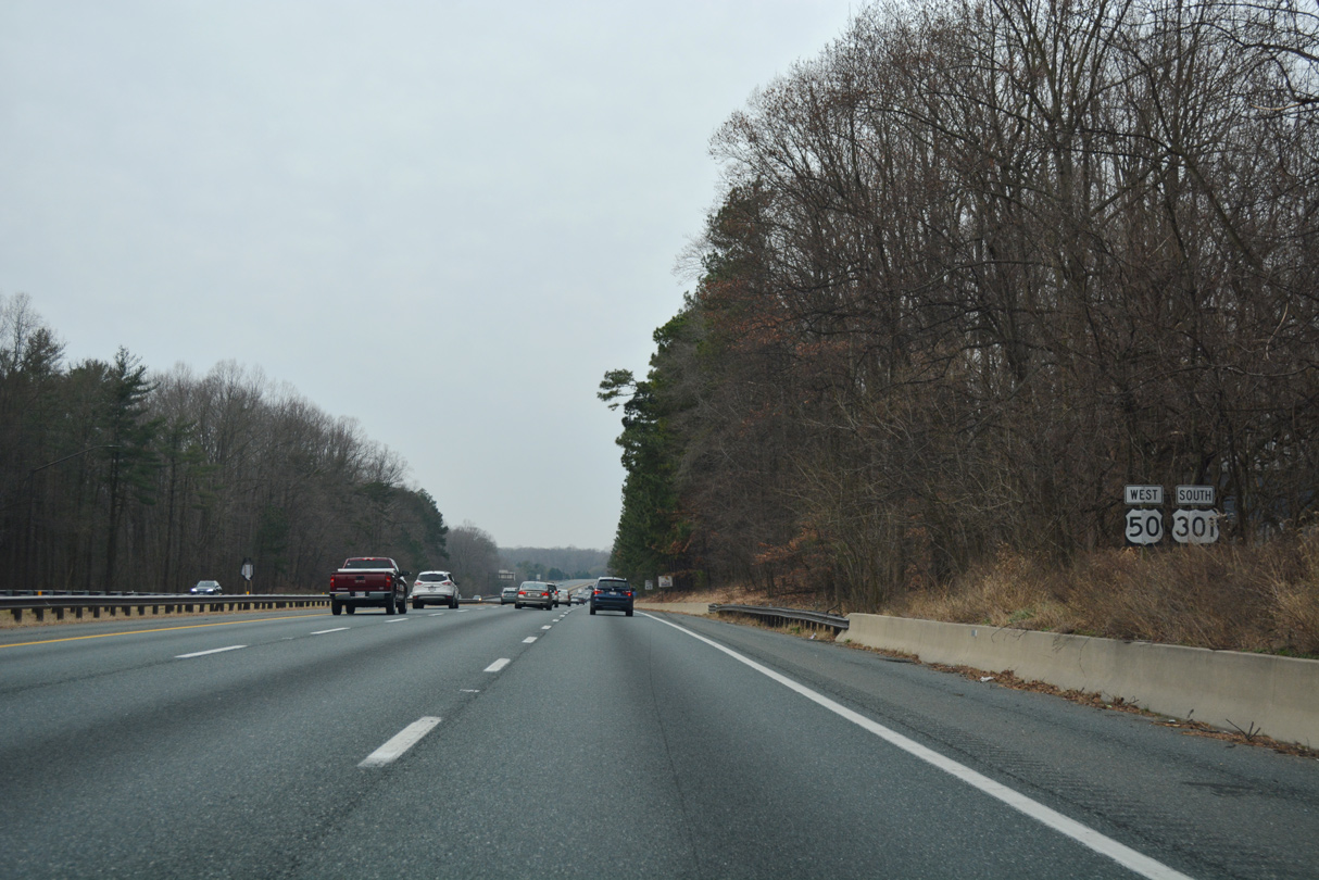
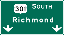
| Beyond U.S. 50, U.S. 301 heads south 128 miles to Richmond, Virginia. 12/27/22 |
|
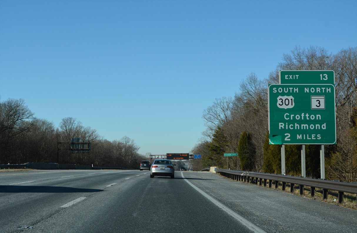
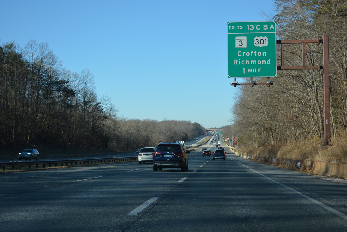
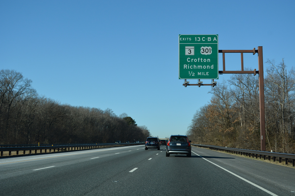
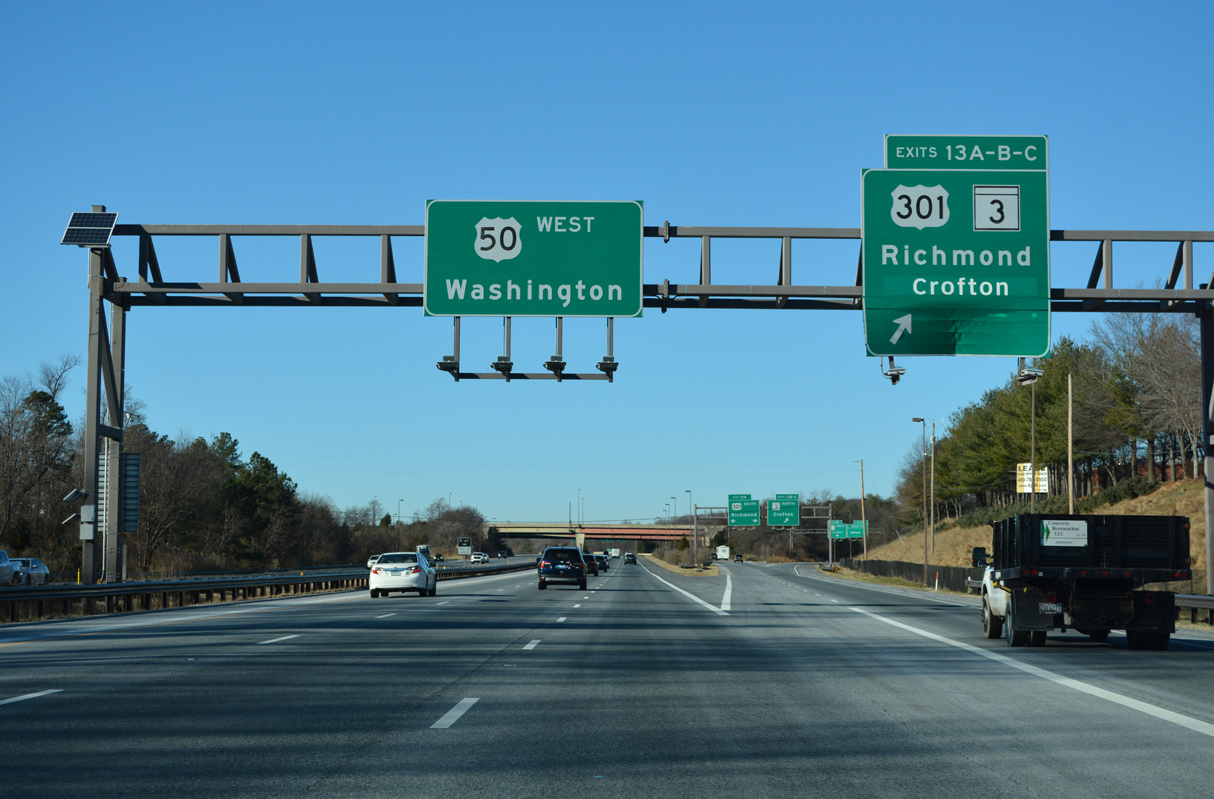
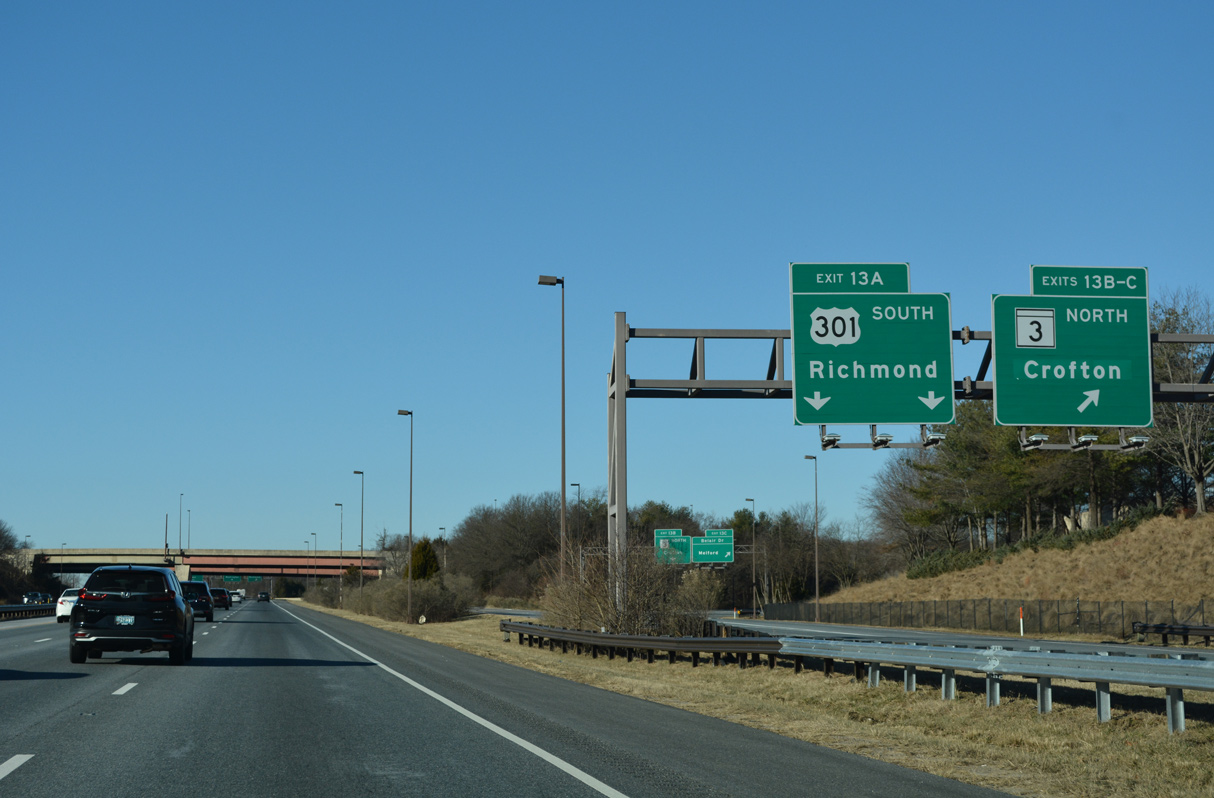
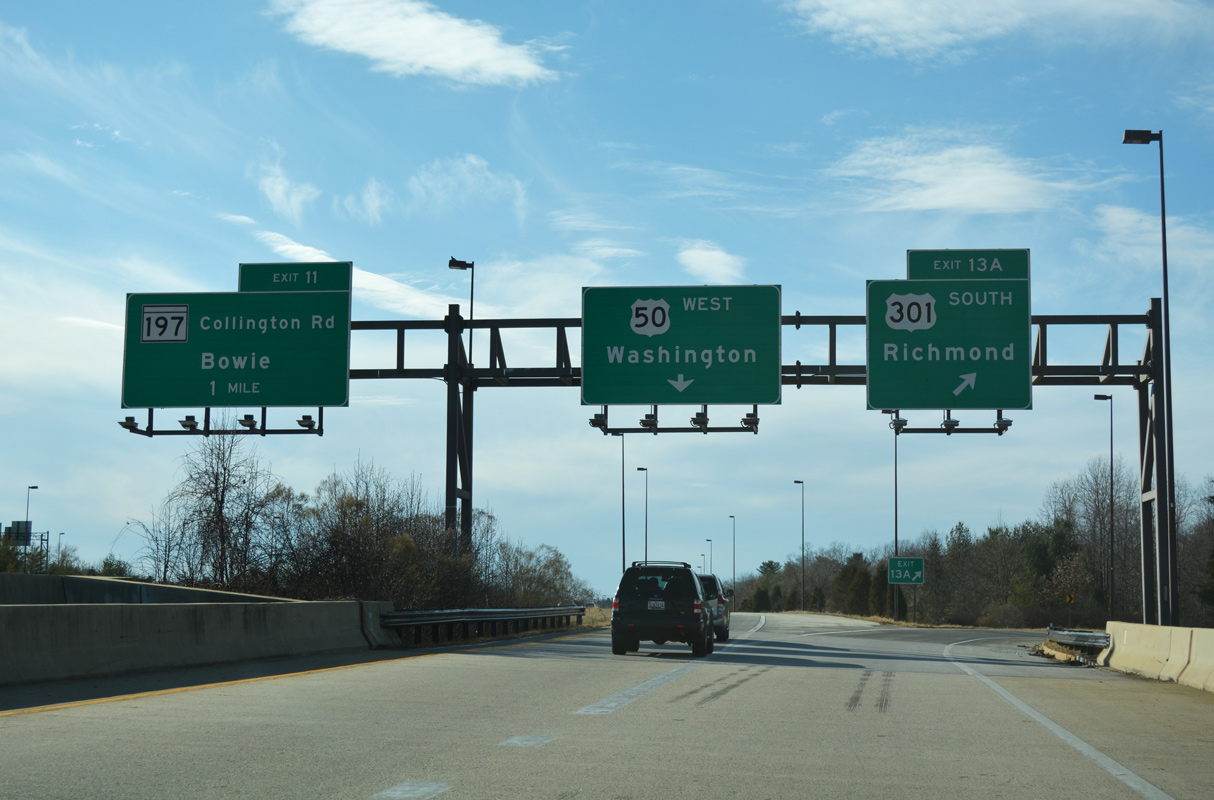
| U.S. 301 splits with U.S. 50/I-595 (John Hanson Highway) at a directional cloverleaf interchange (Exit 13) with MD 3 (Robert Crain Highway) two miles west of Patuxent River Road. 12/27/22 |
|
| U.S. 301 follows Robert Crain Highway south from MD 3 at Bowie to Upper Marlboro, Waldorf and the Governor Nice/Senator Middletown Bridge into Virginia. 12/27/22 |
|
| U.S. 301 south from Exit 13 A to MD 214 (Central Avenue) west leads to the Six Flags America theme park. 12/27/22 |
|
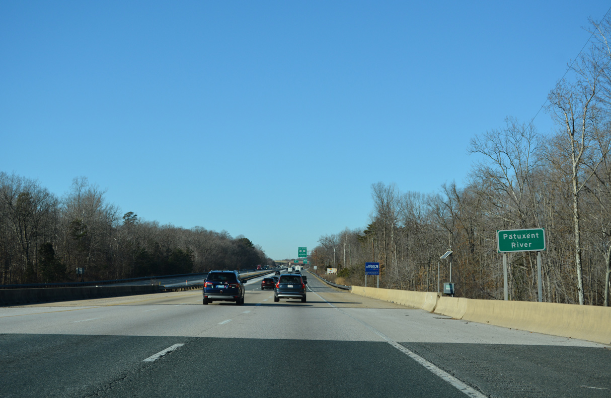
| Spanning the Patuxent River, U.S. 50/301 (John Hanson Highway) enter Price George's County. 12/27/22 |
|
| U.S. 301 provides an alternate route to Interstate 95 for regional traffic headed south to Richmond, Virginia. Crain Highway extends 7.11 miles north from U.S. 301 along MD 3 to Crofton and I-97/MD 32 at Millersville. 12/27/22 |
|
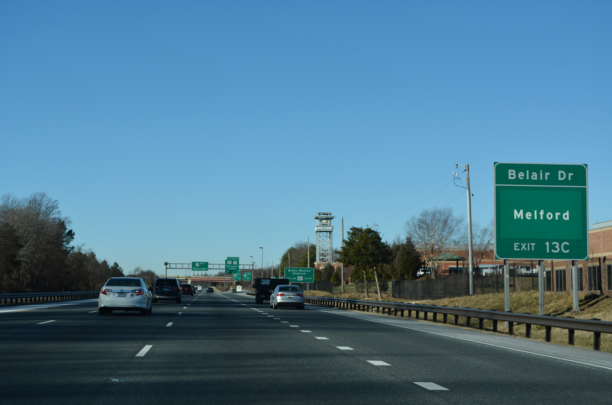
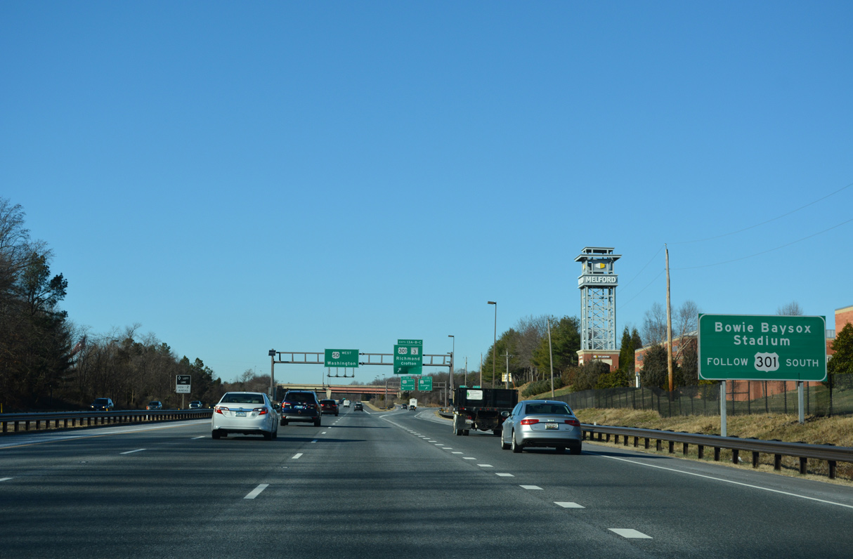
| MD 3 (Crain Highway) meets Belair Drive west into Bowie and Melford Boulevard east to the Melford commercial center at a parclo interchange just north of U.S. 50/301. 12/27/22 |
|
| Prince George's Stadium, home of the Double A Bowie Baysox Minor League Baseball team, is located south of Exit 13 A along Ball Park Road east of U.S. 301 (Crain Highway). 12/27/22 |
|
| Two lanes separate at Exit 13 for the c/d roadway to MD 3 (Crain Highway) north, Bel Air Drive west / Melford Boulevard east, and U.S. 301 south. 12/27/22 |
|
| Exits 13 B/C partition for ramps to MD 3 (Robert Crain Highway) north to Crofton and Belair Drive west/ Melford Boulevard east in Bowie. MD 3 historically continued north to Glen Burnie and Baltimore along the former route of U.S. 301. 12/27/22 |
|
| U.S. 301 overtakes Crain Highway south from MD 3 ahead of a commercial strip east of Essington in Bowie. U.S. 301 converges with the I-95 corridor in Richmond, Virginia. The two commingle southward to Santee, South Carolina. 12/31/16 |
Page Updated 01-11-2023.

 West
West  South
South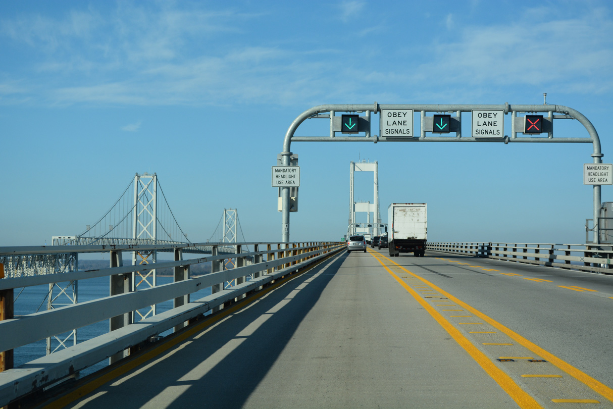
 South
South