|
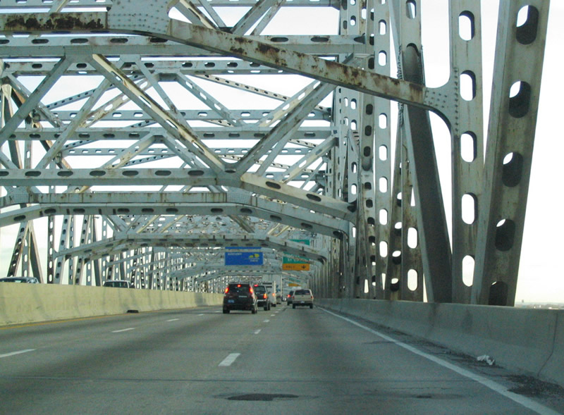
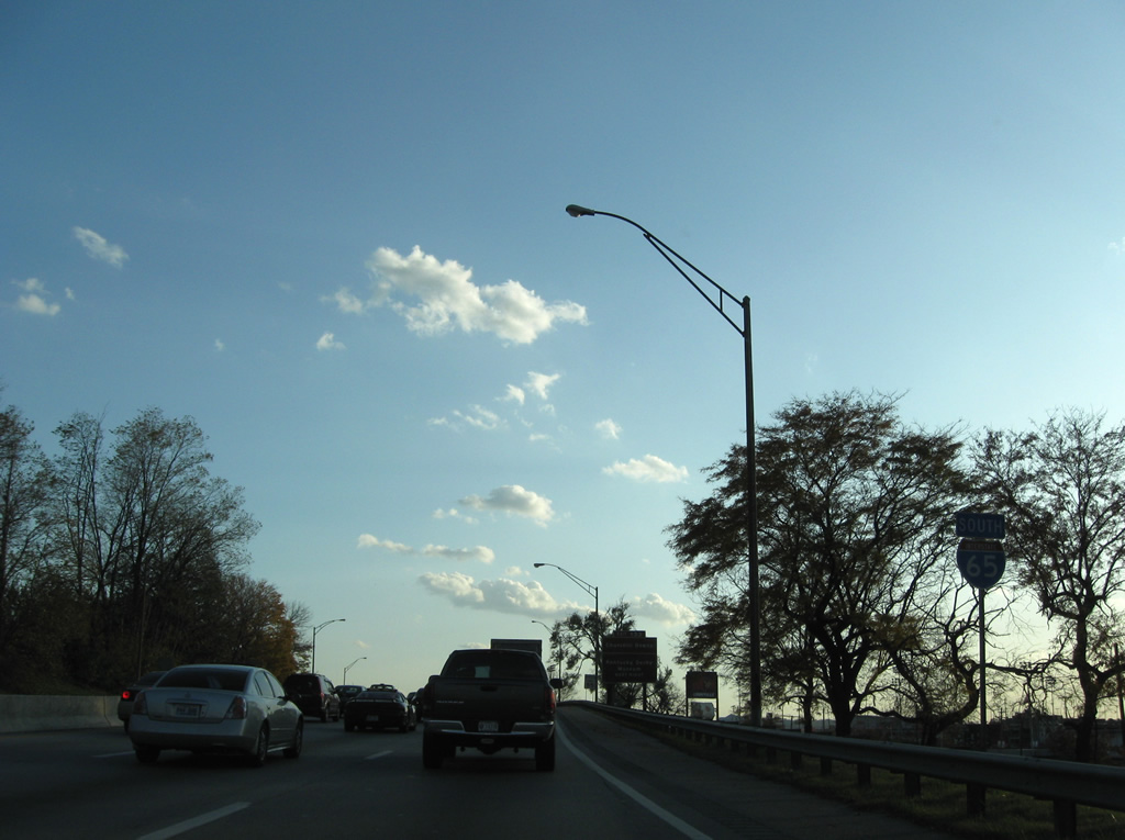
| Crossing over the Ohio River on the John F. Kennedy Memorial Bridge, seven-lane Interstate 65 enters Kentucky for its 138 mile journey through the Bluegrass State. 11/12/04 |
|
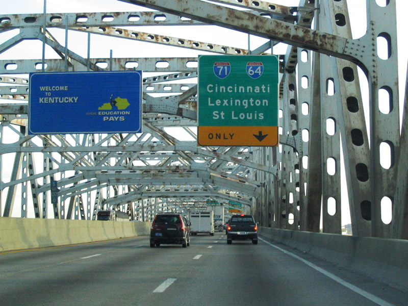
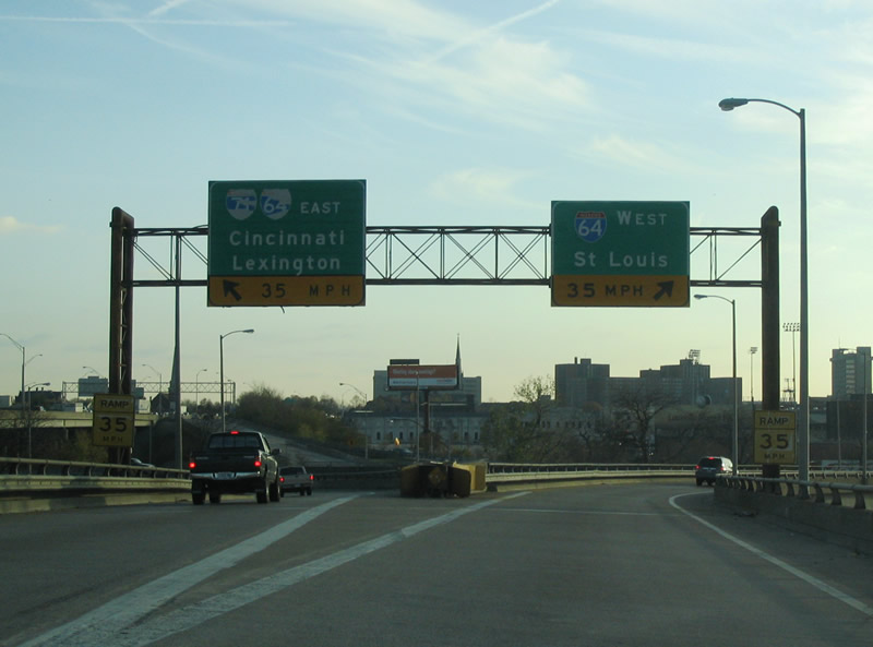
| A Welcome to Kentucky banner greets motorists while crossing the Ohio River. Motorists are also notified of the impending right-lane only ramp for the unsigned Exit 137 interchange with Interstate 64 & 71 interchange. 11/12/04 |
|
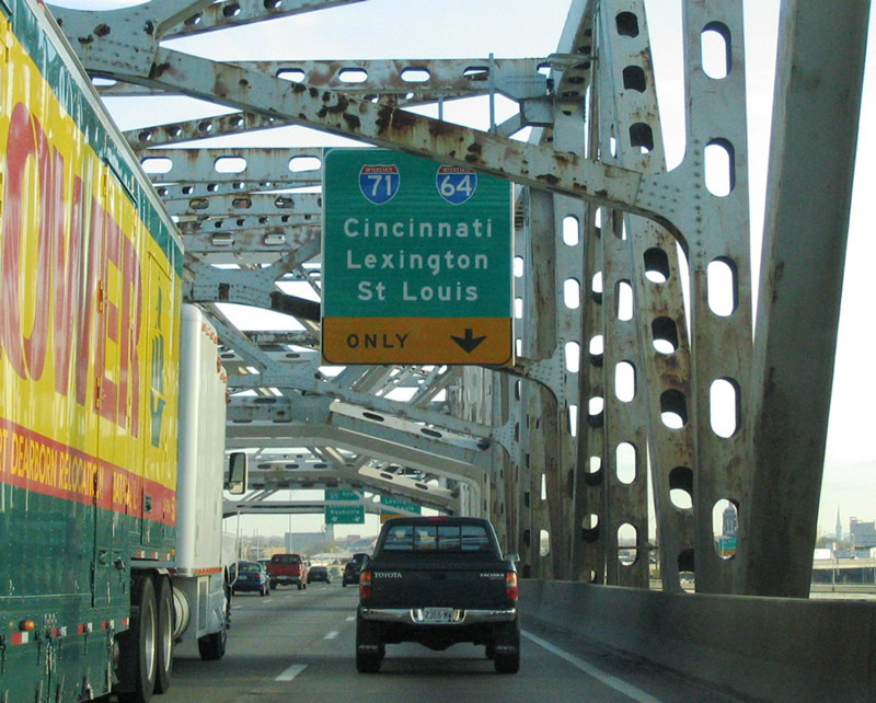
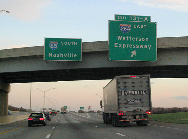
| Interstate 64 is a 963 mile interstate connecting the cities of St. Louis, Evansville (via Interstate 164), Louisville, Lexington, Charleston, Richmond and Norfolk. Interstate 71 begins just east of Exit 137 and travels northeast to Cincinnati and Columbus, eventually terminating in Cleveland. 11/12/04 |
|
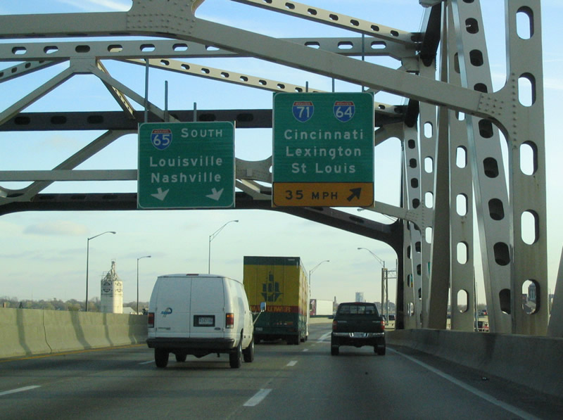
| The right lane prepares to leave the mainline of Interstate 65. The ramp connection between the three interstates constitutes a 35 m.p.h. speed limit.
Work is slated to begin in 2012 to add a new Ohio River bridge for Interstate 65. The toll bridge is tentatively planned to open in 2018. 11/12/04 |
|
| The ramp for Exit 137 splits over River Road which runs parallel to the Ohio River. Motorists wanting to access Interstate 64 east and Interstate 71 north continue on the left ramp. The ramp enters the main northbound roadway for Interstate 71 north from the left with an access point for Interstate 64 east before the highways diverge. Westbound Interstate 64 is accessed via the right ramp and also enters the interstate from the left. 11/12/04 |
|
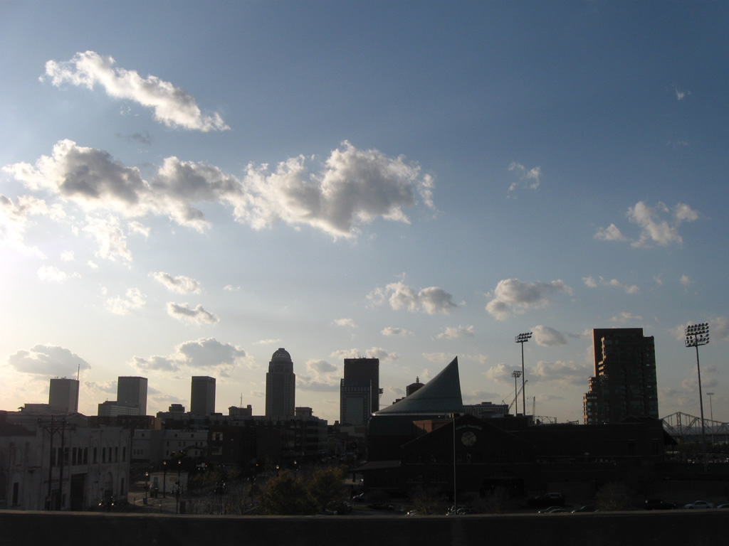
| Continuing south of the Kennedy Interchange, Interstate 65 travels a viaduct above Main Street (U.S. 60 west & 31E north). Louisville Slugger Field, home of the Louisville Bats AAA Baseball club, lies west of the freeway within the central business district. The U.S. 31 Rogers Clark Memorial Bridge spans the Ohio River in the background. 11/04/09 |
|
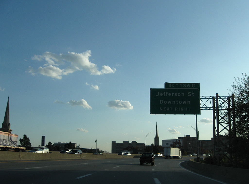
| Exit 136C follows as a direct ramp onto Jefferson Street west and Brook Street north into downtown Louisville. Brook Street leads one block north to the one way street couplet of U.S. 31E & 60 (Main / Market Streets). U.S. 31W joins U.S. 60 west from 2nd Street and the Clark Memorial Bridge. 11/04/09 |
|
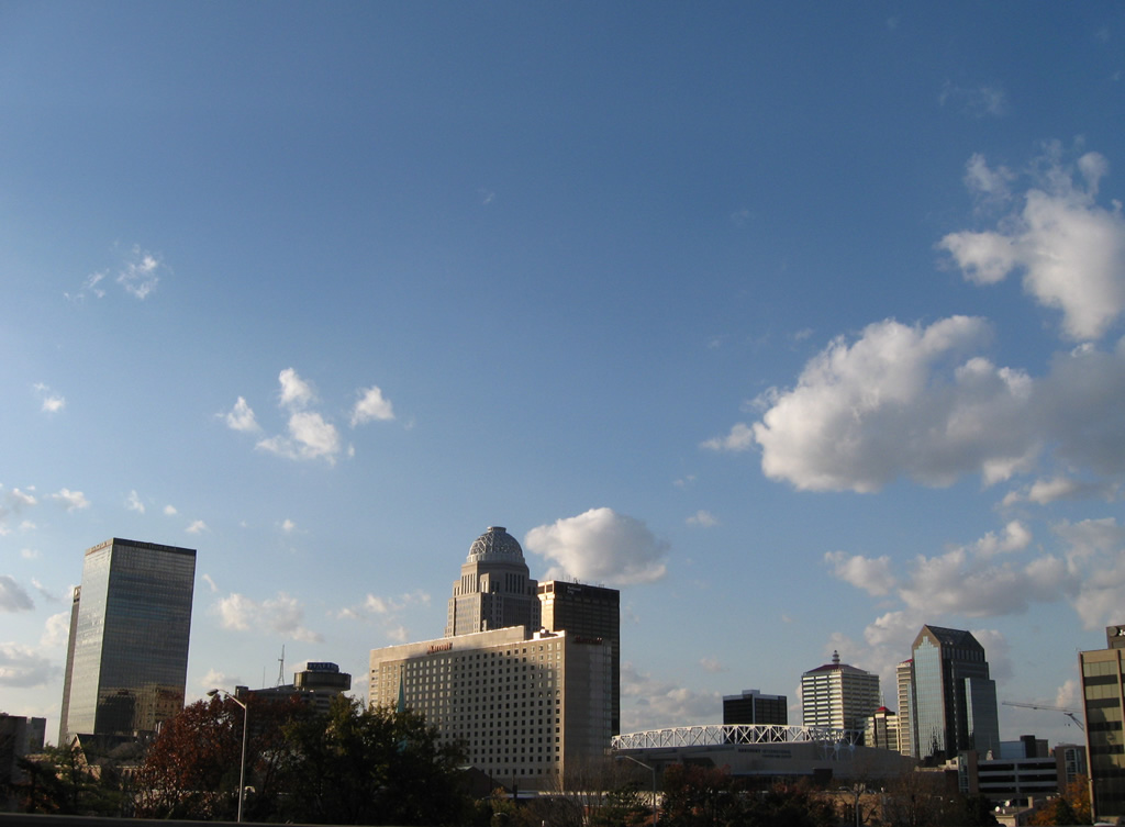
| Again looking west at the downtown skyline, Kentucky International Convention Center comes into view from the corner of Market Street (U.S. 31W north & 60 east) and 2nd Street (U.S. 31E south and KY 1020). 11/04/09 |
|
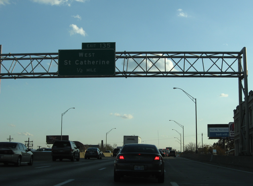
| Some of the signs for Interstate 65 through Louisville were replaced by 2007 using the new Clearview font. Known as the Martin Luther King, Jr. Expressway, Interstate 65 meanders through downtown, turning southward along 1st and Brook Streets to Exit 135 with St. Catherine Street. 11/04/09 |
|
| Three on-ramps in a row join Interstate 65 south from adjacent 1st Street southbound. A reassurance marker resides at the ramp from 1st and Jacob Streets. 11/04/09 |
|
| Exit 135 departs Interstate 65 south after the Caldwell Street underpass, passing over Kentucky Street before merging onto St. Catherine Street west. St. Catherine Street travels west to 7th Street (former KY 1931) near the 9th and Oak Street SPUI. 11/04/09 |
|
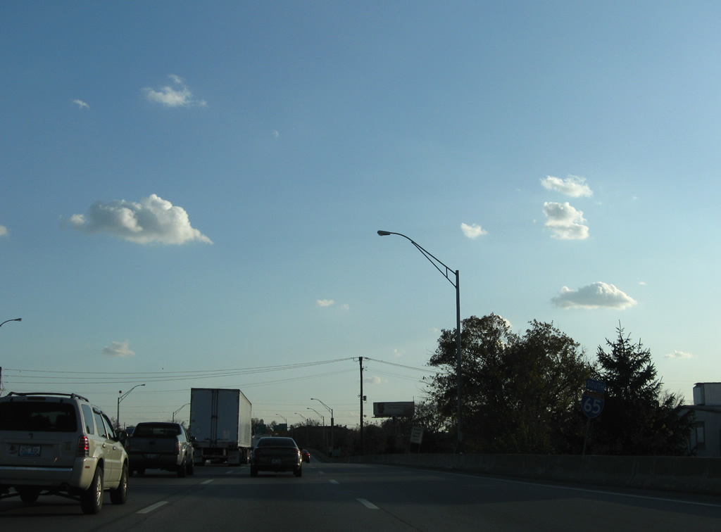
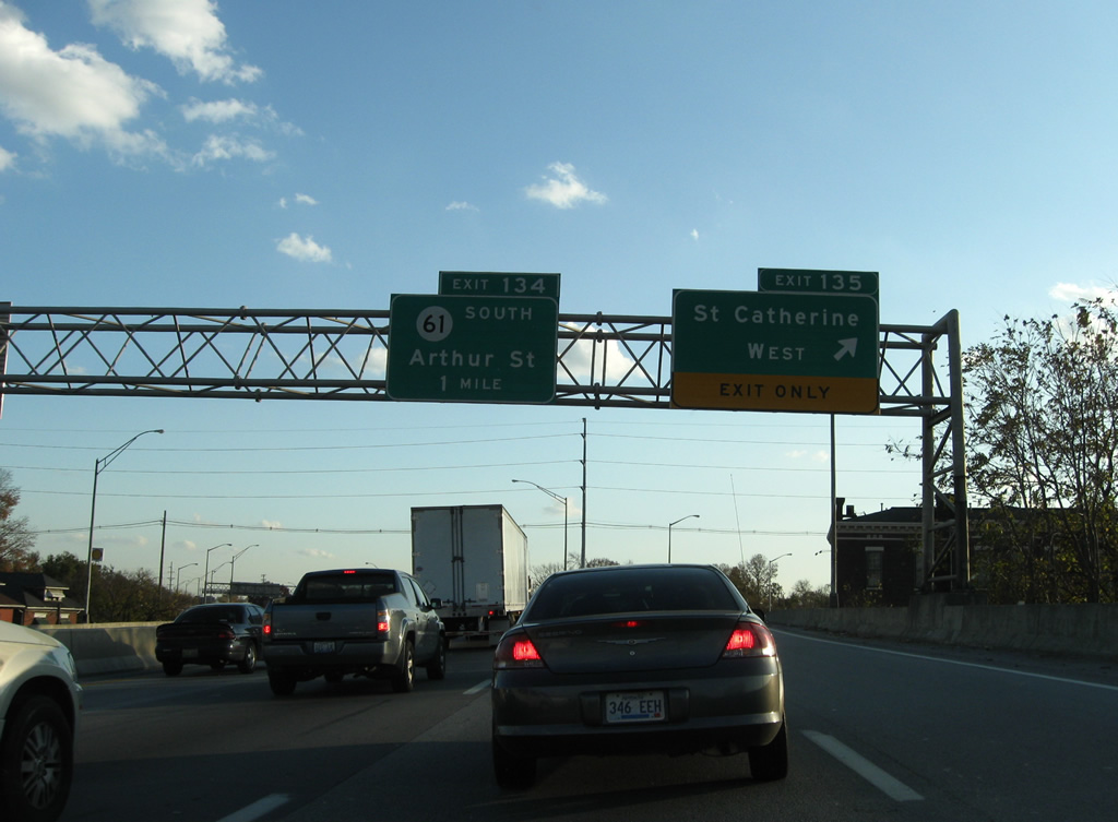
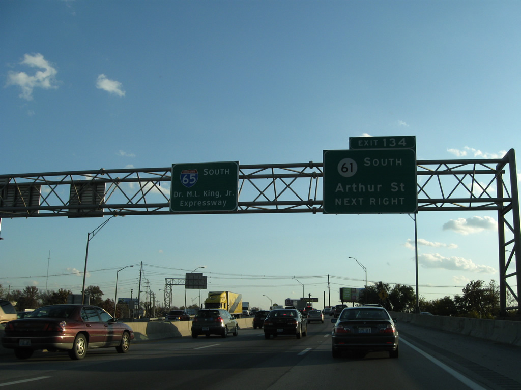
| Interstate 65 and KY 61 commingle along the viaduct over Burnett Avenue and the CSX Railroad, between the Preston Street southbound on-ramp and the Arthur Street southbound off-ramp (Exit 134). 11/04/09 |
|
| KY 61 begins at U.S. 31E in Downtown Louisville and follows the one way street couplet of Preston Street (south) and Jackson Street (north). A wye interchange brings the state route onto Interstate 65 via Exit 134A of northbound. Exits 134 and 135 serve the University of Louisville campus and the J.B. Speed Art Museum, which both lie west of Interstate 65 along KY 1020 (3rd Street). 11/04/09 |
|
| Interstate 65 marker posted after the ramps from KY 61 (Preston Street) south and Magnolia Avenue east merge onto the viaduct over the CSX Railroad. 11/04/09 |
|
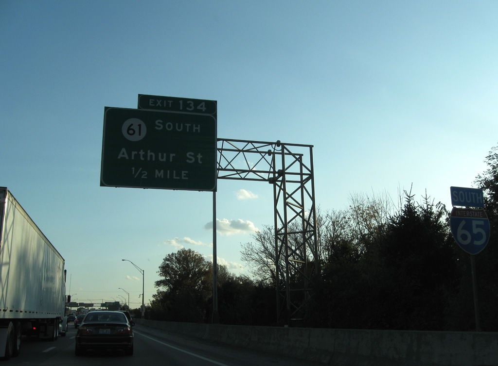
| Interstate 65 & KY 61 quickly part ways at Exit 134, with KY 61 following Arthur Street south alongside the freeway to Brandeis Avenue east. 11/04/09 |
|
| KY-61 shield posted at the Arthur Street off-ramp at Gaulbert Avenue. Southbound KY 61 rejoins the northbound side of the state route at Brandeis and Preston Streets. The state route continues in close proximity to Interstate 65 southward to Lebanon Junction (Exit 105). 11/04/09 |
|
| A slip ramp brings drivers onto Interstate 65 south from KY 61 (Arthur Street) south near Lee Street. 11/04/09 |
|
| Southbound Interstate 65 rises to cross Brandeis Avenue (KY-61 south) by Trager Stadium of the University of Louisville. 11/04/09 |
|
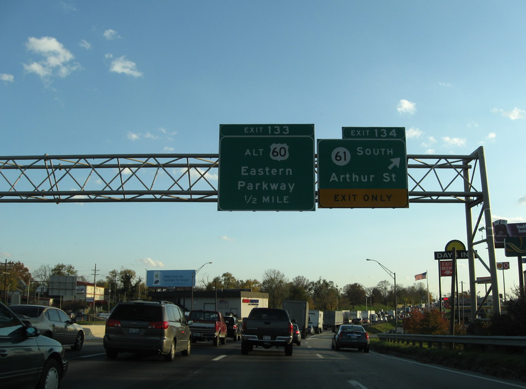
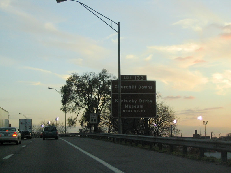
| Exit 133 follows as a slip ramp onto the parallel Arthur Street south for Warnock Street and U.S. 60 Alternate (Eastern Parkway). Use Eastern Parkway west to KY 1020 (3rd Street) south to Churchhill Downs, home of the Kentucky Derby race and Museum. 11/12/04 |
|
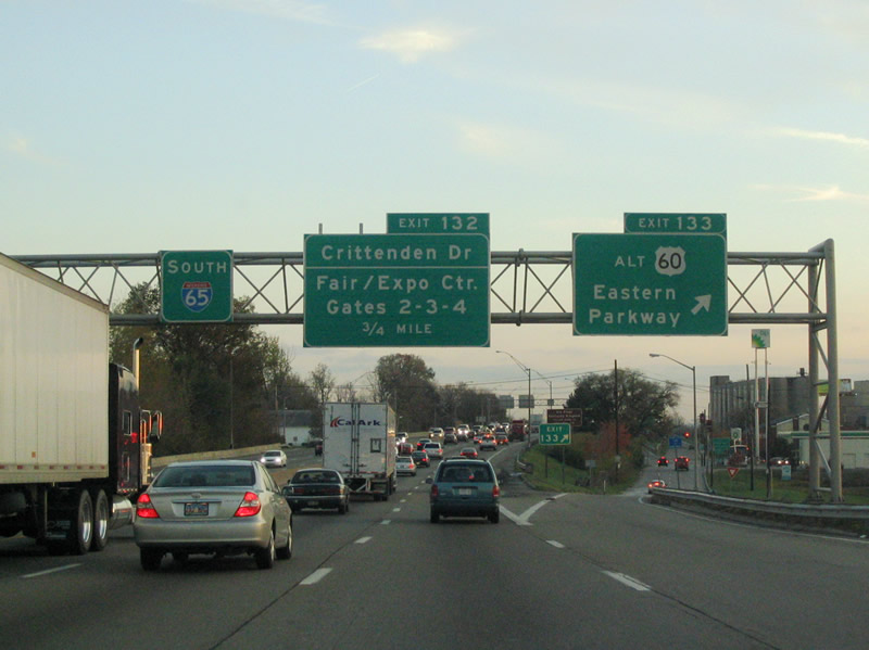
| Southbound at the Exit 133 ramp departure to Arthur Street south for Eastern Parkway. U.S. 60 Alternate follows Eastern Parkway east from Crittenden Drive along a circuitous route to bypass central Louisville. Eastern Parkway (former U.S. 60 Alternate) west utilizes a viaduct to 3rd Street.
Approved in April 2011, U.S. 60 Alternate was relocated from the parkway and 3rd Street south, Winkler Avenue west and Taylor Boulevard south to a combination of Crittenden Drive south and Central Avenue west. Heading east, U.S. 60 Alternate continues along Eastern Parkway to Cherokee Park. 11/12/04 |
|
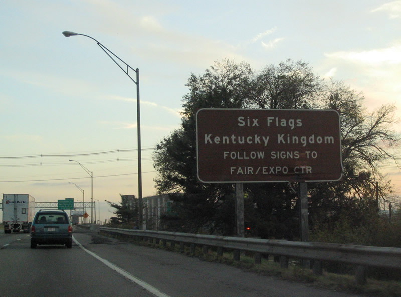
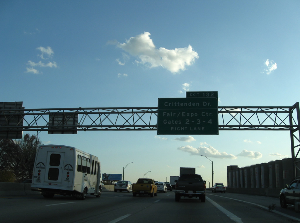
| Next in line for southbound travelers is the Crittenden Drive (U.S. 60 Alternate) exit for the Kentucky Fair and Exposition Center, which is home to Six Flags Kentucky Kingdom. Exit 132 consists of a southbound only ramp. 11/12/04 |
|
| Crittenden Drive (KY 1631) leads south from U.S. 60 Alternate (Central Avenue) and Interstate 65 to the Fair/Expo Center and Gates 2, 3, and 4 of Louisville International Airport's terminal. The airport lies south of Interstate 265 and east of Crittenden Drive. 11/04/09 |
|
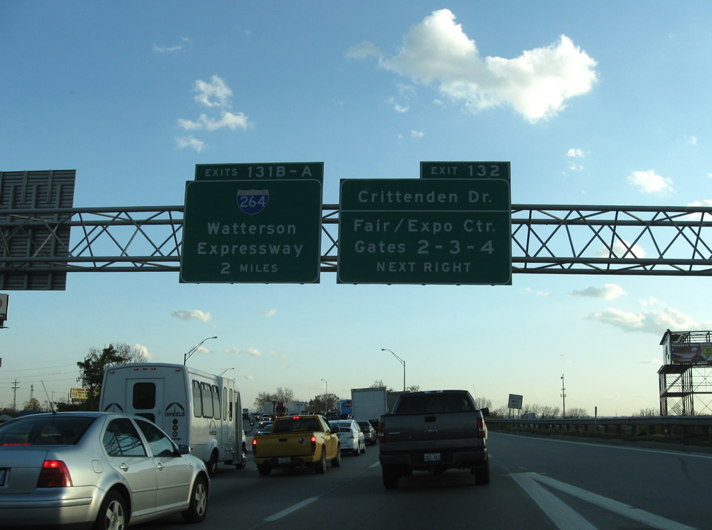
| Interstate 65 curves southeasterly along the east side of Kentucky Fair and Exposition Center toward Interstate 264 (Henry Watterson Expressway) and the airport. A parclo interchange (Exit 132) joins the elevated roadway with Crittenden Drive. KY 1631 follows Crittenden Drive for 1.58 miles between I-264 and Eastern Parkway. 11/04/09 |
|
| Approaching the sprawling interchange complex with Interstate 264 (Henry Watterson Expressway), the Fair/Expo Center via Freedom Way north and Terminal Drive into Louisville International Airport (SDF). 11/04/09 |
|
| Interstate 264 encircles central Louisville from Shively to the west and Lyndon to the east. The freeway also connects the airport with Interstate 64 and St. Matthews. 11/04/09 |
|
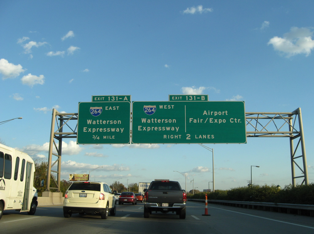
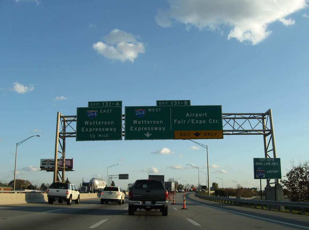
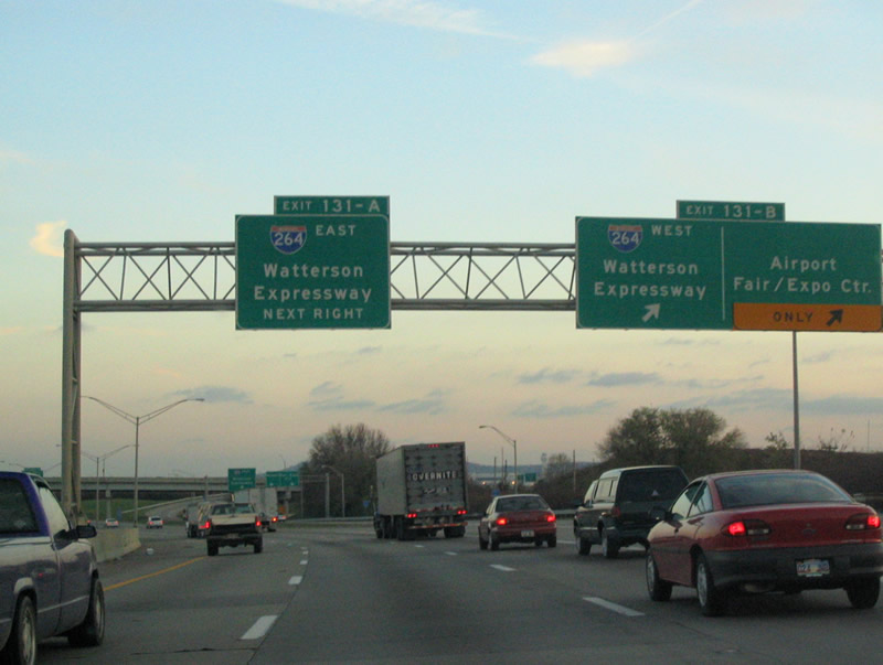
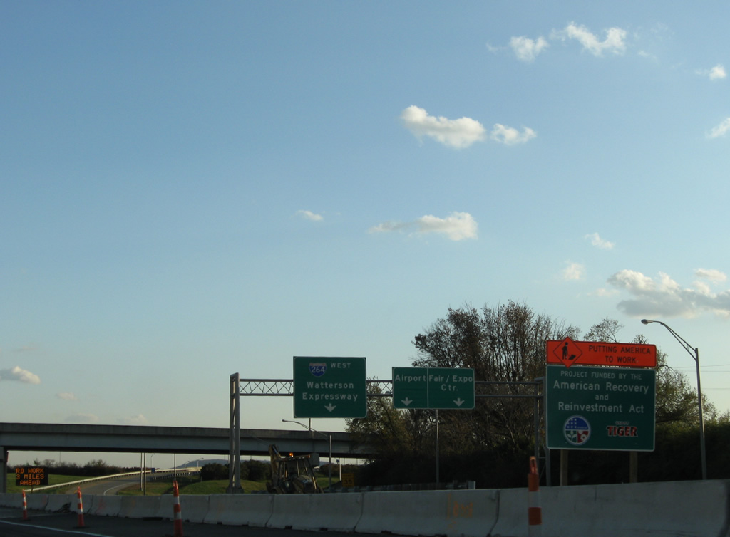
| A two lane ramp departs Interstate 65 south via Exit 131B for Interstate 264 west to Shively and Freedom Drive north to the fairground areas. 11/12/04 |
|
| Exit 131B also provides access to Louisville International Airport (SDF) via Freedom Way south to Terminal Drive. Road work in 2009 expanded the southbound mainline to four overall lanes. 11/12/04 |
|
| A directional ramp connects Interstate 65 south with Interstate 265 (Henry Watterson Expressway) east to Watterson Park and Lyndon. The freeway generally uses Watterson Expressway in place of a control city, except for the use of Shively on the Shawnee Expressway portion of the Interstate. 11/12/04, 11/04/09 |
|
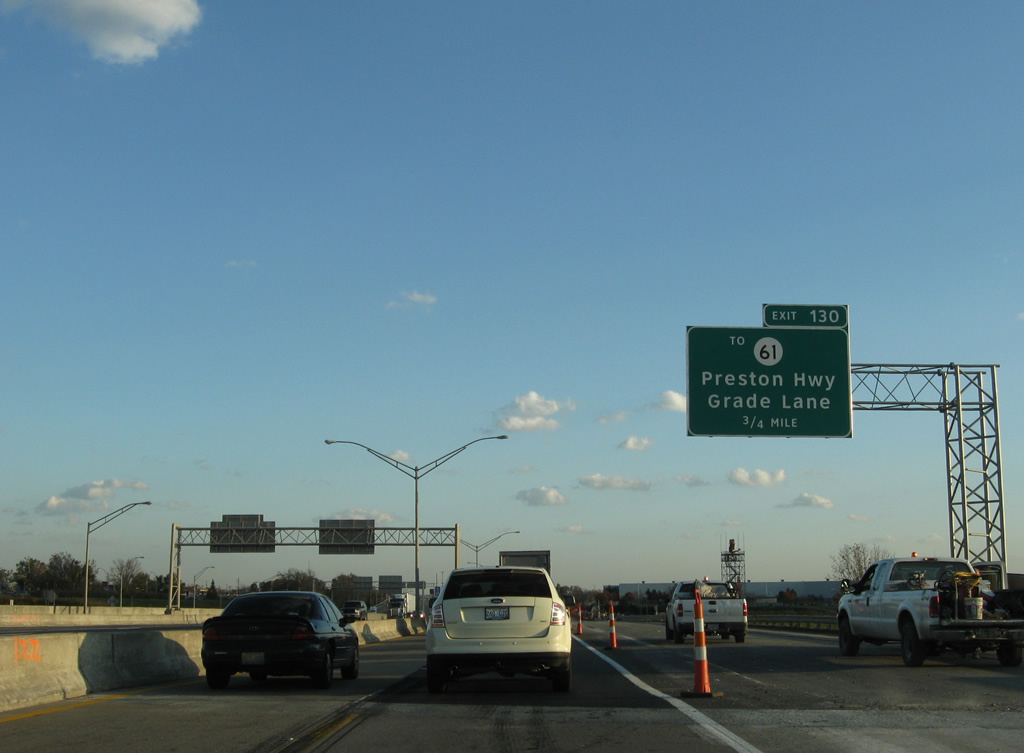
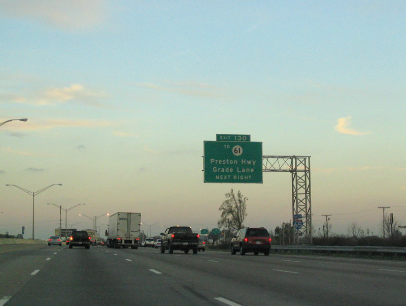
| Exit 130 is next with New Grade Lane on the eastern side of the airport. Grade Lane (former KY 2843) travels south from adjacent KY 61 (Preston Highway) to KY 1065 (Outer Loop). 11/12/04, 11/04/09 |
|
| A portion of Grade Lane was relocated due to airport expansion in the form of New Grade Lane. New Grade Lane utilizes a parclo interchange in conjunction with KY 61 (Preston Highway) for Interstate 65's Exit 130. 11/12/04 |
|
| Exit 130 leaves Interstate 65 south for New Grade Lane (KY 2843 until 1988). KY 61 diverges from close proximity with Interstate 65 to the southeast to Hillview in Bullitt County. Much of the route south toward Interstate 265 consists of a commercialized arterial. 11/12/04, 11/04/09 |
|
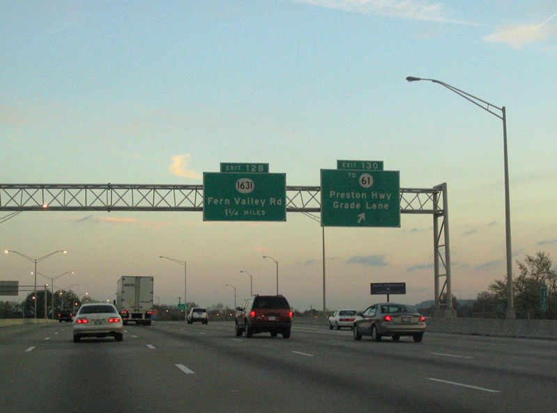
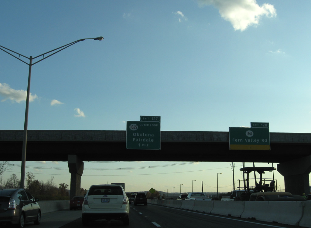
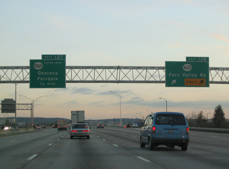
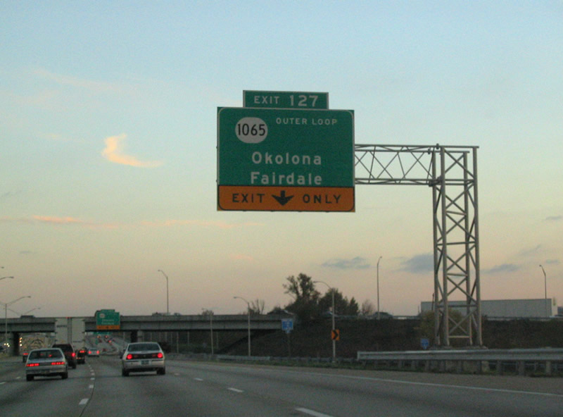
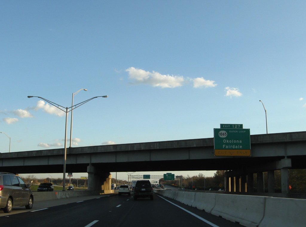
| Fern Valley Road meets Interstate 65 at the Exit 128 parclo interchange. Originally this stretch of road carried the designation KY 1631, but in 2005 airport expansion removed a segment of Fern Valley Road east from Crittenden Drive. The disconnection with KY 1631 along Crittenden Drive resulted in the renumbering of Fern Valley Road to an extension of KY 1747. 11/12/04 |
|
| Clearview based overheads at the Turberose Avenue overpass replaced the previously pictured sign bridge. The Tuberose Avenue bridge was constructed by 2009 to connect parallel Grade Lane with Lotus Avenue as part of the Louisville Airport Improvement Program. 11/04/09 |
|
| Exit 128 carries two lanes to KY 1747 (Fern Valley Road). KY 1747 travels Fern Valley Road east from Grade Lane to KY 864 and its original beginning via Hurstbourne Parkway. Much of the route is industrialized, including the General Electric Appliance Park. 11/12/04 |
|
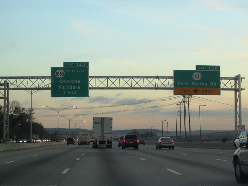
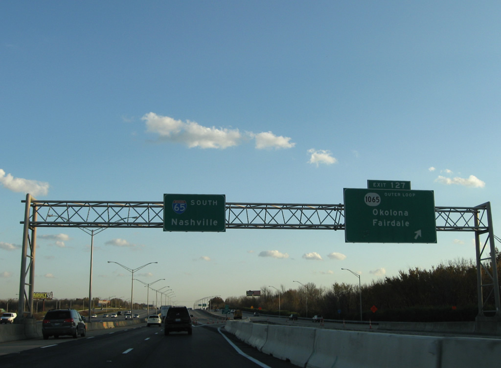
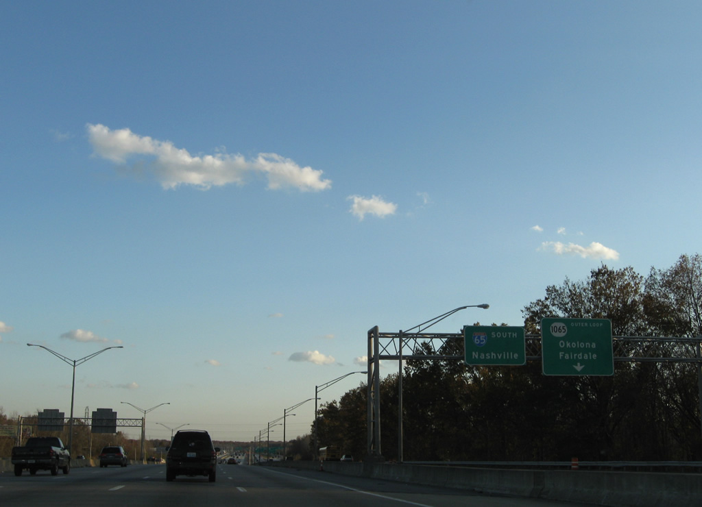
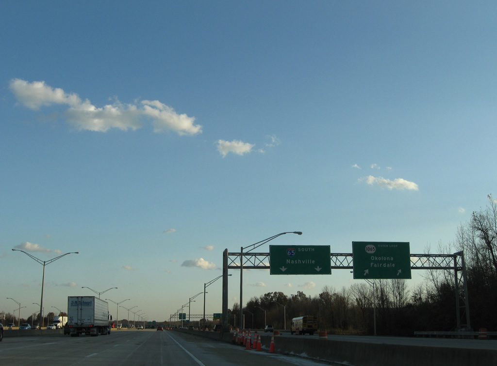
| KY 1065 (Outer Loop) meets Interstate 65 at the Exit 127 six-ramp parclo interchange. 11/12/04 |
|
| A distributor roadway carries both movements of Exit 127 to KY 1065. KY-1065 stretches 13.71 miles across Louisville, ending at KY 907 (Third Street Road) to the west and KY 1819 (Billtown Road) to the east. 11/04/09 |
|
| The Outer Loop consists of a divided highway west to warehouse and distribution centers south of the airport and KY 1020 (National Turnpike) and east to Jefferson Mall and KY 2052 (Shepherdsville Road). 11/04/09 |
|
| Travelers taking Exit 130 join a c/d roadway that began at Fern Valley Road to make the connection with Outer Loop. 11/04/09 |
|
| A six-ramp parclo interchange provides separate movements to KY-1065 west to Fairdale and east to Okolona. Okolona is a community within Louisville to the east. Minor Lane Heights and Fairdale, other Louisville neighborhoods, lie to the west. 11/04/09 |
|
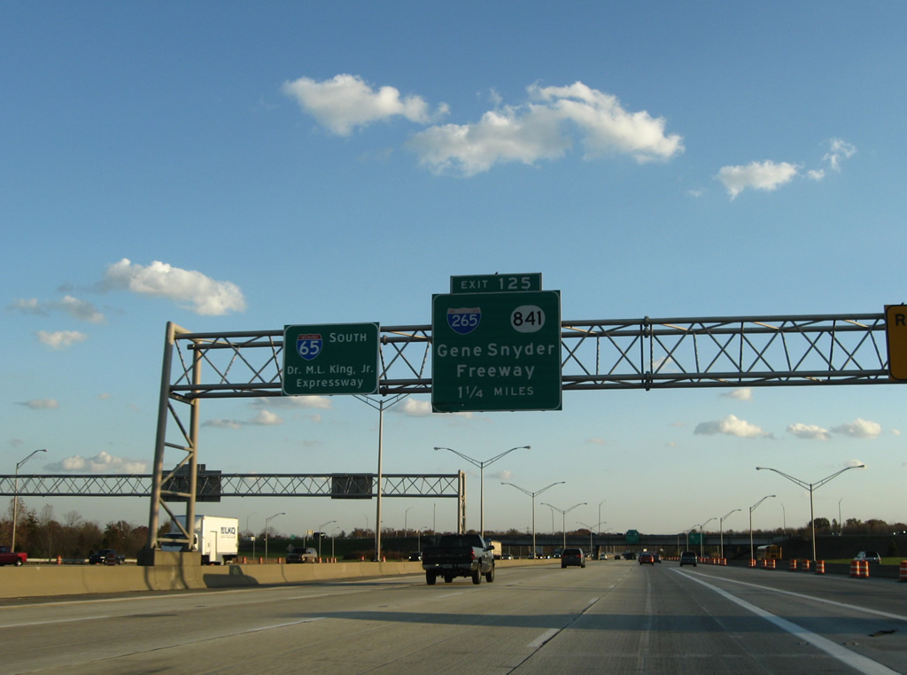
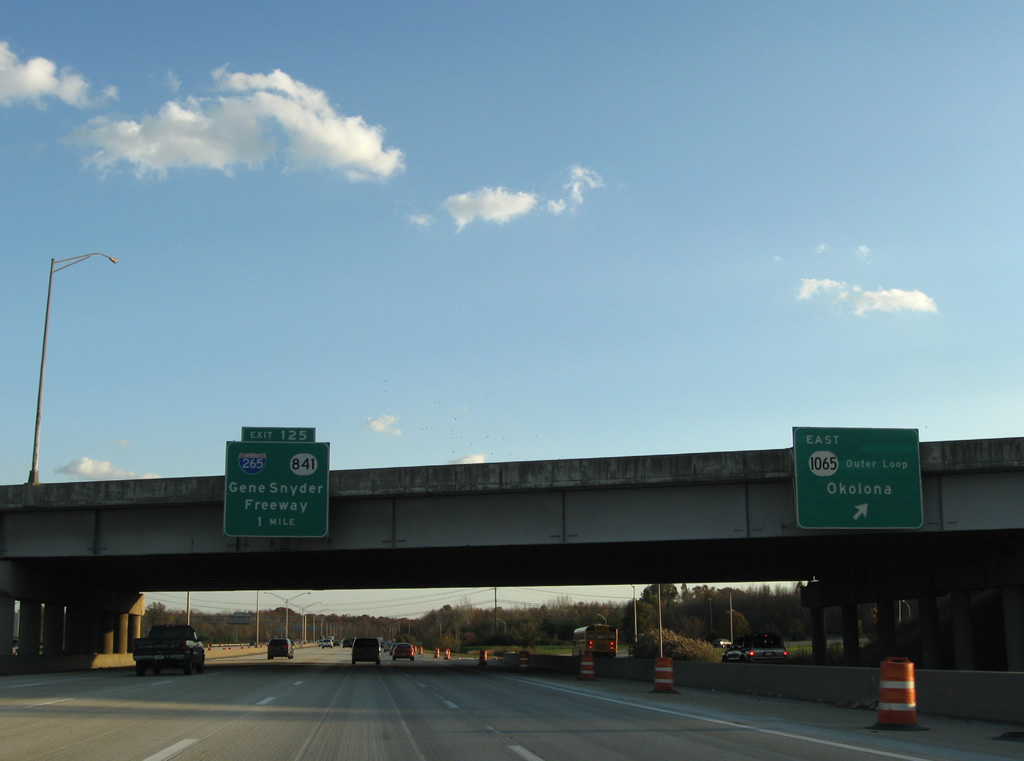
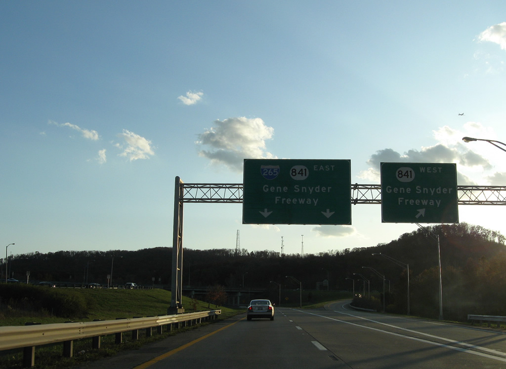
| Still within the Outer Loop interchange, the first sign of Interstate 265 east & KY 841 (Exit 125) is posted. Interstate 65 remains at eight overall lanes southward to the Gene Snyder Freeway. 11/04/09 |
|
| Passing under KY 1065, one mile north of the directional cloverleaf interchange with Interstate 265 east & KY 841 (Gene Snyder Freeway). Exit 125 represents the southwestern terminus of Interstate 265. 11/04/09 |
|
| Interstate 65 south expands to six overall lanes through a forested area. I-265/KY 841 travel east through the outer suburbs of Louisville to Interstate 64 at Middletown Gene Snyder Freeway is used in place of a control city for the highway. 11/04/09 |
|
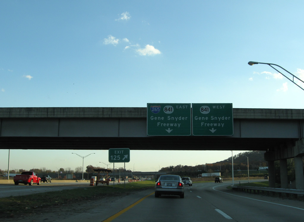
| Exit 125 ramps to Interstate 265 east & KY 841 (Gene Snyder Freeway) depart in unison from Interstate 65 south ahead of the Park Road overpass. 11/04/09 |
|
| KY 841 continues the Gene Snyder Freeway west to Fairdale and U.S. 31W & 60 (Dixie Highway) north of Fort Knox. 11/04/09 |
|
| Southbound at the partitioning of Exit 125 to I-265/KY 841 east and KY 841 west. I-265 presently ends at Interstate 71 in northeast Louisville, but KY 841 continues northwest from there to U.S. 42 at Prospect. When the new Ohio River bridge opens (projected for 2017) between Indiana 265 and KY 841, Interstate 265 will see an extension to Clarksville, Indiana. 11/04/09 |
Page Updated 05-18-2011.

 South
South