|
| Five exits along Interstate 75 south serve the city of Lexington. Two of the next three lie along the 6.3 mile overlap with Interstate 64 east. 11/08/09 |
|
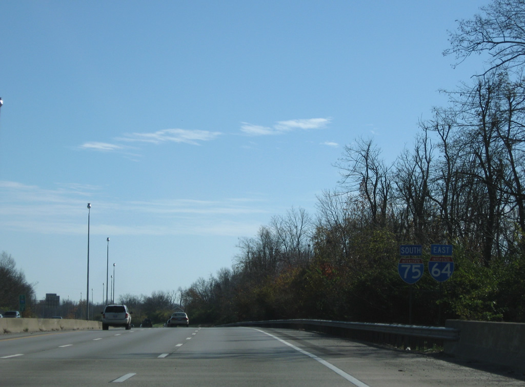
| The first set of confirming markers for I-64/75 east appears near Greendale. 11/08/09 |
|
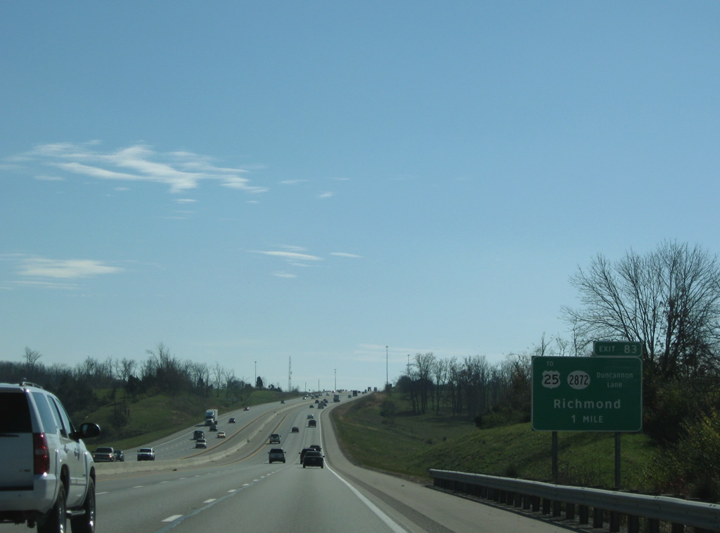
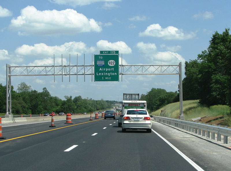
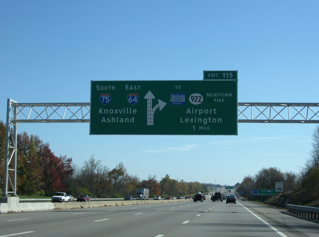
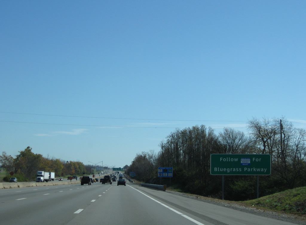
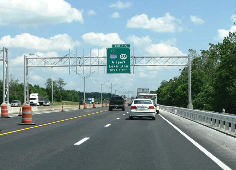
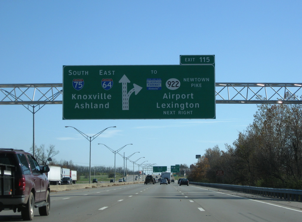
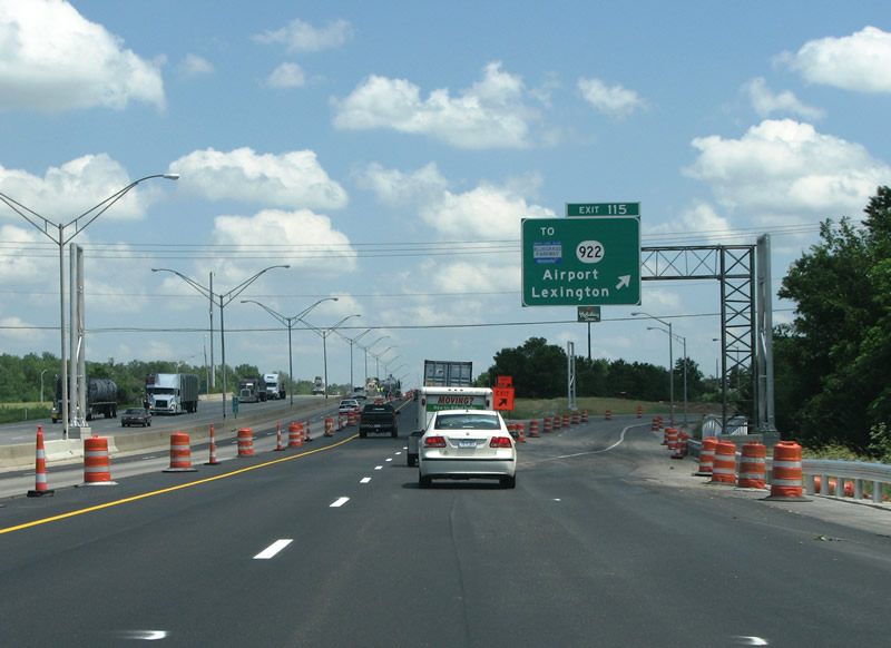
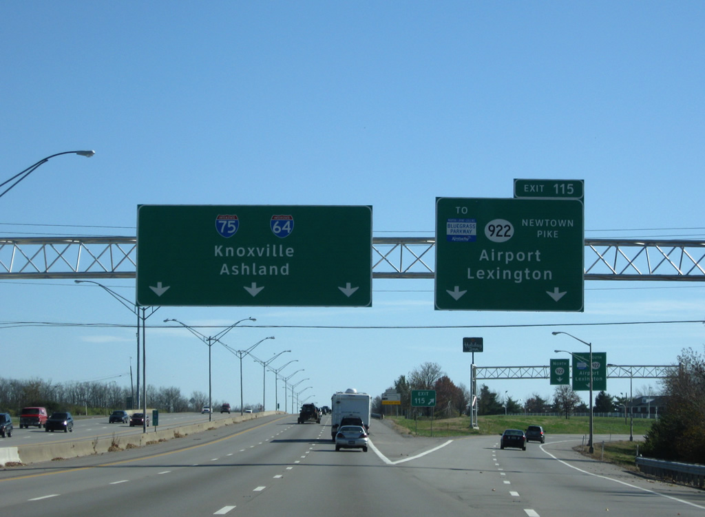
| KY 922 (Newtown Pike), a 20.18 mile route from central Lexington north to New Zion and KY 620 in Scott County, meets I-64/75 at the first of two interchanges along their overlap (Exit 115). 06/05/08, 11/08/09 |
|
| Trailblazers for the Bluegrass Parkway direct motorists southward on KY 922 (Newtown Pike) to KY 4 (New Circle Road) and U.S. 60 (Versailles Road) west to the freeway beginning near Gaybourn in Woodford County. 11/08/09 |
|
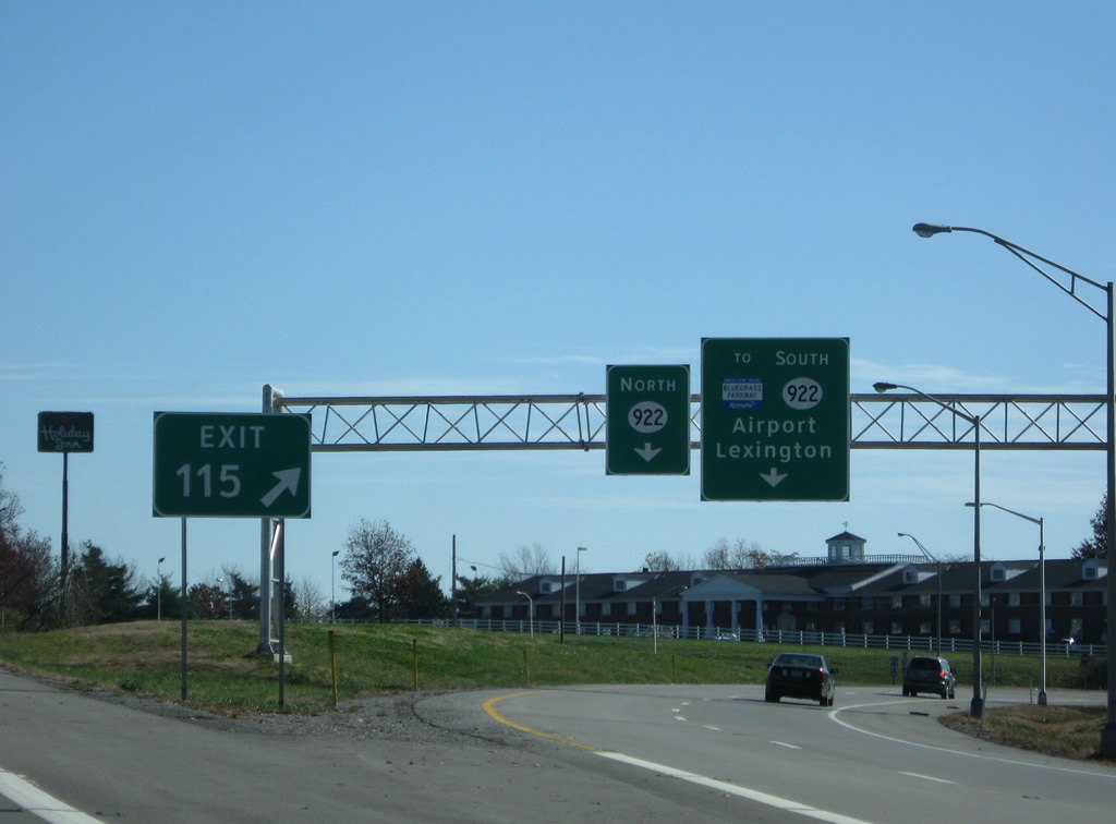
| KY 922 runs south 1.8 miles to New Circle Road, Lexington's partial freeway loop. The Bluegrass Parkway forms an important limited access route west to I-65 and Elizabethtown. 06/05/08, 11/08/09 |
|
| A parclo interchange joins I-64/75 with KY 922 (Newtown Pike) at Exit 115. Newtown Pike leads south to become U.S. 25 ahead of U.S. 421 (Main Street) and downtown Lexington. Interests to Blue Grass Airport (LEX) should follow KY 4 west to U.S. 60, a short distance west of New Circle Road. 06/05/08, 11/08/09 |
|
| All traffic to KY 922 departs in unison at Exit 115. KY 922 quickly becomes rural on the northward drive to New Zion at the Scott County line. 11/08/09 |
|
| New shields added in 2009 include a state-name Interstate 75 shield where the previously assembly omitted I-75. I-64/75 was completed through Lexington on November 25, 1963 when the road opened from US 62 at Georgetown to Ironworks Pike on the north side of Lexington. 11/08/09 |
|
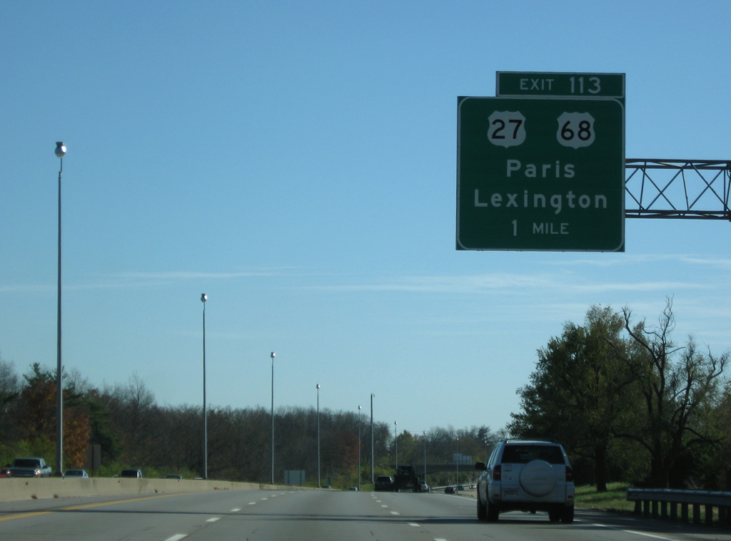
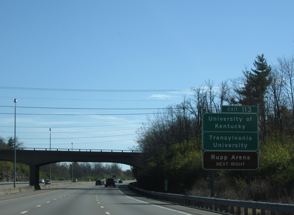
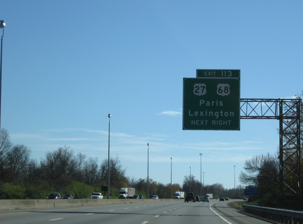
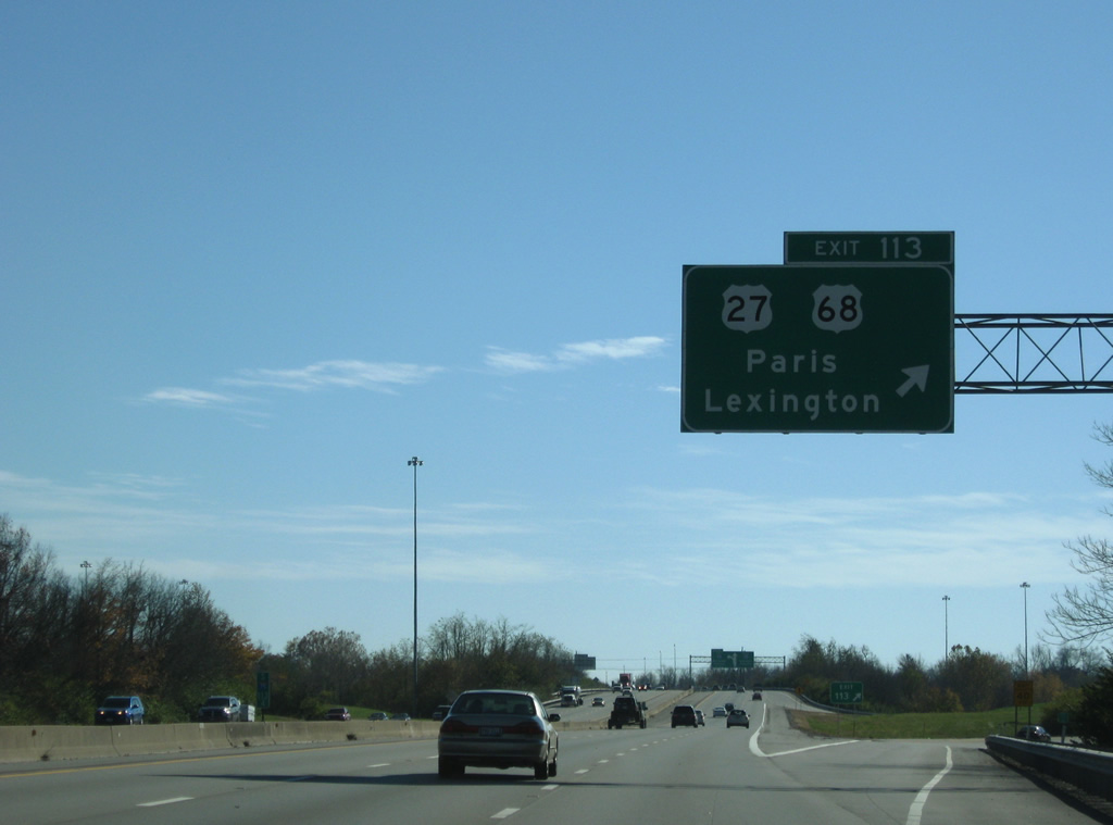
| One mile northwest of the Exit 113 off-ramp to U.S. 27/68 (Broadway). I-64/75 was widened to six lanes in 2001-2002, as part of the widening of I-75 to six lanes throughout the entire state. The freeway was repaved in 2008. 11/08/09 |
|
| The University of Kentucky put Lexington on the map, it was founded in 1865. 11/08/09 |
|
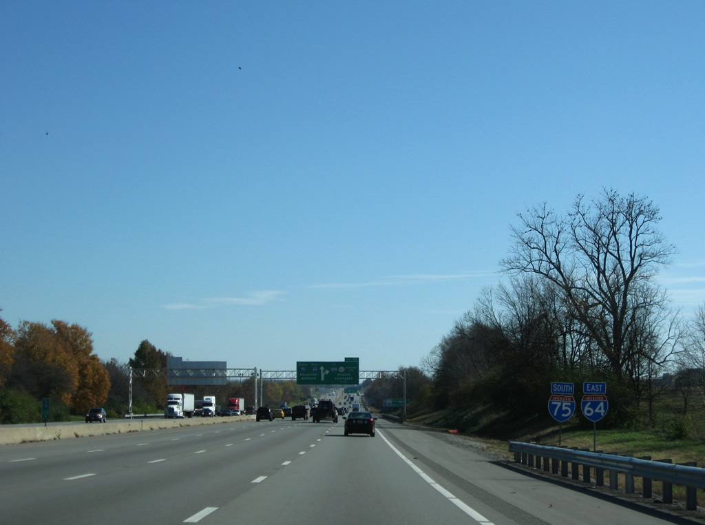
| US 27 largely follows I-75 from Florida to Michigan, and Lexington is no exception. US 68 is a relatively short US highway that runs from US 62 in Western Kentucky to I-75 in Findlay, Ohio. 11/08/09 |
|
| The folded diamond interchange between I-64/75 (Exit 113) and U.S. 27/68 (Broadway) resides amid a series of residential neighborhoods lining the east-west arterial. U.S. 27/68 combine in downtown Lexington and lead northeast to the Bourbon County seat of Paris. 11/08/09 |
|
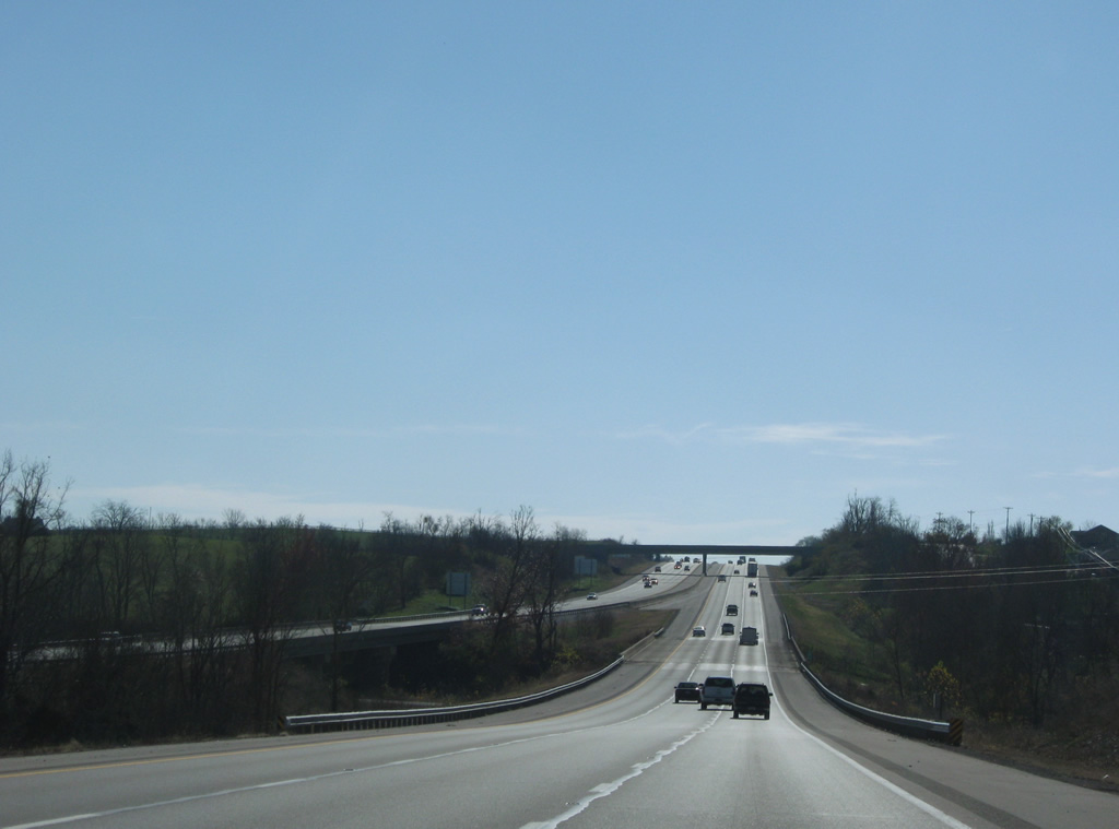
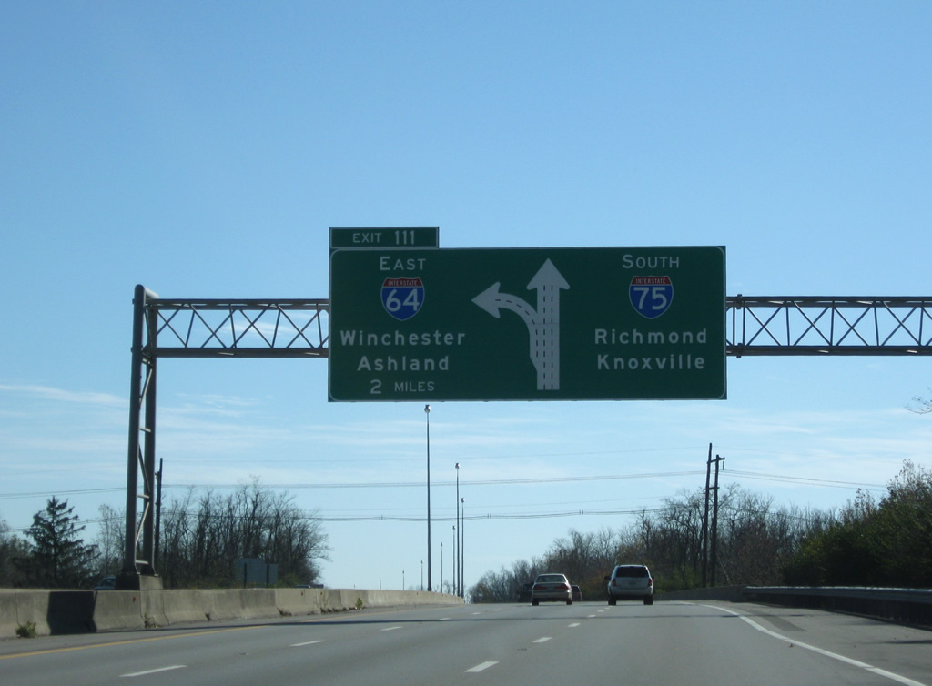
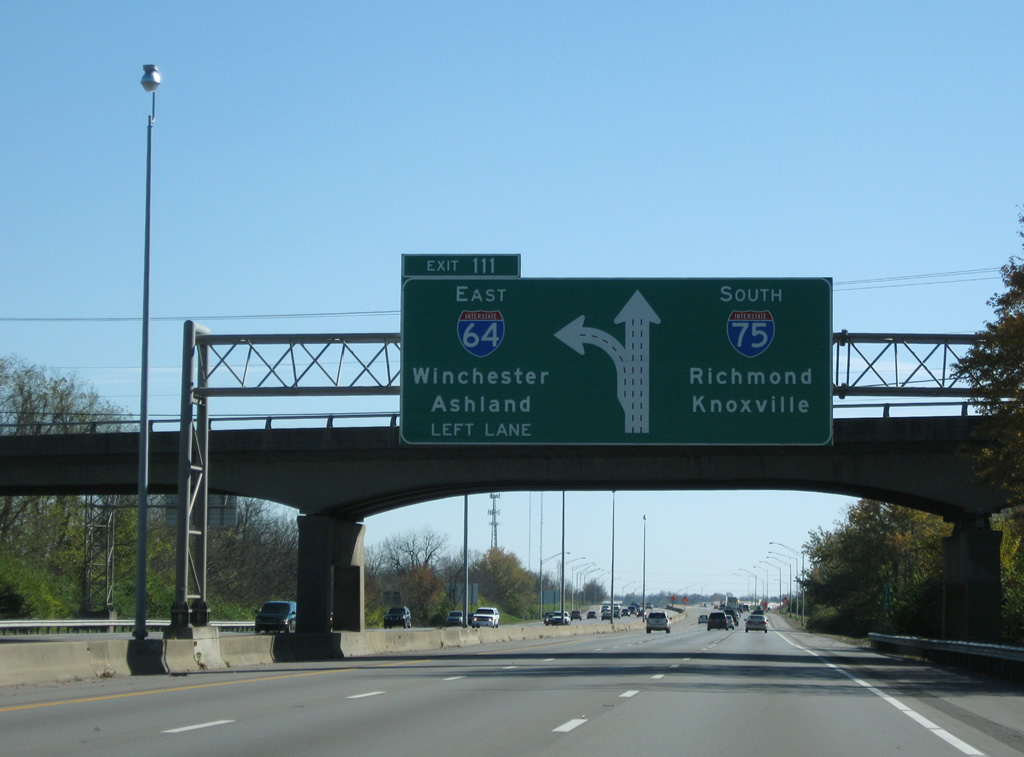
| Two miles northwest of Exit 111 where I-64 branches east from Interstate 75 south. Large diagrammatic signs advise motorists of the forthcoming three-wye interchange. 11/08/09 |
|
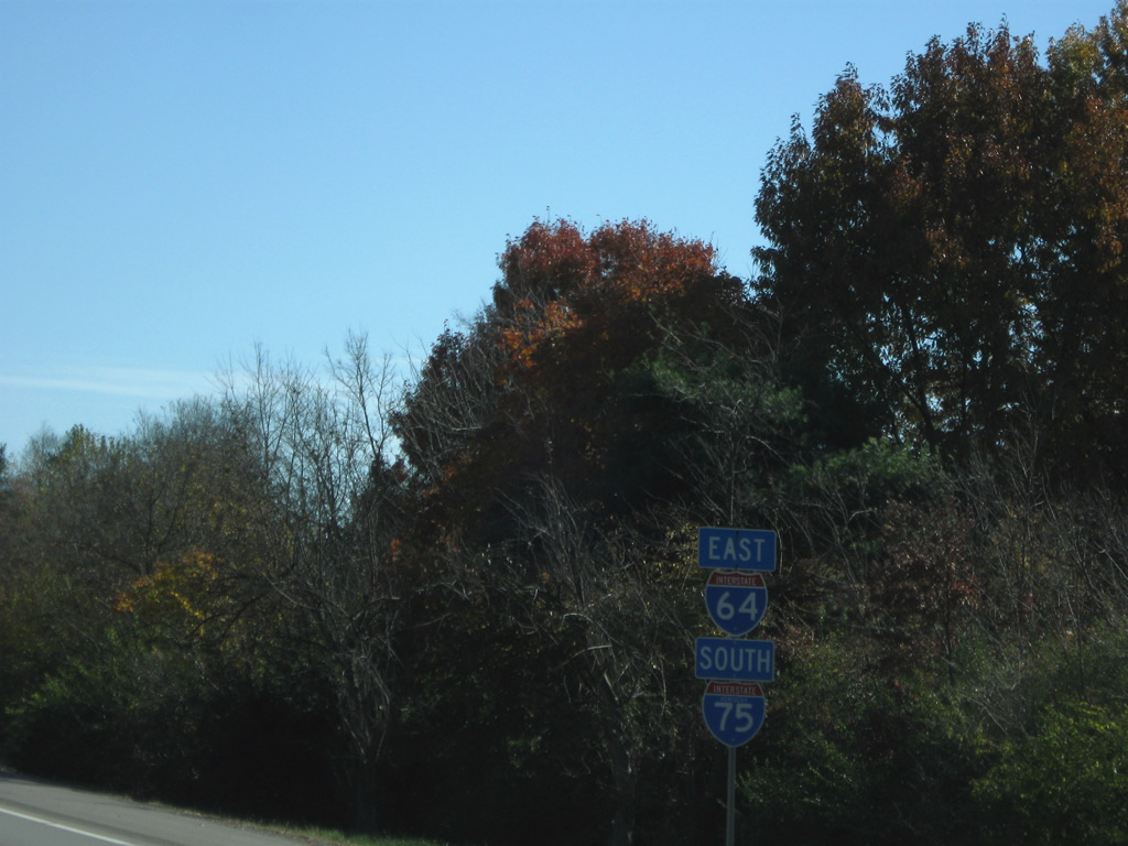
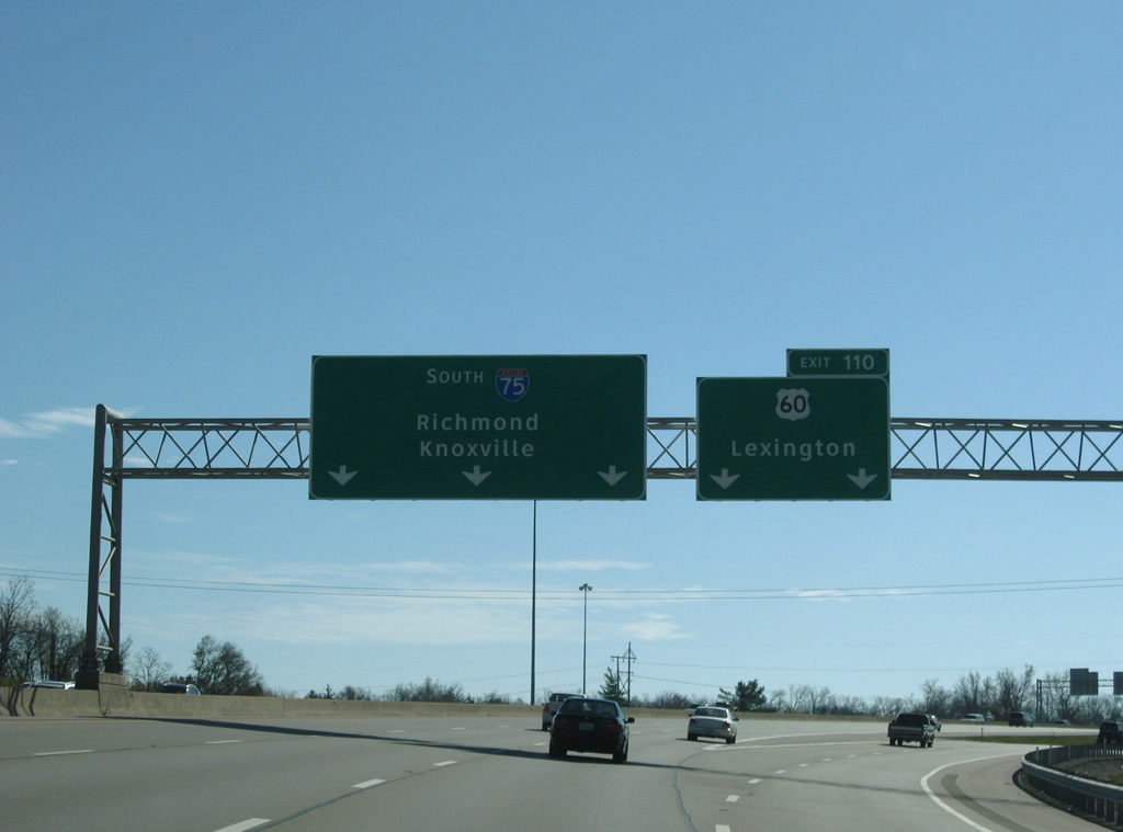
| The last set of shields posted for I-64/75 south appear at the Broadway underpass. I-64 next overlaps with I-77 in Charleston, West Virginia. I-75 next joins I-640 and I-40 at Knoxville, Tennessee. 11/08/09 |
|
| Interstate 64 departs from the left side of Interstate 75 south for Winchester, Ashland, and Huntington, West Virginia. KY 57 (Bryan Station Road) passes over the freeway at the second diagrammatic overhead. 11/08/09 |
|
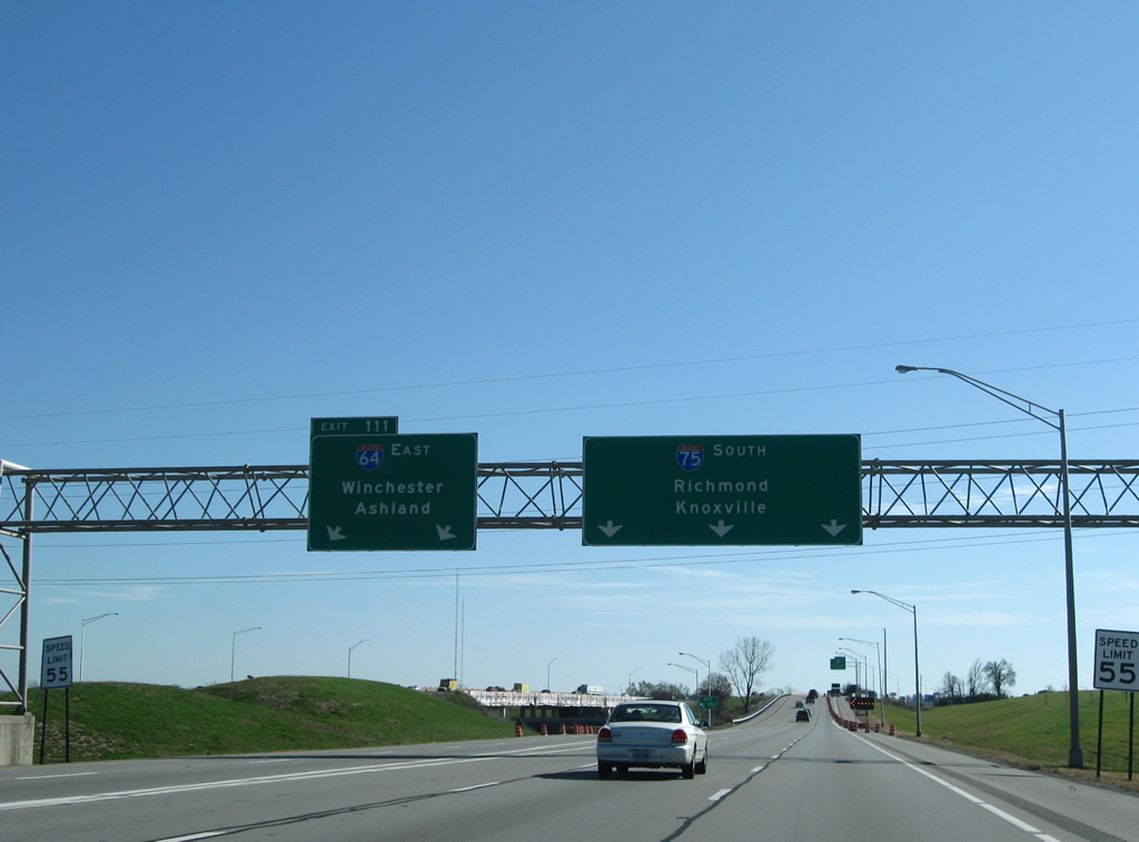
| Exit 111 dives below I-75 north at the stack. Interstate 75 continues with six overall lanes to Richmond and Berea as Interstate 64 returns to rural environs on the 15 mile drive to Winchester. 11/08/09 |
|
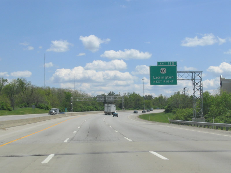
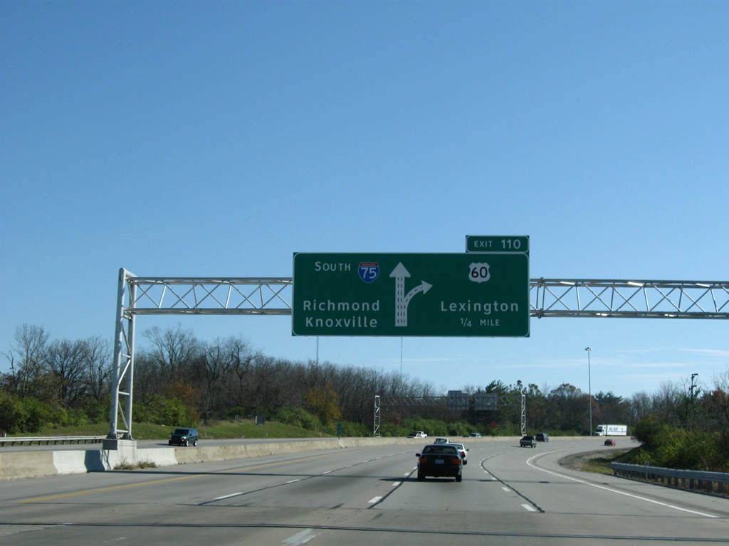
| Continuing south, Interstate 75 meets the Exit 110 diamond interchange with U.S. 60 (Winchester Road) in one mile. 05/01/05 |
|
| U.S. 60 shadows Interstate 64 east from Lexington to Winchester and beyond. Westbound, Lexington Road carries U.S. 60 to a SPUI with KY 4 (New Circle Road) and downtown.
A new sign bridge was installed by 2009 for Exit 110. 05/01/05, 11/08/09 |
|
| Exit 110 departs Interstate 75 south for U.S. 60 (Winchester Road) at a growing area of business parks and other sprawl. 05/01/05 |
|
| Exit 110 was expanded to a two lane off-ramp by 2009. New overheads include Richmond as the next control city of Interstate 75 south. 11/08/09 |
|
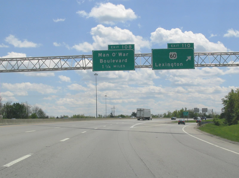
| Meeting Interstate 75 next is the Exit 108 parclo interchange with Man O' War Boulevard. Man O' War Blvd (named after a horse) forms a secondary outer loop of the city. 11/08/09 |
|
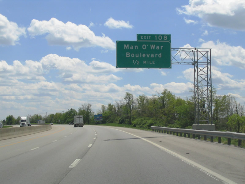
| One half mile north of the parclo interchange on Interstate 75 south. Man O' War Boulevard replaced Bryant Road as a multi-lane arterial when it was constructed in conjunction with the building of Exit 108 in the 80s. 05/01/05 |
|
| Interstate 75 separates big box retail to the west of Exit 108 with residential areas to the east. Man O' War Boulevard doubles as KY 1425, a 1.43 mile route northeast to U.S. 60 (Winchester Road). 11/08/09 |
|
| The urban stretch of Interstate 75 south continues from the CTRL Kentucky Line Railroad, east of Andover Golf & Country Club, toward the KY 1927 (Todds Road) overpass. Suburban frontage continues close to both sides of I-75. 11/08/09 |
|
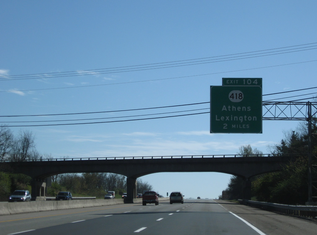
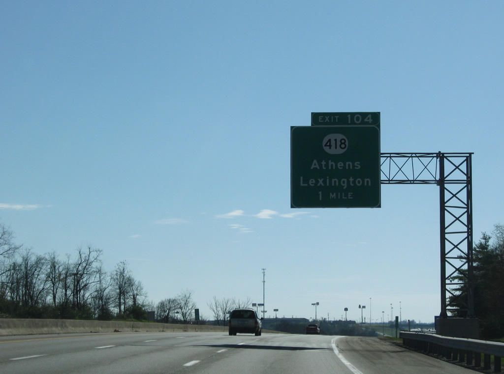
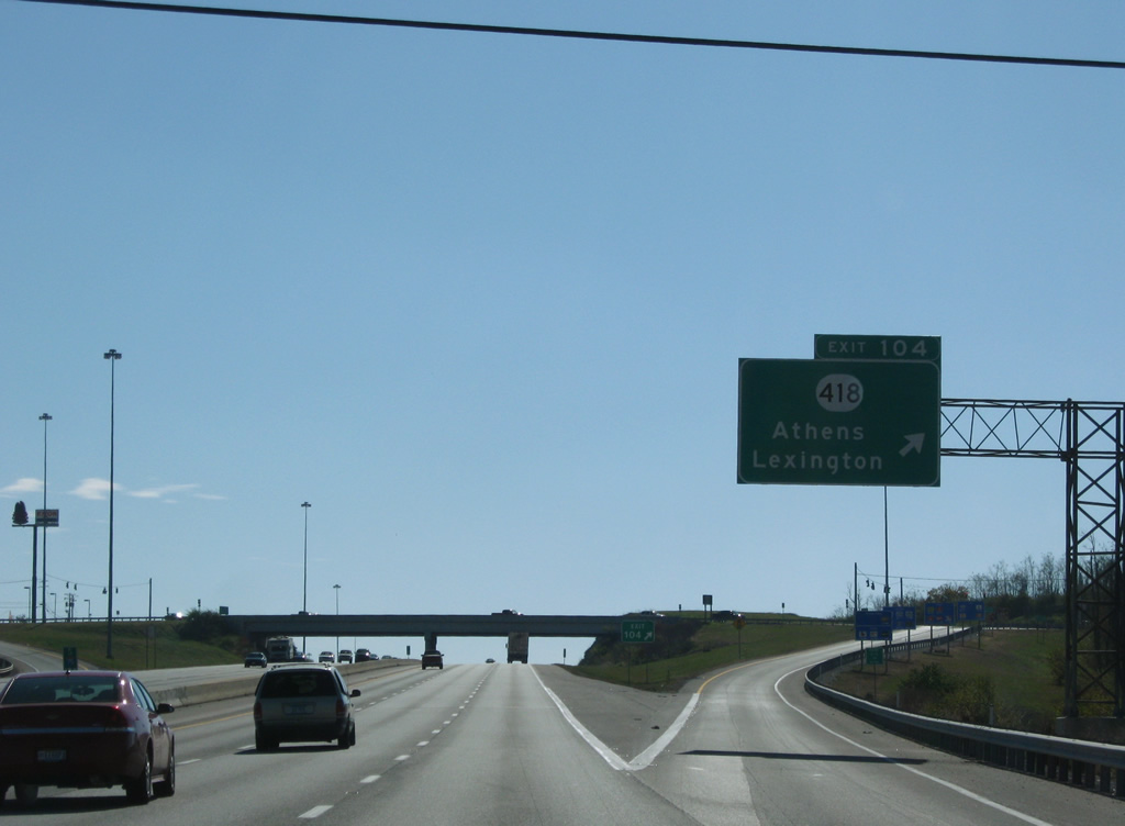
| KY 418 (Athens Boonesboro Road) stems southeast from U.S. 25 & 421 (Richmond Road) in Lexington to a diamond interchange (Exit 104) with Interstate 75 in two miles. 11/08/09 |
|
| Exit 104 serves a number of points of interest including 'Ashland' The Henry Clay Estate, Talon Winery & Vineyards, and The Arboretum / State Botanical Gardens. 11/08/09 |
|
| KY 418 eastbound from Exit 104 is restricted for STAA Trucks. The Surface Transportation Assistant Act of 1980 set size and weight limits for trucks. Roads included in the STAA network are available to approved larger trucks. 11/08/09 |
|
| One mile north of the Exit 104 off-ramp to KY 418. Athens Boonesboro Road carries four overall lanes northwest to U.S. 25 & 421, where the pair take over en route to Downtown. Southward beyond Blue Sky Parkway nearby, KY 418 enters Athens. 11/08/09 |
|
| KY 418 travels 6.09 miles within Fayette County and 11.74 miles overall between Richmond Road and KY 627 at Boonesborough. 11/08/09 |
|
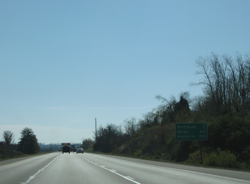
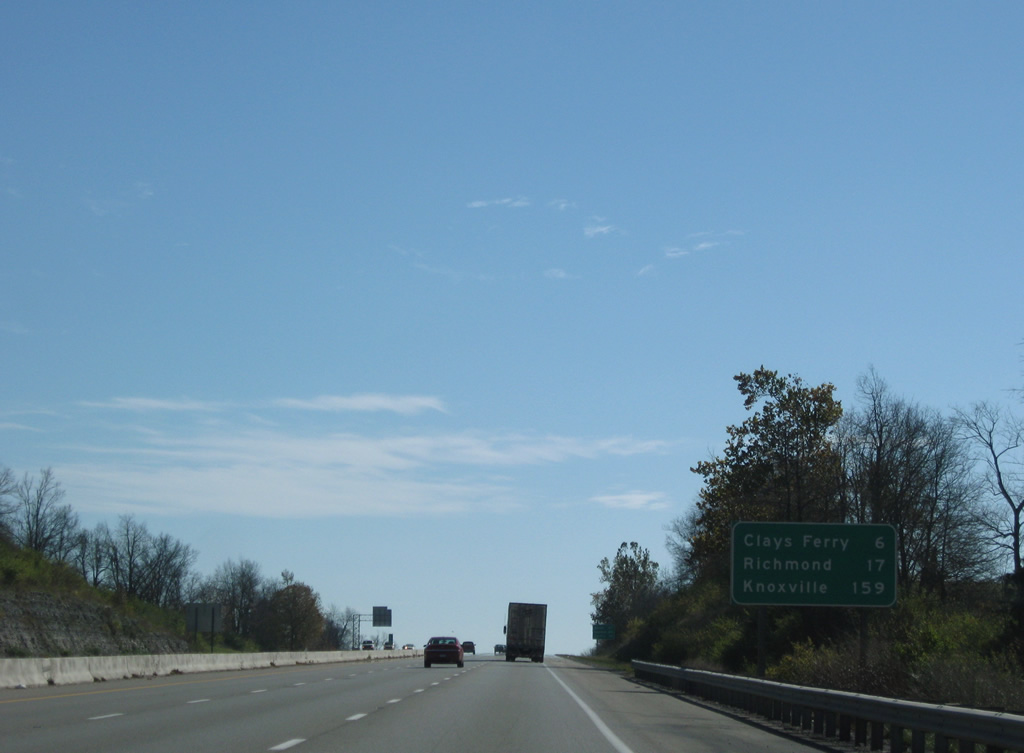
| Interstate 75 leaves the outer suburbs of Lexington and enters an agricultural area to Clays Ferry. Richmond, the Madison County seat is 17 miles to the south. 11/08/09 |
|
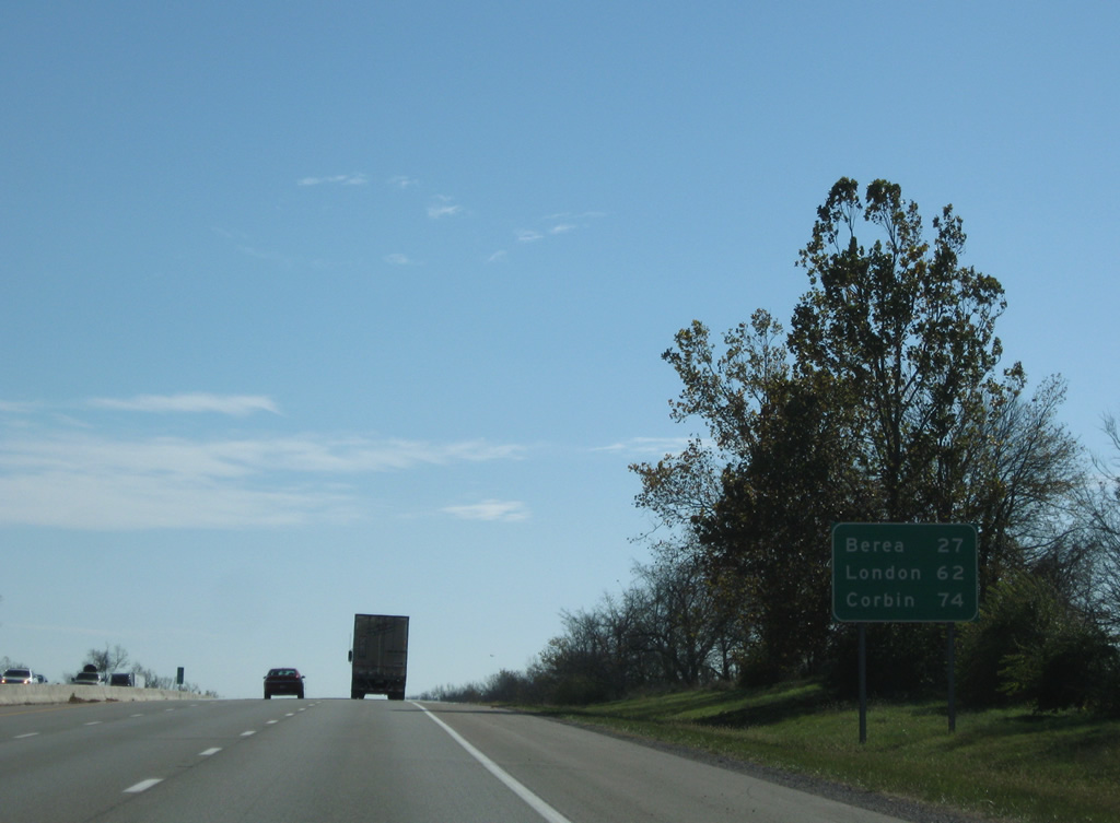
| A second distance sign lists Kentucky only control cities of Interstate 75 south to the Tennessee state line. Berea, London and Corbin are the largest population centers south of Richmond. 11/08/09 |
|
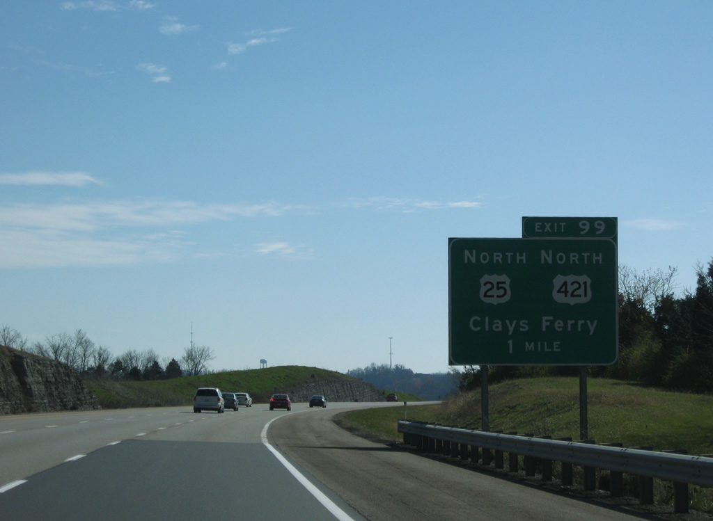
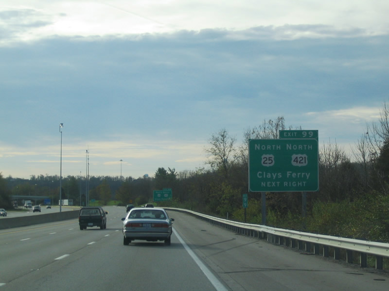
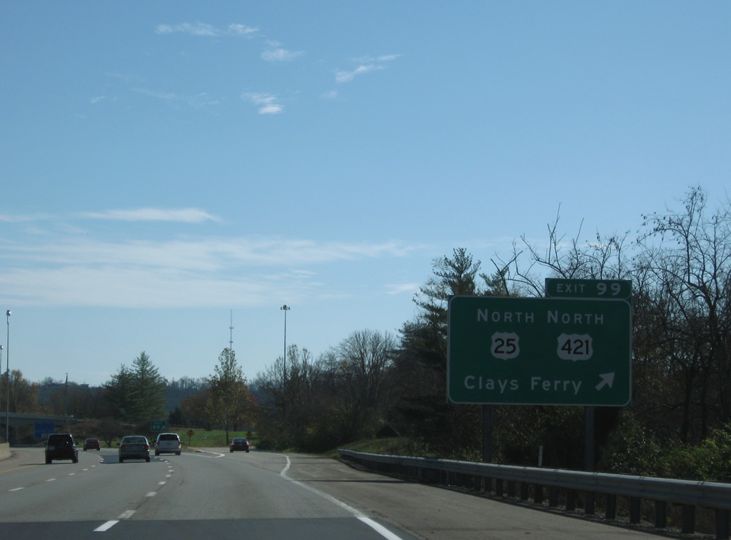
| U.S. 25 & 421 (Old Richmond Road) angle southeast from central Lexington to cross over Interstate 75 and parallel the east side of the freeway to the Exit 99 parclo interchange in two miles. 11/08/09 |
|
| Continuing southeast along a peninsula between Elk Lick Creek and Boone Creek to the Kentucky River area exit with U.S. 25 & 421 (Old Richmond Road) north. 11/08/09 |
|
| KY 2328, the pre-1946 routing of U.S. 25, ties into Exit 99 from the south. The route makes its way down to cross the Kentucky River via a one-lane truss bridge. 10/31/04 |
|
| The U.S. 25 & 421 pair join Interstate 75 at Exit 99 to cross the Kentucky River via a high-level bridge. Its original construction as a two lane span occurred in 1946 to bypass the original one-lane bridge below. A second span was completed in 1963 when Interstate 75 was constructed through the area. The middle span joining the two was completed in 1997 as part of the six-laning project through the Lexington metro area. 11/08/09 |
|
| Reassurance shield posted for Interstate 75 south on the descent to the Kentucky River bridge. Clays Ferry lies along the banks of the river below. 11/08/09 |
|
| U.S. 25 & 421 south only utilize the bridge over the Kentucky River with Interstate 75 before rejoining their original course southward to White Hall. 11/08/09 |
|
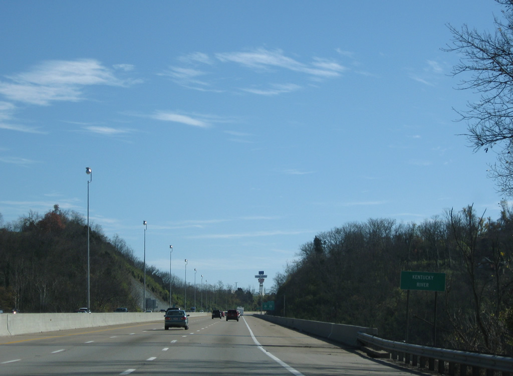
| Spanning the 260 mile long Kentucky River along Interstate 75 & U.S. 25-421 south. The bridge does not look like much out of the ordinary from above, but below the substructure and height ode to the prominence of the span. The Kentucky River flows northwest from the Cumberland Mountains to the Ohio River at Carrollton. 11/08/09 |
|
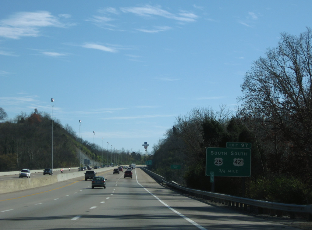
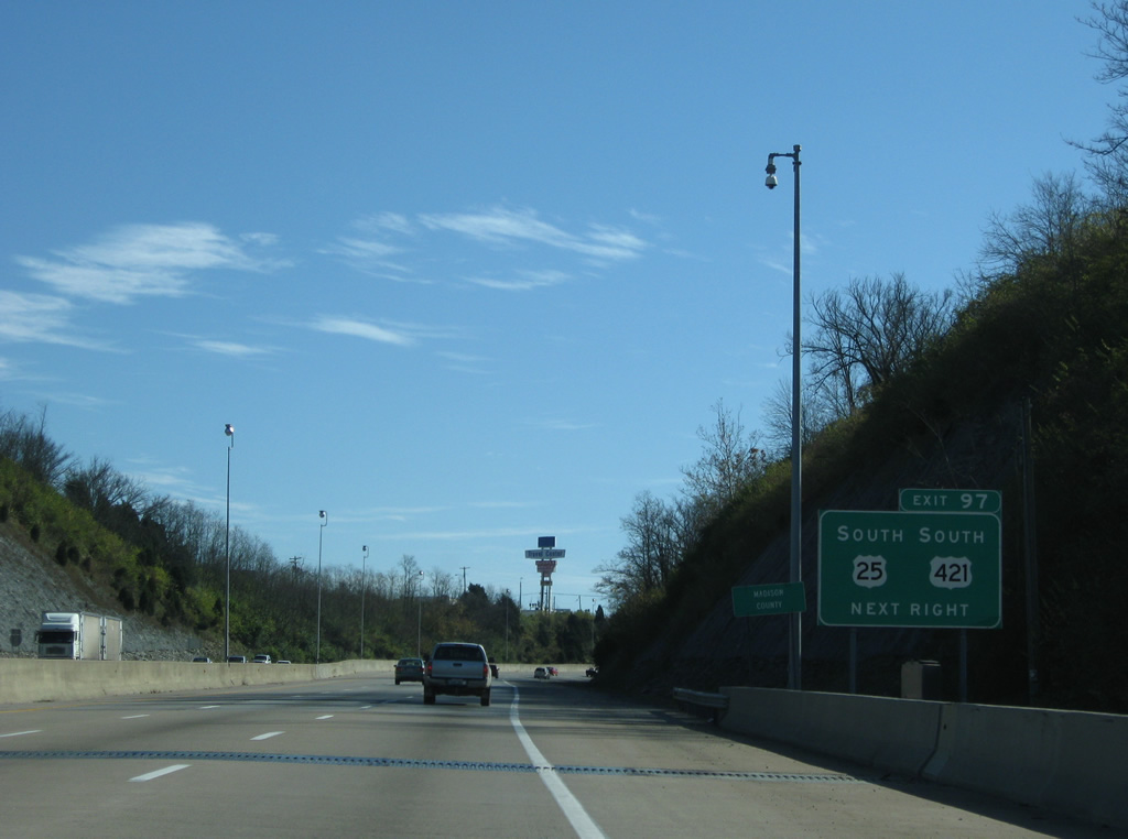
| Crossing into Madison County, both U.S. 25 & 421 prepare to depart Interstate 75 southbound at Exit 97. KY 2328 (former U.S. 25) ties in from the north. 11/08/09 |
|
| The Exit 97 diamond interchange with U.S. 25 & 421 (Lexington Road) south and KY 2328 north lies just south of the Kentucky River valley. U.S. 25 & 421 remain paired to Richmond and Terrill. 11/08/09 |
|
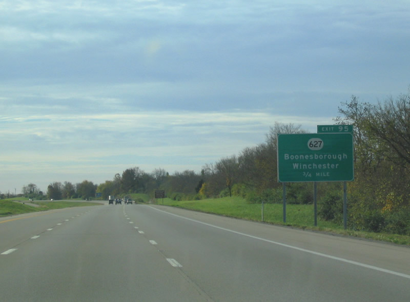
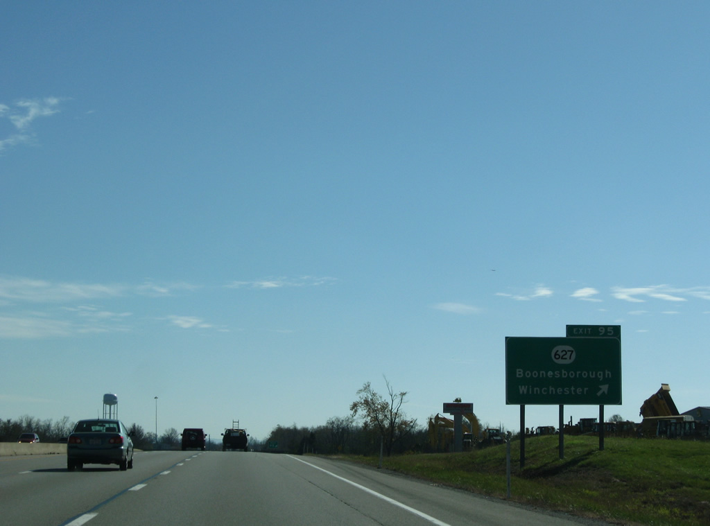
| KY 627 (Boonesborough Road and former U.S. 227) meets Interstate 75 at the next interchange, Exit 95. 11/08/09 |
|
| KY 627 veers northeast of Interstate 75, passing by Fort Boonesborough State Park on its way to Boonesborough and Winchester, the county seat of Clark County. The state highway ends at parallel U.S. 25 & 421 just to the west. 10/31/04 |
|
| Entering the Exit 95 diamond interchange with KY 627 (Boonesborough Road). U.S. 25 & 421 (Lexington Road) continue south from the KY 627 end to White Hall, historic home of Cassius Marcellus Clay. U.S. 227 follows KY 627 until 1972, when the route was decommissioned. KY 388, between Richmond and Boonesborough to the east, was the first alignment of the Richmond to Carrollton US Highway. 11/08/09 |
|
| Richmond, a city of 31,364 as of the 2010 census, lies next along Interstate 75 south. The city is the employment and shopping center of south central Kentucky. 11/08/09 |
|
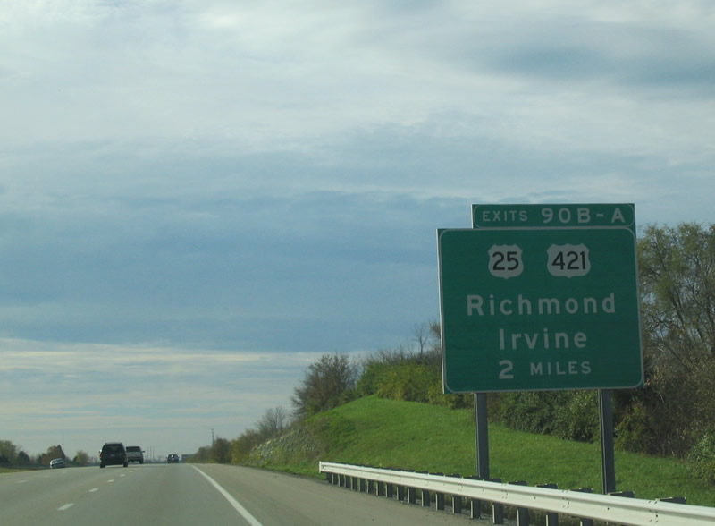
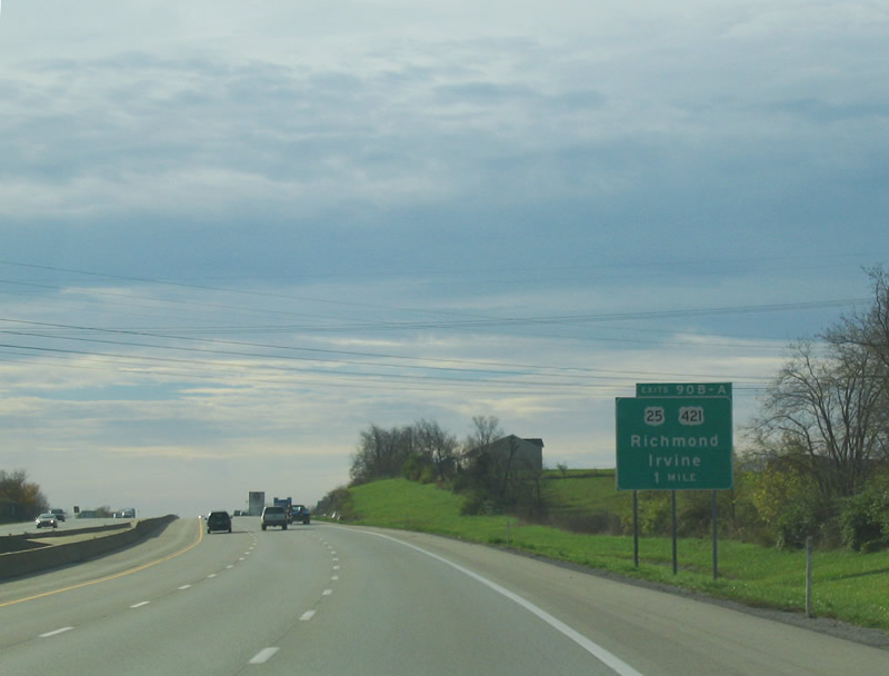
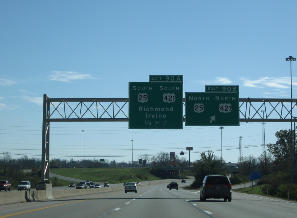
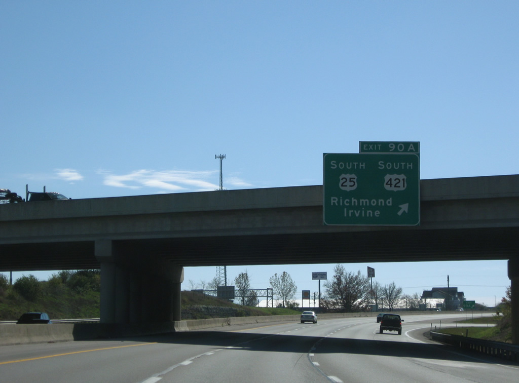
| U.S. 25 & 421 intersect Interstate 75 once more at the parclo interchange of Exits 90BA/A. 10/31/04 |
|
| The city of Richmond lies to the southeast of Exit 90BA. U.S. 25 & 421 circumvent the city via the Dr. Robert R. Martin Bypass while their business loop counterparts traverse through the city. Irvine is located 19 miles to the east of Richmond and is reached via KY 52. 10/31/04 |
|
| Two ramps serve Dr. Robert R. Martin Bypass from Interstate 75 south. The first ramp for Exit 90B gives motorists access to northbound U.S. 25 & 421 (Lexington Road) back to White Hall while Exit 90A facilitates movement onto southbound U.S. 25 & 421. 11/08/09 |
|
| Lexington Road and Main Street comprise the business route into downtown Richmond from nearby U.S. 25 & 421 (Dr. Robert R. Martin Bypass) nearby. U.S. 25 returns to Interstate 75 at Berea, while U.S. 421 veers easterly to McKee and Manchester. 11/08/09 |
|
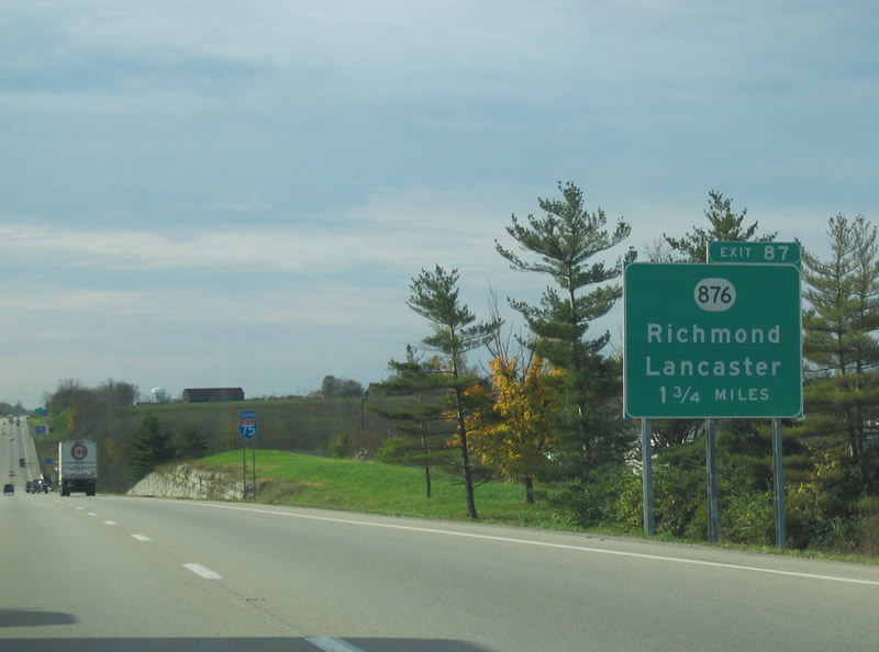
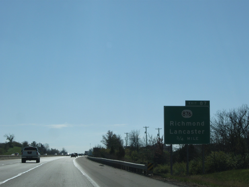
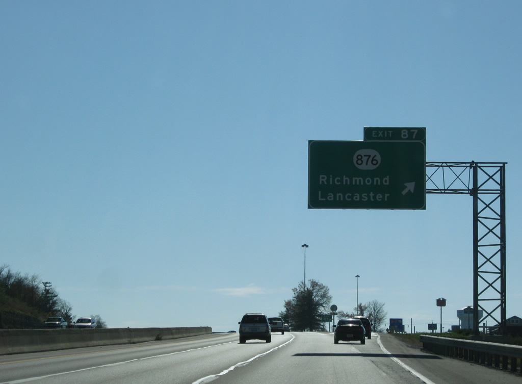
| KY 876 (Eastern Avenue) represents the southern portion of the Richmond bypass route and shares a diamond interchange with Interstate 75 at Exit 87. 10/31/04 |
|
| Southbound travelers along Interstate 75 sink into the Tate Creek Valley and pass over KY 169 (Tates Creek Road) along the west side of Richmond. 11/08/09 |
|
| Exit 87 serves interests to Eastern Kentucky University, located at the junction of KY 876 and KY 52 to the east. 11/08/09 |
|
| The four lane KY 876 is recognized as Eastern Bypass on the 2.83 mile to the east, linking I-75 with U.S. 25 & 421 (Berea Road). A two lane KY 876 becomes Barnes Hill Road to the west, concluding the 7.13 mile path at KY 595. 11/08/09 |
|
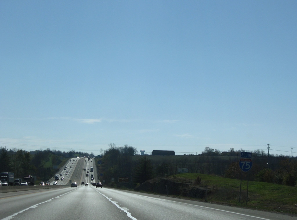
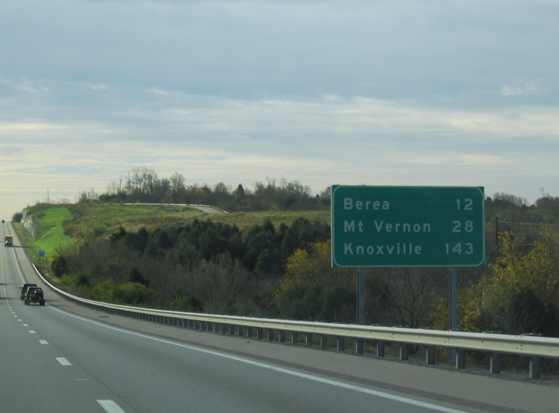
| Distance sign for the upcoming towns of Berea, Mount Vernon, the county seat of Rockcastle County, and Knoxville, TN. 10/31/04 |
|
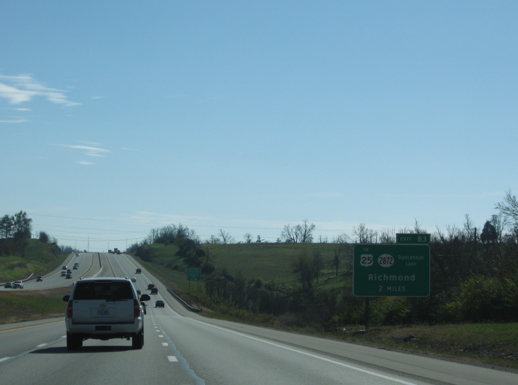
| A new diamond interchange was built at Interstate 75 and Duncannon Lane (KY 2872) at mile marker 83 in 2005. 11/08/09 |
|
| KY 2872 links the freeway with KY 2881 (Caleast Road) to the west and U.S. 25 (Berea Road) at the Bluegrass Army Depot to the east. 11/08/09 |
|
| Exit 83 leaves Interstate 75 south for KY 2872 (Duncannon Lane). KY 2872 totals 4.271 miles between KY 2811 and U.S. 25 (Berea Road), mostly as a four lane divided highway. 11/08/09 |
|
| Roadways of Interstate 75 separate to accommodate a forested median from the site of former rest areas by Exit 83 to Silver Creek in this scene. 11/08/09 |
|
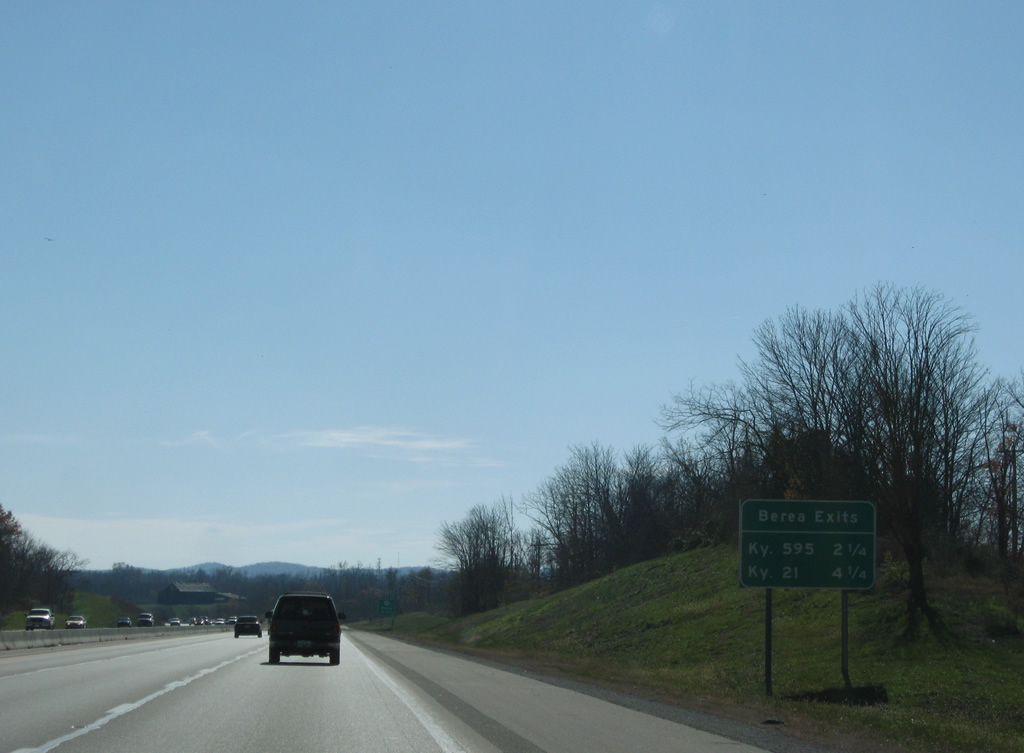
| The next two exits, the final within Madison County, serve the city of Berea. Berea, population 13,561 as of the 2010 census, was founded by Reverend John Gregg Fee who established two churches, a village, and Berea College. He named the community after the biblical city of Berea. 11/08/09 |
|
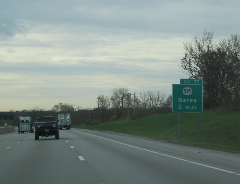
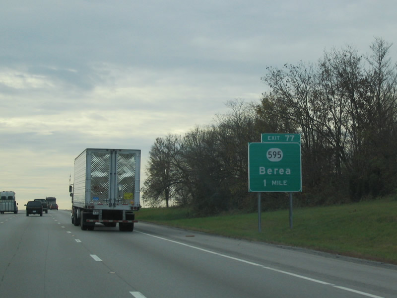
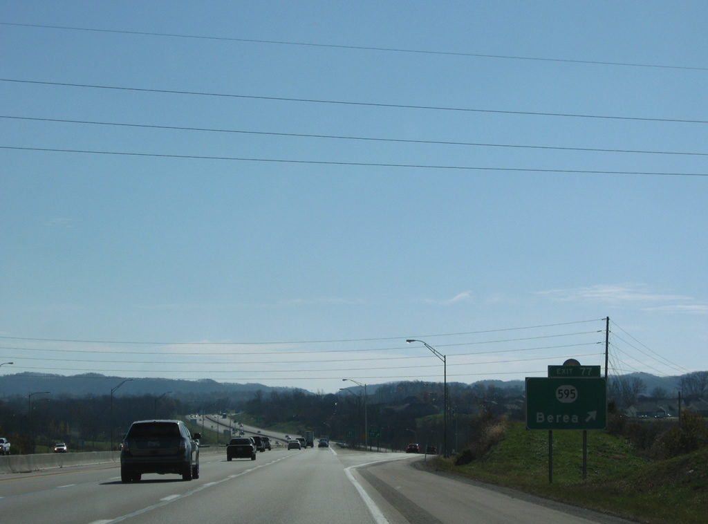
| Approaching the diamond interchange of Exit 77 with KY 595 (Walnut Meadow Road). 10/31/04 |
|
| The Kentucky Artisan Center is located at Exit 77. Berea is commonly known as the "Folk Arts and Craft Capital of Kentucky". 10/31/04 |
|
| KY 595, referred to as Walnut Meadow Pike to the east of the freeway and Walnut Meadow Road to the west, also provides a link between U.S. 25 in Berea and KY 52 in Happy Landing. 11/08/09 |
|
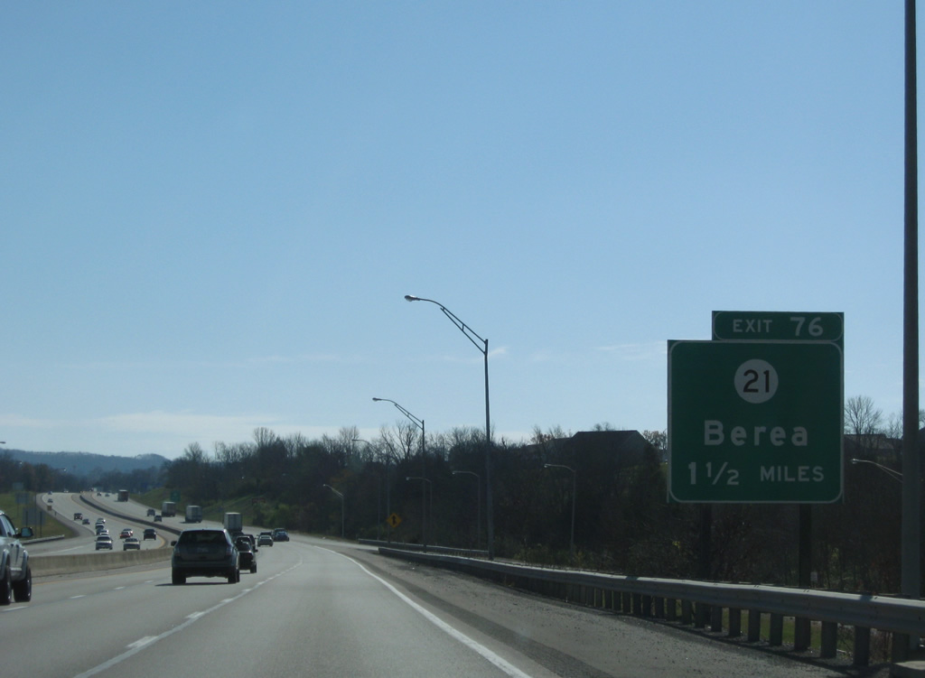
| Still within the confines of Exit 77, a guide sign alerts motorists on the upcoming Exit 76 with KY 21. 11/08/09 |
|
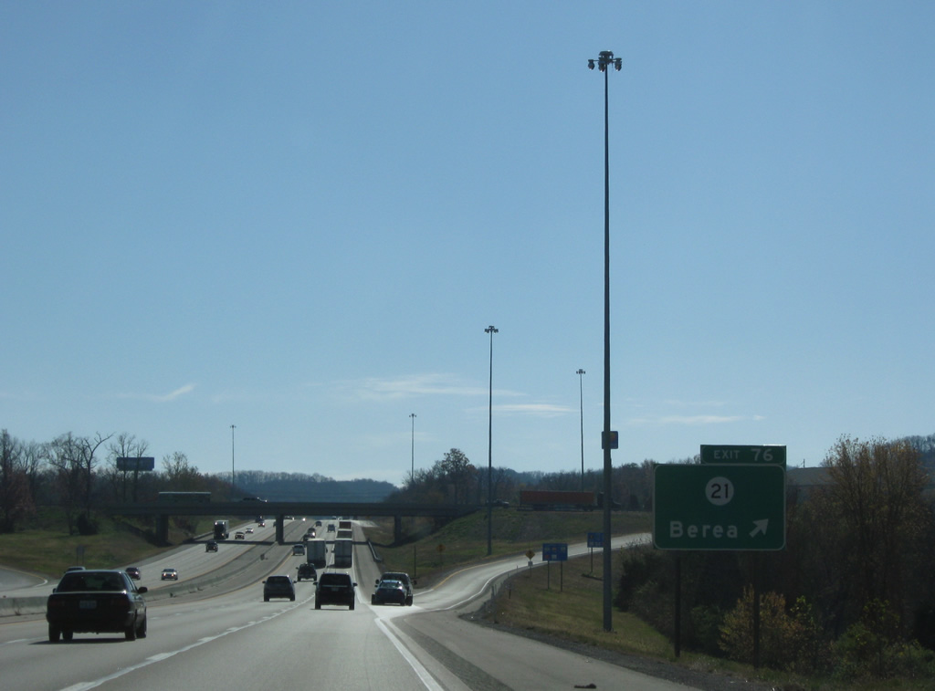
| Also known as Chestnut Street, KY 21 meets Interstate 75 at the Exit 76 diamond interchange on the south side of Berea. 11/08/09 |
|
| KY 21 merges with U.S. 25 to the east for a brief overlap to Berea College. The short route joins KY 52 at Paint Lick to the west with U.S. 421 at Bighill to the east. 11/08/09 |
|
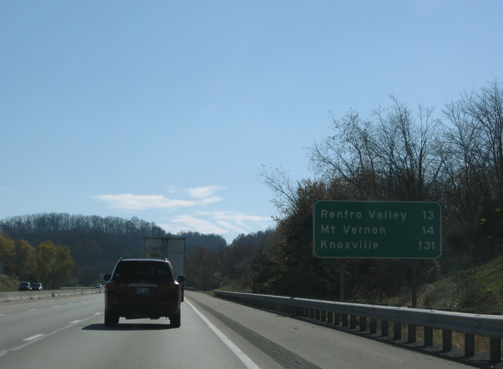
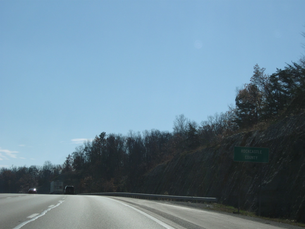
| Interstate 75 exits Madison County for a 22.64 mile path through Rockcastle County. Renfro Valley and Mount Vernon follow within 14 miles. Knoxville is two hours away. 11/08/09 |
|
| Linville Knob comes into view along the southern horizon as Interstate 75 widens to the west of Boone Gap in north Rockcastle County. 11/08/09 |
|
| Four lanes of Interstate 75 undulate south of Conway onto Brindle Ridge. 11/08/09 |
|
| Curving south southeasterly from Brindle Ridge, communication towers on a hill at Mount Vernon come into view as Interstate 75 lowers into Renfro Valley. 11/08/09 |
|
| U.S. 25 meanders southward from a course east of Interstate 75 through Roundstone to meet the freeway just south of Renfro Valley at Exit 62. 11/08/09 |
|
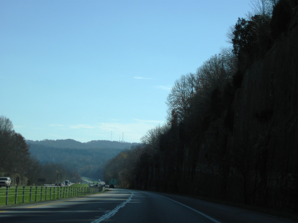
| Descending into Renfro Valley, construction of Interstate 75 utilized a rock cut through the hill east of Lake Linville and west of U.S. 25. 11/08/09 |
|
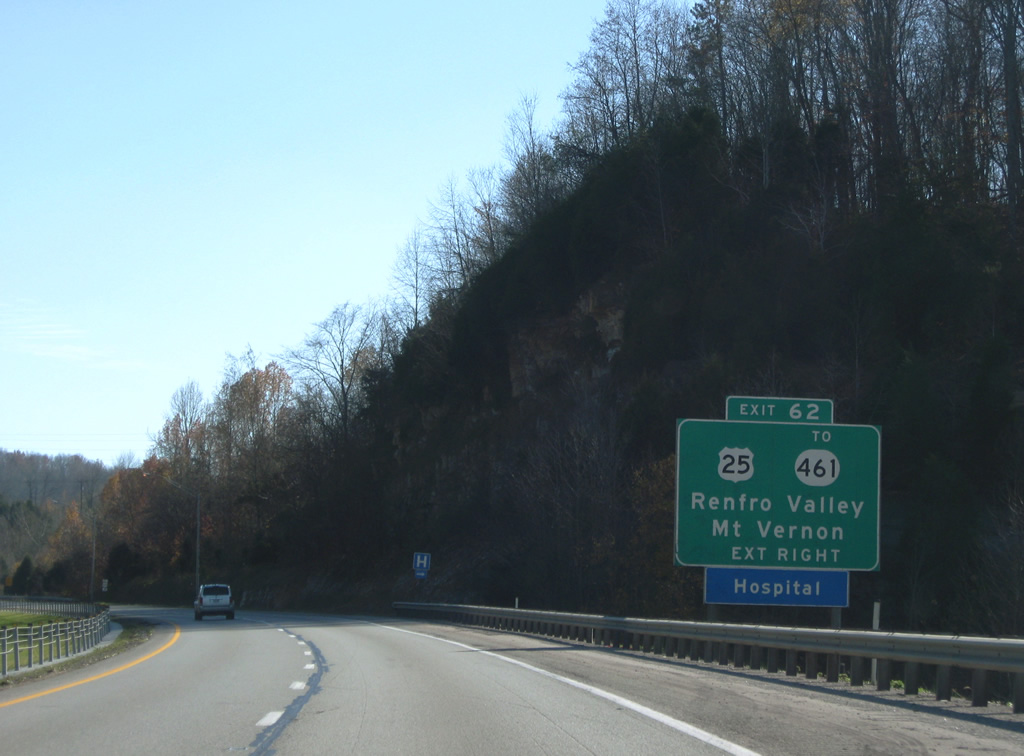
| One mile north of the diamond interchange (Exit 62) with U.S. 25. U.S. 25 travels Richmond Street south to KY 461 nearby. KY 461 comprises a bypass route of Mount Vernon west to U.S. 150 (New Brodhead Road). 11/08/09 |
|
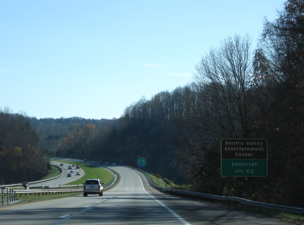
| Travelers bound for Somerset or Lake Cumberland are directed southwest along KY 461, 18 miles to KY 80. Renfro Valley Entertainment Center and the Kentucky Music Hall of Fame & Museum are notable points of interest along U.S. 25 (Richmond Street) south in Mt. Vernon. 11/08/09 |
|
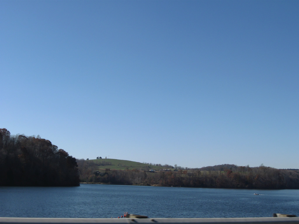
| Interstate 75 travels along the southeastern periphery of Lake Linville. 11/08/09 |
|
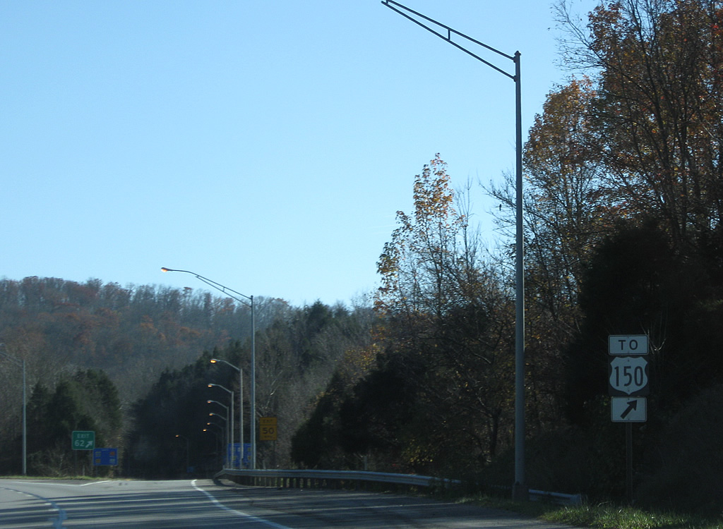
| Exit 62 departs I-75 south for U.S. 25 (Richmond Street) to KY 461 west. U.S. 25 continues 1.9 miles to U.S. 150 (New Brodhead Road) in Downtown Mt. Vernon. 11/08/09 |
|
| A U.S. 150 trailblazer directs motorists bound for 571 mile route to the Quad Cities onto Exit 62. U.S. 150 joins Mount Vernon with Brodhead, Stanford and Danville to the northwest. 11/08/09 |
Page Updated 03-09-2012.

 East
East  South
South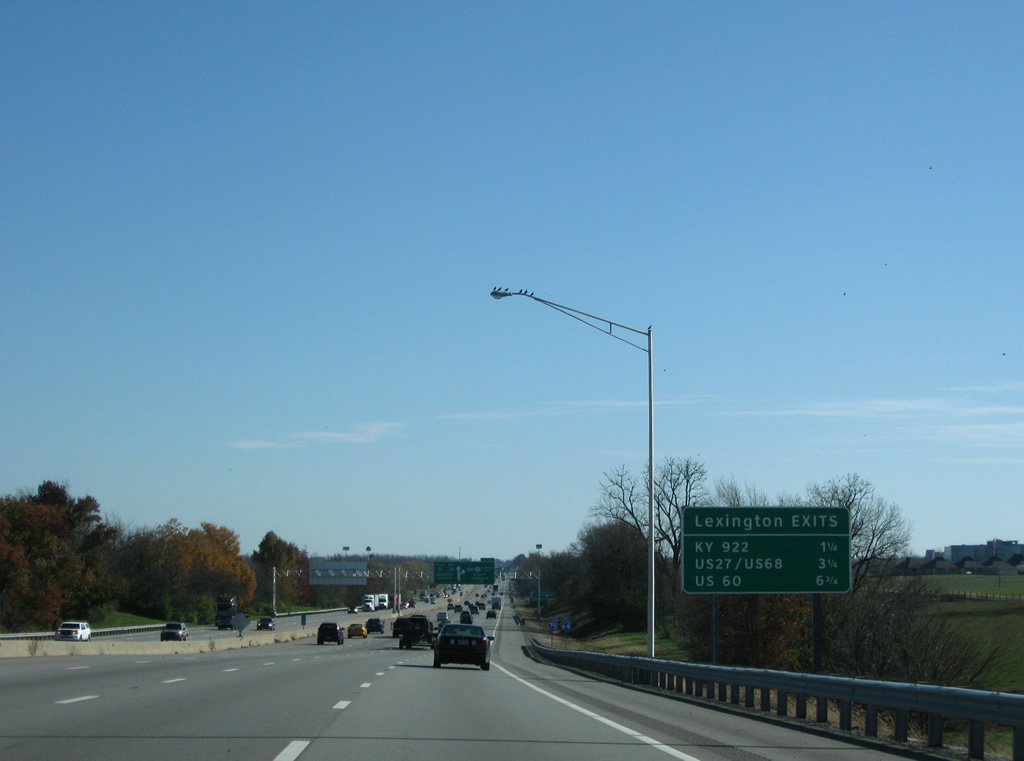


 South
South