|
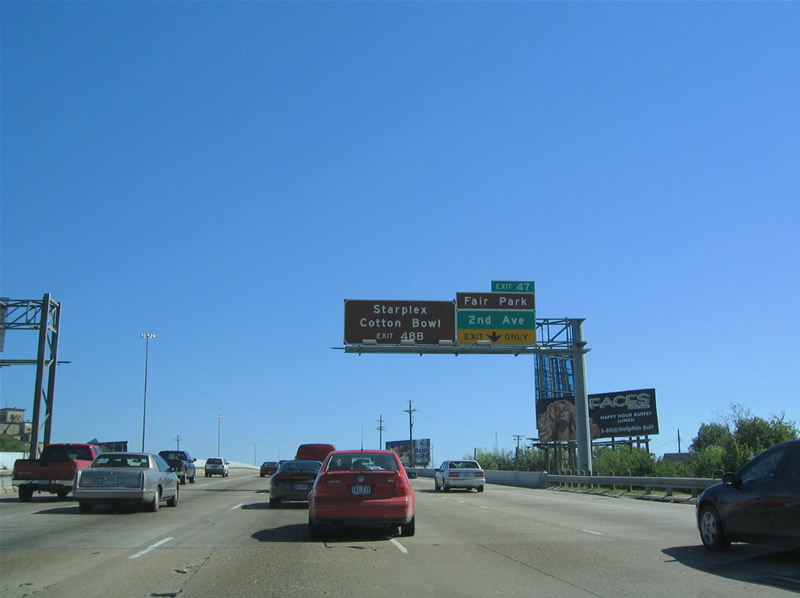
| IH 30 elevates along a viaduct east from IH 45/U.S. 75 to a wye interchange with 2nd and 1st Avenues near Fair Park. SH 352 begins here and follows 2nd Avenue (old U.S. 175) to Robert B. Cullum Boulevard southeast. Fair Park is home of the Texas State Fairgrounds and the Cotton Bowl. 10/19/03 |
|
| Exit 47 leaves IH 30 east for 2nd Avenue (SH 352 east) and Fair Park. SH 352 comprises a 13.55 mile loop east to Mesquite and U.S. 80 at Sunnyvale. SH 352 mostly follows Scyene Road. The name originated from pioneer settlers who wanted to name their area after the Seine River in Paris, but did not know how to spell it. 10/19/03 |
|
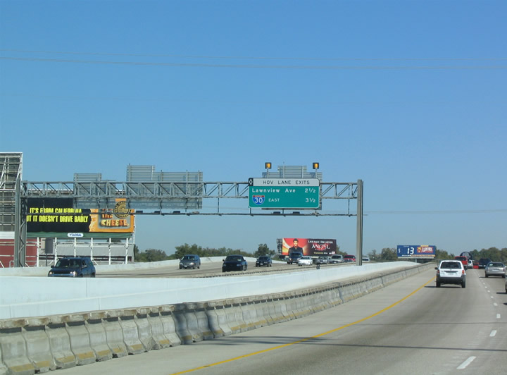
| IH 30 (R.L. Thorton Freeway) east between Deep Ellum and Fair Park includes the first reversible HOV lane in Texas. Operated by Dallas' transit authority, DART, the HOV lanes opened in 1991. 10/19/03 |
|
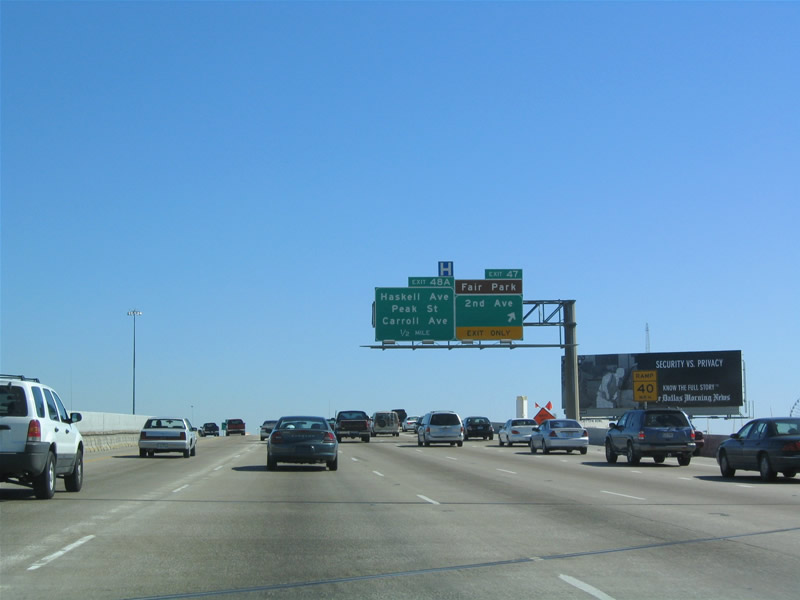
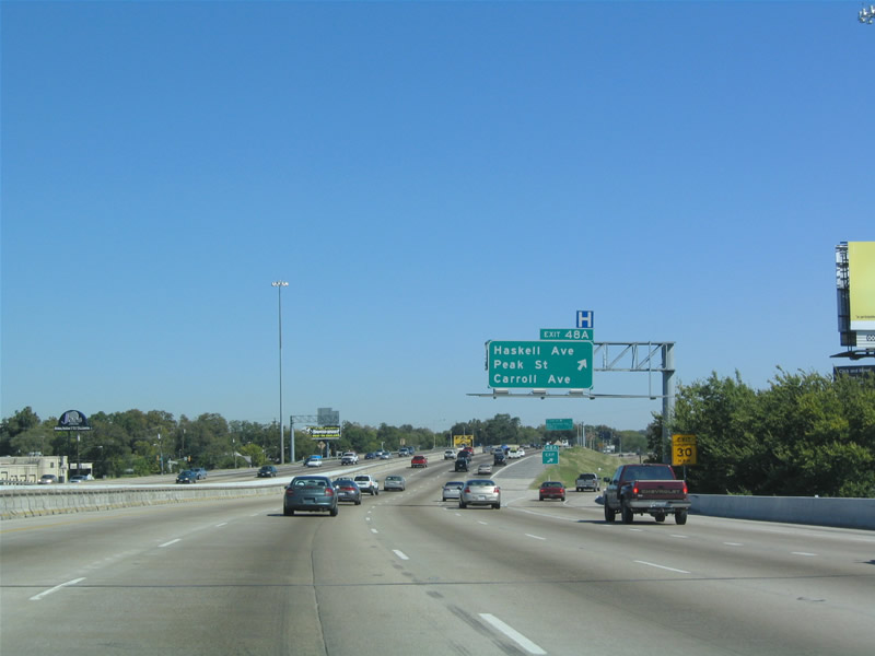
| Exit 48A follows with a loop ramp to Haskell Avenue and a second ramp to Peak Street and Carroll Avenue. Peak and Carroll head north to Old East Dallas; Haskell Avenue heads east to Military Parkway at the Dolphin Heights neighborhood. 10/19/03 |
|
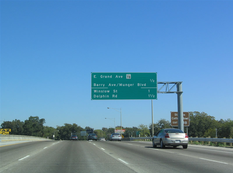
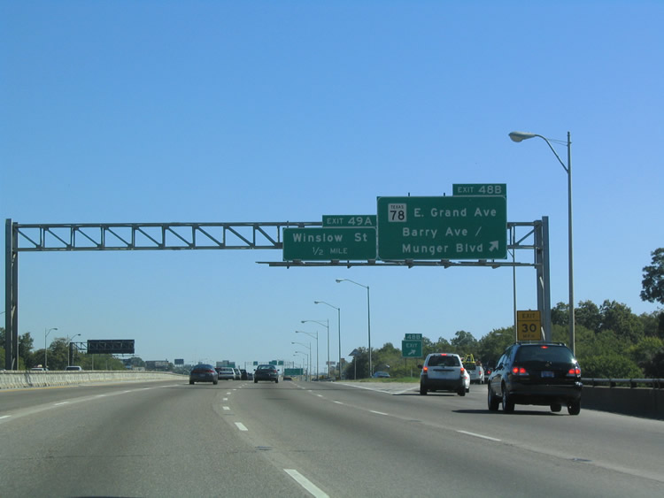
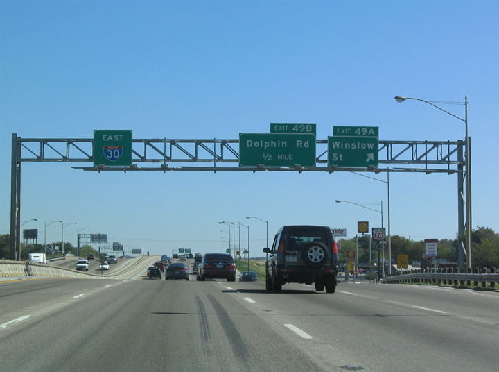
| Interchange sequence sign for SH 78 (Exit 48B), Winslow Street (Exit 49A) and Dolphin Road (Exit 49B). These two exits are well known for their profusions of seedy liquor stores. Samuell-Grand Park and the city's main municipal golf course lie just to the north. 10/19/03 |
|
| Barry Avenue south to Fitzhugh Avenue southwest leads to Fair Park, home of the Dos Equis Pavilion concert venue and the Cotton Bowl. Munger Boulevard continues Barry Avenue north to Munger Place. Opened in 1905, Munger Place was the city's first deed-restricted subdivision. Today its home to a score of fine mansions and historic sites. 10/19/03 |
|
| Exit 48B leaves forms an eastbound frontage road at Barry Avenue. The service road connects with Grand Avenue and the eastbound beginning of SH 78. SH 78 follows Grand Avenue and Garland Road to Garland and the northeast suburbs. A multi state route, SH 78 crosses into Oklahoma north of Bohnam. 10/19/03 |
|
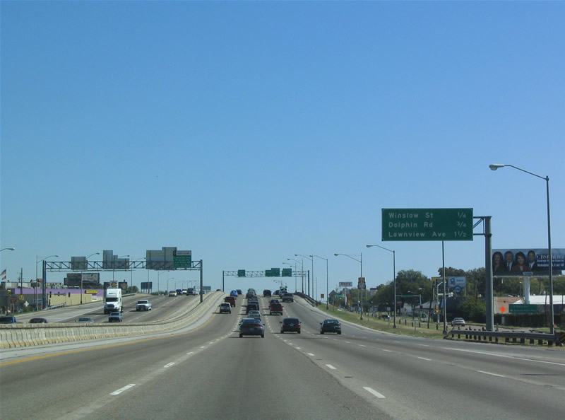
| Ramps to Winslow Avenue and Dolphin Road depart Interstate 30 in quick succession ahead of White Rock Creek. 10/19/03 |
|
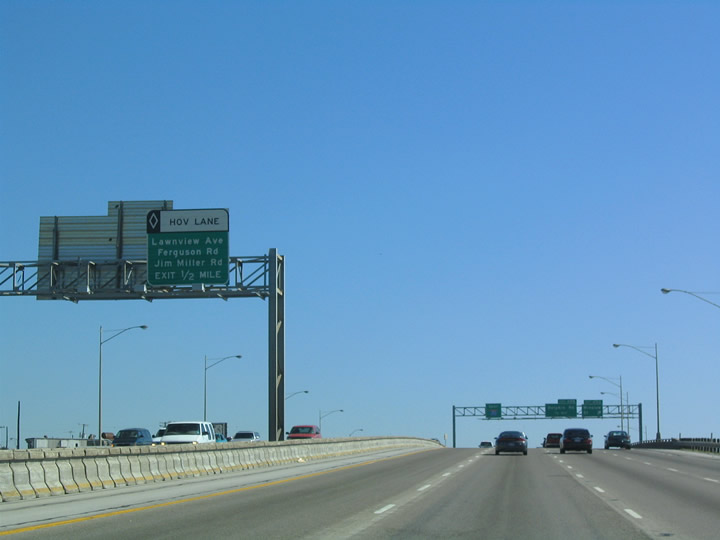
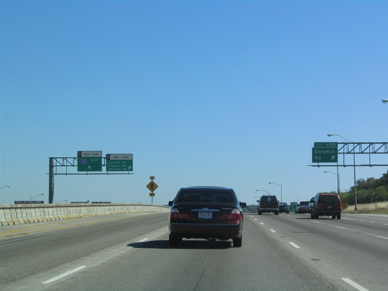
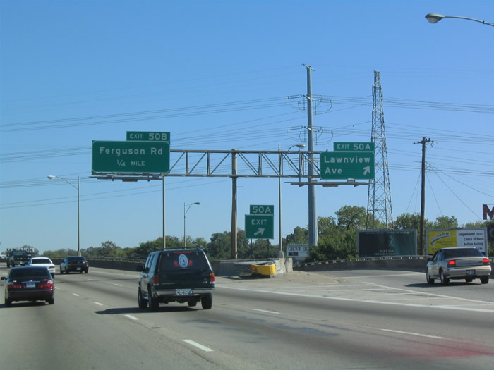
| An egress point to the IH 30 mainline departs from the HOV roadway ahead of Exit 50A for Lawnview Avenue. 10/19/03 |
|
| Winslow Avenue is a short street linking with Samuell Boulevard and SH 78 (Grand Avenue) at Samuell-Grand Park. A commercial district at Winslow and Grand lies just south of Dallas' unique Hare Krishna neighborhood. 10/19/03 |
|
| A diamond interchange joins IH 30 with Dolphin Road at Exit 49B. The HOV roadway concludes just beyond the exchange. Dolphin Road stems south from parallel Samuell Boulevard to Military Parkway and Hatcher Street. 10/19/03 |
|
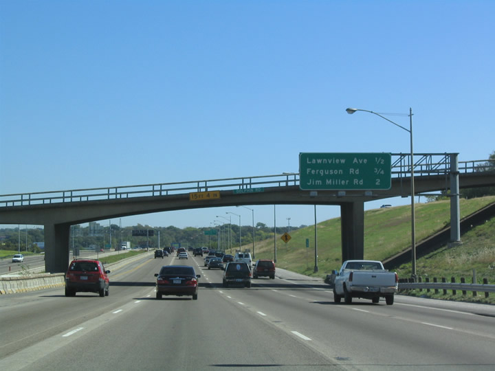
| Interchange sequence sign posted at the Dolphin Road overpass. IH 30 between Grand Avenue and Loop 12 opened in 1962, and bridges like the one at Dolphin date from the original construction. 10/19/03 |
|
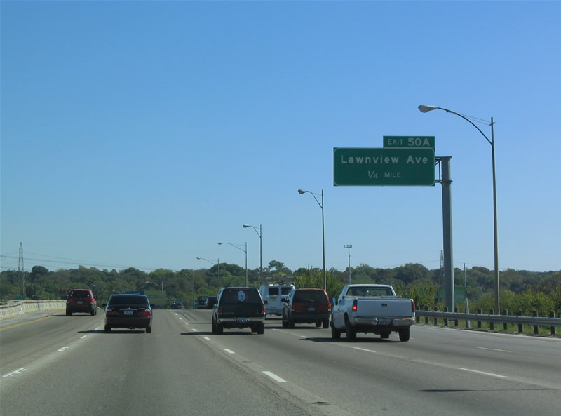
| Crossing White Rock Creek, IH 30 advances east to Exit 50A for Lawnview Avenue. Lawnview Avenue leads south from Samuell Boulevard to Military Parkway and SH 352 (Scyene Road). 10/19/03 |
|
| Exit 50A leaves one quarter mile ahead of Exit 50B to Ferguson Road. Ferguson Road branches northeast from Samuell Boulevard to the White Rock Hills neighborhood. IH 30 follows Samuell Boulevard through East Dallas. The route, named after local doctor W.W. Samuell, was originally US 80. 10/19/03 |
|
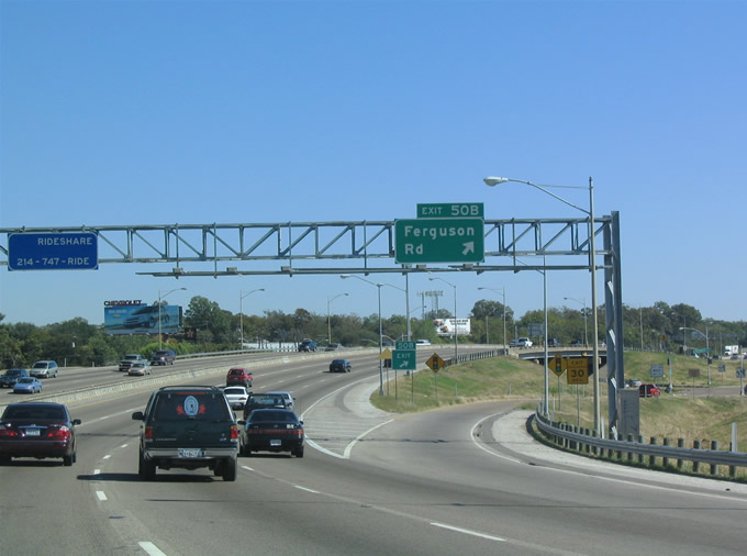
| Ferguson Road weaves through residential areas northeast from a diamond interchange (Exit 50B) with IH 30 to IH 635 at Centerville Road in Garland. Locally known as the Ferguson Curve, the arc along IH 30 here was designed to avoid wetlands area adjacent to White Rock Creek. 10/19/03 |
|
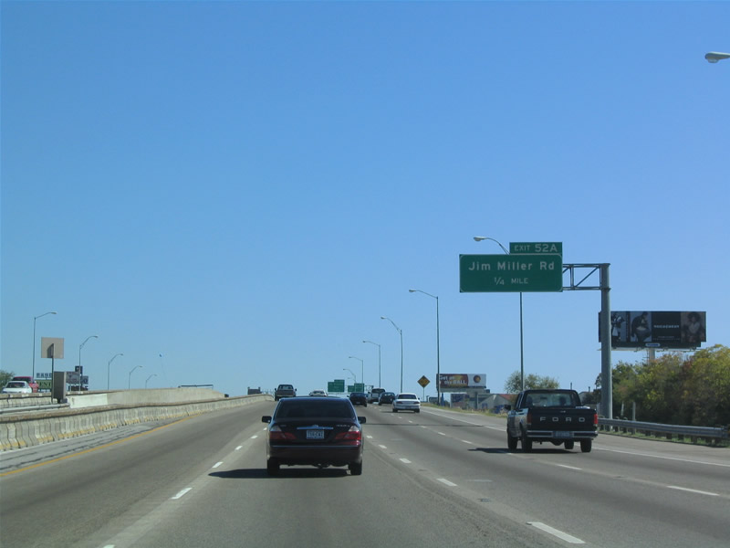
| Jim Miller Road ties into Interstate 30 at a diamond interchange (Exit 52A) in East Dallas. 10/19/03 |
|
| Exit 52A leaves IH 30 east for Jim Miller Road in a commercial area. Jim Miller Road heads north into White Rock Hills and south with six lanes to Military Parkway. The road was named after a 1920s era county commissioner who pushed for a good roads plan. 10/19/03 |
|
| Exit 52B follows from the Jim Miller Road overpass to St. Francis Avenue for White Rock Hills and the Buckner Terrace / Everglade Park community. 10/19/03 |
|
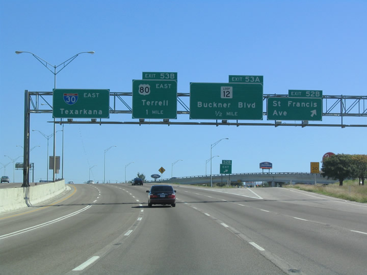
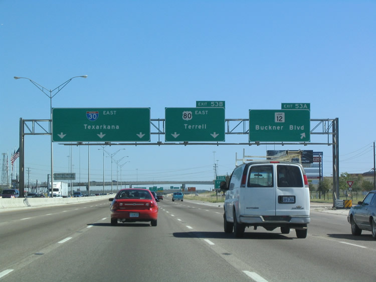
| U.S. 80 begins from IH 30 at a wye interchange (Exit 54) just beyond Loop 12 (Buckner Boulevard). Truncated west from Mesquite, U.S. 80 travels east to Tybee Island, Georgia. The eastern leg of Loop 12 leads south to Pleasant Grove and U.S. 175 (Hawn Freeway) and north to Casa Linda and White Rock Lake. 10/19/03 |
|
| A three level interchange using the respective frontage roads of IH 30 and SL 12 (Buckner Boulevard) join the two roadways at Exit 53A. The exchange was preceded by a roundabout in 1949 where US 67/80 and SL 12 met. That year, a 16.6 mile long section of divided highway opened along U.S. 67 east all the way to the county line. U.S. 67 was subsequently upgraded and converted into IH 30. 10/19/03 |
|
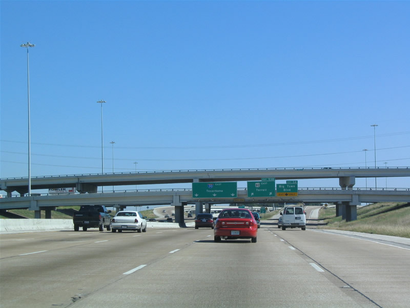
| U.S. 80 splits from IH 30 along a freeway across the city of Mesquite toward IH 20 at Terrell. Exit 54B leaves with the U.S. 80 ramp for Big Town Boulevard, a an arterial to Eastfield College and the site of the former Big Town Mall. 10/19/03 |
|
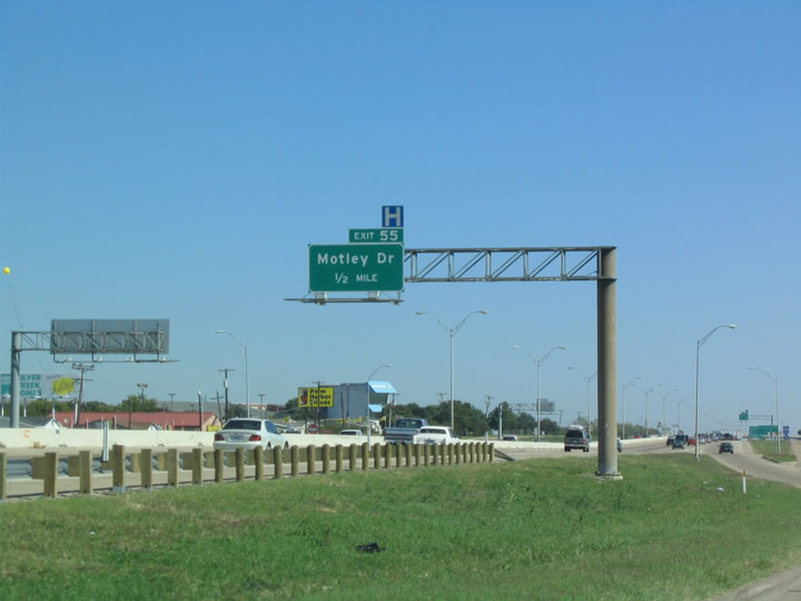
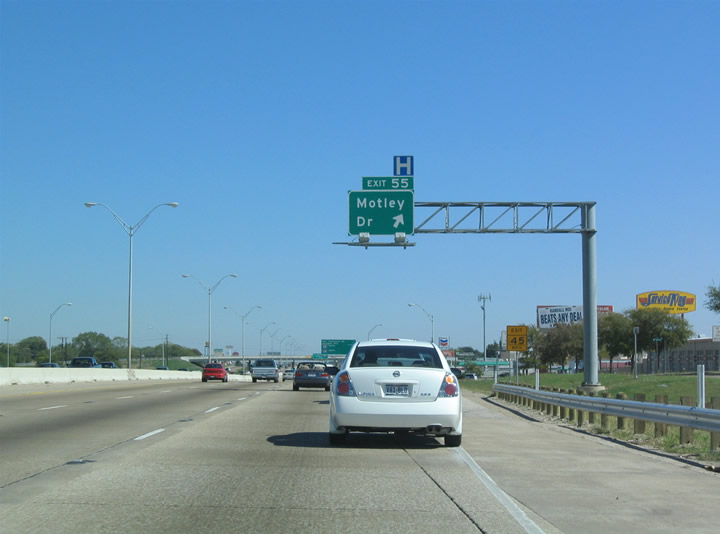
| Continuing beyond U.S. 80, IH 30 trends northward to Motley Drive (Exit 55) at the Town East States neighborhood and Interstate 635 (Lyndon B. Johnson Freeway). 10/19/03 |
|
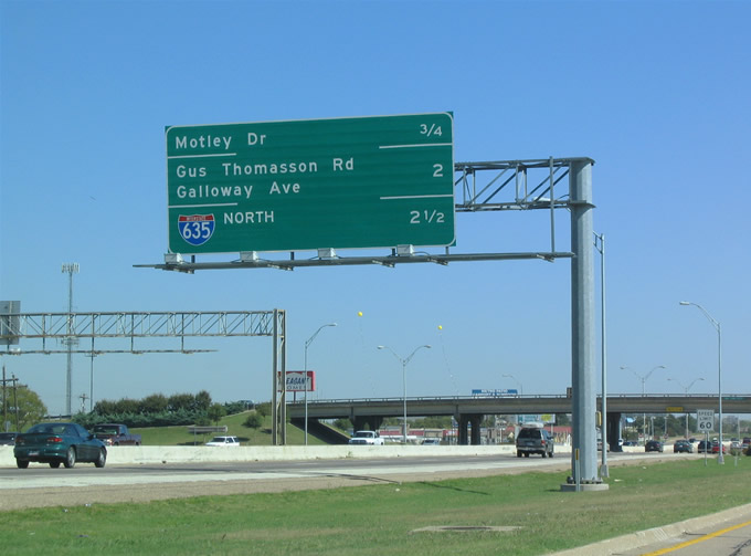
| Motley Drive heads north from a diamond interchange (Exit 55) with IH 30 to Eastfield College and southeast to Gross Road near U.S. 80. 10/19/03 |
|
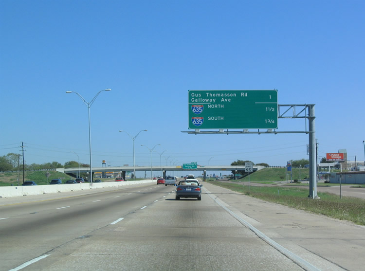
| Gus Thomasson Road crosses paths with IH 30 just ahead of a systems interchange with IH 635 (Lyndon B. Johnson Freeway). Like Jim Miller Road, Gus Thomasson was renamed in the 1930s for a county road commissioner. 10/19/03 |
|
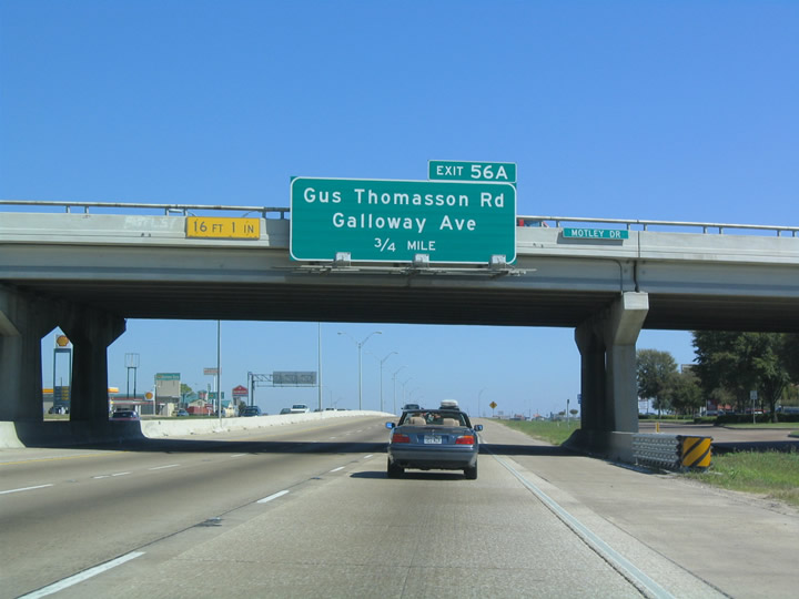
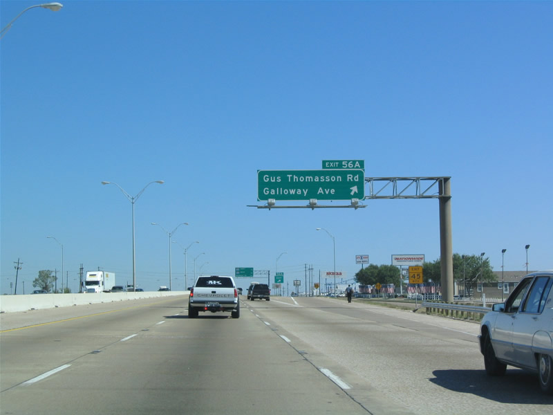
| A half diamond interchange (Exit 56A) joins IH 30 east with Gus Thomasson Road in Mesquite. The frontage road system connects the freeway with Galloway Avenue east of IH 635. 10/19/03 |
|
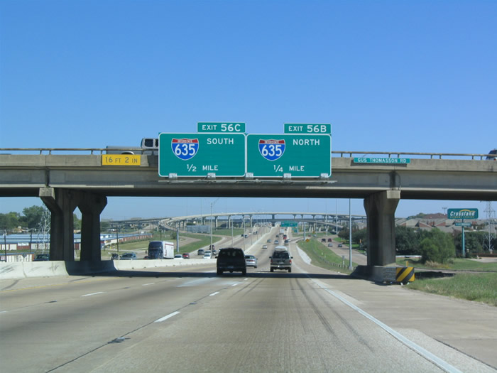
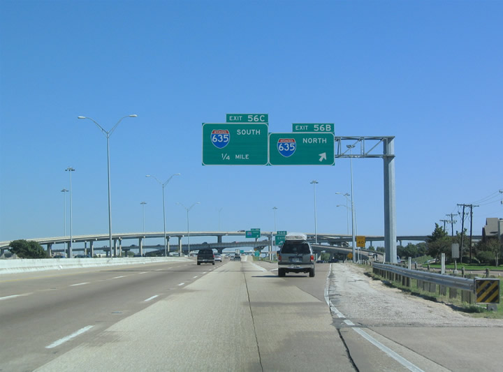
| Exits 56B/C join IH 30 with Interstate 635 (Lyndon B. Johnson Freeway) in a half mile. IH 635 comprises a commuter freeway encircling Dallas east from Dallas-Fort Worth International Airport (DFW) to Richardson and south through Mesquite. 10/19/03 |
|
| Typical for Dallas area three-digit Interstates, no control points are used for IH 635. IH 635 extends eight miles south to IH 20 at Balch Springs. 10/19/03 |
|
| Exit 56B departs for IH 635 (Lyndon B. Johnson Freeway) to Garland, Richardson and north Dallas. IH 635 is one of the busiest freeways in Dallas, with the tolled LBJ Express lanes constructed along the northern arc between the Dallas High Five interchange at U.S. 75 and IH 35E by Farmers Branch. 10/19/03 |
|
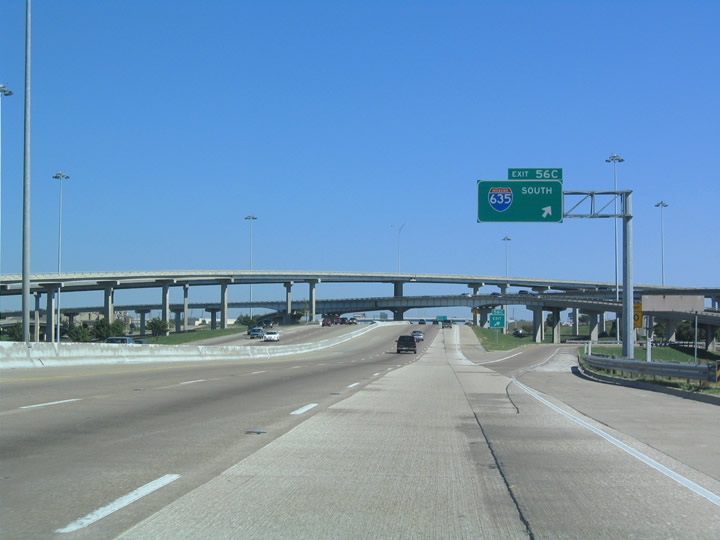
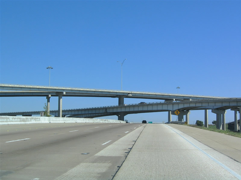
| Entering the five-level interchange with IH 635, Exit 56C separates for the LBJ Freeway south through Mesquite to Town East Mall and U.S. 80. IH 635 previously continued west alongside IH 20 to Exit 467 (IH 35E) in south Dallas. 10/19/03 |
|
| The stack interchange at IH 30/635 was one of three identical ones built along IH 635 in 1971/72. 10/19/03 |
|
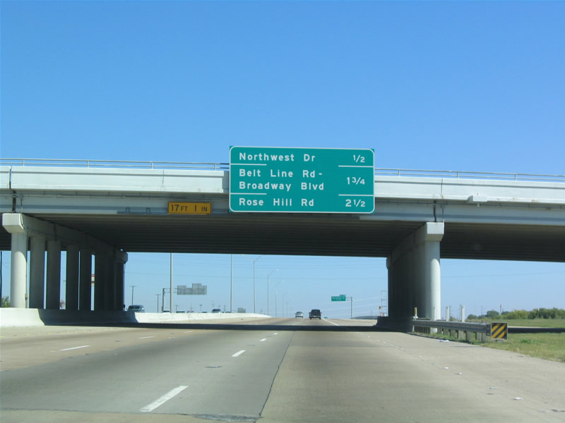
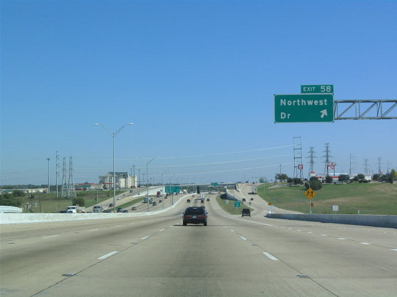
| Exit 57 with Northwest Drive is the final Mesquite interchange along IH 30 eastbound. Northwest Drive is the eastern extension of Northwest Highway (SS 244) and Loop 12, a major arterial across North Dallas. 10/19/03 |
|
| Exit 57 joins the adjacent frontage road ahead of a return ramp from Galloway Avenue. Northwest Drive crosses over IH 30 eastward to the Palos Verdes neighborhood and Belt Line Road. 10/19/03 |
|
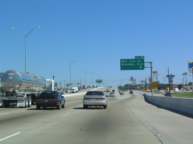
| Known in Garland as Broadway Boulevard, Belt Line Road meets Interstate 30 at a diamond interchange (Exit 59) in 0.75 miles. Belt line Road previously converged with IH 30 in Grand Prairie at Exit 34. 10/19/03 |
|
| Exit 59 leaves IH 30 east for Broadway Boulevard / Belt Line Road in Garland. Belt Line was established in 1928 as a 96 mile loop of Dallas, connecting all of the outlying communities. Today, it still encircles the city as an important arterial route. 10/19/03 |
Page Updated 07-05-2019.

 East
East