|
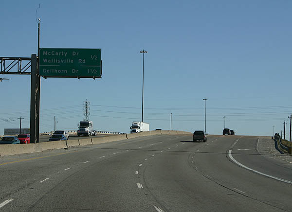
| IH 610 curves southeast from the Settegast community in Houston to Exit 24 with McCarty Drive (U.S. 90A / BU-090U) and Wallisville Road. 12/24/05 |
|
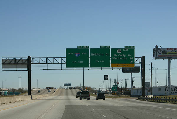
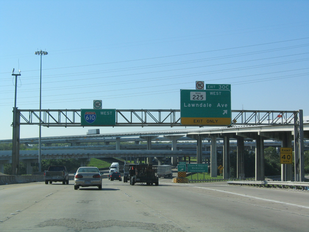
| Exit 24 represents the east end of U.S. 90 Alternate and west end of U.S. 90 Business from Crosby. U.S. 90 Alternate replaced U.S. 90 along McCarty Drive south to IH 10 when the Crosby Freeway was completed from IH 10/610. The bannered route measures 178.85 miles west to Seguin. 12/24/05 |
|
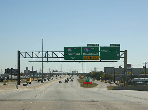
| Gellhorn Drive winds southwest from Wallisville Road through industrial areas of Northshore to meet IH 610 at Exit 25 and IH 10 (East Freeway) at the Pleasantville Area of Houston. 12/24/05 |
|
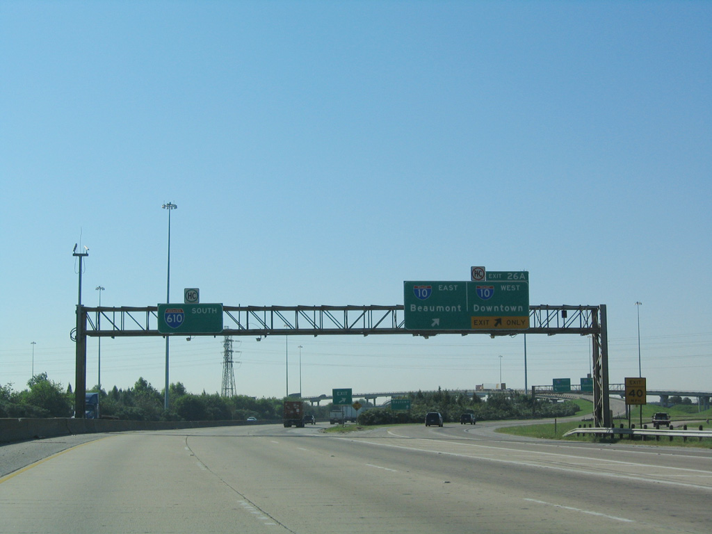
| Exit 26A departs the East Loop of IH 610 next for IH 10 (East Freeway) west to Downtown Houston and east to Baytown and Beaumont. U.S. 90 combines with IH 10 west at this exchange, but there is no access to it from IH 610 south. 10/22/03 |
|
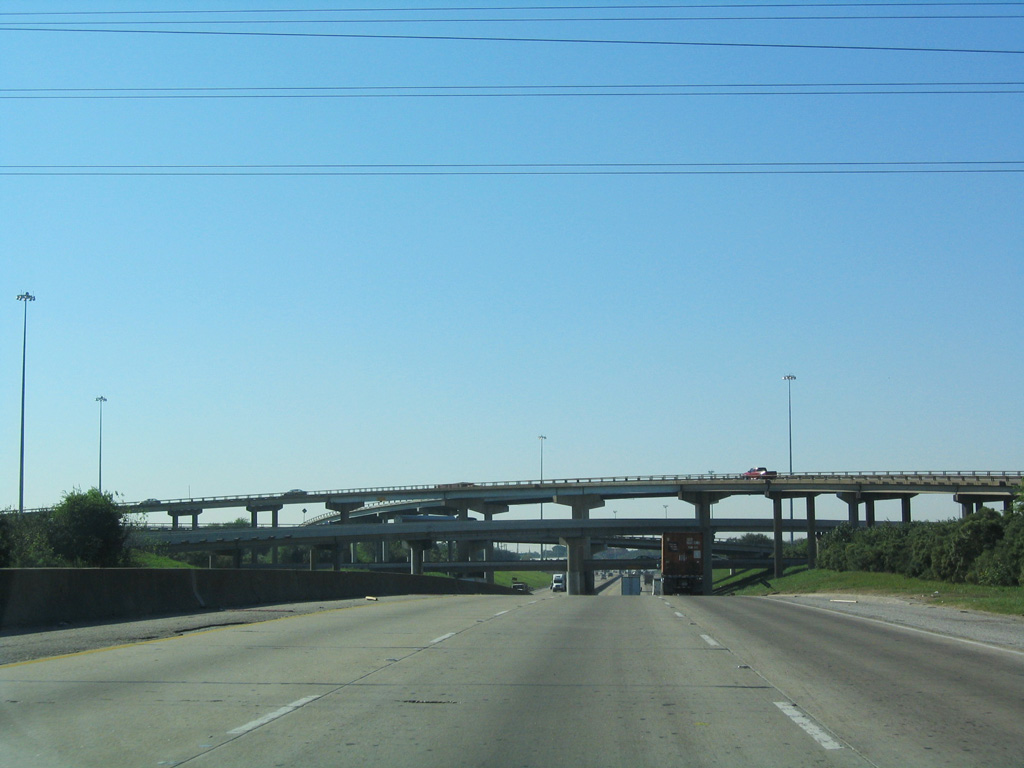
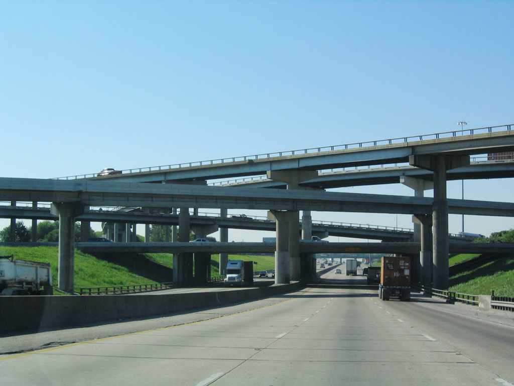
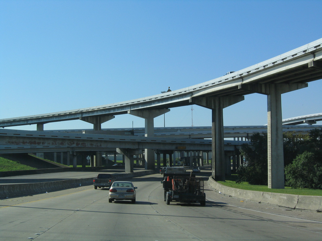
| IH 610 south at IH 10 (Exit 26) was rebuilt in 2005/06. A fifth level was added at the systems interchange with the East Freeway in 2010/11 for U.S. 90 (Crosby Freeway) leading northeast toward Liberty. 10/22/03 |
|
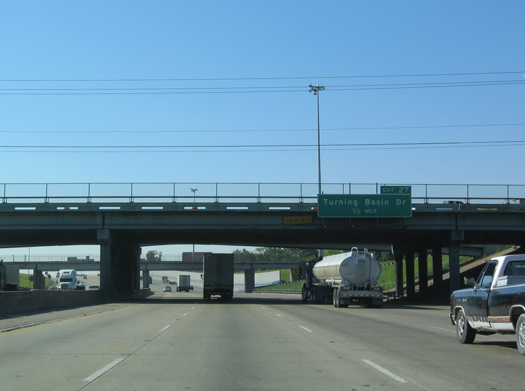
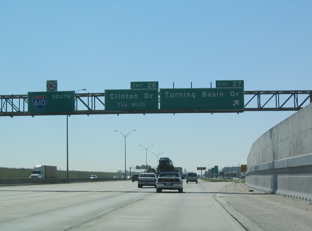
| Advancing south from the East Freeway, IH 610 enters the Clinton Park Tri-Community ahead of Exit 27 for Turning Basin Drive and Flagship Drive west. 10/22/03 |
|
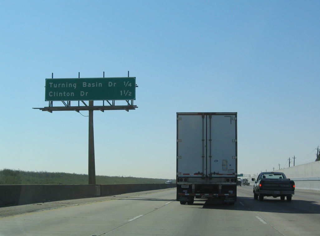
| Turning Basin Drive spurs south from Flagship Drive and the off-ramp at Exit 27 to an array of industrial businesses alongside IH 610 and a turnaround at the Port Terminal Railroad. 10/22/03 |
|
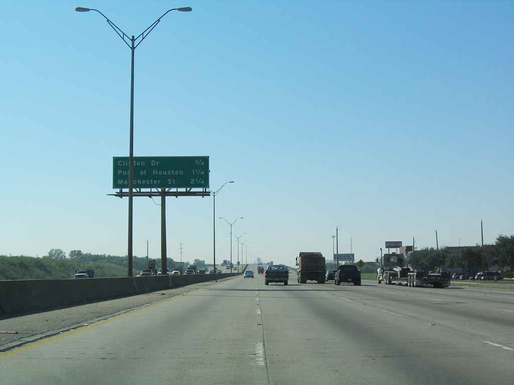
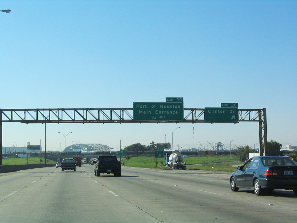
| Clinton Drive ties into IH 610 south from the Denver Harbor / Port Houston area in 0.75 miles. 10/22/03 |
|
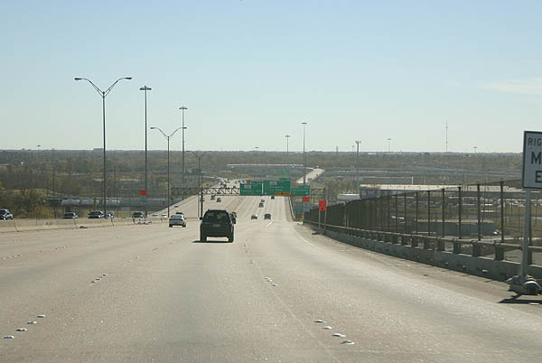
| The high level Houston Ship Channel bridge comes into view as IH 610 southbound reaches the folded diamond interchange (Exit 28) for Clinton Drive. 10/22/03 |
|
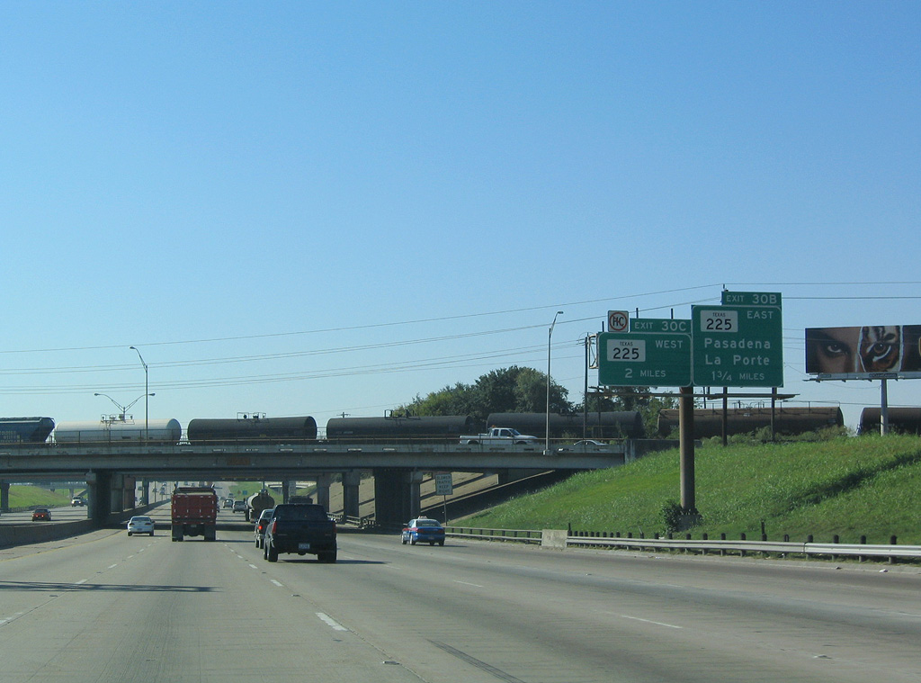
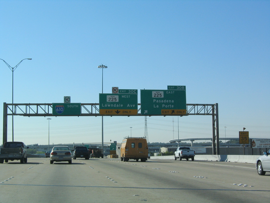
| South beyond the Sidney Sherman Bridge, IH 610 converges with the La Porte Freeway (SH 225) at a four level interchange (Exits 30B/C). 10/22/03 |
|
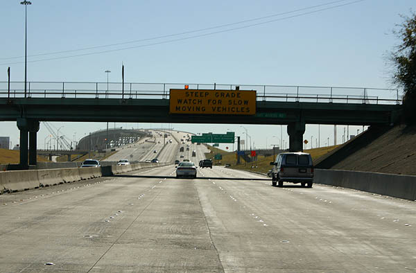
| The Ship Channel bridge has steep grades on either side. 12/24/05 |
|
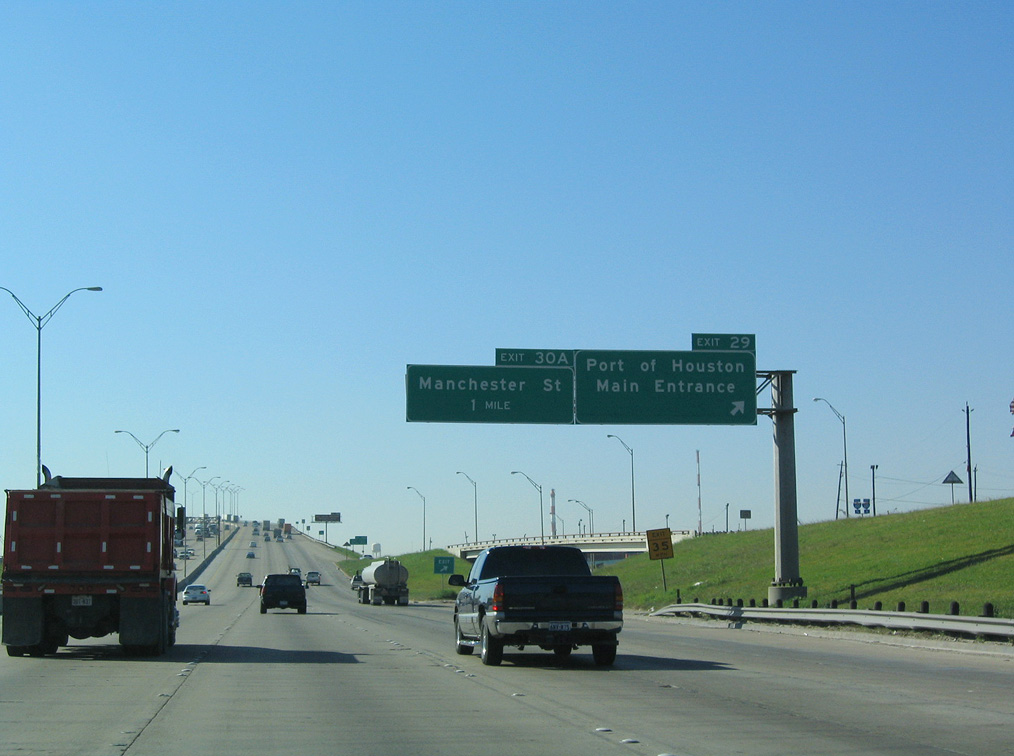
| Exit 29 serves the main entrance for the Port of Houston. 10/22/03 |
|
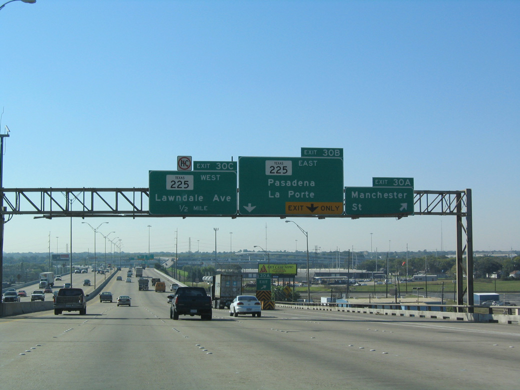
| Rising onto the Sidney Sherman Bridge, guide signage directs tourists headed to the Battleship Texas and San Jacinto Monument State Historic Site via Exit 30B to the Pasadena Freeway (SH 225) east. 10/22/03 |
|
| The Sidney Sherman Bridge opened to traffic on March 2, 1973.1 The 1,230 foot long span rises to a height of 134.5 feet above Houston Ship Channel.2 12/24/05 |
|
| A wye interchange (Exit 30A) joins the south end of the Houston Ship Channel Bridge with Manchester Street in the Harrisburg / Manchester neighborhood. 10/22/03 |
|
| A two lane flyover (Exit 30B) connects IH 610 southbound with SH 225 (La Porte Freeway) east to the cities of Pasadena, Deer Park and La Porte. 10/22/03 |
|
| The west end of the La Porte Freeway stubs out at Broadway Street, with frontage roads extending to Lawndale Street to Lawndale / Wayside. SH 225 was originally proposed to continue northwest to Downtown Houston along the unbuilt Harrisburg Freeway. 10/22/03 |
|
| IH 610 transitions from the East Loop to the South Loop through the exchange with SH 225 (La Porte Freeway). 10/22/03 |
Page Updated 08-01-2019.

 South
South