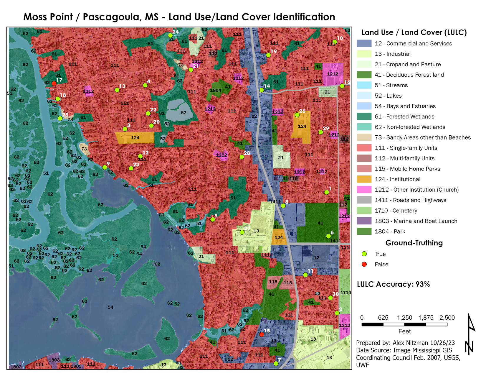
Cartography, the Good and the Bad
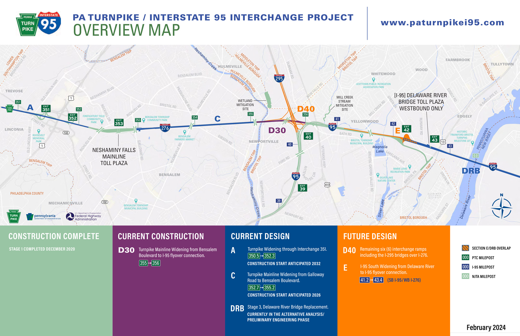
Advancing to our second week of Computer Cartography, the first module requires us to think about how we look at and interpret a map. Our task was to select for critical analysis and evaluation, both a map that we consider well designed, and another that is poorly designed. What a task that was, as there have been several over the years that fit both contexts. Trying to recall any [...]