
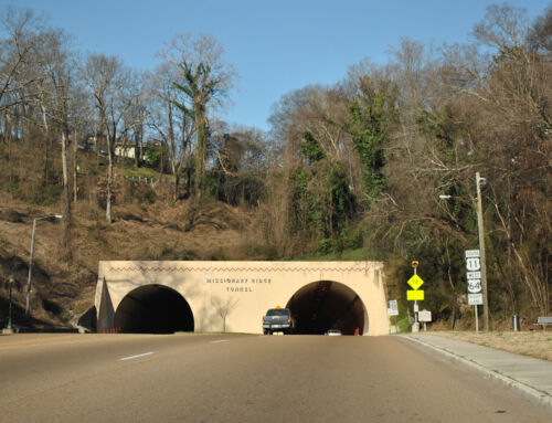
Speaking of carbon copying signs, perhaps it is about time that Interstate 10 guide signs in Mobile County, Alabama reflect Biloxi and/or New Orleans? Pascagoula made sense when Interstate 10 was originally built, because the freeway defaulted onto U.S. 90 at the state line for many years before Mississippi completed its portion. Nowadays, Pascagoula makes little sense, as Interstate 10 travels through Moss Point, Pascagoula’s neighbor to the north, and U.S. 90, the route that still travels to the coastal city, is not directly accessible from the freeway anymore. Yet all these years, little thought has been given into changing the control city to something else.
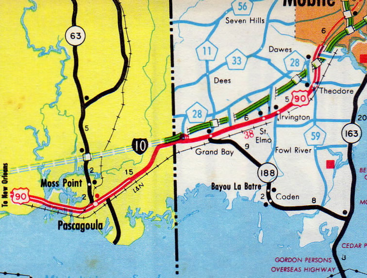
1974 Alabama official highway map.
Furthermore, Interstate 10 gains the control city of Mobile along eastbound from Gulfport and Biloxi through Moss Point. There’s no mention of Pascagoula outside of exit signs for Mississippi 613 and 63.
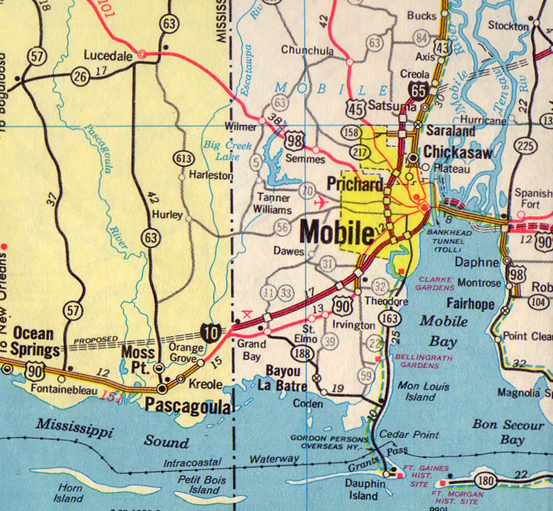
1971 Gousha Alabama/Georgia highway map.
The same can be said for Interstate 10’s control point from Slidell, Louisiana, which features the U.S. 90 city of Bay St. Louis. When Interstate 10 ended at Mississippi 607 (Exit 2) from Louisiana, it made sense to have Bay St. Louis, since MS 607 to U.S. 90 carried motorists directly into the Hancock County city. Nowadays Interstate 10 bypasses the community well to the north.
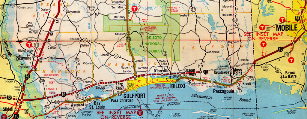
1971 Mississippi Gousha Mississippi highway map.
Throughout the years the same cities are carbon copied without any thought to updating the signs. However it is possible to change such designations. Texas officials altered signs in 2007 for U.S. 75 leading north from Dallas that replaced Sherman with McKinney…
Hear hear, I second this motion. Looking at the situation from a historical standpoint, though, makes things a lot clearer. I always wondered what drove LaDOTD and Alabama DOT to use such odd control cities. The signs should at a minimum mention Gulfport and Mobile on eastbound I-10 and Gulfport and New Orleans on westbound I-10.
That was a good post.
I noticed today that the control points on US 175 and 2nd Ave and SH 310 are still Sherman. Those are also the roads that happen to go through hardcore ghetto. :)
The example of Pascagoula control signage is proof positive that the Southwestern states were wise in signing their control cities the way they did. For example, drive I-70 to the end @I-15. You will see the following on the sign bridge:
I-15 North: Salt Lake
I-15 South: Las Vegas
Both places everyone needs and wants to go.
Of course, not all states out West are that wise. As any Denver commuter will tell you, E-470, I-225, and I-70 all point toward some truckstop called Limon. Not to mention, I-76 points east toward some meatpacking town called Fort Morgan.
It might be this reason to…The city of Pascagoula may of asked DOT to keep them as a posted city on the interstate.to keep the city economy up..You would think the signs had to be replaced many times from 1971…and the control city would change..Being a exit on I-10 signing the way to Pascagoula and after that exit the control city would change.
How about adding electronic signs warning of traffic hazards and accidents. These signs should also provide information about alternative routes. I was on I-10 East in East New Orleans the other night trying to get back to Mississippi. The road was closed due to an accident and the police made all cars exit the highway. The only problem was that I had no idea what a safe alternative would be. These electronic signs are all over the northeast U.S. especially on I-95 and they are very helpful.
This is pretty neat. I hadn’t checked this blog in a while but was actually driving to Texas last week via I-65/I-10 and had to pull out my atlas to figure out what this “Pascagoula” was. You’d think the states could communicate to give some sort of universal control cities along a route. This way, when I-65 ends at I-10, I-10 west could be toward “Biloxi/New Orleans” instead of “Pascagoula”.
Why not just use Pasacgoula, Biloxi, and New Orleans to avoid confusion and be like I-64 in Hampton Roads with up to 3 control cities at once in both directions. I would think that Pascagoula is bigger than “Dunn” and “Benson” on I-95 in North Carolina.
The problems exist nationwide. Example 1- I-95 in NC (Wilson, Benson, Dunn), I-80 in PA (if the signs read cities like Dubois, Milton, Bloomsburg, they should also read Youngstown to the west and New York City to the east), I-77 in southern Ohio (Marietta, Cambridge), I-76 & I-70 in CO. All these cities need to run concurrent with neighboring states and major cities instead of in one direction with one city and from the opposite direction of that same city another control city that simply bypassing that same city in the opposite direction. Gotta love the interstate in-state highway system!
I-10 is have this confusion I lived in Pascagoula and when I go out of town to Biloxi or Gulfport It would reflect New Orleans well I-10 officials need to change that some tourists want to go to Biloxi or Gulfport and I-10 East It would reflect Bay St Louis then to Mobile it is nonsense you are on the west coast of Mississippi and Mobile is lots of miles ignoring Biloxi/Gulfport and Pascagoula the resolution is that I-10 East should be Biloxi,Gulfport,Pascagoula then Mobile like I said tourists want to stop in Mississippi but yet again I-10 in Lousiana and Alabama was built before that Mississippi but the controlled cities need to be changed?
Apparently nobody from LaDOTD read this article, or they have reasons that shall remain secret to us. Whatever the reason, new signage for I-10 west at I-12/59 still pays homage to Bay St. Louis, though now in beautiful Clearview.