|
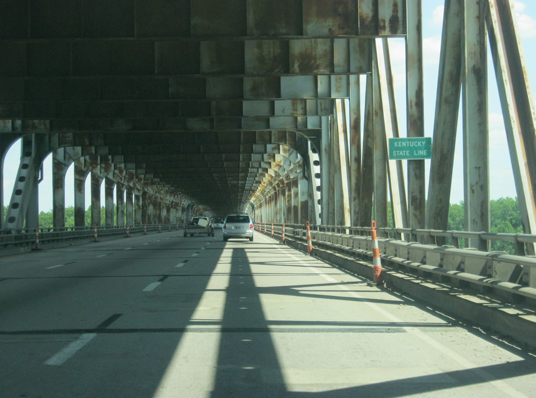
| Scenes along I-64/U.S. 150 east on the Sherman Minton Bridge. The span was named for a US Supreme Court justice from New Albany, Indiana. Indiana paid for the entire bridge, with Kentucky only paying from its approach to it. Opened in 1962, the dual suspended arch bridge travels 2,052.9 feet.2 06/07/12, 11/04/09 |
|
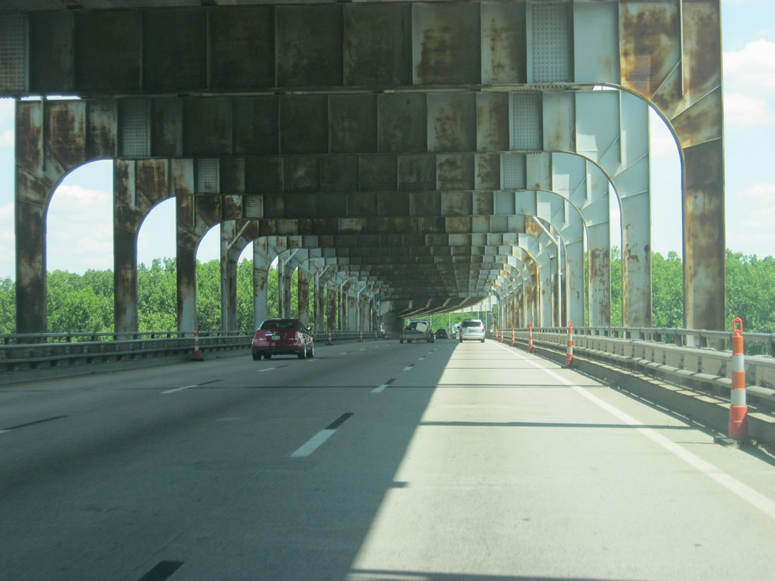
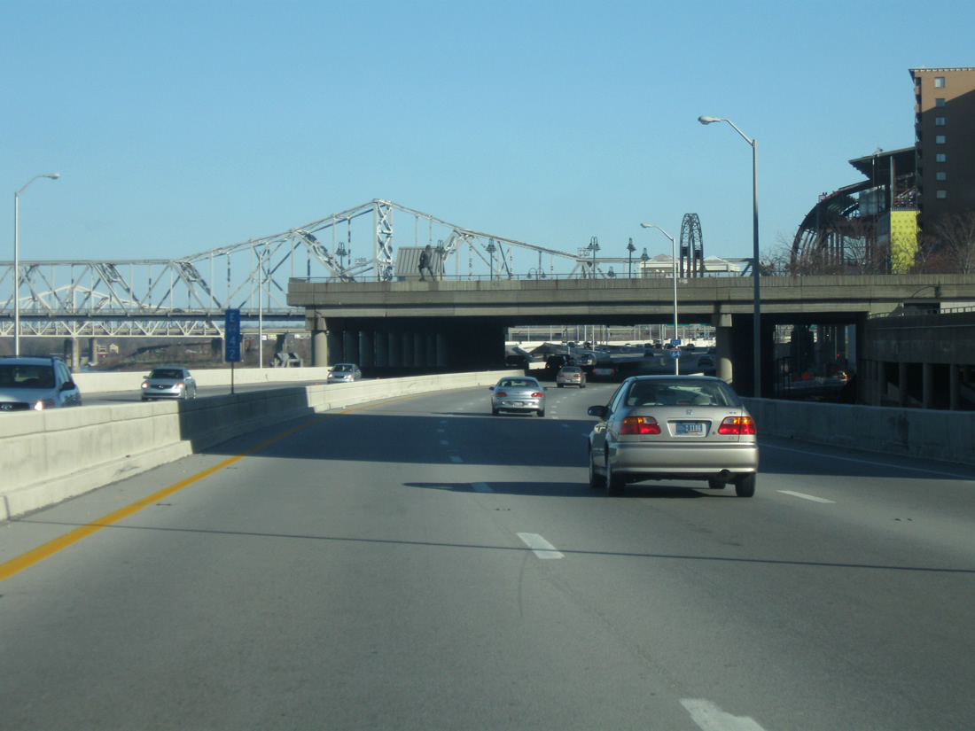
| I-64/U.S. 150 emerge from the Sherman Minton Bridge lower deck and near the tri-level stack interchange with Interstate 264 (Shawnee Expressway). 06/07/12 |
|
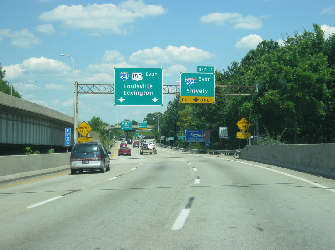
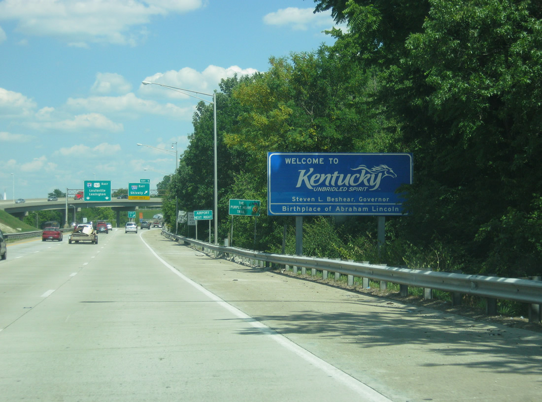
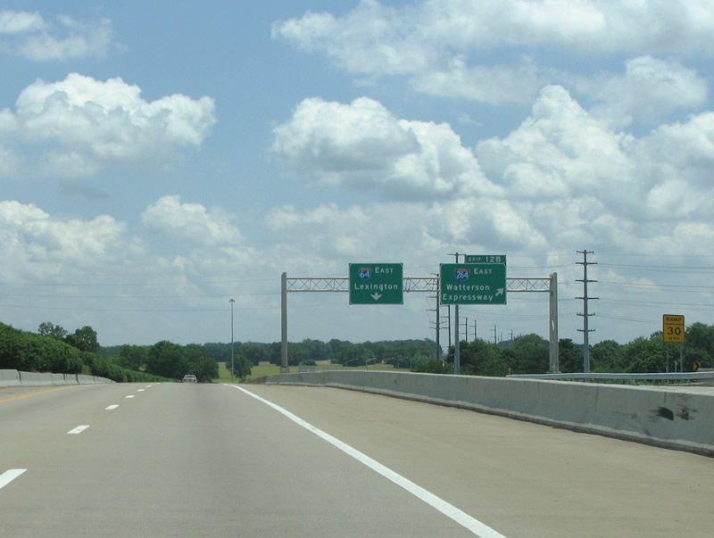
| A Welcome to Kentucky sign greets motorists on eastbound I-64/U.S. 150 near the interchange with Interstate 264. 06/07/12 |
|
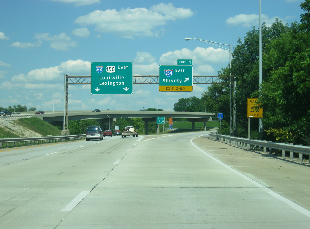
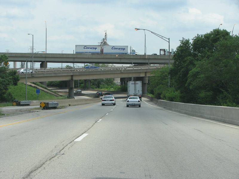
| Interstate 264 leads south to Shively and then east along the Waterson Expressway around central Louisville. Work underway between fall 2009 and spring 2010 replaced the overpass connecting Interstate 264 west to I-64/U.S. 150 west. 06/07/12 |
|
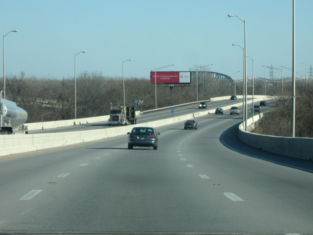
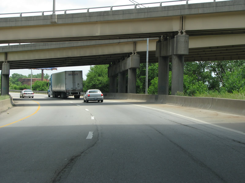
| Two lanes of I-64/U.S. 150 wind undernearth ramps to and from the Shawnee EZxpressway as the freeway passes by Shawnee Golf Course and Old Portland Wharf Park. 12/26/09 |
|
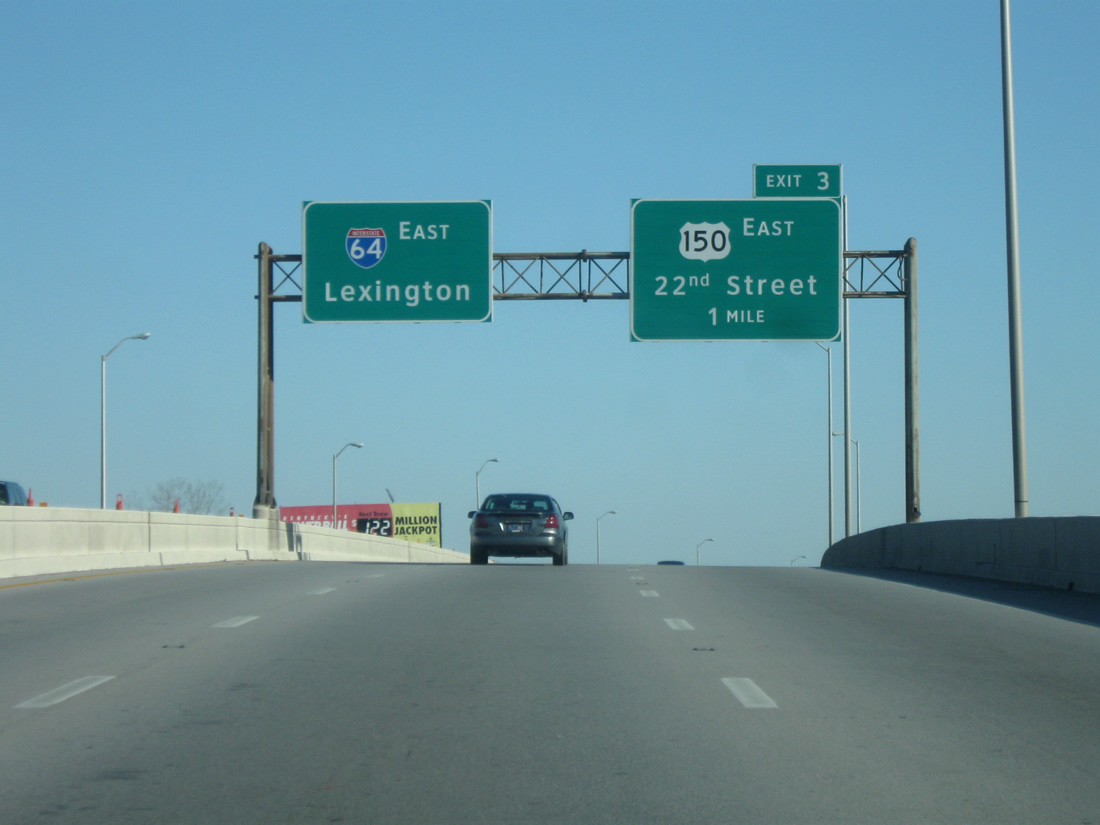
| U.S. 150 nears its split with Interstate 64 east at the Exit 3 trumpet interchange with North 22nd Street. 12/26/09 |
|
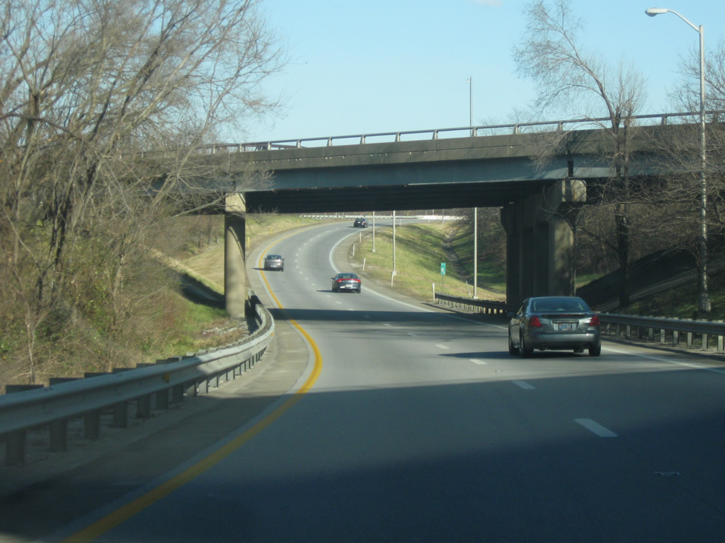
| Interstate 64 travels a viaduct above the McAlpine Locks and Dam area and a Kentucky and Indiana Railroad line. 12/26/09 |
|
| A pedestrian bridge passes over I-64/U.S. 150 between Northwestern Parkway at 23rd Street and Lannan Park along the Ohio River. 12/26/09 |
|
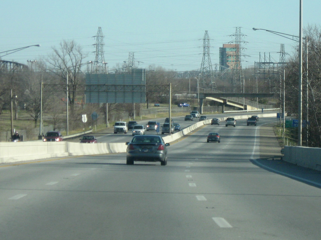
| U.S. 150 east follows 22nd Street southward to Broadway. U.S. 31W and 60 join 22nd Street south from the couplet of Main and Market Streets toward Shively. 12/26/09 |
|
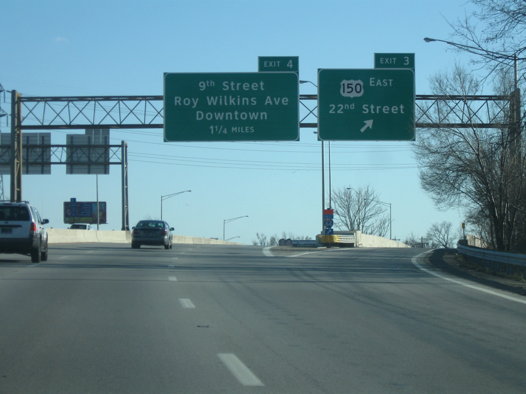
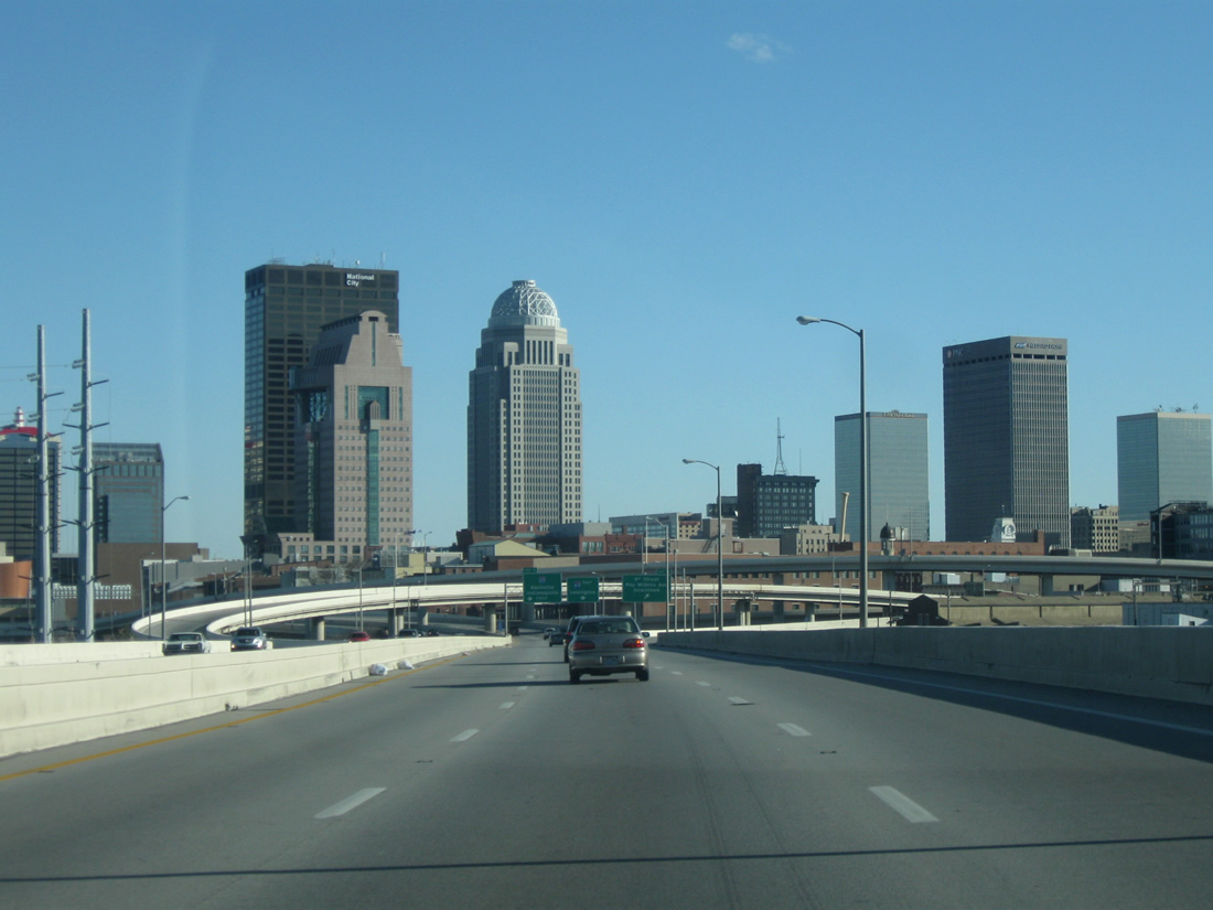
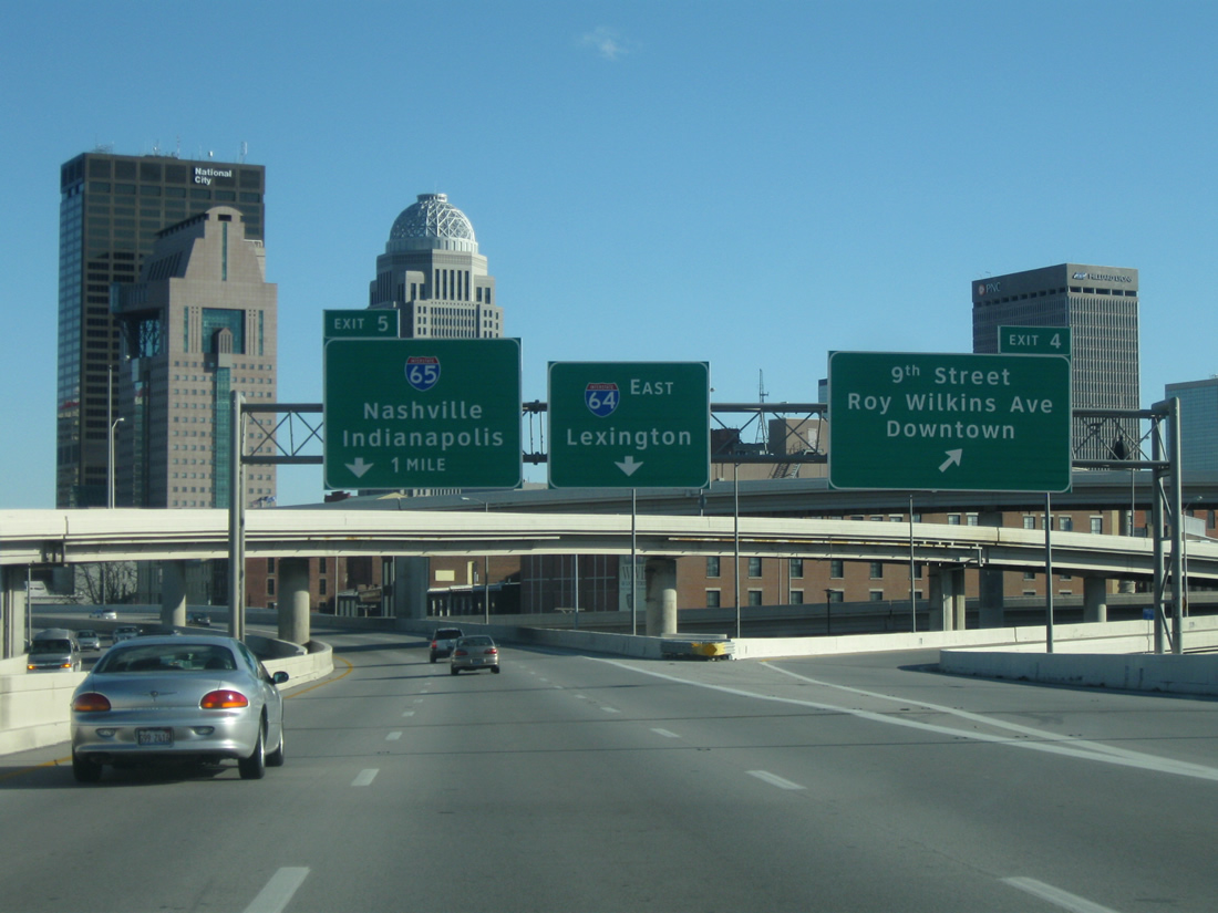
| Exit 4 with 9th Street and Roy Wilkins Avenue provides the main route to downtown Louisville from Interstate 64 east. Exit 5, the Kennedy Interchange, follows with Interstate 65 to the northeast of the central business district. 12/26/09 |
|
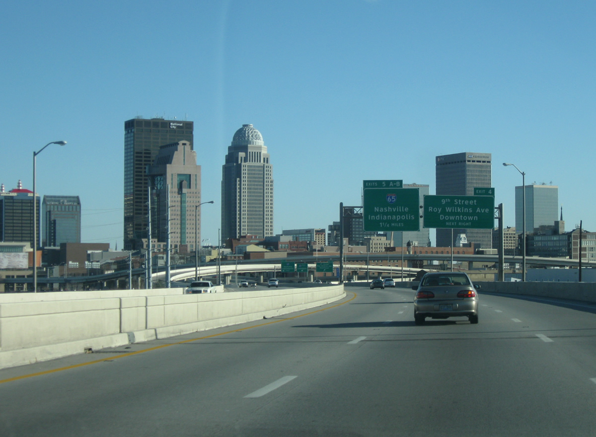
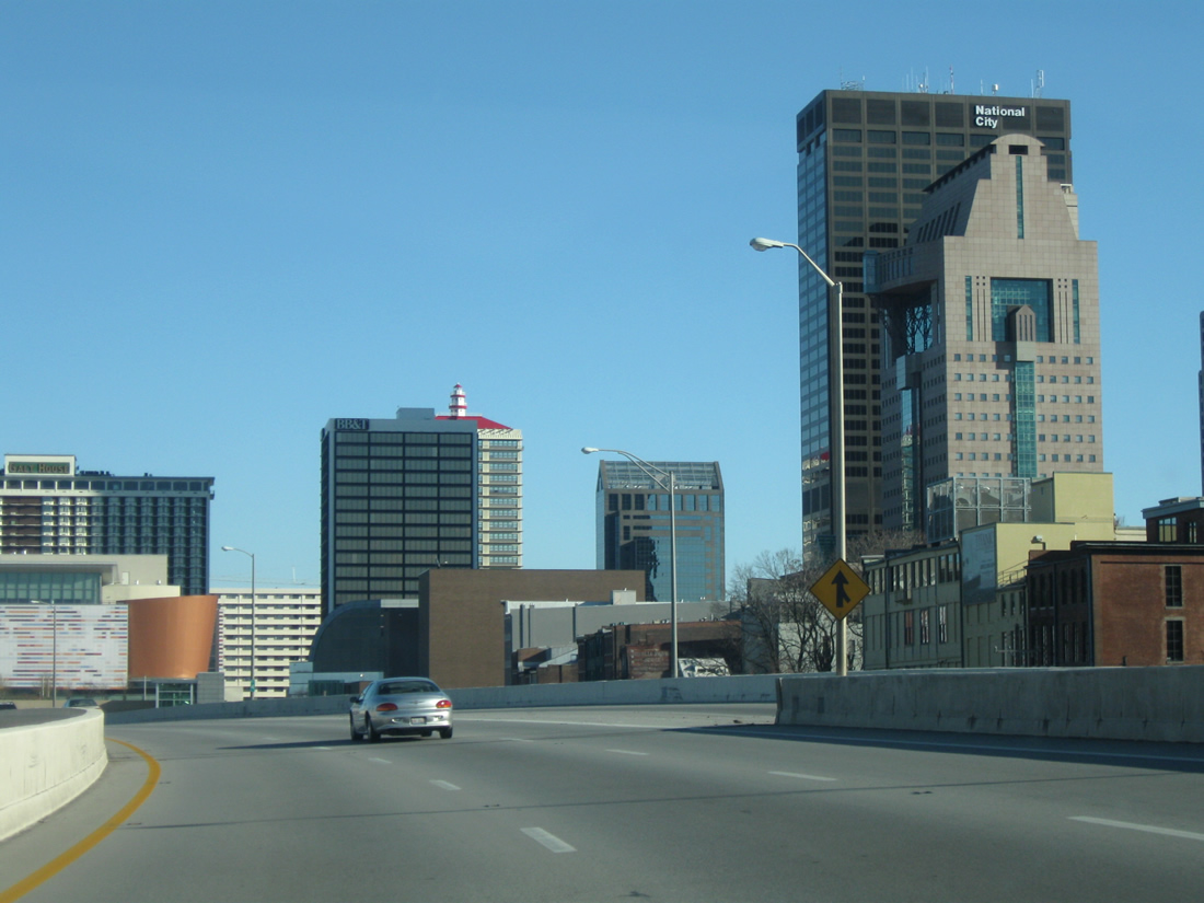
| The skyline of Louisville spreads into view beyond the directional interchange with 9th Street and Roy Wilkins Avenue. Named after King Louis XVI of France, Louisville was incorporated in 1780 and is home to 741,096 per the 2010 census. 12/26/09 |
|
| 9th Street / Roy Wilkins Avenue constitutes a tree-lined boulevard from Exit 4 south to U.S. 150 (Broadway). One mile further east along I-64 is the left side ramp to Interstate 65 north to Indianapolis and south to Nashville. 12/26/09 |
|
| Ramps from Roy Wilkins Avenue north and Main Street (U.S. 31W south / U.S. 60 west) converge ahead of the Interstate 64 eastbound viaduct. The freeway lines the south banks of the Ohio River by downtown Louisville. 12/26/09 |
|
| This view looks eastbound along I-64 in downtown Louisville. The new building on the right is the Muhammad Ali Center. The six story museum and arts center opened in 2005. 06/04/08 |
|
| The George Rogers Clark Memorial Bridge comes into view along Interstate 64 east. The cantilevered truss bridge, opened in 1929, carries U.S. 31 over the Ohio River between downtown Louisville and Jeffersonville, Indiana. 12/26/09 |
|
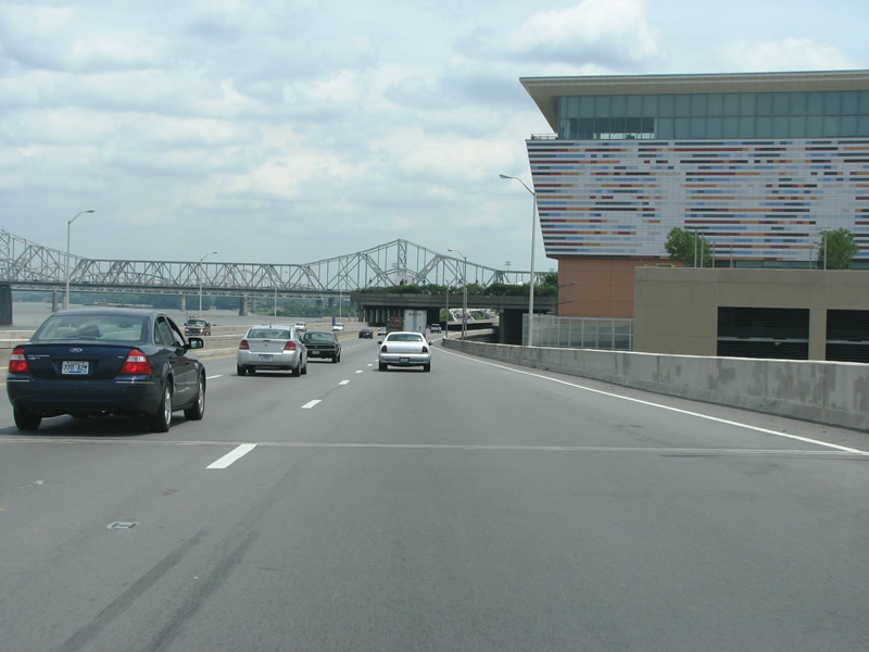
| I-64 heads underneath Riverfront Plaza, which opened in 1973 in an attempt to connect the downtown area to the river. The structure contains a seven acre park and large parking structure. 06/04/08 |
|
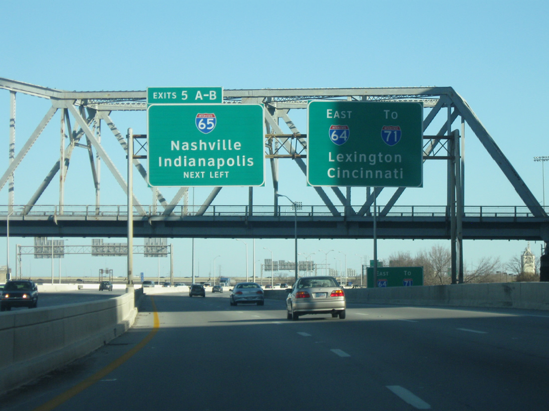
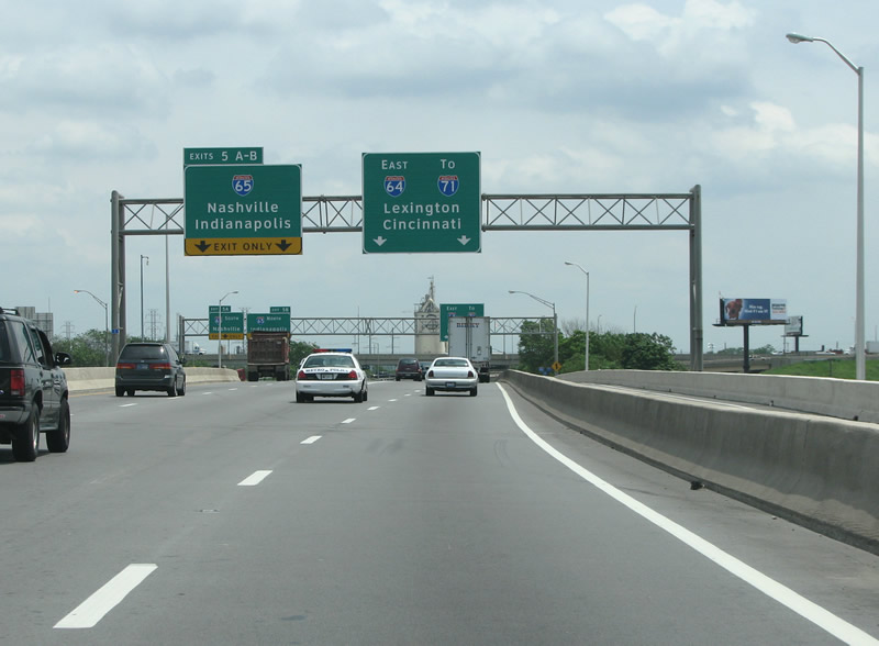
| Beyond Riverfront Plaza, Interstate 64 approaches the directional interchange with Interstate 65. Interstate 65 travels 137 miles in Kentucky, from the Ohio River south to Elizabethtown and Bowling Green. The John F. Kennedy Memorial Bridge spans the Ohio River northward to Jeffersonville, Indiana. The crossing is slated for expansion with the addition of a second, cable-stayed bridge for northbound I-65. Initial land clearing on the project was underway in 2013 with construction expected to run through 2019. 12/26/09 |
|
| The Riverfront Expressway heads into the Kennedy Interchange on the east end of downtown. The interchange and road through here is scheduled for reconstruction, beginning in 2013, with new lanes added here. A vocal group of critics are out to tear down the expressway and replace it with a waterfront boulevard. The left lanes exit to I-65, which runs north/south through Louisville. 06/04/08 |
|
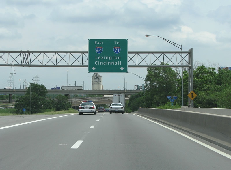
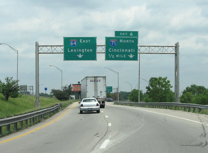
| After the I-65 exit, I-64 prepares to split with I-71, which runs north and east to Ohio. 06/04/08 |
|
| The Kennedy Interchange is locally known as Spaghetti Junction, and during peak travel periods gets backed up in every direction. The interchange opened in the early 60s in conjunction with the adjacent Kennedy Bridge over the Ohio River. 06/04/08, 11/04/09 |
|
| I-71 has its western end here in Louisville, this view looks eastbound towards the split. 06/05/08 |
|
| One lane exits off to the right for motorists heading northeast on I-71. The interstate begins its 343 mile journey north to I-90. On the way it passes through Ohio's three major cities of Cincinnati, Columbus, and Cleveland. 06/05/08 |
|
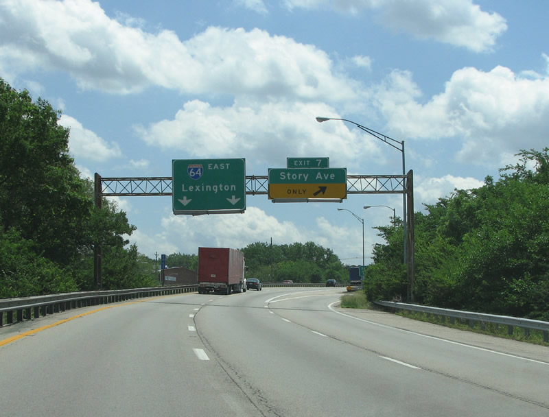
| Just south of the Kennedy Interchange, I-64 hits Story Avenue. Story is a minor street but important in the fact that it carries US 60 and US 42 westbound. The eastbound part of the US highway couplet, Mellwood Avenue, is not directly accessible from this exit. 06/05/08 |
|
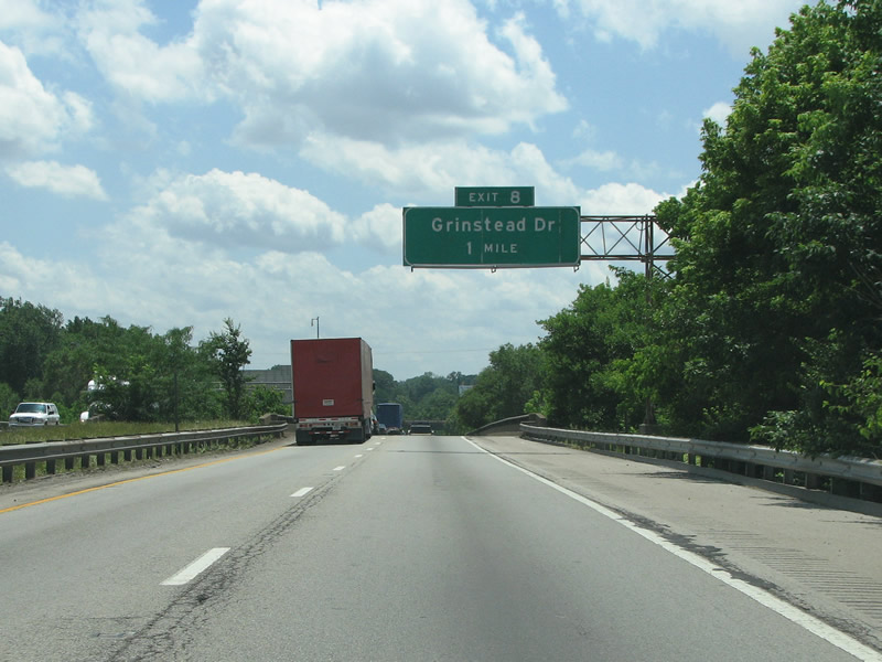
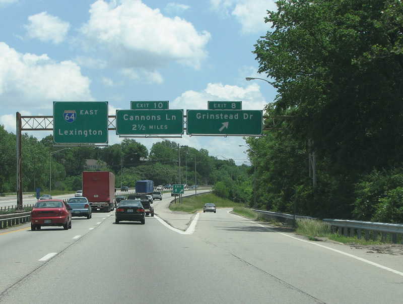
| Grinstead Dr is the next exit along the freeway eastbound. 06/05/08 |
|
| Although it is not signed here, Grinstead forms part of Alt US 60. The road is relatively minor but connects to other major routes. 06/05/08 |
|
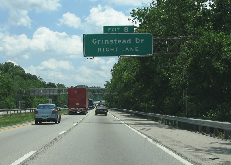
| There is no trace of the adjacent residential areas, and the beautiful Cherokee Triangle neighborhood just south of the freeway here. The area is known for its annual art fair and funky architecture. Grinstead exits here in a diamond interchange. 06/05/08 |
|
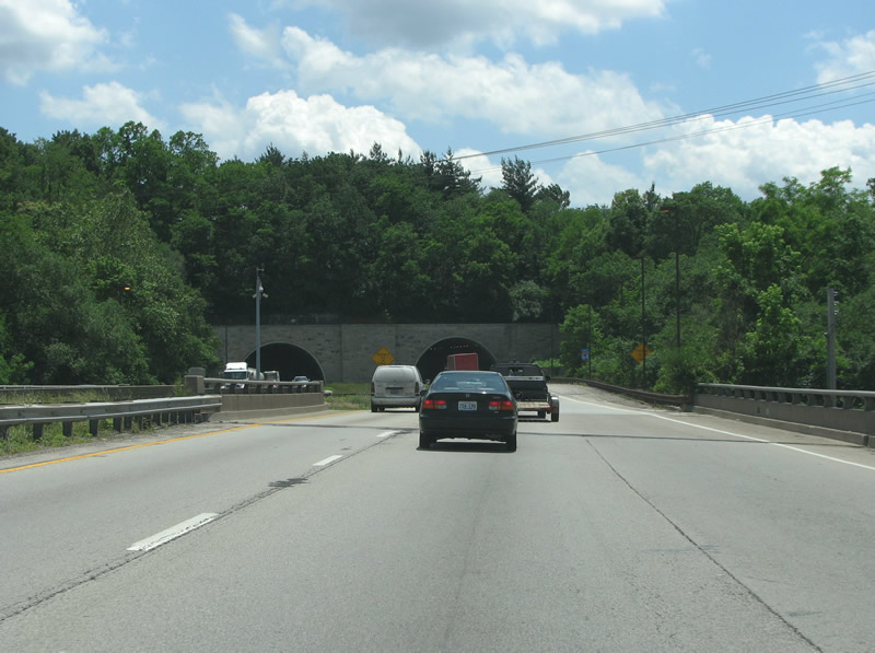
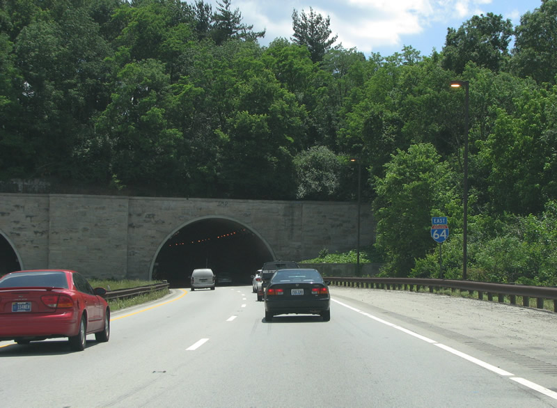
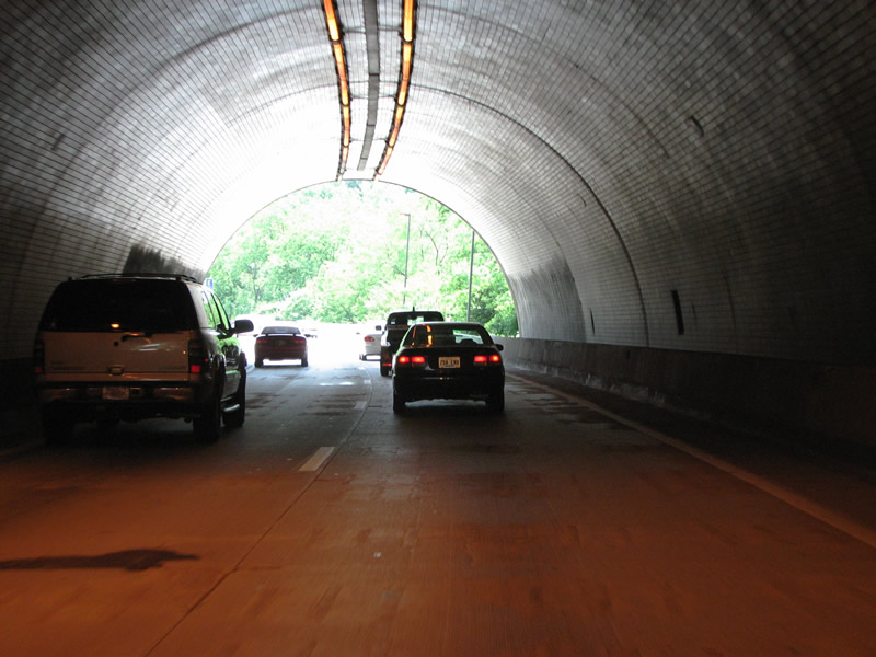
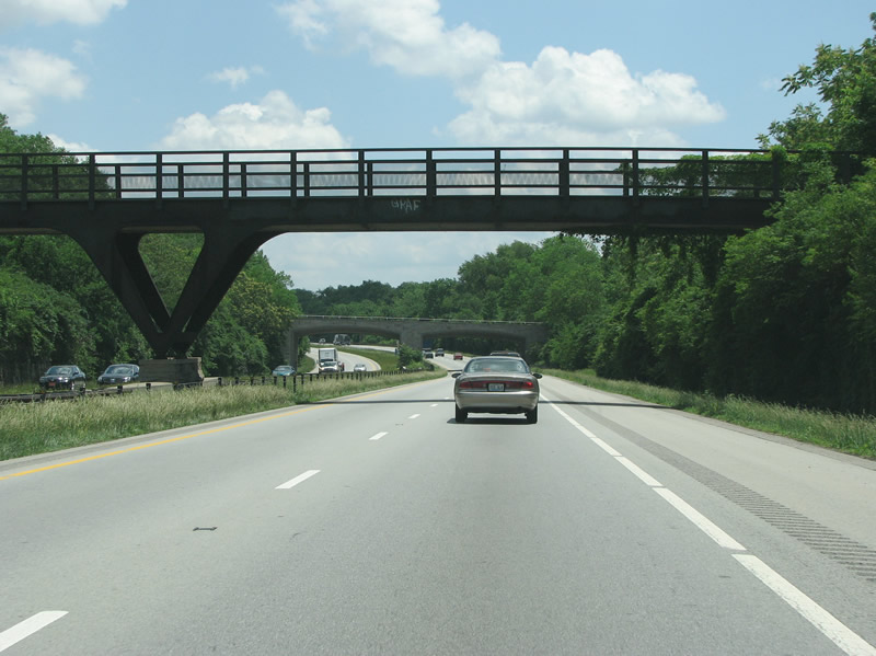
| The Cherokee Park tunnels opened in 1970 and take I-64 under Cherokee Park. The park, designed by famous landscape architect Frederick Law Olmstead, is an oasis of green in central Louisville. The tunnels were repaved in 2006, and talk was made of painting a mural in them but was determined to be too much of a distraction to drivers. The two lane tunnels also mean that widening the freeway here would be very difficult. 06/05/08 |
|
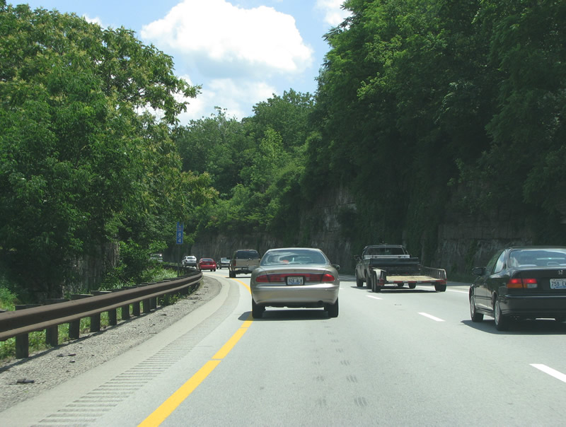
| The freeway continues through Cherokee Park with rock cuts. The 409 acre park was severely damaged in a 1974 F4 tornado. So many mature trees were damaged that 2,500 new ones had to be planted. 06/05/08 |
|
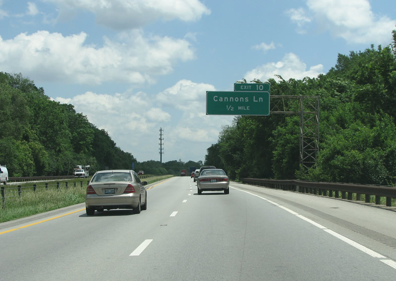
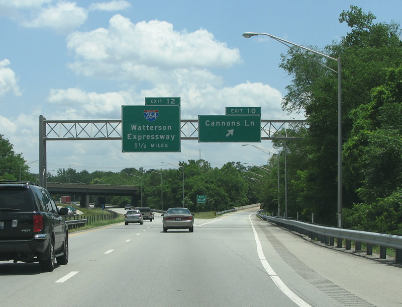
| Cannons Lane is the next exit two miles past Grinstead. The road is KY 2048 but no mention is made of the designation along I-64. In fact, in central Louisville, there are no shields for adjoining route numbers. 06/05/08 |
|
| Cannons Lane is a minor street on the east side of town. Bowman Field airport is immediately to the south of here. It is one of the oldest continuously operating airfields in North America, and opened right after WW2. 06/05/08 |
|
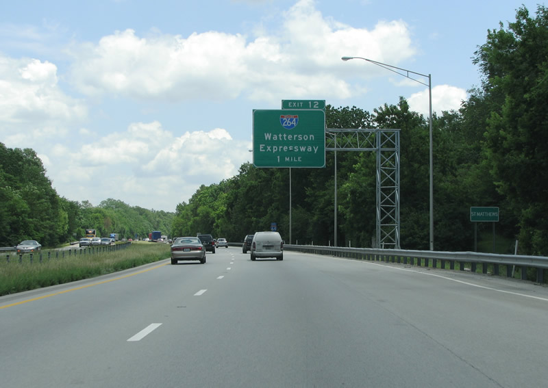
| The first mention of I-264 is here, right after Cannons Lane. The exits through here are about two miles a part. I-64 enters the upscale suburb of St. Mathews here as well. 06/05/08 |
|
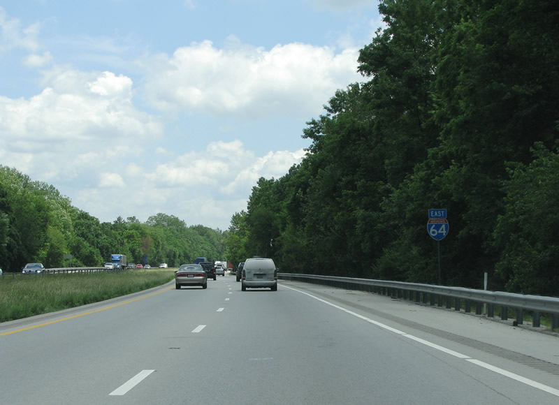
| An eastbound I-64 reassurance marker in St. Mathews. 06/05/08 |
|
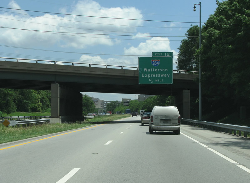
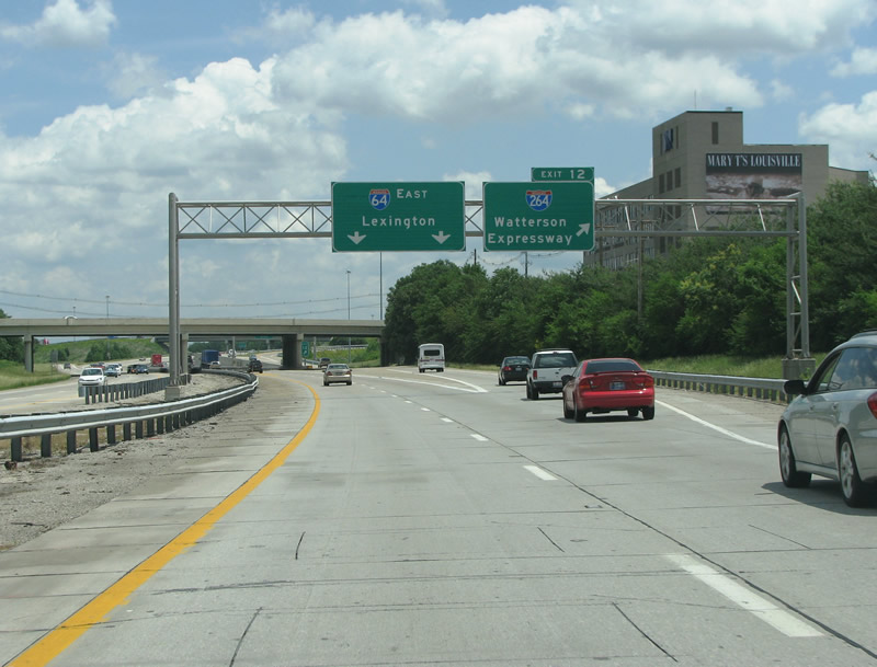
| I-264 is signed only as the Watterson Expressway, without control points. The road is almost exclusively known by its name rather than its interstate designation. 06/05/08 |
|
| With the North Suburban Hospital to the right, I-264 leaves I-64 on the right hand side. 06/05/08 |
|
| The I-264/64 interchange, built in 1969, is a modified cloverleaf with a direct connection ramp from west to south. 06/05/08 |
|
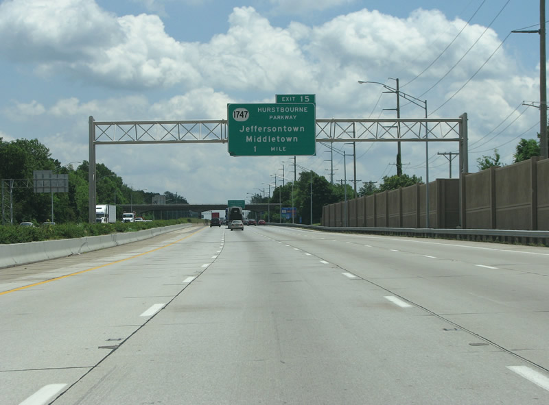
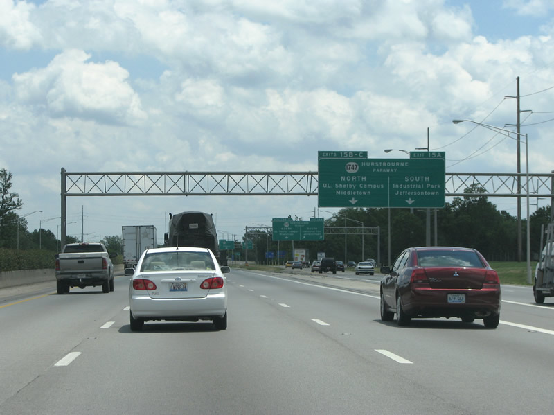
| Exit 15, the first one outside of the Watterson connects I-64 with Hurstbourne Parkway, the most important arterial on the east side of town. 06/05/08 |
|
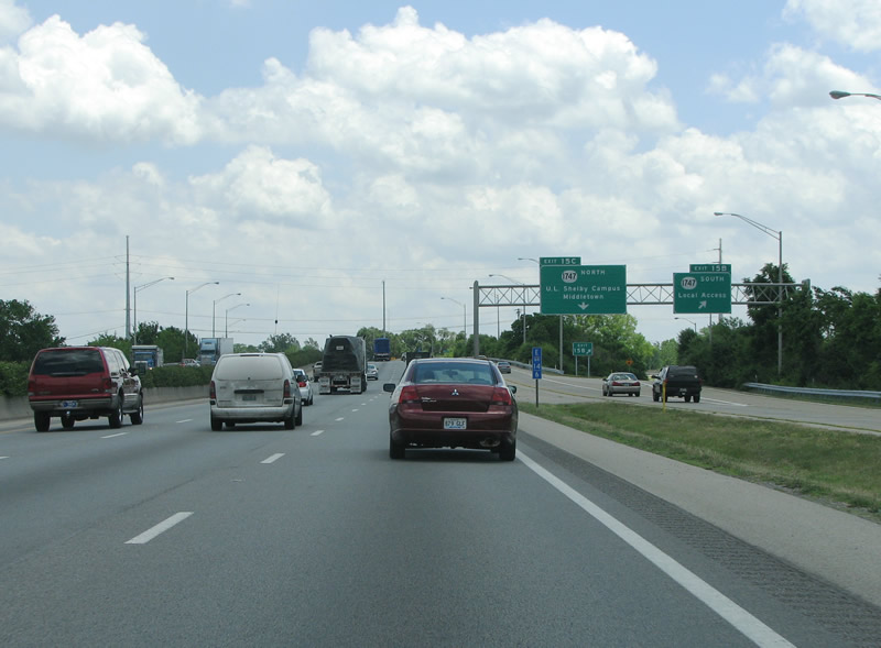
| The road gets a few more lanes here, and maintains three of them in each direction east of the Watterson Expressway. 06/05/08 |
|
| Hurstbourne Parkway contains many of Louisville's important suburban employers. Jeffersontown and Middletown are two of the city's wealthier suburbs, and both were founded in 1797. 06/05/08 |
|
| The parclo interchange at Hurstbourne Parkway has ramps that are separated from the mainline of the freeway. There are actually two ramps for southbound Hurstbourne, with one connecting to Bluegrass Parkway. This interchange is one of the busiest freeway-to-arterial junctions in Kentucky. 06/05/08 |
|
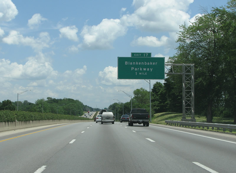
| The first interchange east of the very busy Hurstbourne is at Blankenbaker Parkway - this one is also a parclo. 06/05/08 |
|
| The interstate gets an extra lane as it nears Blankenbaker. The road was named after a prominent early settler family. 06/05/08 |
|
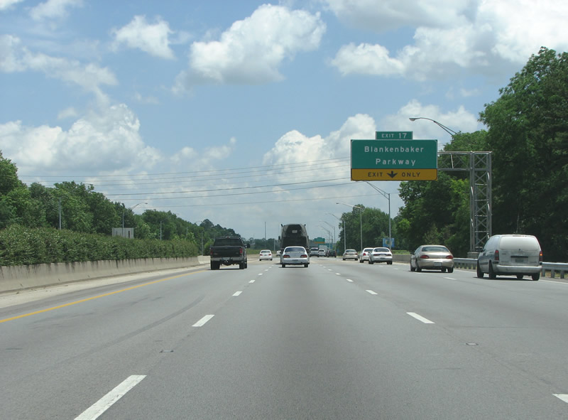
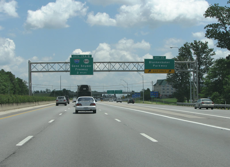
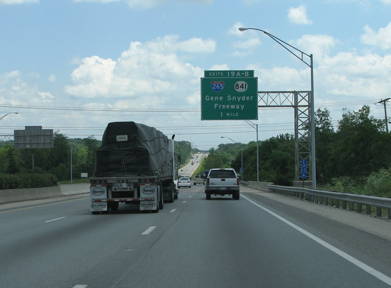
| The first mention of the city's outer loop, the Gene Snyder Freeway, sits here at the Blankenbaker exit. 06/05/08 |
|
| I-64 is a six lane freeway with a planted center divider as it nears Gene Snyder. 06/05/08 |
|
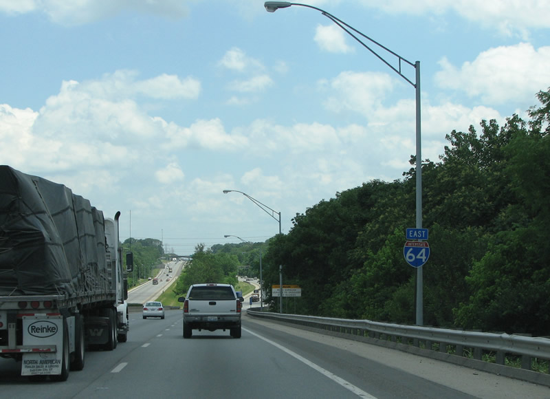
| The interstate gets a bit more rural as it leaves the Jeffersontown area here. This view looks eastbound at an I-64 reassurance marker. 06/05/08 |
|
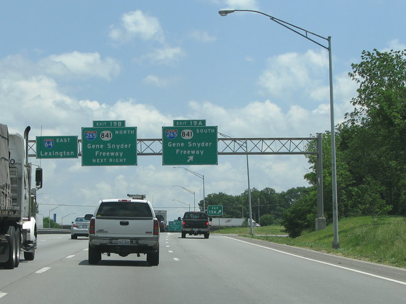
| Like the Watterson, I-265 has its name as a control point. The freeway is always signed with its state pairing, KY 841. 06/05/08 |
|
| Like I-264, I-64 meets another interstate here with a cloverleaf. This junction was built in the late 1970s and has not been upgraded since. 06/05/08 |
|
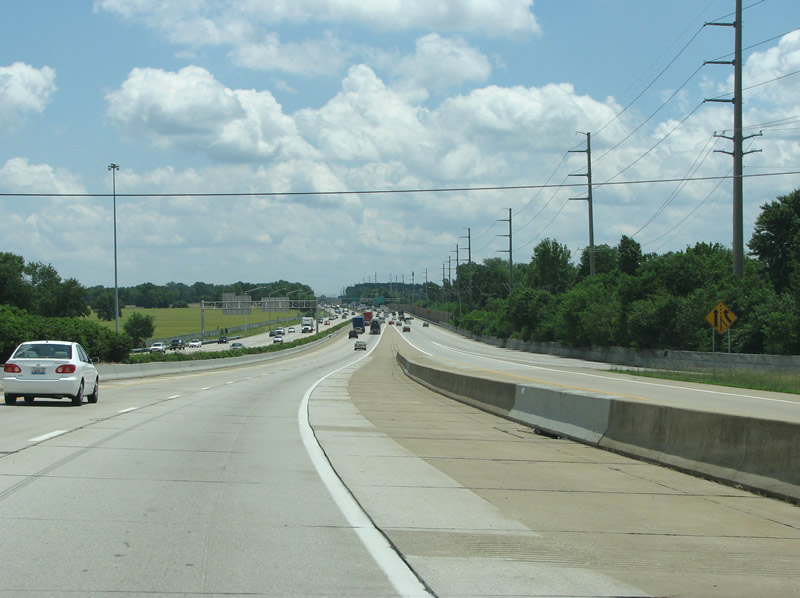
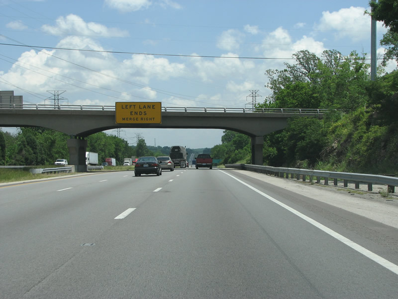
| I-64 originally lost its third lane beyond I-265/KY 841. Widening in 2010 expanded the freeway to six lanes as it leaves the urbanised portion of Louisville and moves into more rural territory. 06/05/08 |
|
| There are not many exits on this stretch in eastern Jefferson County - in fact it is nine miles to the next one after the Gene Snyder Freeway. 06/05/08 |
|
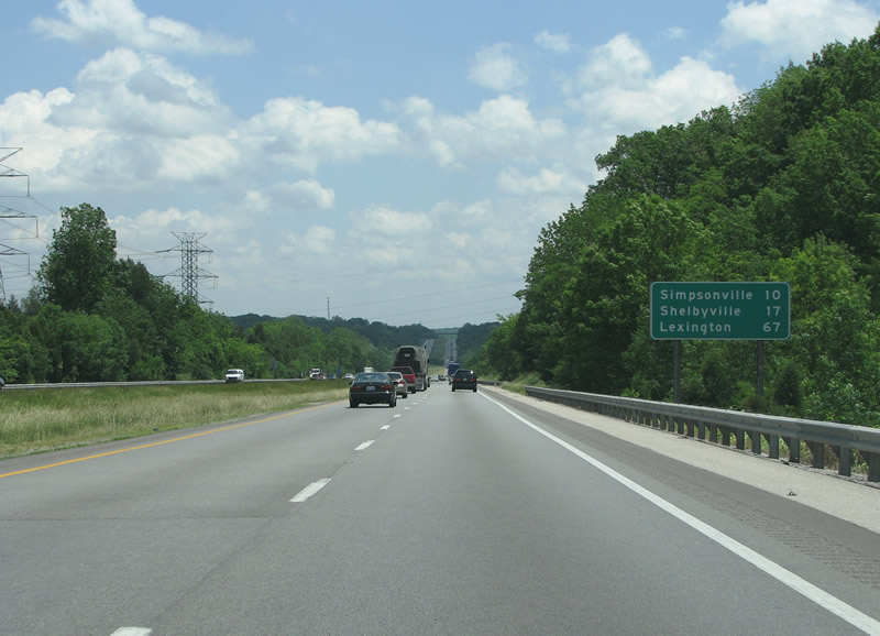
| Shelby County is entered a bit after the last exit. The county was founded in 1792 and named after Isaac Shelby, the first governor of the state. 06/05/08 |
|
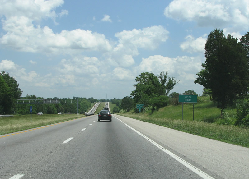
| A look at Interstate 64 widening as the freeway enters Shelby County. 10/01/10 |
Page Updated 02-24-2013.


 East
East