|
| Lowering from the Fred Schwengel Memorial Bridge into the city of Le Claire along Interstate 80 west. The Mississippi River bridge from Illinois opened on October 27, 1966. 09/04/05 |
|
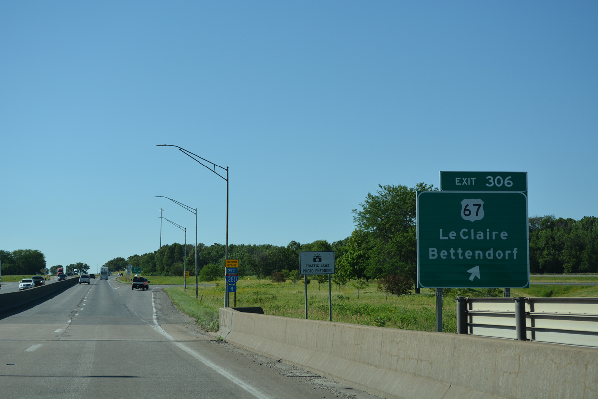
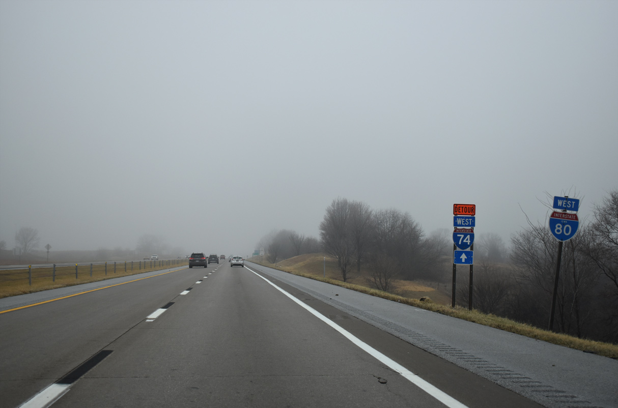
| A folded diamond interchange (Exit 306) ties the north end of the Fred Schwengel Memorial Bridge with U.S. 67 (Cody Road) at Le Claire. U.S. 67 travels 67 miles in Iowa, from the Centennial Bridge between Rock Island, Illinois and Downtown Davenport, northeast along the Mississippi River to Sabula. 06/20/22 |
|
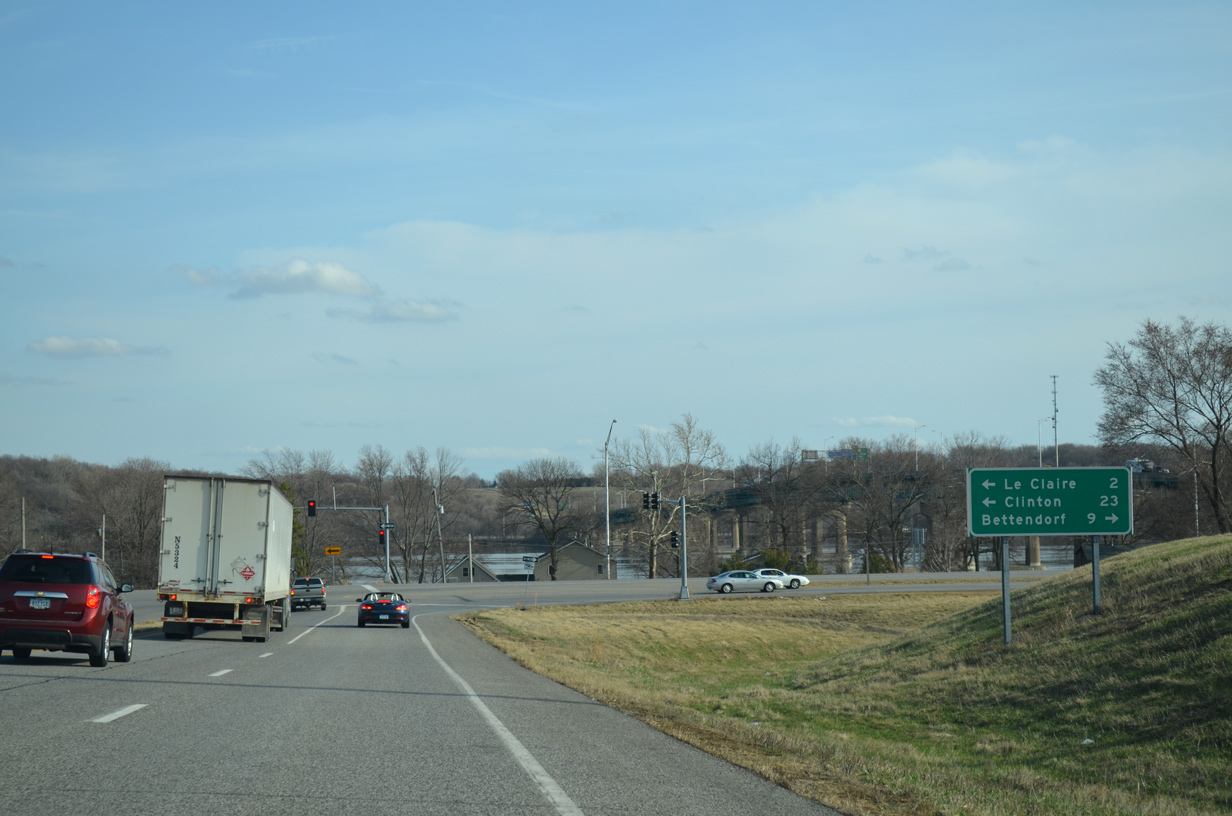
| U.S. 67 doubles as a Great River Road west nine miles to the Bettendorf Riverfront and north through Le Claire to Clinton and U.S. 30. 04/08/13 |
|
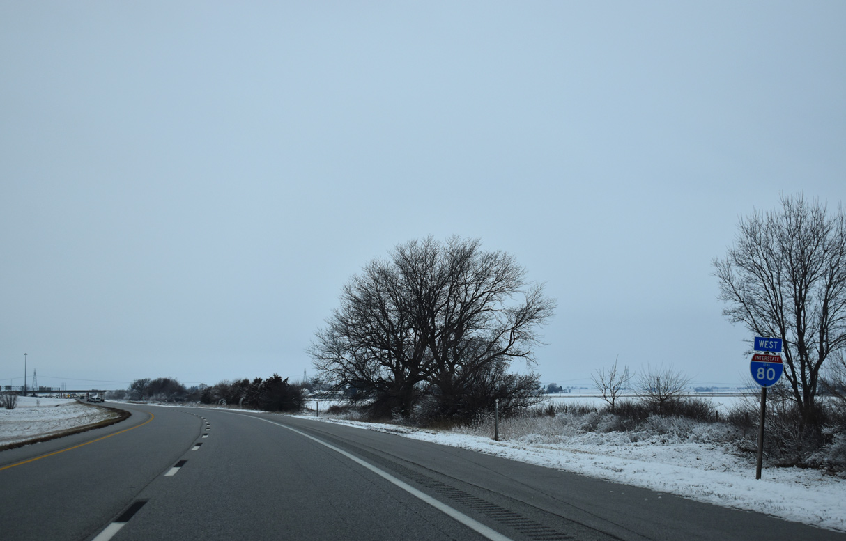
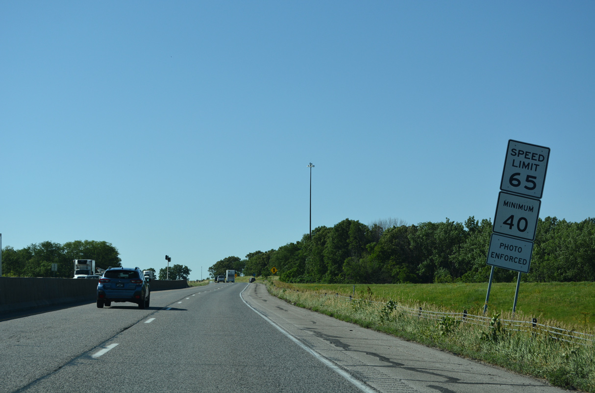
| The city of LeClaire utilizes photo speed enforcement. I-80 travels within the city limits until the SW 35th Street overpass. 06/20/22 |
|
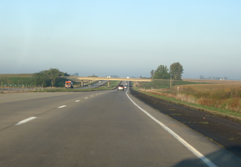
| Interstate 80 climbs onto the bluffs north of the Mississippi River. The first confirming marker for I-80 west in Iowa was removed after 2019. 12/23/19 |
|
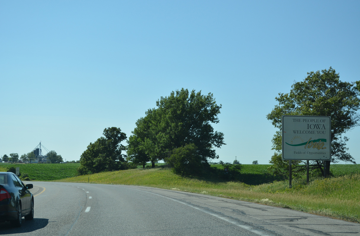
| Interstate 80 curves west by the Iowa welcome sign ahead of the northern reaches of Bettendorf. 06/20/22 |
|
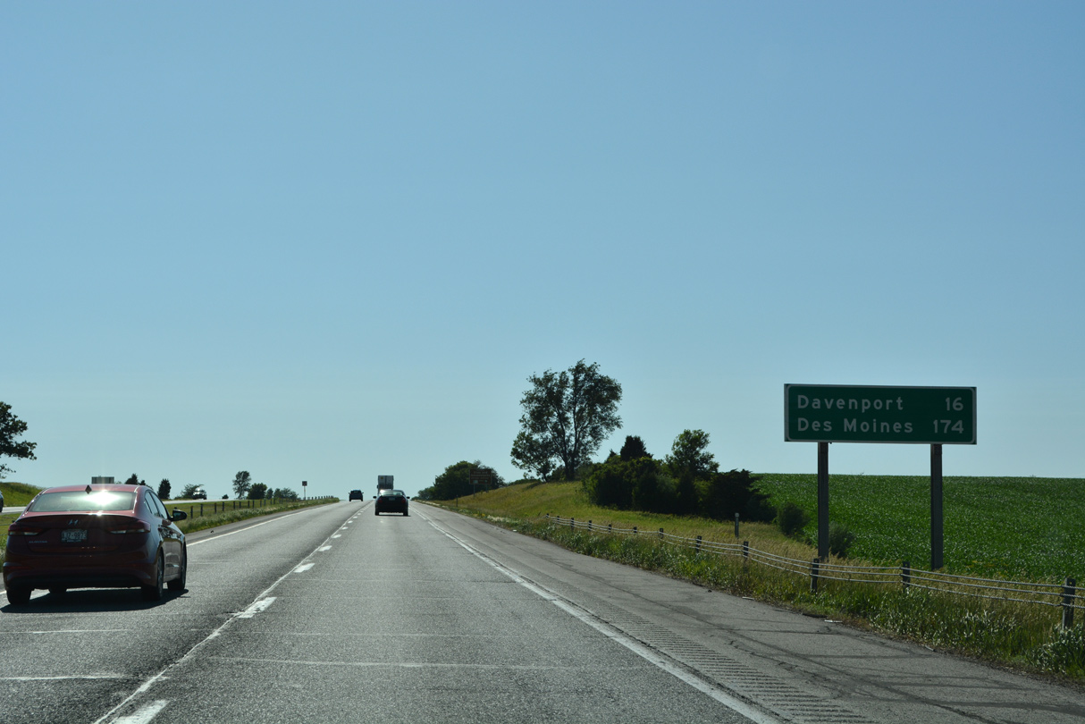
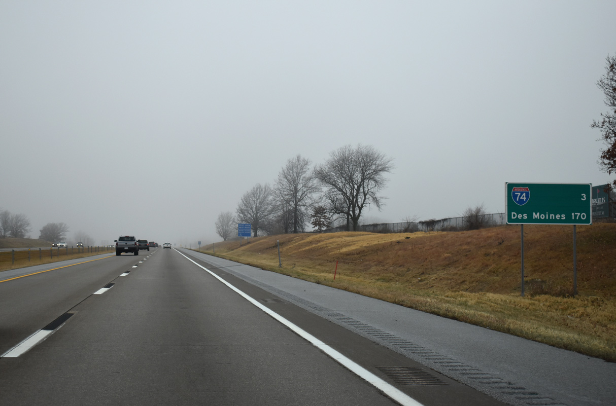
| Downtown Davenport is a 16 mile drive from Interstate 80 at Le Claire via U.S. 61 Business south. Des Moines is 174 miles from this point. 06/20/22 |
|
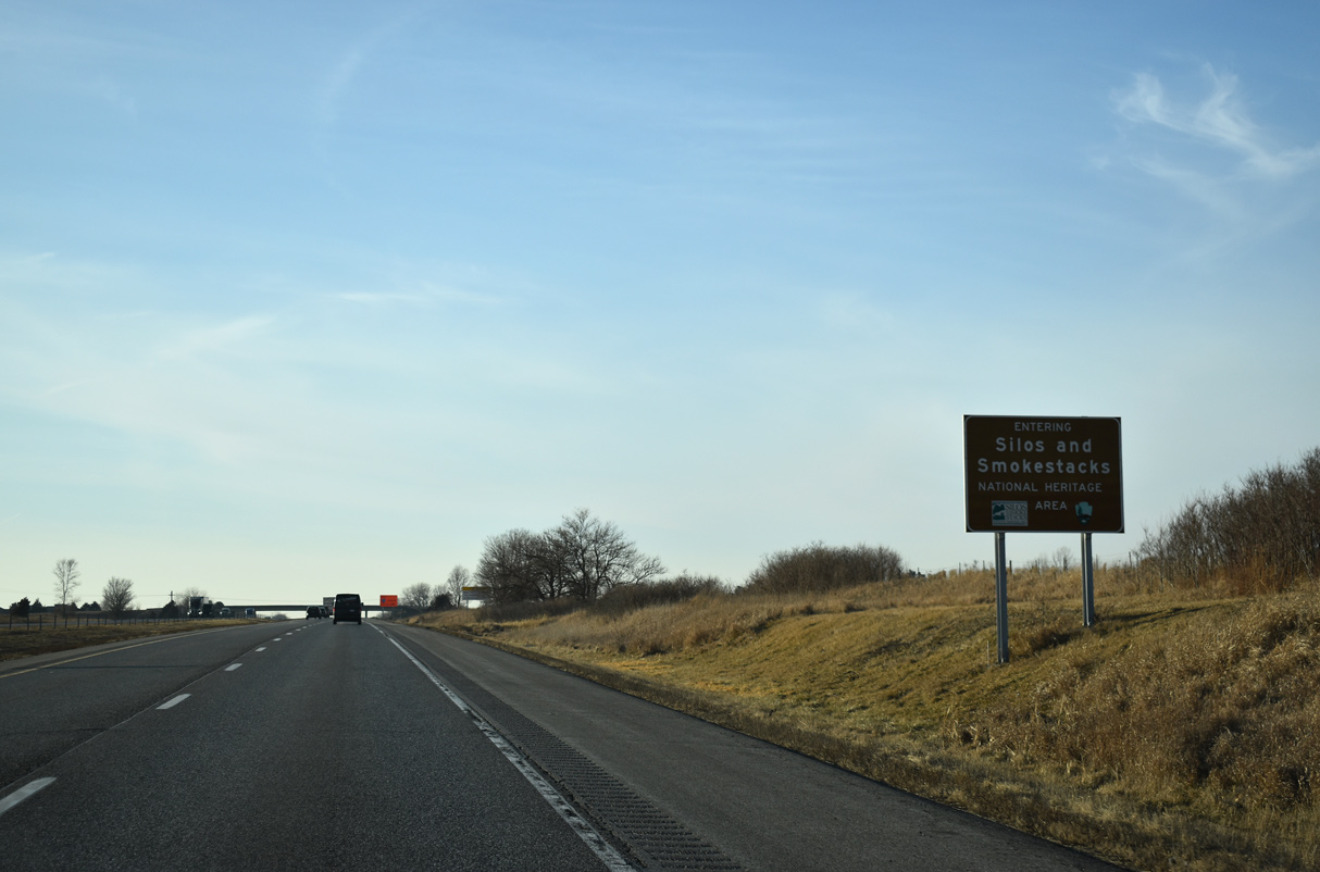
| The Silos and Smokestacks National Heritage Area spreads across a swath of 37 counties in northeastern Iowa. Affiliated with the National Park Service, the area includes a number of sites, programs and events celebrating the history of agriculture in America.1 12/23/19 |
|
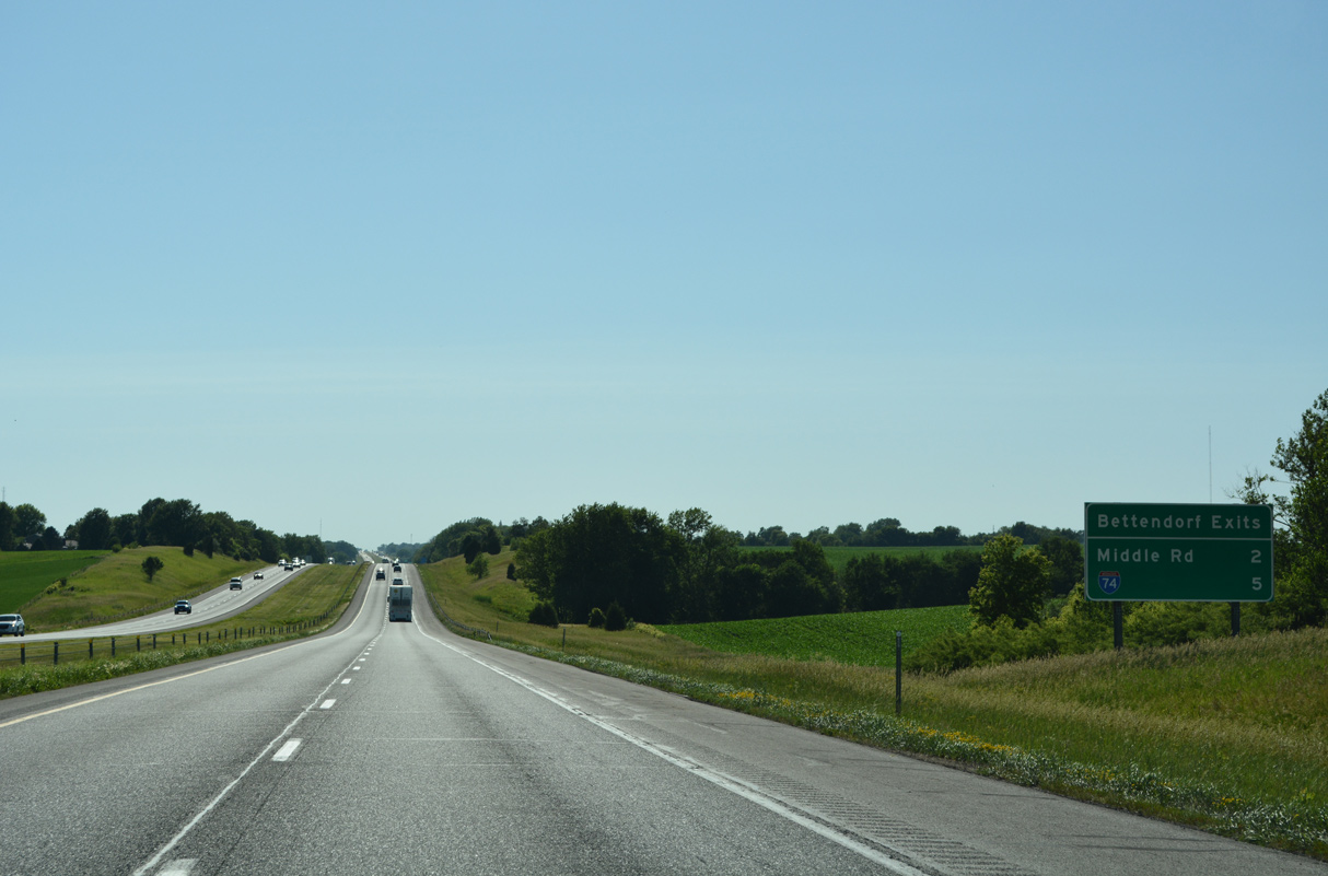
| Two interchanges serve the city of Bettendorf from Interstate 80 west over the next five miles. South from I-80, I-74 has four exits for the city of nearly 40,000. 06/20/22 |
|
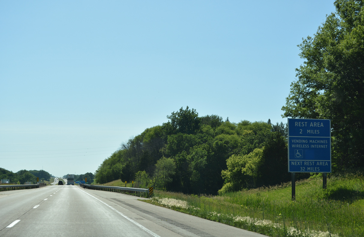
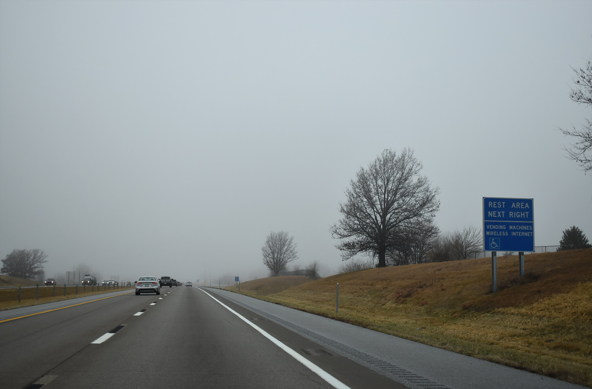
| The Davenport Rest Areas is the first of ten facilities along Interstate 80 across Iowa. The freeway enters the Bettendorf city limits west of the Wells Ferry Road underpass. 06/20/22 |
|
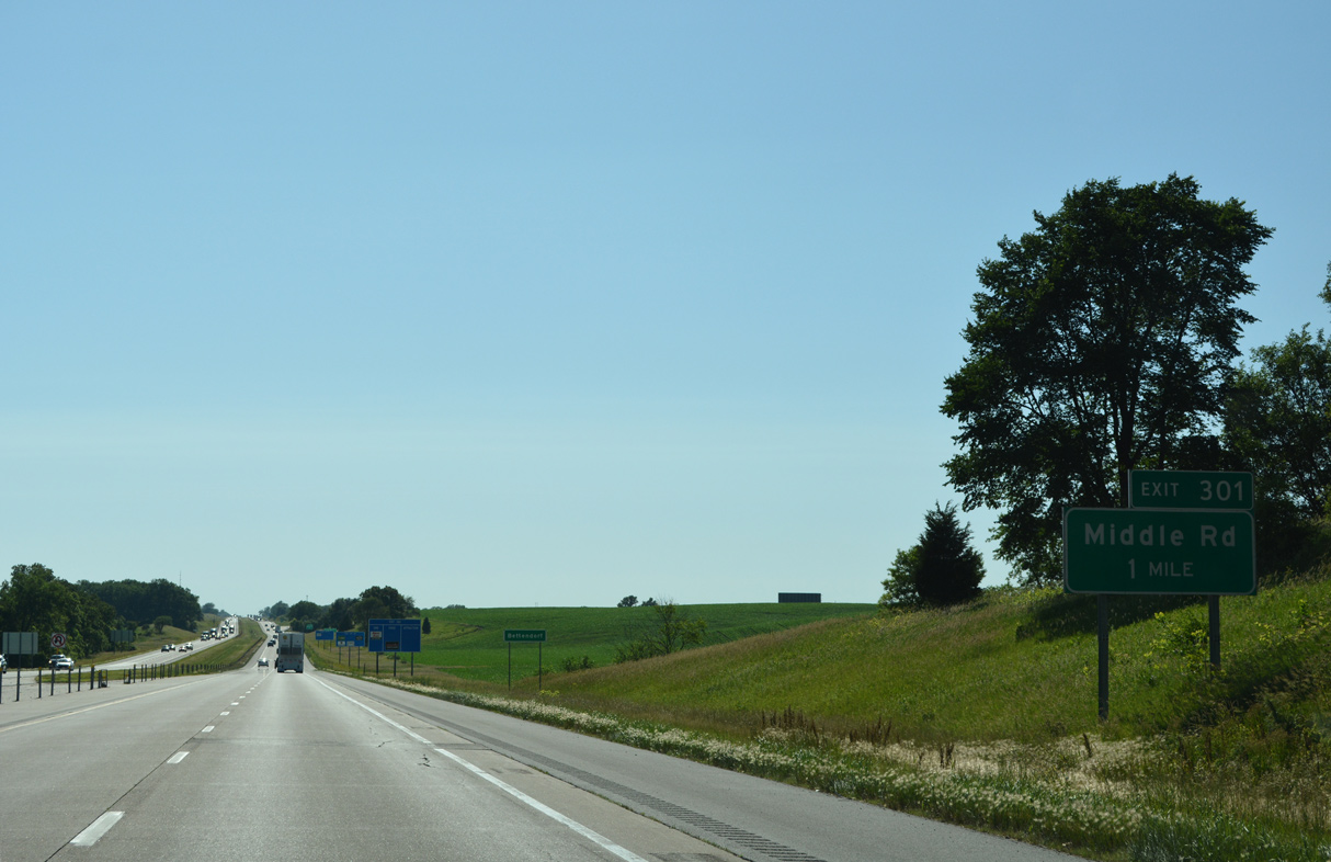
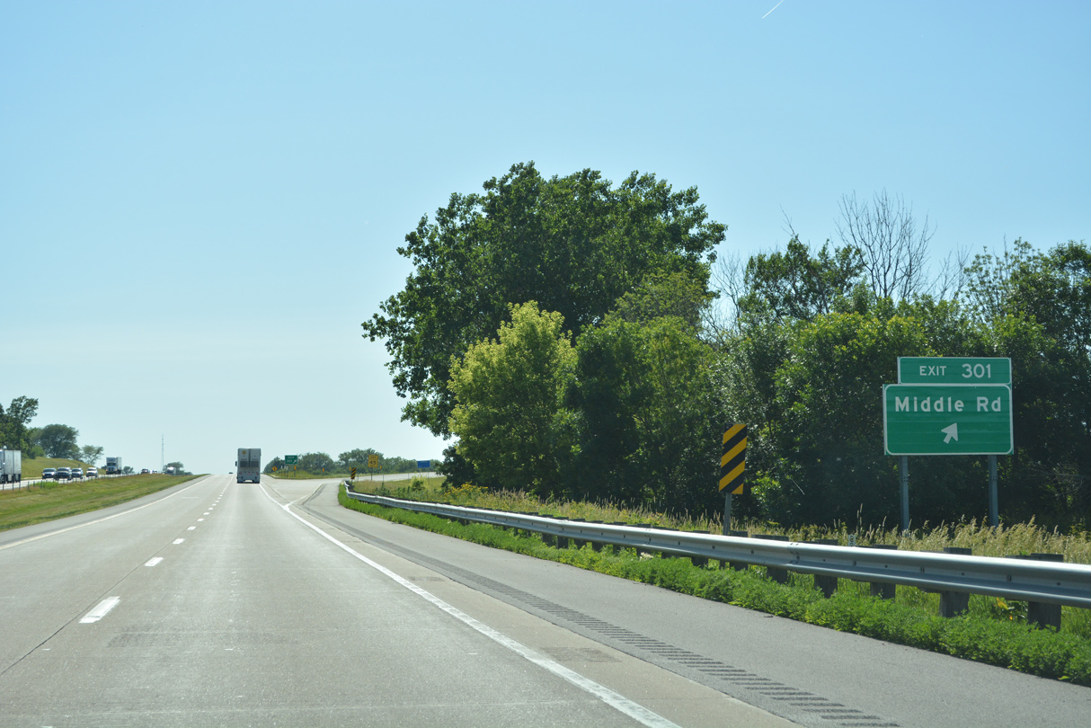
| Beginning at parallel Indiana Avenue, just north of Exit 301, Middle Road leads southwest into suburban areas of Bettendorf. 06/20/22 |
|
| Interstate 80 crosses Spencer Creek ahead of the parclo A2 interchange (Exit 301) with Middle Road. 06/20/22 |
|
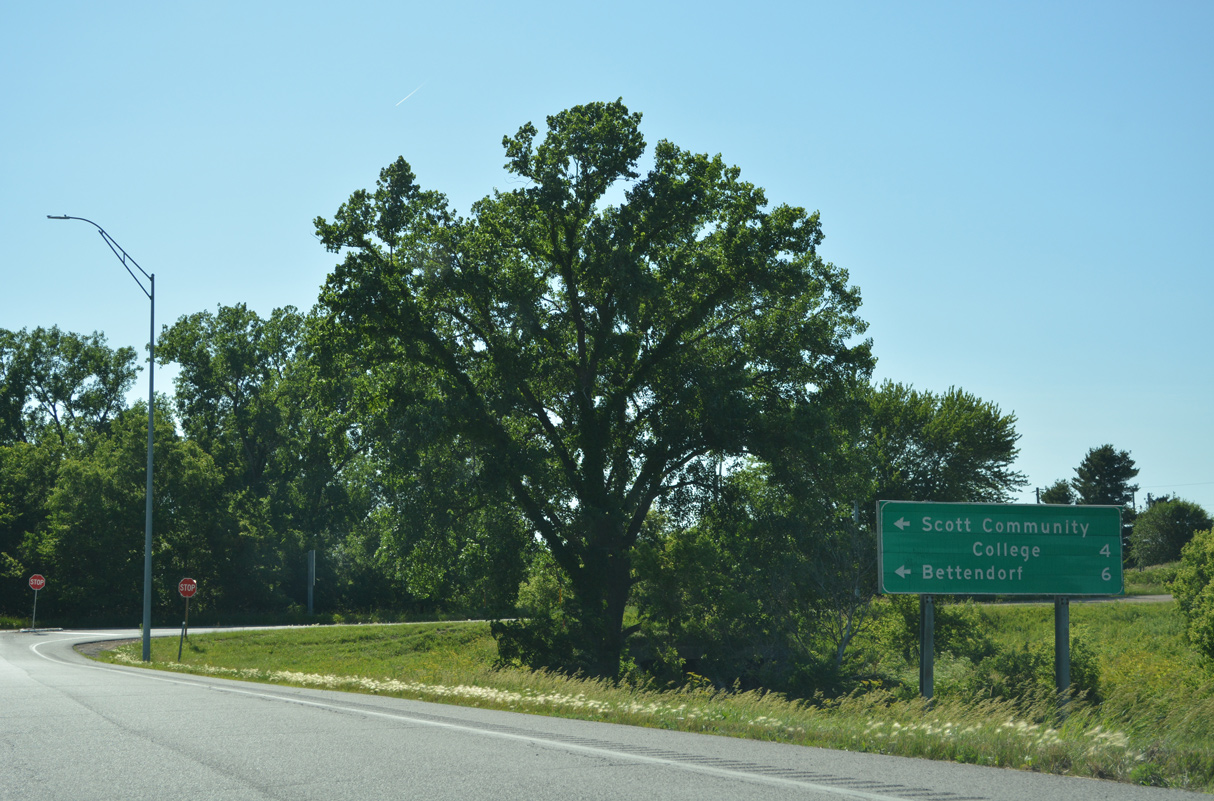
| Middle Road arcs southwest through Bettendorf to Interstate 74 at Exit 3 and Locust Street at the Davenport city line. Belmont Road leads motorists east from Middle Road to Scott County Community College in 3.4 miles. 06/20/22 |
|
| Interstate 80 parallels Spencer Creek ahead of Hidden Hills Golf Course in north Bettendorf. 12/23/23 |
|
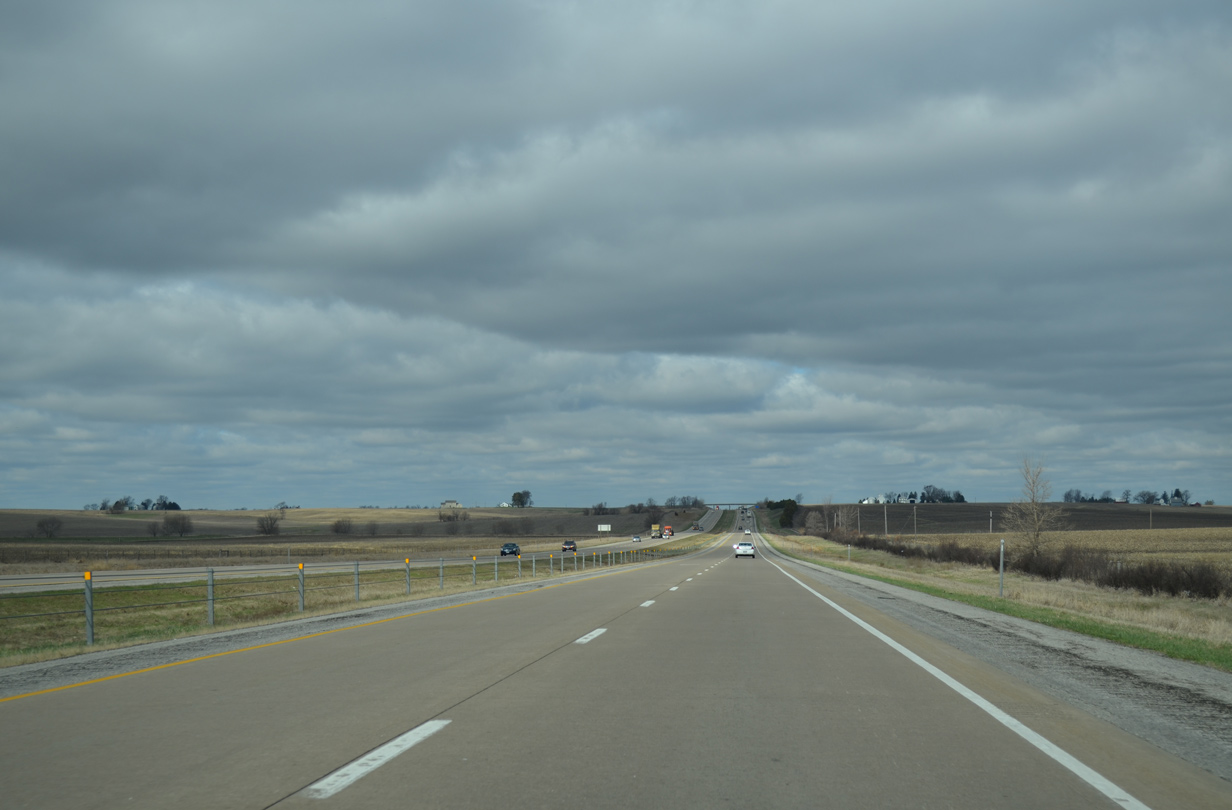
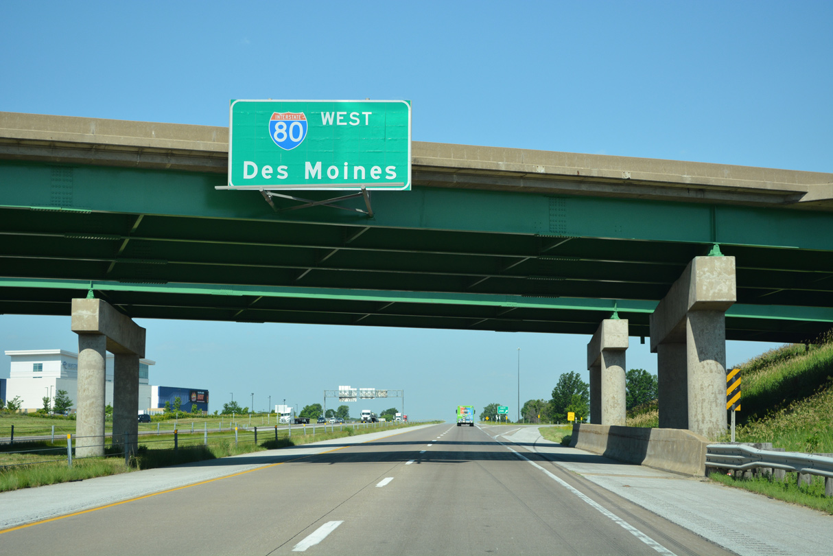
| The succeeding exit along I-80 westbound is the west end of Interstate 74 in three miles. Des Moines is another 167 miles from the first exchange in Davenport. 12/23/23 |
|
| The Davenport Rest Areas line Interstate 80 just inside the Bettendorf city limits. The next westbound facility is after Exit 271 in Cedar County. 12/23/23 |
|
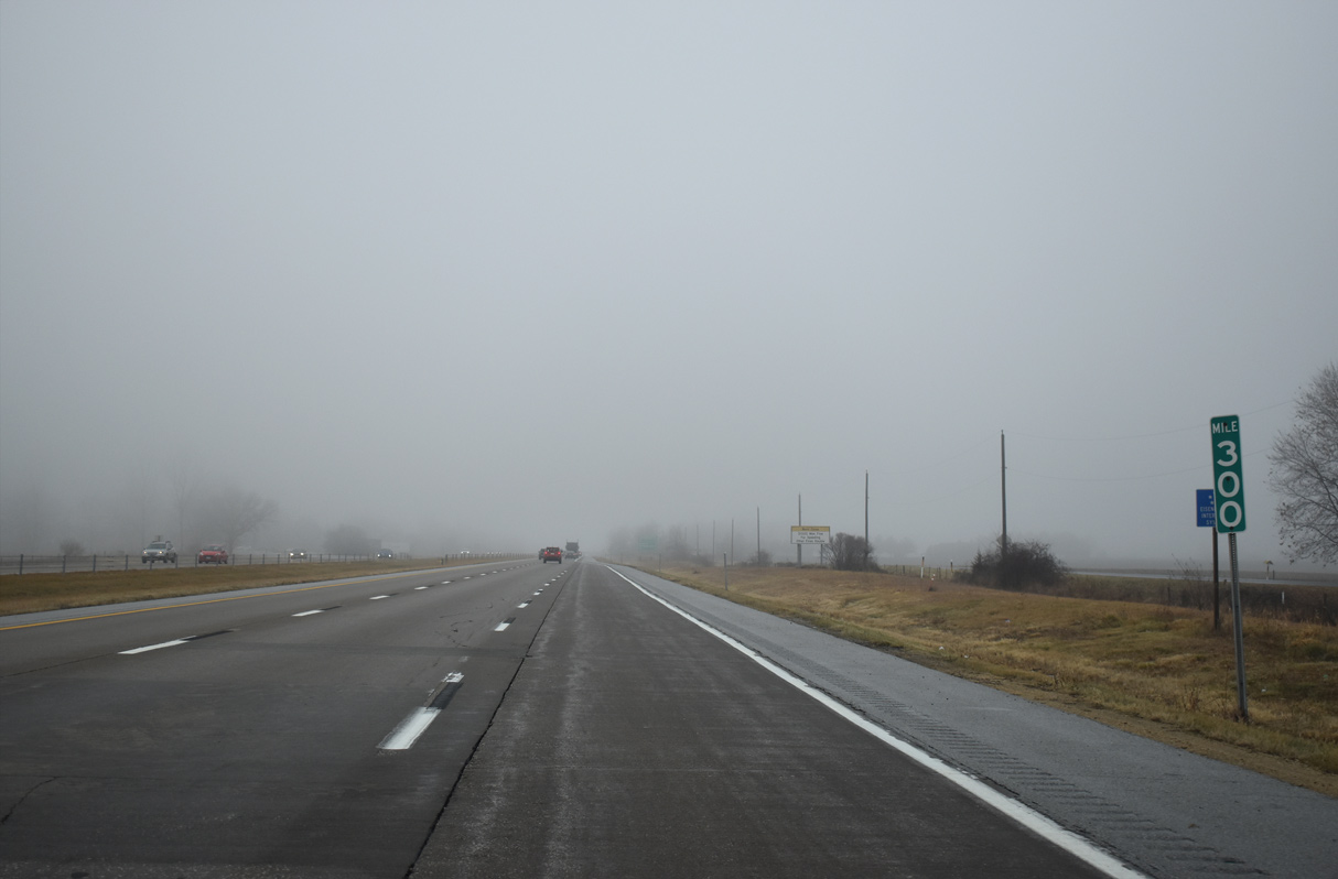
| 76th Avenue parallels Interstate 80 west from Devils Glen Road by mile marker 300. 12/23/23 |
|
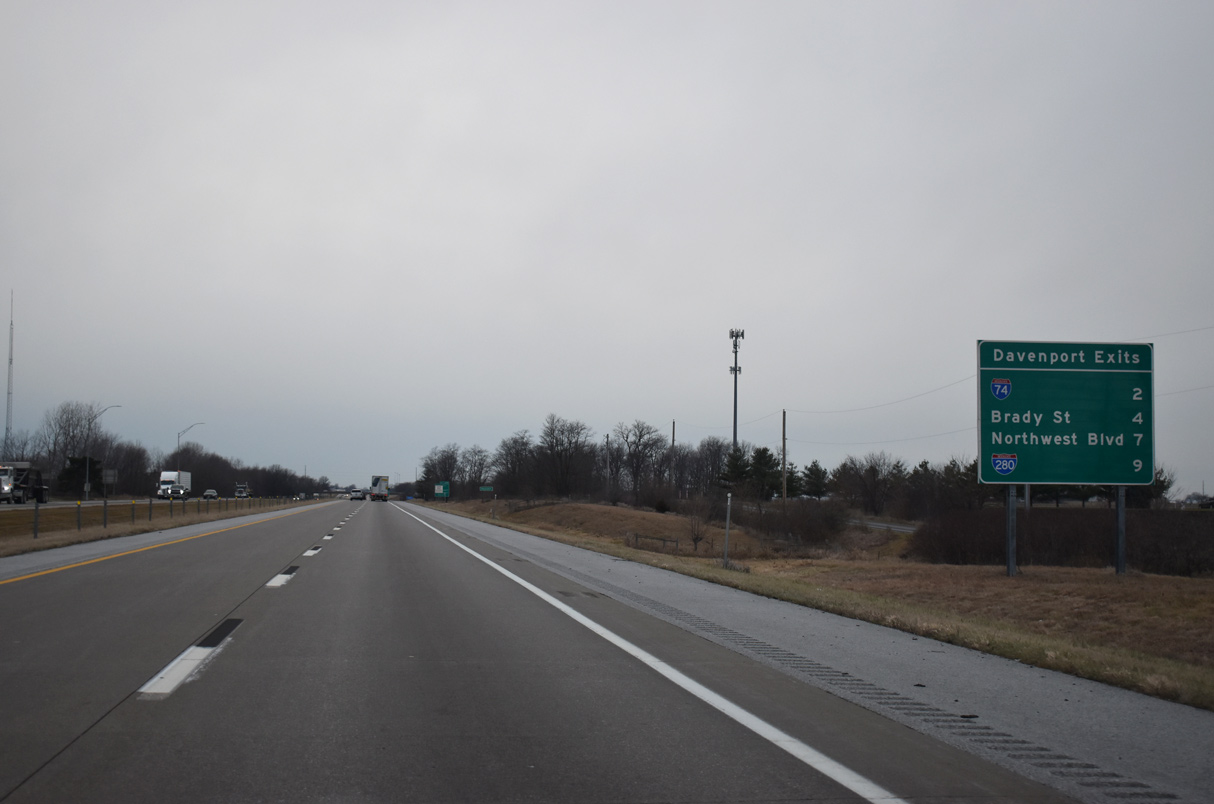
| U.S. 61 south and U.S. 61 Business north meet I-74 at Brady Street in four miles. Iowa 130 branches northwest from Davenport in seven miles. Interstate 280, like I-74, has four exits in the largest of the Quad Cities. 12/26/23 |
|
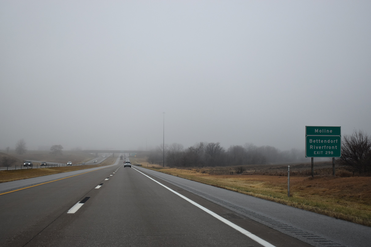
| Interstate 74 leads five miles south from Exit 298 to the Mississippi River Bridge into Moline, Illinois. 12/23/23 |
|
| Interstate 74 travels 428 miles overall between the Quad Cities and Cincinnati, Ohio. The freeway joins Moline, Illinois with Peoria and Bloomington to the southeast. Additional portions of Interstate 74 are signed in North Carolina, but those are independent from the original I-74 in Ohio. 12/23/23 |
|
| Interstate 74 separates Davenport and Bettendorf south to Exit 2 for U.S. 6 (Spruce Hills Drive) before crossing the Mississippi River by the Bettendorf Riverfront area. 12/23/23 |
|
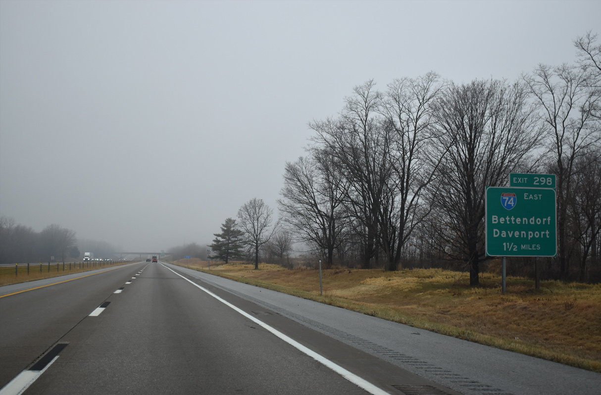
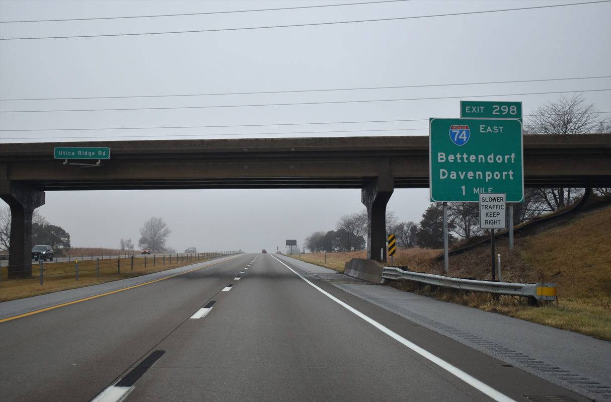
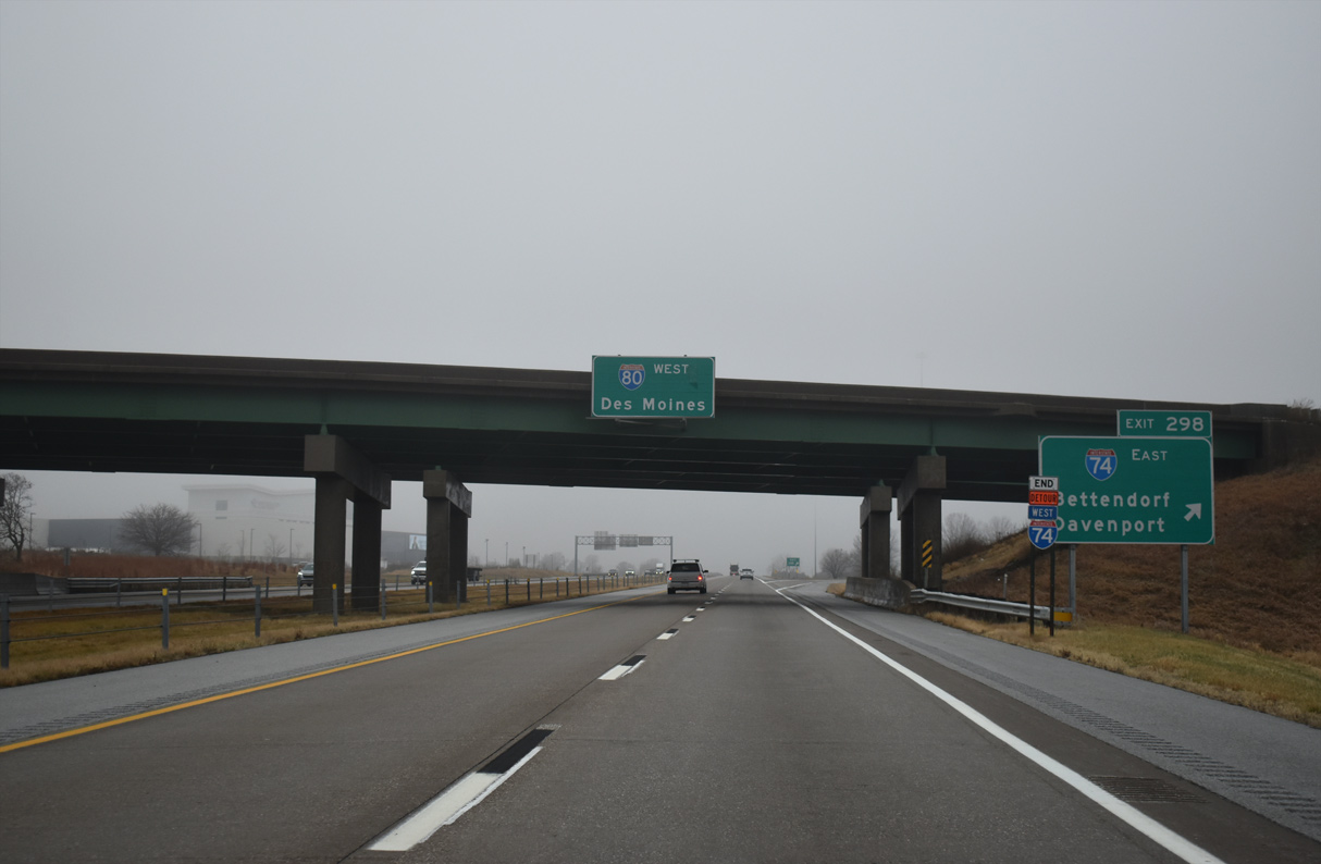
| A trumpet interchange (Exit 298) joins Interstate 80 with I-74 just west of Crow Creek. I-74 turns east alongside I-280 by Quad City International Airport (MLI) in ten miles. 12/23/23 |
|
| The exchange joining I-74/80 lies adjacent to the Rhythm City Casino constructed in 2015. 06/21/22 |
|
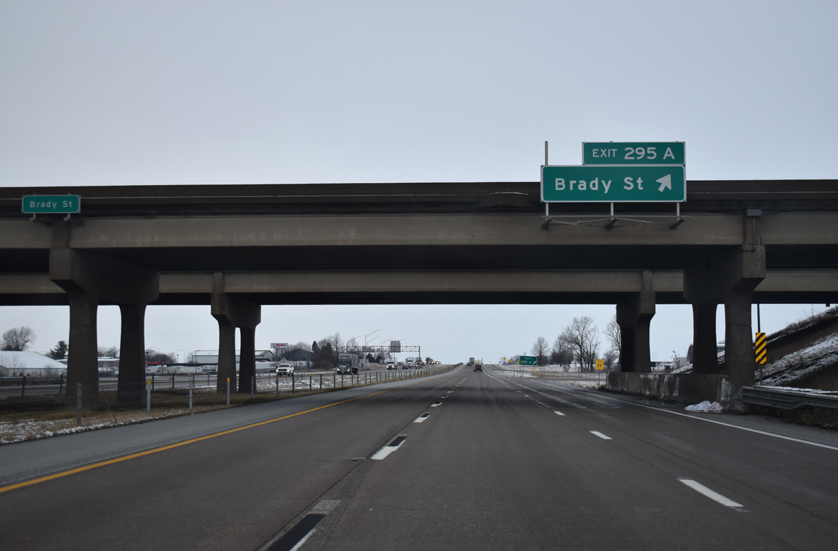
| Interstate 80 passes under Jersey Ridge Road at this distance sign for the last three Davenport exits. I-80 continues two miles west from I-74 to U.S. 61 Business (Brady Street) south and U.S. 61 north. 06/21/22 |
|
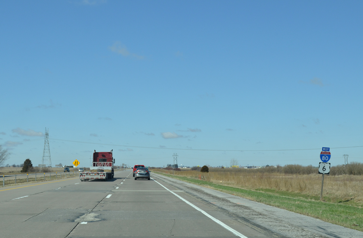
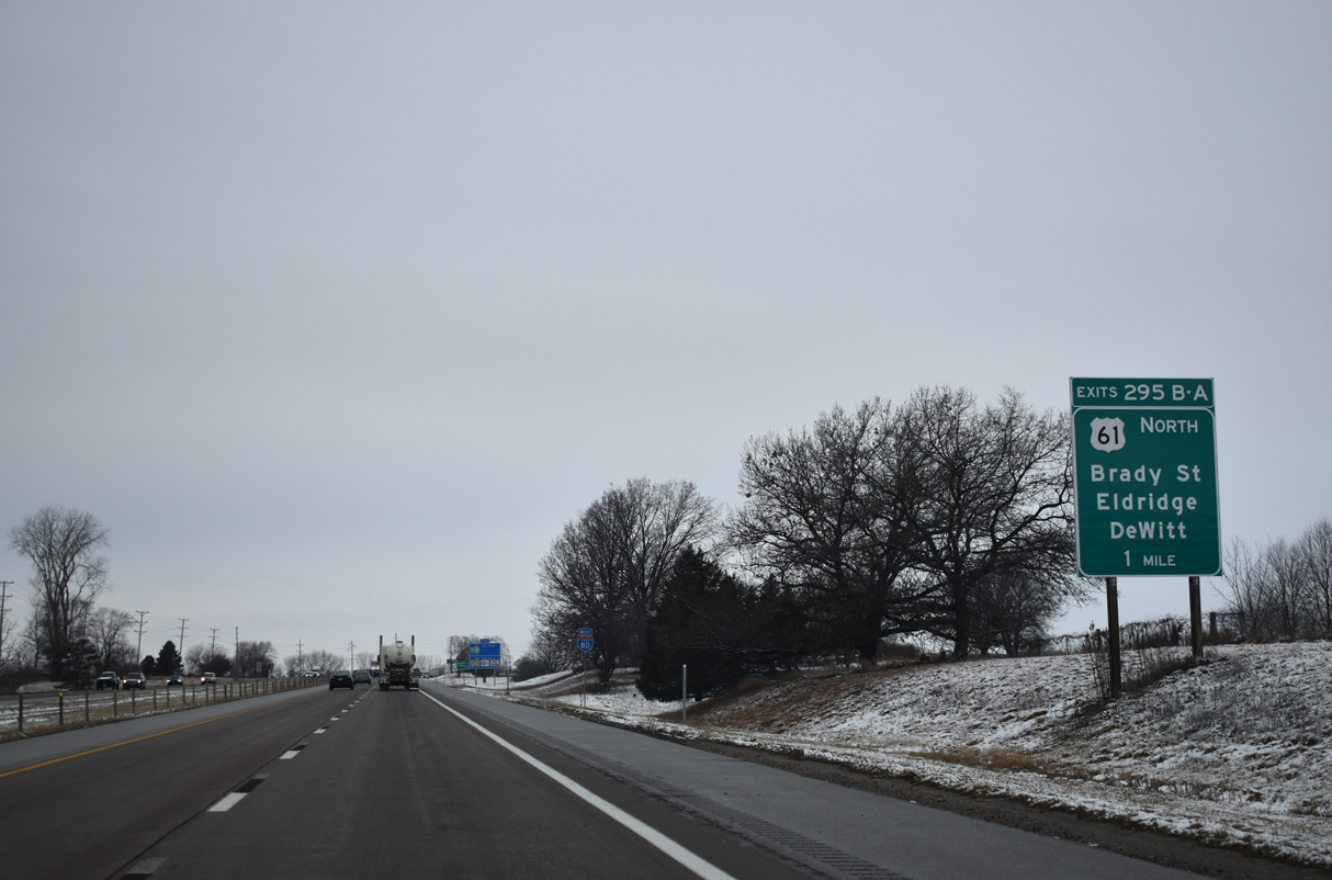
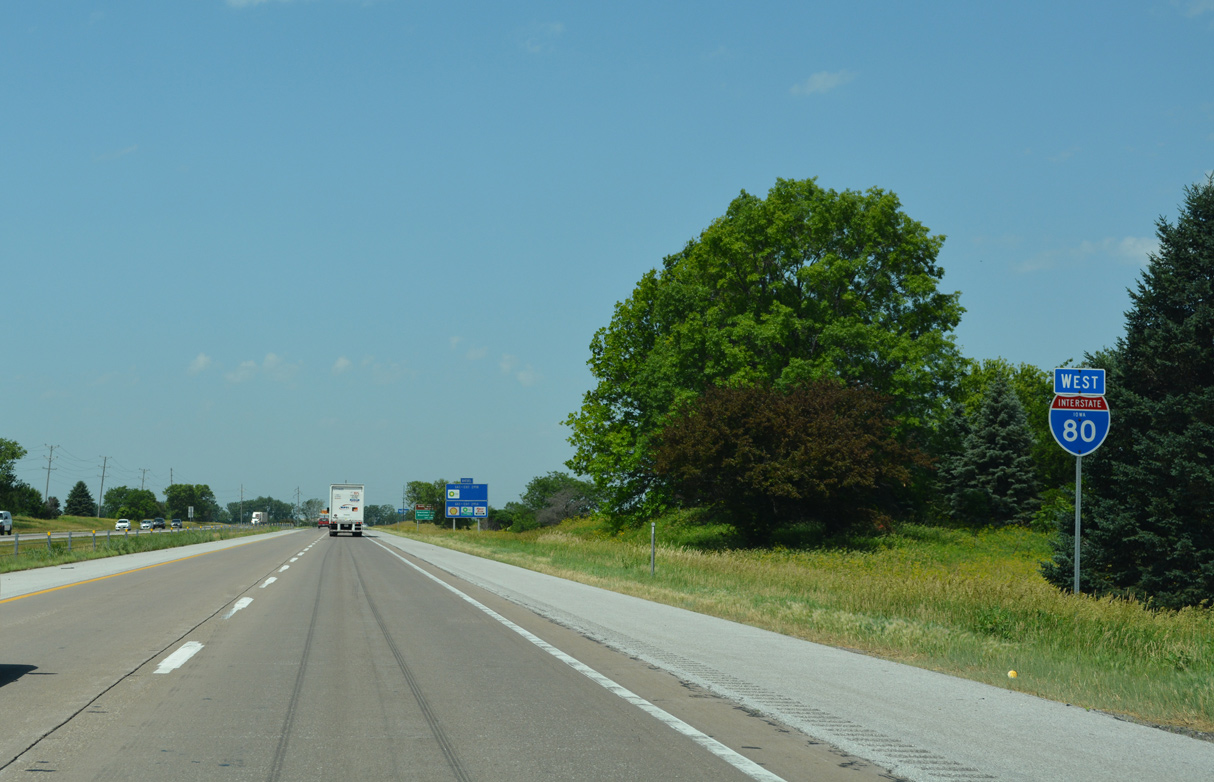
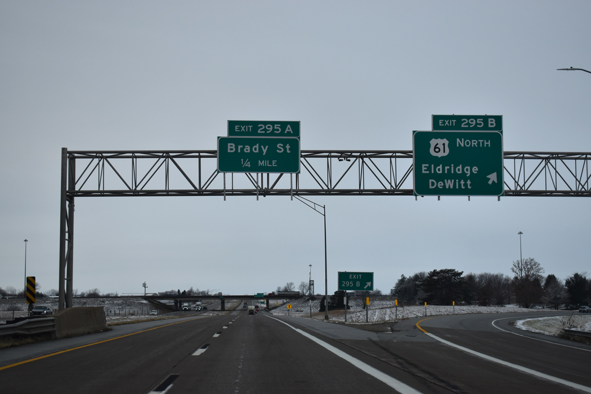
| A cloverleaf interchange (Exits 295 B /A) joins Interstate 80 with U.S. 61 northand U.S. 61 Business (Exit south in one mile. U.S. 61 was realigned from the in-city route through Davenport to bypass the city along I-80 west and I-280 east officially May 20, 2010. Sign changes were made by September 2011. 12/29/23 |
|
| Interstate 80 travels alongside farm land and a John Deere plant west of Jersey Ridge Road. 06/21/22 |
|
| U.S. 61 follows a freeway north to Eldridge, Scott County Park and De Witt. U.S. 61 Business leads south to Downtown Davenport, the Davenport Riverfront and the Centennial Bridge into Rock Island, Illinois. 06/21/22 |
|
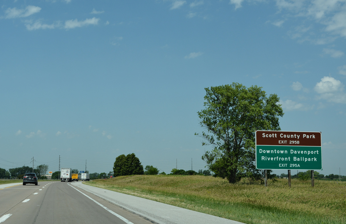
| Exit 295 B leaves Interstate 80 west for U.S. 61 north to Davenport Municipal Airport (DVN), Eldridge and DeWitt. The route continues as an expressway north from DeWitt and U.S. 30 in 16 miles to Maquoketa and Dubuque. 12/29/23 |
|
| U.S. 61 Business follows Brady Street south to Goose Creek, where it partitions into a couplet. Welcome Way takes the business route south to Northpark Mall and Harrison Street through the Davenport street grid while Brady remains the northbound direction from Downtown and the Davenport Riverfront to I-80. 12/29/23 |
|
| West from Brady Street, I-80/U.S. 61 run between Davenport Municipal Airport (DVN) and an industrial park along parallel W 76th Street. 06/21/22 |
|
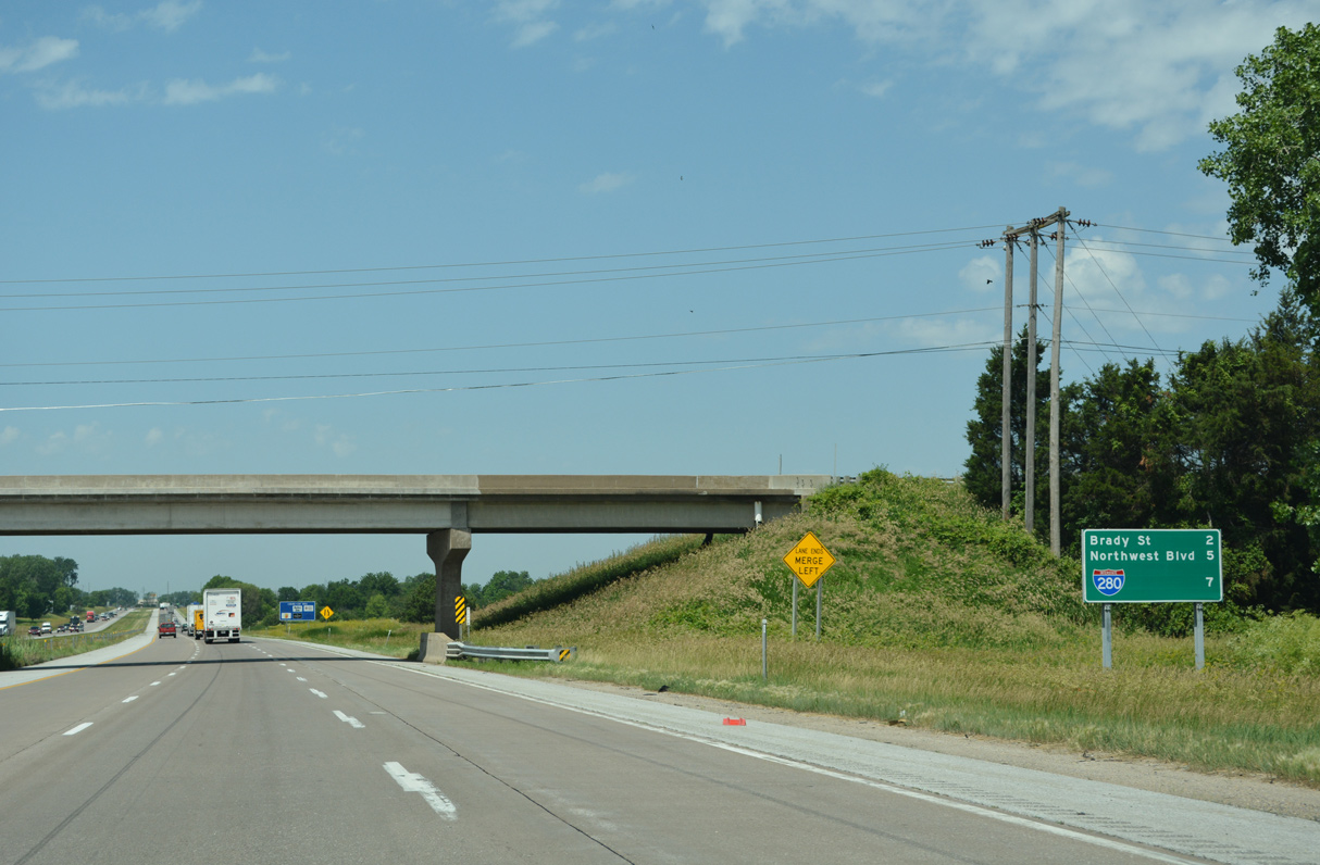
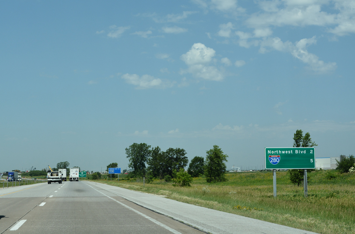
| I-80/U.S. 61 advance two miles west to Iowa 130 / Northwest Boulevard and five miles to their separation at Interstate 280 east. 06/21/22 |
|
| Northwest Boulevard branches north from U.S. 6 (Kimberly Road) at Harrison Street and Northpark Mall through residential areas of northwest Davenport to meet I-80 at Exit 292. 06/21/22 |
|
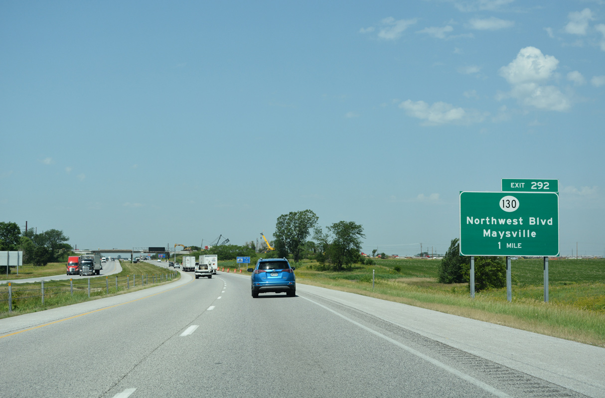
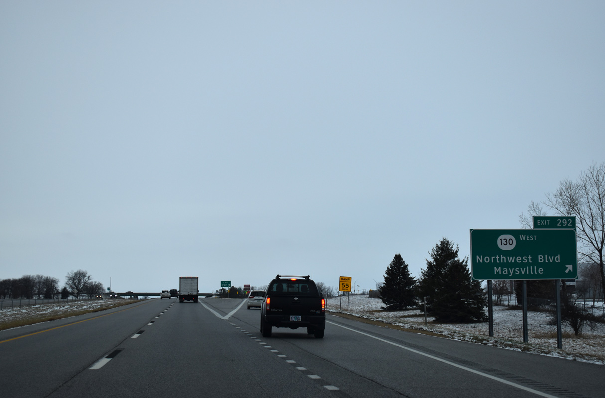
| Exit 292 leaves I-80/U.S. 61 west for Iowa 130 west and Northwest Boulevard south. Iowa 130 travels 32 miles from Exit 292 to Iowa 38 at Tipton. The state route was truncated south of I-80 in 1985 when Northwest Boulevard was turned over to the city.2 12/29/23 |
|
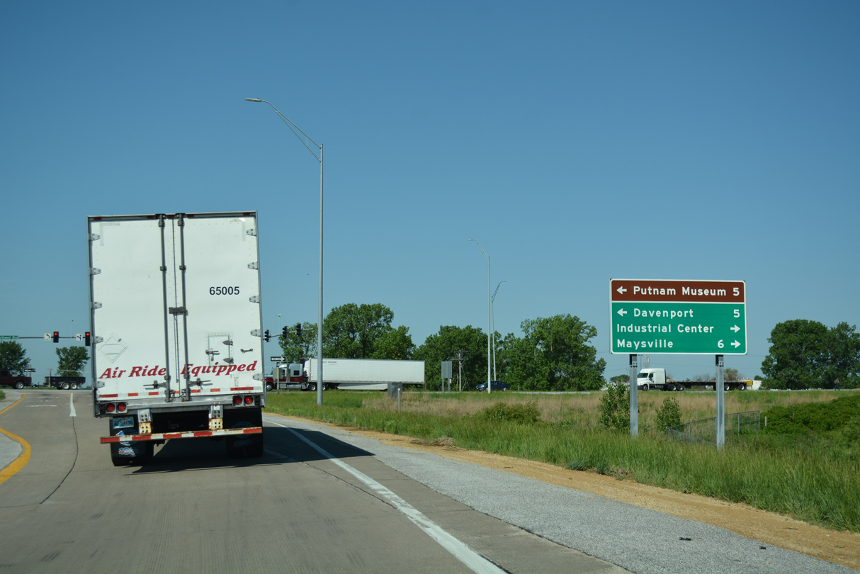
| Iowa 130 (New Liberty Road) heads six miles northwest from the diamond interchange at Exit 292 to Maysville. 05/26/18 |
|
| Still within the Davenport city limits, Interstate 80 transitions into a rural freeway west from Exit 292. 12/29/23 |
|
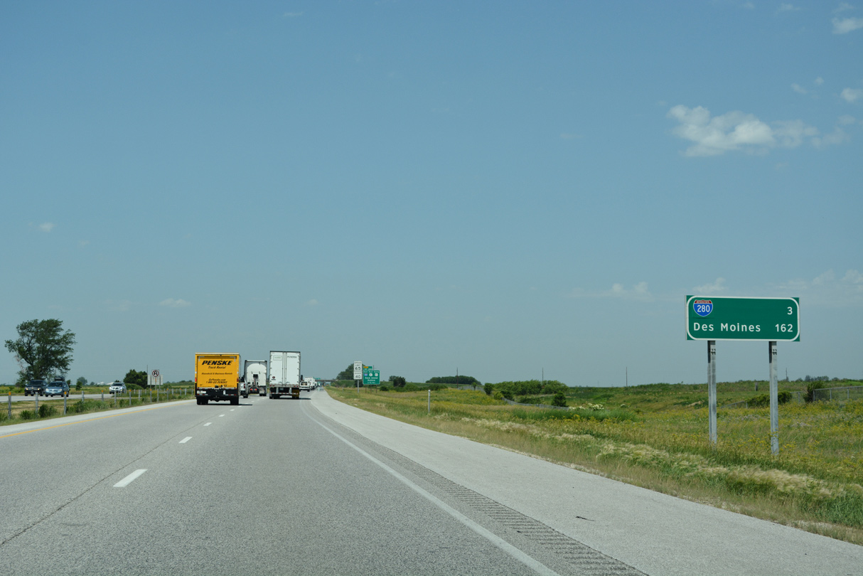
| Westbound distance sign posted three miles out from Interstate 280 and 162 miles from Des Moines. 06/21/22 |
|
| Interstate 280 wraps around the west side of Davenport, providing a more direct route for I-80 eastbound through travelers headed to Moline and Rock Island, Illinois from the west. U.S. 61 follows the freeway south six miles to resume its westward course to Blue Grass and Muscatine while U.S. 6 overlaps with I-280 to nearby Kimberly Road. 12/29/23 |
|
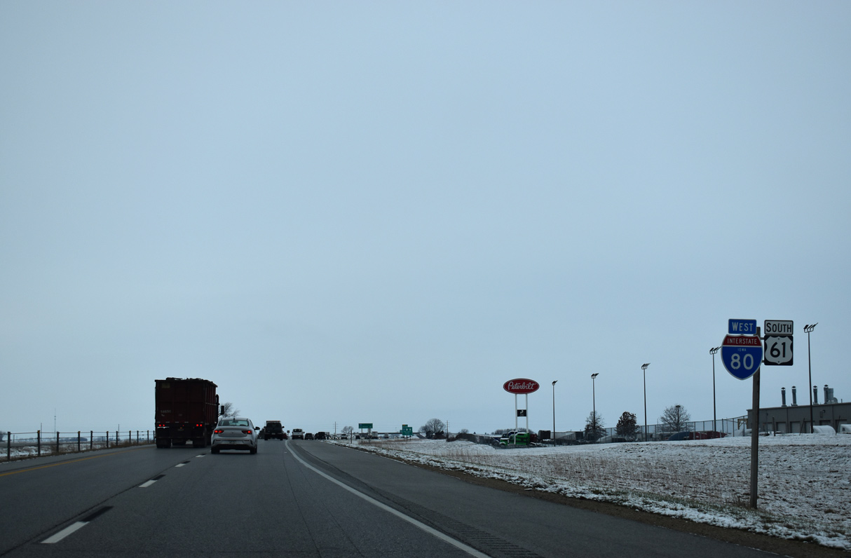
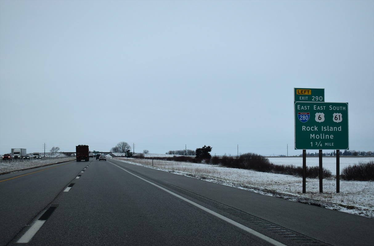
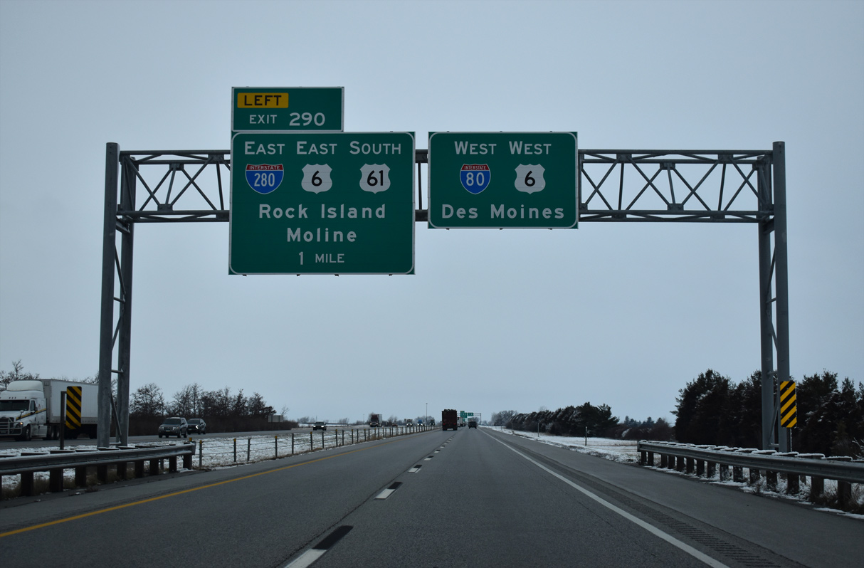
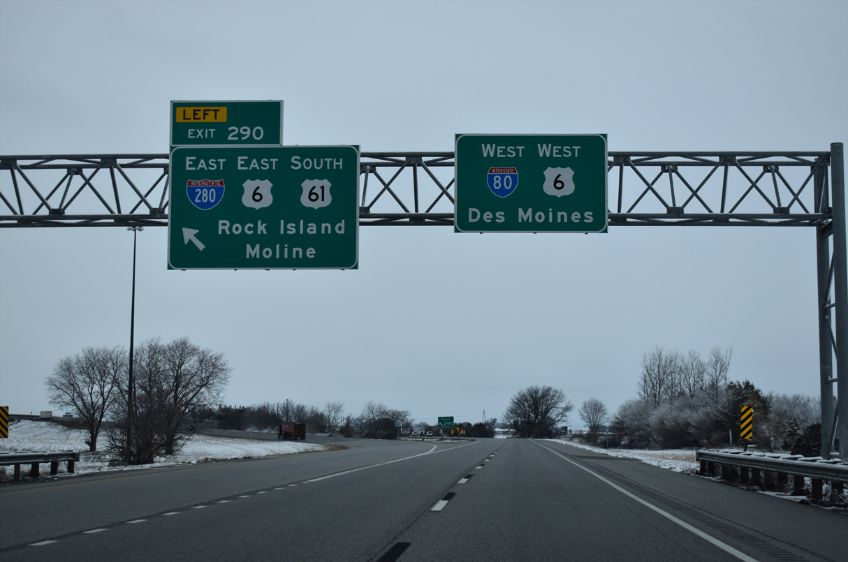
| I-80/U.S. 61 converge with I-280/U.S. 61 at a directional-T interchange (Left Exit 290). Stretching nearly 27 miles from Exit 290 to I-80 at Colona, Illinois, I-280 constitutes the southern half of the Quad Cities belt line. 12/29/23 |
|
| Much of I-280 between I-80 and the Mississippi River is rural. The loop crosses into Illinois over wetlands on Big Island before meeting the Centennial Expressway (IL 92) spur into Rock Island. 12/29/23 |
|
| U.S. 61 south parts ways from I-80 west at Left Exit 290. This is the last I-280 encountered by I-80 west until San Francisco, California. I-680 in Nebraska was initially designated as I-280, but conflicts with I-280 in eastern Iowa resulted in the renumbering of the Omaha bypass. 12/29/23 |
|
| A reassurance marker for I-80 appears within the exchange at I-280. Shields are typically posted along ramps and mainlines at Interstate to Interstate junctions in Iowa. 12/29/23 |
|
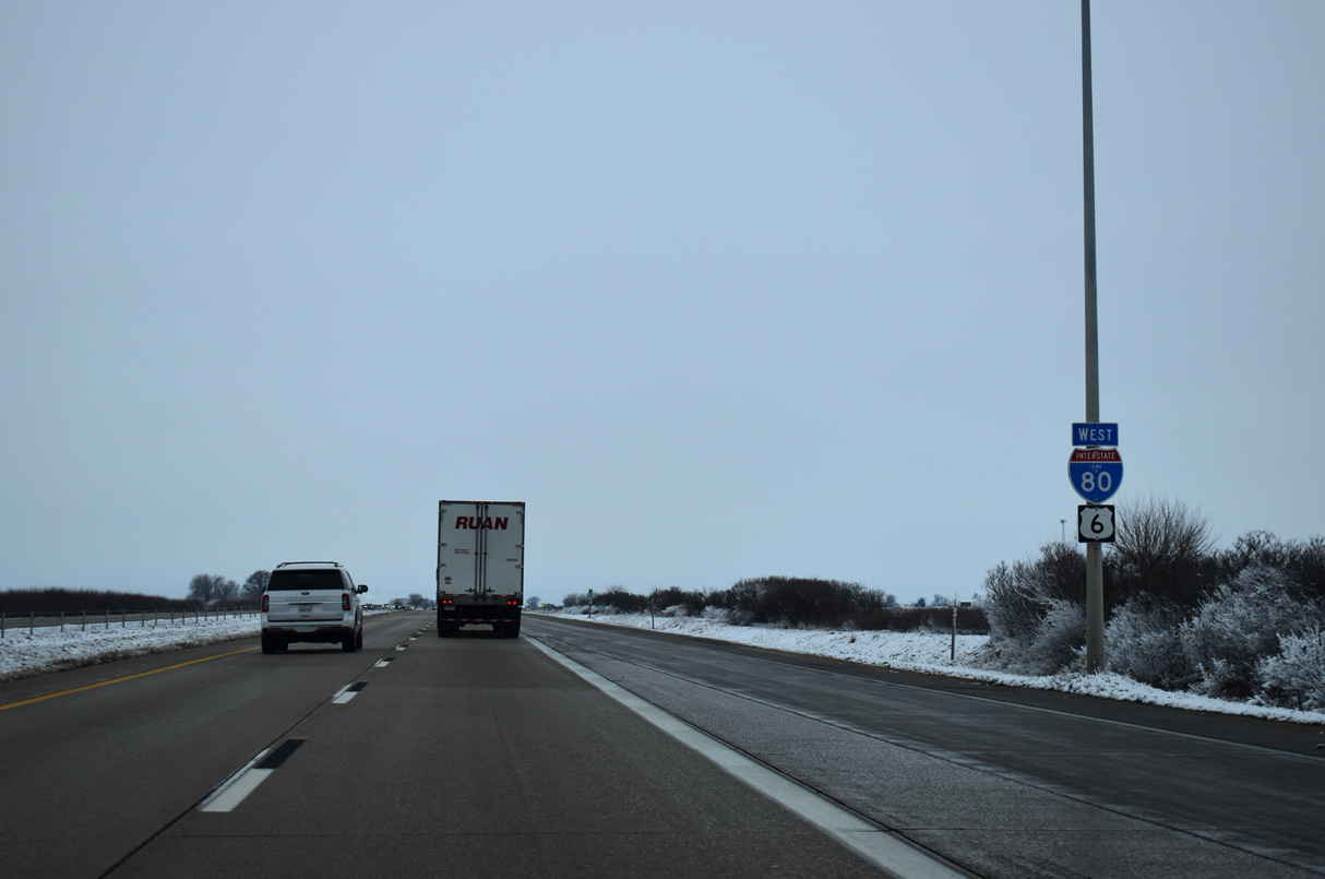
| U.S. 6 combines with Interstate 80 west for 19 miles from Davenport to near Wilton. 03/28/16 |
|
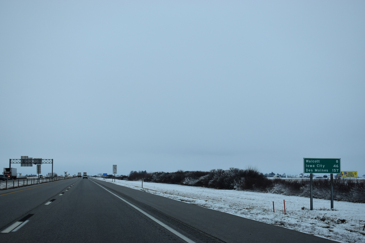
| Leaving the Quad Cities area, I-80/U.S. 6 proceed west to Walcott, a city of 1,551 (2020 census) in eight miles. Iowa City, home of the University of Iowa, follows in 46 miles. 12/29/23 |
|
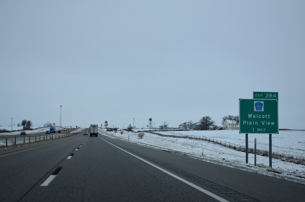
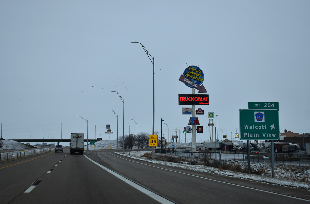
| Scott County Route Y40 (Plainview Road) meets I-80/U.S. 6 in one mile at a diamond interchange (Exit 284) in northern reaches of Walcott. 12/29/23 |
|
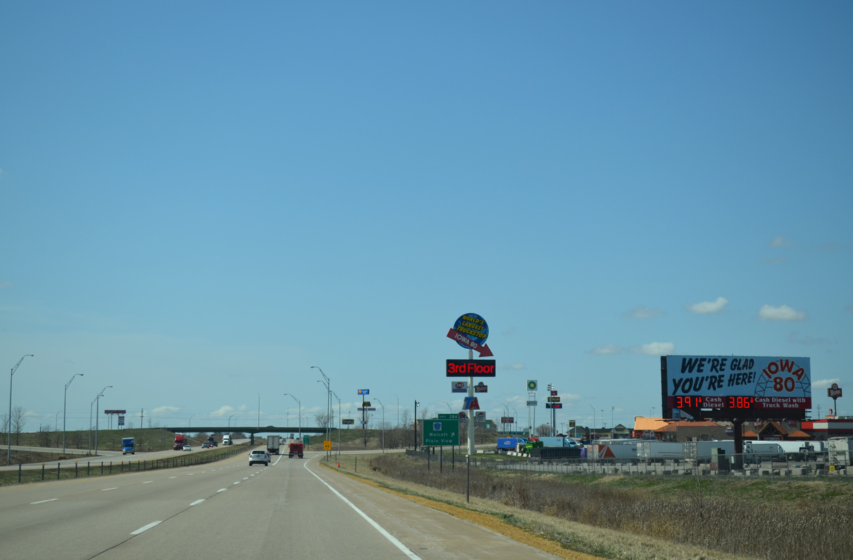
| Exit 284 is known for the Iowa 80 truck stop, billed as the world's largest. 04/08/13 |
|
| CR Y40 follows 60th Avenue north from Walcott to Plainview and Iowa 130 (New Liberty Road). Southward Plainview Road leads to CR F58 (Historic U.S. 6), northwest of the Walcott street grid. 12/29/23 |
|
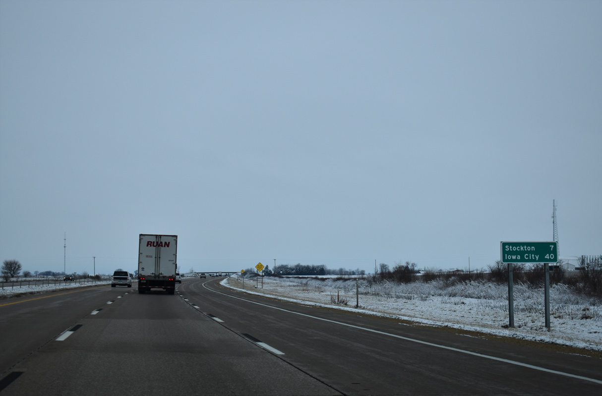
| Stockton is seven miles west from the Walcott exit via Interstate 80 and CR Y30 south to Historic U.S. 6. Iowa City is 40 miles away. 12/29/23 |
|
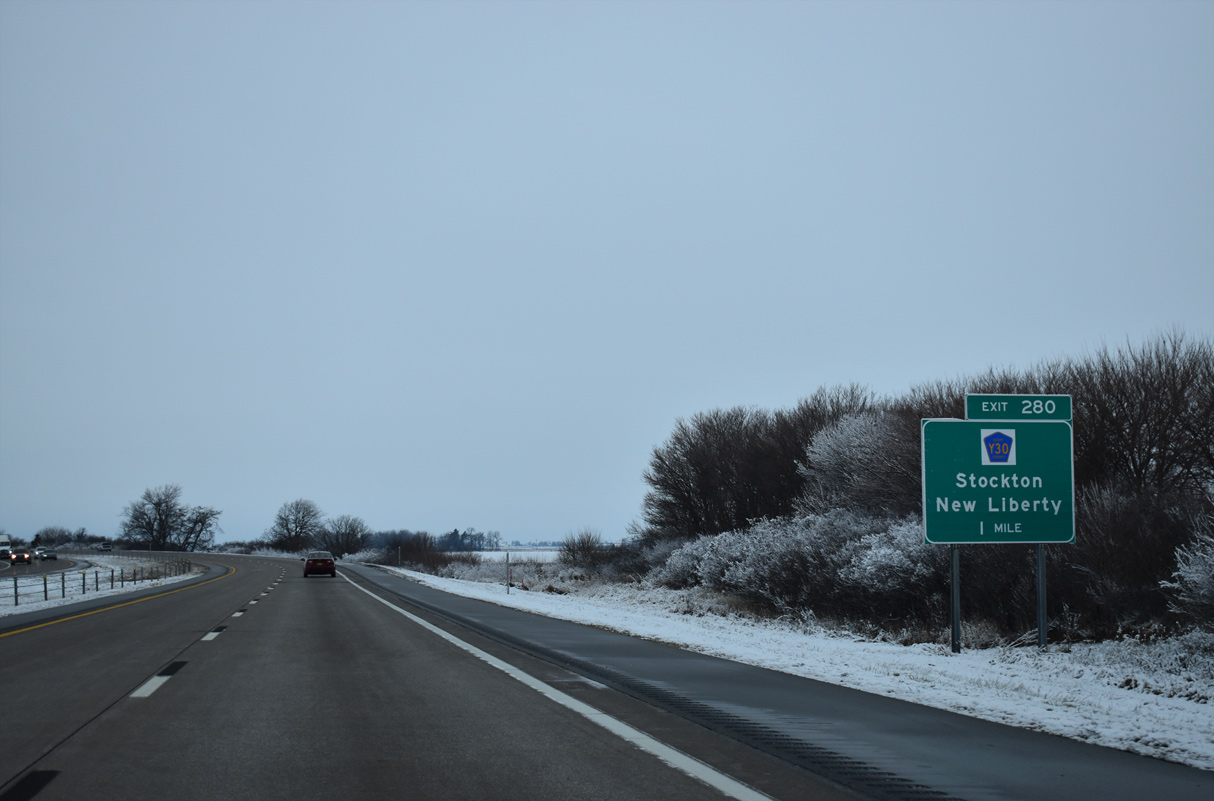
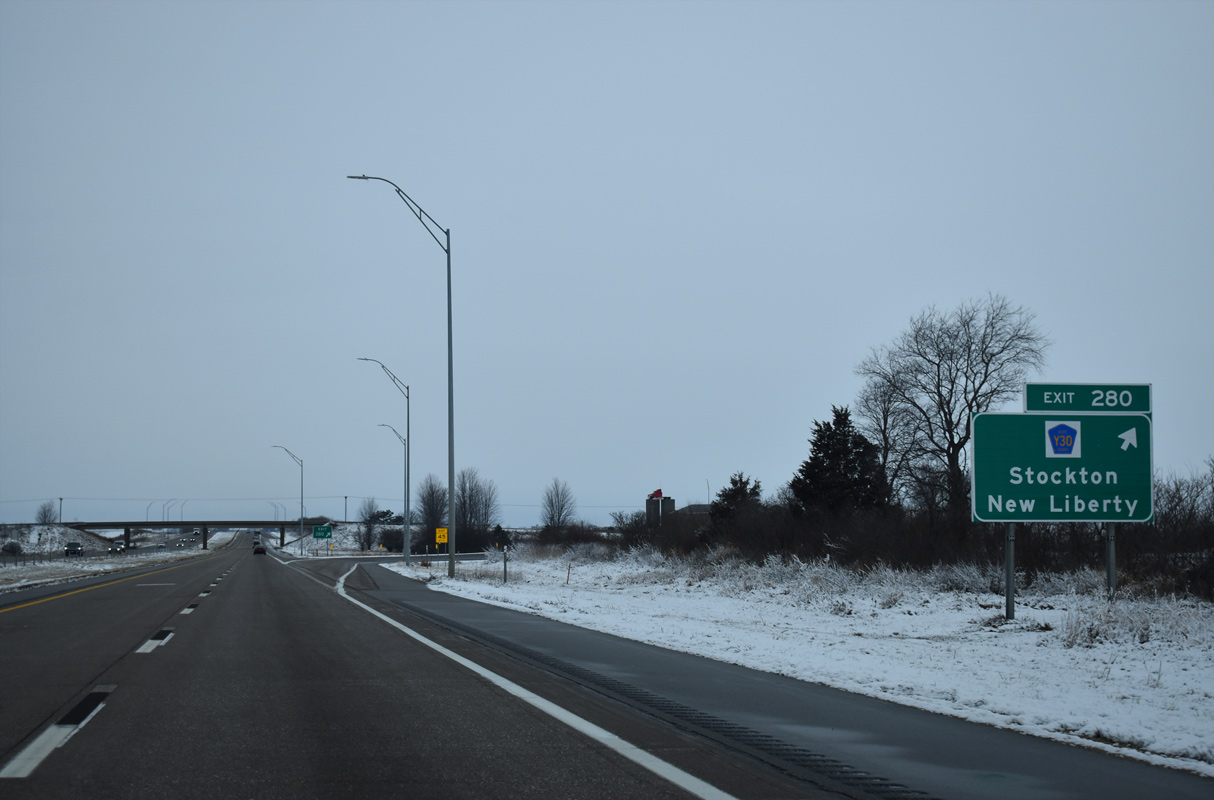
| The final exit in Scott County joins I-80/U.S. 6 with County Route Y30 (20th Avenue), three miles north from the city of Stockton. 12/29/23 |
|
| North from Exit 280, County Route Y30 heads 4.4 miles to Iowa 130, southeast from the rural city of New Liberty. 12/29/23 |
|
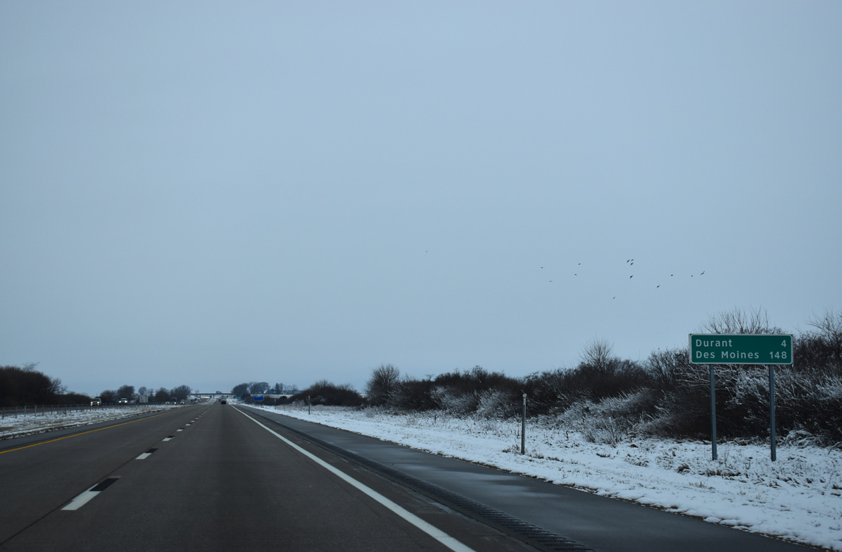
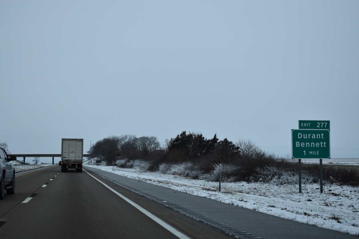
| I-80/U.S. 6 advance two miles west from Exit 280 to bypass Durant, located two miles to the south. Des Moines is 148 miles to the west. 12/29/23 |
|
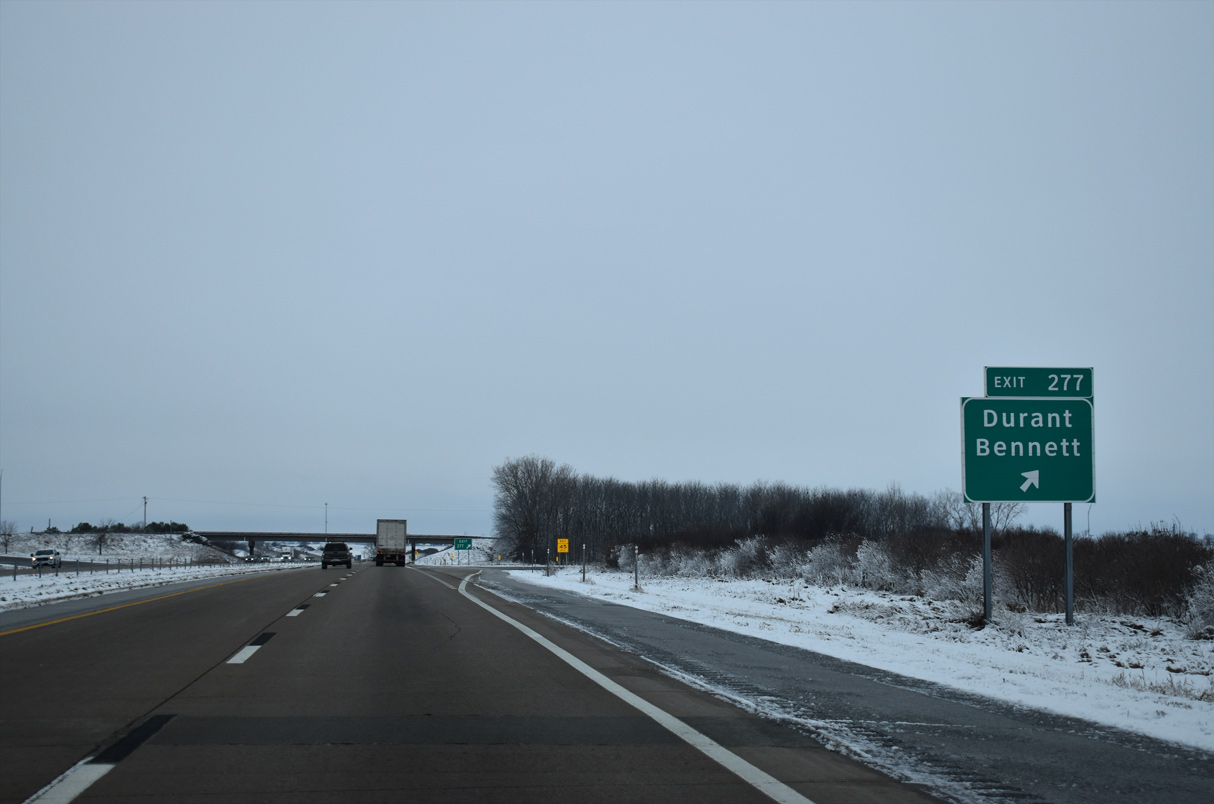
| One mile ahead of the diamond interchange (Exit 277) with County Route Y26 (Yankee Avenue) on I-80/U.S. 6 west. 12/29/23 |
|
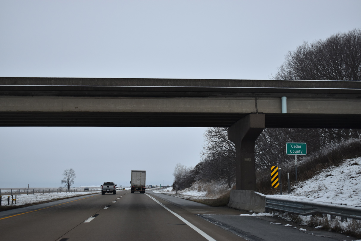
| Crossing into Cedar County along I-80/U.S. 6 west. 12/29/23 |
|
| CR Y26 runs 2.3 miles south to Historic U.S. 6 (5th Street) in the city of Durant. Northward, the county route continues 2.4 miles to CR F44 (290th Street) west to Sunbury. Bennett is a city along Iowa 130 at CR Y14, which can be reached by either Yankee Avenue or CR F44. 12/29/23 |
|
| I-80/U.S. 6 confirming markers posted where the freeway curves ahead of a tributary of Mud Creek. 12/29/23 |
|
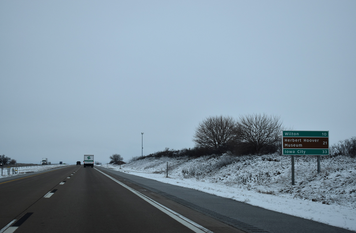
| Wilton, located in northern Muscatine County along U.S. 6, is ten miles away. West Branch, home of the Hoover Presidential Library and Birthplace, is 21 miles to the west. 12/29/23 |
|
| I-80/U.S. 6 west ahead of the Vermont Avenue overpass. 11/04/08 |
|
| Lowering toward Little Elkhorn Creek along I-80/U.S. 6 west in Farmington Township. Taylor Road (County Route Y14) spans the freeway in the distance. 04/13/13 |
|
| U.S. 6 separates from Interstate 80 west along a southerly course alongside Iowa 38 to Wilton. 99 miles in length, Iowa 38 travels from Iowa 92 in Muscatine to Iowa 3, north of Greeley. 12/29/23 |
|
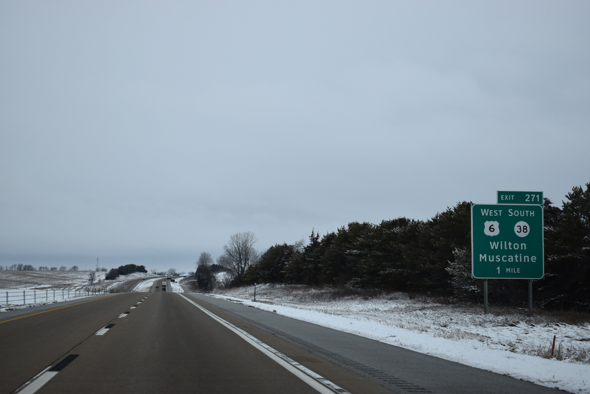
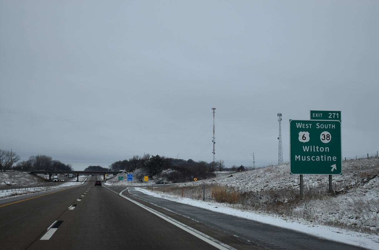
| Entering the diamond interchange (Exit 271) with U.S. 6 west / Iowa 38 south to Milton and Cedar County Route X64 (Rose Avenue) north. U.S. 6 rejoins its original alignment from 5th Street in Wilton south and west to Atalissa and West Liberty. 12/29/23 |
|
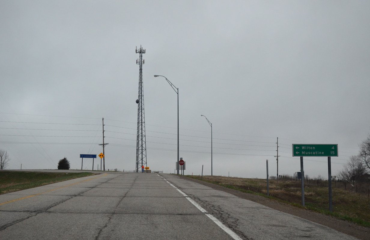
| Muscatine is a Mississippi River city located 15 miles to the south along U.S. 61. 04/12/13 |
09/04/05, 11/04/08, 04/08/13, 04/12/13, 04/13/13, 03/28/16, 05/26/18, 12/23/19, 06/20/22, 06/21/22, 12/23/23, 12/26/23, 12/29/23 by AARoads
Page Updated 02-03-2024.

 West
West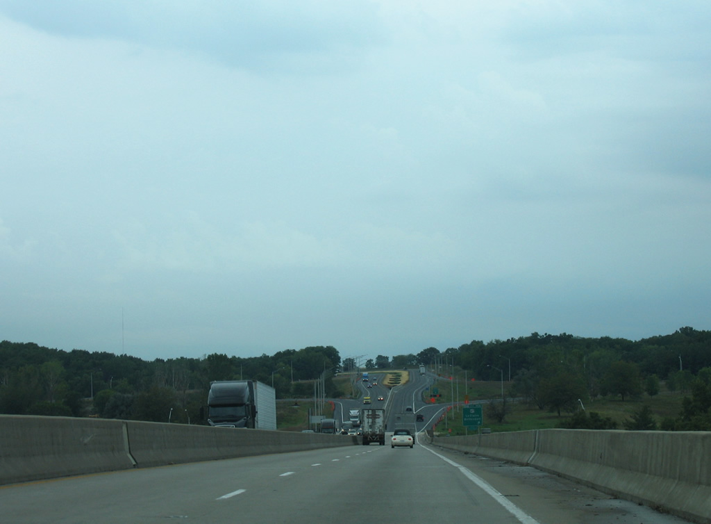
 South
South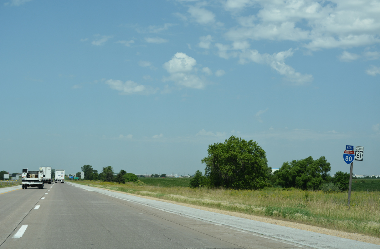

 West
West