NC 3, a 27.82 mile long route from Concord to Mooresville, was renumbered from NC 136 in memory of Dale Earnhardt, who drove the Number 3 Chevrolet in the NASCAR series. Efforts to renumber the state route were undertaken by the Mooresville city council and supported by resolutions passed by Iredell and Carteret County Commissioners, and eventually Concord City Council, by September 2001. The N.C. Transportation Board eventually followed suit and on October 23, 2002, legislation formally swapping the route numbers of 3 and 136 was signed into law by Governor Mike Easley. Earnhardt died on the final lap of the February 2001 Daytona 500.8,9
|
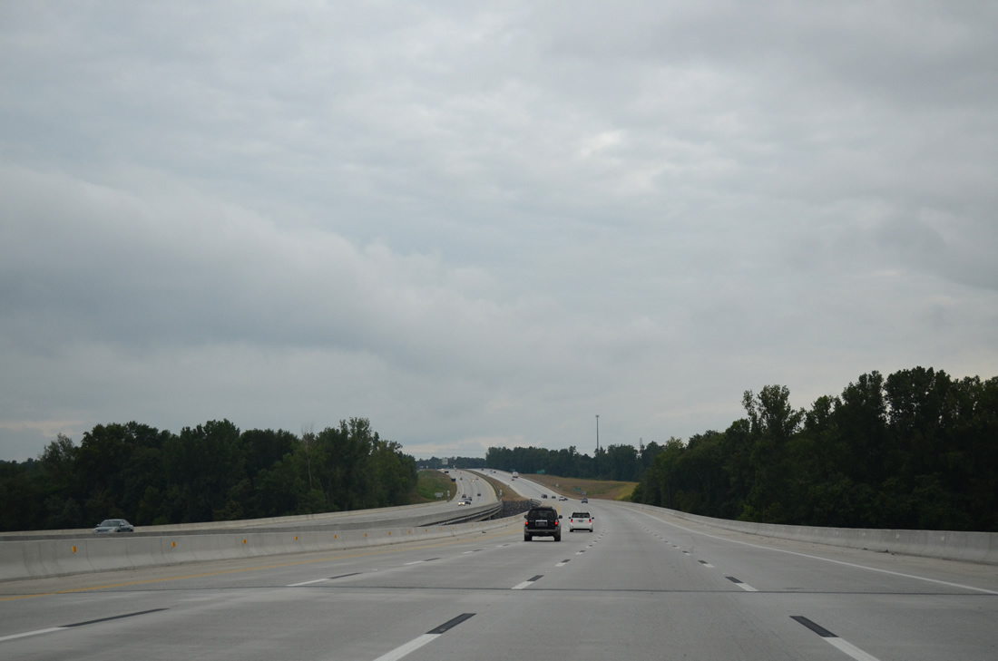
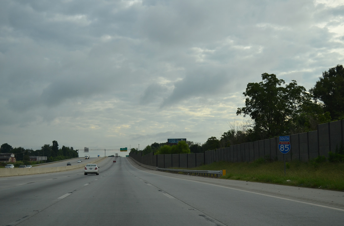
| I-85 across the Yadkin River was named the Yadkin River Veterans Memorial Bridge on June 12, 2012. The southbound span is 0.55 miles long and 72 feet in width.1 The 1955 bridge for I-85 nearby, which stretched just 0.2 miles, was demolished by April 2013.2 08/06/13 |
|
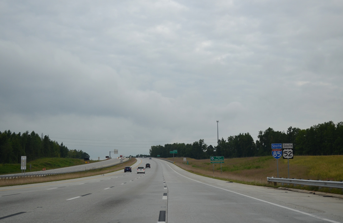
| Interstate 85 and U.S. 52 overlap 11 miles southwest from Lexington to Salisbury. 08/06/13 |
|
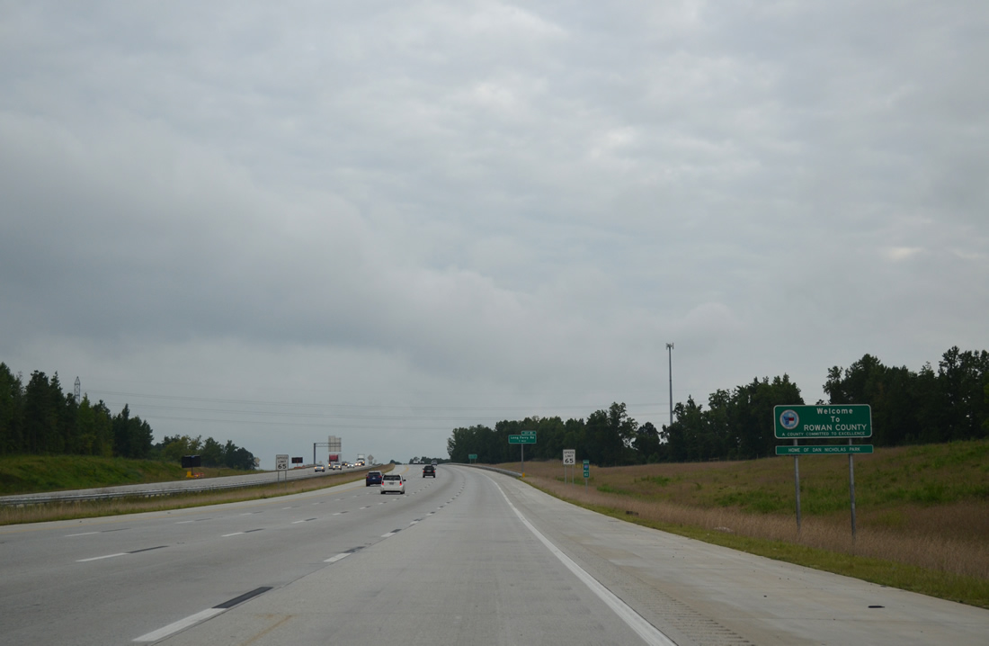
| I-85 enters Rowan County midway across the Yadkin River. The county was formed in 1753 from a portion of Anson County and named after North Carolina Governor Matthew Rowan. 08/06/13 |
|
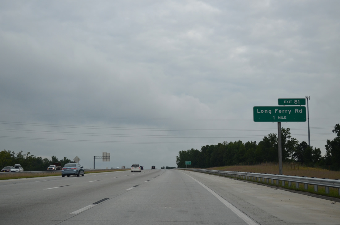
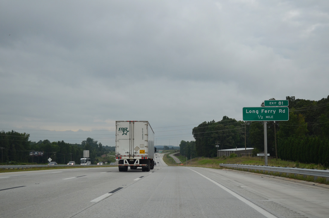
| Long Ferry Road (SR 2120) winds east from U.S. 29-70/NC 150 (Salisbury Avenue) in Spencer to Trading Ford and a dead end on a peninsula off High Rock Lake. 08/06/13 |
|
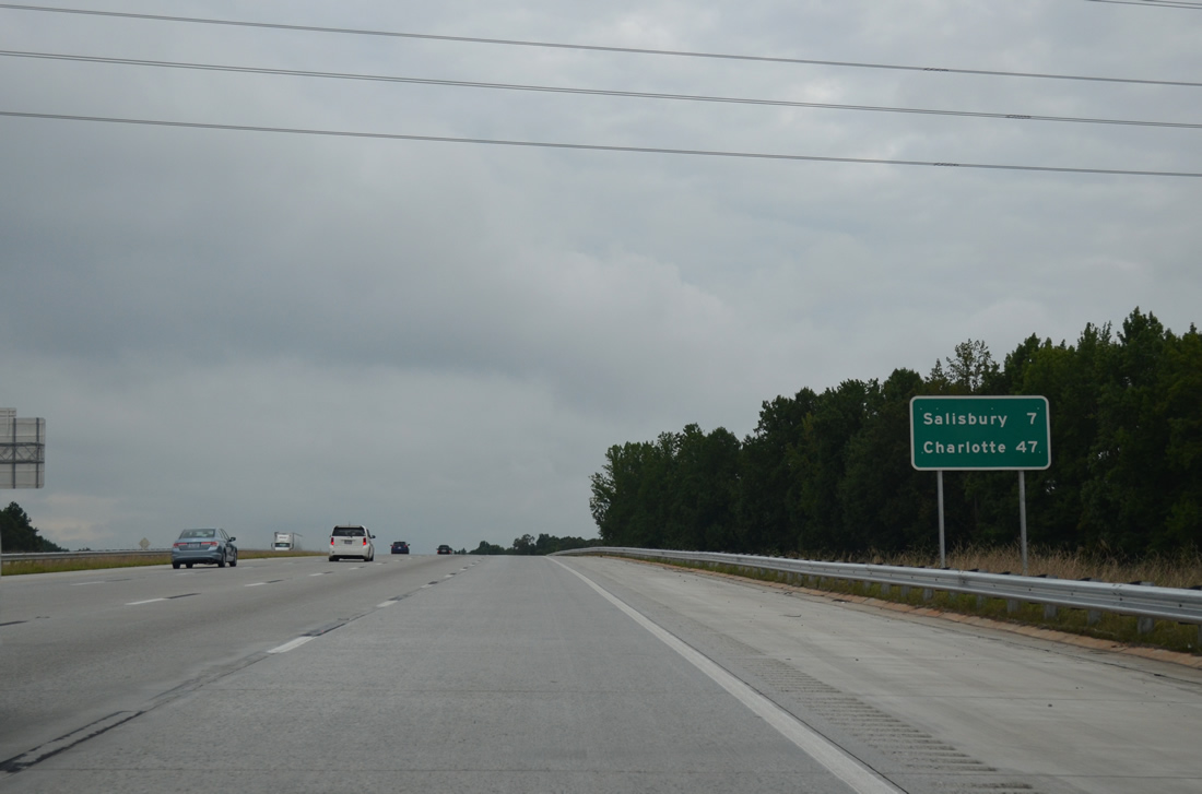
| Downtown Salisbury is seven miles ahead at the former crossroads of U.S. 29-52-70-601 (Main and Innes Streets) while Charlotte is 47 miles to the southwest. 08/06/13 |
|
| Interstate 85 continues with eight overall lanes through the diamond interchange (Exit 81) with Long Ferry Road (SR 2120). 08/06/13 |
|
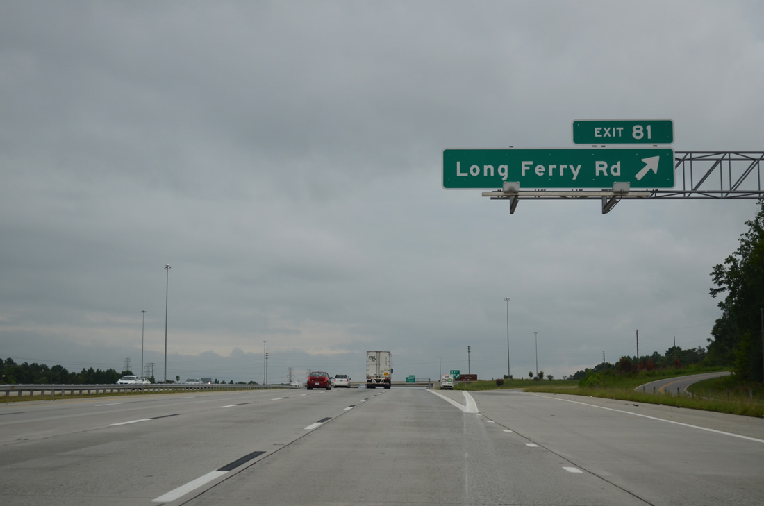
| Exit 81 leaves I-85/U.S. 52 south for Long Ferry Road west to Spencer and east to the Buck Combined Cycle Plant, a Duke Energy natural gas facility along the Yadkin River. 08/06/13 |
|
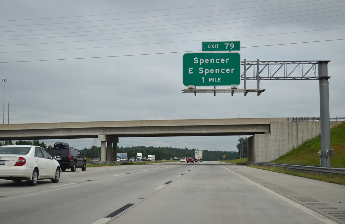
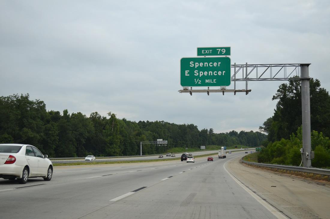
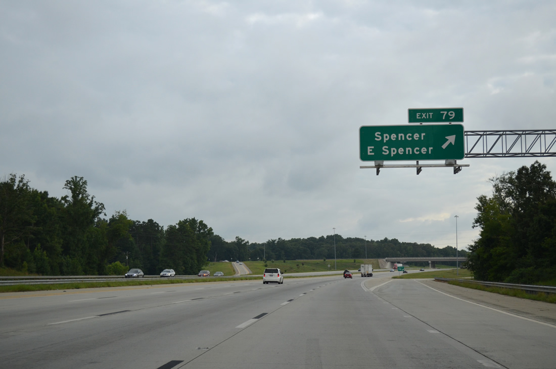
| Continuing south, I-85/U.S. 52 enter the town of East Spencer at the diamond interchange (Exit 79) with Andrews Street west and Old Union Church Road (SR 1915) east. 08/06/13 |
|
| Andrews Street (SR 1915) leads 1.2 miles north to U.S. 29-70/NC 150 (Salisbury Avenue) east of Downtown Spencer. 08/06/13 |
|
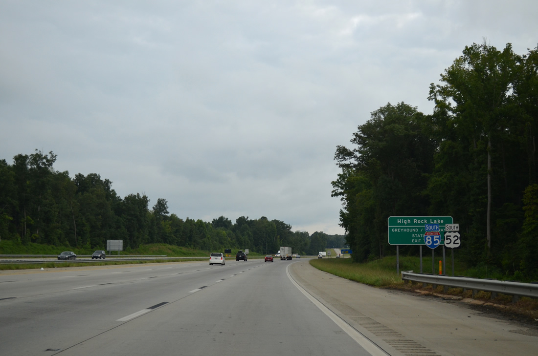
| High Rock Lake was formed along the Yadkin River by the construction of High Rock Dam, a hydroelectric power facility, in 1927. The 15,180-acre lake includes recreation opportunities including boating and camping. 08/06/13 |
|
| Old Union Church Road (SR 1915) heads southeast to connect I-85/U.S. 52 with Bringle Ferry Road (SR 1002) east to Craven and High Rock Lake. 08/06/13 |
|
| I-85 south from milepost 81 to 68 was reconstructed between June 1997 and 2007 in four sections at a cost of $84.2 million. The final project expanded I-85 from north of Bringle Ferry Road to Long Ferry Road between January 2005 and early 2007. Work included the reconstruction of both Exit 81 and 79.3,5 08/06/13 |
|
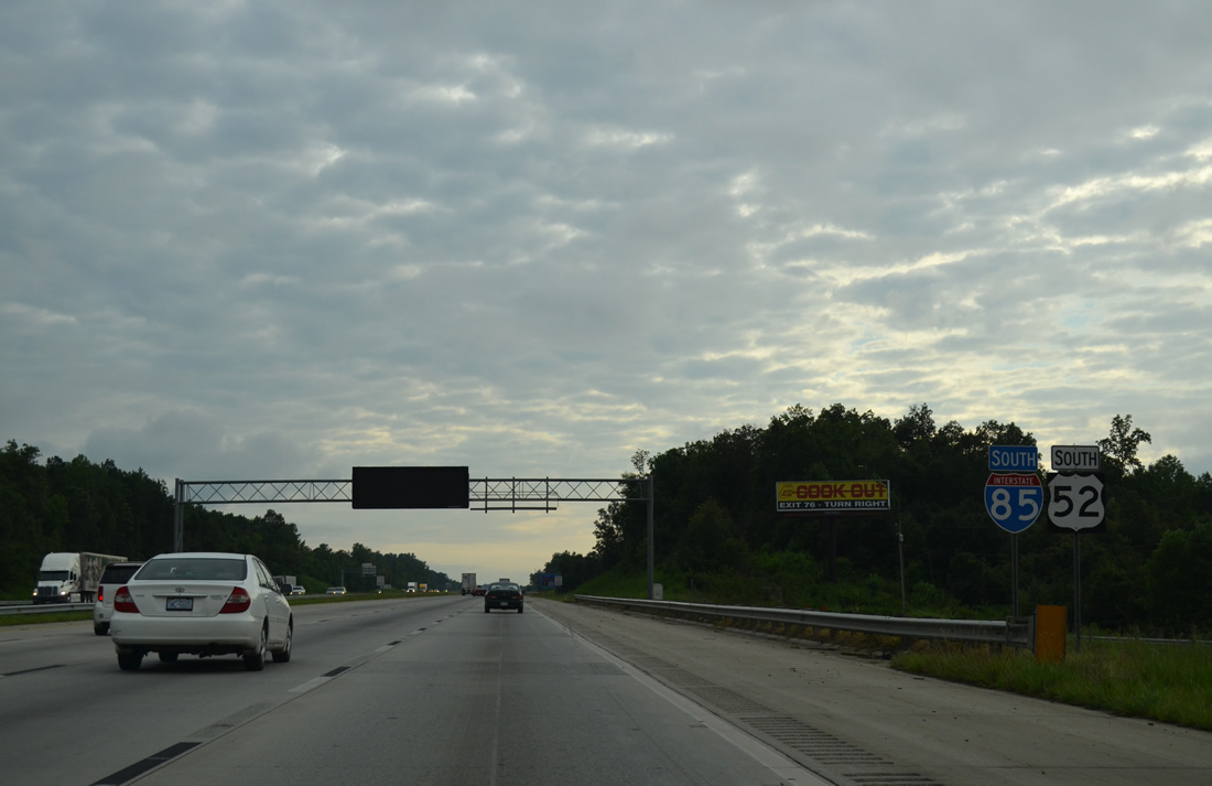
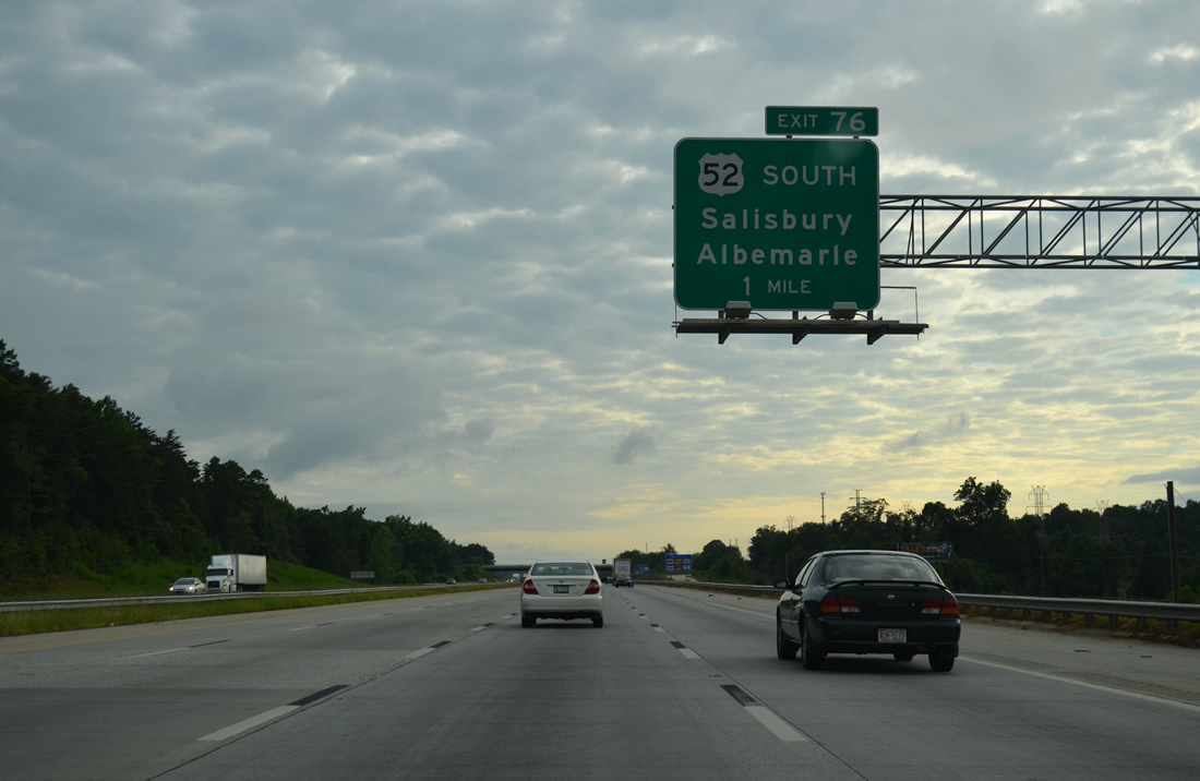
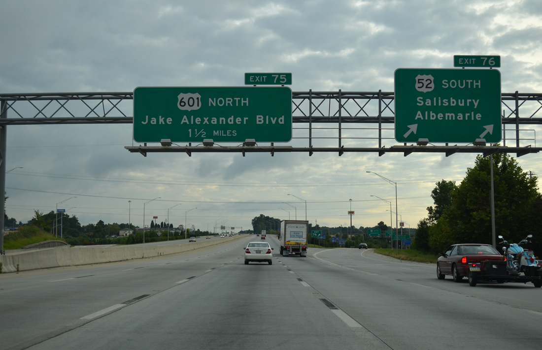
| U.S. 52 south parts ways with Interstate 85 at Exit 76 to join Innes Street south to Granite Quarry and Rockwell in southern Rowan County. U.S. 52 historically followed U.S. 29/70 (Main Street) to Innes Street southeast from Downtown until 1971.4 08/06/13 |
|
| Exit 76 was rebuilt from a cloverleaf interchange into a SPUI as phase three of the overall 13 mile widening of I-85 from East Spencer to China Grove. Work broke ground in February 2001 and ran through Summer 2006.5 U.S. 52 travels south 29 miles to the Stanly County seat of Albemarle. 08/06/13 |
|
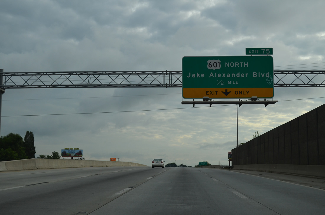
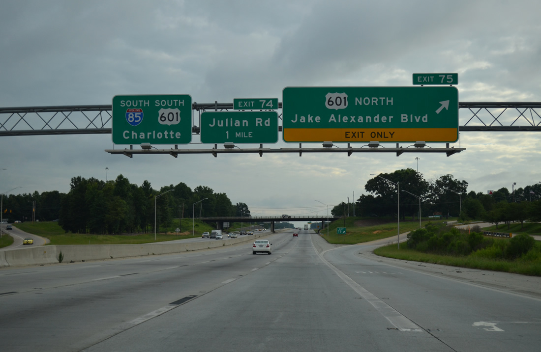
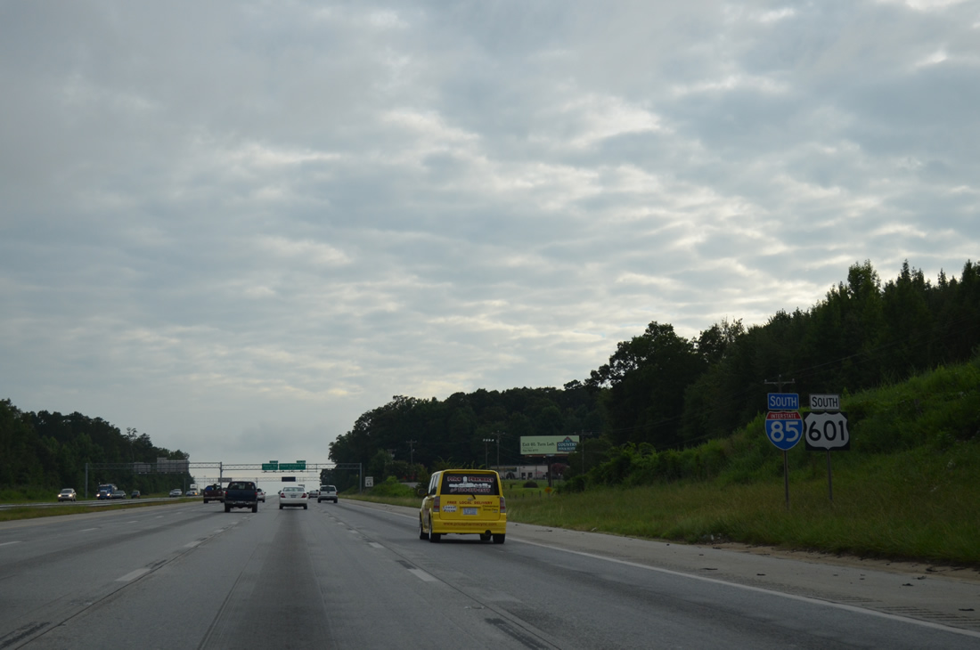
| Interstate 85 travels solo for just 1.5 miles before combing with U.S. 601 south at Jake Alexander Boulevard. 08/06/13 |
|
| U.S. 601 bypasses Salisbury along Jake Alexander Boulevard, a commercialized arterial southward from Innes Street to a diamond interchange (Exit 75) with Interstate 85. 08/06/13 |
|
| Jake Alexander Boulevard (SR 1007) continues east from I-85/U.S. 601 to U.S. 52 (Innes Street) at South Salisbury. U.S. 601 north combines with U.S. 70 west from U.S. 29 near Rowan Mills to Statesville Road. Previously U.S. 601 overlapped with U.S. 29 southwest through China Grove, Landis and Kannapolis, meeting I-85 at Exit 58. 08/06/13 |
|
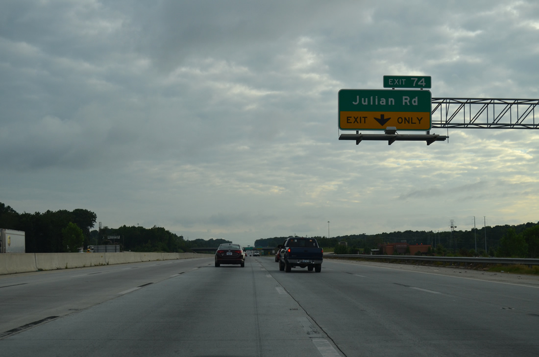
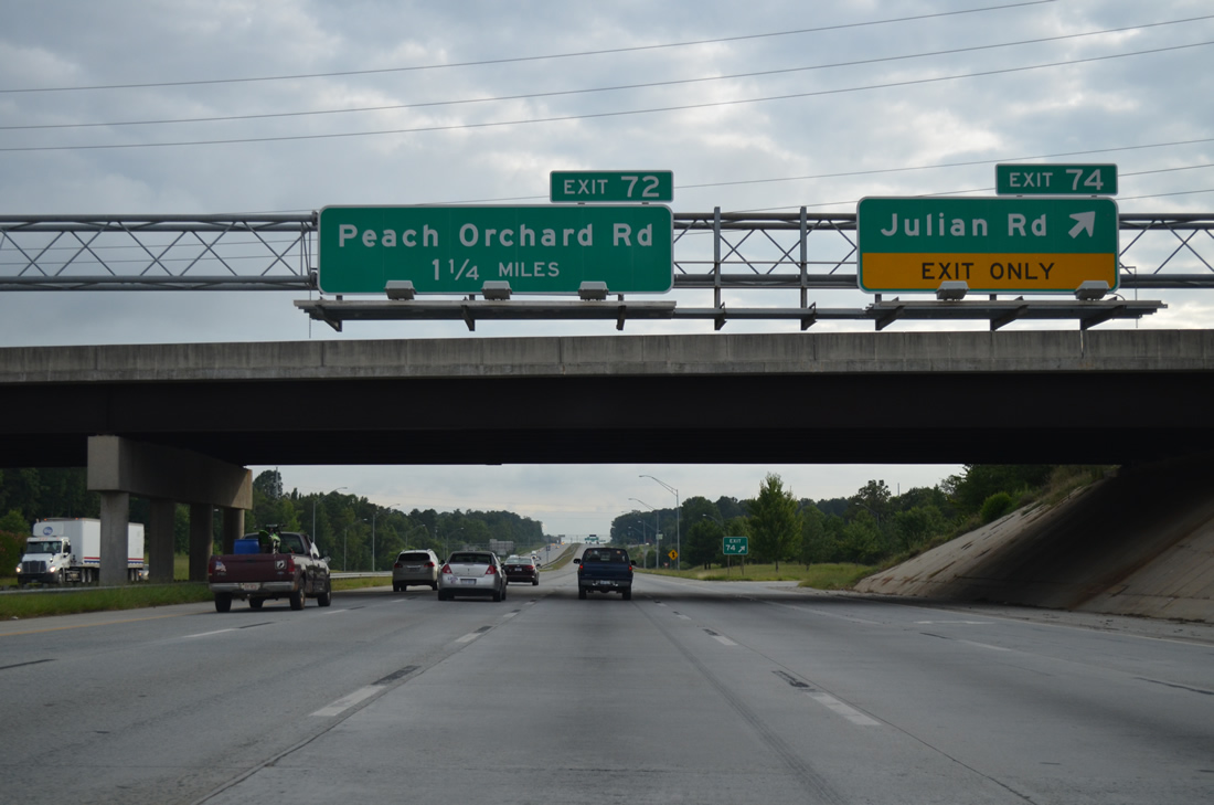
| I-85 reconstruction between China Grove and Spencer added auxiliary lanes from Jake Alexander Boulevard southwest to Julian Road (SR 2528). The exchange at Exit 74 with SR 2528 was reconfigured into a folded diamond during Phase II of the 1997-2007 project. 08/06/13 |
|
| Julian Road arcs southward from U.S. 601 (Jake Alexander Boulevard) by a business park, apartment complex and big box retail to Old Concord Road (SR 1002) at Heilig Road (SR 2528). 08/06/13 |
|
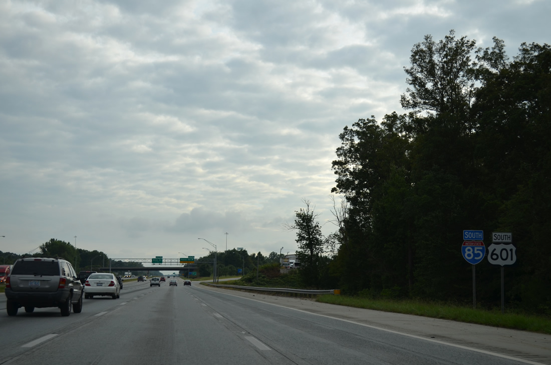
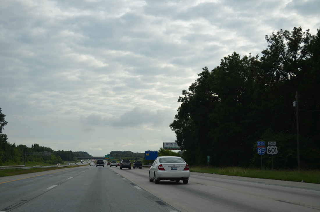
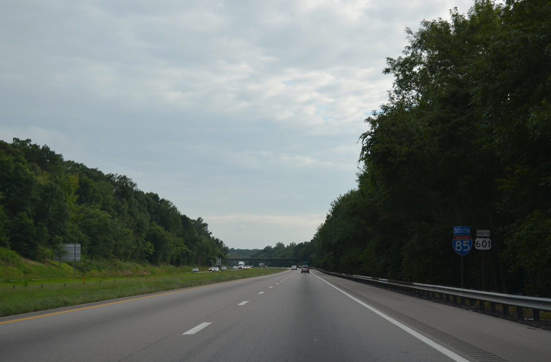
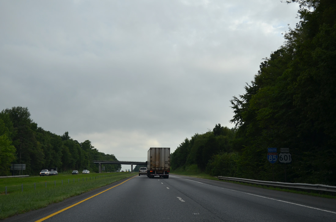
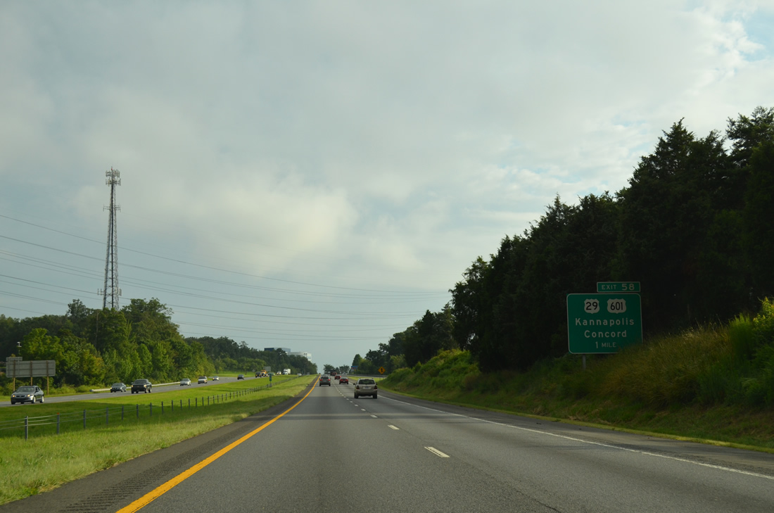
| U.S. 601 runs concurrent with Interstate 85 south for 16.5 miles to Cannon Boulevard (U.S. 29) in Kannapolis. 08/06/13 |
|
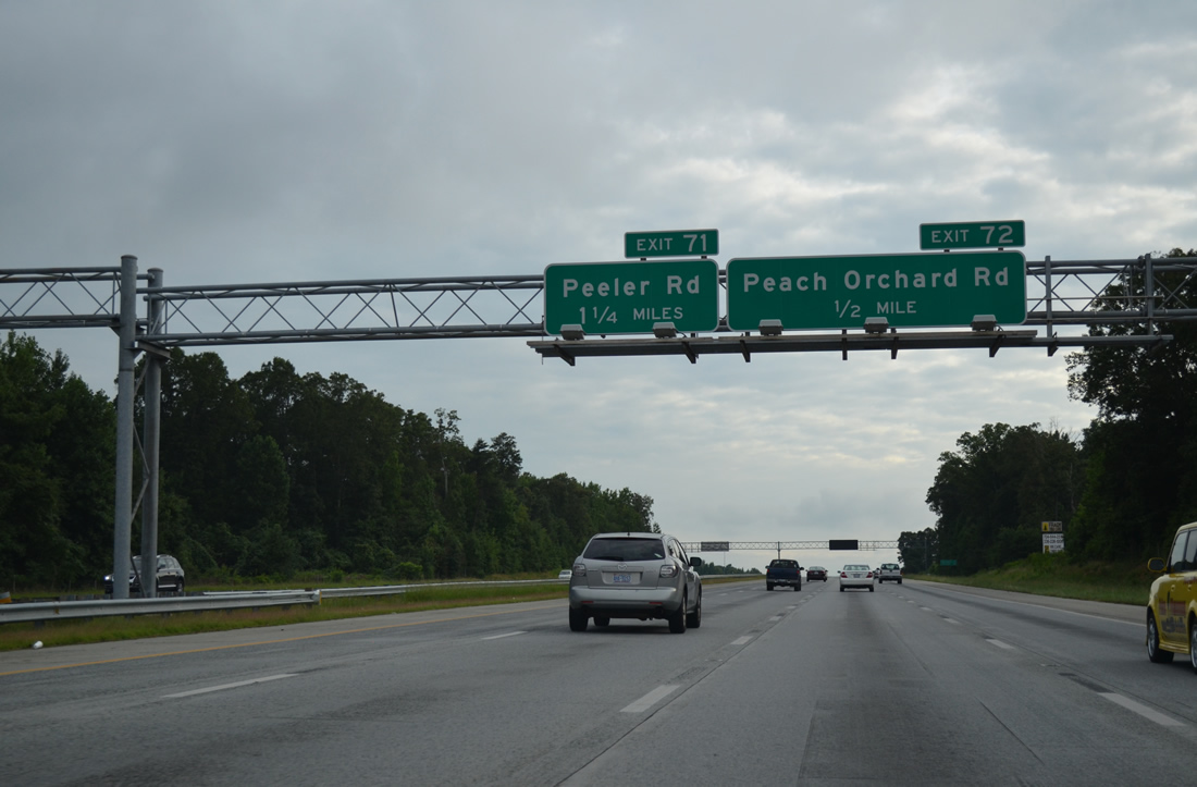
| Peach Orchard Road (SR 2539) and Peeler Road (SR 2538) are the first of three roads connecting I-85/U.S. 601 with U.S. 29 (Main Street) to the west and Old Concord Road (SR 1002) to the east. 08/06/13 |
|
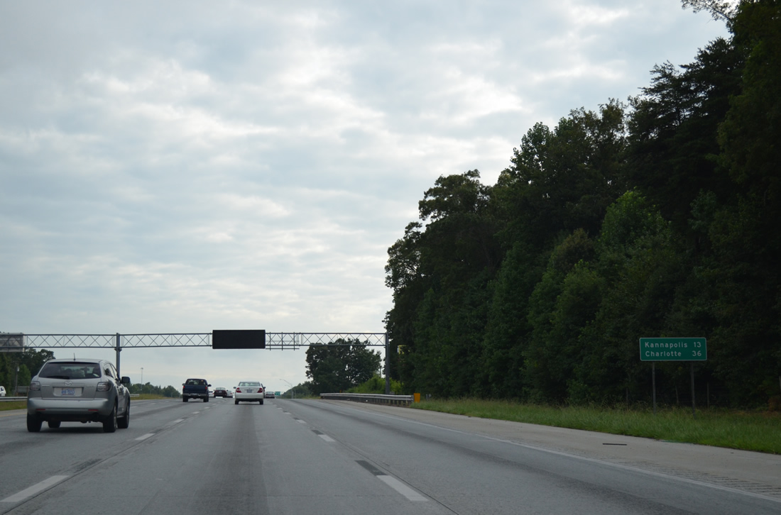
| Downtown Kannapolis is 13 miles to the south, followed by Charlotte in 36 miles. 08/06/13 |
|
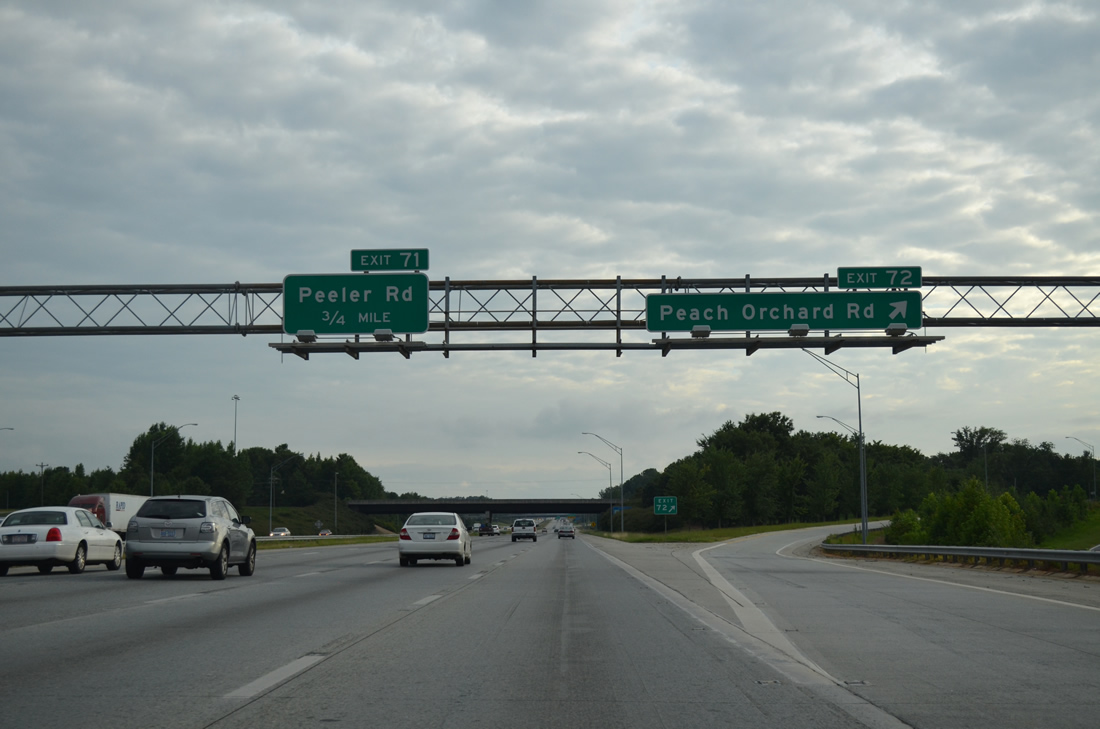
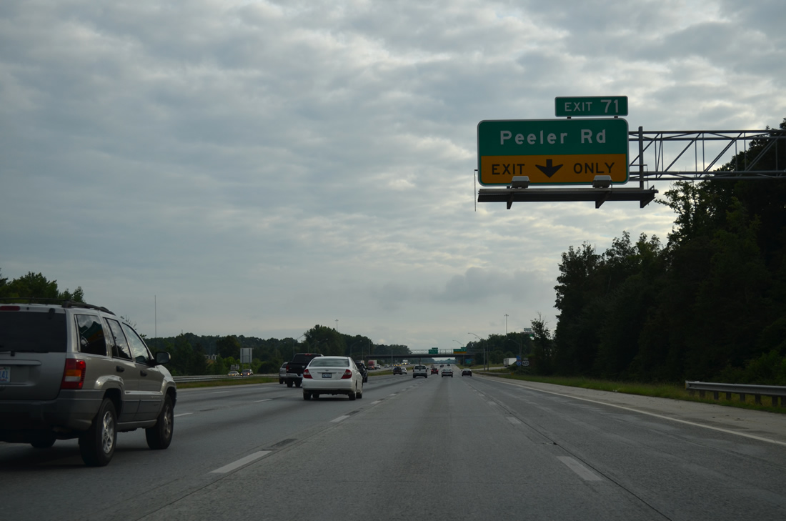
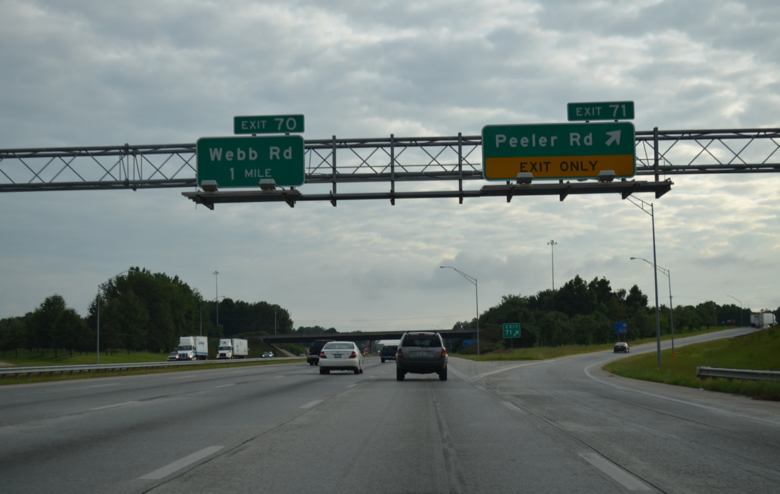
| Diamond interchanges join I-85/U.S. 601 with Peach Orchard Road at Exit 72 and Peeler Road at Exit 71 in 0.75 miles. 08/06/13 |
|
| Phase II of the I-85 widening between China Grove and Salisbury focused on a 3.2 mile stretch from north of Julian Road to north of Webb Road (Exit 70). Completed on August 1, 2001,6 this work expanded I-85/U.S. 601 to ten overall lanes between Exit 72 and 71. 08/06/13 |
|
| A pair of truck stops line Peeler Road (SR 2538) adjacent to I-85/U.S. 601 at Exit 71. U.S. 29 (Main Street) leaves the Salisbury city limits just south of Peeler Road. 08/06/13 |
|
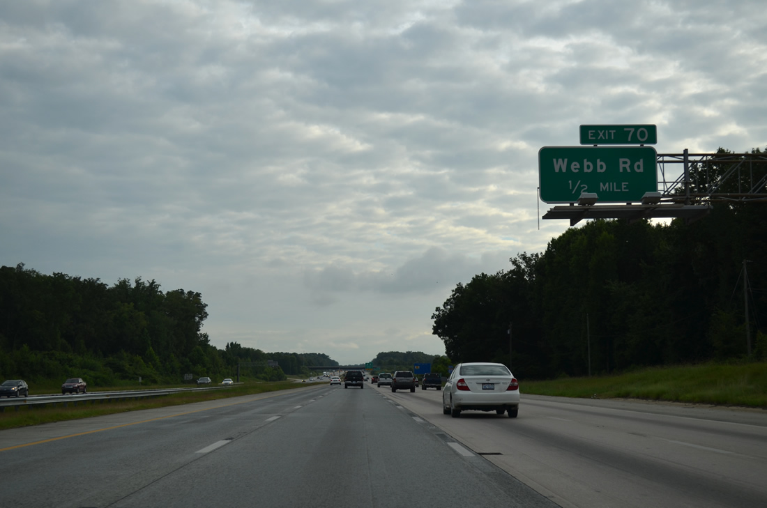
| One half mile north of the diamond interchange (Exit 70) joining I-85/U.S. 601 with Webb Road (SR 1500). 08/06/13 |
|
| I-85/U.S. 601 parallel Town Creek to the eastern reaches of China Grove at Exit 68. 08/06/13 |
|
| Exit 70 leaves the southbound freeway for Webb Road west to U.S. 29 (Main Street) at Roseman Road (SR 1500). 08/06/13 |
|
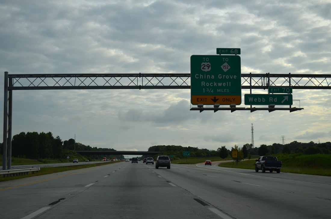
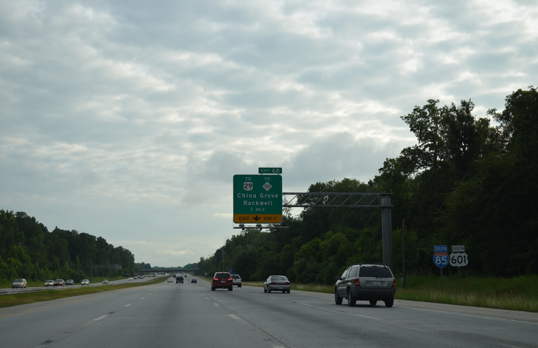
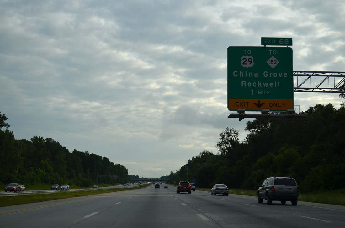
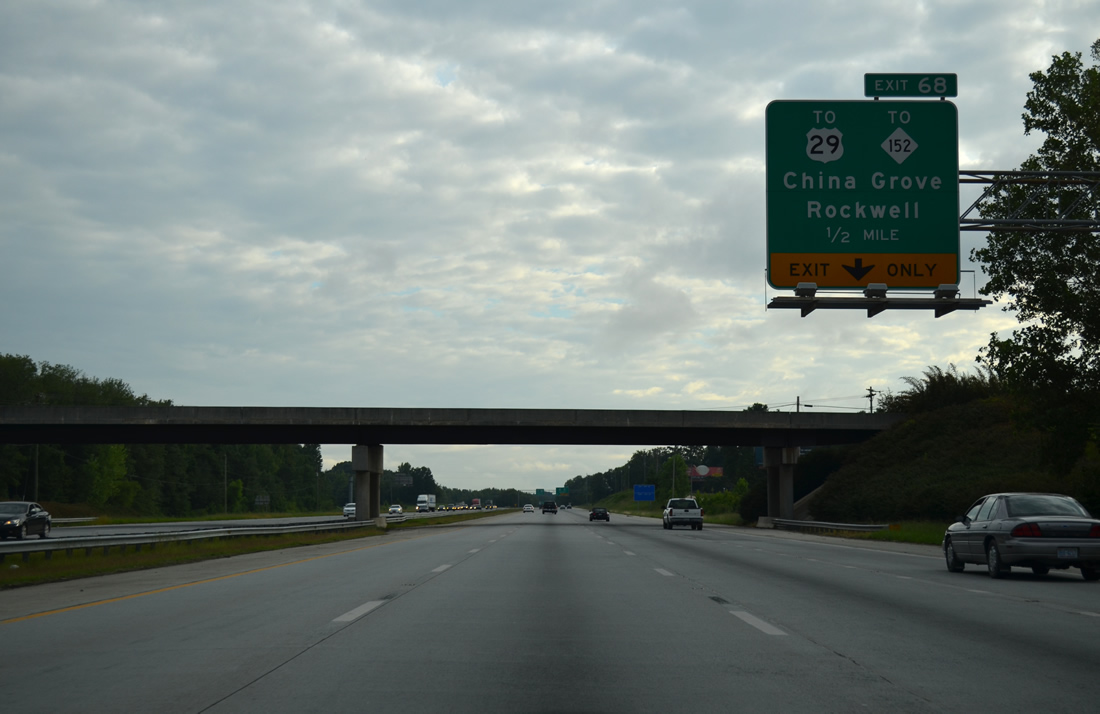
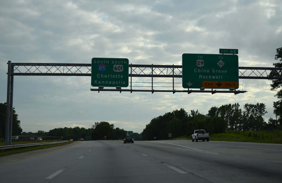
| A wye interchange (Exit 68) previously joined I-85/U.S. 601 with U.S. 29 directly via SR 2664. Completed in Summer 2000, this stretch of freeway was modernized during Phase I of the 1997-2007 project.6 08/06/13 |
|
| Widening of I-85 south from Exit 68 from Fall 2016 to Summer 2020 eliminated the wye with the U.S. 29/601 Connector (SR 2664) and reconfigured the adjacent exchange with NC 152 into a dumbbell interchange. NC 152 leads east to Rockwell and travels west from U.S. 29 in China Grove via Church Street to Mooresville. 08/06/13 |
|
| Interstate 85 shifts eastward to bypass most of Kannapolis on the 33 mile drive to Charlotte. Five exits serve the city over the next 14 miles. 08/06/13 |
|
| Another Mt. Hope Church Road (one met I-85 previously east of Greensboro) passes overhead. I-85 was constructed as new expressway for U.S. 29 from China Grove northeast to Greensboro in the 1950s. The former connector to U.S. 29 represented the southern extent of that expressway. 08/06/13 |
|
| U.S. 29 splits with Main Street for a four lane bypass of China Grove to Landis and Cannon Boulevard through Kannapolis. Main Street, formerly signed as U.S. 29A, follows the old route through the China Grove city and Landis town centers. 08/06/13 |
|
| I-85/U.S. 601 previously reduced to a four lane freeway ahead of a half diamond interchange (Exit 68 on northbound) with NC 152. Expansion of I-85 south to Exit 55 (NC 73) to eight overall lanes cost $297.14 million. 08/06/13 |
|
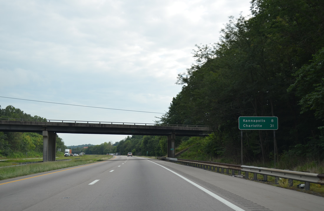
| Southbound distance sign posted eight miles from the Kannapolis city center and 31 miles from Charlotte at the Lentz Road (SR 1137) overpass. 08/06/13 |
|
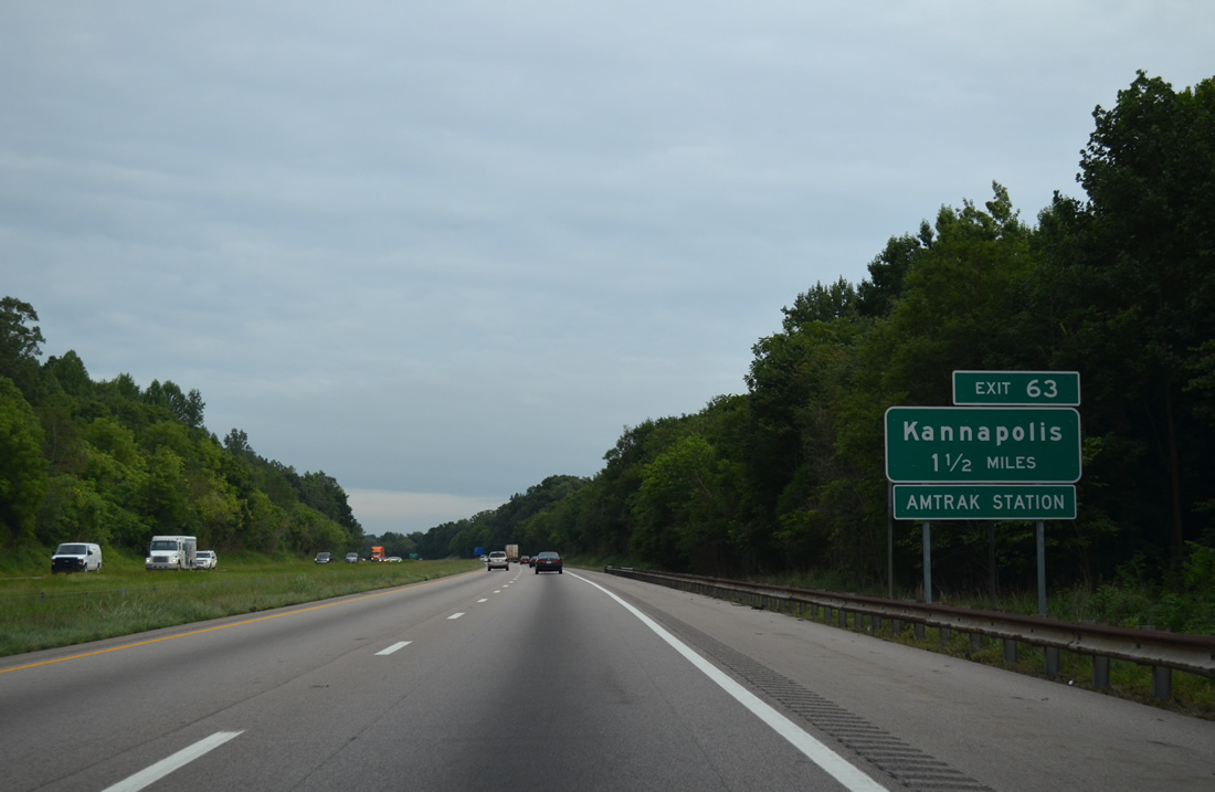
| A parclo A2 interchange was built at Old Beatty Ford Road (SR 1221) during I-85 expansion completed in Summer 2020. The exchange (Exit 63) with Lane Street (SR 2180) was converted into a dogbone interchange. 08/06/13 |
|
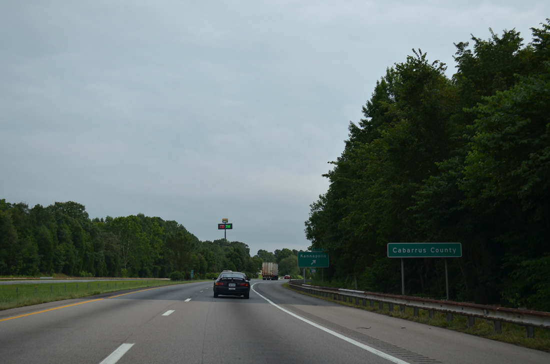
| I-85/U.S. 601 circumvents adjacent Lake Fisher to the Cabarrus County line. 08/06/13 |
|
| Lane Street heads 0.79 miles east from Exit 63 to Old Salisbury-Concord Road (SR 1002) and west 2.50 miles to Brantley Road (SR 2000), one block east of U.S. 29 (Cannon Boulevard) in Kannapolis. 08/06/13 |
|
| Brantley Road (SR 2000) branches southward from Lane Street to cross Lake Fisher ahead of an overpass spanning I-85/U.S. 601. 08/06/13 |
|
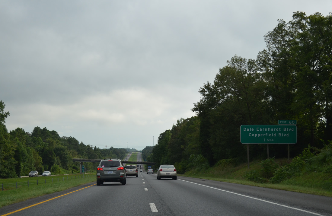
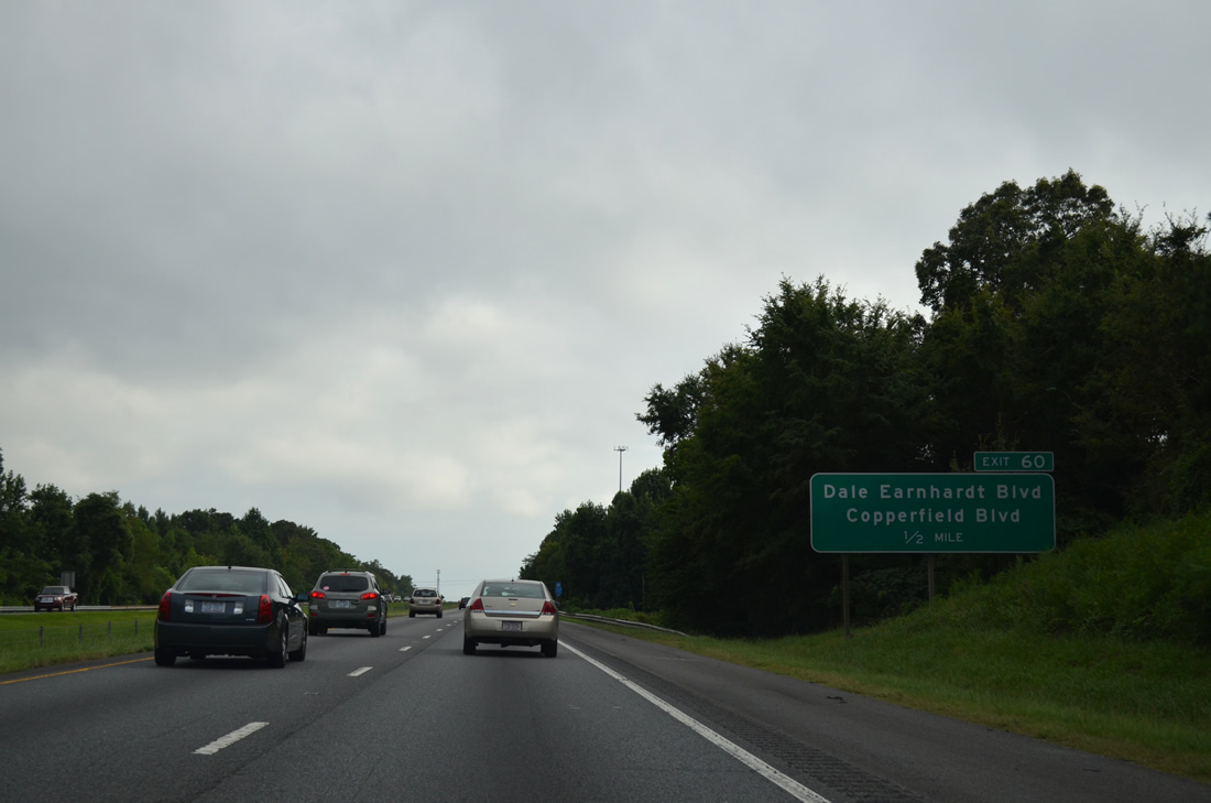
| Copperfield Boulevard north and Dale Earnhardt Boulevard (SR 2126) east come together at a commercialized parclo interchange (Exit 60) with I-85/U.S. 601 in one mile. 08/06/13 |
|
| Dale Earnhardt Boulevard was renamed from Earnhardt Road on October 5, 1993 during a day of celebration to honor the Kannapolis native and seven-time NASCAR Winston Cup Champion.7 The five lane arterial leads northwest to become NC 3 west from Concord Lake Road. NC 3 continues Dale Earnhardt Boulevard northwest to Mooresville Road through Kannapolis. 08/06/13 |
|
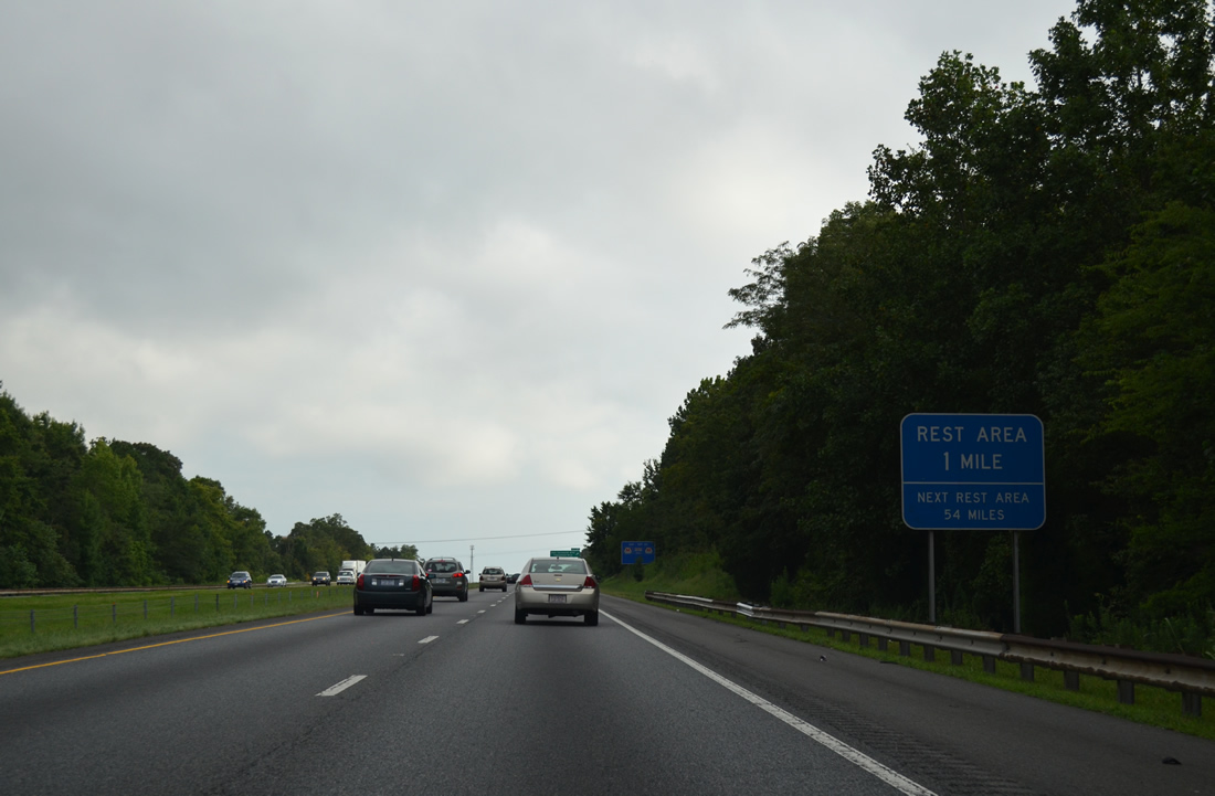
| Located beyond Exit 60, rest areas line both sides of Interstate 85 by the adjacent development off NC 3 (Concord Lake Road) and Copperfield Boulevard. 08/06/13 |
|
| Copperfield Boulevard south follows the east side of I-85/U.S. 601 from Exit 60 to NC 3 (Concord Lake Road) near Carolina Mall. NC 3 crosses the freeway without direct access just east of Exit 58.
08/06/13 |
|
| Development in the form of offices, hotels and retail followed the 1992 completion of the Earnhardt Road interchange southward along Copperfield Boulevard to then-NC 136. 08/06/13 |
|
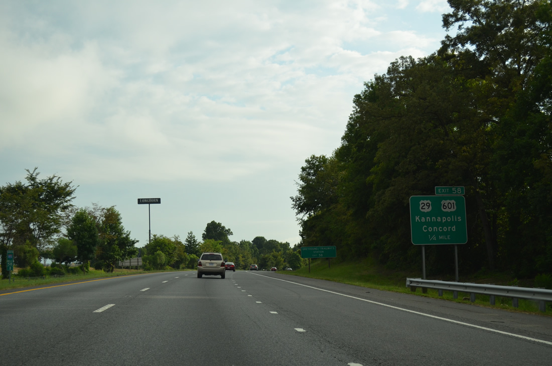
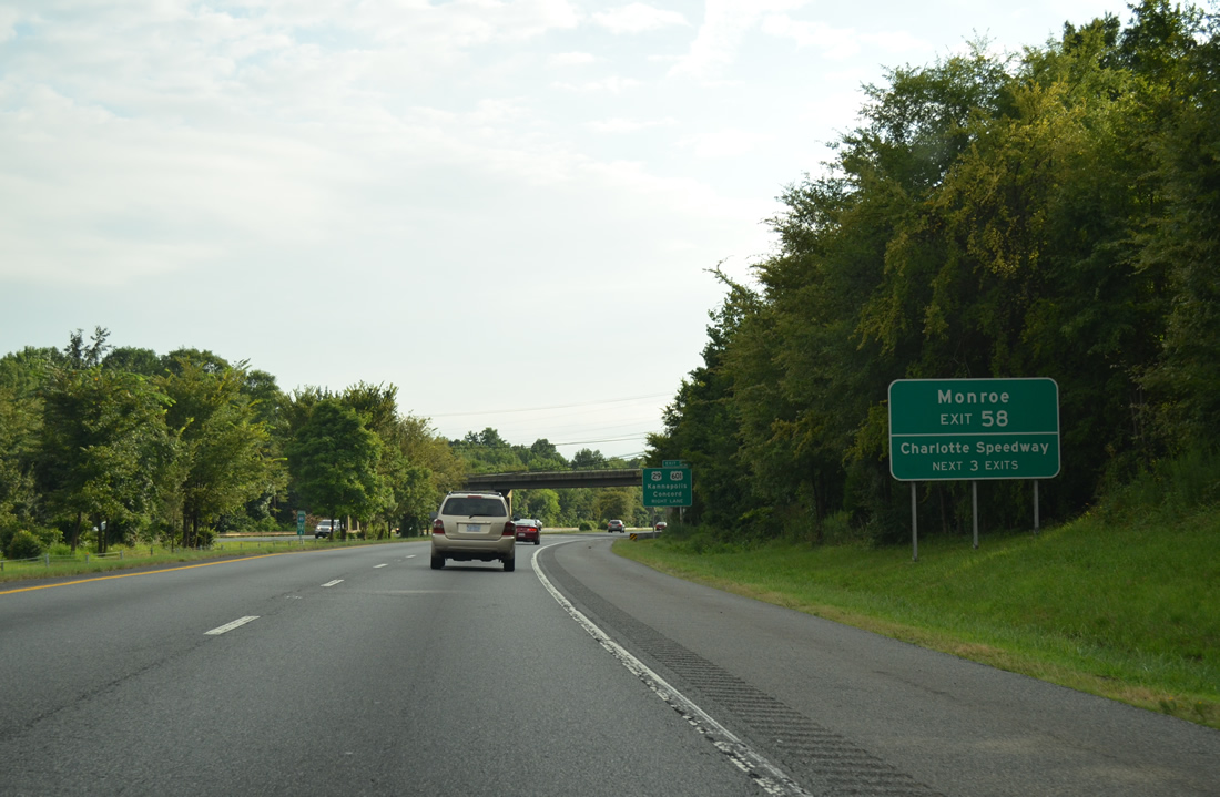
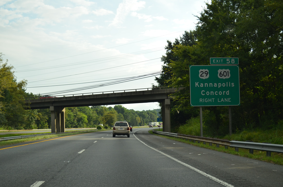
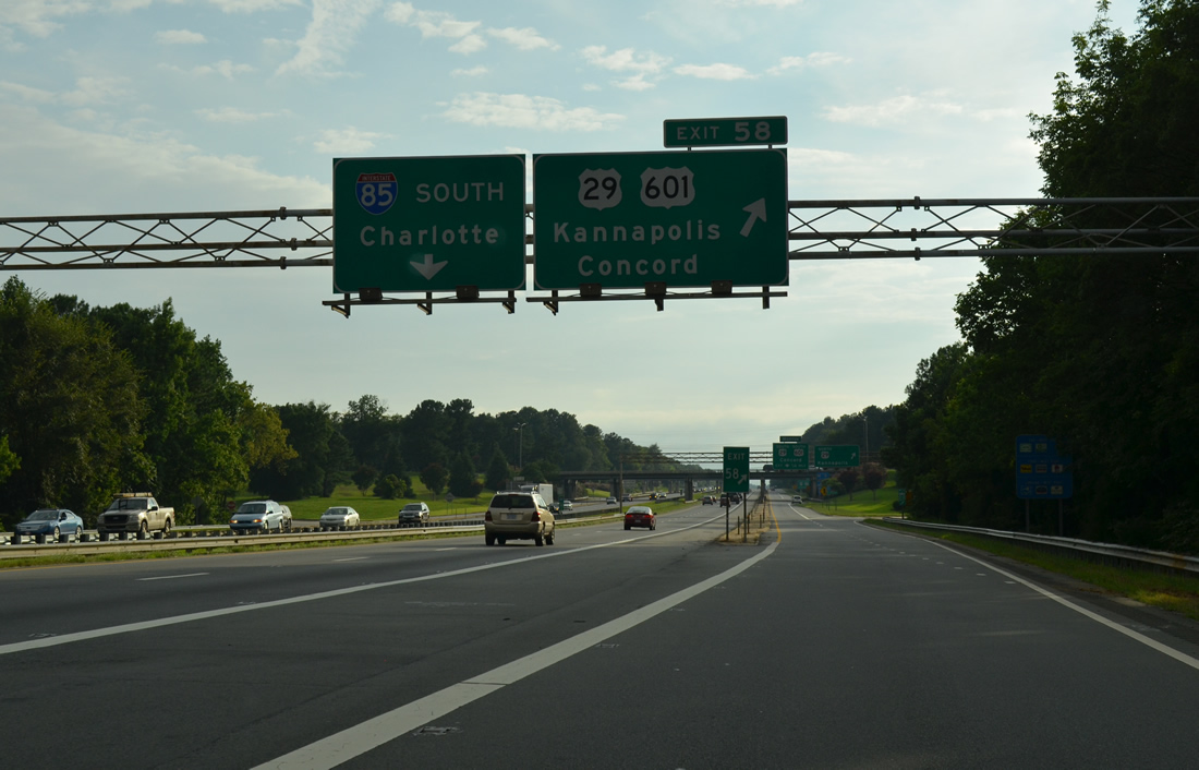
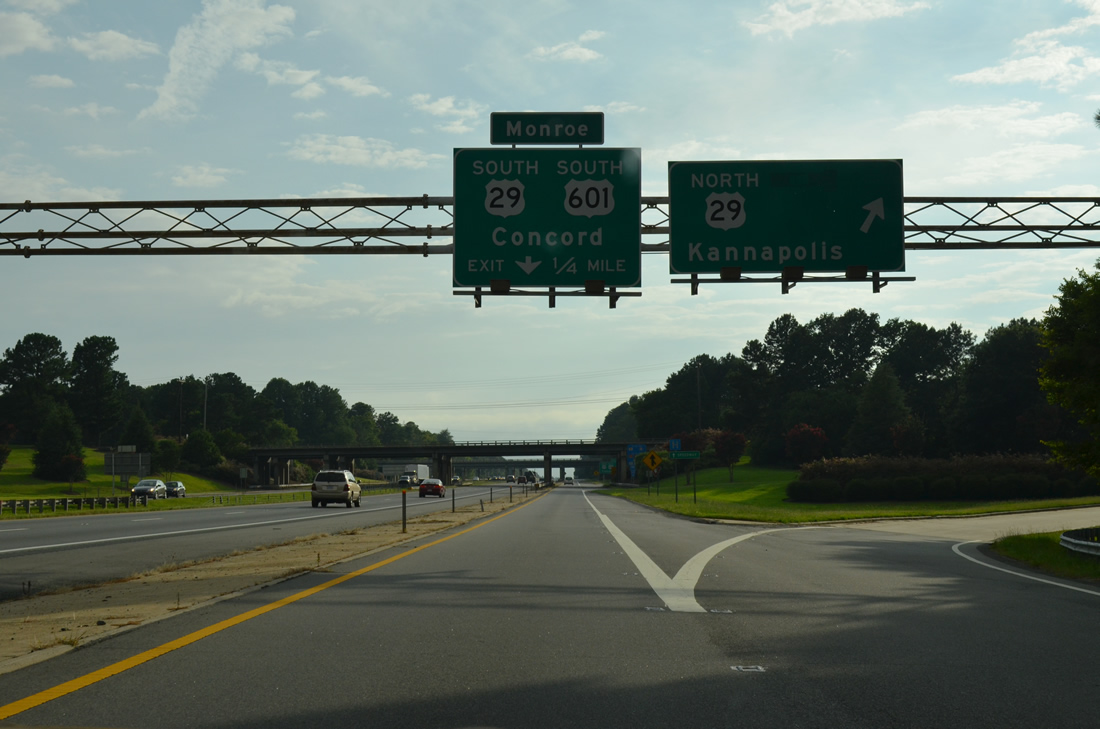
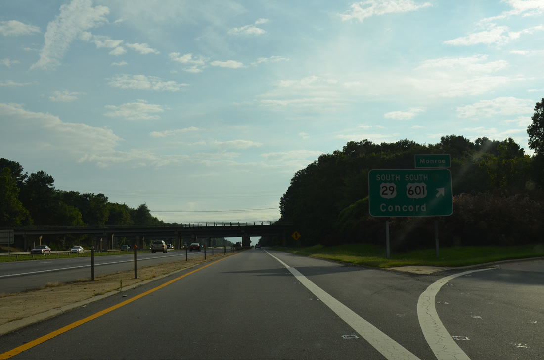
| U.S. 601 parts ways with Interstate 85 south at diverging diamond interchange (Exit 58) with U.S. 29 (Cannon Boulevard north / Concord Parkway south). U.S. 601 combines with U.S. 29 south for 3.6 miles along a commercial arterial between Carolina Mall and W.C. Coleman Boulevard near West Concord. 08/06/13 |
|
| U.S. 29 leaves Kannapolis along an older bypass of Concord before turning west along Concord Parkway to Charlotte Motor Speedway and N Tryon Street into Charlotte. 08/06/13 |
|
| U.S. 601 connects the city of Concord with the Union County seat of Monroe by way of Midland, Fairview and Unionville. Exit 58 is the first of three interchanges for Charlotte Motor Speedway, a 1.5 mile quad oval track hosting NASCAR events, along U.S. 29 at Bruton Smith Boulevard (SR 2894). 08/06/13 |
|
| NC 3 spans I-85/U.S. 601 south ahead of Exit 58 for Cannon Boulevard north to Kannapolis and Concord Parkway south to Concord. The cloverleaf interchange with U.S. 29/601 was rebuilt as a DDI during 2015-2020 widening. 08/06/13 |
|
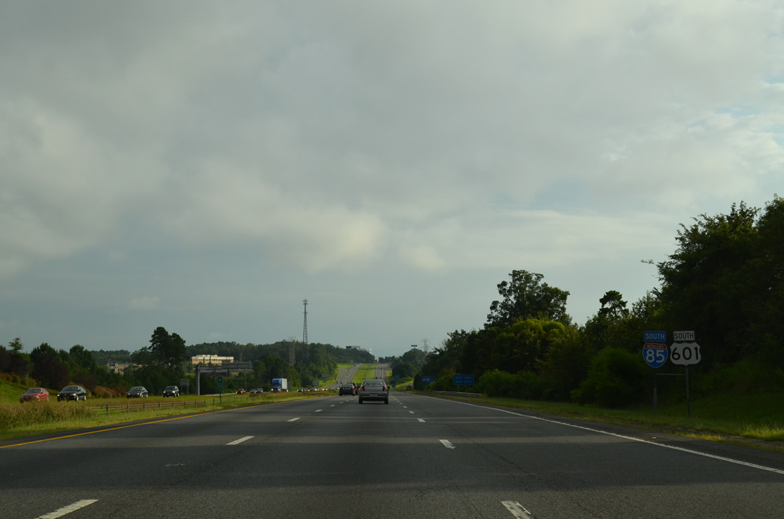
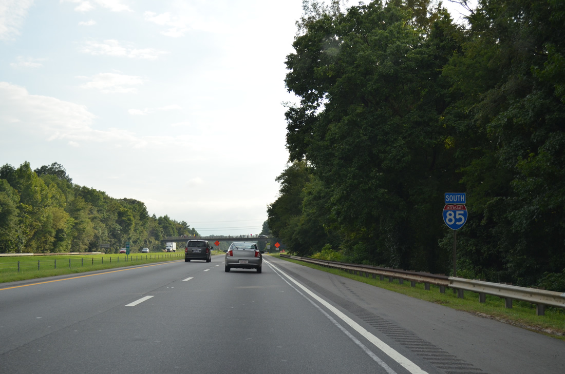
| Interstate 85 maintains eight overall lanes through the DDI with U.S. 29/601. US 601 comprises a two-state route for 316 miles from Mount Airy to U.S. 321 near Tarboro, South Carolina. 08/06/13 |
|
| An older guide sign for U.S. 29 north alluded to the former cosigning with U.S. 601 north through Kannapolis, Landis and China Grove. Old U.S. 29A follows Main Street south to Kannapolis Highway (SR 1008) just to the west. 08/06/13 |
|
| A loop ramp previously connected U.S. 601 south with U.S. 29 (Concord Parkway) from Interstate 85. NC 73, which lines Davidson Drive and Church Street south into Downtown Concord, merges with U.S. 29/601 nearby. 08/06/13 |
|
| Interstate 85 heads west from the split with U.S. 601 along the Kannapolis and Concord city line to Coddle Creek beyond Exit 54. 08/06/13 |
|
| NC 73 turns west from U.S. 29/601 along Davidson Highway to North Concord and I-85 at Exit 55, one mile beyond Irish Buffalo Creek. 08/06/13 |
|
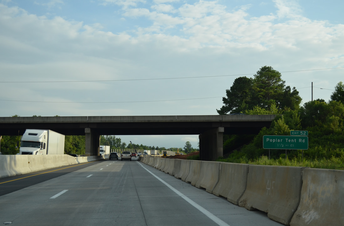
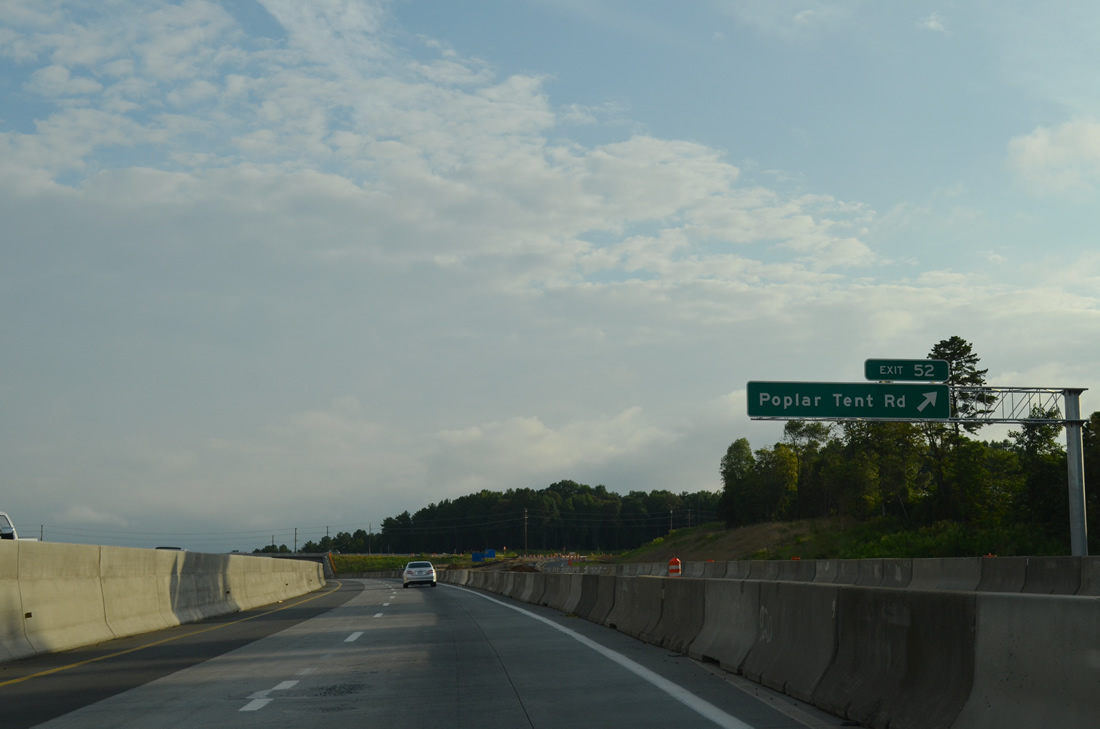
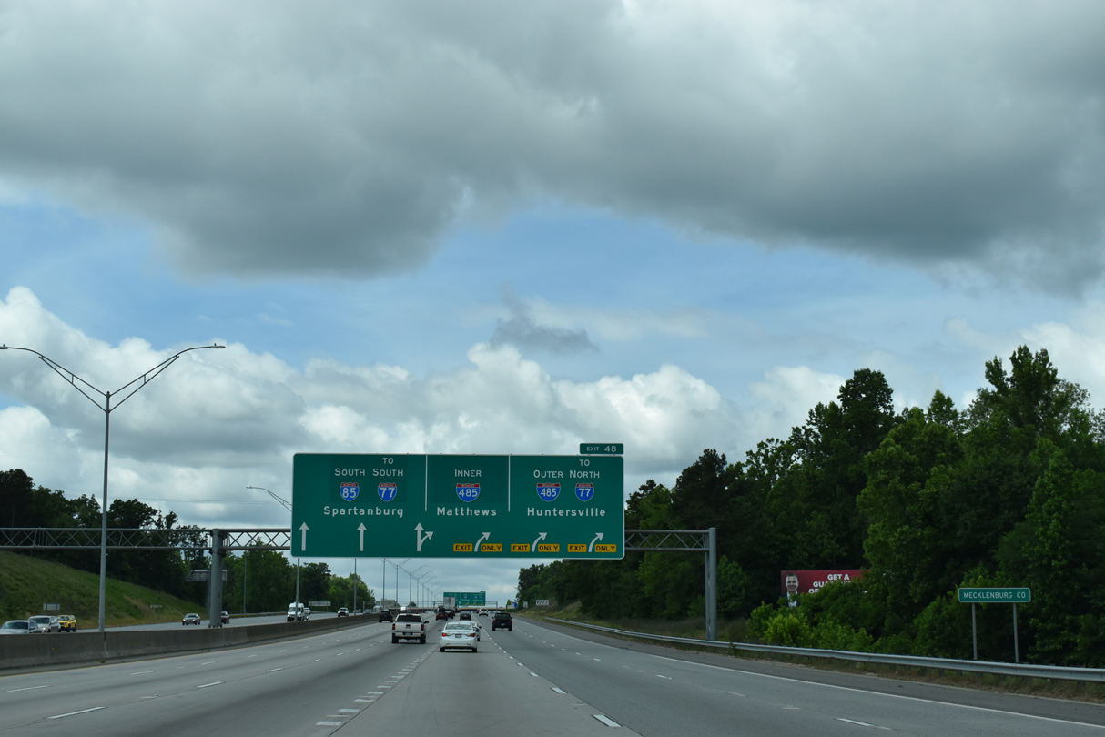
| A $138.7 million project underway by September 2010 expanded I-85 from four to eight lanes along a 7.3 mile stretch southwest from Irish Buffalo Creek to I-485. This work included converting the exchanges with NC 73 (Exit 55) and Poplar Tent Road (Exit 52) into diverging diamond interchanges. Construction was anticipated for completion by June 2014.10 08/06/13 |
|
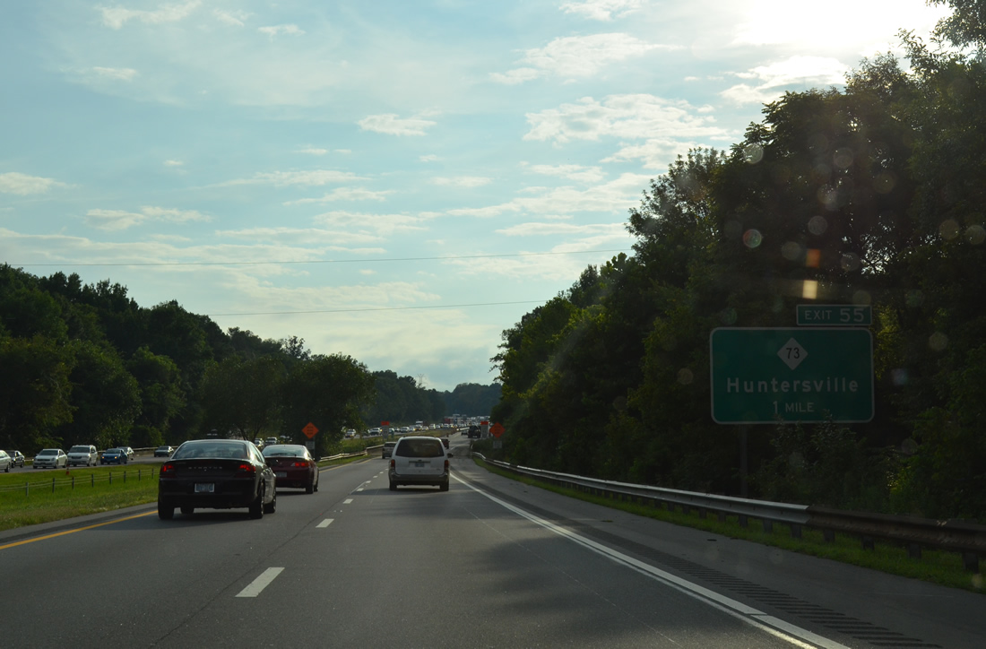
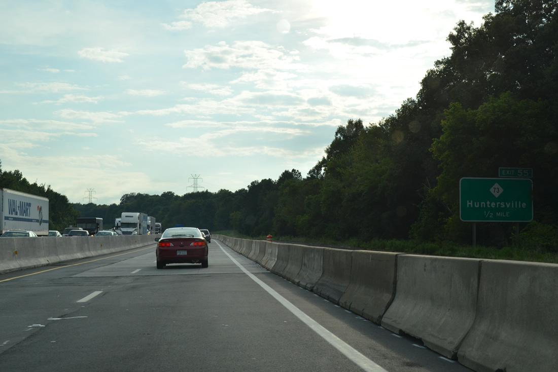
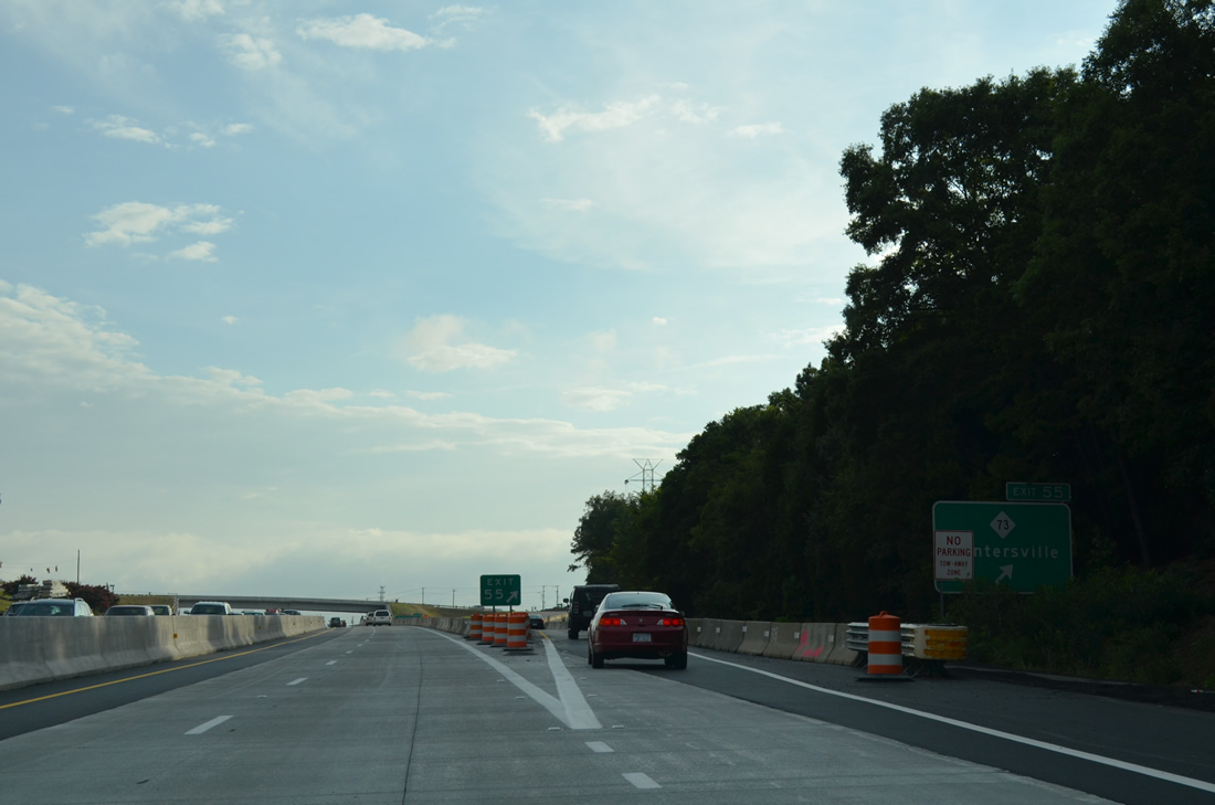
| Exit 55 leaves Interstate 85 south for NC 73 (Davidson Highway) east to Concord and west to Huntersville. NC 73 runs 118.5 miles from NC 27, east of Lincolnton, to U.S. 15/501, north of Pinehurst. 08/06/13 |
|
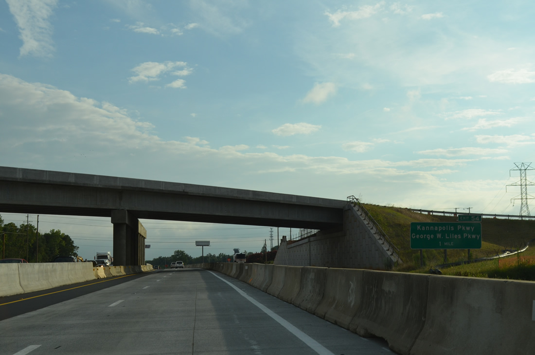
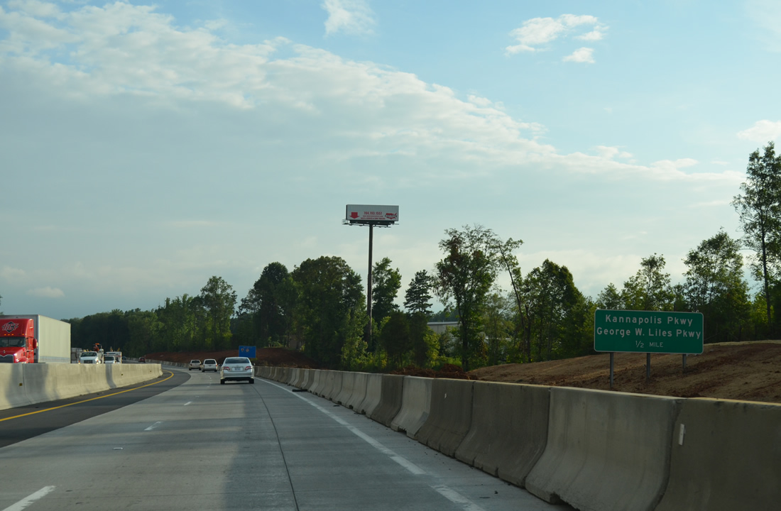
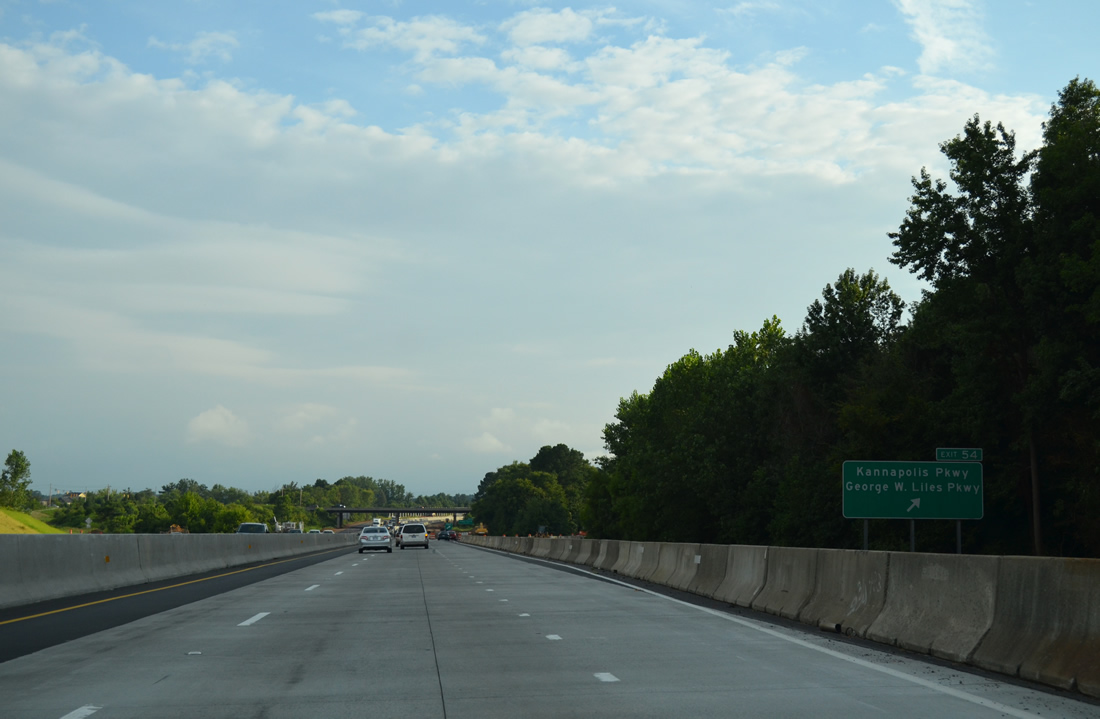
| Exit 54 joins I-85 with Kannapolis Parkway north (SR 1430) and George W. Liles Parkway (SR 1430). Originally touted as the Westside Bypass, SR 1430 between Poplar Tent Road and NC 73 opened to traffic along with the diamond interchange at Exit 54 on October 31, 2002.11 08/06/13 |
|
| George W. Liles Parkway extends SR 1430 south from the Kannapolis city line to Roberta Road (SR 1304) in Concord. A $44.5 million project lengthened the arterial south to U.S. 29 at then-Roberta Church Road (SR 1310),12 Slough Road (SR 1309) continues the route 1.84 miles from SR 1304 to NC 49. 08/06/13 |
|
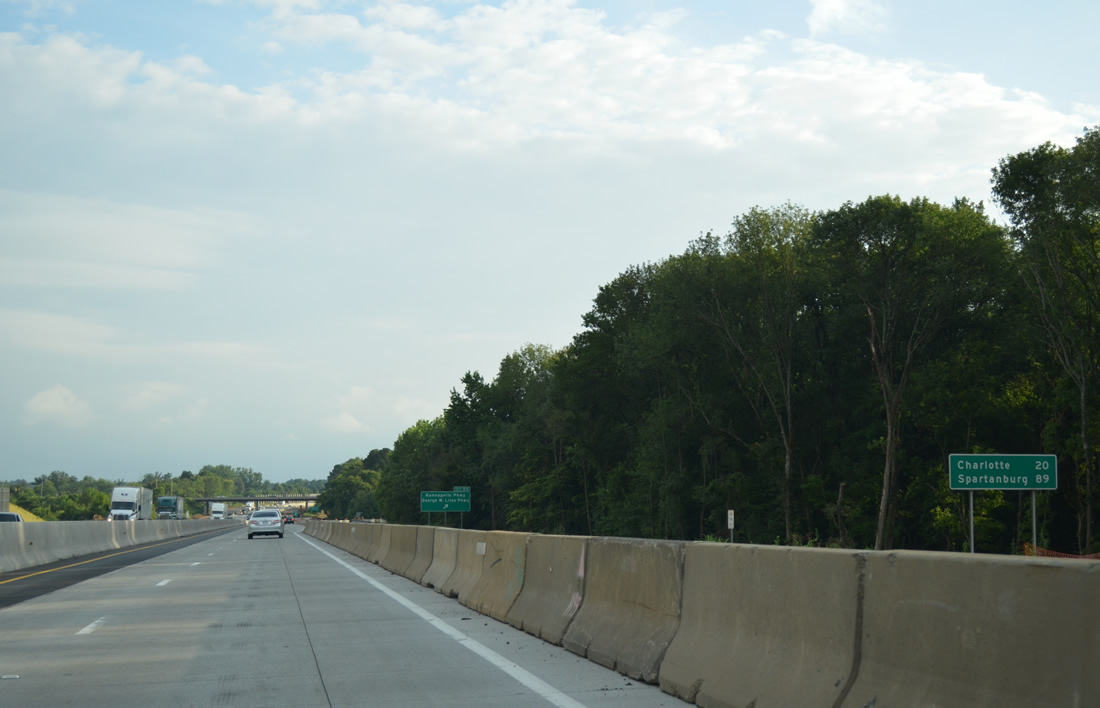
| Spartanburg, South Carolina debuts on southbound I-85 distance signs at 89 miles away. Downtown Charlotte is just 20 miles further. 08/06/13 |
|
| Kannapolis Parkway winds northward through western reaches of Kannapolis to NC 3 (Mooresville Road). The four lane arterial opened between NC 73 (Davidson Highway) and NC 3 in Spring 2007. An extension of the parkway north is proposed to Tuckaseegee Road (SR 1616).11 08/06/13 |
|
| Poplar Tent Road (SR 1394) stems west from U.S. 29/601 (Concord Parkway) and McGill Avenue to Interstate 85 at Exit 52 in 1.5 miles. 08/06/13 |
|
| West from the DDI with Interstate 85, Poplar Tent Road continues by a quarry to Cox Mill, Wallace Crossroads and a number of subdivisions to NC 73 along the Cabarrus and Mecklenburg County line. 08/06/13 |
|
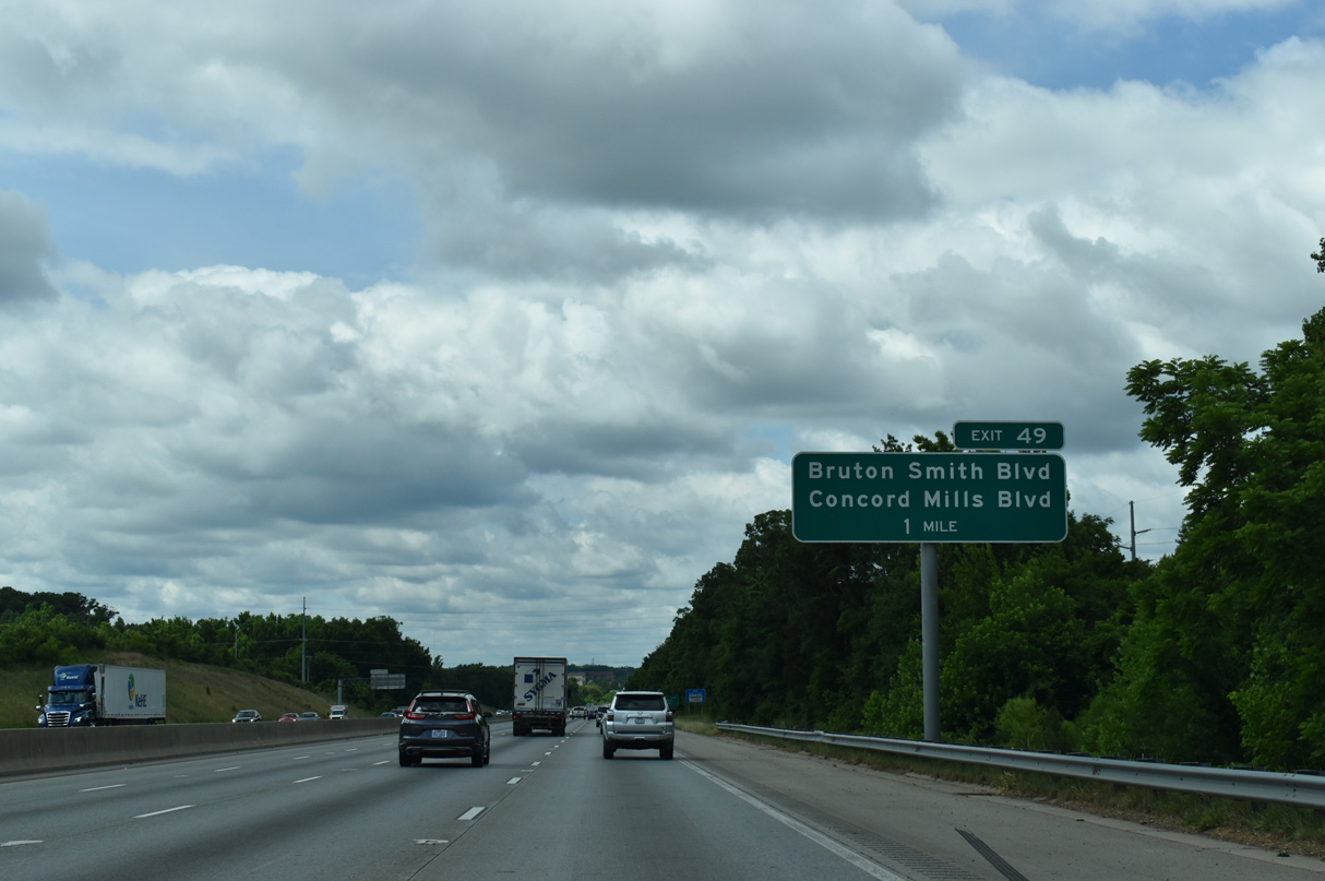
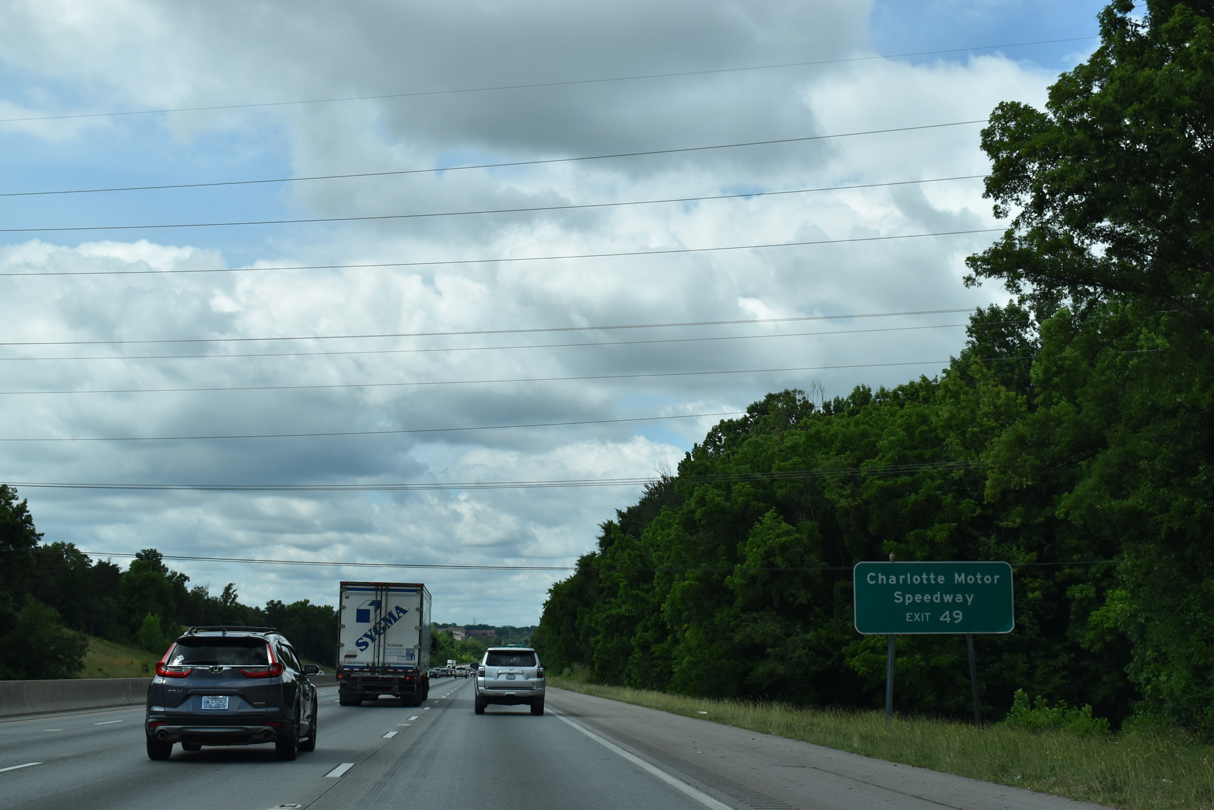
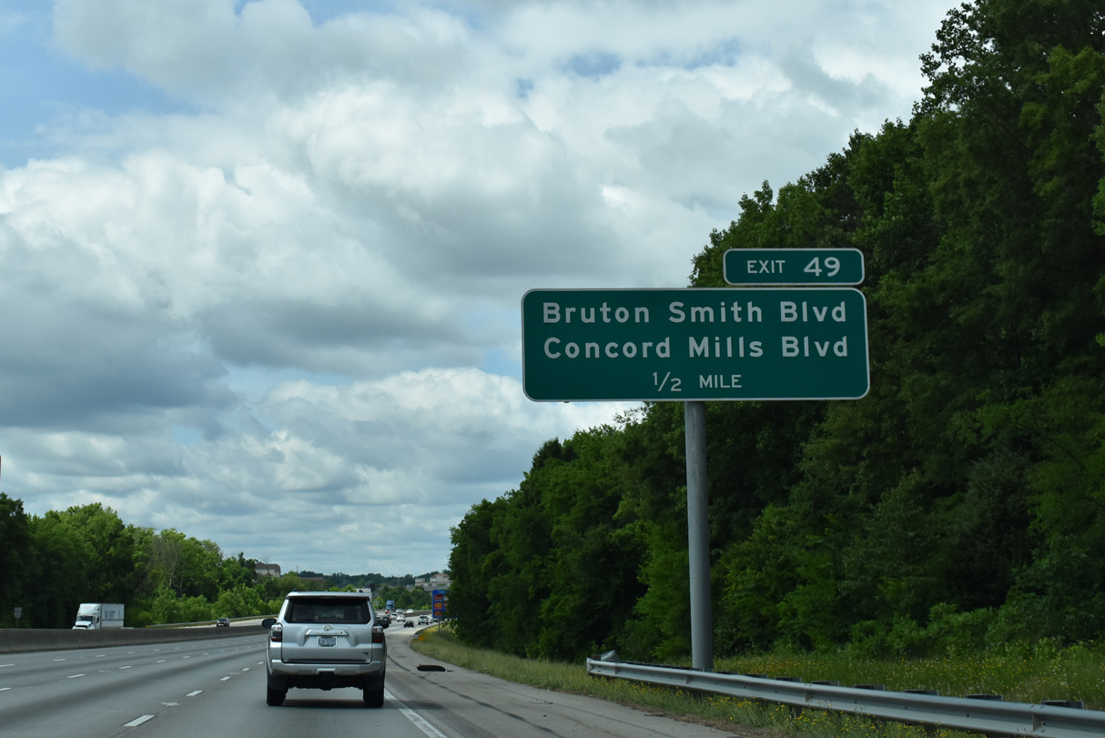
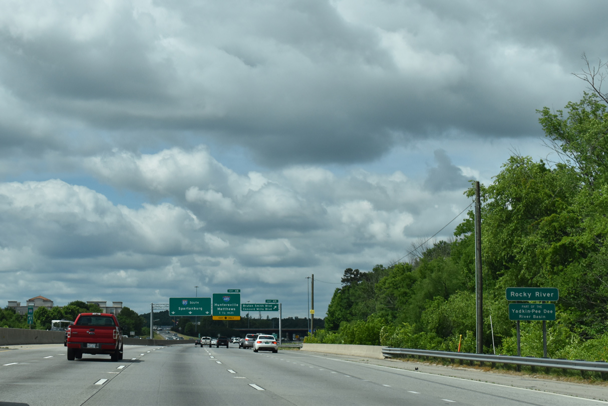
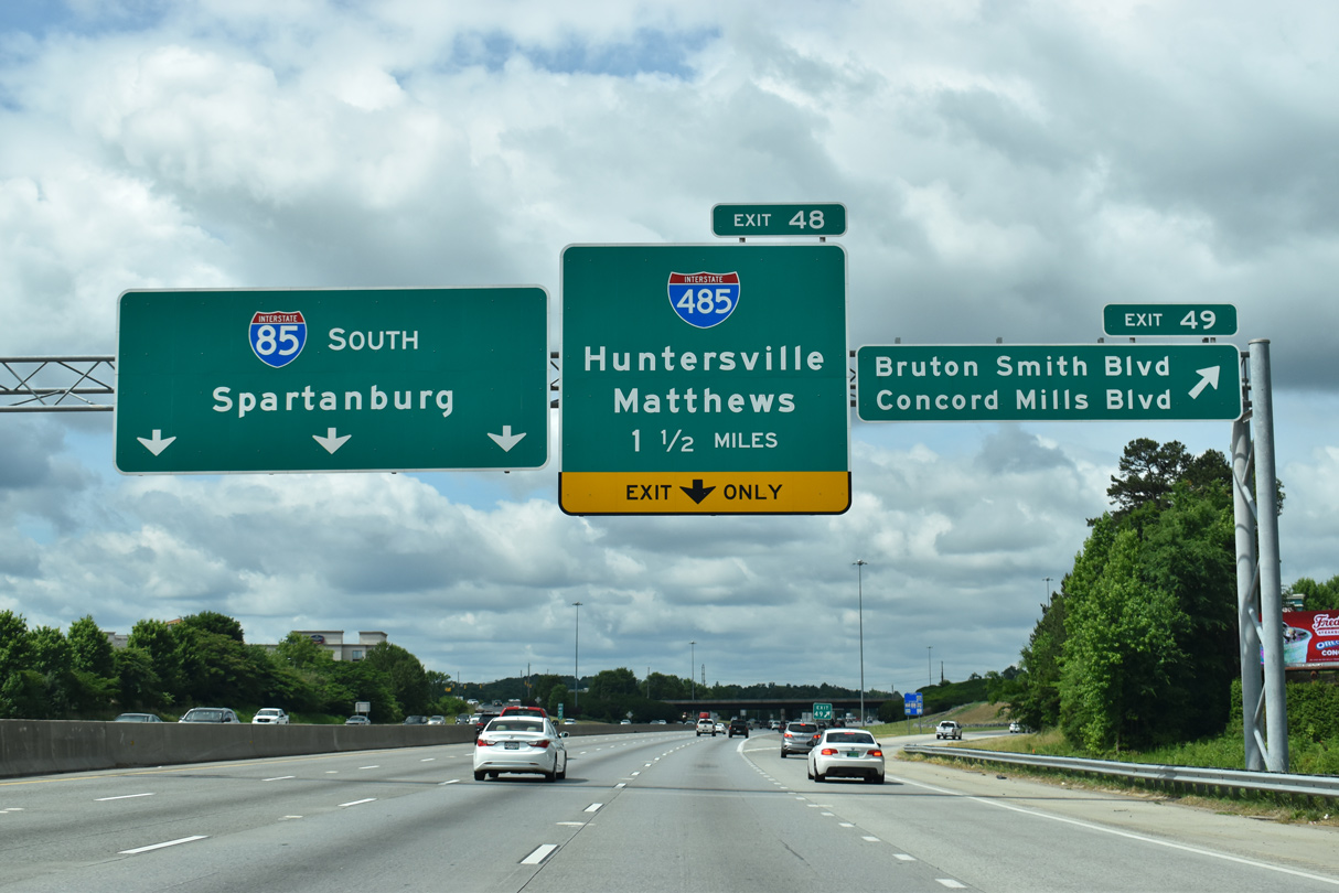
| Interstate 85 travels by Concord Regional Airport (JQF) to a parclo interchange (Exit 49) with Concord Mills Boulevard north and Bruton Smith Boulevard south. 05/31/21 |
|
| Collectively SR 2894, Concord Mills and Bruton Smith Boulevard connect Interstate 85 with adjacent Concord Mills Mall and Charlotte Motor Speedway at U.S. 29. 05/31/21 |
|
| Christenbury Parkway continues SR 2894 north from Concord Mills Boulevard to the Highland Creek suburb of Charlotte. 05/31/21 |
|
| Exit 49 departs Interstate 85 south for Concord Mills Boulevard north to Derita Road (SR 1445) and Bruton Smith Boulevard (formerly Speedway Boulevard) south to U.S. 29 (Concord Parkway) just beyond the Rocky River. 05/31/21 |
|
| The exchange at Exit 49 opened to traffic on October 1, 1996 in conjunction with Speedway Boulevard south to U.S. 29 at Charlotte Motor Speedway.13 05/31/21 |
|
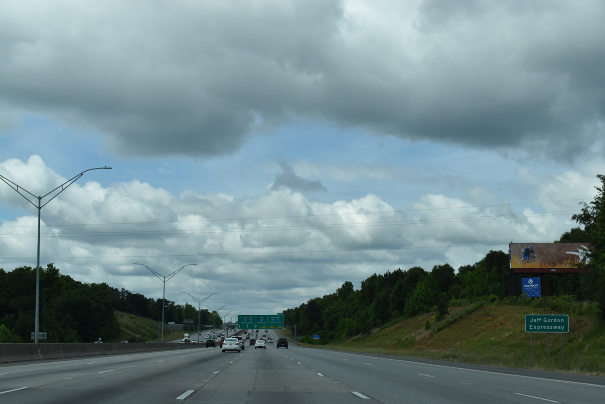
| Interstate 85 southwest from the Cabarrus / Mecklenburg County line to the Charlotte city limits is the Jeff Gordon Expressway, named after the four time NASCAR cup series champion. 05/31/21 |
|
| Interstate 85 south enters Mecklenburg County along an undeveloped stretch between Concord Mills and Ridge Road (SR 2464). 05/31/21 |
Page Updated 11-23-2022.


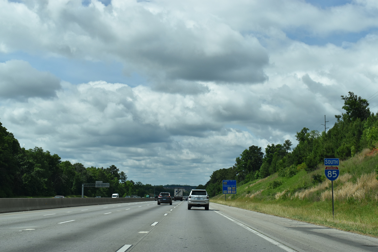
 South
South