|
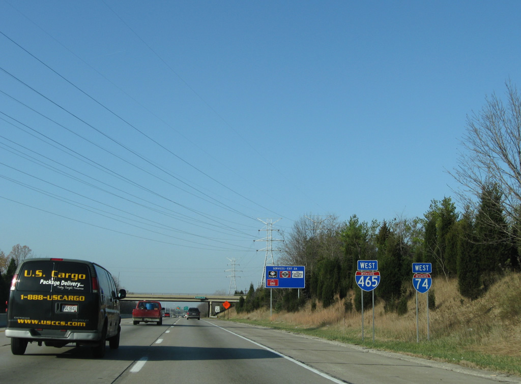
| I-74 overlaps with Interstate 465 west for 20.60 miles across the south side of Indianapolis. 11/05/09 |
|
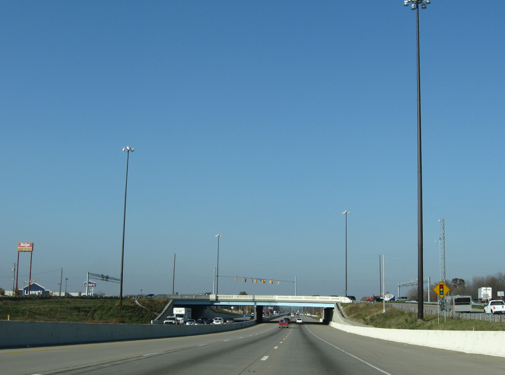
| I-74/465 enter the city of Beech Grove west ahead of Exit 52 with Emerson Avenue. 11/05/09 |
|
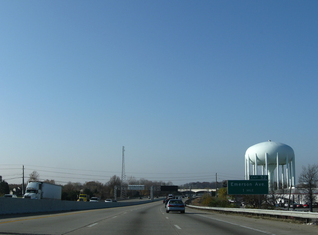
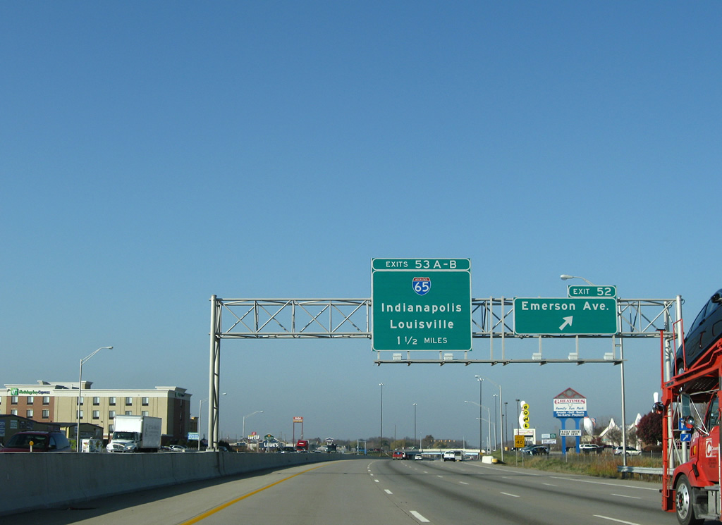
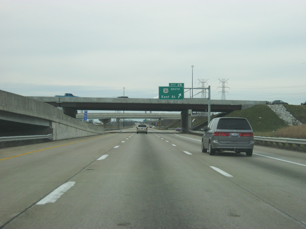
| Interstate 65 converges with the Indianapolis Beltway west of Beech Grove. Locally I-65 joins Downtown with Greenwood, Franklin and the south suburbs. 11/05/09 |
|
| Exit 52 partitions with I-74/465 west for Emerson Avenue, 1.50 miles from the cloverstack interchange (Exit 53) with Interstate 65. Emerson Avenue is the main arterial through Beech Grove, running east of bisecting industrial interestsand west of residential areas. 11/05/09 |
|
| Emerson Avenue leads north from Beech Grove to Irvington and Sunnyview and south across Interstate 65 to Greenwood. 11/05/09 |
|
| A single point urban interchange (Exit 52) connects I-74/465 and Emerson Avenue in Beech Grove. 11/05/09 |
|
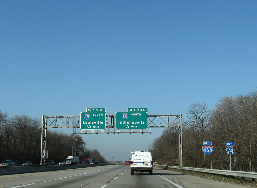
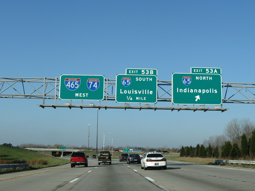
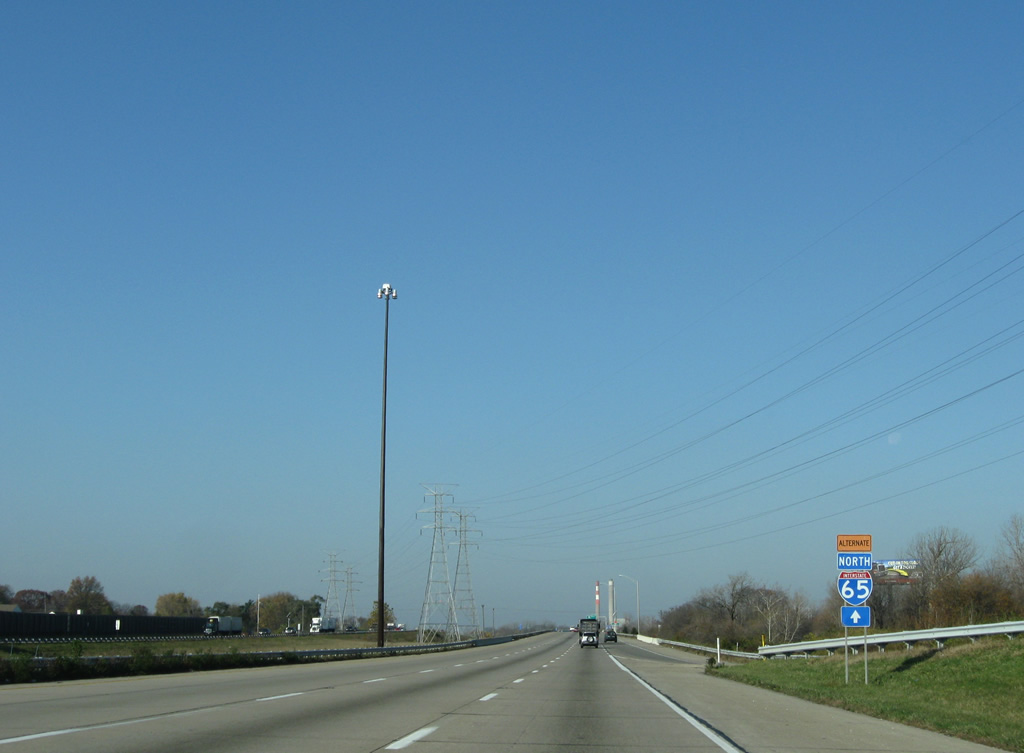
| 261.27 miles long in Indiana, Interstate 65 runs northwest to Lafayette, industrial Gary and the Chicagoland area and south to Columbus, and Clarksville / Jeffersonville north of Louisville. 11/05/09 |
|
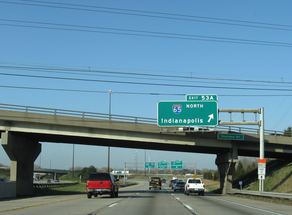
| Interstate 65 north leads five miles to the Indianapolis central business district. 11/05/09 |
|
| Eventual construction upgraded Exit 53 at Interstate 65 into a systems interchange. 11/05/09 |
|
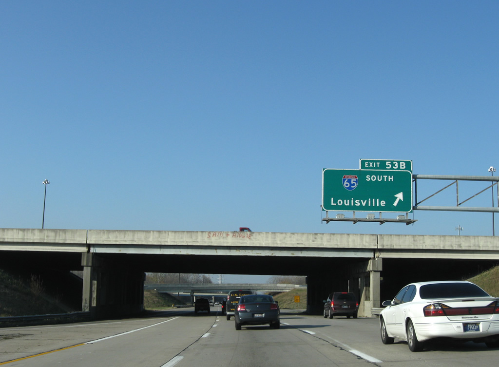
| Interstate 65 crosses the Ohio River southward to Downtown Louisville in 106 miles. The freeway was previously expanded to six lanes from I-74/465 to Exit 99 at Greenwood. 11/05/09 |
|
| I-74/465 travel between the University Heights and Rosedale Hills communities west of Interstate 65. 11/05/09 |
|
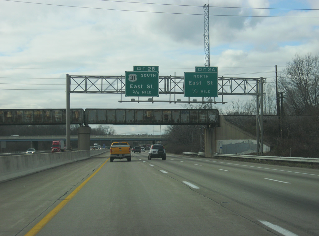
| U.S. 31 south leaves an unmarked overlap with the Indianapolis Beltway and rejoins its original alignment on East Street at Exit 2. 12/17/11 |
|
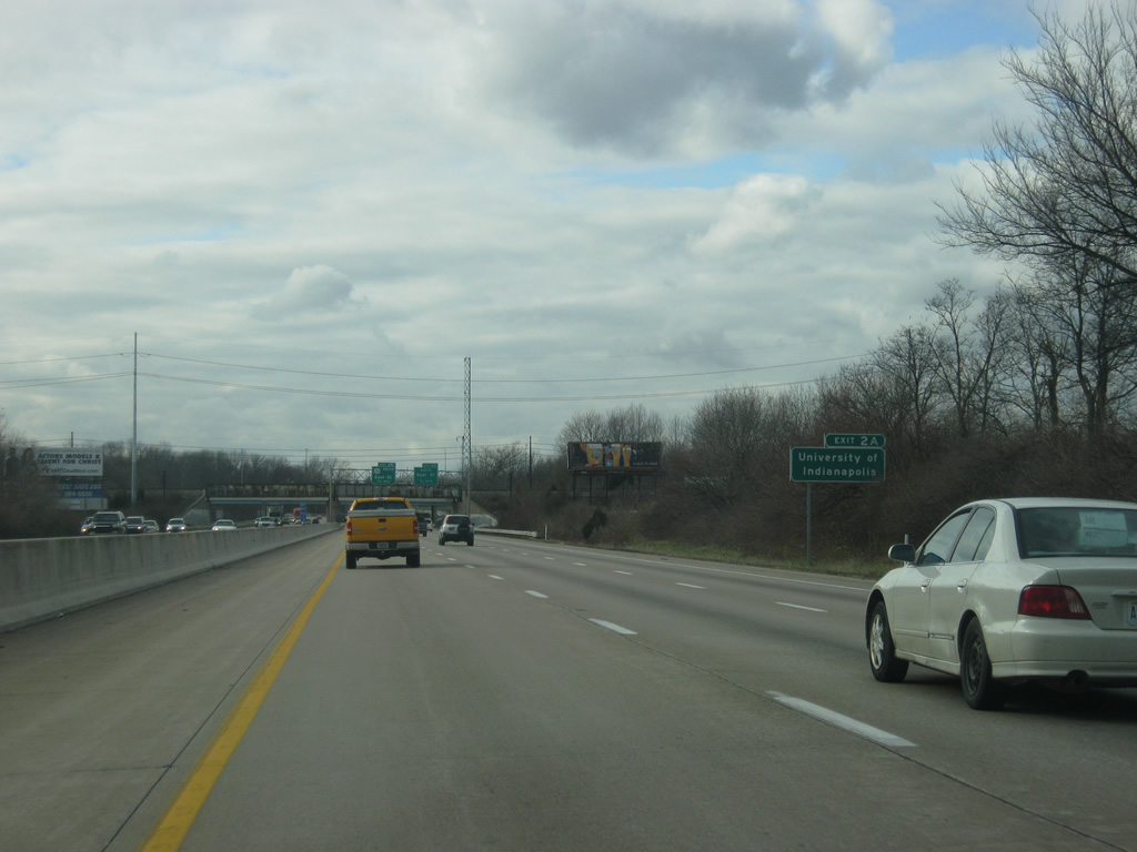
| The University of Indianapolis can be reached by using Exit 2A and following East Street north to Hanna Avenue east. 12/17/11 |
|
| The directional cloverleaf interchange (Exit 2) with East Street is a half mile west of the Louisville & Indiana Railroad overpass. East Street was formerly part of U.S. 31 northward to Madison Avenue. Madison Avenue southeast to Homecroft, Southport and Greenwood was the 1948 alignment for SR 431. 12/17/11 |
|
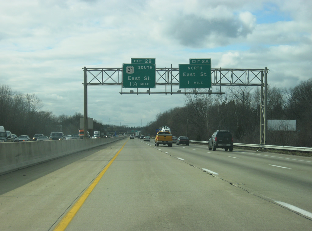
| Exit 2 A leaves I-74/465 west for East Street north to the University of Indianapolis and Madison Avenue for Downtown. 12/17/11 |
|
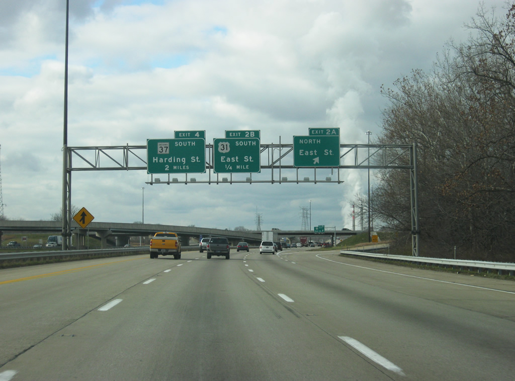
| Exit 2 B loops onto U.S. 31 (East Street) south to Greenwood. U.S. 31 follows the I-65 corridor to Franklin, Columbus and Louisville, Kentucky. 12/17/11 |
|
| Lick Creek flows in the median of the beltway at Exit 2. A transmission corridor runs westward across I-465 to a substation near Exit 4. 11/05/09 |
|
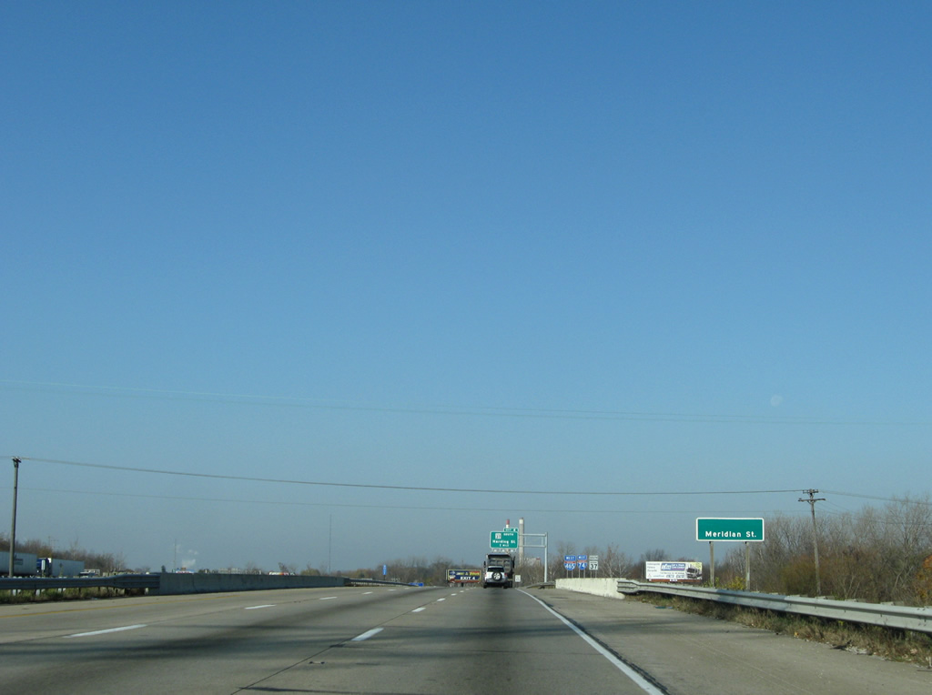
| Meridian Street, former State Road 135, passes below I-74/465 west. SR 135 continued Meridian Street south from U.S. 31 and Downtown to Thompson Road, where the route currently turns east from the south to end at U.S. 31 (East Street). 11/05/09 |
|
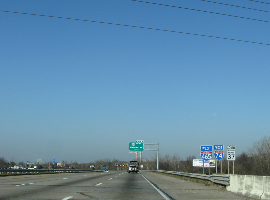
| Prior to being relocated wholly along the beltway north to I-69, SR 37 was first realigned onto I-465 between Exits 2 and 4. This shield assembly remained from that time period. Beyond Exit 4. U.S. 36, U.S. 40 and SR 67 continue unsigned along the beltway west. 11/05/09 |
|
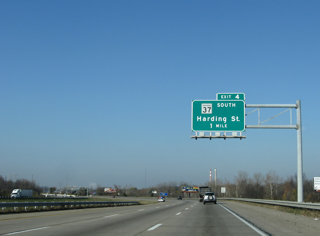
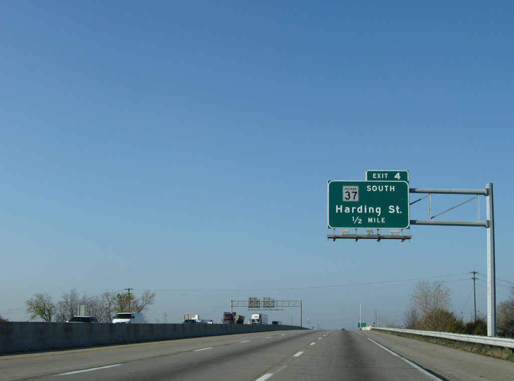
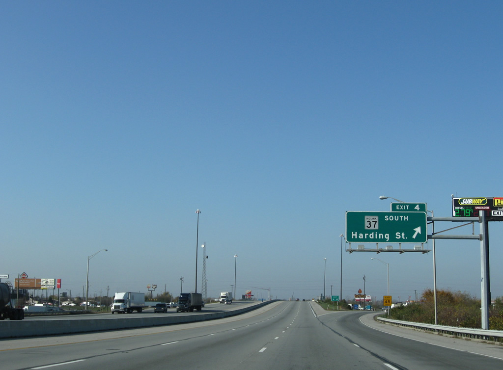
| SR 37 branches south of I-74/465 at the diamond interchange (Exit 4) with Harding Street. The 1968 Indianapolis Transportation Plan outlined upgrading Harding Street north as the Harding Freeway.1 The unconstructed route was envisioned along Harding Street north to Oliver Avenue beyond I-70, and a separate alignment northwest to I-65 and Kessler Boulevard. 11/05/09 |
|
| Angling west southwest along I-74/465 near the Bluff Road underpass. Bluff Road represents the former alignment of SR 37 north to West Street and Downtown and south to Glenns Valley. 11/05/09 |
|
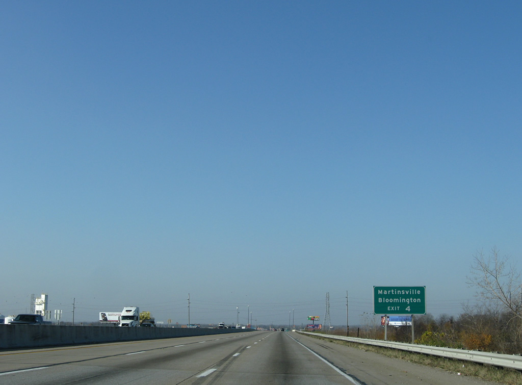
| I-69 superseded SR 37 southwest from Indianapolis to Waverly, Martinsville and Bloomington. The state road was previously a four lane arterial or at grade expressway. I-69 was completed south from Martinsville in 2018. 11/05/09 |
|
| Harding Street angled southwest to become part of Interstate 69 nearby. Opened fully by August 9, 2024, the final leg of the I-69 extension ties into I-74/465 just west of Exit 4. SR 37 has two legs: the south segment leads from Marion to Tell City, the north segment travels between Fort Wayne and Ohio State Route 2. 11/05/09 |
|
| I-74/465 travel alongside a rock quarry to the north and the Sunshine Gardens neighborhood to the south. Construction underway by 2022 along this stretch built the two-wye interchange with Interstate 69. 11/05/09 |
|
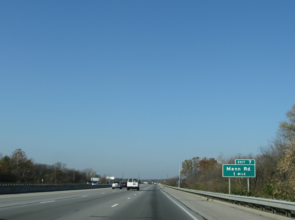
| Continuing west, I-74/465 spans the White River West Fork ahead of Exit 7 to Mann Roads. 11/05/09 |
|
| The same transmission corridor that crossed over the Beltway at Lick Creek reappears at the half diamond interchange (Exit 7) with Mann Road. Mann Road heads north to Kentucky Avenue (former SR 67) at Mars Hill and south to Landersville in Morgan County. 11/05/09 |
|
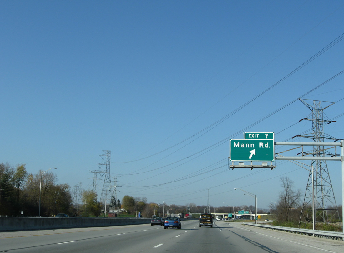
| I-74/465 curve northwest from the exchange with Mann Road. 11/05/09 |
|
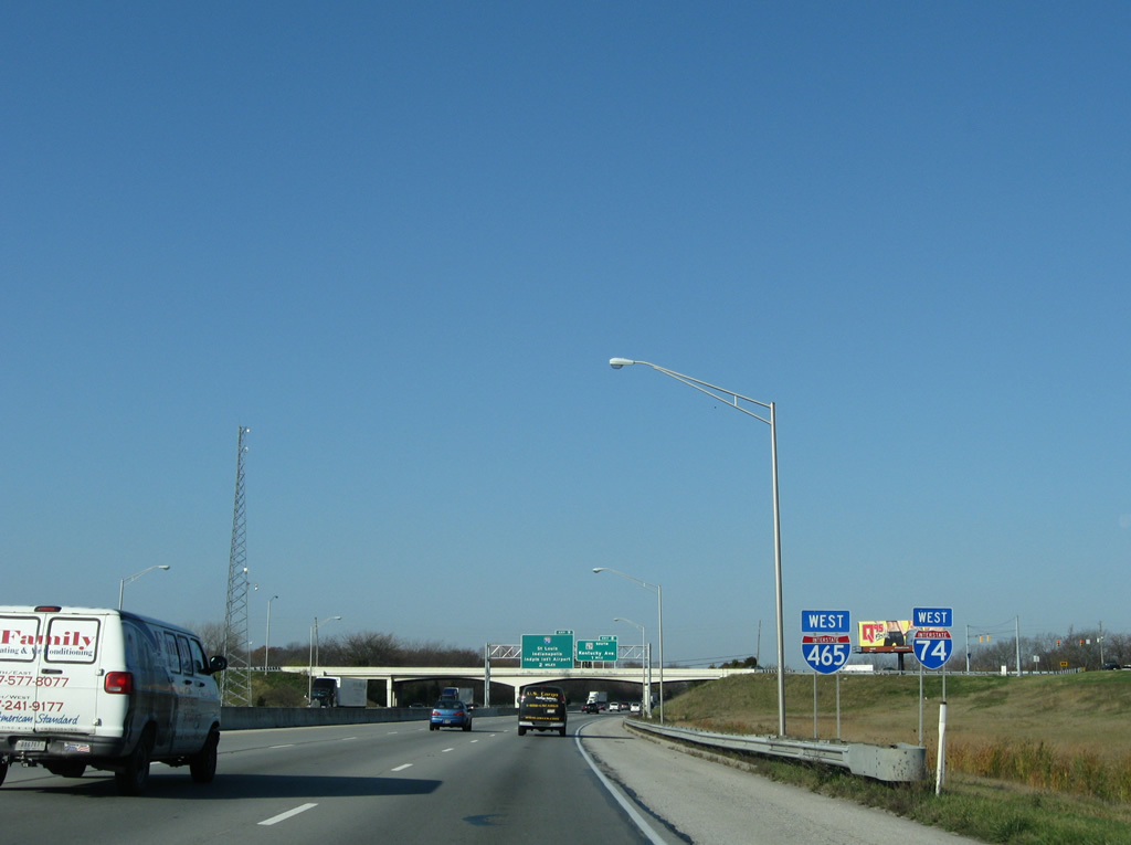
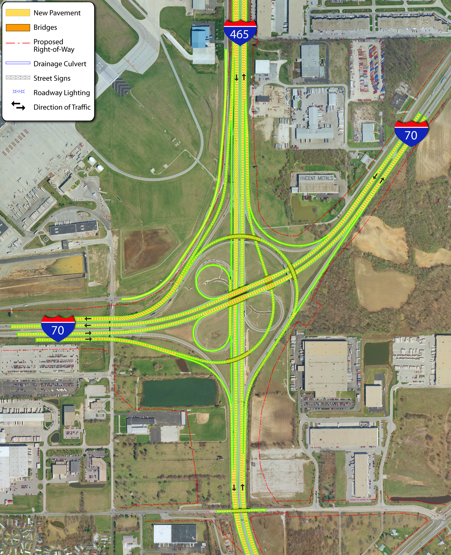
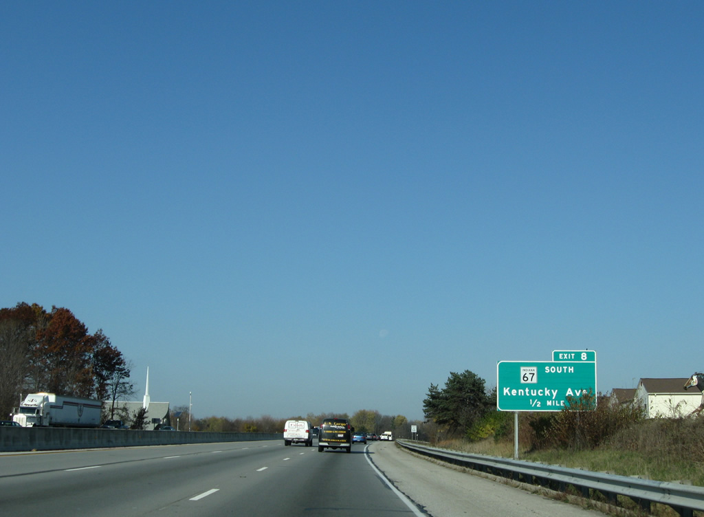
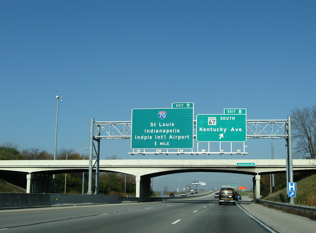
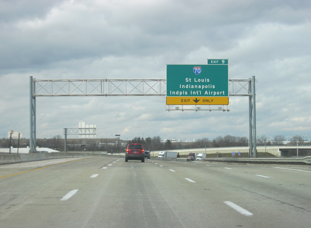
| SR 67 parts ways with I-465 at the forthcoming folded diamond interchange (Exit 8) with Kentucky Avenue. Interstate 70 follows at a cloverstack interchange (Exit 9) built during the Accelerate 465 project. 11/05/09 |
|
| Kentucky Avenue carries SR 67 from Exit 8 through the southwest suburbs to Valley Mills and Mooresville. Kentucky Avenue east represents former State Road 67 east through Mars Hill and Maywood to Harding Street. The sprawling AmeriPlex office complex can be reached along SR 67 to the south. 11/05/09 |
|
| SR 67 constitutes a 199.3 mile long route from Vincennes to SR 29. Southward, SR 67 (Kentucky Avenue) remains a four lane expressway around Mooresville and past Martinsville before reducing to two lanes. 11/05/09 |
|
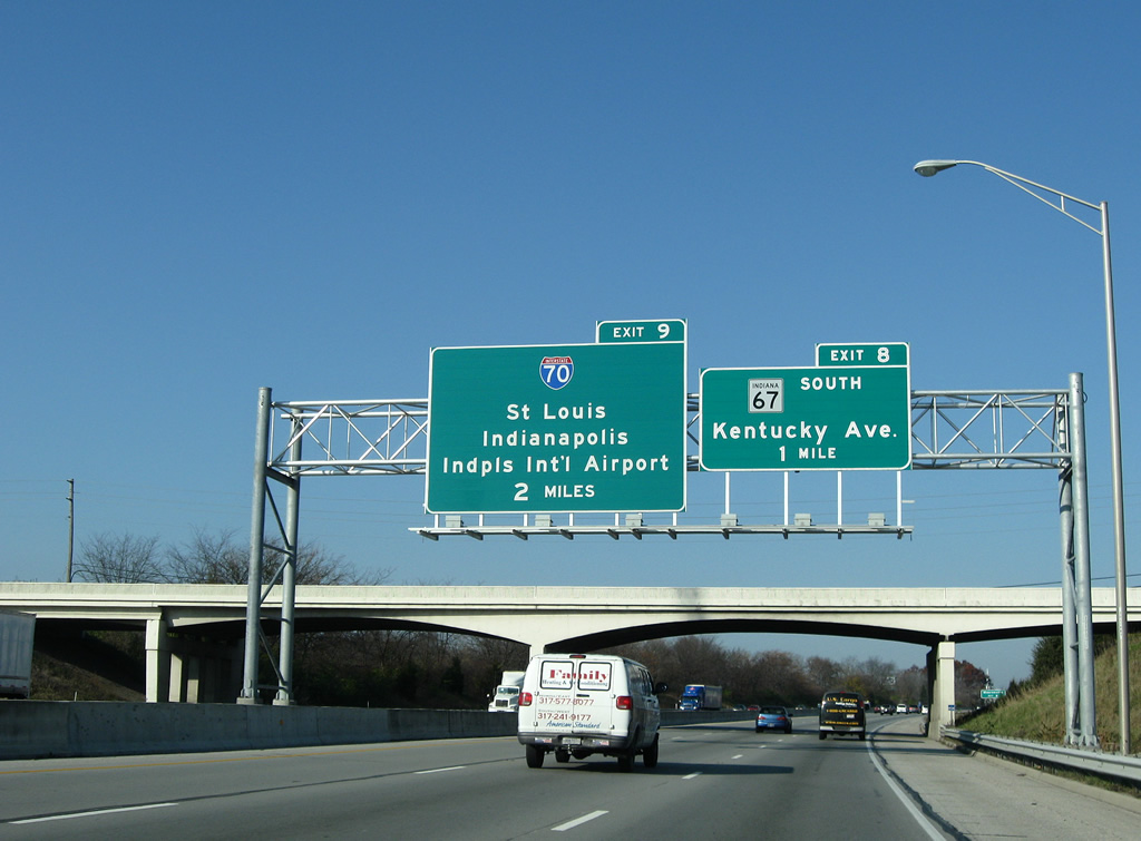
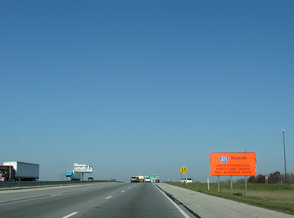
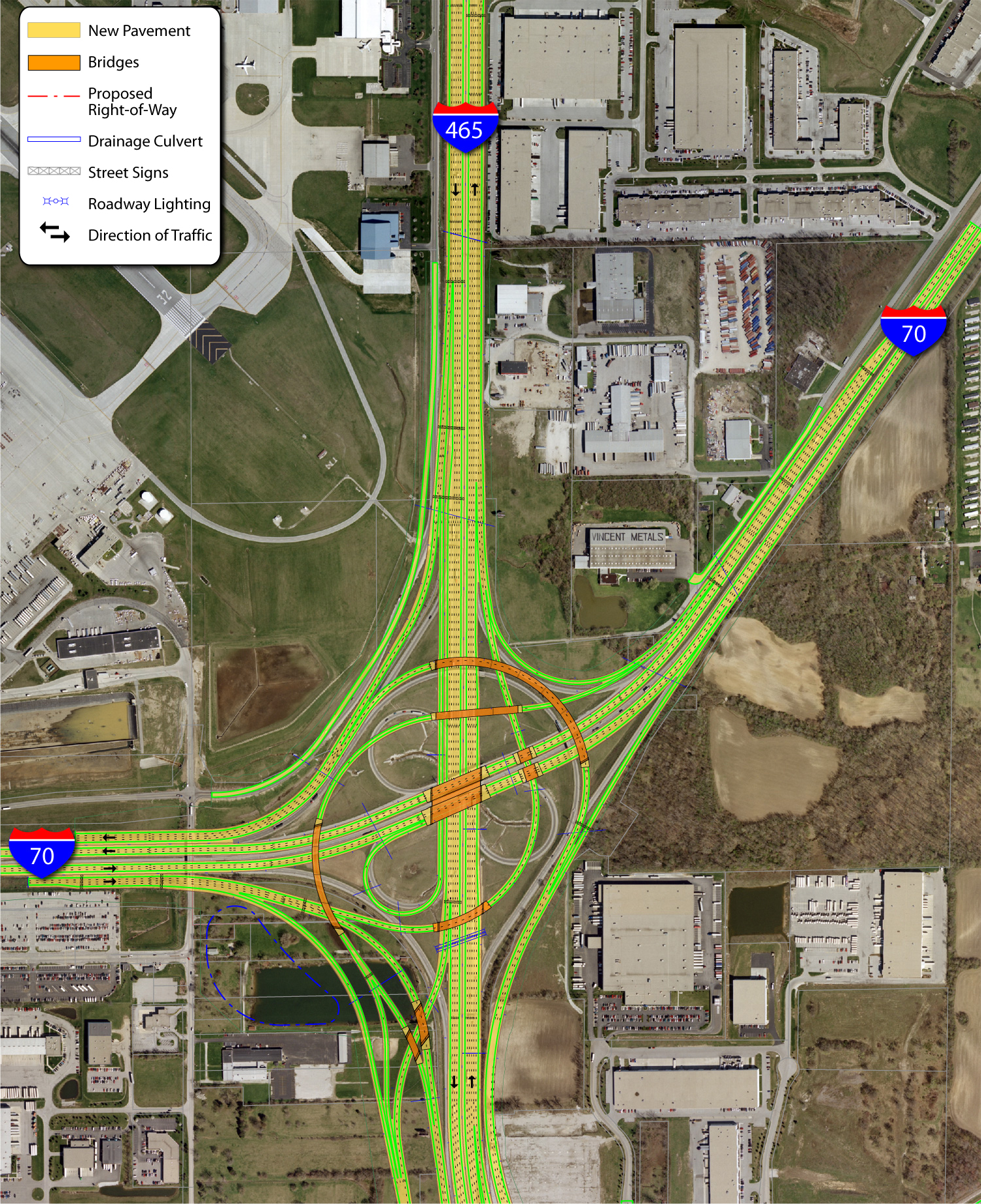
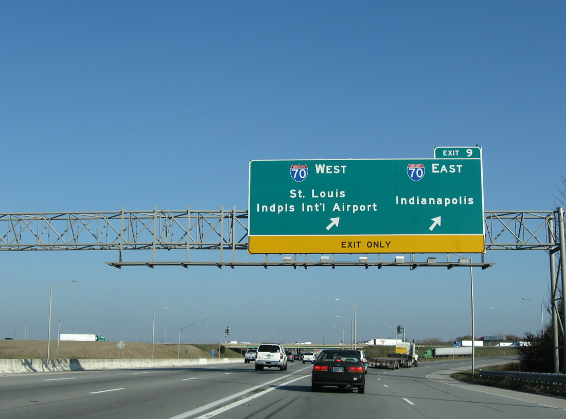
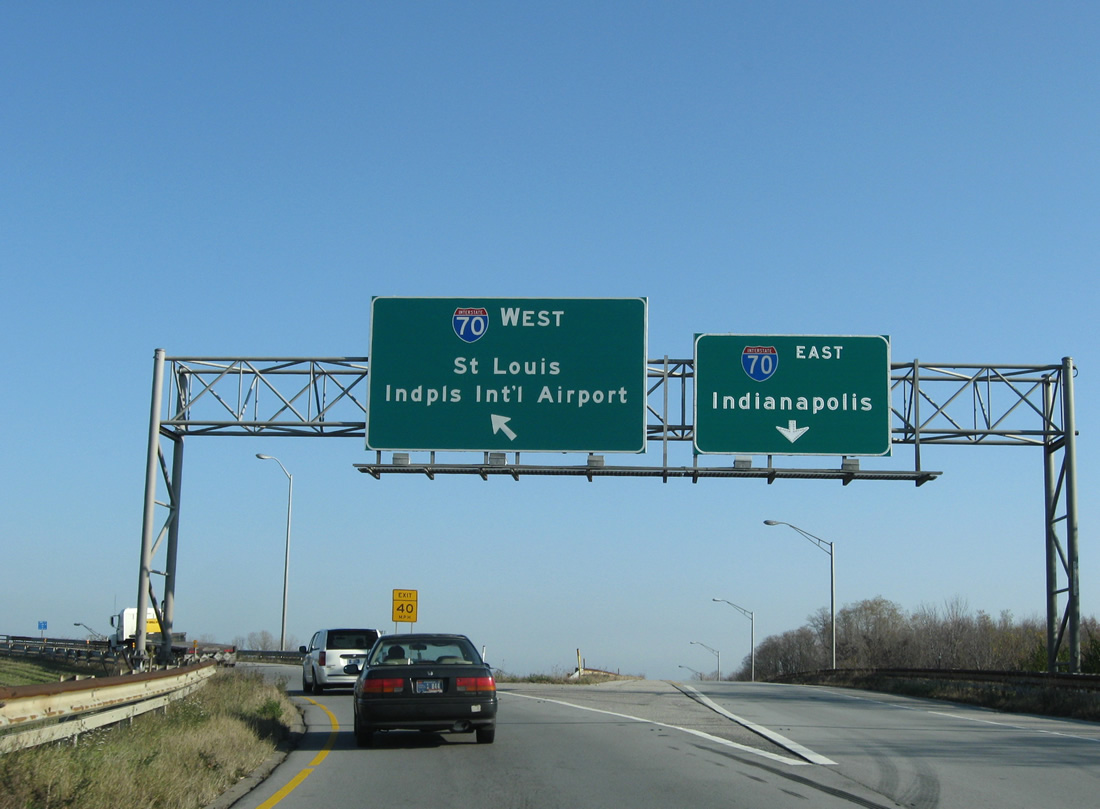
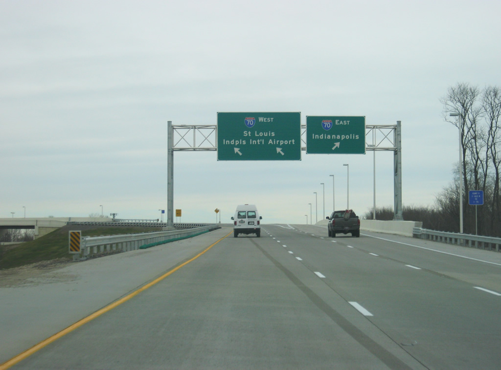
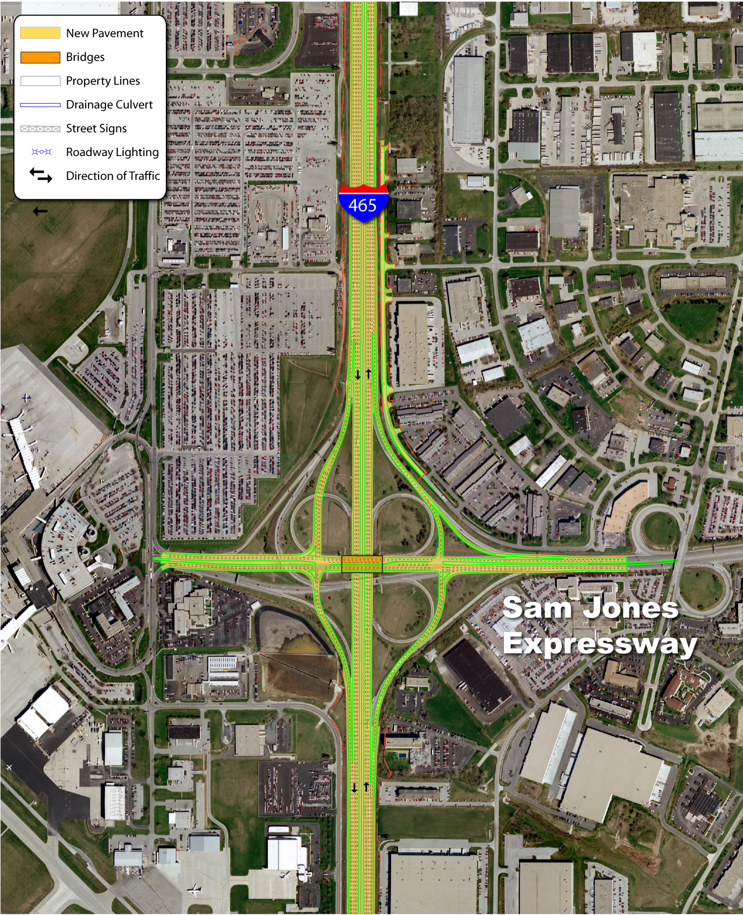
| Expansion and reconstruction of Interstate 465 from Mann Road north to the Interstate 65 took place as a part of the Accelerate 465 project aimed to expand the beltway and redesign antiquated interchanges. Widening expanded portions of the road to eight and ten lanes along this stretch. Up ahead, Exit 9 consists of a two lane ramp to Interstate 70 west to Indianapolis International Airport (IND) and Terre Haute and Interstate 70 east to Downtown Indianapolis. A new two lane directional ramp joins I-465 north with I-70 west. 11/05/09, 12/17/11 |
|
| Approaching the Hanna Avenue overpass along I-74/465 north. A dismissed alternative to the I-70 and SR 67 interchange project included four sets of ramps linking the two interchanges independent of the Beltway mainline. 11/05/09 |
|
| Interstate 70 stretches 156.60 miles across Indiana. The 2,153 mile route begins at Cove Fort, Utah (Interstate 15) and leads east to Denver, Salina, Topeka, Kansas City, St. Louis, Indianapolis, Columbus, Wheeling, Hagerstown and Baltimore, Maryland. 11/05/09, 12/17/11 |
|
| Interstate 70 was reconstructed in the mid-2000s from Interstate 465 west to Ronald Reagan Parkway (Exit 68) to coincide with a relocation of the Indianapolis International Airport passenger terminal and expansion of the runways. The northbound Interstate 465 to westbound Interstate 70 ramp was widened to two lanes as part of the interchange reconstruction. To the east, a six mile drive returns motorists to Downtown. 11/05/09, 12/17/11 |
|
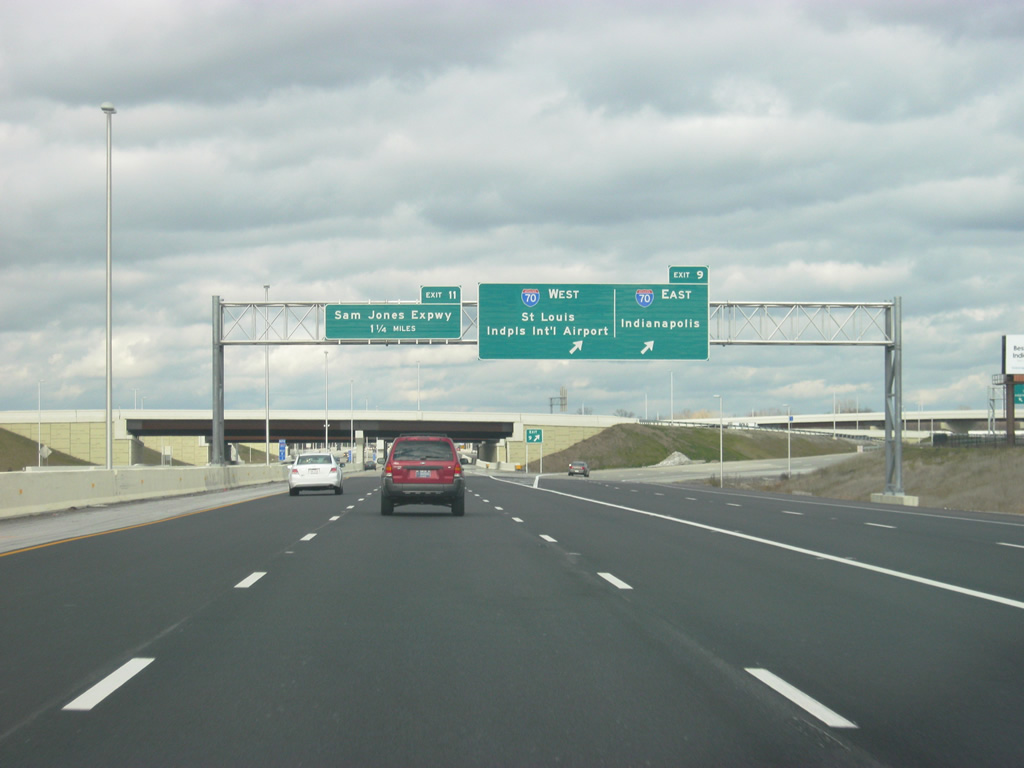
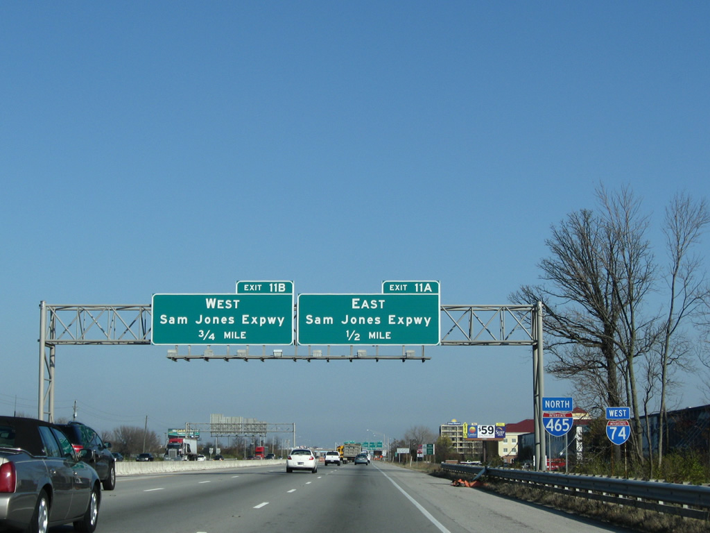
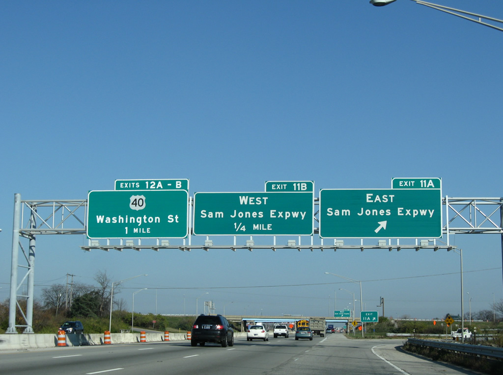
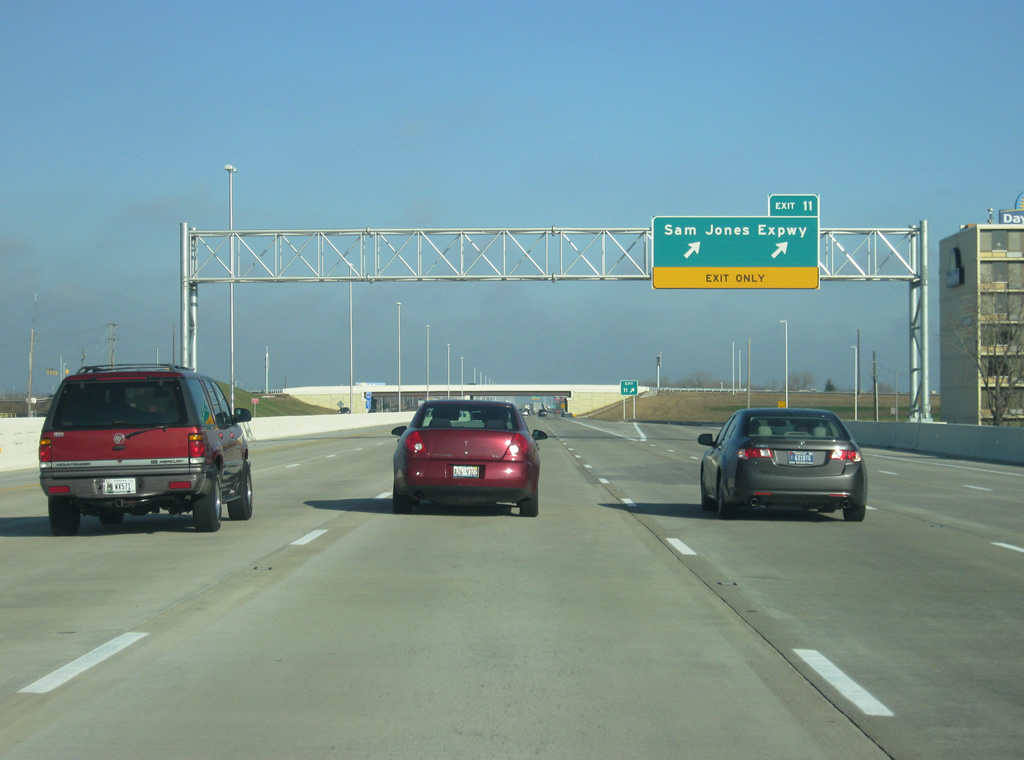
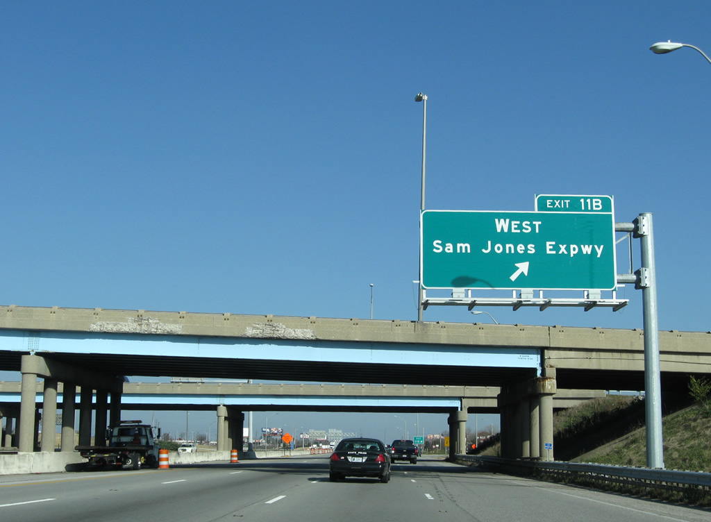
| Continuing due north, I-74/465 next meet Sam Jones Expressway at Exit 11. Formerly the Airport Expressway, the east-west freeway was renamed in 2007 after Sam Jones, a local civic leader, as the road no longer connected with the airport terminal. 11/05/09, 12/24/11 |
|
| Sam Jones Expressway leads east from parallel High School Road to Interstate 70 and Raymond Street at Maywood. The freeway facility opened in 1969 as a new route to Indianapolis International Airport.2 11/05/09, 12/24/11 |
|
| The Accelerate 465 construction redesigned the Same Jones Expressway exchange from a directional cloverleaf into a conventional diamond interchange and eliminated most of the loop ramps, including Exit 11B pictured here. 11/05/09 |
|
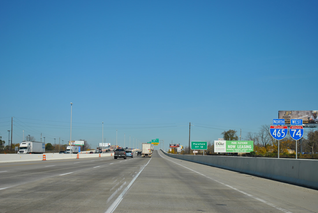
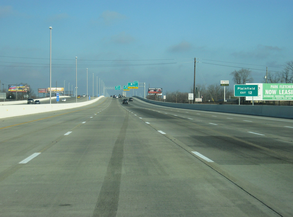
| Northbound scene along I-74/465 between Sam Jones Expressway and U.S. 40 (Washington Street) west. 11 lanes of freeway now travel this stretch. The next four exits serve the Wayne Township area of Indianapolis. Up ahead is Exit 12, where U.S. 40 West will part ways with I-74/465. Plainfield, in southeastern Hendricks County is several miles to the west along U.S. 40 West. 11/04/11, 12/24/11 |
|
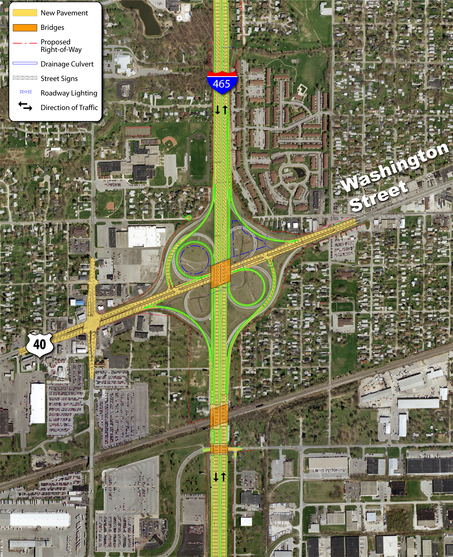
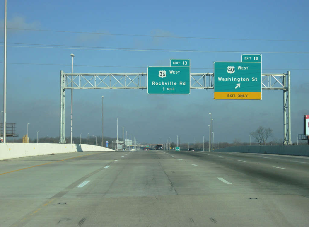
| U.S. 40 leaves the Indianapolis Beltway for its original alignment along Washington Street west to Bridgeport and Plainfield. Roadwork reconfigured Exit 12 into a six-ramp parclo from a cloverleaf interchange. 12/24/11 |
|
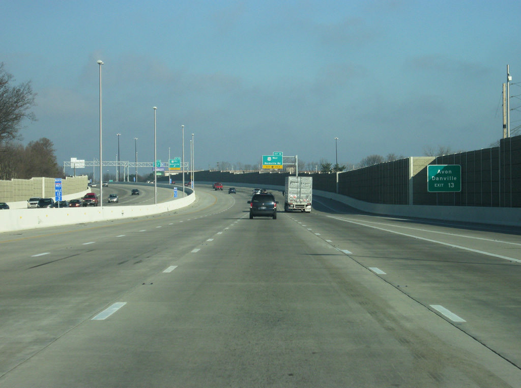
| All traffic to U.S. 40 west and Washington Street (Exit 12) departs in unison from I-74 west / I-465 north. Washington Street (former U.S. 40) east joins the beltway with Mickleyville and Lynhurst. Exit 13, serving U.S. 36 (Rockville Road) is a mile away. 12/24/11 |
|
| Exit 13 provides access to the growing western suburb of Avon and the Hendricks County seat of Danville. 12/24/11 |
|
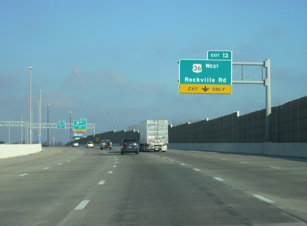
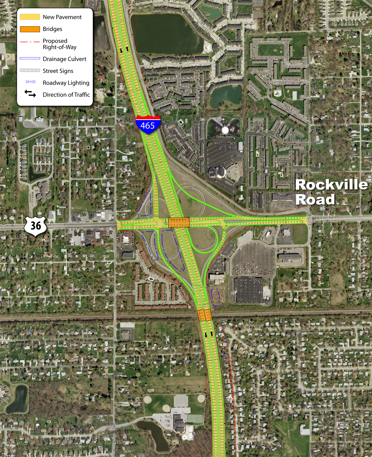
| U.S. 36 leaves the Beltway at a parclo (Exit 13) interchange west to Tremont, Avon and Danville. Originally a cloverleaf interchange joined Rockville Road with I-74/465. 12/24/11 |
|
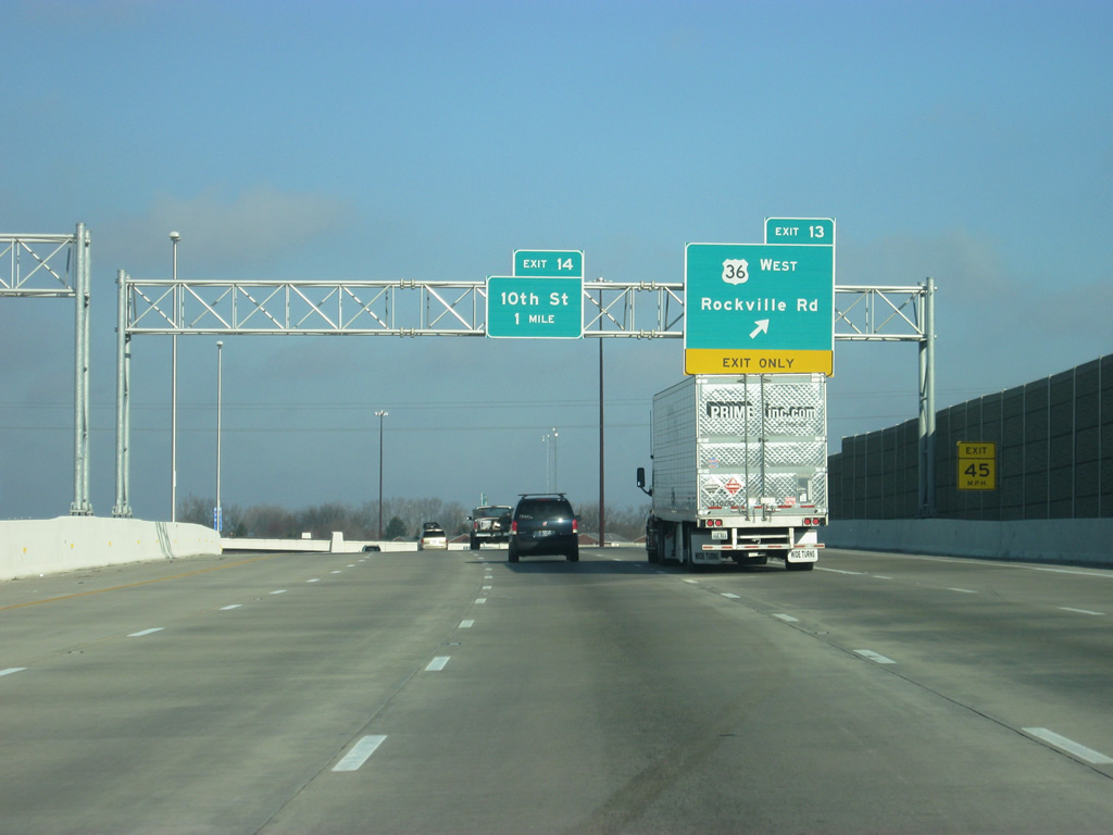
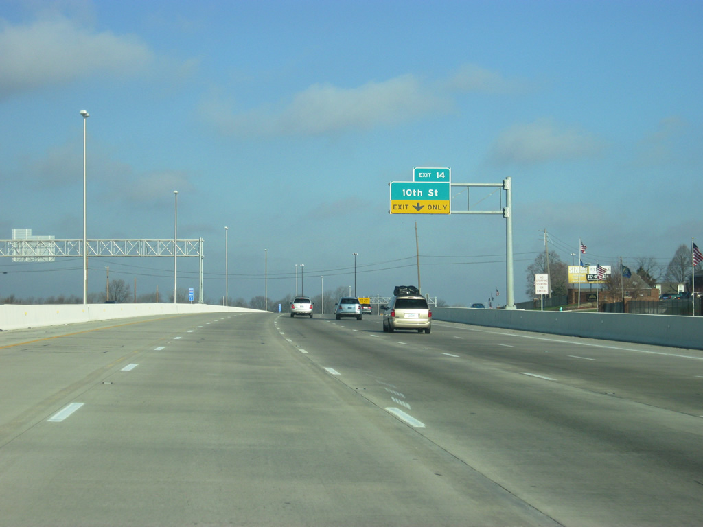
| Rockville Road east from Exit 13 and Interstates 74-465 travels by Lynhurst to merge with Washington Street at Eagle Creek, where U.S. 36 and 40 originally combined through the west side of the city. Exit 14 for 10th Street is one mile away. 12/24/11 |
|
| Up ahead, 10th Street goes through the west side neighborhood of Haughville and Speedway. To the west the road heads out through Chapel Hill and Westwood and provides another route into Avon. Exit 14, along with upcoming Exit 16 provide the best routes for northbound traffic to the Indianapolis Motor Speedway on Race day. 12/24/11 |
|
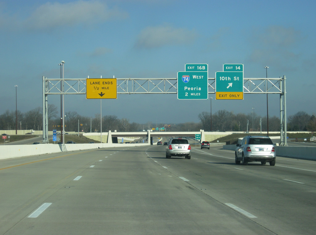
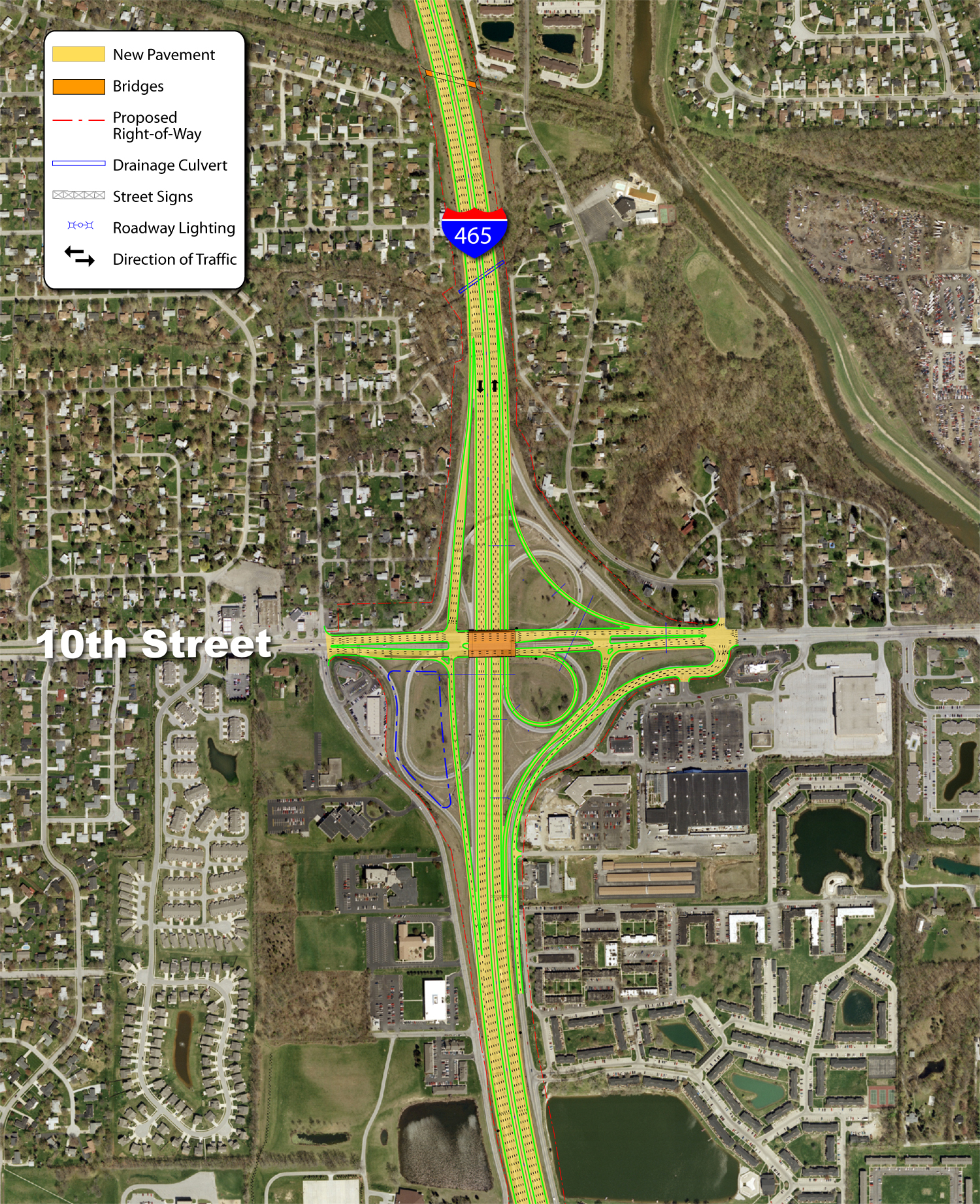
| Exit 14 with 10th Street was redesigned into a conventional parclo interchange from an eight-ramp design during Accelerate 465 road work.
New overheads now tout the two mile approach of the Interstate 74 westbound split (Exit 16B) from the Beltway. 12/24/11 |
|
| A new diamond interchange opened in 2012 directly connecting the Beltway with U.S. 136 (Crawfordsville Road) west to Clermont. This replaces a connection along the old I-74 freeway stub to Crawfordsville Road.
The Interstate 74 freeway originally defaulted onto Crawfordsville Road (former U.S. 136) east into Speedway. Accelerate 465 construction removed the freeway spur over the Beltway and reconfigured the Crawfordsville Road intersection with High School Road north. 12/06/12 |
|
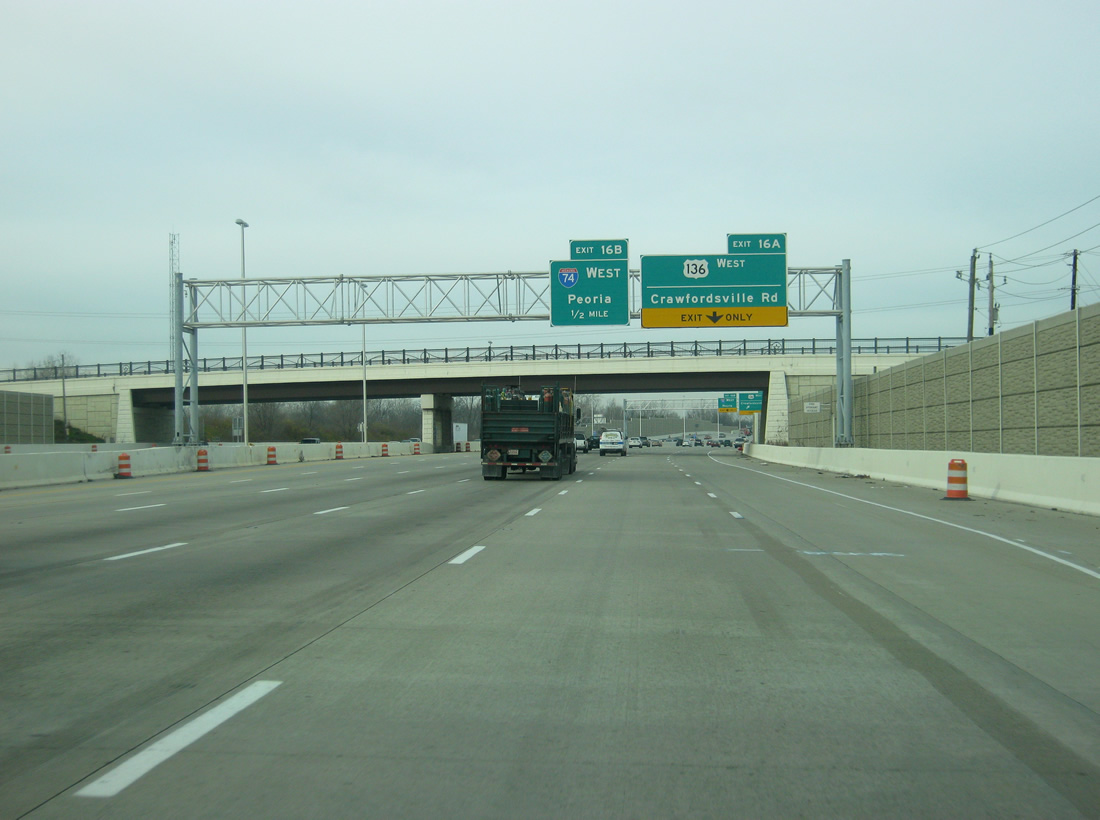
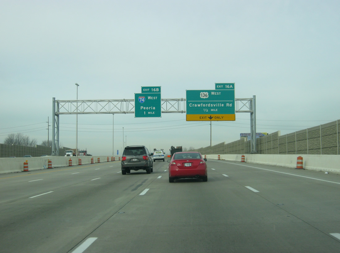
| Traffic bound for Crawfordsville Road (U.S. 136 West) will head off toward the right past the 21st Street Bridge. Traffic bound for Interstate 74 West will exit off on its own ramp up ahead. U.S. 136 begins from Interstate 465 and travels 804 miles to Edison, Nebraska. Within Indiana, the US highway parallels Interstate 74 west through Brownsburg and Crawfordsville to Danville, Illinois. 12/06/12 |
|
| Exit 16A for U.S. 136 West (Crawfordsville Road) now heads off from the right as part of the new diamond interchange. Crawfordsville Road to the east is known as the Hulman Memorial Way and is the most patrolled traffic route into the Indianapolis Motor Speedway on Race Day. The second lane from the right now becomes an auxiliary lane for Interstate 74 westbound traffic, which exits off up ahead. 12/06/12 |
|
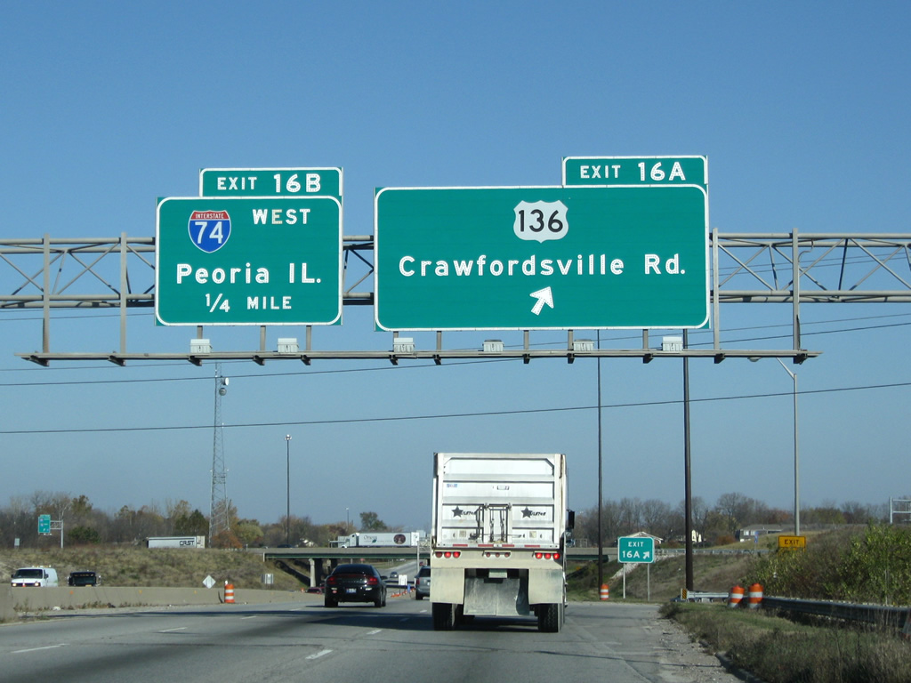
| Historical look at the Exit 16A ramp departure onto the I-74 freeway end with Crawfordsville Road. 11/05/09 |
|
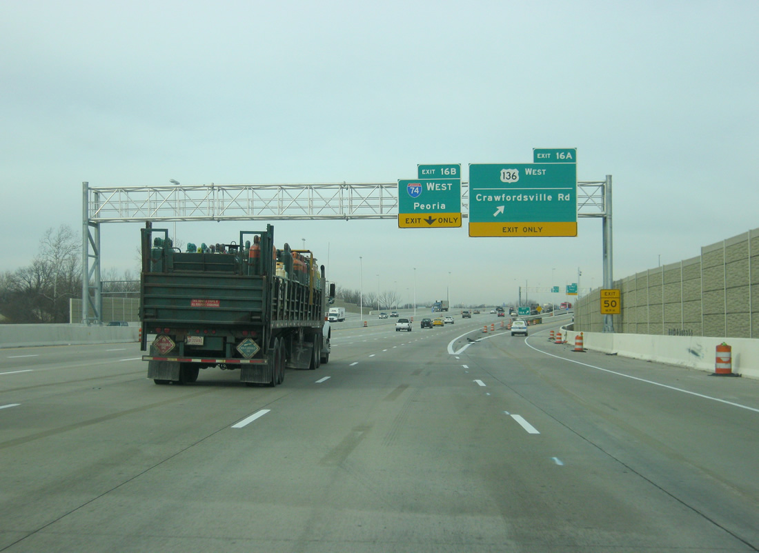
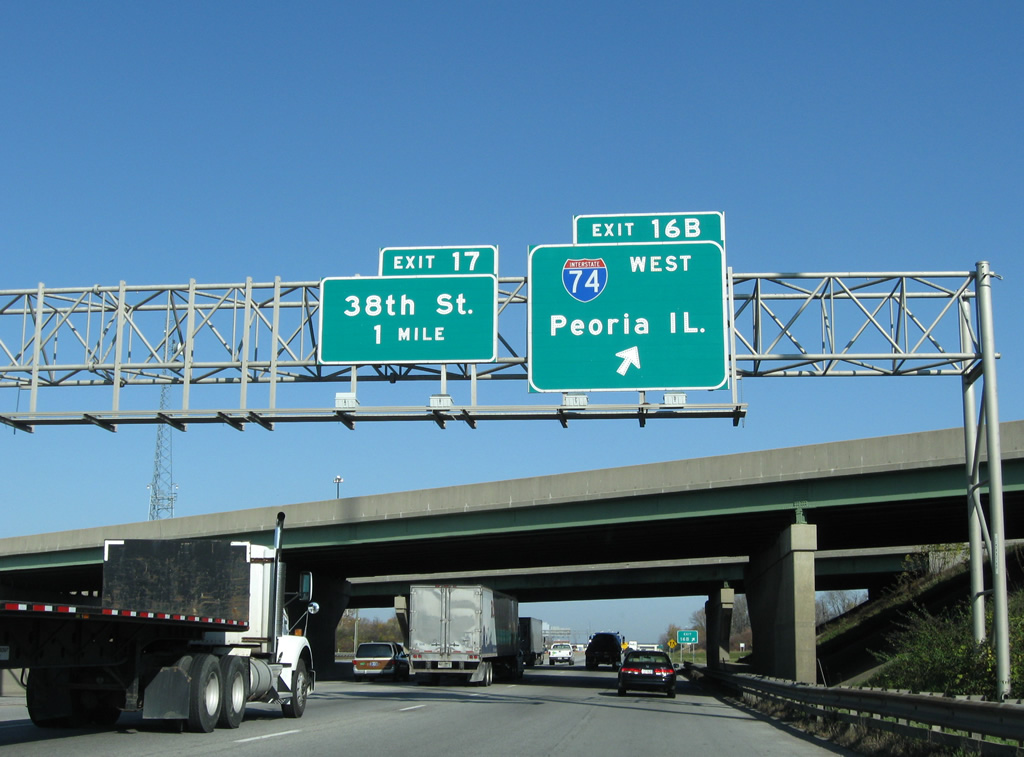
| The right two lanes on Interstate 465 north now exit off onto Interstate 74 west, replacing a one-lane loop ramp that had existed before the interchange was rebuilt. The ramp then defaults onto westbound Interstate 74 as the highway departs the Speedway area toward Brownsburg, Crawfordsville and Peoria, Illinois.
The 38th Street interchange (Exit 17) now lies a mile away on Interstate 465 north. 12/06/12 |
|
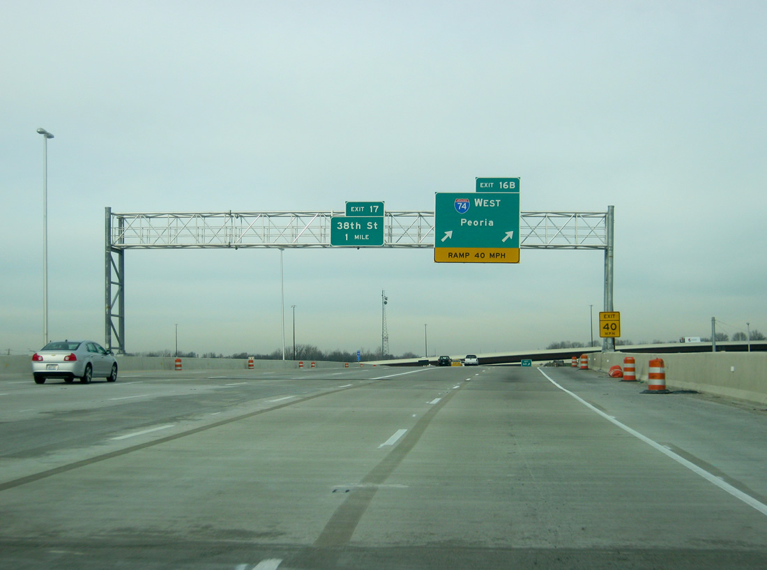
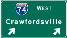
| The Interstate 74 westbound mainline was relegated to a single lane loop ramp (Exit 16B) from Interstate 465 north until Accelerate 465 replaced it with the two lane high-speed ramp. This photo looks at the original split of I-74 west from I-465 north. 11/05/09 |
Page Updated 01-13-2012.

 West
West  South
South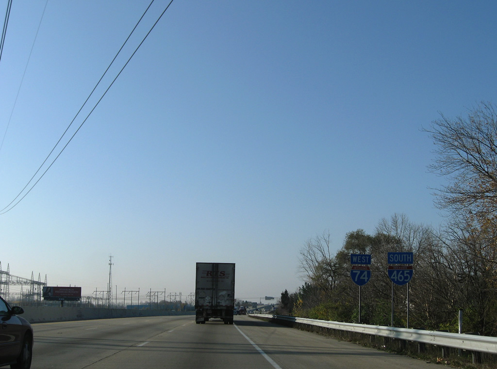


