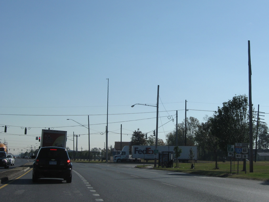
|
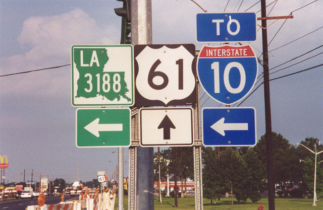
| U.S. 61 (Airline Highway) southbound at the southern terminus of LA 3188 (Belle Terre Boulevard) at Laplace. 06/26/01 |
|
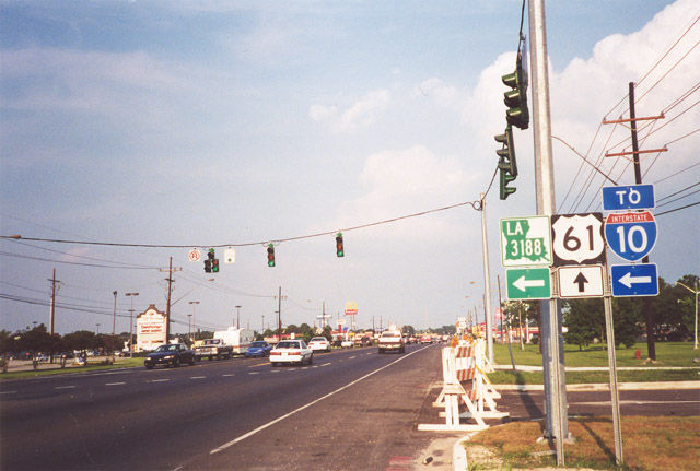
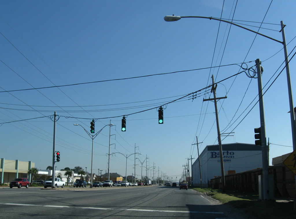
| LA 3188 comprises a divided four lane highway traveling 2.09 miles between the Airline Highway and a trumpet interchange with Interstate 10 (Exit 206). The commercial arterial serves residential areas of west LaPlace to I-10. 06/26/01 |
|
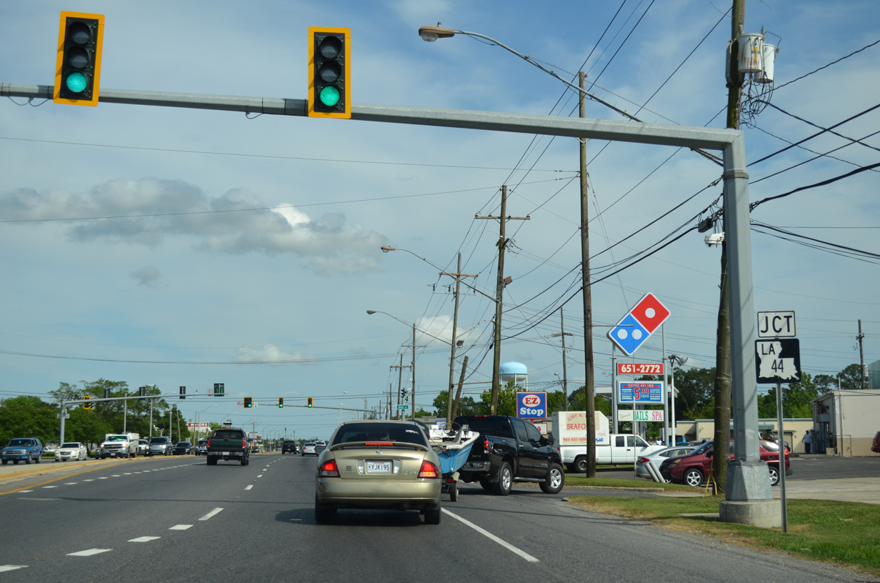
| U.S. 61 curves southeast from LA 3188, 1.2 miles to intersect the south end of U.S. 51 in LaPlace. 05/09/15 |
|
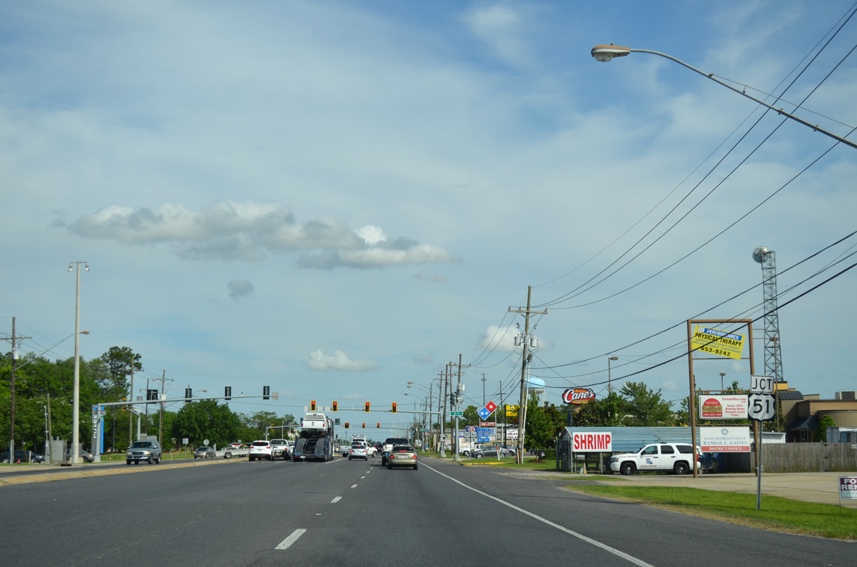
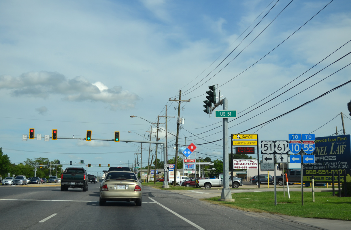
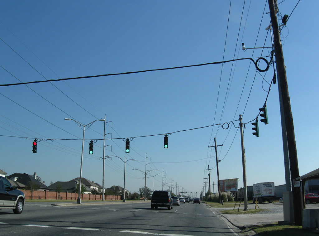
| U.S. 51 begins a nearly 1,300 mile trek northward to Wisconsin from U.S. 61 in LaPlace. Locally the US highway follows an arterial style route 3.8 miles northeast to Interstate 55 north, where it combines with the freeway to Ponchatoula and Hammond. 05/09/15 |
|
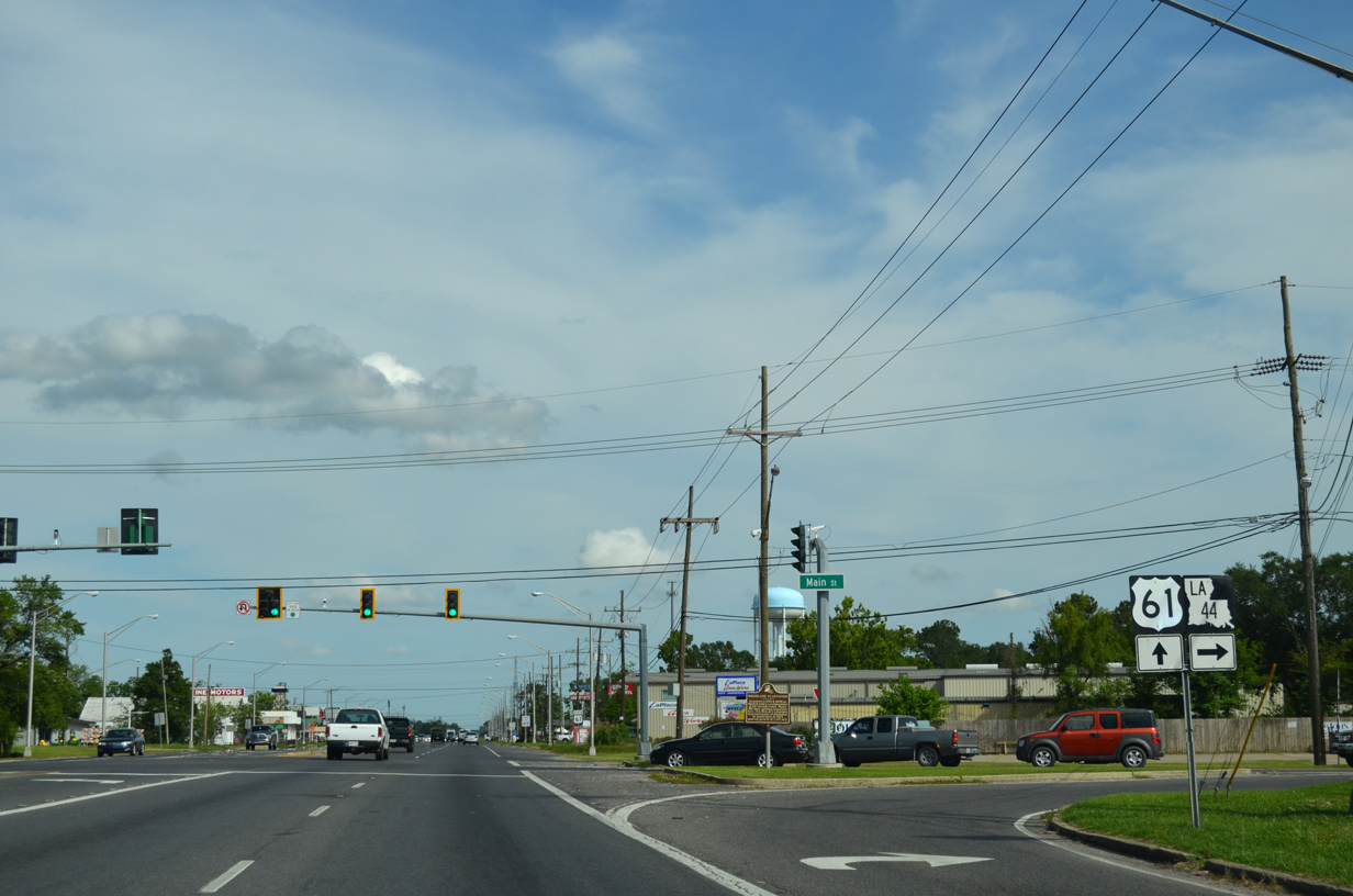
| LA 44 concludes a 50 mile route from Prairieville at the adjacent intersection to U.S. 51 on U.S. 61 south. 05/09/15 |
|
| Following Main Street west, LA 44 connects with 5th Street to arc southwest to the Great River Road paralleling the Mississippi west to Reserve and Dutch Bayou. Main Street north of U.S. 61 is the historic alignment of U.S. 51. 05/09/15 |
|
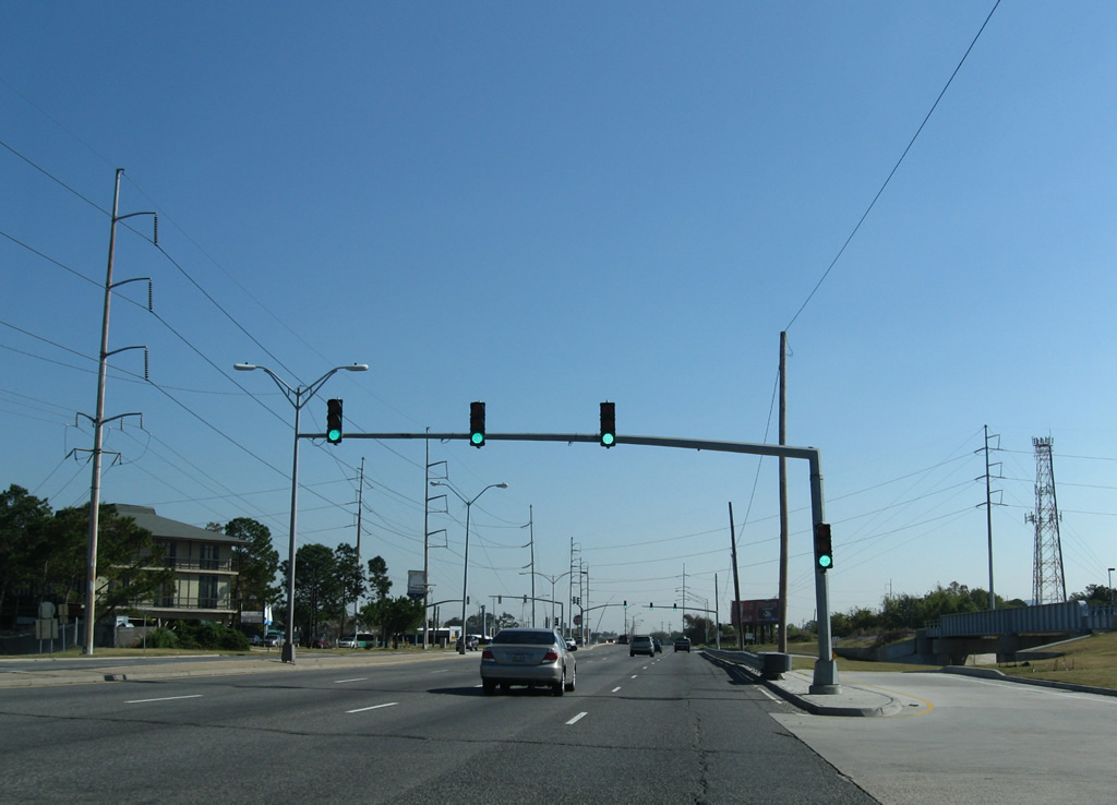
| Leading away from U.S. 51 and LA 44, U.S. 51 becomes more rural on the exit of LaPlace to the Bonnet Carre Floodway. 05/09/15 |
|
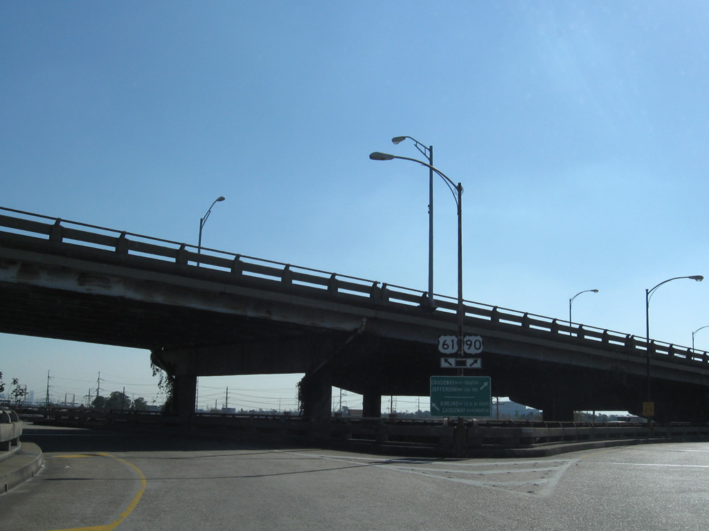
| U.S. 61 reassurance marker posted after the north end of LA 626. 04/20/12 |
|
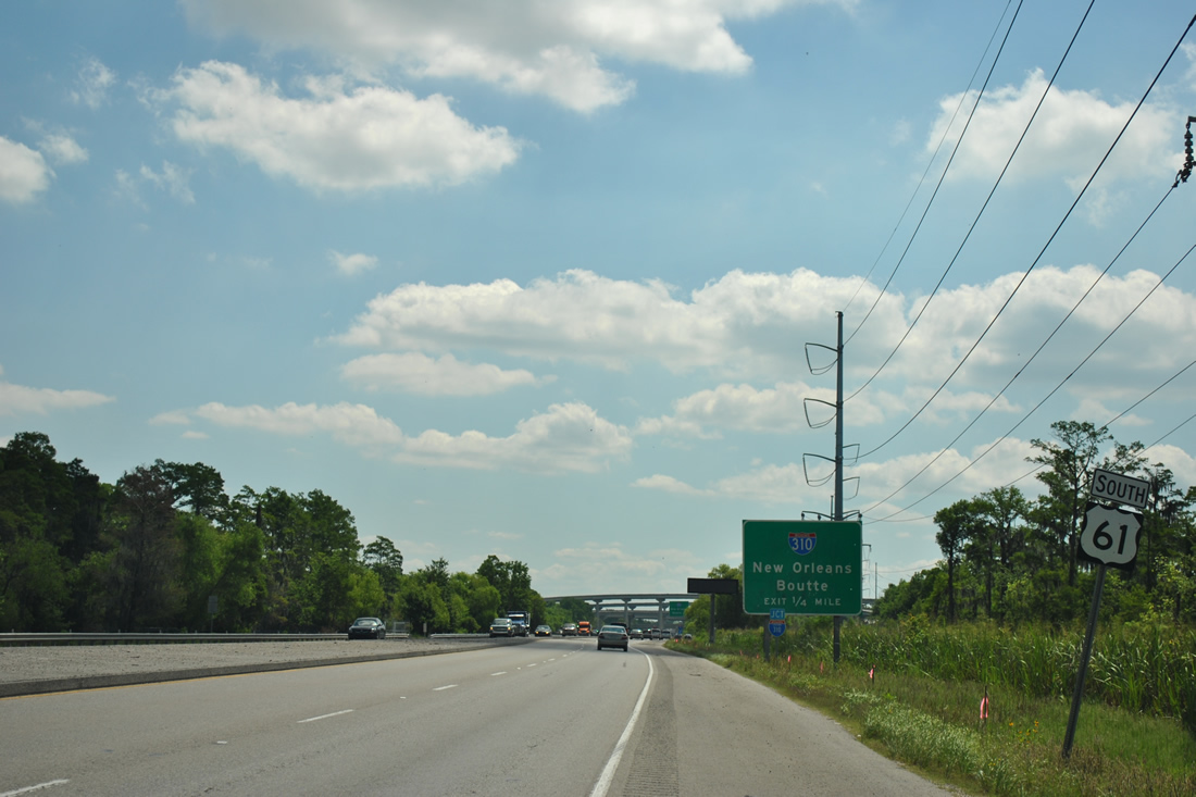
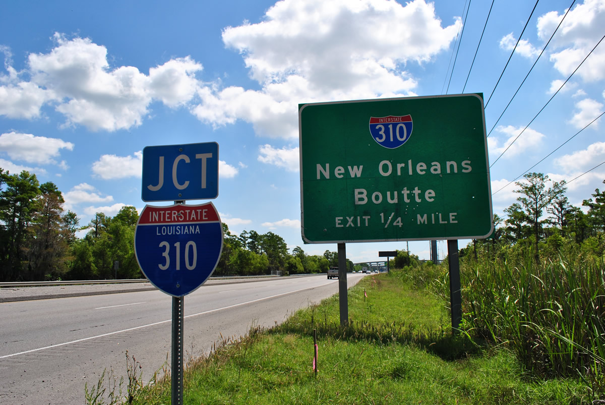
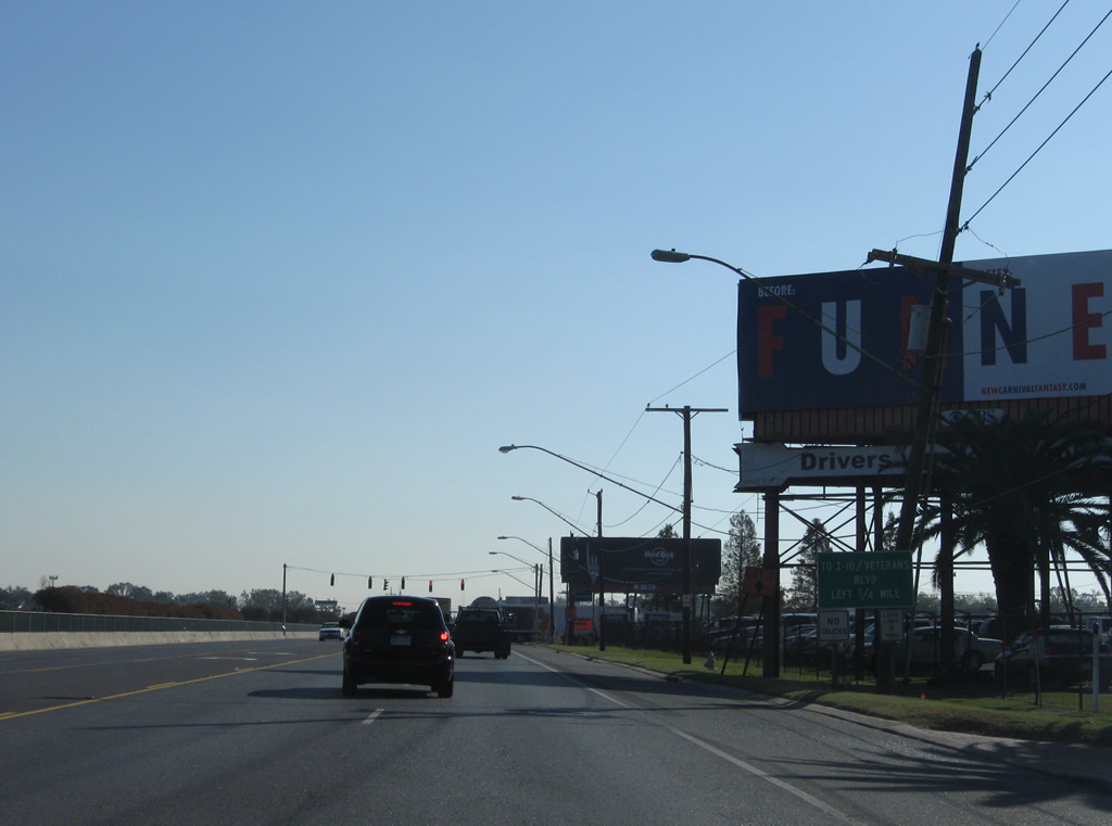
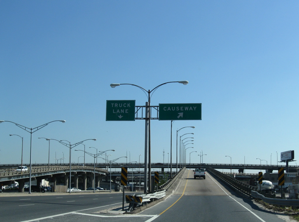
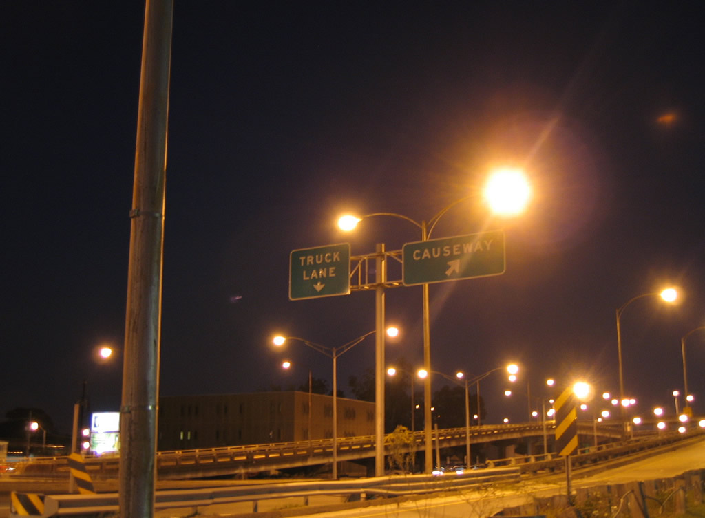
| Interstate 310 advance guide sign and state-named shield posted along U.S. 61 (Airline Highway) southbound. Interstate 310 constitutes a southwesterly spur from Interstate 10 near Kenner to U.S. 90 at Boutte. The freeway includes the first crossing of the Mississippi River north from Jefferson Parish. 04/20/12 |
|
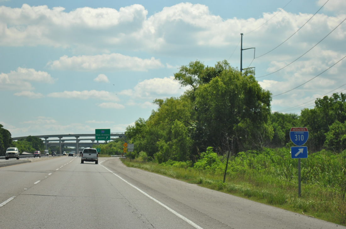
| A second Interstate 310 Louisiana shield precedes the off-ramp for the 11.25 mile freeway. State-named shields for the Pelican State returned in 2011. 04/20/12 |
|
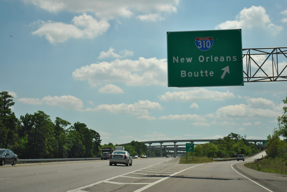
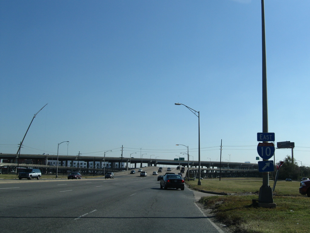
| All traffic bound for Interstate 310 departs in unison from U.S. 61 (Airline Highway) southbound. Interstate 310 leads southwest to Destrehan and the Hale Boggs Bridge to Luling. 04/20/12 |
|
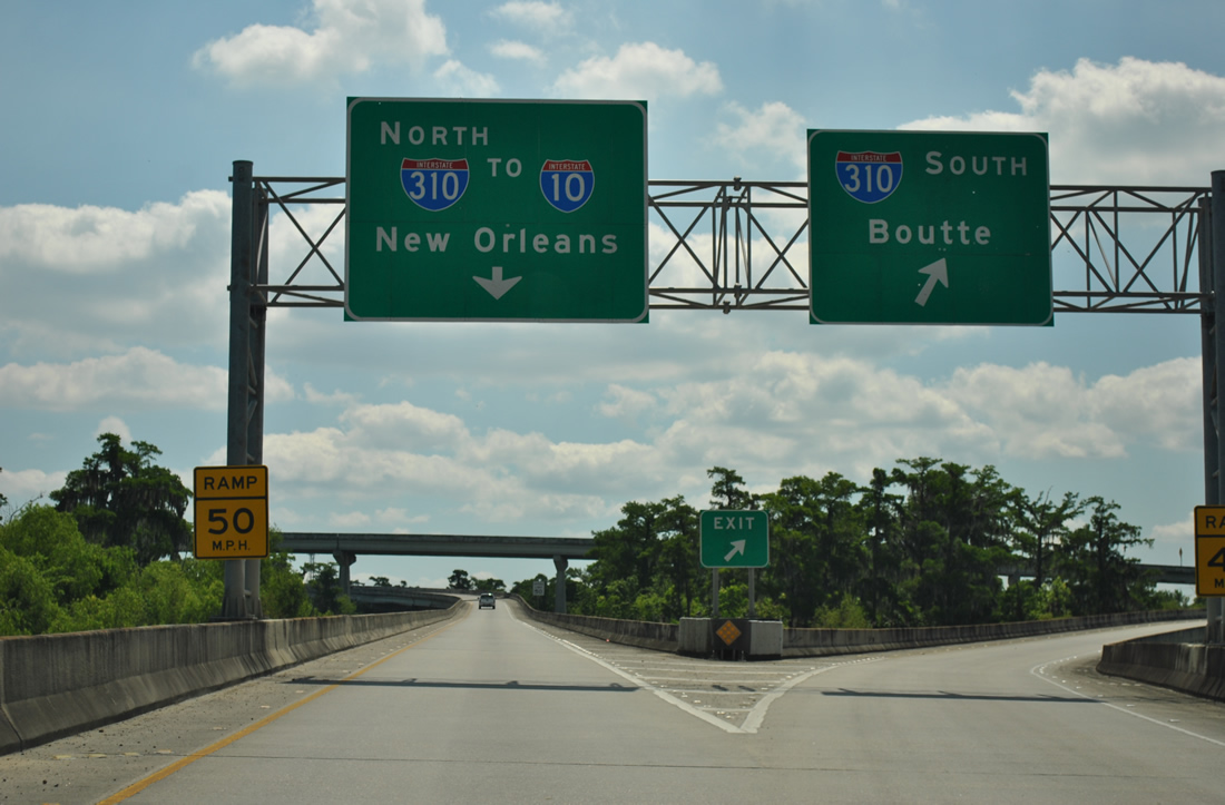
| The flyover onto Interstate 310 northbound joins the viaduct 2.25 miles ahead of the stack interchange with Interstate 10 near the Jefferson Parish line. Interstate 10 enters Kenner en route to New Orleans from there. 04/20/12 |
|
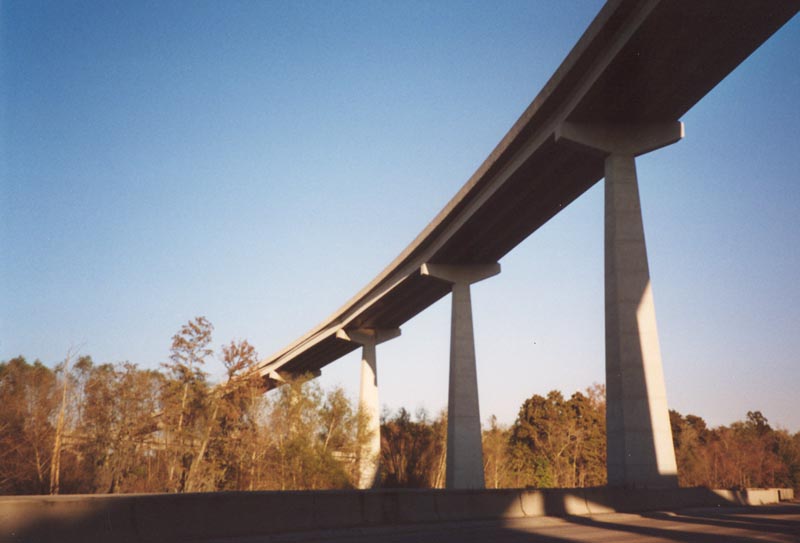
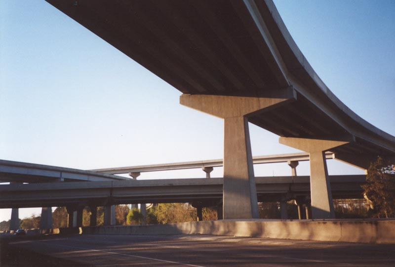
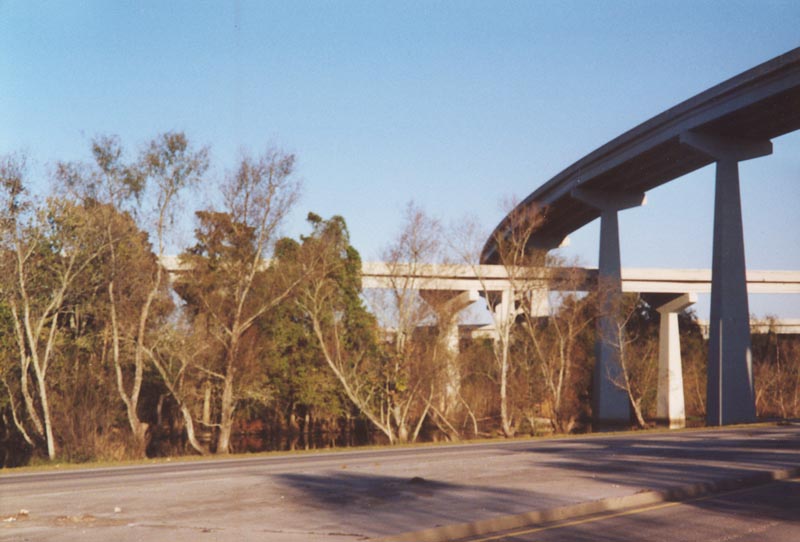
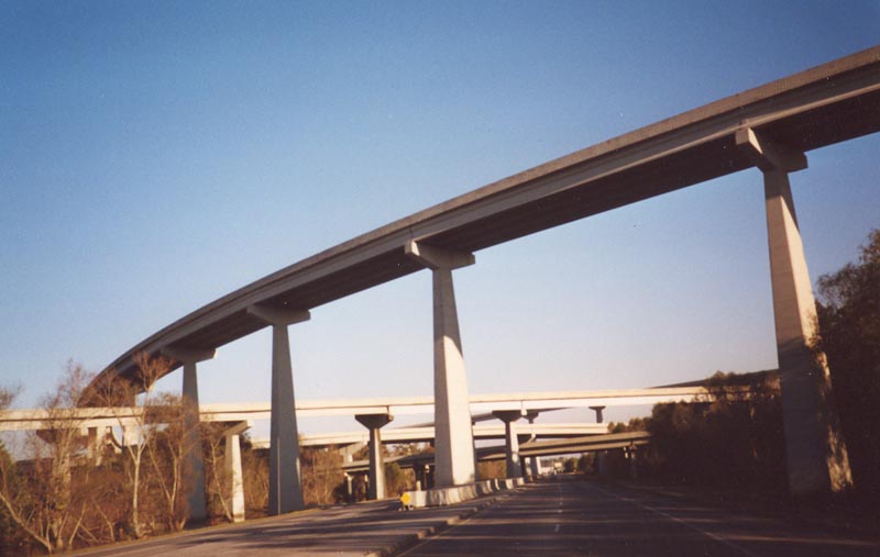
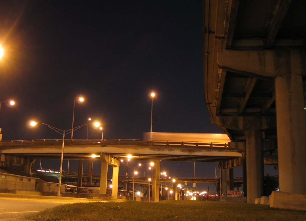
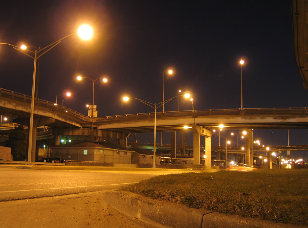
| The interchange between Interstate 310 and U.S. 61 reminds one more of Los Angeles, than Louisiana. The mammoth symmetrical stack interchange features sweeping flyovers high above wetlands, an adjacent levee and the Kansas City Southern Railroad. U.S. 61 (Airline Highway) crosses underneath the I-310 viaduct and associated ramps just barely above the adjacent swamp land. 11/06/99 |
|
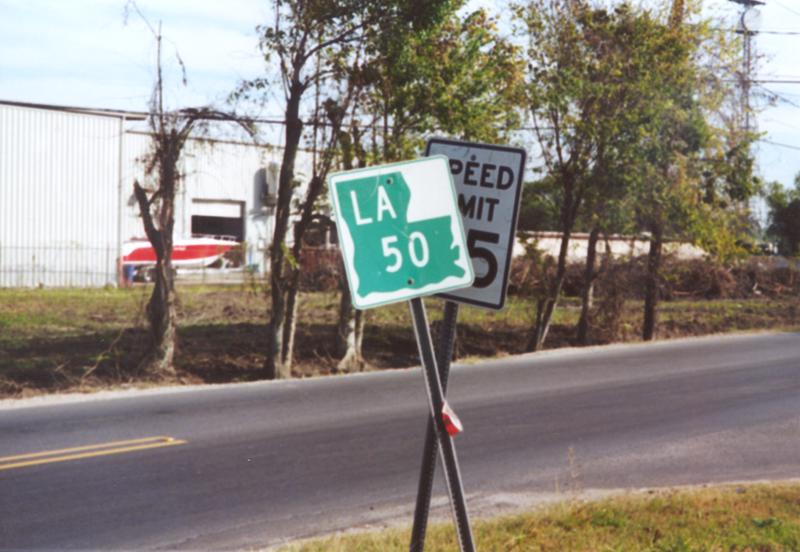
| Just east of the I-310 stack interchange is the northern terminus of the short LA 50 (Almedia Road). The state highway spurs 0.85 miles to the southeast between U.S. 61 and LA 48 (River Road) at Saint Rose. 11/12/99 |
|
| A viaduct carries U.S. 61 over the Illinois Central Railroad at Kenner. The four lane divided highway comes into view of Louis Armstrong New Orleans International Airport (MSY) on the descent to Farrar Avenue. 11/20/08 |
|
| U.S. 61 intersects Farrar Avenue north and a service road from the airport east of the Railroad bridge. Car rental offices associated with the airport are access via this signal. 11/20/08 |
|
| The next signal, since replaced with mast-arm supported assemblies, lies at the entrance to Louis Armstrong New Orleans International Airport (MSY) terminal from U.S. 61 (Airline Drive). 11/20/08 |
|
| A controlled-access highway leads northward from the airport terminal alongside U.S. 61 to a northward turn along Duncan Canal to Interstate 10. This road includes a half diamond interchange with Veterans Memorial Boulevard. 11/20/08 |
|
| Daniel Street meets U.S. 61 at the next signal at a commercial area east of the airport. The north-south road is part of the Kenner residential street grid. 11/20/08 |
|
| LA 49 begins and ventures northward along Williams Boulevard from U.S. 61 (Airline Drive) in Kenner. The state highway travels almost four miles northward to Joe Yenni Boulevard and the Pontchartrain Center. 11/20/08 |
|
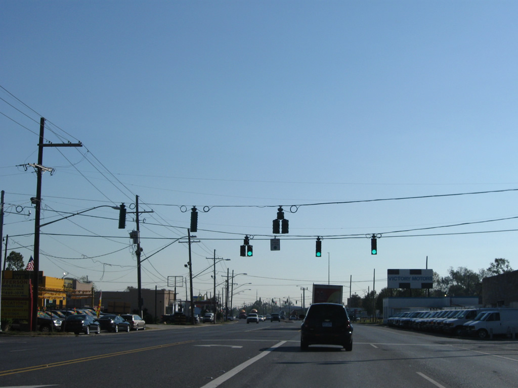
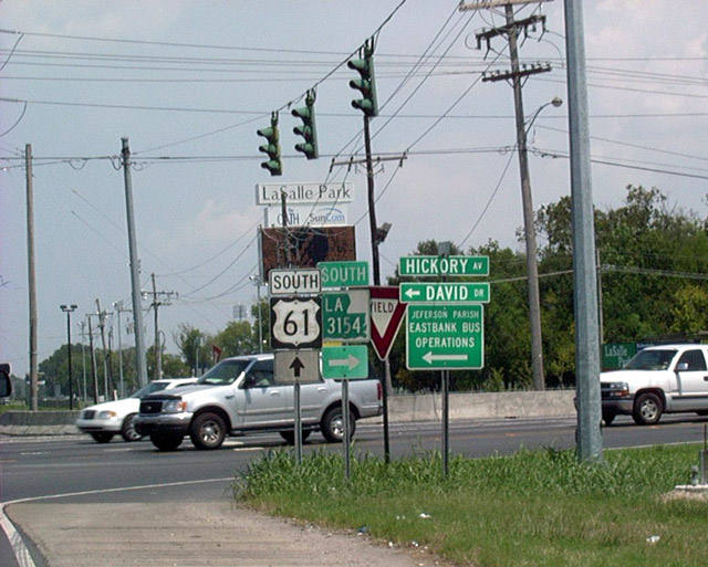
| U.S. 61 (Airline Highway) southbound at the northern terminus of LA 3154 (Hickory Avenue). David Drive enters the intersection from Power and Veterans Boulevard to the northwest. LA 3154 connects U.S. 61 with the west end of LA 3139 (Earhart Expressway) and LA 48 (Jefferson Highway) at Harahan. LA 3154 constitutes 3.1 miles. 08/02/02 |
|
| The junction of U.S. 61 (Airline Drive) and Causeway Boulevard (LA 3046 south) near Jefferson features an unusual interchange with an elevated rotary between the two highways. The interchange is symmetrical with ramps protruding downward in all directions. Causeway Boulevard is a heavily traveled arterial between the Lake Pontchartrain Causeway southward to U.S. 90 (Jefferson Highway). The LA 3046 designation applies to the controlled access portion of Causeway Boulevard between U.S. 61 and 90. 11/20/08, 10/23/03 |
|
| Traffic bound for Causeway Boulevard in either direction departs U.S. 61 and rises to meet the elevated traffic circle. The first ramp joins LA 3046 southbound to U.S. 90 at Jefferson. 11/20/08 |
|
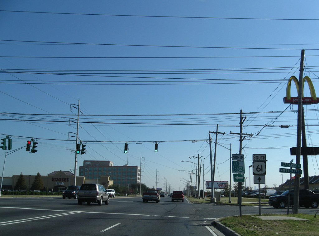
| Labarre Road, LA 3262 until 2011, intersects U.S. 61 (Airline Drive) just east of the ramps with Causeway Boulevard. 11/20/08 |
|
| The former LA 3262 leads south to an industrial park and a large railroad yard and north to LA 611-9 (Metairie Road). 11/20/08 |
|
| Continuing east along U.S. 61 (Airline Drive) through southern reaches of Metairie. 11/20/08 |
|
| Ridgewood Drive stems northeast from U.S. 61 to the Old Metairie community. 11/20/08 |
|
| Mapleridge Drive provides the only access point to the Maple Ridge Park subdivision north of U.S. 61 (Airline Drive) at this traffic light. The aforementioned railroad yard appears to the south, opposite Metaire Country Club to the north. 11/20/08 |
|
| Parallel L & A Road emerges from the adjacent industrial area to meet U.S. 61 (Airline Drive) via two prongs. 11/20/08 |
|
| Leaving Metairie and Jefferson Parish, U.S. 61 enters Orleans Parish and the city of New Orleans. 11/20/08 |
|
| A Canadian National Railroad line lines the south side of U.S. 61 (Airline Highway) from just east of the parish line to Interstate 10. The railroad line separates U.S. 61 from the Hollygrove street grid to the south. Mistletoe and Palm Streets come together on the north side of U.S. 61 at this traffic light. 11/20/08 |
|
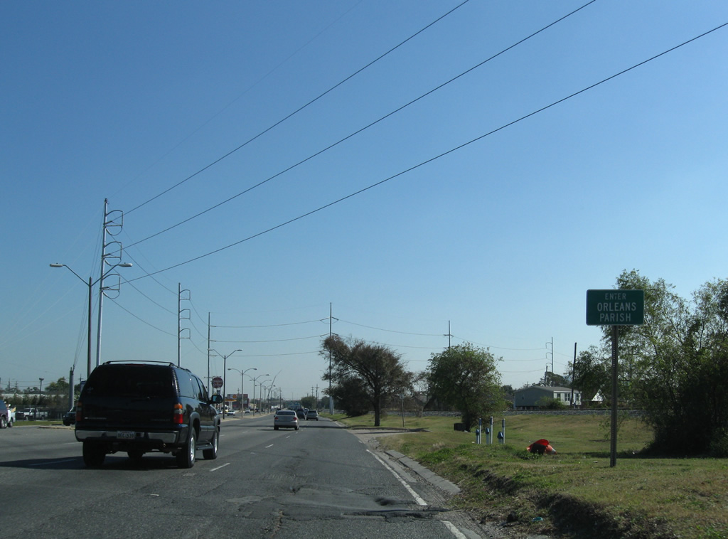
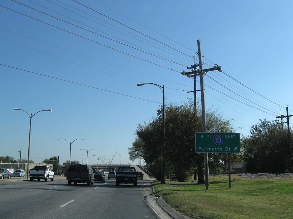
| U.S. 61 partitions with an off-ramp to Palmetto Street south to Hollygrove and Gert Town as Airline Drive prepares to meet Interstate 10 east. 11/20/08 |
|
| A pair of overpasses carry Palmetto Street above U.S. 61 (Airline Highway) as the eight lane arterial crosses Palmetto Canal below. 11/20/08 |
|
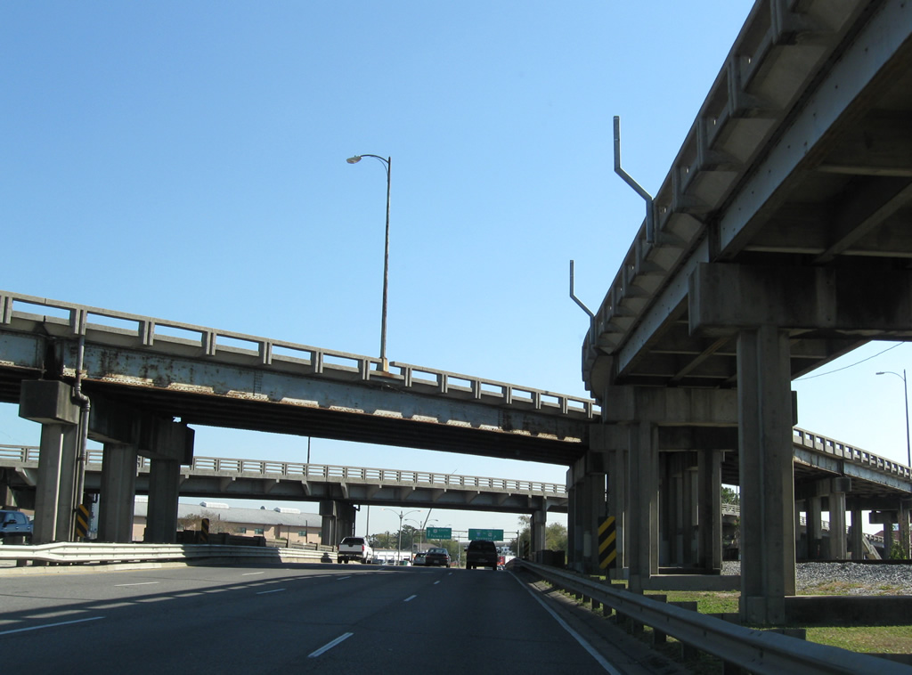
| Airline Highway becomes Tulane Avenue south of Carrollton Avenue and Interstate 10 at Mid-City. A complicated array of ramps joins U.S. 61 with Interstate 10 otherwise, with southbound traffic afforded a direct connection to a c/d roadway system to I-10 east and Howard Avenue. 11/20/08 |
|
| Monroe Street ties into Airline Highway from the Dixon neighborhood opposite the eastbound off-ramp of Interstate 10 to U.S. 61. 11/20/08 |
|
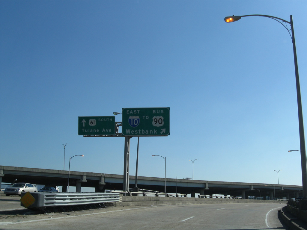
| U.S. 61 elevates onto a short viaduct above ramps to and from Interstate 10. Traffic destined for Downtown and the Crescent City Connection bridge to the Westbank departs as the viaduct begins. 11/20/08 |
|
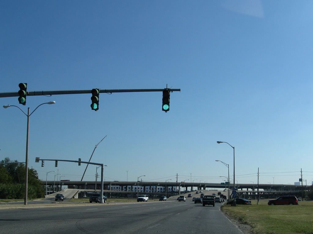
| Two lanes depart U.S. 61 (Airline Highway) southbound for Interstate 10 (Pontchartrain Expressway) east. I-10 next splits with U.S. 90 Business for the Claiborne Avenue viaduct northeast to Treme and the Seventh Ward. 11/20/08 |
|
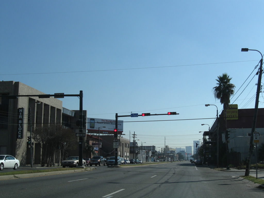
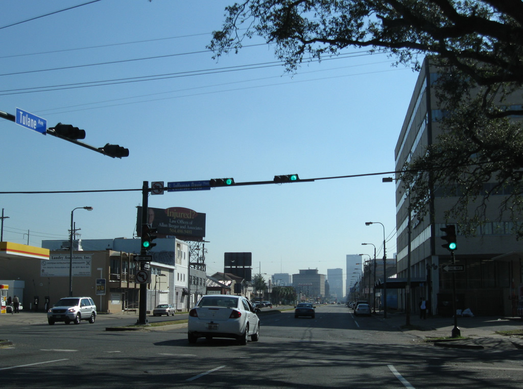
| Following Tulane Avenue, U.S. 61 carries six lanes with a narrow median through Mid-City. The first signal south of Carrollton Avenue is at Pierce Street. Pierce Street flows outward from U.S. 61 in both directions and left turns are protected, despite the lack of a dedicated turn lane. 11/20/08 |
|
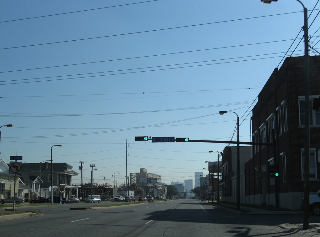
| Cortez Street travels one block west to Gravier Street and northeast through Mid-City to Orleans Avenue. Cortez Street at Gert Town, along with other residential streets, are discontinuous due to Interstate 10. 11/20/08 |
|
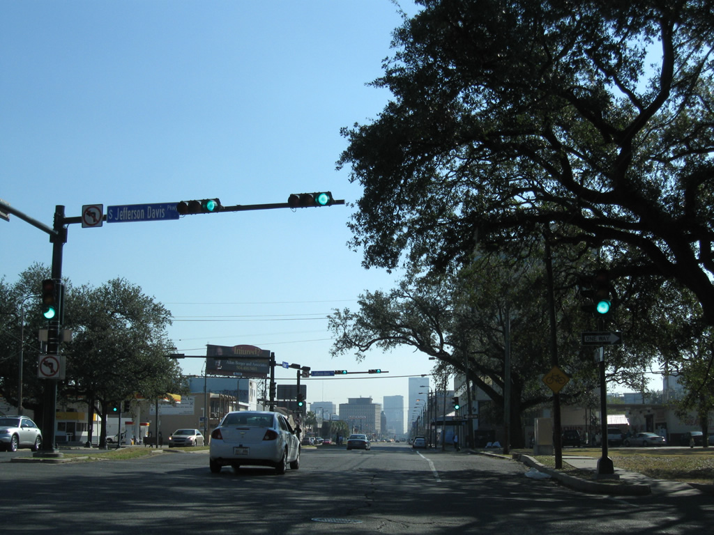
| Jefferson Davis Parkway comprises a divided tree lined boulevard northeast to Bayou St. John. Southwesterly, the boulevard combines over a viaduct across Interstate 10 before separating at Gert Town. Left turns are prohibited between Tulane Avenue and the parkway, requiring motorists to make a Michigan Left. 11/20/08 |
|
| U.S. 61 continues seven blocks southward to meet U.S. 90 at its turn from Broad Avenue east onto Tulane Avenue south to the Tulane / Gravier neighborhood of New Orleans. 11/20/08 |
|
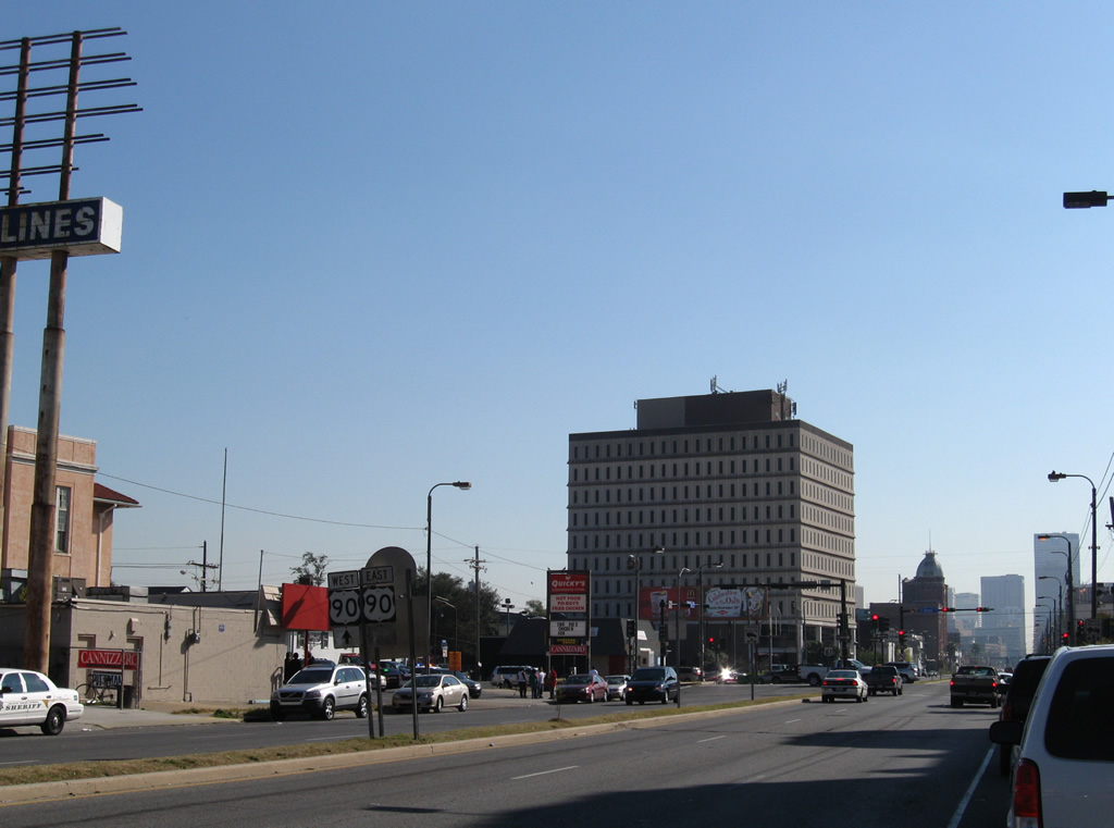
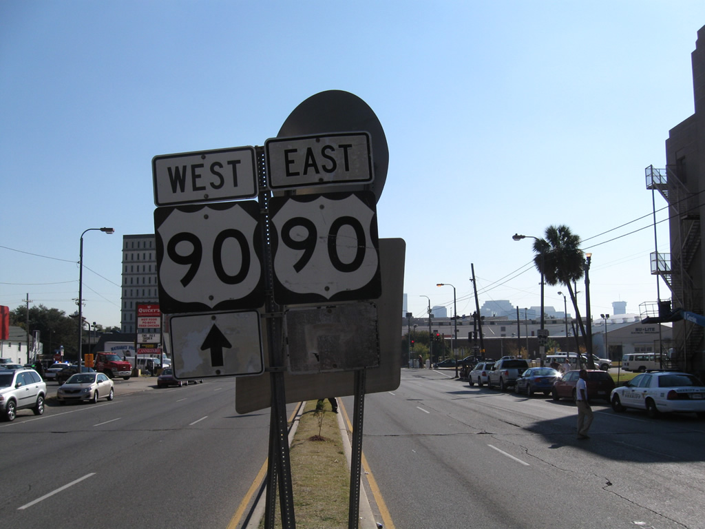
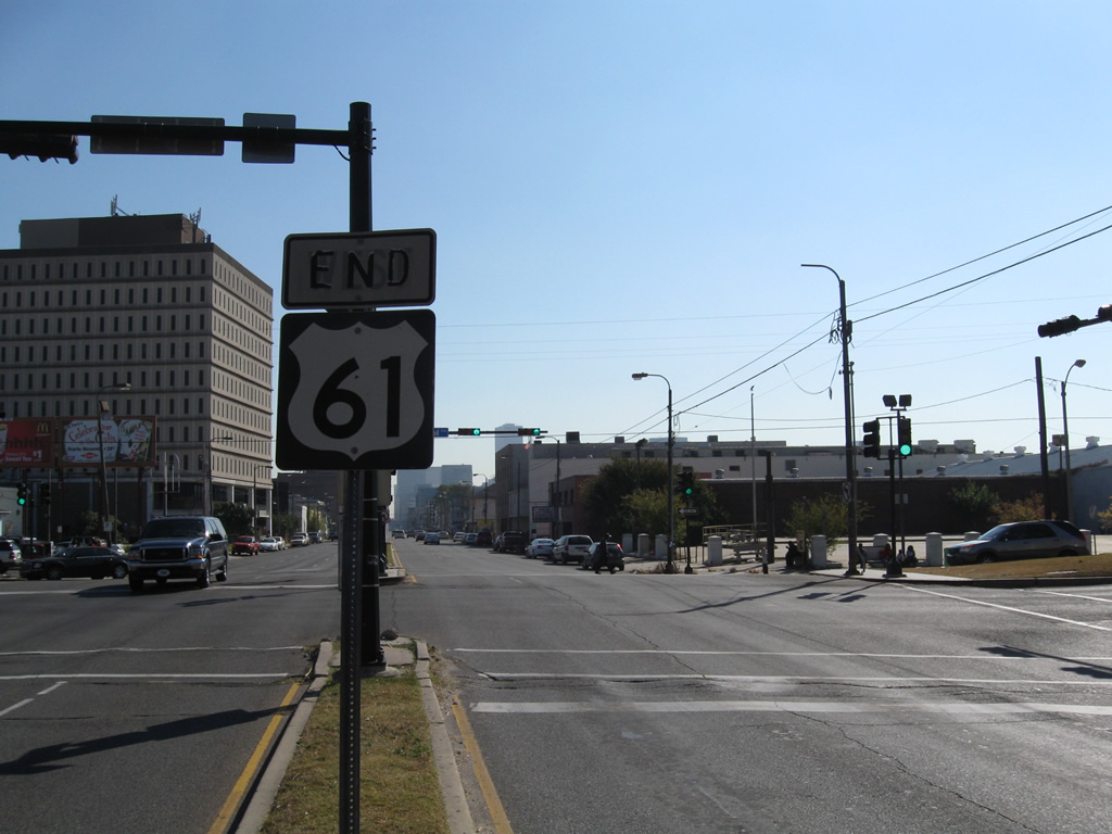
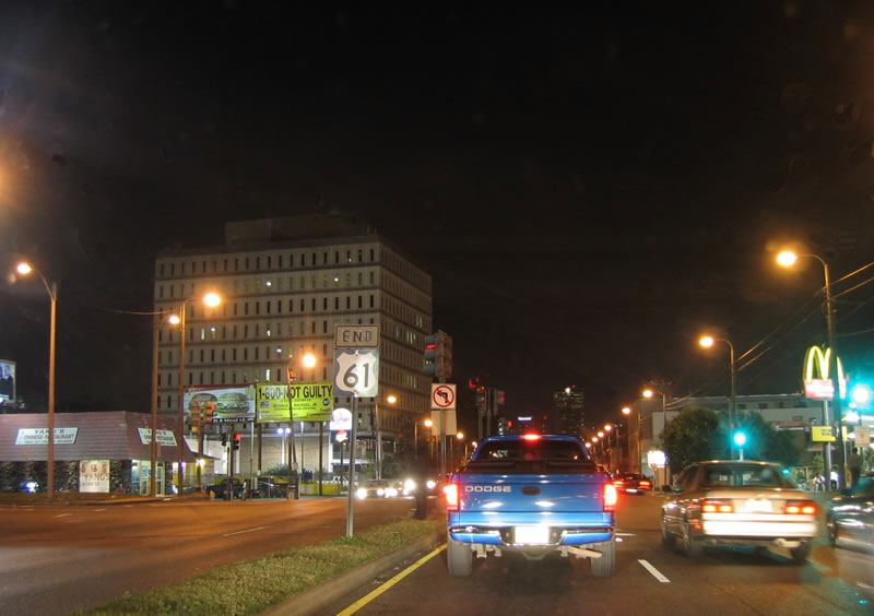
| An end sign appears where U.S. 61 south concludes at U.S. 90 (Broad Avenue). Until the 1960s, U.S. 61 turned east onto Broad Avenue four blocks to Canal Street, when Canal Street was apart of U.S. 90 southeast to Claiborne Avenue. 11/20/08 |
|
| Broad Avenue extends southwest to a grade separated intersection with Poydras Street along a viaduct spanning I-10 (Pontchartrain Expressway) to Earhart Boulevard. 10/23/03 |
Page Updated 10-04-2016.

 South
South