|
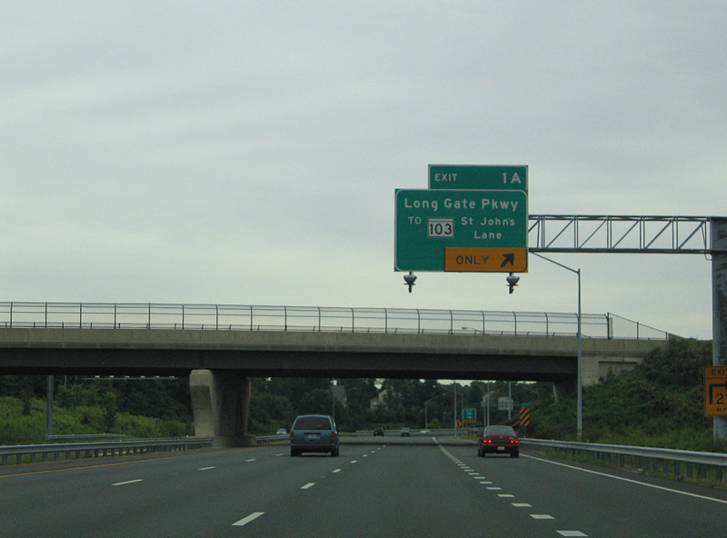
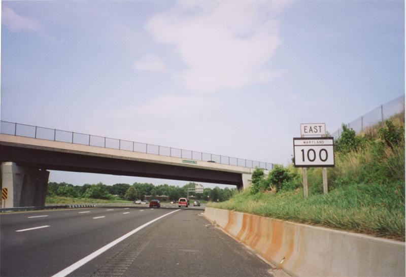
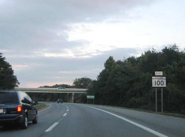
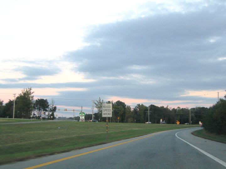
| MD 100 begins ahead of a parclo interchange with Long Gate Parkway. MD 103 (Montgomery Road) commences nearby at St. Johns Land and U.S. 29 (Columbia Pike) and parallels the freeway east to Montgomery Knolls. 08/27/05 |
|
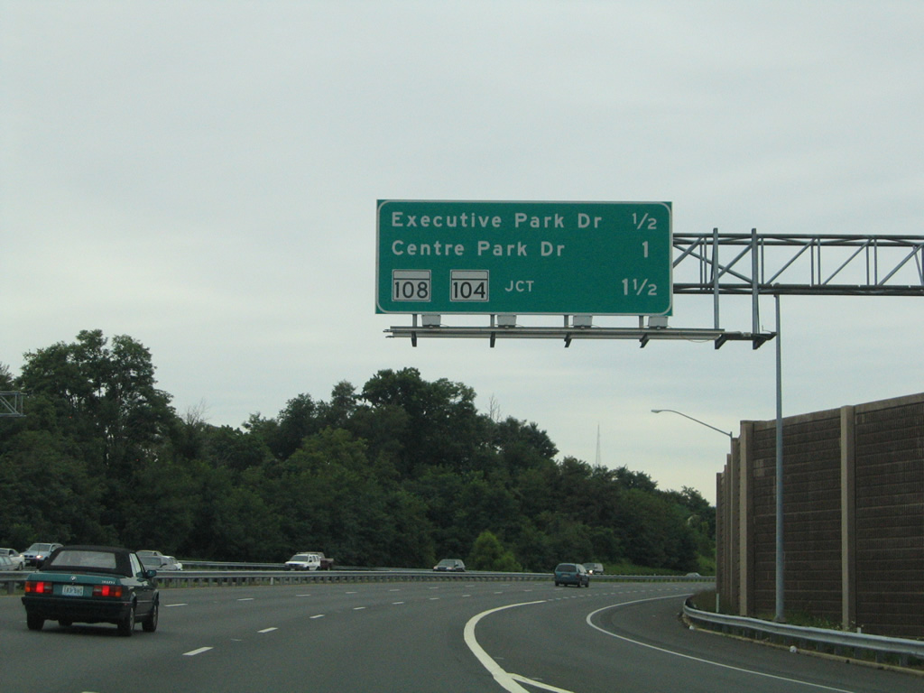
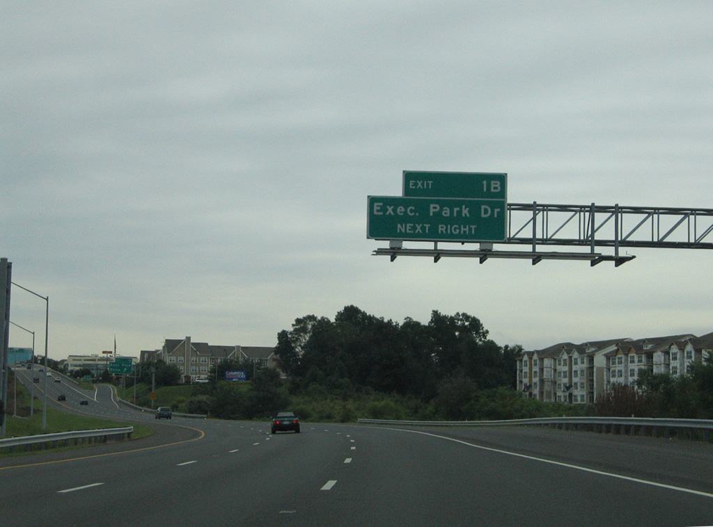
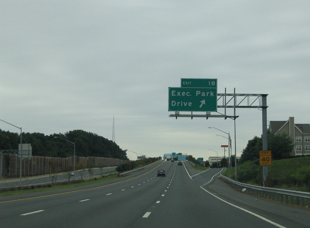
| The next three exits fall within 1.50 miles at the Columbia Hills area. Executive Park Drive spurs west from MD 100 at Exit 1B. 08/27/05 |
|
| Executive Park Drive serves a mixed area of offices, town homes, and single family homes lining the west side of MD 100. 08/27/05 |
|
| Exit 1B leaves MD 100 east for Executive Park Drive west to Columbia 100 Parkway. 08/27/05 |
|
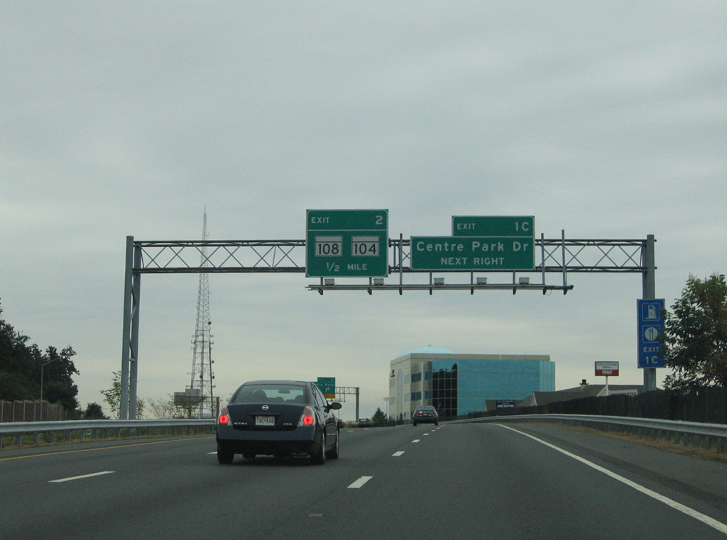
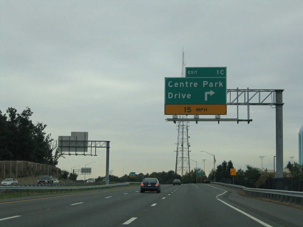
| A second off-ramp (Exit 1C) to Columbia Hills follows with Centre Park Drive. 08/27/05 |
|
| Centre Park Drive begins from Exit 1C and connects MD 100 with MD 108 (Old Annapolis Road) opposite Phelps Luck Drive. 08/27/05 |
|
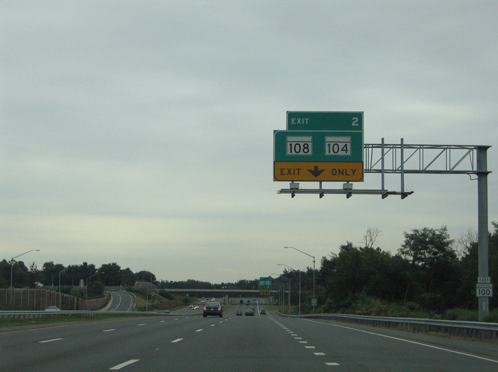
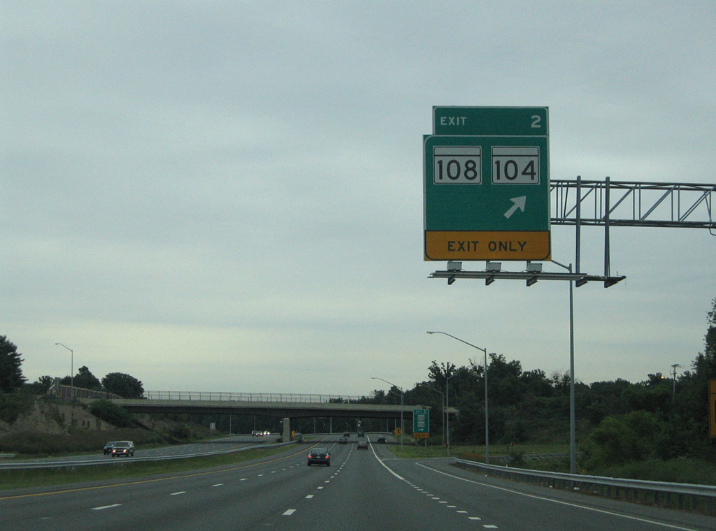
| MD 104 constitutes a 1.14 mile route between MD 108 (Old Annapolis Road) at Jonestown and MD 103 (Montgomery Road) near Worthington. Exit 2 provides access to Old Annapolis Road ahead of Waterloo Road. 08/27/05 |
|
| Eastbound MD 100 at Exit 2 for MD 108 (Old Annapolis Road). MD 108 overtakes Waterloo Road from MD 104 south, paralleling MD 100 to Old Montgomery Road before turning south to end at MD 175. The state route totals 34.23 miles from MD 27 at Damascus. 08/27/05 |
|
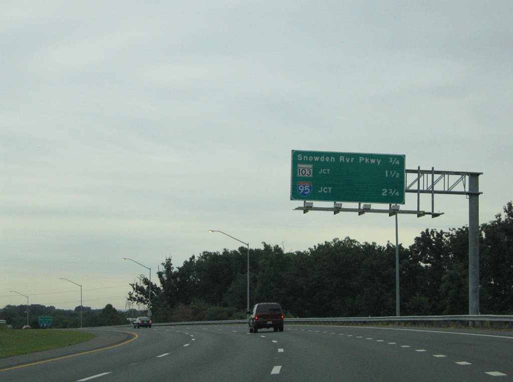
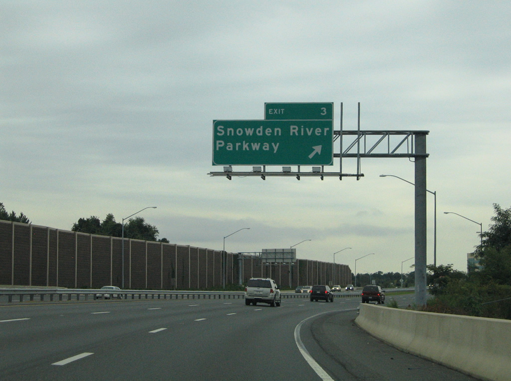
| Interstate 95 appears for the first time on MD 100 east, 0.75 miles west of the diamond interchange (Exit 3) with Snowden River Parkway. 08/27/05 |
|
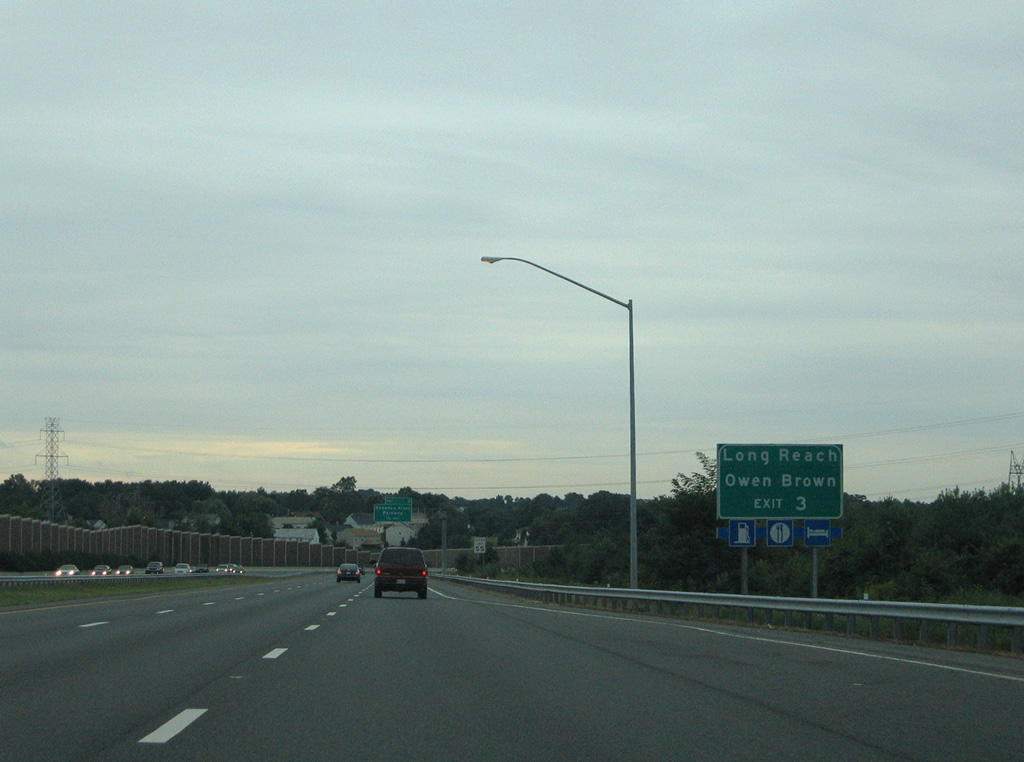
| Snowden River Parkway meanders southwest from MD 100 (Exit 3) to the suburbs of Long Reach and Owen Brown. 08/27/05 |
|
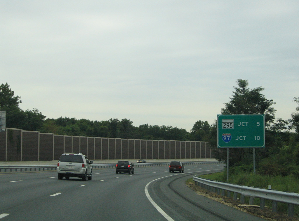
| A distance sign preceding Exit 3 shows the forthcoming connections with MD 295 (Baltimore-Washington Parkway) and Interstate 97. 08/27/05 |
|
| Snowden River Parkway constitutes a controlled access arterial between MD 100 and Broken Land Parkway near Guilford at MD 32. A parclo interchange joins the parkway with MD 175 (Patuxent Parkway) amid a heavily developed retail area. 08/27/05 |
|
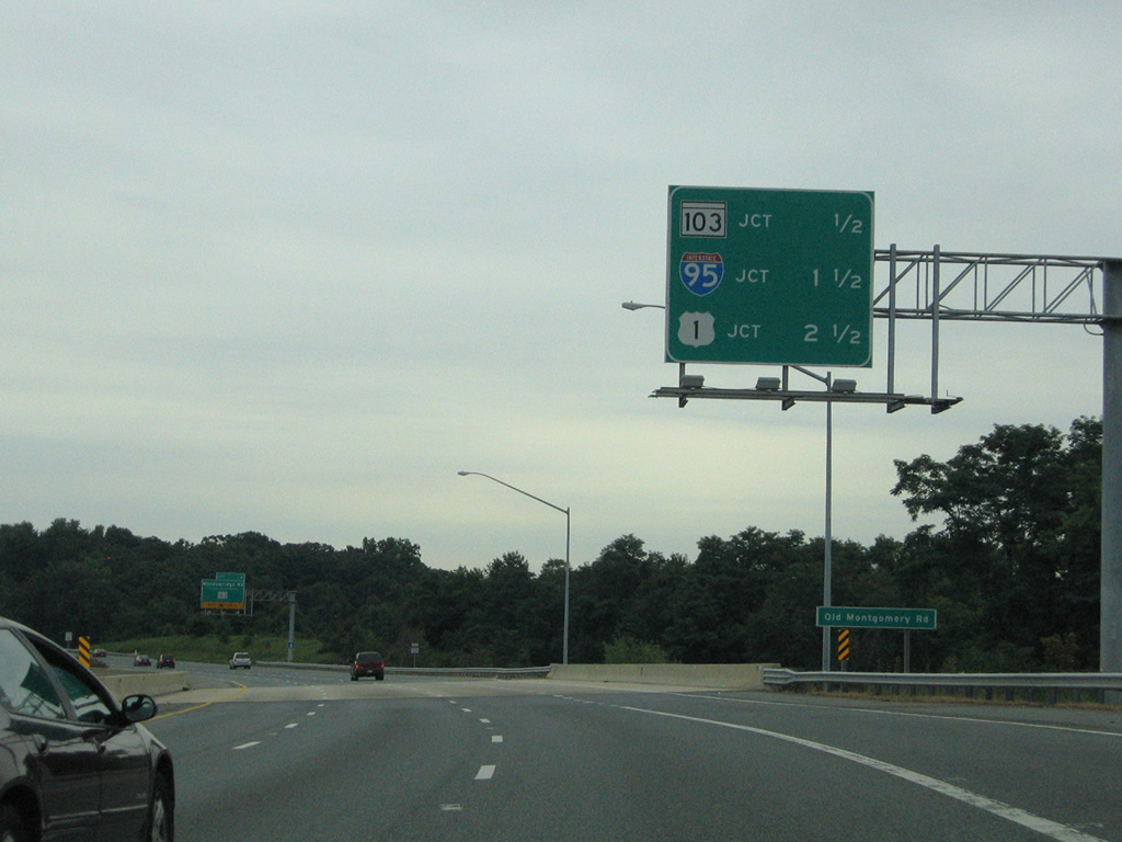
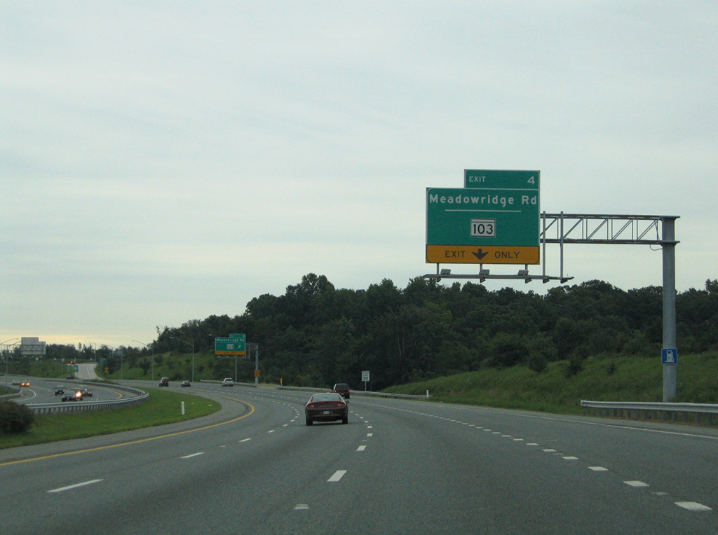
| MD 103 converges with MD 100 at diamond interchange (Exit 4) south of Font Hill. 08/27/05 |
|
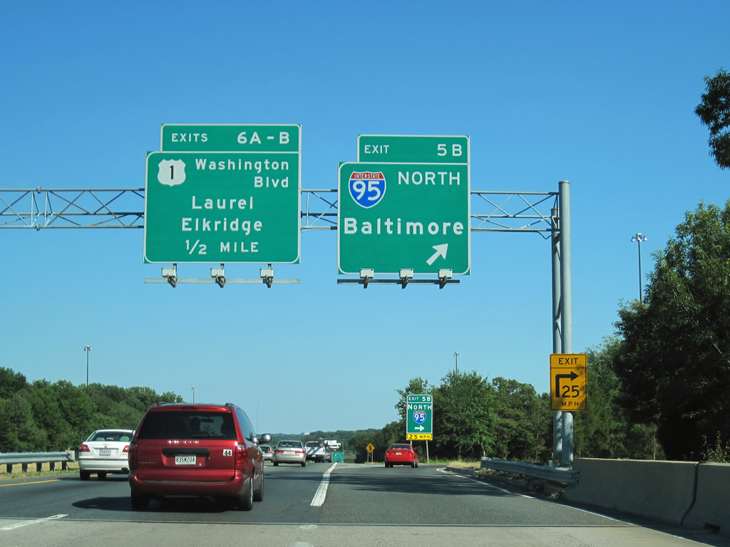
| MD 103 follows Meadowridge Road south from Brightfield Road to MD 100 and U.S. 1 opposite Dorsey Road). The state route parallels the freeway to the Anne Arundel County line. 08/27/05 |
|
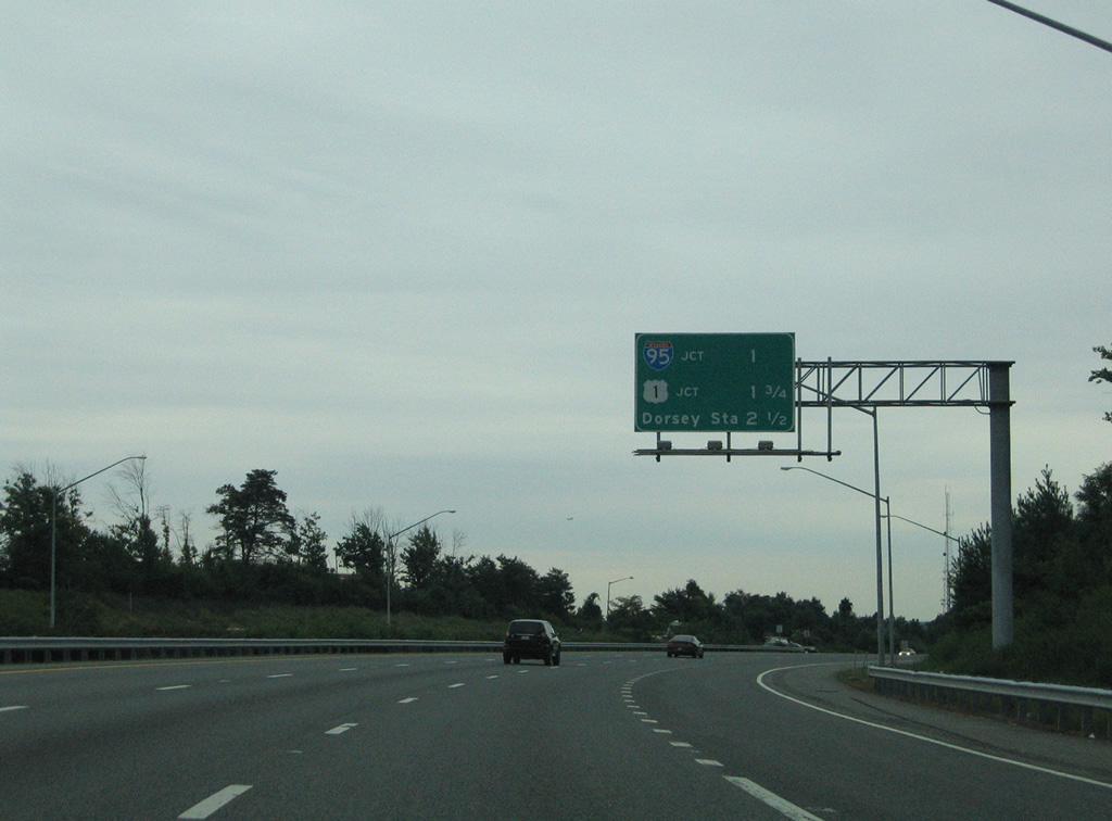
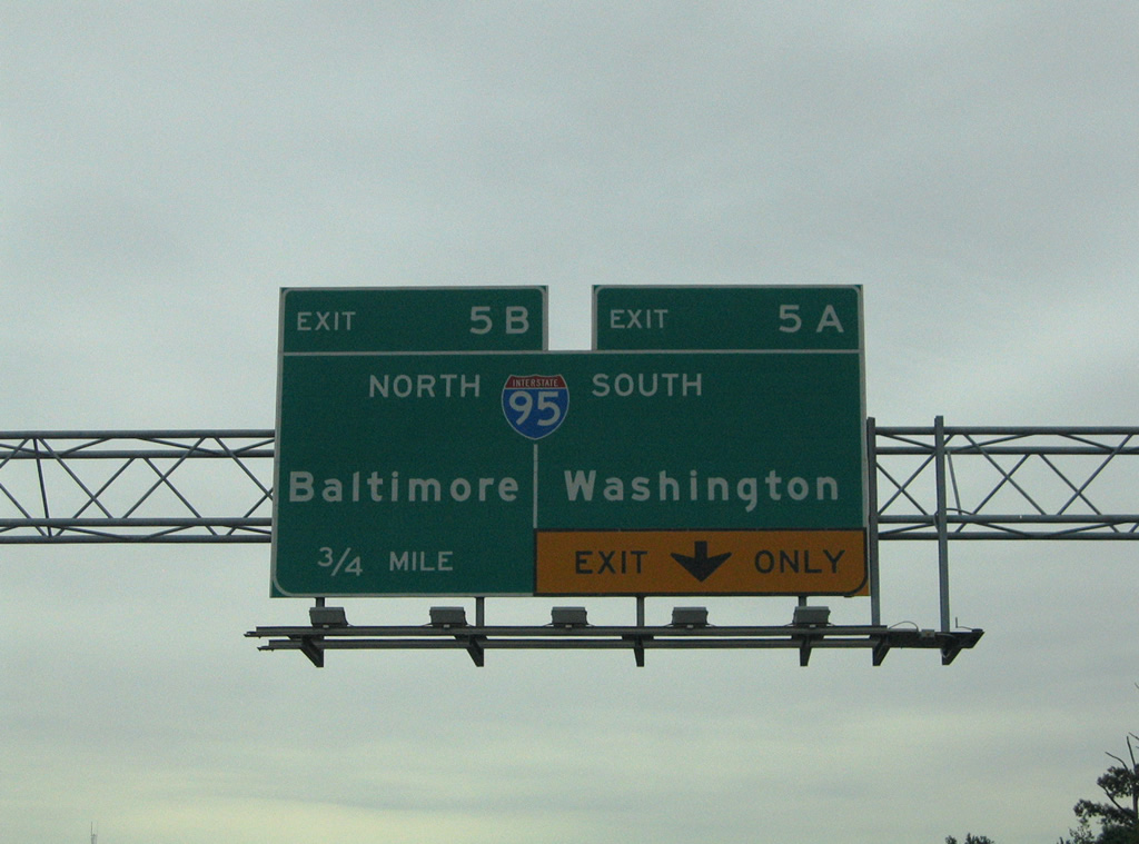
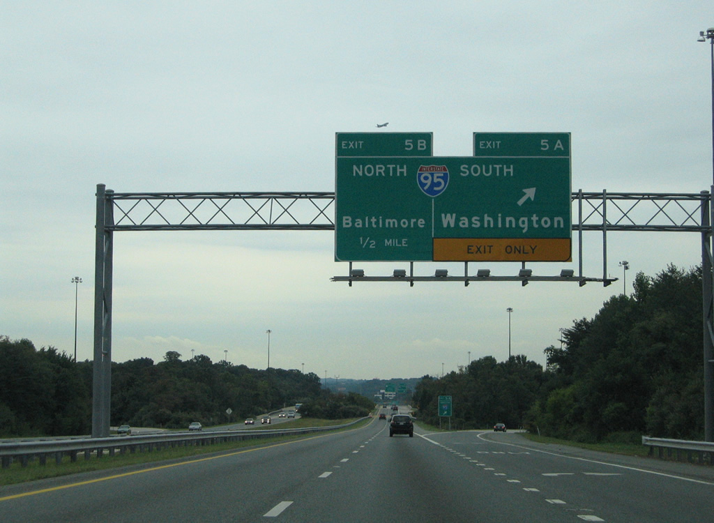
| Distance sign posted one mile west of the directional cloverleaf interchange (Exits 5 A/B) with Interstate 95. 08/27/05 |
|
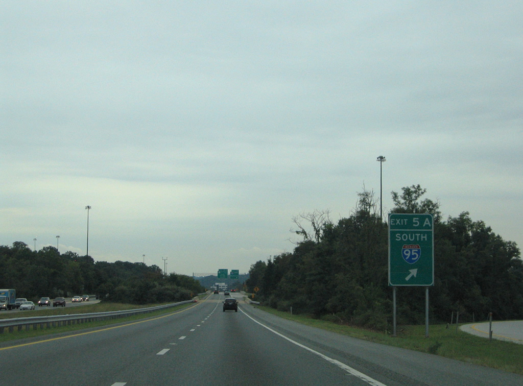
| Exit 5A departs next for Interstate 95 southwest to Laurel and Washington, DC. 08/27/05 |
|
| South from Exit 5A, I-95 next meets MD 175 at Waterloo and Jessup. Interstate 95 exits the state in 42.3 miles at the Woodrow Wilson Bridge. 08/27/05 |
|
| A loop ramp (Exit 5B) descends onto Interstate 95 north to Baltimore from MD 100 east. The eight lane freeway continues to Interstate 695 in four miles. 07/02/10 |
|
| Advancing to the community of Wesley Grove along MD 100 east ahead of Exits 6 A/B with U.S. 1. 07/02/10 |
|
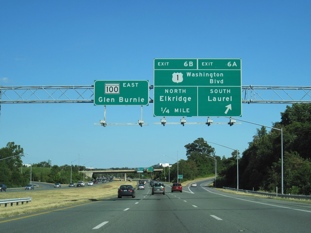
| A six-ramp parclo interchange links MD 100 with U.S. 1 (Washington Boulevard). Exit 6A connects with U.S. 1 south to Waterloo, Jessup and Laurel. 07/02/10 |
|
| U.S. 1 (Washington Boulevard) heads north from the exchange with MD 100 for Elkridge and Halethorpe in Baltimore County. 07/02/10 |
|
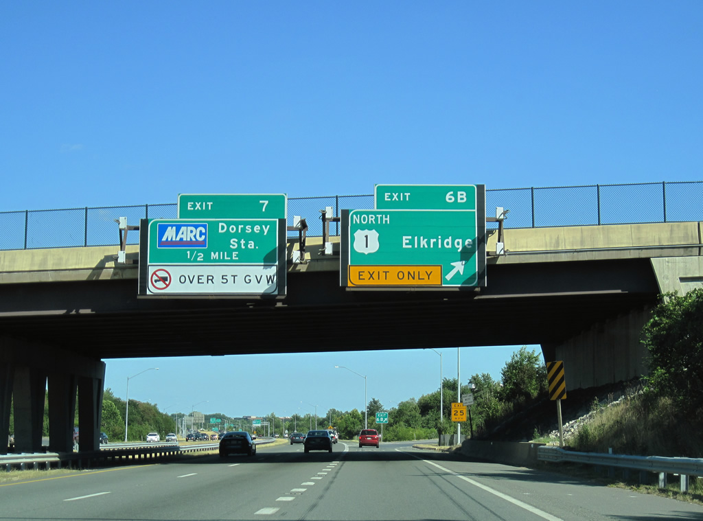
| An auxiliary lane opens from U.S. 1 east to the diamond interchange at Exit 7. 07/09/10 |
|
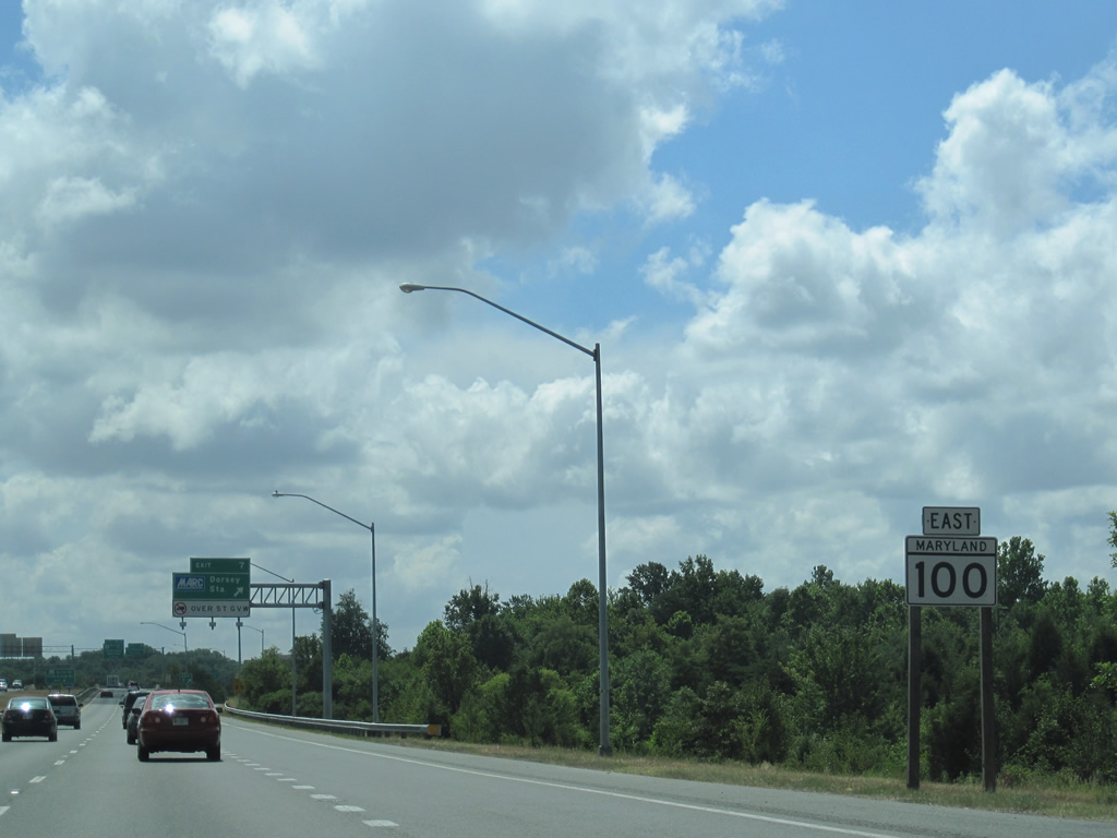
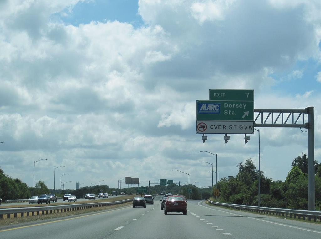
| Exit 7 provides access to the MARC Dorsey Station. 07/09/10 |
|
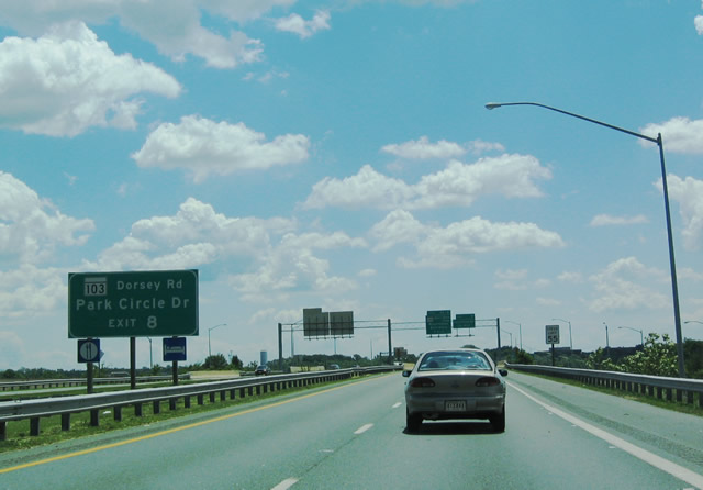
| Forthcoming Exit 8 with Coca-Cola Road provides access to adjacent MD 103 (Dorsey Road) and Park Circle Drive at an industrial park to the north. MD 103, the route that MD 100 replaced, parallels the freeway between U.S. 29 and the Howard-Anne Arundel County line. 05/31/04 |
|
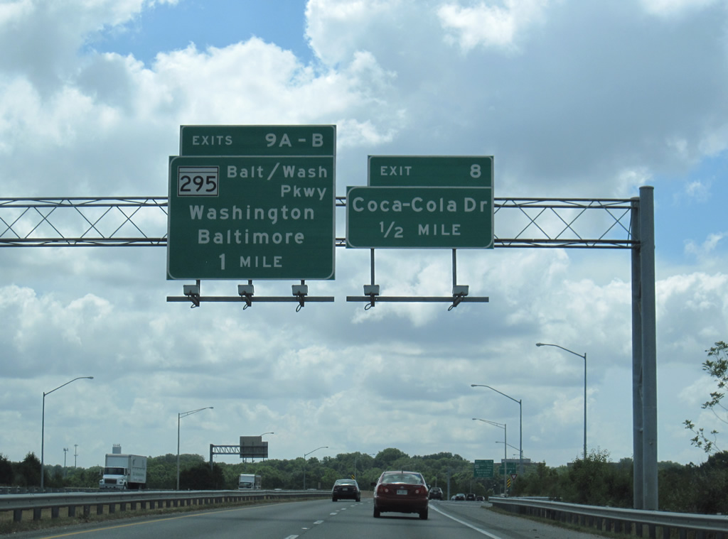
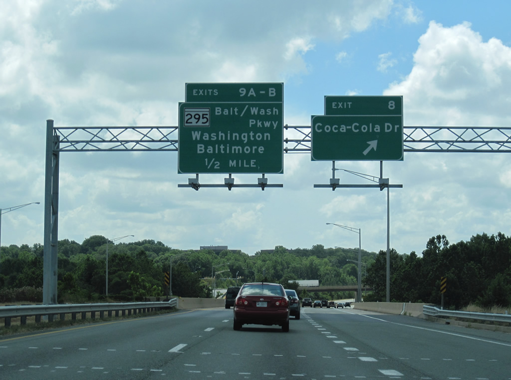
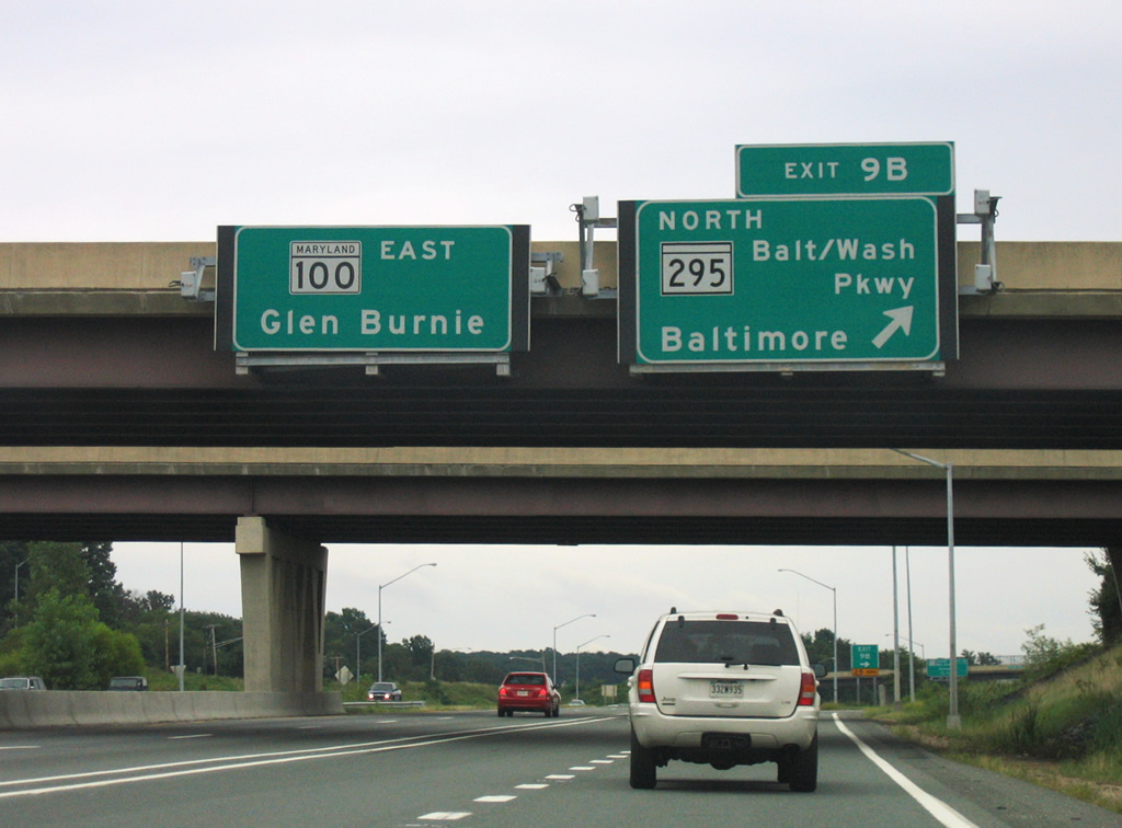
| MD 100 leaves Howard County and enters Anne Arundel County at the crossing over Deep Run. A diamond interchange follows in one half mile at Exit 8. MD 295 (Baltimore-Washington Parkway) and MD 100 converge at a cloverleaf interchange (Exits 9 A/B) beyond Coca-Cola Road. 07/09/10 |
|
| Coca-Cola Road ties into MD 103 to the south and High Tech Drive east of Harwood Park. Exits 9 A/B for MD 295 provides a viable alternate to Interstate 95 between Baltimore and Washington. 07/09/10 |
|
| MD 295 south follows Baltimore-Washington Parkway into Washington, D.C. Trucks are prohibited on the route south of MD 175. 07/09/10 |
|
| Exit 10B loops onto MD 295 (Baltimore-Washington Parkway) north to BWI Airport (via Interstate 195 east), Linthicum and Baltimore. 08/27/05 |
|
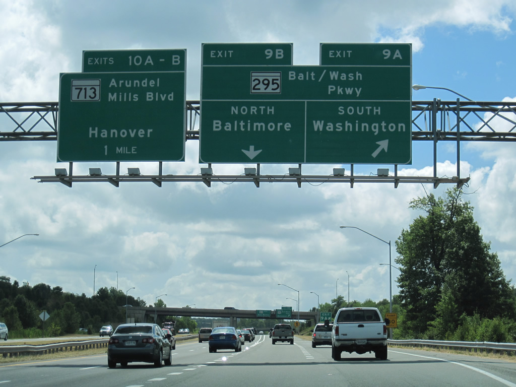
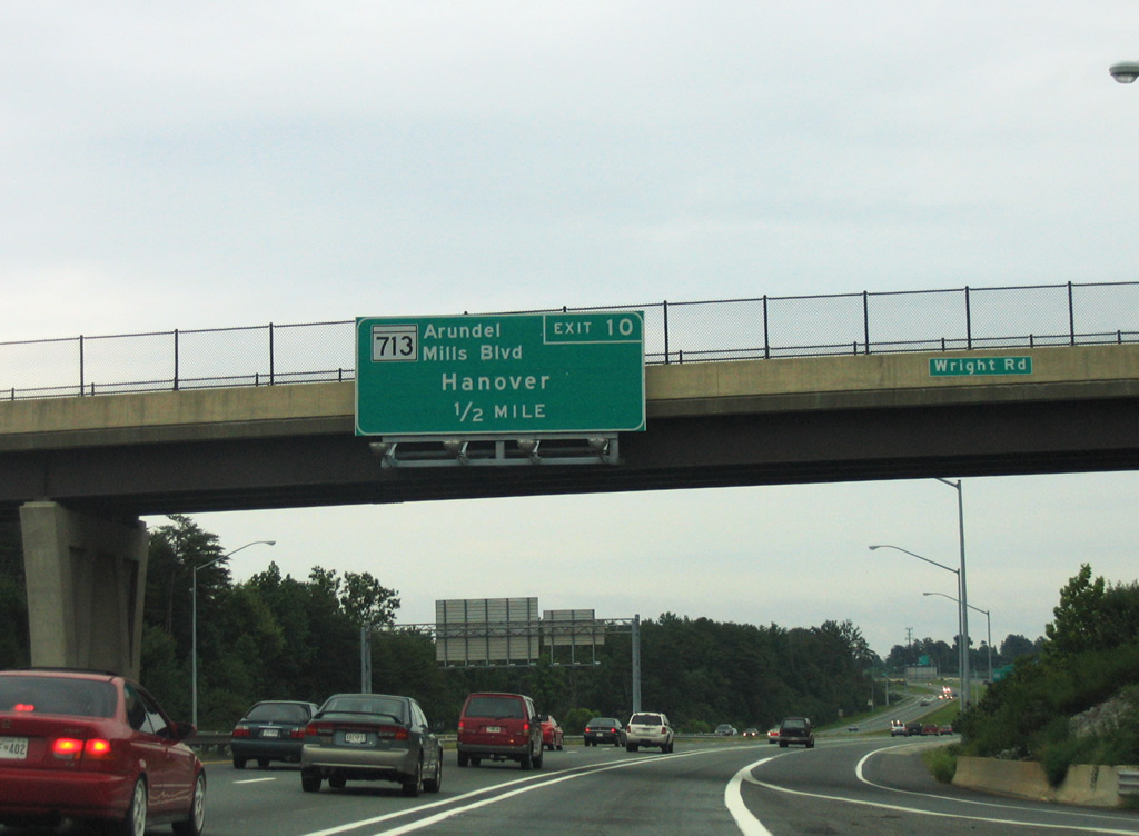
| MD 100 continues a half mile from Wright Road to MD 713 at Exits 10 A/B. 08/27/05 |
|
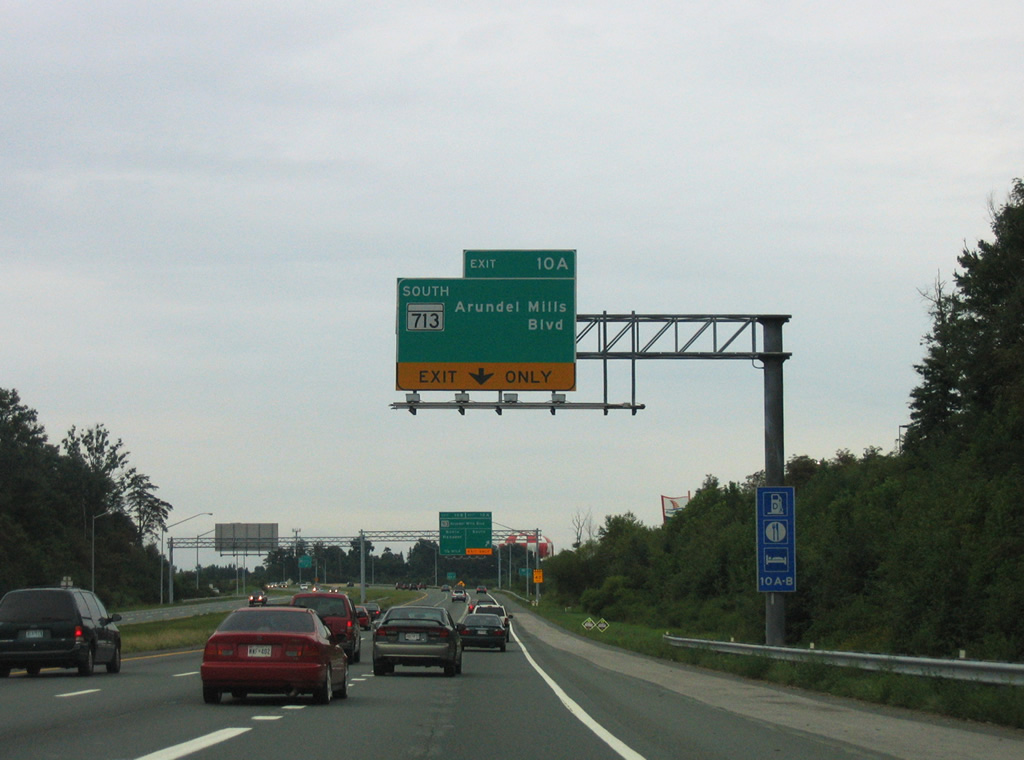
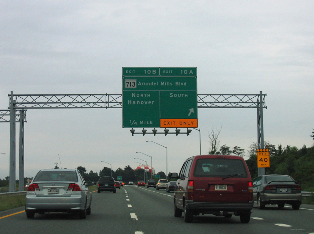
| A third lane opens along eastbound MD 100 to Exit 10 A for MD 713 (Arundel Mills Boulevard) south. MD 713 splits with Arundel Mills Boulevard east of Arundel Mills mall nearby for Ridge Road south to MD 175 (Annapolis Road). 08/27/05 |
|
| Arundel Mills Parkway travels west from Exit 10 A near Joe Cannon Stadium to MD 295 (Baltimore-Washington Parkway). MD 713 concludes just north of Exit 10 B at parallel MD 176 (Dorsey Road). 08/27/05 |
|
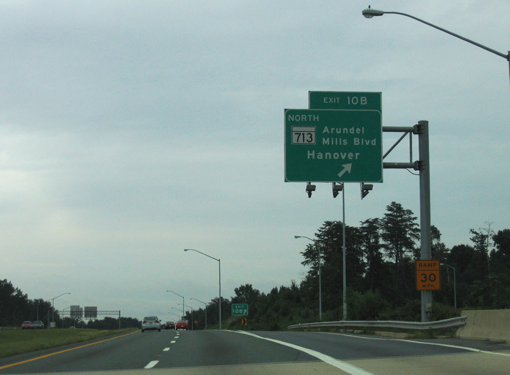
| Exit 10B loops onto MD 713 (Arundel Mills Boulevard) north to New Ridge Road at Shipley Corner. MD 176 leads east from the end of MD 713 to Hanover. 08/27/05 |
|
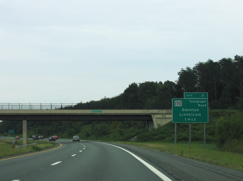
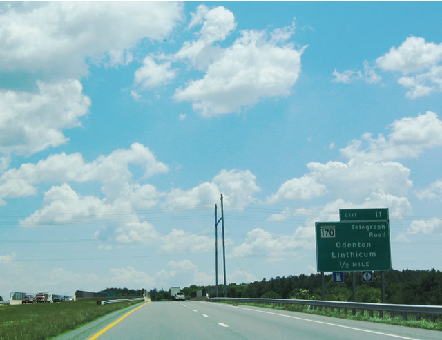
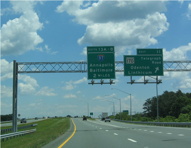
| MD 100 continues east one mile to a single point urban interchange (Exit 11) with MD 170 (Telegraph Road). 08/27/05 |
|
| MD 170 begins in Odenton to the south near MD 32, then heads north through Severn, to MD 100, Baltimore-Washington International Airport (BWI) and MD 2 at Brooklyn Park in Baltimore. 05/31/04 |
|
| Exit 11 leaves MD 100 for MD 170 (Telegraph Road). MD 170 encircles the west side of BWI Airport along Aviation Boulevard. Aviation Boulevard constitutes the northern segment of the Airport Loop. 05/31/04 |
|
| Confirming marker for MD 100 posted eastbound at the Queenstown Road overpass. 06/17/00 |
|
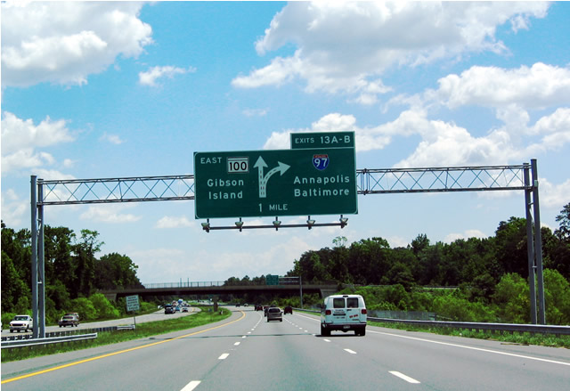
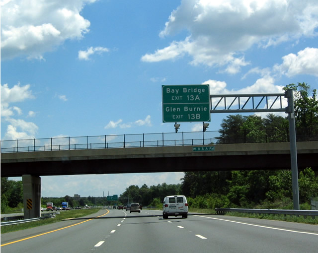
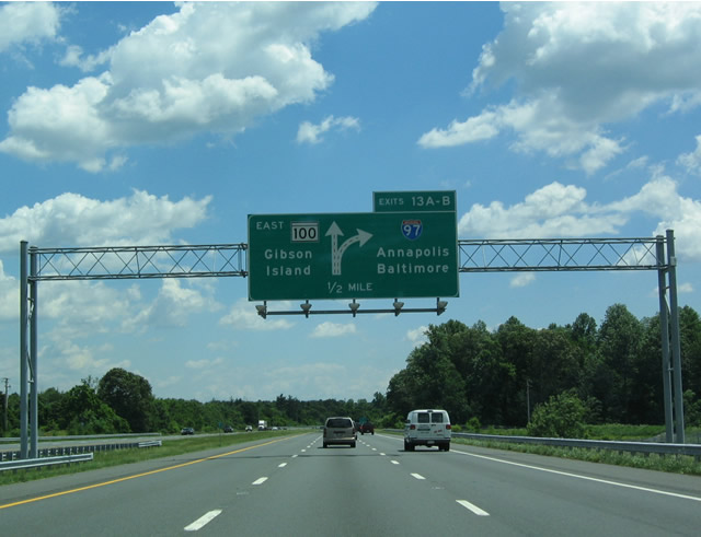
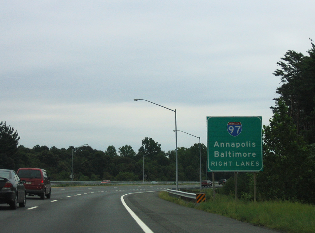
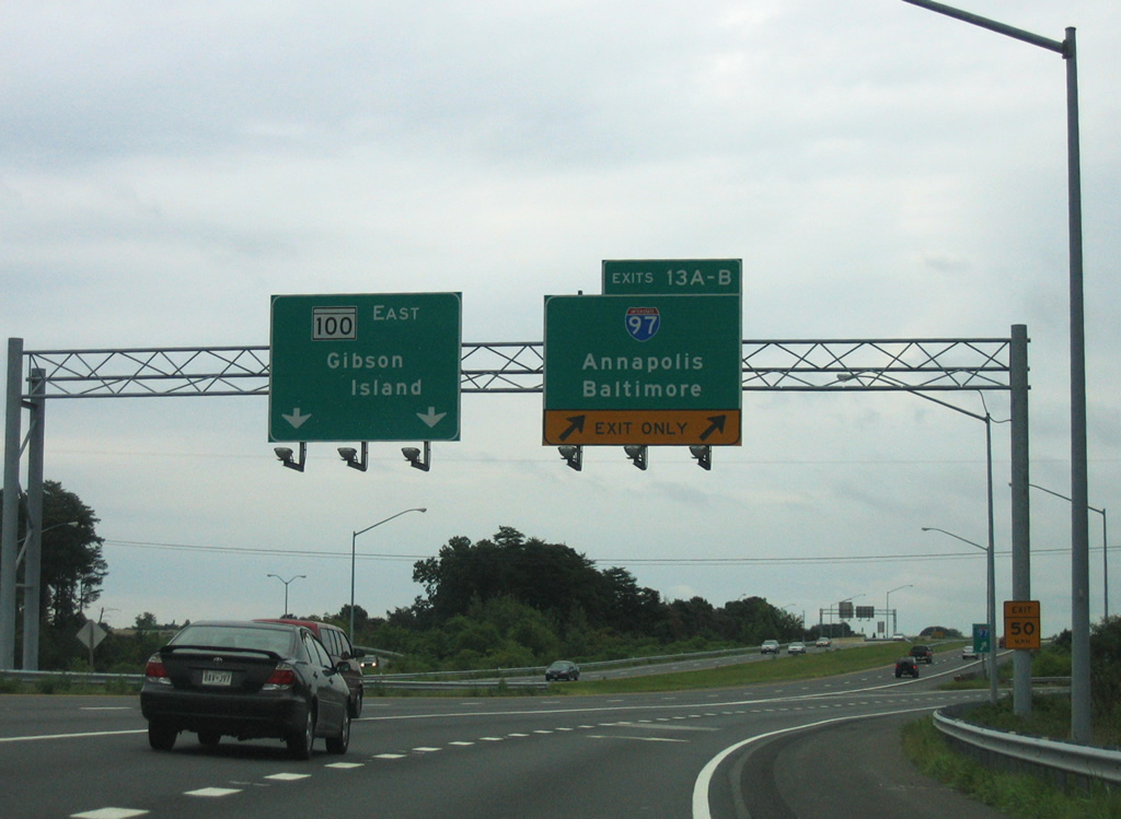
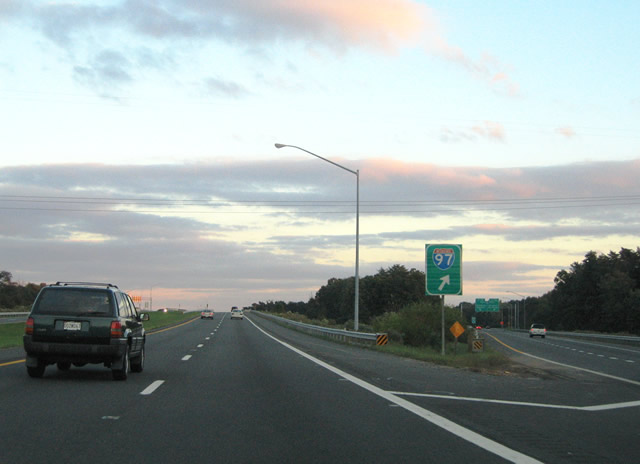
| An intracounty route measuring just 17.62 miles in length, Interstate 97 meets MD 100 next at Exits 13 A/B. 05/31/04 |
|
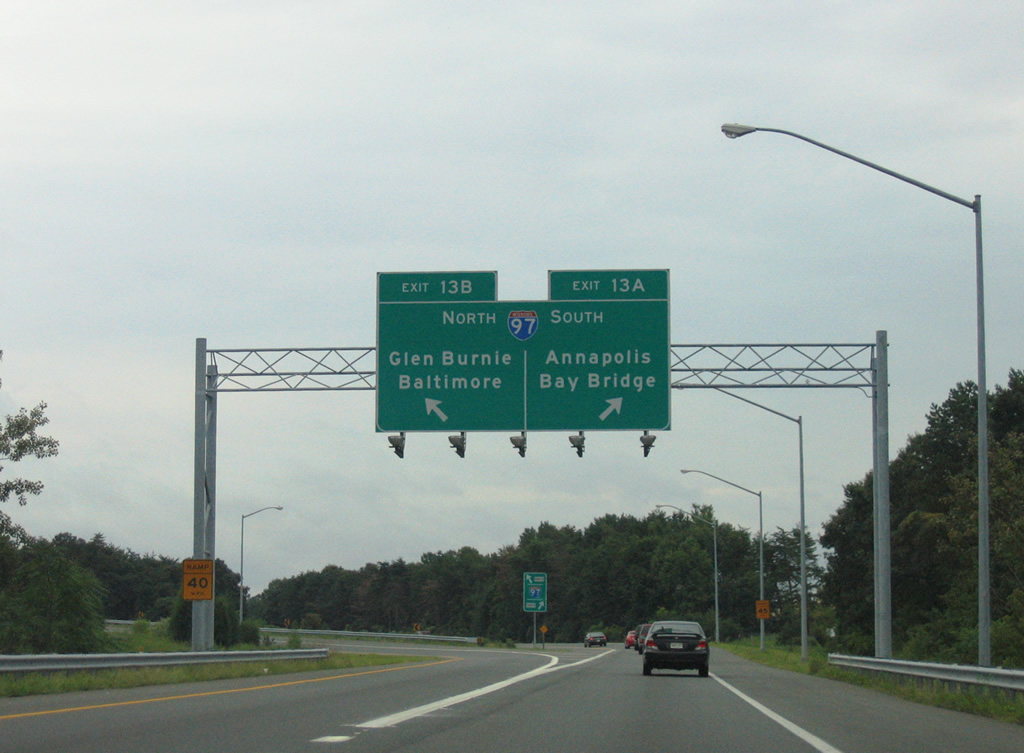
| I-97 runs north to Glen Burnie and south to U.S. 50/301 west of Annapolis and the Chesapeake Bay Bridge. 05/31/04 |
|
| Two lanes separate at Exit 13 from MD 100 east beyond Sawmill Creek for Interstate 97 between McPherson and Burleytown south of BWI Airport. 05/31/04 |
|
| Interstate 97 connects Baltimore with Annapolis along the corridor of former MD 3 and MD 178. 08/27/05 |
|
| Traffic partitions at Exit 13 with two lanes continuing along MD 100 east toward Green Haven, Lake Shore and Gibson Island, and two departing for both directions of Interstate 97. 08/27/05 |
|
| A half turbine interchange joins MD 100 and Interstate 97 at Exit 13 and Southgate. 10/10/04 |
|
| Interstate 97 extends north to I-695 and I-895 Spur leading to the tolled Baltimore Harbor Tunnel Thruway. 08/27/05 |
|
| Interstate 97 connects with U.S. 50/301 west to Bowie in 13.5 miles. 08/27/05 |
|
| MD 10 (Arundel Expressway) and MD 100 (Paul T. Pitcher Memorial Highway) overlap for a half mile near Pasadena in central Anne Arundel County. 10/10/04 |
|
| MD 10 to MD 2 (Governor Ritchie Highway) south leads to Annapolis. MD 2 constitutes an arterial route through Pasadena, Severna Park, and Arnold en route to U.S. 50/301 and the capital city. 10/10/04 |
|
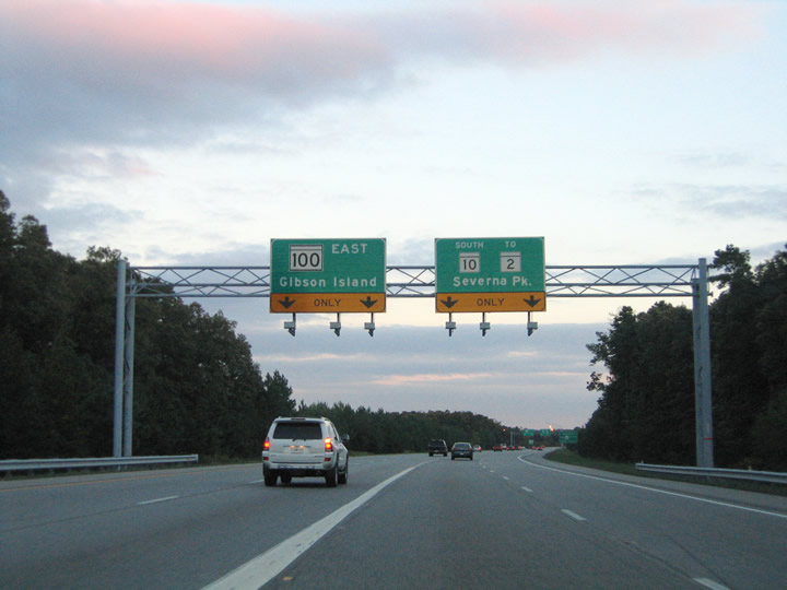
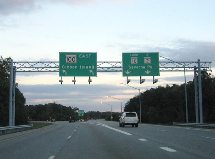
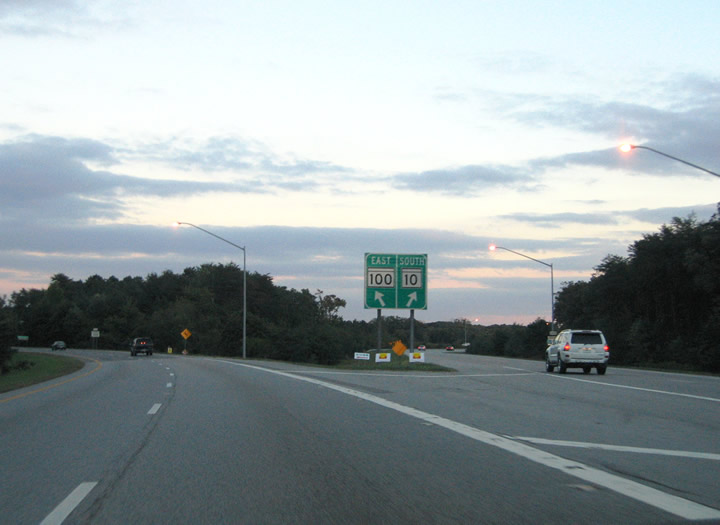
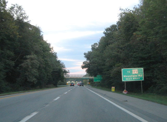
| MD 100 eastbound branches away from MD 10 south to Lake Shore and Gibson Island. The expressway along MD 100 extends another three miles to MD 177 (Mountain Road) near Jacobsville. Mountain Road continues east from there to Lake Shore, Mt. Carmel and Gibson Island on Chesapeake Bay. 10/10/04 |
|
| Beyond the separation with MD 10, MD 100 (Paul T. Pitcher Memorial Highway) advances to exits for Catherine Avenue and Raynor Boulevard before intersecting MD 607 (Magothy Bridge Road). The Arundel Expressway along MD 10 concludes at MD 2 (Ritchie Highway) near Pasadena Road. 10/10/04 |
|
| MD 100 eastbound reassurance marker posted after the split with MD 10 south. The northbound mainline for MD 10 passes over the freeway ahead. 10/10/04 |
|
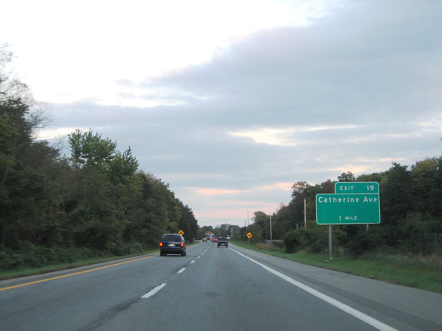
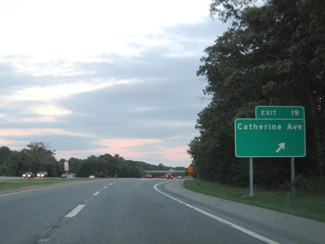
| A half diamond interchange joins MD 100 with Catherine Street at Exit 19. Catherine Street travels north from Pasadena Road to Duvall Highway at Green Haven. 10/10/04 |
|
| Catherine Road north links with MD 177 (Mountain Road) to the communities of Lipins Corner and Armiger. Catherine Street southbound meets MD 648 (Baltimore-Annapolis Boulevard) at Pasadena Road. 10/10/04 |
|
| Exit 19 departs MD 100 eastbound for Catherine Avenue. 10/10/04 |
|
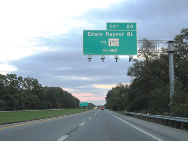
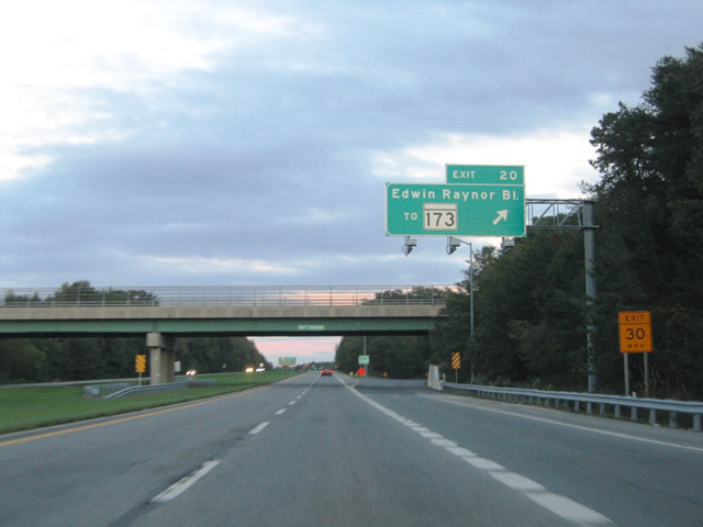
| A second parclo interchange joins MD 100 and Raynor Boulevard at Exit 20. Raynor Boulevard stems north from Magothy Bridge Road to MD 173 (Fort Small Wood Road) at Tick Neck Park. 10/10/04 |
|
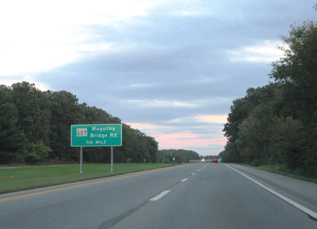
| Magothy Bridge Road travels east from MD 2 and MD 648 to Woods Boulevard where it turns north and becomes MD 607. The MD 607 section of Magothy Bridge Road intersects the MD 100 expressway just east of Raynor Boulevard. 10/10/04 |
|
| A loop ramp carries eastbound drivers to Raynor Boulevard from MD 100. Raynor Boulevard intersect MD 177 (Mountain Road) to the north between Armiger and Jacobsville. MD 173 (Smallwood Road) extends north from Raynor Boulevard to Pine Haven and Riviera Beach. 10/10/04 |
|
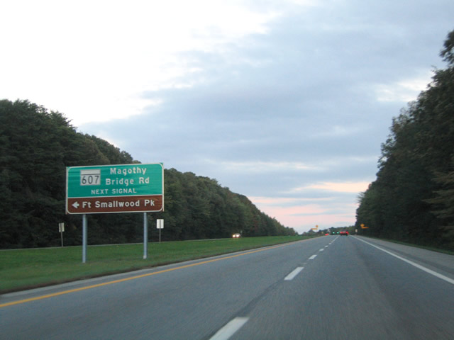
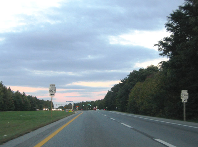
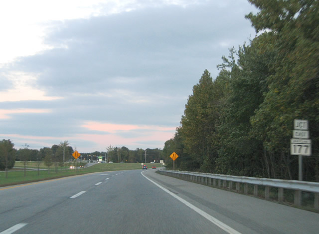
| MD 607 (Magothy Bridge Road) meets MD 100 between Woods Road and MD 177 (Mountain Road) at the first of two traffic signals along the expressway. MD 607 ends at MD 173 (Fort Smallwood Road) north for Jacobsville. 10/10/04 |
|
| MD 607 (Magothy Bridge Road) becomes Hogs Neck Road north of MD 177 (Mountain Road) to MD 173. MD 173 (Fort Smallwood Road) east leads to Fort Smallwood Park along the Chesapeake Bay. 10/10/04 |
|
| The final eastbound reassurance shield of MD 100 stands between the intersections with Magothy Bridge Road and Magothy Beach Road. Magothy Beach Road heads north from the Magothy River to MD 177 at Elizabeth Road. 10/10/04 |
|
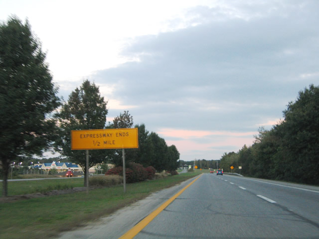
| An expressway ends sign precedes MD 177 (Mountain Road). 10/10/04 |
|
| The east end of MD 100 ties into MD 177 (Mountain Road) south at a wye intersection. 10/10/04 |
Page Updated 03-31-2011.