|
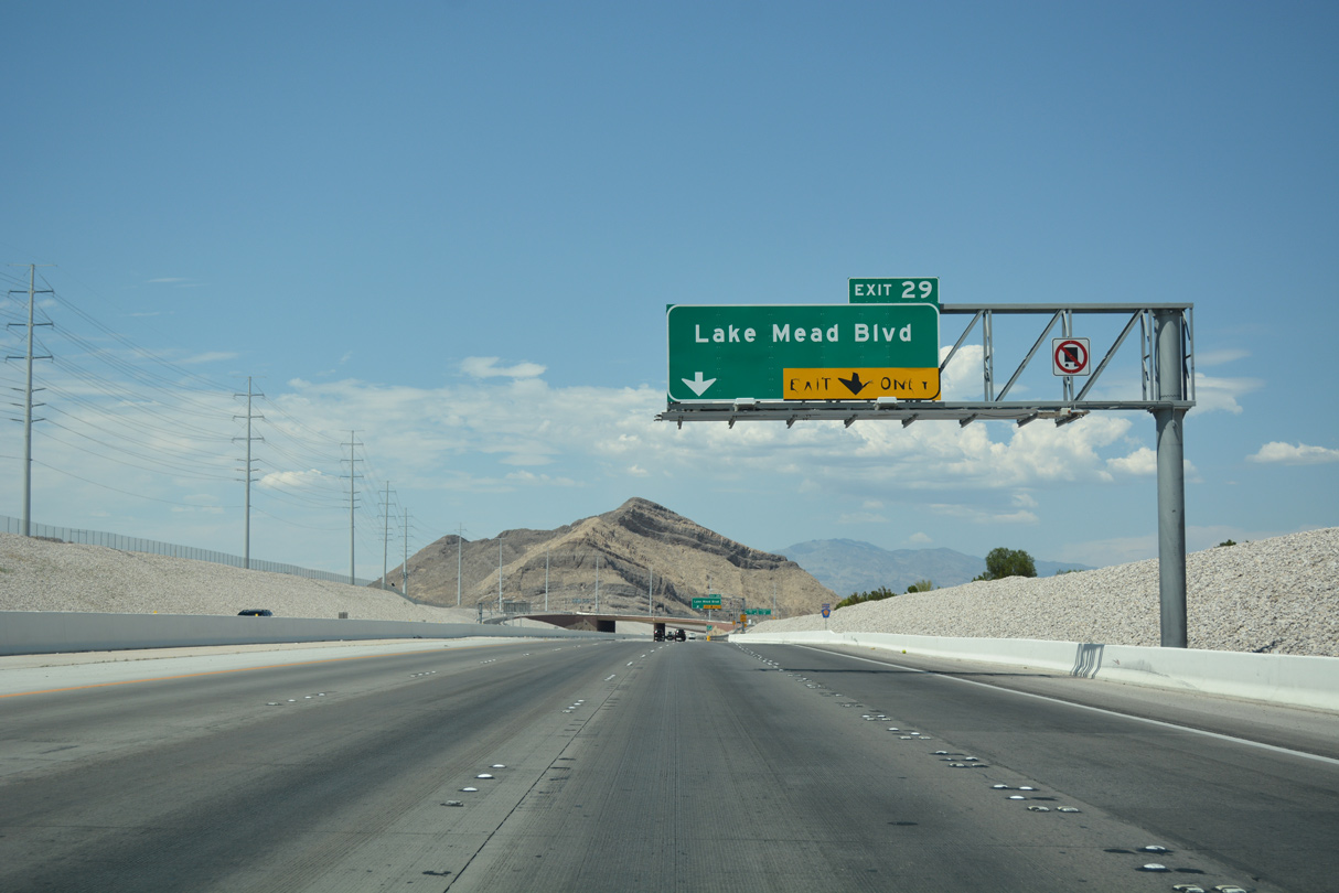
| Clark County 215 (Las Vegas/Bruce Woodbury Beltway) advances 0.30 miles north from a parclo interchange (Exit 28) with Summerlin Parkway to meet Lake Mead Boulevard next. 07/22/17 |
|
| This confirming marker for CC-215 is posted on the approach to Exit 29 (Lake Mead Boulevard). Lake Mead Boulevard extends eastward from CC-215 to North Las Vegas. 07/22/17 |
|
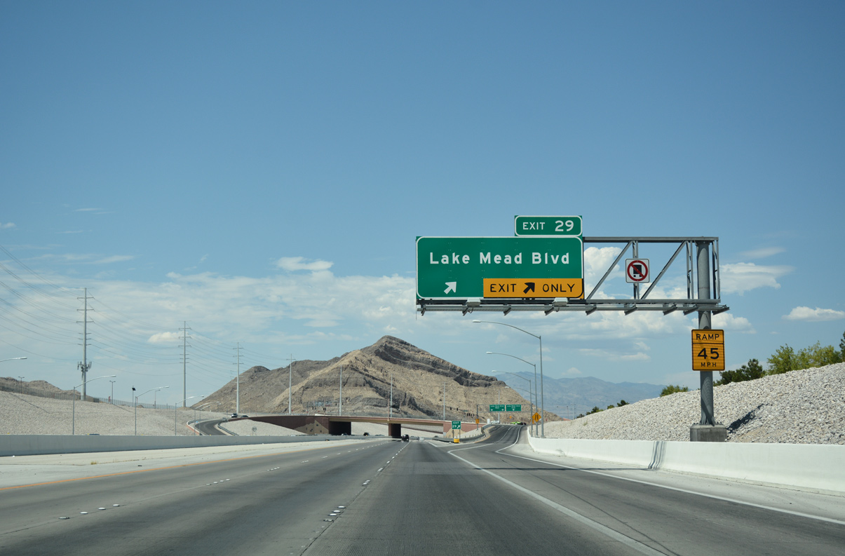
| Two lanes separate from the Bruce Woodbury Beltway to Lake Mead Boulevard (Exit 29). Locally, Lake Mead Boulevard connects to the Trails neighborhood and the age restricted Sun City Summerlin, both within the master planned community of Summerlin. 07/22/17 |
|
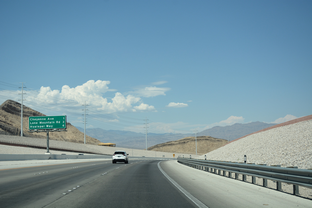
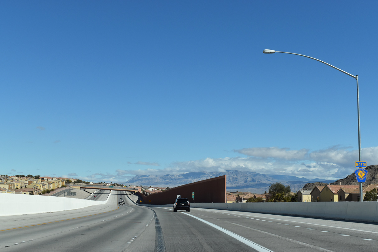
| The Las Vegas Beltway turns eastward to meet Hualapai Way (Exit 35) in six miles. Lone Mountain Road (Exit 32) otherwise meets Clark County 215 three miles ahead at a diamond interchange. 07/22/17 |
|
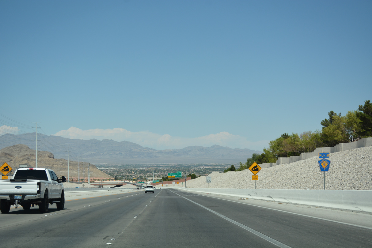
| The Fossil Ridge mountain range dominates the scene as northbound Clark County Route 215 descends 300 feet in elevation toward Cheyenne Avenue (Exit 30). Cheyenne Avenue is the final exchange for Summerlin. 07/22/17 |
|
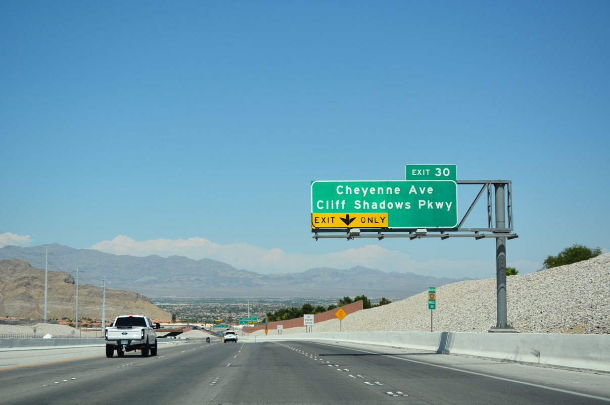
| Cheyenne Avenue borders Sun City Summerlin to its north as the arterial travels east through Las Vegas. Cliff Shadows Parkway continues north from upcoming Exit 30 to Lone Mountain Road. 07/22/17 |
|
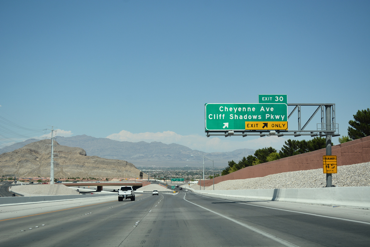
| The Bruce Woodbury Beltway (CC-215) bends north as two lanes depart for Exit 30 (Cheyenne Avenue and Cliff Shadows Parkway). SR 574 overlays a 10 mile section of Cheyenne Avenue between U.S. 95 and SR 612 (Nellis Boulevard) in eastern Las Vegas. 07/22/17 |
|
| Clark County 215 advances from Cheyenne Avenue (Exit 30), traveling between Astoria at Lone Mountain and Sierra Crossings subdivisions en route to Lone Mountain Road. 03/03/19 |
|
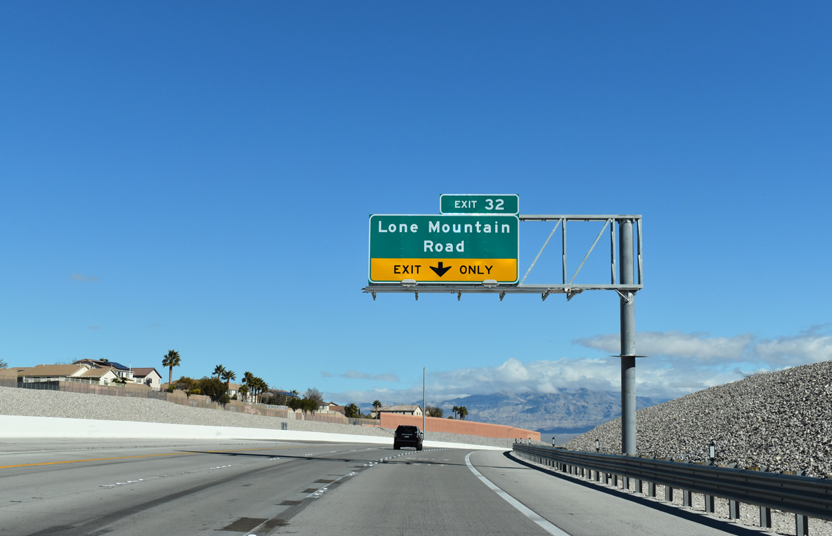
| The diamond interchange (Exit 32) with Lone Mountain Road opened to traffic May 2018, as part of a $92.4 million project to upgrade this section of CC-215 to Hualapai Way (Exit 35).1 03/03/19 |
|
| CC-215 north lowers in advance to Lone Mountain Road (Exit 32), entering into a pair of S-curves. Lone Mountain Road travels east joining the beltway with Lone Mountain Regional Park. 03/03/19 |
|
| Gass Peak serves as a backdrop as CC-215 reaches Exit 32. Lone Mountain Road travels east from Cliff Shadows Parkway to Camino Al Norte at Craig Ranch Regional Park, meeting CC-215 at Lone Mountain Regional Park. 07/22/17 |
|
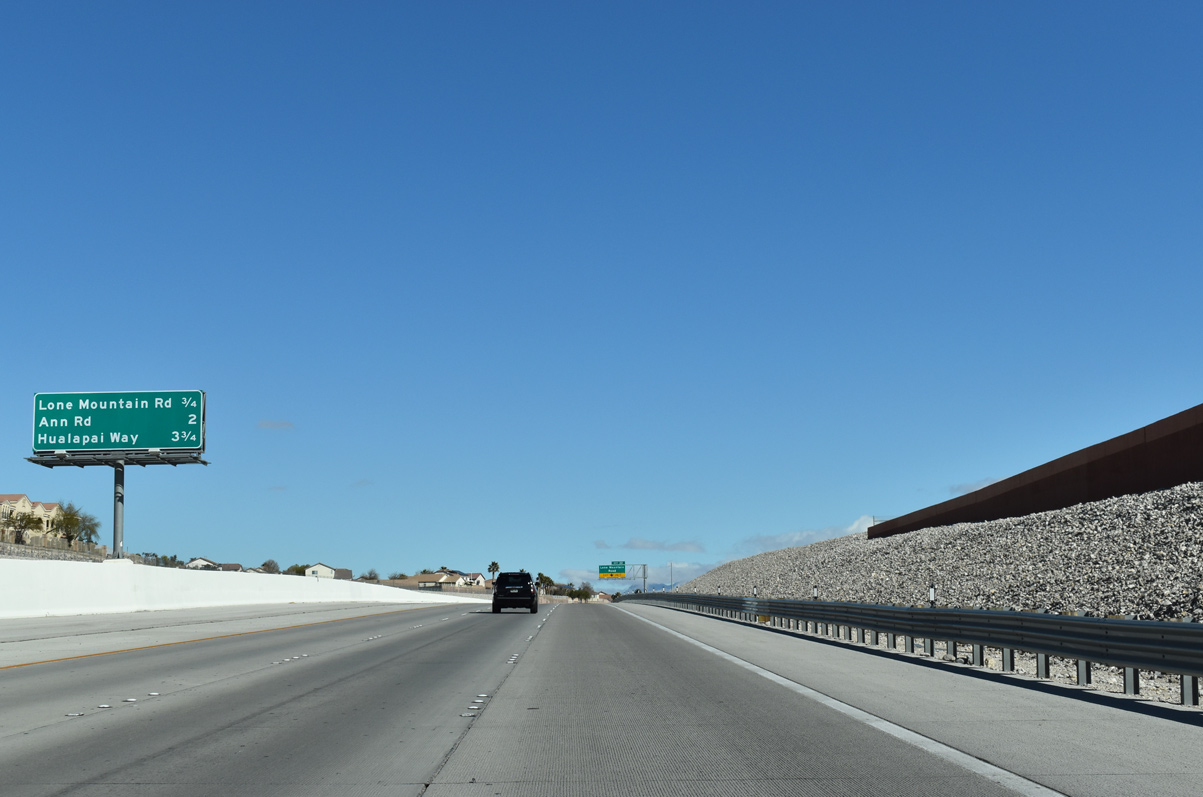
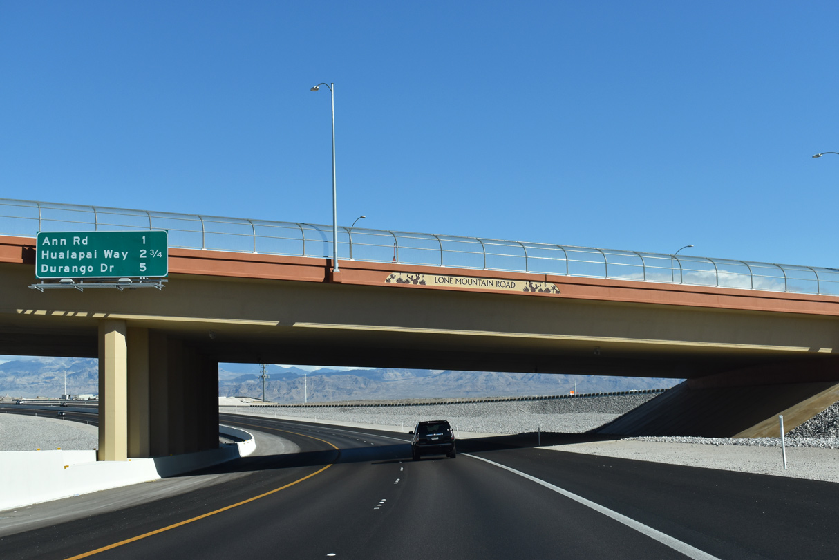
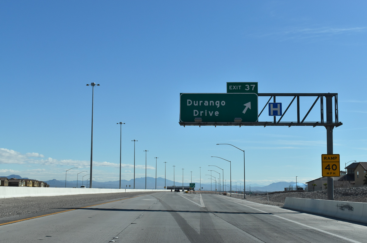
| Clark County 215 passes under Lone Mountain Road one mile out from Ann Road (Exit 35). Durango Drive (Exit 37) connects the Bruce Woodbury Beltway with northwest Las Vegas in five miles. 03/03/19 |
|
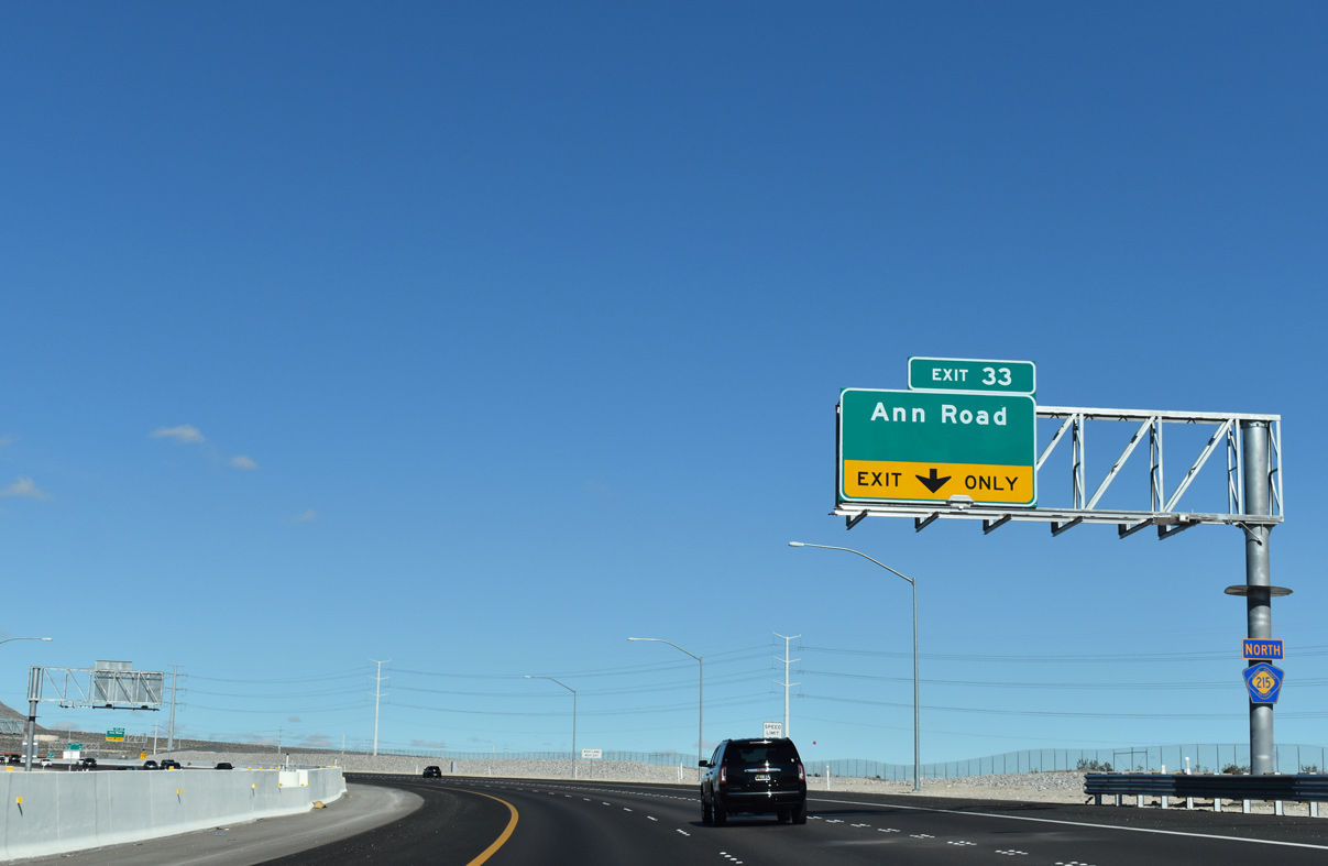
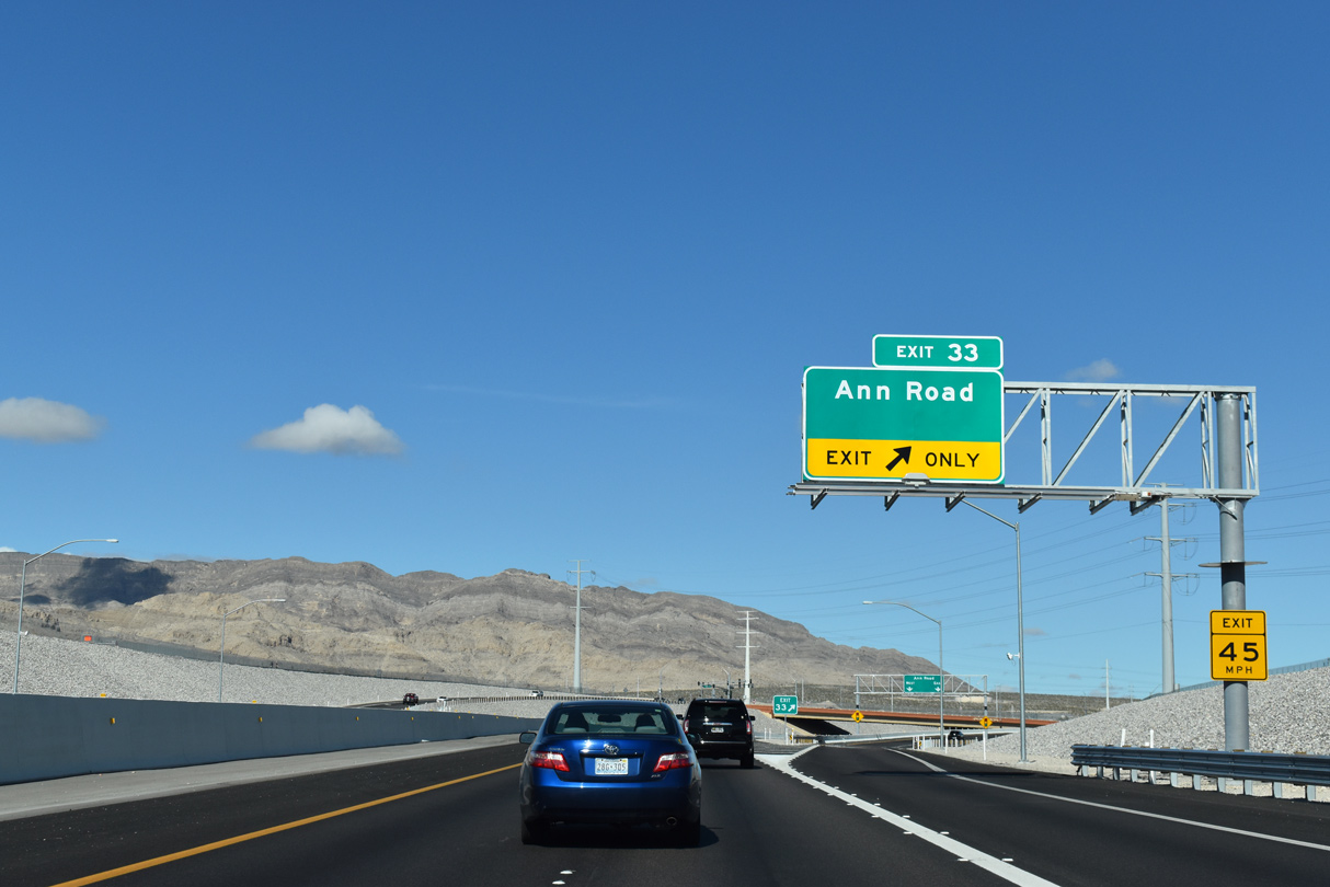
| The Las Vegas/Bruce Woodbury Beltway re-curves northwest ahead of the diamond interchange (Exit 33) with Ann Road. 03/03/19 |
|
| CC-215 north reduces from three to two lanes as a ramp departs for Ann Road (Exit 33). 03/03/19 |
|
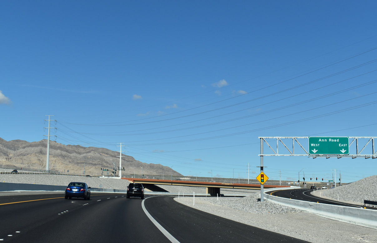
| Ann Road extends east into northern reaches of Las Vegas near the U.S. 95 (Oran K. Gragson) freeway. The local arterial concludes at Tropical Parkway within the city of North Las Vegas. 03/03/19 |
|
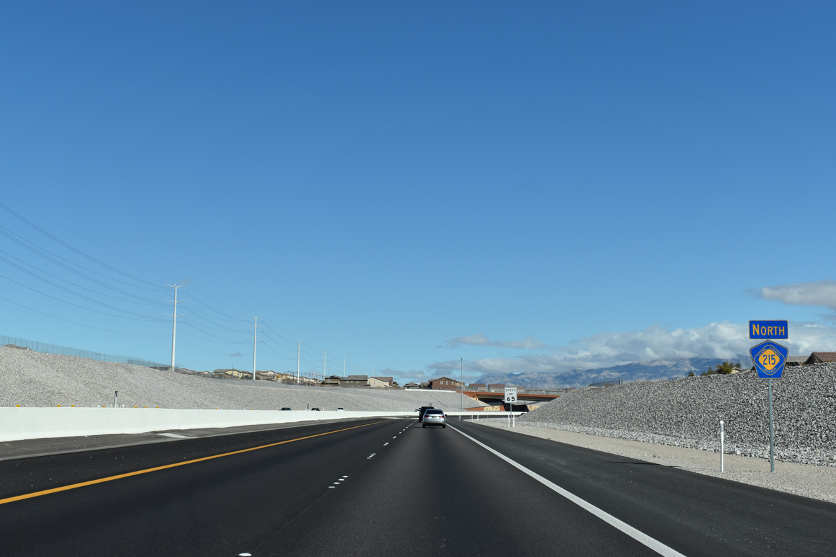
| Confirming marker posted beyond Ann Road (Exit 33). 03/03/19 |
|
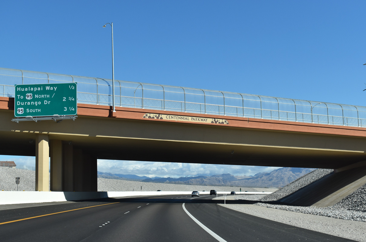
| Clark County 215 shifts eastward as it travels under Centennial Parkway 0.5 miles ahead of Hualapai Way (Exit 35). Centennial Parkway follows the beltway to the south to the exchange with U.S. 95 (Exit 38). 03/03/19 |
|
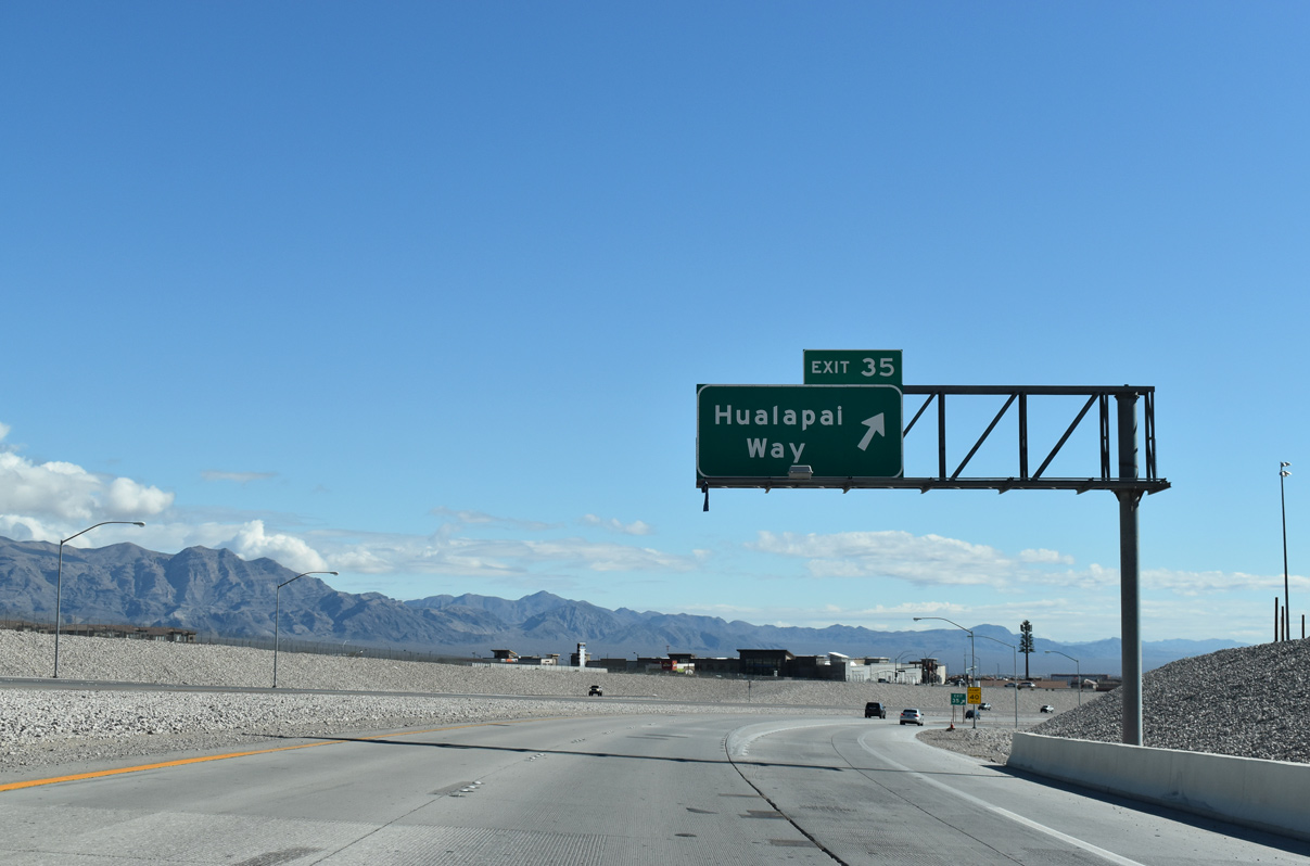
| Traffic departs for the diamond interchange (Exit 35) with Hualapai Way. This segment of Hualapai Way extends north from Centennial Parkway to Skye Canyon Park Drive, and is discontinuous from the section that runs through Summerlin. 03/03/19 |
|
| CC-215 east travels between Centennial Parkway and Deer Springs Way on the ensuing stretch to U.S. 95 (Exit 38). 03/03/19 |
|
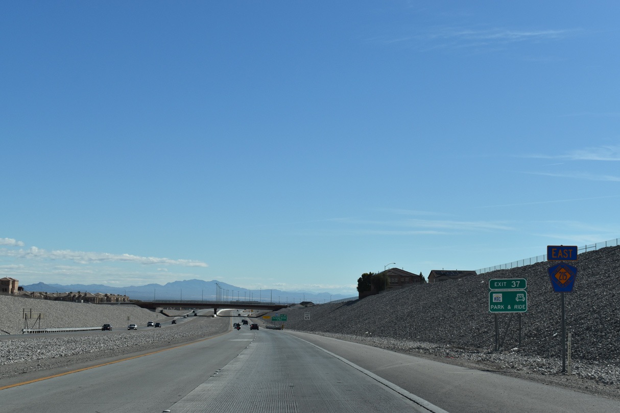
| Durango Drive (Exit 37) connects the Beltway with Floyd Lamb Park located in northwestern reaches of Las Vegas. 03/03/19 |
|
| The freeway portion temporarily ends through the exchange with U.S. 95 (Oran K. Gragson Freeway) one mile ahead. 03/03/19 |
|
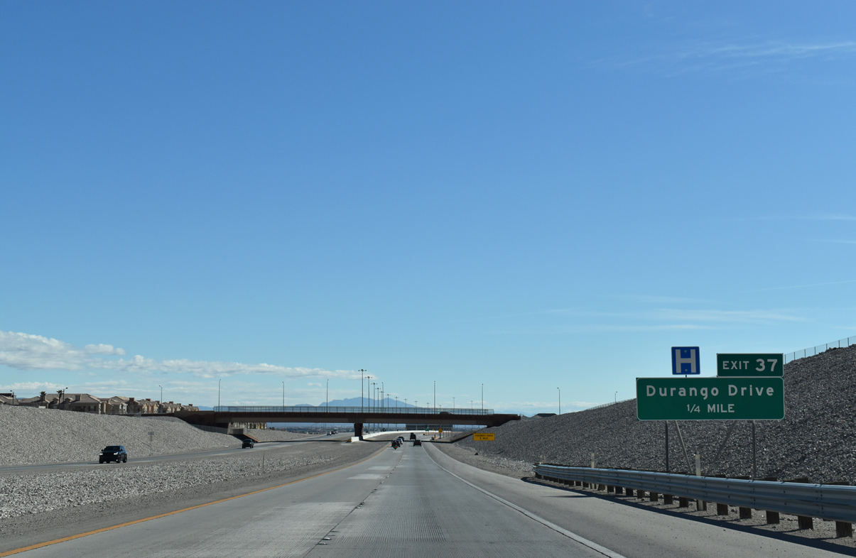
| CC-215 east reaches the diamond interchange (Exit 37) with Durango Drive. Commercial centers line the stretch of Durango Drive between the Beltway and U.S. 95. 03/03/19 |
|
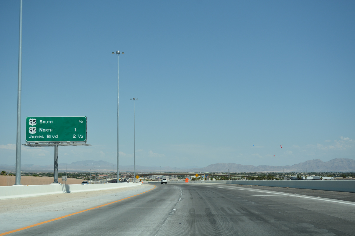
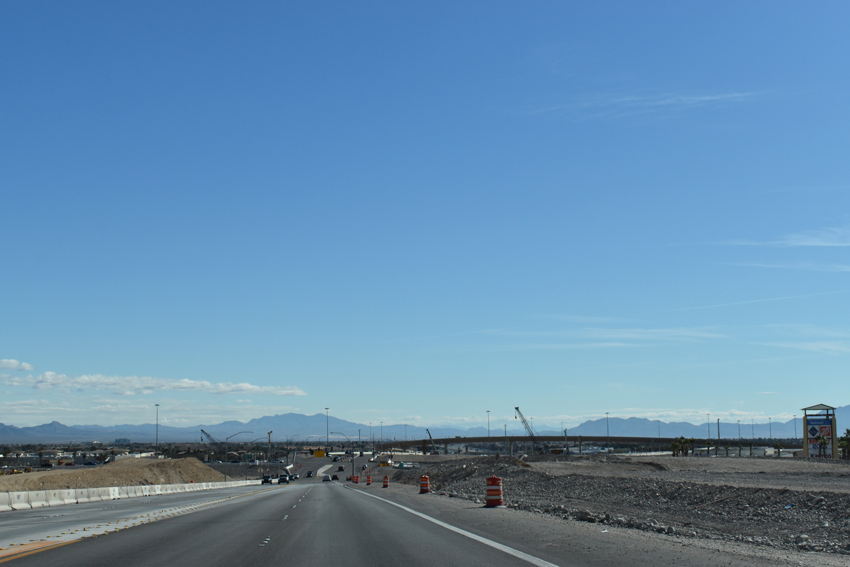
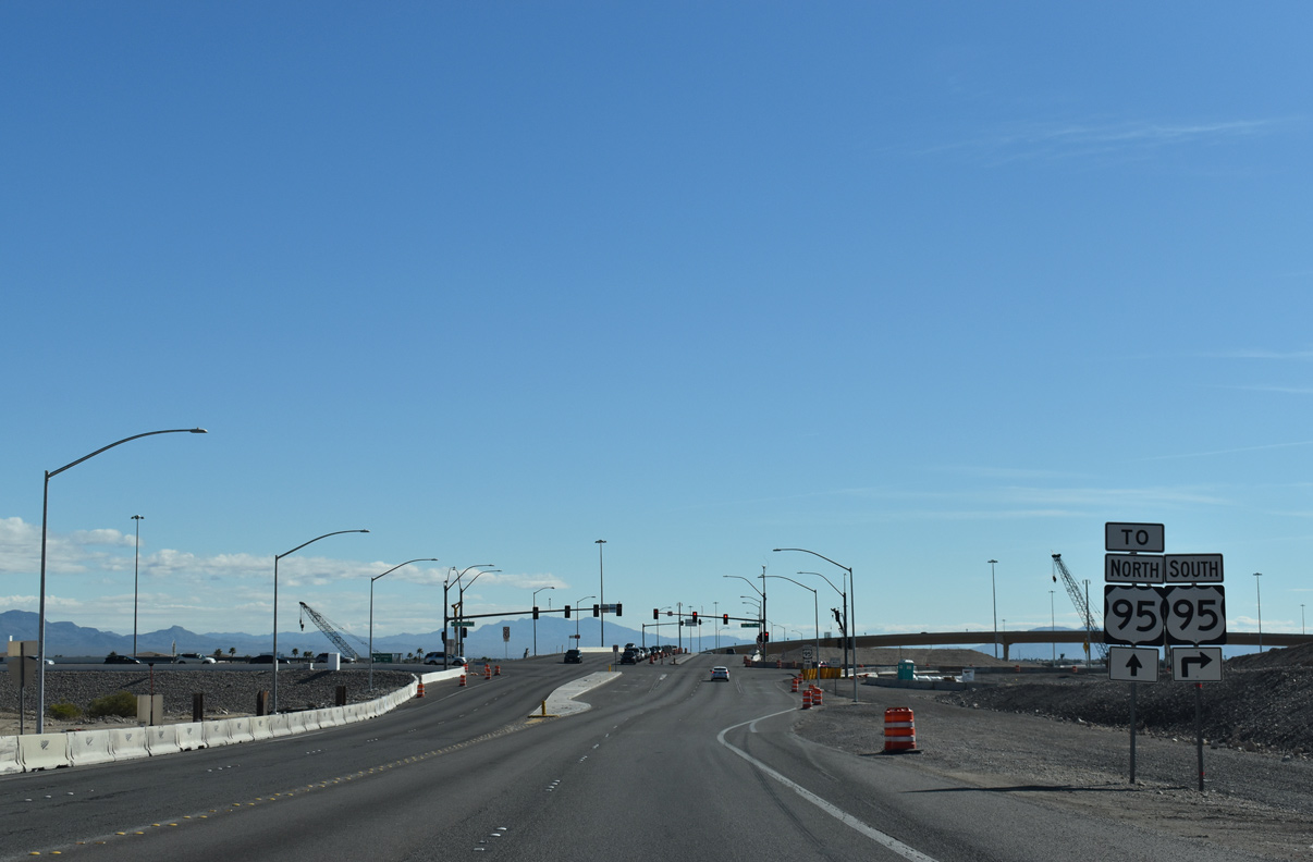
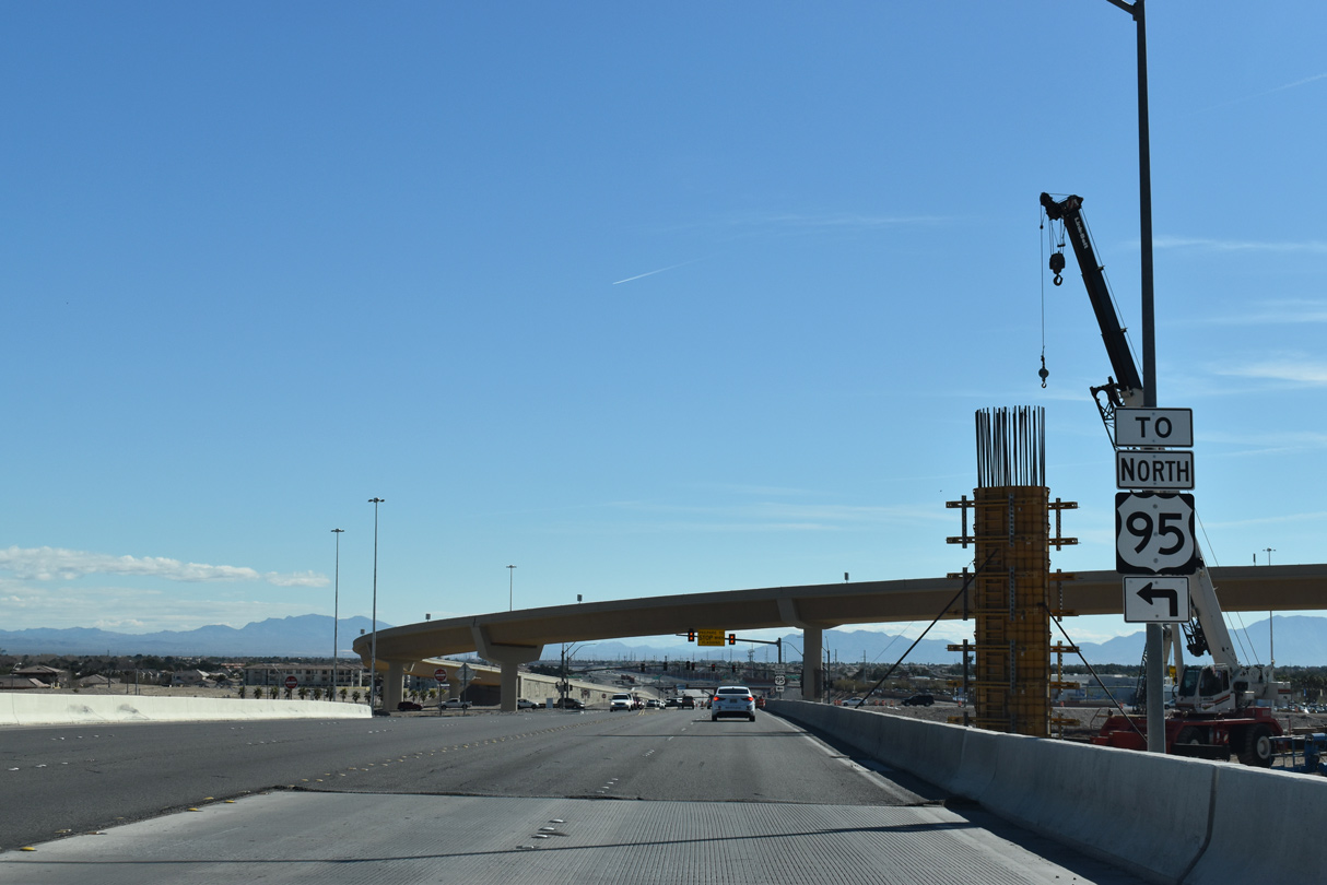
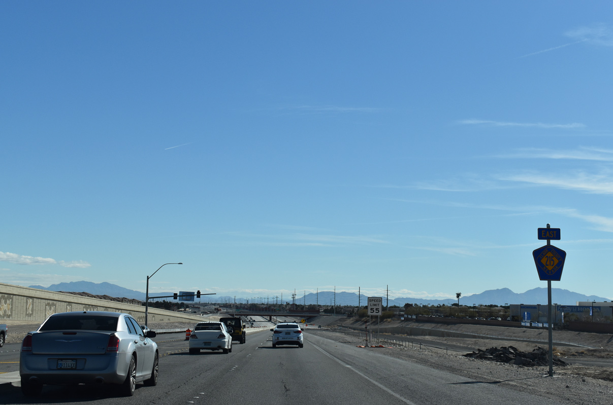
| CC-215 east tapers down to an undivided roadway as it crosses over Grand Montecito Parkway ahead of U.S. 95 north and south (Oran K. Gragson Freeway). Locally dubbed the Centennial Bowl, the exchange presently consists of a mix of high speed and at-grade ramps between the two freeways. 07/22/17, 03/03/19 |
|
| A wide berth will accommodate future travel lanes for the Las Vegas Beltway and additional high speed ramps connecting to/from U.S. 95. The multi-year, mulit-phase project to upgrade the Centennial Bowl into a systems exchange is projected to conclude by 2022 at the earliest.2 07/22/17 |
|
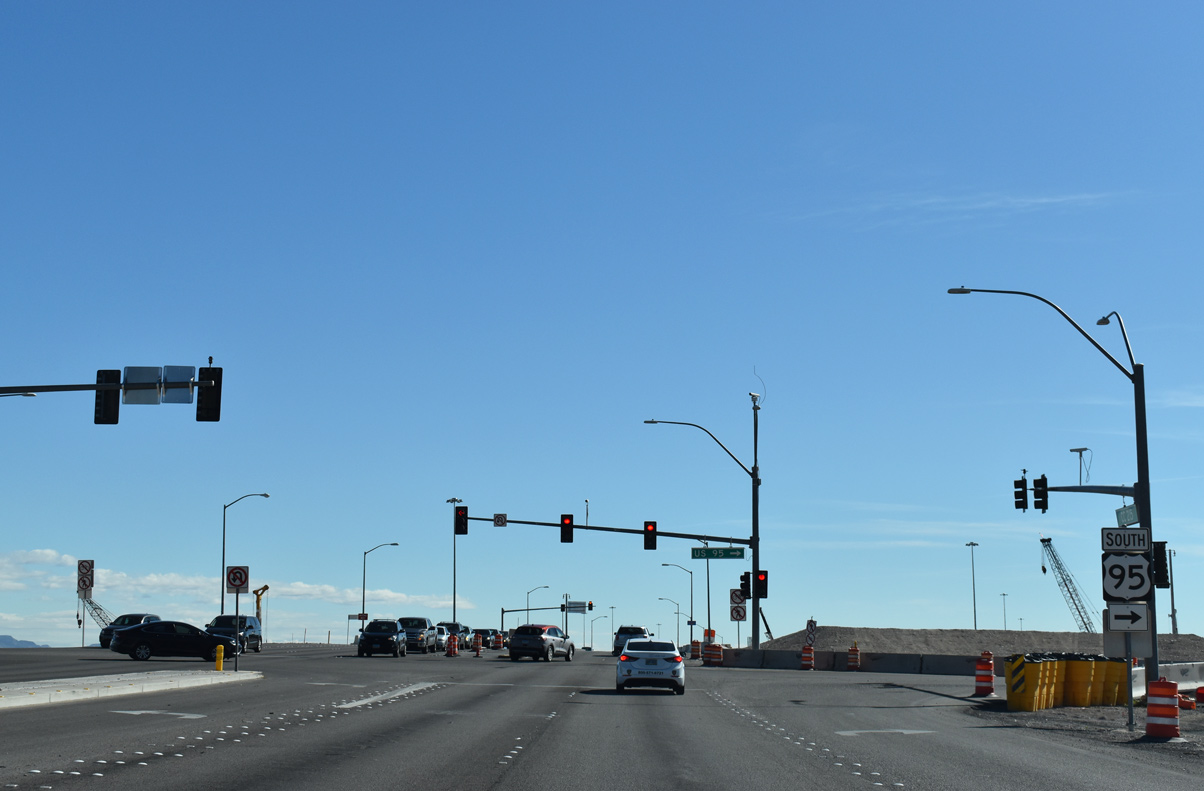
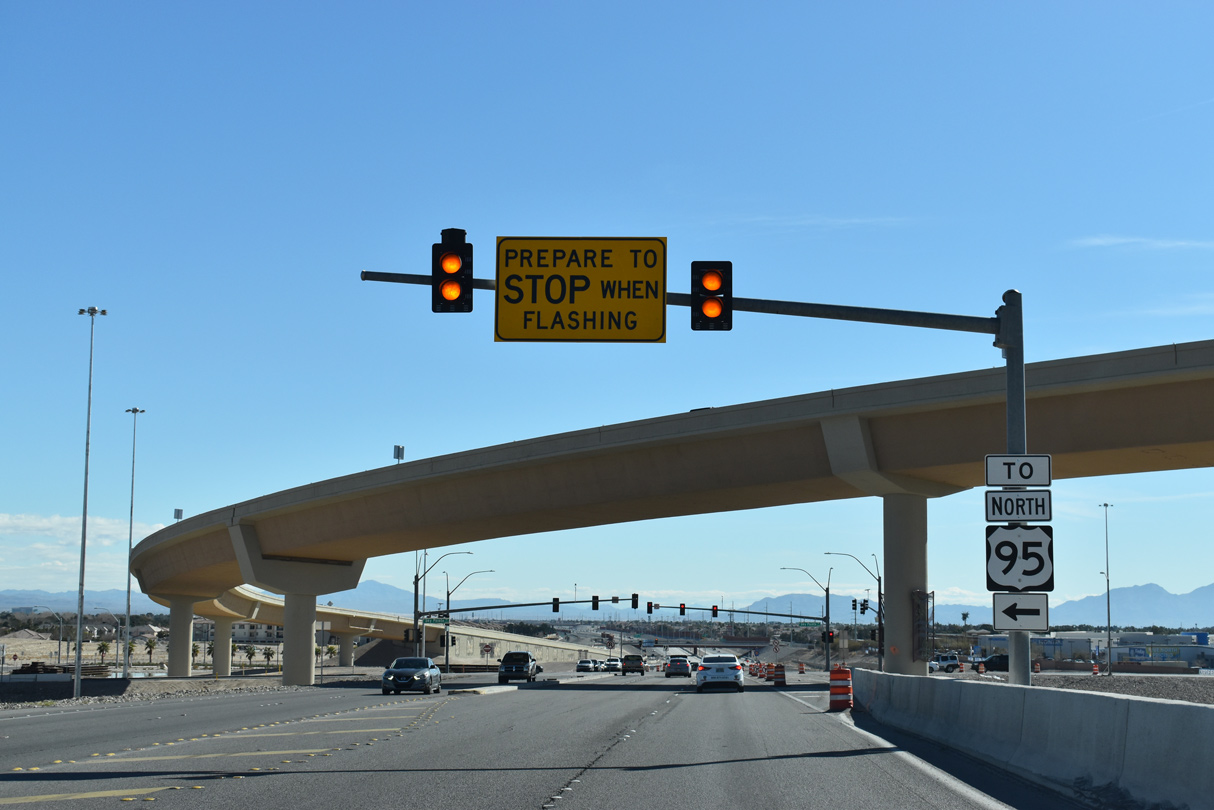
| Currently at-grade ramps provide connections from CC-215 east to U.S. 95 south and north. Plans to remove the at-grade intersections will begin Fall 2018 and continue into the remaining phase of the project.3
U.S. 95 overlays the Oran K. Gragson freeway south to Downtown Las Vegas and Henderson. 03/03/19 |
|
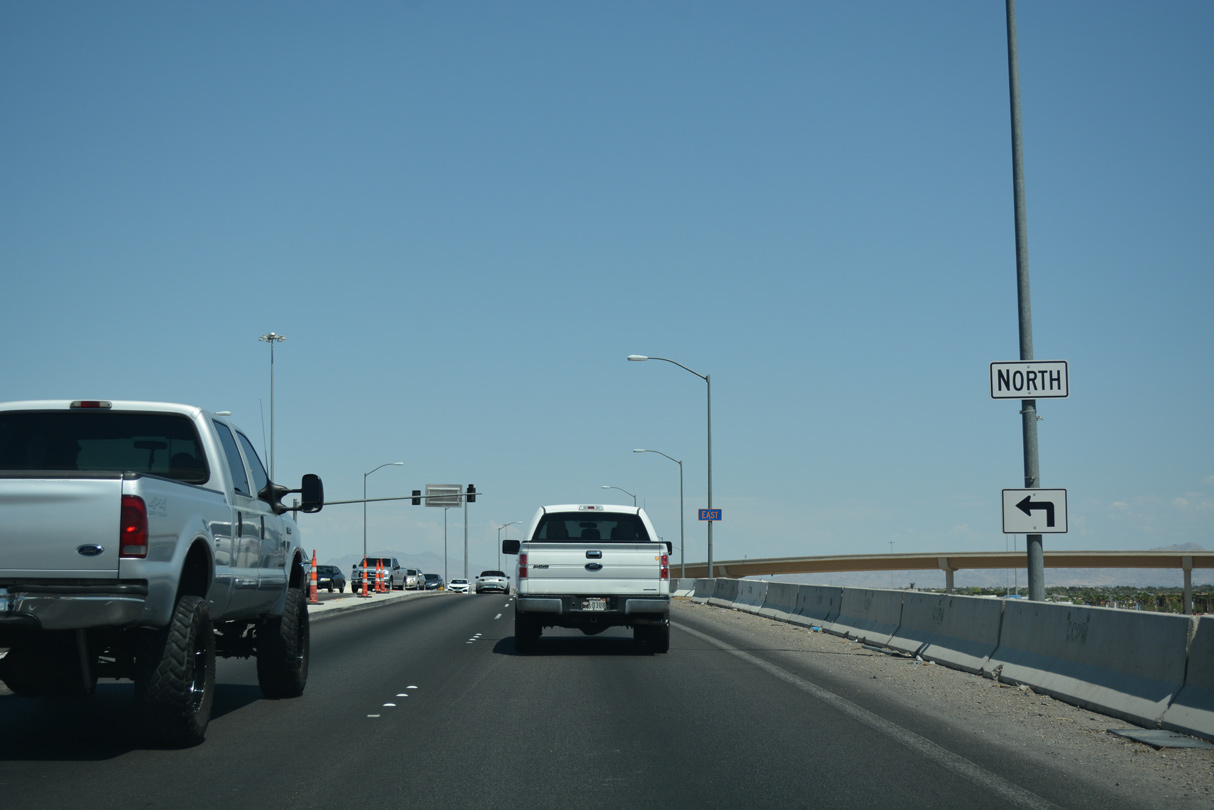
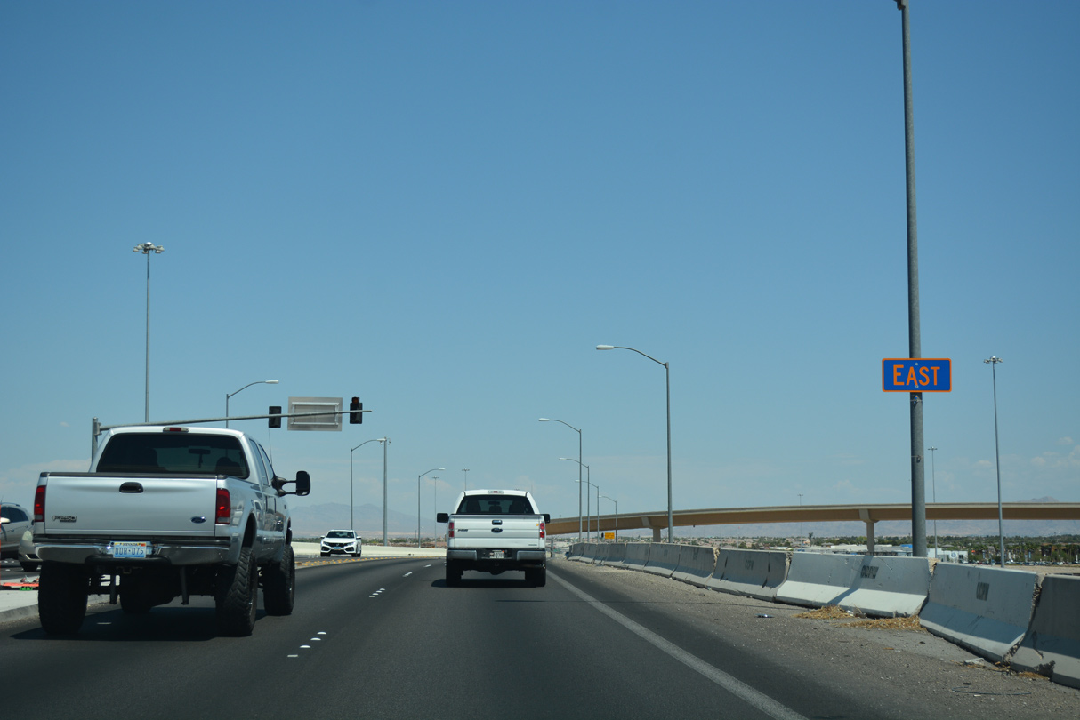
| The U.S. 95 (Oran K. Gragson) freeway underpass presently carries all traffic for CC-215 (Bruce Woodbury Beltway). Separate spans will be built as part of the build-out of the Centennial Bowl interchange. 07/22/17 |
|
| Motorists are directed to Sky Pointe Drive at the signalized intersection for the connection to northbound U.S. 95 north to Indian Springs and Tonopah.
Completed July 2017, the highest flyover of the exchange opened to traffic, connecting CC-215 west to U.S. 95 south via a 60 foot high, 2,500 foot long ramp.2 03/03/19 |
|
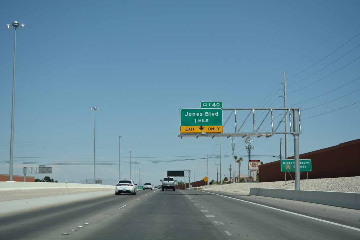
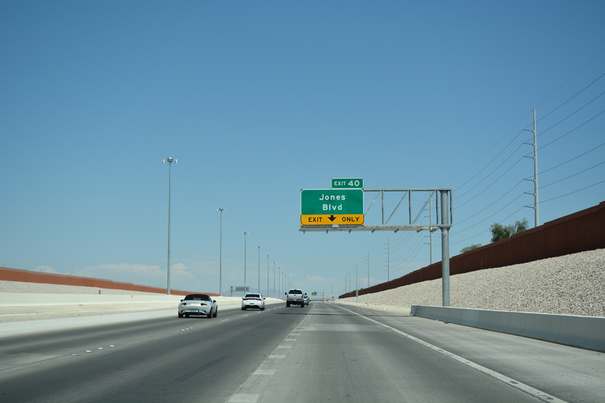
| Confirming marker posted as eastbound CC-215 advances to Jones Boulevard (Exit 40). 03/03/19 |
|
| Jones Boulevard joins the Bruce Woodbury Beltway (Clark County 215) with the Carson Ranch and Copperfield subdivisions in one mile. 07/22/17 |
|
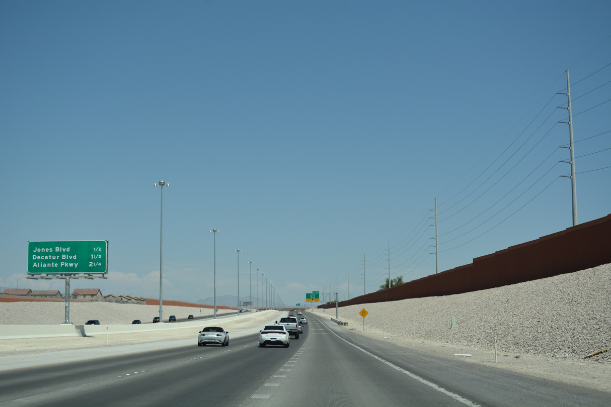
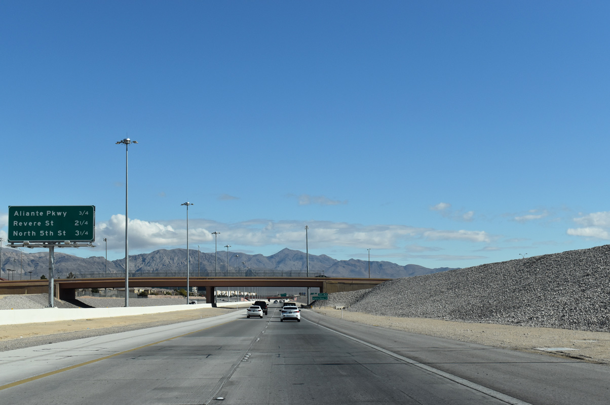
| Aliante Parkway meets CC-215 east 2.25 miles ahead at a diamond interchange (Exit 43) near the master planned community of the same name. 07/22/17 |
|
| Provisions are already in place for additional lanes along this stretch of CC-215. 07/22/17 |
|
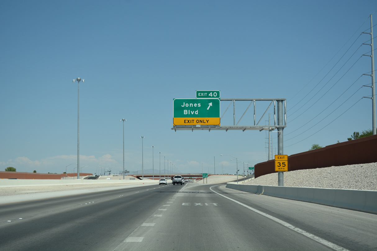
| A single lane ramp leaves for Jones Boulevard (Exit 40) as CC-215 advances east. 07/22/17 |
|
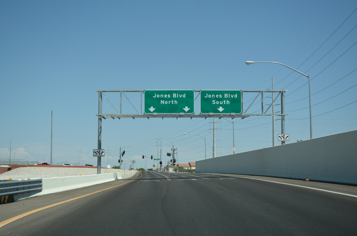
| Traffic partitions for north and south Jones Boulevard. Jones Boulevard extends south to Rancho Drive (SR 599) and north to Iron Mountain Road. 07/22/17 |
|
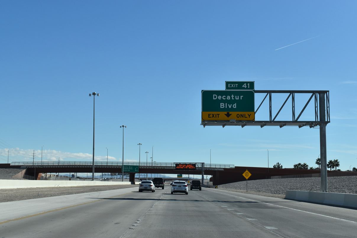
| An auxiliary lane briefly joins eastbound CC-215 between Jones Boulevard (Exit 40) and upcoming Decatur Boulevard (Exit 41). 03/03/19 |
|
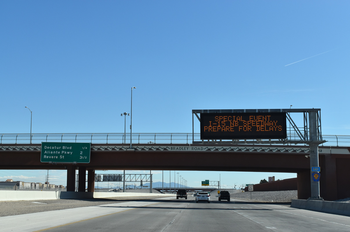
| Bradley Road passes above the Las Vegas Beltway (CC-215) 3.5 miles out from Revere Street (Exit 45). 03/03/19 |
|
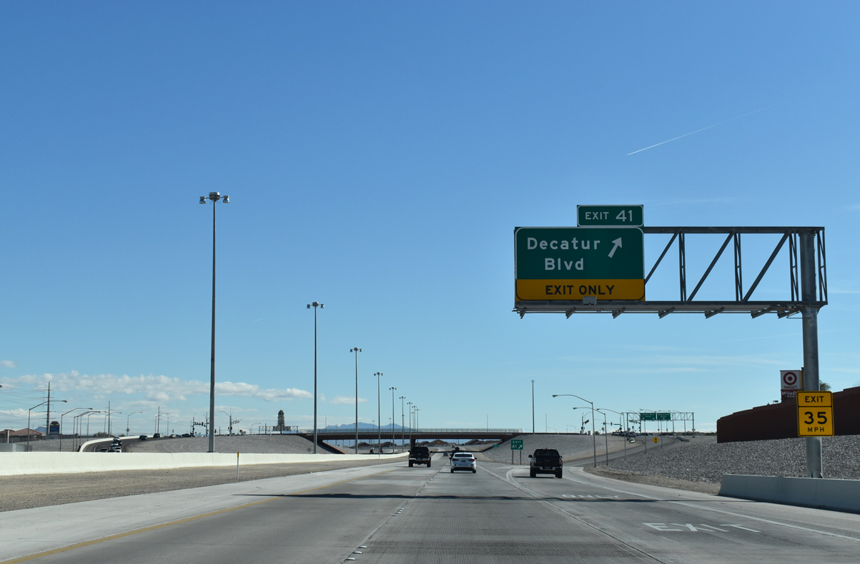
| Several developments line Decatur Boulevard on both side of the diamond interchange (Exit 40). Decatur Boulevard travels south to meet Rancho Drive (SR 599) at the northwest corner of North Las Vegas Airport (VGT). 03/03/19 |
|
| Eastbound CC-215 curves northeast to meet Aliante Parkway next. 07/22/17 |
|
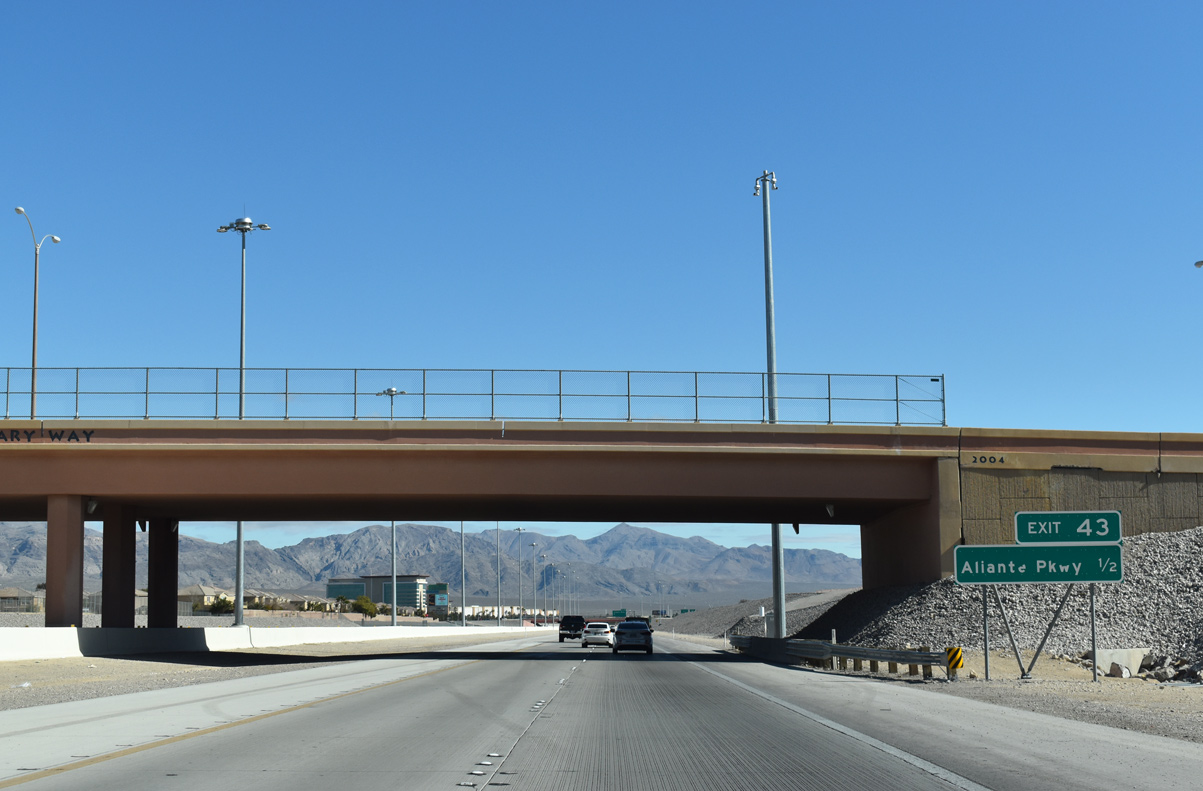
| The Bruce Woodbury Beltway travels under Aviary Way ahead of the departure to Ailiante Parkway (Exit 43). North 5th Street joins the beltway with North Las Vegas in 3.25 miles. 03/03/19 |
|
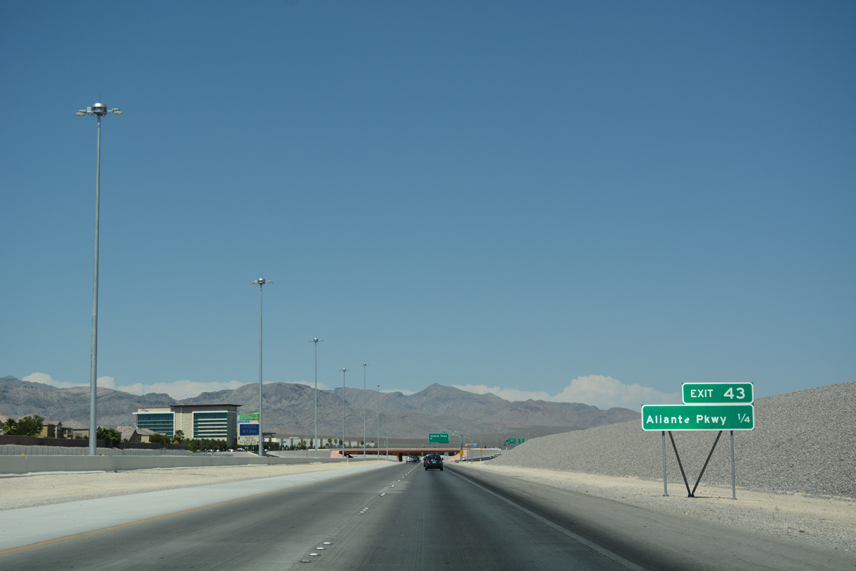
| The Aliante Casino and Hotel rises in the distance on the quarter mile drive to Aliante Parkway. The hotel/casino opened by 2008 on 40 acres of land in the northeast quadrant of the diamond interchange. 07/22/17 |
|
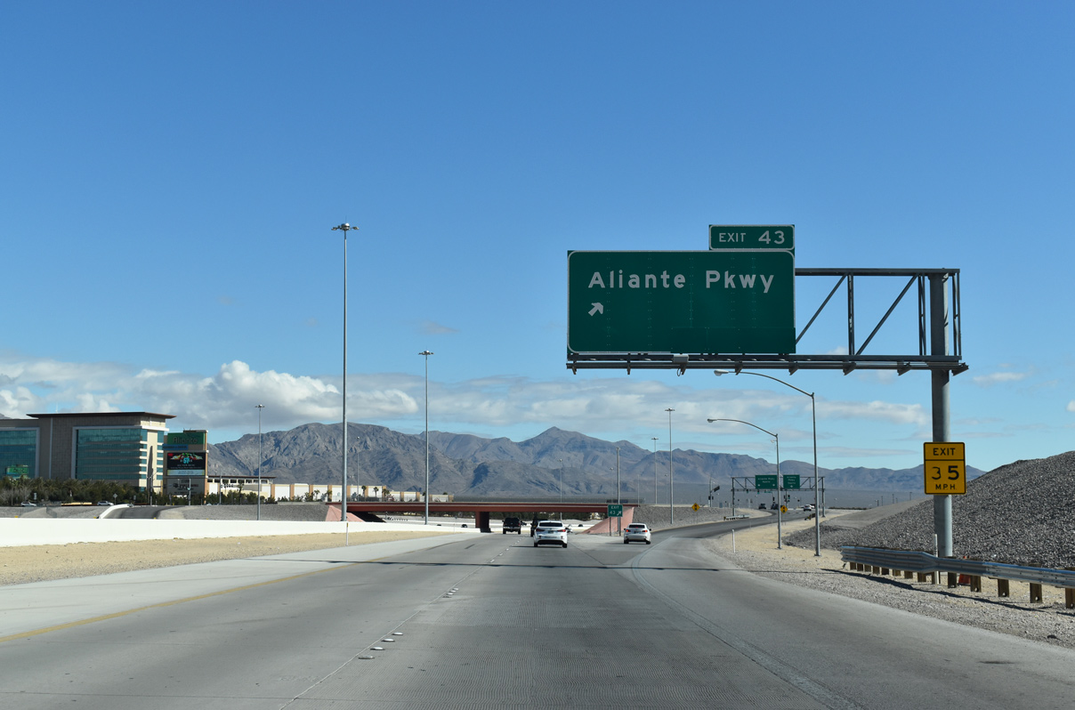
| Traffic leaves for Exit 43 (Aliante Parkway) along CC-215 east. Aliante occupies over 1900 acres north of the beltway and includes the age restricted (55 and older) Sun City Aliante in addition to the hotel and casino. 03/03/19 |
|
| CC-215 kinks back east en route to Revere Street (Exit 45) nine-tenths of a mile ahead. 03/03/19 |
|
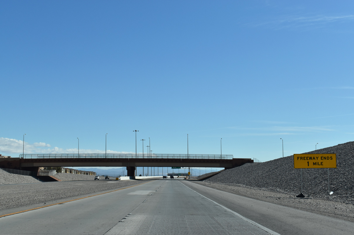
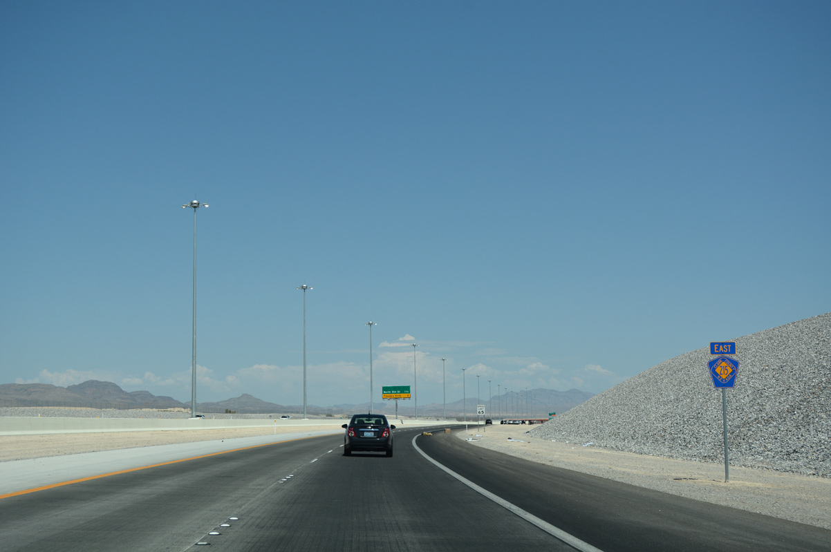
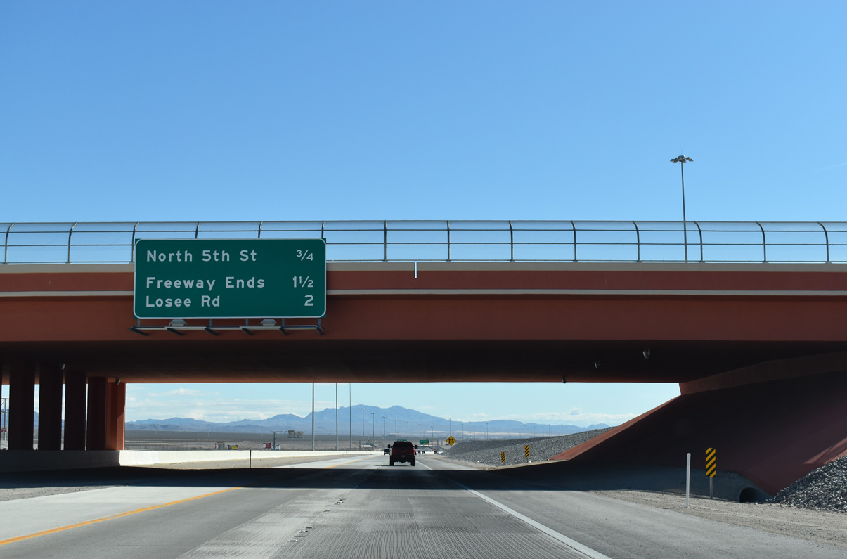
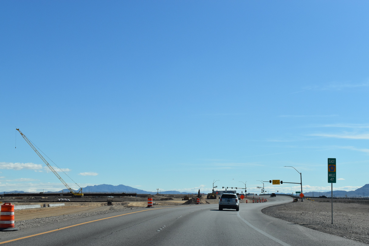
| Losse Road (Exit 47) represents the current end of the freeway portion of CC-215 two miles ahead, as construction continues on upgrading the final segment of the beltway. 03/03/19 |
|
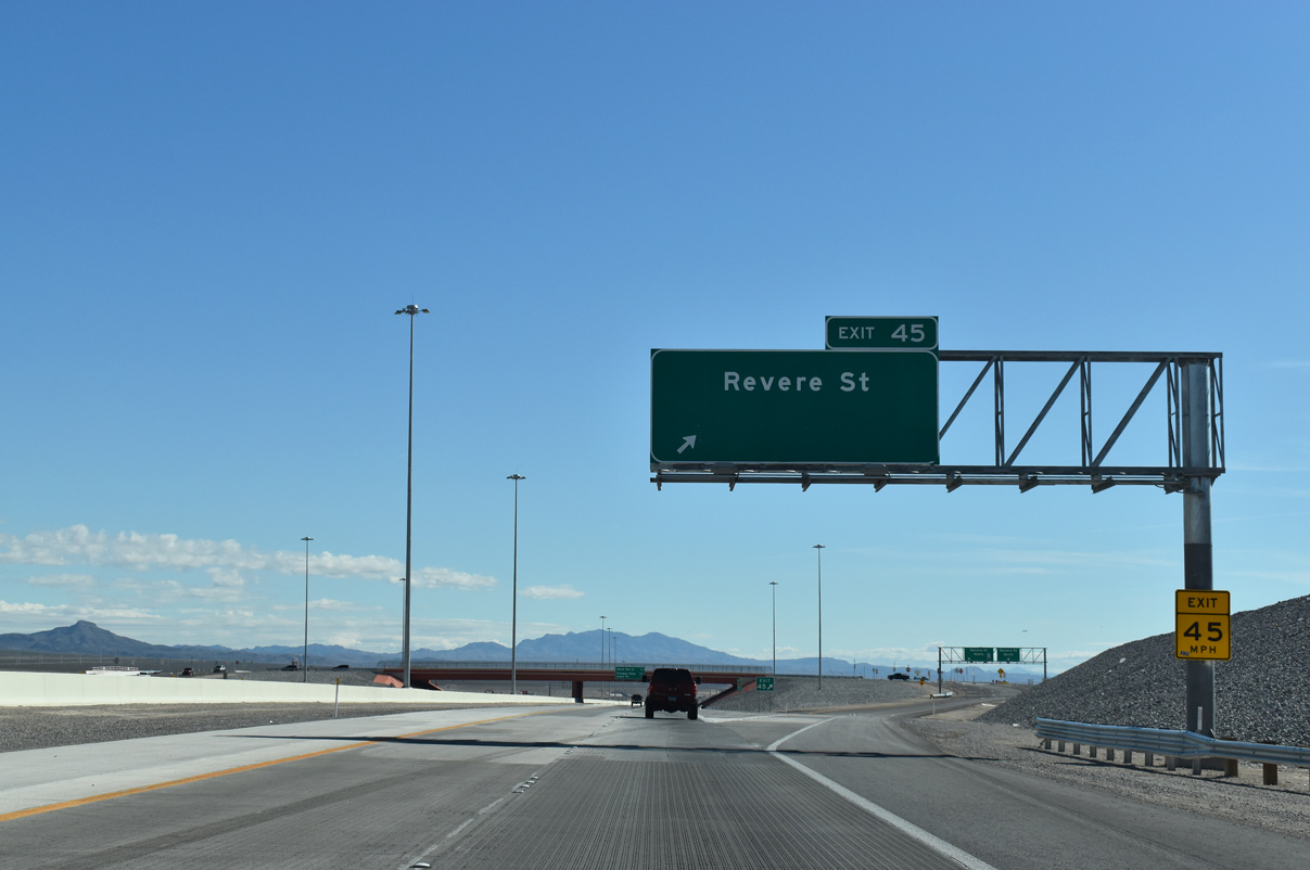
| A two lane ramp separates from CC-215 (Bruce Woodbury Beltway) east for Revere Street (Exit 45) south. The diamond interchange was completed by October 20164. 03/03/19 |
|
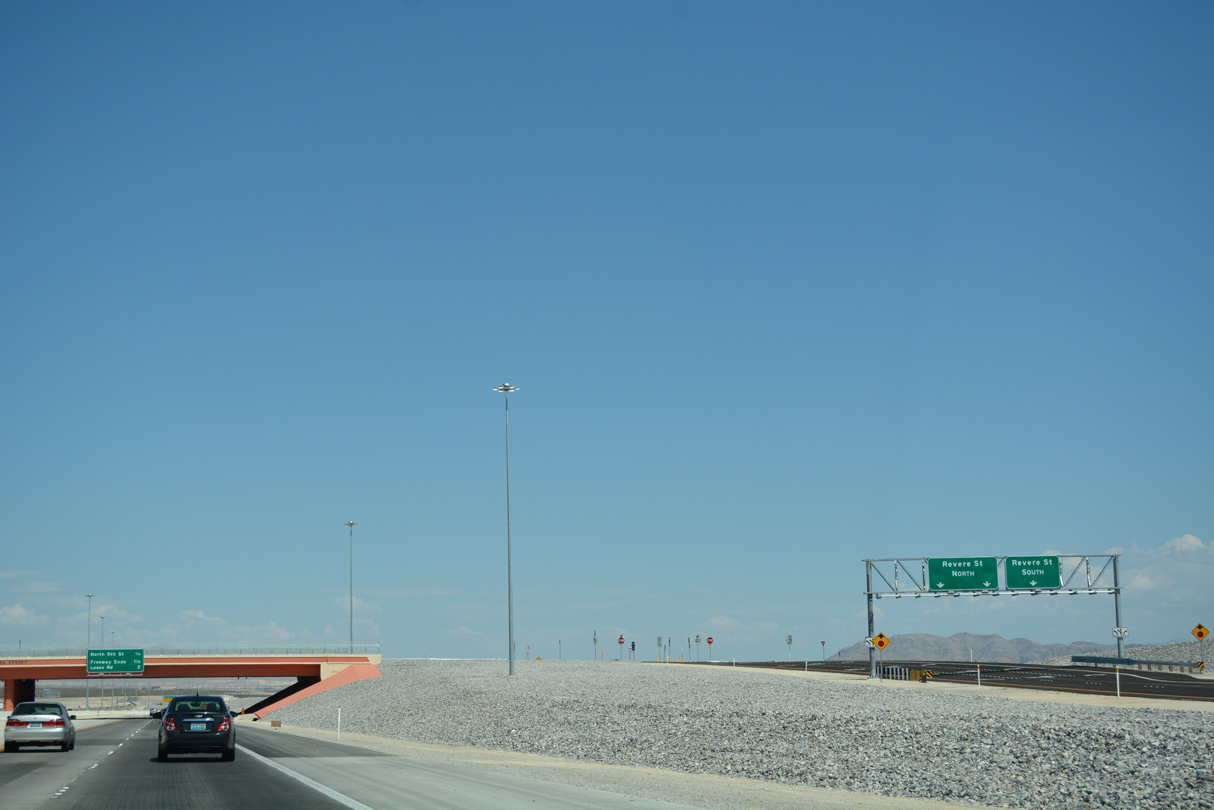
| Parting shot of the ramp partition for Revere Street along CC-215 east. 07/22/17 |
|
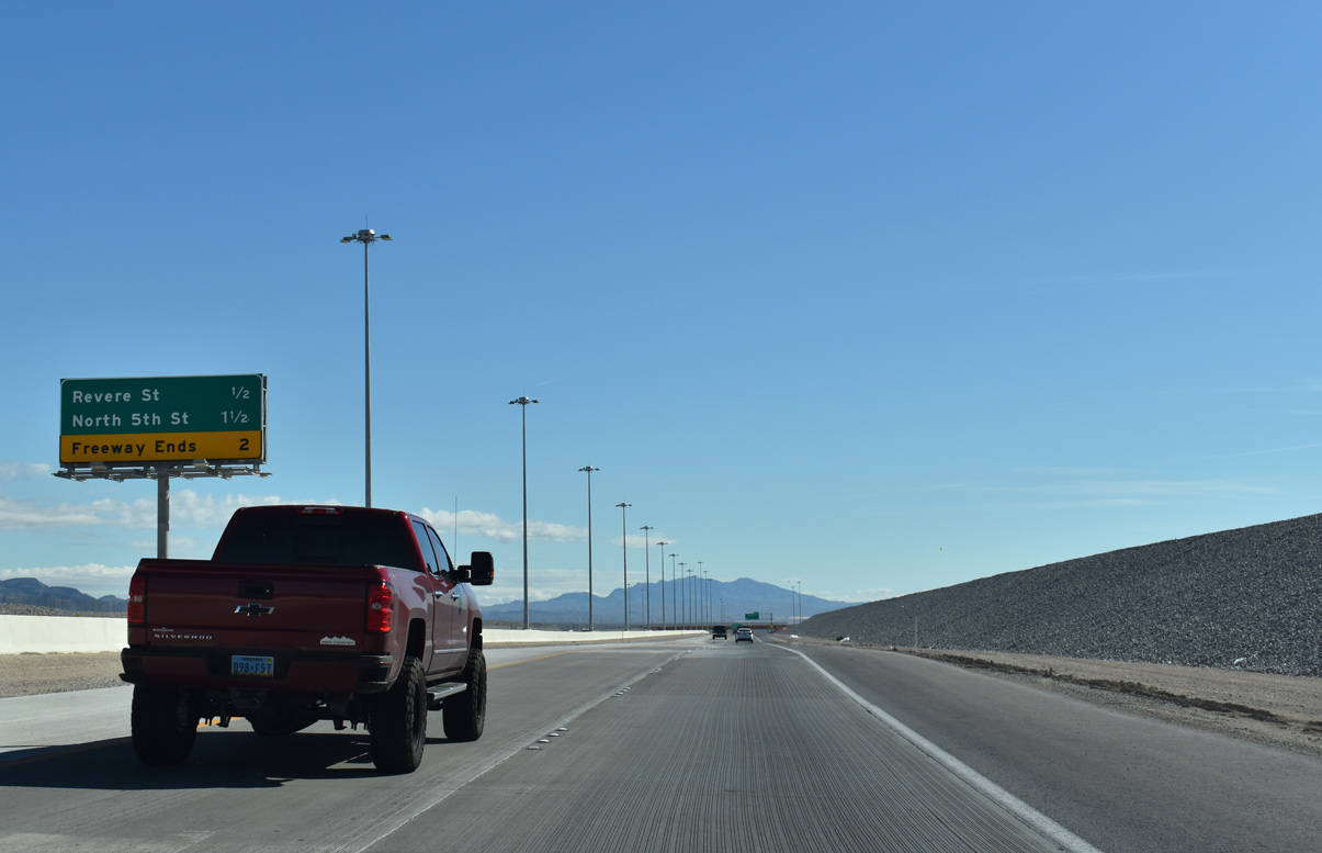
| Revere Street crosses the Las Vegas Beltway mainline 1.5 miles ahead of the current end of the freeway. Work continues through Summer 2020 to upgrade the remaining at-grade intersections to interchanges.5 03/03/19 |
|
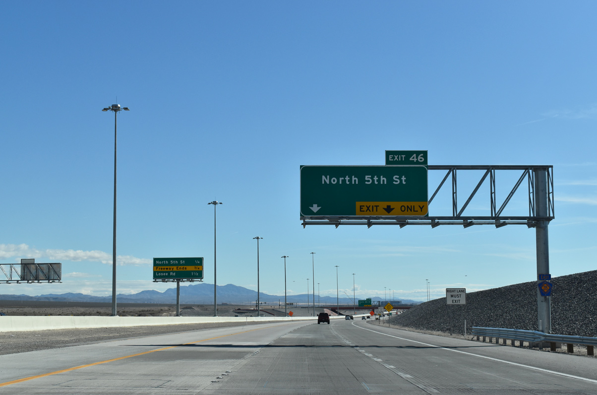
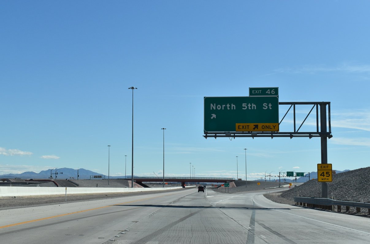
| CC-215 advances eastward to Exit 46 (North 5th Street). Losee Road stems south from a signalized intersection 1.50 miles ahead. 03/03/19 |
|
| North 5th Street (Exit 46) travels south along a multi lane divided arterial to El Campo Grande Avenue in North Las Vegas. Further south, North 5th Street ties into Las Vegas Boulevard to Downtown Las Vegas. 03/03/19 |
|
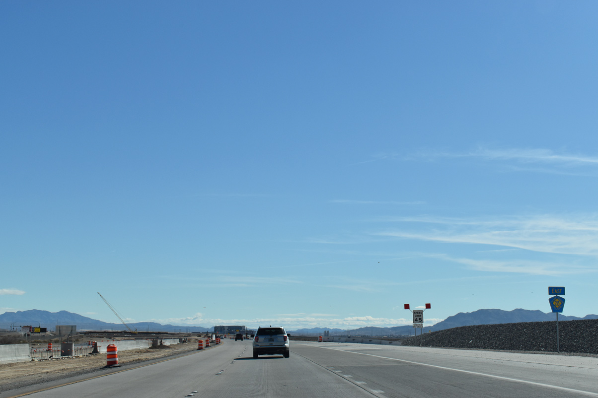
| Speed limits reduce from 65 mph as CC-215 (Bruce Woodbury Beltway) proceeds east from Exit 46 onto the non-freeway portion of the beltway. CC-215 will meet Losee Road (Exit 47) next. 03/03/19 |
|
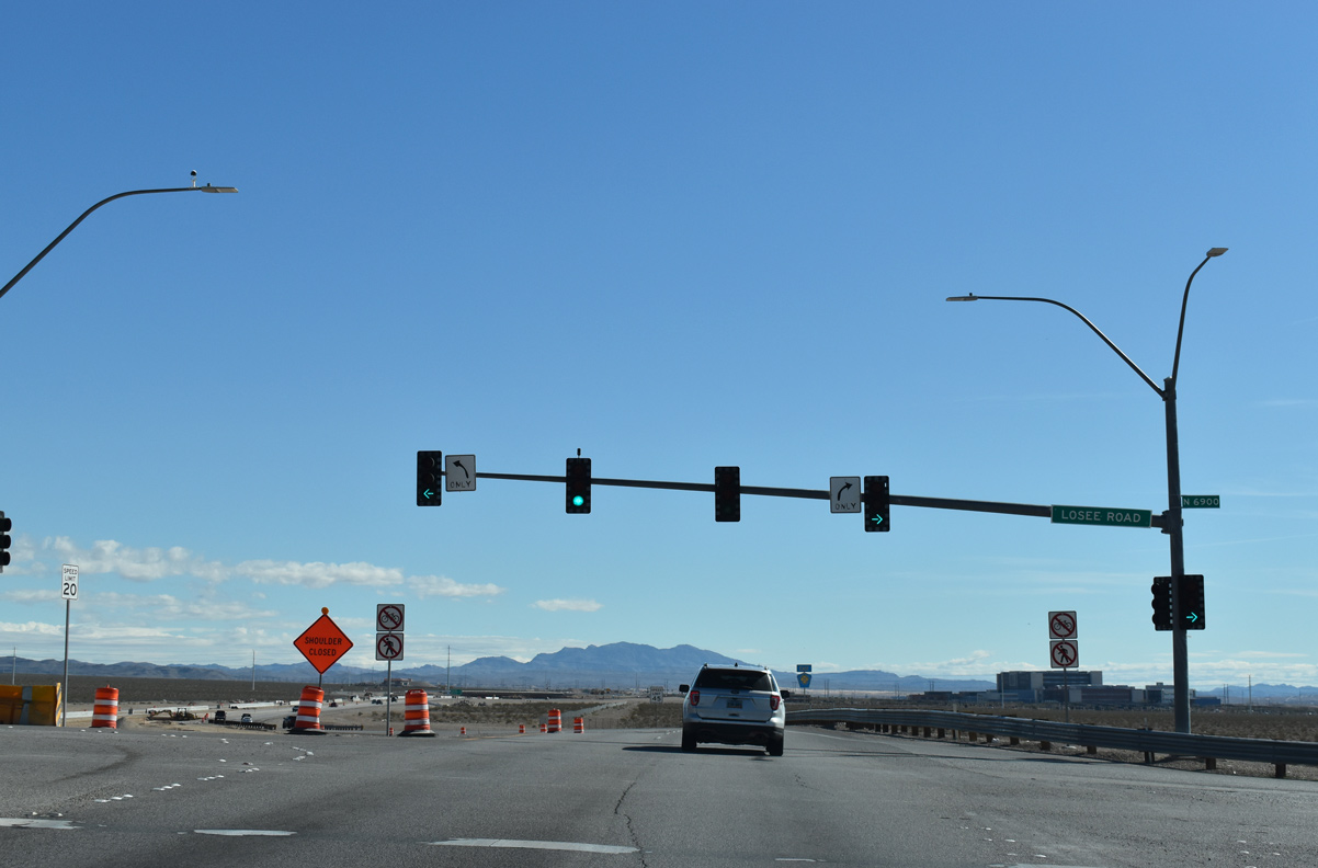
| Clark County 215 widens out on the approach to Losee Road. These approaches will serve as on and off ramps once interchanges are completed along this segment of the beltway. 03/03/19 |
|
| Losee Road (Exit 47) extends south from the Bruce Woodbury Beltway to Craig Road (SR 573) before running parallel with I-15 to Lake Mead Boulevard. 03/03/19 |
|
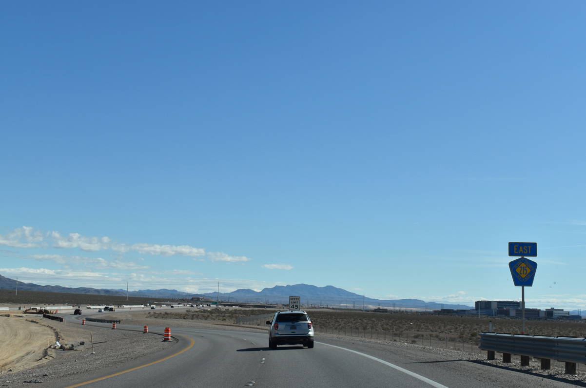
| Reassurance marker standing along CC-215 east beyond Losee Road. 03/03/19 |
|
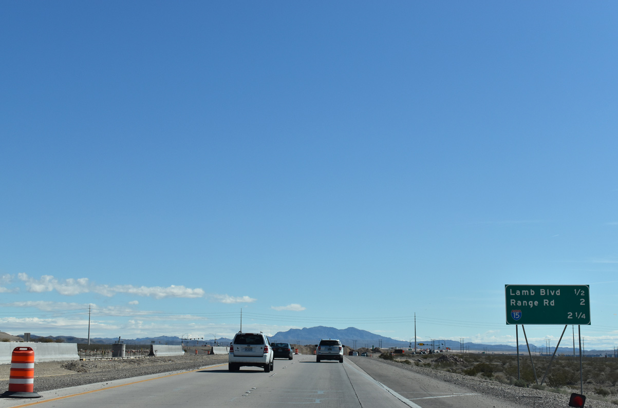
| Range Road meets the Las Vegas Beltway ahead of I-15 to Downtown Las Vegas and Mesquite in three miles. 03/03/19 |
|
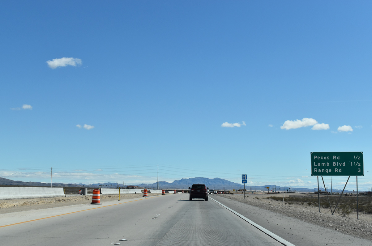
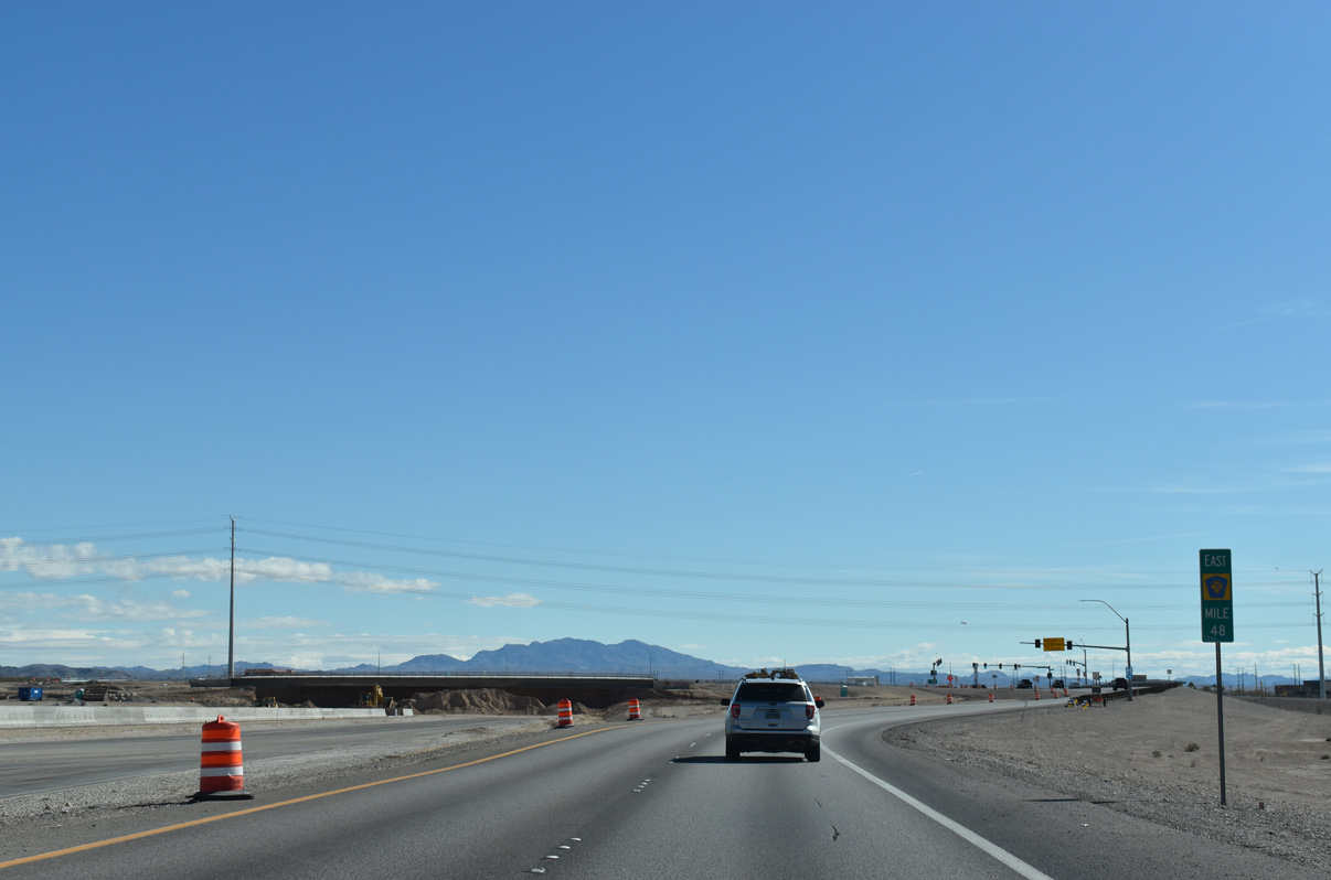
| CC-215 expands outward toward Pecos Road near milepost 48. 03/03/19 |
|
| This portion of Pecos Road leads 2.4 miles south from Clark County 215 to Washburn Road. Separate sections continue to Las Vegas and Henderson.
The North Las Vegas VA Medical Center occupies the southeast corner of this intersection. 03/03/19 |
|
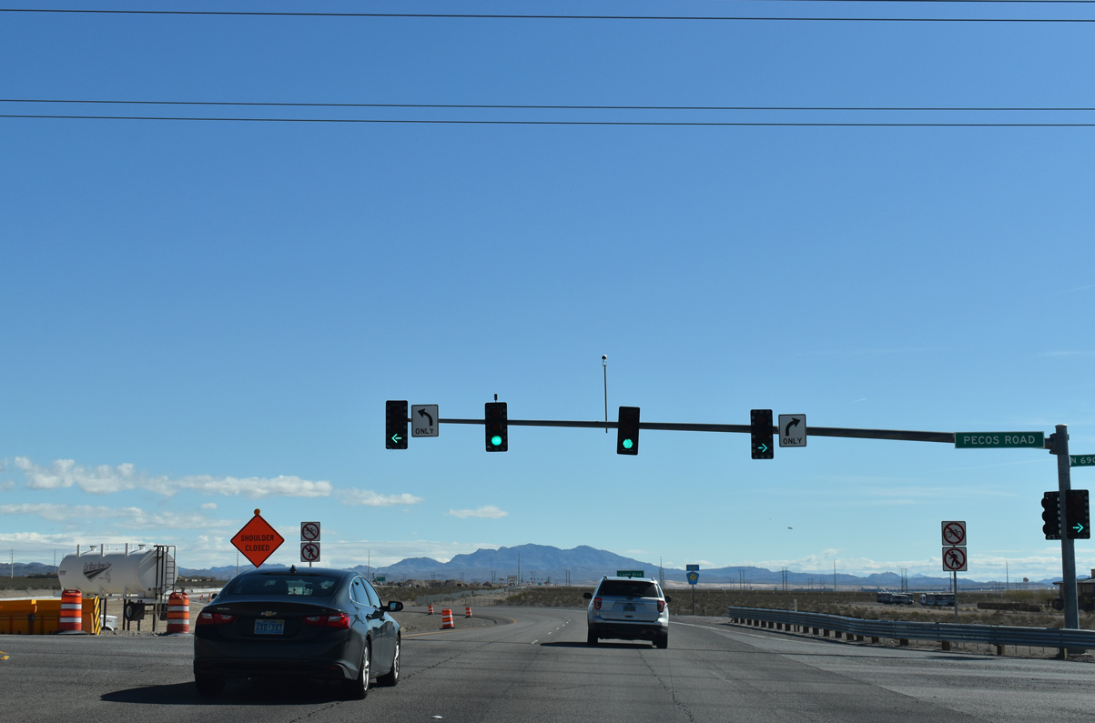
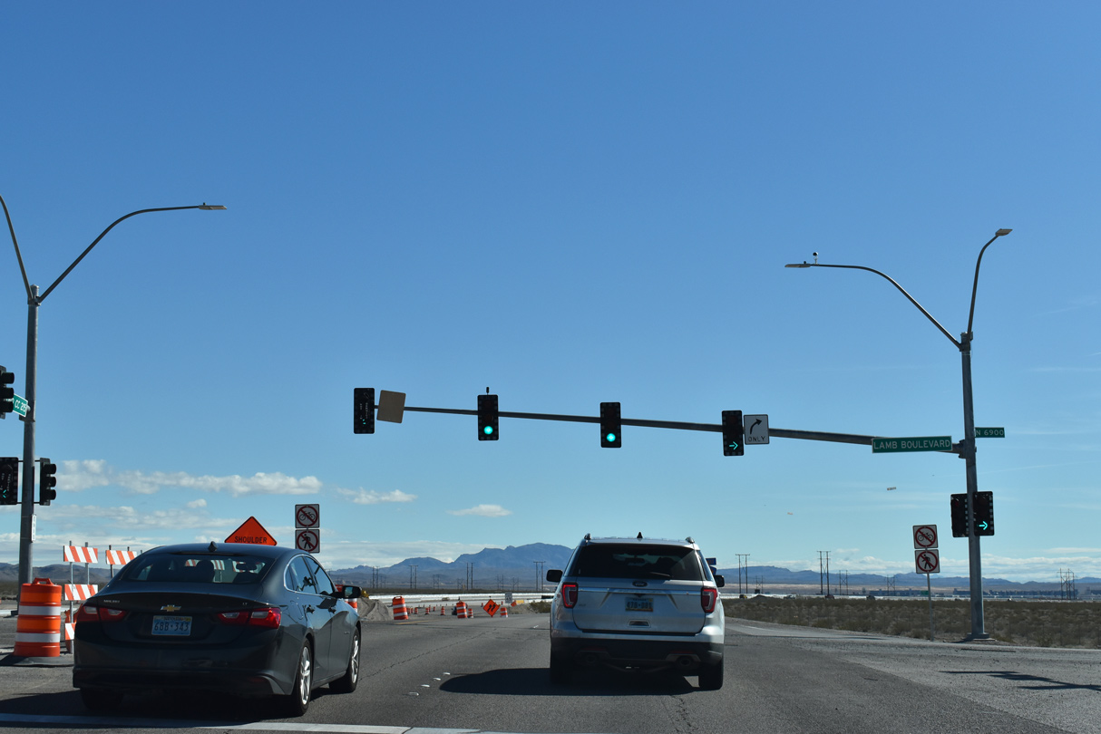
| The Bruce Woodbury Beltway (CC-215) proceeds east one mile to Lamb Boulevard south. 03/03/19 |
|
| The Las Vegas/Bruce Woodbury Beltway concludes 2.25 miles ahead at a diamond interchange with I-15. 03/03/19 |
|
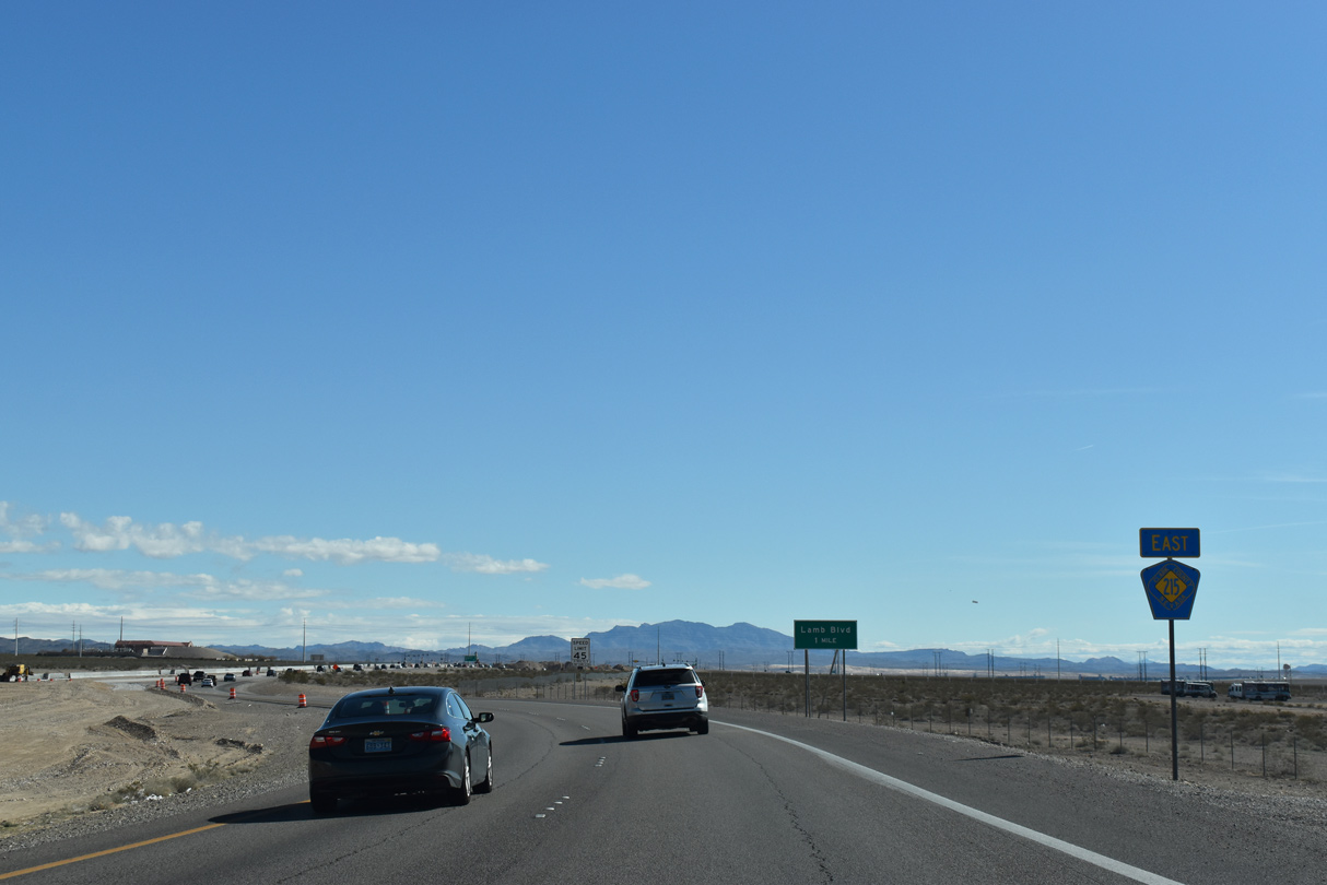
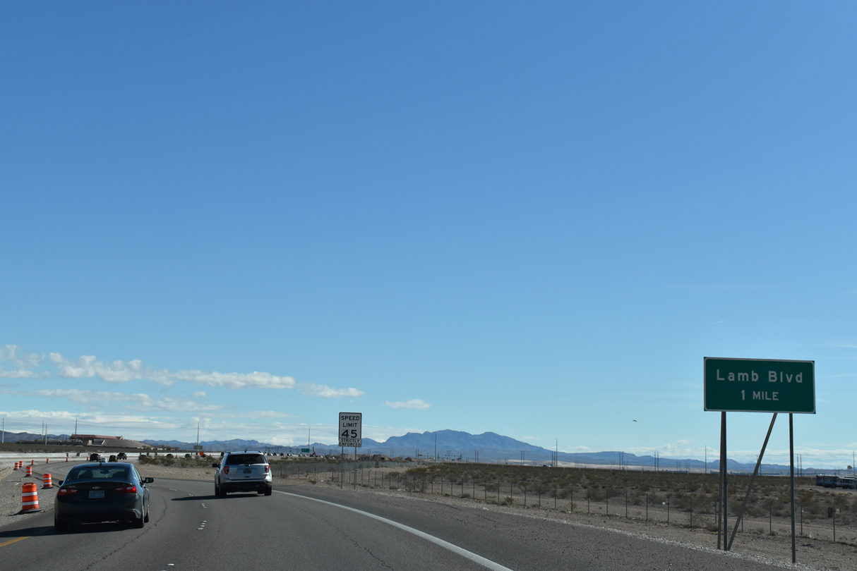
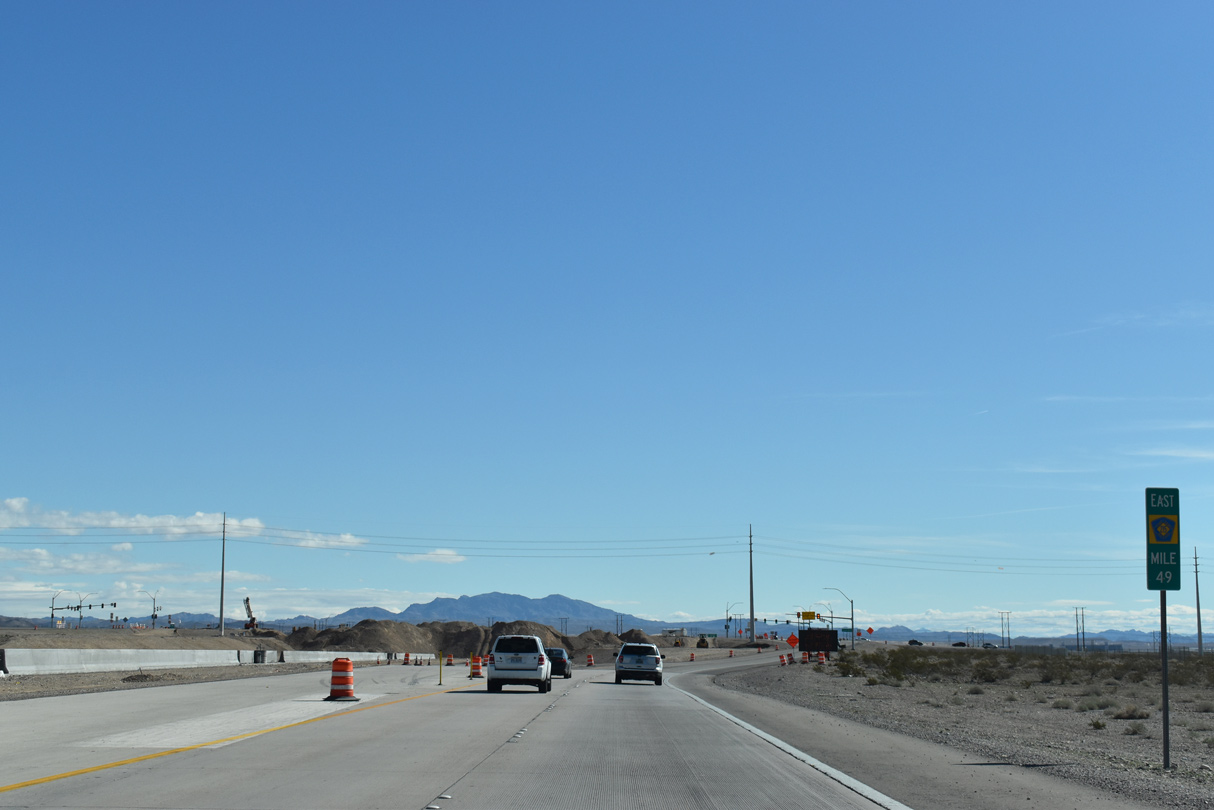
| Eastbound CC-215 curves at milepost 49 to meet Lamb Boulevard at a signalized intersection. 03/03/19 |
|
| Lamb Boulevard extends south from the beltway to Sunrise Manor located west of Nellis Air Force Base. SR 610 overlays Lamb Boulevard south of an interchange with I-15 to SR 604 (North Las Vegas Boulevard). 03/03/19 |
|
| The final confirming marker for Clark County 215 stands east of Lamb Boulevard. 03/03/19 |
|
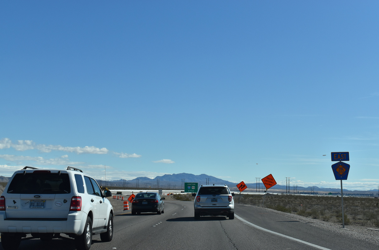
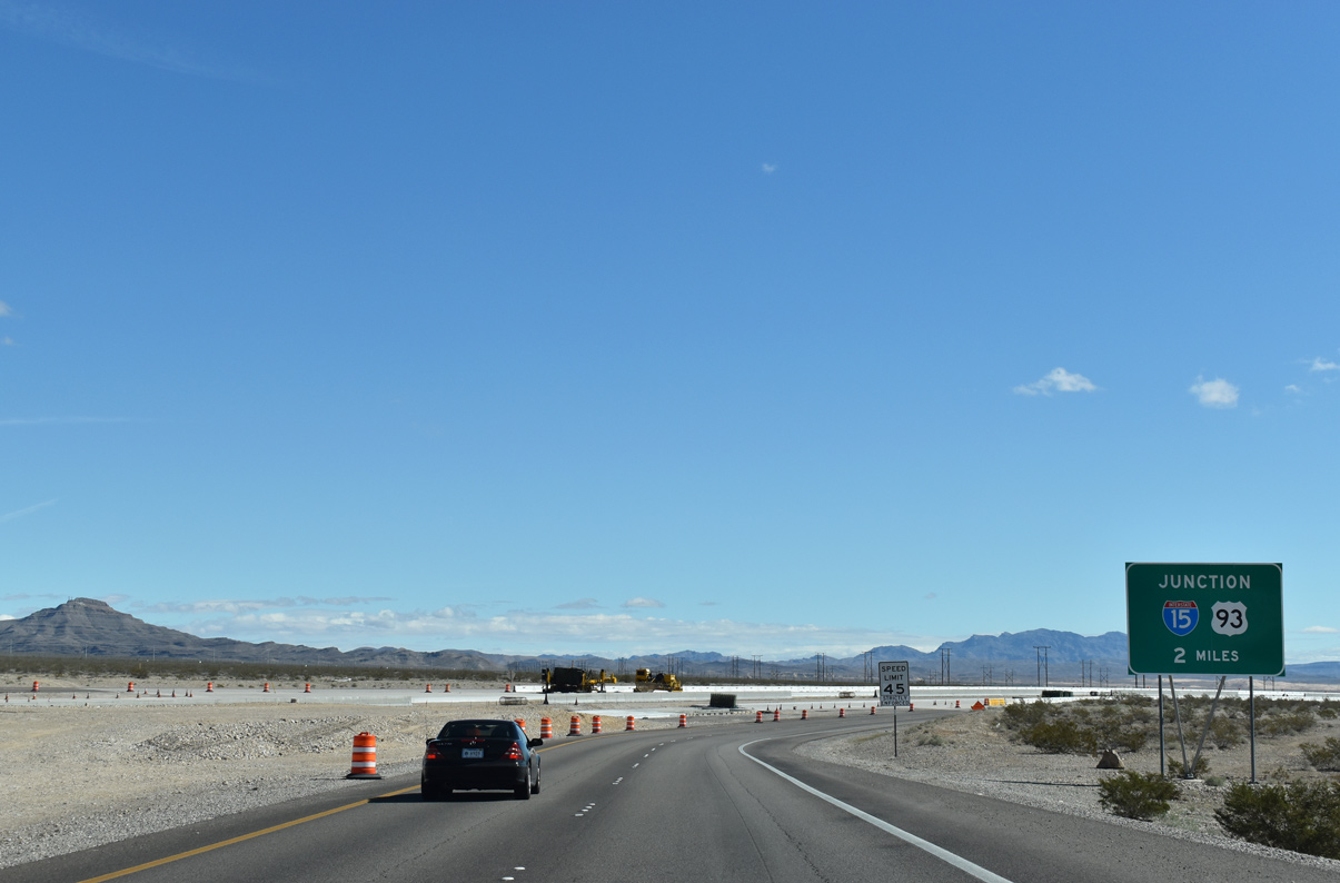
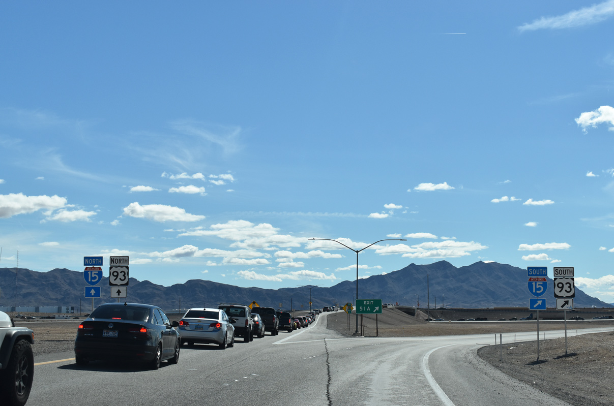
| CC-215 east turns southeast two miles ahead of the exchange with Interstate 15 and U.S. 93 (Exit 51). 03/03/19 |
|
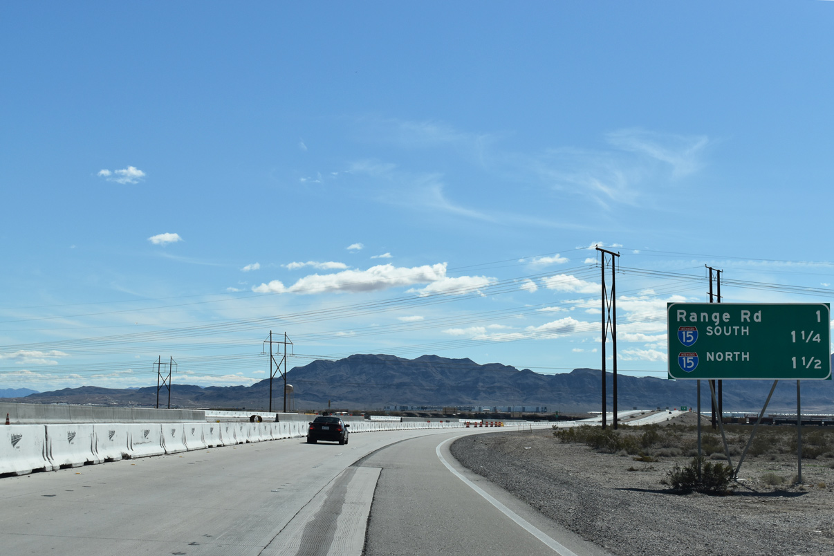
| A series of transmission lines span across the Bruce Woodbury Beltway one mile out from Range Road. 03/03/19 |
|
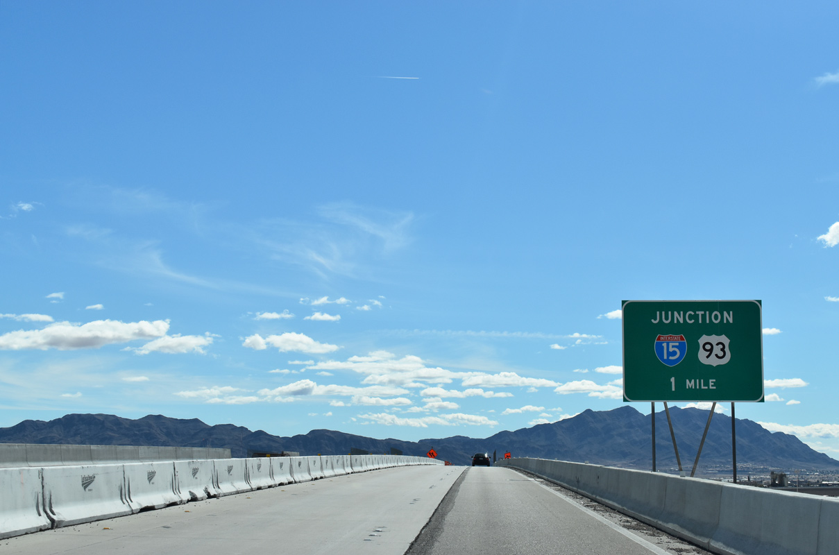
| Eastbound CC-215 spans Pacific Union rail lines under pass on the final mile to I-15 and U.S. 93. 03/03/19 |
|
| Range Road serves several industrial businesses as it curves southeast under I-15, otherwise the local road extends north to the Nevada Army National Guard complex for Clark County. 07/22/17 |
|
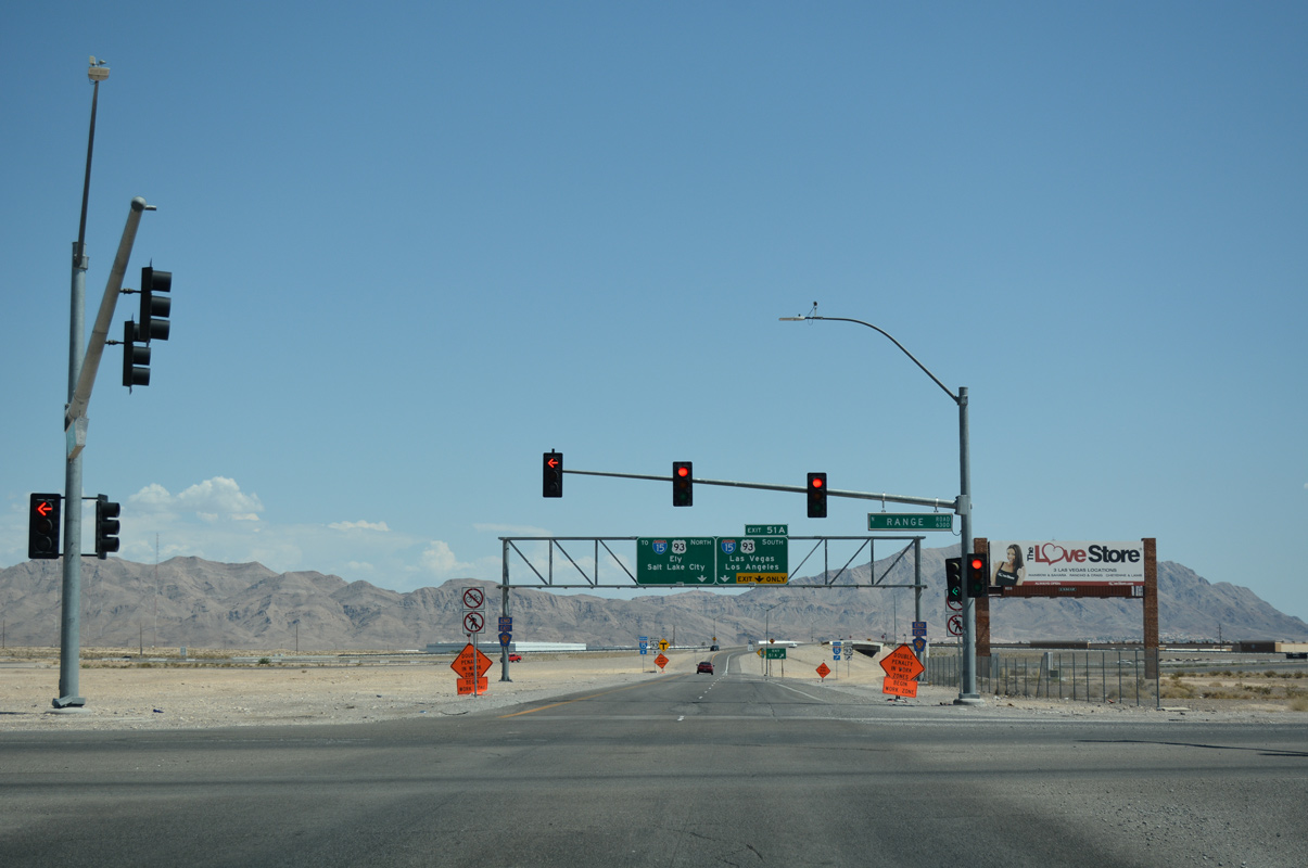
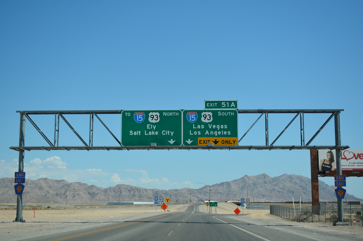
| CC-215 (Las Vegas/Bruce Woodbury Beltway) concludes its 51 mile course around the Las Vegas metro area as lanes split for I-15 & U.S. 93 south (Exit 51A) to Downtown Las Vegas and north to Salt Lake City. U.S. 93 breaks from I-15 north in 12 miles for Ely.
Construction set to begin summer 2020 will create a systems exchange between the Beltway and I-15, including new connections to Range Road and Tropical Parkway. 07/22/17, 03/03/19 |
Page Updated 06-23-2018.