

Traveling nearly 43 miles across southern Sussex County, SR 20 joins the city of Seaford with Millsboro and beaches from Fenwick Island north to Bethany Beach. The state route is mostly rural outside of the population centers. The lone four lane segments along the route are located in Seaford and along the overlaps with U.S. 13 (Sussex Highway) and U.S. 113 (Dupont Boulevard).
SR 20 (Stein Highway) extends east from the end of MD 392 at the community of Reliance. The state route initially through farm land before entering Seaford at Chapel Branch. Stein Highway expands into a five-lane commercial boulevard across the city to Front Street (old U.S. 13 Alternate). Norman Eskridge Highway continues the route east to the 0.84 mile overlap with U.S. 13 (Sussex Highway) south.
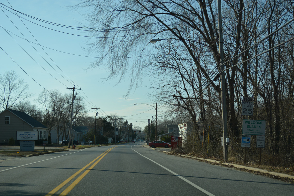
U.S. 13/SR 20 (Sussex Highway) cross Williams Pond and the Nanticoke River south to the town of Blades. Concord Road then leads SR 20 east by a series of residential streets along Deep Creek to the community of Concord. The route shifts southeast from there to cross U.S. 9 at Hardscrabble Road.
Hardscrabble Road takes SR 20 east to Jones Crossroads, Workmans Corners and the original end at U.S. 113 on the north side of Millsboro. A 3.12 mile overlap with U.S. 113 takes the state route through Millsboro, where it branches southeast to the town of Dagsboro.
SR 20 zigzags through Dagsboro, briefly overlapping with SR 26 along Main Street and Vines Creek Road. Leaving the town limits, SR 20 angles southeast through the rural communities of Omar and Roxana to Johnson. Suburban development accompanies the route on Zion Church Road to its merge with SR 54 (Lighthouse Road). SR 20/54 then overlap for 3.96 miles to their joint termini at SR 1.
The alignment of SR 20 appeared on the 1936-37 Official Delaware Highway Map between Reliance and U.S. 113 outside Millsboro. Through Seaford and Blades, the state route turned south along Front Street between Stein Highway and High Street. High Street continued the route east to Concord Road at U.S. 13. The alignment along Norman Eskridge Highway to U.S. 13 was added by 1970.
The Delaware Department of Transportation extended SR 20 east from Millsboro to Fenwick Island in July 1991 to provide another signed route for resort traffic. Travelers bound for the Bethany Beach and Fenwick Island area were encouraged to follow U.S. 13 south from Bridgeville to SR 20 at Seaford to avoid a congested stretch of SR 404 east through Georgetown.1 Beyond the new overlap with U.S. 113, SR 20 overtook previously unnumbered roads southeast to Fenwick Island.
Delaware State Route 20 Guides
Delaware State Route 20 - 2015 Annual Average Daily Traffic (AADT)
- 5,475 - Maryland state line to Woodpecker Road
- 19,885 - Shipley Street to Pine Street Extension in Seaford
- 37,325 - South Seaford city limits to Road 535 along U.S. 13
- 7,400 - U.S. 13 to Circle Drive
- 5,375 - U.S. 9 to Shiloh Church Road
- 30,031 - North Millsboro limits to SR 24 along U.S. 113
- 10,077 - U.S. 113 to northwest Dagsboro limits
- 17,041 - Iron Branch Road to Main Street in Dagsboro
- 6,093 - Frankford School Road to Bayard Road
 scenes scenes |
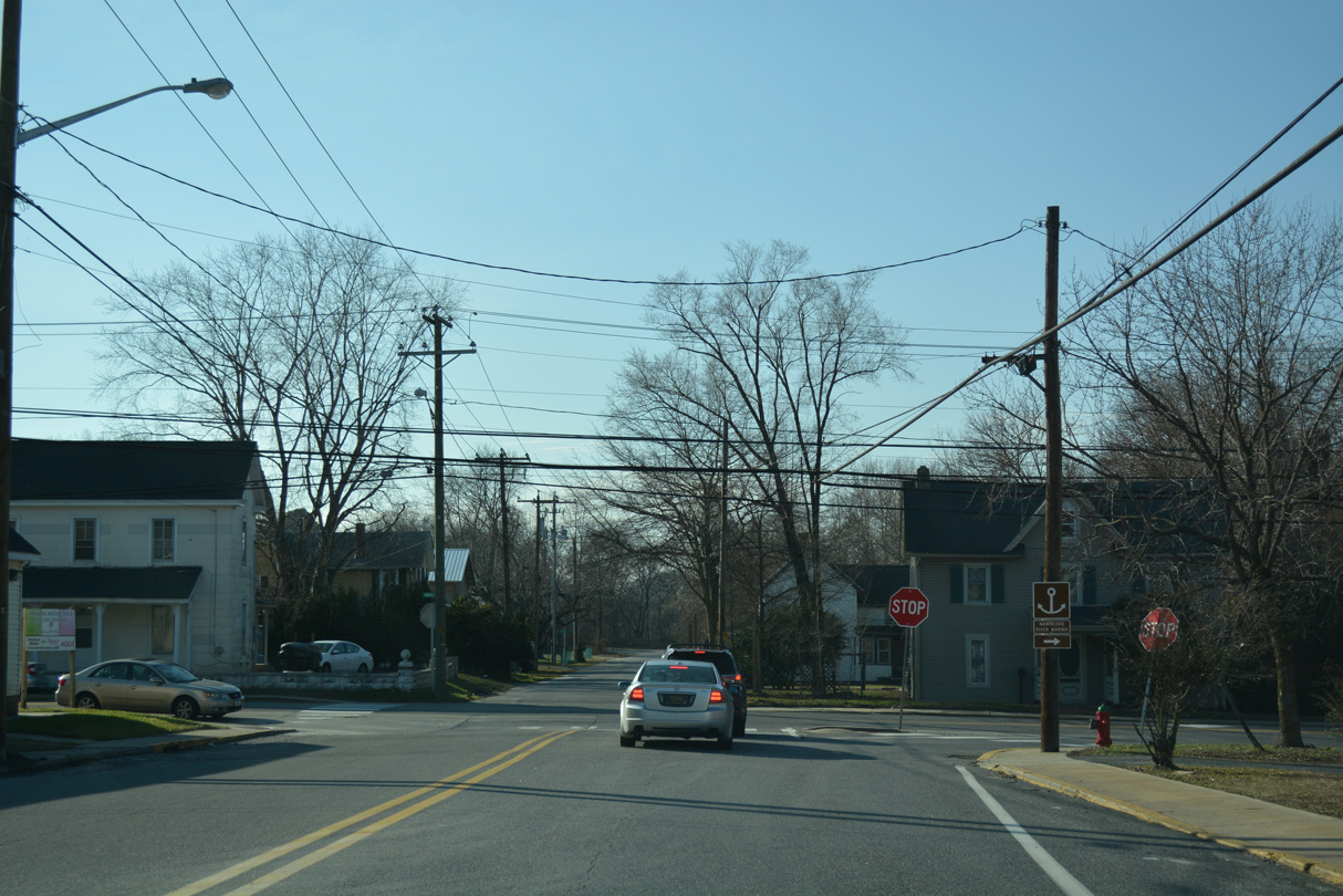
 | Concord Road curves southwest from U.S. 13 and SR 20 by the Nanticoke River to enter the town of Blades. The former alignment of SR 20 becomes High Street to the west. 01/15/17 |
 | SR 20 historically turned north from High Street onto Market Street. Market Street was formerly a part of U.S. 13 Alternate south to Delmar and north to Hearns Mill. 01/15/17 |
 | Market Street took SR 20 north from High Street to the Nanticoke River. 01/15/17 |
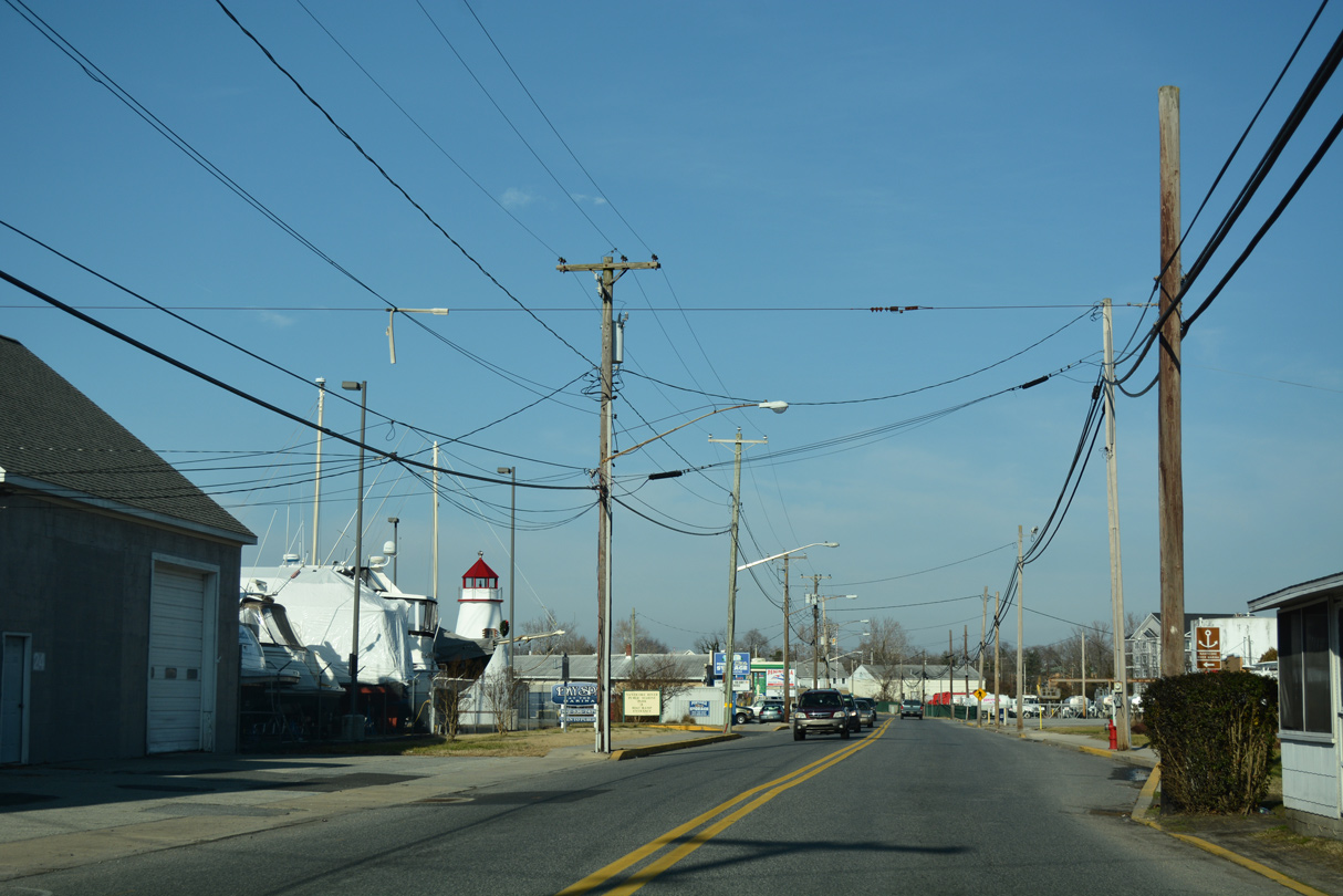
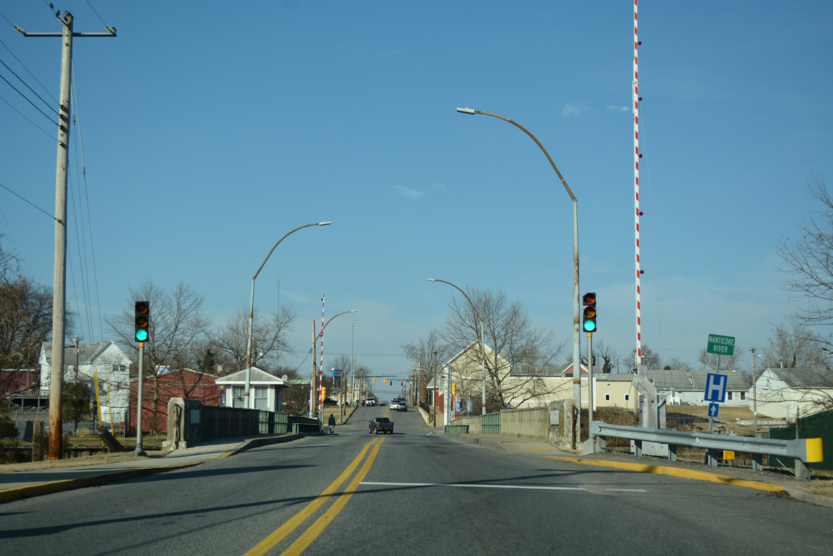 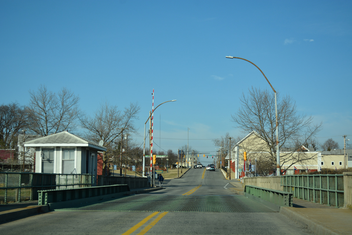 | A single leaf bascule bridge carries drivers from Market Street in Blades north to Front Street through Seaford. The draw bridge dates back to 1925. 01/15/17 |
 | Market Street splits with Front Street to the northwest to Downtown Seaford. Front Street continues one block north to the traffic light with High Street. 01/15/17 |
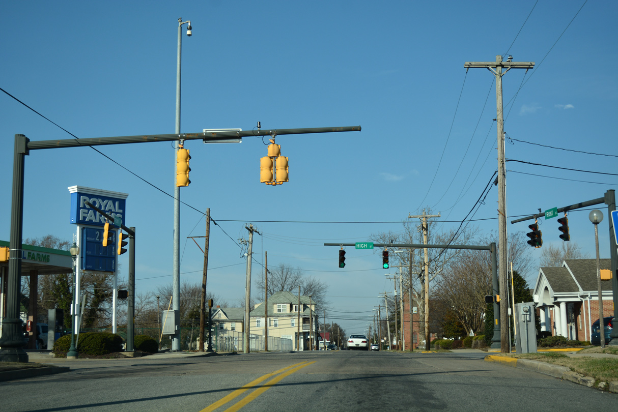
 | Front Street advances north 0.4 miles to intersect SR 20 (Stein Highway west / Norman Eskridge Highway east). A guide sign references the former turn of SR 20 west here. 01/15/17 |
 | SR 20 expands into a divided arterial along Norman Eskridge Highway from Front Street east to U.S. 13 (Sussex Highway). Front Street north becomes Bridgeville Highway, the continuation of old U.S. 13 Alternate to Hearns Mill. 01/15/17 |
- "Delaware 20 in Sussex extended in attempt to ease resort traffic." The News Journal (Wilmington, DE), July 31, 1991.
Photo Credits:
01/15/17 by AARoads
Connect with:
U.S. 9
U.S. 13
State Route 1
State Route 17
State Route 26
Multi State Route 54
Route 392
Page Updated 11-30-2018.