|
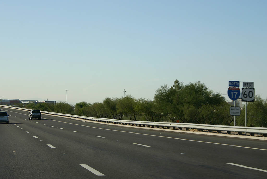
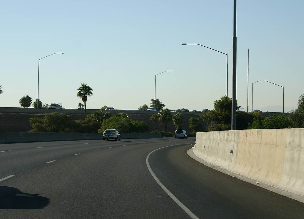
| The first confirming marker for Interstate 17 north. Since I-17 replaced old SR 69, it follows the original mileposts of SR 69. As a result of this numbering, I-17 begins at milepost 194 and initially travels west to milepost 197 and the Durango Curve. 11/03/07 |
|
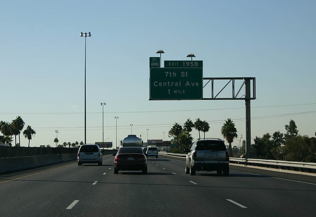
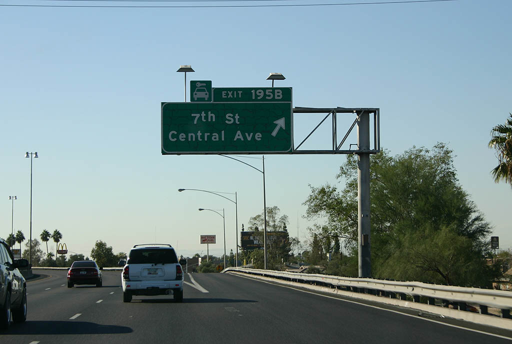
| The first exit from I-17/U.S. 60 north is with the Maricopa Freeway frontage road west to 7th Street and Central Avenue. Both streets head north into Downtown Phoenix and south to South Mountain. 11/03/07 |
|
| Central Avenue separates the Phoenix grid system, with north to south numbered avenues increasing west from it, and north to south numbered streets increasing to the east. 11/03/07 |
|
| 7th Street extends northward through Phoenix all the way to Loop 101 and Happy Valley Road at Deer Valley. Central Avenue is discontinuous at North Mountain. 11/03/07 |
|
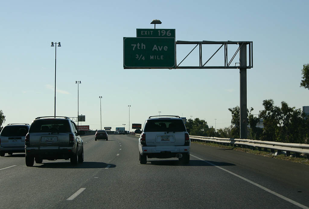
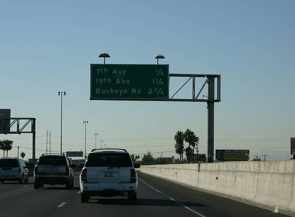
| The succeeding exit from I-17/U.S. 60 (Maricopa Freeway) is for 7th Avenue. The original plans for the Interstate highway system incorporated the northern leg of the Maricopa Freeway as part of I-10. When plans shifted I-10 northward, I-17 was extended over the Maricopa Freeway west from the Papago Freeway. 11/03/07 |
|
| A diamond interchange joins I-17/U.S. 60 with 7th Avenue north of a warehouse district at Exit 196. 11/03/07 |
|
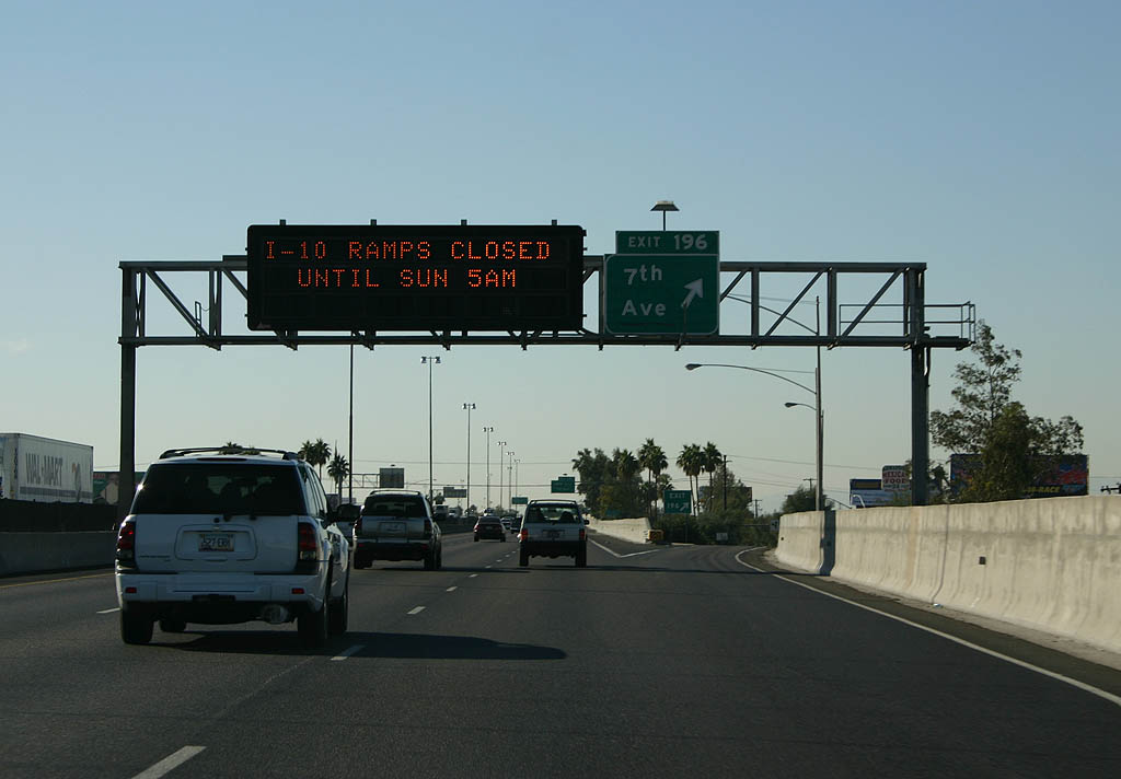
| Exit 196 departs I-17/U.S. 60 (Maricopa Freeway) north for 7th Avenue. 7th Avenue runs along the west side of Downtown Phoenix and south across the Salt River to South Mountain Village. 11/03/07 |
|
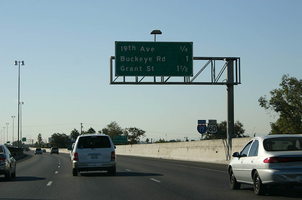
| Continuing west, Exit 197 connects I-17/U.S. 60 north next with S 19th Avenue. 11/03/07 |
|
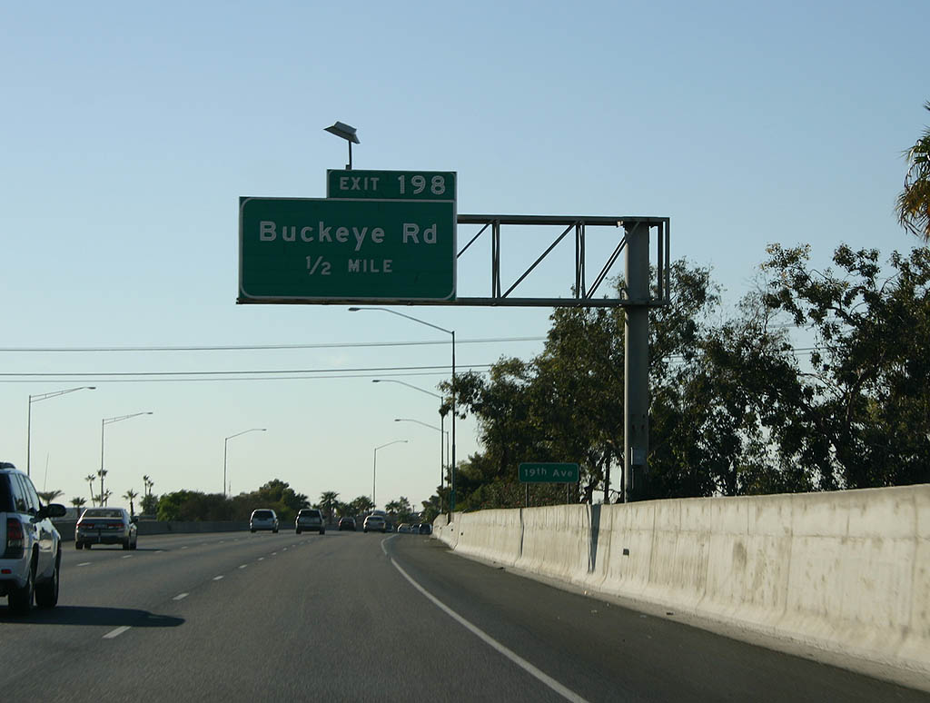
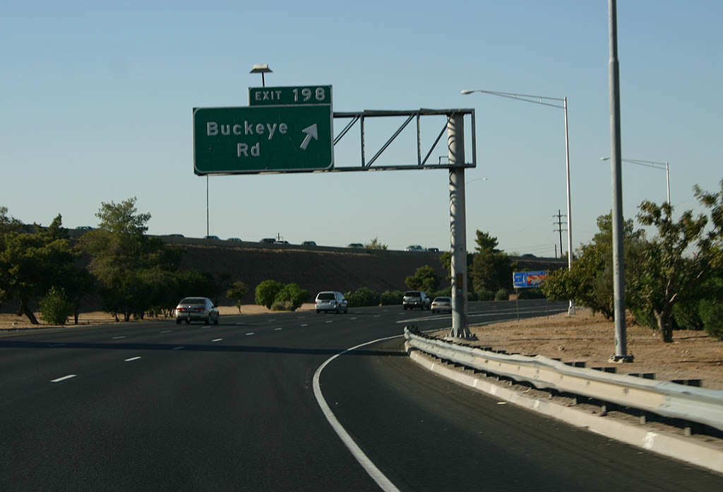
| Exit 198 follows in one mile for Buckeye Road, the former alignment of both U.S. 80 and SR 85. 11/03/07 |
|
| 19th Avenue / Exit 197 represents the transition of I-17/U.S. 60 from the Maricopa Freeway onto the Black Canyon Freeway. 11/03/07 |
|
| U.S. 80, and later SR 85, followed Buckeye Road west from Downtown Phoenix to Buckeye. SR 85 was eventually truncated to end at I-10, while Buckeye Road was turned over to local control and a portion west of the Phoenix city limits designated as Maricopa County Route 85. 11/03/07 |
|
| Interstate 17 turns north through the Durango Curve. This location was originally intended to be the merge point of I-10 and I-17, and two bridges were built along the southbound roadway for ramps with I-10. With the realignment of I-10, these were removed in 1973. 11/03/07 |
|
| Exit 198 separates from I-17/U.S. 60 (Black Canyon Freeway) within the Durango Curve for Buckeye Road (old SR 85). 11/03/07 |
|
| I-17/U.S. 60 (Black Canyon Freeway) advances north to Interstate 10 through a series of streets named after U.S. Presidents. 11/03/07 |
|
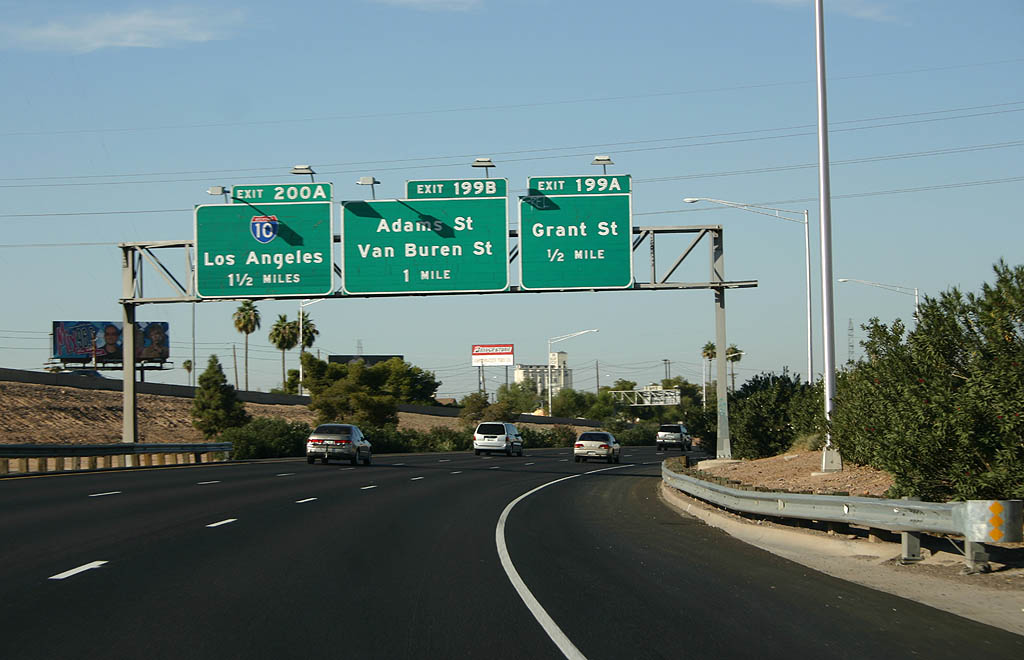
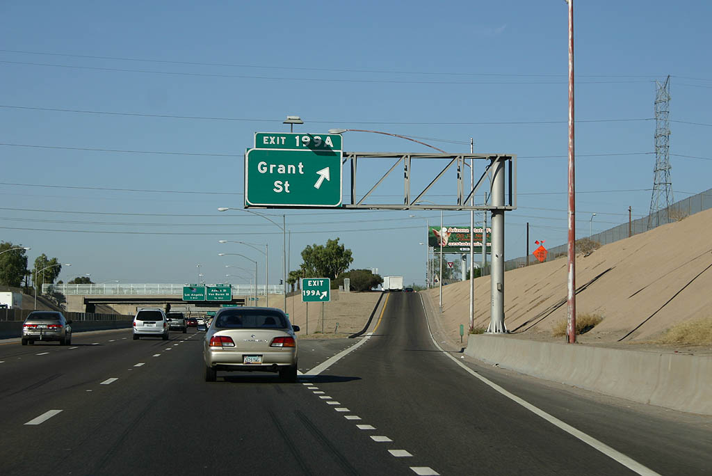
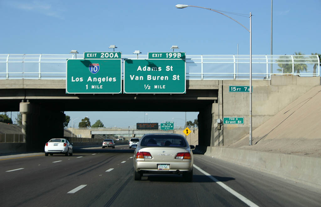
| Grant Street stems east from the diamond interchange at Exit 199A along an industrial corridor paralleling the Union Pacific Railroad. 11/03/07 |
|
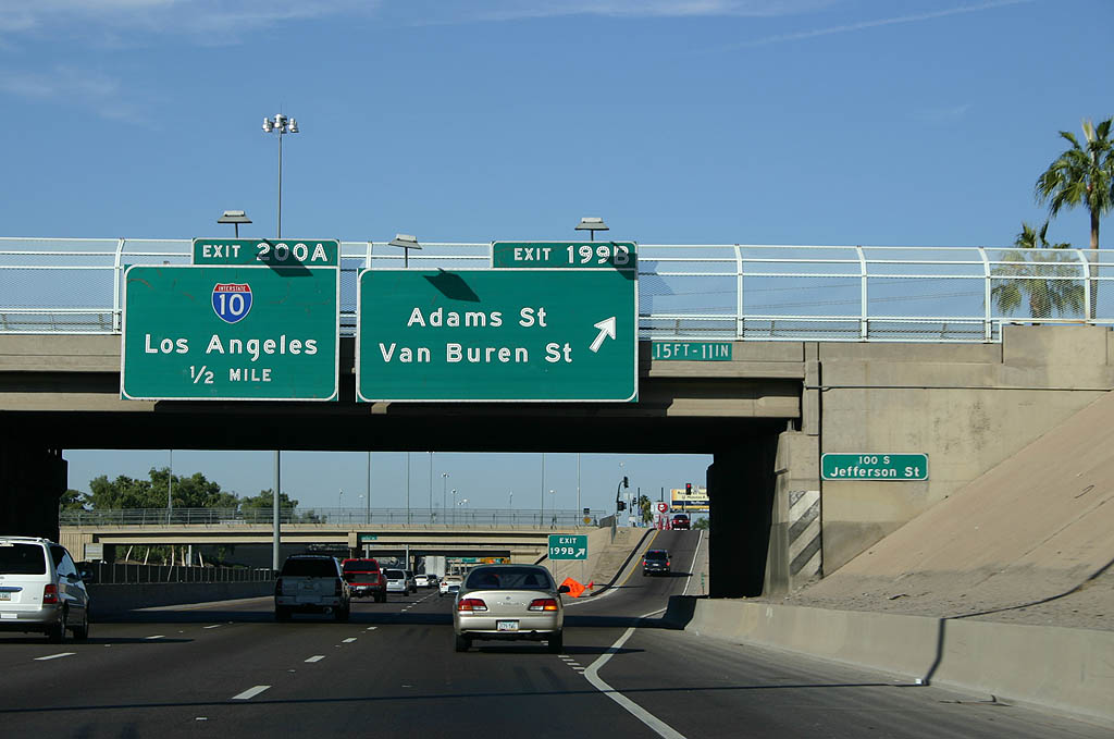
| Forthcoming Adams Street west forms a couplet with Jefferson Street east to the Arizona State Capital. Van Buren Street leads east to Downtown Phoenix campus of Arizona State University and Arizona Center mall. 11/03/07 |
|
| Prior to the completion of I-10, U.S. 60 followed Van Buren Street and Grand Avenue northwest from Downtown Phoenix. With the completion of the freeway grid, U.S. 60 was rerouted onto I-10 and I-17, and the old route was given to the city for maintenance. The superfluous routes associated with U.S. 60 were decommissioned from Phoenix in the same chronological order: U.S. 70 - 1969, U.S. 80 - 1977, and U.S. 89 - 1992. 11/03/07 |
|
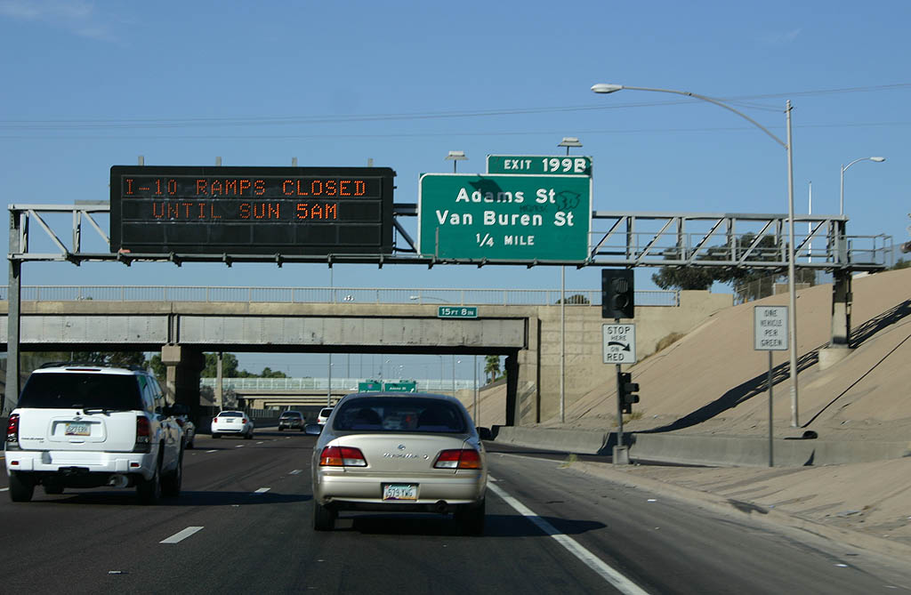
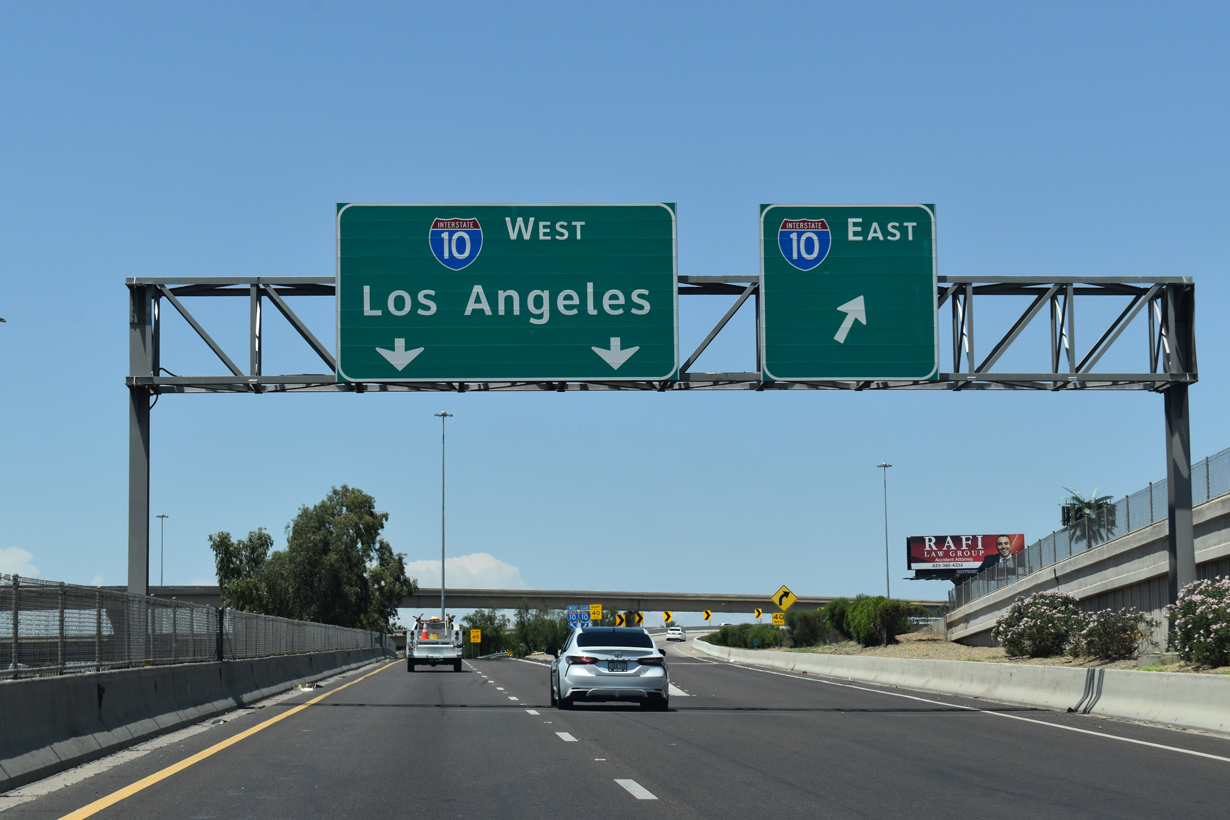
| Exit 199B ascends from I-17/U.S. 60 north onto the Black Canyon Freeway service road at Adams Street, two blocks south of Van Buren Street. The overhead for Exit 200A is notable that it only lists a control city for westbound, despite providing access to both directions of I-10. 11/03/07 |
|
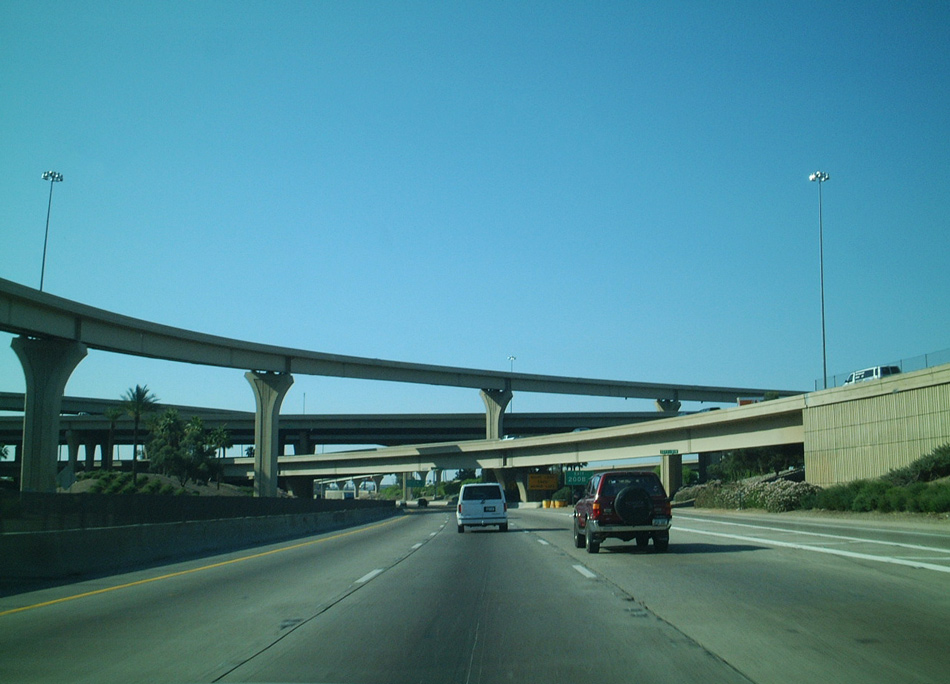
| I-17/U.S. 60 passes between Memory Lawn Cemetery and an industrial park area north into The Stack, a four level interchange with Interstate 10 (Papago Freeway). 05/31/21 |
|
| The Papago Freeway takes Interstate 10 around Downtown to the north and east toward Phoenix Sky Harbor International Airport (PHX). 05/31/21 |
|
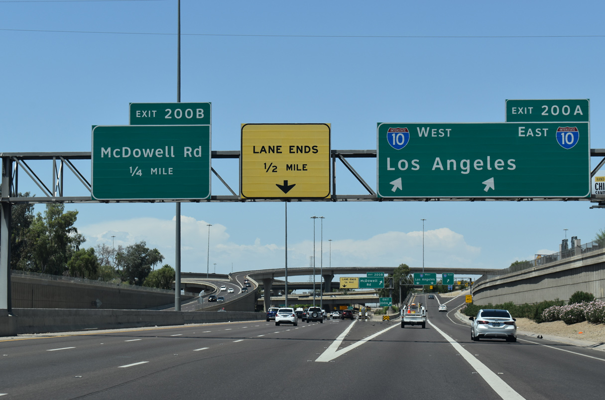
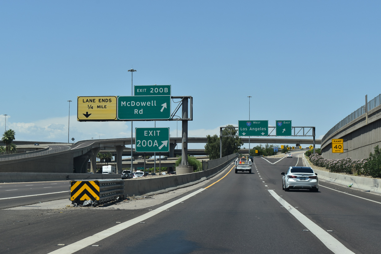
| Exit 200B follows from I-17/U.S. 60 north for the Black Canyon Freeway service road ahead of McDowell Road. 05/31/21 |
|
| Interstate 10 (Papago Freeway) travels through Maryvale Village and the west side of Phoenix to Goodyear, Avondale and Buckeye. Beyond the Valley of the Sun, I-10 continues to San Bernardino and Los Angeles, California. 05/31/21 |
|
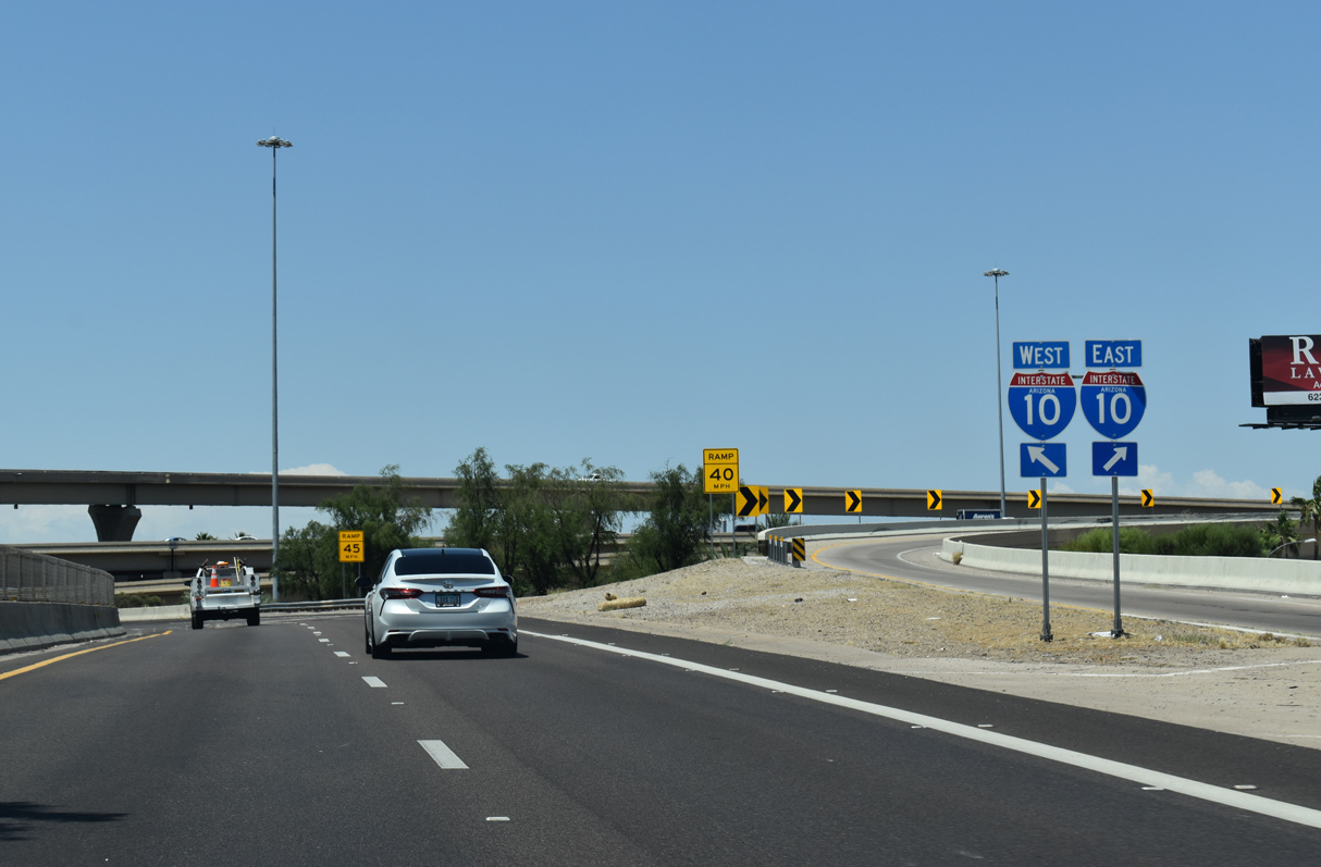
| Exit 200A separates into flyovers. 05/31/21 |
|
| Continuing north through the systems interchange with Interstate 10 (Papago Freeway). 05/23/03 |
|
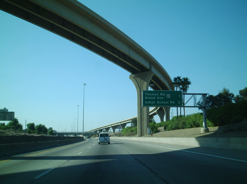
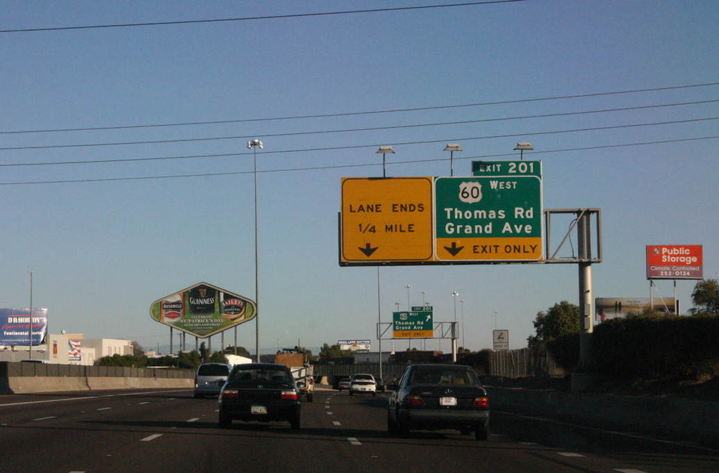
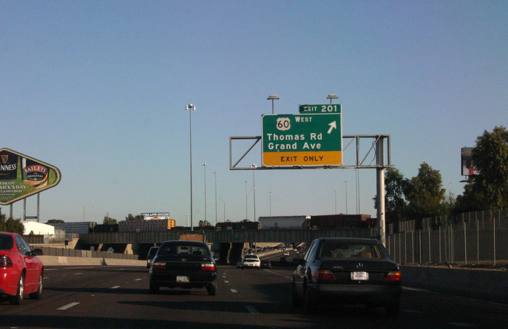
| U.S. 60 parts ways with I-17 (Black Canyon Freeway) at Exit 201 for Thomas Road west to Grand Avenue north. 05/23/03 |
|
| Originating in Downtown Phoenix at the intersection of Van Buren and 7th Avenue, Grand Avenue runs diagonally northwest through Phoenix, Glendale, Peoria and Youngtown. Grade separations were added at many of the previous six-way intersections along the arterial route in projects completed during 2005. 03/03/07 |
|
| U.S. 60 heads northwest toward Wickenburg, where it meets U.S. 93. Part of the I-11 corridor, U.S. 93 continues north to Las Vegas, while U.S. 60 turns southwest to rejoin I-10 east of Quartzsite. Historically, U.S. 60 continued all the way to Los Angeles, California, along with U.S. 70. 03/03/07 |
|
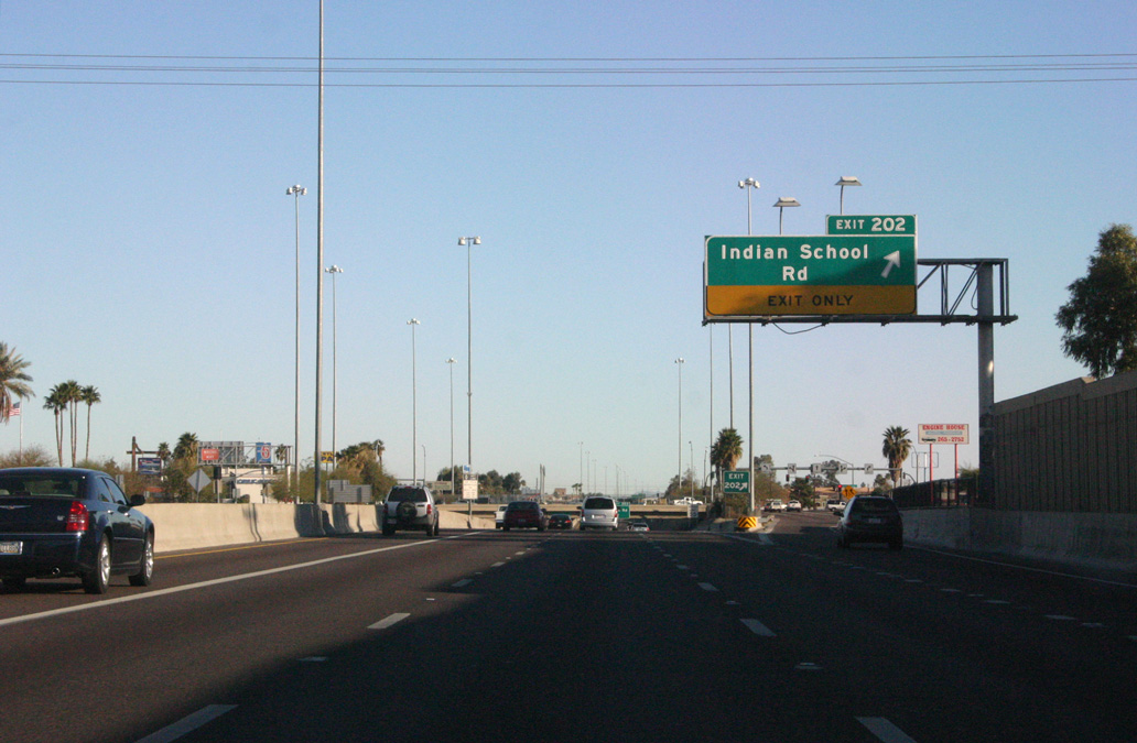
| I-17 north to Indian School Road is part of the oldest freeway in the Valley of the Sun, completed in approximately 1957. Situated below grade for much of the distance between I-10 and Loop 101, I-17 carries between six and ten lanes along the Black Canyon Freeway. 03/03/07 |
|
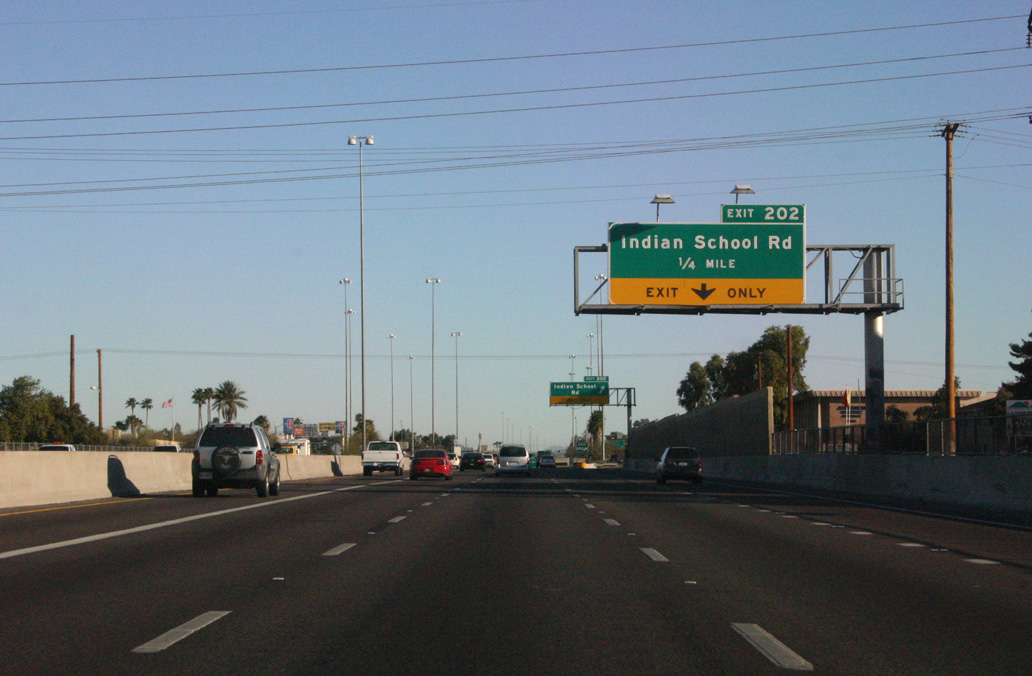
| A diamond interchange joins I-17 with Indian School Road at Exit 202. The grid pattern of major east to west streets beyond Downtown Phoenix spaces them by one mile a part. Some of the routes are discontinuous due to mountains, open space and intervening developments. 03/03/07 |
|
| Interstate 17 continues from U.S. 60 north to I-40/SR 89A at Flagstaff without meeting another U.S. Highway. 03/03/07 |
|
| Exit 202 departs Interstate 17 north for Indian School Road to the Encanto Village neighborhood. 03/03/07 |
|
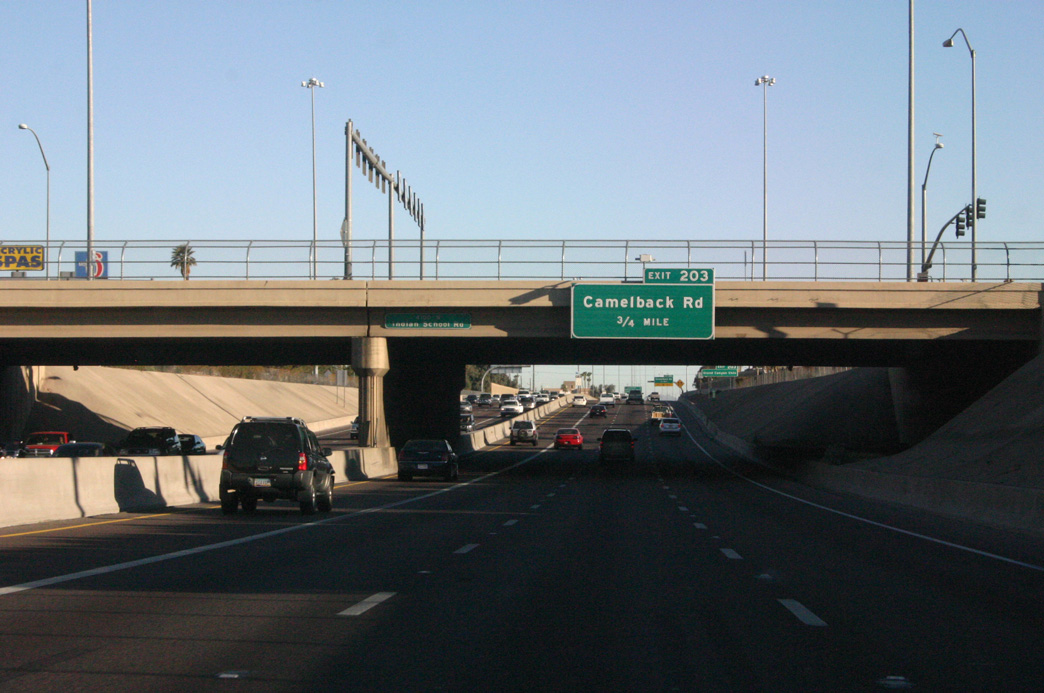
| Continuing north, the Black Canyon Freeway meets Camelback Road in the Alhambra neighborhood of Phoenix. 03/03/07 |
|
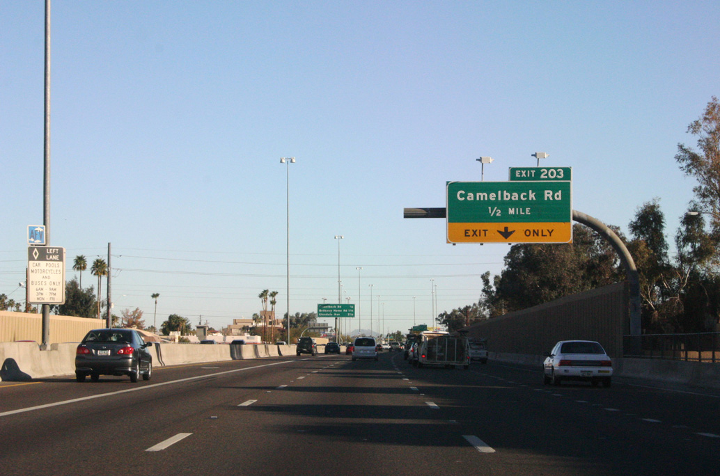
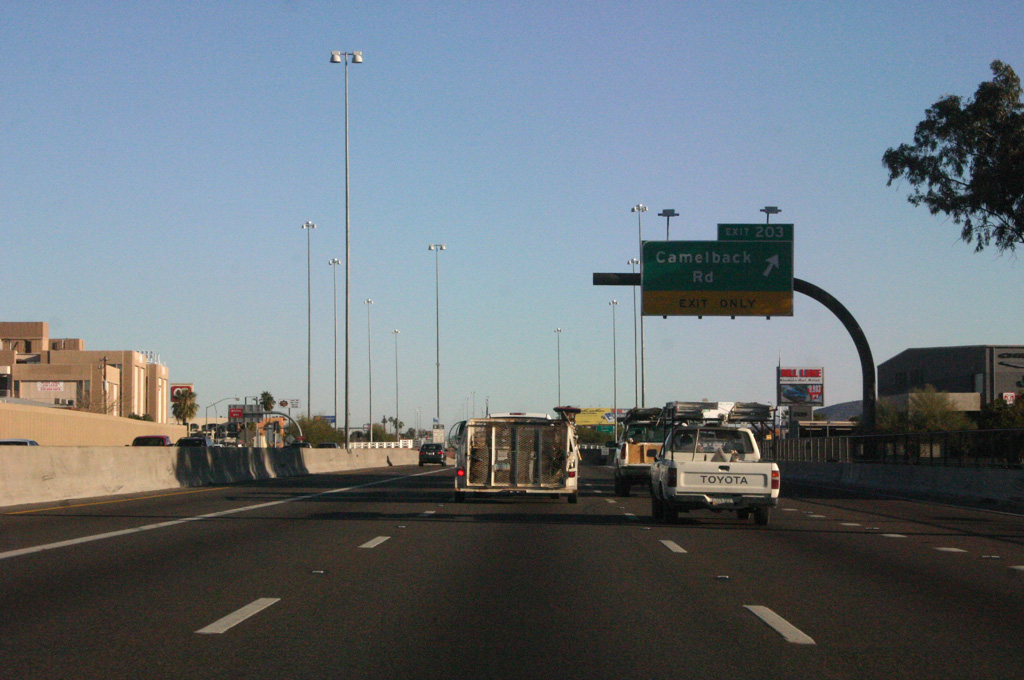
| Interstate 17 transitions to an at-grade freeway ahead of the single point interchange (Exit 203) with Camelback Road. 03/03/07 |
|
| ADOT recorded 195,000 vehicles per day in 2019 along Interstate 17 ahead of Exit 203 / Camelback Road. 03/03/07 |
|
| Exit 203 departs I-17 (Black Canyon Freeway) north for Camelback Road and Grand Canyon University. 03/03/07 |
|
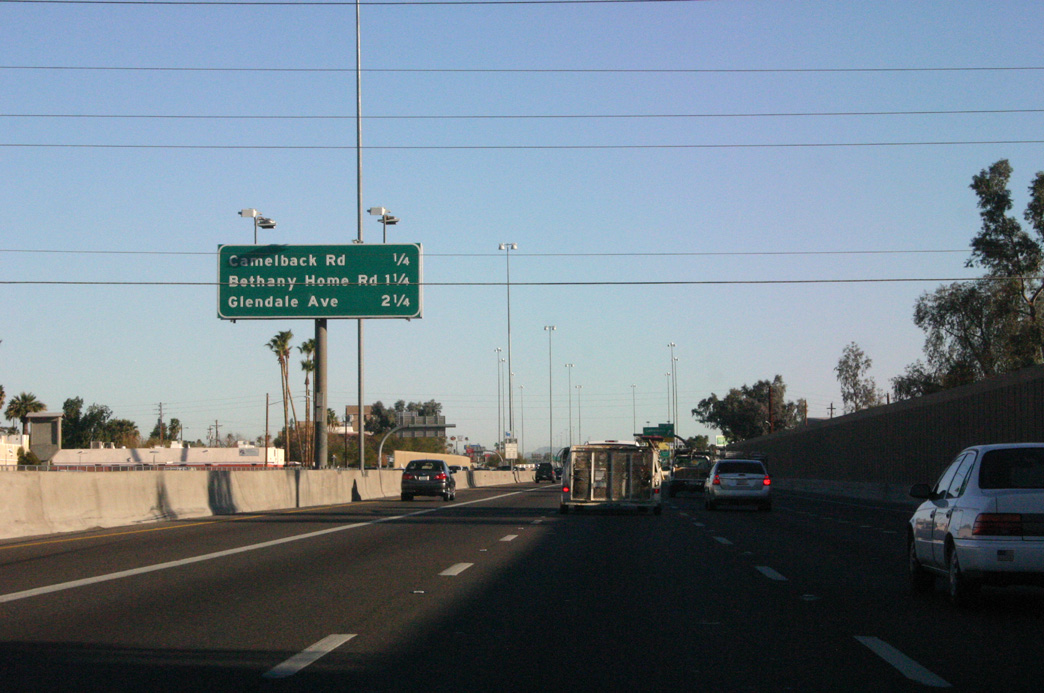
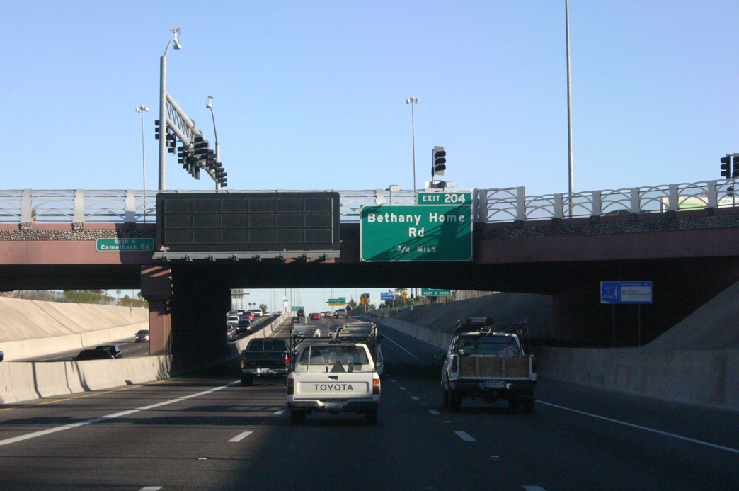
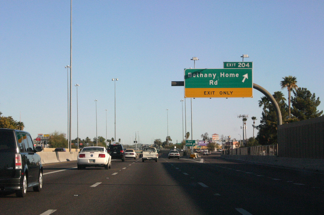
| Bethany Home Road is the first of three exits from Interstate 17 northbound with arterials leading west to the city of Glendale. 03/03/07 |
|
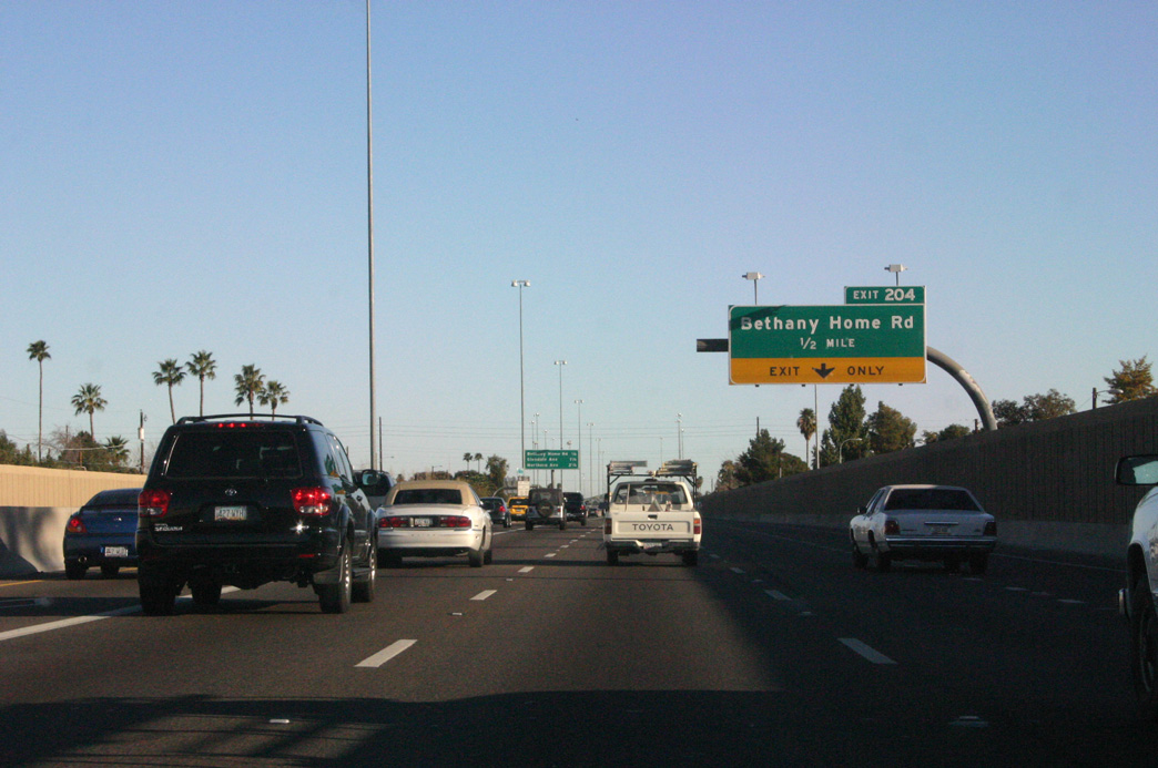
| A SPUI links Interstate 17 (Black Canyon Freeway) with Bethany Home Road at Exit 204. 03/03/07 |
|
| Bethany Home Road heads east to Christown Spectrum mall and SR 51 (Piestewa Freeway) at Exit 4B. 03/03/07 |
|
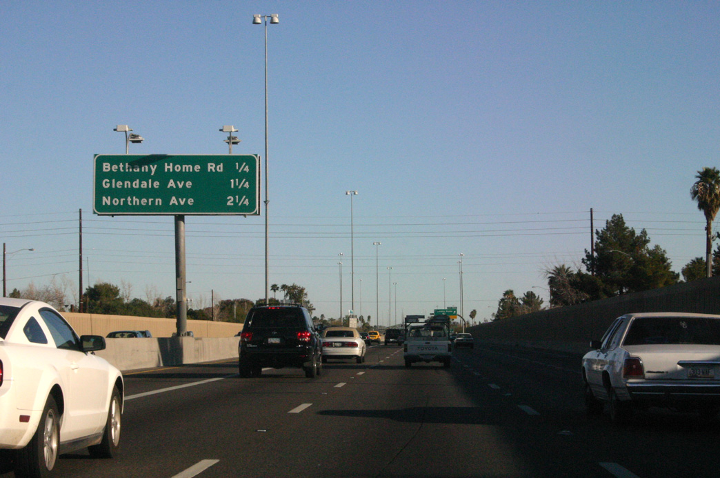
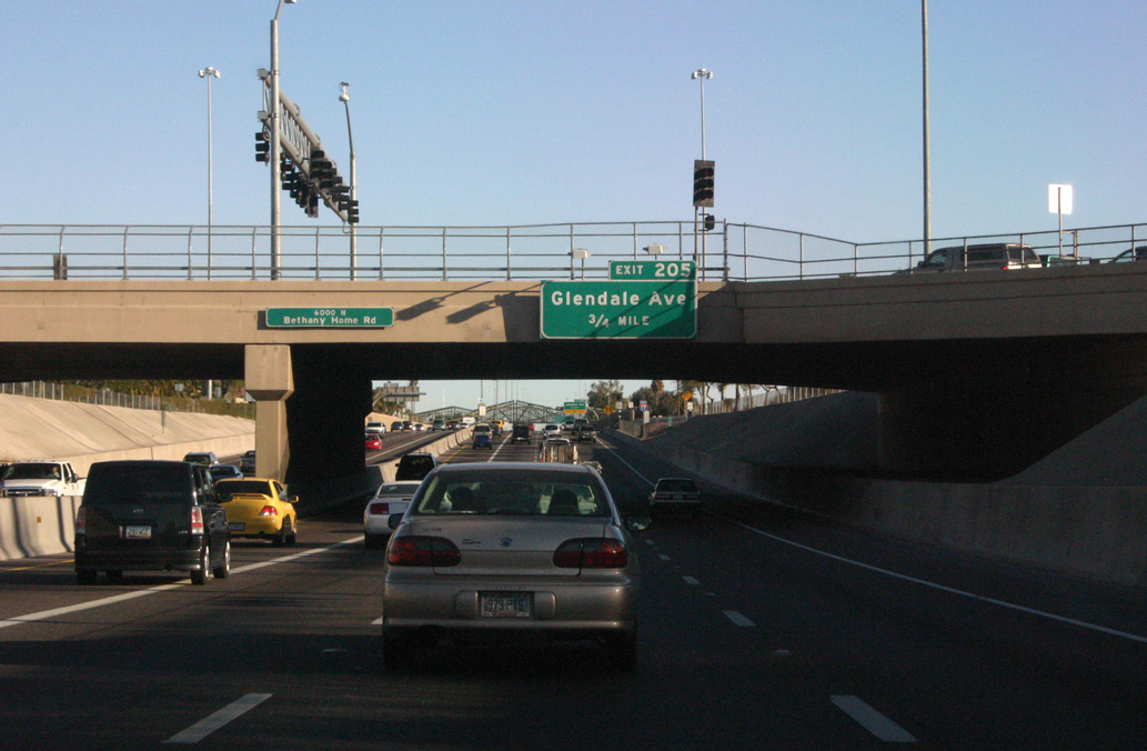
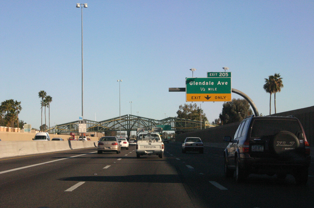
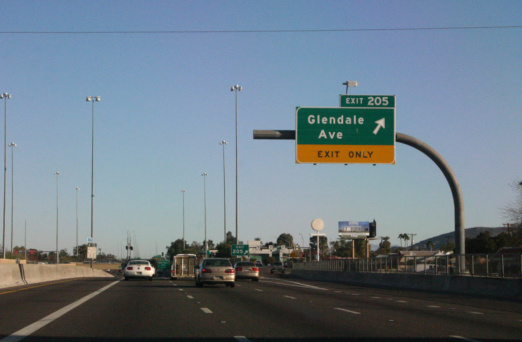
| Glendale Avenue runs 4.2 miles east from the grade separated intersection with U.S. 60 (Grand Avenue) and 59th Avenue by the Glendale Municipal Building to meet Interstate 17 at Exit 205. 03/03/07 |
|
| Exit 205 is the third SPUI in succession along Interstate 17 (Black Canyon Freeway) north. 03/03/07 |
|
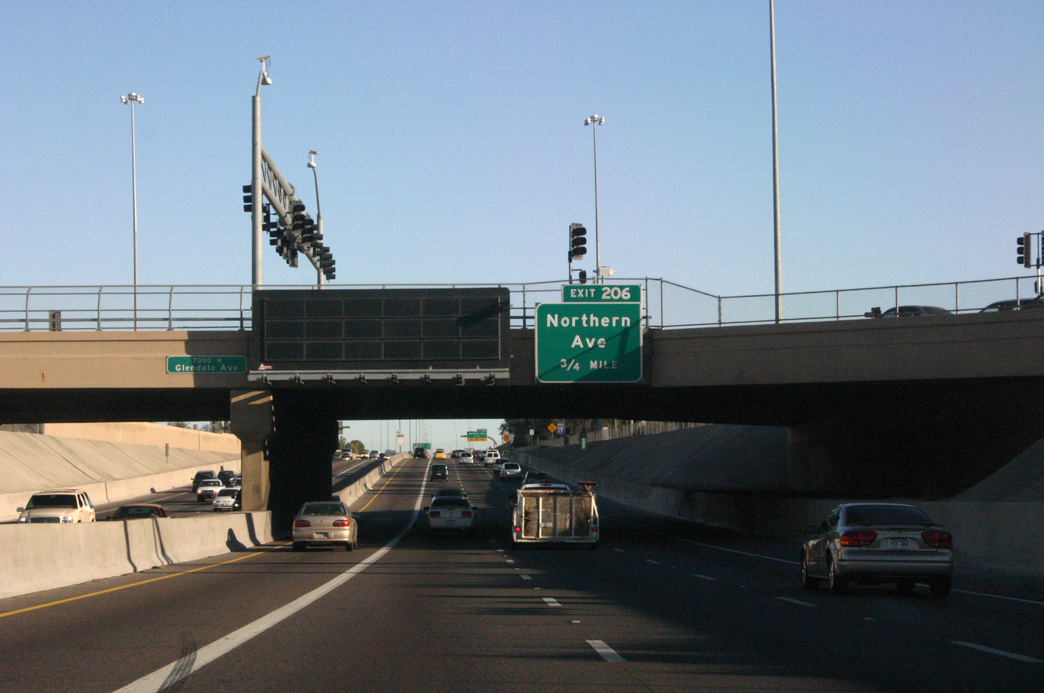
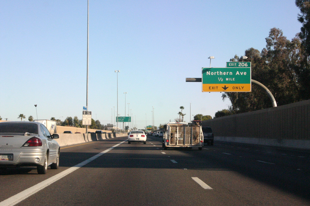
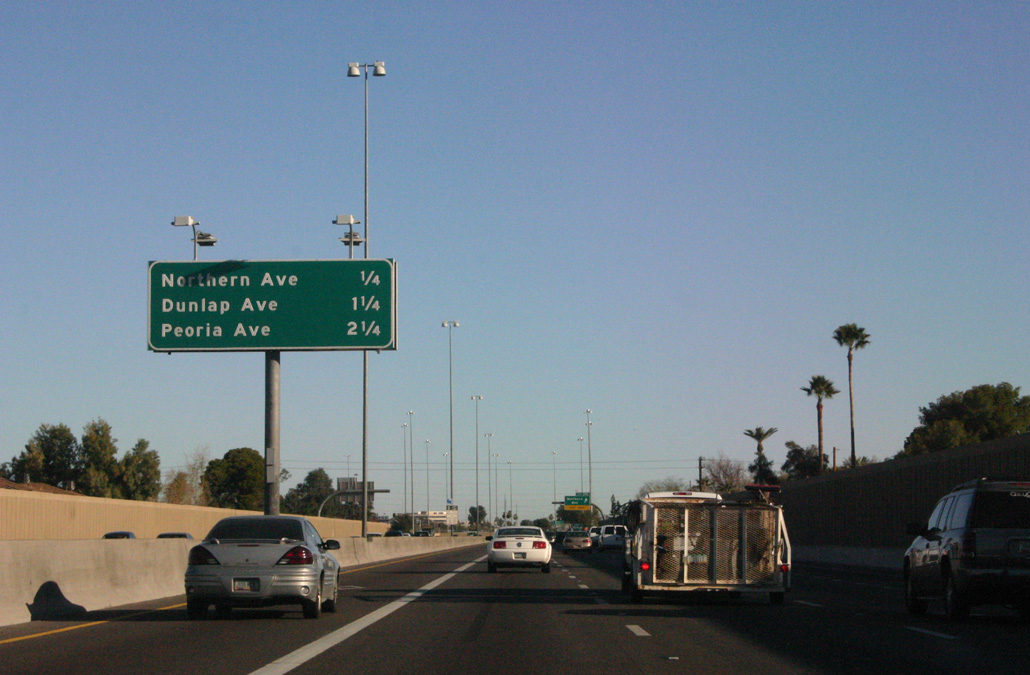
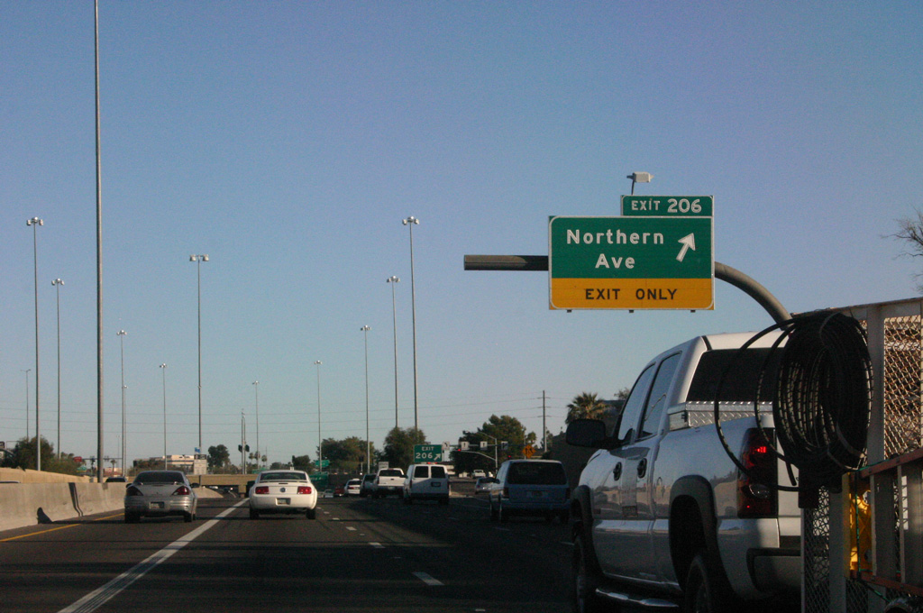
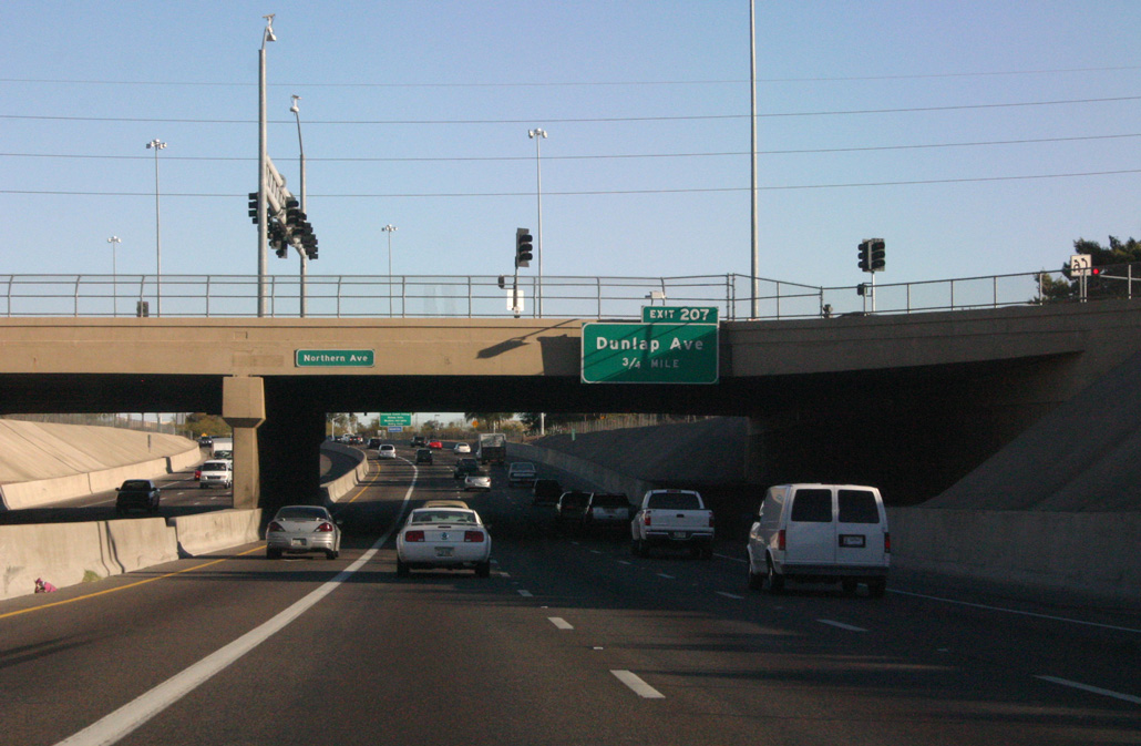
| The succeeding exit along northbound Interstate 17 (Black Canyon Freeway) is with Northern Avenue. 03/03/07 |
|
| Northern Avenue heads east to meet SR 51 at the Camelback East neighborhood near Piestewa (Squaw) Peak. 03/03/07 |
|
| Interstate 17 leaves the Alhambra neighborhood area of Phoenix into the North Mountain community ahead of exits for Dunlap and Peoria Avenues. 03/03/07 |
|
| West from the SPUI at Exit 206, Northern Avenue continues through Glendale toward the White Tank Mountain Regional Park (via Olive Avenue). 03/03/07 |
|
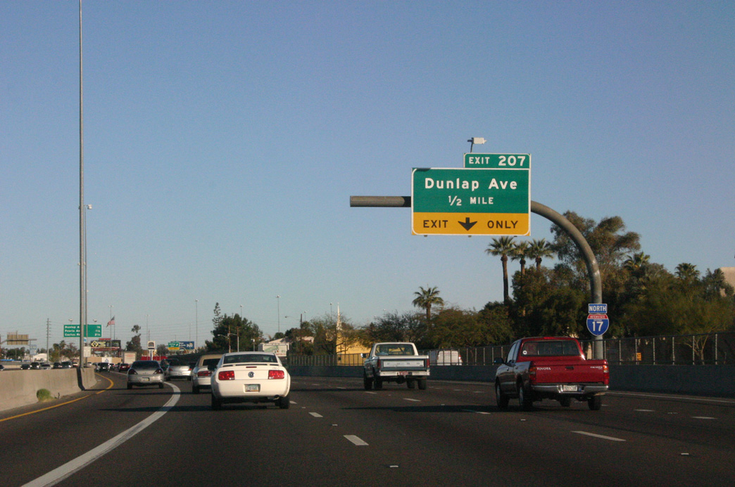
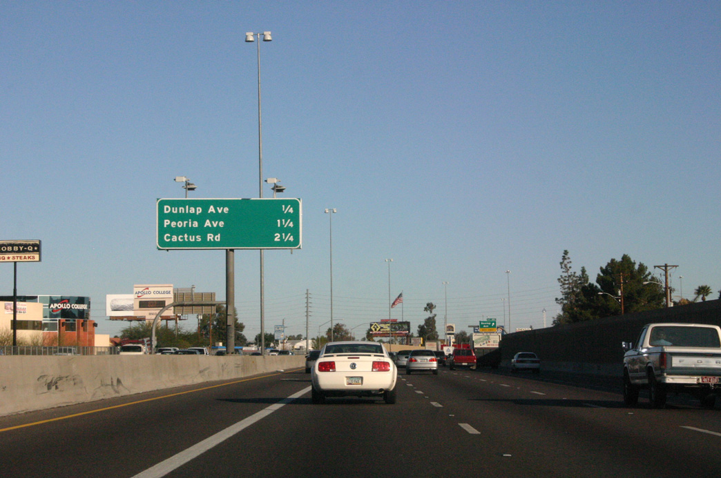
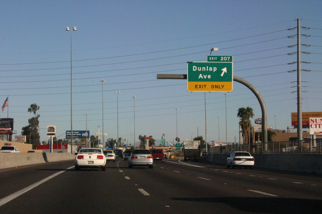
| Advancing 0.75 miles north from Northern Avenue, Interstate 17 meets Dunlap Avenue at Exit 207. 03/03/07 |
|
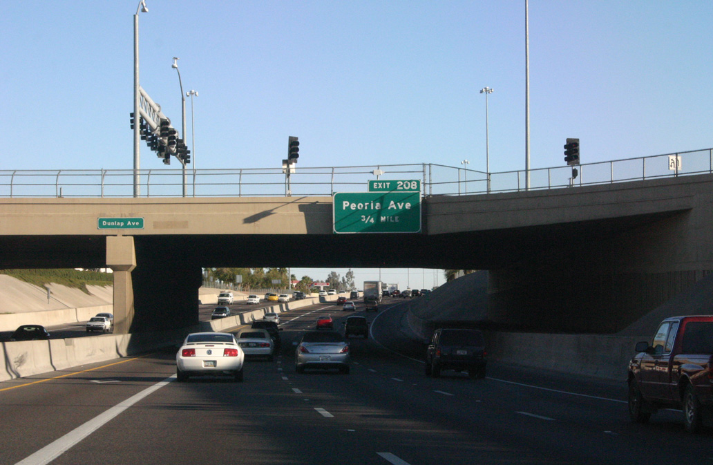
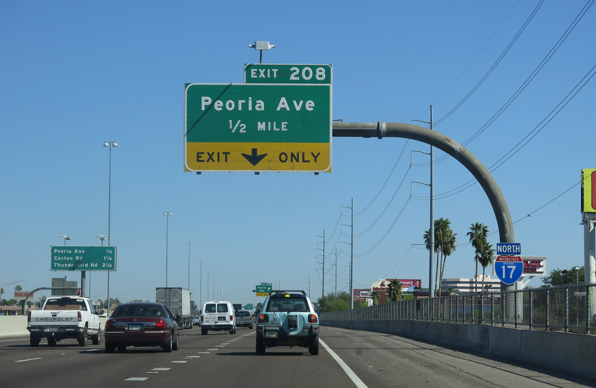
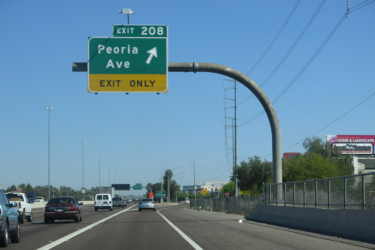
| Interstate 17 continues north from Dunlap Avenue across Arizona Canal, 0.75 miles to Peoria Avenue / Exit 208. 03/03/07 |
|
| Interstate 17 (Black Canyon Freeway) shifts west a quarter mile westward ahead of the SPUI (Exit 207) with Dunlap Avenue. 03/03/07 |
|
| Dunlap Avenue and Peoria Avenue both serve the Metrocenter retail area to the west of Interstate 17. 03/03/07 |
|
| Dunlap Avenue constitutes a commercial boulevard east from Exit 207 to the Sunnyslope neighborhood. Dunlap Avenue becomes Olive Avenue two miles west of I-17 at the Glendale city line. 03/03/07 |
|
| A powerline corridor accompanies Interstate 17 north along the commercialized corridor leading to Exit 208 for Peoria Avenue. The transmission lines remain alongside I-17 to the exchange with Loop 101. 04/05/13 |
|
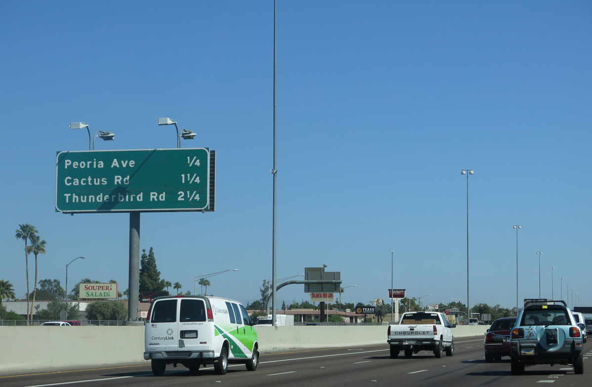
| Interstate 17 parallels Cave Creek north through Deer Valley to the ensuing exits with Cactus Road and Thunderbird Road. 04/05/13 |
|
| Peoria Avenue runs east through an area of industrial parks to 7th Avenue to North Mountain and west into Glendale across Arizona Canal. 04/05/13 |
|
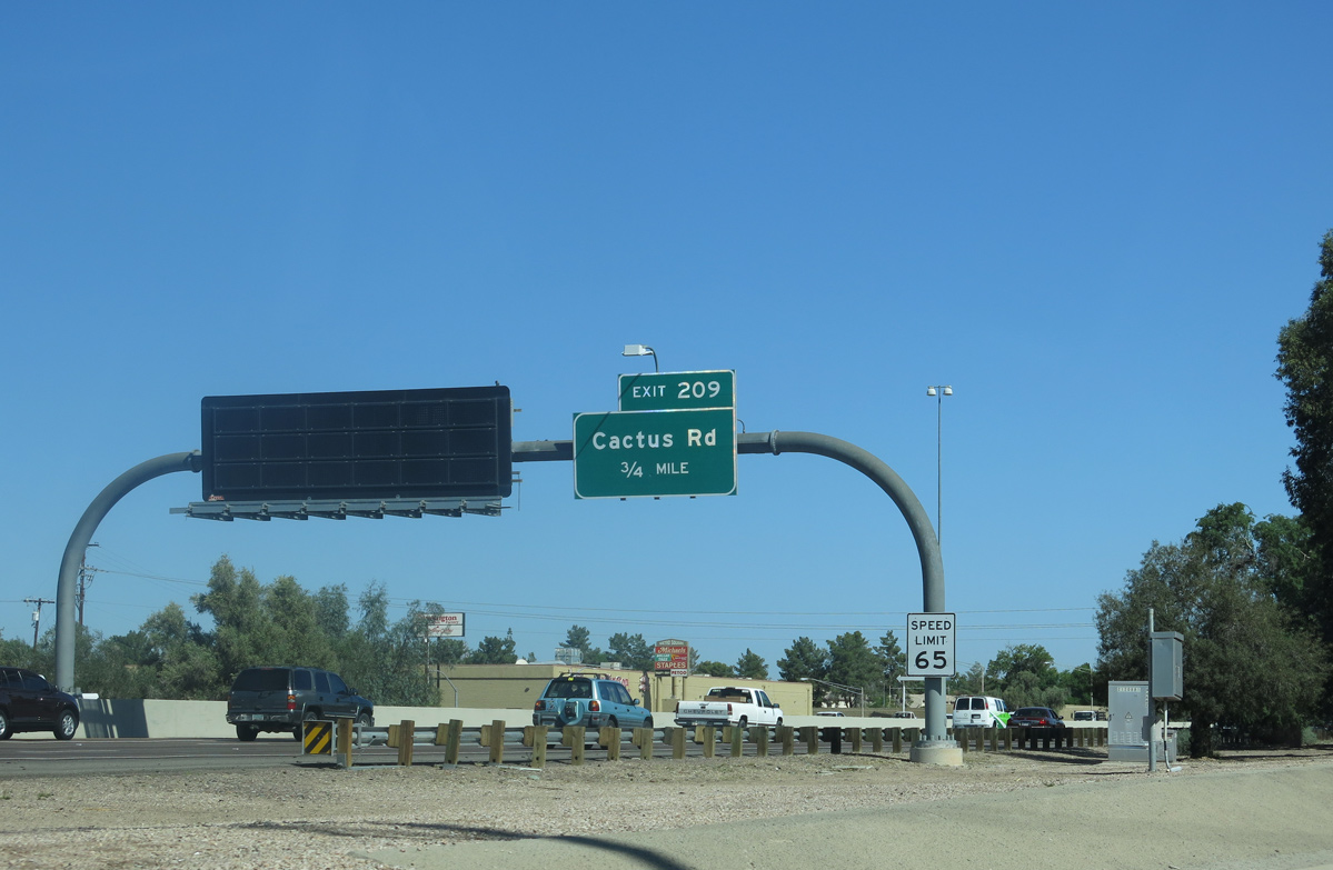
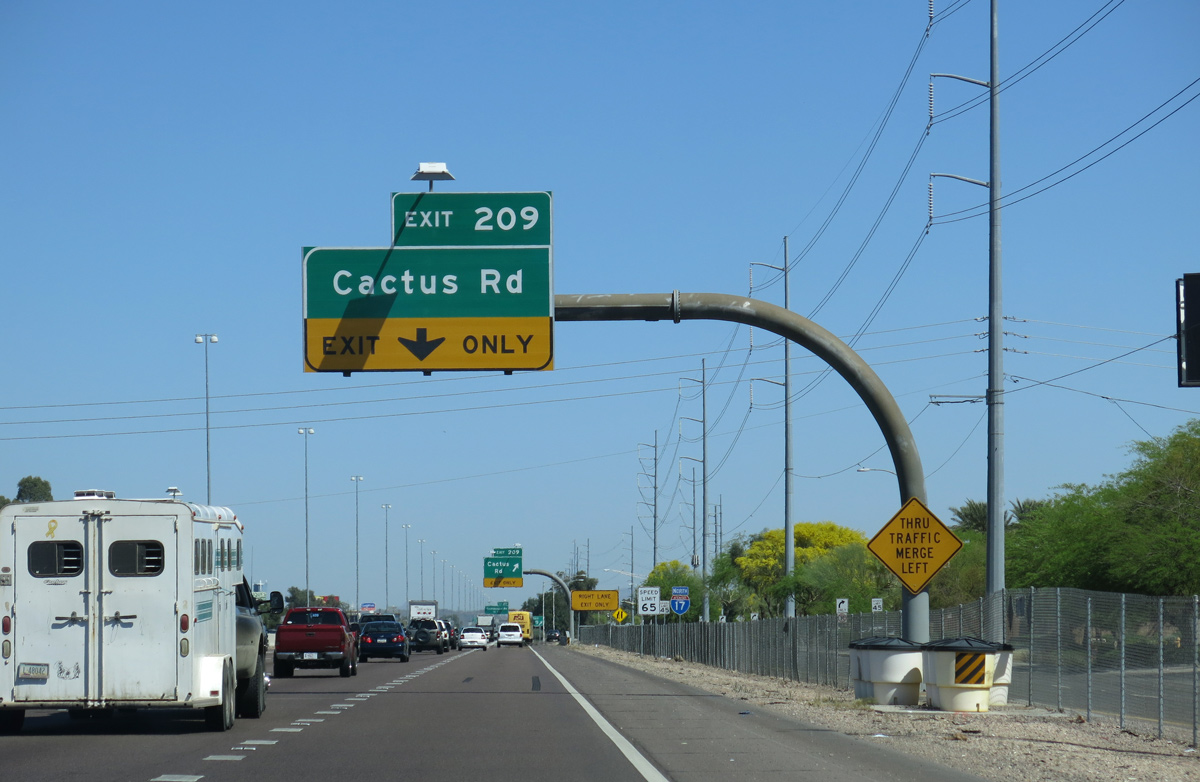
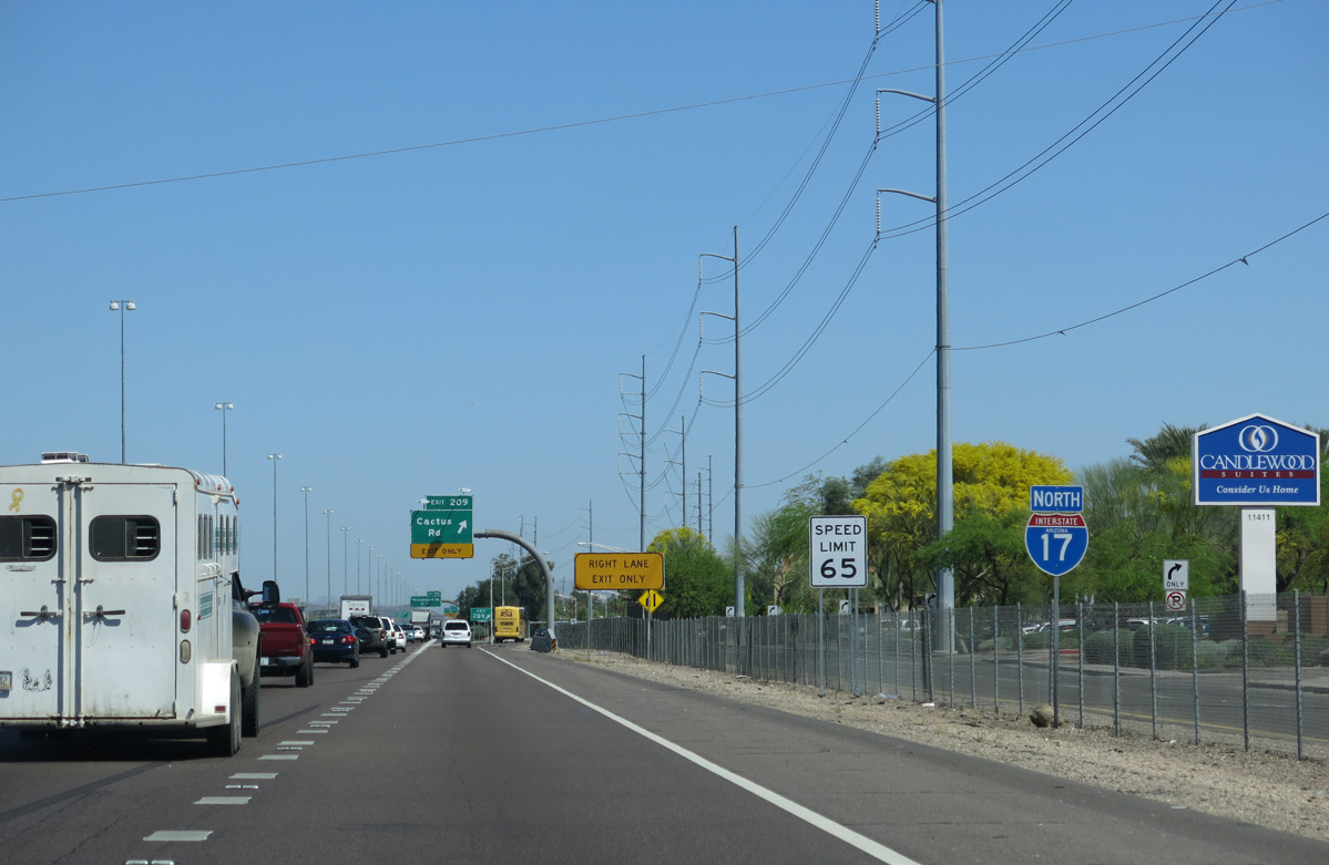
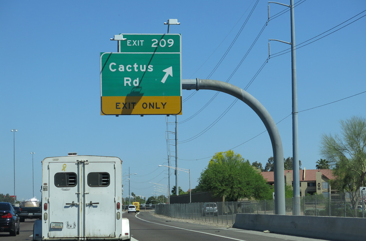
| A diamond interchange links I-17 (Black Canyon Freeway) with Cactus Road at forthcoming Exit 209. 04/05/13 |
|
| 2019 ADOT traffic counts along Interstate 17 between Peoria Avenue and Cactus Road topped out at 209,446 vpd. 04/05/13 |
|
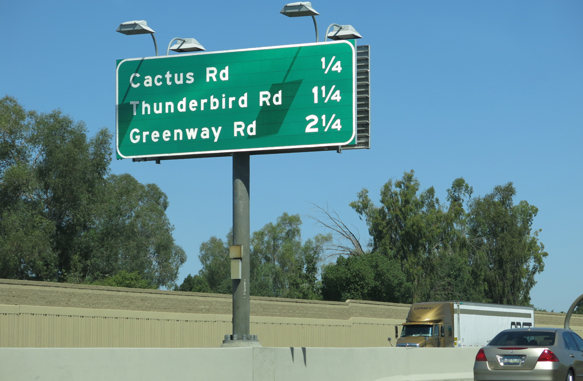
| Cactus Road leads one mile east to 19th Avenue by the Phoenix Mountains at Shaw Butte. 04/05/13 |
|
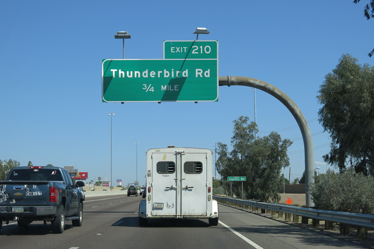
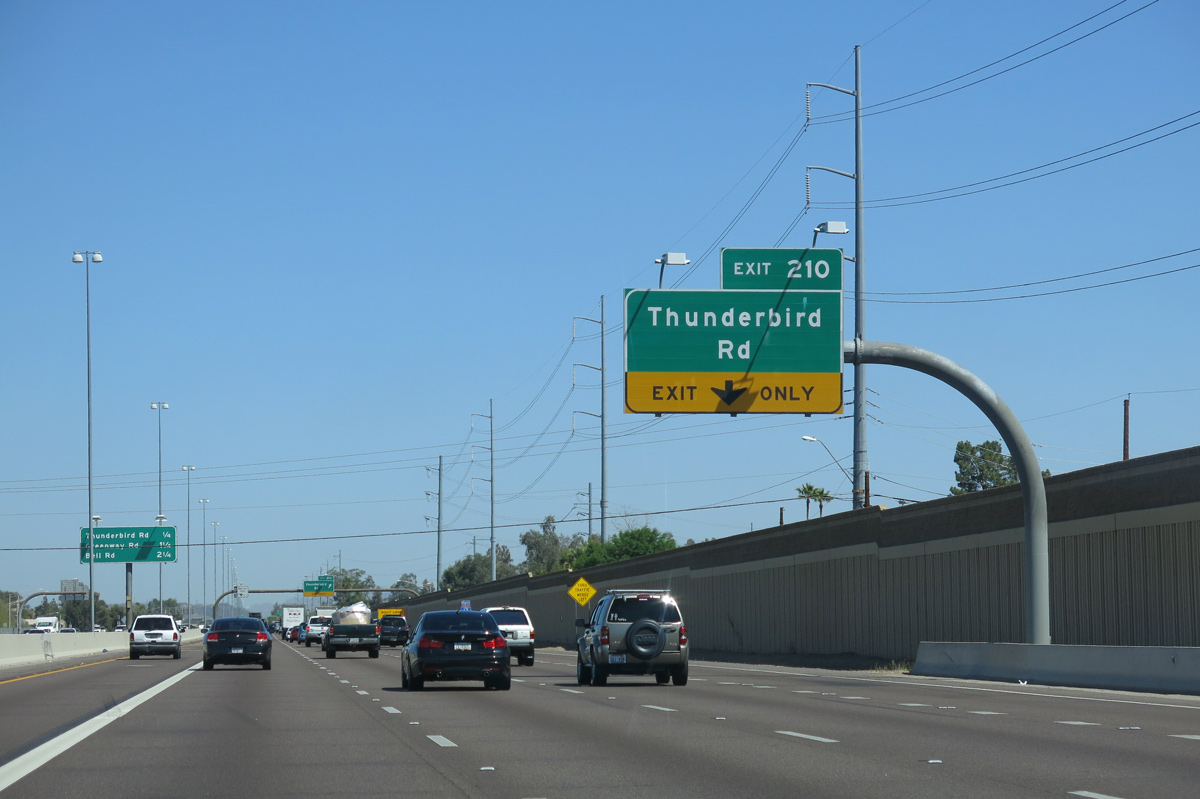
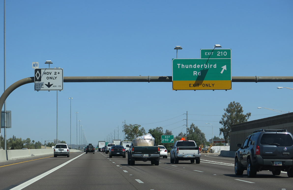
| Thunderbird Road meets Interstate 17 at Exit 210 west from the Moon Valley neighborhood in Phoenix. 04/05/13 |
|
| Loop ramps at the six-ramp parclo interchange built in 1965 joining I-17 with Thunderbird Road were eliminated during 2004/05 road work. 04/05/13 |
|
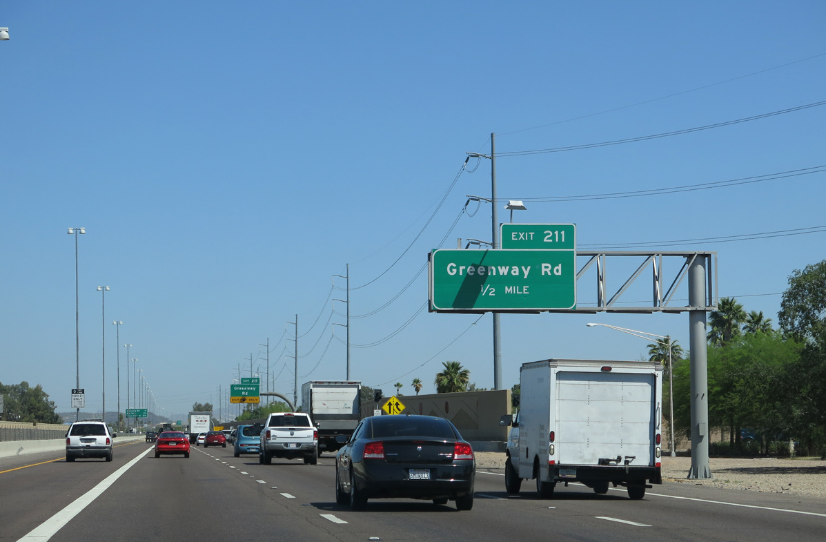
| Interstate 17 progresses from the North Mountain area of Phoenix into Deer Valley at Greenway Road. 04/05/13 |
|
| Thunderbird Road continues west from the diamond interchange at Exit 210 to the West Campus of Arizona State University and into Glendale at 51st Avenue. 04/05/13 |
|
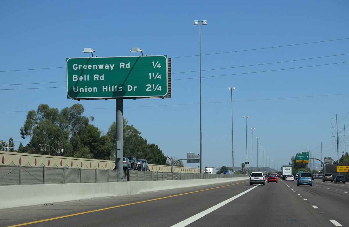
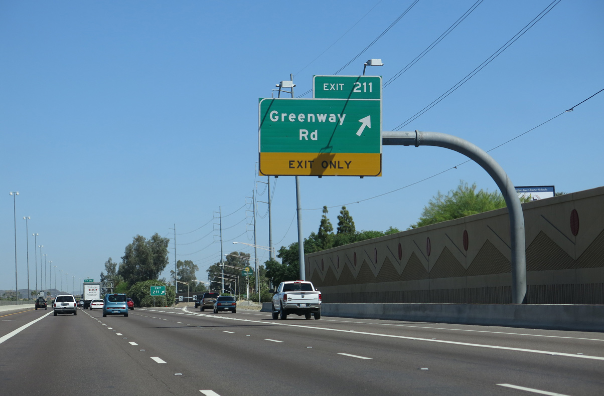
| Greenway Road meets the Black Canyon Freeway at a diamond interchange (Exit 211) adjacent to Northern Arizona University (NAU). 04/05/13 |
|
| Auxiliary lanes expand Interstate 17 to ten overall lanes between Thunderbird Road and Exit 211 for Greenway Road. 04/05/13, 04/06/13 |
|
| Greenway Road passes north of Moon Hill and Lookout Mountain east to Paradise Valley in northeast Phoenix. 04/06/13 |
Page Updated 04-20-2022.

 North
North  West
West