|
| Tyron Peak rises to the northwest of Interstate 26 beyond the first confirming marker in North Carolina. 05/26/21 |
|
| There are three interchanges along the 13.14 mile stretch through Polk County, with the first two for Columbus. 05/26/21 |
|
| White Oak Mountain appears along the northern horizon. 05/26/21 |
|
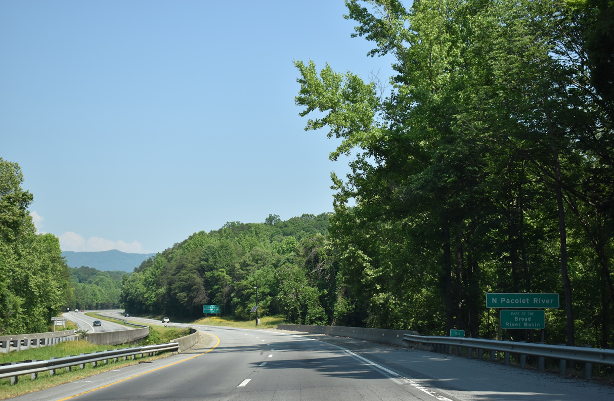
| Interstate 26 spans the North Pacolet River east of Burnt Chimney Corner. 05/26/21 |
|
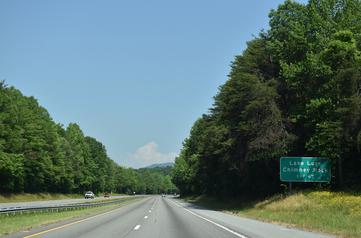
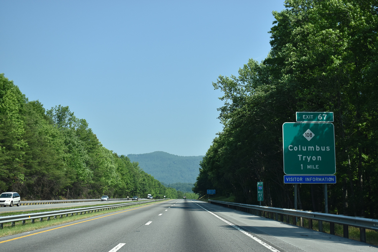
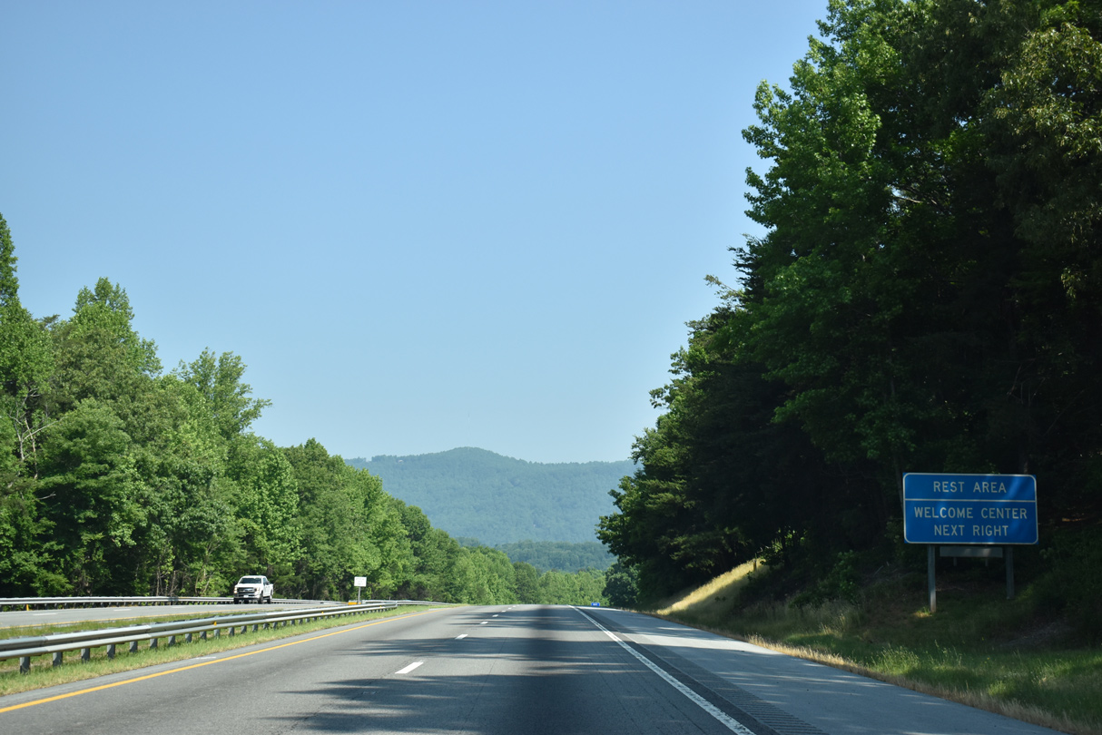
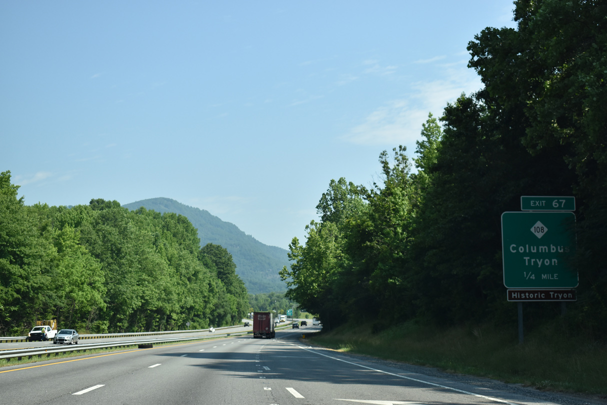
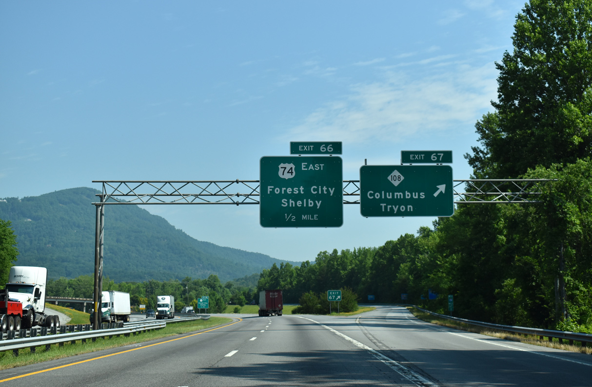
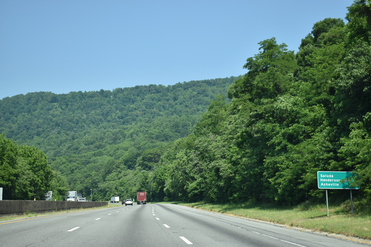
| NC 108 meets I-26 at Exit 67 in Columbus. The state route provides a cut off north to NC 9 at Mill Spring for Lake Lure and Chimney Rock. 05/26/21 |
|
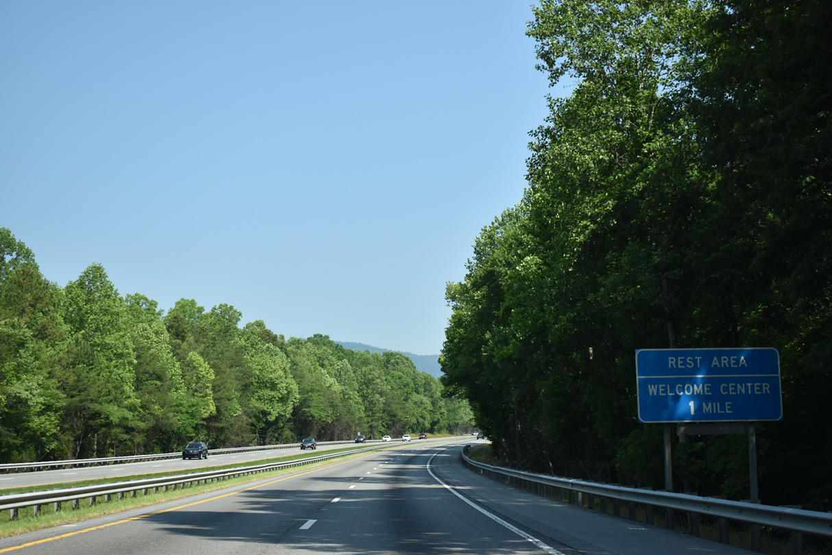
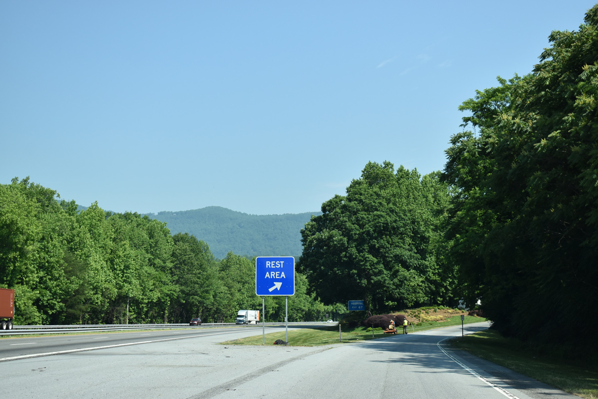
| The North Carolina Welcome Center precedes the town of Columbia along Interstate 26 west at mile marker 67.5 05/26/21 |
|
| A dogbone interchange (Exit 67) follows in one mile at NC 108 (Mills Street). 05/26/21 |
|
| The North Carolina Welcome Center opened in 1979 and was renovated in 2005.1 05/26/21 |
|
| NC 108 originates 3.45 miles to the southwest of Exit 67 from U.S. 176 in the town of Tryon. 05/26/21 |
|
| NC 108 (Mills Street) runs through Downtown Columbus northeast to Mill Spring. Overall NC 108 runs 22.09 miles between Tryon and U.S. 221/221A in Rutherfordton. 05/26/21 |
|
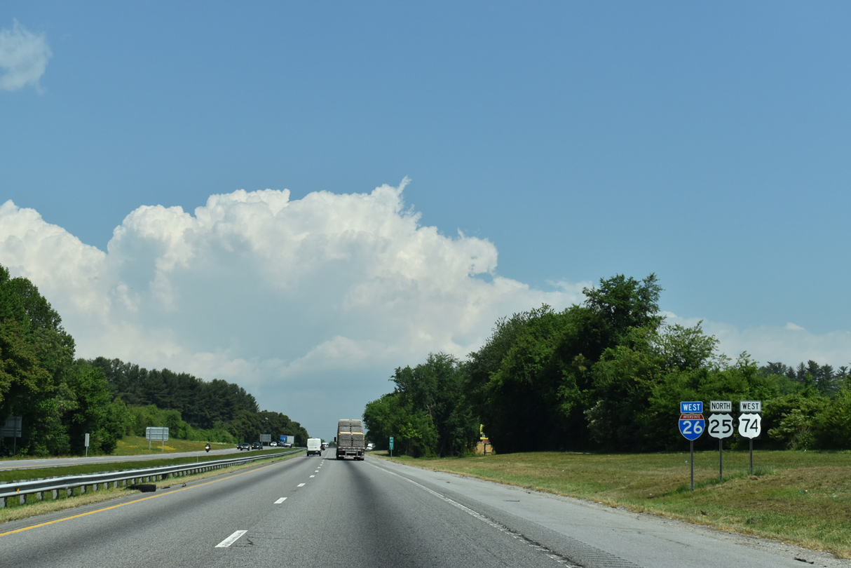
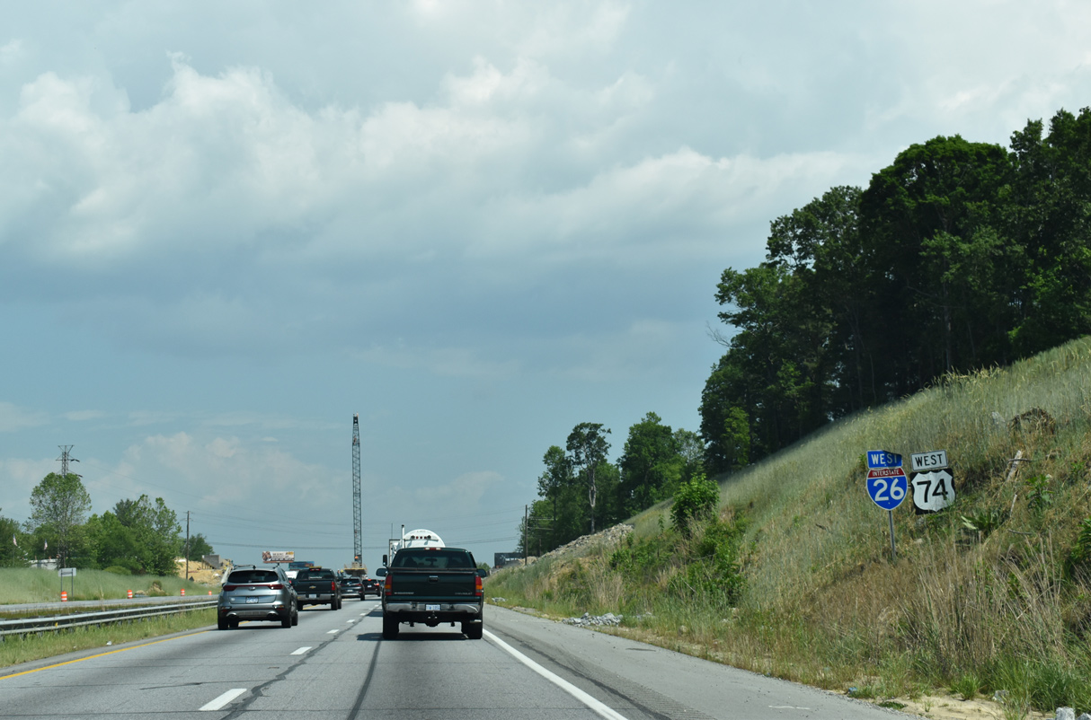
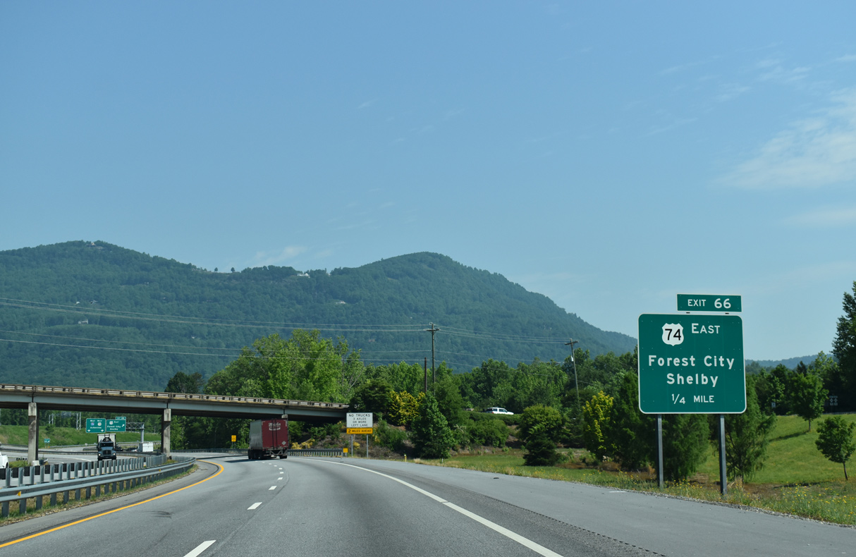
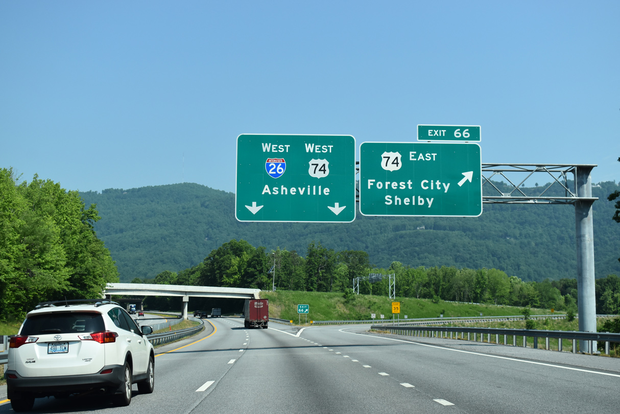
| Direct ramps at Exit 66 linking Interstate 26 with the U.S. 74 freeway east to Forest City and Shelby were constructed from 2017 to 2019. Previously a single ramp joined I-26 with NC 108 and U.S. 74. 05/26/21 |
|
| U.S. 74 travels 55 miles east from the directional T interchange (Exit 66) with I-26 to I-85 at Kings Mountain. 05/26/21 |
|
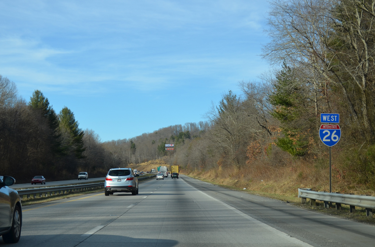
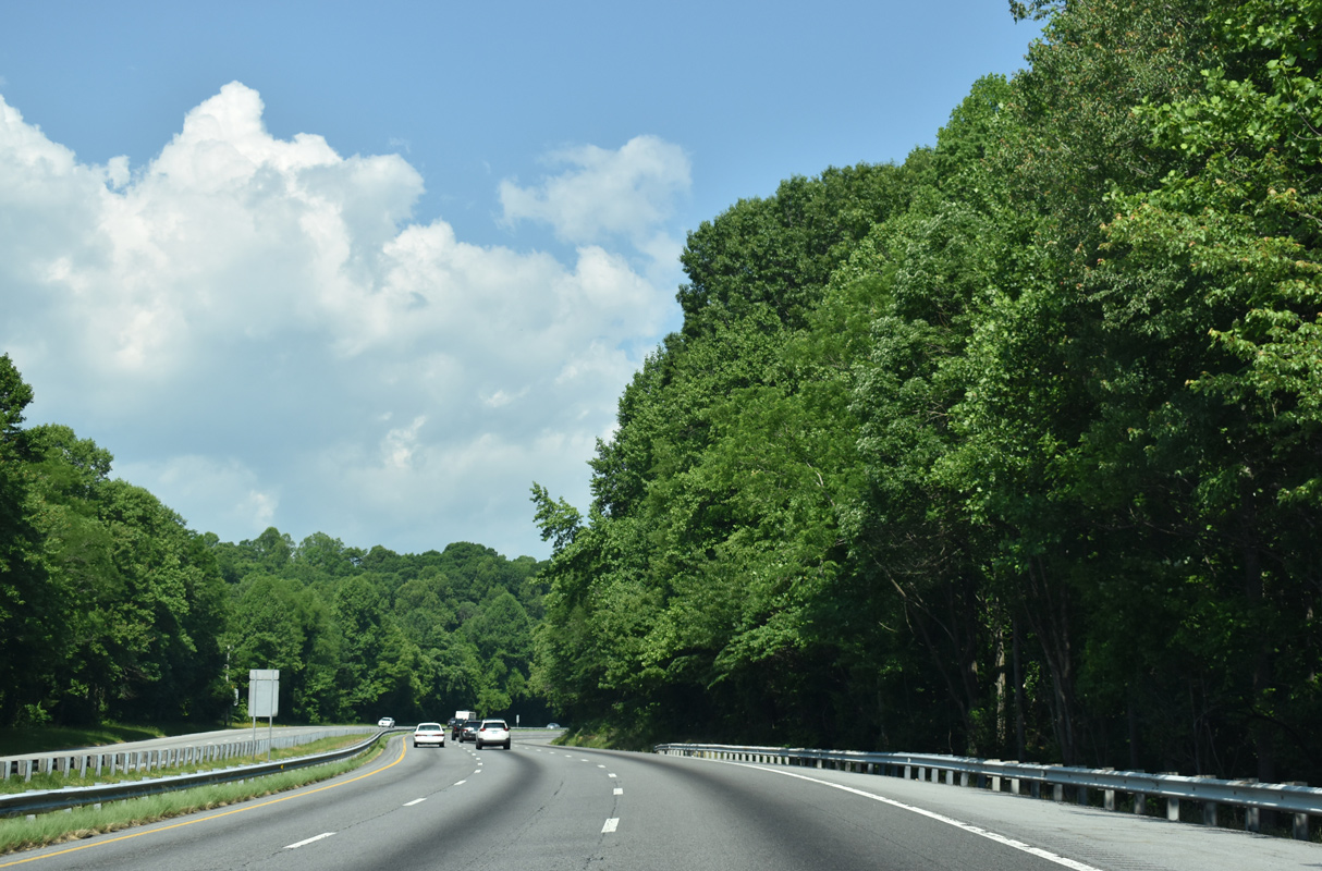
| Turning west from Columbus, Interstate 26 navigates through Howard Gap between Round Mountain and Miller Mountain on the ensuing stretch. 05/26/21 |
|
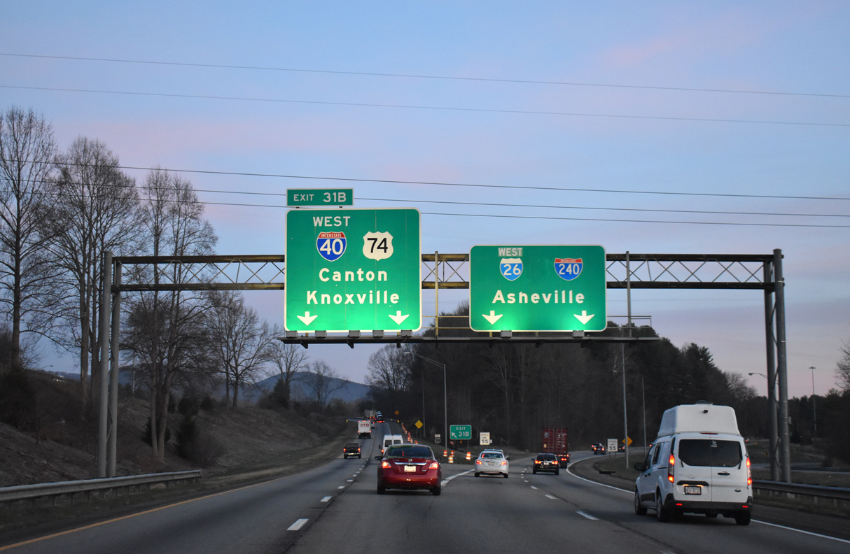
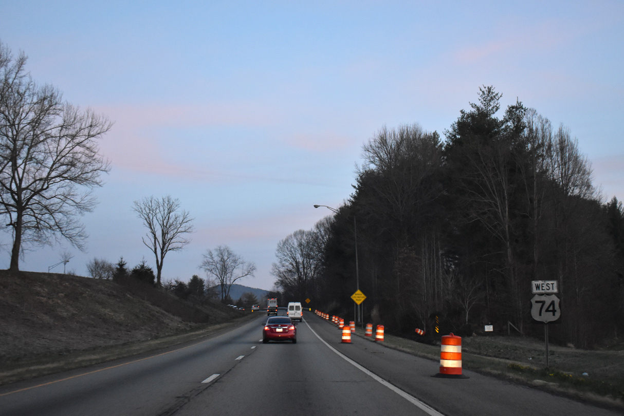
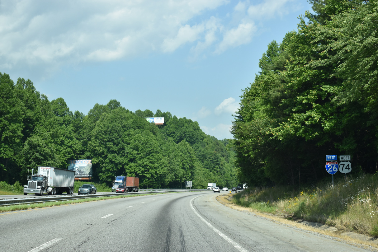
| U.S. 74 combines with Interstate 26 west from Columbus to I-40/240 at Asheville. 05/26/21 |
|
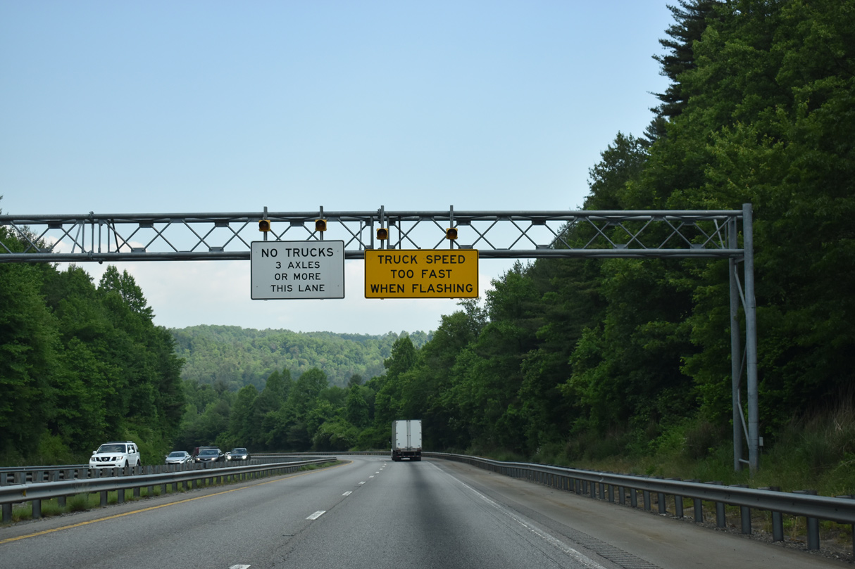
| A truck climbing lane opens along I-26/U.S. 74 westbound to Howard Gap. 05/26/21 |
|
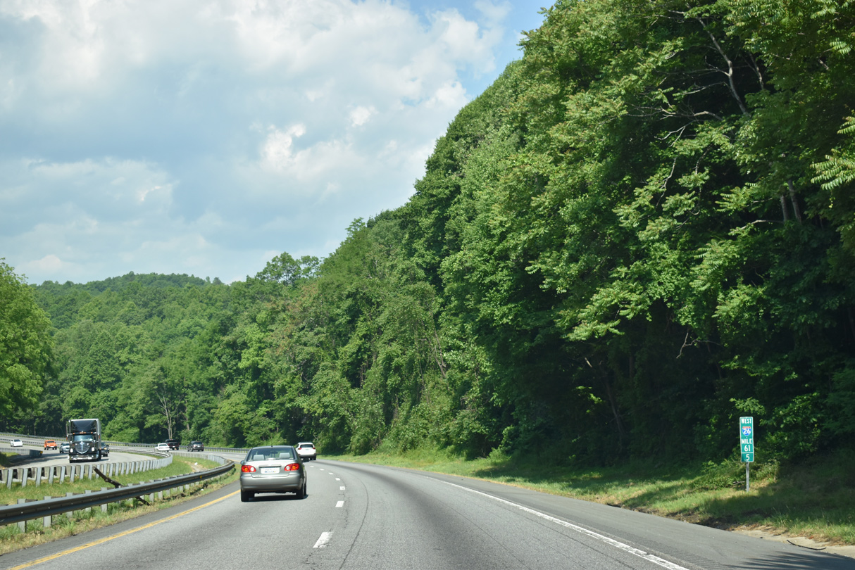
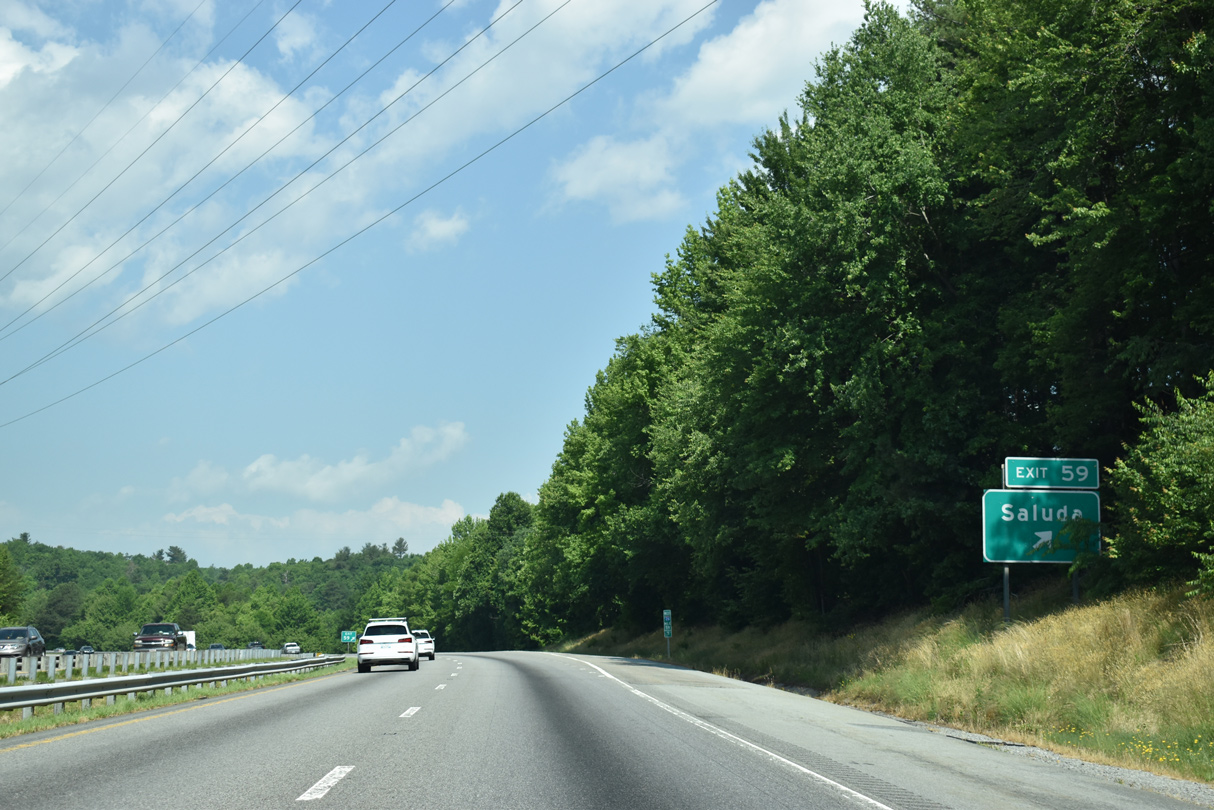
| Removed after 2012, the two mile guide sign for Exit 59 was previously posted along Interstate 26 west near milepost 61.5. 05/26/21 |
|
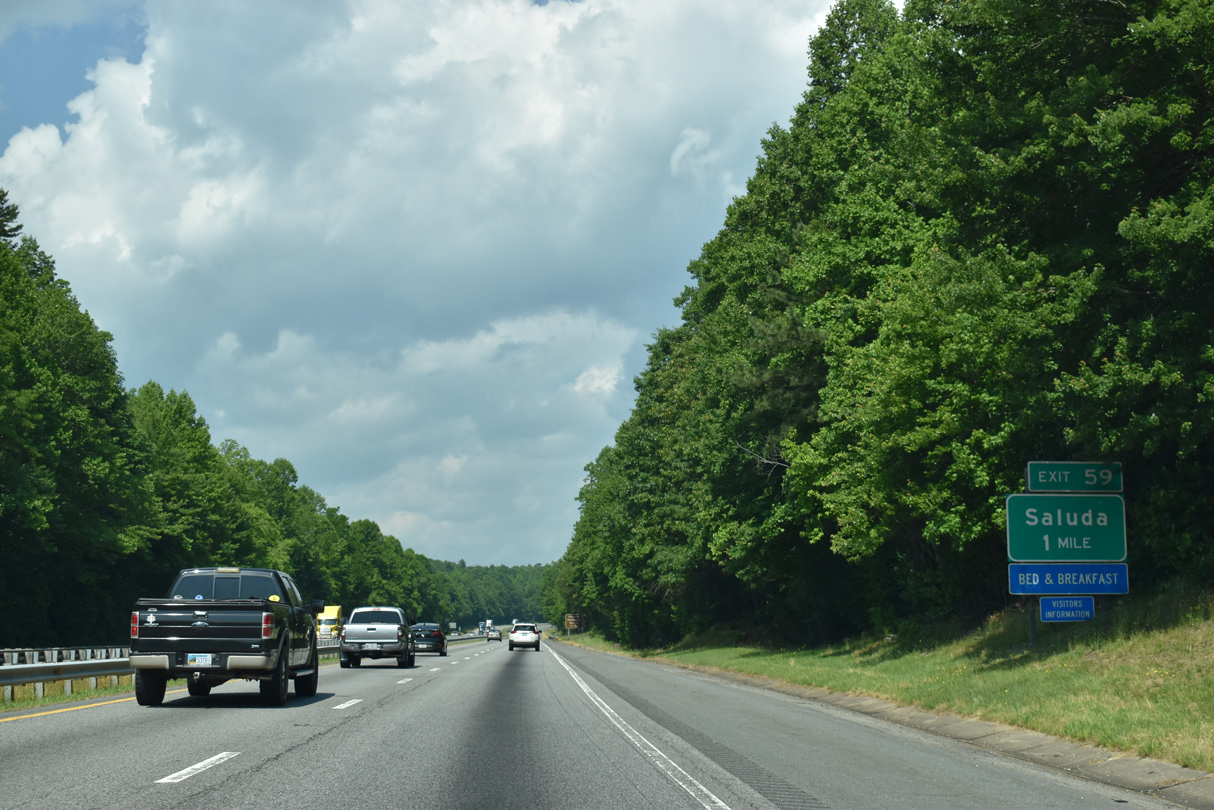
| Advancing west from Chestnut Mountain, I-26/U.S. 74 meet Ozone Drive (SR 1142) at Exit 59 for the city of Saluda. 05/26/21 |
|
| Ozone Drive (SR 1142) connects I-26/U.S. 74 with U.S. 176 (E Main Street), 1.16 miles south of Exit 59 in Saluda. 05/26/21 |
|
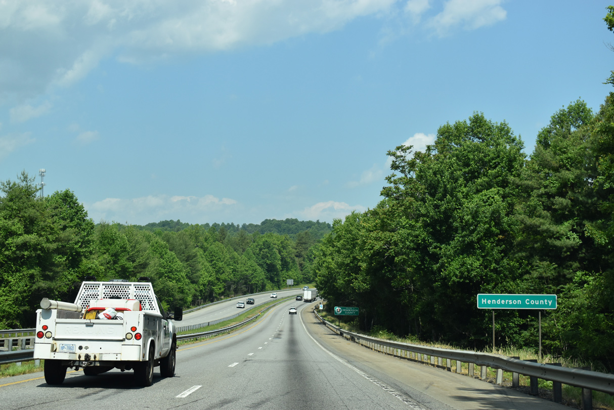
| Interstate 26 crosses the Henderson County line between the Puzzle Gulley Road (SR 1183) overpass and Camp Creek. 05/26/21 |
|
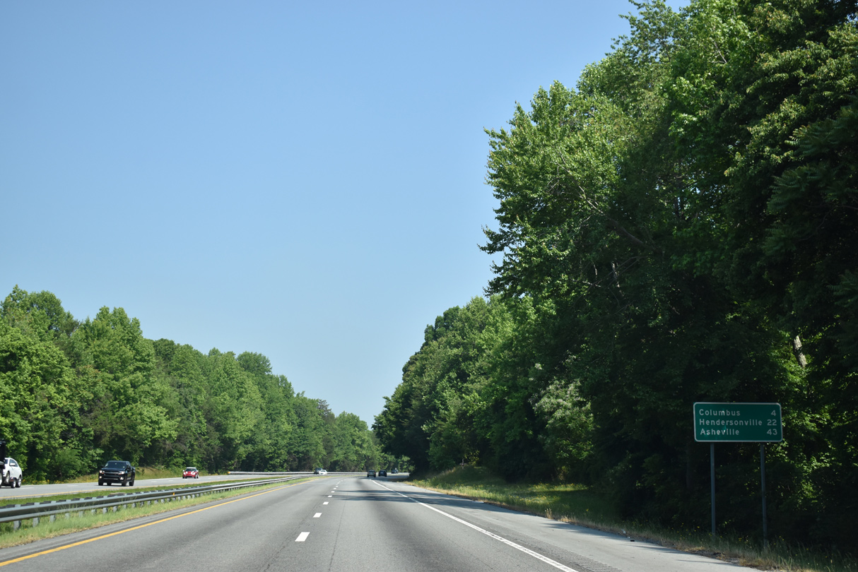
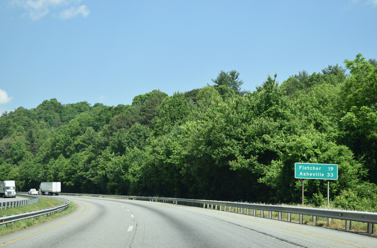
| Located 16 miles to the north, the town of Fletcher lies midway between Hendersonville and Asheville. Downtown Asheville is 31 miles away. 05/26/21 |
|
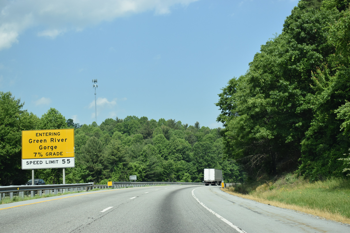
| Traversing the Saluda and Blue Ridge Mountains, I-26/U.S. 74 crosses the Green River valley with grades upward of 7%. 05/26/21 |
|
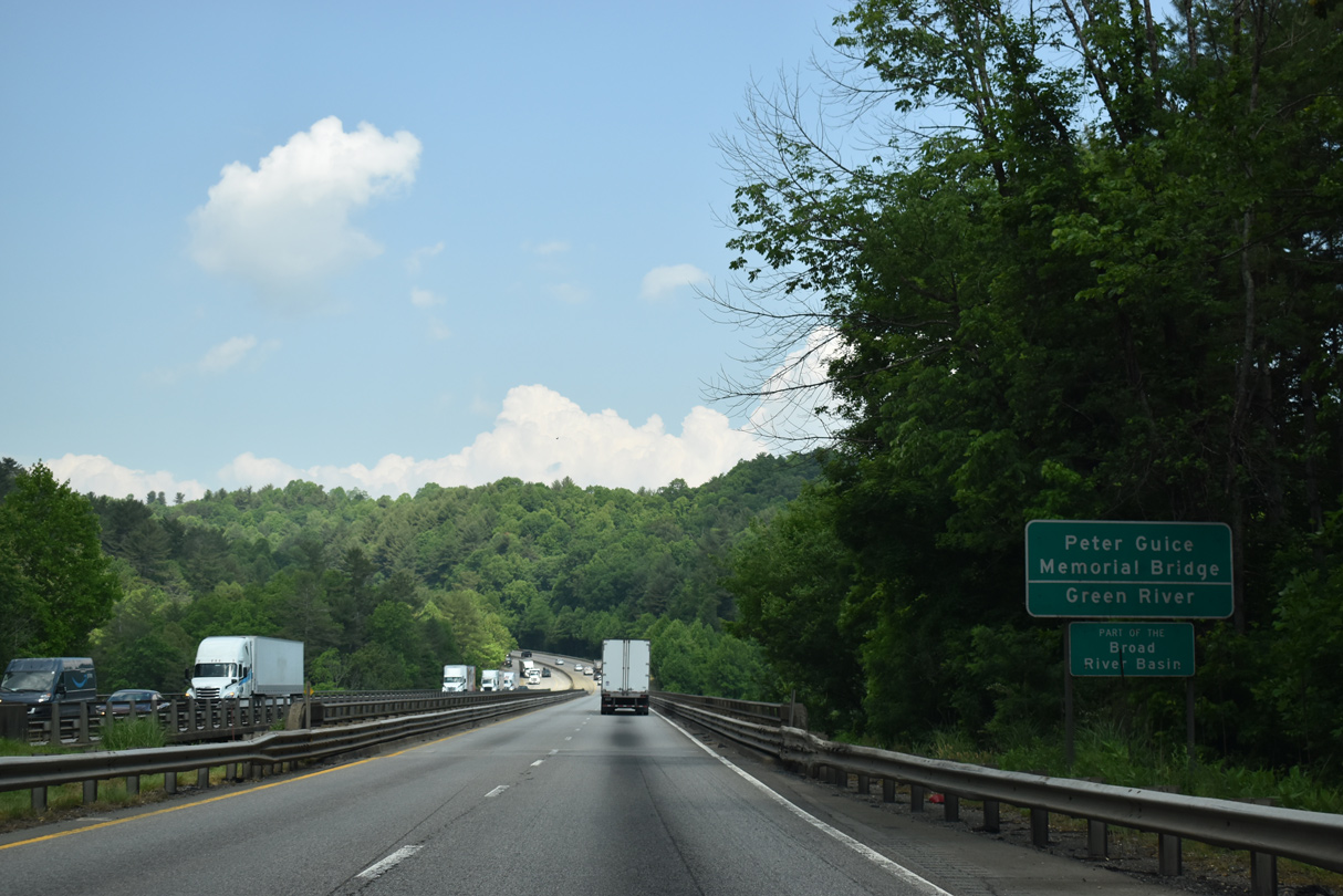
| I-26/U.S. 74 cross the Green River over the Peter Guice Memorial Bridge. 05/26/21 |
|
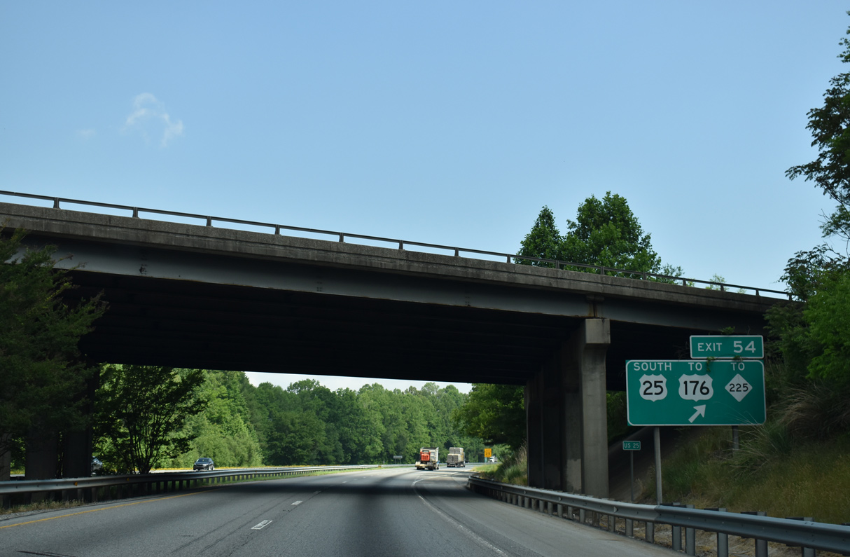
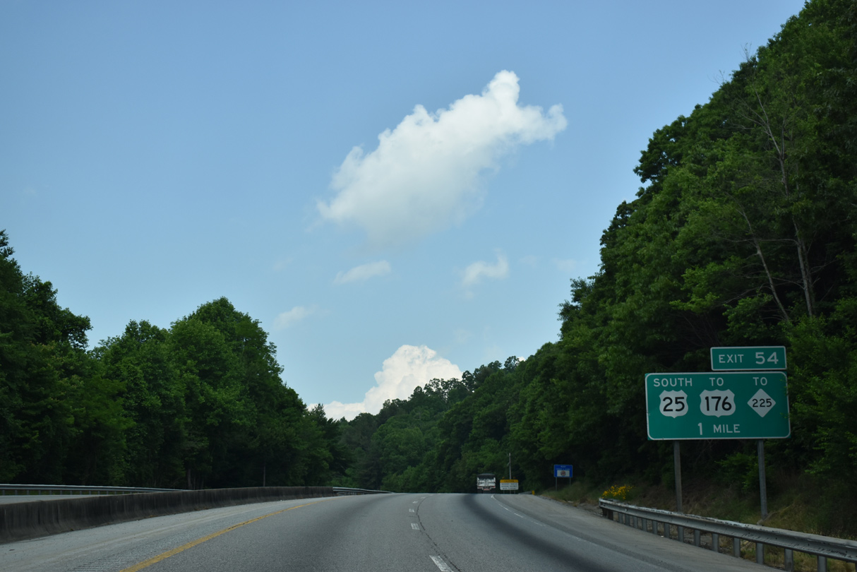
| I-26/U.S. 74 converge with U.S. 25 at Exit 54 beyond Dodging Hill. U.S. 25 replaced NC 225 along the freeway bypass around East Flat Rock in 2003. U.S. 25 Business was designated northward into Hendersonville. 05/26/21 |
|
| U.S. 25 south connects I-26/U.S. 74 with U.S. 176/25 Business (Spartanburg Highway) north into unincorporated East Flat Rock. 05/26/21 |
|
| U.S. 25 extends 8.96 miles south from the trumpet interchange (Exit 54) with I-26/U.S. 74 to the South Carolina line en route to Travelers Rest and Greenville. 05/26/21 |
|
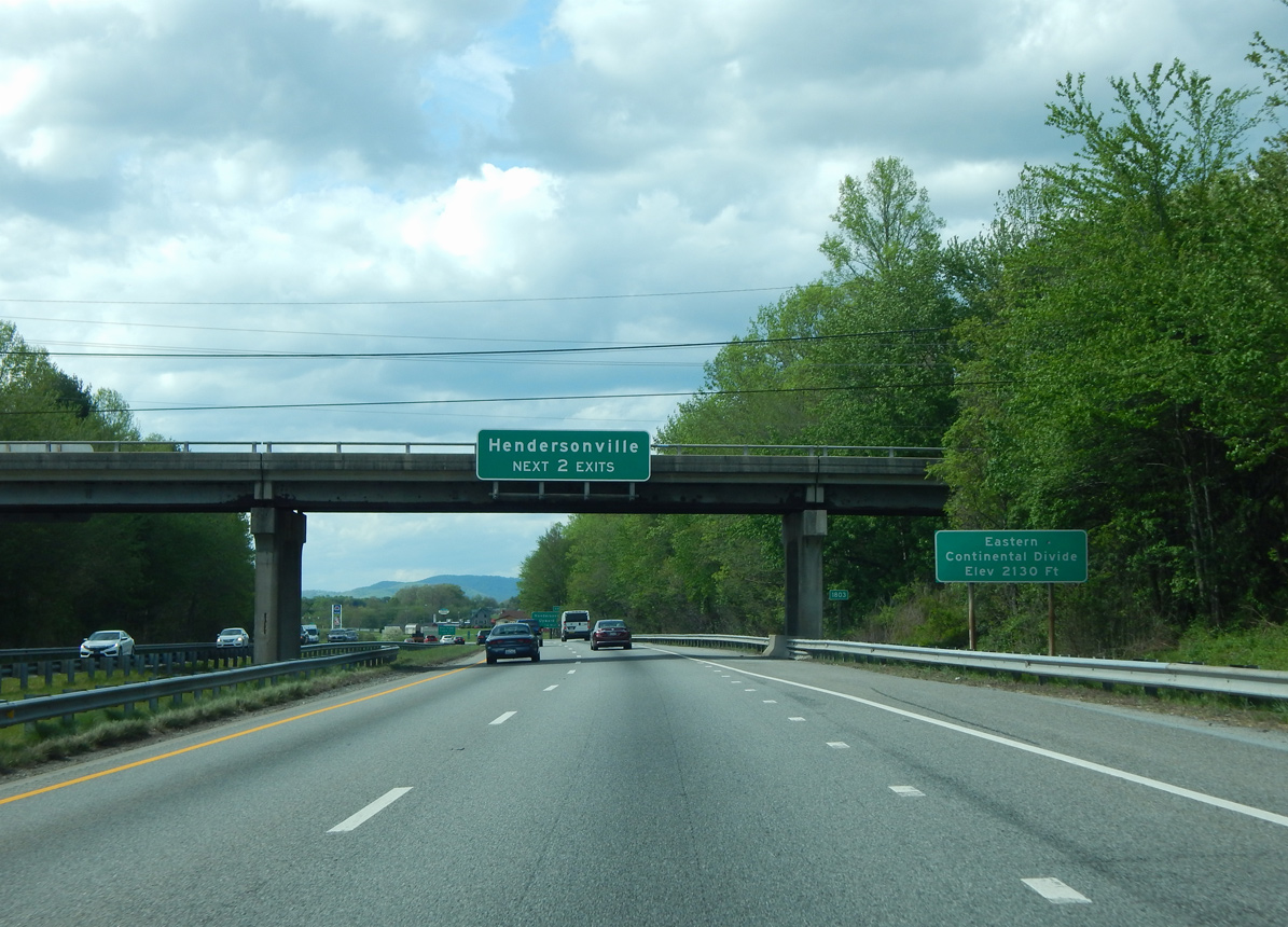
| U.S. 25 overlaps with I-26/U.S. 74 west from Exit 53 to 44. The freeway crosses the Eastern Continental Divide (Elevation 2,130 feet) at the Crest Road (SR 1803) overpass east of Flat Rock. 04/22/17 |
|
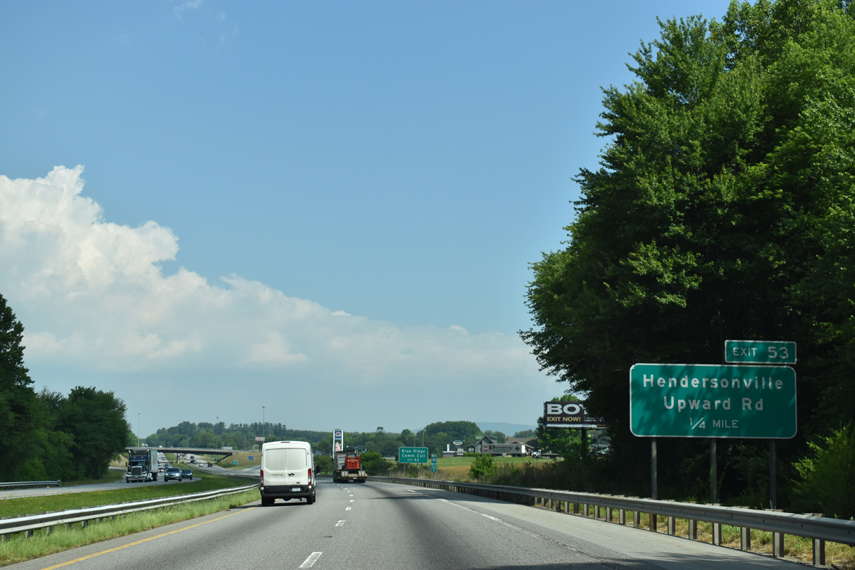
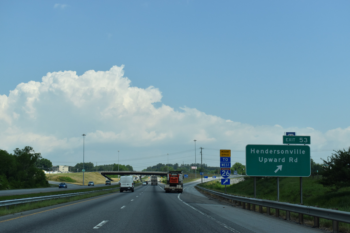
| Upward Road (SR 1783) meets I-26/U.S. 25-74 at the first of two Hendersonville area interchanges at Exit 53. 07/16/05 |
|
| Upward Road (SR 1783) is a four lane arterial linking I-26/U.S. 25-74 with U.S. 176/25 Business (Spartanburg Highway) 1.31 miles to the west. 05/26/21 |
|
| East from the diamond interchange (Exit 53) with Interstate 26, Upward Road (SR 1783) arcs 3.7 miles northeast to Upward and Dana. 05/26/21 |
|
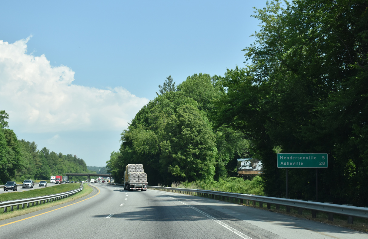
| Interstate 26 advances northwest through increasing development, passing by Blue Ridge Community College to Hendersonville. 05/26/21 |
|
| Asheville lies 25 miles to the northwest along Interstate 26. 05/26/21 |
|
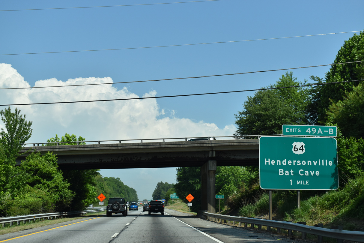
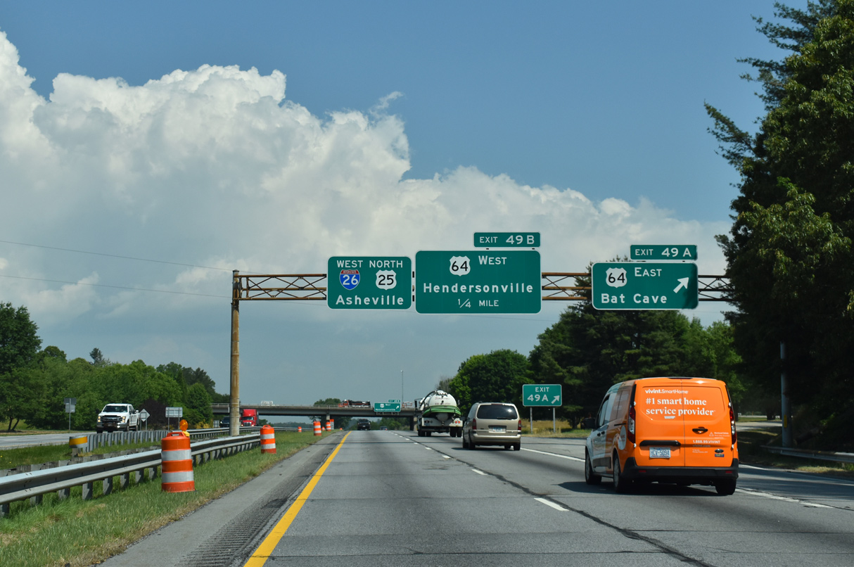
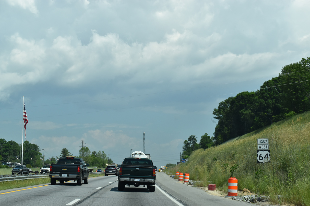
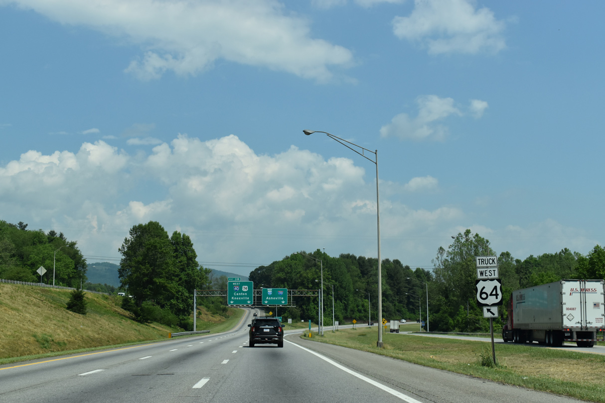
| U.S. 64 heads northeast from Downtown Hendersonville along Four Seasons Boulevard to I-26/U.S. 25-74 at Exit 49. 2019-24 widening of I-26 revamps the cloverleaf interchange with U.S. 64 into a six-ramp parclo. 05/26/21 |
|
| U.S. 64 overlaps with U.S. 74A east from Bat Cave to Chimney Rock and Lake Lure. 05/26/21 |
|
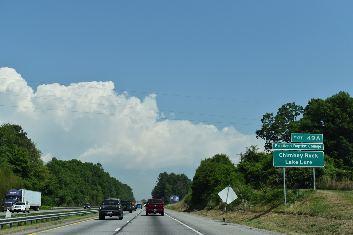
| Exit 49 A departs I-26 west for U.S. 64 (Chimney Rock Road) east 12.5 miles to U.S. 74A/NC 9 at Bat Cave. 05/26/21 |
|
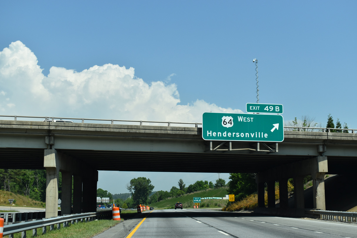
| Exit 49 B loops onto U.S. 64 (Four Seasons Boulevard) west across the city of Hendersonville. U.S. 64 continues from the Henderson County seat to Brevard, Murphy and Cleveland, Tennessee. 05/26/21 |
|
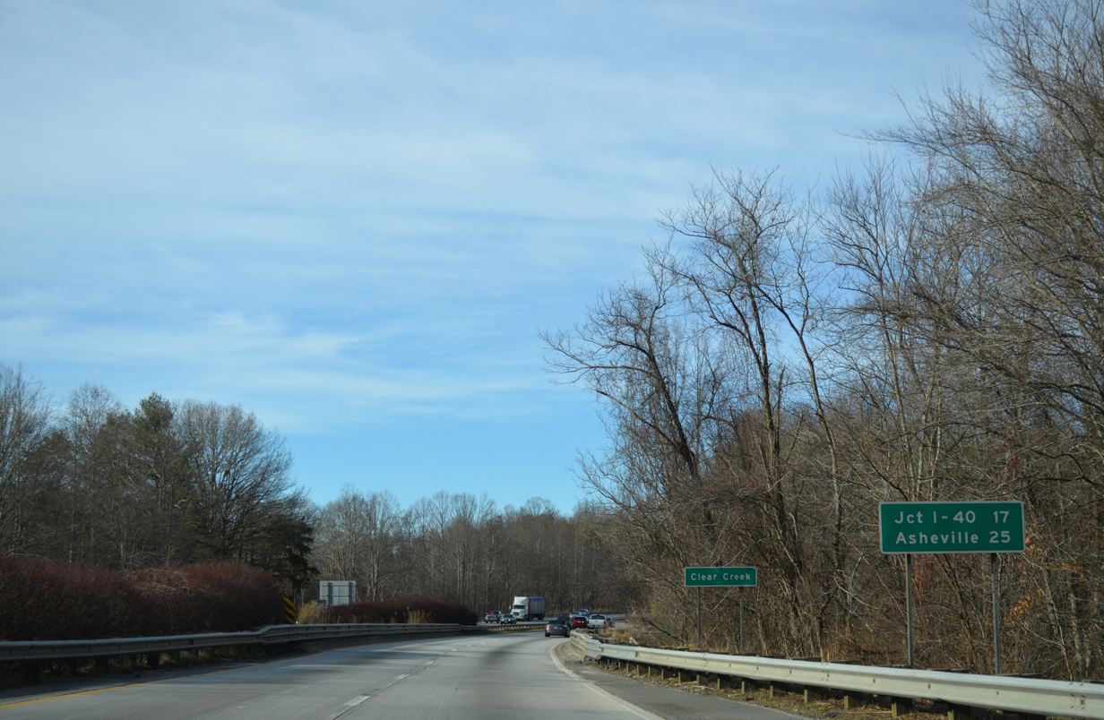
| North from U.S. 64, I-26/U.S. 25-74 navigate through an S-curve across Clear Creek. Beyond Hendersonville, I-26/U.S. 74 overlap another 17 miles to the exchange with I-40/240 in Asheville. 12/31/13 |
|
| A new overpass was constructed for Clear Creek Road (SR 1503) to accommodate six lane expansion of the freeway. 05/26/21 |
|
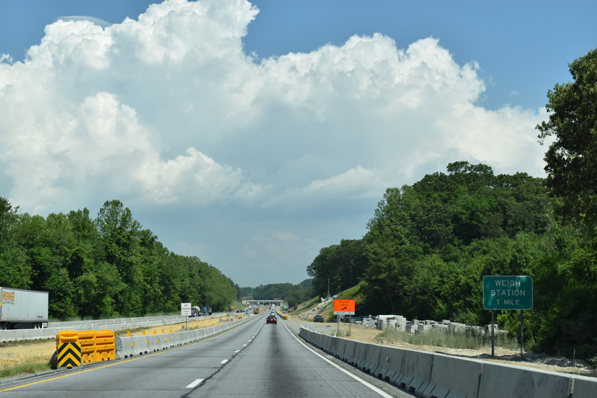
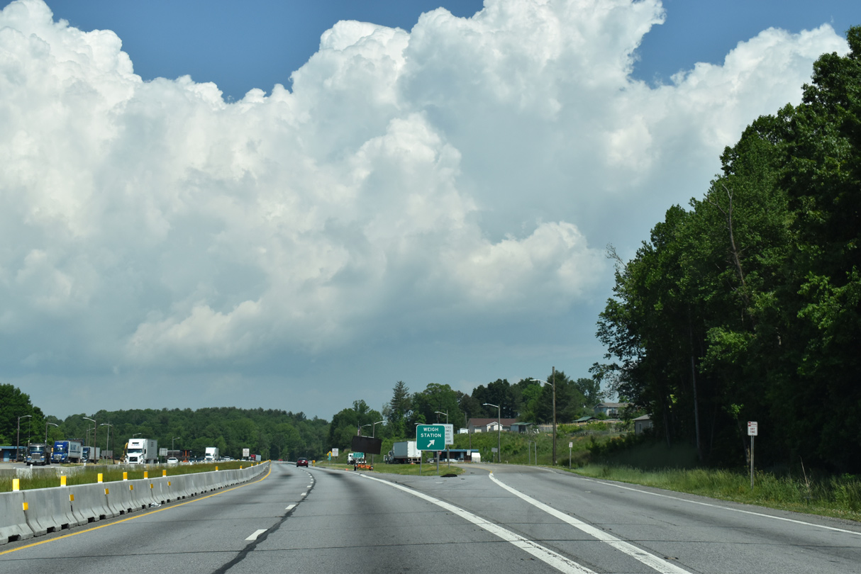
| Weigh stations line both sides of Interstate 26 beyond the Brookside Camp Road (SR 1528) overpass near Mountain Home. 05/26/21 |
|
| Interstate 26 shifts west of Byers Mountain toward the unincorporated community of Naples. 12/31/13 |
|
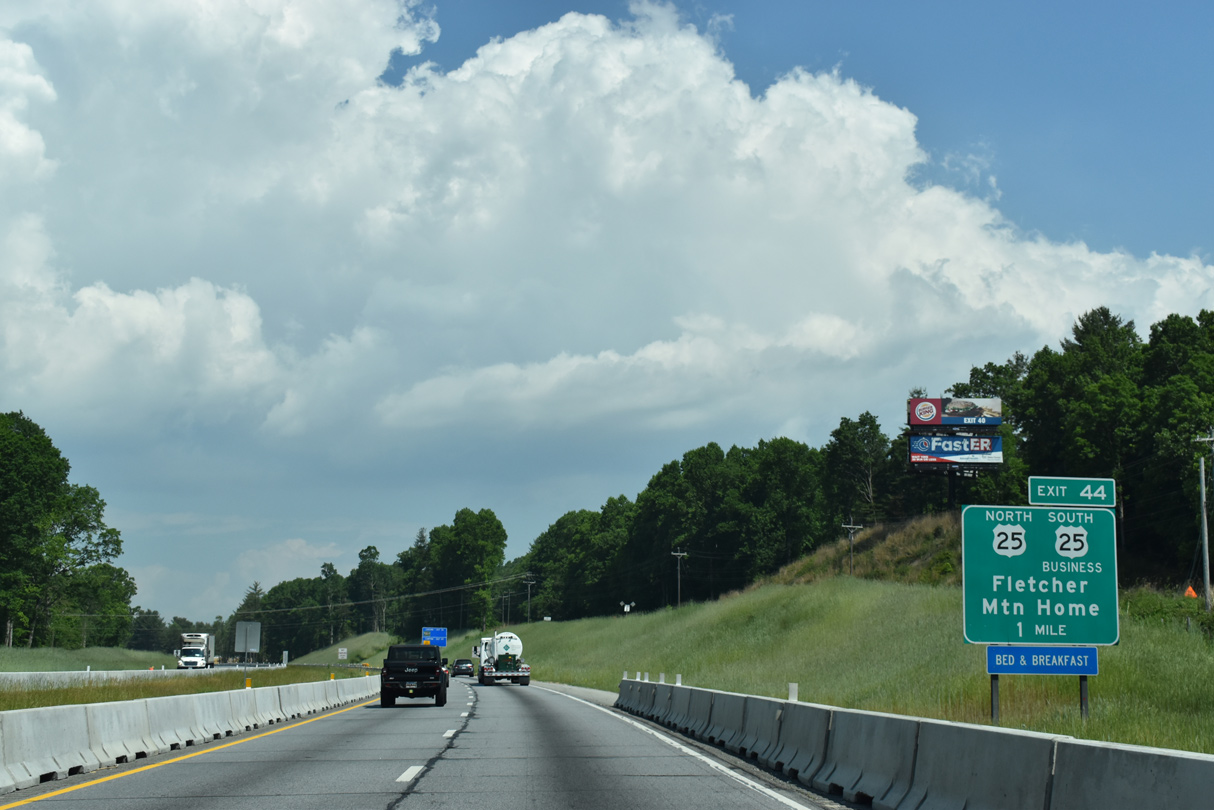
| U.S. 25 splits with I-26/U.S. 74 west at Exit 44. U.S. 25 (Hendersonville Road) follows a five lane boulevard northward through the town of Fletcher, Arden and Skyland in south Asheville. 05/26/21 |
|
| I-26 widening converts the diamond interchange at Exit 44 into a DDI. U.S. 25 Business (Asheville Highway) runs south to Mountain Home and Naples. U.S. 25 meets I-26 again at Downtown Asheville. 05/26/21 |
|
| Confirming markers posted ahead of the Butler Bridge Road (SR 1345) overpass near Brickton. 05/26/21 |
|
| Downtown Asheville lies five miles beyond the original west end of Interstate 26 at I-40. 05/26/21 |
|
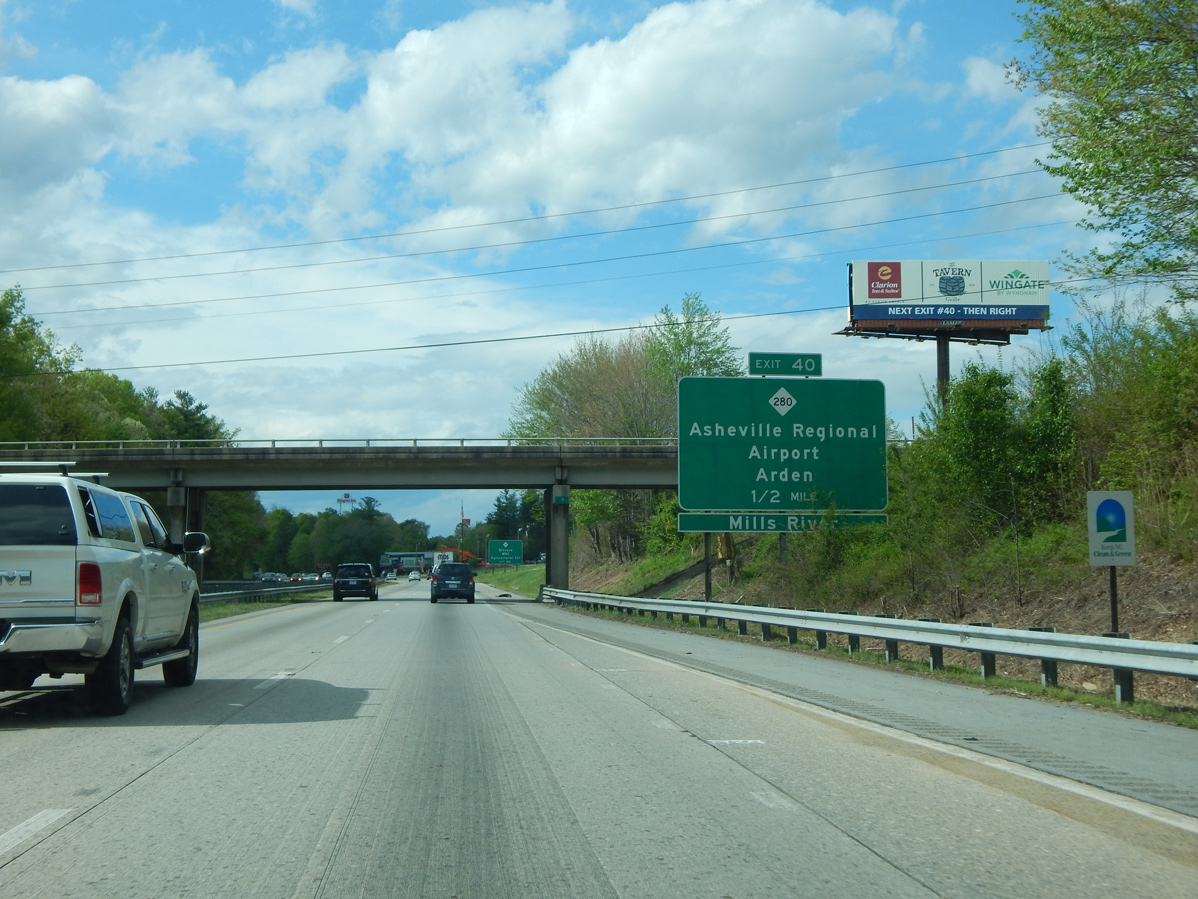
| $8.8 million in construction from May 2014 to November 2016 reconfigured the diamond interchange (Exit 40) with NC 280 (New Airport Road) into a DDI. The new traffic pattern along NC 280 debuted to motorists the week of November 23, 2015.2 04/22/17 |
|
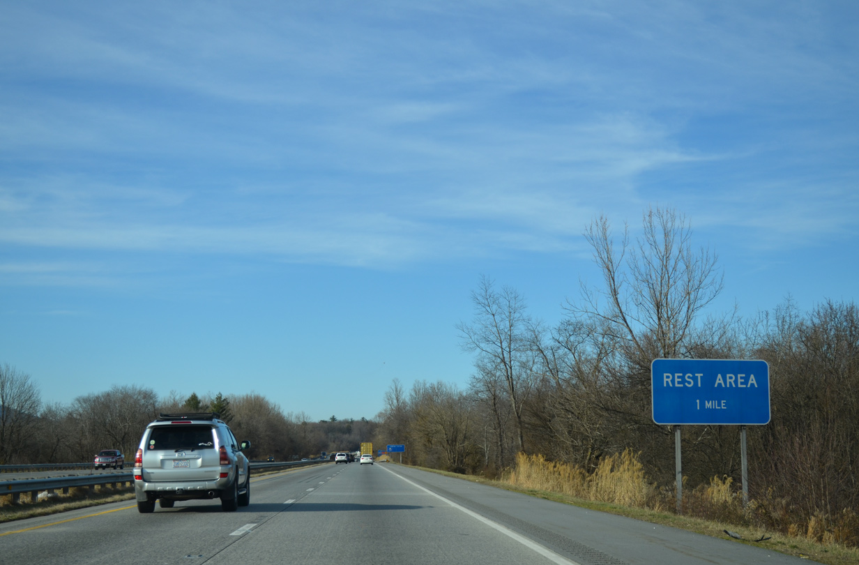
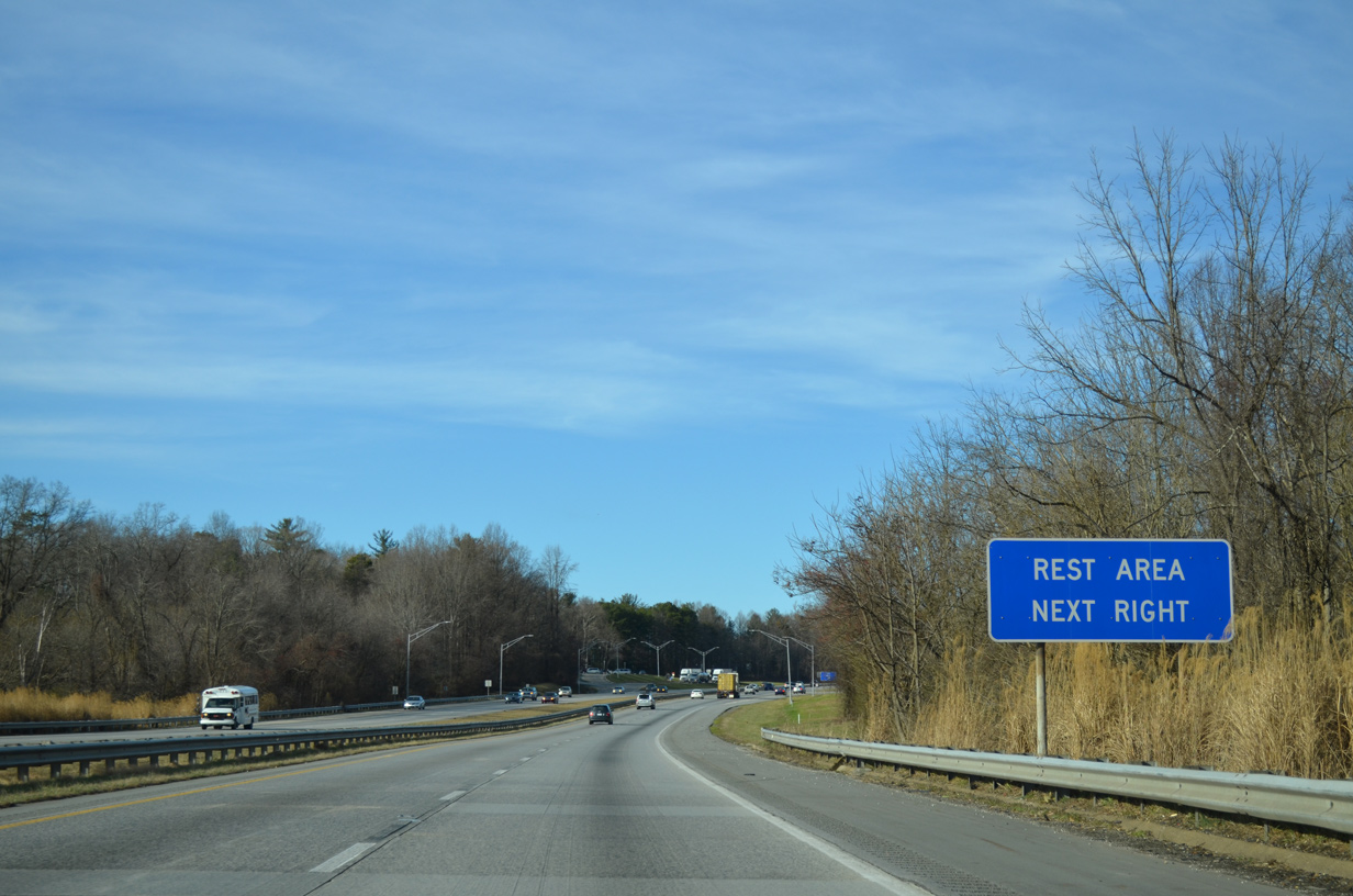
| A set of rest areas line both sides of I-26/U.S. 74 at the Buncombe County line between Cane Creek and the Fanning Bridge Road (SR 3539) overpass. 12/31/13 |
|
| The 2019-24 I-26 Widening Project included replacing the rest areas at Fletcher with new buildings, expanded parking and landscaping improvements. The existing facilities were demolished in April 2020.3 12/31/13 |
|
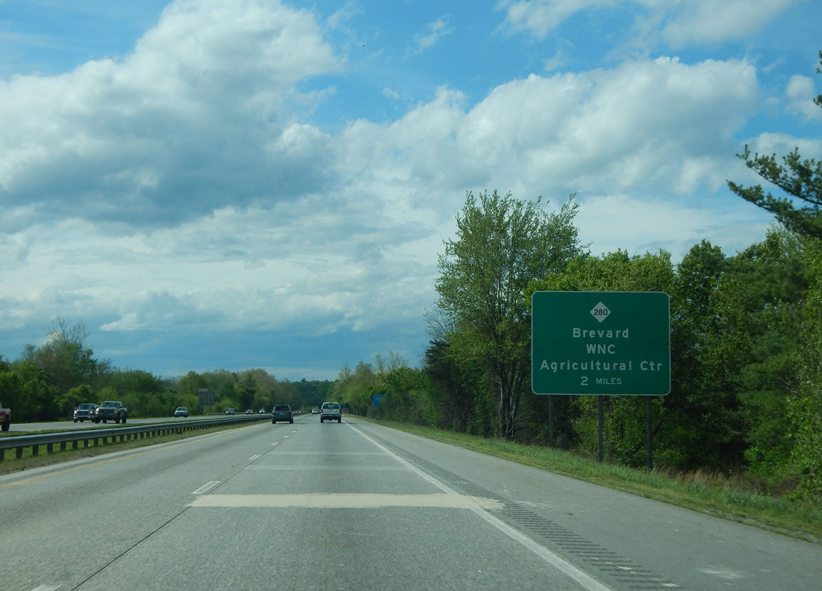
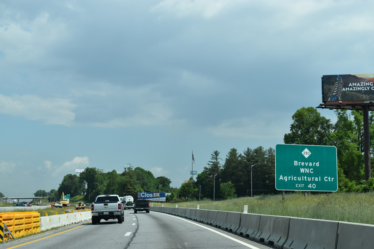
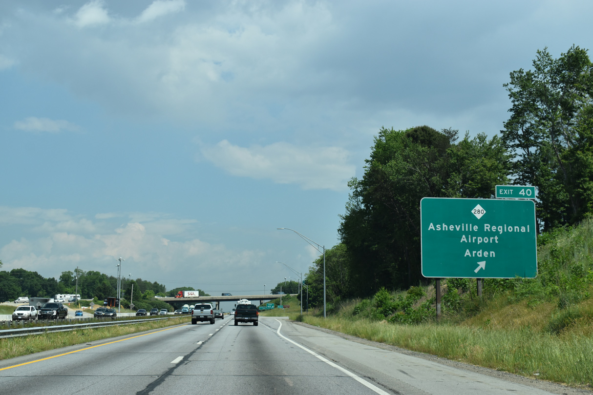
| NC 280 constitutes a 19.83 mile route southwest to U.S. 64/276 at the Transylvania County seat of Brevard and northeast at U.S. 25/25A in Arden. 04/22/17 |
|
| NC 280 (New Airport Road) converges with I-26/U.S. 74 north alongside Asheville Regional Airport (AVL) and the WNC Agricultural Center. 05/26/21 |
|
| Exit 40 leaves I-26/U.S. 74 westbound for NC 280 (New Airport Road) south to NC 191 (Old Haywood Road) at Mill River and north to U.S. 25A (Sweeten Creek Road) to Royal Pines. 05/26/21 |
|
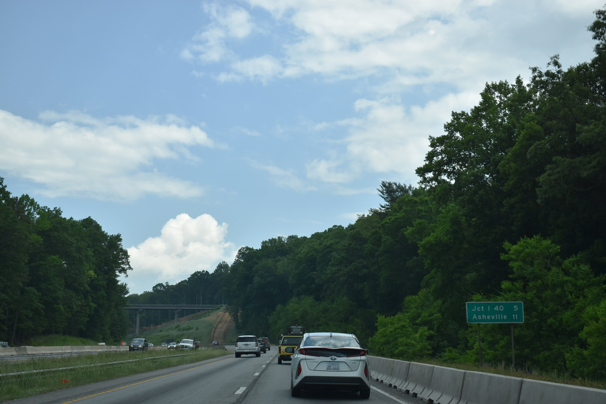
| Passing Southridge Shopping Center, I-26/U.S. 74 west progress toward the French Broad River and Ducker Mountain. 05/26/21 |
|
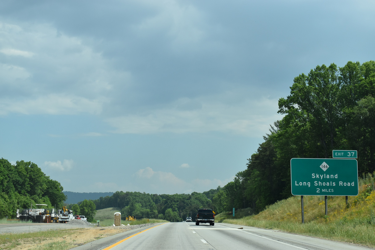
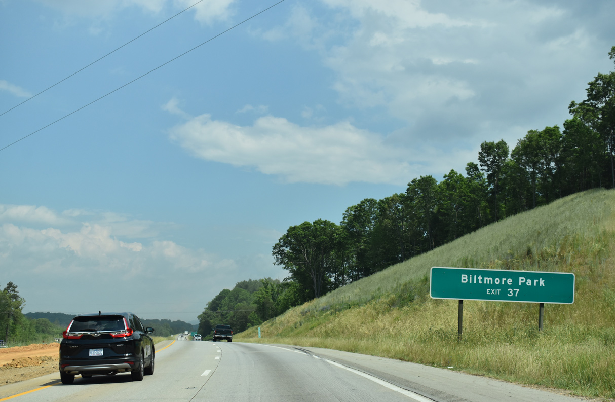
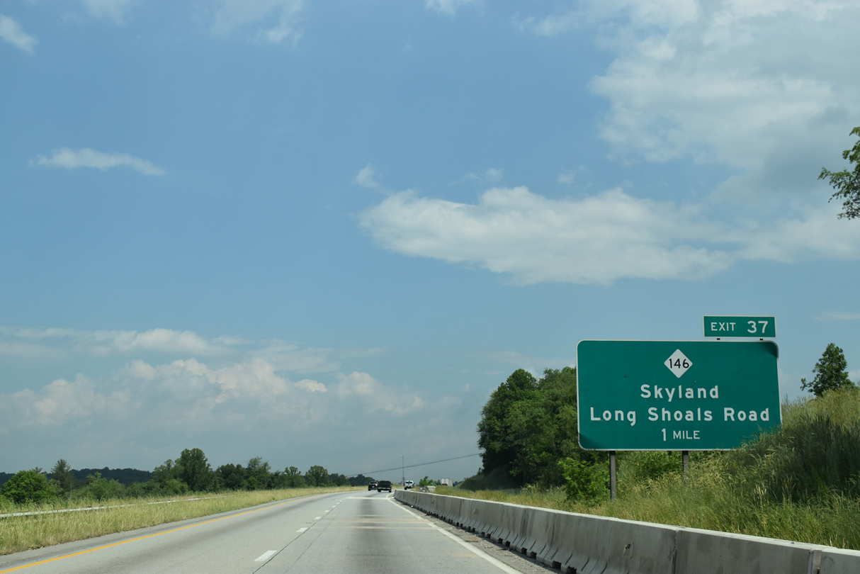
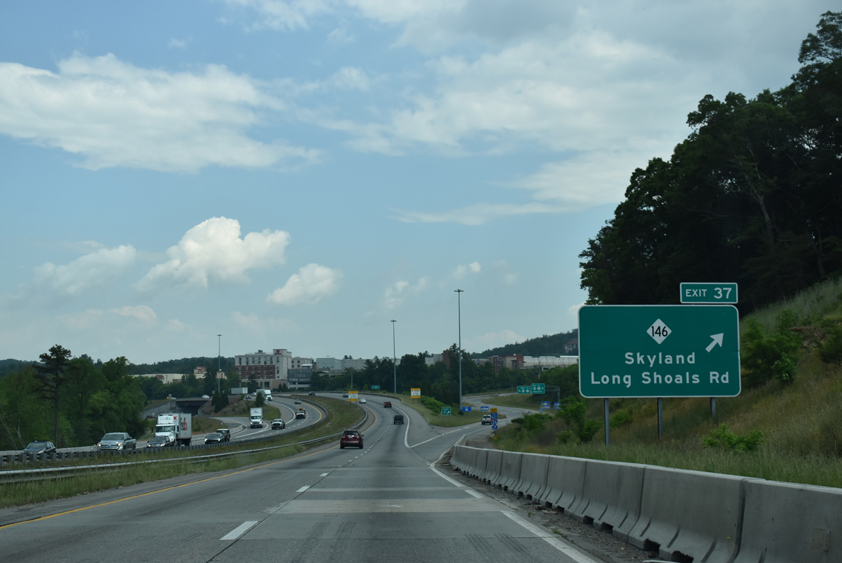
| NC 146 (Long Shoals Road) meets I-26/U.S. 74 at Exit 37, midway between West Haven and Skyland in south Asheville. 05/26/21 |
|
| The Biltmore Park development spreads to the northeast of the exchange joining I-26/U.S. 74 and NC 146. 05/26/21 |
|
| The SPUI (Exit 37) with NC 146 lies adjacent to Long Shoals on the French Broad River. NC 146 replaced the alignment NC 280 took prior to 1991 between NC 191 and Skyland.4 05/26/21 |
|
| NC 146 (Long Shoals Road) measures just 3.48 miles between NC 191 (Brevard Road) and U.S. 25 (Hendersonville Road). Construction in 2010 replaced the diamond interchange at Exit 37 with a SPUI and the adjacent bridge for NC 146 across the French Shoals River with a six lane span. 05/26/21 |
|
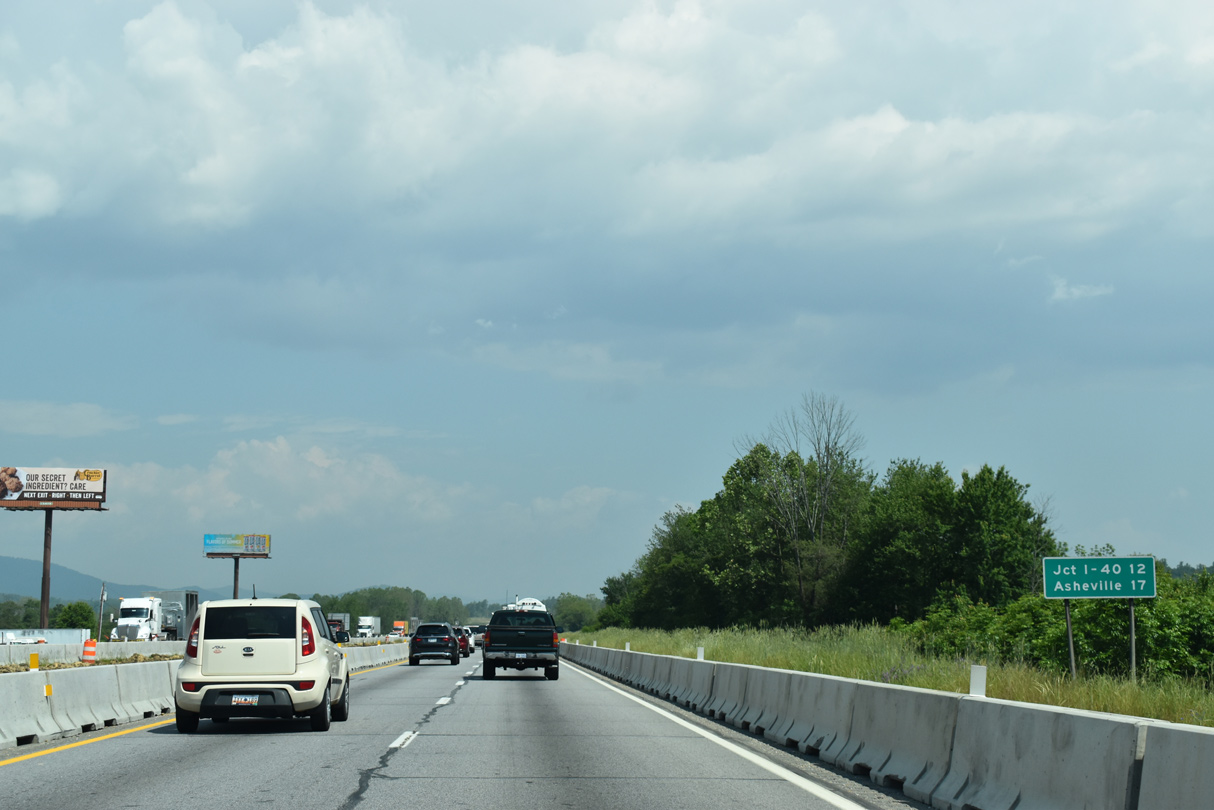
| I-26/U.S. 74 continue five miles north from Ducker Mountain to their separation at I-40/240. 05/26/21 |
|
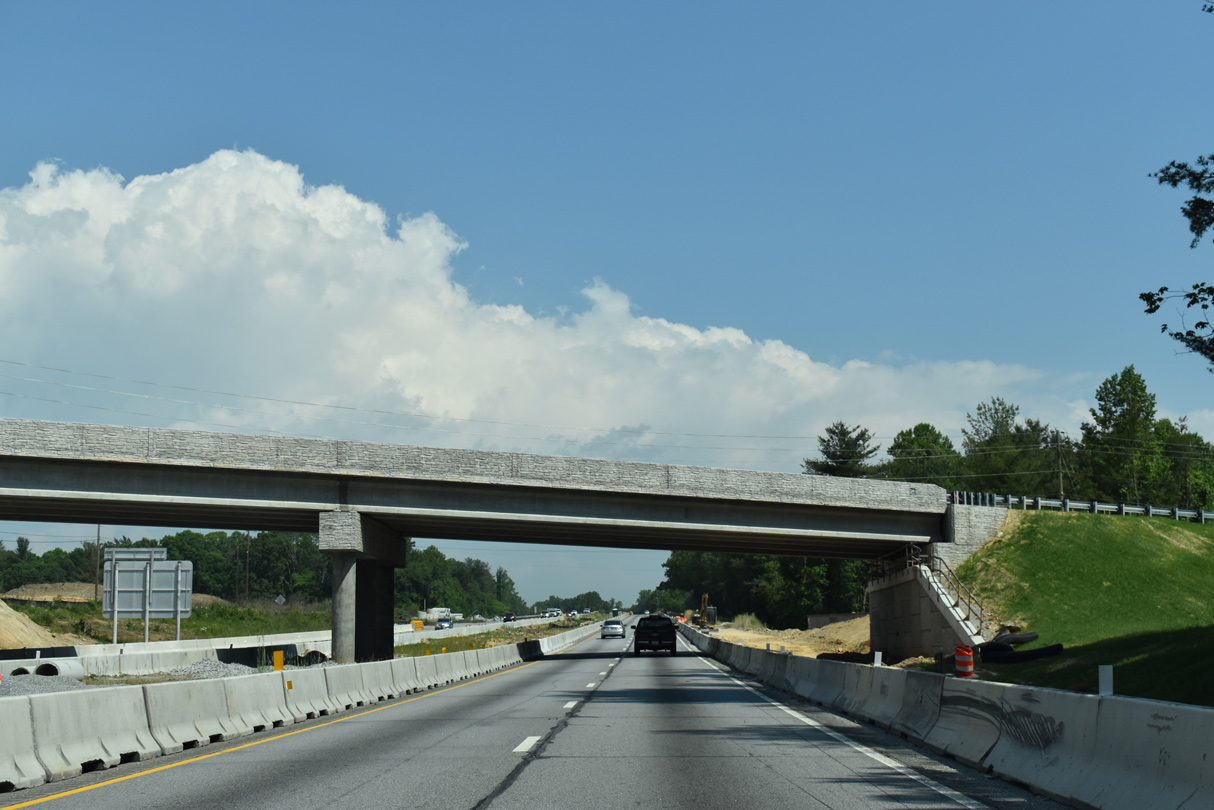
| I-26/U.S. 74 westbound at the Blue Ridge Parkway overpass. Construction replaces the bridge to accommodate eight lane expansion. 05/26/21 |
|
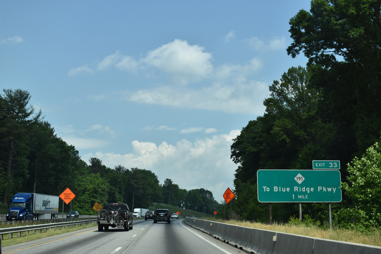
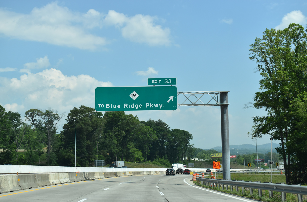
| NC 191 (Brevard Road) connects with Blue Ridge Parkway 2.4 miles south from Exit 33. 05/26/21 |
|
| The original bridges taking I-26/U.S. 74 across the French Broad River were completed in 1967. Road work replaces the spans with an eight lane crossing including full inside and outside shoulders. 05/26/21 |
|
| A $47.4 million project underway from Spring 2016 to Fall 2020 upgraded the parclo B2 interchange (Exit 33) with NC 191. Located a quarter mile further north and 900 feet longer than its predecessor, the new exit ramp to Brevard Road opened to traffic on May 11, 2020.5 05/26/21 |
|
| NC 191 (Brevard Road) heads south along a commercial strip anchored by the Asheville Outlets to Bent Creek. The arterial north continues to I-40 by the WNC Farmers Market at west Asheville. 05/26/21 |
|
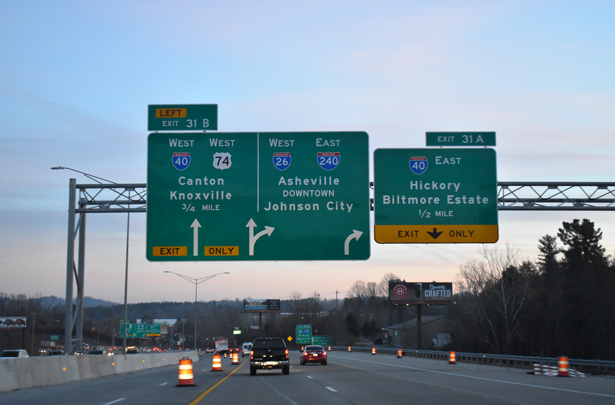
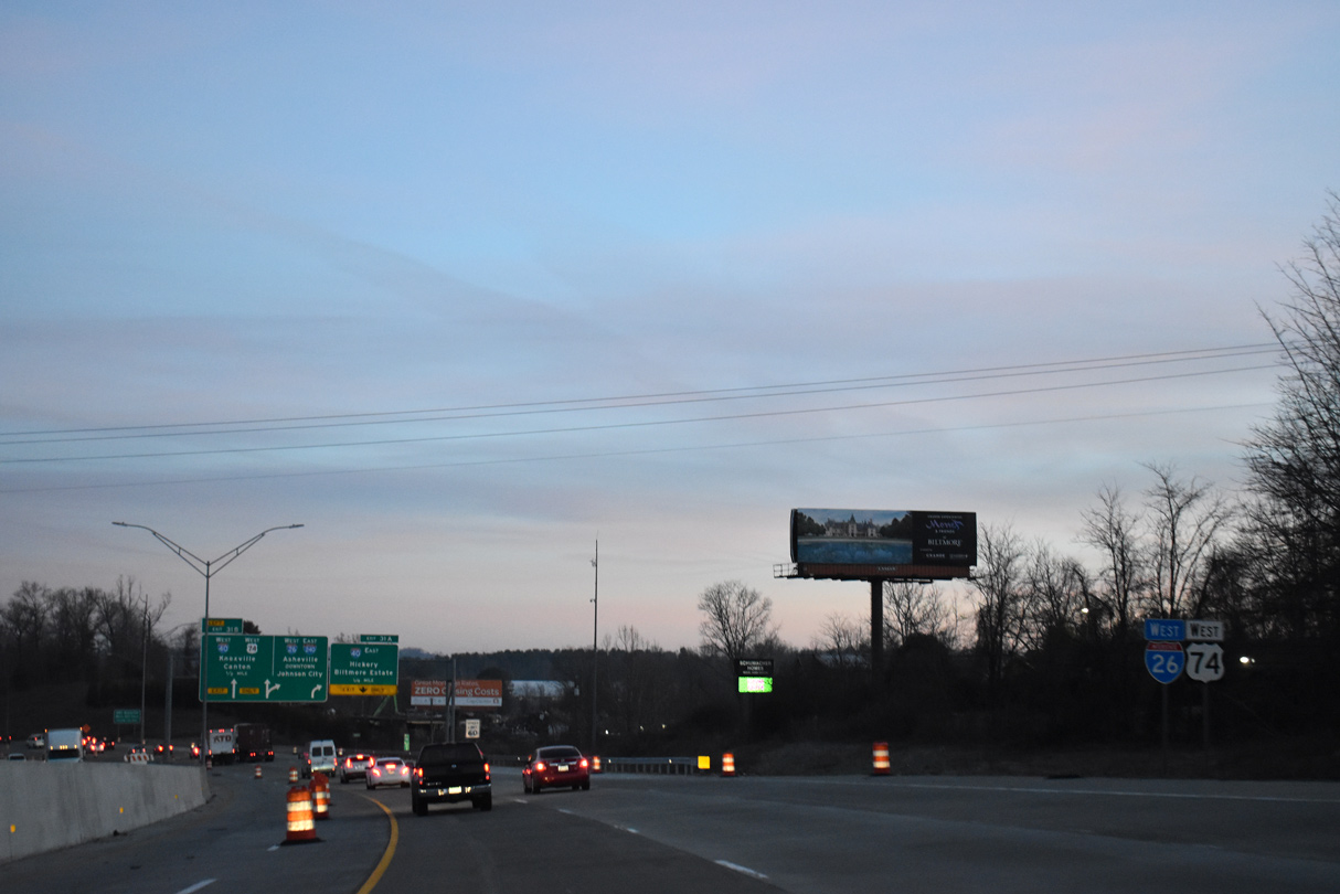
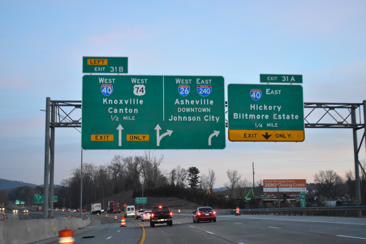
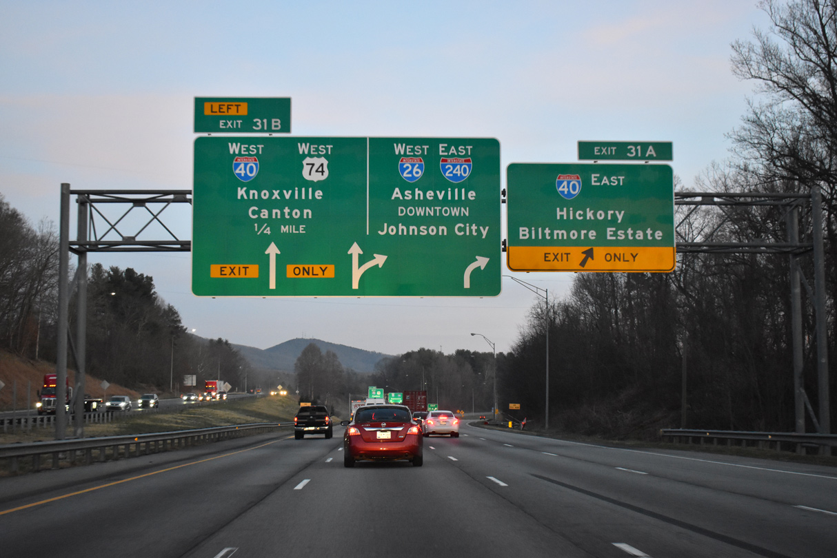
| I-26/U.S. 74 continue a half mile north to a three-level interchange (Exit 31) with Interstate 40 and I-240 east. 03/14/22 |
|
| Interstate 26 and U.S. 74 lower toward Hominy Creek from NC 191 (Brevard Road). 03/14/22 |
|
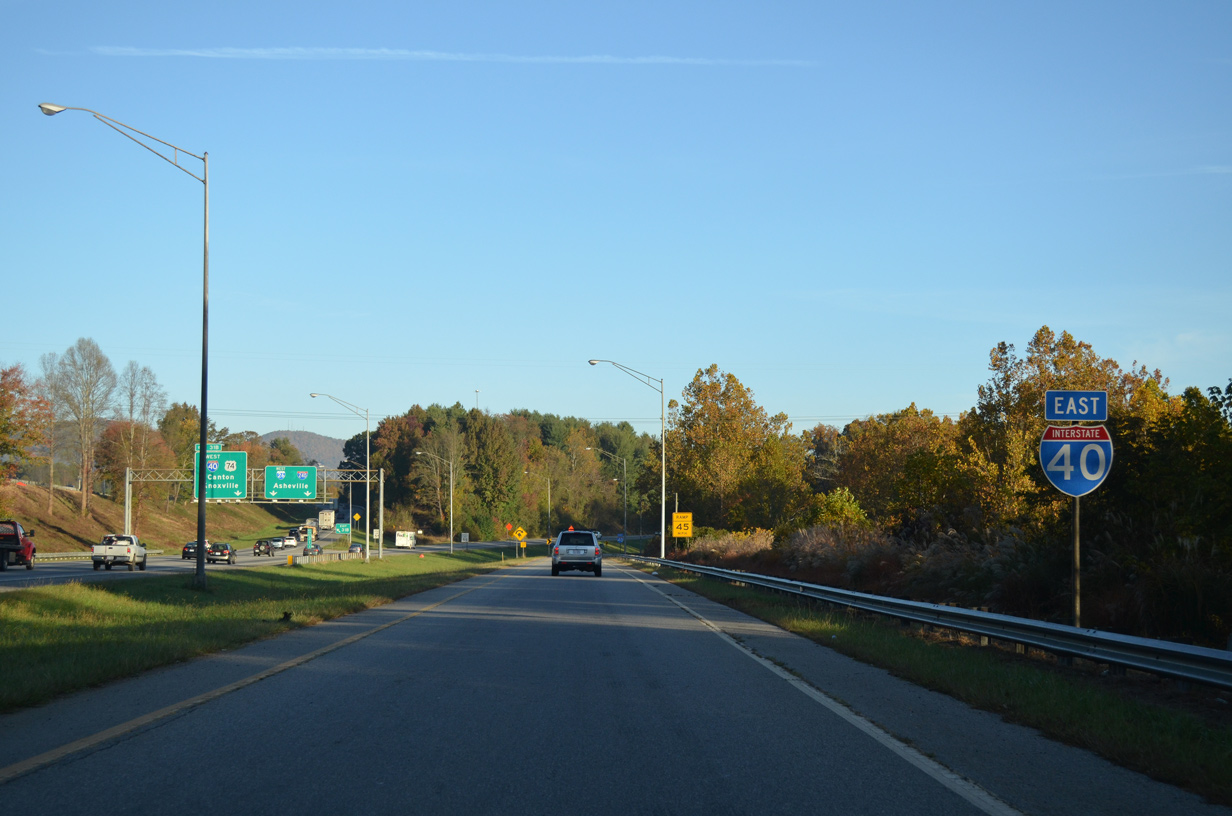
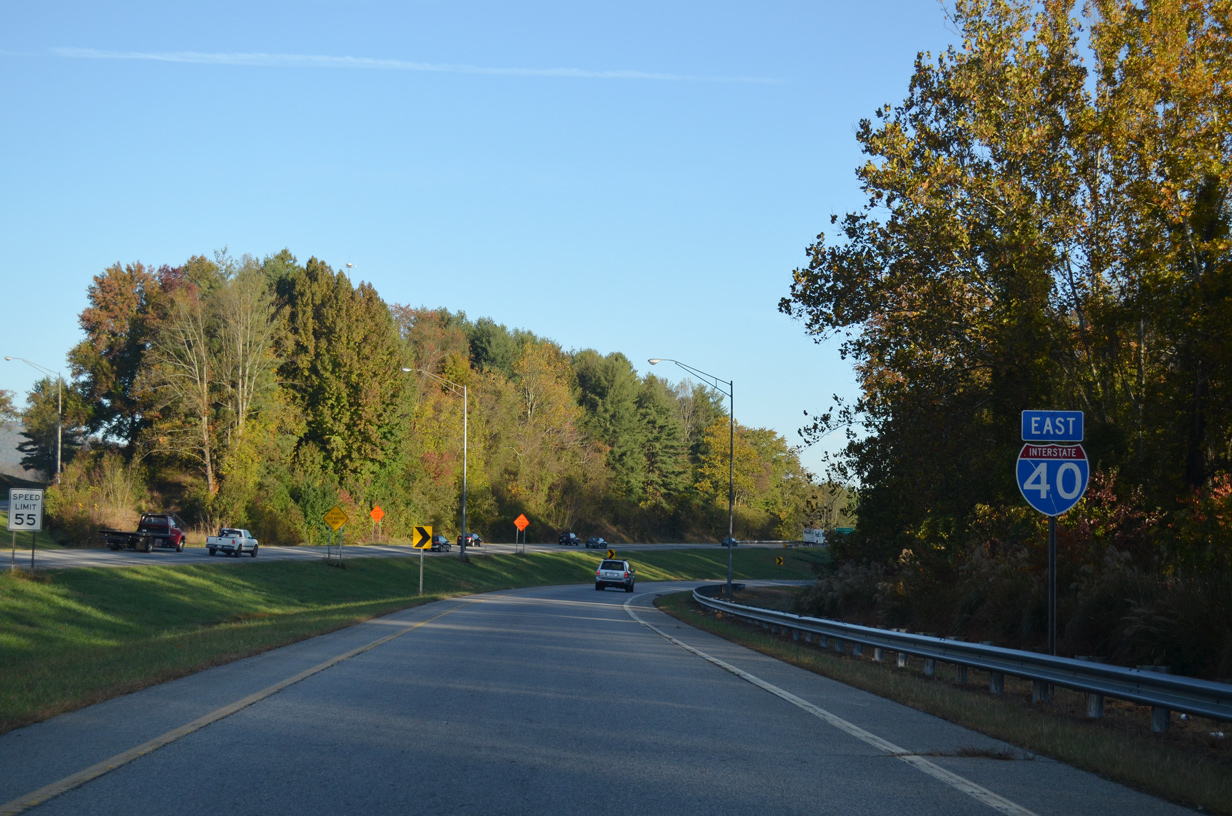
| Interstate 40 runs across the south side of Asheville from the Biltmore Estate east toward Black Mountain. U.S. 74 combines with I-40 west to Canton and Clyde. 03/14/22 |
|
| Interstate 26 was expanded from four to eight overall lanes from NC 191 to I-40/240. Exit 31 A departs next for I-40 east to Hickory, Statesville and the Piedmont Triad region. 03/14/22 |
|
| A pair of shields for I-40 stand along the exit ramp connecting I-26 west with the freeway east to Biltmore Forest and south Asheville. 10/23/15 |
|
| Interstate 26 was extended northward alongside I-240 east to Downtown Asheville and along U.S. 19/23 toward the Tri-Cities of Tennessee on August 5, 2003. 05/26/21 |
|
| Interstate 240 commences along I-26 west beyond Left Exit 31 B for I-40/U.S. 74 west. The Asheville urban loop runs 9.54 miles east to I-40 at U.S. 74A near Oakley. 03/14/22 |
|
| U.S. 74 overlaps with I-40 west 19 miles to the Great Smokey Mountain Expressway. 03/14/22 |
Page Updated 01-27-2023.

 West
West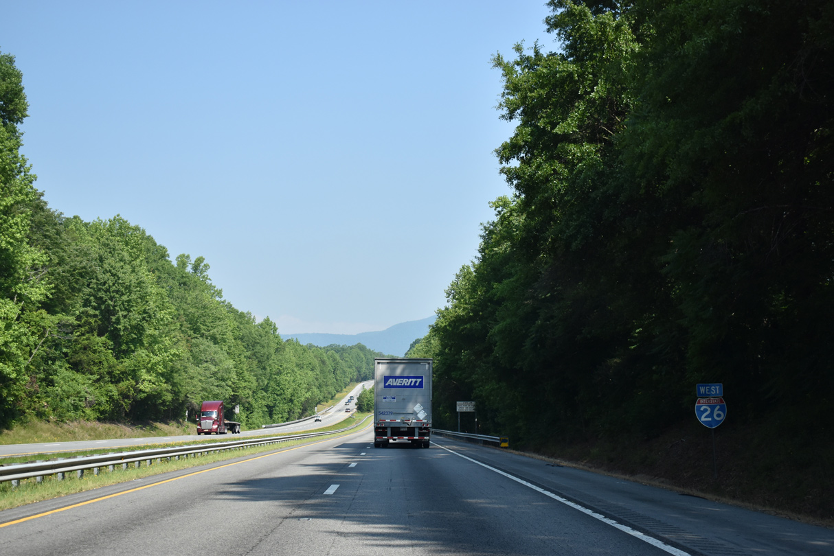
 West
West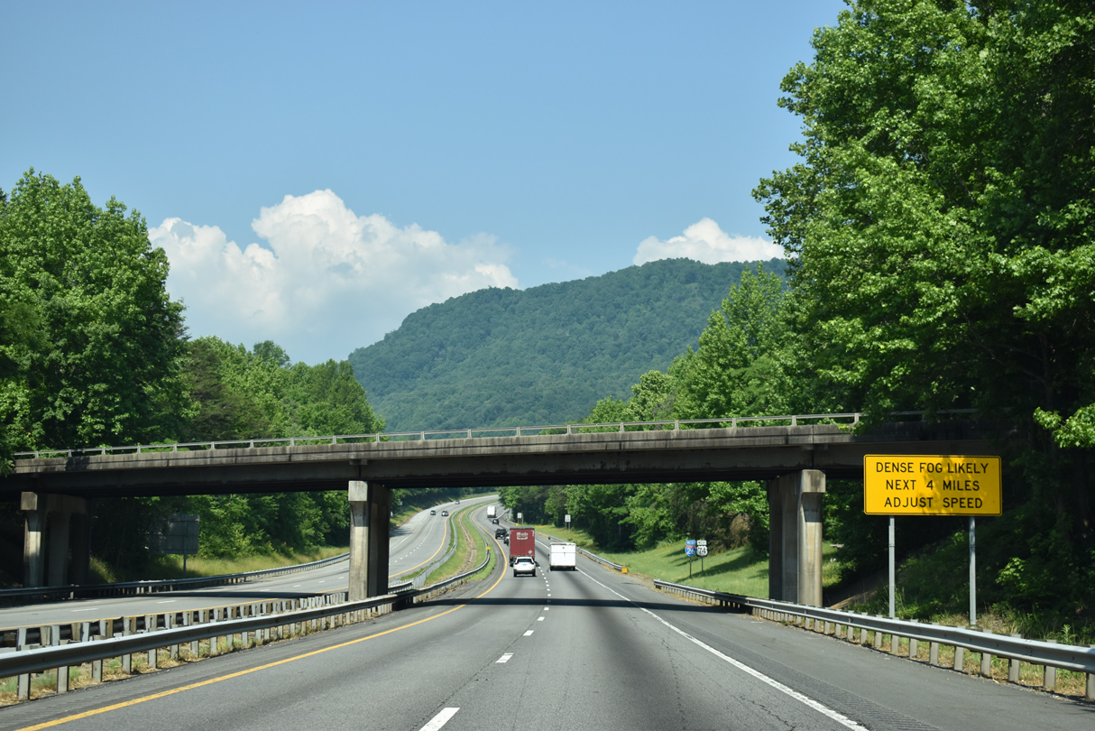

 North
North