|
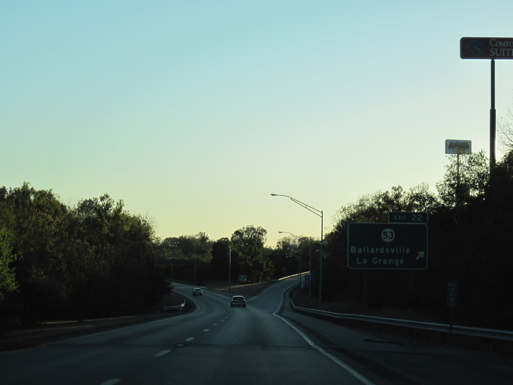
| KY 53 (1st Avenue) meets Interstate 71 at the first of four interchanges in Oldham County. The state route joins the freeway with the La Grange city center along a congested commercial route. 10/01/10 |
|
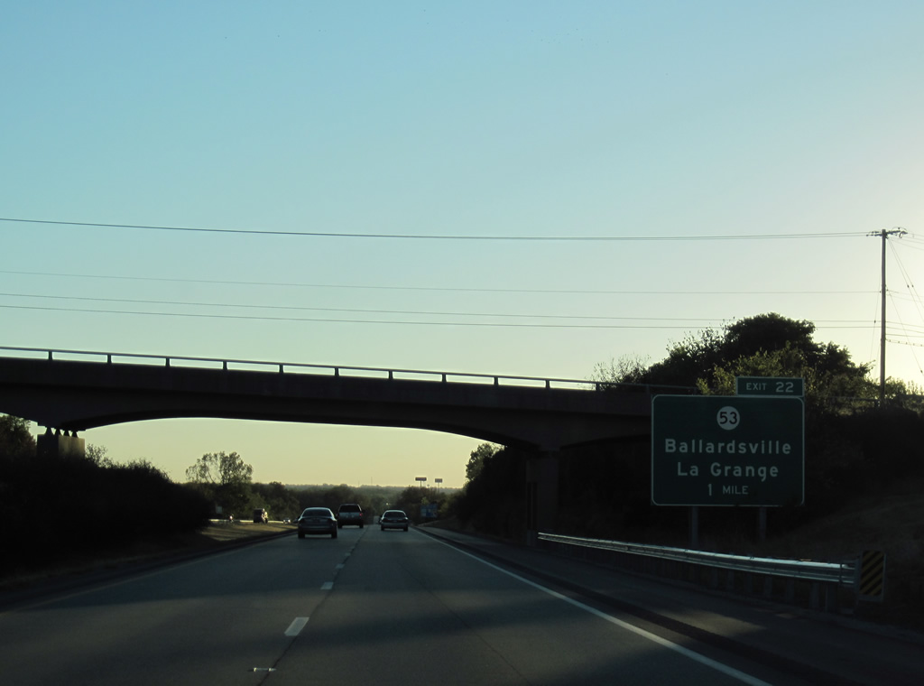
| KY 712 (Jericho Road) passes over Interstate 71 one mile from Exit 22 to KY 53. Suburban growth enveloped much of the surrounding area of LaGrange. A mixture of retail and single family home subdivisions line KY 53 south to KY 22 at Ballardsville. 10/01/10 |
|
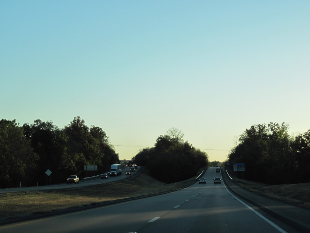
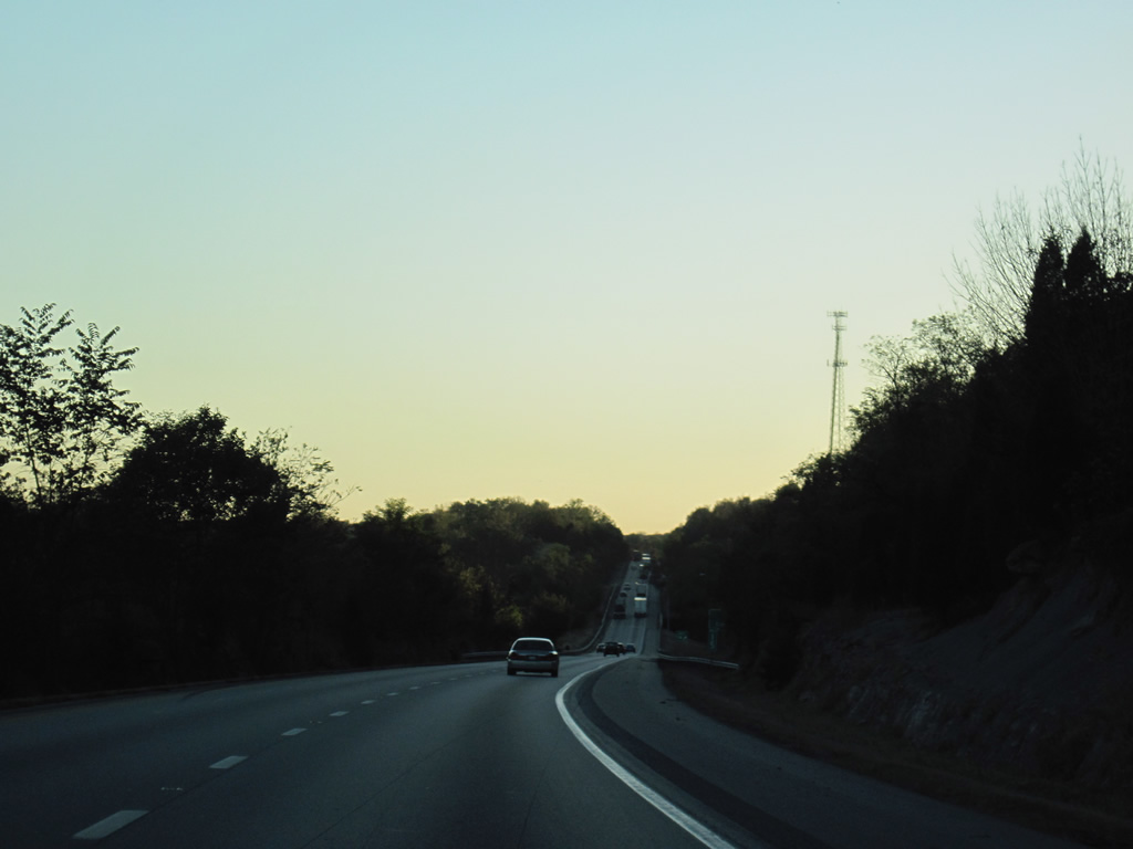
| A wide forested median along I-71 precedes Exit 22. Waters from the North Fork of Currys Fork flow between the separated roadways to Exit 18. 10/01/10 |
|
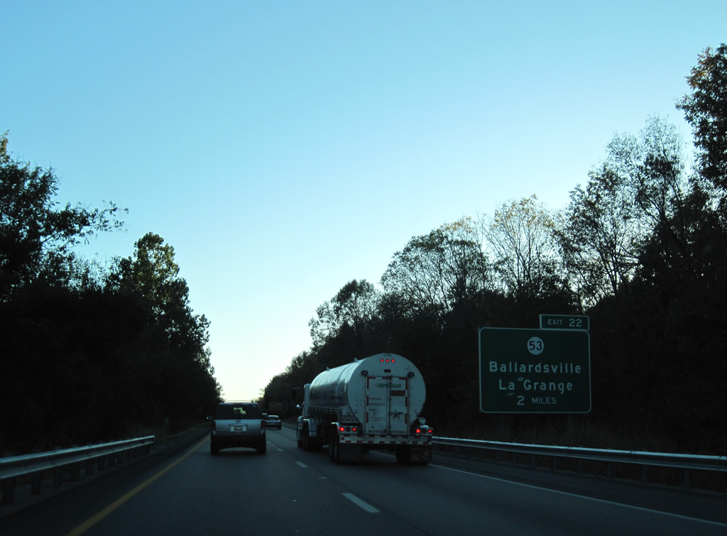
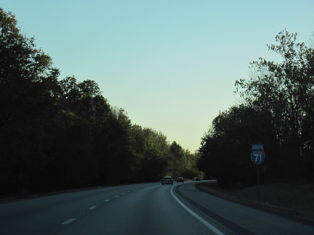
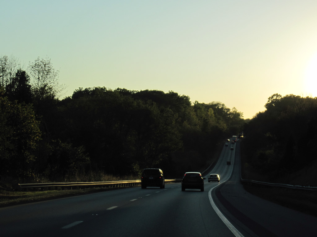
| Interstate 71 travels between L and N Lake to the north and Crystal Lake to the south ahead of the diamond interchange with KY 53 at Exit 22. KY 53 travels 50 miles between U.S. 42 near Russell Corner and KY 555, south of Willisburg. 10/01/10 |
|
| Continuing west, Interstate 71 leaves La Grange. An industrial park lines the north side of the freeway while a hodgepodge of leafy subdivisions and wooded areas spread to the south. 10/01/10 |
|
| KY 393 is the first of two exits for the unincorporated community of Buckner along Interstate 71 south. 10/01/10 |
|
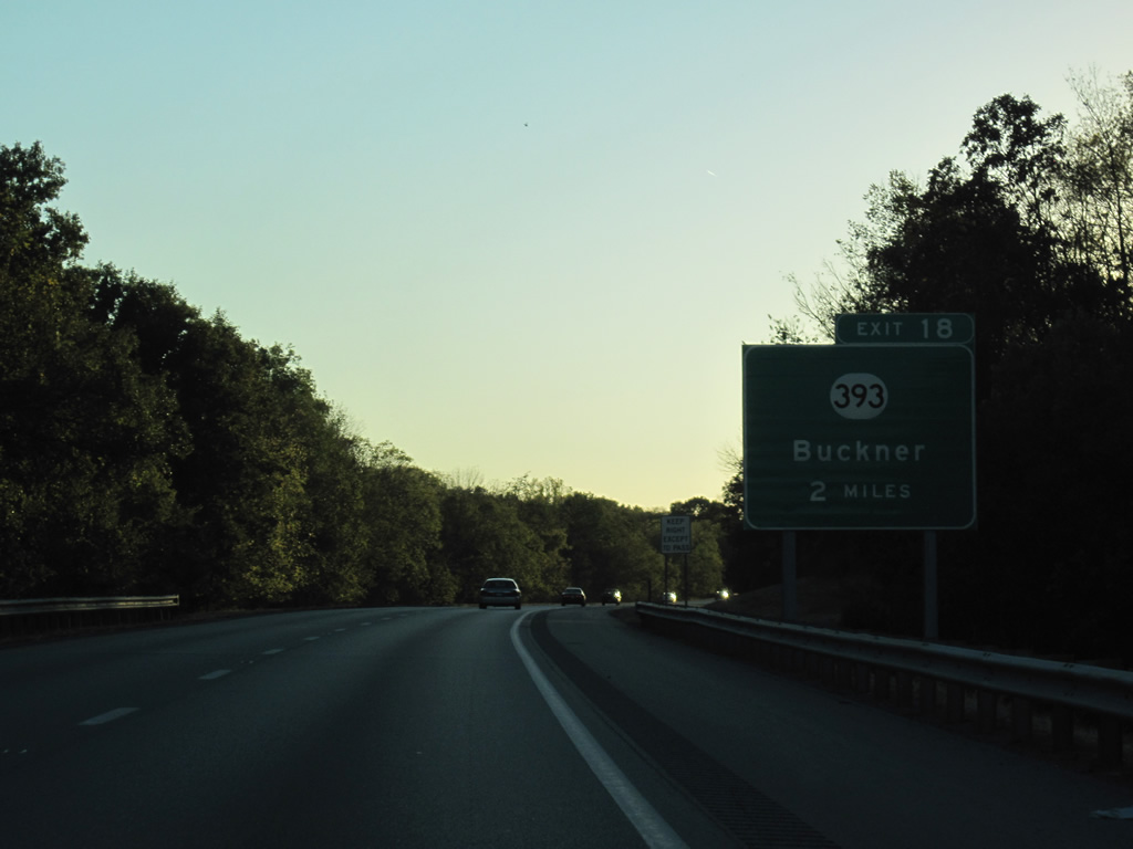
| One mile east of the diamond interchange with KY 393. KY 393 meanders northwest from KY 1818 (West Mount Zion Road) to Centerfield, Buckner and U.S. 42 west of Greenhaven for a total mileage of 10.06. 10/01/10 |
|
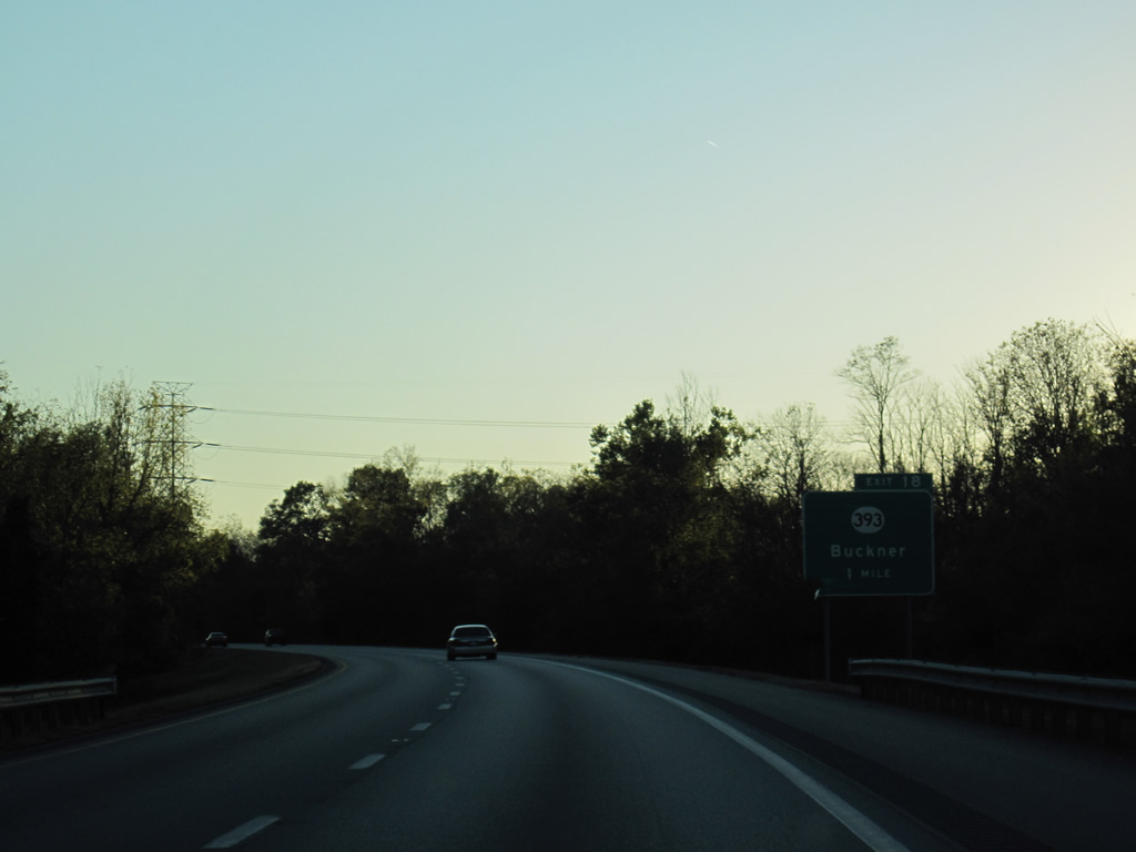
| Southbound at Exit 18 to KY 393 on Interstate 71. KY 393 combines with KY 146 (La Grange Road) at Buckner nearby. 10/01/10 |
|
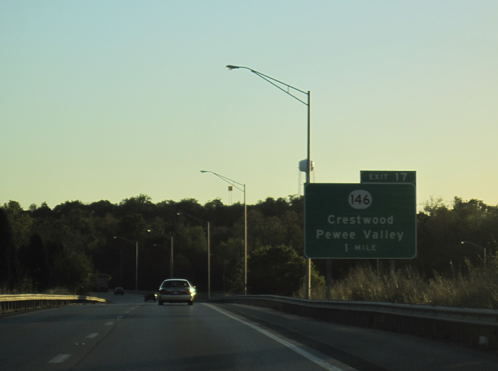
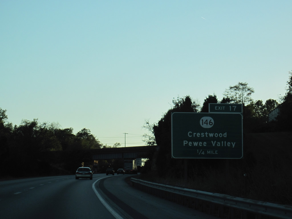
| KY 146 (La Grange Road) returns to Interstate 71 at Exit 17 from Buckner. The state route previously crossed the freeway near Exit 28 in Henry County. 10/01/10 |
|
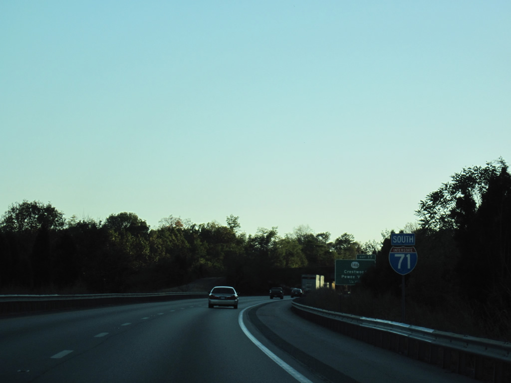
| Interstate 71 marker posted a quarter mile from the folded diamond interchange with KY 146 (La Grange Road) at Exit 17. 10/01/10 |
|
| West from Exit 17, KY 146 parallels I-71 to Glenarm before turning southward into Crestwood and Pewee Valley. The state route concludes at U.S. 60 by Interstate 264 in St. Matthews. 10/01/10 |
|
| Traveling more west than south, Interstate 71 leaves Buckner and crosses the South Fork Darby Creek. Despite the suburban growth, the freeway remains with just four overall lanes. 10/01/10 |
|
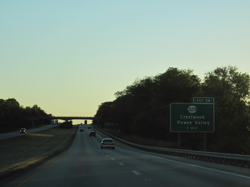
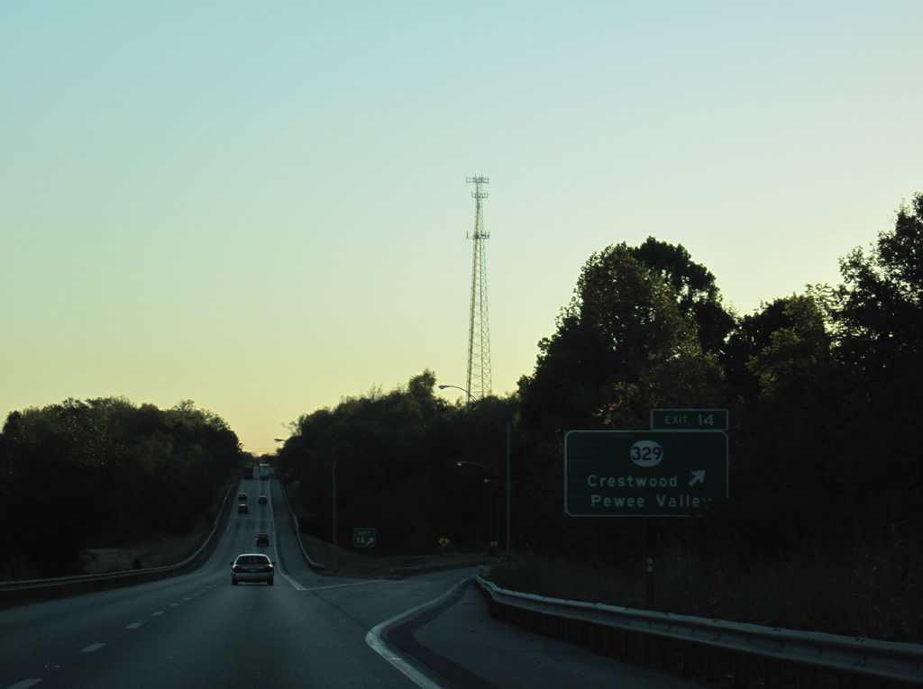
| The diamond interchange at Exit 14 joins I-71 south with KY 329 at Brownsboro. KY 329 comprises a 9.72 mile long arc between Crestwood and U.S. 42 at Prospect within Jefferson County. 10/01/10 |
|
| The eastbound lanes disappear from view where Interstate 71 lowers to Exit 14 by South Fork Harrods Creek. 10/01/10 |
|
| KY 329 splits with a Bypass route leading south to Crestwood from Exit 14. KY 329 concludes at KY 146 (La Grange Road) east of Pewee Valley, while the bypass route (Veterans Memorial Parkway) angles southeast to KY 22 (Ballardsville Road). KY 329 constitutes a rural route west from Brownsboro to Louisville. 10/01/10 |
|
| West from Brownsboro, Interstate 71 descends again to cross South Fork Harrods Creek. 10/01/10 |
|
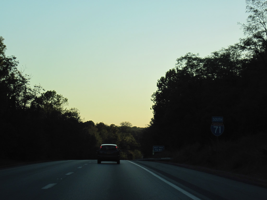
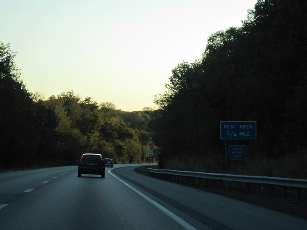
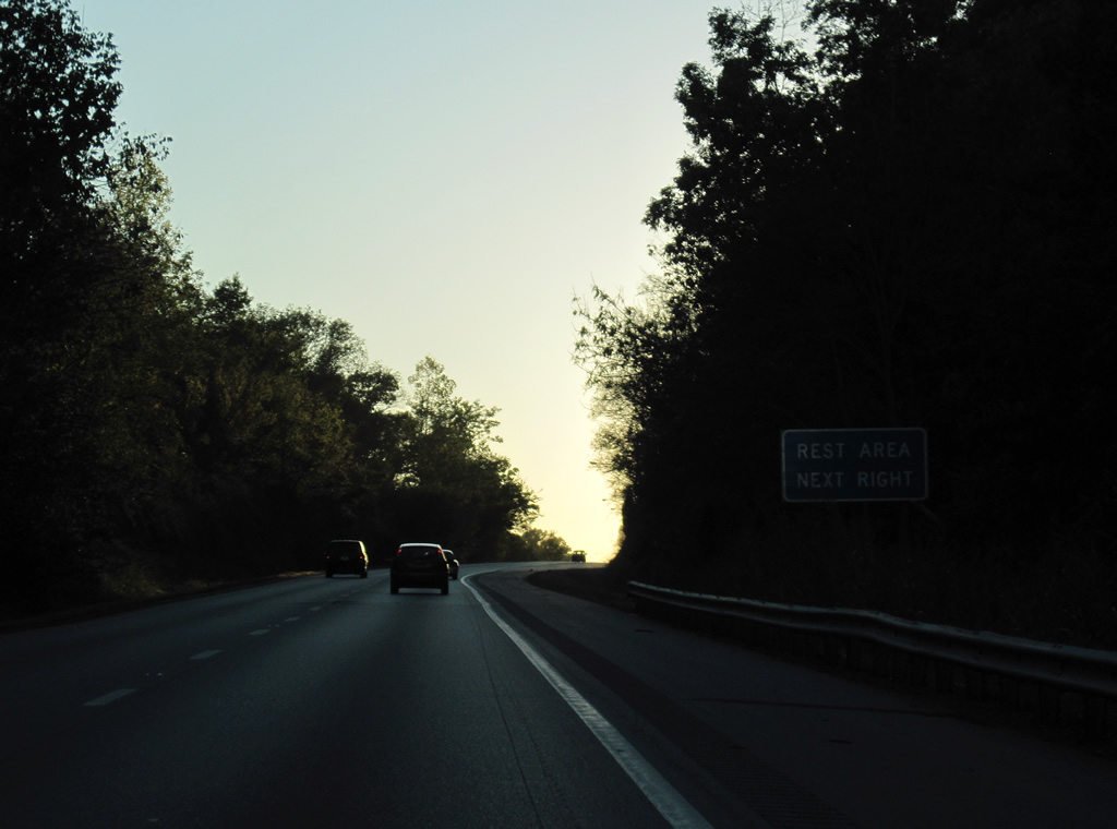
| Rising from South Fork Harrods Creek, Interstate 71 reaches a set of rest areas ahead of the Jefferson County / Louisville city line. 10/01/10 |
|
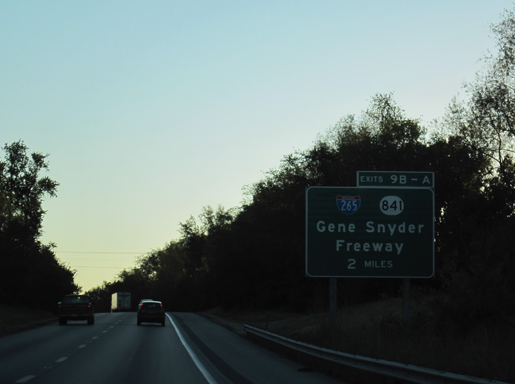
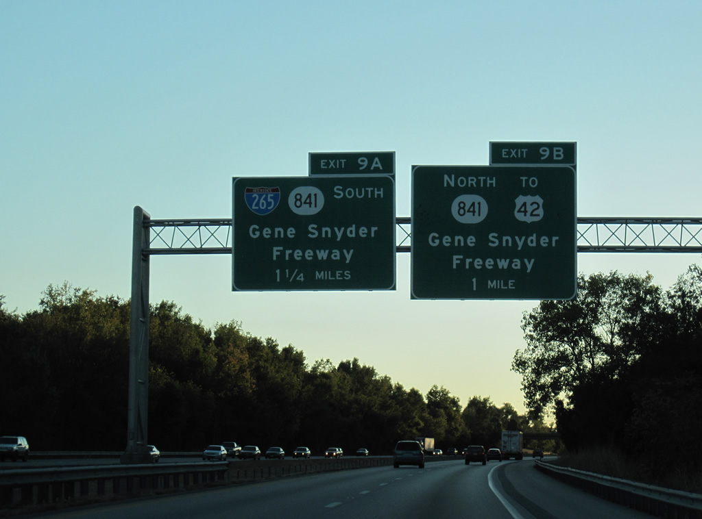
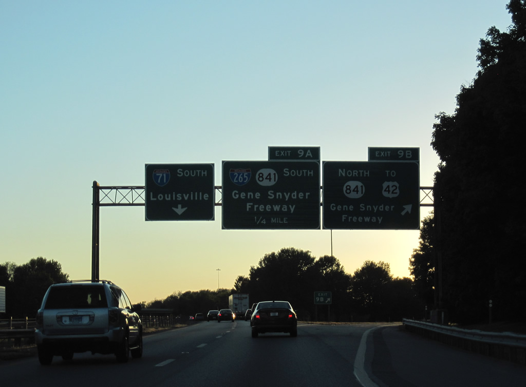
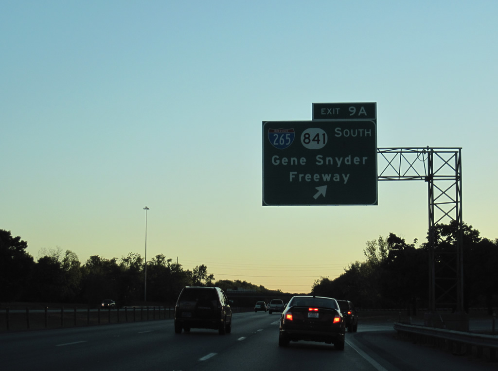
| A cloverleaf interchange (Exits 9 B/A) links Interstate 71 with I-265/KY 841 (Gene Snyder Freeway) in two miles. 10/01/10 |
|
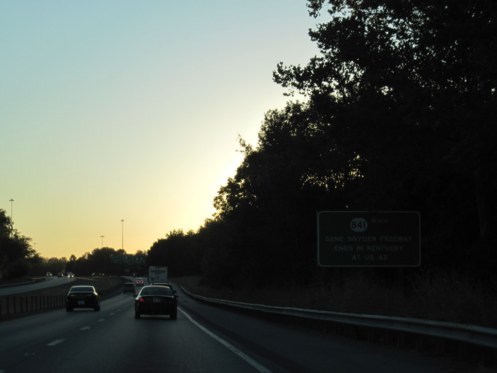
| Previously KY 841 spurred 2.26 miles west from I-71/265 to U.S. 42 near Harrods Creek and Prospect. Work on the East End Bridge project linking the Indiana (SR 265) and Kentucky (KY 841) portions of I-265 started on August 30, 2012. The toll bridge opened to traffic on December 18, 2016. 10/01/10 |
|
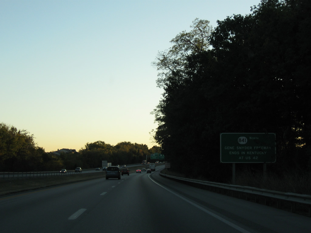
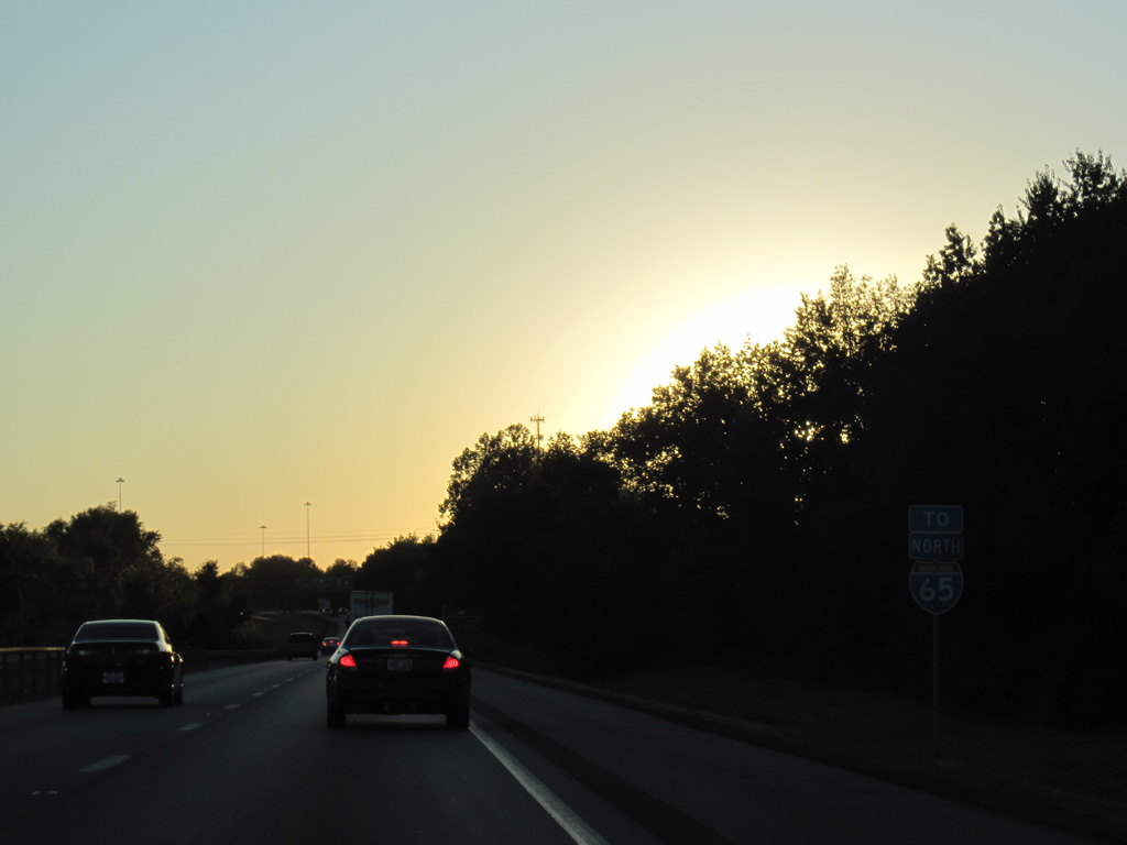
| KY 841 runs concurrent with the 24.48 mile route of I-265. KY 841 extends west from the south end of I-265 along the Gene Snyder Freeway to U.S. 31W/60 (Dixie Highway) and Greenbelt Highway (KY 1934). 10/01/10 |
|
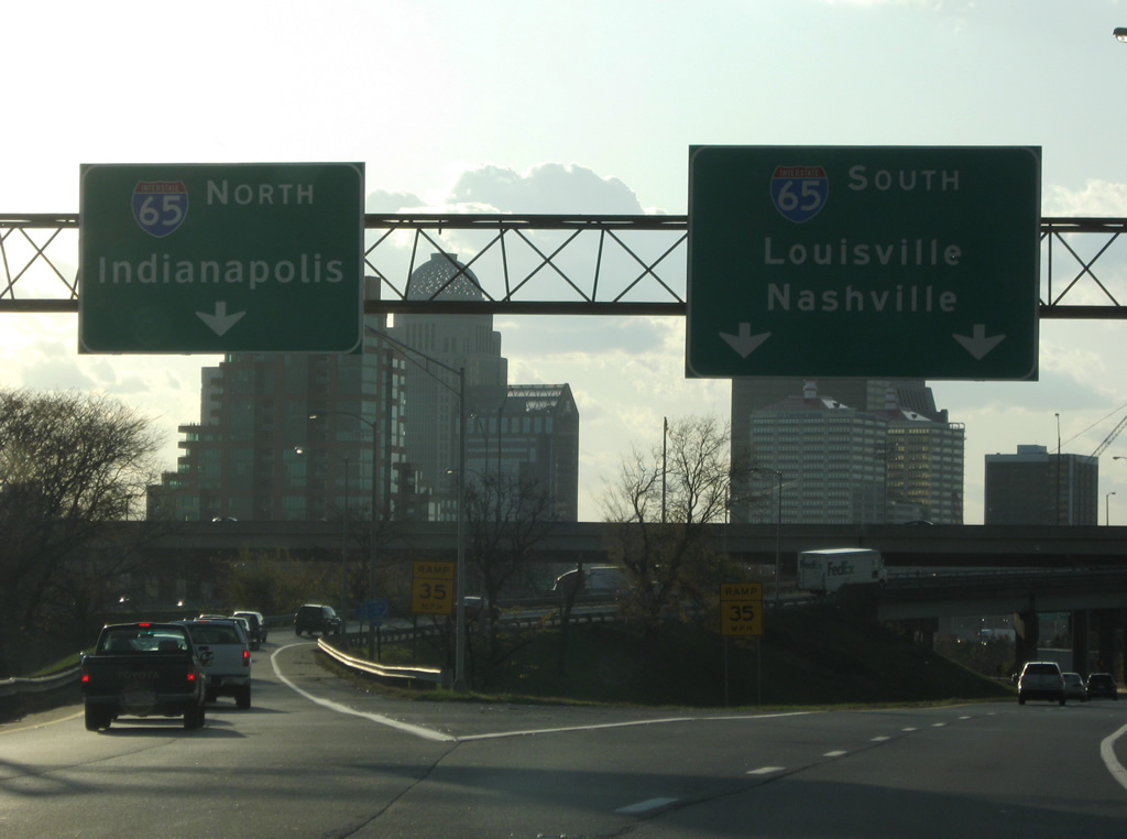
| Travelers headed south from I-71 to I-65 for Elizabethtown or Nashville are directed onto I-265/KY 841 south via Exit 9 A. 10/01/10 |
|
| Former sign referencing the previous end of KY 841 at U.S. 42. KY 841 west to SR 265 and I-265 provides a bypass of Louisville for I-65 to Indianapolis and I-64 to St. Louis. 10/01/10 |
|
| Exit 9 B departs Interstate 71 for KY 841 (Gene Snyder Freeway) north to U.S. 42 and SR 265 at the Lewis and Clark (East End) Bridge. U.S. 42 continues southwest into Louisville through Indian Hills to U.S. 60 and U.S. 31E (Baxter Avenue) near Downtown Louisville. 10/01/10 |
|
| Exit 9 A follows onto southbound Interstate 265 to Middletown and south Louisville. The interchange with the Gene Snyder Freeway was constructed in the mid 80s, as the Snyder Freeway through this point was built in 1987. 10/01/10 |
|
| Four lanes of Interstate 71 travel by Brownsboro Farm and Barbourmeade, enclave cities within the overall Louisville / Jefferson County contiguous area. 11/04/09 |
|
| While already formally within the city of Louisville, the final distance sign of Interstate 71 references Louisville again at nine miles east from downtown. I-71 was completed in Jefferson County by late 1968. 11/04/09 |
|
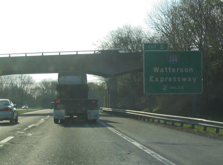
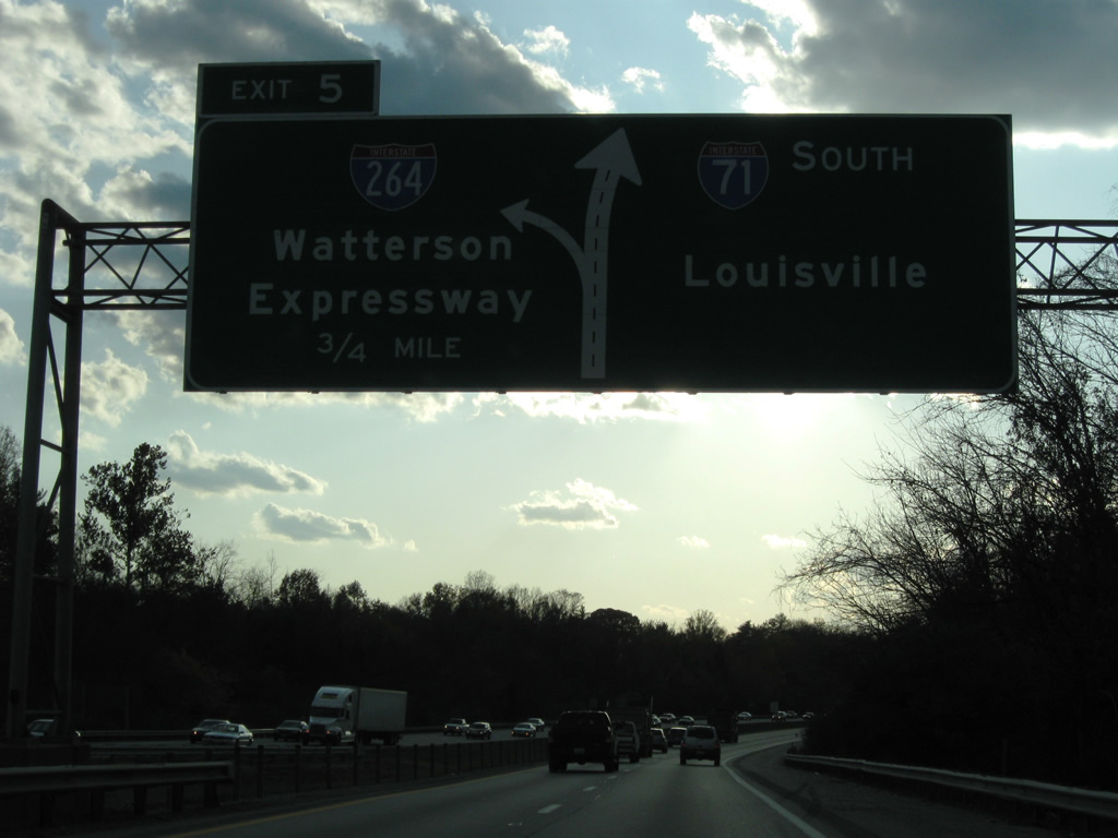
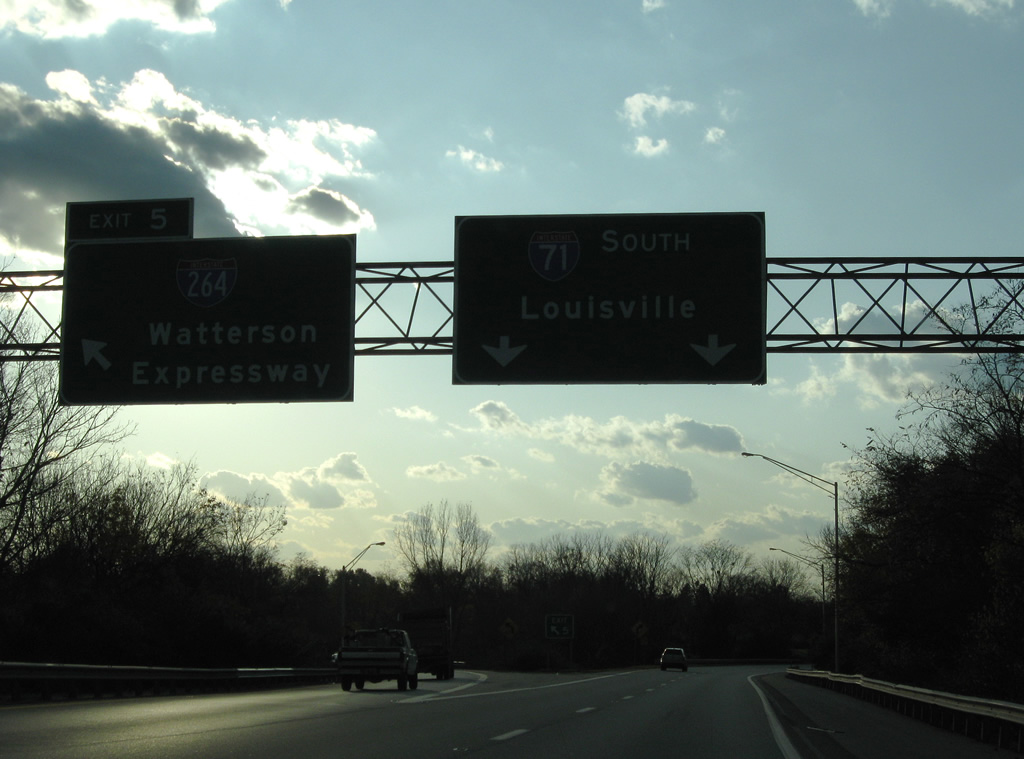
| Interstate 264 (Henry Watterson Expressway) begins at the following three-wye interchange (Exit 5). I-264 constitutes an inner-belt freeway encircling the city of Louisville between Northfield and Shively. 11/12/04 |
|
| Exit 5 departs from the left side of Interstate 71 south in three quarters of a mile. 11/04/09 |
|
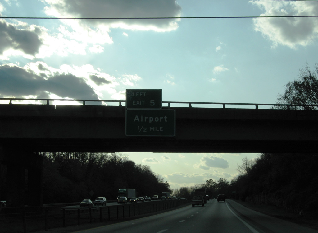
| Louisville International Airport lies alongside Interstate 264 west of the interchange complex with I-65 and the Kentucky Fair and Exposition Center. 11/04/09 |
|
| Interstate 264 loops 22.93 miles south from I-71 to St. Matthews, Shively and I-64 ahead of the Sherman Minton Bridge to New Albany, Indiana. 11/04/09 |
|
| Exit 5 ramps were cut into the rock bluff where the plateau of Kentucky meets the Ohio River valley. Studies done in 2005 indicate there is a need to widen the ramp from southbound I-71 to the Watterson. Additionally, widening I-71 from here to I-265 is also planned. 11/04/09 |
|
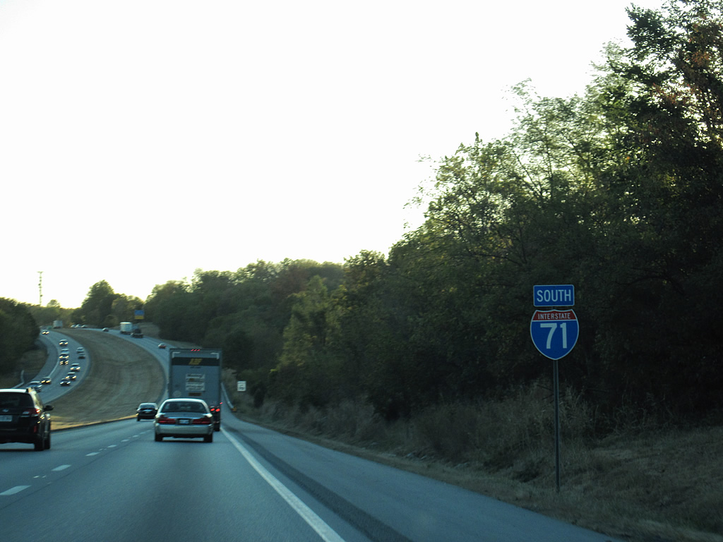
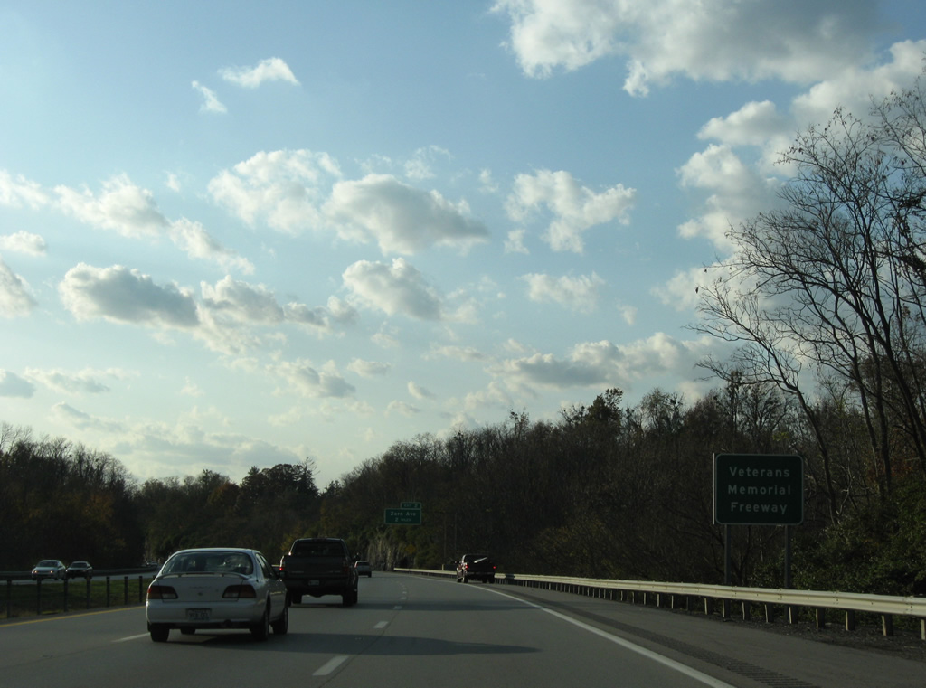
| I-71 is signed locally as the Veterans Memorial Freeway, although never referred to as such colloquially. 11/04/09 |
|
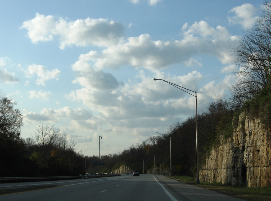
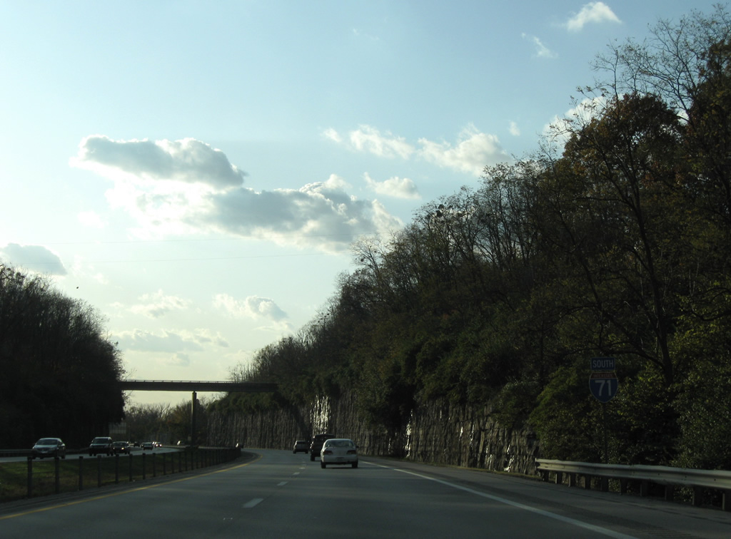
| Interstate 71 curves northwest toward longview and the Ohio River on the two miles leading to Exit 2 for Zorn Avenue. Rock cuts line I-71 above the Ohio River bluffs through this stretch. 11/04/09 |
|
| I-71 reassurance marker posted ahead of the Poplar Hill Court overpass near Longview. Some of Louisville's wealthiest homeowners live beyond the rock cuts and trees to each side of the freeway. 11/04/09 |
|
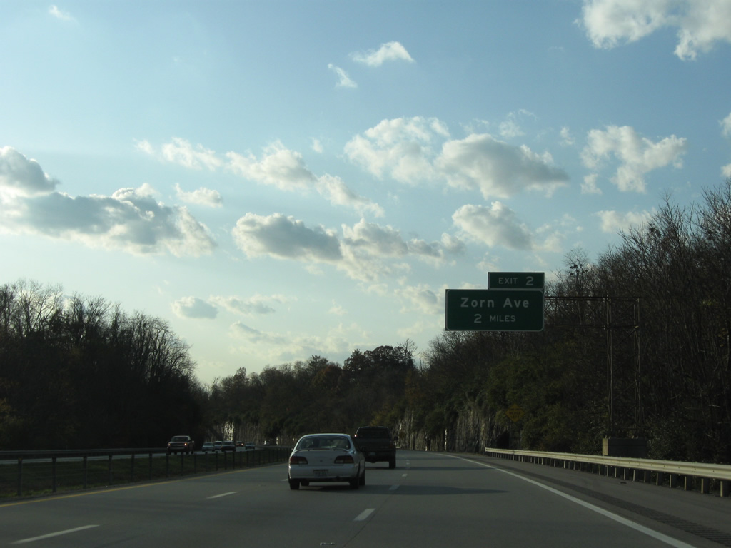
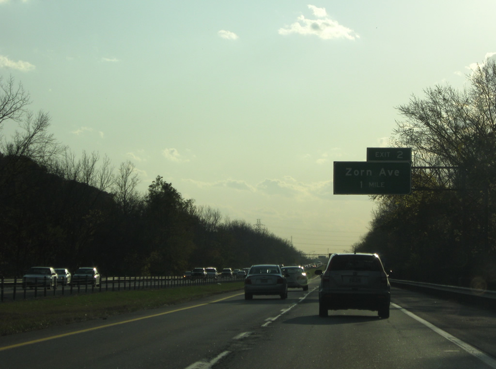
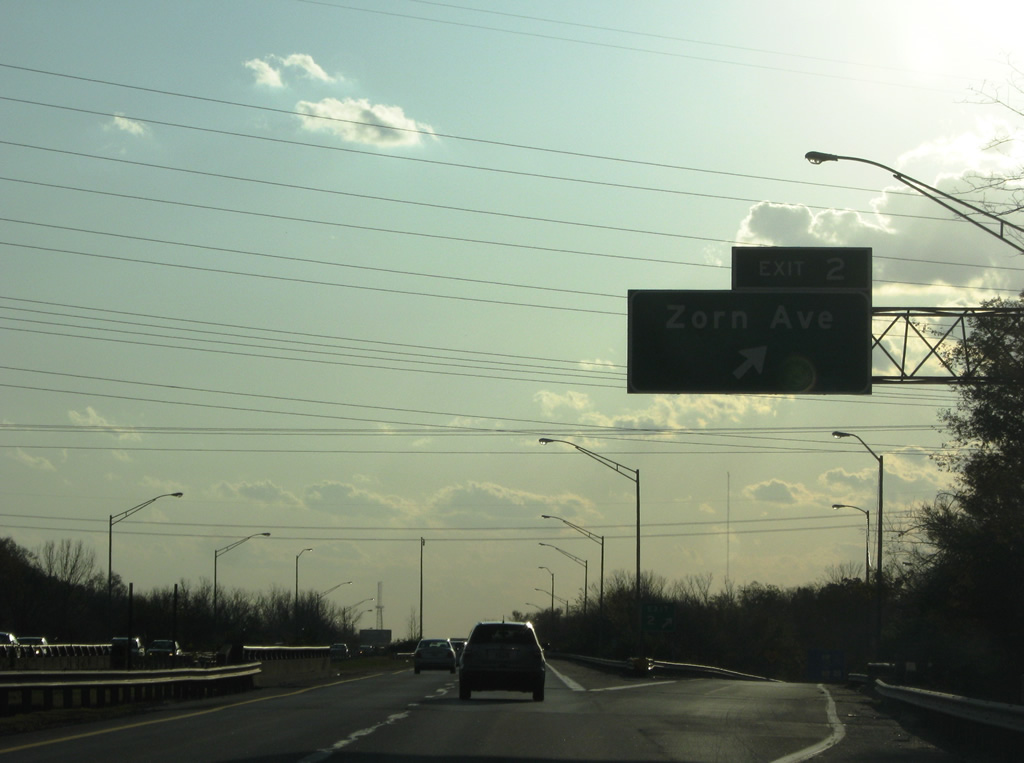
| A diamond interchange (Exit 2) joins Interstate 71 with Zorn Avenue in one mile. Named for Sebastian Zorn, one time president of the local water company, Zorn Avenue ends at the Ohio River and the oldest modern water tower in the world, at the city's old water works. 11/04/09 |
|
| Zorn Avenue runs northwest to southeast from parallel River Road to Brownsboro Road (U.S. 42) and the historic Brownsboro-Zorn neighborhood. 11/04/09 |
|
| The final confirming marker for Interstate 71 south stands near River Road Country Club golf course. 11/04/09 |
|
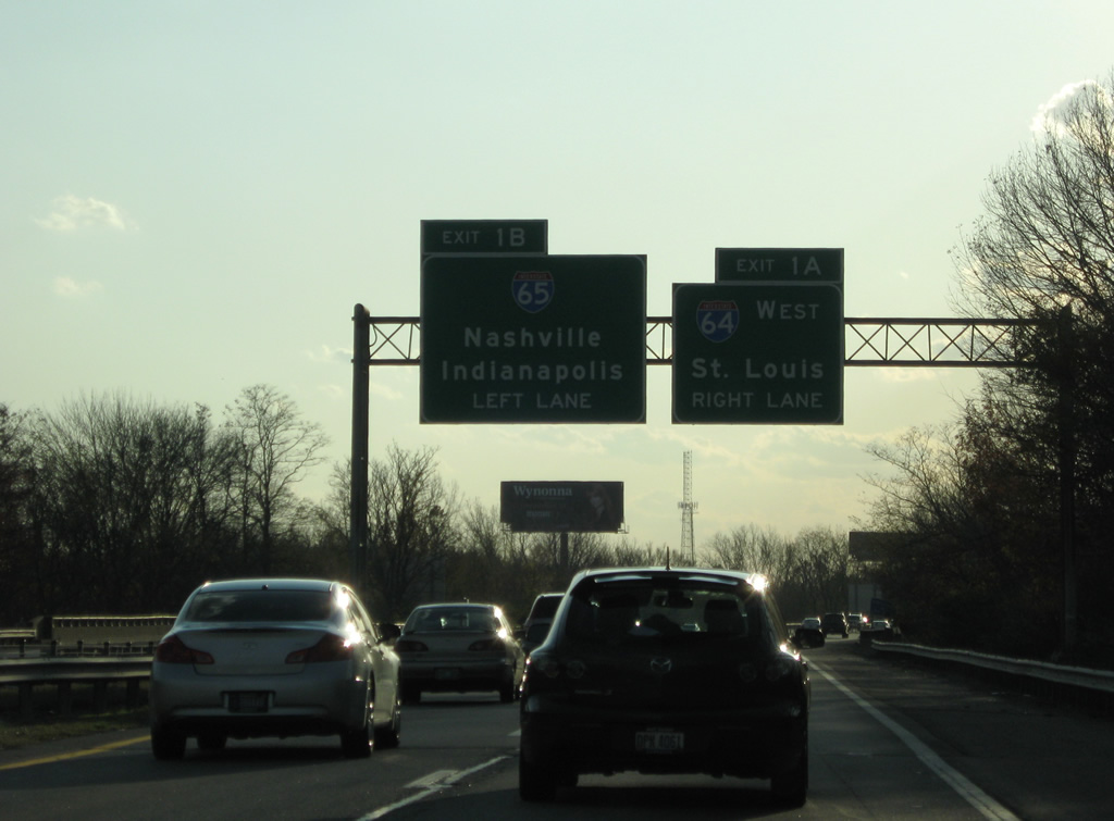
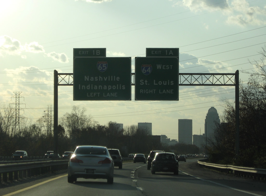
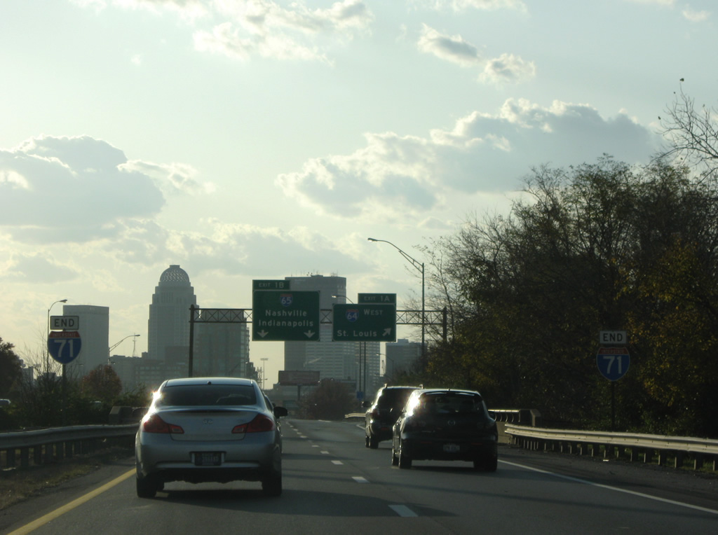
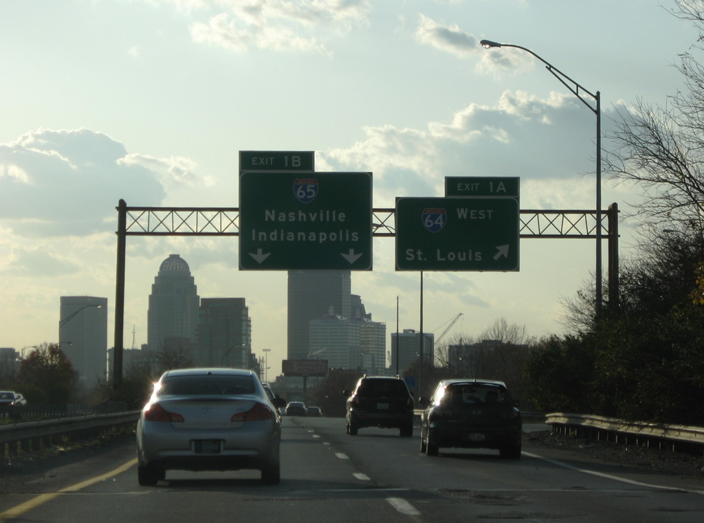
| The first of three sign bridges for Exits 1A to I-64 west and 1B to I-65 appears along Interstate 71 south at the Edith Road underpass. Exit 1 A joins I-64 west at a wye interchange. 11/04/09 |
|
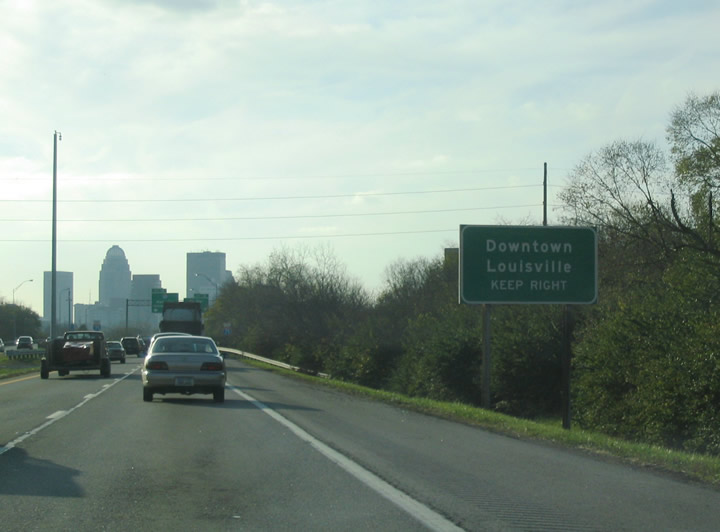
| Skyscrapers in Downtown Louisville come into view along Interstate 71 southbound. The I-71 mainline defaults onto Exit 1 B leading into the Kennedy Interchange with I-65. Exit 1 B combines with traffic from I-64 west along a two lane ramp. 11/04/09 |
|
| Motorists bound for the Louisville central business district are directed onto Interstate 64 west at Exit 1 A to the 3rd Street interchange. 11/12/04 |
|
| End Interstate 71 shields posted at the Frankfort Avenue underpass. 11/04/09 |
|
| Exit 1A departs Interstate 71 south for Interstate 64 west to New Albany, Evansville and St. Louis, Missouri. Interstate 64 here and the adjacent Kennedy Interchange are slated for an entire rebuild with the Ohio River Bridges project slated to run until 2018. Upon completion, Interstate 71 will meet a relocated Interstate 64 further south away from the Ohio River. 11/04/09 |
|
| Continuing along the Exit 1B roadway to Interstate 65, drivers prepare to partition into the northbound ramp for the Kennedy Bridge and southbound along the east side of downtown. 11/04/09 |
|
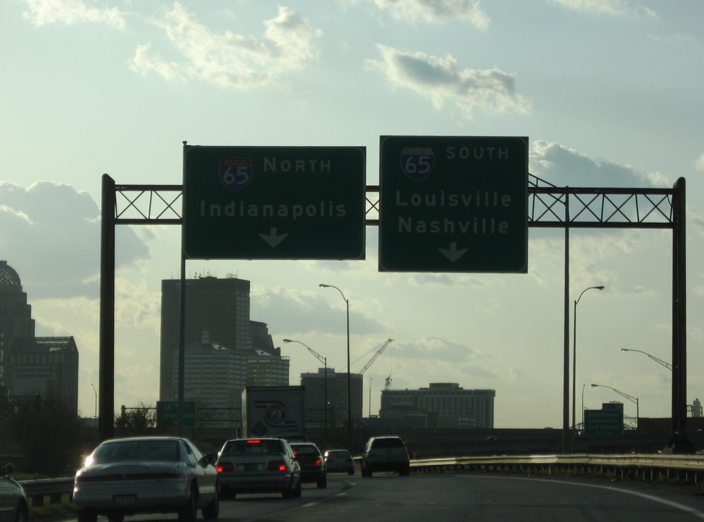
| Two lanes continue onto Interstate 65 south to Elizabethtown and Nashville. Ramps to Interstate 65 northbound combine from both directions of I-64 onto the 1963-opened Kennedy Bridge. Interstate 65 leaves Kentucky for Jeffersonville, Clarksville and Indianapolis. 11/04/09 |
|
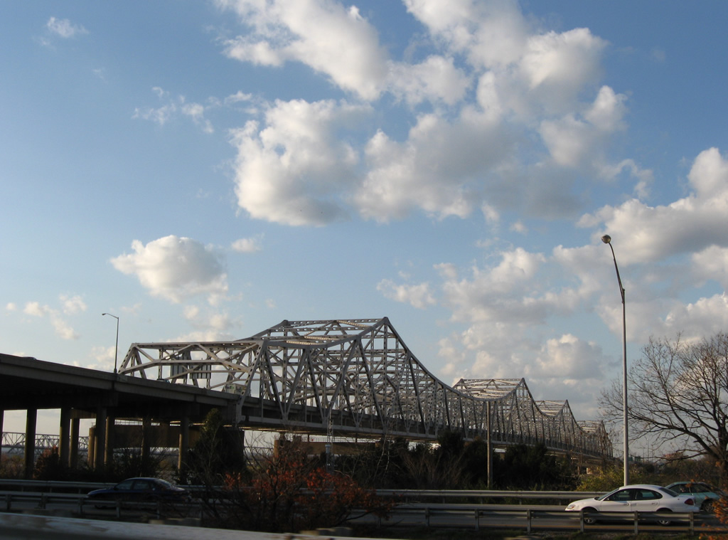
| Coming into view along the north side of Interstate 71 south at Interstate 64 is the 1895 completed Big Four Bridge. The railroad truss bridge was removed from service in 1968 and its approaches removed by 1969. Visible in this photo is the beginning of construction of a ramp spiraling onto the south side of the span. This was the first step in a project to convert the railroad span into a pedestrian and bicycle bridge.
A $6.5 million project was awarded in February 2012 to build pedestrian and bicycle access from the Jeffersonville side. The bridge will be opened to Indiana in March 2013.1 11/04/09 |
|
| The Kennedy Bridge looms just west of the Big Four Bridge. The Ohio River Bridges project added a cable stayed bridge (Abraham Lincoln Bridge) for northbound Interstate 65 traffic. Southbound traffic remains on the reconstructed Kennedy Bridge south. 11/04/09 |
Page Updated 03-14-2012.

 South
South