|
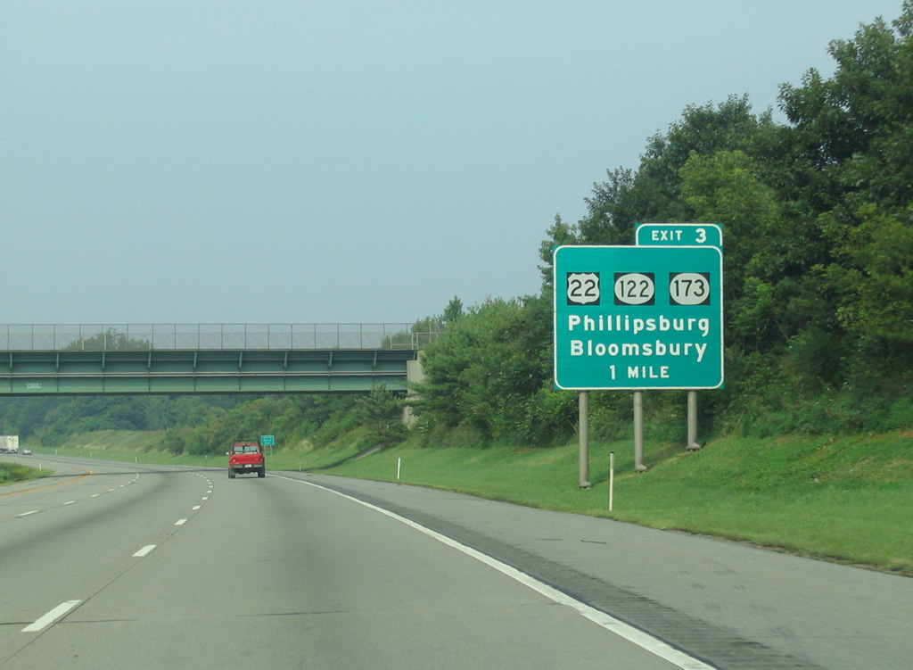
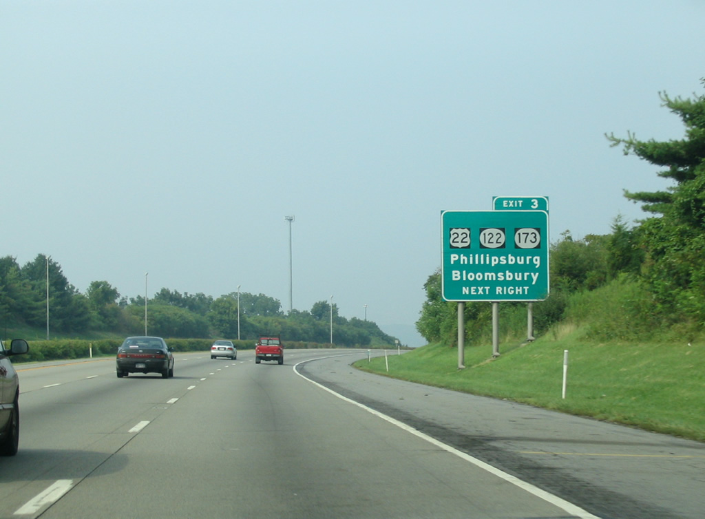
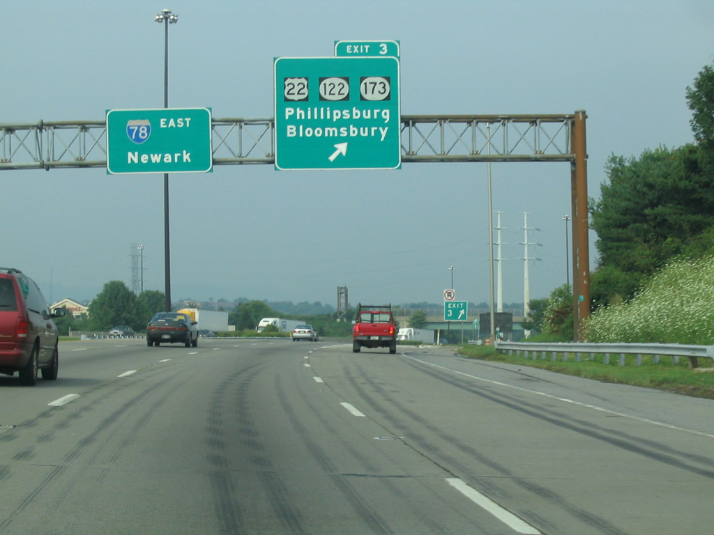
| Interstate 78 encircles the borough of Alpha from the Delaware River eastward to Still Valley. The freeway comverges with U.S. 22 east and Route 173 west at Exit 3. 08/11/04 |
|
| U.S. 22 joins Interstate 78 east at Exit 3 from Phillipsburg and Easton, Pennsylvania. Route 173 begins at the exchange and parallels I-78/U.S. 22 eastward along the former alignment of U.S. 22. 08/11/04 |
|
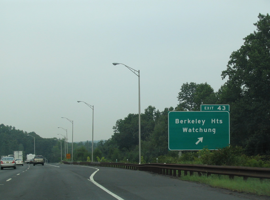
| Interstate 78 turns more easterly into the the directional cloverleaf interchange (Exit 3) with U.S. 22 west and Route 178 east. U.S. 22 follows a commercial arterial northwest to overtake Route 57 along Memorial Parkway west into Phillipsburg. Route 122 (New Brunswick Avenue) stems west from U.S. 22 nearby to Alpha and Phillipsburg to the south of U.S. 22. The state route follows the original route of U.S. 22 Alternate. 08/11/04 |
|
| Route 173 travels three miles east from Exit 3 to the borough of Bloomsbury. The state route intertwines with I-78/U.S. 22 several times in Hunterdon County. 08/11/04 |
|
| East of the half diamond interchange (Exit 4 on I-78 west) with Main Street (CR 637), I-78/U.S. 22 advance to Exit 6 with Bloomsbury Road (CR 632) at Musconetcong Valley. 08/11/04 |
|
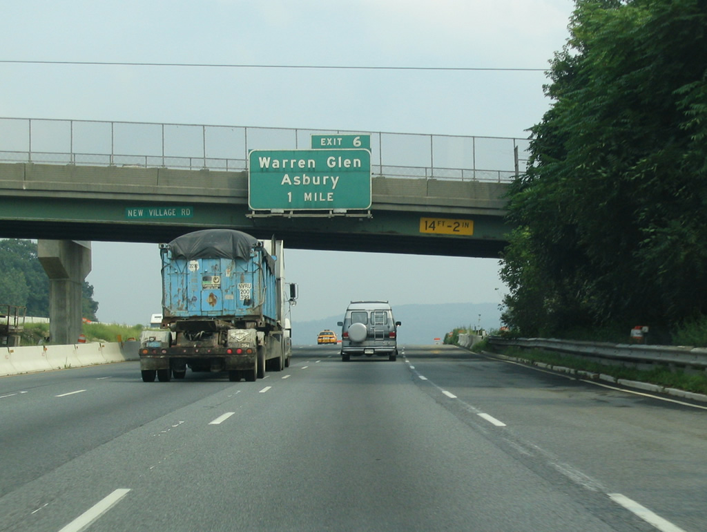
| Construction in 2004-05 added truck weigh stations along both sides of I-78/U.S. 22 at the original half diamond interchange with Asbury Bloomsbury Road (CR 632). Ramps were relocated further out. CR 632 runs northeast 4.5 miles to Asbury along the Musconetcong River. 08/11/04 |
|
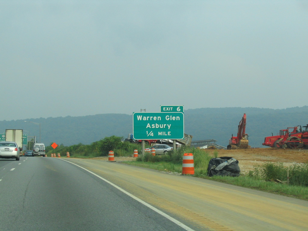
| The former eastbound ramp departure of Exit 6 for Asbury Bloomsbury Road (CR 632). Warren Glen lies 3.9 miles to the southwest via Route 173 and Warren Glen Bloomsbury Road. 08/11/04 |
|
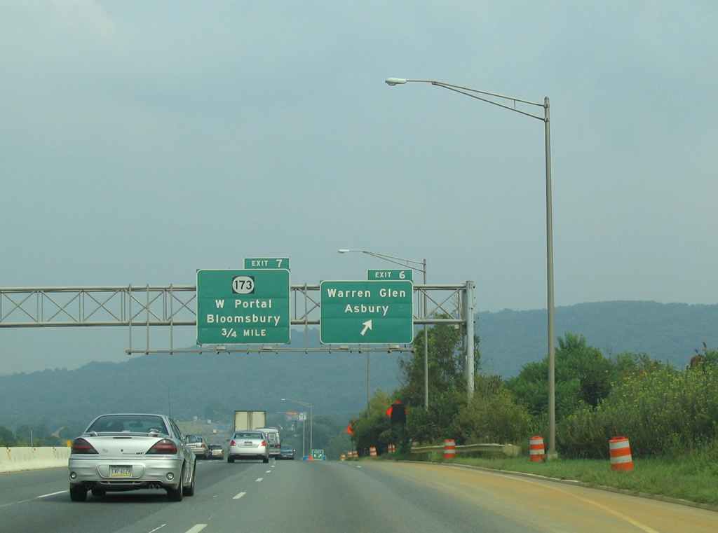
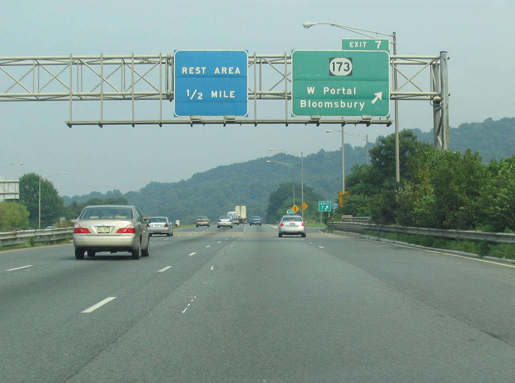
| I-78/U.S. 22 cross Musconetcong River ahead of a parclo B2 interchange (Exit 7) with Route 173. Rute 173 leaves Bloomsbury en route to West Portal in Bethlehem Township to the east. 08/11/04 |
|
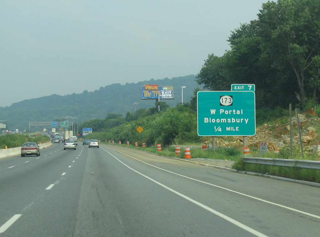
| Former button copy overheads posted at Exit 7 to Route 173 in east Bloomsbury. Route 173 reaches West Portal in 2.3 miles. 08/11/04 |
|
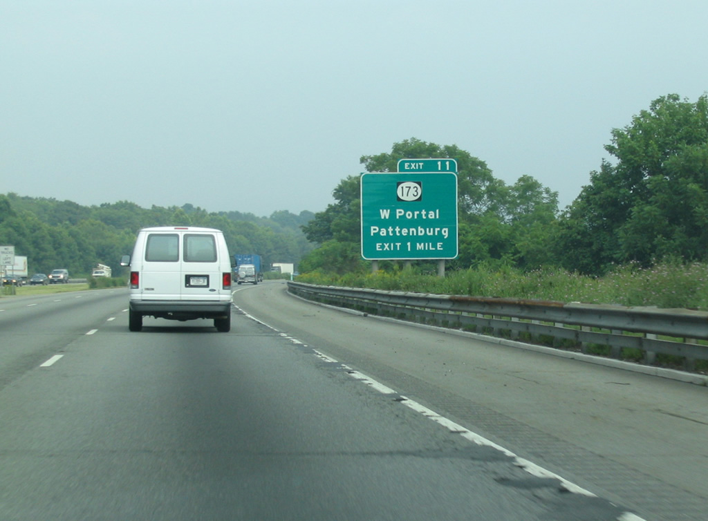
| I-78/U.S. 22 wind across Musconetcong Mountain over the next several miles. Route 173 returns to the freeway at a modified diamond interchange (Exit 12). Old U.S. 22 expands to a four lane highway from West Portal to a traffic circle with Pattenburg Road north of Exit 12. 08/11/04 |
|
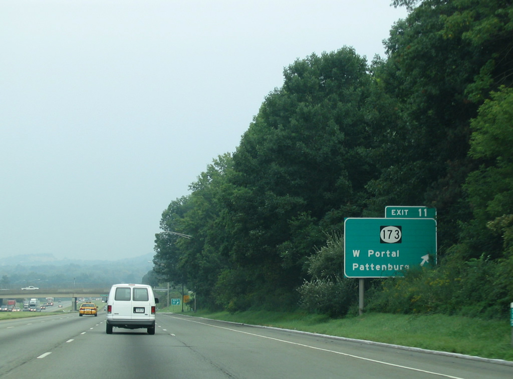
| Exit 11 departs I-78/U.S. 22 east for Pattenburg Road (CR 614) and Baptist Church Road. Route 173 ties into Pattenburg Road north of the freeway at Strotz Road. The area roads join the three routes with Norton to the north and Pattenburg to the south. 08/11/04 |
|
| A pair of frontage roads coincide with I-78/U.S. 22 between Exits 11 and 13. The north side frontage road doubles as Route 173 (former U.S. 22). The forthcoming ramps for Exit 12 tie into the adjacent roads for CR 635 (Perryville Road) north and south. 08/11/04 |
|
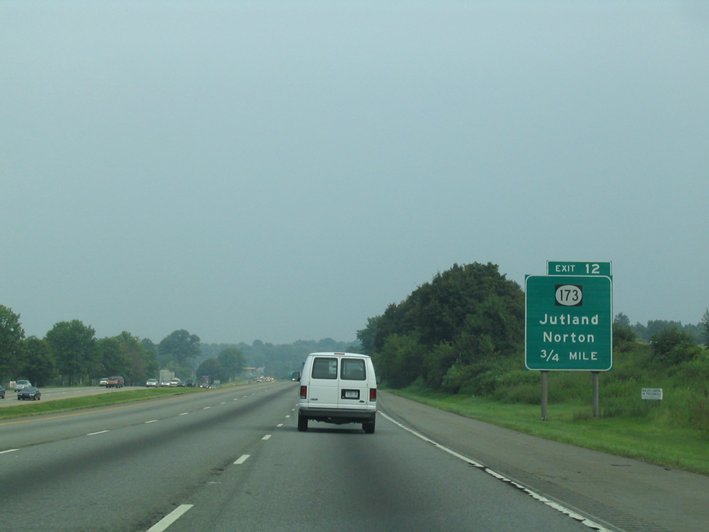
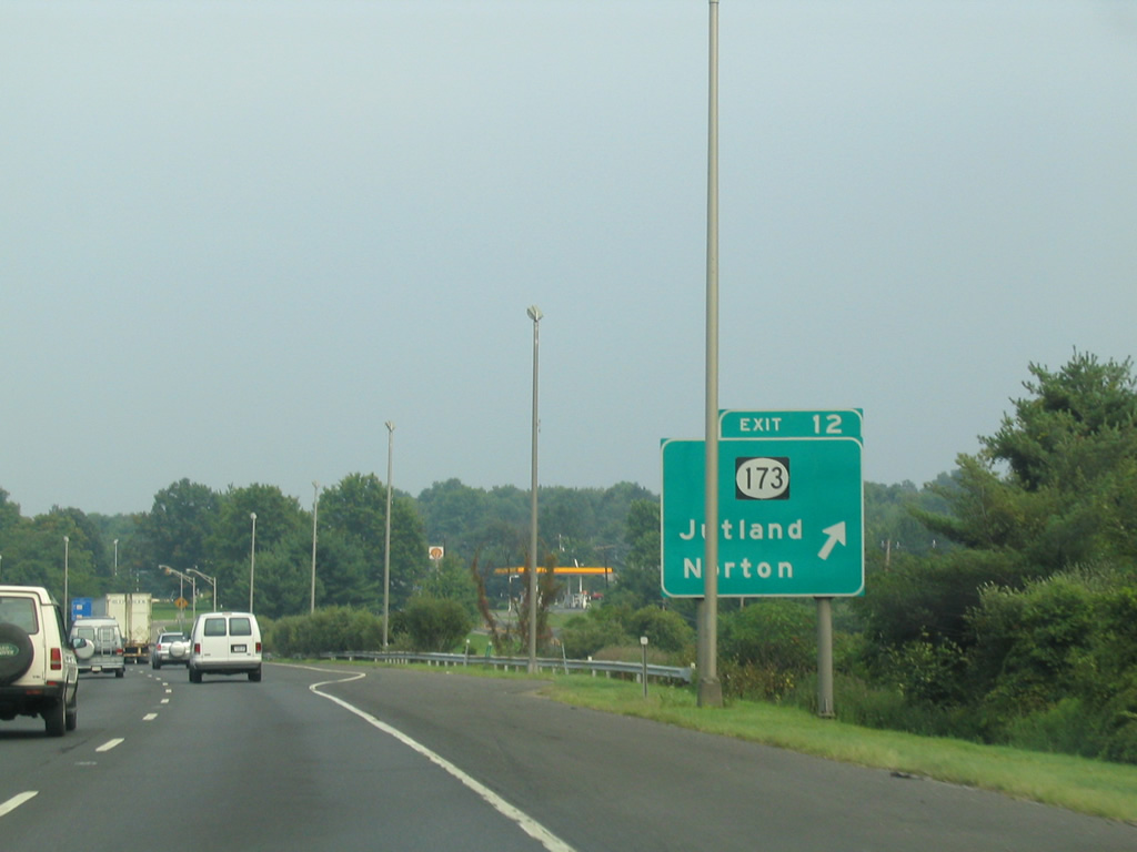
| Exit 12 leaves I-78/U.S. 22 east for Route 173, Norton and Jutland. The south side Frontage Road intersects County Route 635 south of Norton, and north of Perryville Road east to Jutland. 08/11/04 |
|
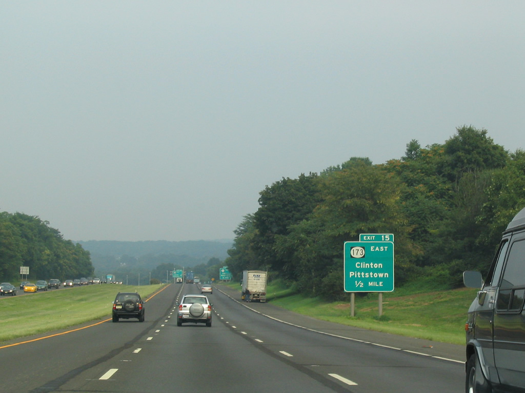
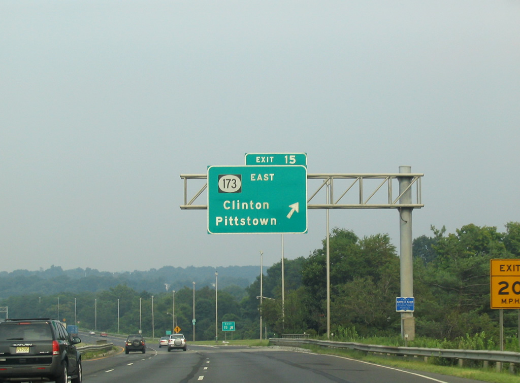
| Route 173 joins I-78/U.S. 22 between Exits 13 and 15 in Union Township. Route 173 reemerges along W Main Street at the town of Clinton via the loop ramp (Exit 15) to Pittstown Road (CR 513). 08/11/04 |
|
| Route 173 extends another 1.81 miles east through the Clinton town center to Route 31 near Annandale. County Route 513 leads southwest from Clinton four miles to Pittstown along the Union and Franklin Township line. 08/11/04 |
|
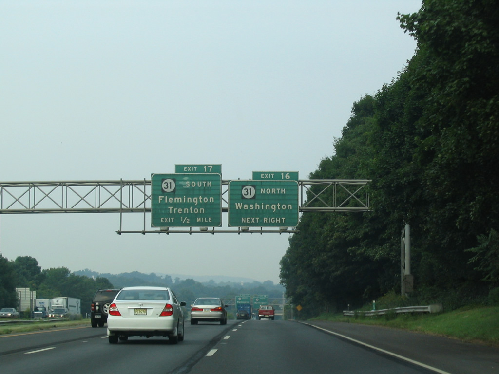
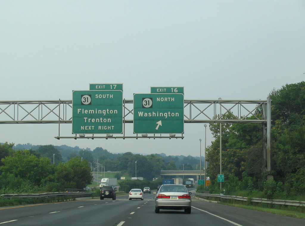
| I-78/U.S. 22 pass through Clinton ahead of Exit 16 and 17 with Route 31. 08/11/04 |
|
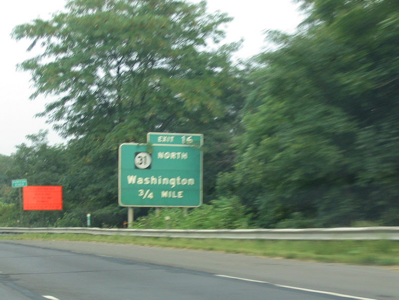
| Exit 16 links with Route 173 east for Route 31 north to Washington and High Bridge. The wye interchange brings traffic onto Route 173 ahead of Center Street and ramps with Route 31 at CR 626 (Beaver Road). 08/11/04 |
|
| The borough of Washington lies 11 miles to the northwest of Exit 16. Overall Route 31 travels 48.93 miles between Trenton and U.S. 46 in White Township. 08/11/04 |
|
| A four lane highway through Clinton Township, Route 31 expands to accommodate directional ramps with I-78/U.S. 22 near Annandale. Exit 17 joins Route 31 south two miles from Allerton and ten miles from U.S. 202 at Flemington. 08/11/04 |
|
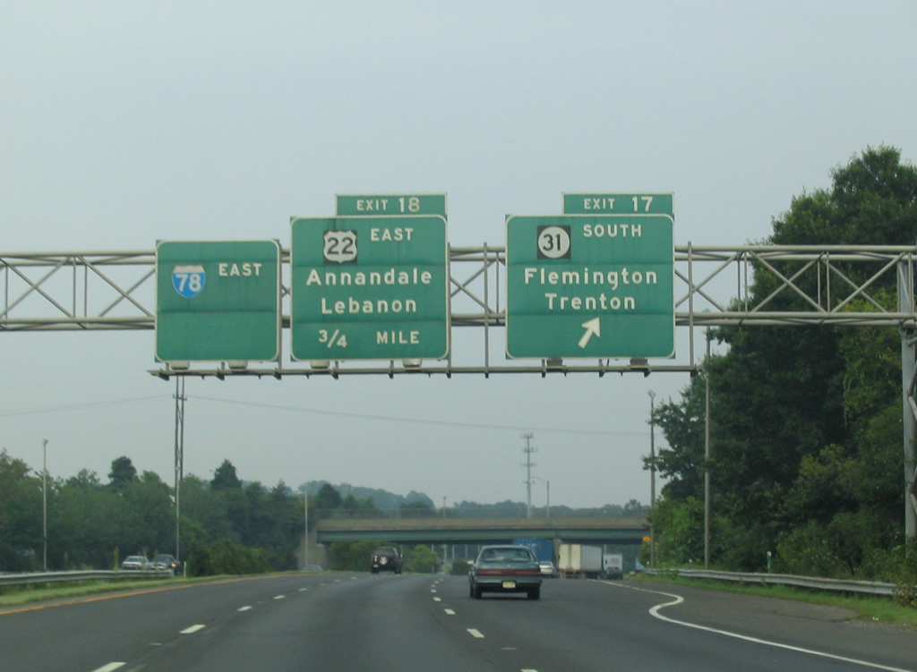
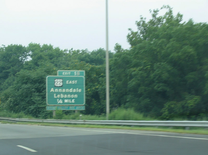
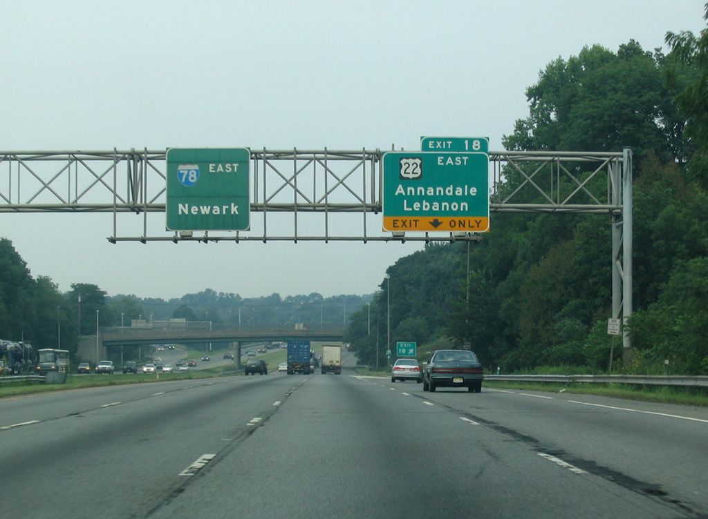
| The 15 mile long overlap with U.S. 22 concludes along Interstate 78 at Exit 18. U.S. 22 diverges from I-78 for Lebanon, Whitehouse and Somerville beyond the Old Allerton Road (CR 633) over crossing. 08/11/04 |
|
| A wye interchange for U.S. 22 east lies opposite a westbound wye interchange with CR 626 (Beaver Avenue / former U.S. 22) through Annandale. U.S. 22 meets Interstate 78 again at its eastern terminus in Newark. 08/11/04 |
|
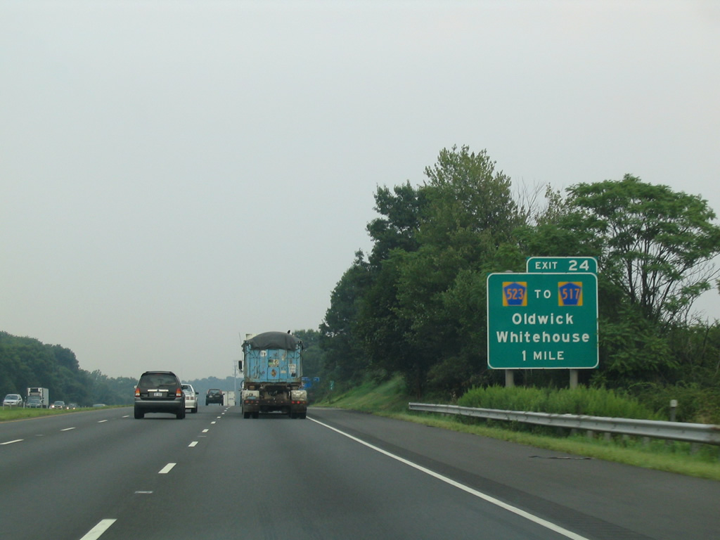
| Hunterdon County Route 523 (Oldwick Road) crosses paths with Interstate 78 seven miles east of the split with U.S. 22. CR 523 joins the freeway with Whitehouse two miles to the south and Oldwick one mile to the north. 08/11/04 |
|
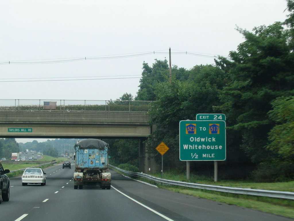
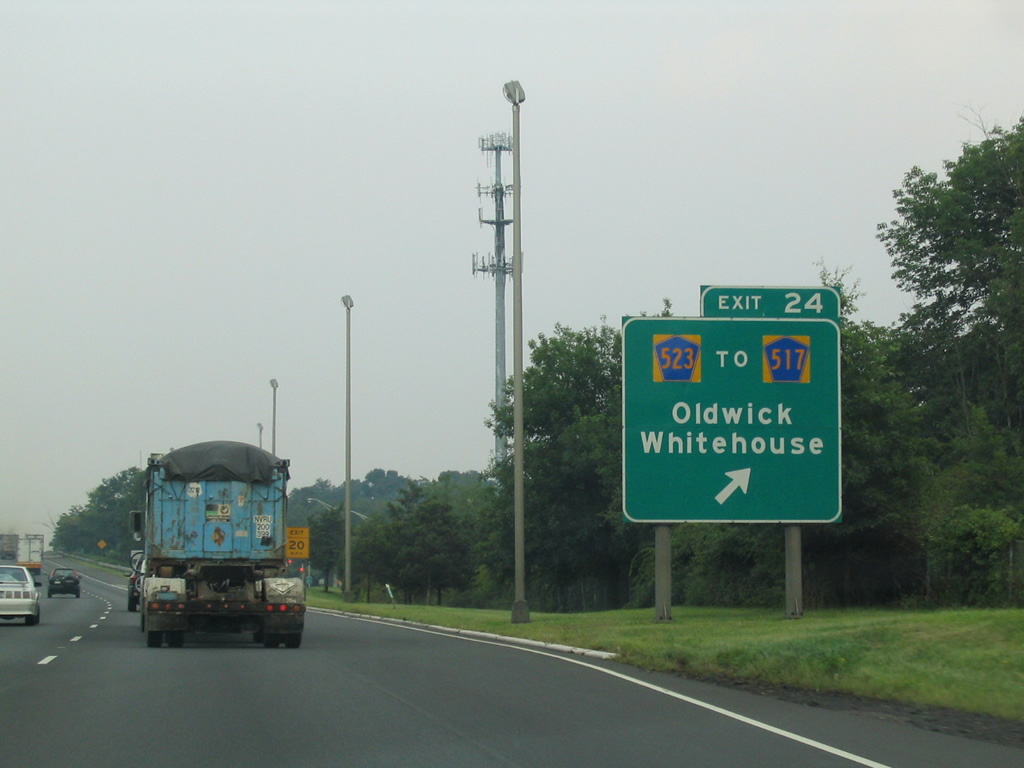
| A diamond interchange (Exit 24) joins I-78 with CR 523 (Oldwick Road) a half mile beyond Taylors Mill Road in northern Readington Township. CR 523 leads to CR 517 north for Oldwick and Fairmount. 08/11/04 |
|
| North of Exit 24, County Route 523 (Oldwick Road) turns east onto Lamington Road for Lamington and Bedminster Township east of Oldwick Road. 08/11/04 |
|
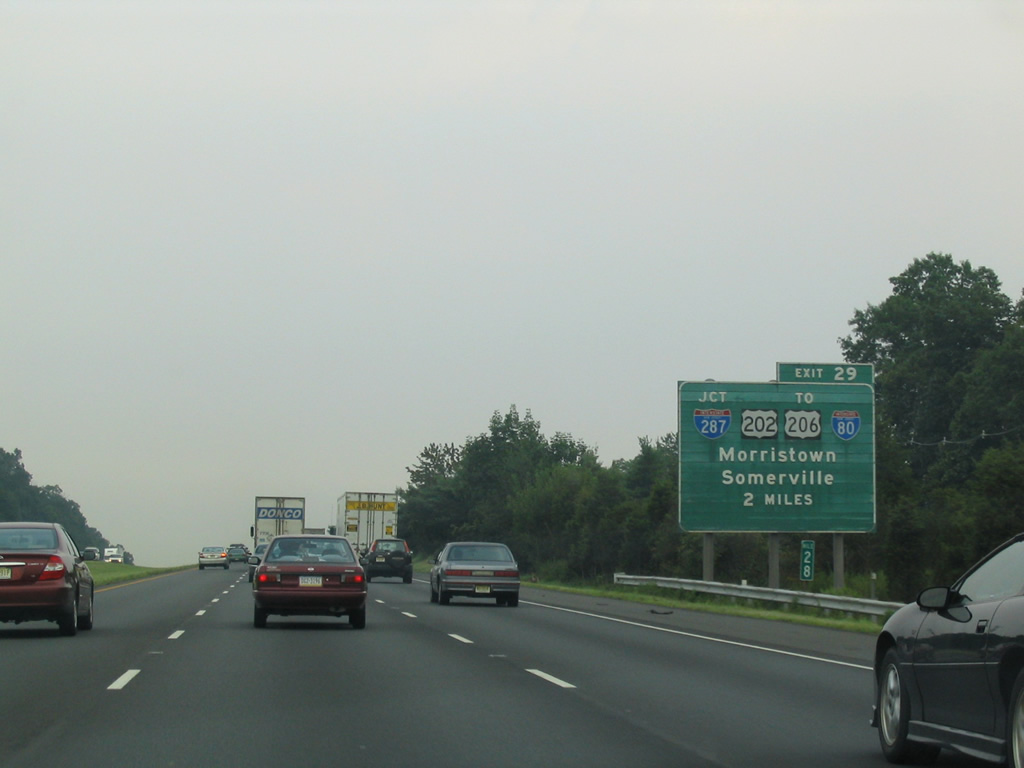
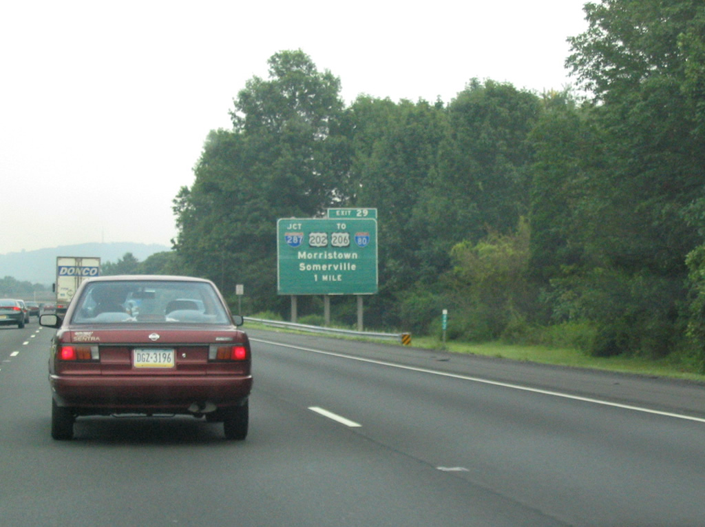
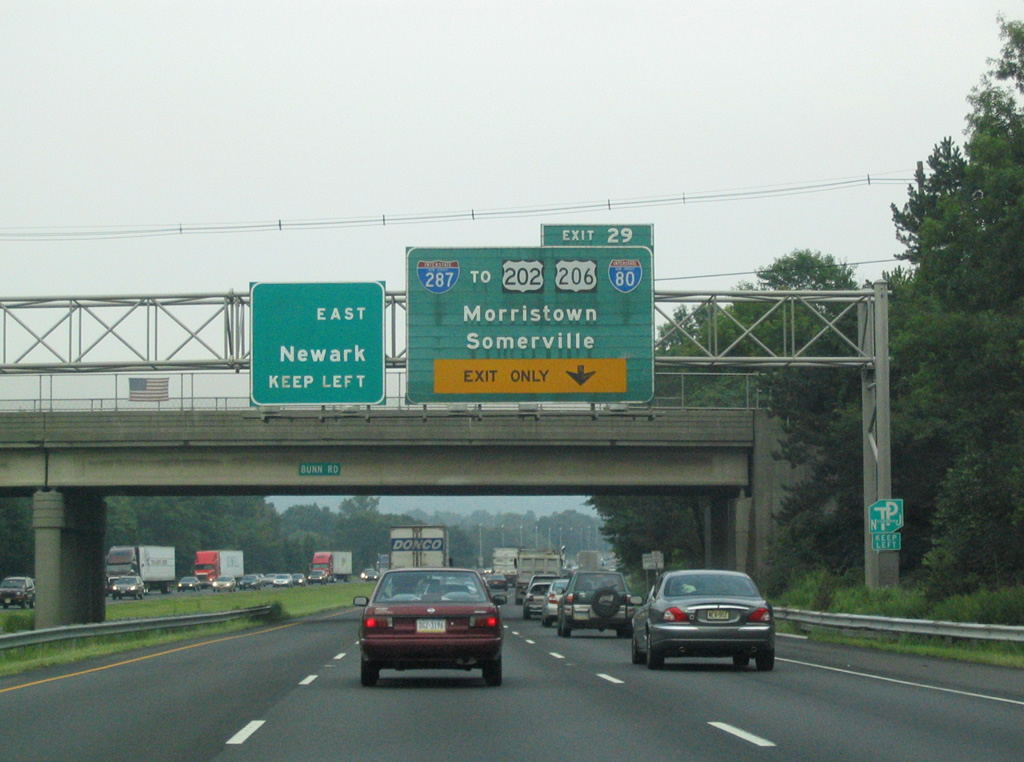
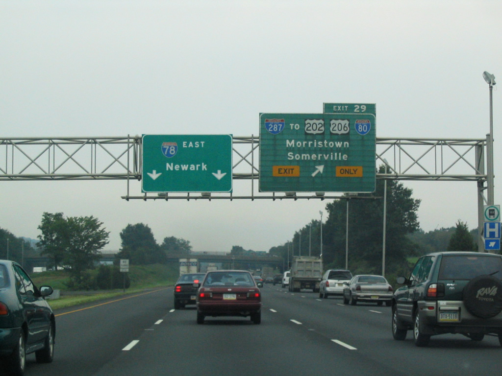
| Continuing east through Bedminster Township, I-78 advances to a directional cloverleaf interchange (Exit 29) with Interstate 287. 08/11/04 |
|
| Signs for Interstate 287 reference the connections with U.S. 202/206 south into Somerville and I-80 to the north. U.S. 202/206 parallel I-287 through Pluckemin. 08/11/04 |
|
| Interstate 287 and adjacent U.S. 202/206 southbound travel four miles through Bridgewater Township before parting ways for Somerville and Piscataway respectively. U.S. 206 north leaves the I-287 corridor from Pluckemin nearby to Chester. 08/11/04 |
|
| Exit 29 departs from I-78 east ahead of the Burnt Mills Road (CR 620) over crossing. I-287 and U.S. 202 north intertwine from Somerville to Mahwah at the New York state line. Both routes reach the Morris County seat of Morristown in 15 miles. I-287 meets I-80 in 20 miles at Parsippany-Troy Hills Township. 08/11/04 |
|
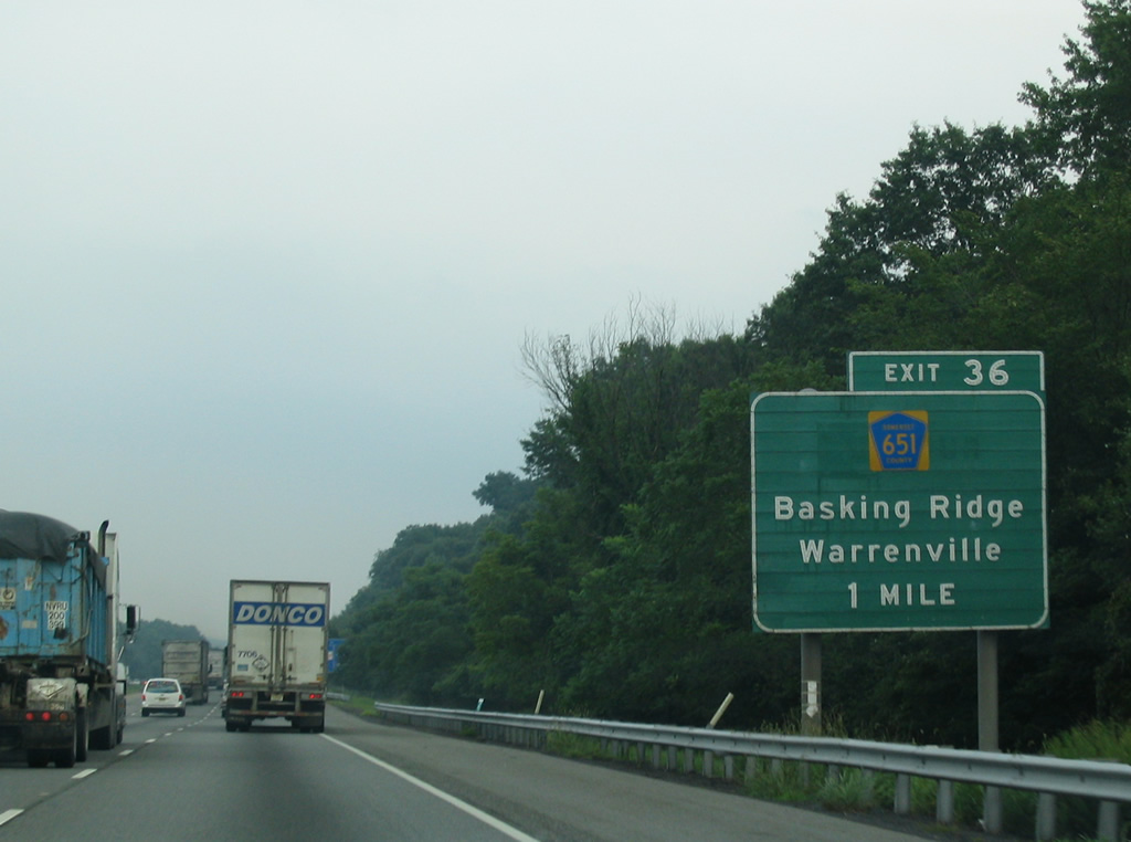
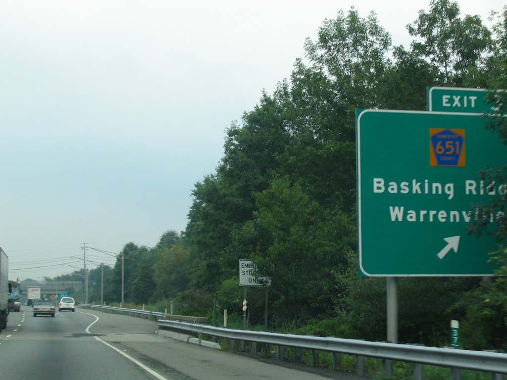
| Interstate 78 traverses Second Watchung Mountain into Warren Township. East from Exit 33, the freeway parallels the Dead River in a broad valley north of Second Watchung Mountain to Exit 36 with County Route 651 (King George Road). 08/11/04 |
|
| CR 651 (King George Road) links Interstate 78 with Mt. Bethel and Warrenville to the south and Basking Ridge in Bernards Township to the north. 08/11/04 |
|
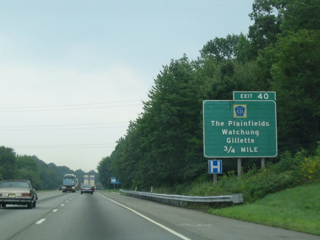
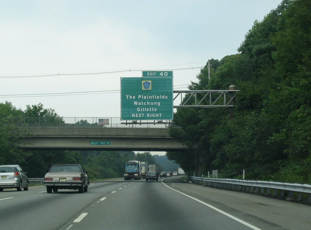
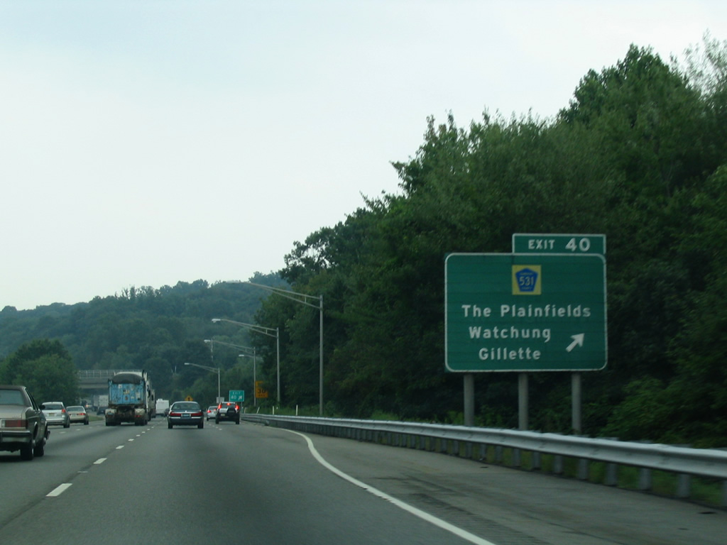
| CR 531 (Hillcrest Road) meets Interstate 78 at Exit 40 near Watchung. Hillcrest Road runs from CR 527 (Valley Road) in the borough of Watchung to Mountain Avenue (CR 622) and Gillette across the Morris County line to the north. 08/11/04 |
|
| A six-ramp parclo interchange (Exit 40) joins I-78 with CR 531 beyond the Valley View Road overpass. CR 531 continues southeast of Watchung to North Plainfield, Plainfield, South Plainfield, Metuchen and Edison. 08/11/04 |
|
| County Route 531 ends at CR 512 (Valley Road), 1.7 miles to the north of Exit 40 in Gillette. 08/11/04 |
|
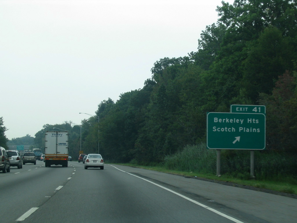
| The final Somerset County departs Interstate 78 east for Dale Road at Drift Road on Second Watchung Mountain. Drift Road lowers to Plainfield Avenue nearby, just north of Exit 41. Plainfield Avenue crosses into Union County north of there to west Berkeley Heights Township while leading south to become Bonnie Burn Road to Scotch Plains. 08/11/04 |
|
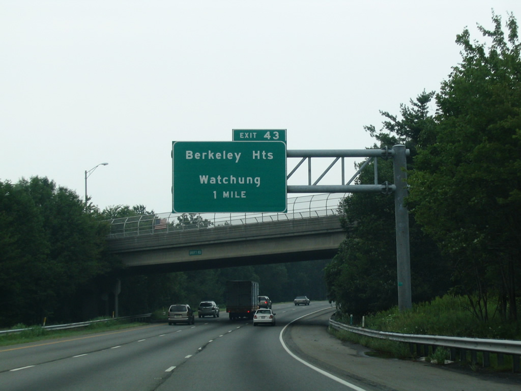
| I-78 proceeds one mile from the half diamond interchange (Exit 41) at Drift Road to Exit 43 for CR 527 (Valley Road). CR 527 runs between First and Second Watchung Mountains. 08/11/04 |
|
| Linking Exit 43 with CR 527 (Valley Road), Oak Way serves adjacent Connell Corporate Park. 08/11/04 |
|
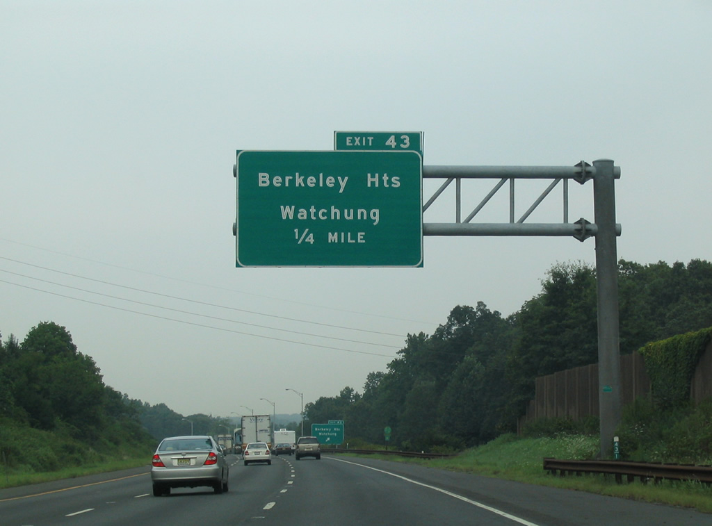
| Exit 43 leaves I-78 east for Oak Way and CR 527. Diamond Hill Road (CR 655) ties into CR 527 nearby, providing return access to I-78 east from Scotch Plains Township to the south. 08/11/04 |
|
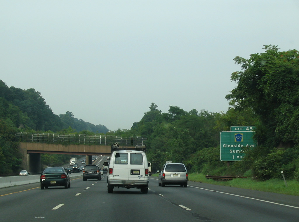
| CR 527 constitutes a lengthy route, originating at Toms River in South Jersey and ending to the north at Cedar Grove. CR 527 (Glenside Avenue) parallels the south side of Interstate 78 along the northern boundary of the Watchung Reservation between Exits 43 and 45. 08/11/04 |
|
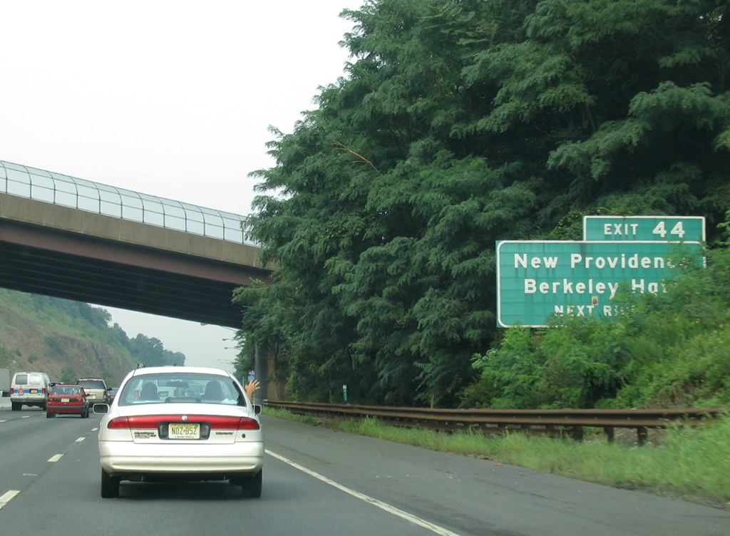
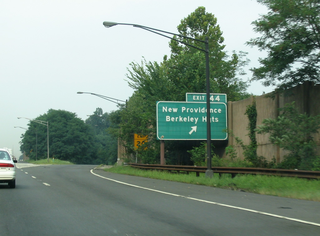
| Exit 44 is the first of two for Glenside Avenue on Interstate 78 eastbound. Glenside Avenue provides connections to New Providence and Berkeley Heights via CR 647 (Glenside Road / South Street) north. 08/11/04 |
|
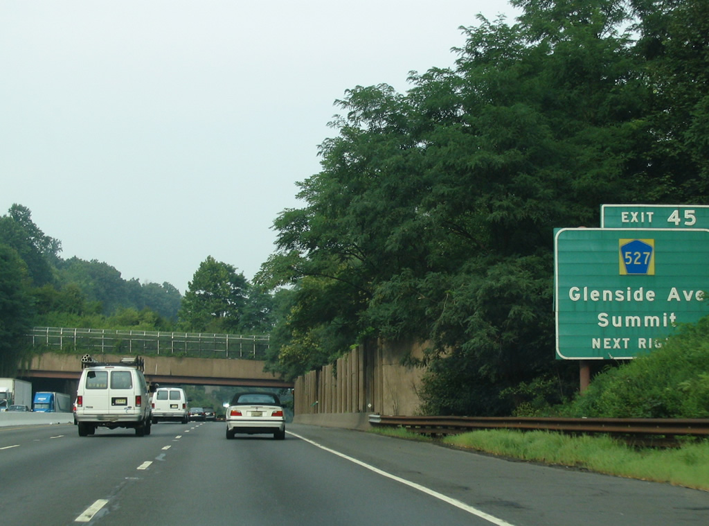
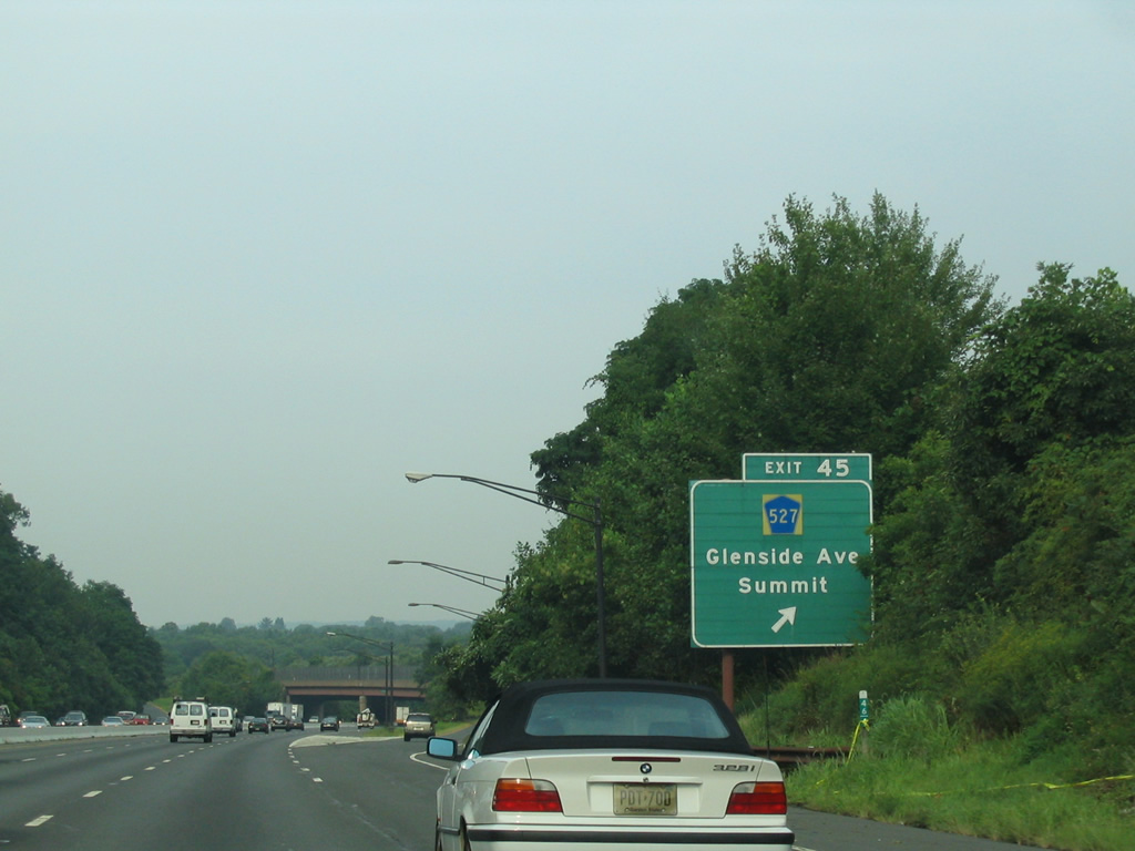
| County Route 527 (Glenside Avenue) and Interstate 78 travel from Watchung Reservation into the city of Summit, coming together again at a half diamond interchange (Exit 45) in one mile. 08/11/04 |
|
| Glenside Avenue carries County Route 527 another 1.3 miles northeast from Exit 45 to Morris Avenue through the city of Summit. 08/11/04 |
|
| Union County Route 527 continues through Summit to Millburn and Livingston, with interchanges at Route 24 and Interstate 280. 08/11/04 |
|
| Interstate 78 partitions into a Local / Express configuration at the exchange with Route 24 in Springfield Township. The dual freeway runs east through Union Township and Newark. 08/11/04 |
|
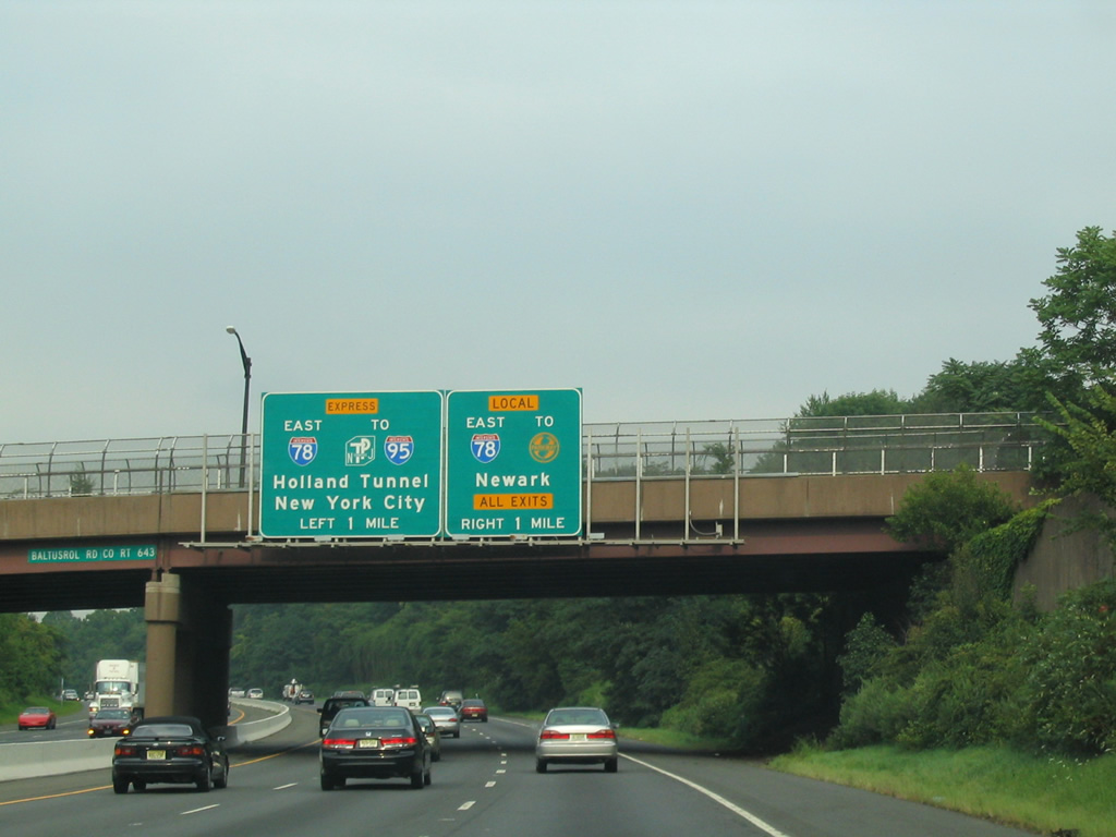
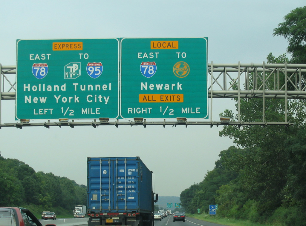
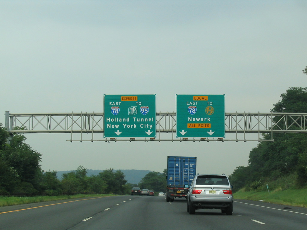
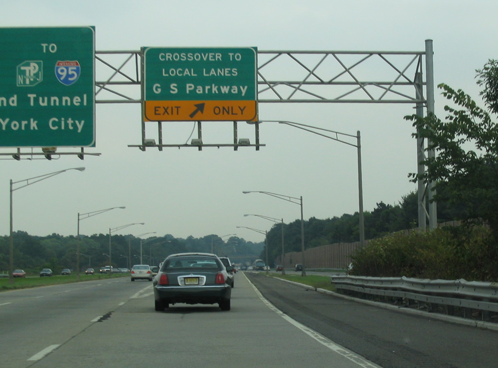
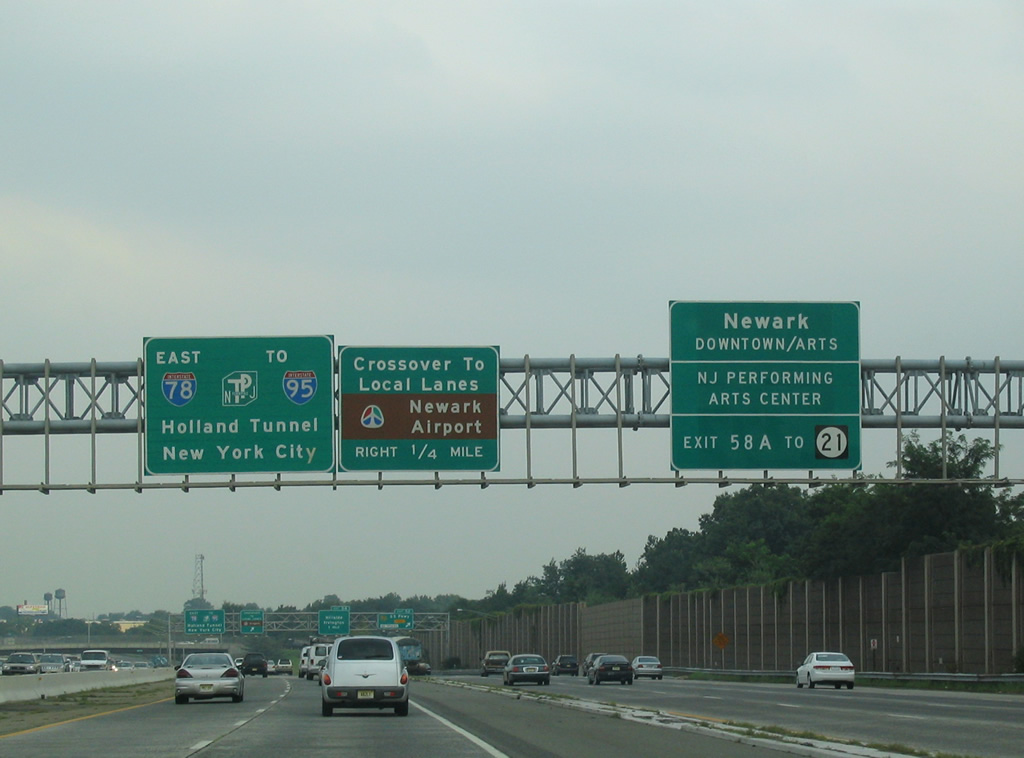
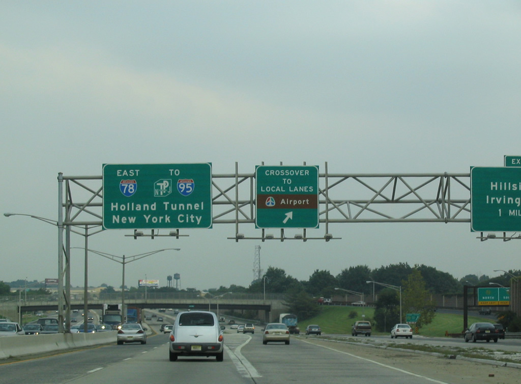
| Traffic bound for the New Jersey Turnpike (I-95) and Holland Tunnel into New York City is advised to use the Express lanes through Union and Newark. I-78 meets the Garden State Parkway in four miles at Union. 08/11/04 |
|
| Interstate 78 east separates into a pair of two lane roadways by Hidden Valley Park. The freeway eventually swells to between ten and 14 lanes on the stretch through Union and Newark. The dual freeway configuration concludes at the New Jersey Turnpike Extension to Bayonne, Jersey City and the Holland Tunnel. 08/11/04 |
|
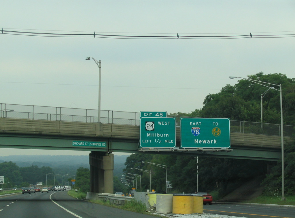
| Interstate 78 Express and Local eastbound at the Shunpike Road (CR 636) overpass. Exit 48 departs from the Local lanes in one half mile for Route 24 west. Comprising a commuter freeway between I-78 at Springfield and I-287 at Morristown, Route 24 runs 10.42 miles to the northwest. 08/11/04 |
|
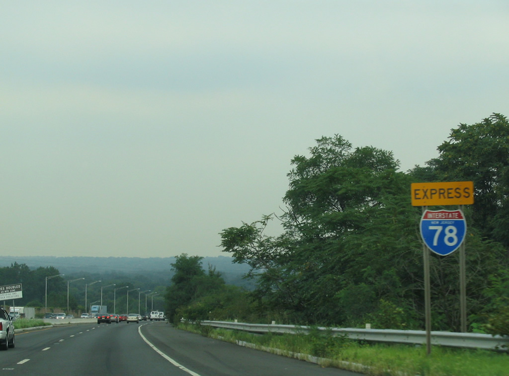
| Interstate 78 Express reassurance shield posted ahead of the Troy Drive and Baltusrol Way underpass. 08/11/04 |
|
| Route 124 (Springfield Avenue) parallels Route 24 and I-78 at Morristown, Springfield and Union. Route 124 follows Morris Avenue southeast below I-78 to Maple Avenue and Route 82. Route 82 continues Morris Avenue southeast to Downtown Union while Route 124 shifts northward along Springfield Avenue toward Irvington. 08/11/04 |
|
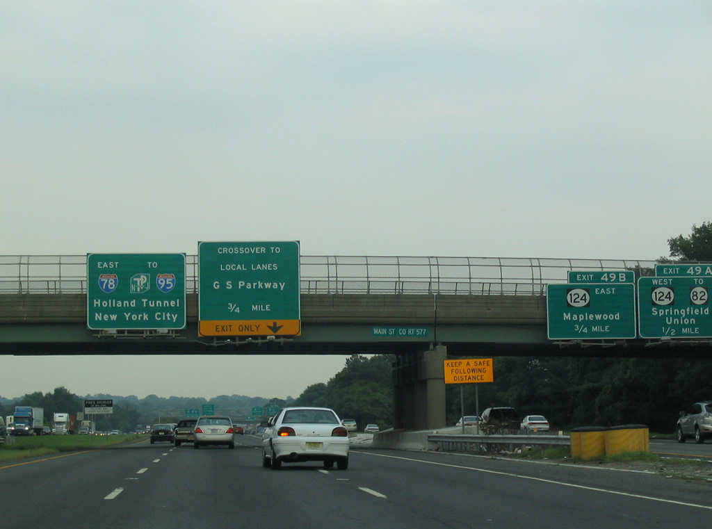
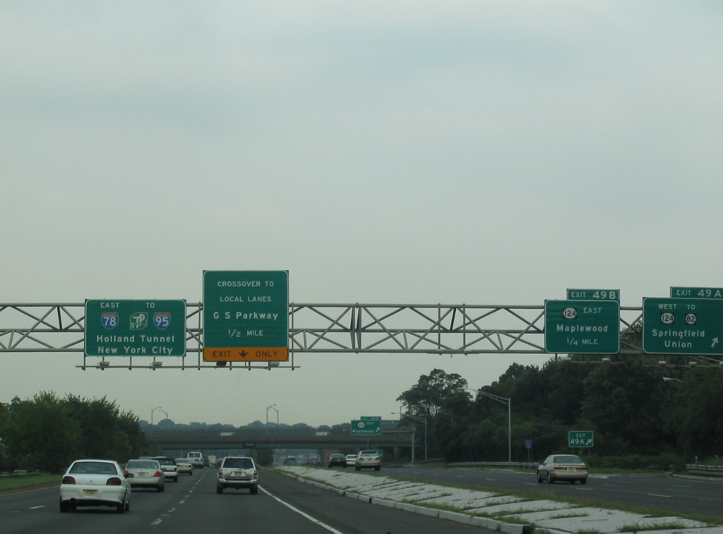
| Exit 49A leaves I-78 Local for Route 124 (Springfield Avenue) west to Route 82 and Springfield. A second loop ramp follows onto Route 124 east for Maplewood and Irvington Townships. 08/11/04 |
|
| A crossover immediately east of Route 124 provides access from the Express lanes to the Local lanes for the Garden State Parkway. 08/11/04 |
|
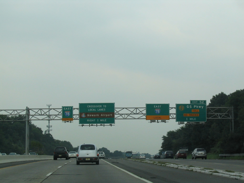
| Ramps bring traffic onto the Local lanes from Liberty Avenue and Vauxhall Road (CR 630) in Union Township. Exit 52 follows from I-78 Local to the Garden State Parkway (GSP). A second crossover precedes the forthcoming exchange for Newark Liberty International Airport (EWR). 08/11/04 |
|
| Sound walls line both sides of the ten lane freeway ahead of Exit 52 for the GSP. The Express to Local lane crossover precedes Exit 58A for Downtown Newark via Route 21 (McCarter Highway) north. 08/11/04 |
|
| The crossover leaves for the Local lanes at the two-wye interchange (Exit 52) and access road to the GSP. A heavily traveled toll road between Woodbridge and Perth Amboy to the south and Orange, Clifton and Patterson to the north, the GSP travels 172 miles overall from Cape May to the New York Thruway (I-87/287). 08/11/04 |
Page Updated 05-06-2014.

 East
East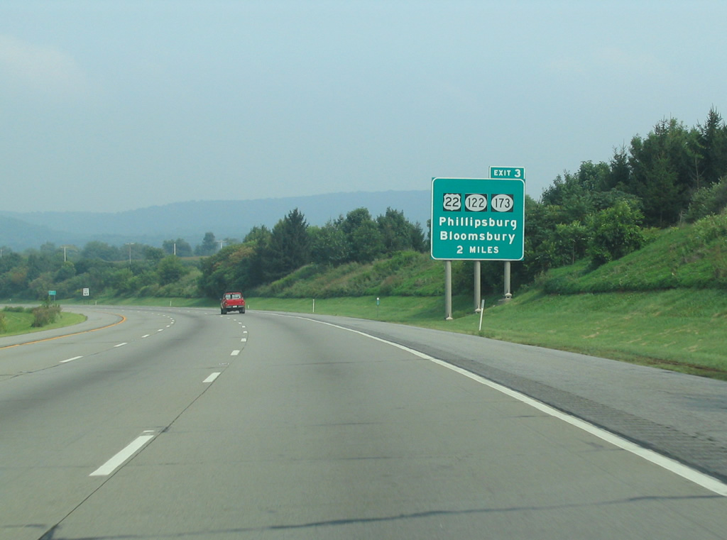
 East
East