
Unlike its eastern component which traverses the Southern Tier of New York east from Erie County, Pennsylvania, the western section of Interstate 86 falls completely within Idaho. Connecting Interstate 15 in Pocatello with I-84 east of Twin Falls and Burley, I-86 travels only 62.5 miles between the two freeways.
Beginning at a trumpet interchange with I-84 just over 12 miles east of Burley, I-86 heads easterly alongside U.S. 30 as a rural freeway through flat grassy terrain toward Pocatello. The two highways parallel south of the Snake River for nearly three quarters of the course to Pocatello, leaving the river beyond American Falls. Other than Pocatello and neighboring Chubbuck, American Falls is the only other populous place found along the I-86 corridor.
Interstate 86 Idaho Guides
Originally signed as Interstate 15W and overlaying former U.S. 30N for the majority of its route, two portions of what would later become I-86 were completed by 1964. This included the section between I-84 (then I-80N) and Raft River and a four mile long stretch around American Falls (between Exits 36 and 40). Further segments of the freeway opened by 1973, leaving only a two lane section between Raft River and American Falls. Also by 1973, U.S. 30 overtook U.S. 30N and was siphoned onto I-15W on the completed sections.
By November 1977, the Idaho Department of Transportation and the American Association of State Highways and Transportation Officials (AASHTO) agreed on several designation changes throughout the state, including a renumbering of I-15W as I-86.1 The first instance of I-86 showed up on the 1978 edition of the Idaho Official Highway Map.
The aforementioned two lane stretch of I-86 between Raft River and American Falls was expanded to four lanes by 1985.2 Construction completing the freeway was separated into two phases, one segment between Coldwater (Exit 21) and Fall Creek with the other segment lying between Fall Creek and Rockland (Exit 37).
 scenes scenes |
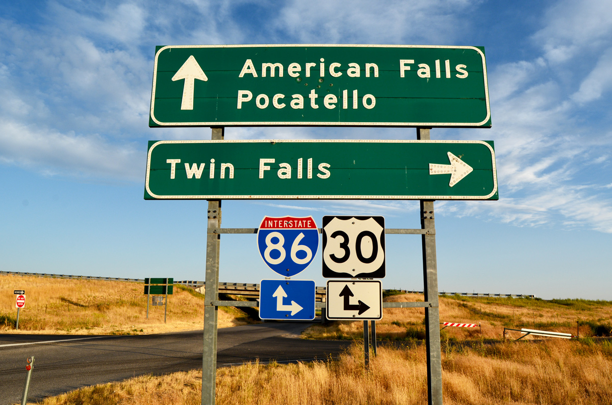 | Remaining button copy signage at the diamond interchange (Exit 15) between Yale Road and I-86/U.S. 30. Yale Road joins the freeway with the Raft River area. 08/09/16 |
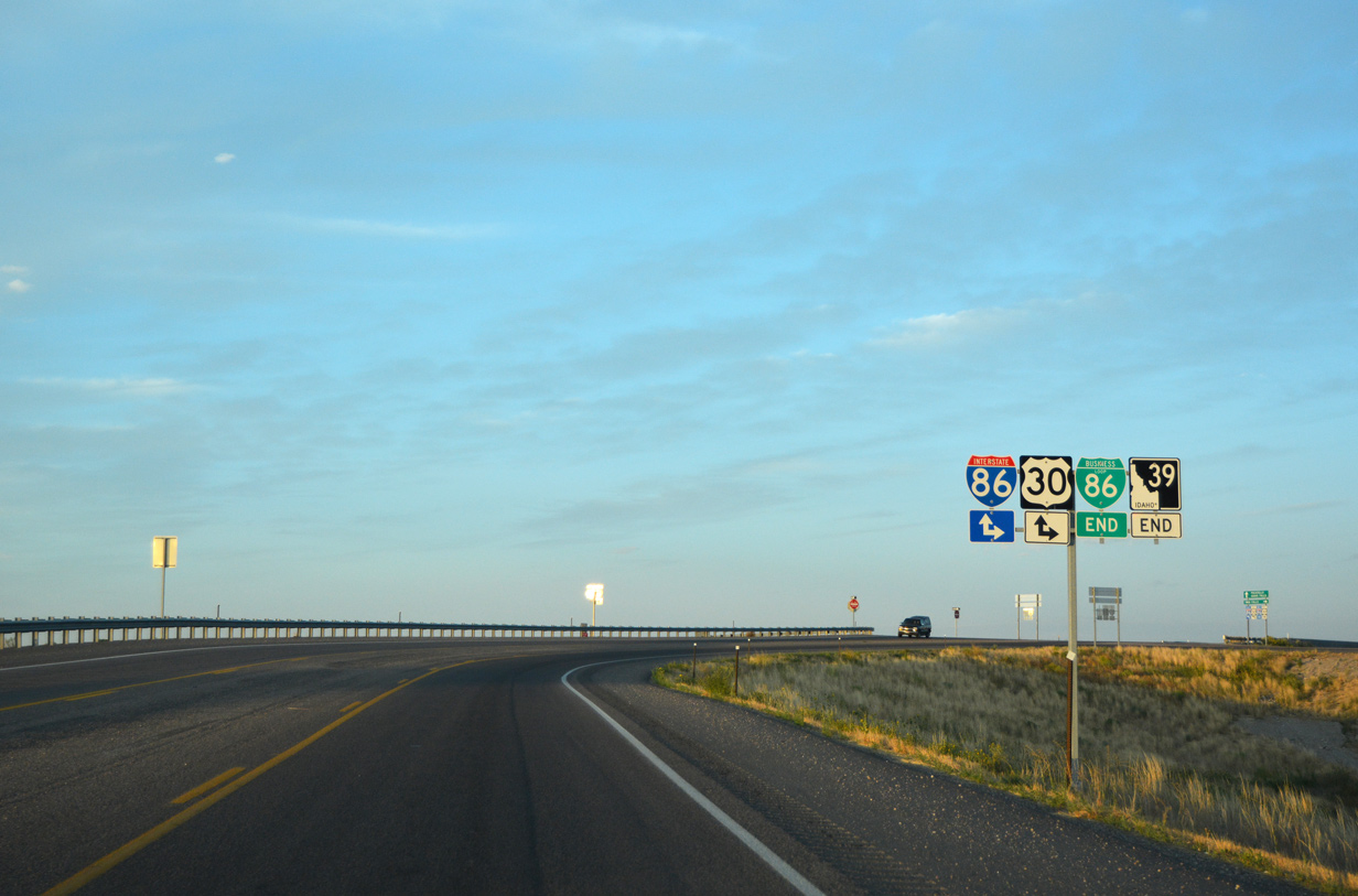 | Assembly showing the ends for both Business Loop I-86/SH 39 (Pocatello Avenue) ahead of the diamond interchange with I-86/U.S. 30. SH 39 concludes after a 52.9 mile run from Blackfoot and Aberdeen while the sole business route for I-86 finishes a 5.34 mile loop through American Falls. 08/09/16 |
- "Road numbers to change", The Spokesman-Review, November 3, 1977.
- "Completion date set for interstate", The Spokesman-Review, June 18, 1981.
Photo Credits:
08/09/16 by AARoads
Connect with:
Interstate 15
Interstate 84
Page Updated 09-01-2016.