|
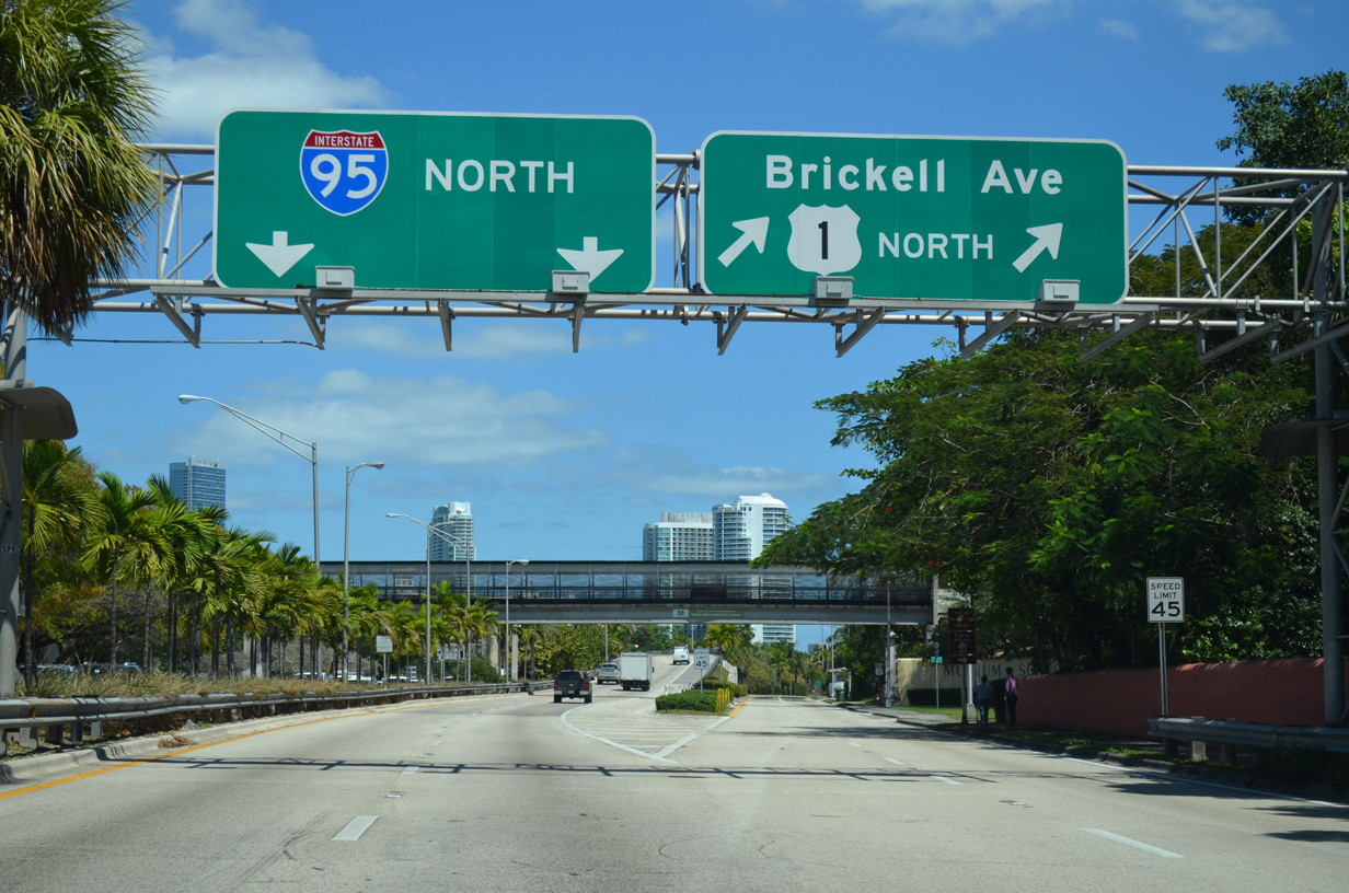
| Interstate 95 north begins at a wye interchange with Brickell Avenue. Brickell Avenue was formerly a part of U.S. 1 until Winter 2014, when the city of Miami took over maintenance for the boulevard leading northeast to Downtown. 04/01/14 |
|
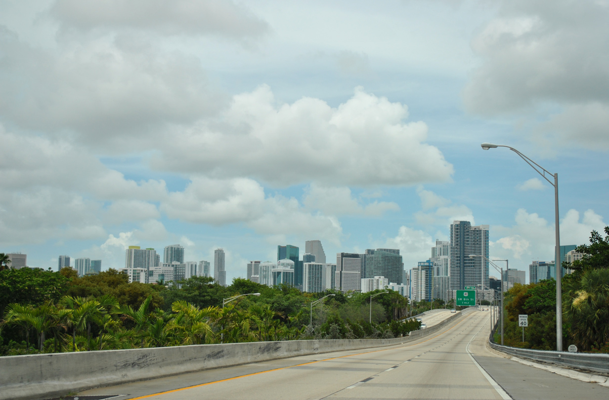
| The freeway rises to pass over SW 26th Road and SR 913 by the first northbound reassurance marker. Interstate 95 skirts the western edge of Downtown and the eastern edge of Little Havana over the next three miles. 04/01/14 |
|
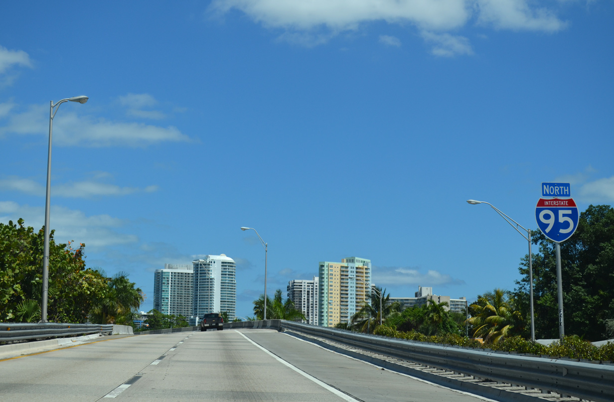
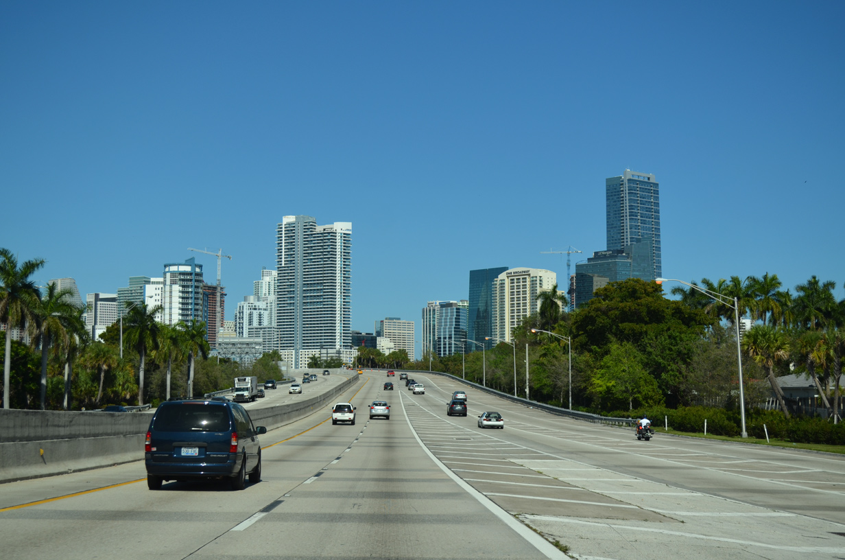
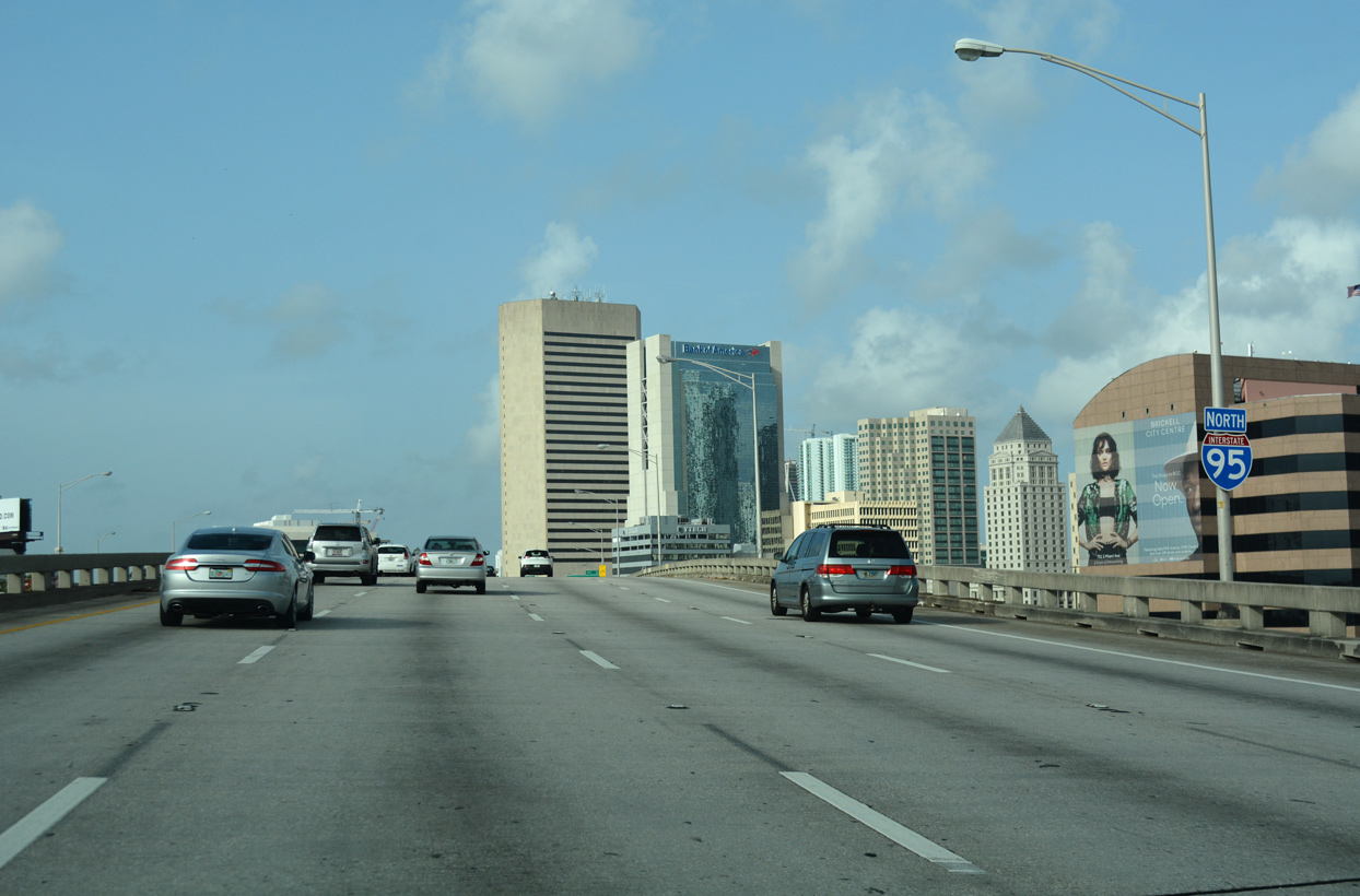
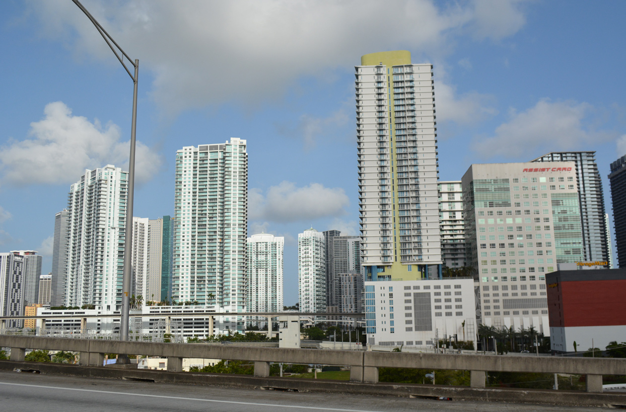
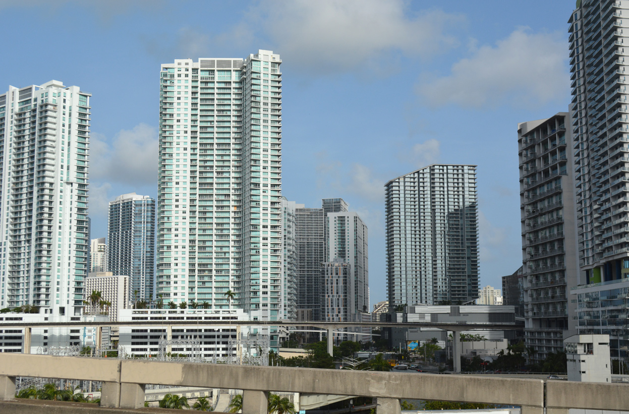
| Condominiums and high rises line the northern horizon as Interstate 95 approaches the Miami financial district. I-95 runs north for 17.26 miles through Miami-Dade County, with the first seven miles falling within the city of Miami. Miami was founded in 1896. 07/05/11 |
|
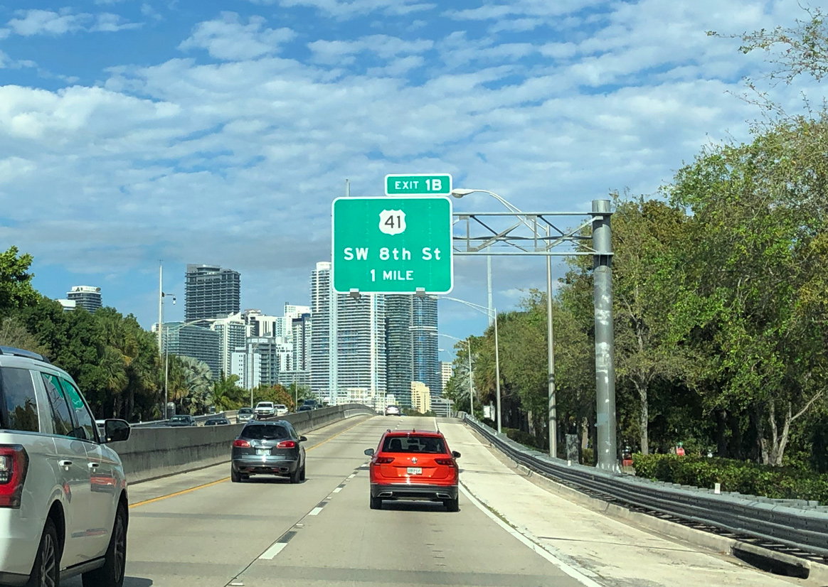
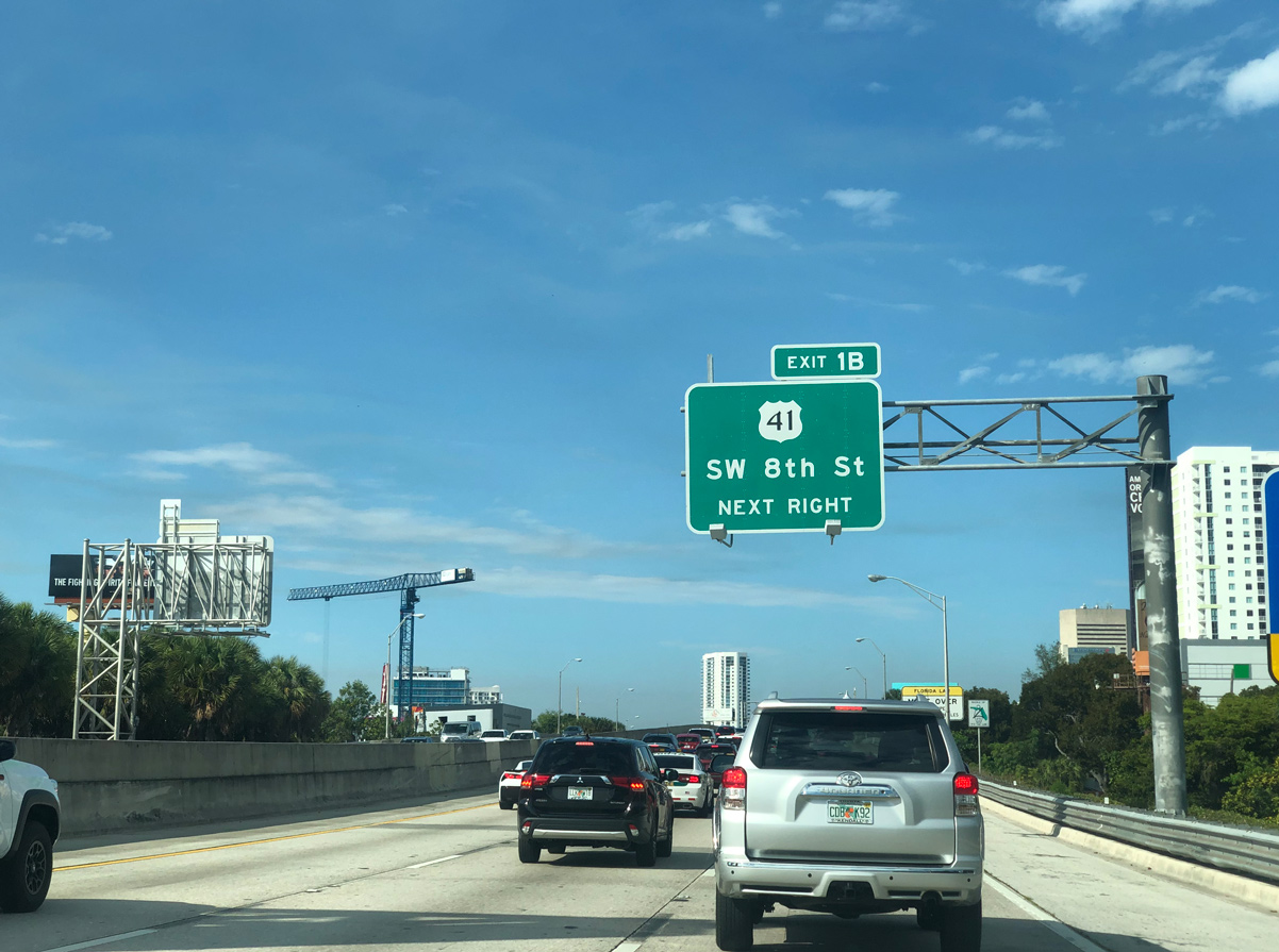
| The first exit from northbound I-95 connects with U.S. 41 (SW 8th Street). U.S. 41 (Tamiami Trail) concludes five blocks to the east at Brickell Avenue (old U.S. 1). Prior to 1999, the route extended further east along SR A1A (MacArthur Causeway) to Miami Beach. 02/27/20 |
|
| The nascent freeway is only four lanes wide, separated by a concrete barrier on a fairly narrow section of right of way. This changes with the on-ramp from SR 913 (Rickenbacker Causeway) north, which adds a third northbound lane. 03/04/14 |
|
| The second shield for Interstate 95 north appears as the freeway turns more northerly along the western periphery of Downtown Miami. The Miami Metrorail line leading northeast from Dadeland to Downtown passes under I-95/U.S. 1 here. 04/01/14 |
|
| A parclo interchange joins Interstate 95 with the one way couplet of U.S. 41 (SW 7th and SW 8th Streets) in one quarter mile. U.S. 41 leads west from Miami to traverse the Everglades en route to Naples, where it curves northward for the remainder of its 2,000 mile route to the upper peninsula of Michigan. 02/27/20 |
|
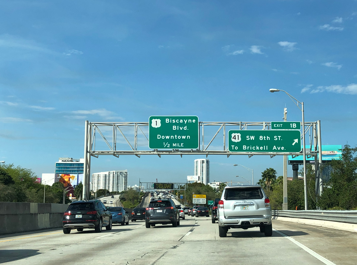
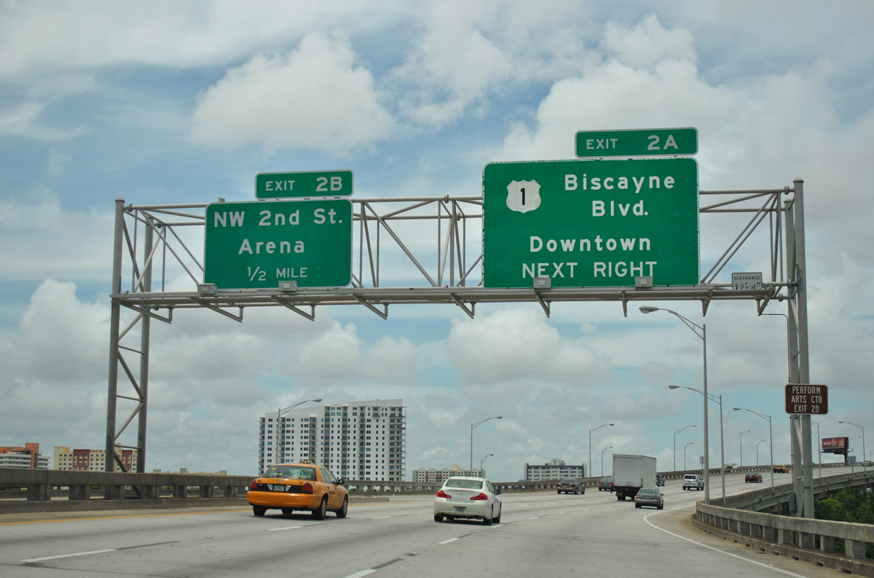
| Exit 1B lowers from I-95/U.S. 1 north onto SW 3rd Avenue north ahead of the U.S. 41 couplet. U.S. 41 intersects the south end of U.S. 441 (SW 8th Avenue), five blocks to the west. U.S. 441 parallels I-95 north through Miami to Hollywood, Boca Raton and West Palm Beach. U.S. 41 remains west to Little Havana, West Miami and Sweetwater. 02/27/20 |
|
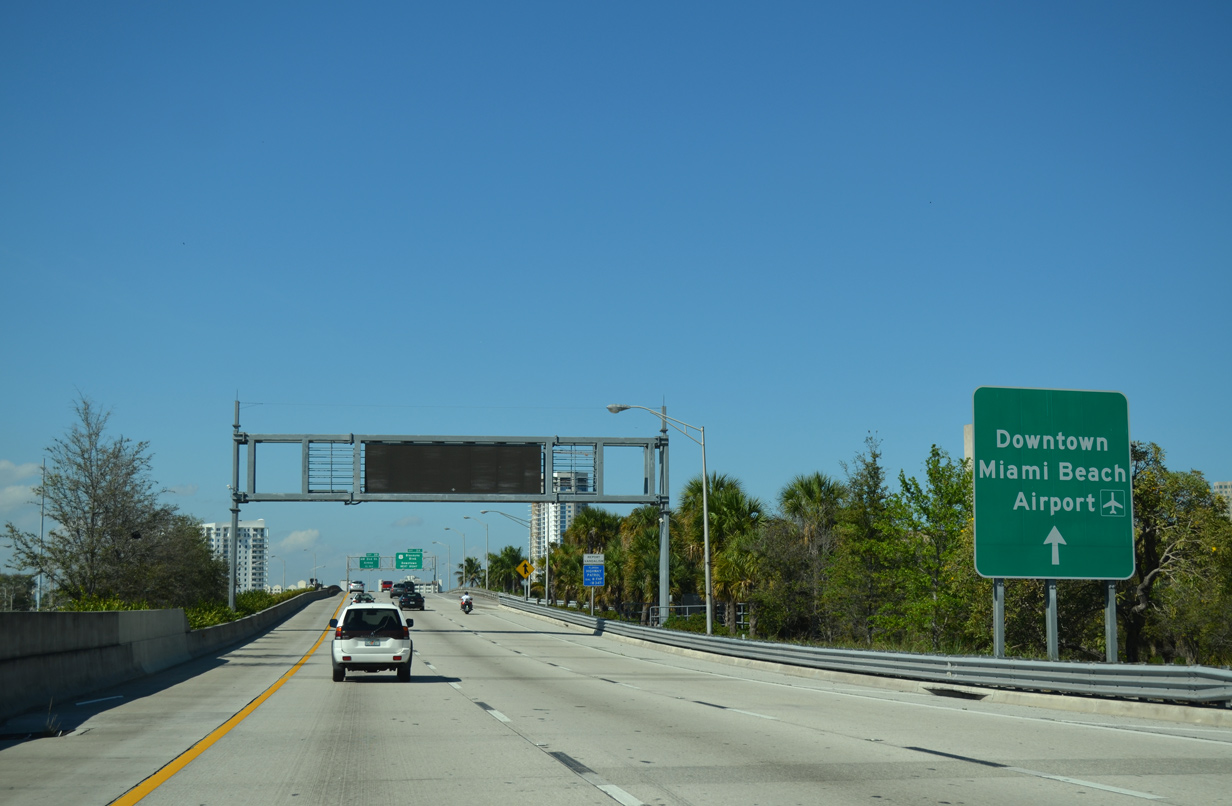
| Wayfinding signs, such as this one posted after the Exit 1 B gore point, direct motorists to popular visitor destinations served by Interstate 95. This assembly references Downtown (via Exit 2 A, Downtown Distributor), Miami Beach via I-395, and Miami International Airport (MIA) via SR 112. 03/04/14 |
|
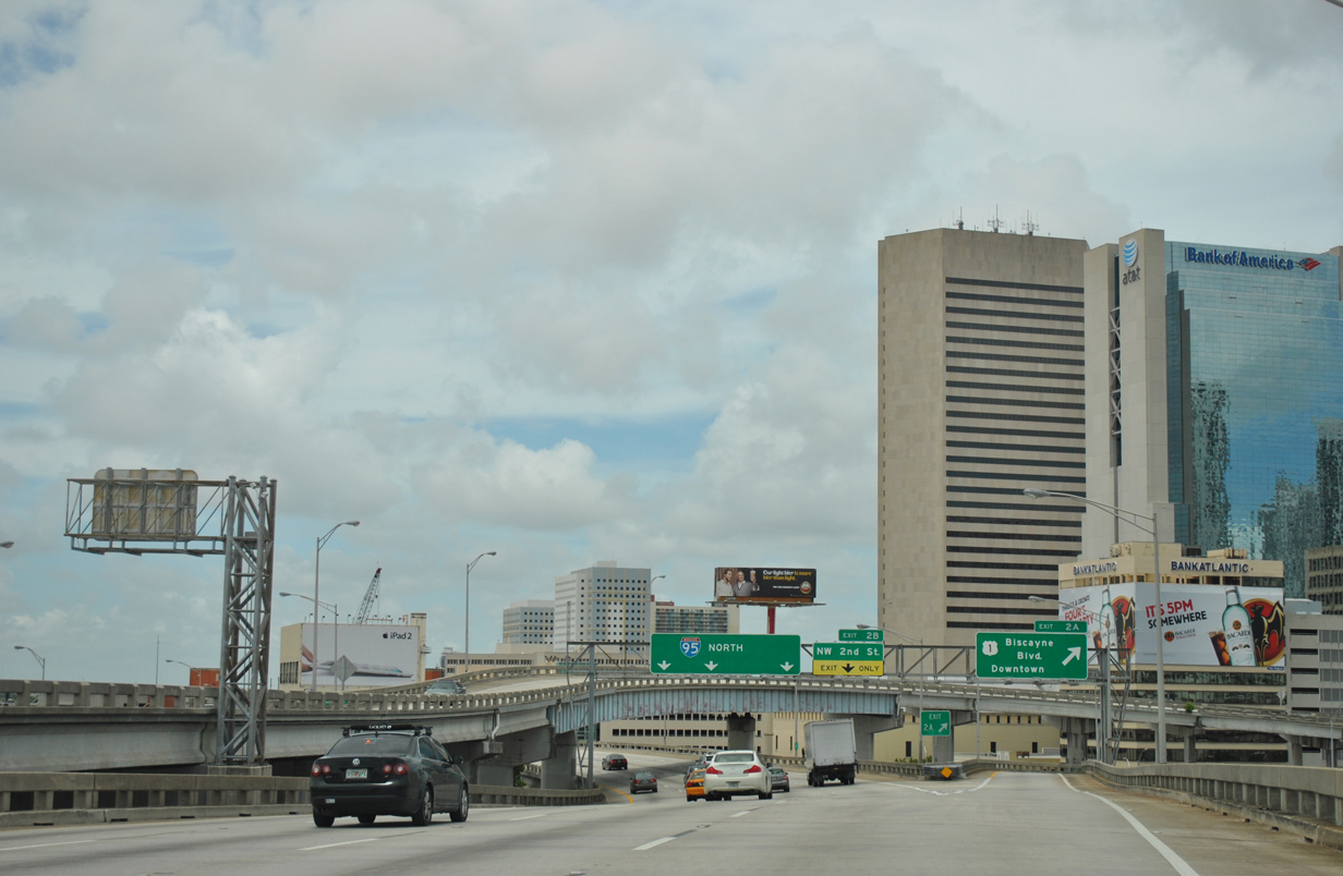
| Interstate 95 remains elevated northward across the Miami River to the Downtown Distributor. Doubling as State Road 970, the Downtown Distributor takes U.S. 1 east to SE 3rd Street at NE 2nd Avenue, two blocks from U.S. 1 north along Biscayne Boulevard. 07/05/11 |
|
| Downtown high rises dominate the view to the east as the Metrorail rises high above the Miami River. Interstate 95 also reaches a higher elevation to span the Miami River and allow boats to pass underneath. 03/04/14, 09/30/17 |
|
| The three wye interchange with the Downtown Distributor (SR 970) spreads into view immediately north of the Miami River. SR 970 is a 0.563 mile long freeway connecting Interstate 95 with the central business district of Miami. It was completed in 1970. 07/05/11 |
|
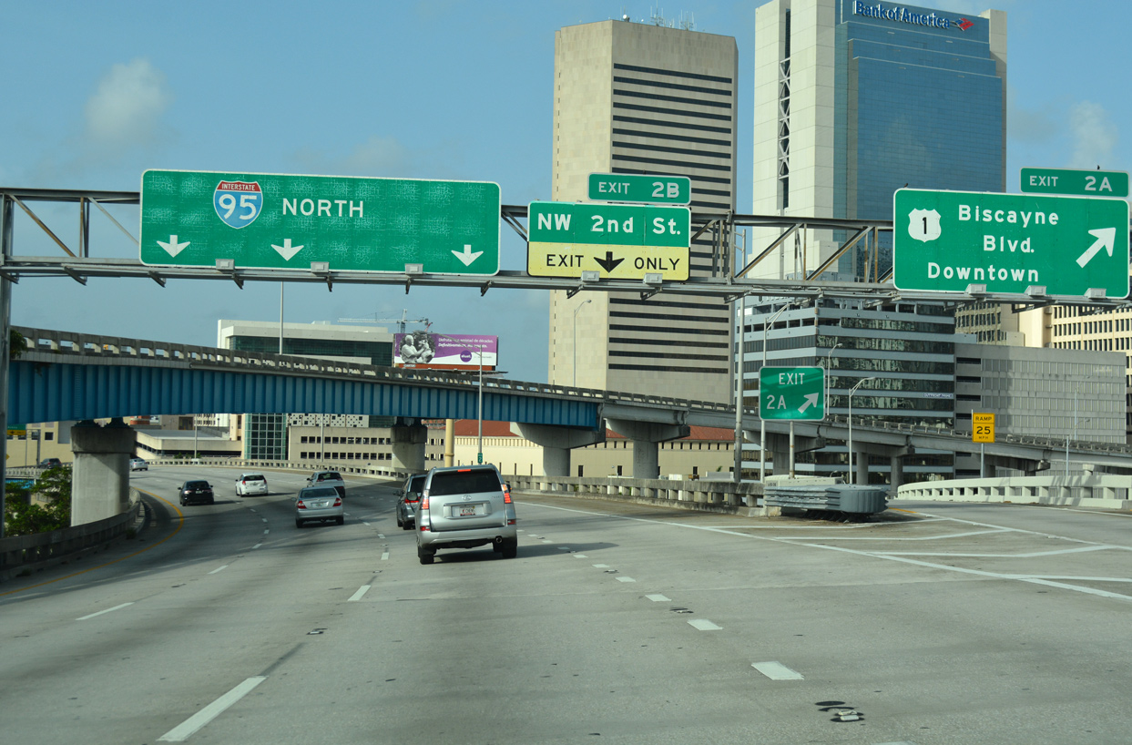
| Exit 2 A departs I-95 north for the Downtown Distributor, U.S. 1 north to SE 2nd Avenue / Biscayne Boulevard. While the two routes parallel one another somewhat closely, they do not cross paths again until the north side of Ormond Beach in Volusia County. The two do not overlap until the George Washington Bridge at Fort Lee, New Jersey. 09/30/17 |
|
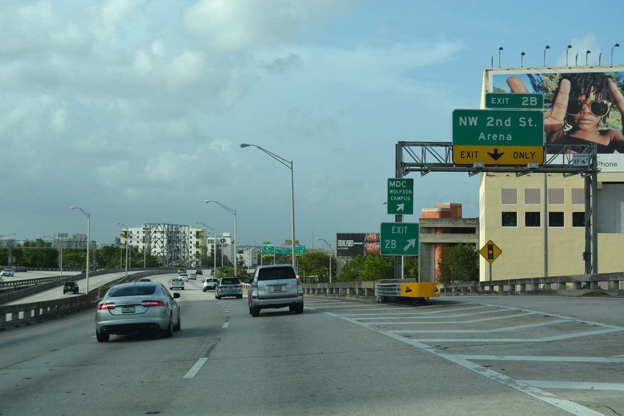
| Exit 2 B quickly follows onto NW 3rd Avenue north at NW 2nd Street. NW 3rd Street parallels the elevated freeway north to NW 5th Street east to American Airlines Arena (home of the NBA Miami Heat). 09/30/17 |
|
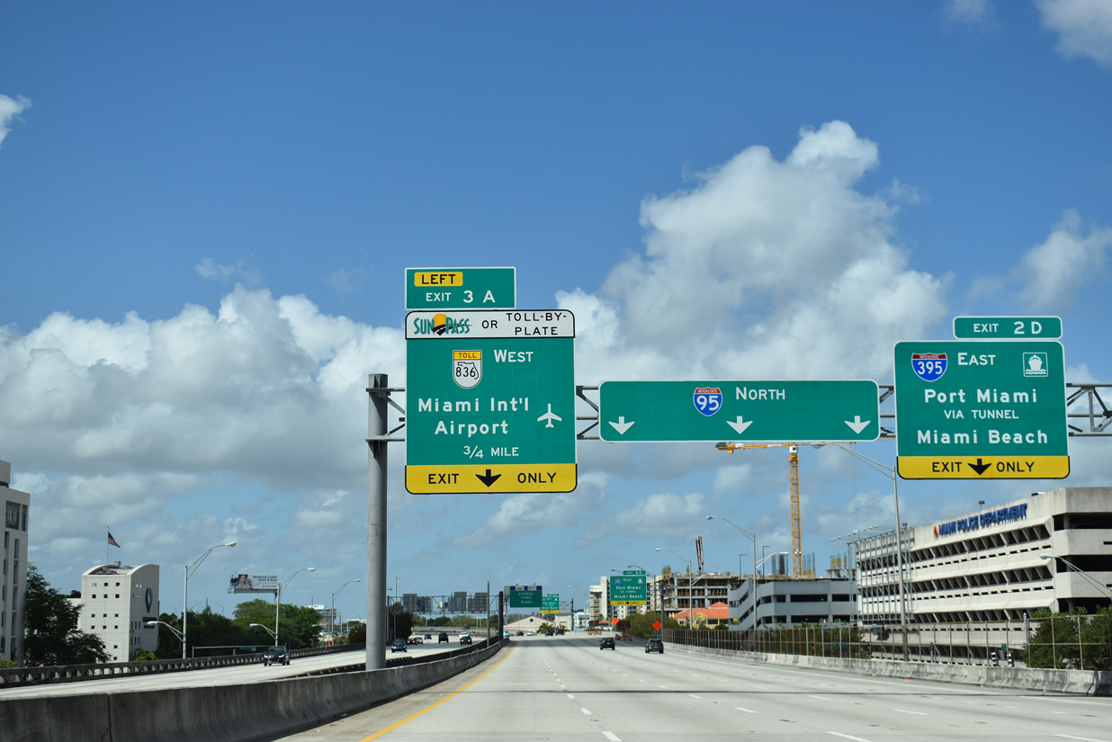
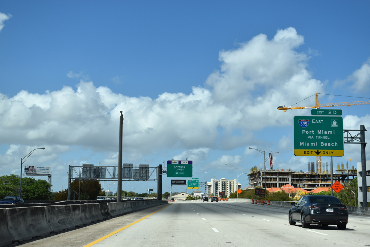
| Advancing north, Interstate 95 approaches the Midtown Interchange (Exits 2D/3A) with I-395 east and SR 836 (Dolphin Expressway) west. 03/21/20 |
|
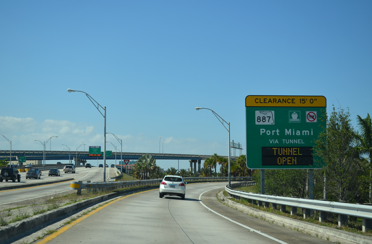
| With the August 3, 2014 opening of the Port Miami Tunnel (SR 887), Exit 2D to I-395 east provides a direct route for the Port of Miami via Mac Arthur Causeway (SR A1A) on Dodge Island. 03/21/20 |
|
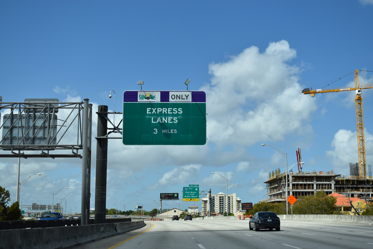
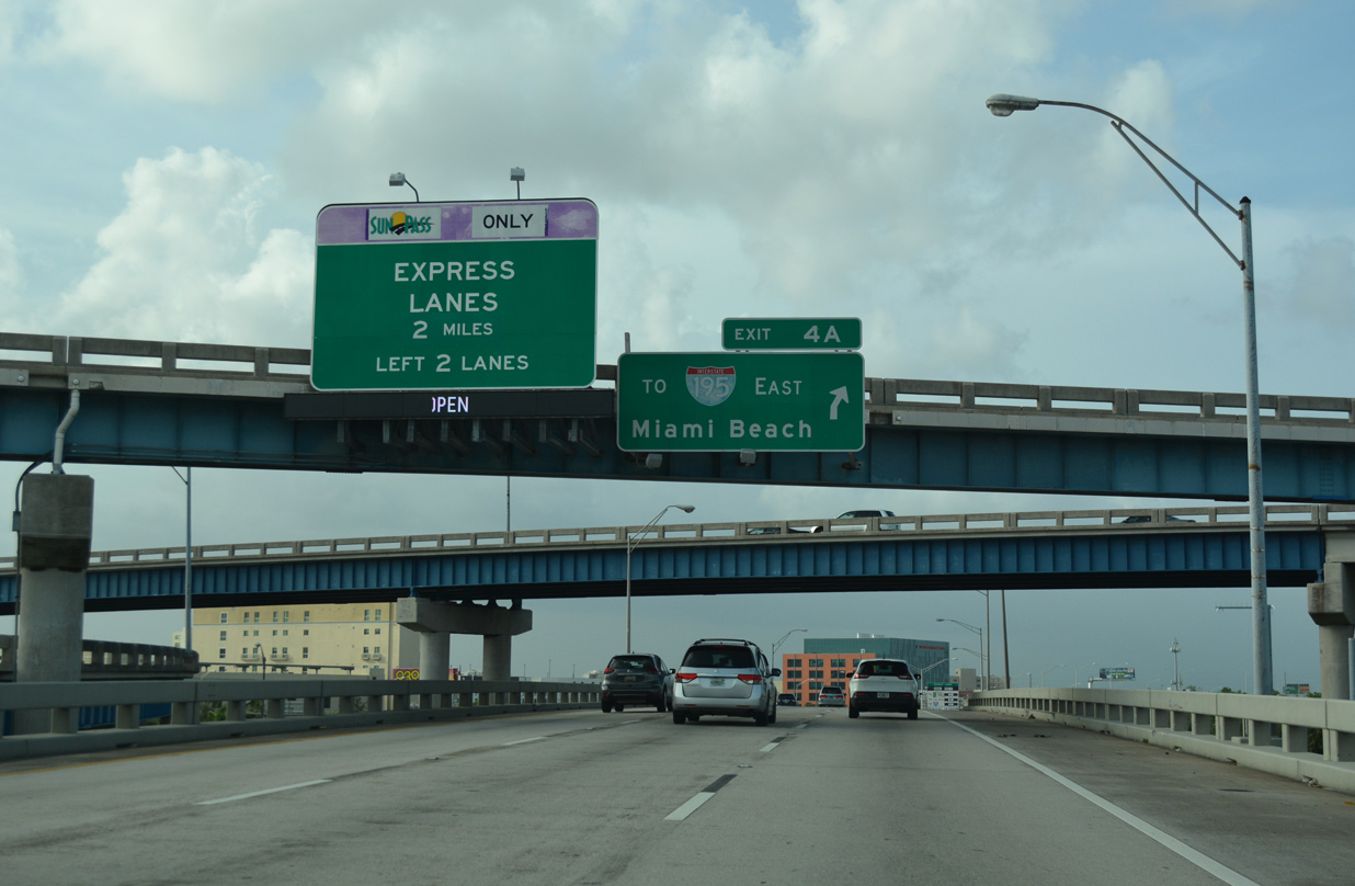
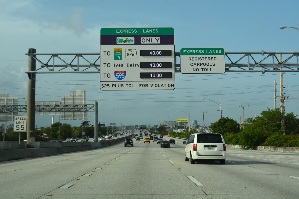
| The 95 Express Lanes begin three miles north of the Midtown Interchange. The tolled lanes run along the left side of I-95 northward into Broward County. 03/21/20 |
|
| A four level interchange joins I-95 with I-395 east and SR 836 west. SR 836 is the hidden counterpart of Interstate 395 east to MacArthur Causeway. MacArthur Causeway (SR A1A) connects with 5th Street at South Beach in Miami Beach. 03/21/20 |
|
| The Port Miami Tunnel originates from the inside lanes of Interstate 395 / SR A1A on Watson Island. Designated State Road 887, the $1 billion tunnel was bored between November 2011 and May 2013. Scheduled to open in May 2014, malfunctioning equipment delayed its debut to traffic until August 2014.1 04/04/15 |
|
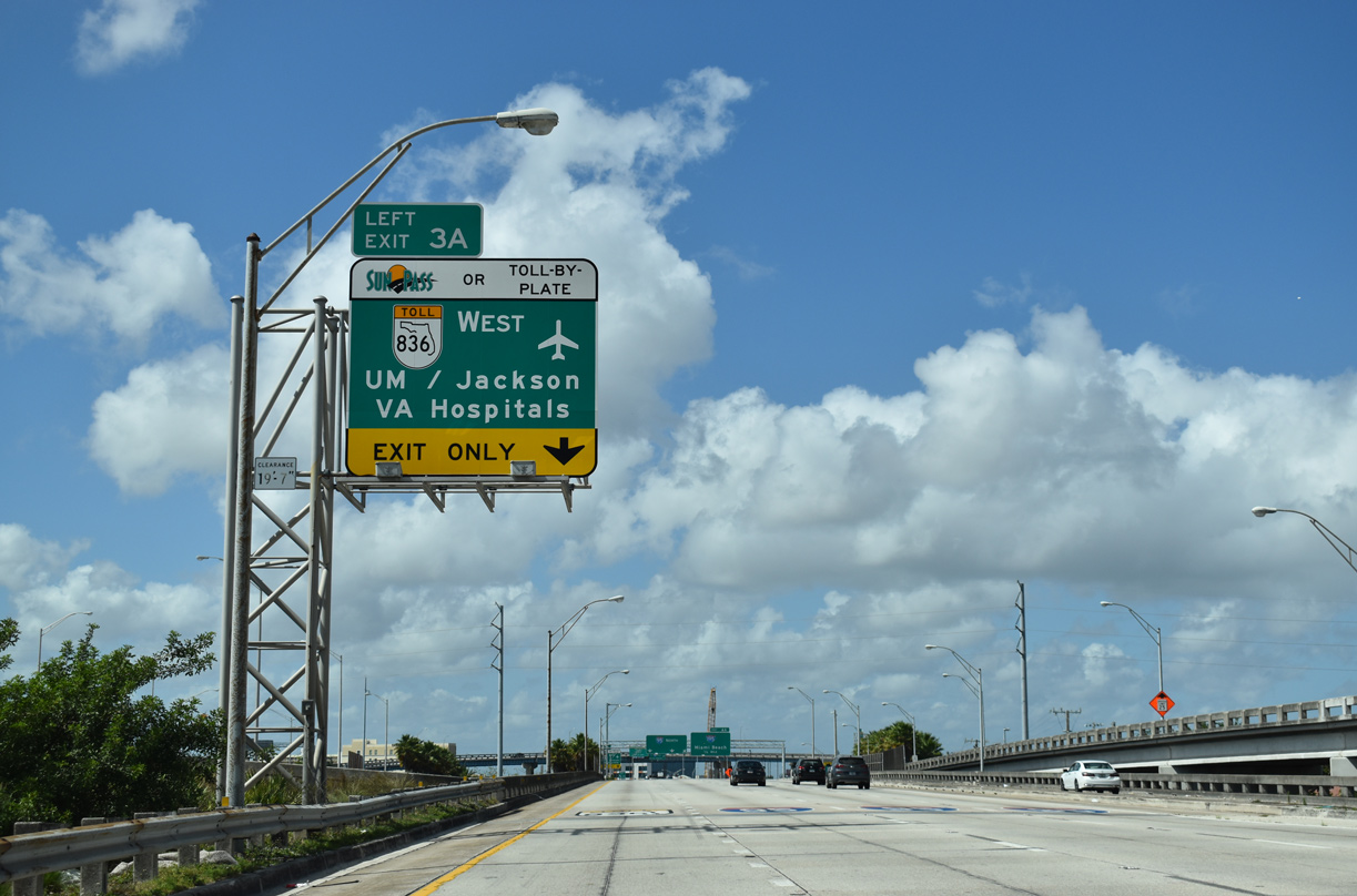
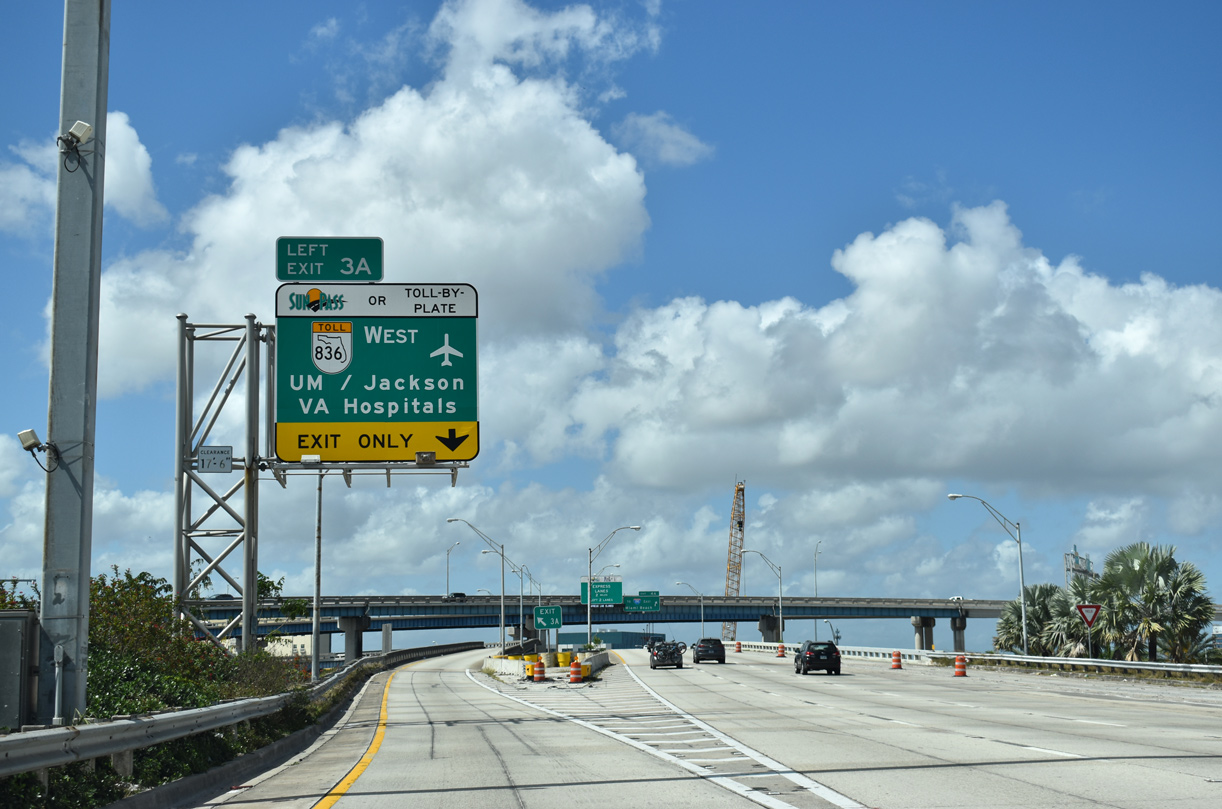
| SR 836 emerges from Interstate 395 along the tolled Dolphin Expressway. The heavily traveled route runs west to Miami International Airport (MIA), the Palmetto Expressway (SR 826) and U.S. 41 (Tamiami Trail) west of Sweetwater. 03/21/20 |
|
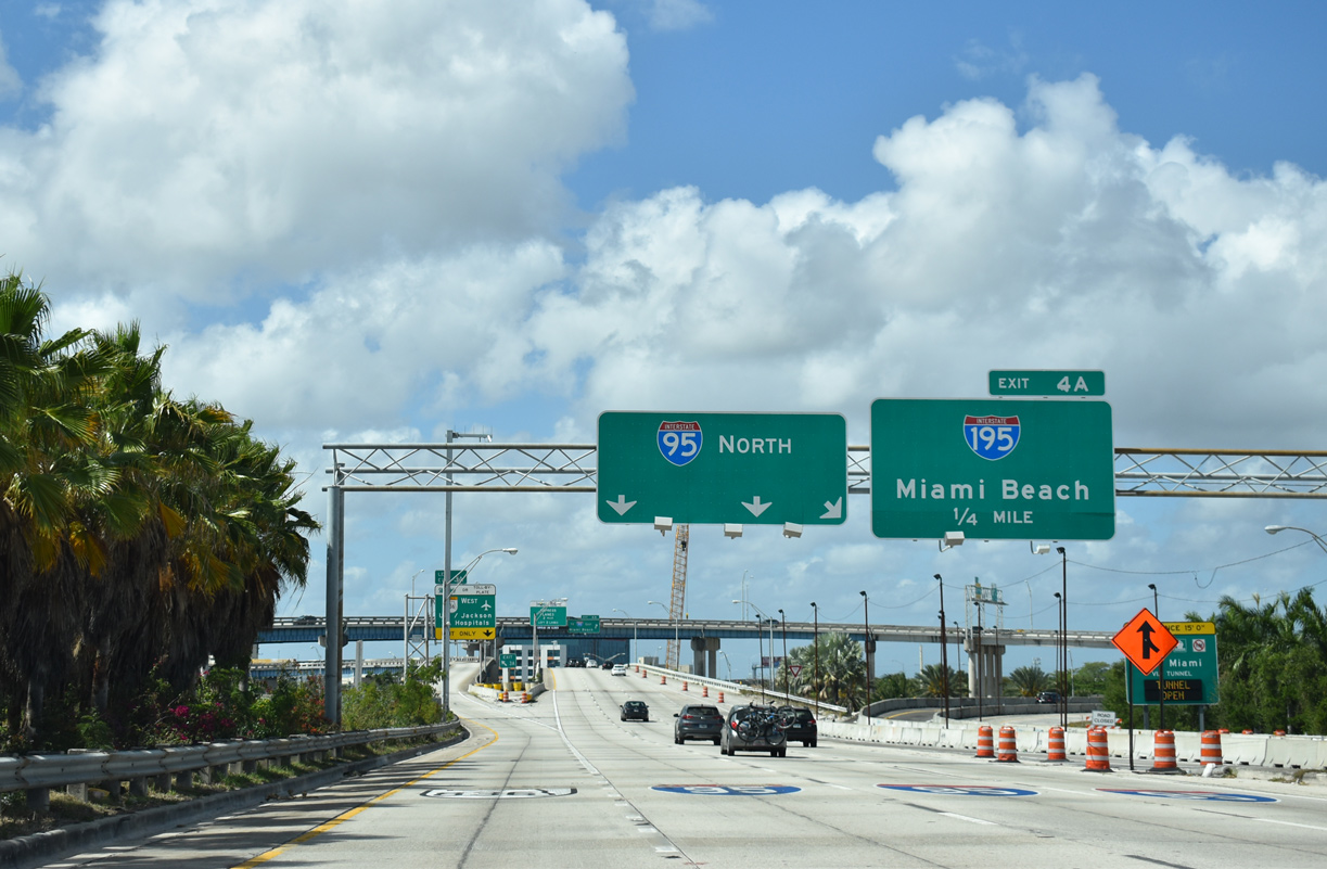
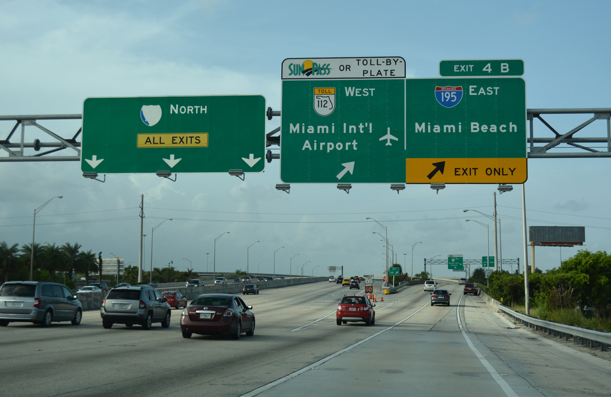
| I-95 runs north alongside the Wynwood neighborhood to the 36th Street Interchange with I-195 east and SR 112 (Airport Expressway) west. Exit 4 A initially departs from within the Midtown Interchange as a bypass ramp avoiding merging traffic from I-395 west and SR 836 east. 03/21/20 |
|
| Left Exit 3 A departs for the SR 836 west. All electronic tolling (AET) commenced along the Dolphin Expressway with the elimination of cash tolling along SR 836 eastbound on July 21, 2013. Tolls were implemented in the westbound direction by Winter 2014.2 03/21/20 |
|
| Northbound I-95 reaches the bypass ramp for Interstate 195 east to Miami Beach. The mainline partitions with the two 95 Express lanes in one mile. 09/30/17 |
|
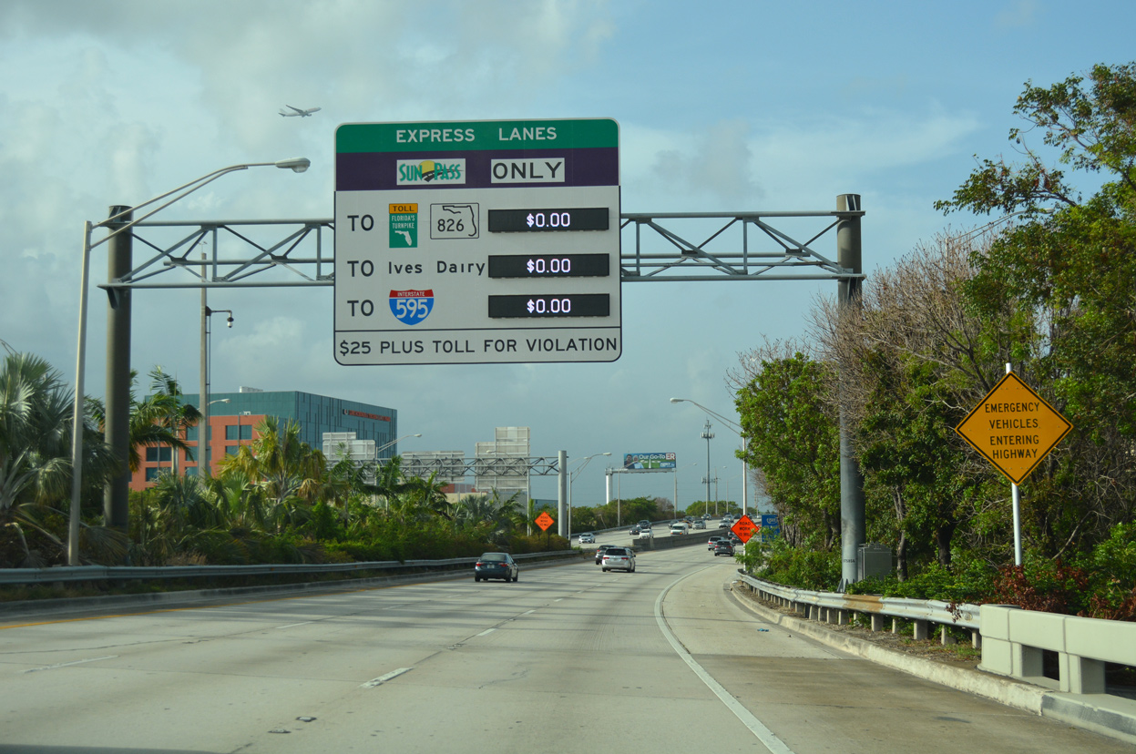
| The tolled 95 Express Lanes charge variable rates depending upon time of day and traffic congestion. Signs initially displayed the rate to the Golden Glades Interchange. A replacement made after 2014 reflected the completion of Phase 2 to Broward County. 09/30/17 |
|
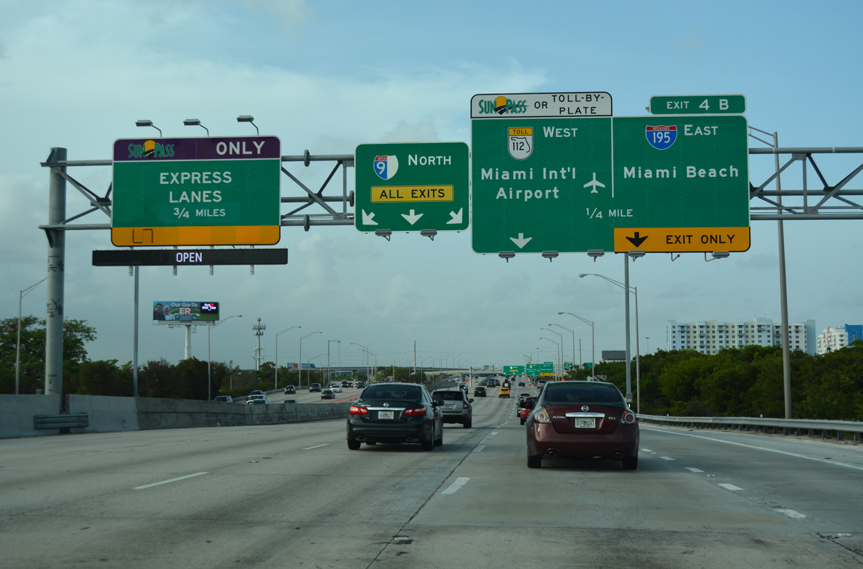
| Exit 4 is a symmetrical stack interchange (Exits 4 A/B) with Interstate 195 east to Julia Tuttle Causeway and Miami Beach and SR 112 (Airport Expressway) west to MIA Airport. 09/30/17 |
|
| A second toll schedule sign appears as traffic merges onto I-95 north from I-395 west and SR 836 east. Preregistered carpools (HOV-3 or more) may travel the 95 Express lanes free of charge. All others are charged tolls electronically, primarily with Sunpass transponders. 09/30/17 |
|
| The fourth reassurance marker for Interstate 95 appears as the North South Expressway passes west of the Wynwood and east of the Allapattah communities. 04/01/14 |
|
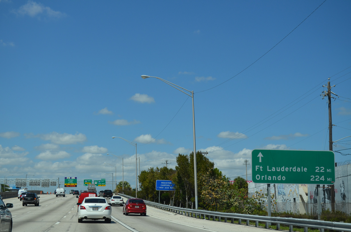
| A distance sign provides the distance to Fort Lauderdale (via Interstate 95) and Orlando (via Florida's Turnpike). This wayfinding sign is another in a series of signs posted for out of town tourists. 04/01/14 |
|
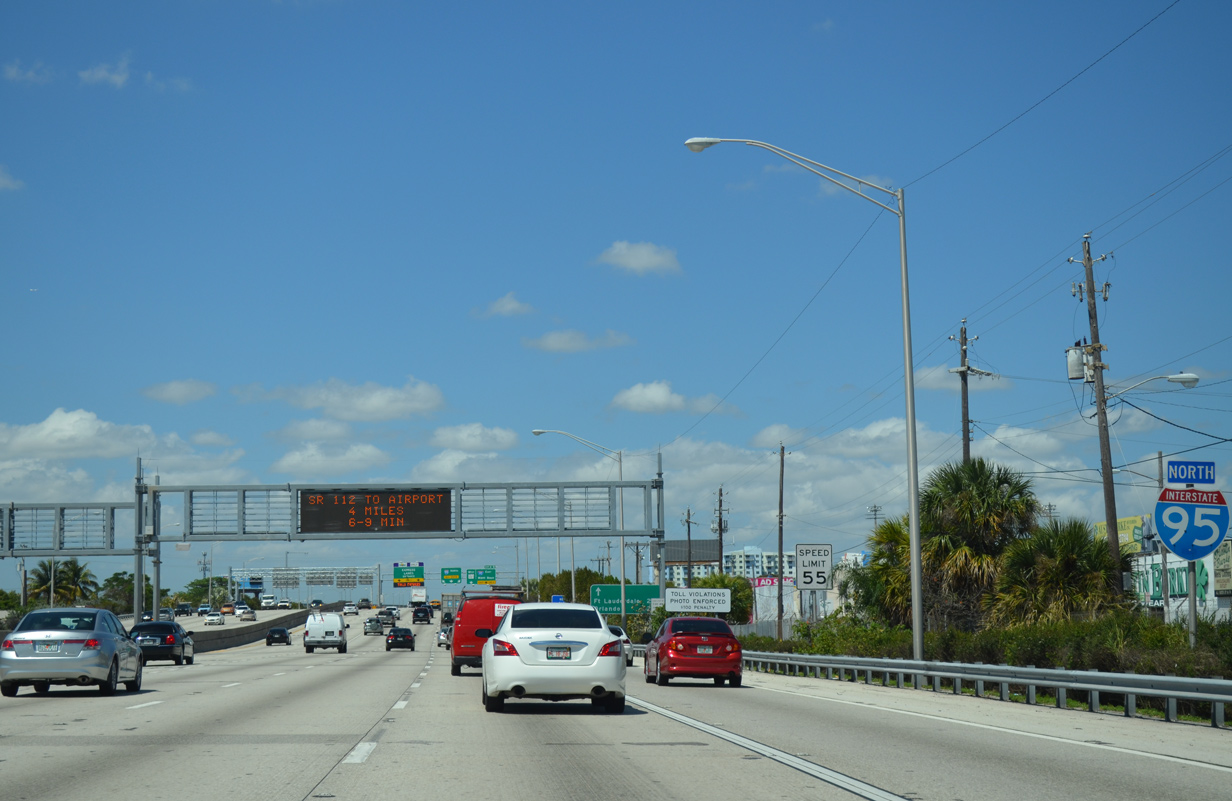
| Exit 4 carries all traffic in unison bound for both Interstate 195 east and State Road 112 (Airport Expressway) west. I-195 extends east from the Airport Expressway 4.42 miles across Biscayne Bay to SR 907 (Alton Road). The Interstate doubles as SR 112, with the state road emerging along Arthur Godfrey Road to SR A1A (Collins / Harding Avenues) in Miami Beach. 09/30/17 |
|
| Interstate 195 provides a high speed route across Julia Tuttle Causeway to north Miami Beach. The six lane freeway fully opened in 1960 as the first route within the Miami expressway system. State Road 112 runs 9.86 miles from SR A1A west to MIA Airport at SR 953 (LeJeune Road). 09/30/17 |
|
| Two lanes join Interstate 195 east ahead of ramps with Miami Avenue and U.S. 1 (Biscayne Boulevard). U.S. 27 parallels the freeway just to the south along NW 36th Street. The US highway commences a 1,364 mile route to Ft. Wayne, Indiana from U.S. 1 at I-195 near Bay Point. 09/30/17 |
|
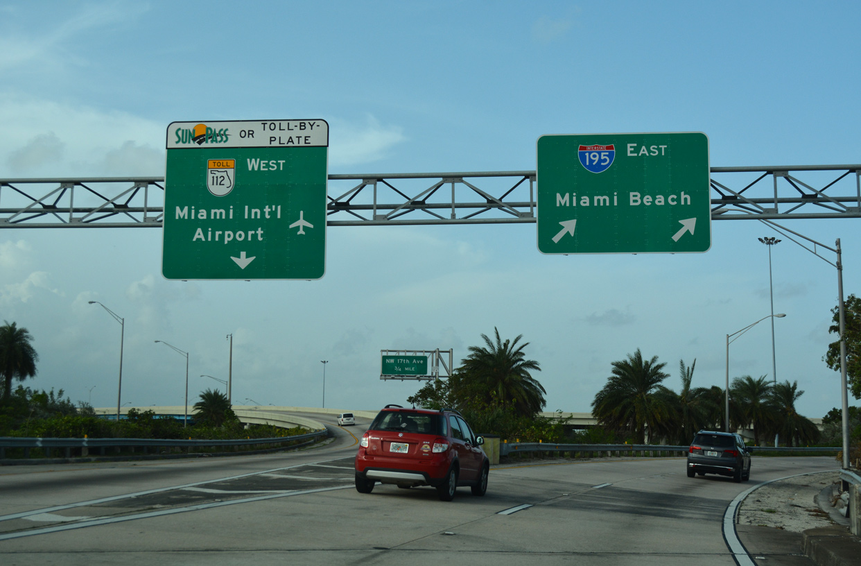
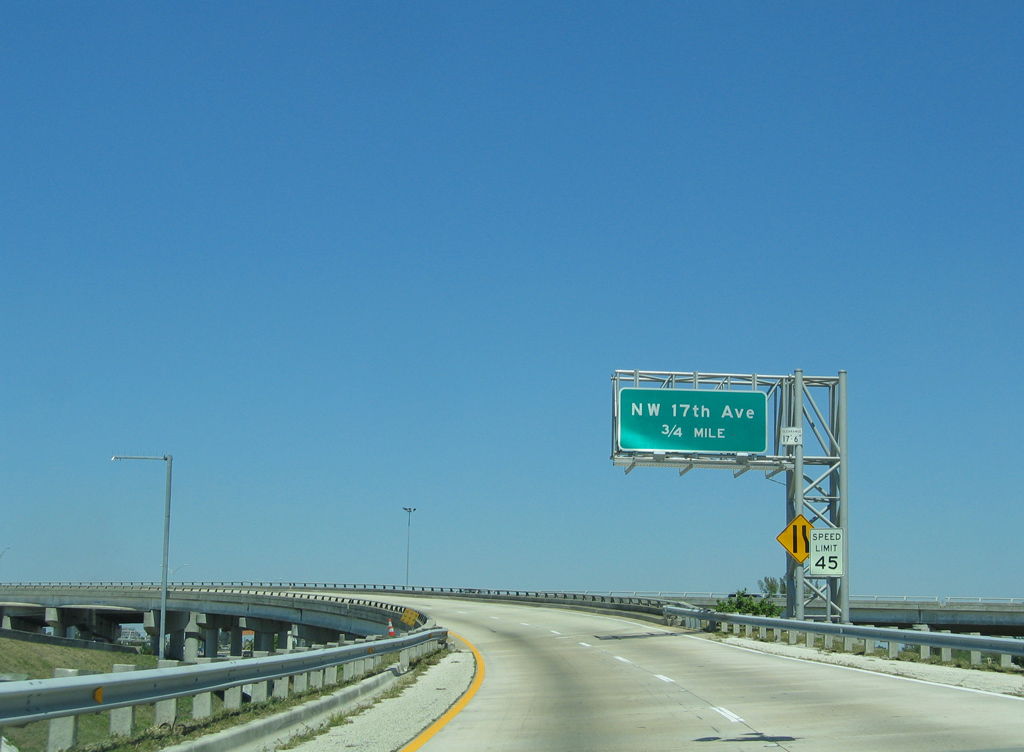
| The flyover from I-95 north to SR 112 west joins the Airport Expressway ahead of NW 17th Avenue (Exit 7). The Expressway leaves the Miami city limits for Brownsville beyond the first off-ramp. 03/26/06 |
|
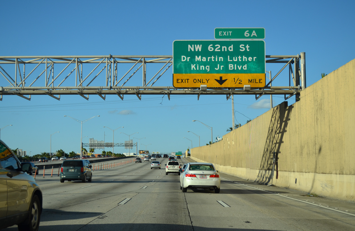
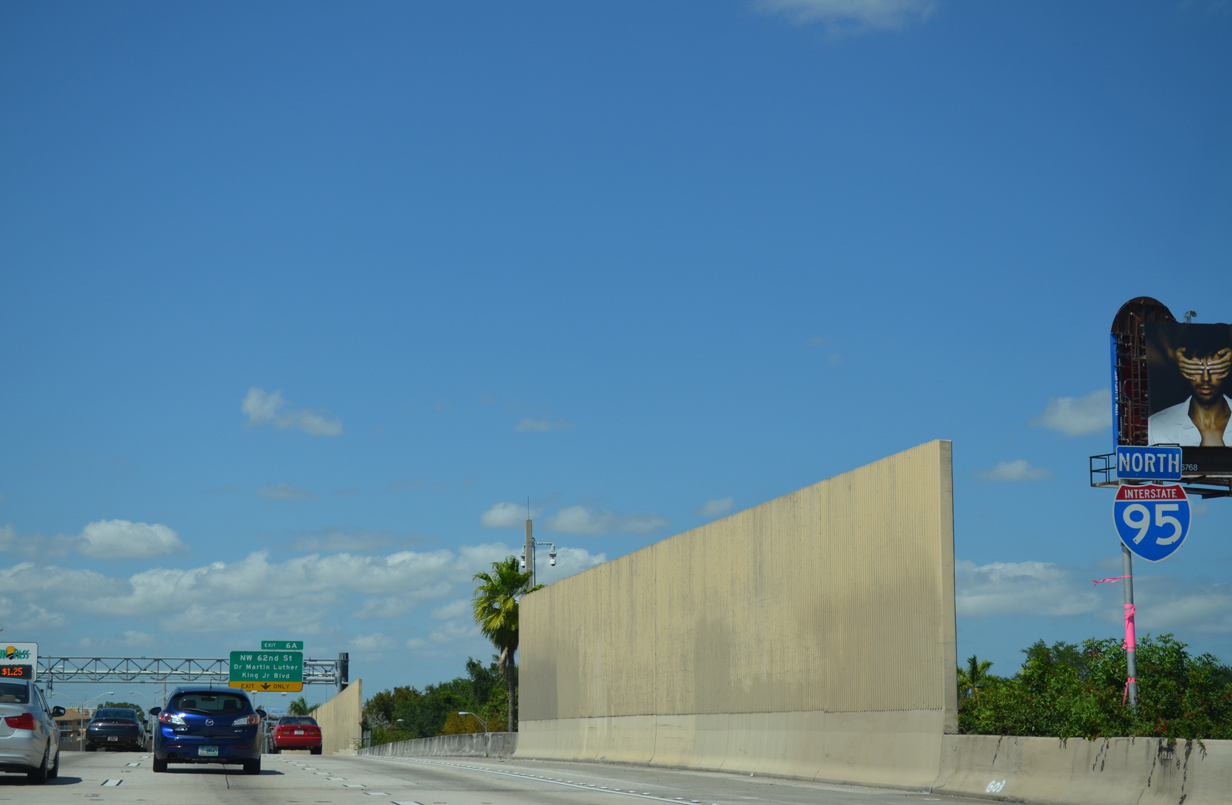
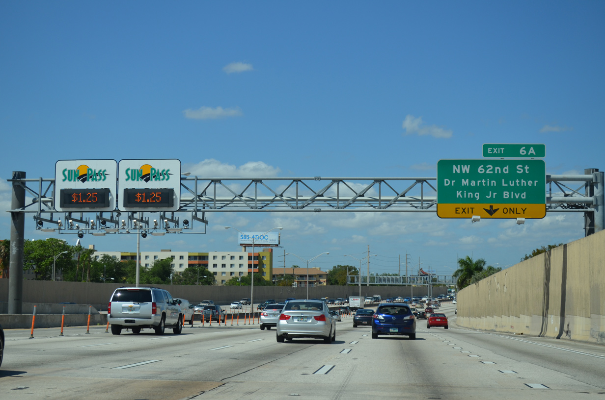
| Interstate 95 continues north with four general purpose lanes and two managed lanes to the Golden Glades Interchange. Auxiliary lanes add capacity between various on and off-ramps, such as to Exit 6 A for NW 62nd Street / Dr. Martin Luther King, Jr. Boulevard. 01/23/16 |
|
| An I-95 shield stands near the SR 944 (NW 54th Street) underpass. Exit ramps connected the freeway with NW 54th Street here until 1976. 04/01/14 |
|
| NW 62nd Street / Dr. Martin Luther King, Jr. Boulevard constitutes a major boulevard route that traverses Liberty City to the west and crosses the Lemon City and Little Haiti areas to the east. 04/01/14 |
|
| Entering the diamond interchange (Exit 6 A) with NW 62nd Street / Dr. Martin Luther King, Jr. Boulevard on I-95 north. NW 5th Court stems north from the ramp end to Athalie Range Park. 01/23/16 |
|
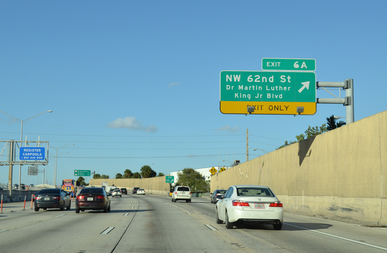
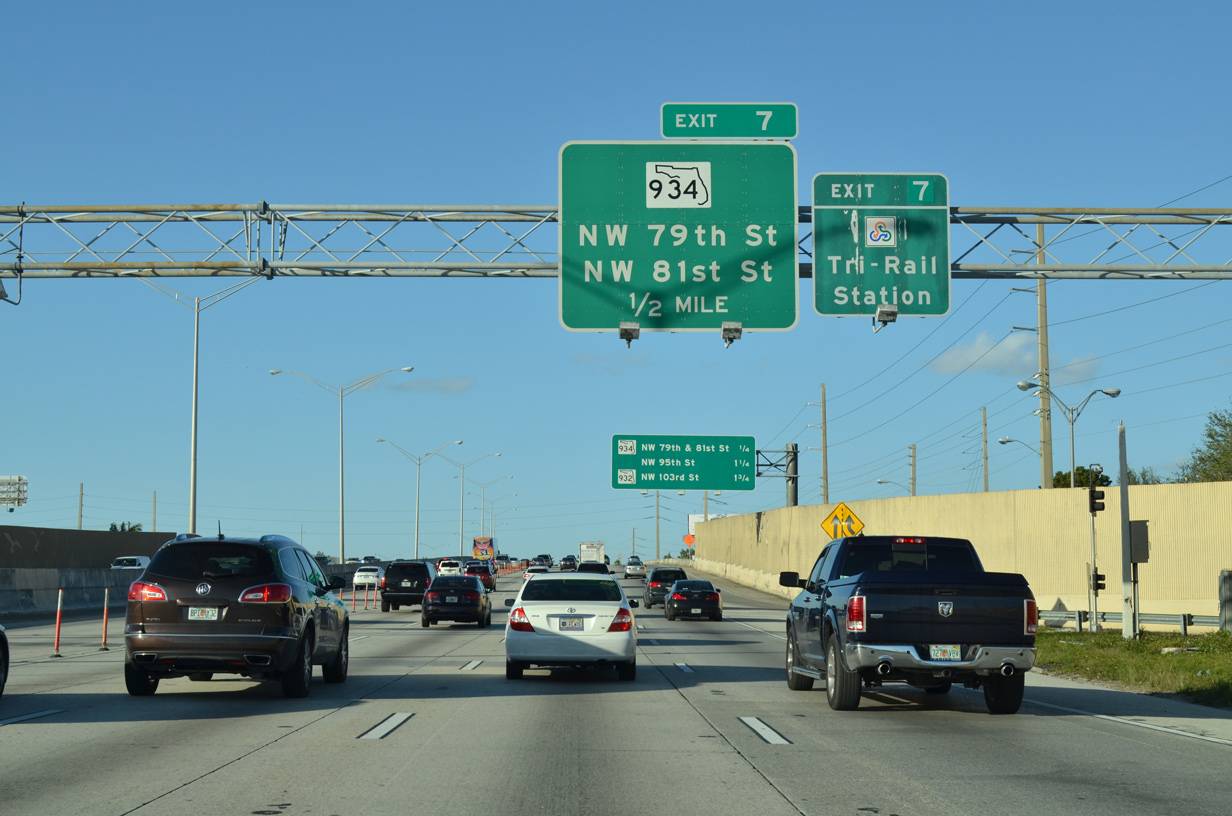
| The first in a series of interchange sequence sign appears at the NW 62nd Street underpass. Interstate 95 leaves the Miami city limits beyond SR 934 (Exit 7) in just over a mile. 04/01/14 |
|
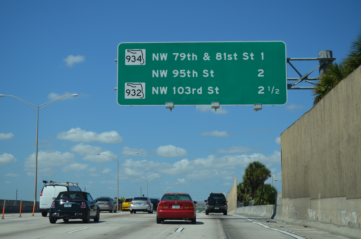
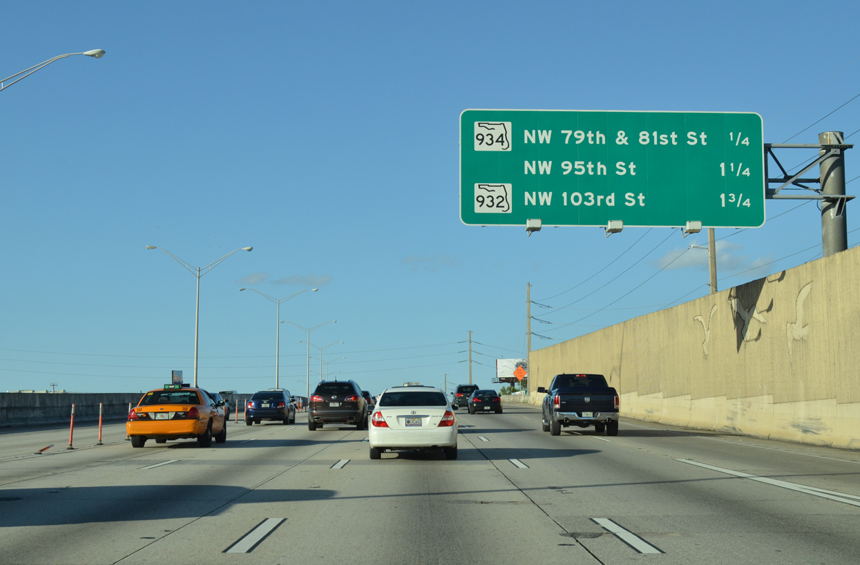
| SR 934 runs along the northern city limits of Miami between Interstate 95 and Miami Avenue. The immediate area north of SR 934 is not incorporated.
SR 934 is a major arterial that extends east, skirting Little Haiti and continuing past U.S. 1 (Biscayne Boulevard) en route to Kennedy Causeway. The causeway spans Biscayne Bay, leading SR 934 through North Bay Village (North Bay and Treasure Islands) to SR A1A in Miami Beach. 01/23/16 |
|
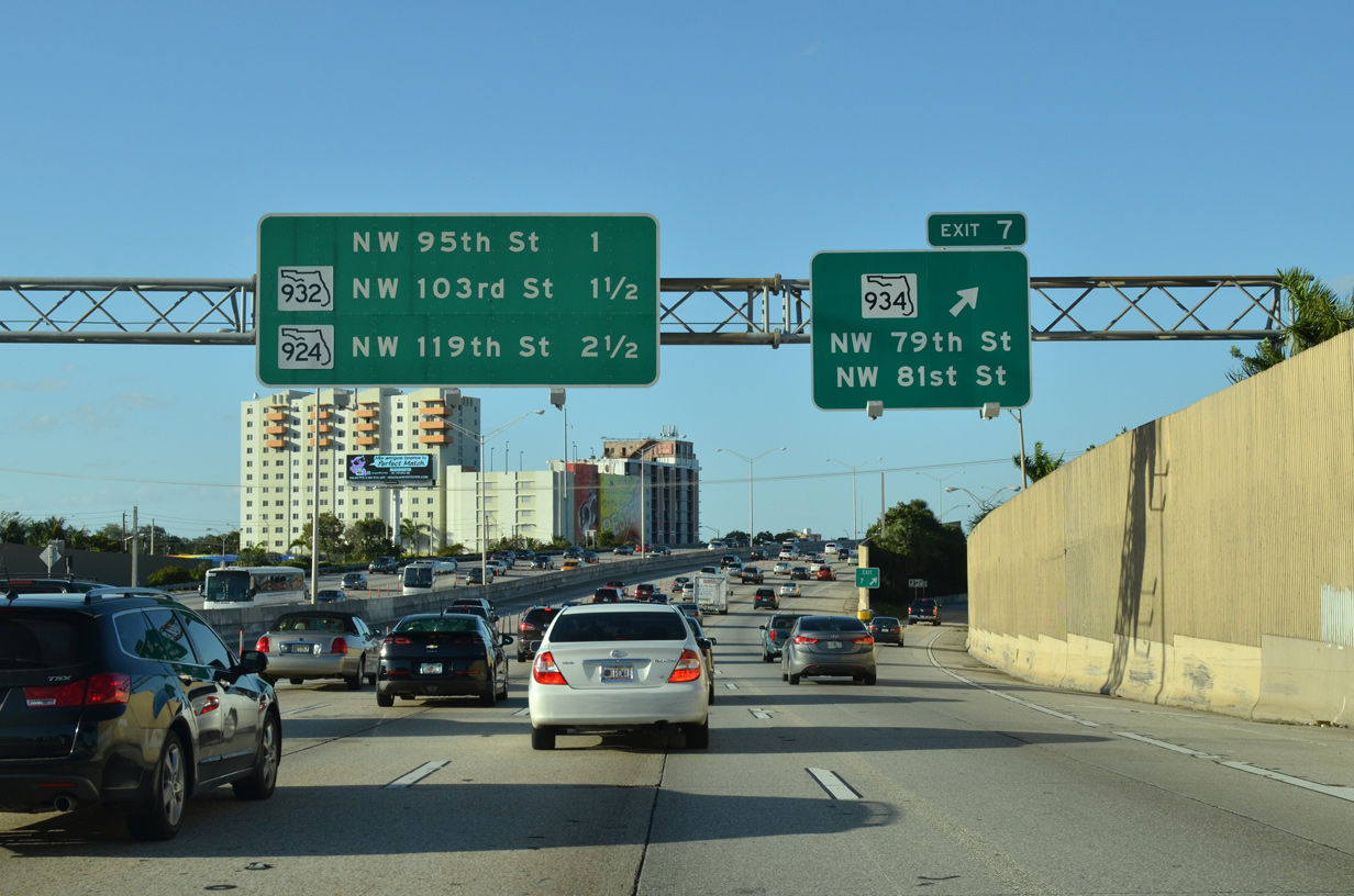
| One quarter mile south of the split diamond interchange (Exit 7) with SR 934 (NW 79th Street east / NW 81st Street west) on I-95 north. 01/23/16 |
|
| Heading west from Exit 7, SR 934 (82nd Street) west recombines with NW 79th Street en route to Gladeview and the city of Hialeah. The 13.11 mile state road ends at SR 826 (Palmetto Expressway) at Medley. 01/23/16 |
Page Updated 10-10-2020.


 North
North