|
| A parclo interchange at Exits 363 A/B links with Max Leggett Parkway (formerly Duval Road) east and SR 102 (Airport Road) west to Jacksonville International Airport (JAX). A $12 million project, paid for by a conglomerate of developers (Ramco-Gershenson, Shands and Signature Land) expanded a 1.2 mile stretch of Duval Road between early August 2011 and 2012 into a four lane arterial.1 11/19/21 |
|
| Widening of Max Legett Parkway replaced Duval Road (CR 110), a 1.24 mile long route between I-95/SR 102 and U.S. 17 at Duval. The suburban arterial supported expansion of River City Marketplace retail center opened in 2005, a medical campus for Shands Healthcare, and a mix of new shopping centers including Parkway Shops. It was renamed for Max Leggett, late Jacksonville city councilman (1991-99) and father of Signature Land owner Steve Leggett.1 11/19/21 |
|
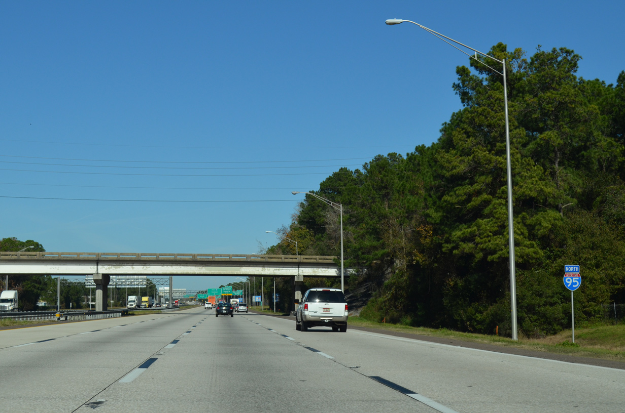
| Expansion of Interstate 95 from I-295 north to the Georgia state line was undertaken during 2001 through 2003. 12/19/13 |
|
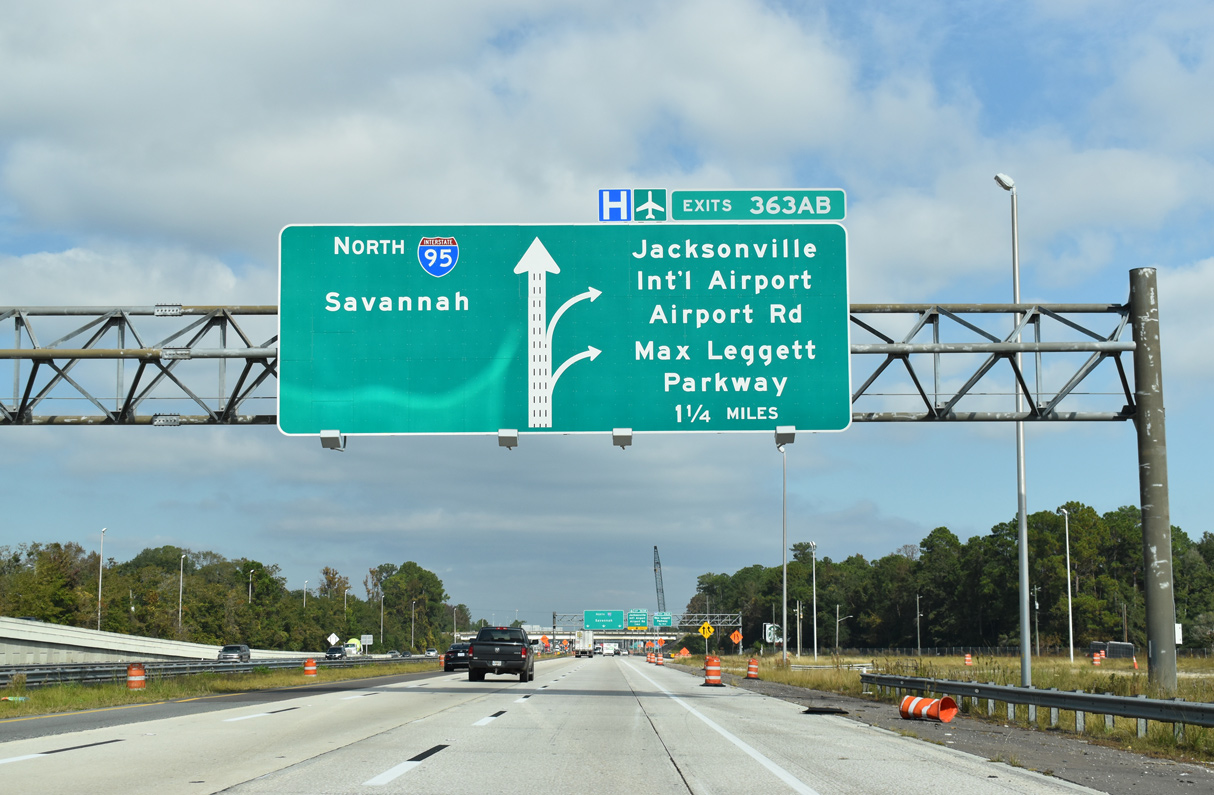
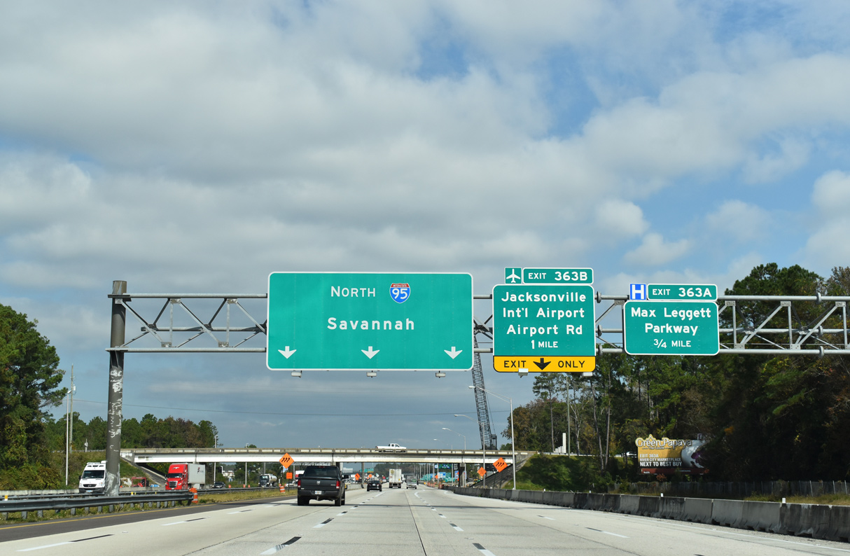
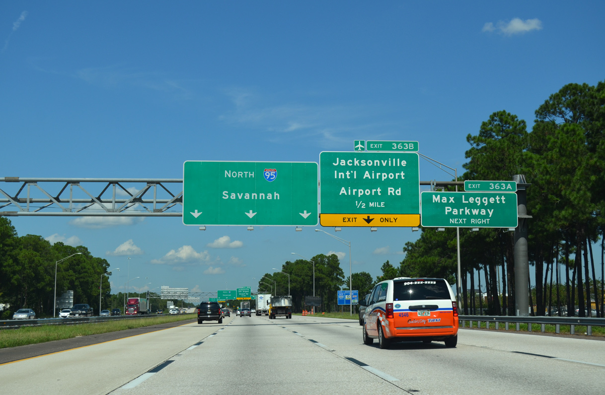
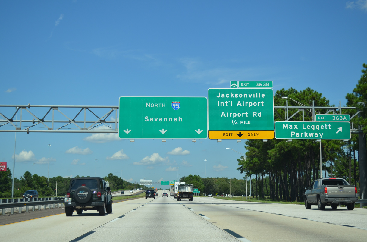
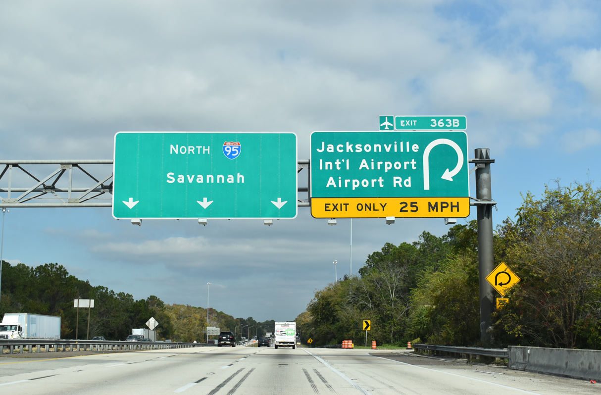
| The auxiliary lane from Interstate 295 drops at the loop ramp (Exit 363 B) for SR 102 (Airport Road) westbound. SR 102 travels along Airport Road for 1.46 miles to the passenger terminal at Jacksonville International Airport (JAX). 09/22/14 |
|
| Exit 363 A leaves Interstate 95 north for Max Leggett Parkway northeast to Duval and Airport Center Drive east from River City Marketplace to U.S. 17 north of Oceanway. 09/22/14 |
|
| Exit 363 B loops onto SR 102 (Airport Road) west for Jacksonville International Airport (JAX) and Beeghly Heights. The remaining portion of Duval Road (unsigned CR 110) splits south from SR 102 nearby en route to Biscayne Boulevard near SR 243 (International Airport Boulevard). SR 243 overlays another section of Duval Road southwest to I-295 at Exit 33. 11/19/21 |
|
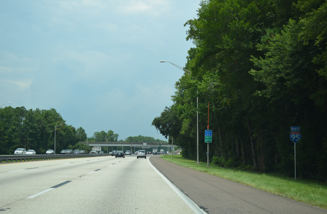
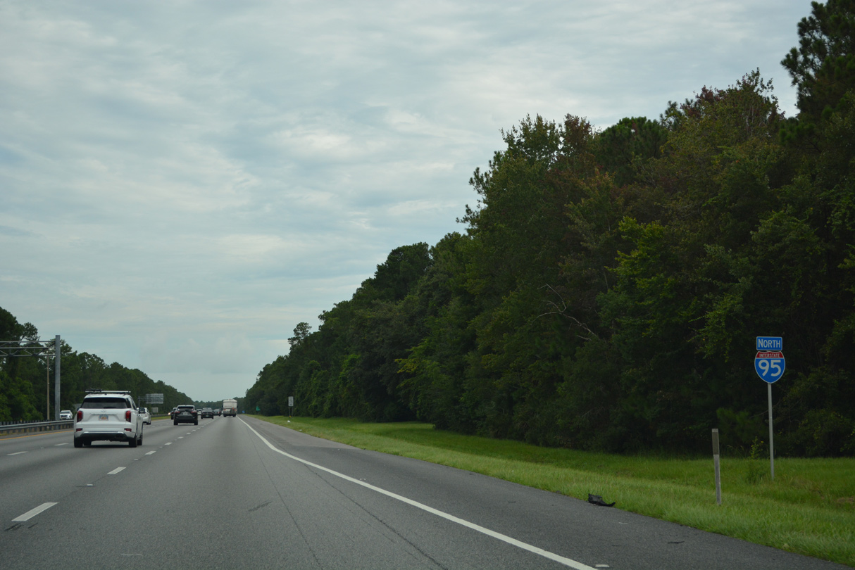
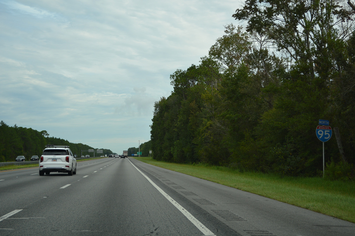
| Leaving the bulk of development behind, Interstate 95 transitions into a rural freeway through wetland areas southwest of Pecan Park. Owens Road passes over the freeway in the distance. 07/23/13 |
|
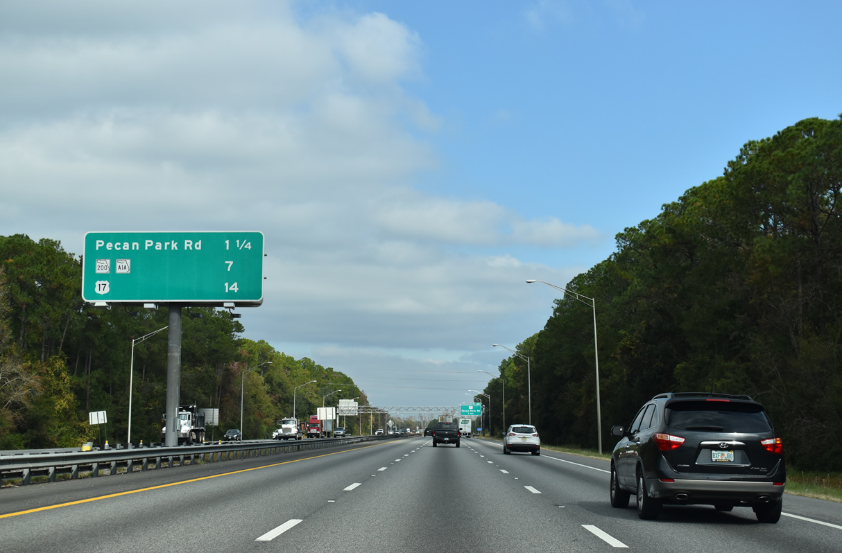
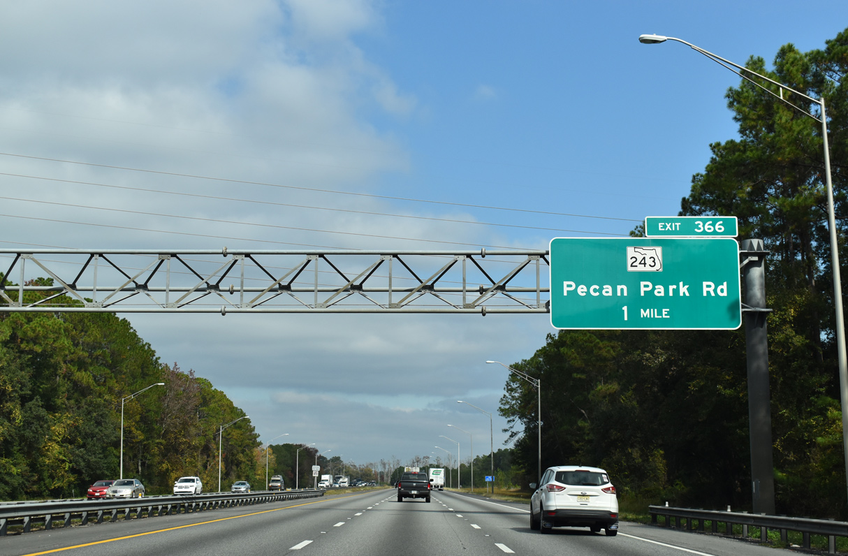
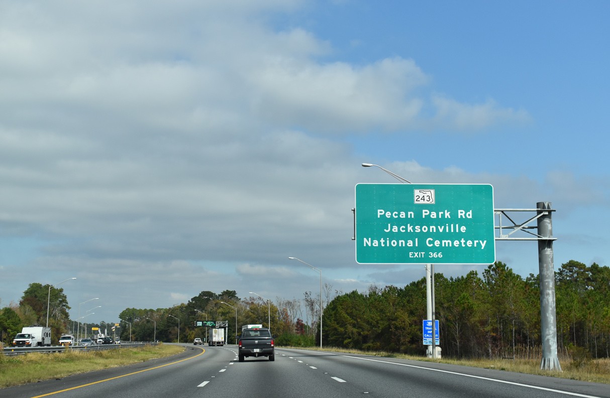
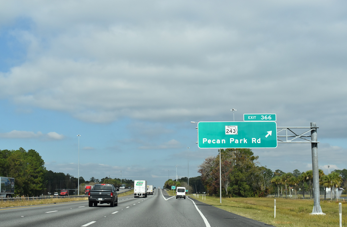
| The exit for Pecan Park Road (SR 243) is the last within Duval County and the city of Jacksonville. Two interchanges follow along I-95 north in Nassau County. 11/19/21 |
|
| Pecan Park Road loops west from U.S. 17 (Main Street) at Pecan Park to Beeghly Heights at Jacksonville International Airport (JAX). SR 243 overlays the arterial 0.75 miles west from the diamond interchange at Exit 366 to International Airport Boulevard south. 11/19/21 |
|
| A supplemental overhead for Exit 366 previously referenced JAX Raceways. The motorsports venue was located along Pecan Park Road between I-95 and U.S. 17. It included a 1/8 mile NHRA drag strip and a 1/2 mile NASCAR dirt track. The drag strip opened around 1969, followed by the dirt oval in 1973. Operations at the raceway ceased after the 2004 season.2 Demolition of the facilities followed in anticipation of a planned 350 home development, which was shelved in 2006 due to environmental concerns.3 11/19/21 |
|
| Road work from July 10, 2017 to Spring 2019 upgraded SR 243 (Pecan Park Road) 1.25 miles west from I-95 to Lexington Park Boulevard. Costing $17.4 million, Project 433730-1 widened the road to four lanes, added bicycle lanes and installed traffic lights at the interchange ramps. 11/19/21 |
|
| Confirming marker north of SR 243 (Pecan Park Road). 08/14/21 |
|
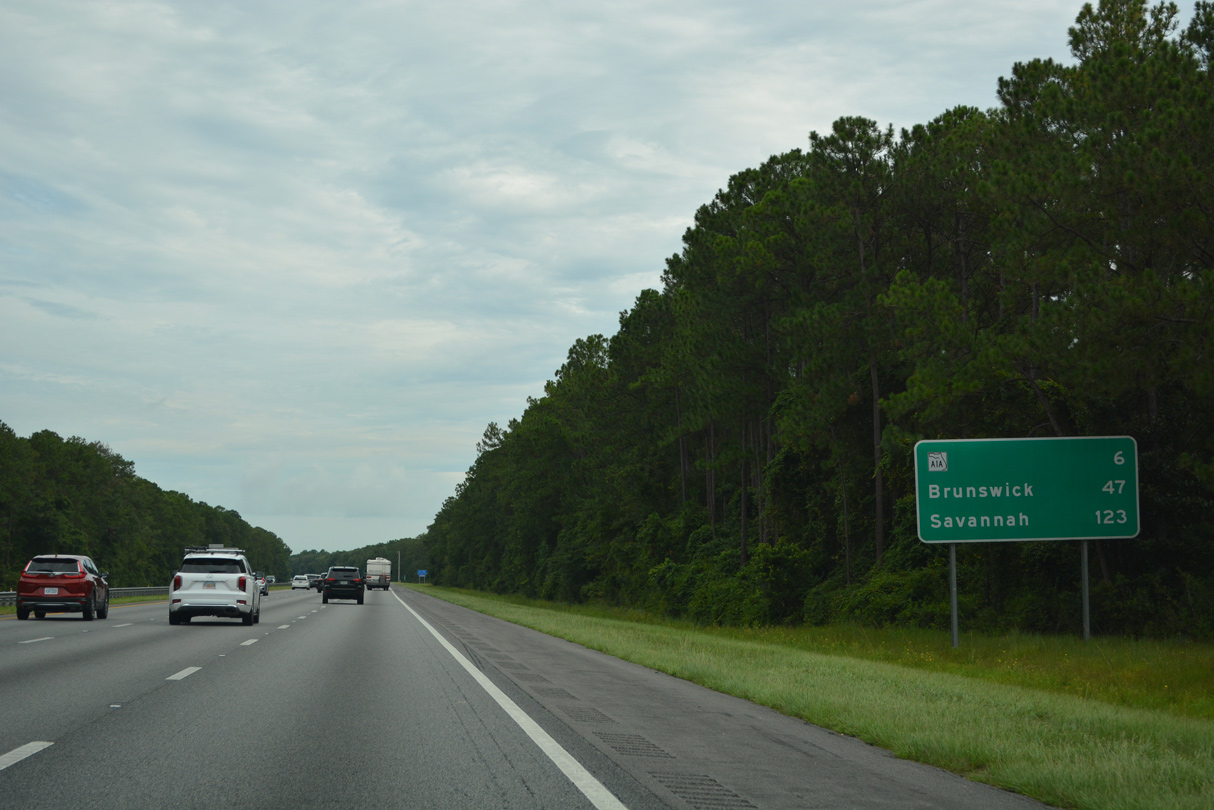
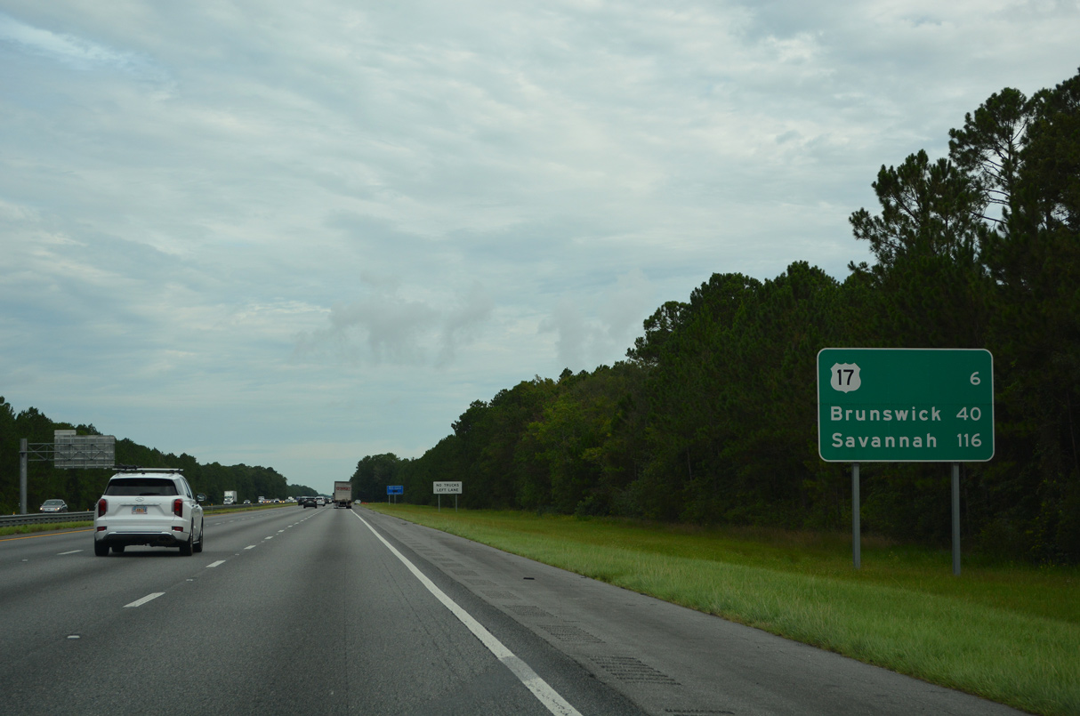
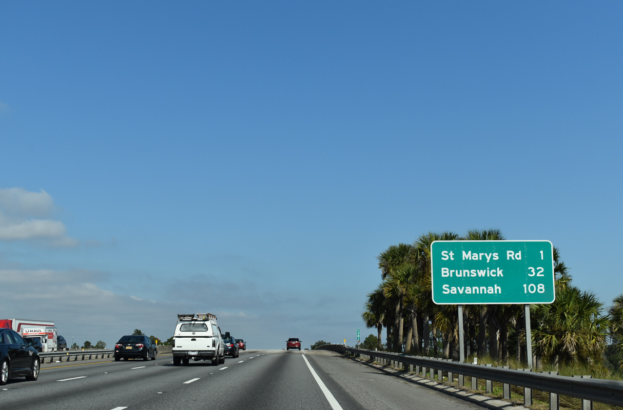
| Brunswick and Savannah, Georgia debut on Interstate 95 distance signage at 47 and 123 miles out. Six miles of swamp land precede the ensuing exit for SR A1A/200. 08/14/21 |
|
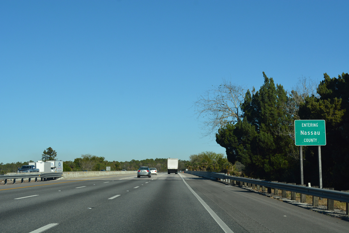
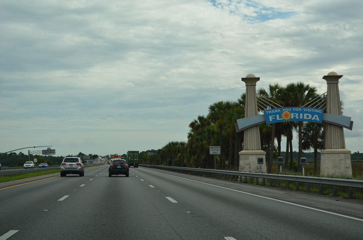
| Spanning the Nassau River, Interstate 95 enters the 12th and final Florida County along the 382 mile course through the Sunshine State. 12/13/17 |
|
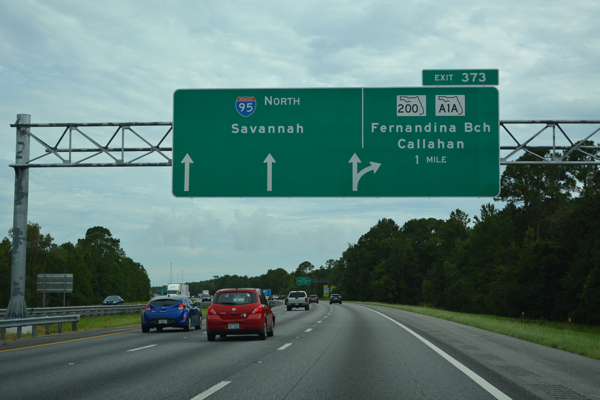
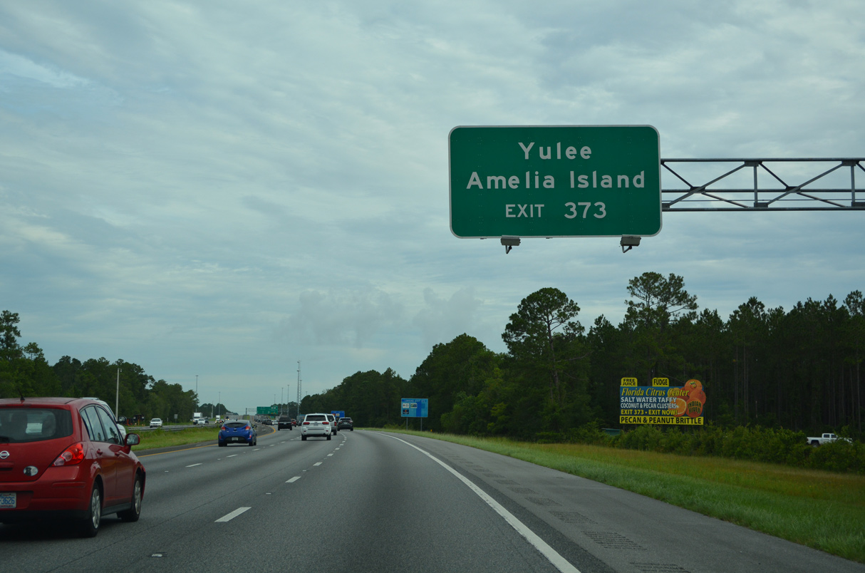
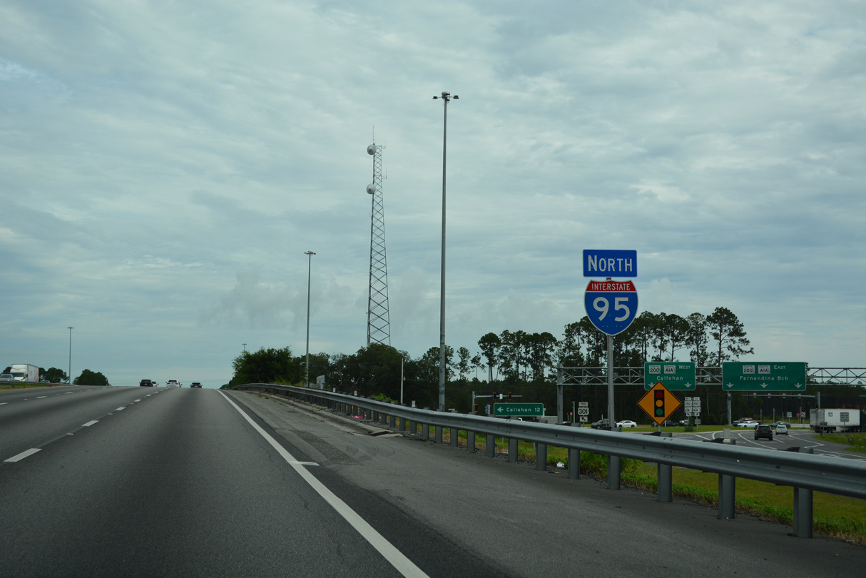
| Interstate 95 emerges from the wetlands surrounding the Nassau River ahead of Exit 373 to SR A1A/200. SR A1A/200 overlap between Callahan and Fernandina Beach, the Nassau County seat. 08/14/21 |
|
| SR A1A south / SR 200 connect I-95 with the unincorporated community of Yulee at U.S. 17 and Amelia Island on the Atlantic Ocean. SR A1A/200 overlap east to Fernandina Beach. SR A1A turns south from the end of SR 200 (Sadler Road) along the coast to Amelia City, American Beach, Franklintown and Coastal City. 08/14/21 |
|
| Started on January 17, 2017, construction reconfigured the exchange with SR A1A/200 into an eight lane wide diverging diamond interchange. Running through Summer Fall 2020, the $40 million project also expanded a two mile section of SR A1A/200 to six lanes.4 08/14/21 |
|
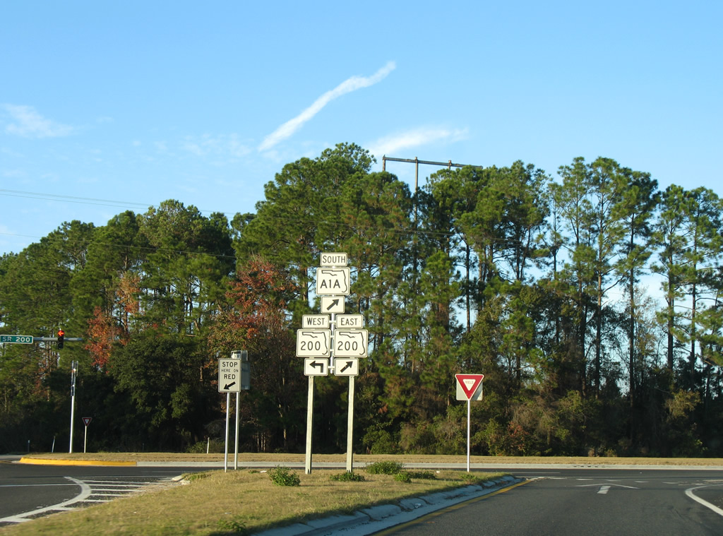
| Westward from Exit 373, SR A1A/200 travel 11.9 miles to U.S. 1-23-301 in Callahan. There SR A1A ends and SR 200 turns south as the hidden counterpart of U.S. 301 to Ocala. SR 200 measures 156 miles in length southwest to U.S. 41 in Hernando. 08/14/21 |
|
| Heading east from I-95, SR A1A/200 reach Yulee in 2.9 miles, O'Neal in 8.3 miles, Fernandina Beach in 14 miles and Fort Clinch State Park in 16 miles. SR A1A constitutes a segmented route stretching southward along the Florida Peninsula to Miami. An additional section of SR A1A also exists in Key West. 12/14/07 |
|
| Interstate 95 remains rural leading north to the Golden Isles of Georgia. Traffic counts decrease accordingly, lowering to 55,000 vehicles a day (2018 FDOT counts). 08/14/21 |
|
| Interstate 95 passes through suburban areas of both Brunswick and Savannah in south Georgia over the course of 117 miles to Port Wentworth. 08/14/21 |
|
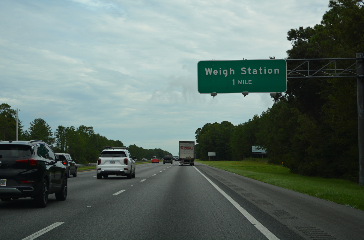
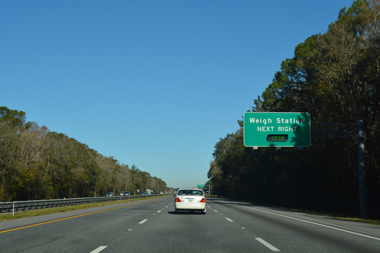
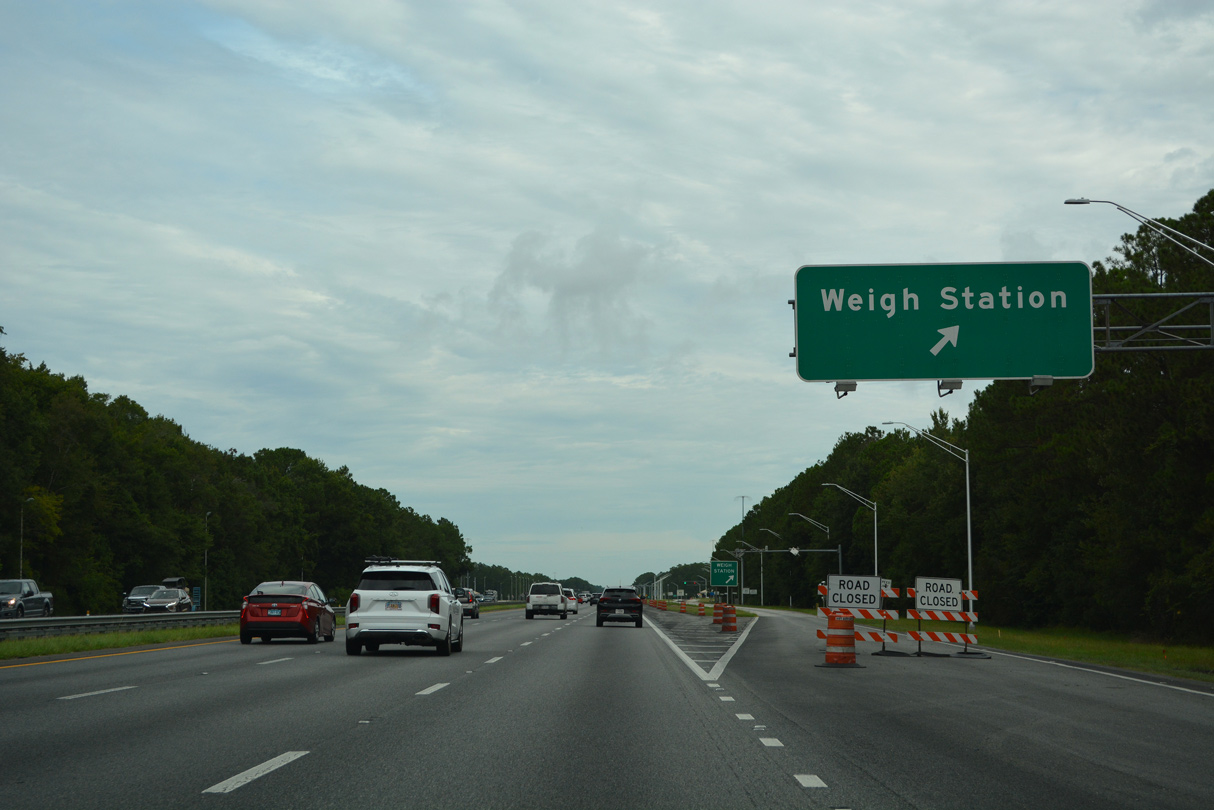
| Constructed in 1999, a pair of weigh stations operate along both directions of Interstate 95 west of Becker. 08/14/21, 12/13/17 |
|
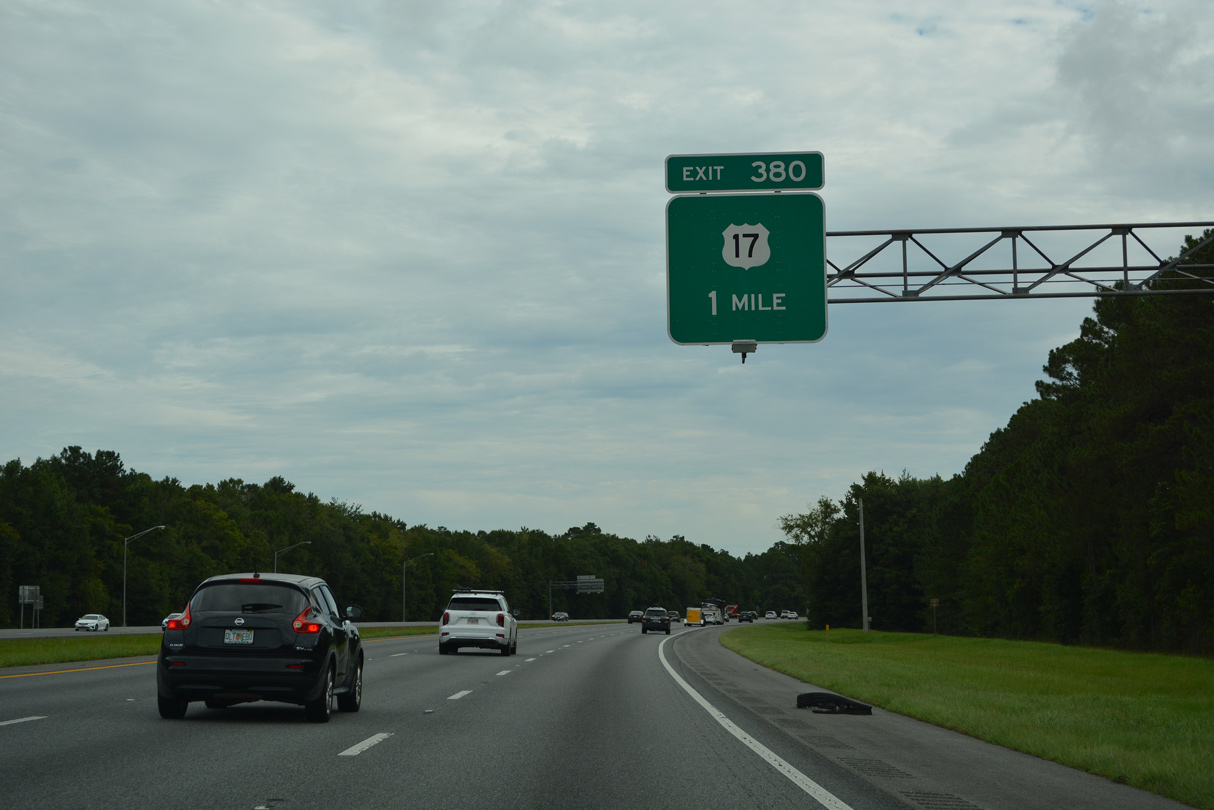
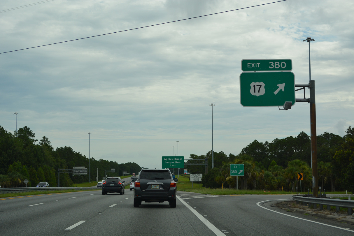
| U.S. 17 converges with I-95, 6.9 miles northwest of Yulee at Exit 380. A folded diamond interchange connects the two highways adjacent to a parallel CSX Railroad line. 08/14/21 |
|
| North from Exit 380, U.S. 17 crosses the St. Mary's River in 2.3 miles and enters Kingsland, Georgia in 5.7 miles. U.S. 17 is part of the Ocean Highway, an auto trail promoted in the 1950s between Florida and Hampton Roads, Virginia. Ocean Highway overlays U.S. 13 northward to New Castle, Delaware. 08/14/21 |
|
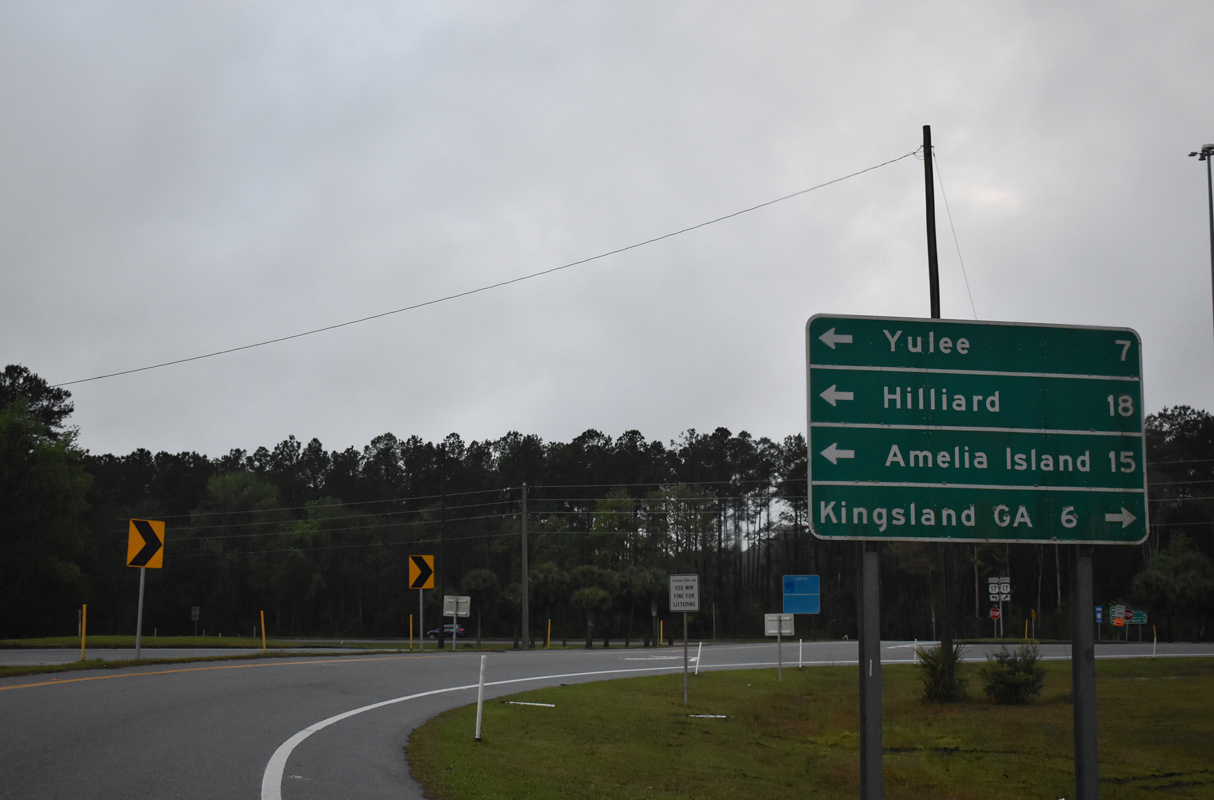
| Comprising a route 18 miles to the town of Hilliard and U.S. 1-23-301, Nassau County Road 108 branches west from U.S. 17 nearby. 03/10/22 |
|
| U.S. 17 parallels I-95 from Jacksonville northward to Savannah, Georgia. The two meet again in 31.7 miles near Brunswick. 03/10/22 |
|
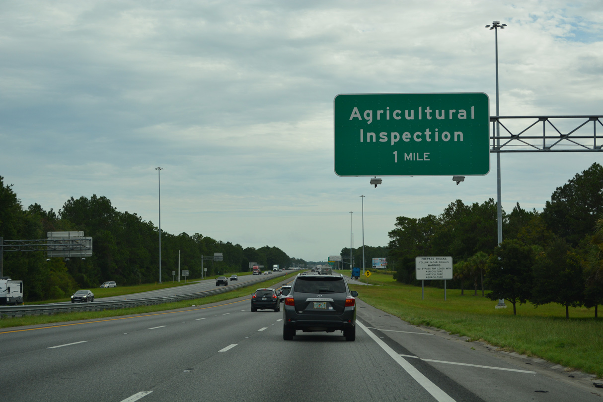
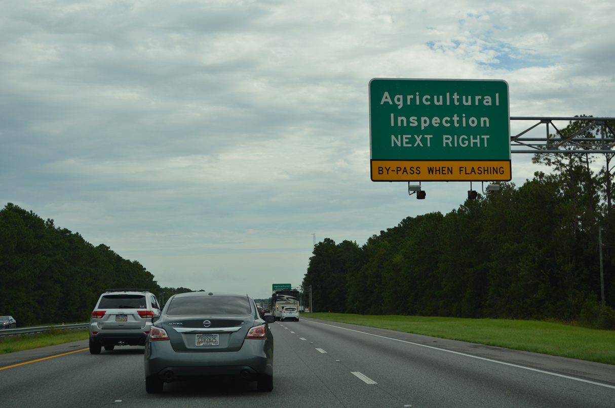
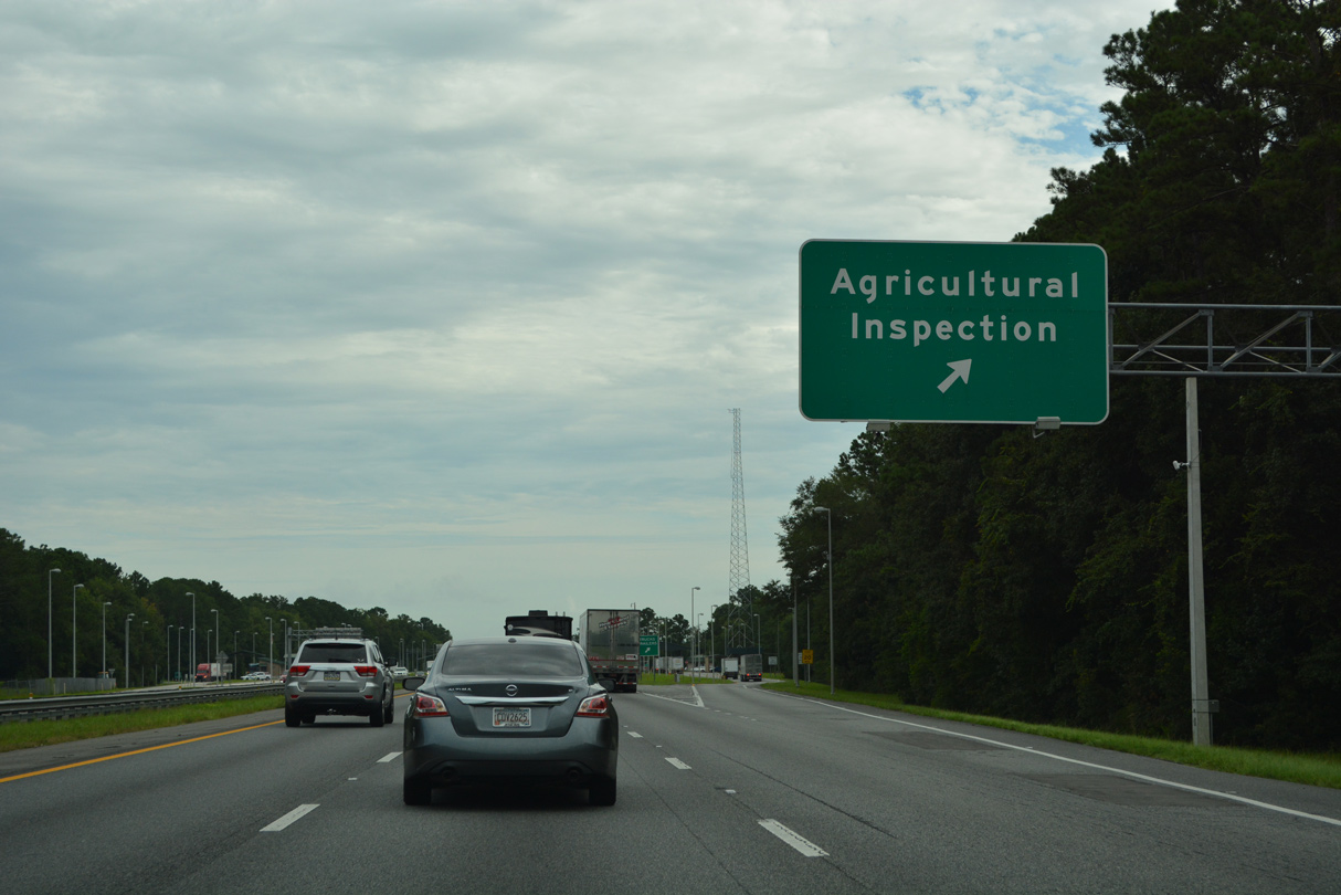
| Like the state of California, Florida utilizes agricultural inspection stations. Unlike California however, only truck traffic, including rentals such as moving vans and recreational vehicles, is required to enter the stations. 08/14/21 |
|
| The agricultural inspection station south of the St. Marys River replaced a weigh station after the facilities south of U.S. 17 were constructed. 08/14/21 |
|
| Welcome to Florida monuments were added along I-10, I-75 and I-95 at their respective state borders in 2016. 08/14/21 |
|
| 32 miles separate the Florida state line from Brunswick, Georgia. Savannah lies 108 miles beyond the St. Marys River crossing. The freeway remains with at least six general travel lanes throughout the Peach State. 11/19/21 |
12/14/07, 07/23/13, 12/19/13, 09/22/14, 12/13/17, 08/14/21, 11/19/21, 03/10/22 by AARoads
Page Updated 07-14-2022.

 North
North