|
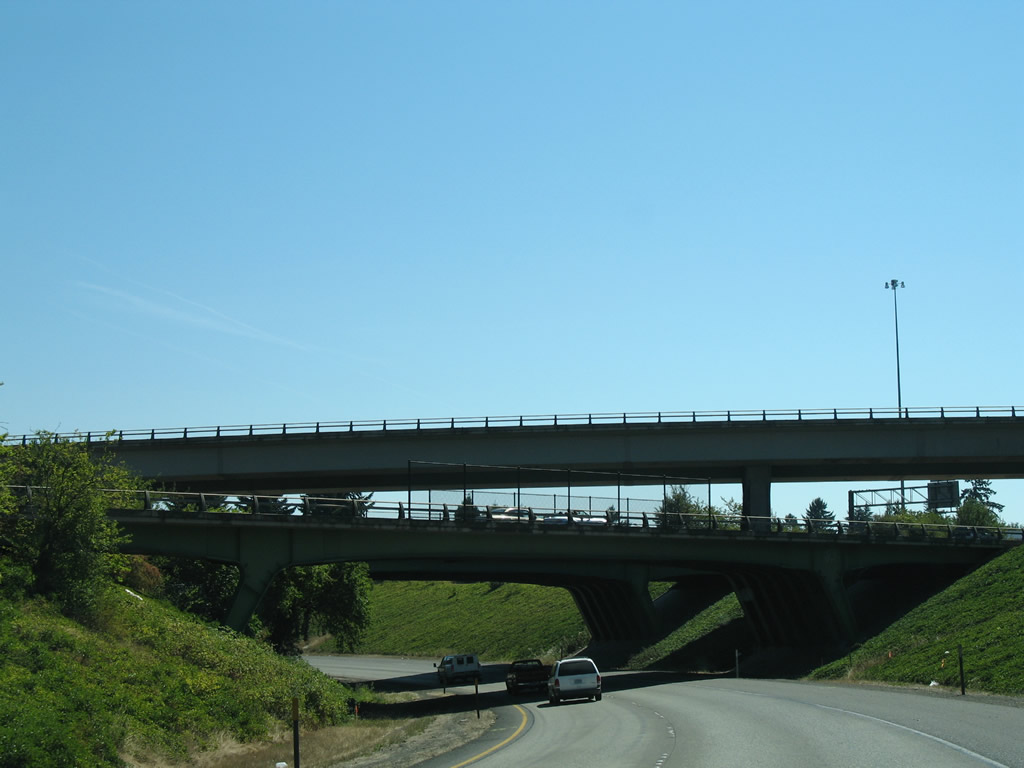
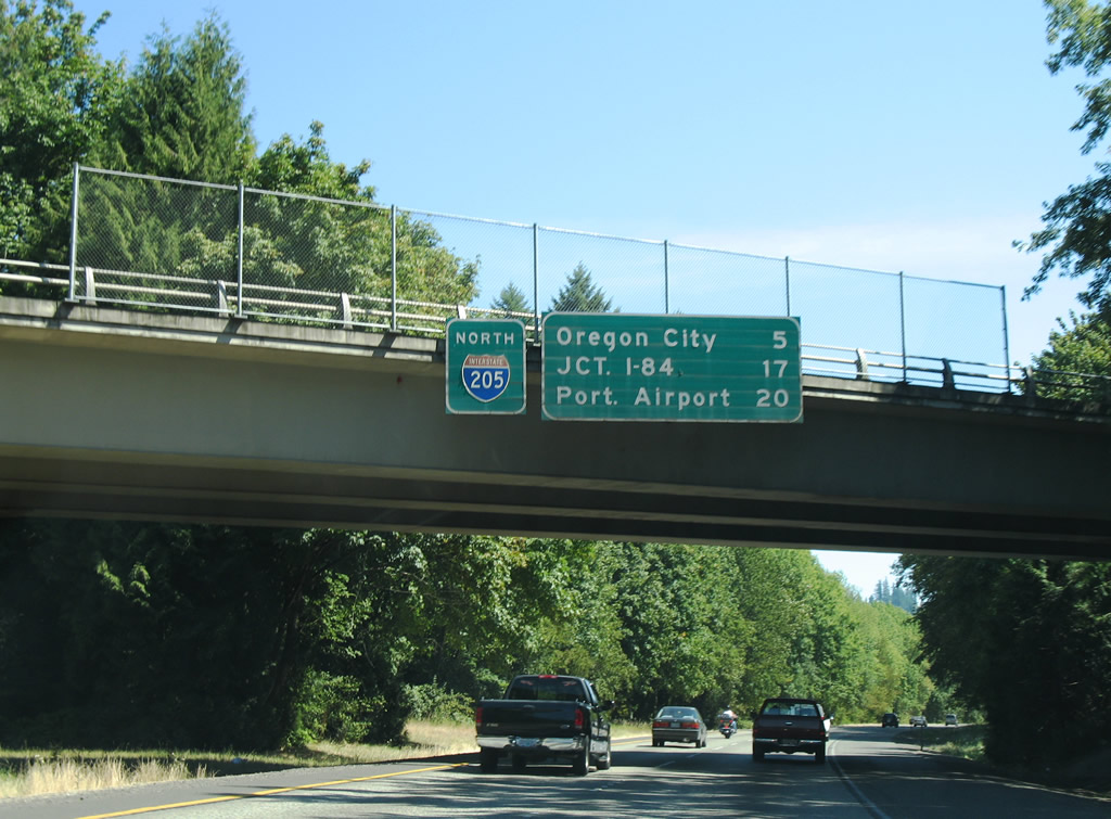
| A directional T interchange joins I-5/205 along the eastern limits of Tualatin in Washington County. Traffic taking Exit 288 from I-5 south to I-205 north travels the lowest level of the exchange. 08/27/06 |
|
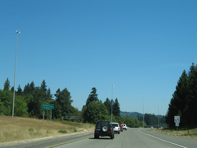
| This distance sign for Portland International Airport (PDX) along the beginning of Interstate 205 north was removed by 2007. 08/27/06 |
|
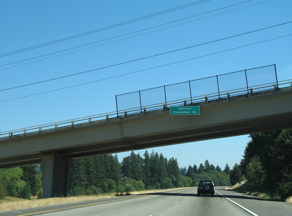
| I-205 enters Clackamas County at the SW 65th Avenue overpass. 08/27/06 |
|
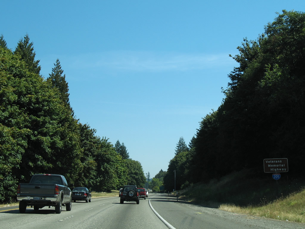
| The East Portland Freeway doubles as Veterans Memorial Highway. 08/27/06 |
|
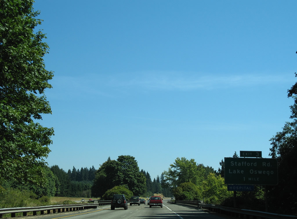
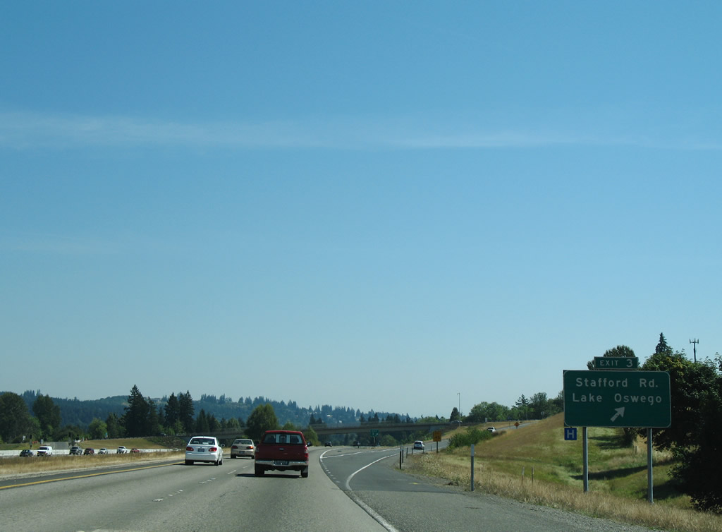
| Stafford Road meets Interstate 205 at a diamond interchange (Exit 3) near Wankers Corner and Stafford. 08/27/06 |
|
| Stafford Road angles northeast from Wilsonville to cross the Tualatin River near Hazelia and Cooks Butte. The road becomes McVey Avenue in the city of Lake Oswego. 08/27/06 |
|
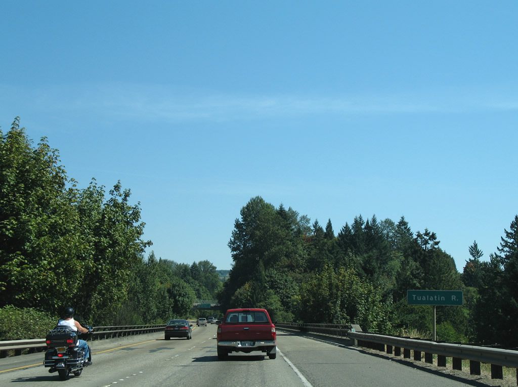
| I-205 passes over Borland Road and the Tualatin River to the east of Exit 3. Borland Road represents the former routing of OR 212 prior to the completion of the freeway. 08/27/06 |
|
| These signs were removed from the Johnson Road overpass by 2009. 08/27/06 |
|
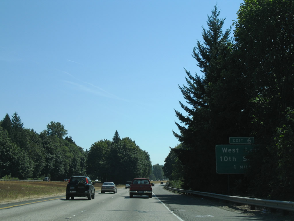
| Entering the city of West Linn, I-205 continues one mile to a diamond interchange (Exit 6) with 10th Street. 08/27/06 |
|
| 10th Street connects I-205 with Willamette Falls Drive (former OR 212) to the south and Blankenship Road west / Salamo Road east to the north. 08/27/06 |
|
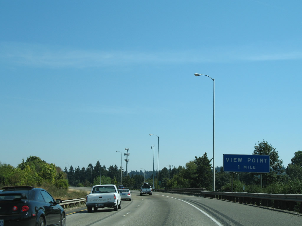
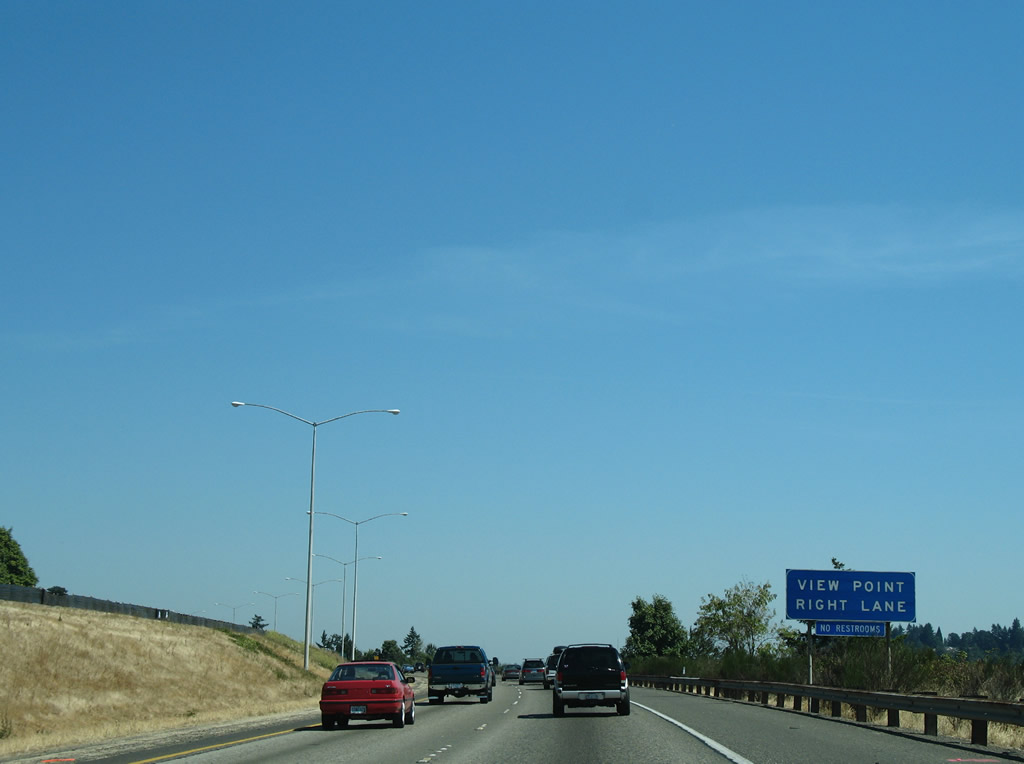
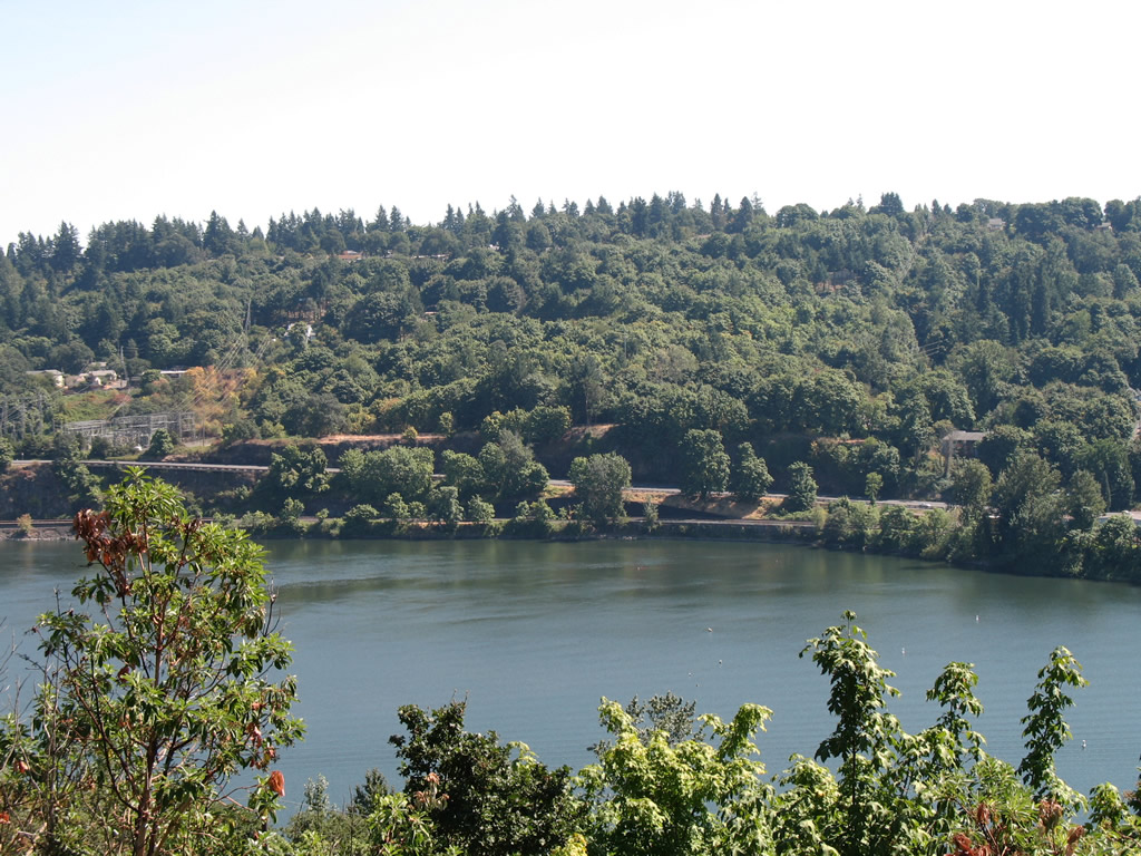
| A view point lines Interstate 205 northbound between Exits 6 and 8 as the Willamette River flows parallel to the freeway. 08/27/06 |
|
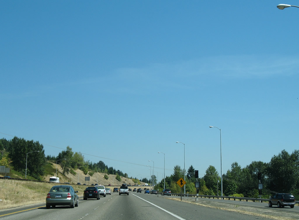
| Ramp meters are present at the majority of interchanges along Interstate 205 through the greater Portland area. 08/27/06 |
|
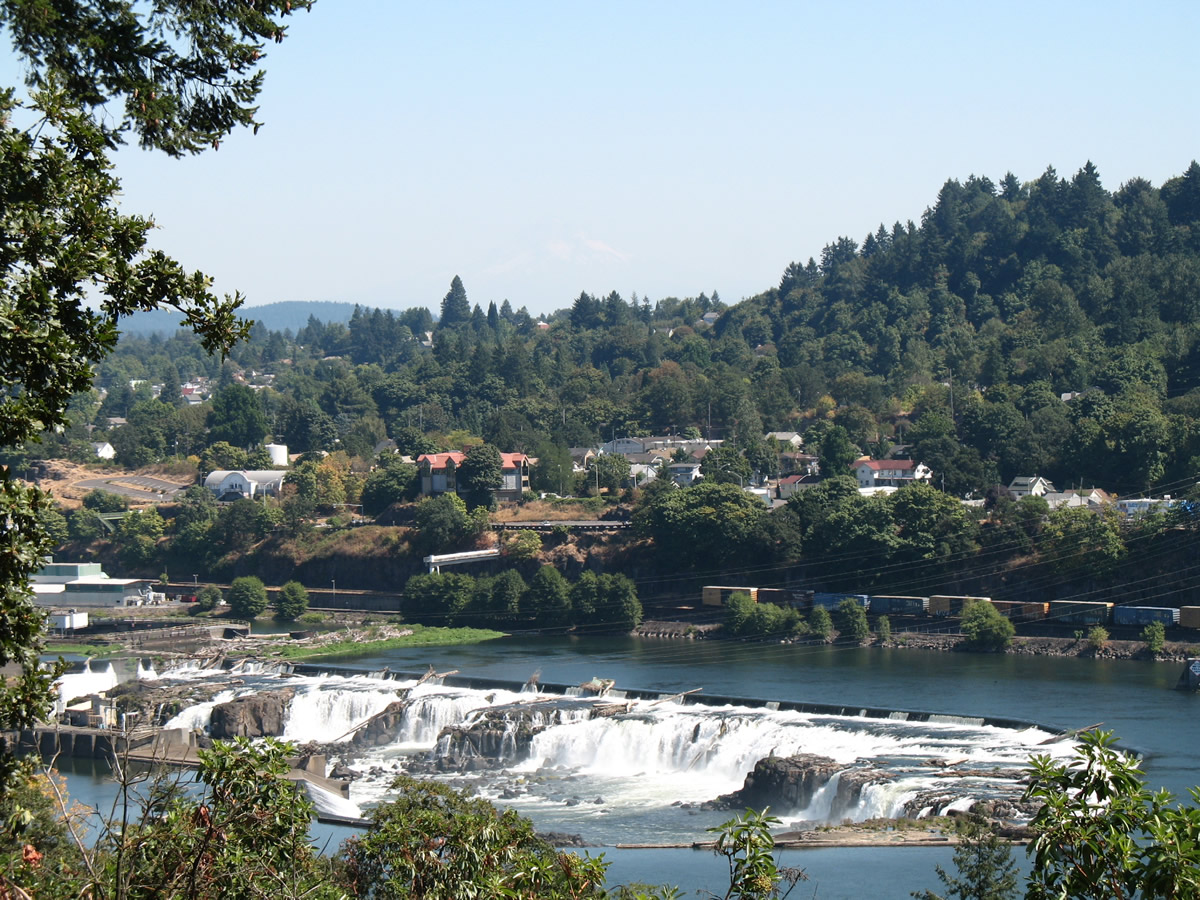
| Scenery at the view point focus on the Willamette River and Willamette Falls, the largest waterfall by volume in the Northwest. The 1,500 foot horseshoe shaped fall drops the Willamette River by 42 feet1. 08/27/06 |
|
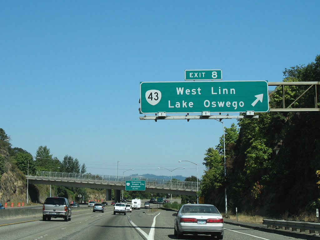
| OR 43 (Willamette Drive) meets Interstate 205 in one half mile at Exit 8. The state route travels 11.60 miles from OR 99E in nearby Oregon City to U.S. 26 and I-5 at the Ross Island Bridge in Portland. 08/27/06 |
|
| The ramp for OR 43 (Exit 8) departs at the West A Street overpass. OR 43 spans the Willamette River via the Oregon City Arch Bridge south into downtown Oregon City. The 1922 built bridge closed between 2011 and 2013 for a $10.6 million rehabilitation. 08/27/06 |
|
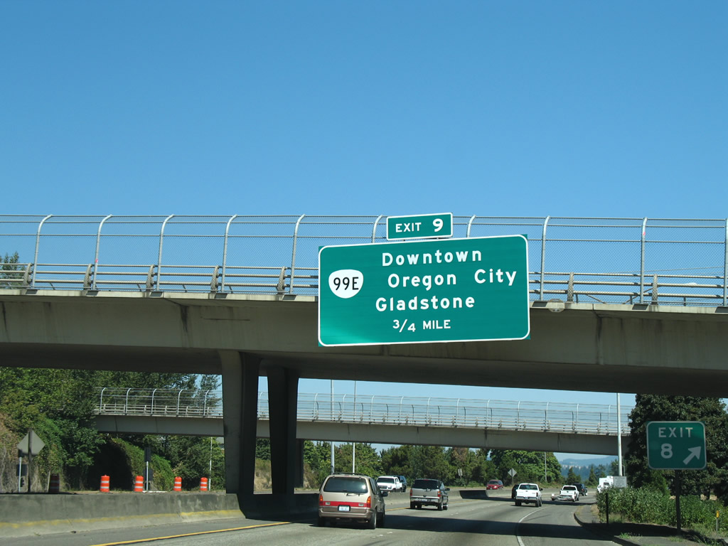
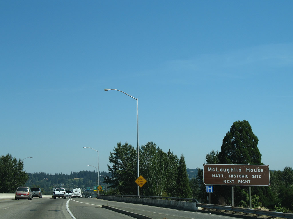
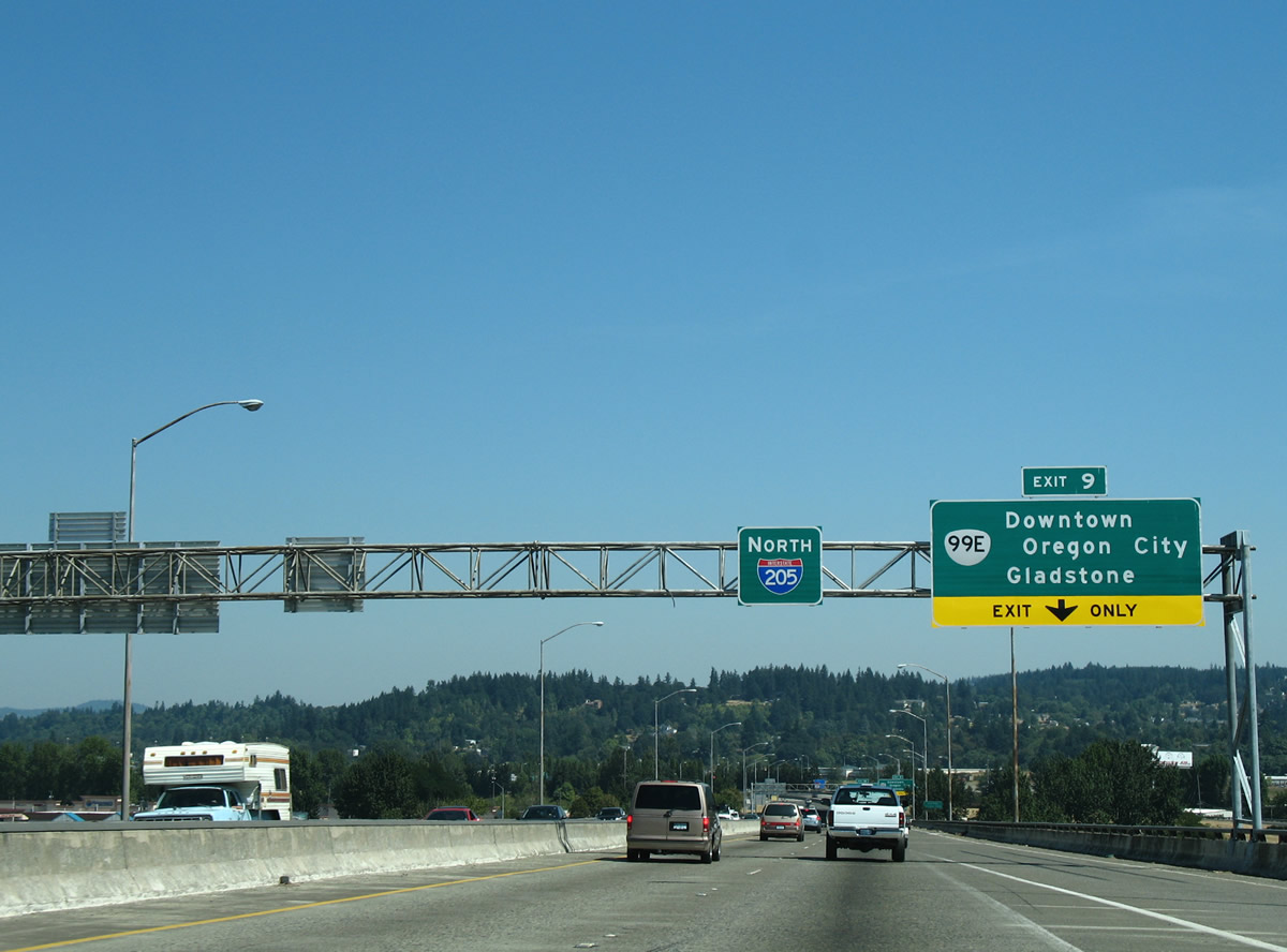
| OR 99E (McLoughlin Boulevard) travels north from downtown Oregon City to a folded diamond interchange (Exit 9) with I-205 next. 08/27/06 |
|
| A loop ramp from OR 43 (Willamette Drive) ties into Interstate 205 as the freeway angles northeast to the Willamette River. 08/27/06 |
|
| OR 99E constitutes a 109.78 mile route from Junction City to I-5 in north Portland. Locally following McLoughlin Boulevard, OR 99E connects I-205 with Gladstone and downtown Oregon City. 08/27/06 |
|
| I-205 spans the Willamette River on the 1970 opened Abernethy Bridge. Part of a multi-year construction project between Stafford Road (Exit 3) and OR 213 (Exit 13), improvements at the river crossing include strengthening the span to withstand major earthquakes2. 08/27/06 |
|
| A folded diamond interchange (Exit 9) joins Interstate 205 with OR 99E (McLoughlin Boulevard) one mile south of OR 213 (Trails End Highway). OR 99E overlays McLoughlin Boulevard northwest into Portland neighborhoods and East Portland. 08/27/06 |
|
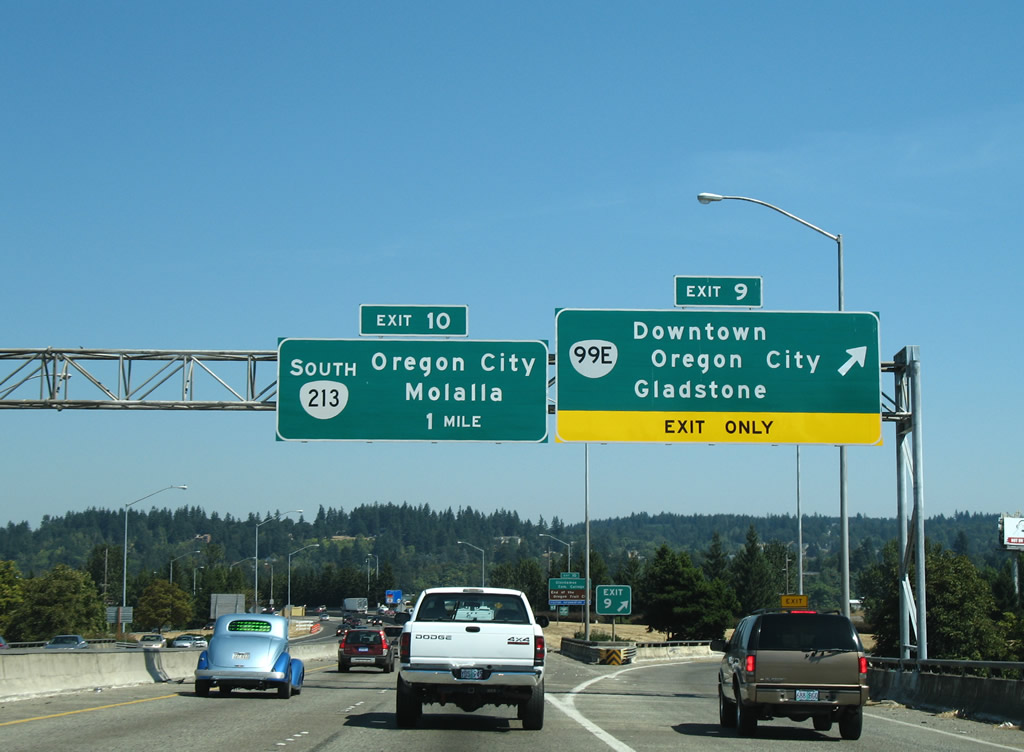
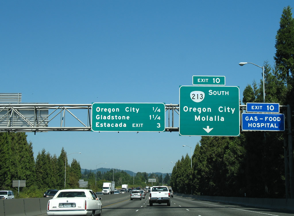
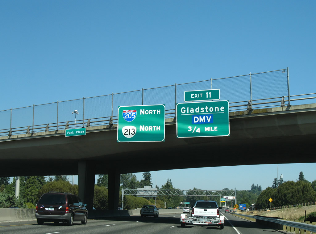
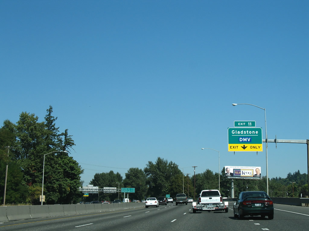
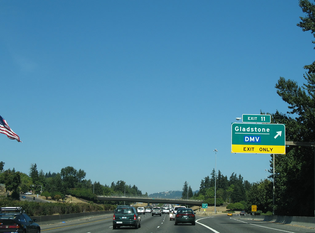
| The last Oregon City exit on Interstate 205 joins the freeway with OR 213 south (Trails End Highway) in 0.25 miles while 82nd Street (Exit 11) angles southwest to E Arlington Street and Gladstone in 1.25 miles. 08/27/06 |
|
| OR 213 travels south from Exit 10 along Trails End Highway to Molalla and Silverton. Washington Street spurs north to the Clackamas River, ending at a foot bridge to Gladstone. 08/27/06 |
|
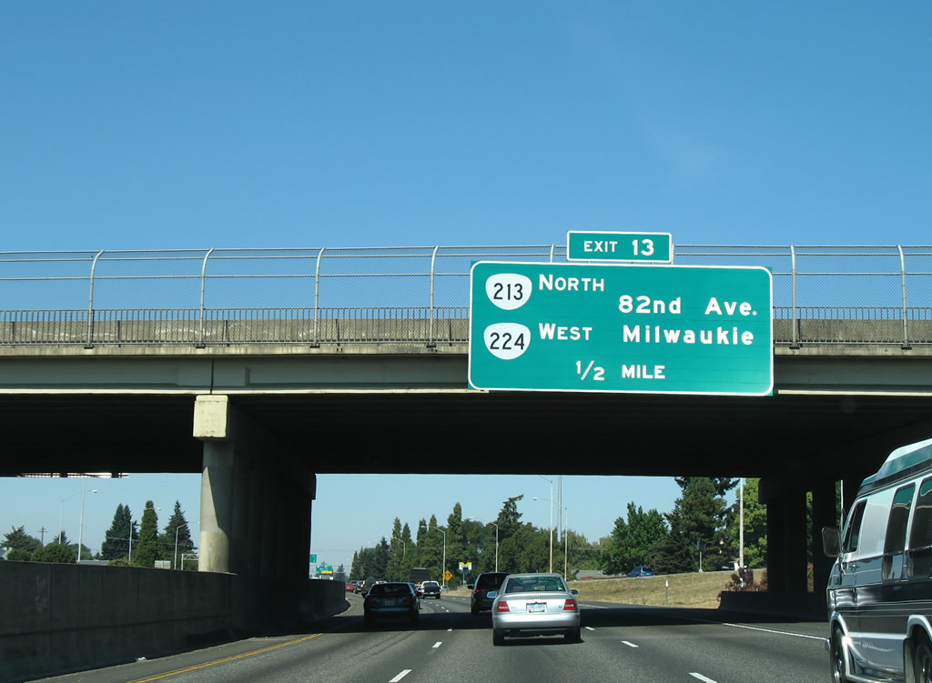
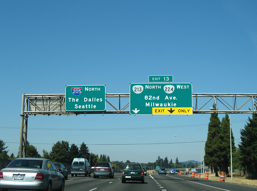
| OR 213 north merges onto I-205 for a 2.65 mile overlap to Exit 13. Overall the state highway travels 55.66 miles from Salem to Portland International Airport. 08/27/06 |
|
| I-205/OR 213 advances north across the Clackamas River to 82nd Drive (Exit 11) to Gladstone next. 08/27/06 |
|
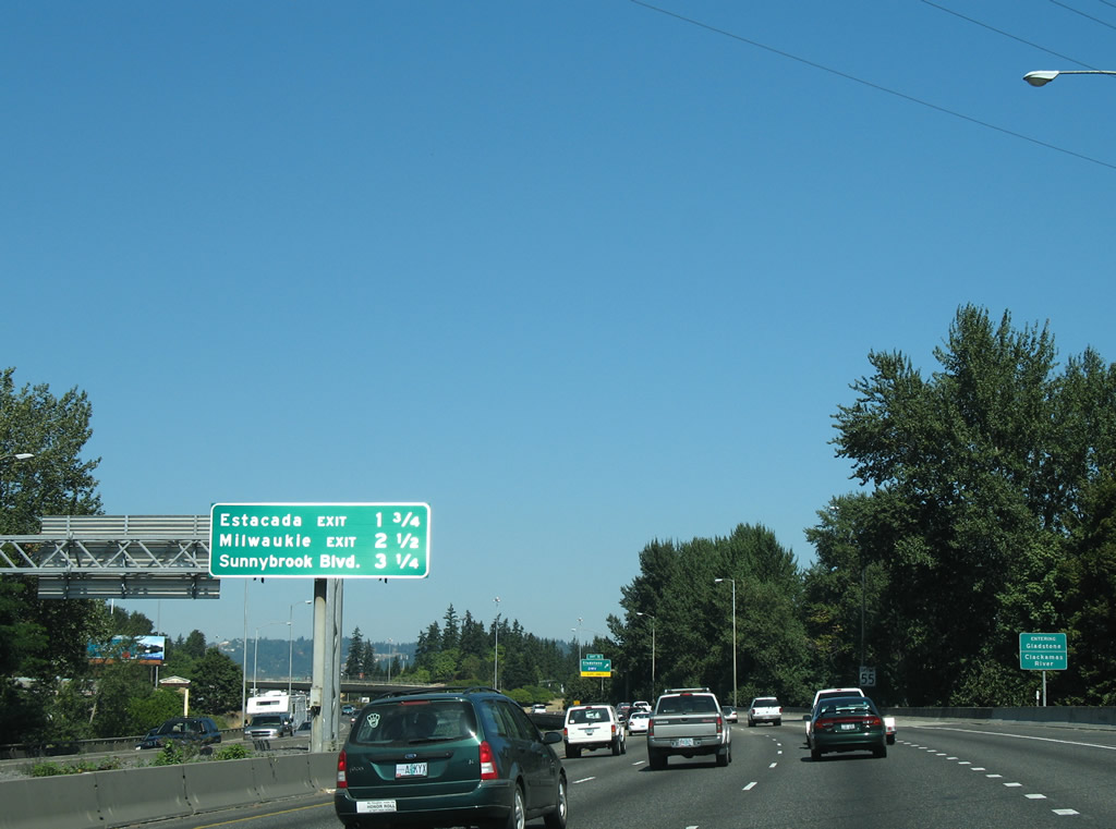
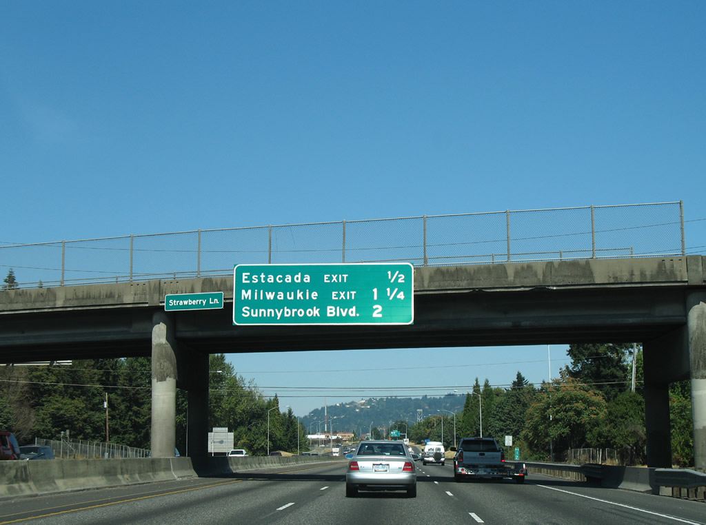
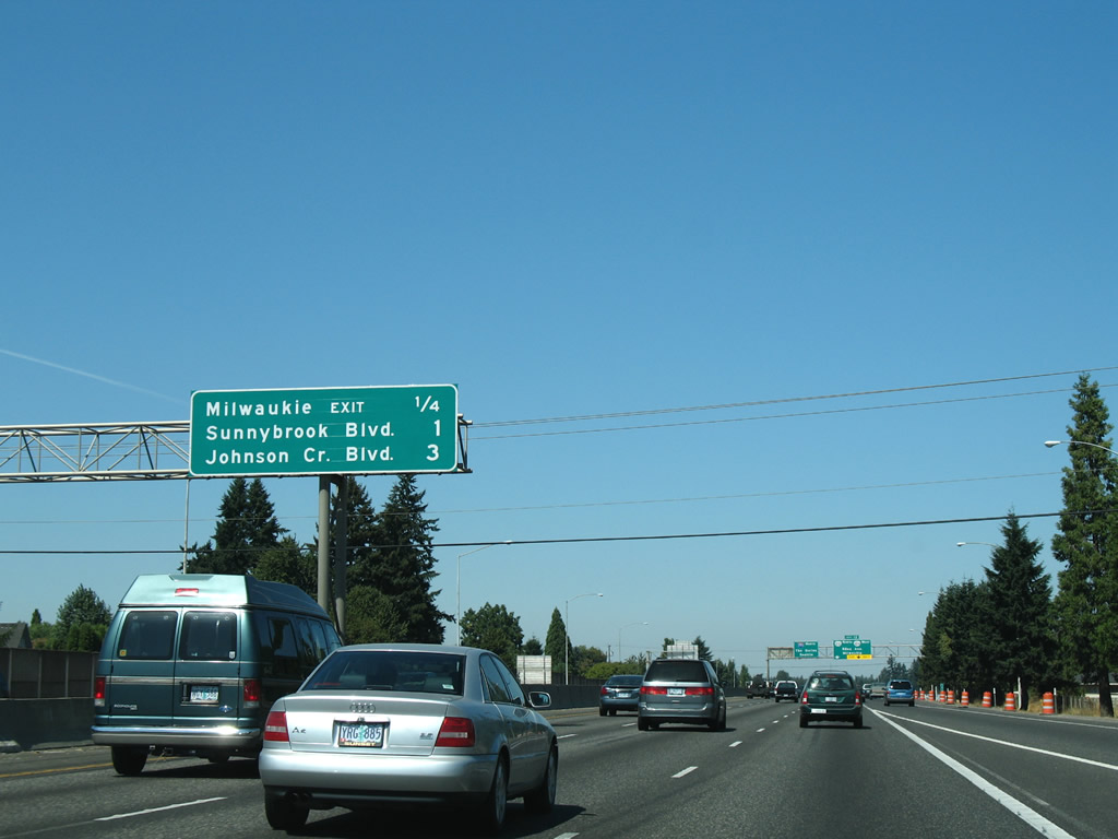
| Interchange sequence sign listing the distances to Estacada (Exit 13), Milwaukie (Exit 14) and Sunnybrook Boulevard (Exit 15). 08/27/06 |
|
| SE 82nd Drive winds northward from the Clackamas River at Gladstone and I-205 to OR 224 (SE 82nd Avenue) at Exit 13. 08/27/06 |
|
| The East Portland Freeway meets OR 212-224 (Clackamas Highway) east at a parclo interchange (Exit 12) in Clackmas. 08/27/06 |
|
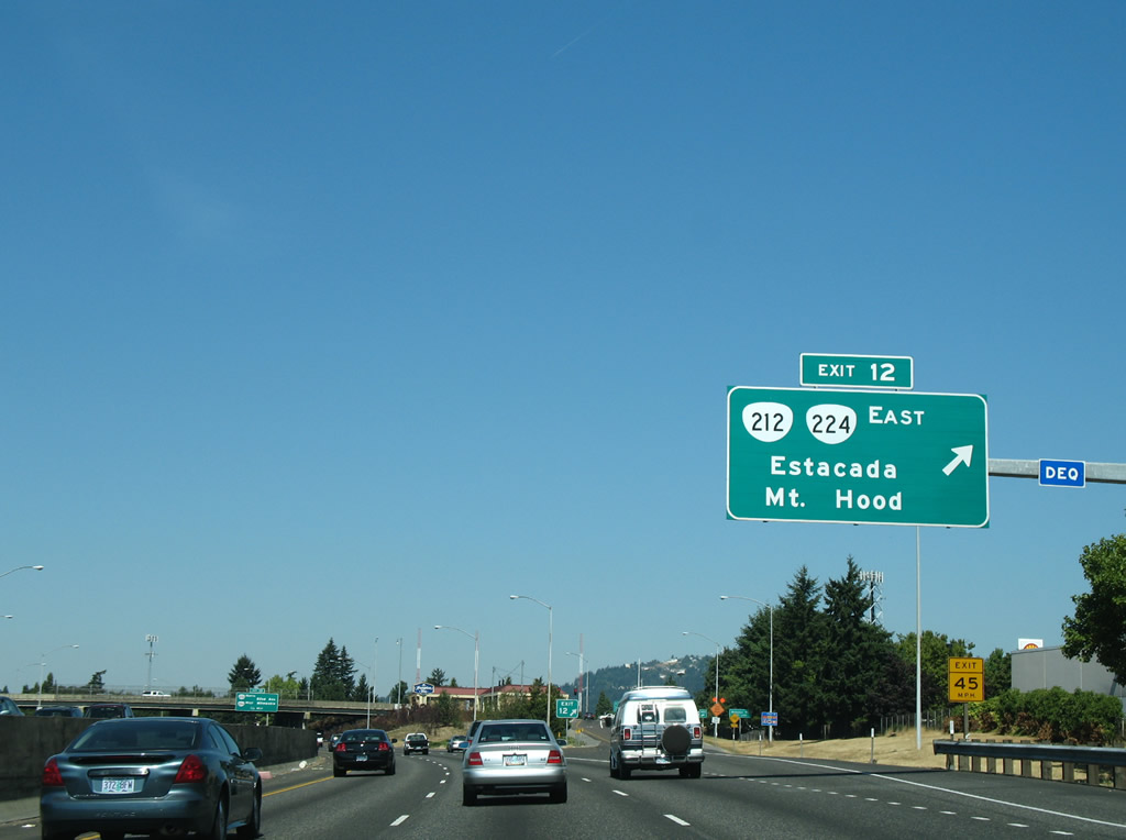
| Strawberry Lane passes over Interstate 205 between Webster Road and 82nd Drive one half mile south of the Clackamas Highway off-ramp (Exit 12). The interchange is signed for Estacada, the city where OR 224 leads after its split with OR 213 from Damascus. 08/27/06 |
|
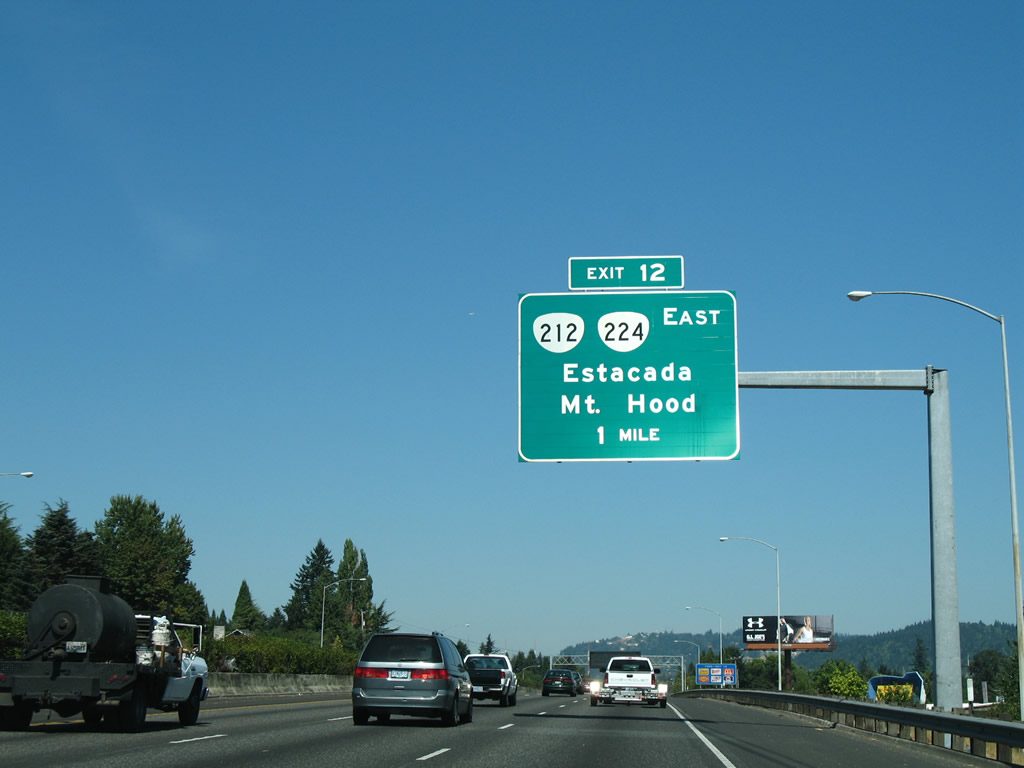
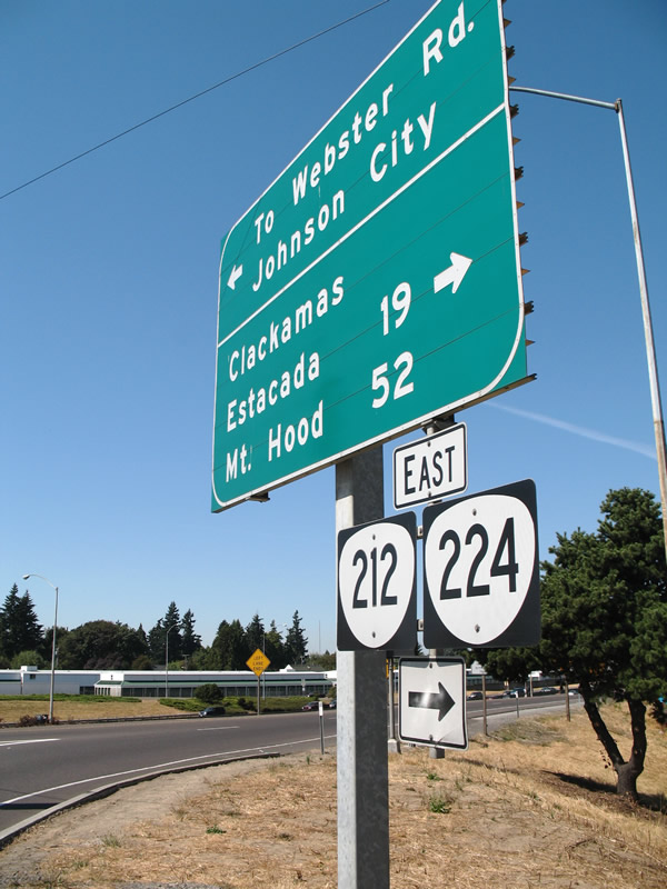
| Exit 12 departs Interstate 205 (East Portland Freeway) north for OR 212 & 224 (Clackamas Highway) east. OR 212 travels 14 miles east to Boring and U.S. 26 west of Sandy. OR 224 leads southeast to Estacada and Mount Hood National Forest.
Opened on July 1, 2016, the Sunrise Expressway realigned OR 224 between I-205 at Exit 13 and Rock Creek Junction to the north. 08/27/06 |
|
| Just one half mile separates the Clackamas Highway overpass from the split with OR 213 north at Exit 13. The state route follows 82nd Avenue north from 82nd Drive and OR 224 to Harmony and the Clackamas Town Center. 08/27/06 |
|
| Construction associated with the Sunrise Project replaced the forthcoming wye interchange with a half diamond interchange at a realigned 82nd Drive. The Sunrise Expressway expressway directly ties into the Milwaukie Expressway at a directional cloverleaf interchange with Interstate 205. 08/27/06 |
|
| OR 212 & 224 shields and guide sign posted at the end of the Interstate 205 (Exit 12) off-ramp to Clackamas Highway. OR 212 begins at the interchange and follows OR 224 east toward Carver. Connections from OR 212 east to U.S. 26 lead motorists 52 miles to Mt. Hood. 08/27/06 |
|
| OR 224 west joins Interstate 205 & OR 213 north briefly to Exit 13 (82nd Avenue). OR 213 north & 224 west comprise a short freeway spur between Exit 13 and the Milwaukie Expressway. 08/27/06 |
|
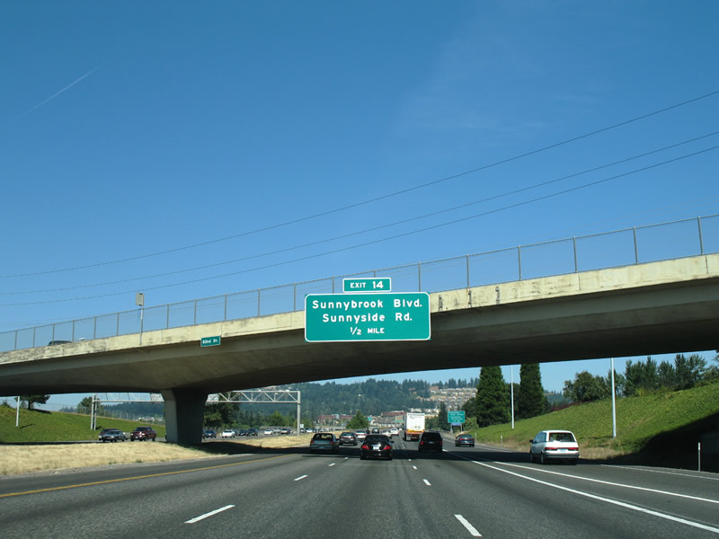
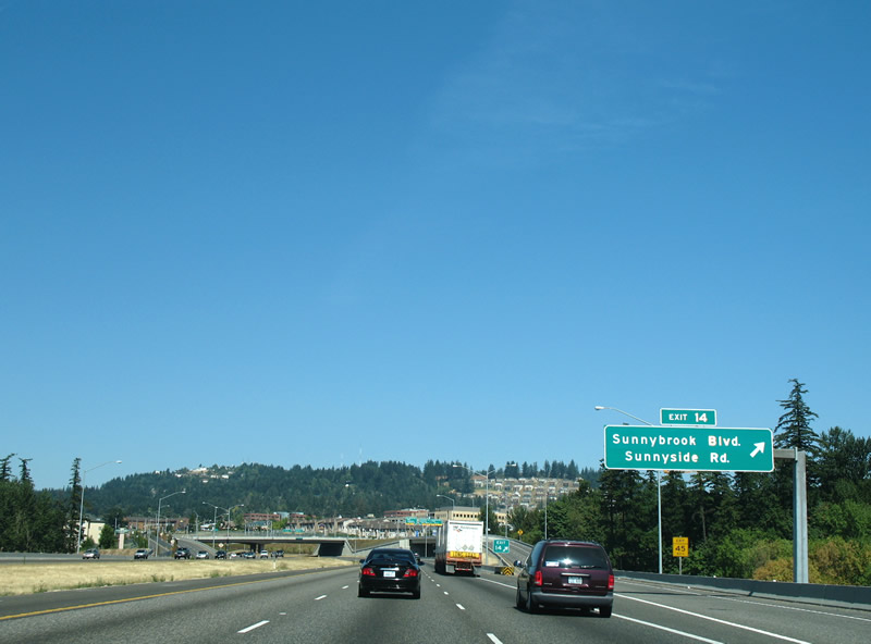
| Interstate 205 travels solo for the first time since Oregon City and approaches Exit 14 with Sunnybrook Boulevard and Sunnyside Road near the Clackamas Town Center mall. 08/27/06 |
|
| Interchange sequence sign posted for the Interstate 205 interchange with Johnson Creek Road (Exit 16) and south Portland (Exits 17 and 19). 08/27/06 |
|
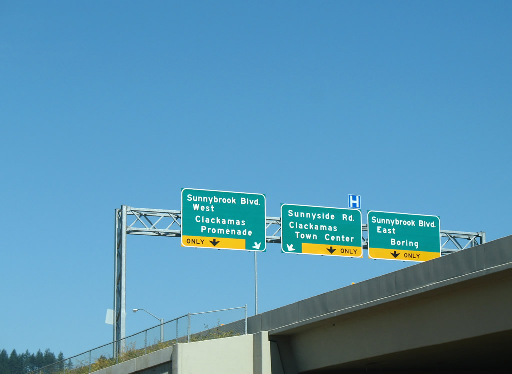
| A split diamond interchange joins I-205 with Sunnybrook Boulevard and Sunnyside Road at Exit 14. Both arterials travel between OR 213 (82nd Avenue) and Sunnyside. The city of Happy Valley lies to the east. 08/27/06 |
|
| What was originally a simple diamond interchange with Sunnyside Road was expanded to include access to Sunnybrook Boulevard in 2003. Sunnybrook Boulevard encircles the commercial area along the south side of Sunnyside Road near Mount Talbert, providing a more direct route to Sunnyside Road east. The Exit 14 ramp elevates here to accommodate an on-ramp from the future OR 224 freeway to Interstate 205 north. 08/27/06 |
|
| Separate ramps join Interstate 205 north from Sunnybrook Boulevard and Sunnyside Road to form an auxiliary lane to Exit 16, Johnson Creek Boulevard. 08/27/06 |
|
| This northbound reassurance stands along I-205 between Happy Valley to the east and the commercial strip along OR 213 (SE 82nd Avenue) to the west at Harmony Point. 08/27/06 |
|
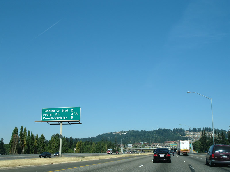
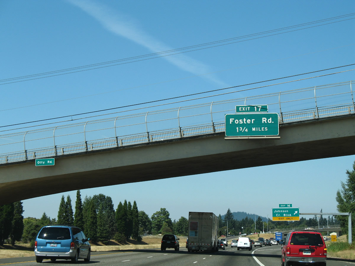
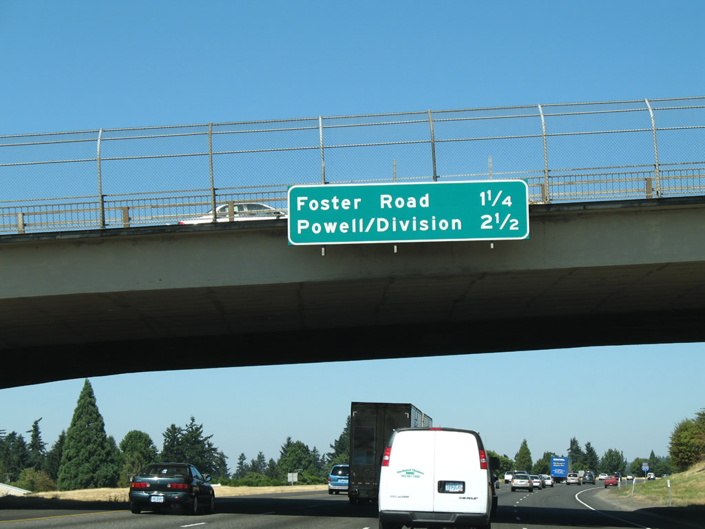
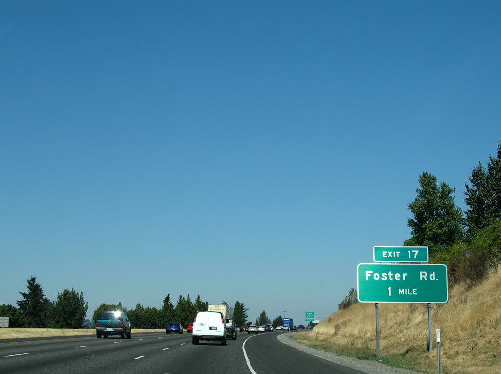
| An older button copy sign was posted for Foster Road, 1.75 miles south of the split diamond interchange (Exit 17) at the Otty Road overpass. 08/27/06 |
|
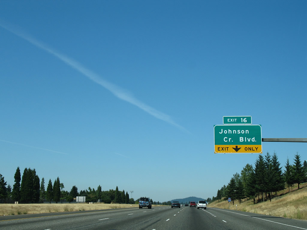
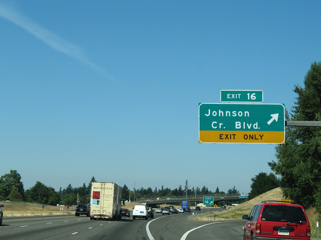
| Exit 16 leaves I-205 (East Portland Freeway) north for Johnson Creek Boulevard. The parclo interchange at Battin was added around 1990, serving suburban areas at Mount Scott to the east and connecting with Johnson Creek Boulevard west from OR 213 to Wichita. The Johnson Creek Freeway was originally proposed between I-205 at this location and Milwaukie. 08/27/06 |
|
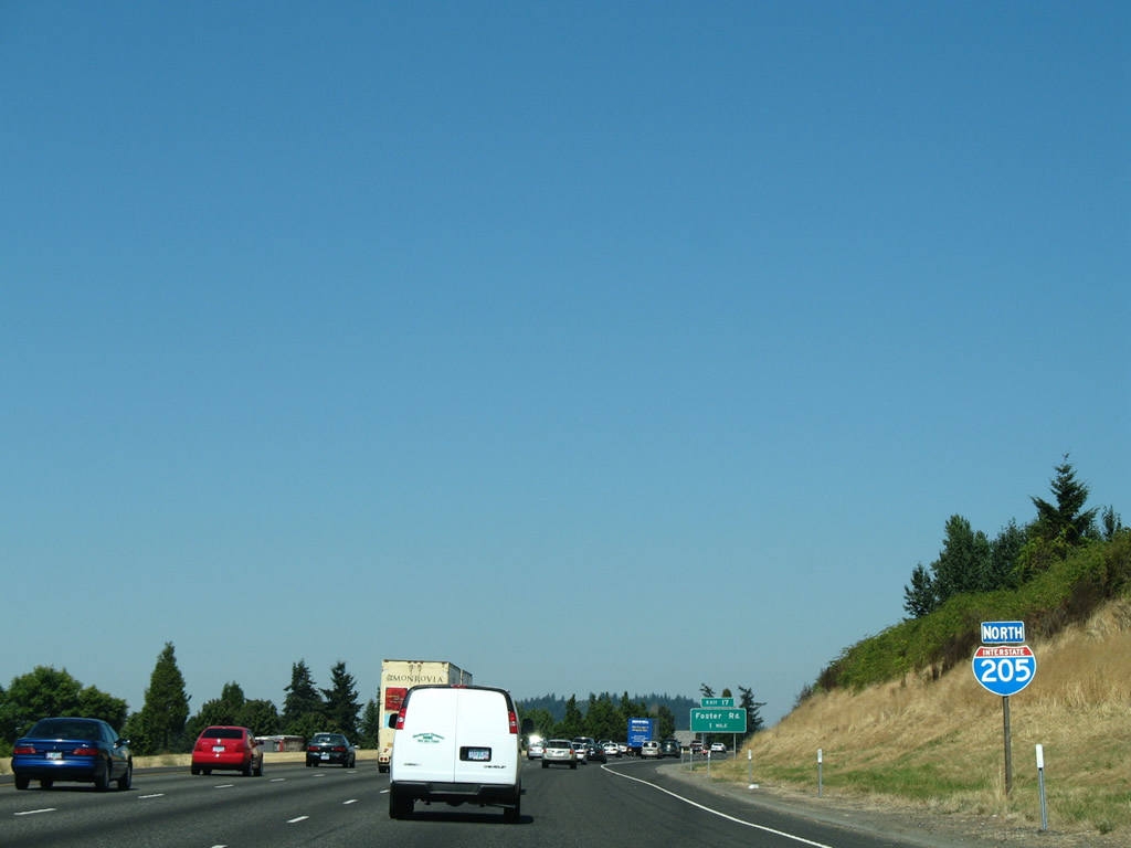
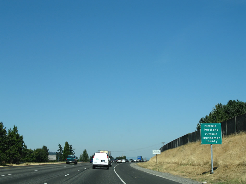
| Interstate 205 enters Multnomah County and Portland beyond Exit 16. The next two exits serve the Lents and Powellhurst-Gilbert neighborhoods of the city. 08/27/06 |
|
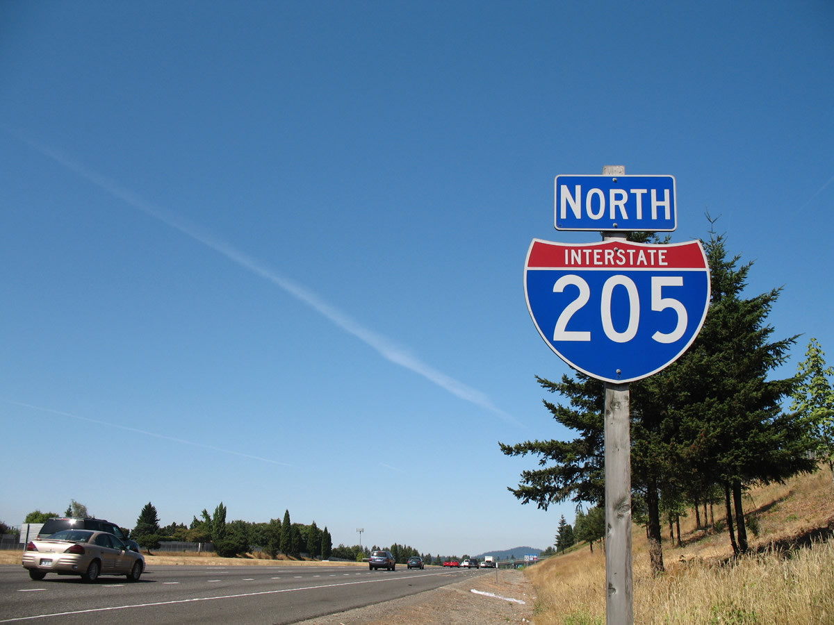
| Confirming shield for Interstate 205 posted at the northeastern curve into Portland. 08/27/06 |
|
| Foster Road and Woodstock Boulevard converge with Interstate 205 in one mile. 08/27/06 |
|
| Interstate 205 (East Portland Freeway) leaves Clackamas County. 08/27/06 |
Page Updated 12-15-2010.

 North
North