|
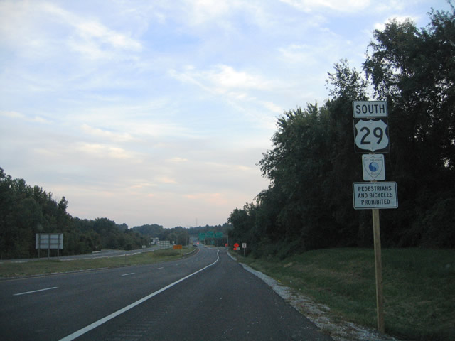
| The first southbound reassurance shield of U.S. 29 resides as Columbia Pike departs its intersection with MD 99 (Old Frederick Road) and Rogers Avenue at Mount Hebron. U.S. 29 travels 13.6 miles within Howard County. All of the road is considered a limited-access highway, though four at-grade intersections, including one with signals, remain along Columbia Pike. 09/25/04 |
|
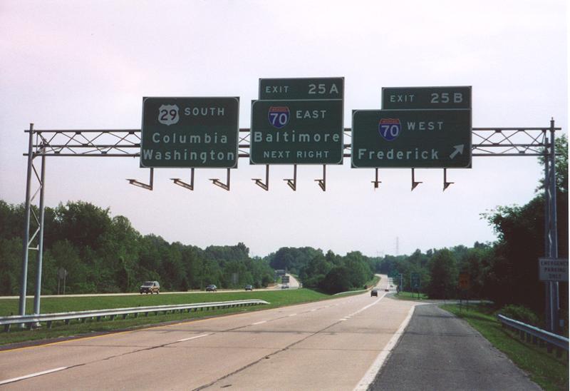
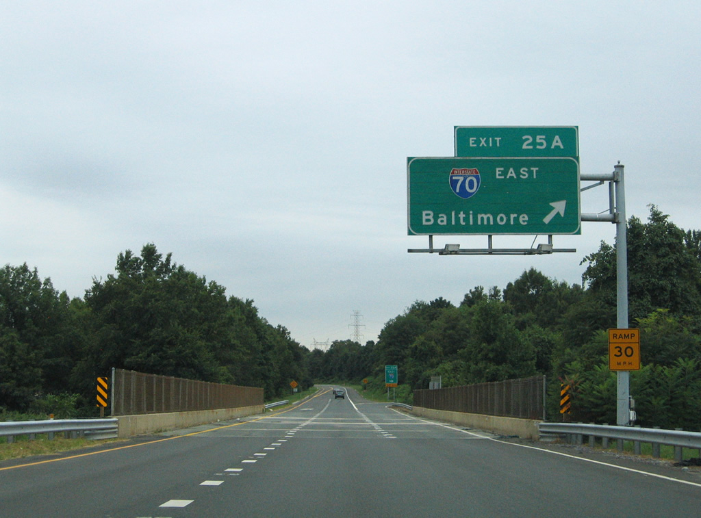
| U.S. 29 (Columbia Pike) immediately meets Interstate 70 at a directional cloverleaf interchange (Exits 25B/A) south of MD 99. Exit numbers for U.S. 29 coincide with milepost 0 at the Maryland/District of Columbia boundary. 06/17/00 |
|
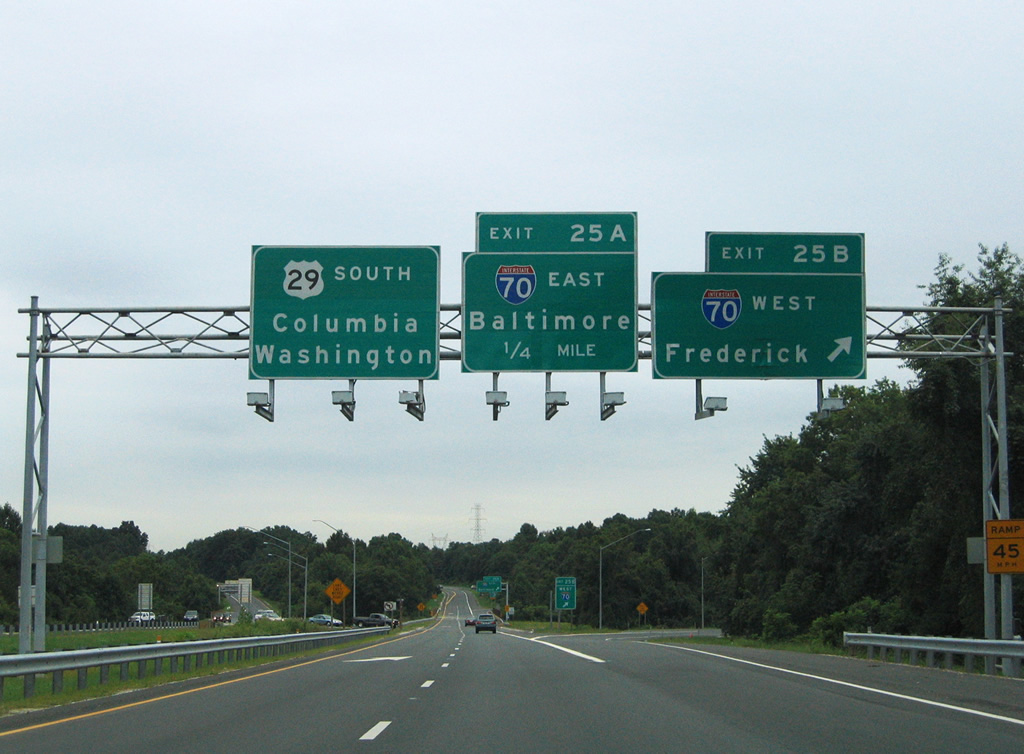
| A second look at the Exit 25B sign bridge sees the installation of sign lighting and the overlaying of the original concrete with asphalt. Interstate 70 provides the main corridor between Baltimore and the western Maryland cities of Frederick, Hagerstown, and Cumberland. 08/27/05 |
|
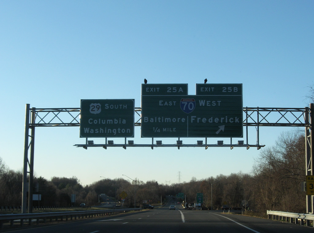
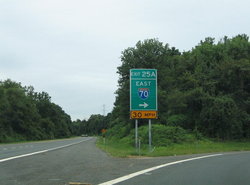
| A replacement sign bridge and new overheads were put in place on U.S. 29 south at Exit 25B by 2008. Interstate 70 reaches Frederick in 31 miles and Hagerstown in 55 miles. Overall the route totals 93.62 miles in Maryland. 12/30/08 |
|
| Exit 25A loops onto Interstate 70 eastbound for Baltimore City and the Baltimore Beltway (Interstate 695). The freeway ends 6.6 miles to the east. 08/27/05 |
|
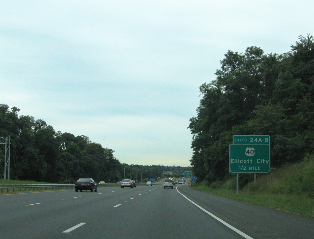
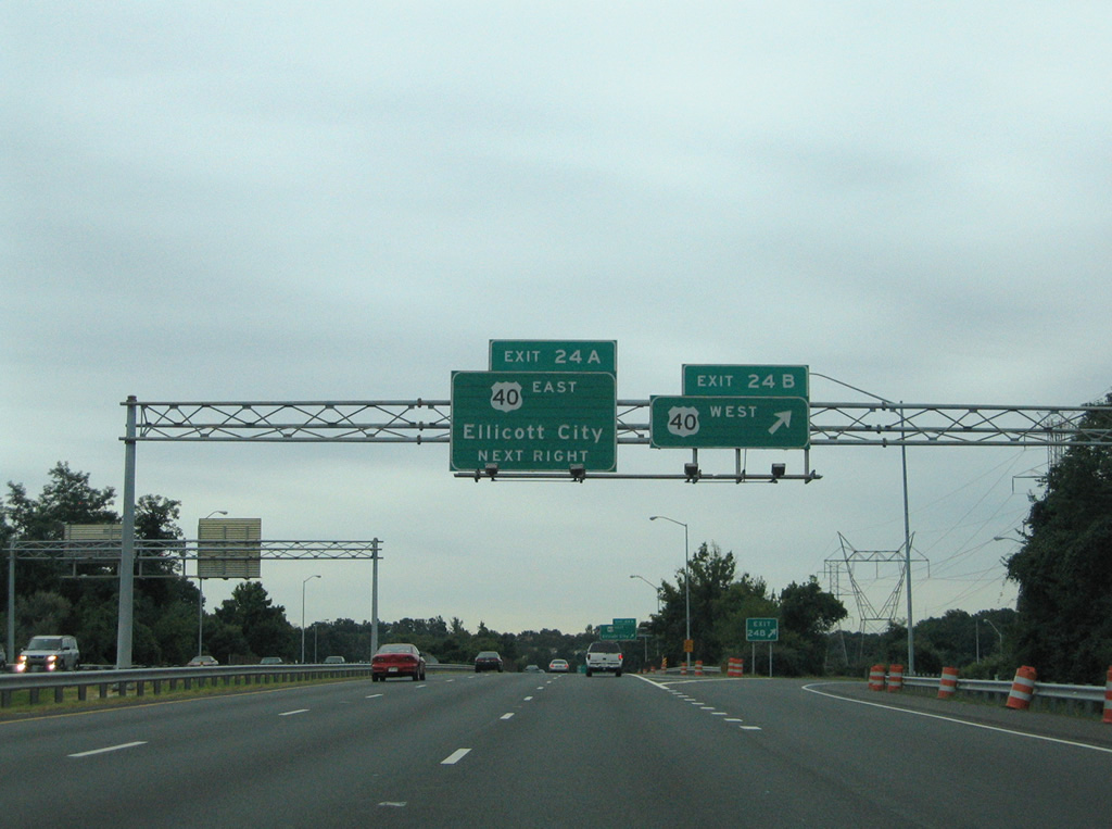
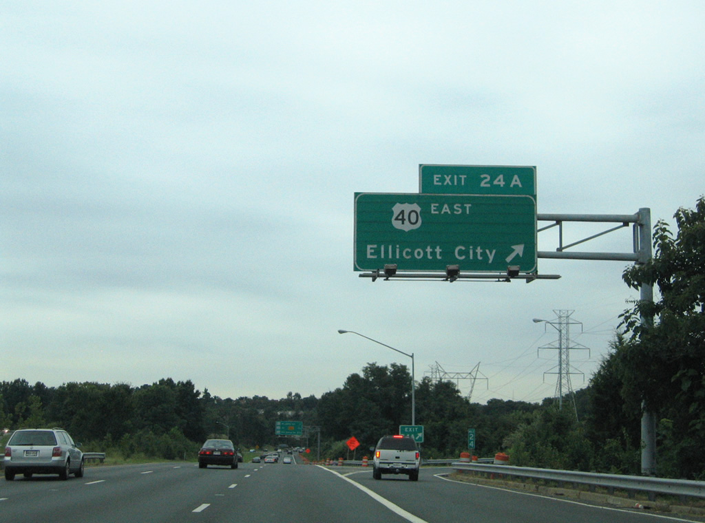
| U.S. 29 continues south from Interstate 70 to meet U.S. 40 at a directional cloverleaf interchange (Exits 24B/A) near Ellicott City. 08/27/05 |
|
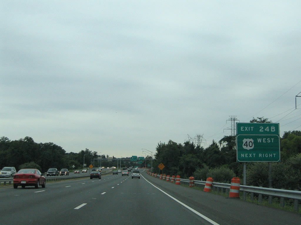
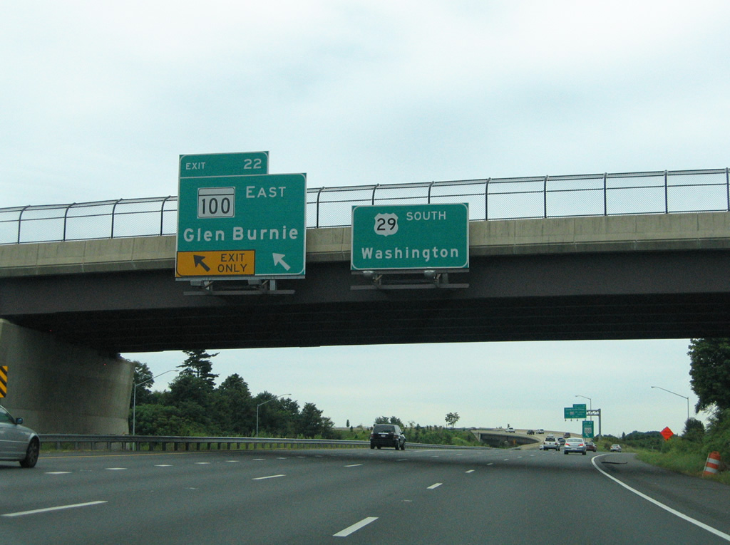
| Exit 24B departs next for U.S. 40 (Baltimore National Pike) west to Pine Orchard. The US route merges with Interstate 70 three miles to the west. MD 144 follows the old alignment of Frederick Road, from that point, to Mayfield and West Friendship, south of I-70/U.S. 40. 08/27/05 |
|
| U.S. 40 maintains four lanes through the communities of Valley Mede and Pine Orchard before merging with Interstate 70 at Exit 82. Eastward, U.S. 40 enters Ellicott City and Patapsco Valley State Park at the Baltimore County line. 08/27/05 |
|
| Southbound U.S. 29 at the Exit 24A loop ramp onto U.S. 40 (Baltimore National Pike) east. U.S. 40 continues from Ellicott City to Catonsville and Westview, paralleling Interstate 70 to its end at the city line. 08/27/05 |
|
| Interchange sequence sign for the trio of Maryland state route exits at McAlpine, Columbia Hills and Guilford Downs. 08/27/05 |
|
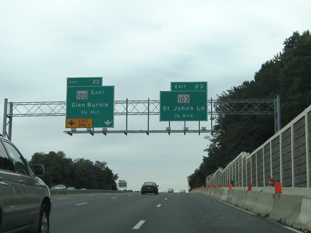
| Beginning in one mile is the MD 100 suburban freeway leading east from U.S. 29 to Severn and Southgate. A directional interchange includes left exits and entrances on U.S. 29 southbound. 08/27/05 |
|
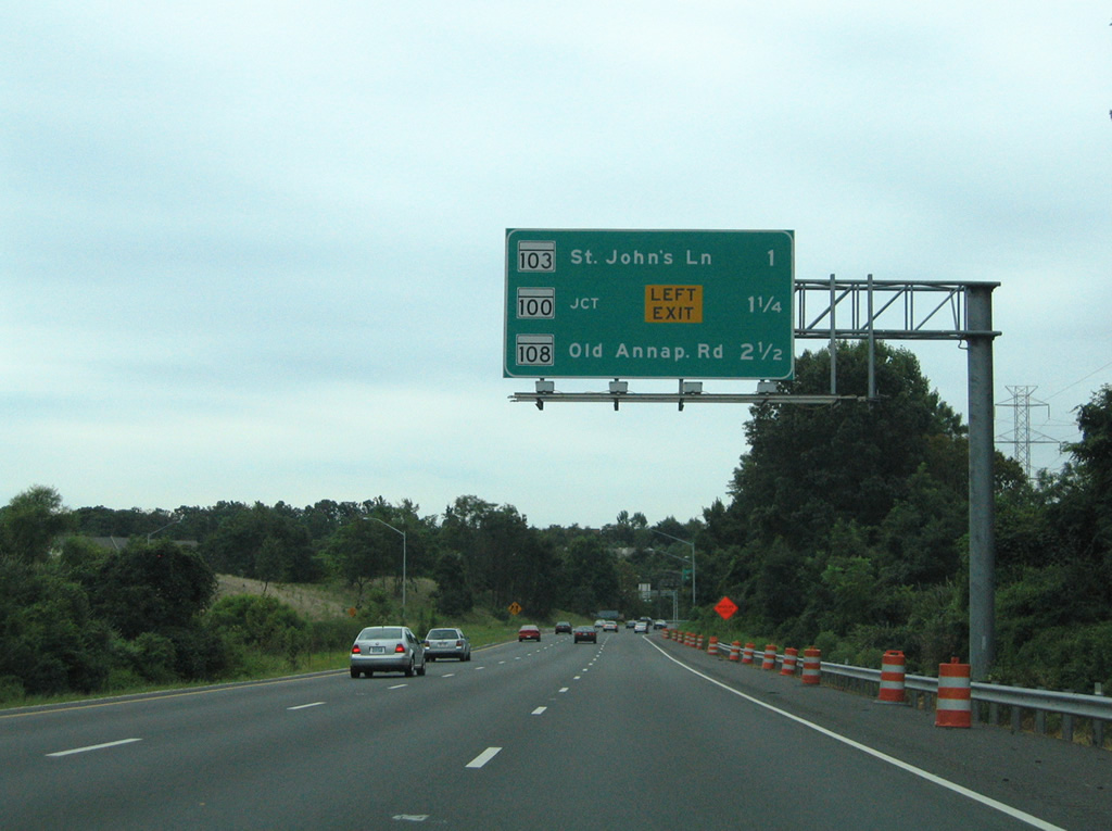
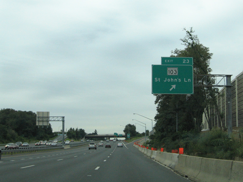
| Exit 23 departs next at a three-quarter diamond interchange with MD 103 (St. John's Lane). MD 103 stems east from the U.S. 29 freeway 8.29 miles to Dorsey. The state route was vastly replaced by the MD 100 freeway in importance. 08/27/05 |
|
| U.S. 29 south expands to four lanes as a two lane ramp prepares to split for MD 100 east from the left side. MD 100 constitutes a 22.05 mile long freeway to MD 177 (Mountain Road) near Lake Shore and Jacobsville in Anne Arundel County. 08/27/05 |
|
| Exit 23 parts ways with U.S. 29 (Columbia Pike) south for MD 103 (St. John's Lane). St. John's Lane turns north at Columbia Road, a southbound side frontage road, at McAlpine to the west. Northward the road shadows U.S. 29 to St. Johns Village and Valley Mede. MD 108 meanwhile travels Montgomery Road from Old Columbia Pike to Exit 4 of MD 100. 08/27/05 |
|
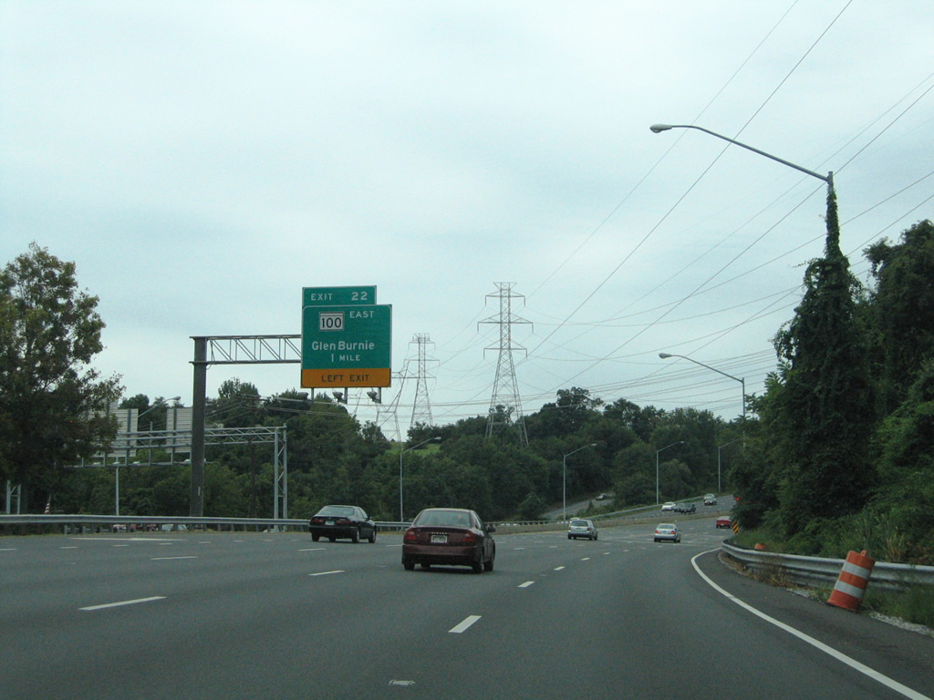
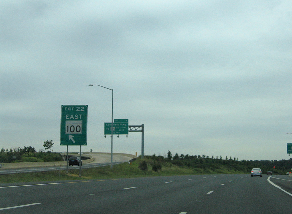
| Exit 22 quickly follows to MD 100 east. The freeway meets Long Gate Parkway at Columbia Hills nearby and otherwise crosses paths with Interstate 95 in 5.4 miles. The freeway can be used to access BWI Airport either from MD 295 north or MD 170 at Exit 11. 08/27/05 |
|
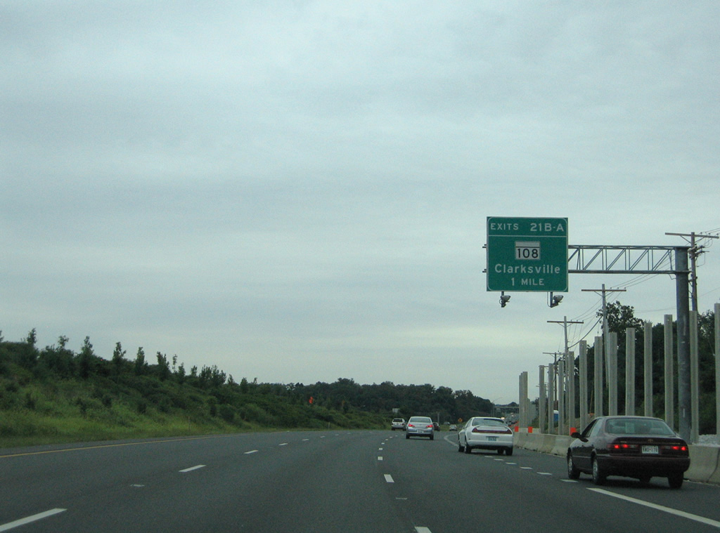
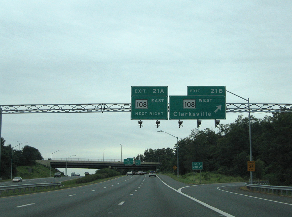
| MD 108 (Old Annapolis Road / Clarksville Pike) meets U.S. 29 at Exits 21B/A near Centennial Park. The east-west highway arcs 34.23 miles between MD 27 at Damascus and MD 175 near Waterloo. 08/27/05 |
|
| MD 108 (Clarksville Pike) travels 6.3 miles west from Exit 21B to meet the west end of the Patuxent Freeway (MD 32)at Clarksville. 08/27/05 |
|
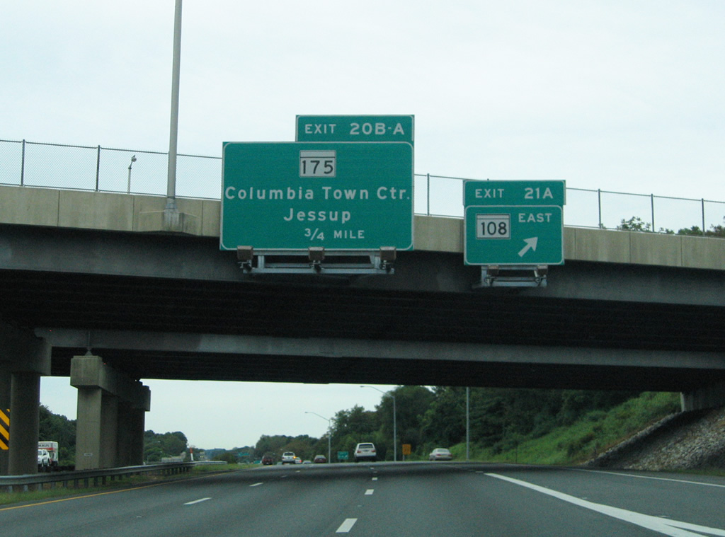
| Drivers bound for MD 108 (Old Annapolis Road) east leave U.S. 29 (Columbia Pike) southbound at Exit 21A. MD 108 meanders southeast from U.S. 29 by Guilford Downs and Oakland Mills and a large business park west of MD 100. 08/27/05 |
|
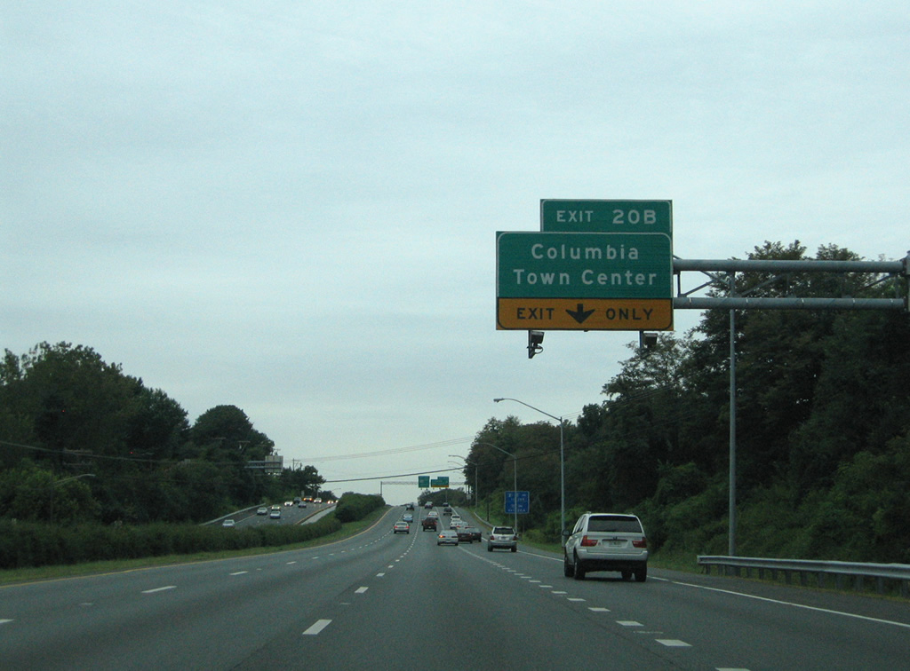
| The cloverleaf interchange of Exit 20 joins U.S. 29 (Columbia Pike) with Little Patuxent Parkway west and the eastbound beginning of MD 175 (Patuxent Parkway) east. 08/27/05 |
|
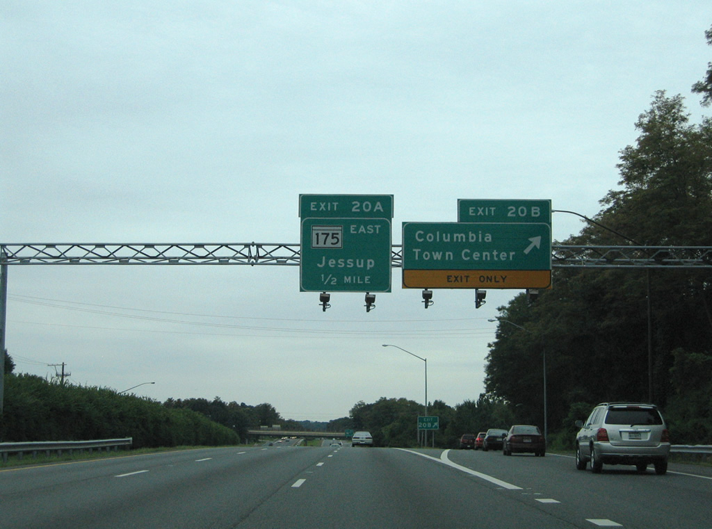
| Little Patuxent Parkway curves southwest to Wilde Lake, the Mall in Columbia, and the Columbia Town Center from Exit 20B. MD 175 continues the divided highway southeast to Oakland Mills and Long Reach. 08/27/05 |
|
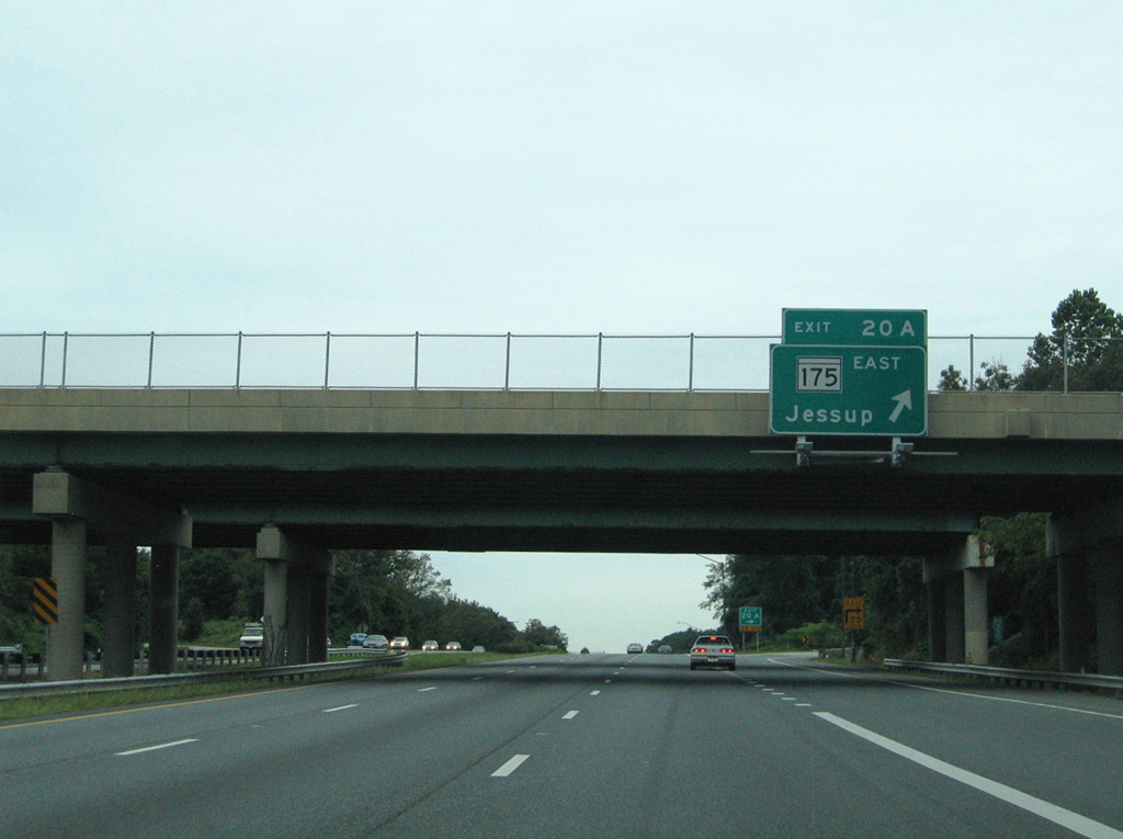
| MD 175 travels 17.01 miles east from U.S. 29 to MD 3 (Crain Highway) at Millersville. Jessup lies six miles to the east of Exit 20A via the state route. 08/27/05 |
|
| Leaving Exit 20, U.S. 29 (Columbia Pike) travels by Lake Kittamaqundi. An at-grade intersection connects with a section of Old Columbia Road along the northbound side. Three homes line the short frontage road that is not otherwise accessible. 08/27/05 |
|
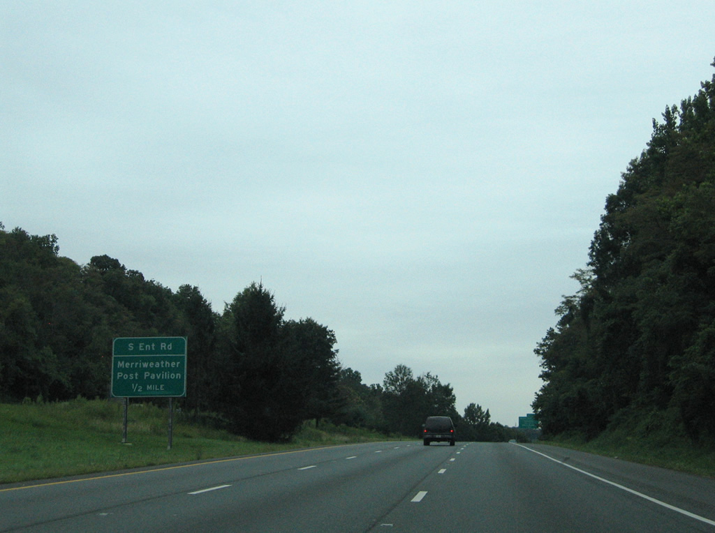
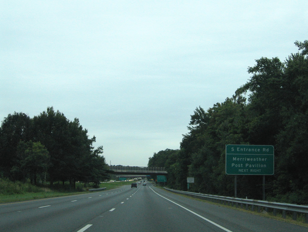
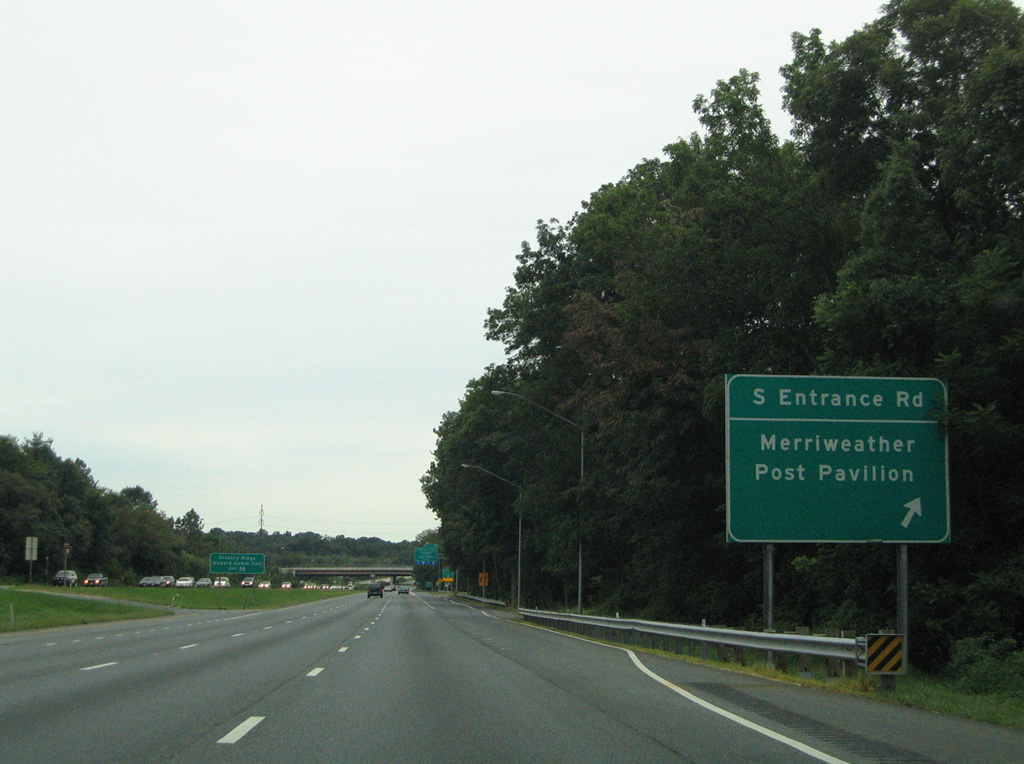
| Merriweather Post Pavilion park occupies land west of U.S. 29 and north of Broken Land Parkway. A direct ramp to South Entrance Road for the music venue is available to southbound motorists. 08/27/05 |
|
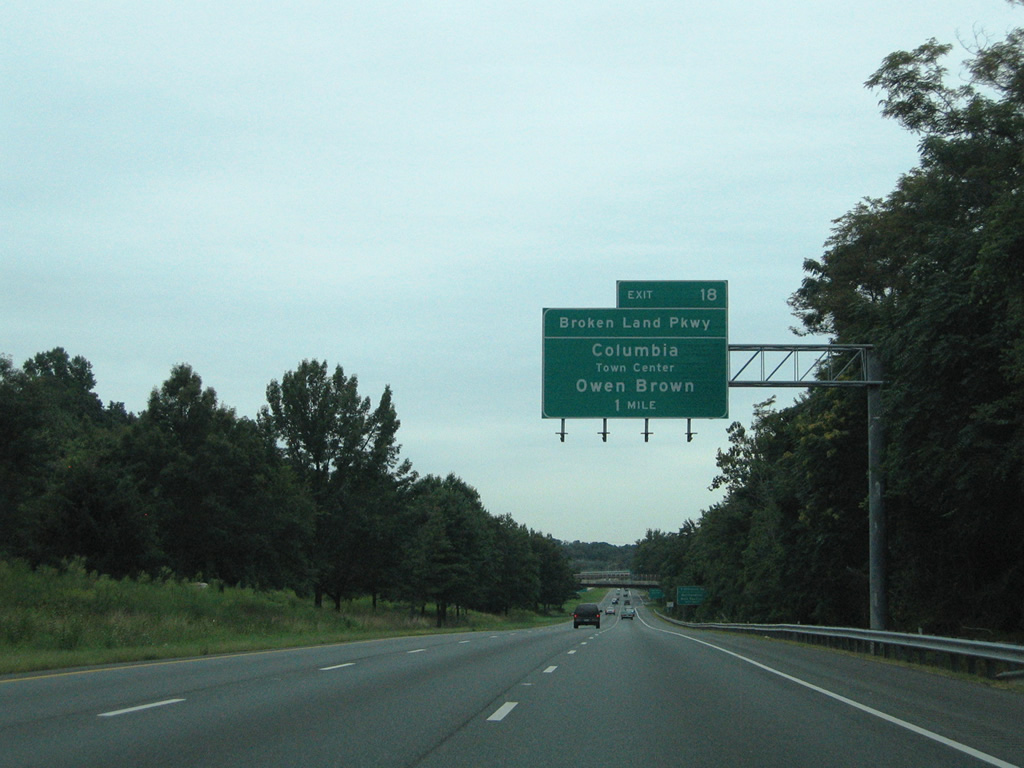
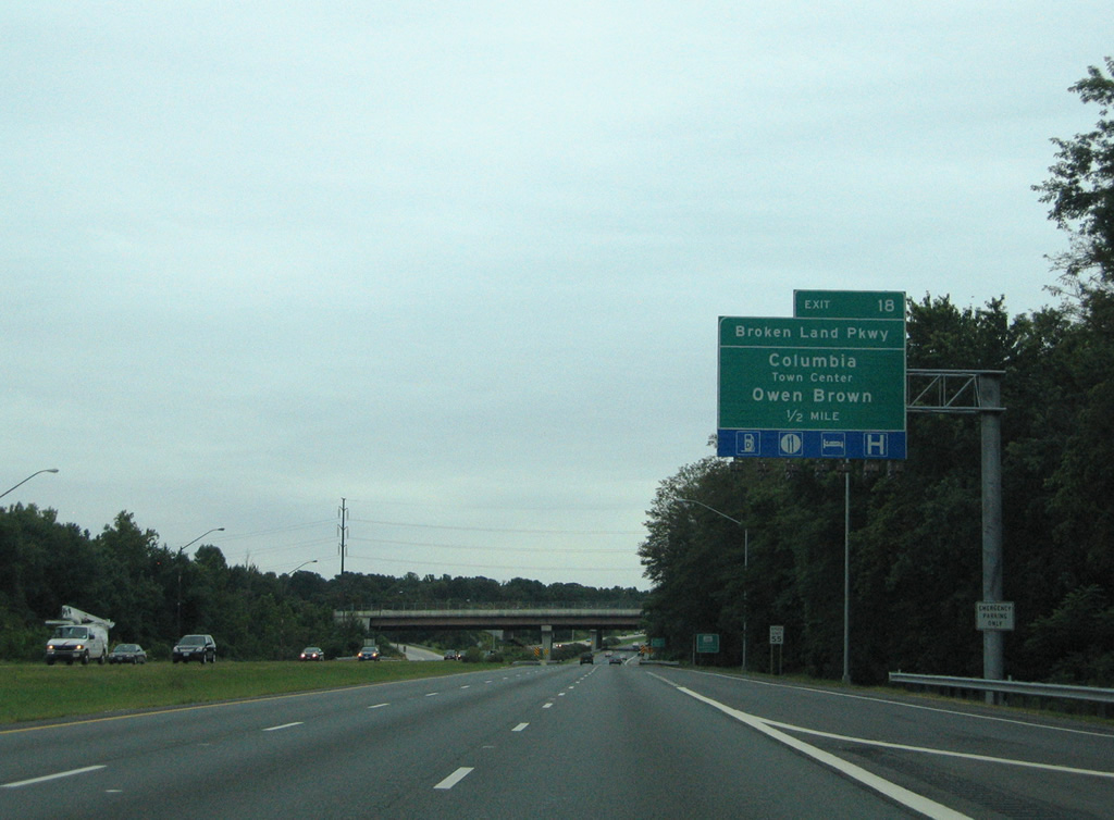
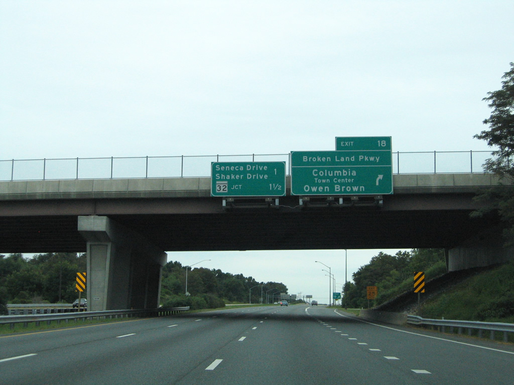
| Broken Land Parkway provides the main entrance to Columbia Town Center from points southward. Exit 18 joins U.S. 29 south with the divided highway near Sebring and Owen Brown. 08/27/05 |
|
| The ramp to South Entrance Road for Merriweather Post Pavilion is unnumbered and acts more like a turn lane than a conventional freeway ramp. 08/27/05 |
|
| A crossover provides access to U.S. 29 northbound for Gales Lane, another residential road remaining from the pre-freeway days of U.S. 29. South Entrance Road otherwise begins at the next turn, connecting U.S. 29 with Symphony Woods Road and Little Patuxent Parkway. 08/27/05 |
|
| One half mile north of the directional cloverleaf interchange with Broken Land Parkway (Exit 18) on U.S. 29 south. Broken Land Parkway leads south from the Mall in Columbia to Owen Brown and Exit 14 of the MD 32 freeway. 08/27/05 |
|
| Exit 18 carries all traffic in unison to Broken Land Parkway. Hickory Ridge and Howard County Community College lie west of Broken Land Parkway via Hickory Ridge Road. 08/27/05 |
|
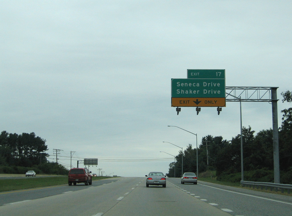
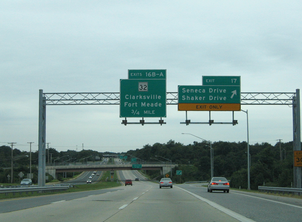
| A folded diamond interchange with Seneca Drive (Exit 17) follows on U.S. 29 south at Simpsonville. 08/27/05 |
|
| Seneca Drive serves residential areas of Atholton and Hickory Ridge adjacent to Columbia Pike. Shaker Drive entails a northbound side frontage road of U.S. 29 to the MD 32 freeway, where the road turns east to Exit 15 at Kings Contrivance. 08/27/05 |
|
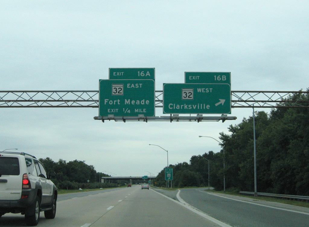
| Entering the cloverleaf interchange (Exits 16B/A) between U.S. 29 (Columbia Pike) south and MD 32 (Patuxent Freeway). MD 32 constitutes a 22 mile suburban type freeway from Clarksville east to Interstate 97 at Millersville. 08/27/05 |
|
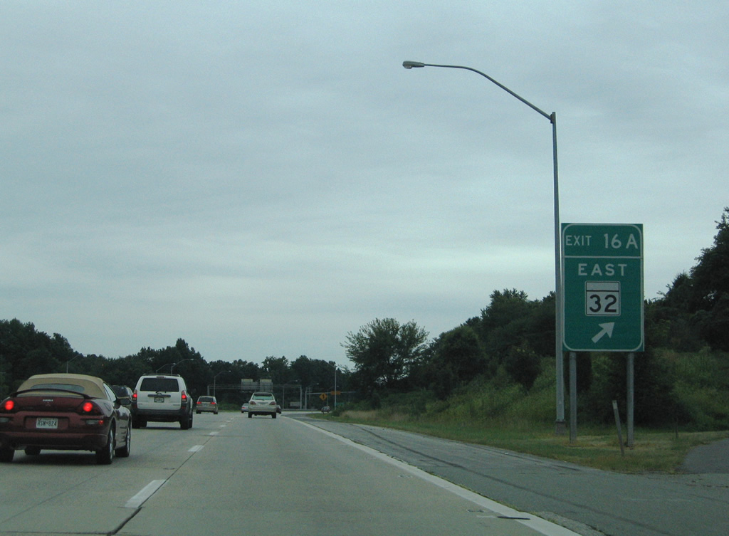
| Exit 16A loops onto MD 32 (Patuxent Freeway) east to Fort Meade. MD 32 travels between the suburban communities of Owen Brown and Kings Contrivance on the 3.2 mile drive to Interstate 95 near Savage. 08/27/05 |
|
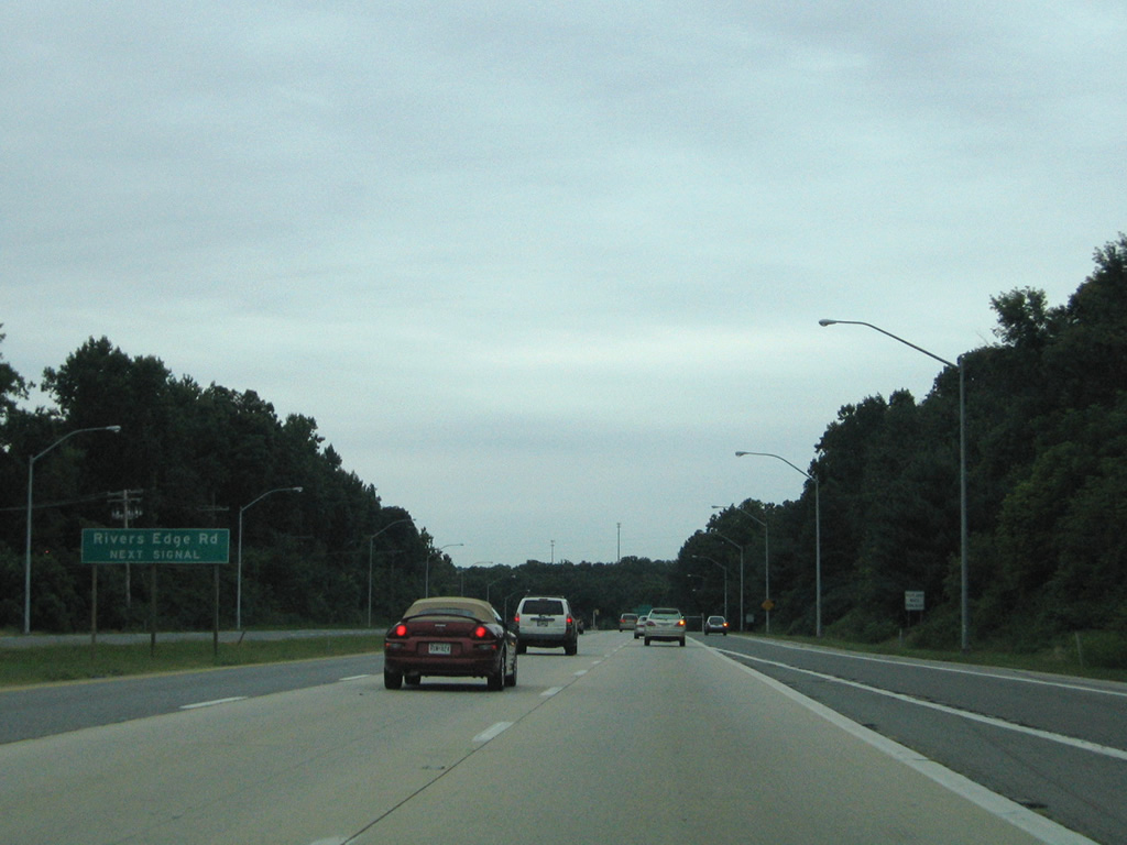
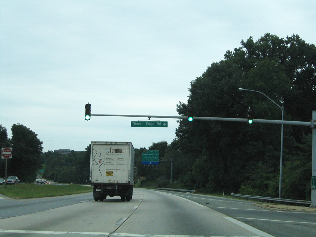
| Heading southwest, U.S. 29 next sees a signalized intersection with Rivers Edge Road. 08/27/05 |
|
| Rivers Edge Road provides the only access point for a subdivision bound by U.S. 29 to the east, MD 32 to the north and the Patuxent River to the west. The signal only affects the southbound roadway. 08/27/05 |
|
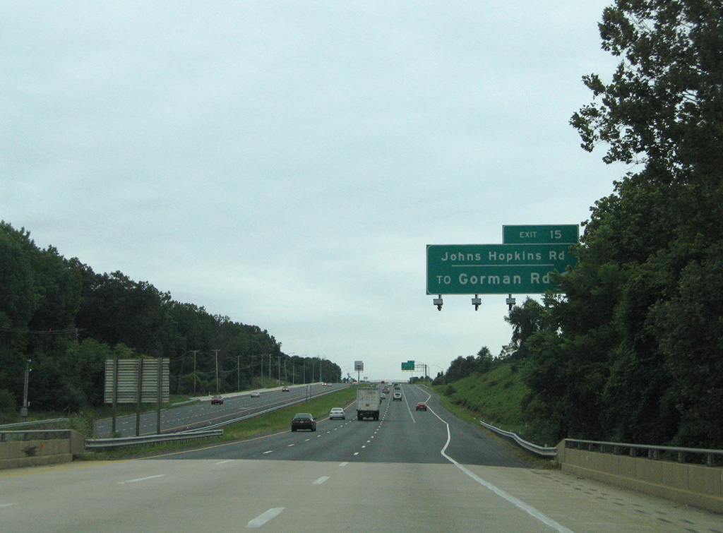
| Johns Hopkins Road crosses paths with U.S. 29 at a parclo interchange east of Johns Hopkins Applied Physics Lab and west of Hammond. Johns Hopkins Road name changes to Gorman Road east of Exit 15. 08/27/05 |
|
| U.S. 29 spans the Patuxent River on the approach to Johns Hopkins Road (Exit 15). 08/27/05 |
|
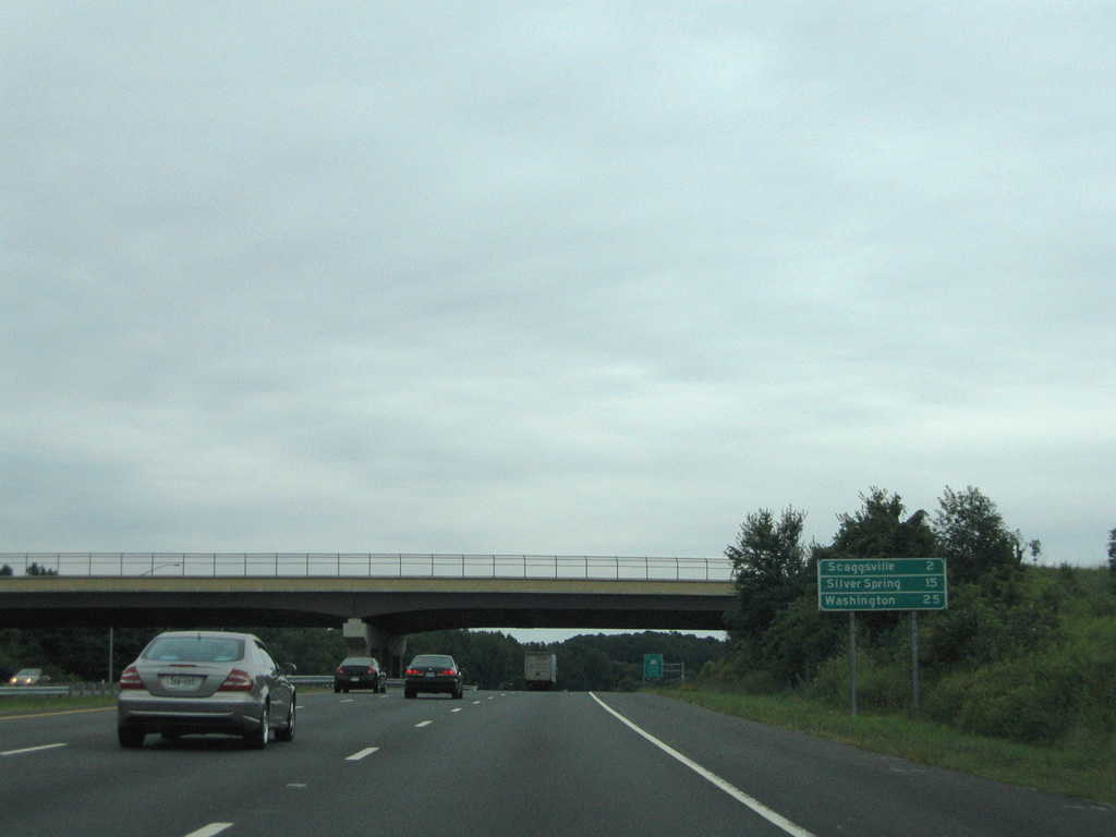
| Continuing south, U.S. 29 next meets Scaggsville in two miles, Silver Spring in 15 miles, and Washington in 25 miles. 08/27/05 |
|
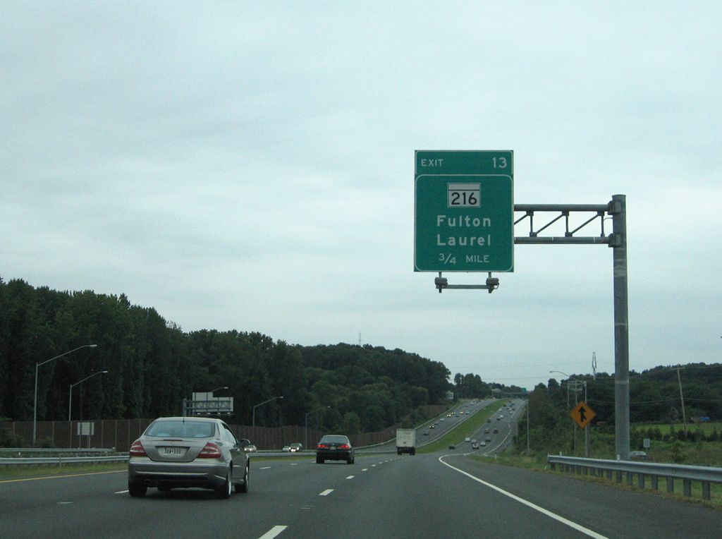
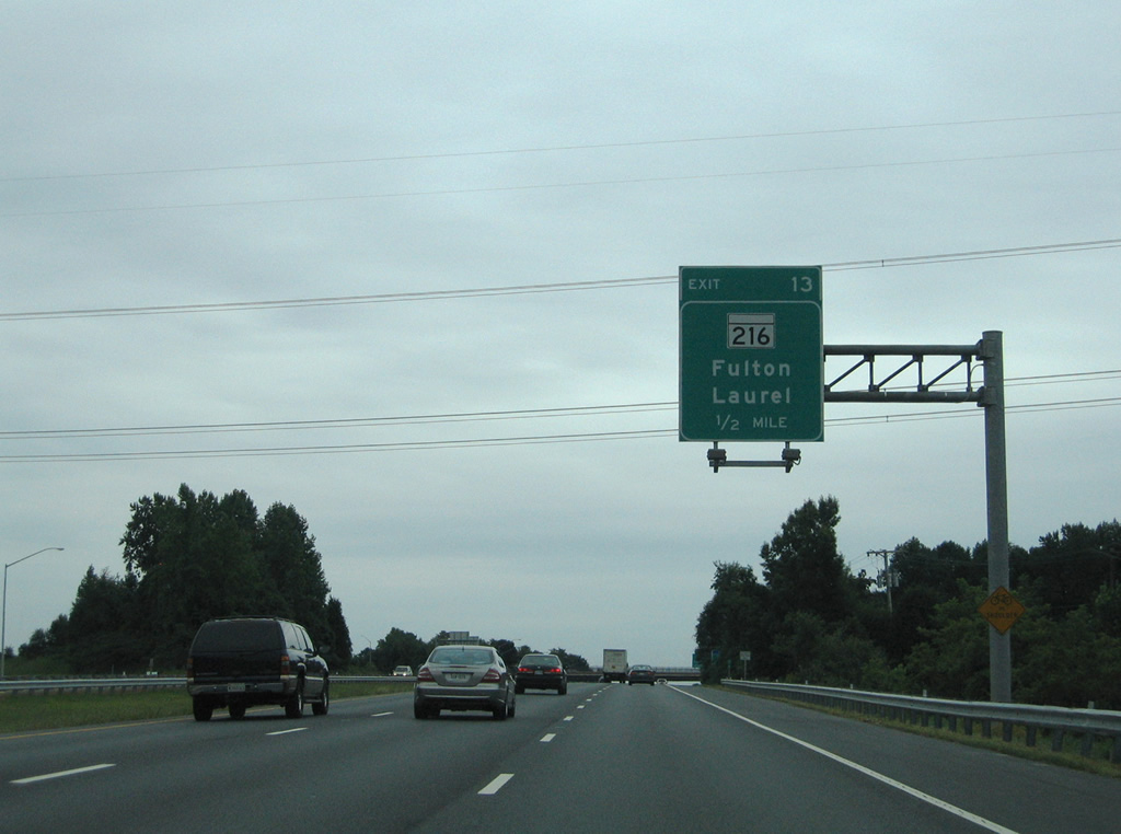
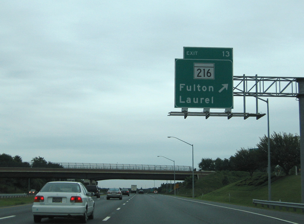
| MD 216 (Exit 13) crosses paths with U.S. 29 at Scaggsville. The east-west route travels Scaggsville Road to Fulton and Hillcrest Heights nearby. 08/27/05 |
|
| Rising southward from Hammonds Branch to the folded-cloverleaf interchange with MD 216 (Scaggsville Road). 08/27/05 |
|
| MD 216 totals 9.06 miles overall between MD 108 at Highland and MD 198 in Laurel. 08/27/05 |
|
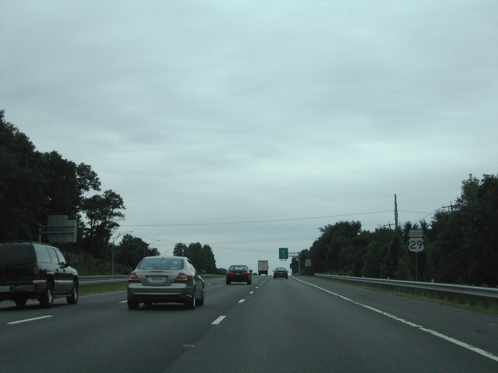
| U.S. 29 southbound at the Exit 13 ramp departure to MD 216 at Scaggsville. The freeway ends beyond the MD 216 on-ramps. 08/27/05 |
Page Updated 03-23-2011.

 South
South