
It was that time of the year again, for us to embark on another AARoads trip specifically to document roads. This year’s trip focused on finishing what we started in November 2009, with a return trip to Indiana and Michigan for the purpose of driving the remaining Interstates that we did not cover two years prior. Day 1 took us northward from Alabama to Cincinnati, Ohio. The day started out clear and sunny, but clouds ahead of an approaching cold front quickly set in by Birmingham and increased in density until yielding sprinkles in Chattanooga and heavy rain north of Cleveland, Tennessee. Rain fell profusely all the way to the Cincinnati area.
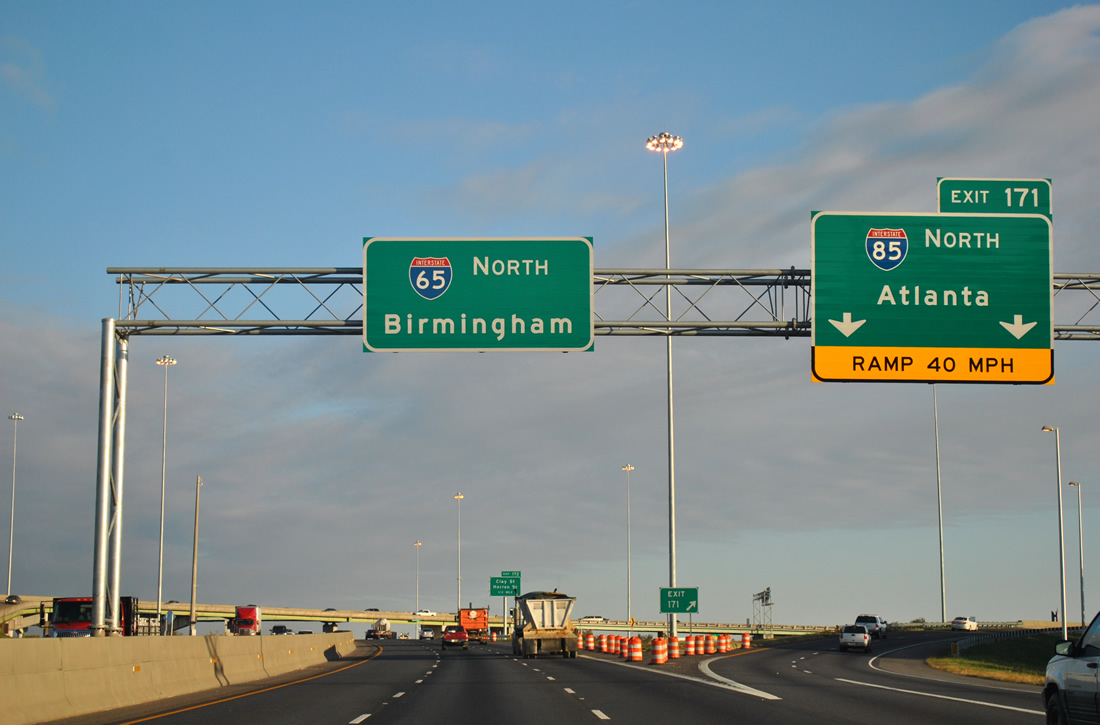
I-65 north at Interstate 85 in Montgomery.
Work associated with the Progress 65 project in Montgomery is now complete. Despite the presence of construction barrels in this scene taken November 3, 2011, there was no active work. Interstate 65 was widened to six lanes on a 4.613-mile stretch through Montgomery and speed limits increased to 60 mph. All final guide signs are in place. http://www.progress65.com/progress65-Montgomery.htm

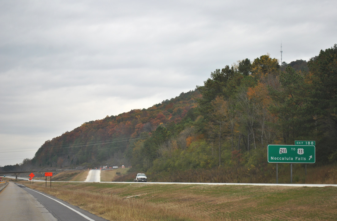
Nearing the off-ramp (Exit 246) for SR 119 on I-65 north.
Shelby County widening of Interstate 65 from Exit 242 (CR 52) north to the Jefferson County line is near completion. The freeway carries six lanes on this stretch with increased ramp capacity at the suburban interchanges of Alabama 119 (Cahaba Valley Road), CR 52 and CR 17 (Valleydale Road). Future expansion will focus on the freeway south from Exit 242 to Exit 238, and eventually the Shelby County Airport interchange (Exit 234). http://www.progress65.com/progress65-Shelby.htm

Entering Jefferson County, I-65 north approaches Interstate 459.
Work continues on the reconstruction of Interstate 65 from the Jefferson County line northward to U.S. 31 (Exit 252) at Vestavia Hills. When we passed through in June, northbound traffic was partitioned between a single lane and two-lane carriageway split and no signs were left for Interstate 459. Now southbound utilizes that configuration while northbound continues with three overall lanes and new Highway Gothic font based signs are in place. Work on this aspect of the Progress 65 project is slated for completion this upcoming winter. http://www.progress65.com/progress65-Jefferson.htm
Many cities and metro areas in the country have an interchange nicknamed “Malfunction Junction”, the Birmingham example of this is the exchange where Interstate 65 meets Interstates 20-59 northwest of downtown.

Large diagrammatic signs went up in 2003 to accompany a reconstruction of the interchange. Left-hand ramps remain in use in all directions as both sets of carriageways intertwine.
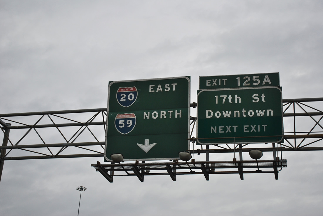
The only remaining button copy shields for Interstates 20 and 59 remain on the ramp from Interstate 65 north to the eastbound overlapped freeway. These signs date from the completion of Malfunction Junction in 1972.
Turn east and cross a viaduct and one quickly meets U.S. 31 and the eastbound beginning of U.S. 280, otherwise known as the Elton B. Stephens Expressway. Constructed between 1962 and the 1980s, the urban freeway varies from an elevated highway southward through a rock cut at Red Mountain. U.S. 280 follows the roadway southward to Rosedale Drive at the Birmingham Zoo and travels 392 miles overall to Blitchton, Georgia (west of Savannah).
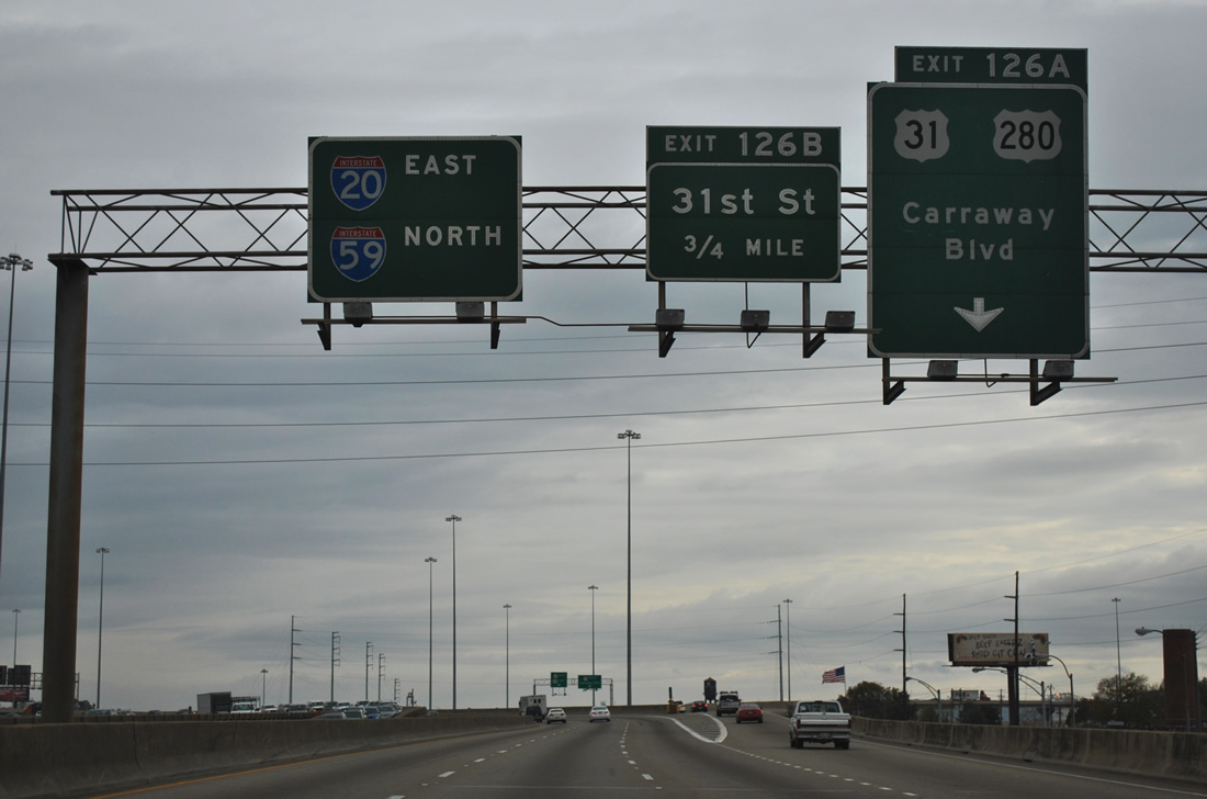
I-20/59 east at U.S. 31/280.
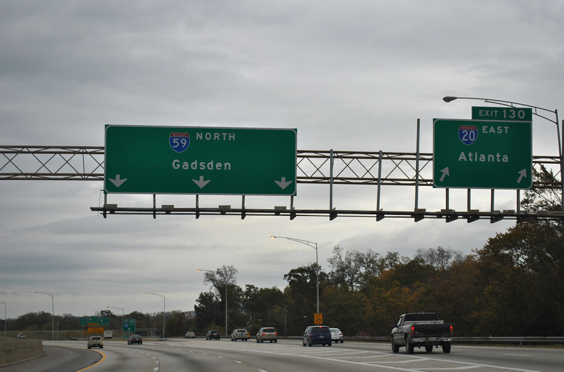
Interstate 20 east and 59 north part ways at Woodlawn and northeast Birmingham. Interstate 20 resumes an eastward course to Atlanta and Columbia while Interstate 59 travels northeast to Gadsden and the Chattanooga area.

Interstate 459 ends at Exit 137 of Interstate 59.
Interstate 459 was completed in 1985 and provides a high speed bypass for Interstate 59 between Tuscaloosa and Gadsden. The planned North Beltline (Interstate 422) will tie into Interstate 59 at a point further north.
Most of Interstate 59 consists of asphalt pavement, but the stretch between Exit 183 and near Stephen Gap Road in Etowah County utilizes a concrete surface. A 10.91-mile progress, dubbed Progress 59, is underway to rehabilitate the pavement. http://www.progress59.com/
Currently travelers in both directions utilize the southbound carriageway with one lane per direction. Concrete resumes as the surface for I-59 throughout Dekalb County.

Interstate 59 north at 49th Street.
A new alignment was constructed for 49th Street between U.S. 11 and Gault Avenue on the north side of Fort Payne in 2010. The roadway ties into Interstate 59 at the diamond interchange (Exit 224), opened July 30, 2010, to provide access to Fort Payne Industrial Park.1

The northernmost 20.67 miles of Interstate 59 travels through Georgia to end at Interstate 24. Raccoon Mountain rises in the background.

Exit 178 partitions into ramps for hidden Interstate 124 & U.S. 27 north to downtown Chattanooga, U.S. 11-41-64 (and U.S. 72 too) along Broad Street northbound and Williams Street southbound.
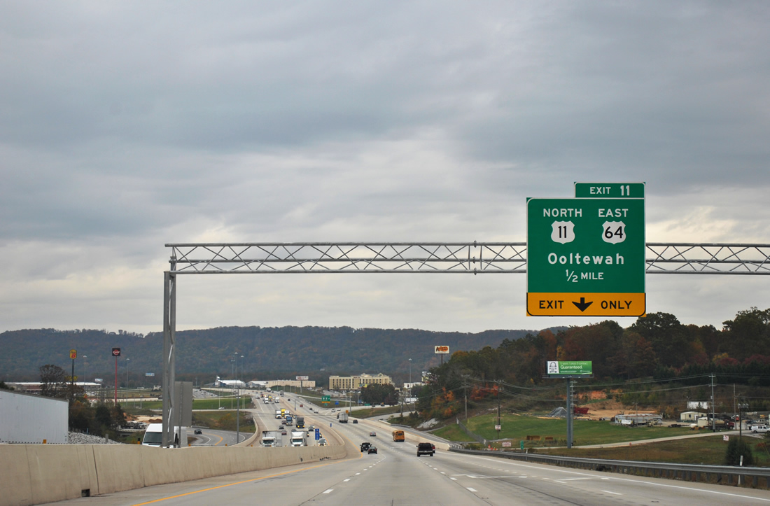
Lowering toward the split with U.S. 11 north & 64 east at Exit 11. A loop ramp was added recently from US 11 south/64 west onto Interstate 75.
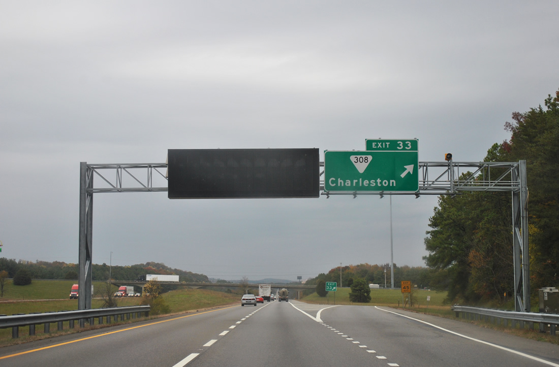
Interstate 75 enters a “Fog Advisory Area” between Exits 27 and 42.
Sign bridges with dynamic message signs are posted at Exits 27 and 33 to advise motorists of speed limit changes and weather conditions during periods of dense fog. A similar configuration exists along the Interstate 10 Bayway in Alabama. Both are a result of tragic car pile ups induced by dense fog conditions (1990 in Tennessee, 1995 in Alabama).
Interstate 40 and 75 combine and share an eight-lane freeway through to Knoxville. Occasionally auxiliary lanes swell the freeway to ten lanes. Though in the early afternoon during inclement weather in this scene, traffic was already moderate. Traffic counts have risen steadily from 128,308 vehicles per day (vpd) in 1995 to a peak of 166,054 vpd in 2009.
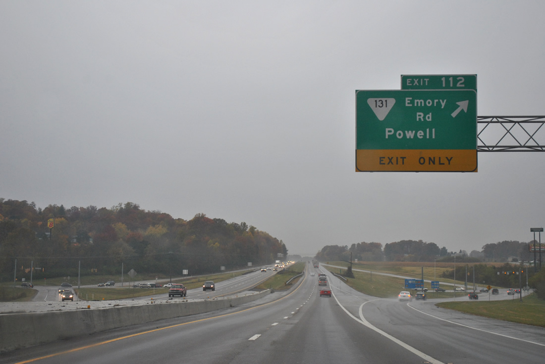
Interstate 75 drops from six to four lanes on the exit of the Knoxville area at Exit 112.
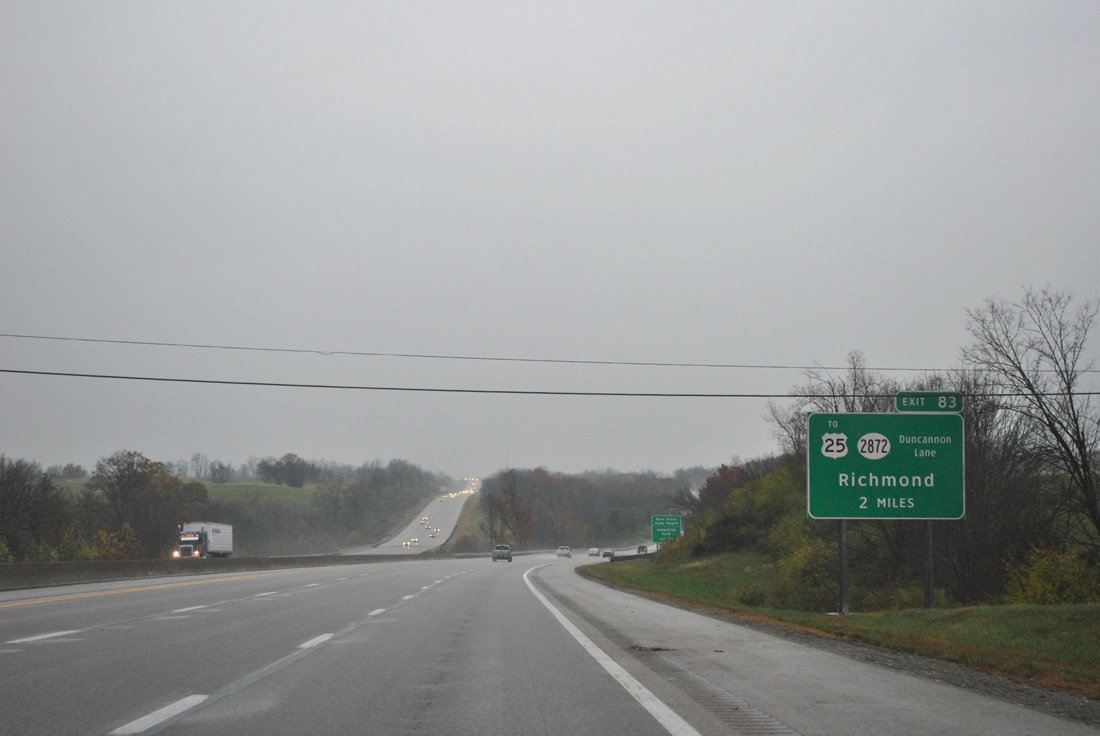
Approaching Exit 83 with Kentucky 2872 at the crossing of Silver Creek along Interstate 75 northbound.
A diamond interchange opened in 2005 with Duncannon Lane, a multilane connector leading northeast to U.S. 25 at the Blue Grass Army Depot. The exit replaced a rest area that previously resided south of Duncannon Lane.
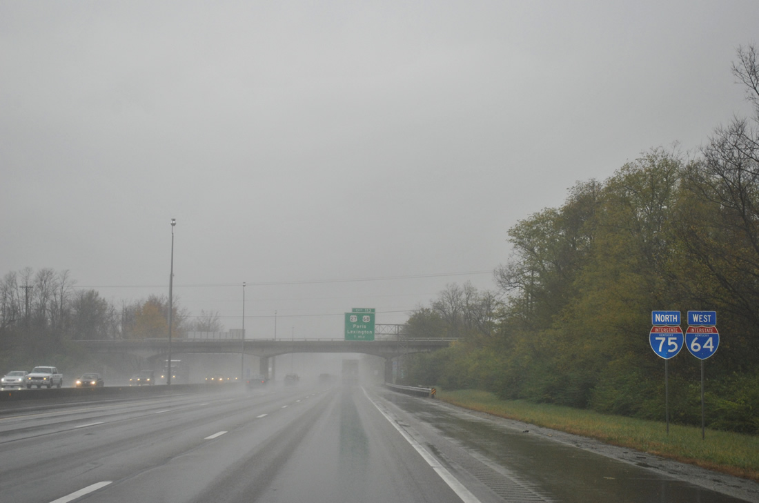
A recent change sees all Interstate shields along Interstate 75 northbound, including the overlap with Interstate 64 west, replaced with state-named shields in Fayette County.
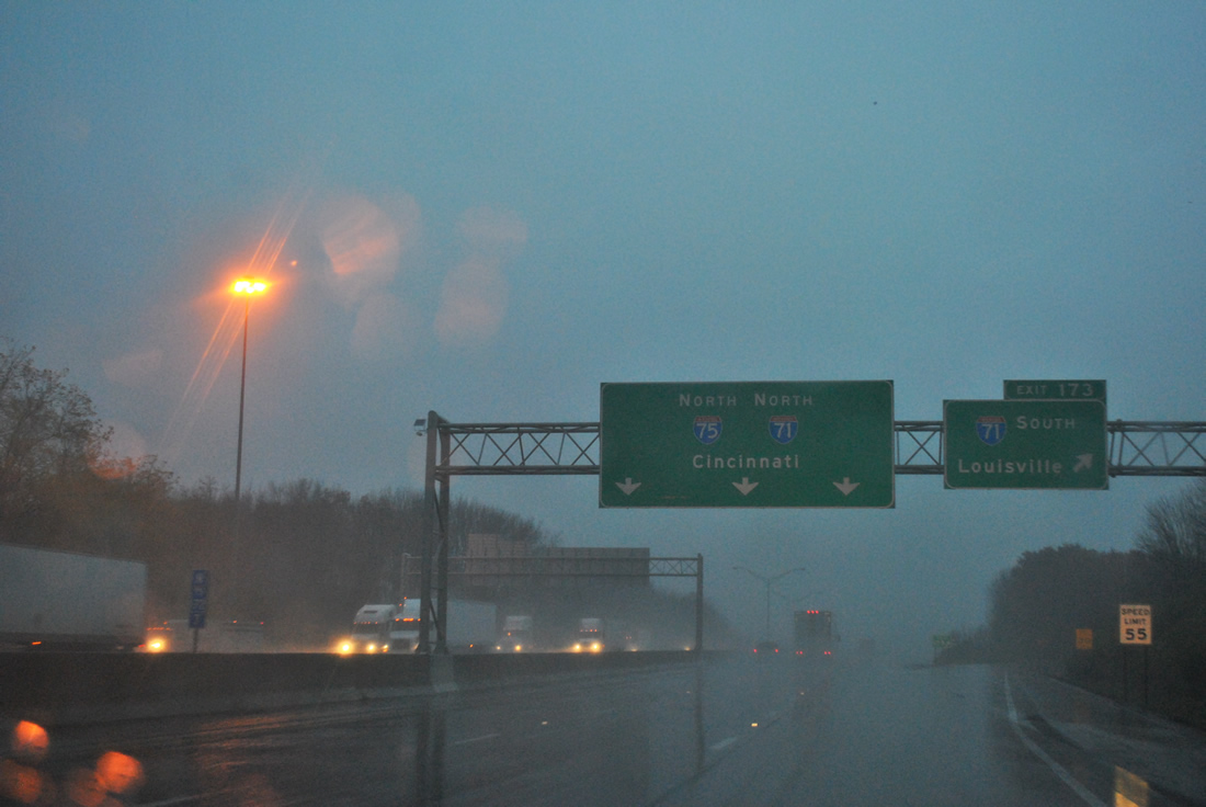
There was little let up to the rain through to the merge with Interstate 71 and into the Covington and Newport area. 2.26 inches of rain fell at Cincinnati/Northern Kentucky International Airport no less…
Sources:
- “New interchange opens in Dekalb County.” WAFF-TV, July 30, 2010.


