
Tolled Express Lanes accompany Interstate 64 from the exchange with I-564 in Norfolk to just south of I-264 (Exit 284) by the Virginia Beach city line. The two lane roadway lines the median of the Hampton Roads Beltway. Free for HOV-2 eligible motorists with an E-Zpass Flex Transponder, the reversible roadway flows in the peak direction between 6-8 AM and 4-6 PM. Outside of those times, they are available to all traffic in the direction that they are open (generally base-bound in the morning and Sundays, Beach-bound in the evening and Saturdays). Heavy trucks are restricted to the regular lanes, regardless of time.1

 East
East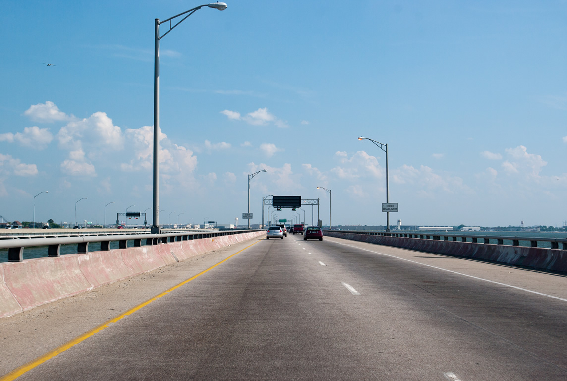
I-64/U.S. 60 east turn southward from the southern artificial island along the Hampton Roads Bridge Tunnel to the Willoughby Spit in Norfolk.
06/05/10
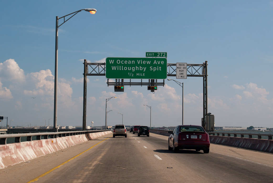
Exit 272 lies just beyond Hampton Roads Bridge Tunnel with adjacent Bayville Street at Willoughby Beach. Bayville Street parallels I-64/U.S. 60 east along Willoughby Bay to 13th View Street north for Ocean View Avenue (former SR 168).
06/05/10
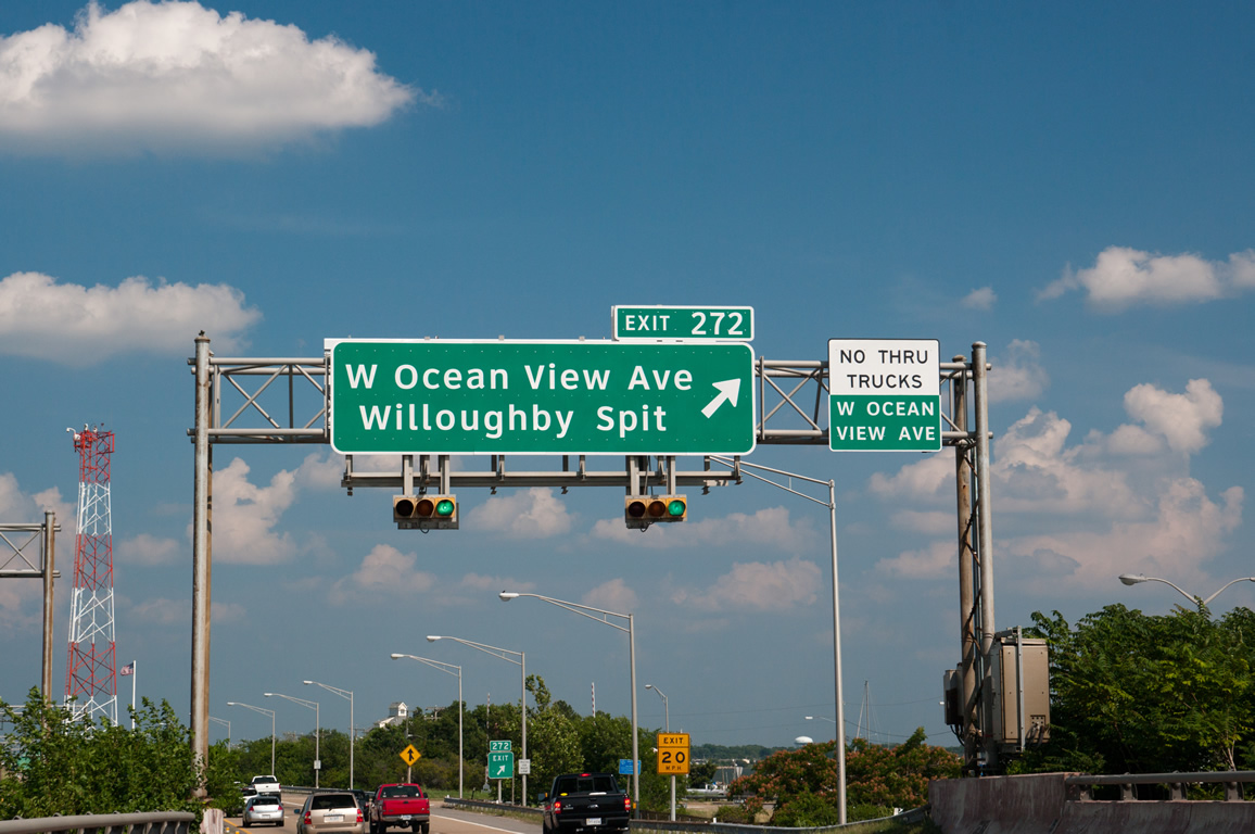
Exit 272 departs I-64/U.S. 60 east for Bayville Street at an adjacent marina. An old alignment of U.S. 60, Ocean View Avenue follows Willoughby Beach southeast to Ocean View.
06/05/10
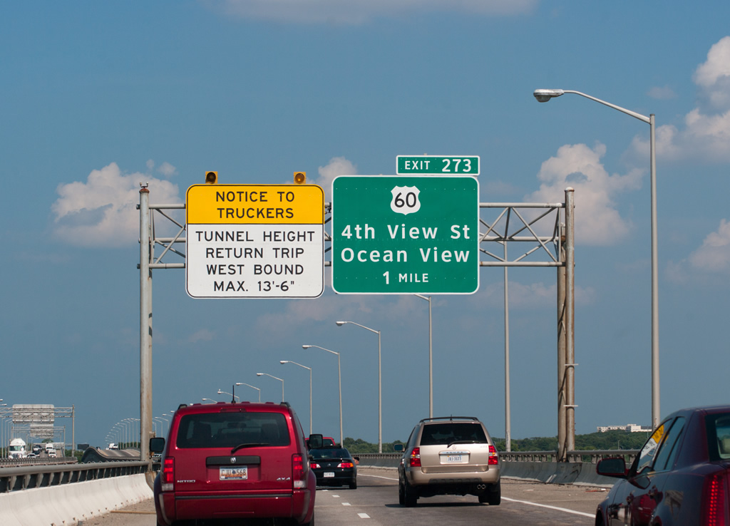
U.S. 60 partitions with Interstate 64 east at the diamond interchange (Exit 273) with 4th View Street.
06/05/10
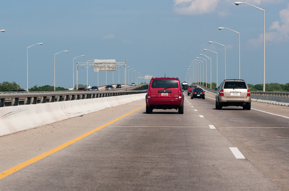
The freeway advances past Willoughby Spit along a pair of bridges over Willoughby Bay and curve southward at Naval Station Norfolk.
06/05/10
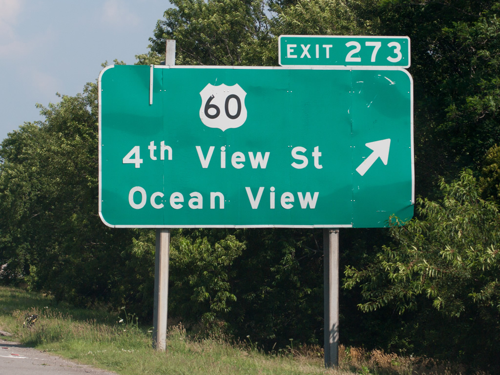
U.S. 60 branches east from I-64 via 4th View Street north to Ocean View Avenue. Running along the south shore of Chesapeake Bay, U.S. 60 travels from Ocean View toward the Virginia Beach city line.
06/05/10
East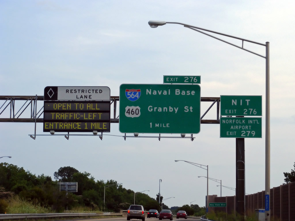
Interstate 64 runs south along the boundary of Naval Air Station (NAS) Norfolk and parallel U.S. 460 (Granby Street) between Mason Creek and I-564 (Admiral Taussig Boulevard).
06/05/10
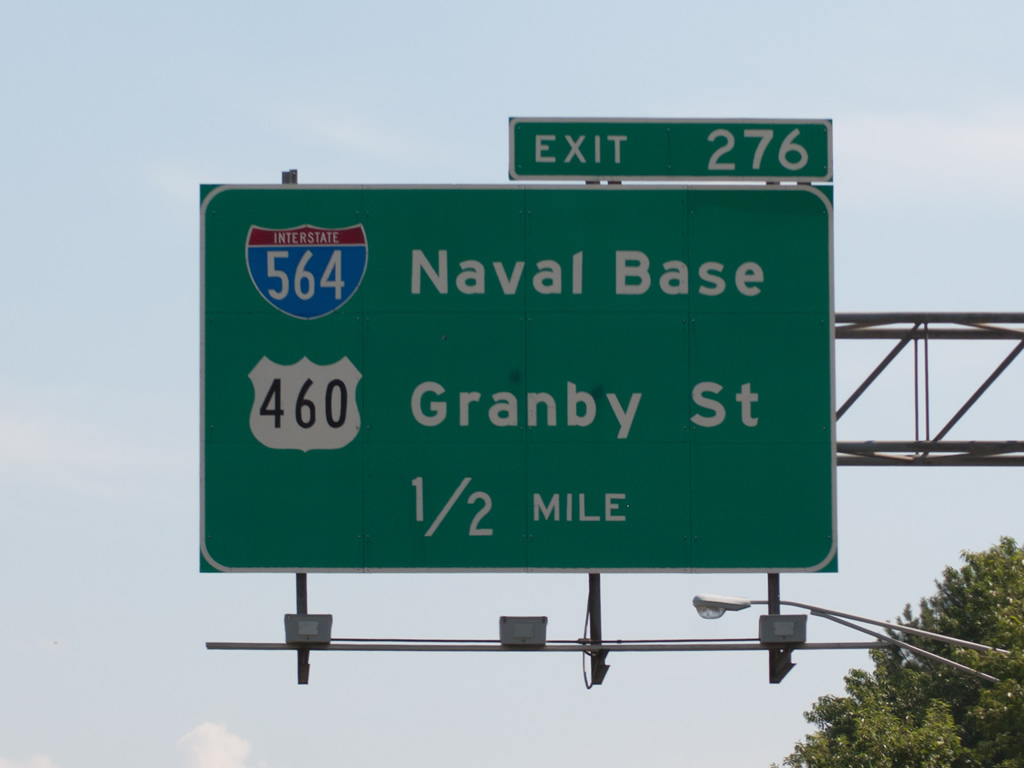
U.S. 460 originates from U.S. 60 at Ocean View to the north. Following Granby Street, U.S. 460 runs south to I-564 at Wards Corner (Exit 276) and the Riverview Historic District north of Downtown Norfolk.
06/05/10

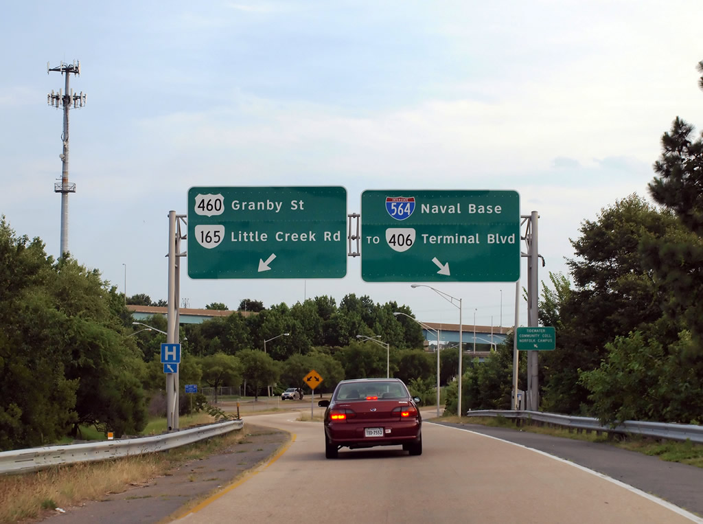
U.S. 460 (Granby Street) south connects with SR 165 (Little Creek Road) east to Denby Park and west to Sussex. I-564 meets SR 406 (Terminal Boulevard) at the first exit westbound.
06/05/10
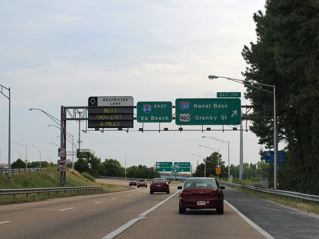
The I-64 Express Lanes and Exit 276 separate simultaneously from Interstate 64 eastbound. Interstate 564 (Admiral Taussig Boulevard) spurs 2.77 miles northwest to SR 337 at NAS Norfolk.
06/05/10
Exit 276 partitions into ramps for I-564 and U.S. 460 (Granby Street) west ahead of SR 165 (Little Creek Road). SR 165 constitutes a 39.75 mile long route from SR 337 (Hampton Boulevard) east to Virginia Beach and south to Chesapeake.
06/05/10
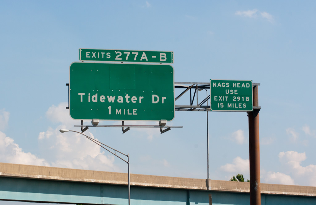
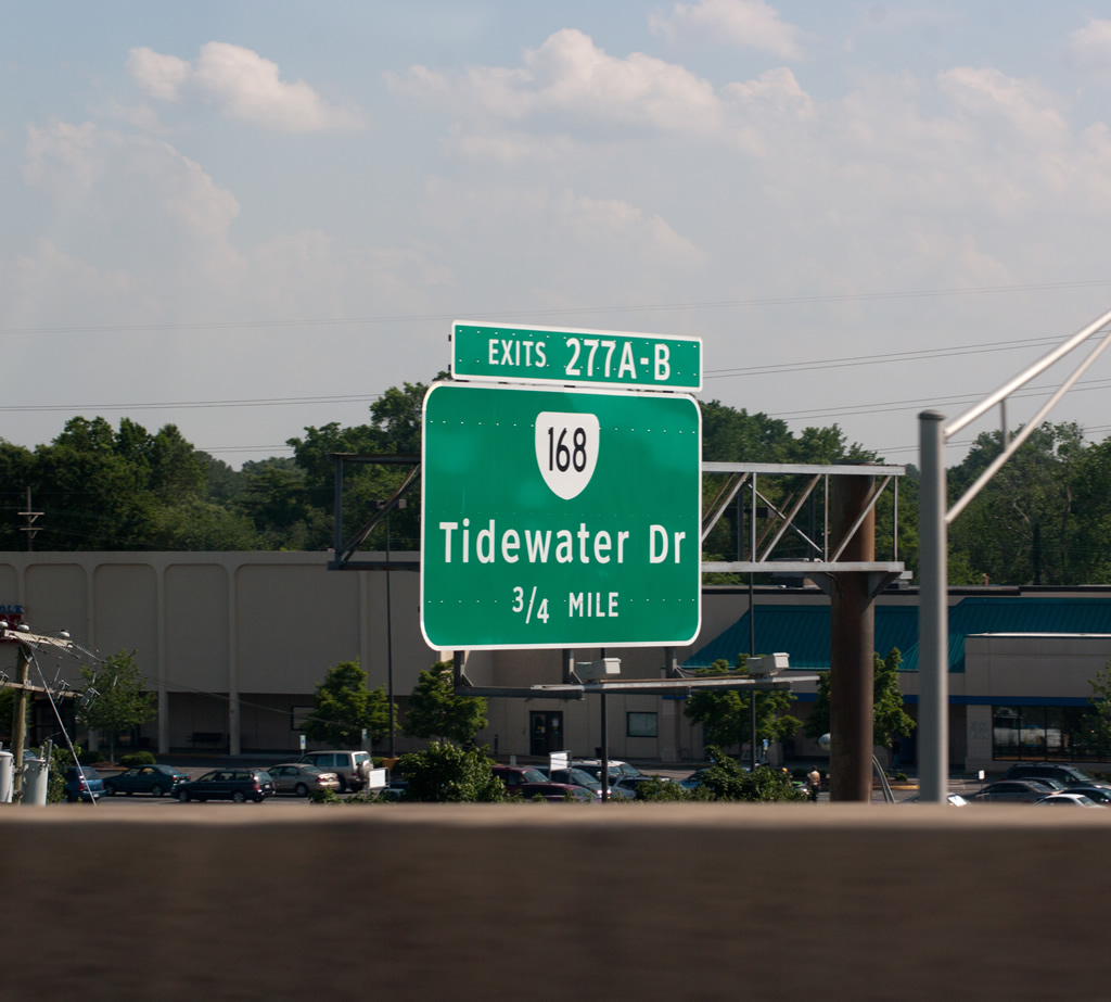
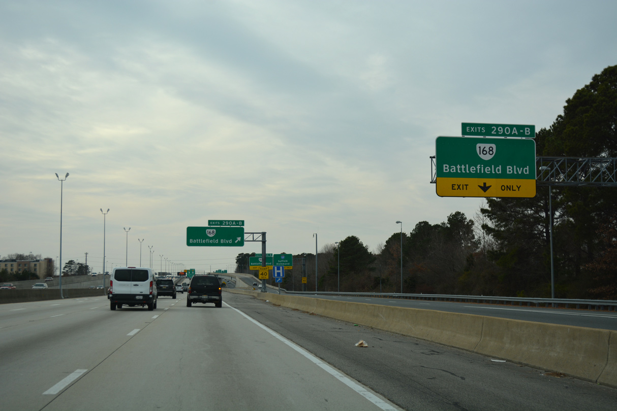
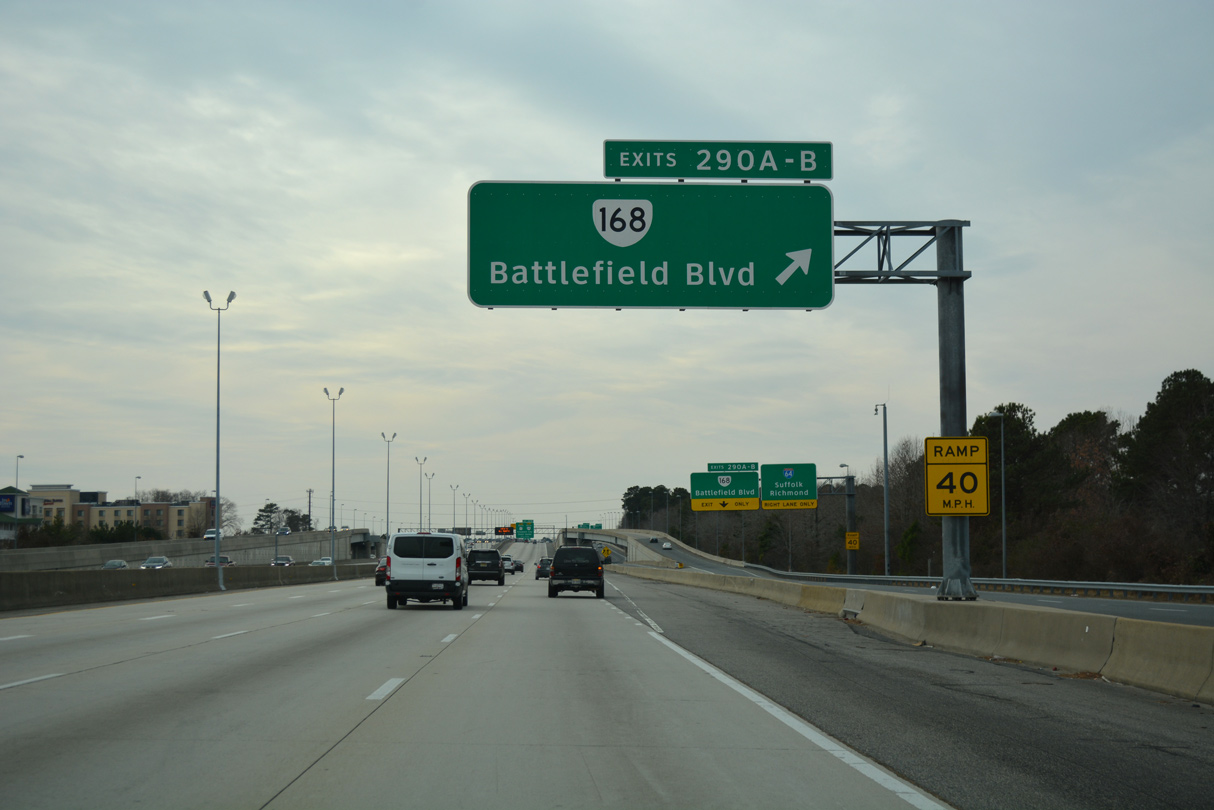
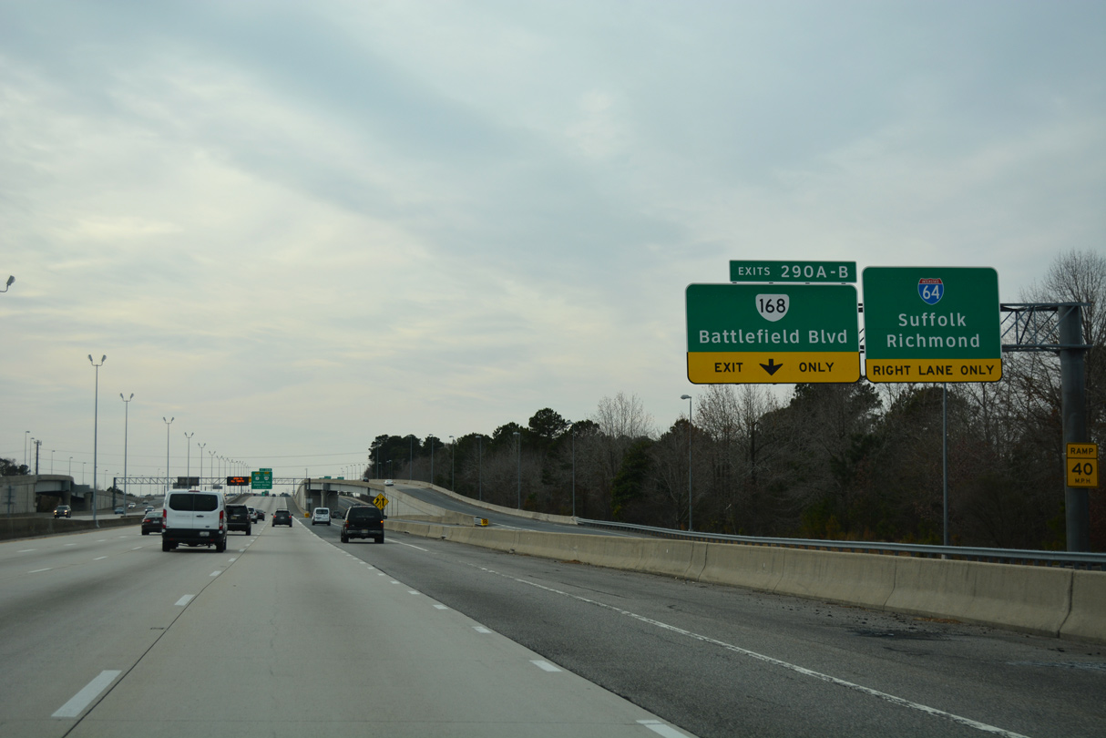
SR 168 (Tidewater Drive) parallels I-64 south from U.S. 60 at Ocean View 3.57 miles to Exit 277.
06/05/10
A multi state route with NC 168, Virginia Route 168 measures 31.19 miles south from Norfolk to the state line near Northwest in Chesapeake.
06/05/10
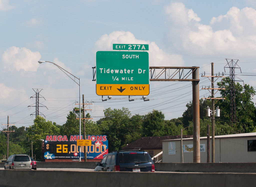
SR 168 (Tidewater Drive) continues south from Exit 277A to Roland Park, Fairmont Park and Lafayette-Winona en route toward Downtown Norfolk.
06/05/10
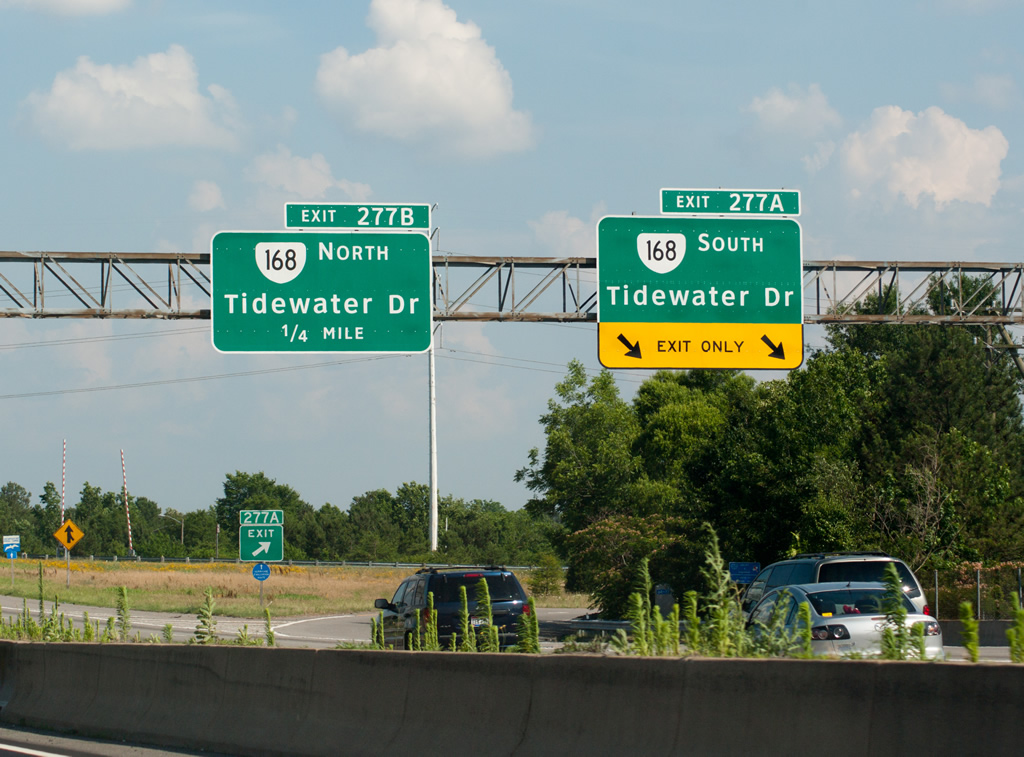
Separate ramps link I-64 east with SR 168 (Tidewater Drive) at a directional cloverleaf interchange (Exit 277) by Wayne Creek.
06/05/10
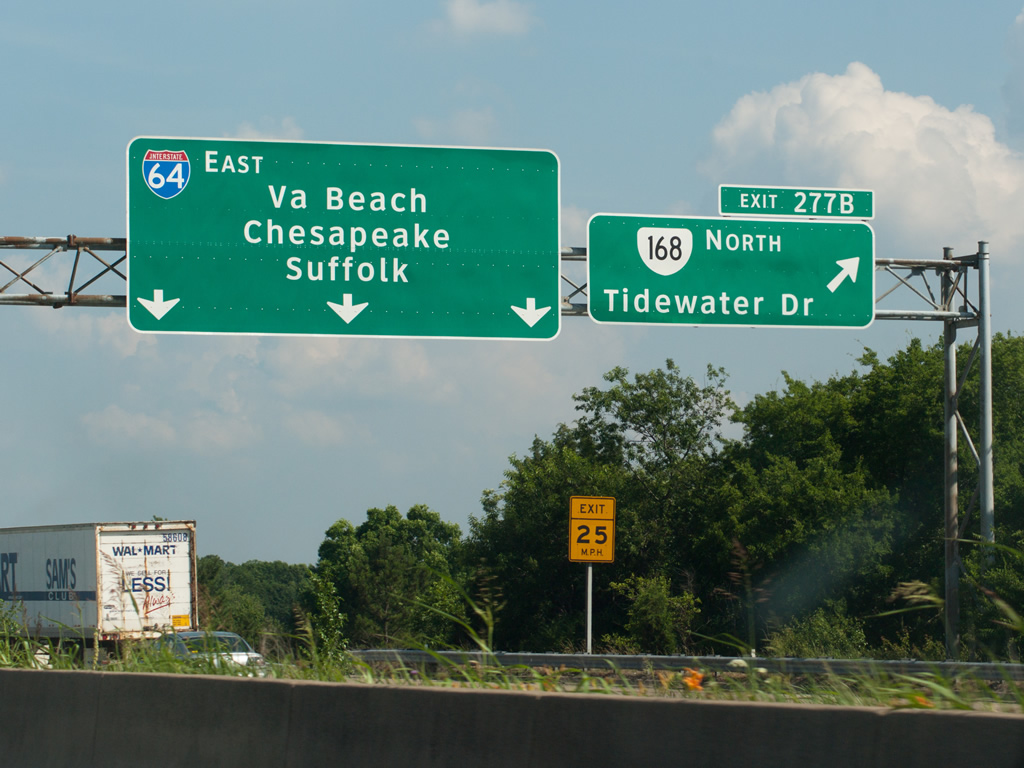
North from Exit 277B, SR 168 (Tidewater Drive) runs through an older retail to the urban diamond interchange with SR 165 (Little Creek Road).
06/05/10
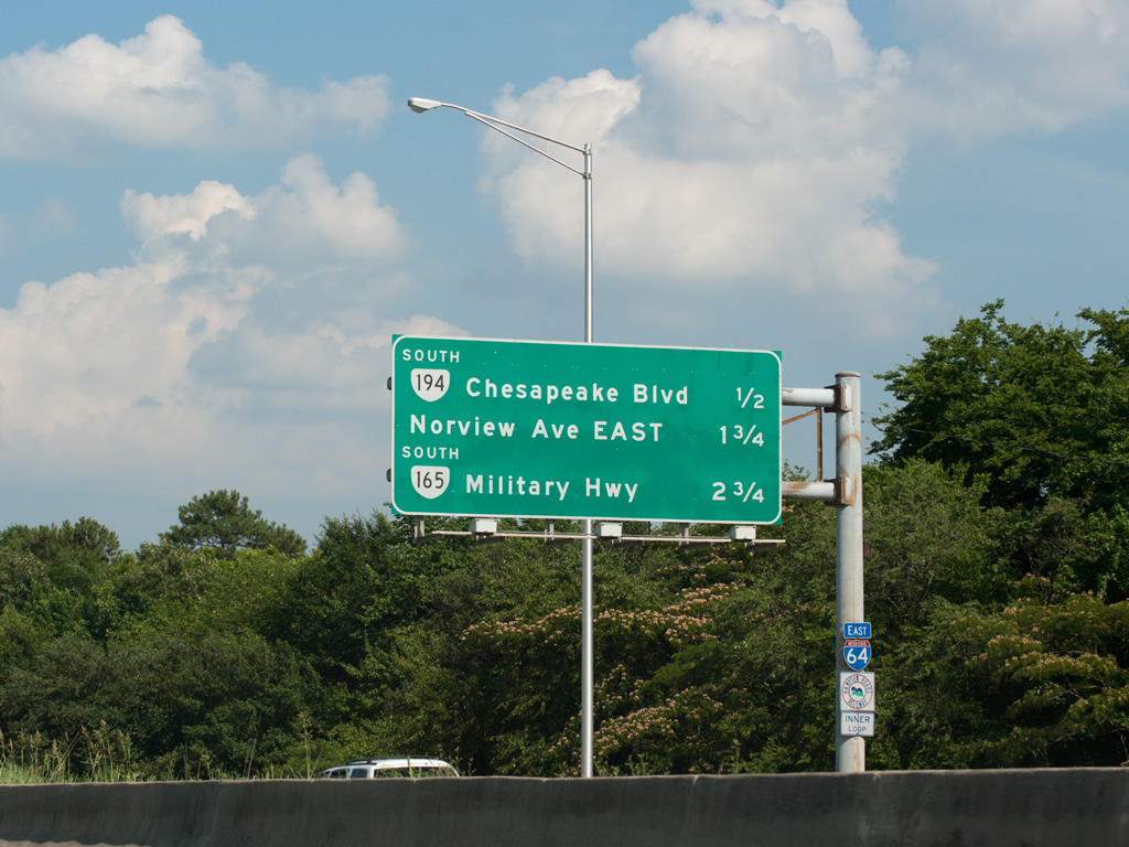
A parclo A2 interchange (Exit 279) joins I-64 east with SR 194 (Chesapeake Boulevard) south to the Norview neighborhood in Norfolk next.
06/05/10
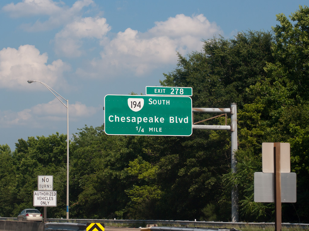
I-64 heads east between the Coronado and Washington Park neighborhoods to the exchange with SR 194 (Chesapeake Boulevard).
06/05/10
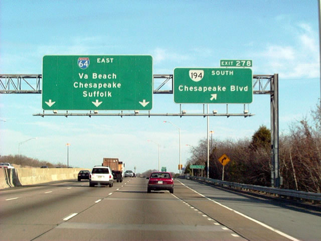
SR 194 (Chesapeake Boulevard) constitutes a 5.75 mile long route from U.S. 60 at Ocean View south to SR 166 (Princess Anne Road) between Pennsytown and Norfolk Industrial Park.
12/17/01
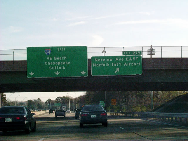
SR 247 (Norview Avenue) connects Interstate 64 with the passenger terminal at Norfolk International Airport (ORF) east from Exit 279.
12/17/01
Exit 281A departs I-64 east for Almeda Avenue south at Robin Hood Road at Fox Hall in Norfolk.
06/05/10
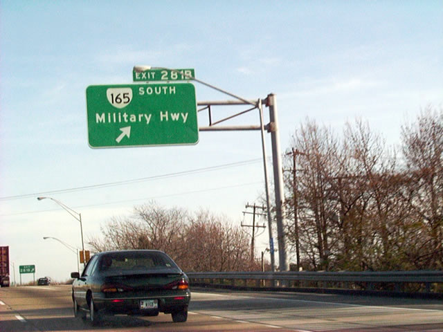
Exit 281B follows for SR 165 (Military Highway) south ahead of the continuous flow intersection (CFI) with U.S. 13 (Northampton Boulevard) and SR 166 (Princess Anne Road) west. Military Highway extends southwest along U.S. 13 to Chesapeake.
12/17/01
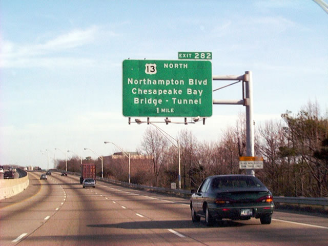
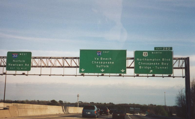
U.S. 13 follows Northampton Boulevard northeast from SR 165 (Military Highway) and Exit 282 to U.S. 60 (Shore Drive) and the Chesapeake Bay Bridge Tunnel.
12/17/01
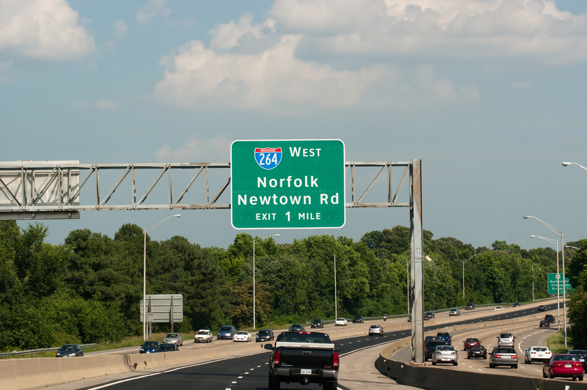
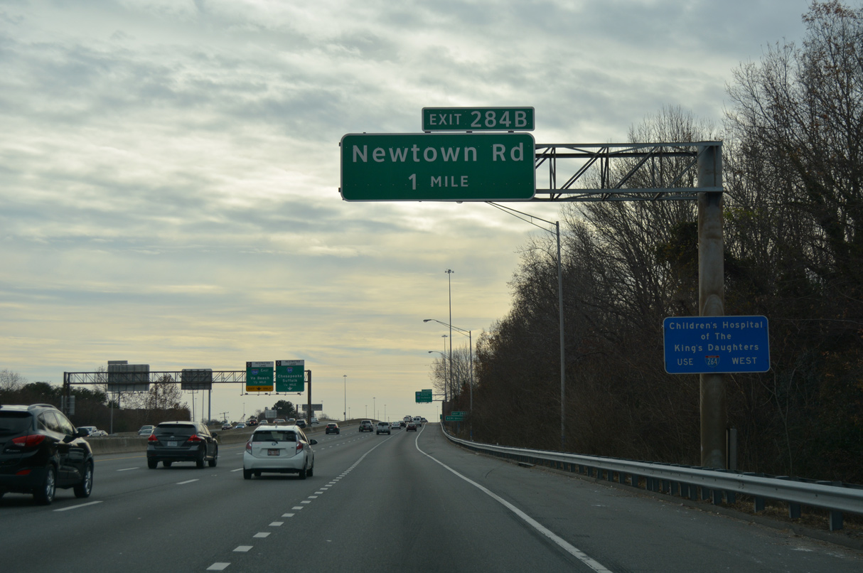
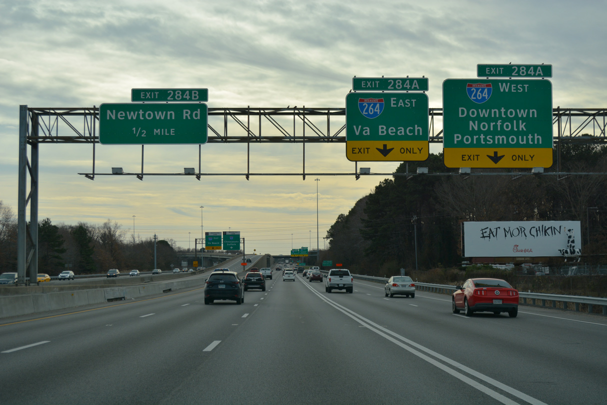
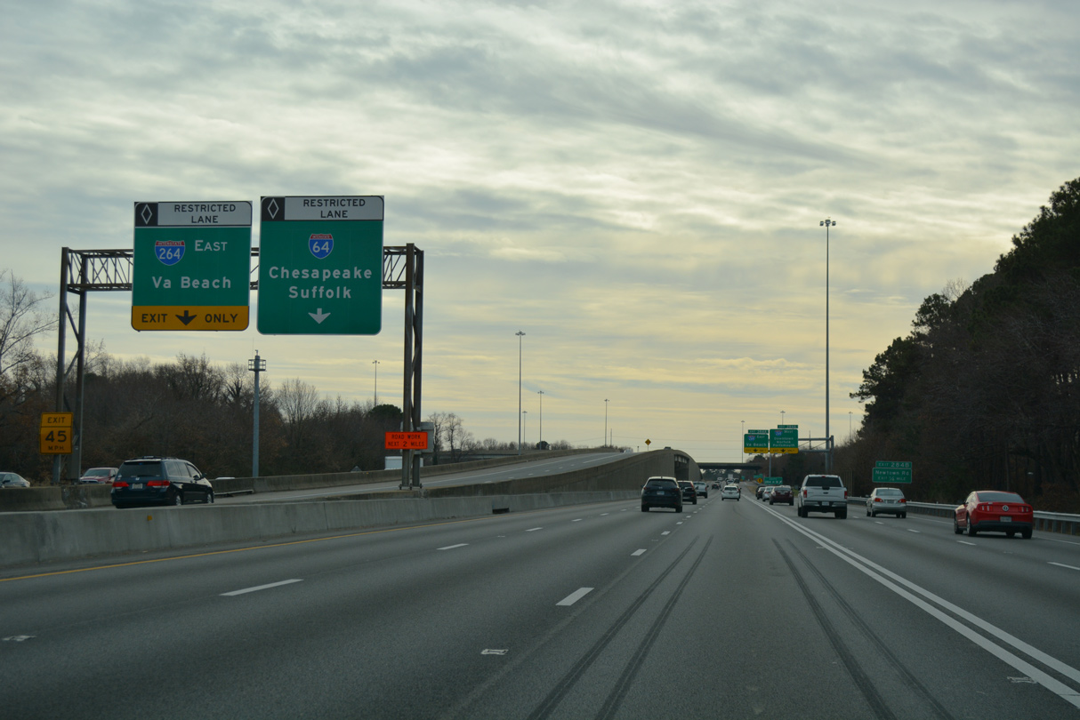
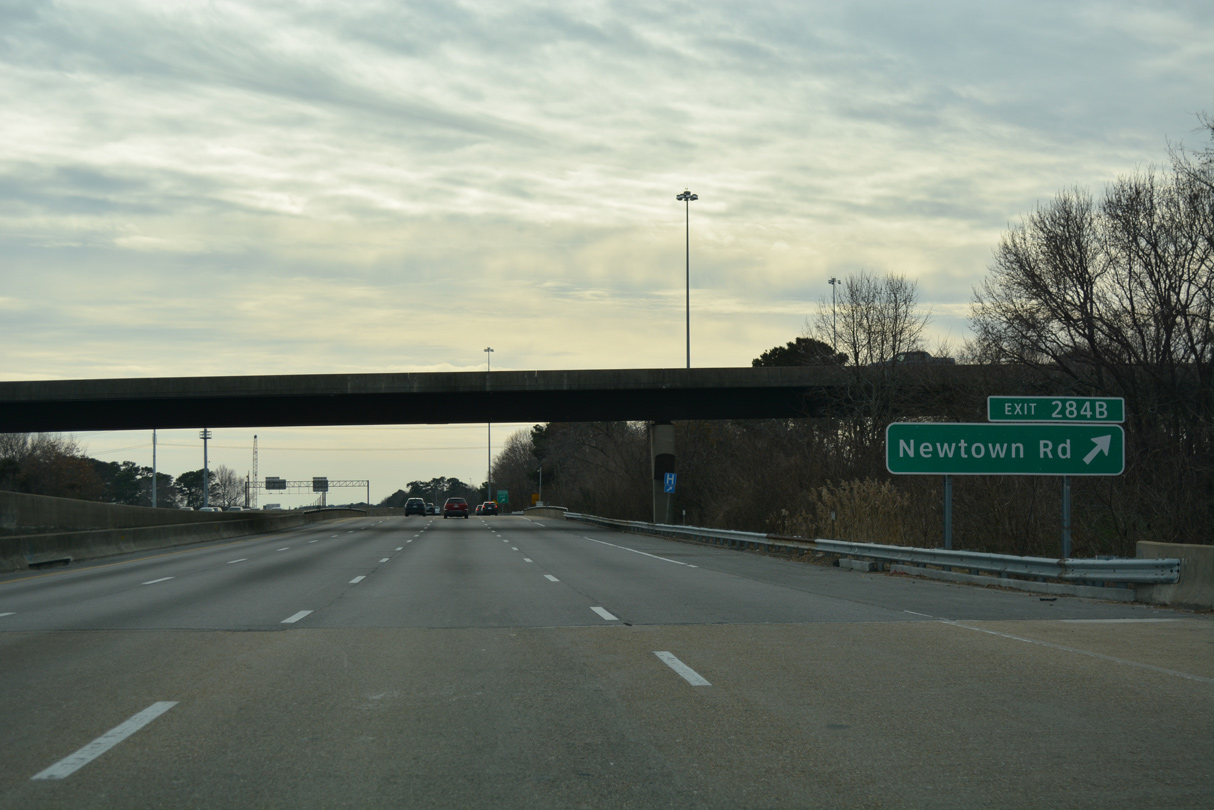
The HOV roadway advances south from the exchange with U.S. 13 (Northampton Boulevard) to an egress point for I-264 west (Exit 284A) and Newtown Road (Exit 284B).
06/05/10
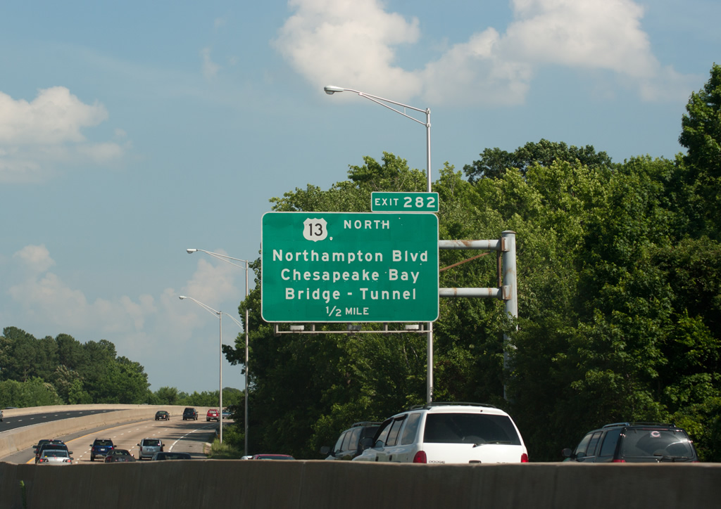
A six lane arterial, U.S. 13 (Northampton Boulevard) heads 4.05 miles from the directional cloverleaf interchange (Exit 282) with I-64 to the Chesapeake Bay Bridge Tunnel approach.
06/05/10
U.S. 13 crosses the Chesapeake Bay Bridge Tunnel 17.5 miles north from Chesapeake Beach in Virginia Beach to Wise Point at the southern tip of Northampton County.
12/17/01
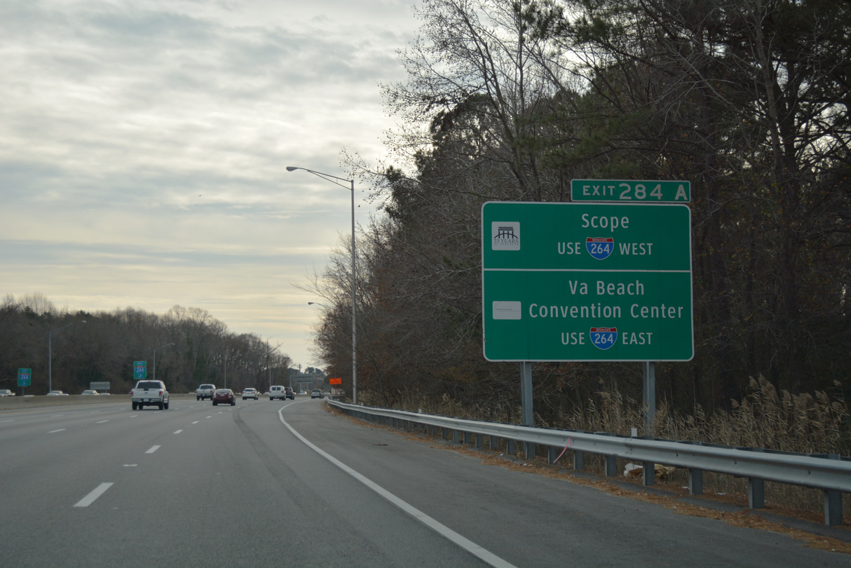
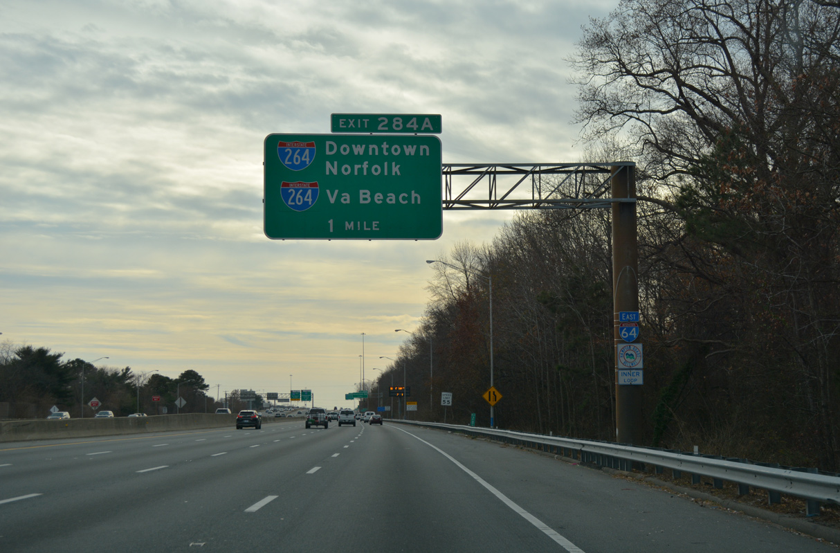
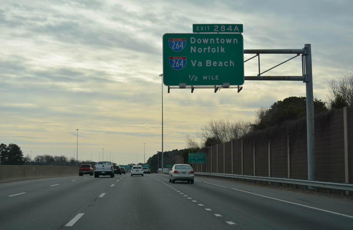
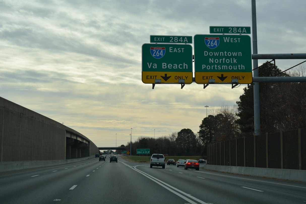
Interstate 264 runs west to Downtown Norfolk, where the Norfolk Scope Arena is located. The east end is located by the Virginia Beach Convention Center.
12/30/17
The egress point from the Express Lanes to I-264 west precedes the causeway across Lake Taylor.
06/05/10
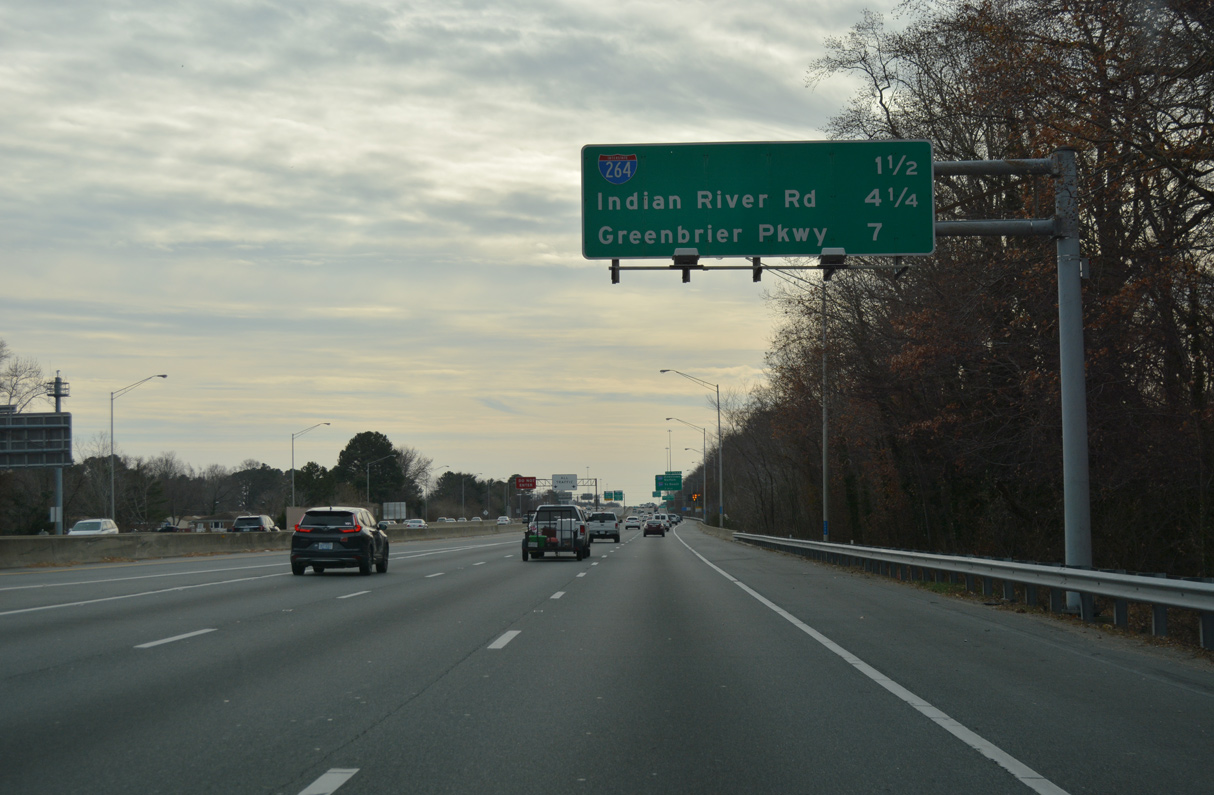
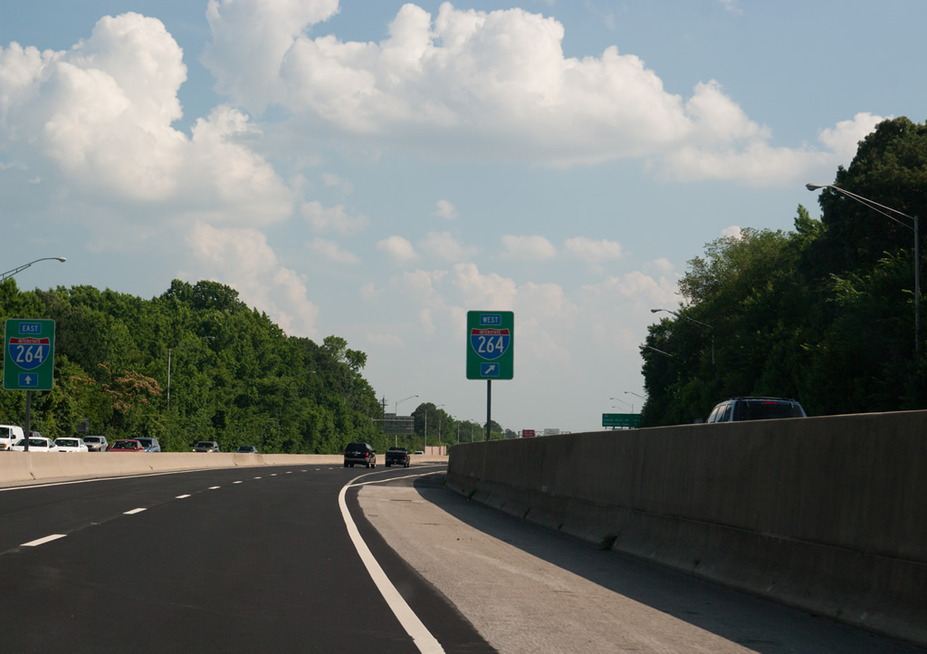
Interstate 64 continues south to the systems interchange (Exit 284) with I-264 (Norfolk Virginia Beach Expressway).
12/30/17
12/30/17
12/30/17
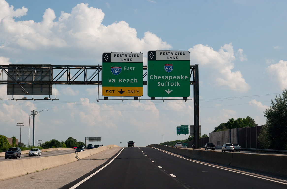
The Express Lanes partition with a flyover for Interstate 264 east to the Virginia Beach Norfolk Expressway beyond Exits 15A/B.
06/05/10
12/30/17
12/30/17
12/30/17
12/30/17
12/30/17
Inner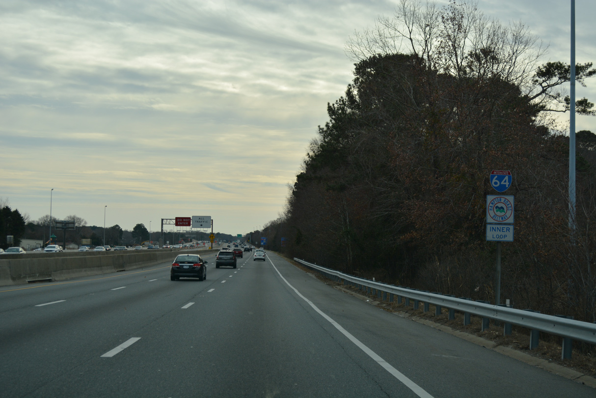
12/30/17
12/30/17
12/30/17
12/30/17
12/30/17
12/30/17

12/30/17
12/30/17
12/30/17
12/30/17
12/30/17
12/30/17
12/30/17
12/30/17
12/30/17
12/30/17
12/30/17
12/30/17
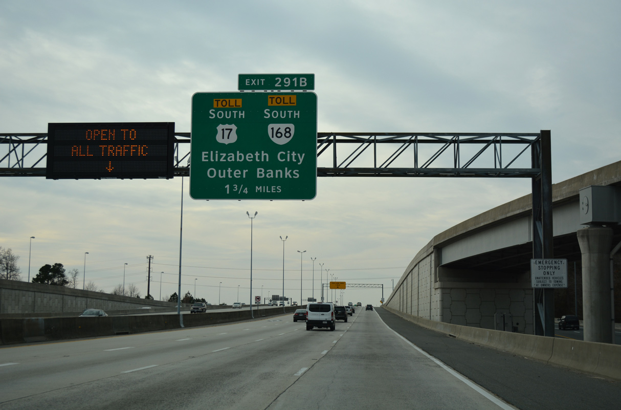
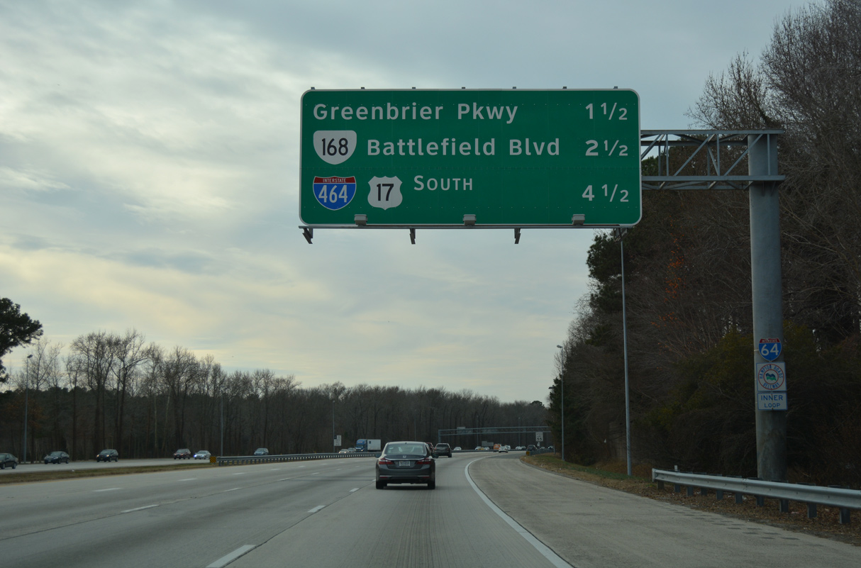
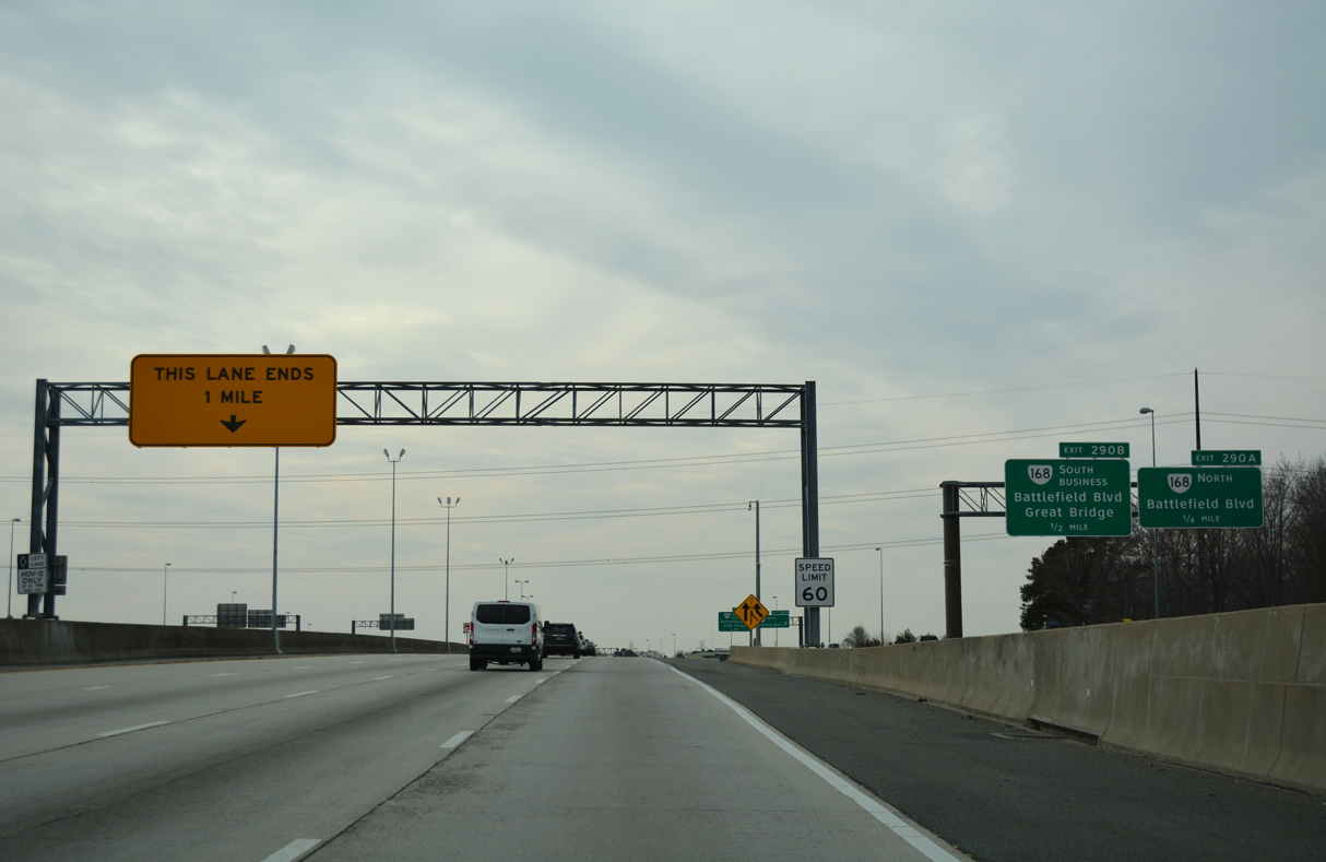
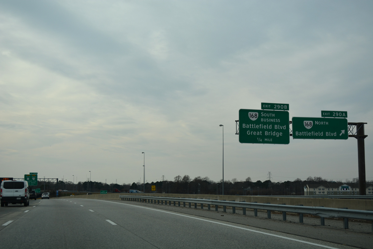
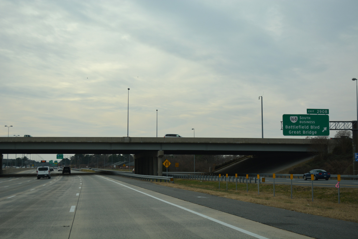
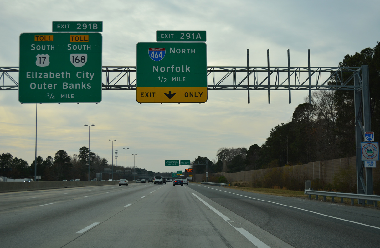
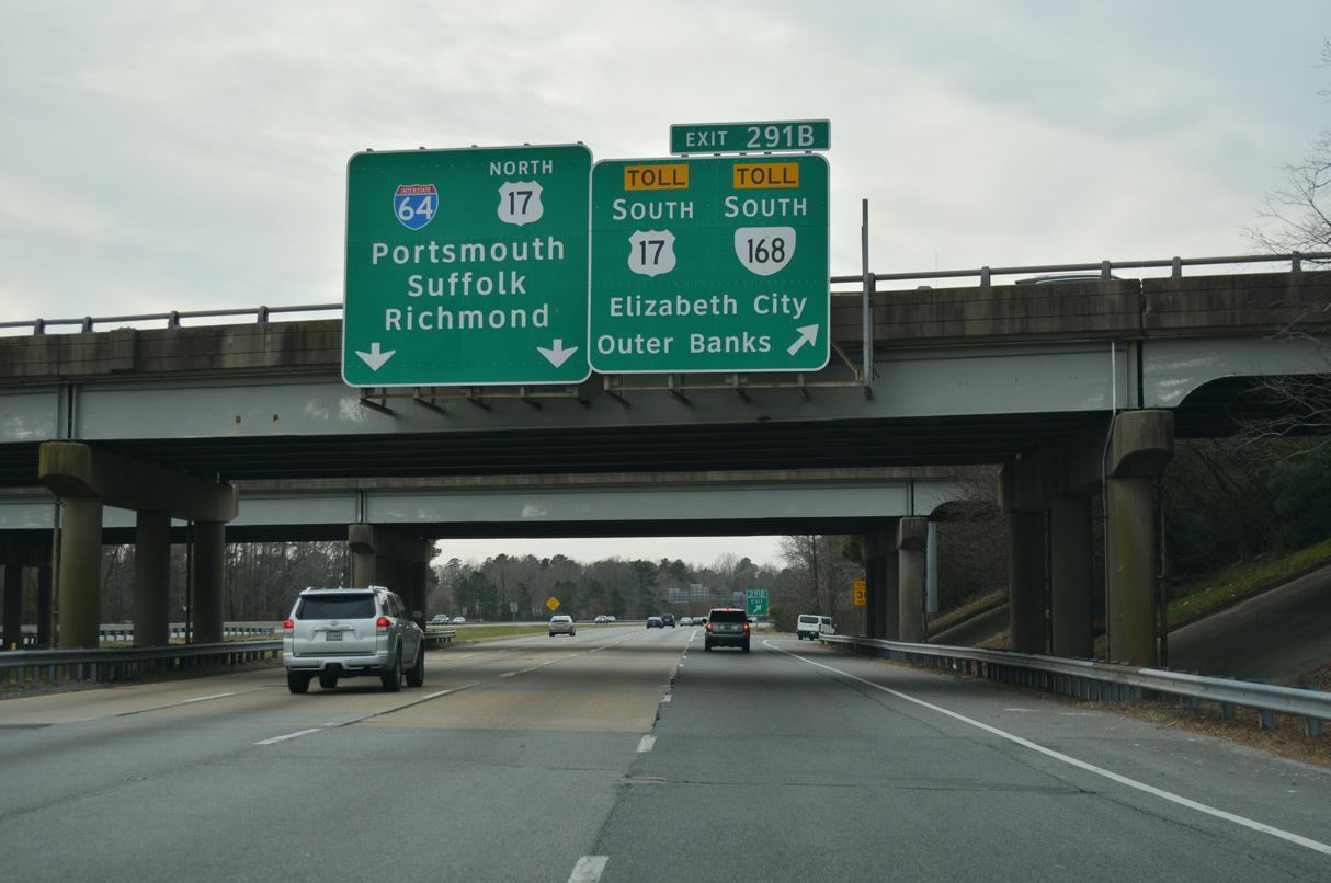
SR 168 heads south from I-64/U.S. 17 along the Oak Ridge Connector, Great Bridge Bypass and the tolled Chesapeake Expressway, a seamless limited access highway south toward Moyock, North Carolina.
12/30/17
12/30/17
12/30/17
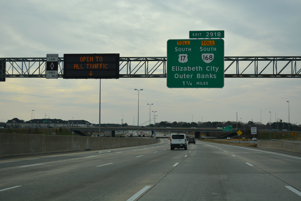
U.S. 17 was realigned in Winter 2002 eastward from George Washington Highway and the Great Dismal Swamp onto Dominion Boulevard to I-64/464 at Exit 291.
12/30/17
12/30/17
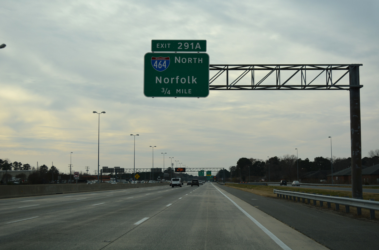
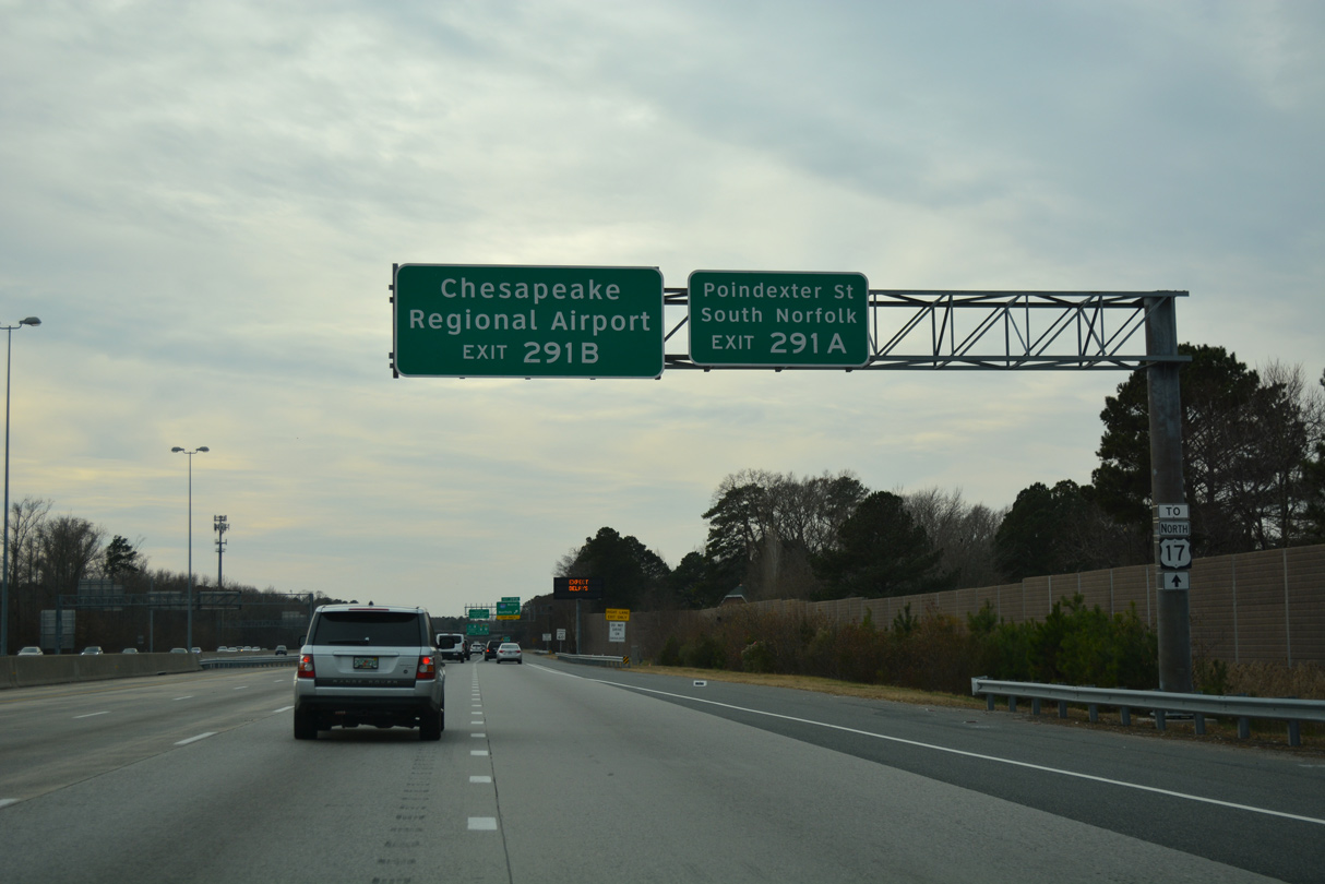
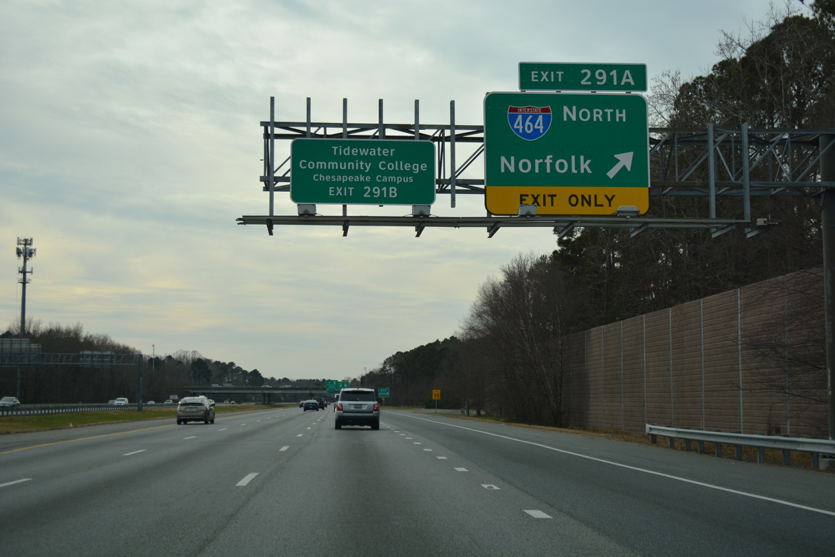
Interstate 464 extends north from the exchange joining I-64, U.S. 17 and SR 168 to I-264 at the Berkley Bridge to Downtown Norfolk.
12/30/17
I-464 runs 5.67 miles north from SR 168 (Oak Grove Connector).
12/30/17
12/30/17
12/30/17
The Veterans Bridge along U.S. 17 (Dominion Boulevard) south across the Elizabeth River is a tolled facility.
12/30/17
 North
North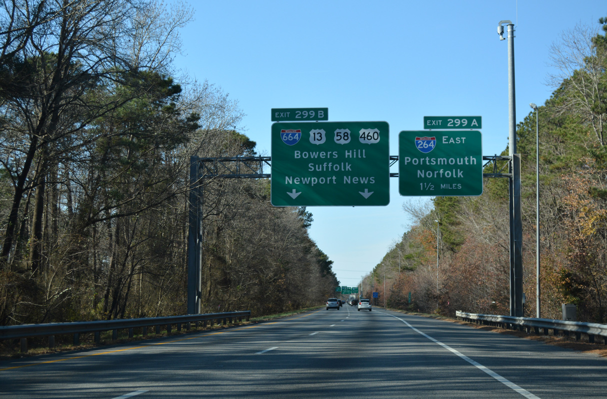
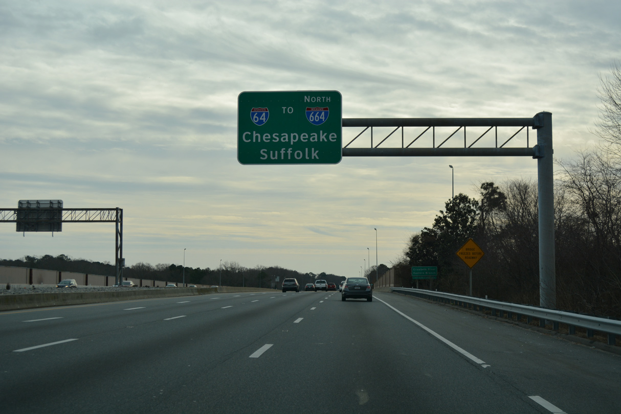
I-64 (Hampton Roads Beltway) converges with the west end of I-264 beyond Cavalier Industrial Park in Chesapeake.
12/14/17
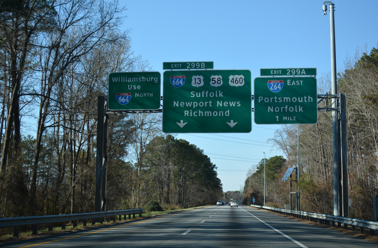
The Hampton Roads Beltway continues west from I-64 along I-664 at Bowers Hill. I-264 heads east to the city of Portsmouth.
12/14/17
12/14/17
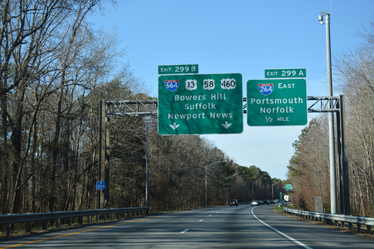
U.S. 13/460 (Military Highway) and U.S. 58 (Airline Boulevard) combine west from I-664 at Bowers Hill to the city of Suffolk.
12/14/17
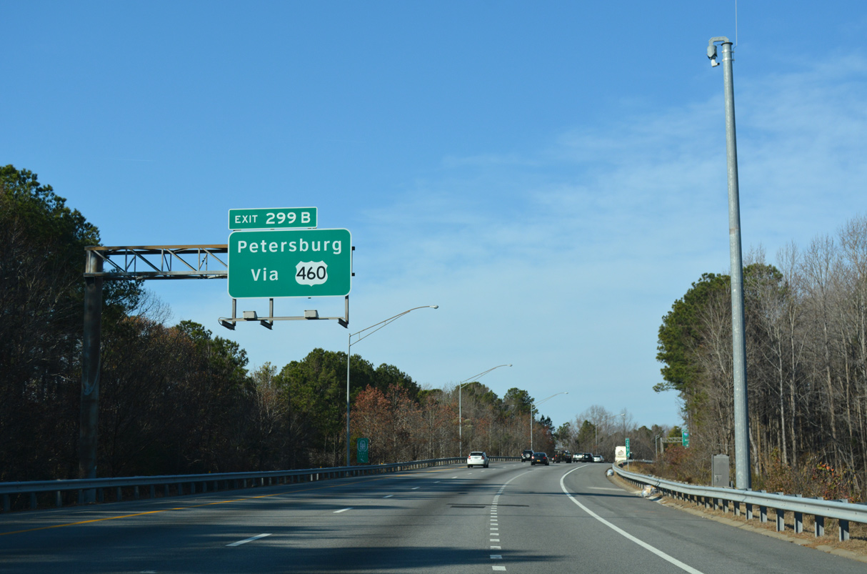
U.S. 460 branches northwest from U.S. 13/58 on the Suffolk Bypass to Petersburg.
12/14/17

Interstate 664 crosses the Monitor Merrimac Memorial Bridge Tunnel north from Suffolk to Newport News.
12/14/17
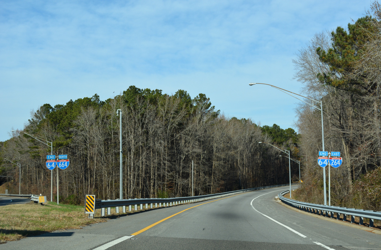
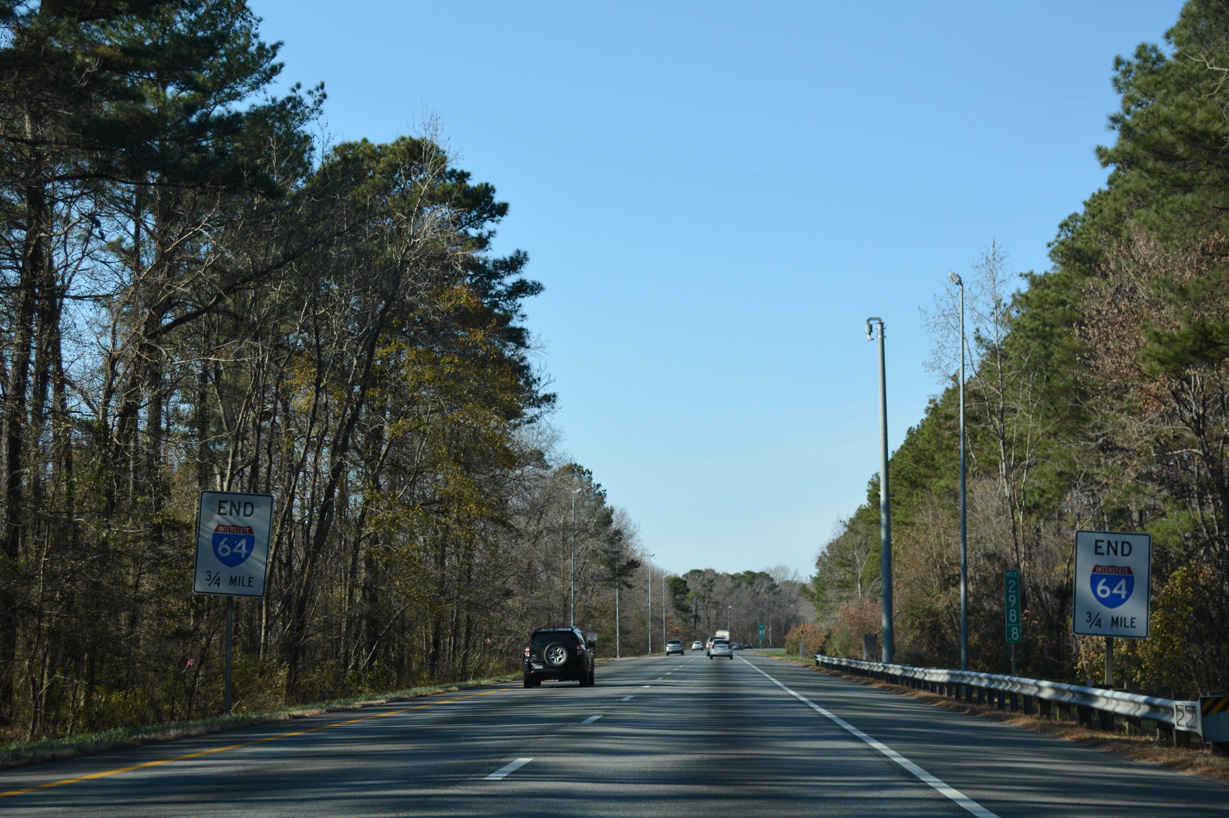
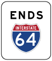
End shields stand along both ramps from I-64 west at the three-wye interchange (Exit 299) with I-264/664.
12/14/17
- Froehlig, Adam.
Photo Credits:
- 12/17/01 by AARoads.
- 06/05/10 by Will Weaver.
- 12/14/17 by AARoads.
- 12/30/17 by AARoads.
Connect with:
Interstate 264
Interstate 464
Interstate 564 - Admiral Taussig Boulevard
U.S. 13
U.S. 17
U.S. 58
U.S. 460
State Route 168 - Chesapeake Expressway
Page Updated 04-07-2021.