|
| Lowering through Greenbrier State Park, Interstate 70 reaches the first Washington County interchange at Exit 35 for MD 66 (Mapleville Road). 12/30/08 |
|
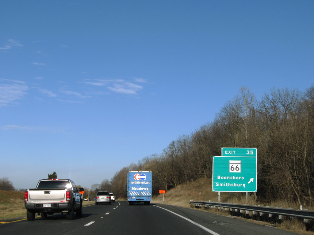
| MD 66 is a 12.84 mile state route betewen U.S. 40 Alternate at Boonsboro and MD 64 outside Smithsburg. Locally, Mapleville Road travels to Mount Aetna, Beaver Creek, and Wagners Crossroads (U.S. 40). 12/30/08 |
|
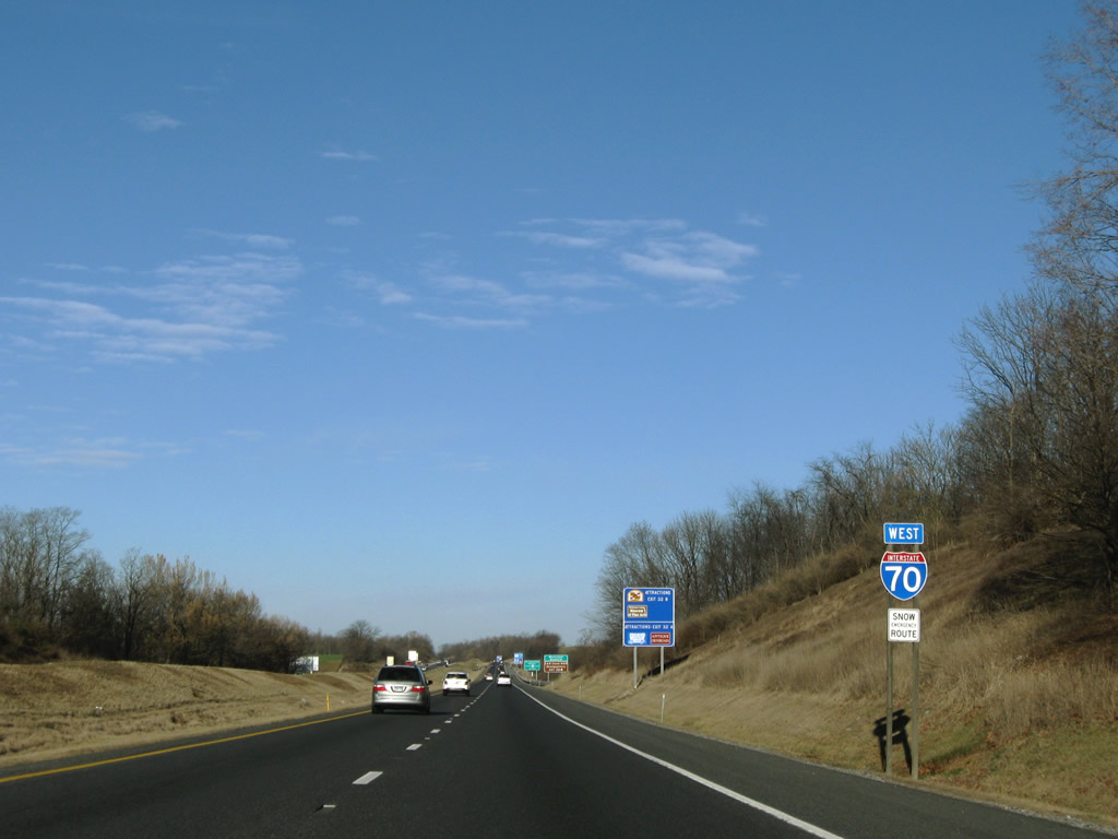
| Continuing west from Beaver Creek along Interstate 70. 12/30/08 |
|
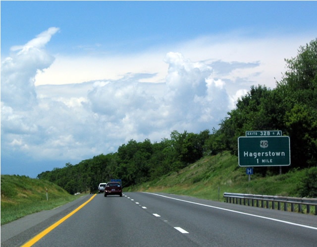
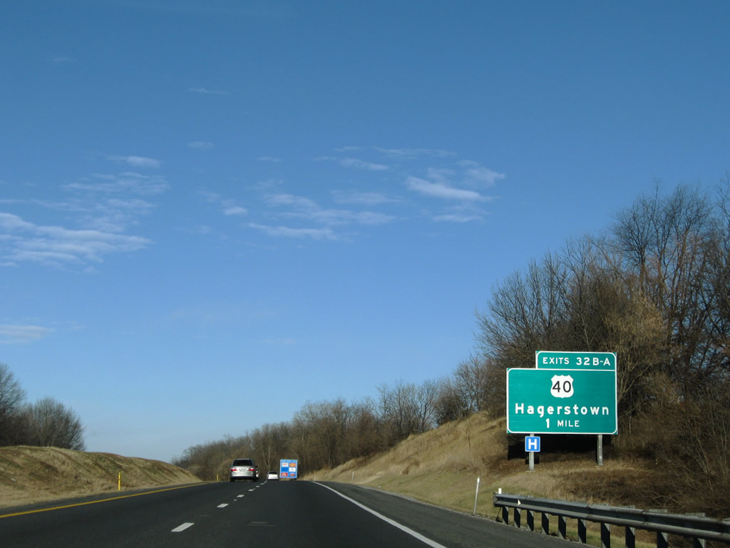
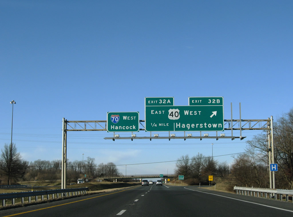
| A look at the original button copy guide sign for the one mile approach to Exits 32B/A near Funkstown. 06/01/04 |
|
| U.S. 40 follows the National Pike northwest from South Mountain and Wagners Crossroads to meet Interstate 70 at a cloverleaf interchange (Exit 32). 12/30/08 |
|
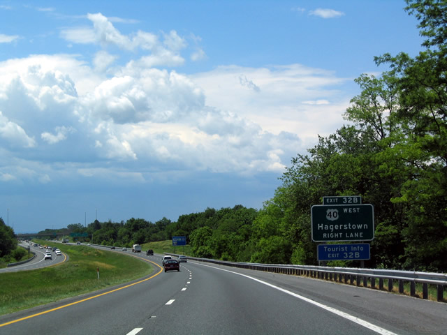
| This older, button copy sign was used for the exit from westbound Interstate 70 to U.S. 40 west. U.S. 40 transitions from a rural divided highway into a commercial arterial leading into Hagerstown. 06/01/04 |
|
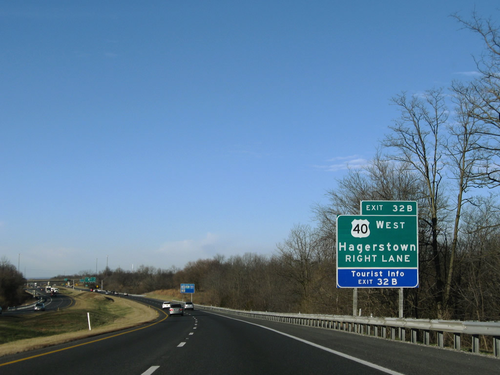
| The sign replacement for Exit 32B to U.S. 40 (Dual Highway) west. U.S. 40 travels directly to downtown. U.S. 40 Alternate enters the central business district from Funkstown and Frederick Street to the west. 12/30/08 |
|
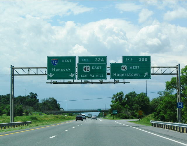
| Older, but not original, overheads and their replacements along Interstate 70 west at the Exit 32B ramp departure to U.S. 40 (Dual Highway) west. This is the first of four exits serving Hagerstown. 06/01/04, 12/30/08 |
|
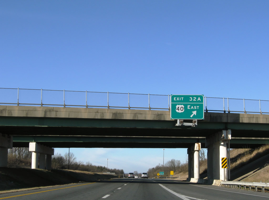
| Exit 32A loops onto U.S. 40 (National Pike) east toward Wagners Crossroads. 12/30/08 |
|
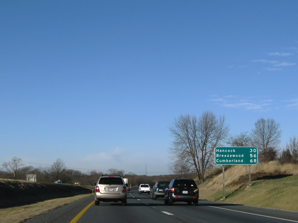
| Distance sign with the Interstate 70 control points of Hancock (I-68) and Breezewood (I-76). Cumberland references I-68 west. 12/30/08 |
|
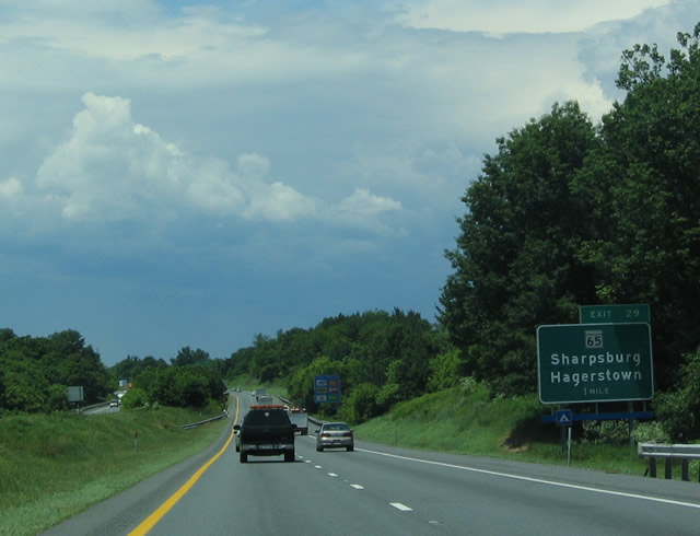
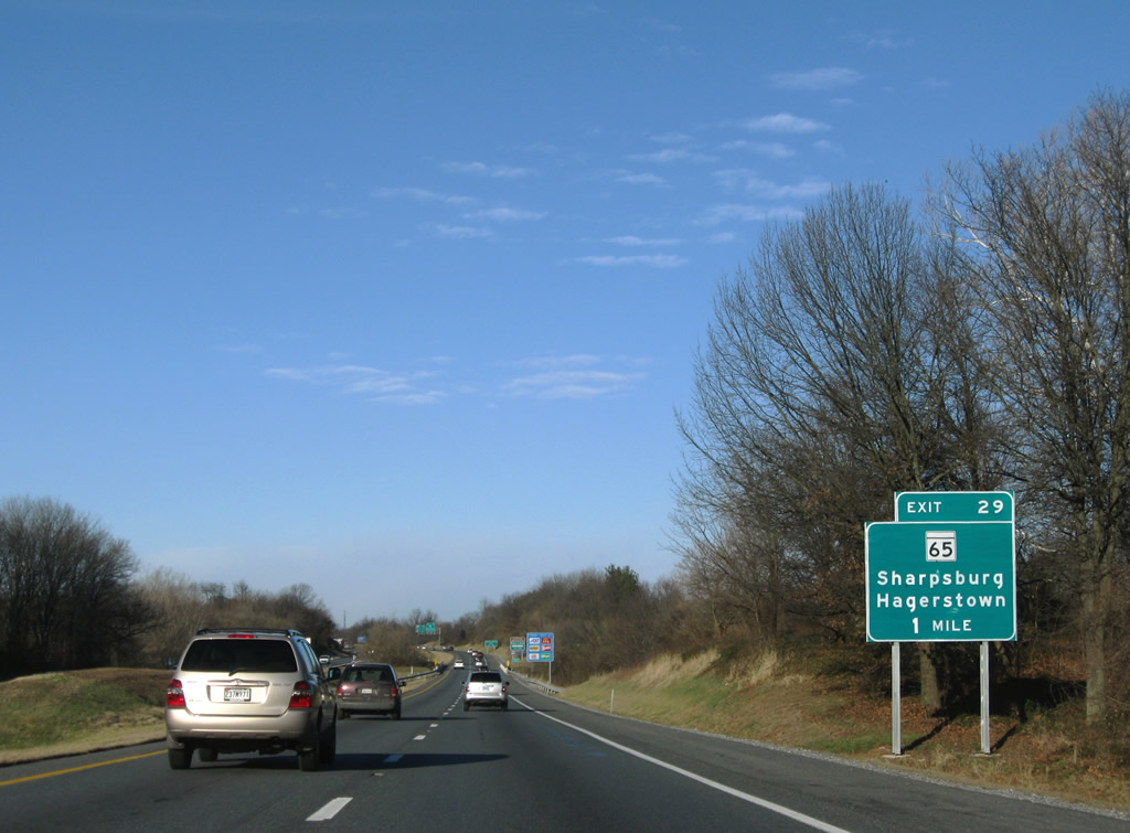
| Interstate 70 stays south of Funkstown and crosses Antietam Creek on the one mile approach to Exit 29 (MD 65). The views here look at the original guide sign and its replacement. 06/01/04, 12/30/08 |
|
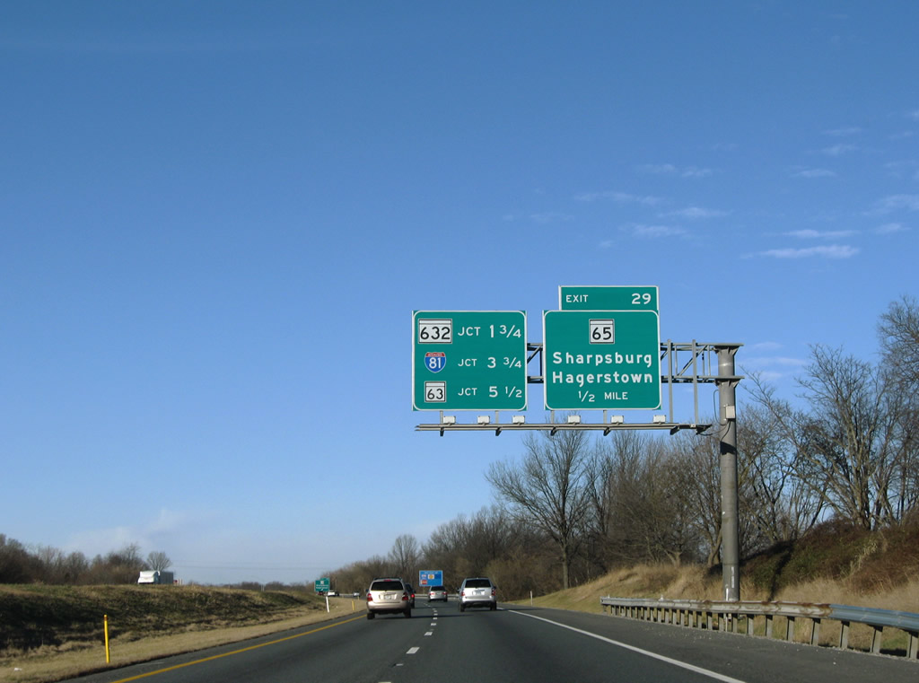
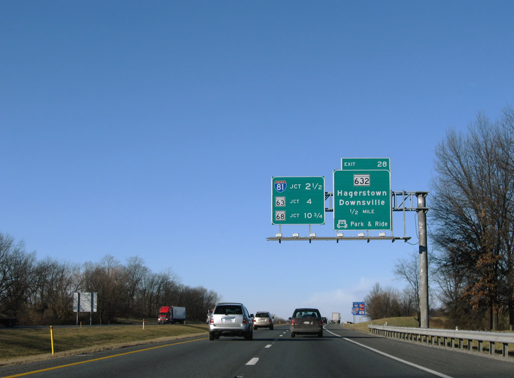
| MD 65 (Sharpsburg Pike south / Potomac Street north) constitutes a 11.75 mile route between MD 34 near the Potomac River bridge and the Hagerstown city limits near Wilson Boulevard. Pictured here is the one half mile guide sign for Exit 29 and an interchange sequence sign providing the first notice of forthcoming I-81. 12/30/08 |
|
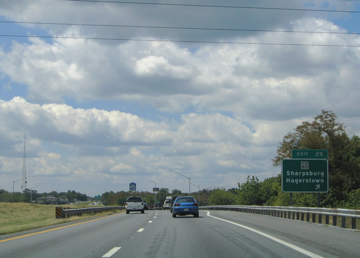
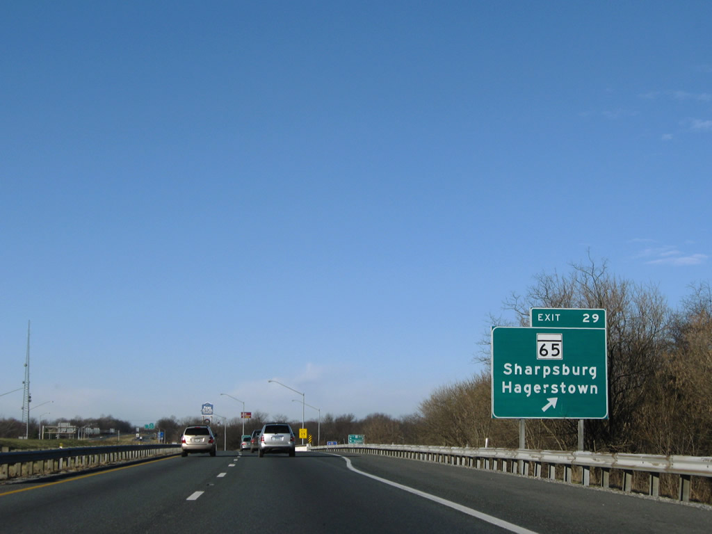
| Westbound Interstate 70 at Exit 29, Potomac Street north into downtown Hagerstown and MD 65 south to Sharpsburg. Like other clustered route numbers in Maryland, the area around Hagerstown is home to MD 65 / Potomac Street, MD 64 / Jefferson Boulevard, MD 60 / Leitersburg Pike, MD 58 / Cearfoss Pike, and MD 68. 08/07/04, 12/30/08 |
|
| The following exit along westbound connects I-70 with MD 632 (Downsville Pike). MD 632 follows Maryland Avenue in south Hagerstown to an endpoint at the intersection of Downsville Road. The cloverleaf interchange with Interstate 81 is now 2.50 miles to the west. 12/30/08 |
|
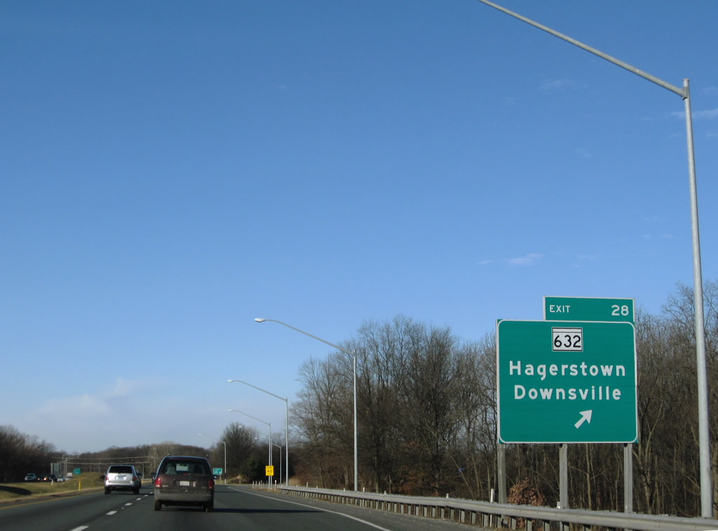
| A parclo A2 interchange joins Interstate 70 with MD 632 at Exit 28. MD 632 links the Vardo and Halfway communities south of Hagerstown with Downsville and MD 63 to the south. 12/30/08 |
|
| Interstate 70 westbound reassurance shield posted between MD 632 and Interstate 81. A highway travel advisory sign illuminates in the distance for a traffic back-up on Interstate 70 near Hancock. 08/07/04 |
|
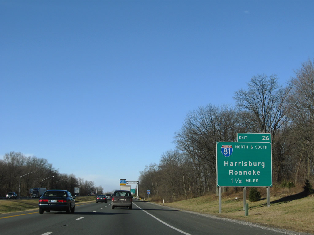
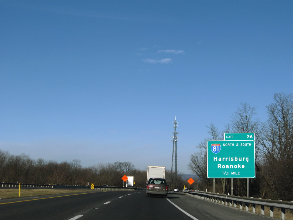
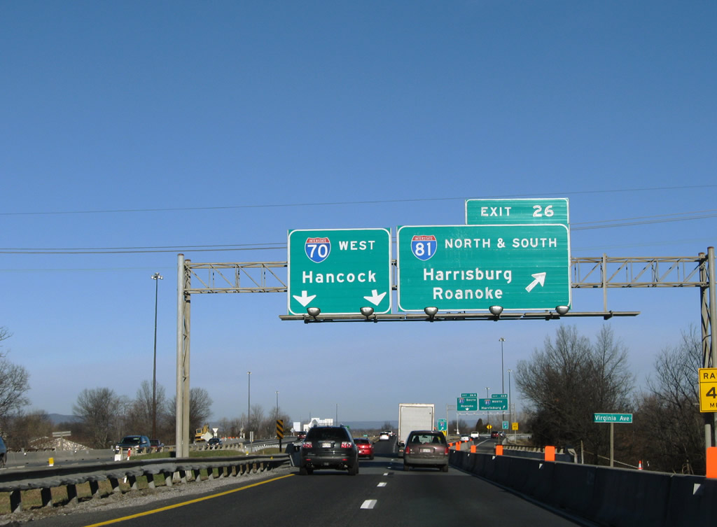
| 1.50 miles east of Exits 26B/A to Interstate 81 west of Halfway. 12/30/08 |
|
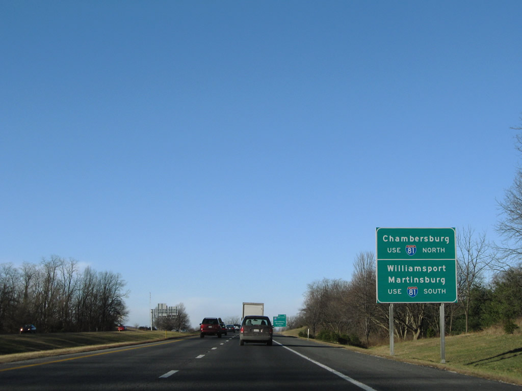
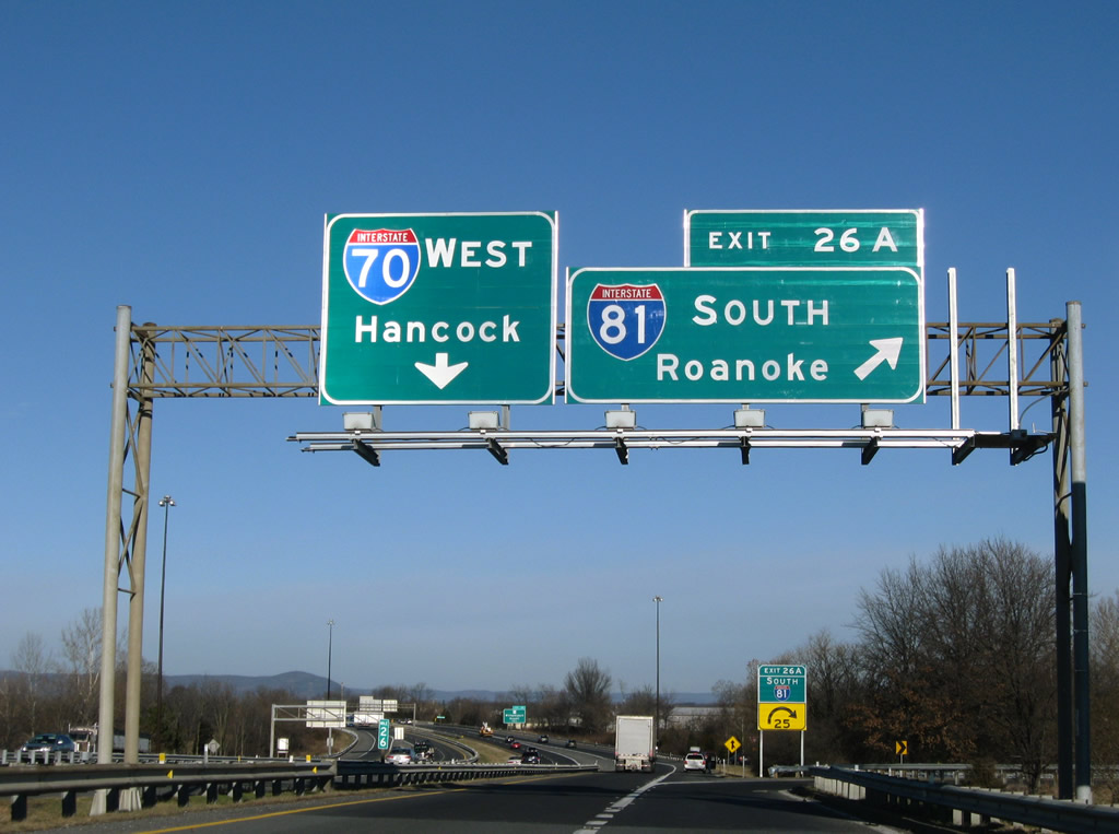
| In addition to its main control cities of Harrisburg and Roanoke, Interstate 81 south reaches Williamsport and Martinsburg, West Virginia and north to Chambersburg, Pennsylvania. 12/30/08 |
|
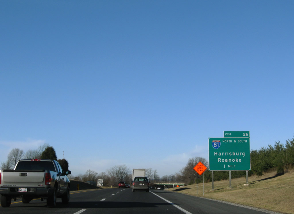
| Nearing the Bower Avenue overpass, one mile ahead of Exit 26 for Interstate 81 on I-70 west. Interstate 81 travels just 12.08 miles within the Free State. 12/30/08 |
|
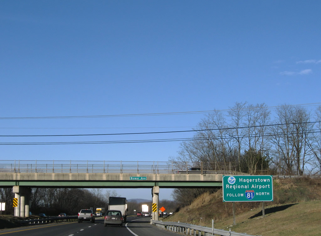
| Interstate 81 northbound joins Hagerstown with its Regional Airport (HGR) at Exit 10. 12/30/08 |
|
| Interstate 81 is a major corridor in the northeast, connecting Ontario in the north with Interstate 40 in eastern Tennessee, following U.S. 11 for its entire length. There is no exit from Interstate 70 to U.S. 11; use Interstate 81 or Exit 28 / MD 632 to reach U.S. 11. 12/30/08 |
|
| Interstate 70 passes over U.S. 11 (Virginia Avenue) ahead of the split with the c/d road of Exit 26 to Interstate 81. 12/30/08 |
|
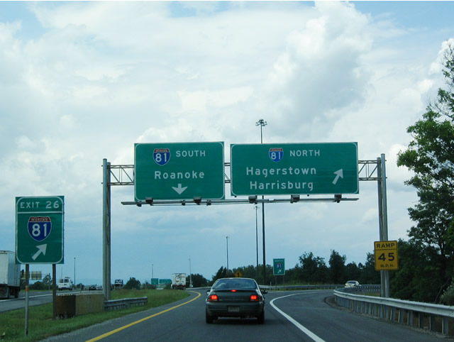
| Now on the collector distributor roadway of Exit 26 from Interstate 70 westbound to Interstate 81. Exit 26B leaves the freeway for Interstate 81 northbound to Hagerstown, Chambersburg, and Harrisburg. Three interchanges serve Hagerstown on Interstate 81 north of Interstate 70. 06/01/04 |
|
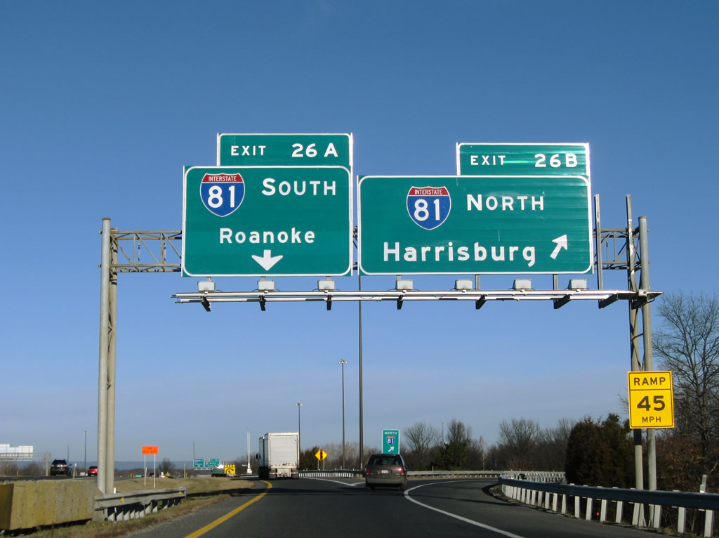
| Sign replacements increase the size of the Interstate 81 shields and add missing exit tabs for Exits 26B and 26A. 12/30/08 |
|
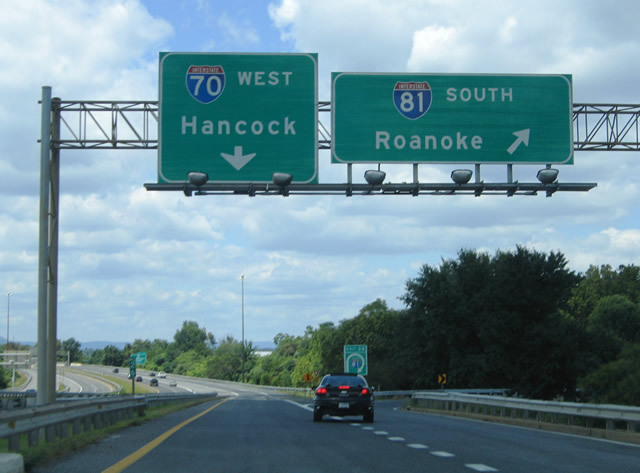
| Traffic to Interstate 81 southbound departs Interstate 70 west for Martinsburg, West Virginia; Winchester, Virginia; and Roanoke, Virginia. Interstate 81 crosses the Potomac River into the Mountain State within four miles. 08/07/04, 12/30/08 |
|
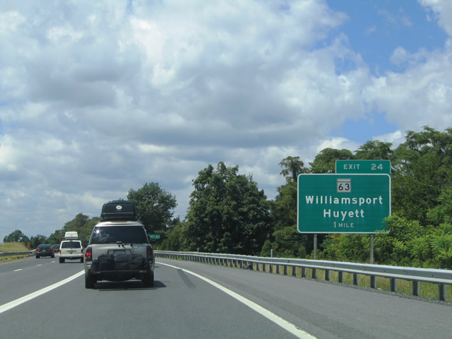
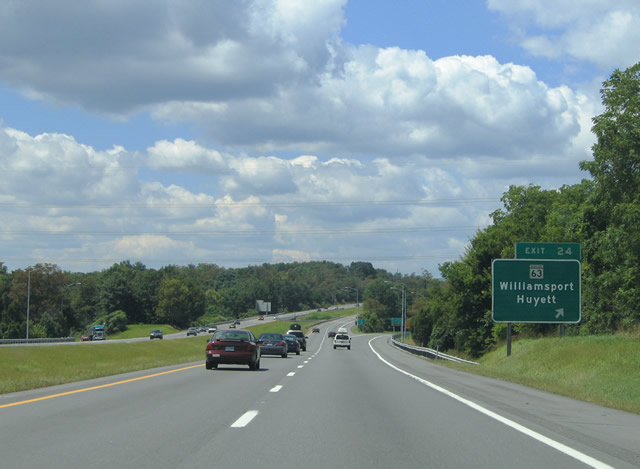
| One mile west of the diamond interchange (Exit 24) with MD 63 (Greencastle Pike) near the community of Huyett. MD 63 travels 1.5 miles north from Interstate 70 to U.S. 40 (National Pike) at Huyett. The state route continues north from there to Troupe Springs and Cearfoss before meeting PA 163 at the state line. 08/07/04 |
|
| Another button copy guide sign for Exit 24 posted on Interstate 70 westbound. MD 63 (Greencastle Pike) derives its name from the connection to PA 163 and Greencastle, Pennsylvania. The state highway merges with U.S. 11 (Potomac Street) 2.2 miles to the south in Williamsport. 08/07/04 |
|
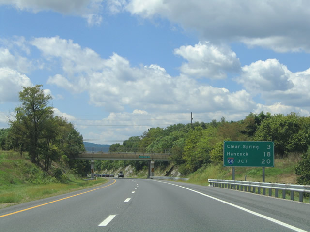
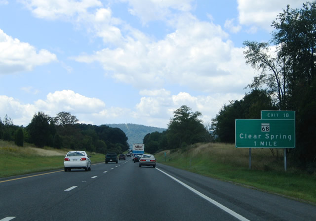
| Cedar Ridge Road travels over Interstate 70 beyond MD 63. Posted ahead of the over crossing is a distance sign for the next exit at Clear Spring and first indication of Interstate 68. 08/07/04 |
|
| MD 68 crosses paths with Interstate 70 at a diamond interchange (Exit 18). The state route follows Clear Spring Road from its end at U.S. 40 (National Pike) in Clear Spring southeast to Pinesburg and Williamsport. 08/07/04 |
|
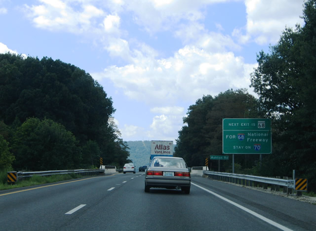
| A sign is posted at the Ashton Road under crossing for Exit 18 advising motorists to remain on Interstate 70 west for Interstate 68 (National Freeway) and to not take MD 68. 08/07/04 |
|
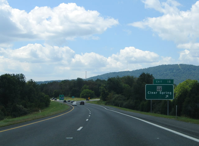
| Interstate 70 westbound at the ramp departure of Exit 18 for MD 68 (Clear Spring Road). A small guide sign reminds Interstate 68 bound motorists to continue straight. MD 68 ends at the Mill Street intersection with U.S. 40 (National Pike) in adjacent Clear Spring to the north. 08/07/04 |
|
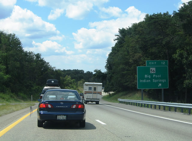
| Interstate 70 advances to the Potomac River at the community of Big Pool. There MD 56 (Big Pool Road) meets the freeway at Exit 12. 08/07/04 |
|
| MD 56 (Big Pool Road) loops west from MD 68 (Clear Spring Road) to Big Pool and Interstate 70. From Exit 12 the state highway turns northward to U.S. 40 near its intersection with Indian Springs Road. Use Indian Springs Road north for the community of Indian Springs. 08/07/04 |
|
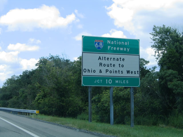
| This guide sign touts the benefits of Interstate 68 for long distance travelers to Ohio and points west along the Interstate 70 corridor. Interstate 68 ends at Interstate 79 in Morgantown south of Washington, Pennsylvania. 08/07/04 |
|
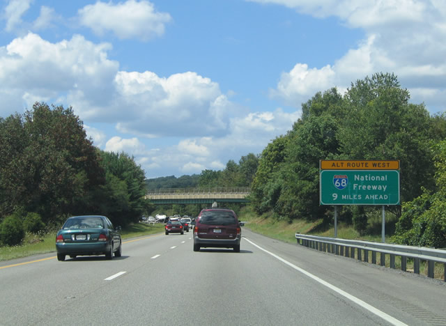
| Interstate 70 hugs the Chesapeake And Ohio Canal National Historic Park along the Potomac River between Big Pool and Hancock (Exit 3). A second guide sign reminds motorists of the pending westbound beginning of Interstate 68 at Exit 1. 08/07/04 |
|
| A distance sign follows the wye interchange (Exit 9) with U.S. 40 on Interstate 70 westbound. U.S. 40 overlaps with I- 70 west to I-68 at Exit 1A. 08/07/04 |
|
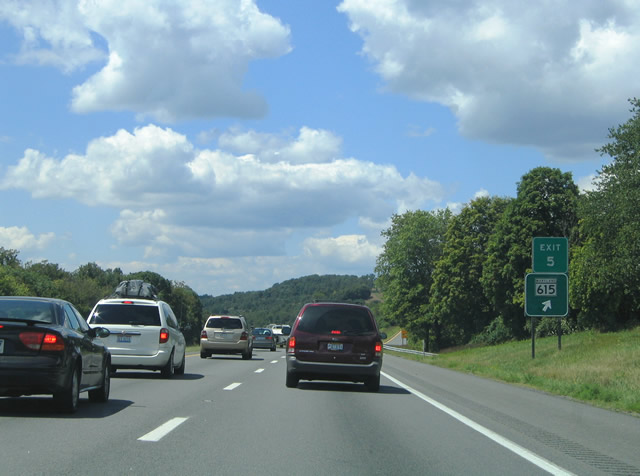
| MD 615 (Millstone Road) parallels Interstate 70 and U.S. 40 westbound closely east of Hancock. The state highway comprises the original routing of U.S. 40 and is accessible via ramps from Exit 5. 08/07/04 |
|
| Interstate 70 and U.S. 40 west at the Exit 5 off-ramp to MD 615 (Millstone Road). MD 615 intersects MD 456 (Hollow Road) before turning north toward the Pennsylvania state line. 08/07/04 |
|
| Sideling Hill Exhibit Center lies along I-68 and U.S. 40 (National Freeway) just west of their departure from Interstate 70 at Sideling Hill. 08/07/04 |
|
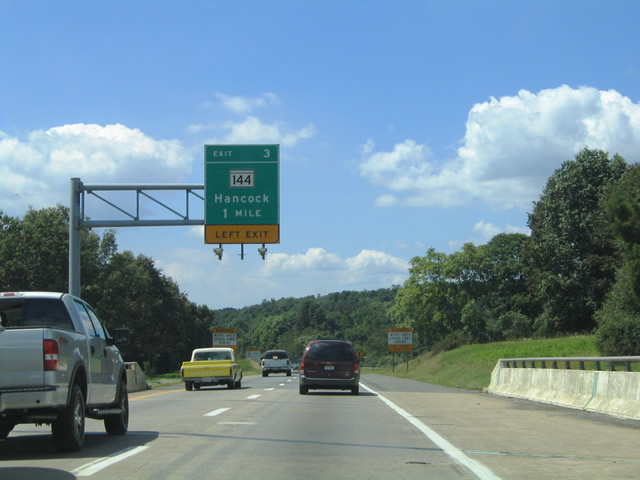
| A left exit carries drivers off I-70/U.S. 40 westbound into Hancock via MD 144 (old U.S. 40). The state route follows Main Street along the Potomac River into Hancock between Exit 3 and U.S. 522. 08/07/04 |
|
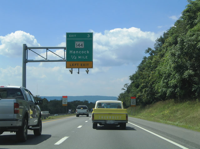
| One half mile ahead of MD 144 (Main Street) near Hancock on I-70 west. MD 144 is assigned to various segments of former U.S. 40 west of Baltimore. 08/07/04 |
|
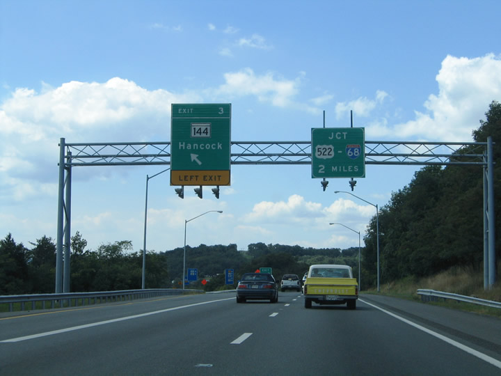
| The topography of the Potomac River valley necessitated the use of a left side off-ramp for MD 144 west from I-70/U.S. 40 westbound at Exit 3. The state highway again interacts with U.S. 40 at the Exit 77 interchange of Interstate 68 via the Western Pike. 08/07/04 |
|
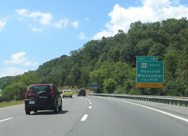
| U.S. 522 meets I-70/U.S. 40 at a directional T interchange (Exit 1B) north of Hancock. The UD highway travels south above the town and across the Potomac River into Morgan County, West Virginia. 08/07/04 |
|
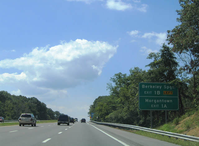
| Auxiliary guide sign including the West Virginia control points of Berkley Springs for U.S. 522 south (Exit 1B) and Morgantown for Interstate 68 (Exit 1A). Berkeley Springs lies six miles to the southwest. 08/07/04 |
|
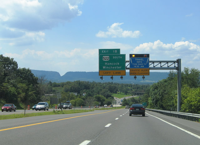
| The Sideling Hill rock cut for the National Freeway comes into view as I-70/U.S. 40 westbound near the left side ramp (Exit 1B) to U.S. 522 south. U.S. 522 travels 47 miles south to Winchester, Virginia. 08/07/04 |
|
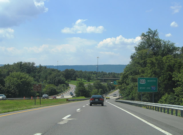
| U.S. 522 northbound joins I-70/U.S. 40 west at a directional T interchange (Exit 1B). U.S. 522 continues northward with I-70, 3.5 miles to Warfordsburg, Pennsylvania. 08/07/04 |
|
| I-70/U.S. 40 westbound at the ramp departure of Exit 1B for U.S. 522 south. U.S. 522 meets MD 144 (Main Street) in 0.75 miles and enters the Mountain State in 1.25 miles near Potomac Airpark and River Road. 08/07/04 |
|
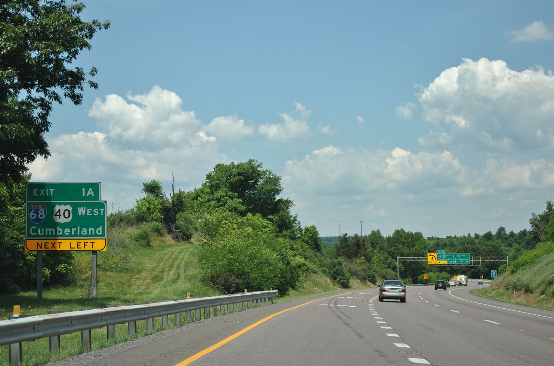
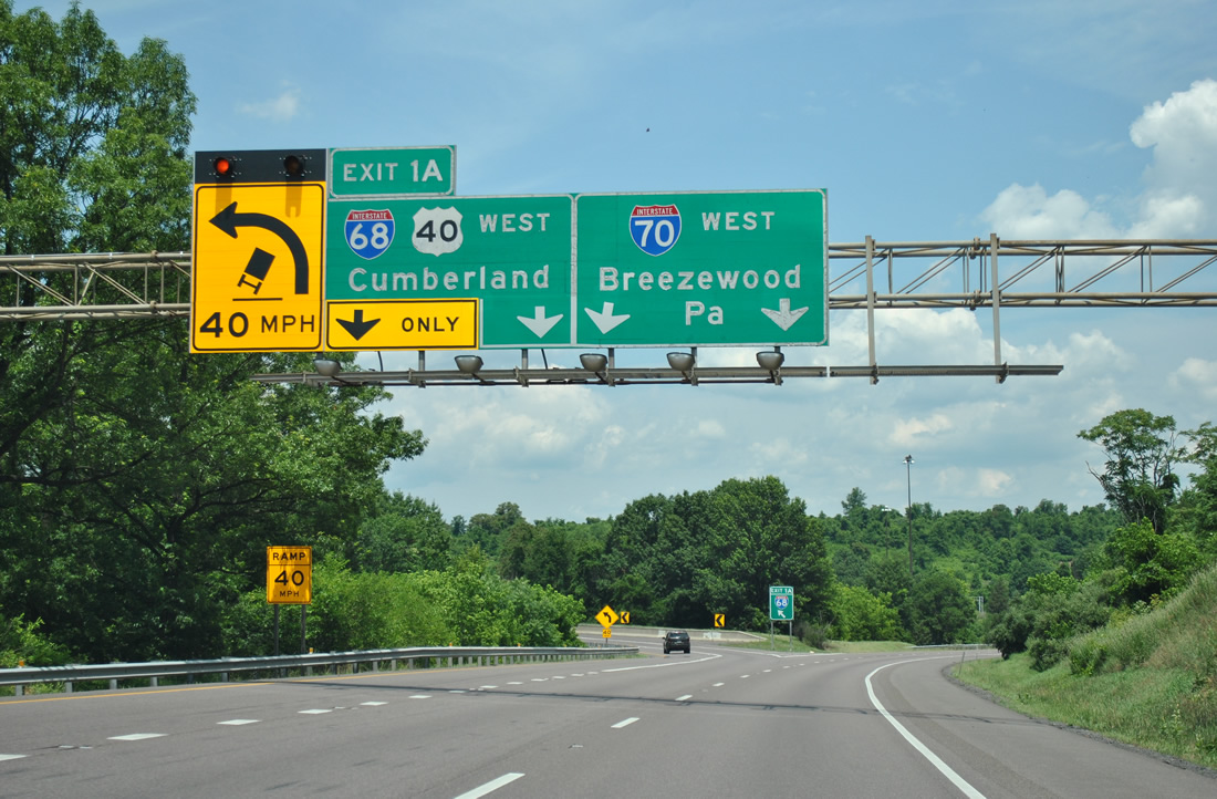
| 0.50 mile diagrammatic overhead for the Exit 1A interchange with Interstate 68's eastern terminus. Known as the National Freeway for the highway in which it replaced (National Highway), Interstate 68 cosigns with U.S. 40 west from Hancock to Keysers Ridge via Cumberland in the Maryland high country. 08/07/04 |
|
| A second guide sign advises motorists of the upcoming left side off-ramp for I-68/U.S. 40 westbound on Interstate 70 west & U.S. 522 north. The city of Cumberland lies 38 miles to the west along the Potomac River in Allegeny County. 06/24/12 |
|
| The westbound beginning of Interstate 68 leaves Interstate 70 with U.S. 40 for Sideling Hill, Cumberland, and Morgantown, West Virginia. Interstate 68 replaced U.S. 48 east of its split with U.S. 40 in Garrett County in the mid 1980s. The freeway ends at Interstate 79 presently. Plans exist to extend Interstate 68 northwest to Interstate 70 in Wheeling, West Virginia. 06/24/12 |
|
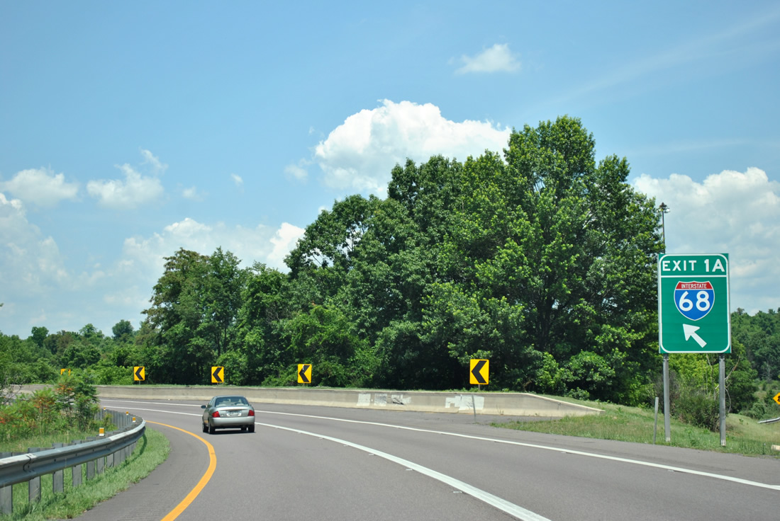
| Exit 1A gore point sign for Interstate 68 west on I-70/U.S. 40 west and U.S. 522 north. The first exit for westbound travelers is Exit 77 with MD 144 (Western Pike) near Sideling Hill. 06/24/12 |
|
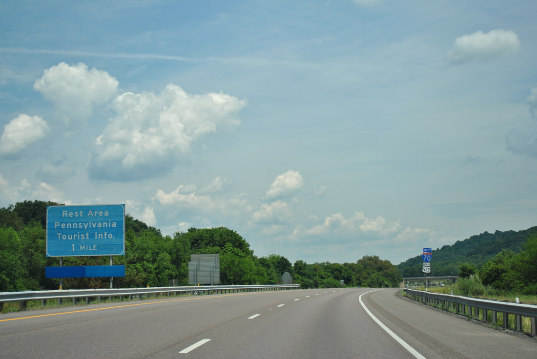
| Next in line for motorists traveling Interstate 70 and U.S. 522 north is the Pennsylvania welcome center. 06/24/12 |
|
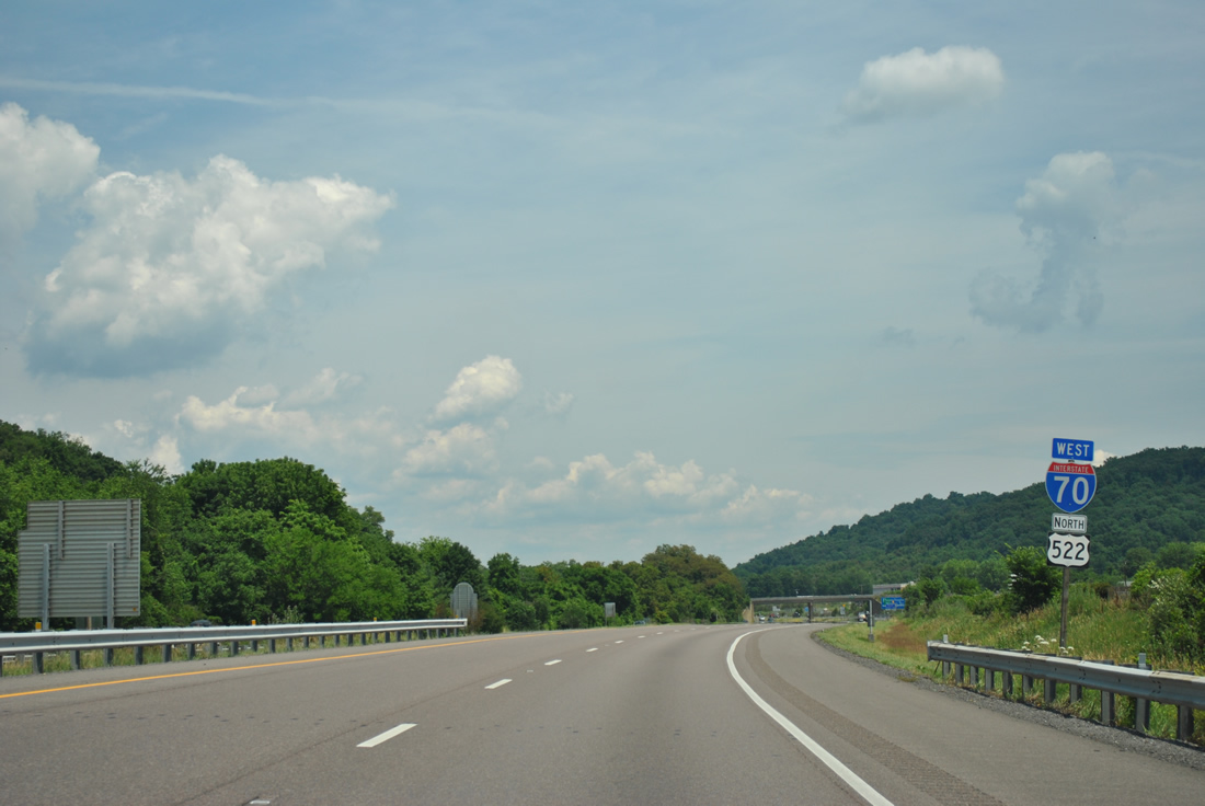
| Interstate 70 west and U.S. 522 north reassurance shields posted beyond the three-wye interchange at Exit 1A. 06/24/12 |
|
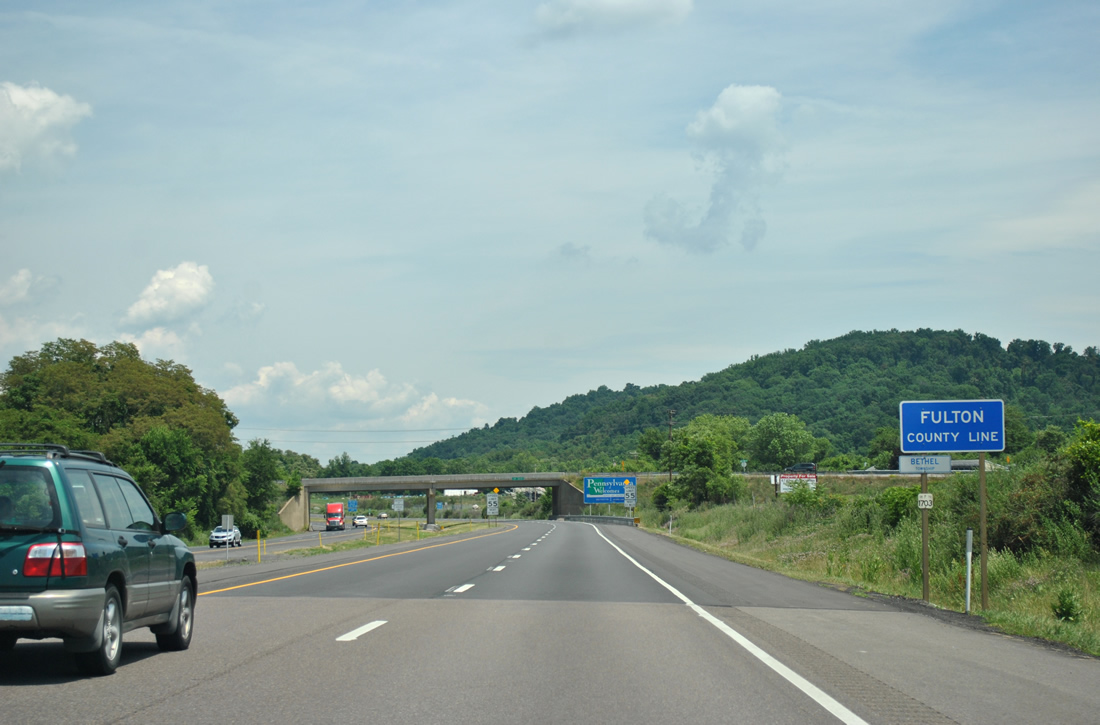
| Interstate 70 west & U.S. 522 north cross the Pennsylvania state line and enter Fulton County. The Buck Valley Road Road (original U.S. 522) overpass crosses in the background. 06/24/12 |
Page Updated 02-04-2013.

 West
West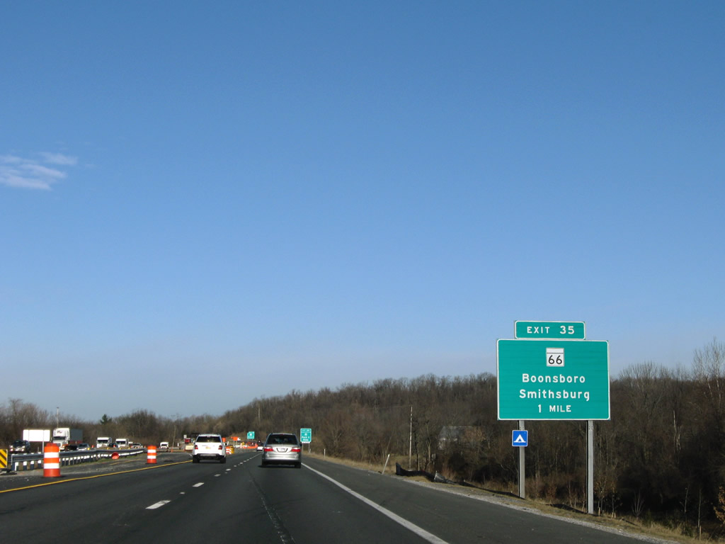

 West
West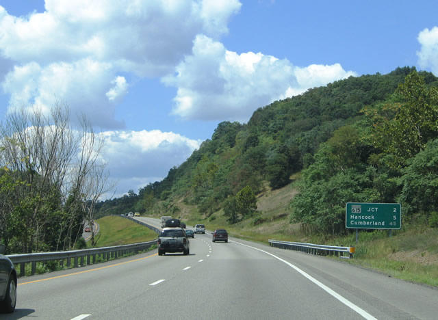


 North
North