|
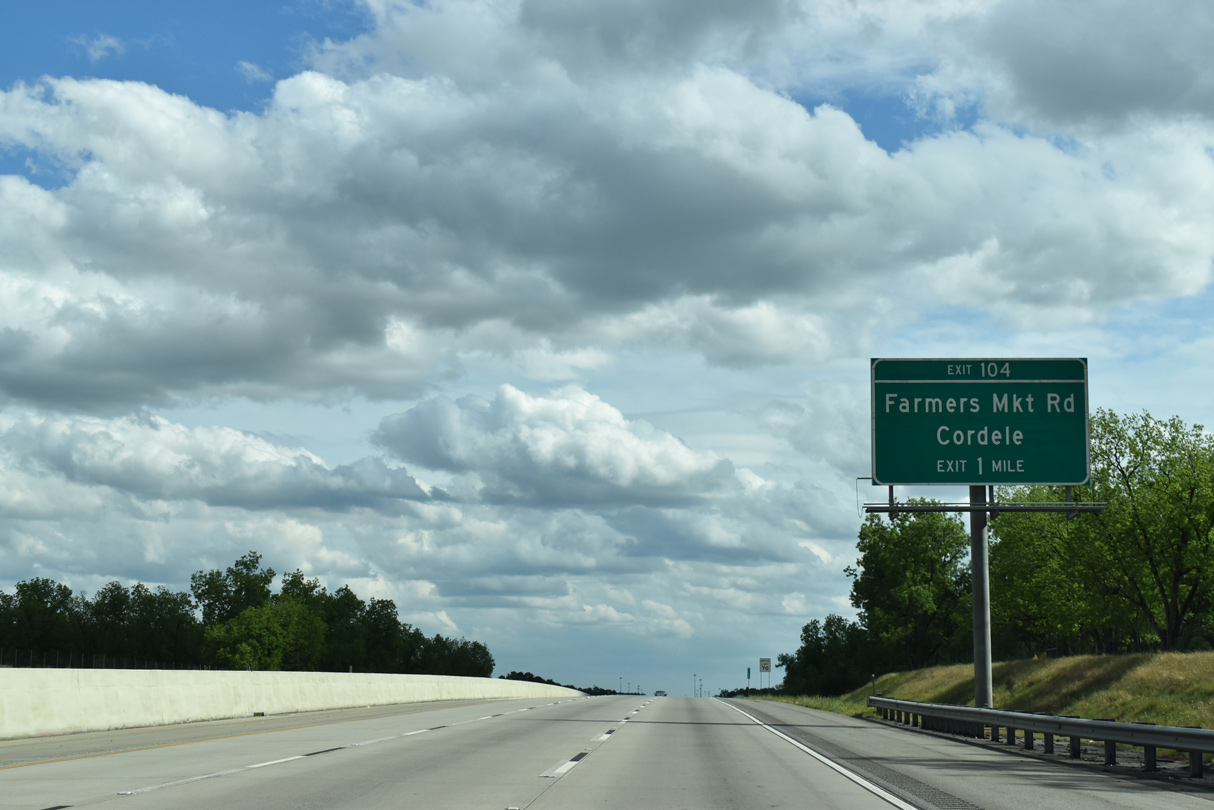
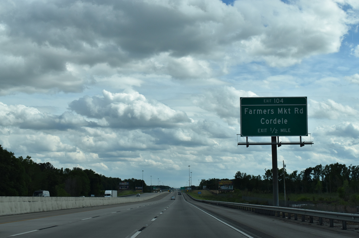
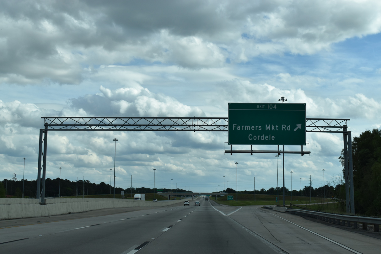
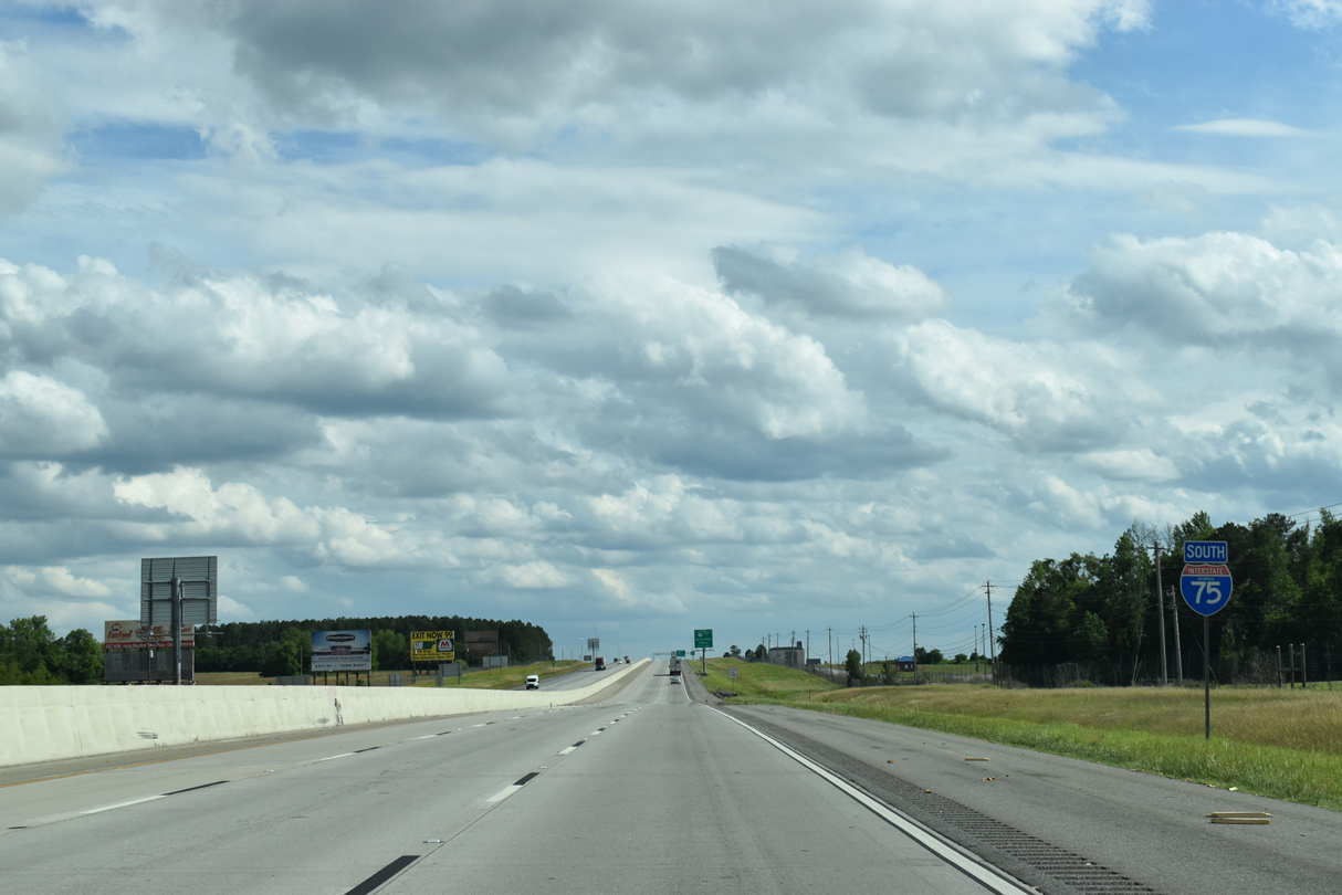
| The first of four Cordele exits on Interstate 75 is the diamond interchange (Exit 104) with Farmers Market Road near Crisp Motorsports Park. 09/11/20 |
|
| Farmers Market Road links U.S. 41/SR 7-90 to the west of Exit 104 with SR 257 at Tremont Road to the east. 09/11/20 |
|
| An empty space on this overhead for Exit 104 alludes to the former status of Farmers Market Road west as Business Loop I-75. The business route for I-75 followed the rural road west to U.S. 41 south into Downtown. U.S. 280 returned the loop east to I-75 at Exit 101. 09/11/20 |
|
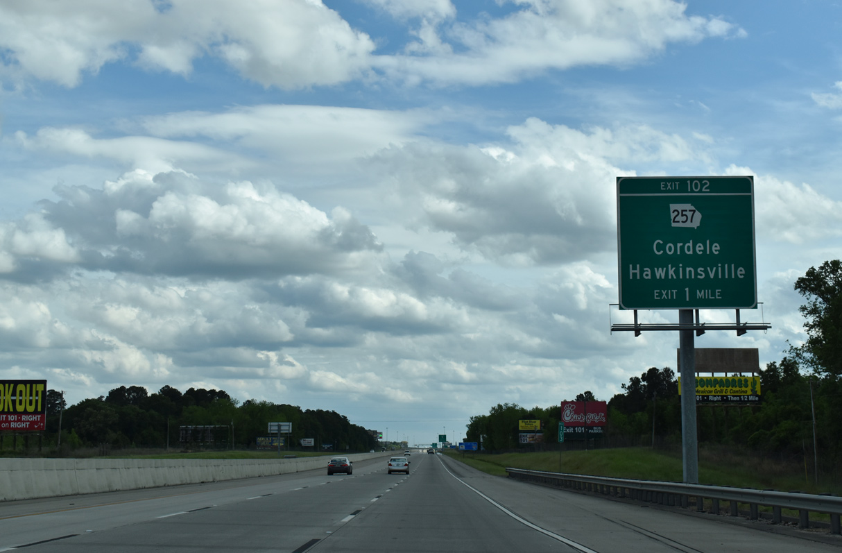
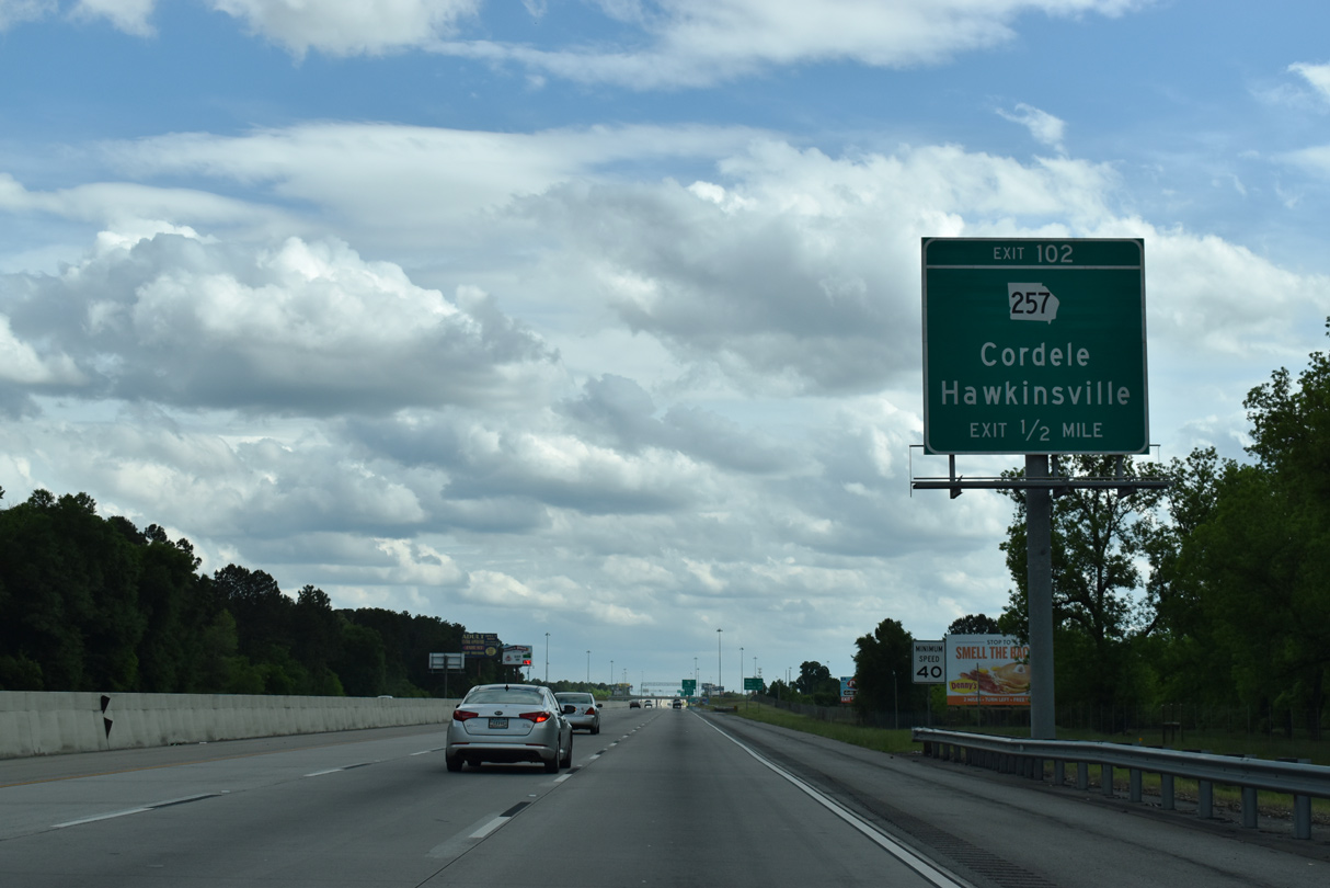
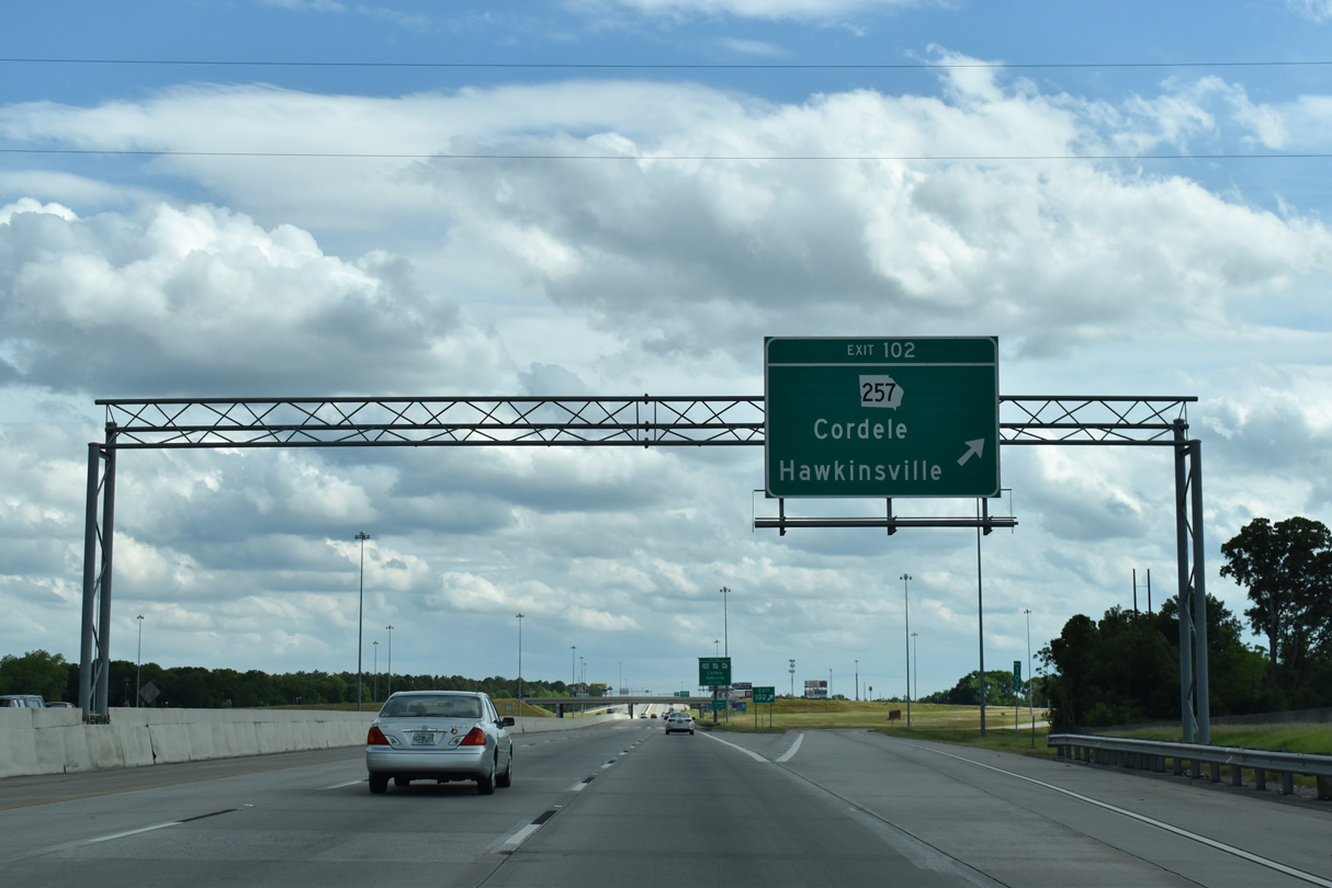
| SR 257 continues 2.40 miles south from Farmers Market Road to conclude at a diamond interchange (Exit 102) with Interstate 75. 09/11/20 |
|
| Reassurance marker posted by the stub end of Blackshear Road near Crisp County-Cordele Airport (CKF). 09/11/20 |
|
| E 8th Avenue extends 1.65 miles west from I-75 and SR 257 to U.S. 41/SR 7-90 (N 7th Street) in Cordele. 09/11/20 |
|
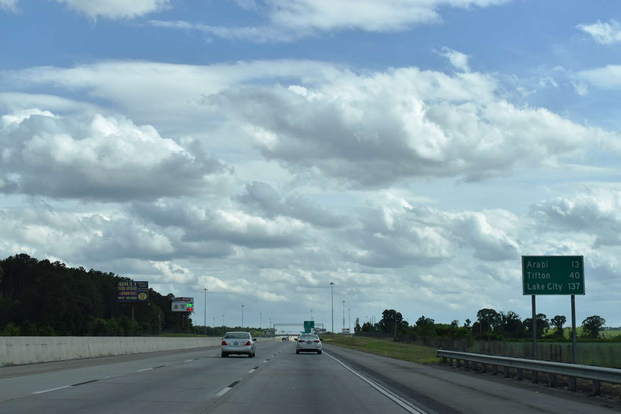
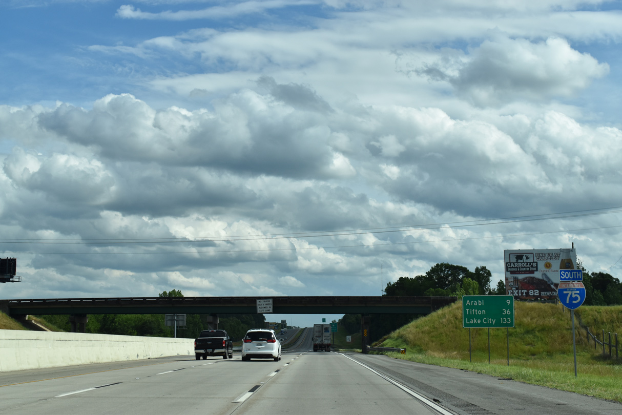
| Tifton and Lake City, Florida debut on this distance sign posted 13 miles north of Arabi. Valdosta returns on signs beyond Arabi. 09/11/20 |
|
| SR 257 travels 69.17 miles northeast from Exit 102 to Hawkinsville and Dublin. 09/11/20 |
|
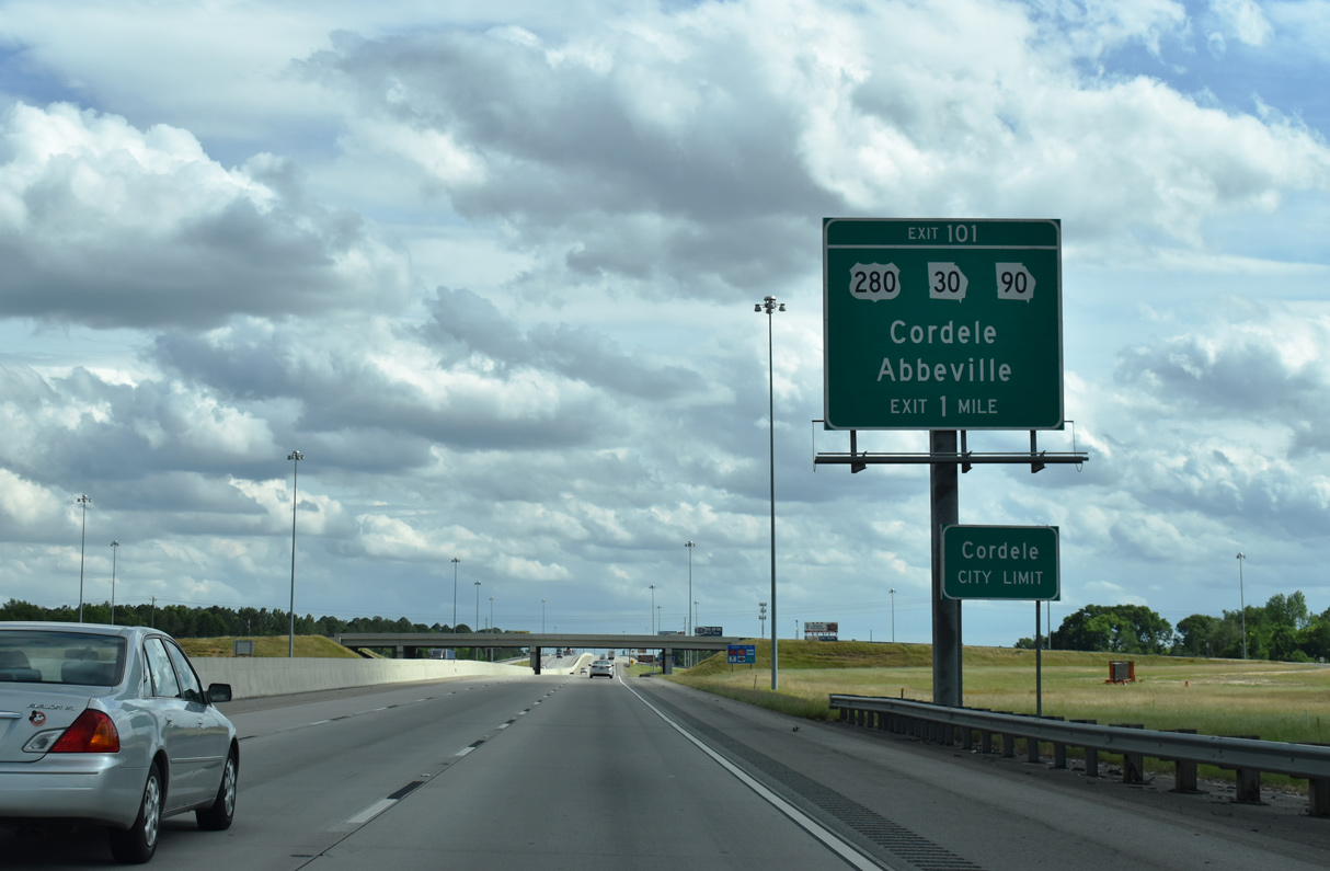
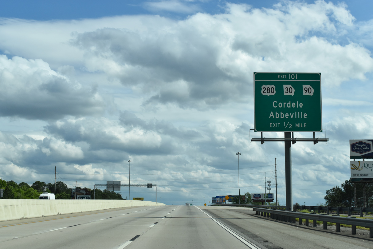
| U.S. 280, SR 30-90 and Business Loop I-75 overlap along E 16th Avenue from U.S. 41 (7th Street) to a commercialized diamond interchange (Exit 101) with I-75. 09/11/20 |
|
| U.S. 280/SR 30 join Cordele with the Wilcox County seat of Abbeville, 27 miles to the east. SR 90 partitions with the pair just to the east of Exit 101 for a southerly course 14 miles to SR 159 and 21 miles to Rebecca. 09/11/20 |
|
| I-75 spans a CSX Railroad line just ahead of Exit 101 to U.S. 280/SR 30-90 (16th Avenue). West from Cordele, U.S. 280/SR 30 head to Georgia Veterans State Park along Lake Blackshear and Americus, home of Georgia Southwestern State University. 09/11/20 |
|
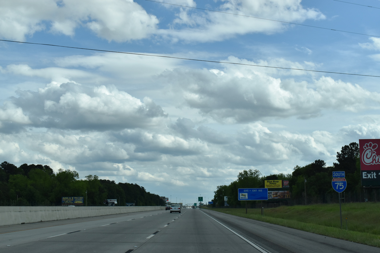
| An array of motorists services line U.S. 280, SR 30-90 and Business Loop I-75 within the vicinity of Exit 101. U.S. 280 goes for 392 miles from Birmingham, Alabama east to U.S. 80 at Blitchton. 09/11/20 |
|
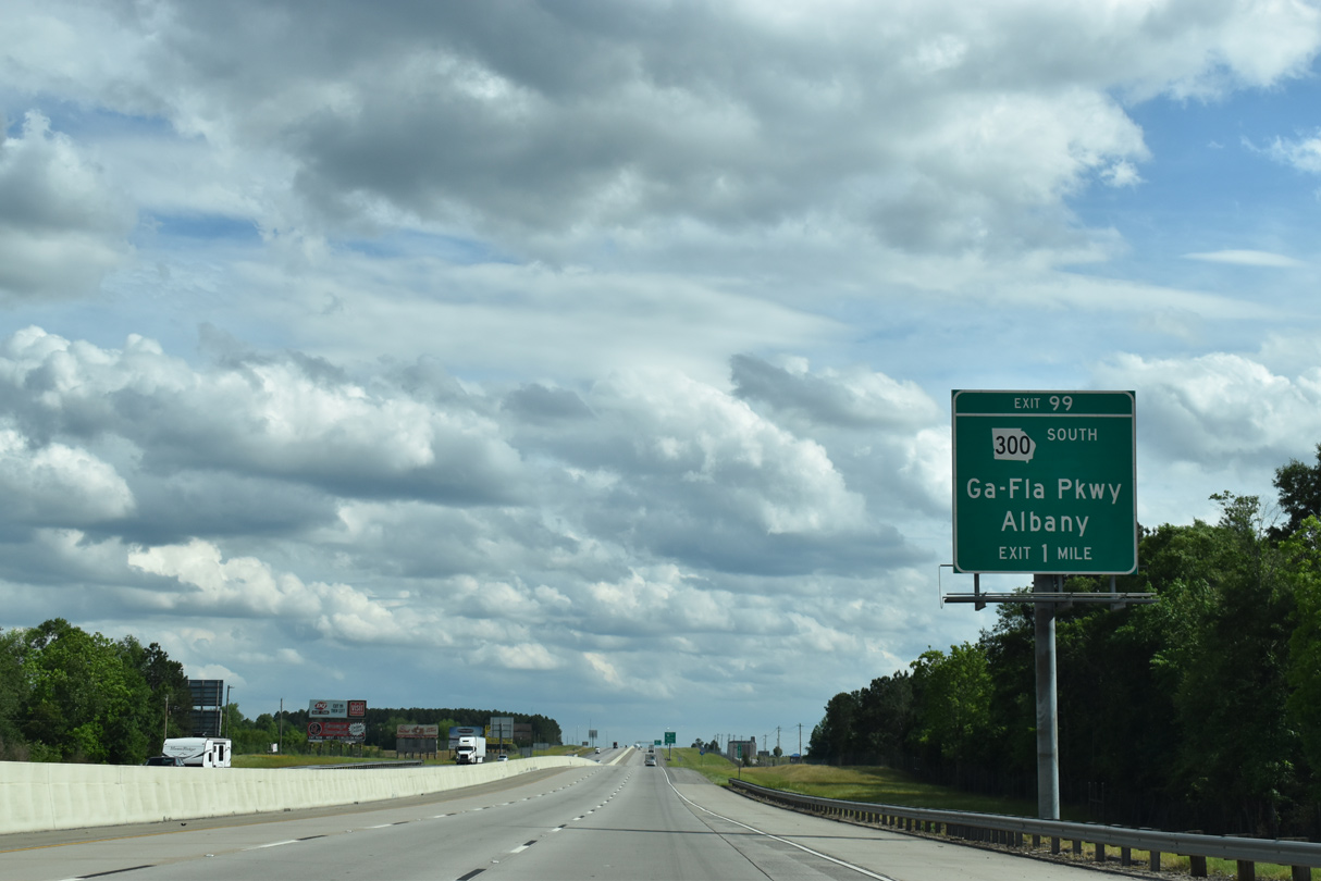
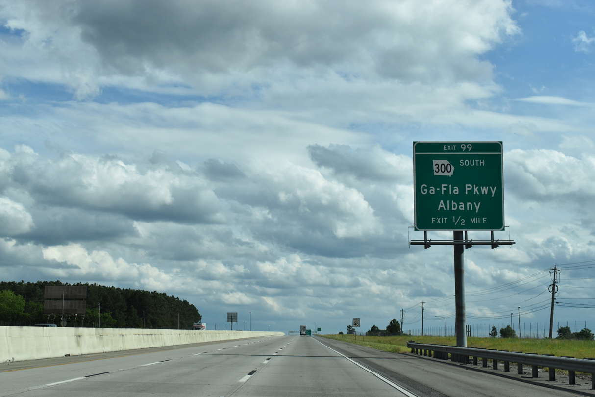
| SR 300, the Georgia-Florida Parkway, begins at Exit 99 from Interstate 75. Mostly a four lane, divided highway, SR 300 travels 36.65 miles southwest from I-75 to U.S. 19/82 at Albany. 04/18/20 |
|
| A frontage road accompanies the west side of Interstate 75 from 24th Avenue to Kelly Road and SR 300 (Georgia-Florida Parkway). 04/18/20 |
|
| A diamond interchange (Exit 99) joins I-75 with SR 300 south and SR 300 Extension, a county maintained roadway linking Georgia-Florida Parkway with SR 90, 0.70 miles to the east. 04/18/20 |
|
| SR 300 replaced SR 257 southwest from Cordele. Georgia Florida Parkway represents a downgraded version of the planned Interstate 175 linking I-75 with Albany.1SR 300 (Georgia Florida Parkway) extends south alongside U.S. 19 to Camilla, Thomasville and the Florida state line north of Monticello.
04/18/20 |
|
| Old Hatley Road spans I-75 south of this confirming marker. Pine Hills Country Club spreads to the east. 04/18/20 |
|
| I-75 leaves Cordele and reaches Arabi in nine miles and Tifton in 36 miles. Lake City, Florida is two hours away. 08/07/13 |
|
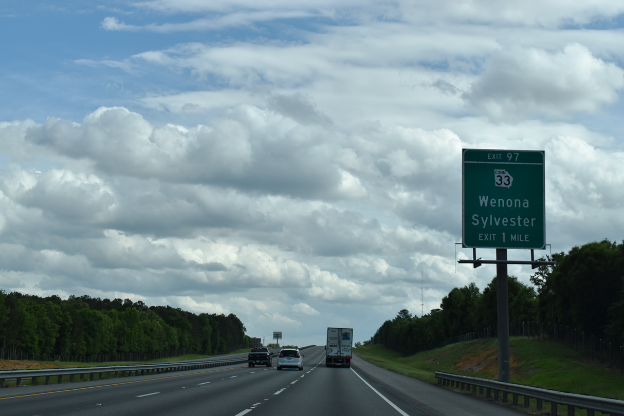
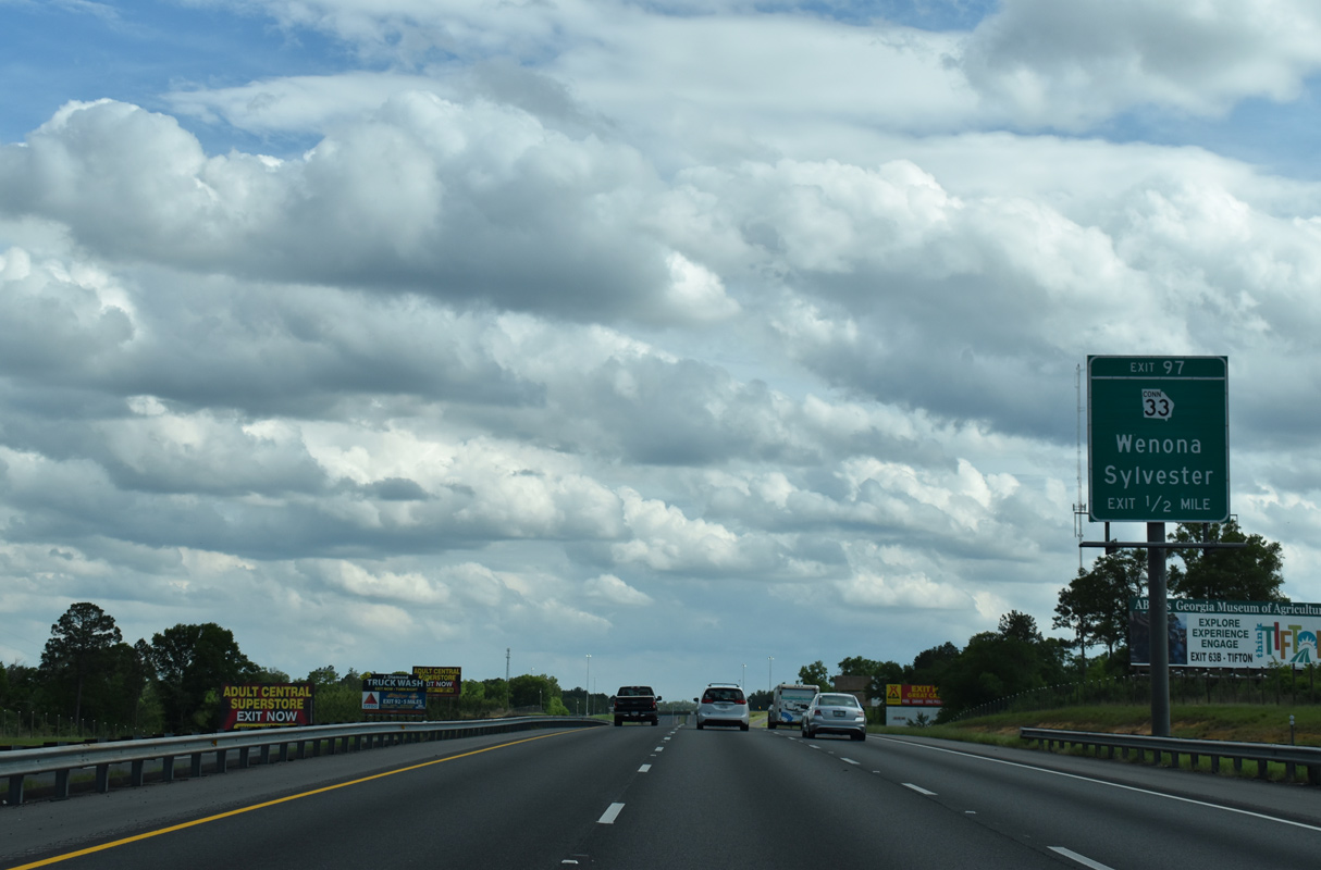
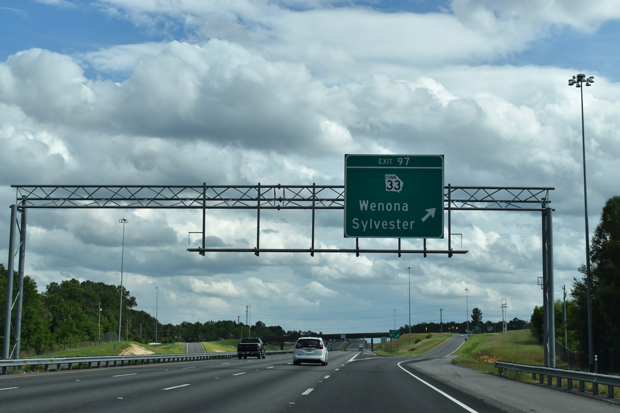
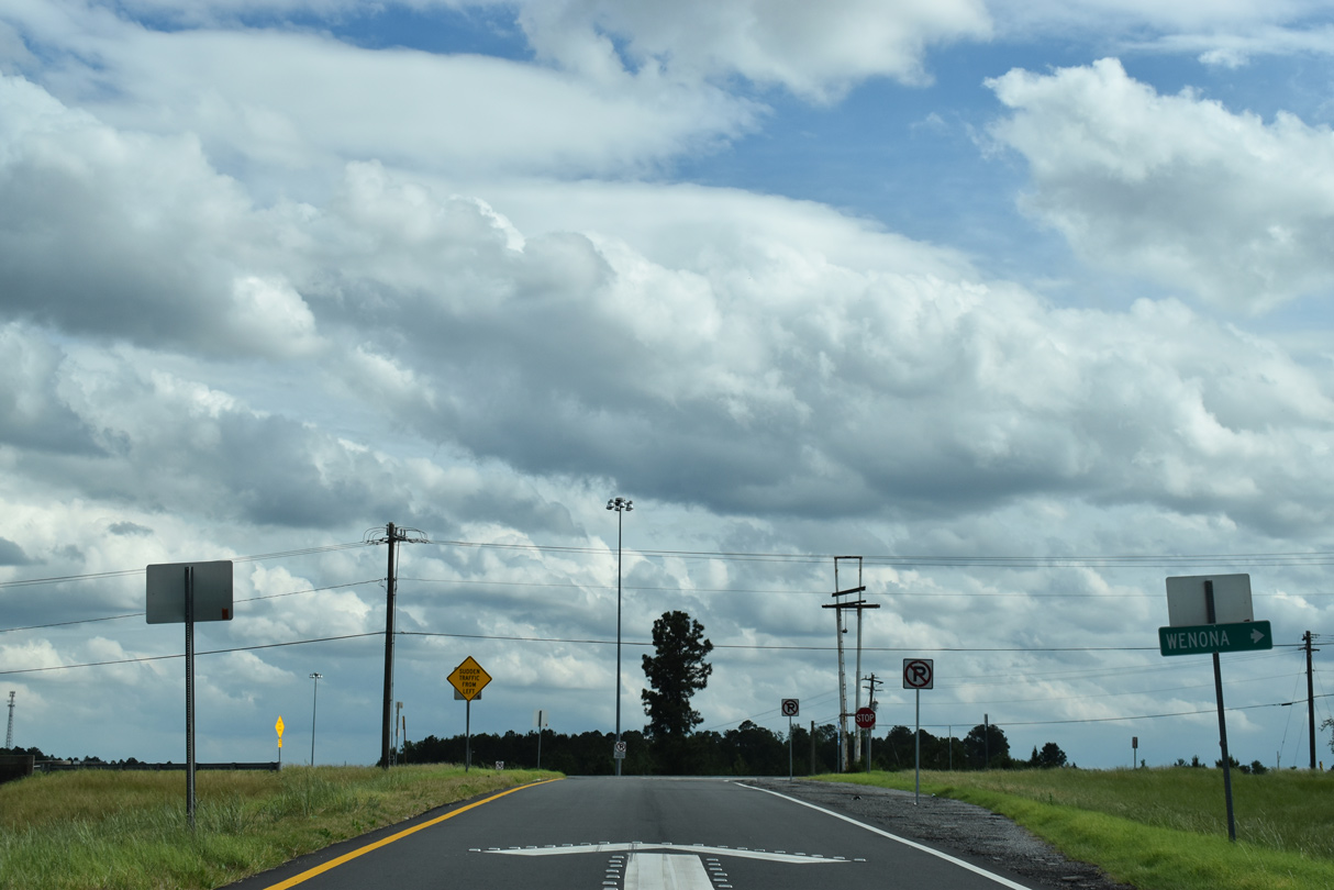
| SR 33CO (Rockhouse Road) links Interstate 75 with U.S. 41/SR 7 and SR 33 at Wenona. 04/18/20 |
|
| Rockhouse Road extends east from Exit 97 as an unpaved road to Rockhouse Road East, which leads 2.15 miles north to Old Hatley Road and SR 90. 04/18/20 |
|
| Southbound at the diamond interchange (Exit 97) with SR 33CO west. An 81.29 mile long highway, SR 33 branches south from U.S. 41 at Wenona to Sylvester, Moultrie and U.S. 84 at Boston. 04/18/20 |
|
| SR 33CO runs 1.78 miles west from I-75 to SR 33 at Wenona. 04/18/20 |
|
| Continuing southward, Interstate 75 passes areas of open farm land and pockets of forest through southern Crisp County. 08/07/13 |
|
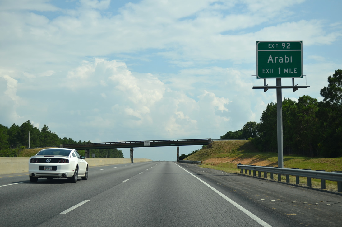
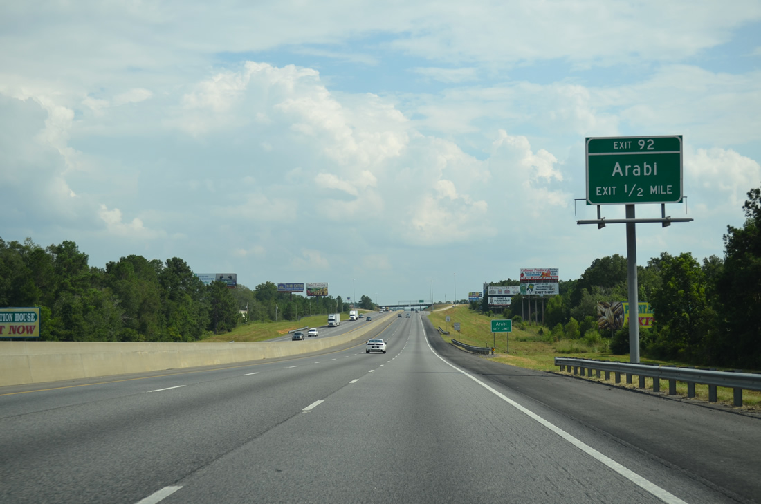
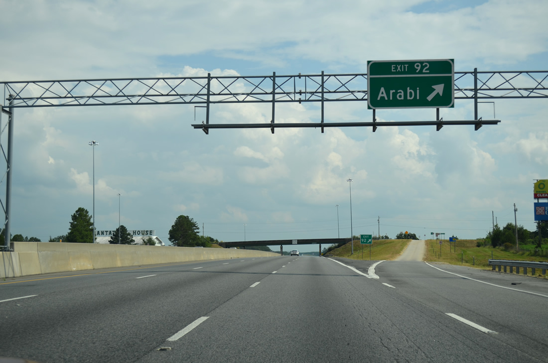
| I-75 enters the town of Arabi at forthcoming Exit 92 with 1st Street. 08/07/13 |
|
| 1st Street leads 1.85 miles east from U.S. 41/SR 7 (Bedgood Avenue) in Arabi to the diamond interchange at Exit 92 and adjacent Hawpond Road at Amboy Road. 08/07/13 |
|
| Hawpond Road extends 5.76 miles east from 1st Street and the Arabi town limits to agricultural areas and SR 90. U.S. 41/SR 7 remain to the west from Arabi south to Dakota and Worth. 08/07/13 |
|
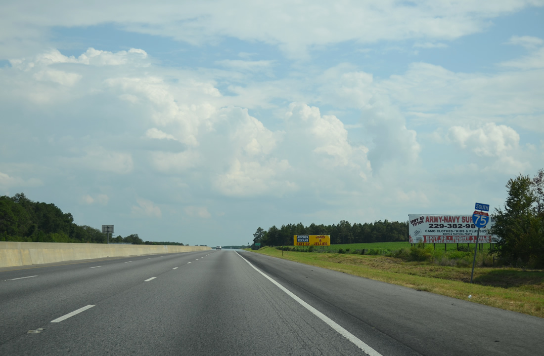
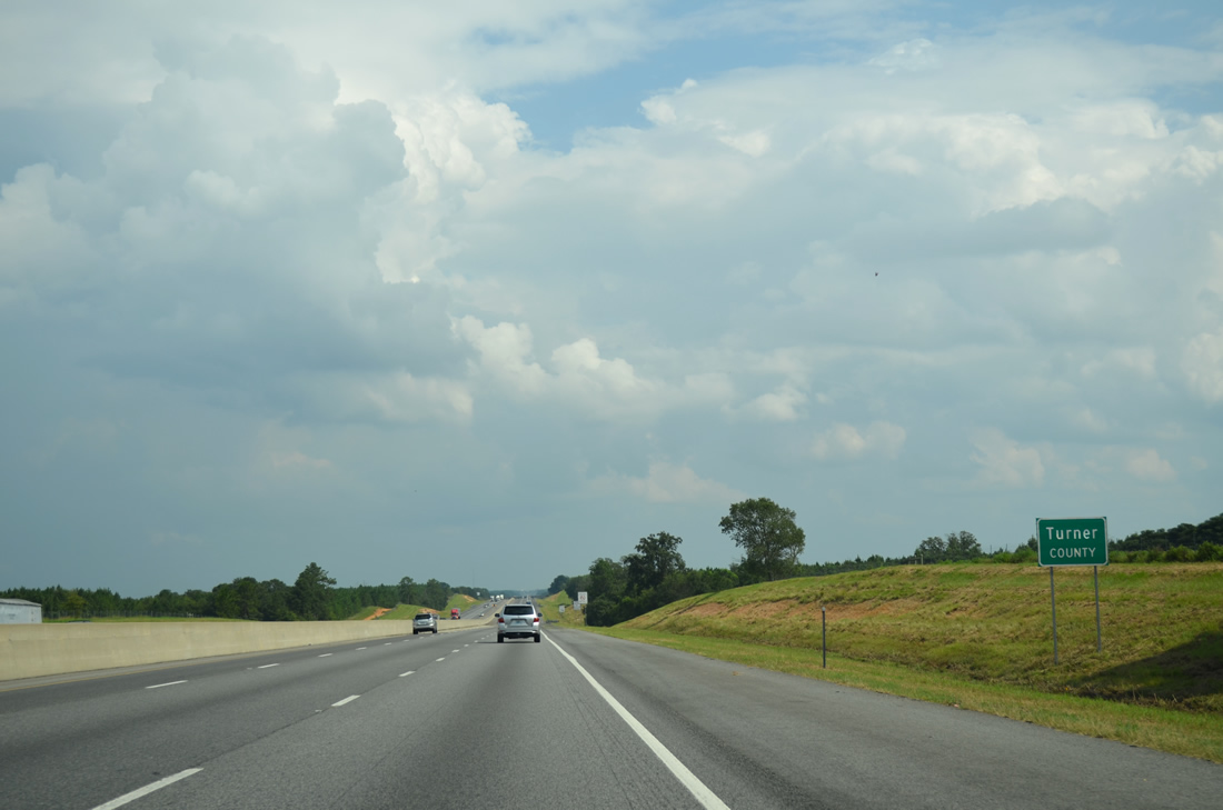
| Interstate 75 remains south through the town limits of Arabi to the Turner County line. 08/07/13 |
|
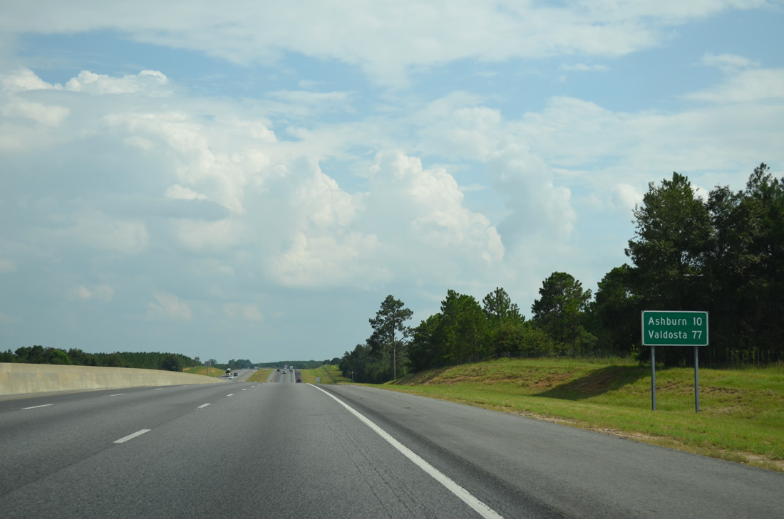
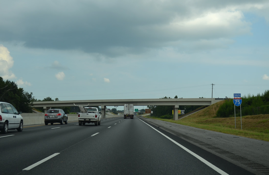
| The Turner County seat of Ashburn is ten miles further south along Interstate 75. Valdosta reappears on distance signs at 77 miles out. 08/07/13 |
|
| Interstate 75 and parallel Mann Road enter Turner County just east of the Norfolk Southern Railroad siding of Sibley. 08/07/13 |
|
| Unpaved Alberson Road spans I-75 east from U.S. 41/SR 7 at Dakota. A large pecan orchard lies along both Alberson Road to the north and I-75 to the west along this stretch. 08/07/13 |
|
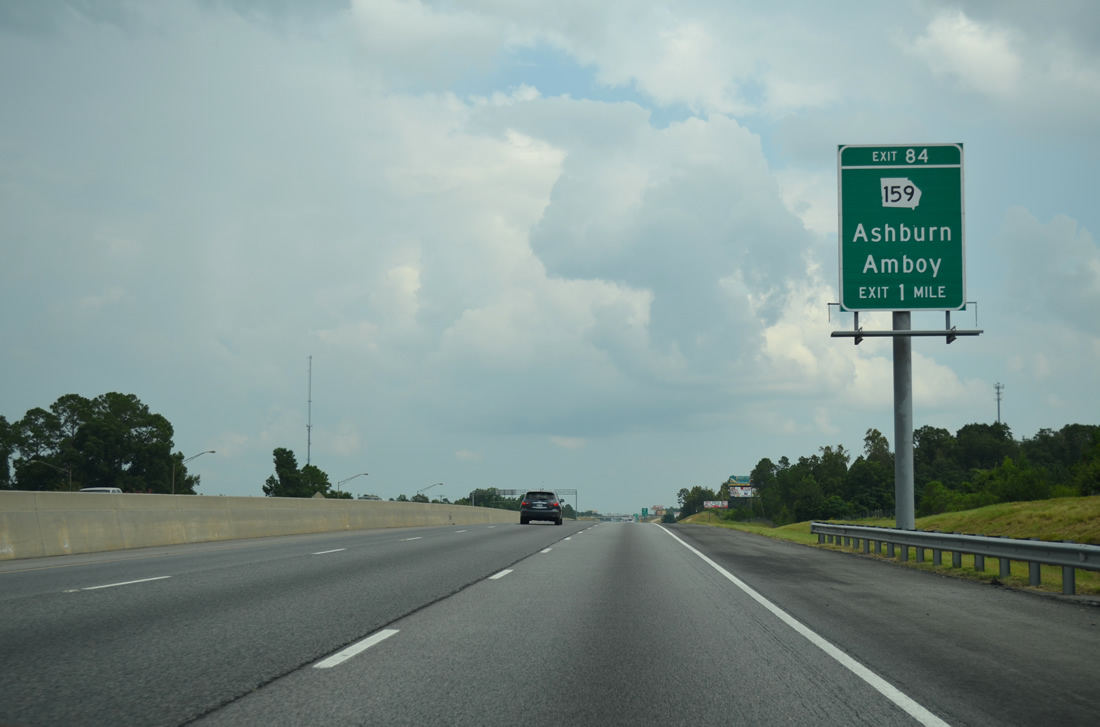
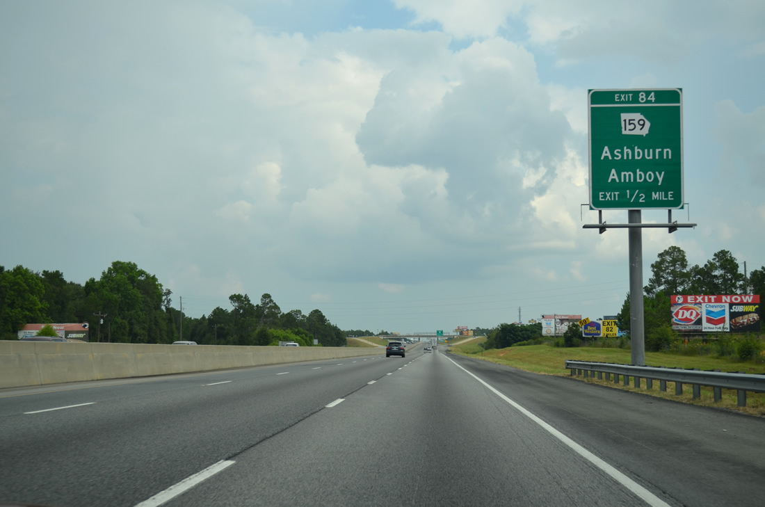
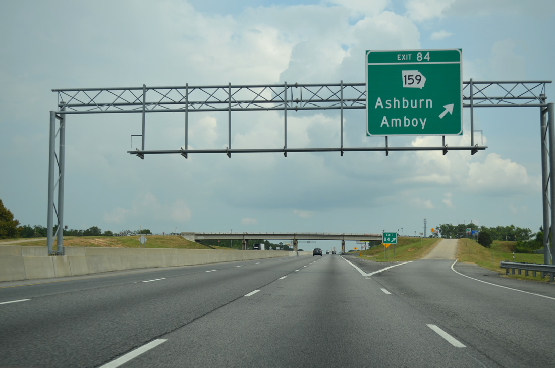
| SR 159, a 18.85 mile long route from Pitts to Ashburn, crosses paths with Interstate 75 at Exit 84. 08/07/13 |
|
| The Ashburn city limits spread north to the exchange with SR 159. SR 159 enters the municipality along North Street. 08/07/13 |
|
| SR 159 concludes 2.2 miles south of the diamond interchange with I-75 at U.S. 41/SR 7 (Main Street) just outside the Ashburn city center. The unincorporated community of Amboy is 5.7 miles to the northeast along SR 159. 08/07/13 |
|
| Interstate 75 runs along the east side of Ashburn south on the succeeding 2.6 miles south from SR 159. 08/07/13 |
|
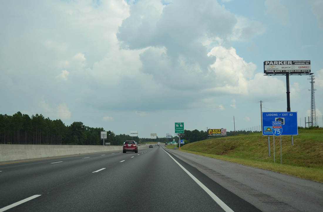
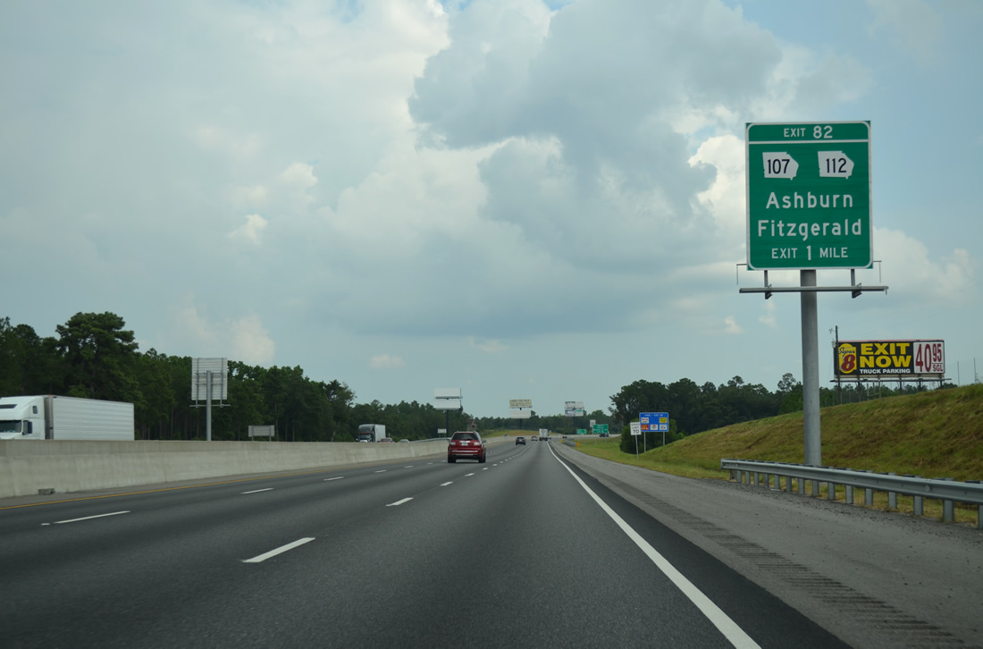
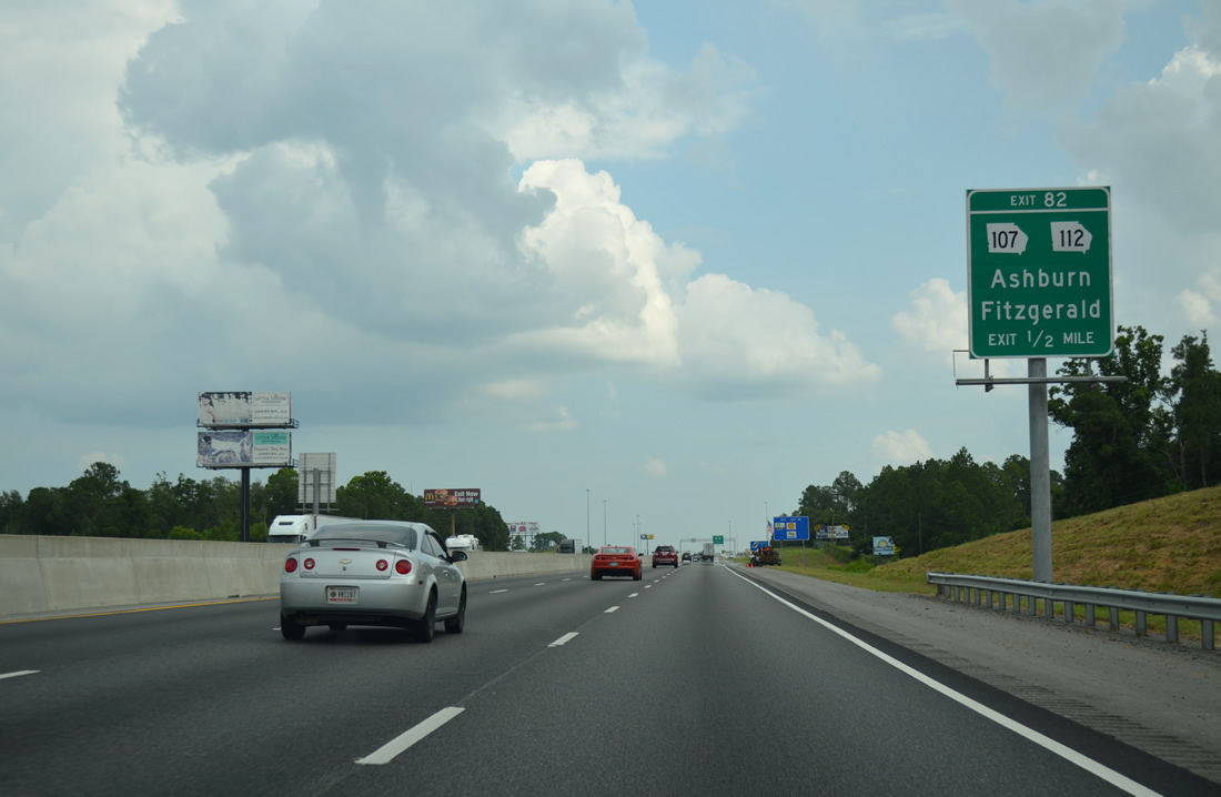
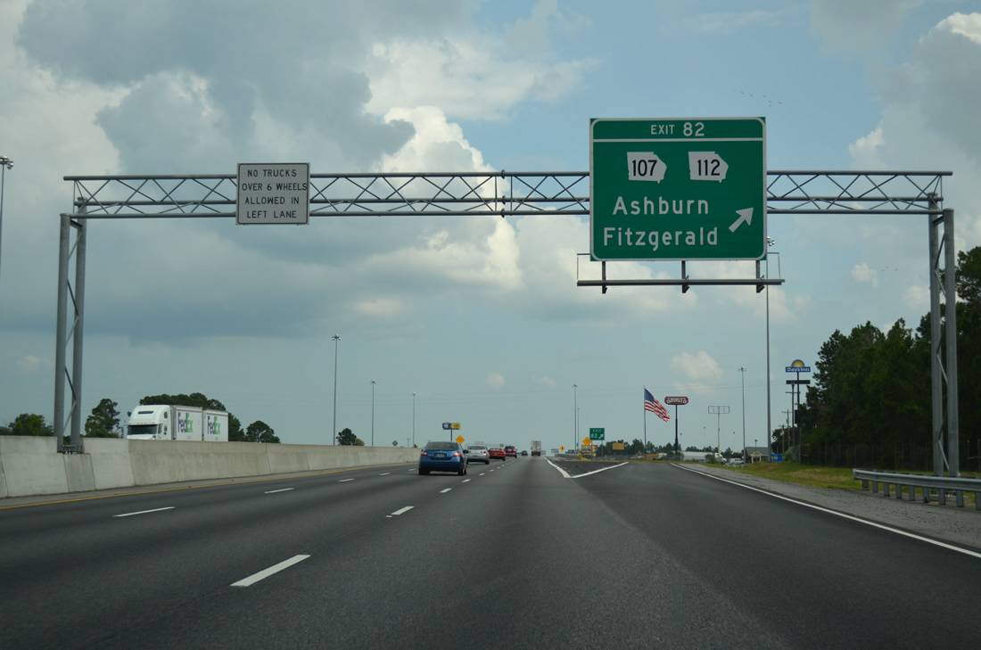
| Forthcoming Exit 82 connects I-75 south with SR 112 (Washington Street) west to Downtown Ashburn and the beginning of SR 107 east to the Ben Hill County seat of Fitzgerald. 08/07/13 |
|
| Tifton is 21 miles away while Valdosta remains an hour's drive. 08/07/13 |
|
| SR 107/112 overlap 3.3 miles east from I-75 and Ashburn before splitting on respectively paths to Fitzgerald and Rebecca. SR 107 runs 61.96 miles from Exit 82 to U.S. 221 in Jeff Davis County. 08/07/13 |
|
| Exit 82 leaves Interstate 75 south for SR 107/112 east and SR 112 (Washington Avenue) west. SR 112 travels 189.92 miles overall from SR 243/540 (Fall Line freeway) south of Milledgeville to U.S. 84/SR 38 at Cairo in Southwest Georgia. 08/07/13 |
|
| Sylvia Drive accompanies the west side of Interstate 75 south to Rock House Road near Turner County Airport (75J). 08/07/13 |
|
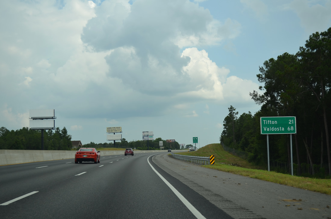
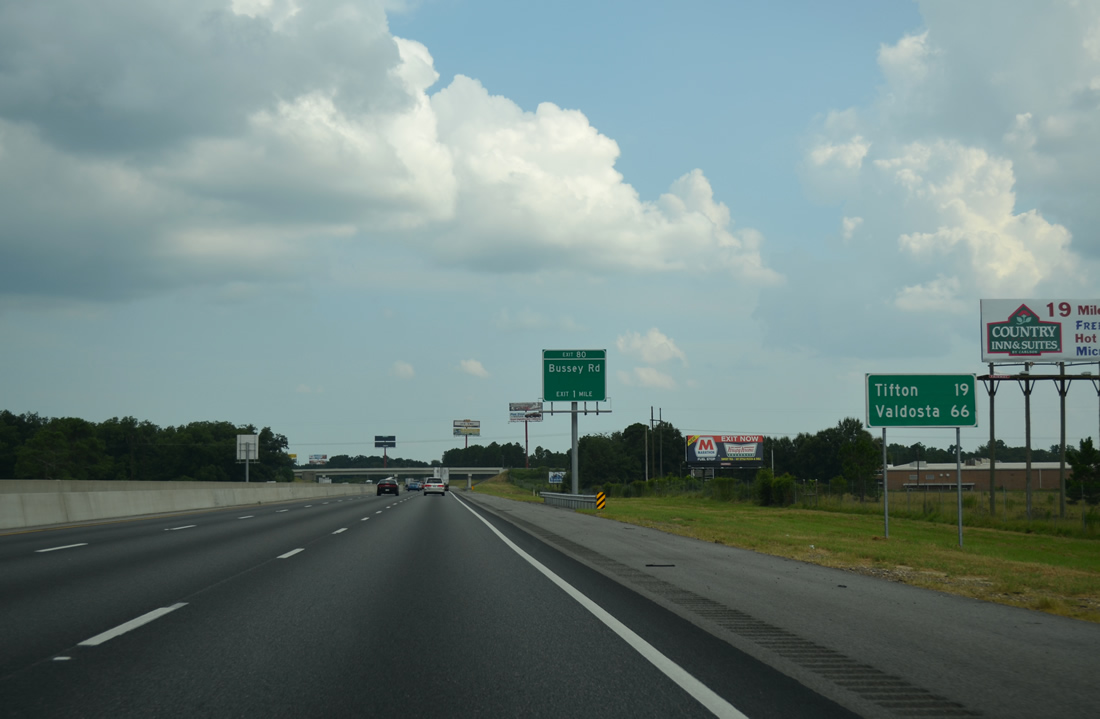
| Southbound distance sign posted 19 miles north of Tifton and 66 miles from Valdosta. 08/07/13 |
|
| The city of Sycamore lies south of Ashburn and Turner County Airport (75J) and west of Exit 80 along U.S. 41/SR 7-32. 08/07/13 |
|
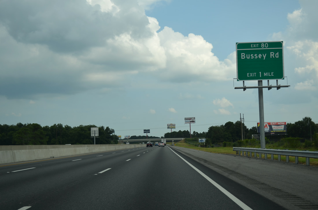
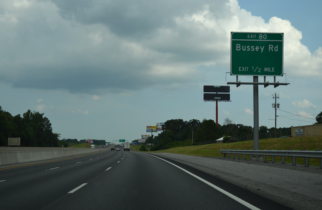
| Bussey Road leads 1.18 miles west from Exit 80 to U.S. 41/SR 7-32 at Collins Street in Sycamore. 08/07/13 |
|
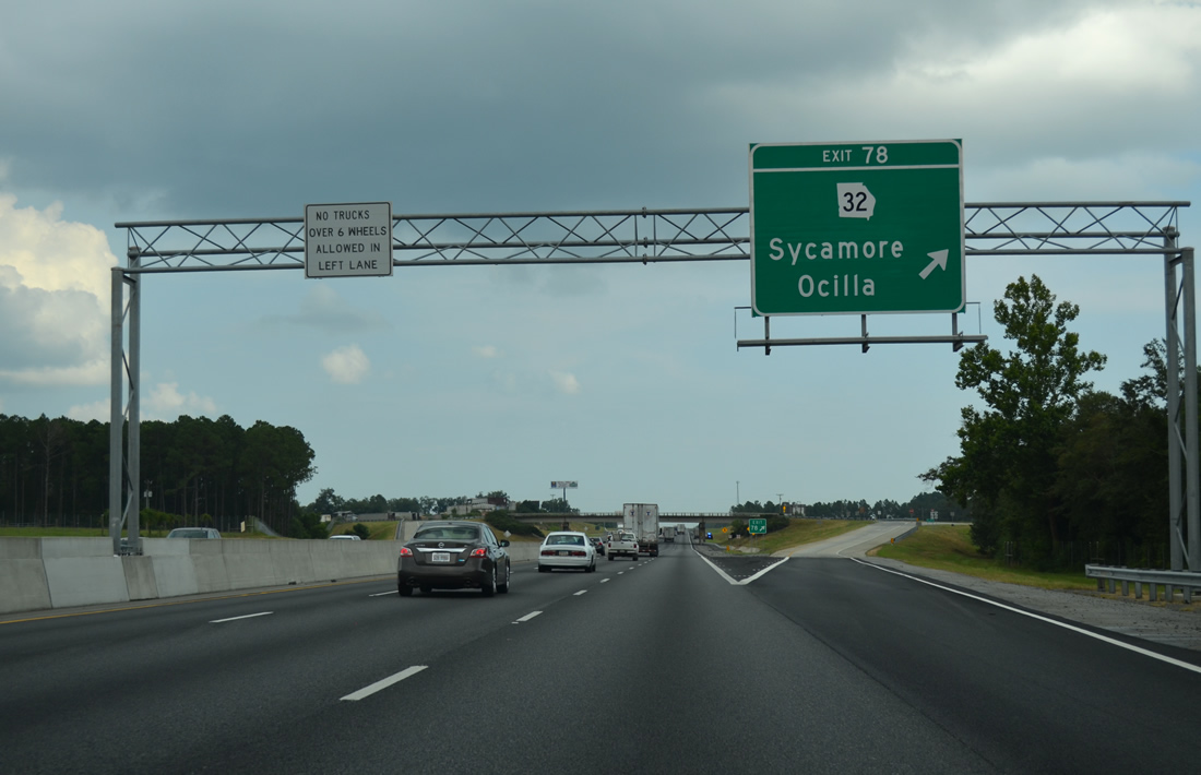
| The diamond interchange (Exit 80) with Bussey Road lies 1.25 miles north of SR 32, which branches east from U.S. 41/SR 7 in Sycamore to the Irwin County seat of Ocilla. 08/07/13 |
|
| SR 32 stretches 189.08 miles across South Georgia from SR 45/520 in Dawson east to Leesburg, Ashburn, Douglas and U.S. 25/341-SR 99 north of Brunswick. 08/07/13 |
|
| Denham Road spans the freeway beyond this shield assembly. The rural highway becomes Willis Street in Sycamore to the west. 08/07/13 |
|
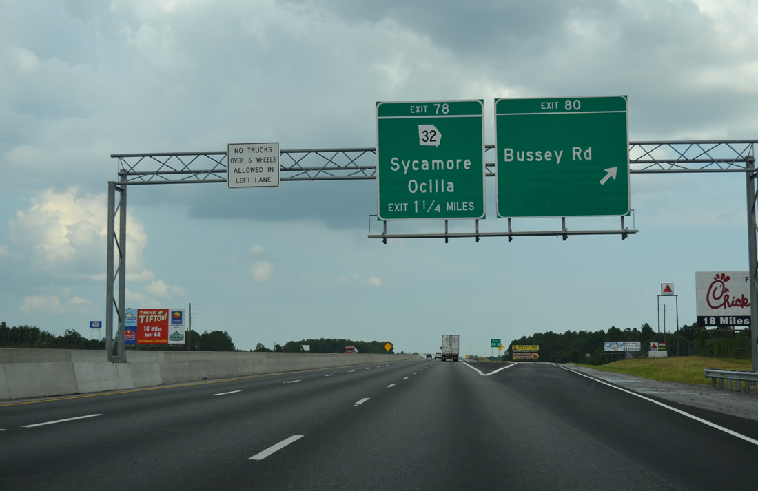
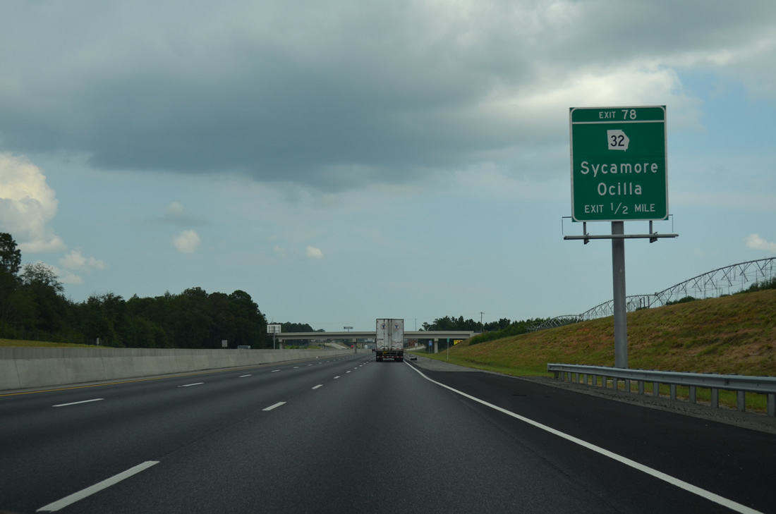
| SR 32 combines with U.S. 41/SR 7 north at Sycamore in 1.5 miles. East from Exit 78, SR 32 continues 26.6 miles to U.S. 319 in Ocilla. 08/07/13 |
|
| Interstate 75 parallels Hat Creek south to the Tift County line through agricultural areas. 08/07/13 |
|
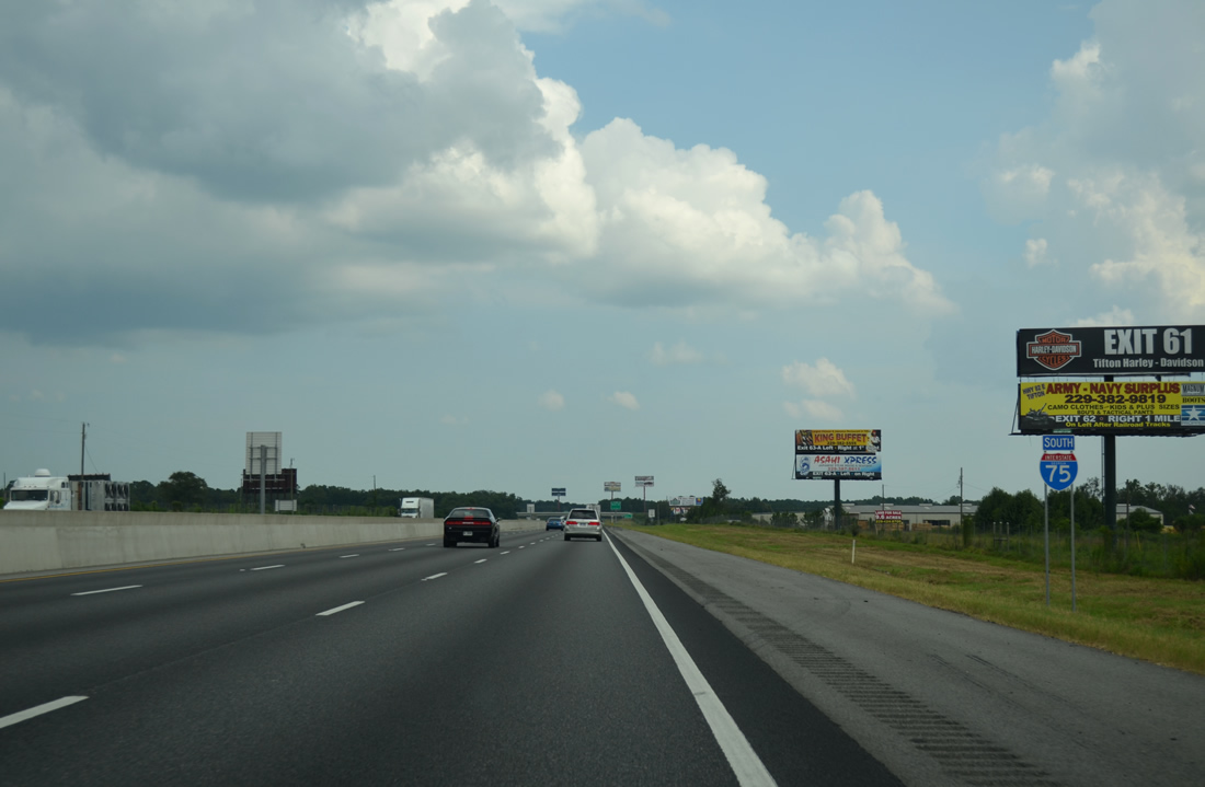
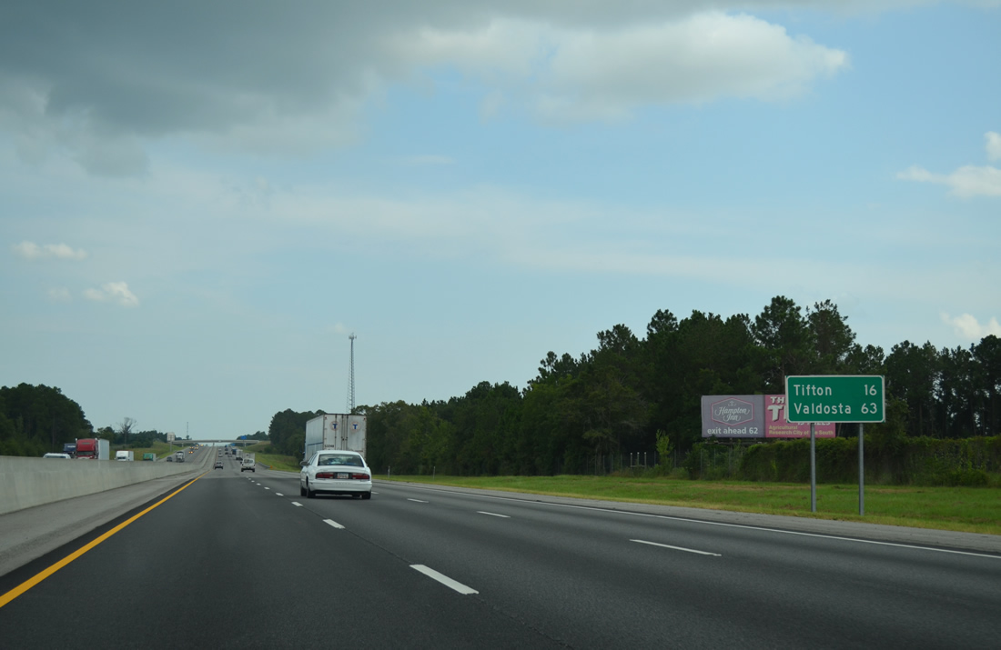
| The Tift County seat of Tifton is 16 miles away while Valdosta is another 47 miles further south. 08/07/13 |
|
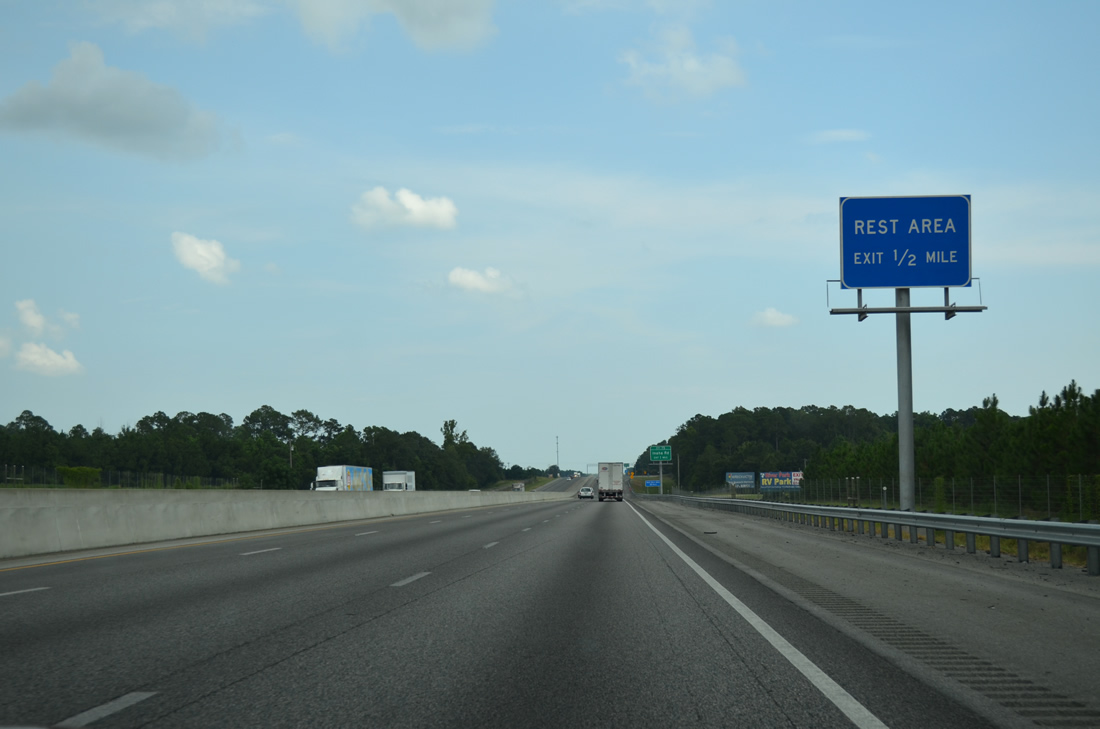
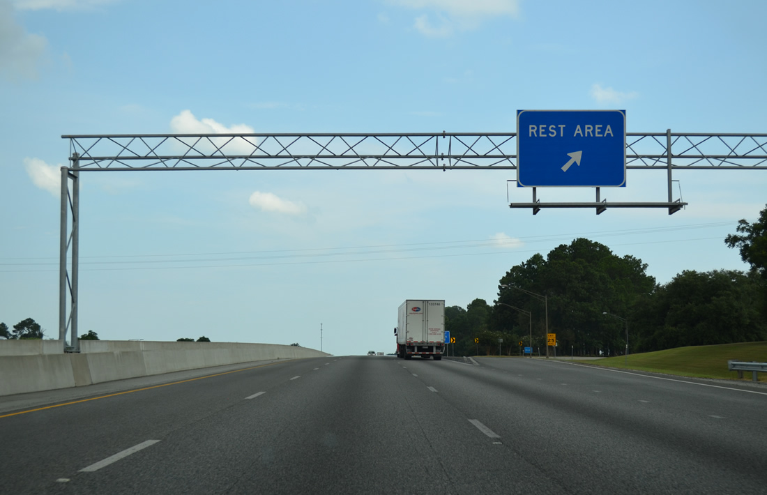
| The penultimate rest area along Interstate 75 south is located at milepost 76.3. 08/07/13 |
|
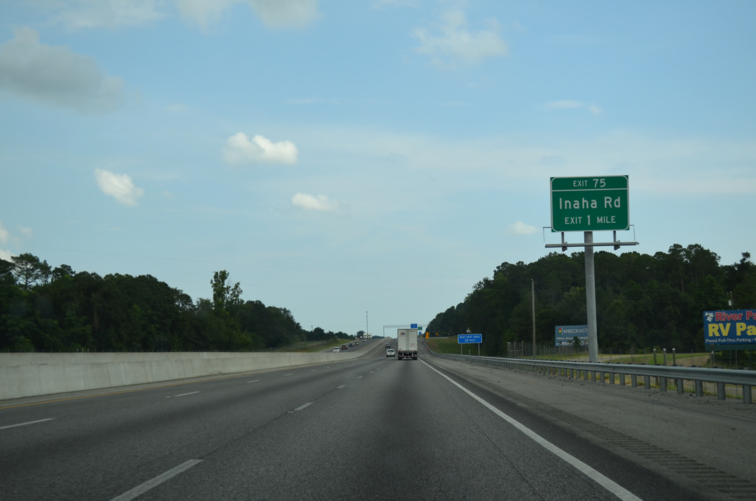
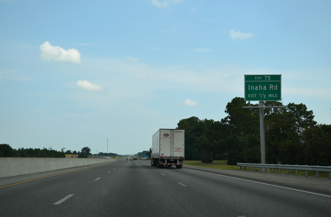
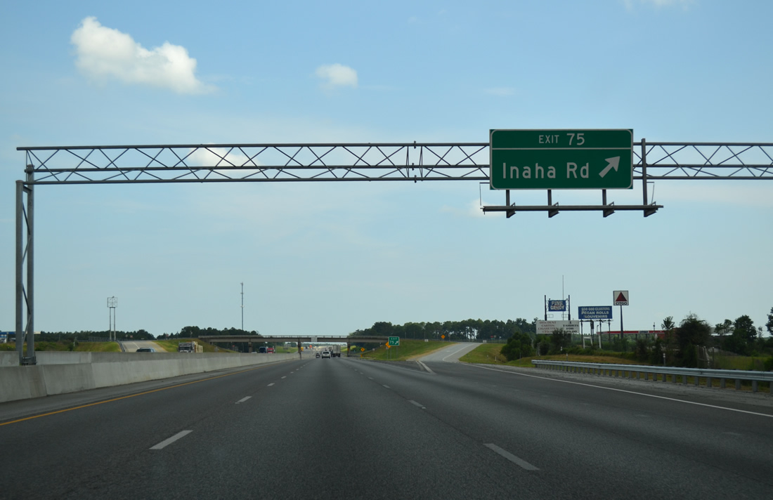
| Inaha Road and Interstate 75 come together at a diamond interchange (Exit 75) in one mile. 08/07/13 |
|
| Rest Area #9 lies 28.3 miles north of Rest Area #6 in Cook County. 08/07/13 |
|
| Inaha Road links I-75 with U.S. 41/SR 7 at the Norfolk Southern Railroad siding of Inaha, 1.92 miles to the west. 08/07/13 |
|
| Inaha Road extends another 2.1 miles east from the diamond interchange at Exit 75 across farm land to Searcy Road. 08/07/13 |
|
| 34,940 vehicles per day (vpd) were recorded by GDOT on the stretch of Interstate 75 between Exit 75 and 71 in 2012. 08/07/13 |
|
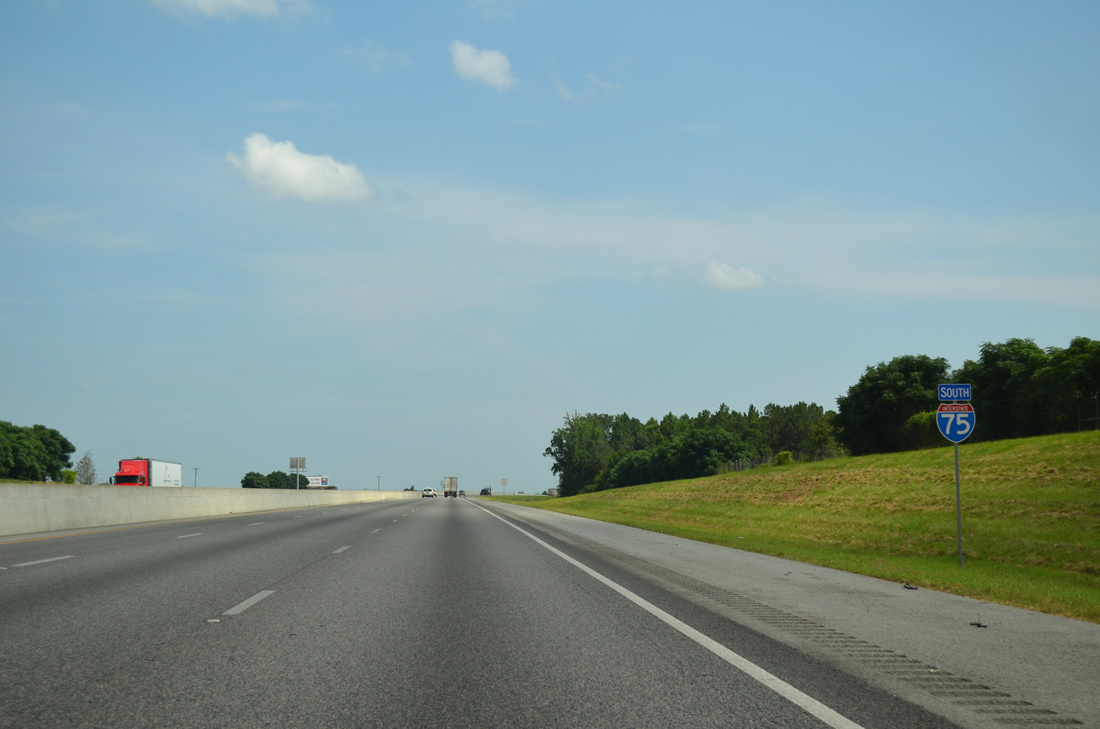
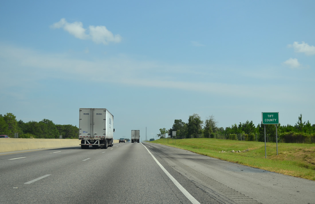
| Entering Tift County, the third to last county along Interstate 75 south in Georgia. 08/07/13 |
Page Updated 06-11-2021.

 South
South