|
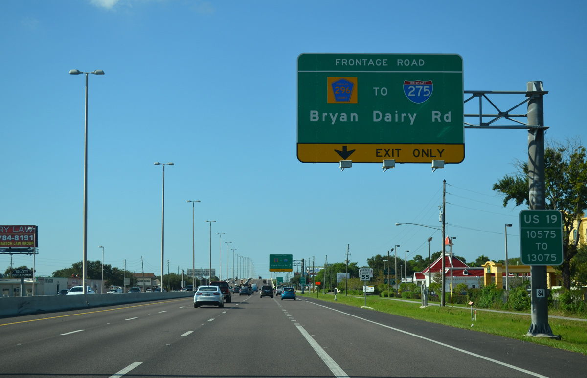
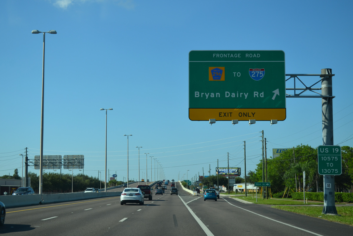
| The freeway portion of U.S. 19 north through Pinellas County commences at the diamond interchange with Bryan Dairy Road (County Road 296). Providing local access to area businesses and side streets, a frontage road system starts at 52nd Street N. 10/07/15 |
|
| U.S. 19 was upgraded at Bryan Dairy Road by 2008. CR 296 provides a direct route to Interstate 275 at the exchange with SR 686 (Roosevelt Boulevard). 10/07/15 |
|
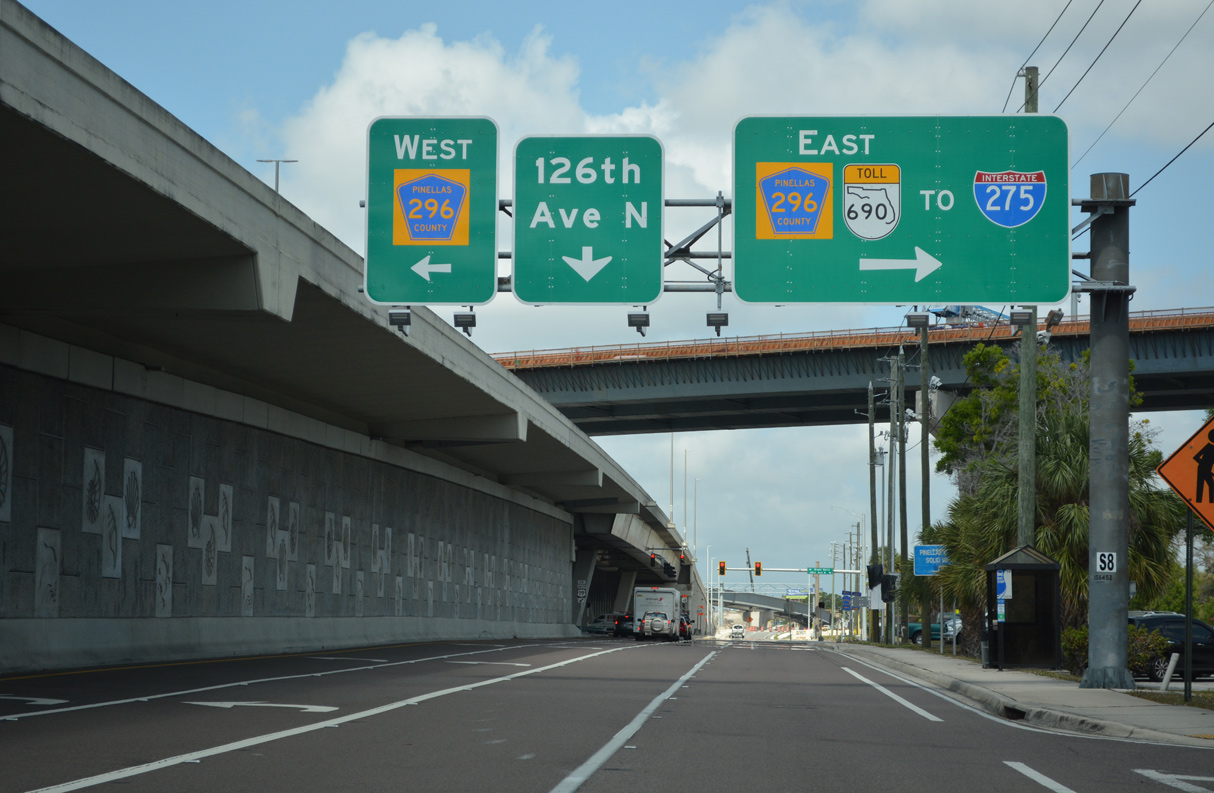
| Construction from September 2017 to late 2023 adds the elevated Gateway Expressway (SR 690) paralleling CR 296 east to I-275. 03/07/23 |
|
| A slip ramp provides return access to U.S. 19 from CR 296 (118th Avenue N). CR 296 extends west from the freeway to a SPUI with SR 693 (66th Street N) while en route to the city of Seminole. 08/24/13 |
|
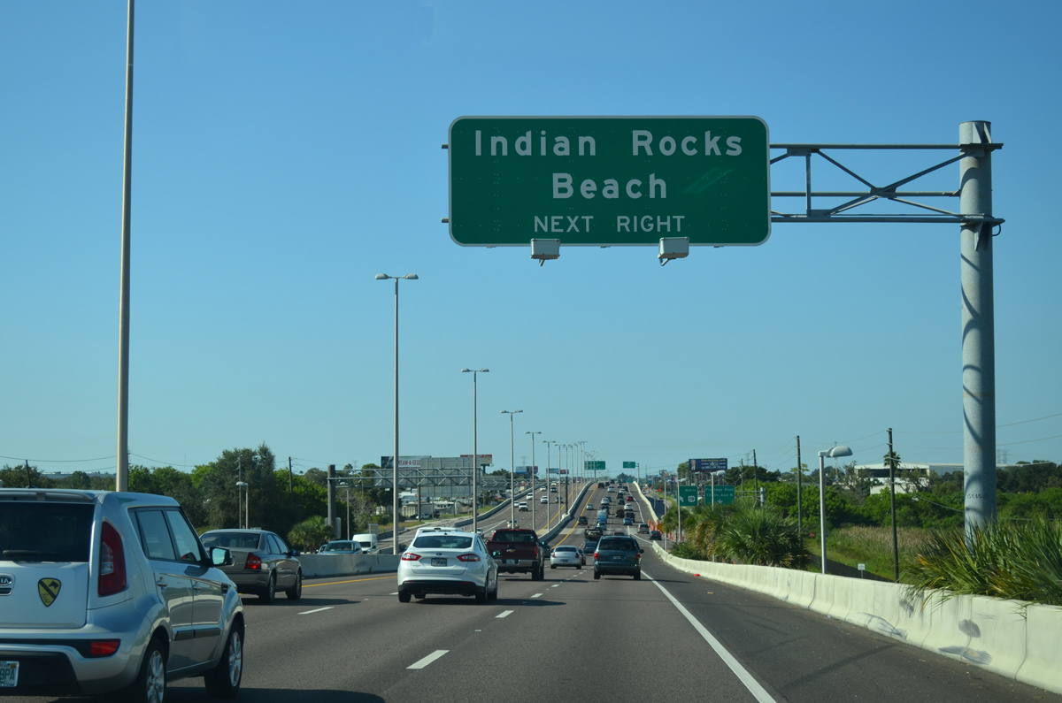
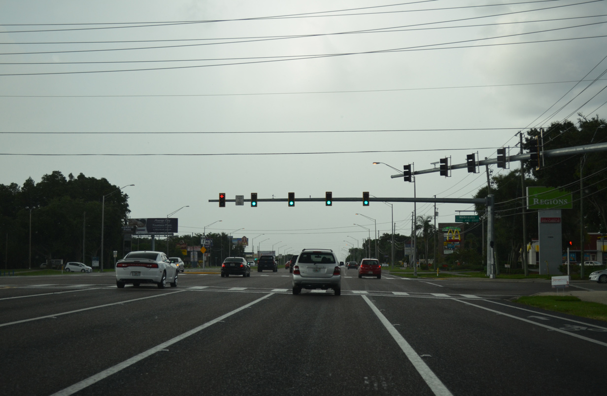
| The next exit along U.S. 19 north joins the freeway with SR 688 (Ulmerton Road), a 12.91 mile route from Indian Rocks Beach to north St. Petersburg. 10/07/15 |
|
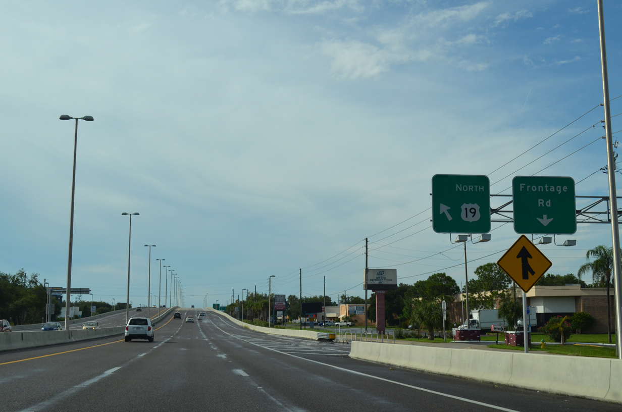
| The adjacent frontage road advances north from CR 296 (Bryan Dairy Road) to 126th Avenue N at Hartsfield Industrial Park. 08/24/13 |
|
| A single point urban interchange (SPUI) joins U.S. 19 with SR 688 (Ulmerton Road). Ulmerton Road comprises a busy six to eight lane commercial arterial across northern reaches of Pinellas Park. 10/07/15 |
|
| A slip ramp joins the adjacent frontage road ahead of SR 688 (Ulmerton Road) west to Largo and Anona and east to St. Petersburg-Clearwater International Airport (PIE) and Feather Sound outside St. Petersburg. 10/07/15 |
|
| Guide signs posted at the U.S. 19 northbound frontage road intersection with SR 688 (Ulmerton Road). Ulmerton Road represents a heavily traveled commuter route east to the Howard Frankland Bridge (I-275). Widening of the arterial in 2007-08 expanded SR 688 up to eight lanes. 01/02/06 |
|
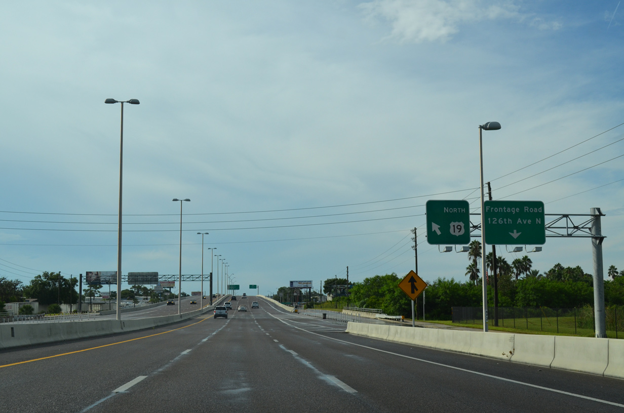
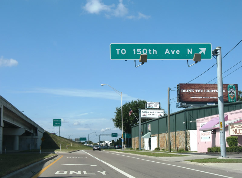
| Advancing north, U.S. 19 converges with the north end of SR 693 (66th Street N) at a diamond interchange. The succeeding exit connects with 150th Avenue N east to High Point. 08/24/13 |
|
| U.S. 19 overtakes SR 693 (66th Street N) on a northerly heading to SR 686 (Roosevelt Boulevard east / East Bay Drive west). 150th Avenue is a discontinuous road at U.S. 19. It is a local street west to a pair of mobile home parks and east to Pinellas Technical College and CR 611. 10/07/15 |
|
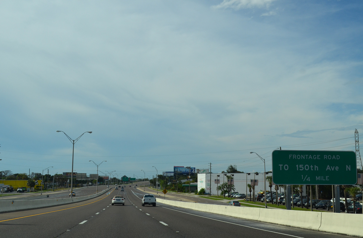
| The U.S. 19 frontage road continues a short distance to 150th Avenue N beyond the entrance from SR 693. 150th Avenue N also joins the freeway with the 62nd Street N industrial area. 10/22/07 |
|
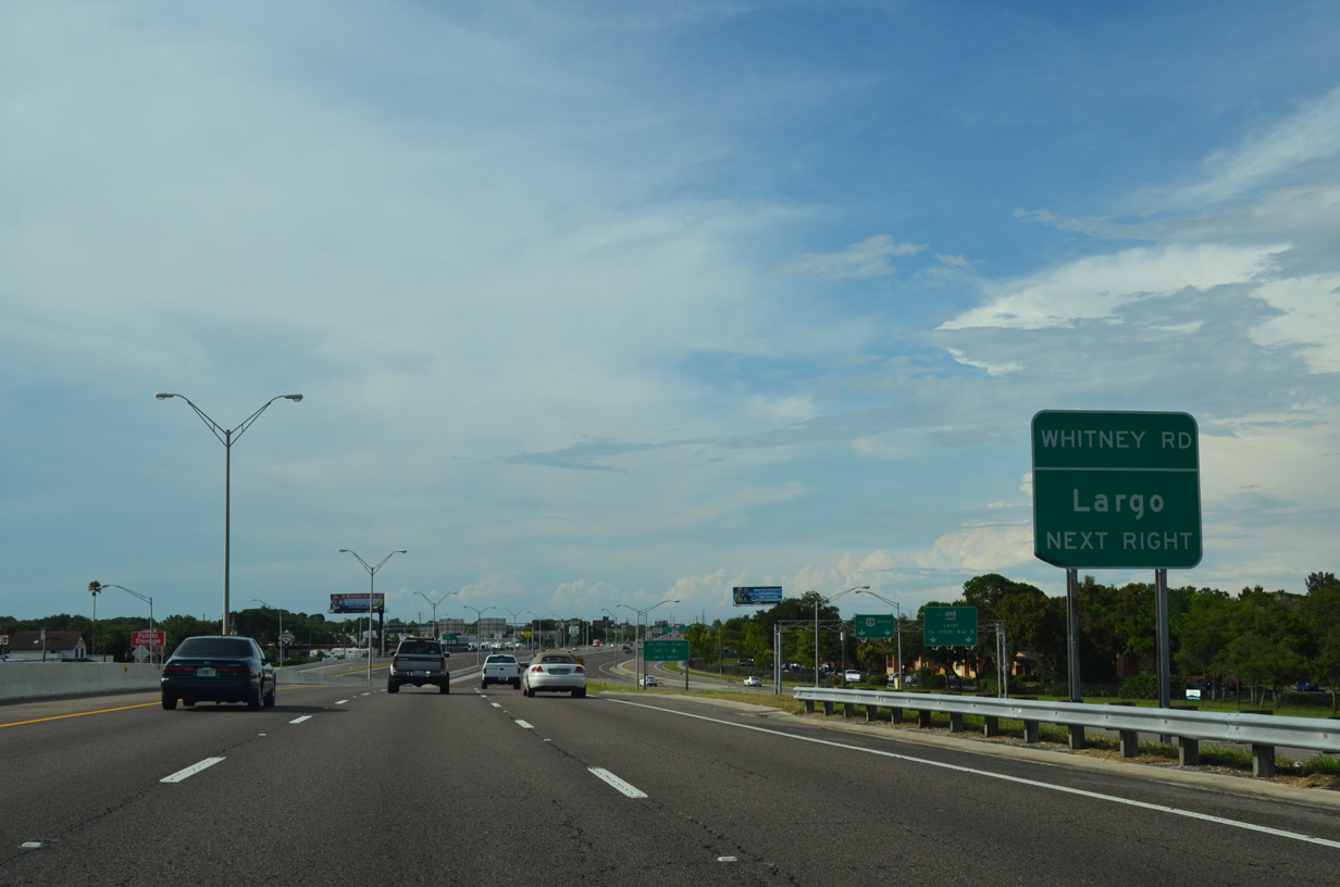
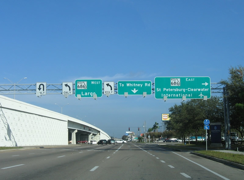
| SR 686 (East Bay Drive) runs west from U.S. 19 toward Largo city hall and U.S. 19 Alternate (Seminole Boulevard). Whitney Road stems east from the frontage road beyond SR 686 to a number of subdivisions off Old Tampa Bay. 08/24/13 |
|
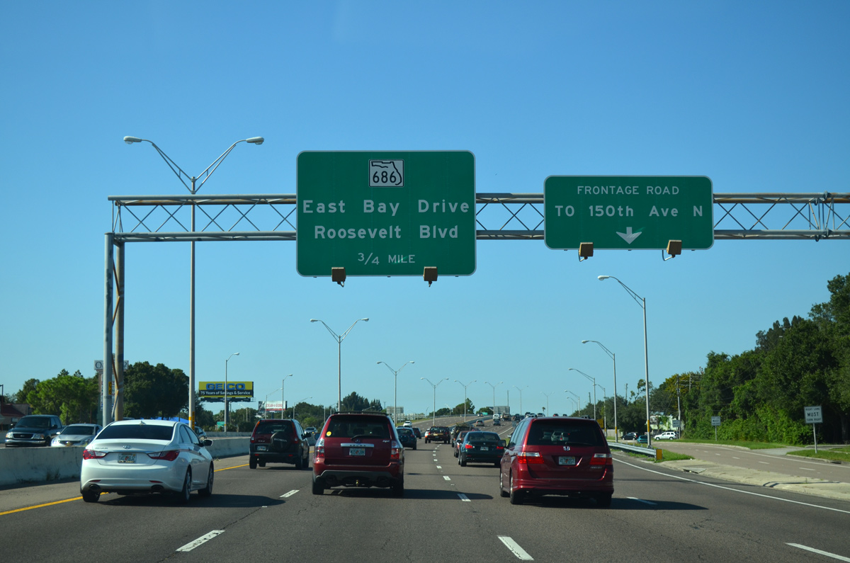
| Two lanes part ways with U.S. 19 for SR 686. The state road stretches 10.82 miles east from U.S. 19A in Largo to SR 694 (Gandy Boulevard) in north St. Petersburg. The majority of the route is a commercial arterial. 08/24/13 |
|
| Sign bridge spanning the U.S. 19 frontage road at SR 686 (Roosevelt Boulevard east / East Bay Drive west) in Largo. West Bay Drive ultimately leads to Belleair Shore along Causeway Boulevard. Aforementioned Whitney Road lies one half mile north along the frontage road. 01/02/06 |
|
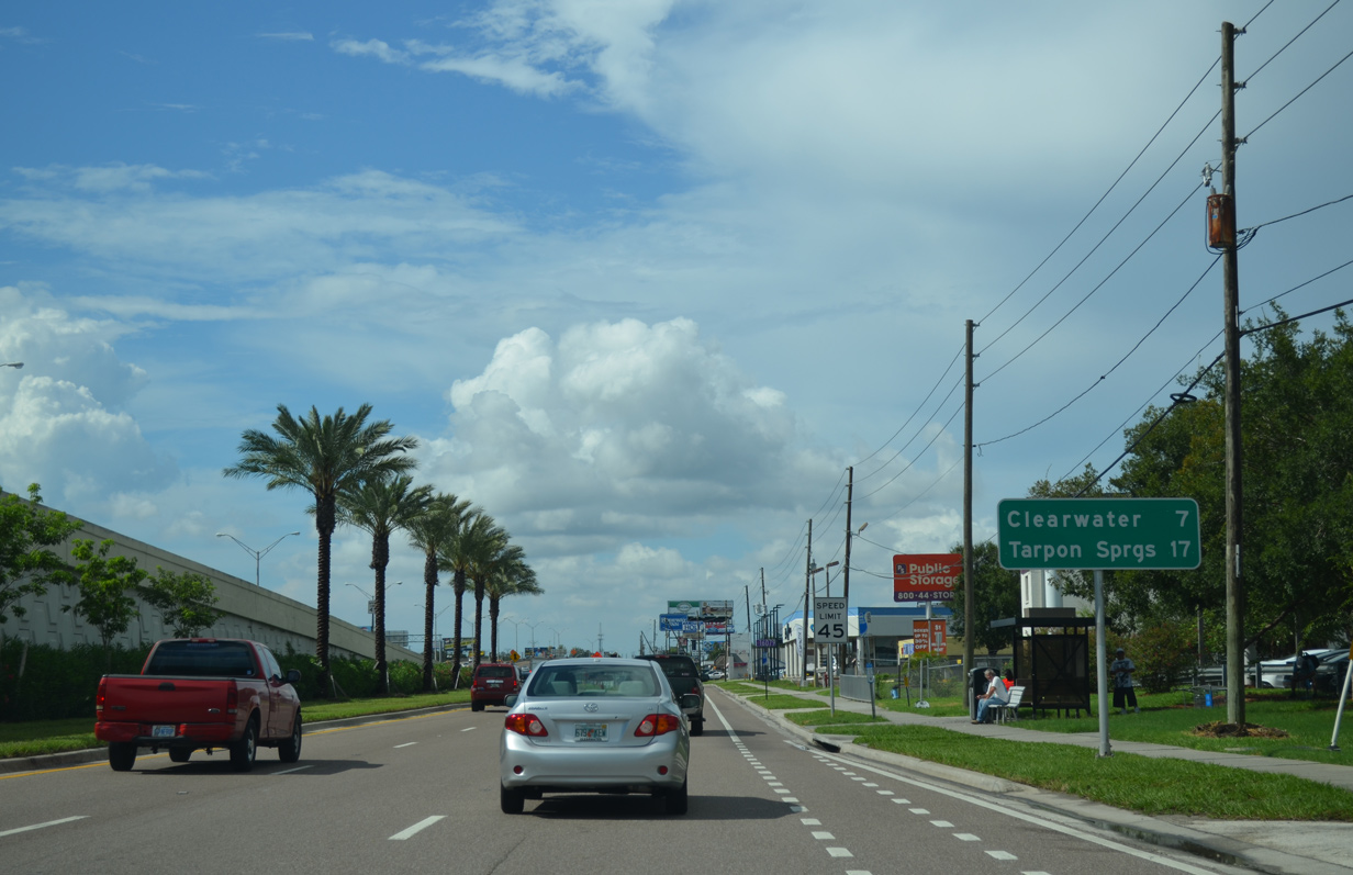
| Nearing the return ramp to U.S. 19 northbound at a distance sign that includes Tarpon Springs, the last Pinellas County city before the highway enters Pasco County. 08/15/15 |
|
| Continuing north, the U.S. 19 freeway passes by Haines Bayshore Road east to Cove Cay Golf Club off Largo Inlet and Old Tampa Bay. 11/15/16 |
|
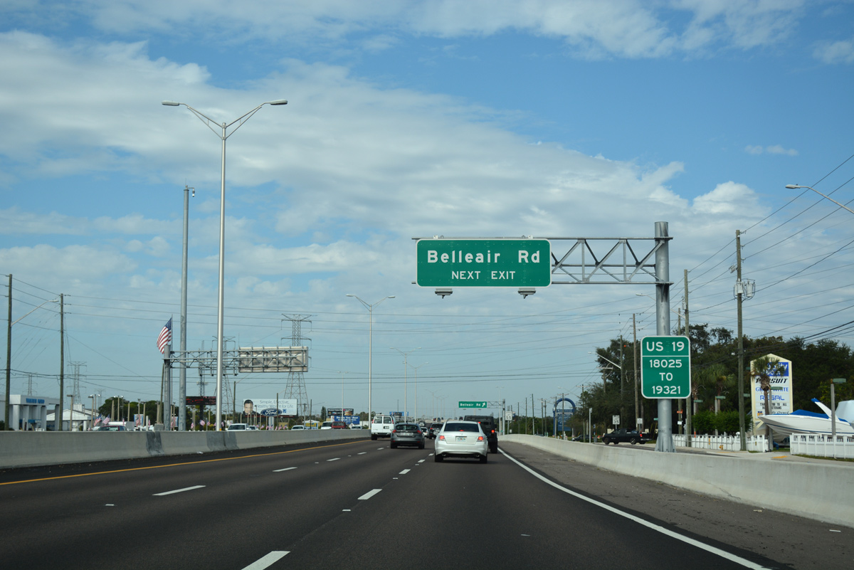
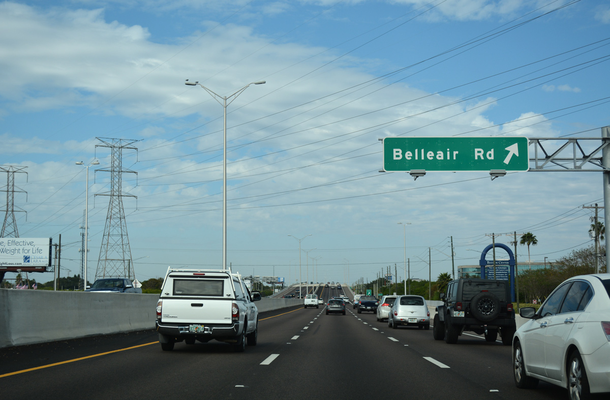
| The upcoming exit ramp for Bellair Road west opened to traffic in Spring 2015. 11/15/16 |
|
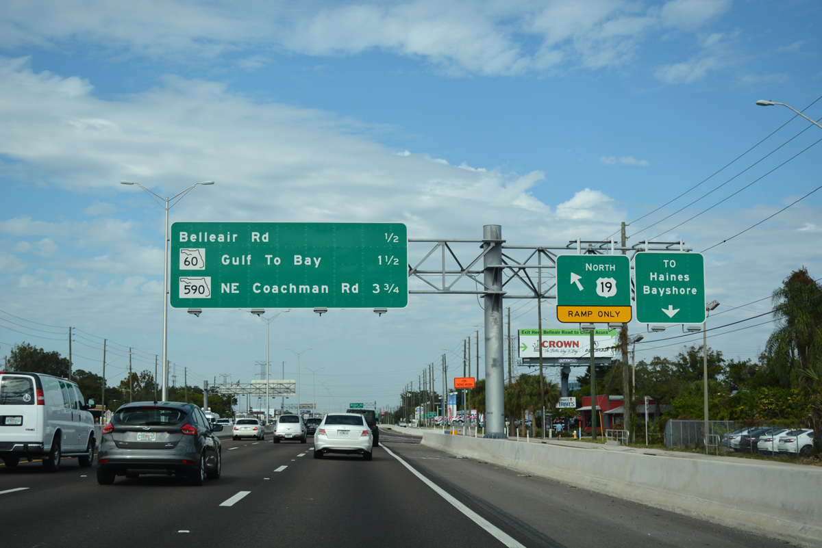
| Final upgrades to bring U.S. 19 to limited access standards between Whitney Road and Gulf to Bay Boulevard were completed by September 2015. The six lane roadway bypasses a number of condo communities and mobile home parks while passing over Allen's Creek and Belleair Road. Belleair Road (CR 464) spurs west to Clearwater-Largo Road at Belleair. 11/15/16 |
|
| The return ramp for U.S. 19 north from Belleair Road ties into the freeway opposite Nursery Road (CR 474) west. 08/15/15 |
|
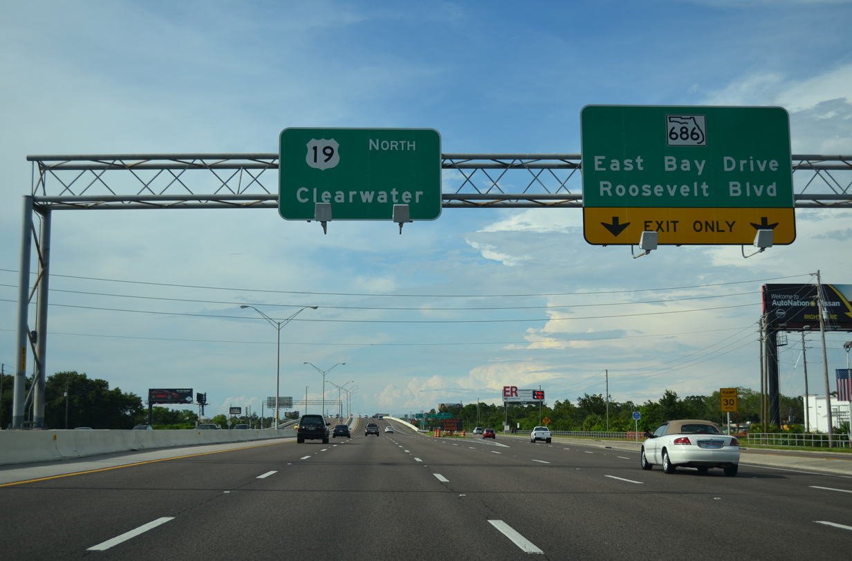
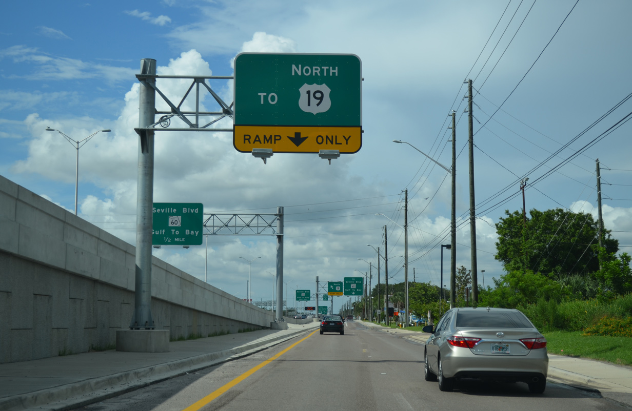
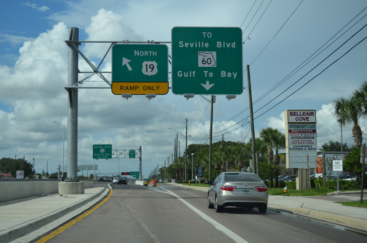
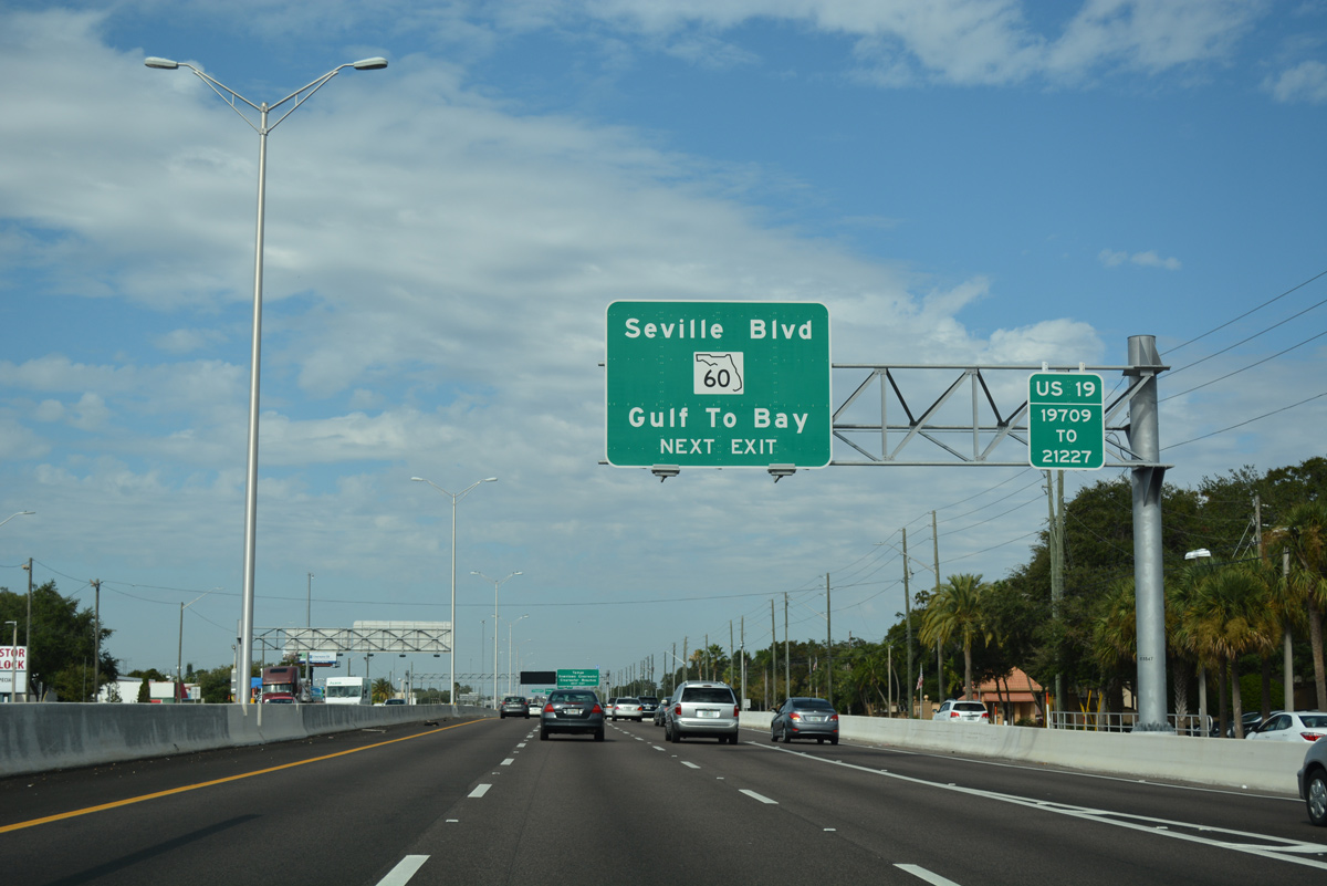
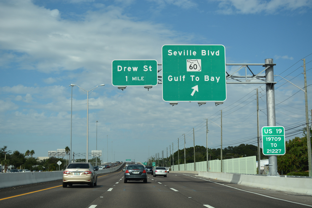
| A slip ramp joins U.S. 19 north just ahead of the off-ramp for Seville Boulevard east and SR 60 (Gulf to Bay Boulevard). The original SPUI between U.S. 19 and SR 60 was reconstructed from 2011-2015. 11/15/16, 08/15/15 |
|
| Forthcoming SR 60 follows Gulf To Bay Boulevard across the city of Clearwater. The commercial arterial leads SR 60 east to Courtney Campbell Causeway across Old Tampa Bay and west to Court Street, a 2002-realignment south of Downtown. 11/15/16 |
|
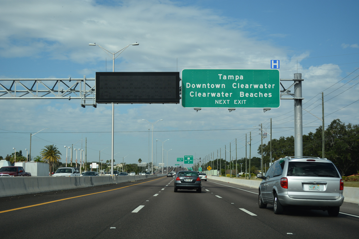
| A cross-peninsula route, SR 60 links Downtown Clearwater with Tampa via Courtney Campbell Causeway as part of a 160.82 mile alignment from Clearwater Beach to Vero Beach. 11/15/16 |
|
| The upgrade of U.S. 19 to limited access standards resulted in the relocation of the SR 60 off-ramp to a point south of Seville Boulevard and Clearwater Mall shopping center. 11/15/16 |
|
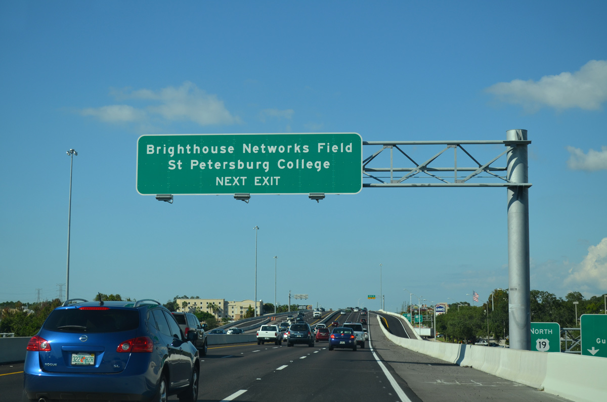
| Spectrum Field, Spring Training home of the Philadelphia Phillies, lies just west of the U.S. 19 freeway and north of the approaching Drew Street off-ramp. 10/07/15 |
|
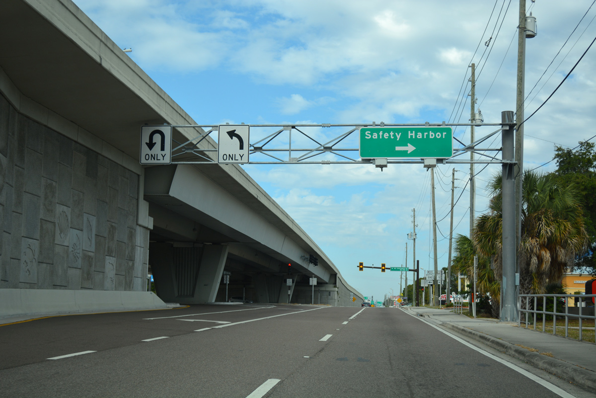
| Advancing north from SR 60, U.S. 19 quickly encounters the Drew Street off-ramp to Clearwater Campus of St. Petersburg College and the city of Safety Harbor. 11/15/16 |
|
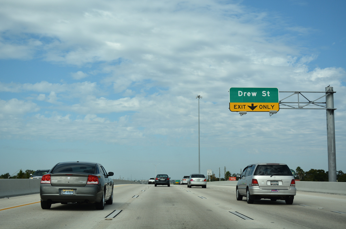
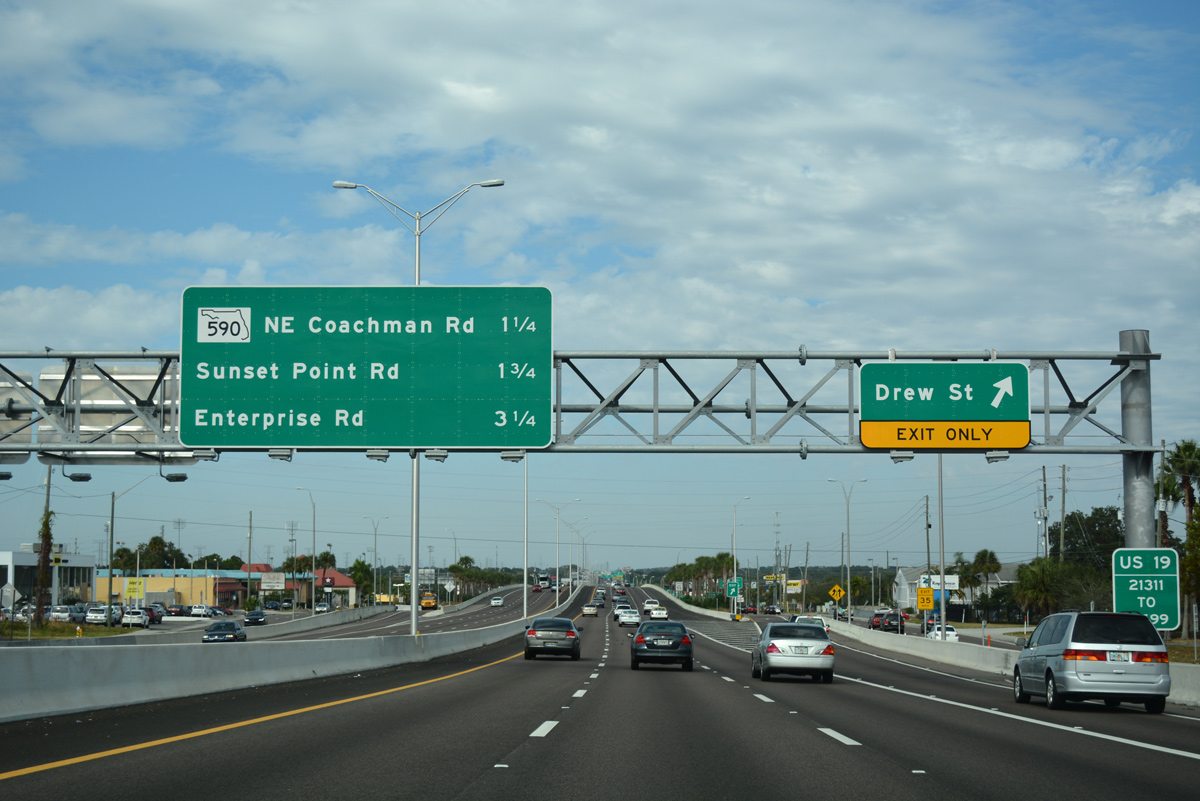
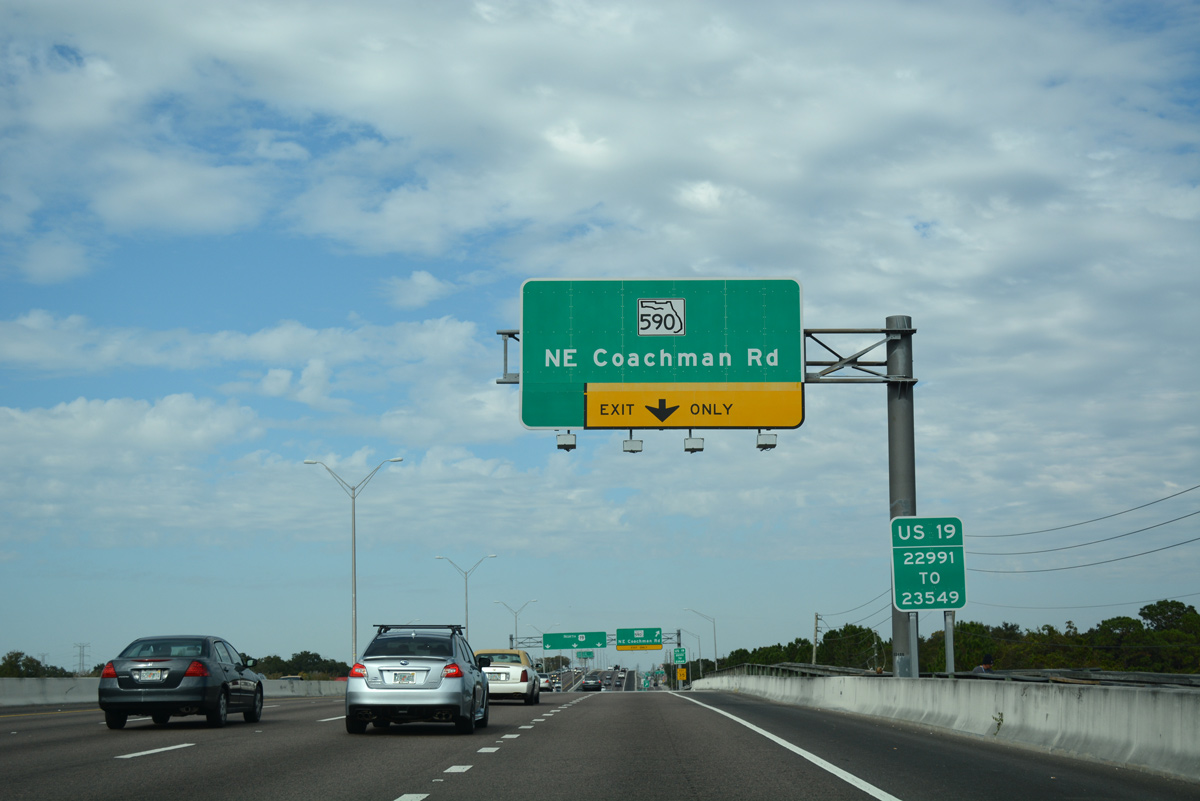
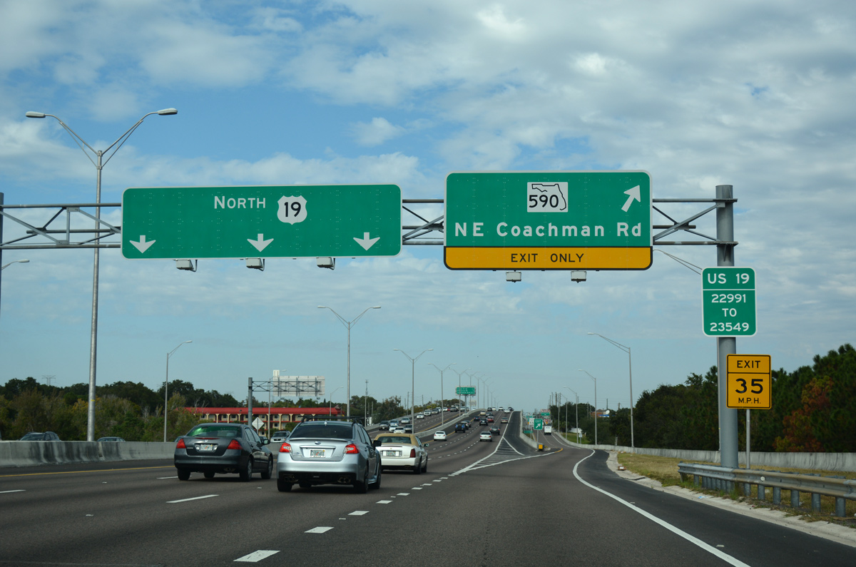
| Entering the unnumbered diamond interchange with Drew Street (Pinellas County Road 528) on U.S. 19 north. Drew Street west becomes a part of SR 590 from Coachman Road across the Skycrest neighborhood to Downtown Clearwater. 11/15/16 |
|
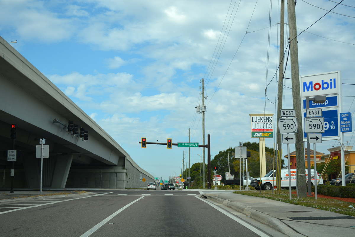
| The frontage road system of the U.S. 19 is discontinuous as the freeway passes over at Moccasin Lake Park. The service roads resume via the SR 590 (NE Coachman Road) off-ramp ahead. 11/15/16 |
|
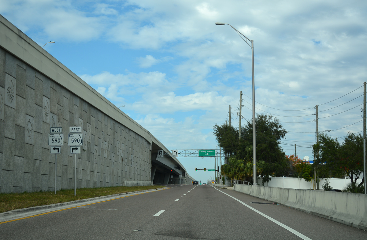
| SR 590 consists of a split state road designation joining Downtown Clearwater with Safety Harbor along Drew Street and NE Coachman Road. 11/15/16 |
|
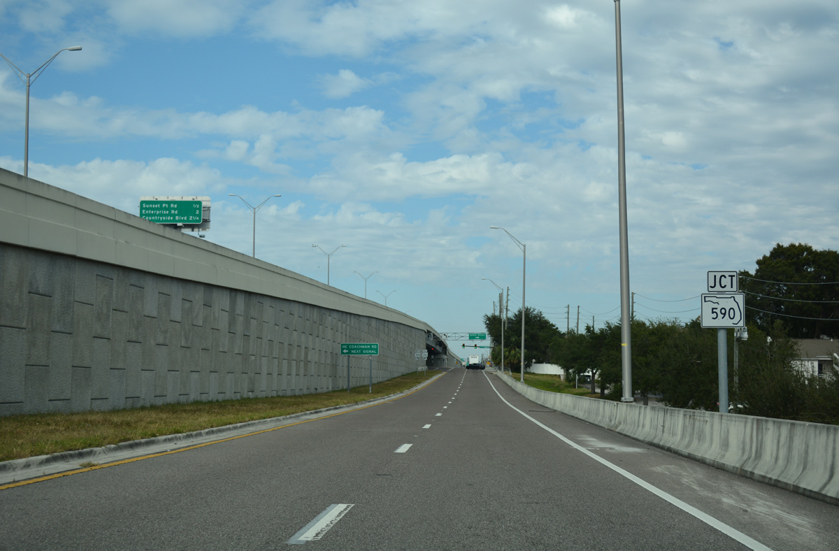
| Following the east side frontage road for U.S. 19 north to SR 590. 11/15/16 |
|
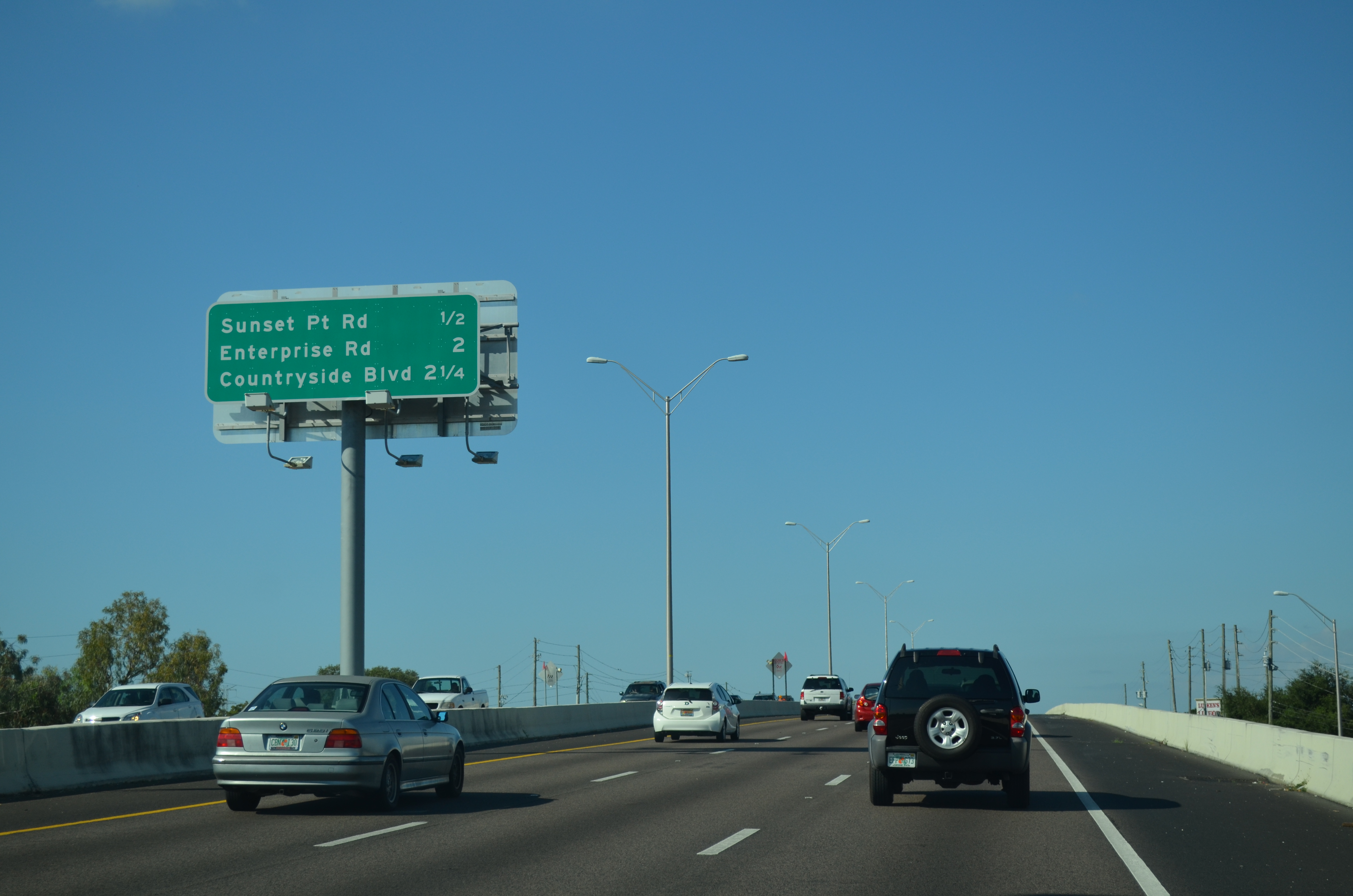
| Interchange sequence sign posted a half mile ahead of the SPUI with Sunset Point Road (County Road 576). The ensuing two exits serve northern reaches of Clearwater. 10/07/15 |
|
| County Road 576 (Sunset Point Road) travels east to Main Street in Safety Harbor and west to U.S. 19 Alternate (Edgewater Drive) on the Intracoastal at Clearwater. 10/07/15 |
|
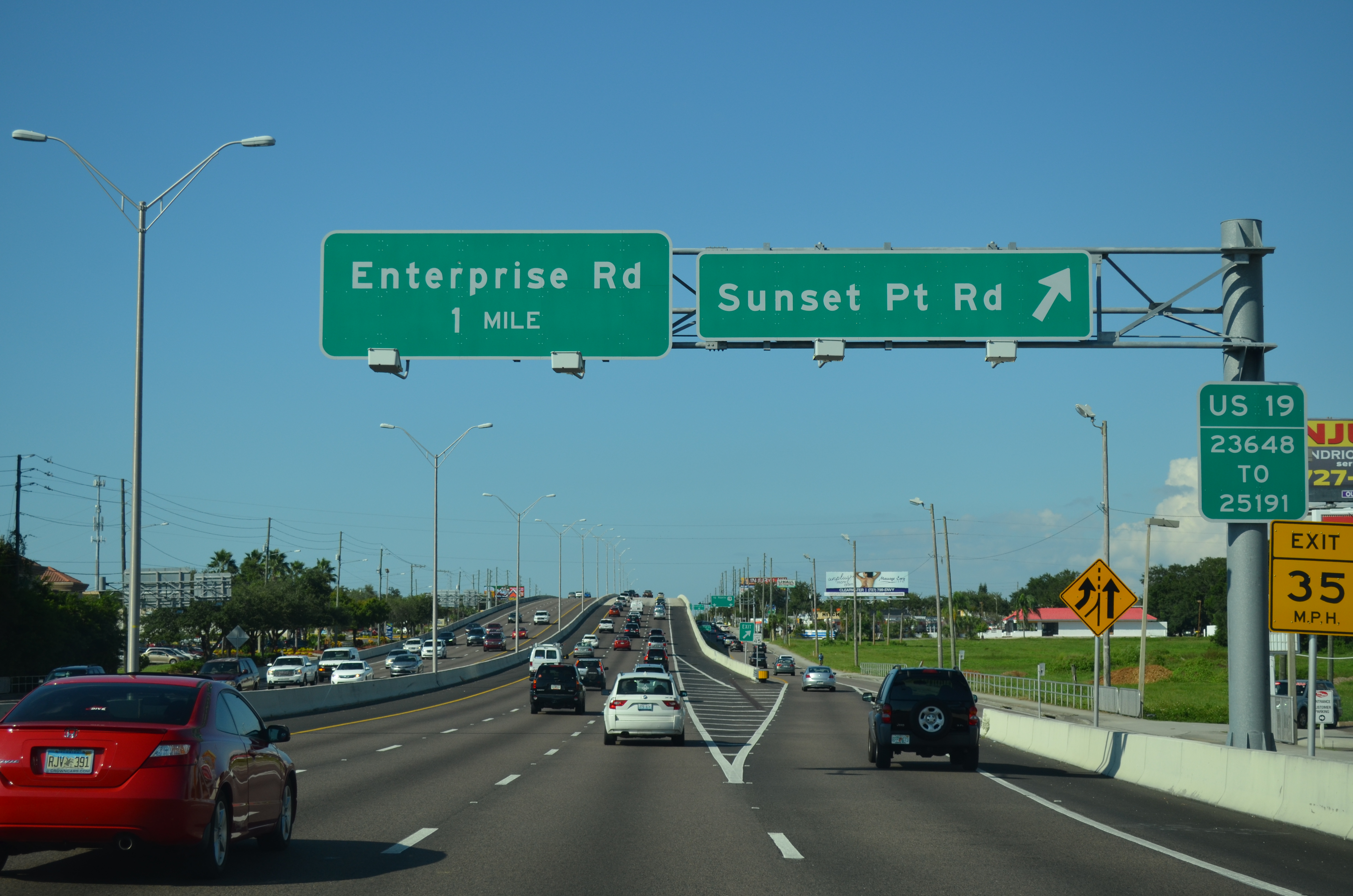
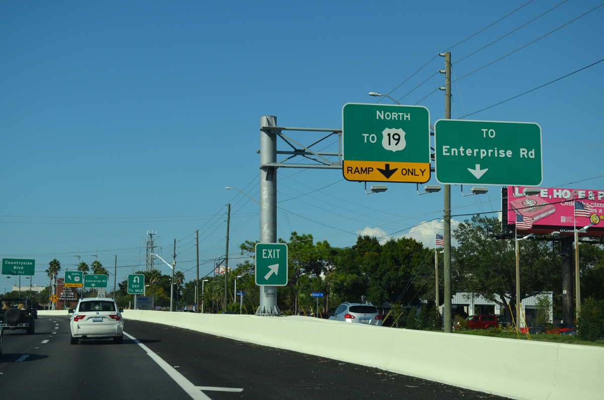
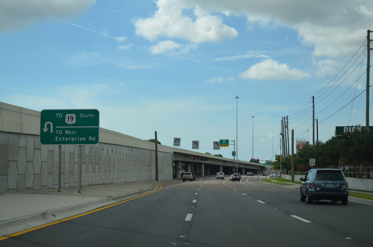
| Construction completed in 2014 upgraded U.S. 19 to a freeway from Sunset Point Road north to an older freeway across Countryside Drive and SR 580. The work severed Enterprise Road as a through route, but added off-ramps in both directions. 08/15/15 |
|
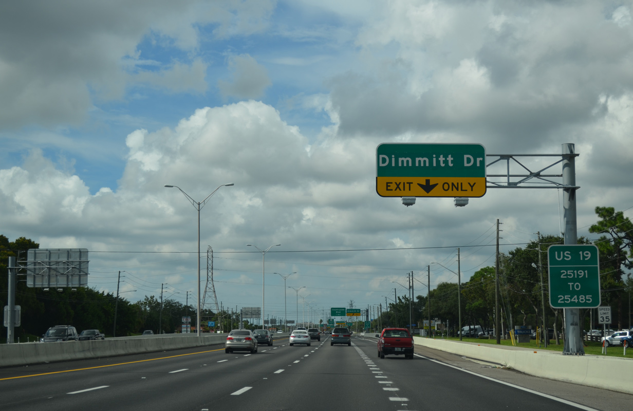
| The on-ramp from Sunset Point Road adds an auxiliary lane to the slip ramp for Dimmitt Drive. 08/15/15 |
|
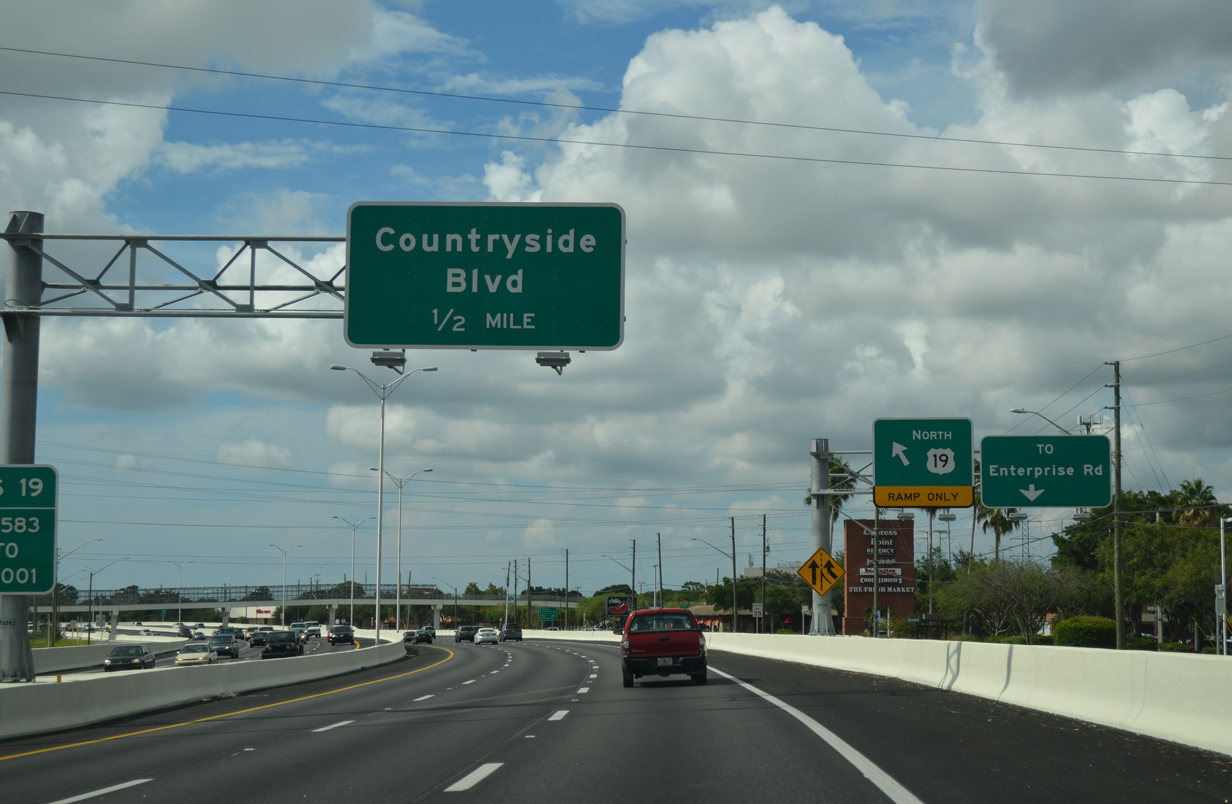
| U.S. 19 continues another mile north to Countryside Boulevard by Westfield Countryside Mall as the local exit to Dimmitt Drive departs. Dimmitt Drive serves an adjacent car dealership via the parallel service road. 08/15/15 |
|
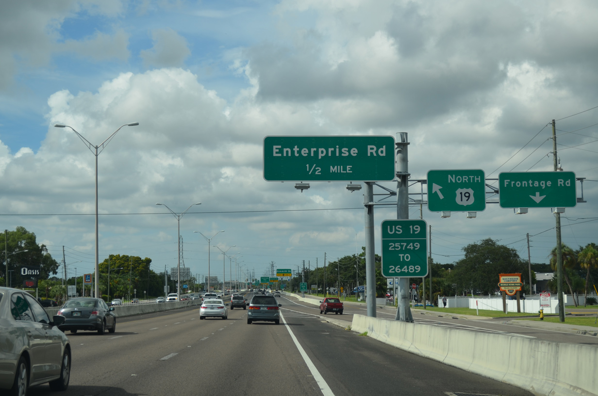
| Drivers bound for Enterprise Road quickly depart U.S. 19 at the adjacent slip ramp for the arterial leading east to CR 611 (McMullen-Booth Boulevard) and Safety Harbor. 10/07/15 |
|
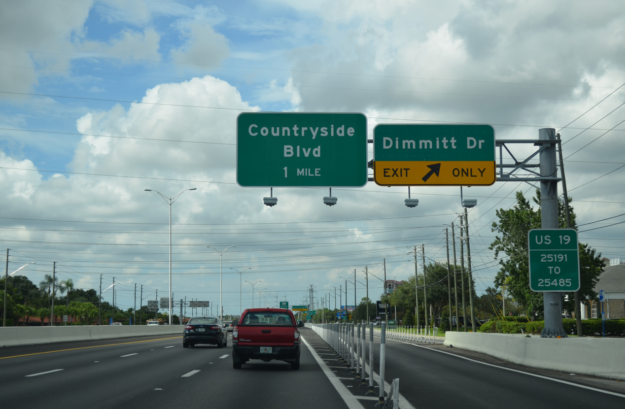
| Countryside Boulevard branches northeast from CR 501 (Belcher Road) to cross paths with U.S. 19 a busy six lane connector to SR 580. Duke Energy Trail spans the freeway and frontage road system in the distance. 08/15/15 |
|
| Motorists bound for Countryside Boulevard and Countryside Mall leave U.S. 19 north as the freeway progresses another half mile north to meet SR 580 directly. 10/07/15 |
|
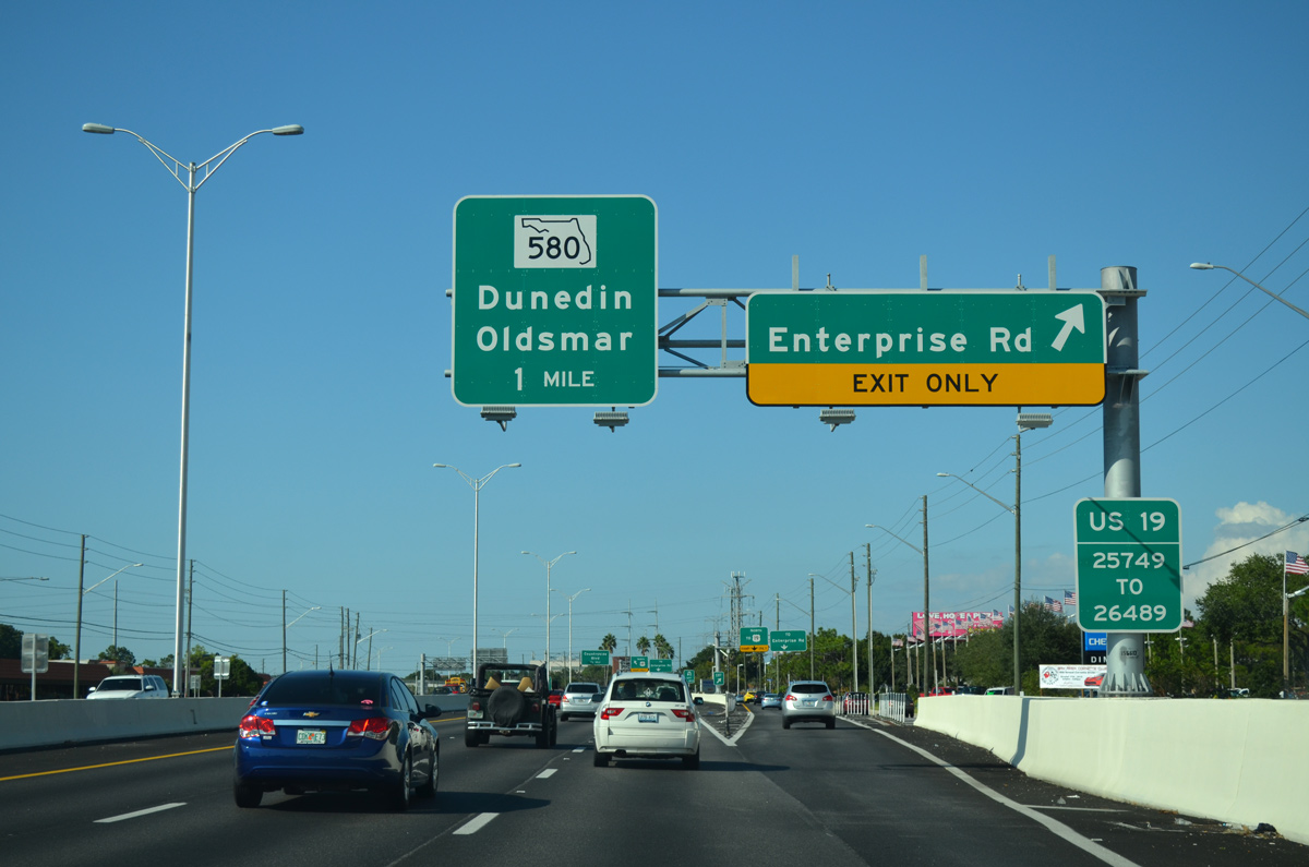
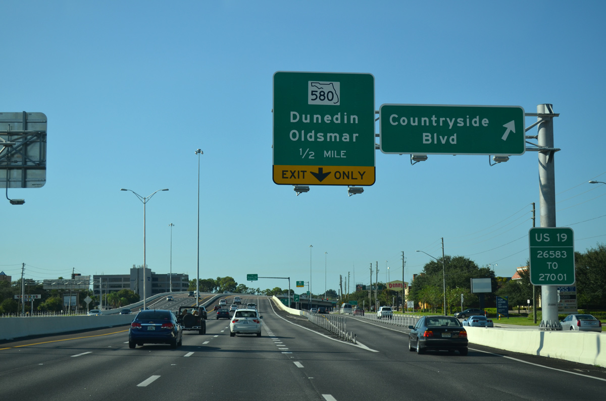
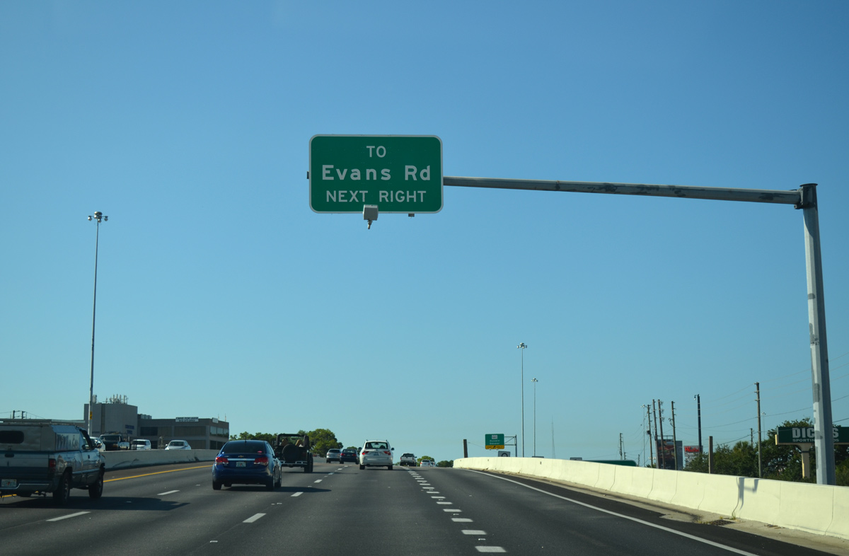
| Northbound motorists next meet SR 580 (Main Street) at another SPUI. U.S. 19 does not become at-grade again until Republic Drive, therefore drivers bound for Evans Road are directed onto the service road north from SR 580. 10/07/15 |
|
| A Texas style U-turn ramp provides access to Enterprise Road west from U.S. 19 at the SPUI with Countryside Boulevard. 08/15/15 |
|
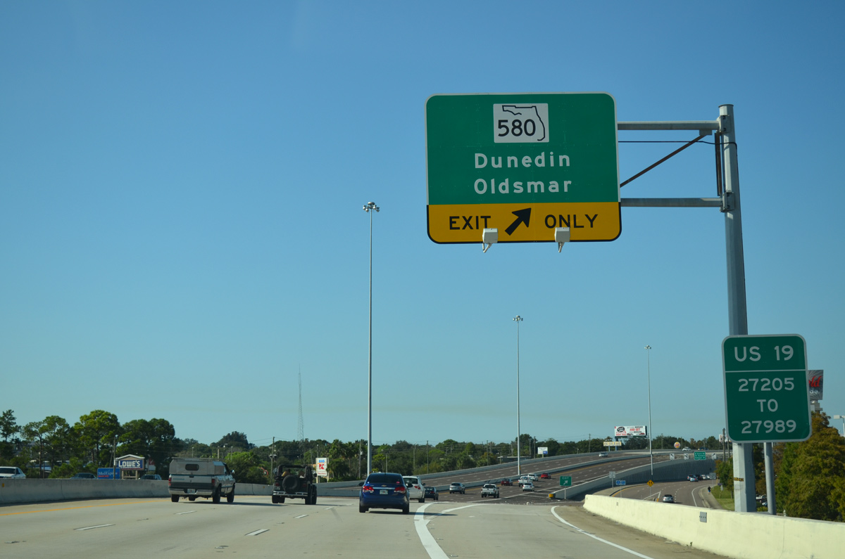
| SR 580 joins U.S. 19 with Dunedin to the west via Main Street and Oldsmar and Tampa to the east. The highest point in Pinellas County lies nearby at 100 feet above sea level. 10/07/15 |
|
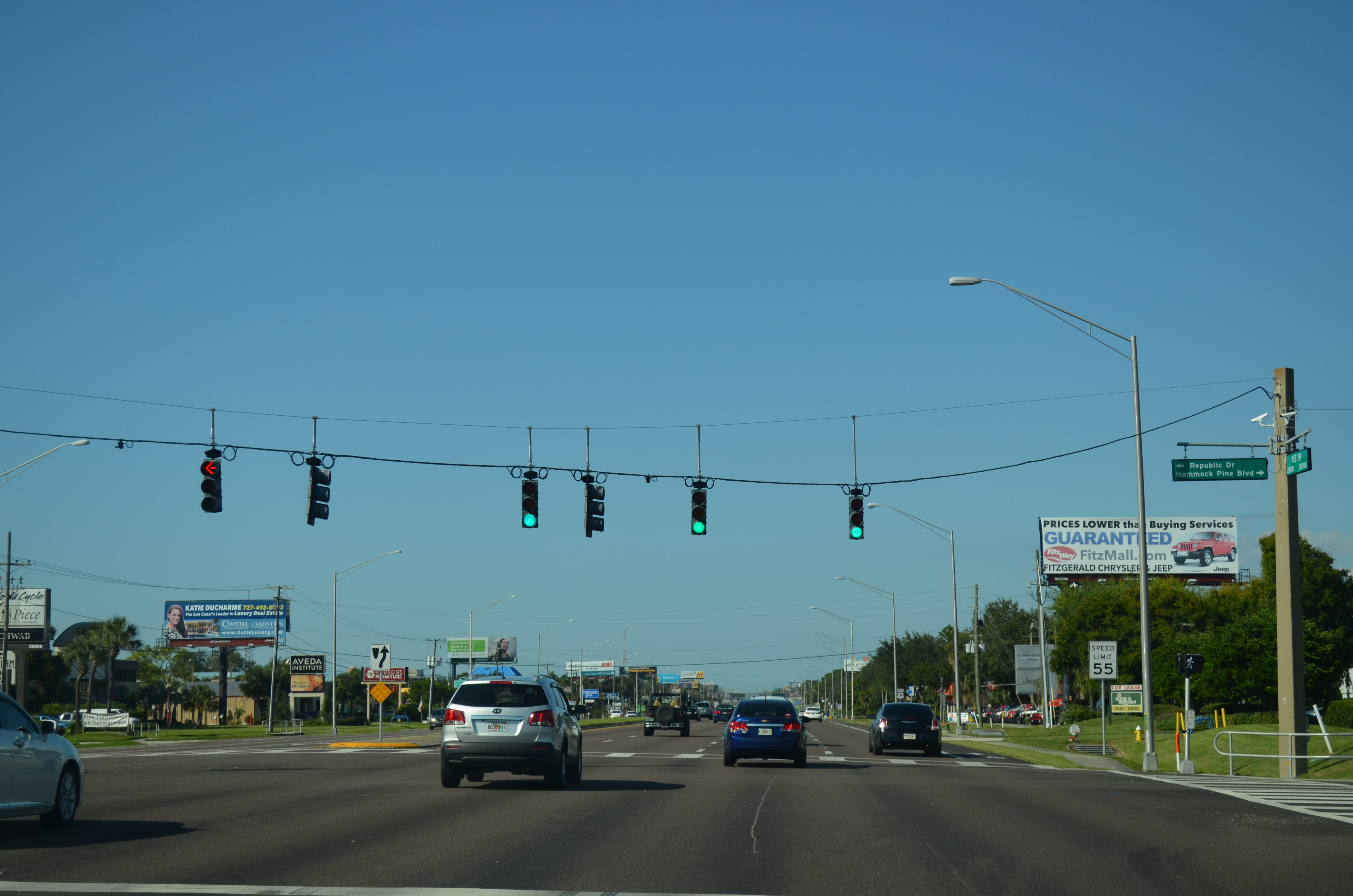
| Republic Drive east and Hammock Pine Boulevard west come together at the first traffic light north of the U.S. 19 freeway end. Both represent local roads. 10/07/15 |
|
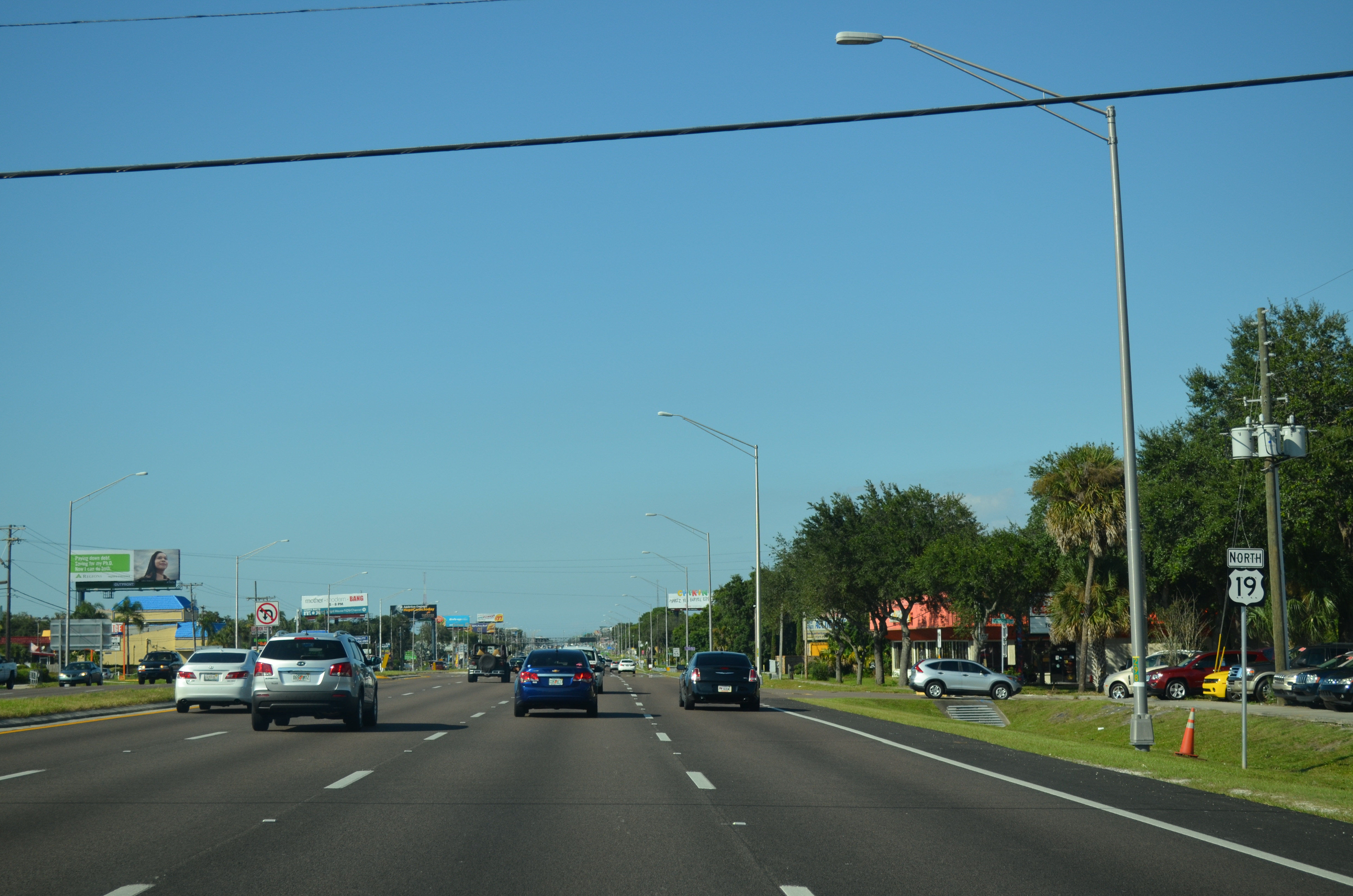
| Reassurance marker posted as U.S. 19 travels as a six to eight lane arterial northward toward Curlew. This stretch north to County Road 95 will be upgraded to limited access standards when funding becomes available. 10/07/15 |
|
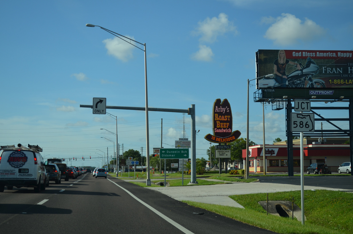
| Approaching the commercialized intersection with SR 586 (Curlew Road) on U.S. 19 north. Curlew Road carries SR 586 east to SR 584 (Tampa Road) at Oldsmar. 06/26/15 |
|
| Curlew Road west doubles as SR 586 west to conclude a 5.33 mile route at U.S. 19 Alternate in Dunedin. Dunedin Causeway stems west from there onto Honeymoon Island. 06/26/15 |
|
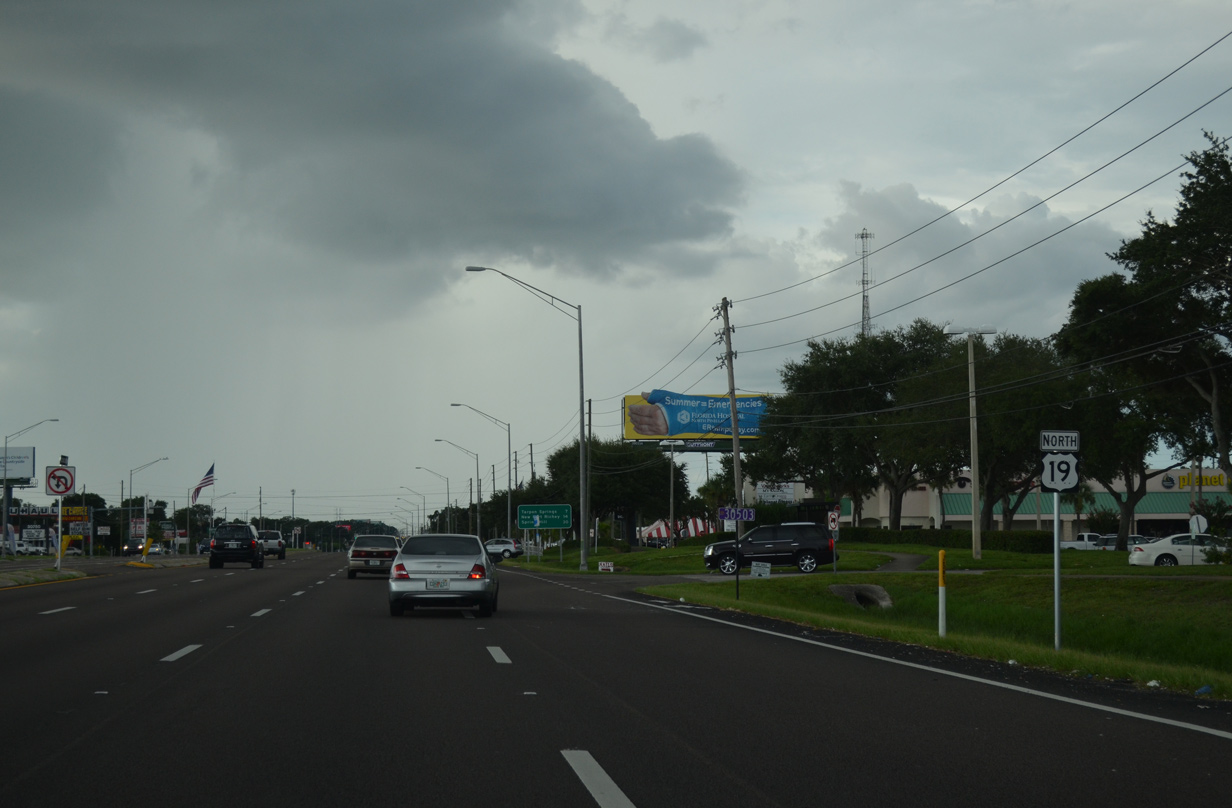
| U.S. 19 regains a fourth northbound lane from Curlew Road by a number of shopping centers to County Road 95. 08/15/15 |
|
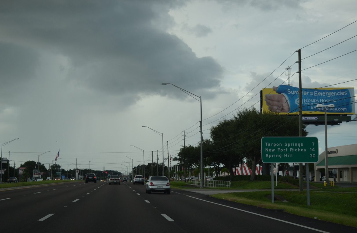
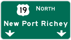
| Tarpon Springs is now just seven miles to the north. New Port Richey in Pasco County is 14 miles to the north while Spring Hill in Hernando County is 30 miles away. 08/15/15 |
|
| Tampa Road extends north from the junction of SR 584 and SR 586 as County Road 752 to Lake Saint George and U.S. 19. The arterial provides one of two main routes to Palm Harbor from U.S. 19 to the west. 08/15/15 |
|
| Nebraska Avenue (County Road 776) leads west from U.S. 19 to the Palm Harbor business district at U.S. 19 Alternate (Palm Harbor Boulevard). 08/15/15 |
|
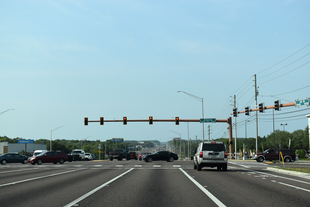
| One mile further north, U.S. 19 intersects Alderman Road (County Road 816) at this traffic light. Alderman Road meanders east to become Highland Road through residential areas west of Lake Tarpon. Westward, CR 816 forms an arterial route to U.S. 19 Alternate at Crystal Beach. 04/14/20 |
|
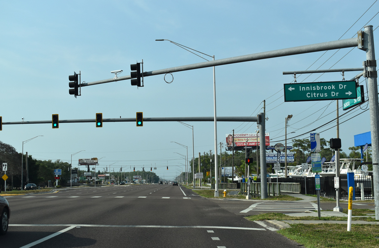
| Innisbrook Drive winds west as the main access road to the Innisbrook golf course community beyond parallel Belcher Road. Citrus Drive ties into the signal from the Lakeshore Estates canal-based subdivision to the east. 04/14/20 |
|
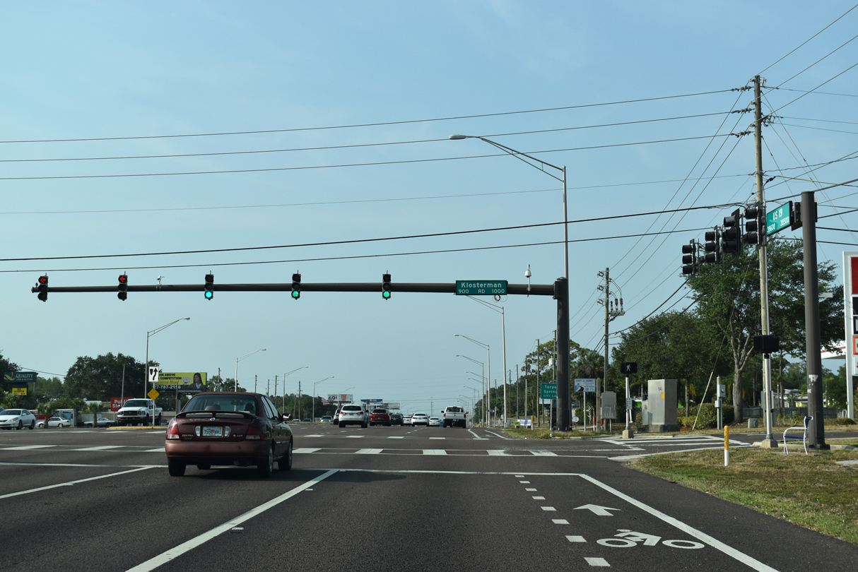
| Klosterman Road (County Road 880) runs west through southern reaches of Tarpon Springs to Carlton Road. 04/14/20 |
|
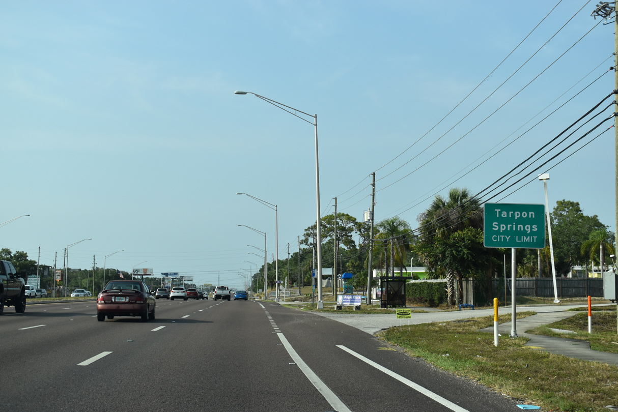
| Entering the Tarpon Springs city limits on U.S. 19 north. 04/14/20 |
|
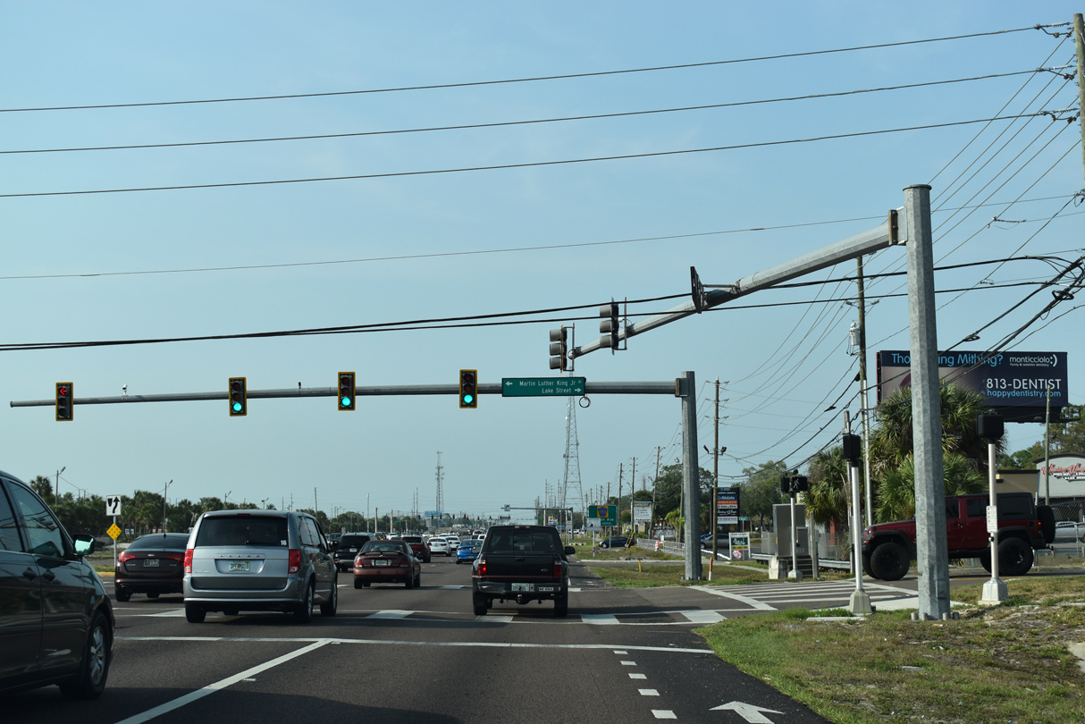
| Martin Luther King Drive heads west from U.S. 19 at Lake Street to the Tarpon Springs street grid to Whitcomb Bayou. 04/14/20 |
|
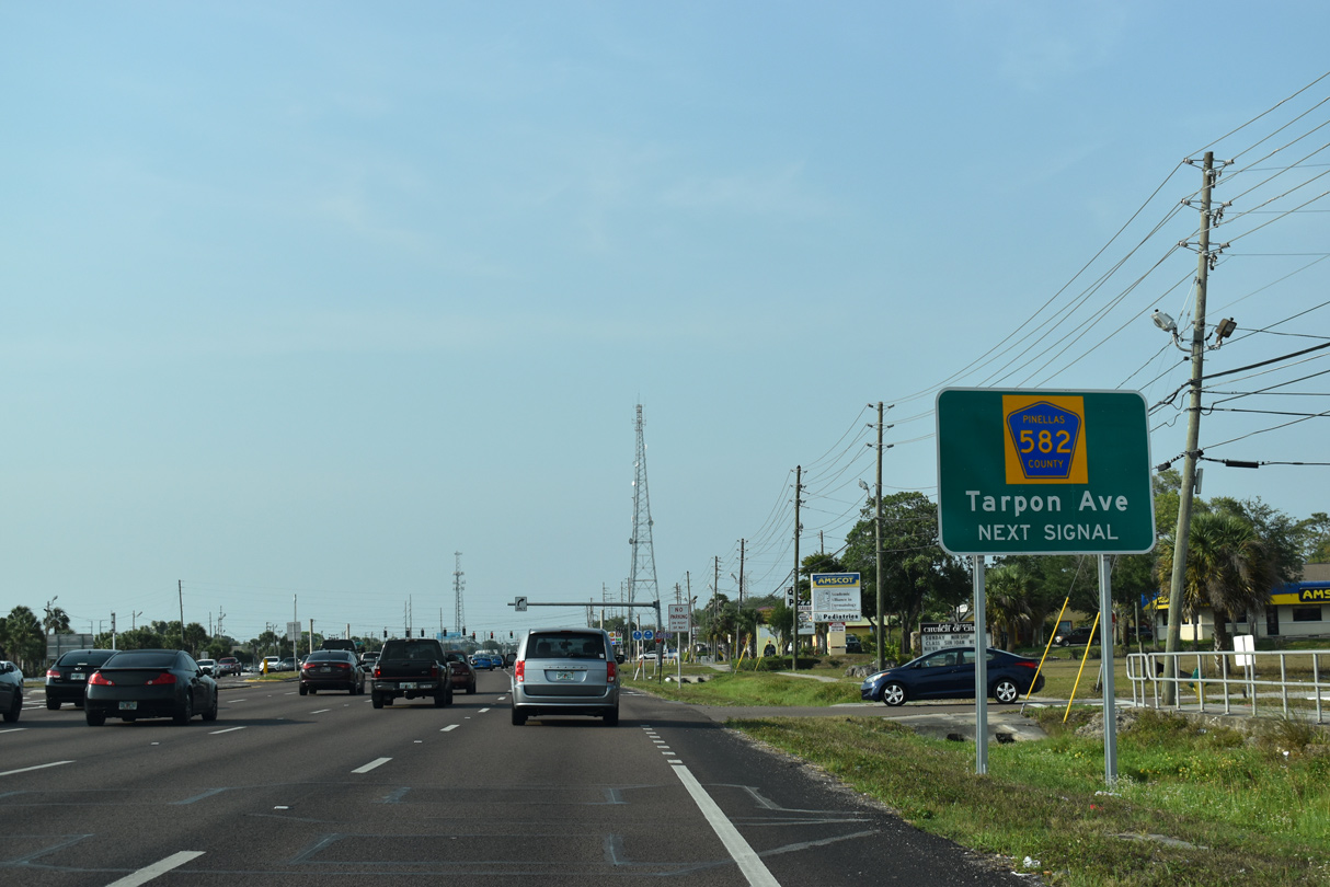
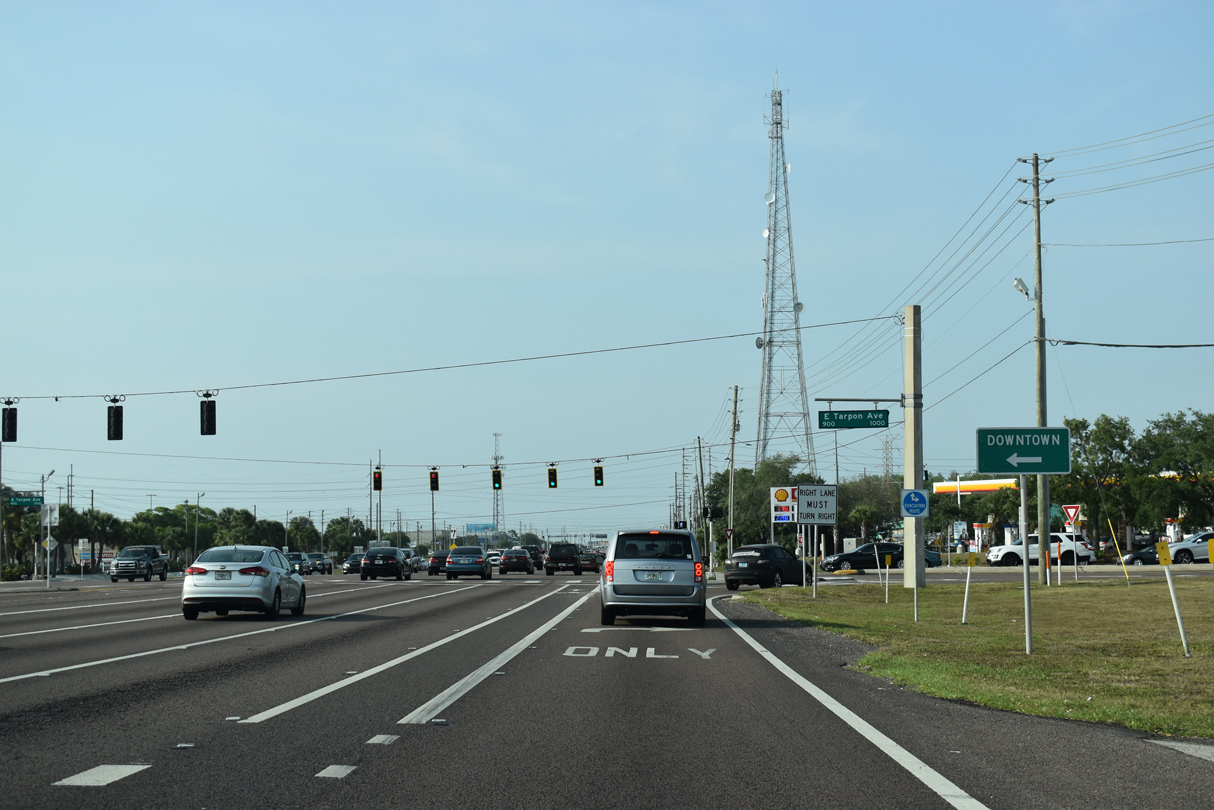
| Tarpon Avenue and Keystone Road (County Road 582) come together at a busy commercialized intersection east of Downtown Tarpon Springs. CR 582 runs east 6.3 miles from U.S. 19 to the Hillsborough County line. 04/14/20 |
|
| Keystone Road provides a through route across Brooker Creek Preserve to Keystone and Lake Fern in northern Hillsborough County. The portion east of the county line is no longer considered CR 582.
West from U.S. 19 to U.S. 19 Alternate, Tarpon Avenue was State Road 582 until the mid 2000s. A second segment of SR 582 remains signed at Tampa. 04/14/20 |
01/02/06, 10/22/07, 08/24/13, 06/26/15, 08/15/15, 10/07/15, 11/15/16, 04/14/20, 03/07/23 by AARoads
Page Updated 04-15-2020.


 North
North