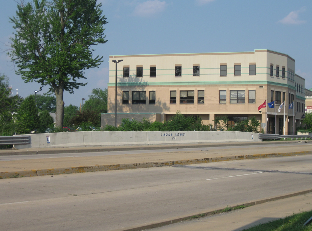
U.S. 30, the third longest U.S. highway in the country, goes for 3,073 miles from the Pacific Ocean at Astoria, Oregon east across the country to the Atlantic Ocean at Atlantic City, New Jersey. In Indiana, the highway goes for 152 miles from the Illinois border in Dyer to the Ohio border east of New Haven. Across the state, U.S. 30 is a four-lane expressway that is a major highway that crosses Northern Indiana, connecting the Northwest Indiana region, and the larger Chicagoland area, with Fort Wayne. U.S. 30 passes through the communities of Schererville, Merrillville, Valparaiso, Plymouth, Warsaw and Columbia City. Historically, U.S. 30 was a part of the Yellowstone Trail and the Lincoln Highway, which followed a pair of routes from Fort Wayne northwest toward Chicago. While one branch went north toward Elkhart and South Bend, the other followed U.S. 30's routing across the state, with many original stretches still named Lincoln Highway, Lincolnway or Old U.S. 30. Today, many of the communities along U.S. 30 pay homage to the historic highway that went through their communities.
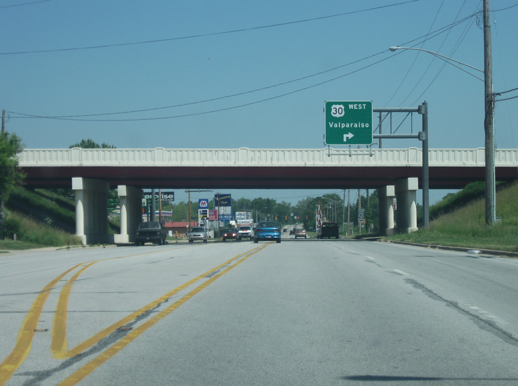
U.S. 30 begins as an undivided four-lane highway in Dyer and follows the path of the original Lincoln Highway into Indiana. East of U.S. 41, the highway becomes a divided expressway as it passes through more of the Northwest Indiana suburbs, passing through Merrillville, Hobart and Valparaiso. East of there, it heads east toward Wanatah, Hanna, Plymouth, Bourbon, Warsaw and Columbia City, bypassing all of those communities with several interchanges at major highways. In the Fort Wayne area, U.S. 30 bypasses the city using Interstates 69 and 469 before heading east from New Haven toward the Ohio border. The highway is a major travel corridor across the state, despite the numerous stoplights along the way. Since the only other way from Fort Wayne to Chicago involves the Indiana Toll Road, the highway is preferred by both travelers and freight between the two cities.
U.S. 30 Indiana Guides
|
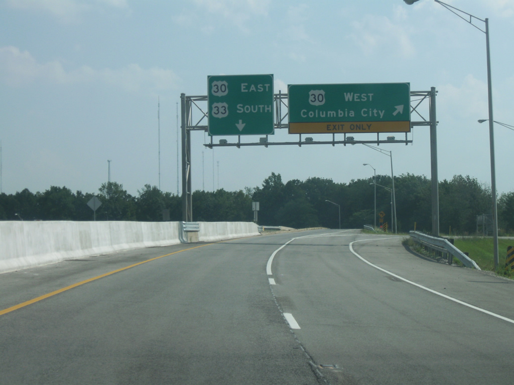
| Looking south on U.S. 33 at the trumpet interchange with U.S. 30 in northwest Fort Wayne within Allen County. Columbia City is the control city for westbound U.S. 30, while U.S. 33 follows U.S. 30 east to Interstate 69, where the two highways will split going on opposite ways along the freeway. 08/16/09 |
|
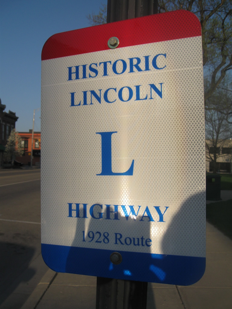
| A view of a Lincoln Highway shield in Downtown Warsaw in Kosciusko County. The Lincoln Highway followed Center Street and Lake Street through the city of Warsaw. 04/09/10 |
|
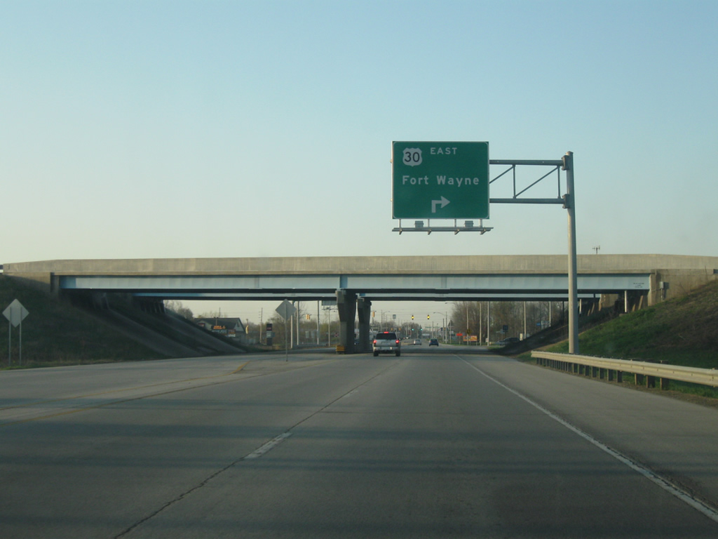
| Looking south on SR 15 (Detroit Street) at the folded diamond interchange with U.S. 30 in Warsaw. Fort Wayne is the control city for U.S. 30 eastbound. 04/09/10 |
|
| Looking north on SR 15 (Detroit Street) at the folded diamond interchange with U.S. 30 in Warsaw. Plymouth is the control city for U.S. 30 westbound. 04/09/10 |
|
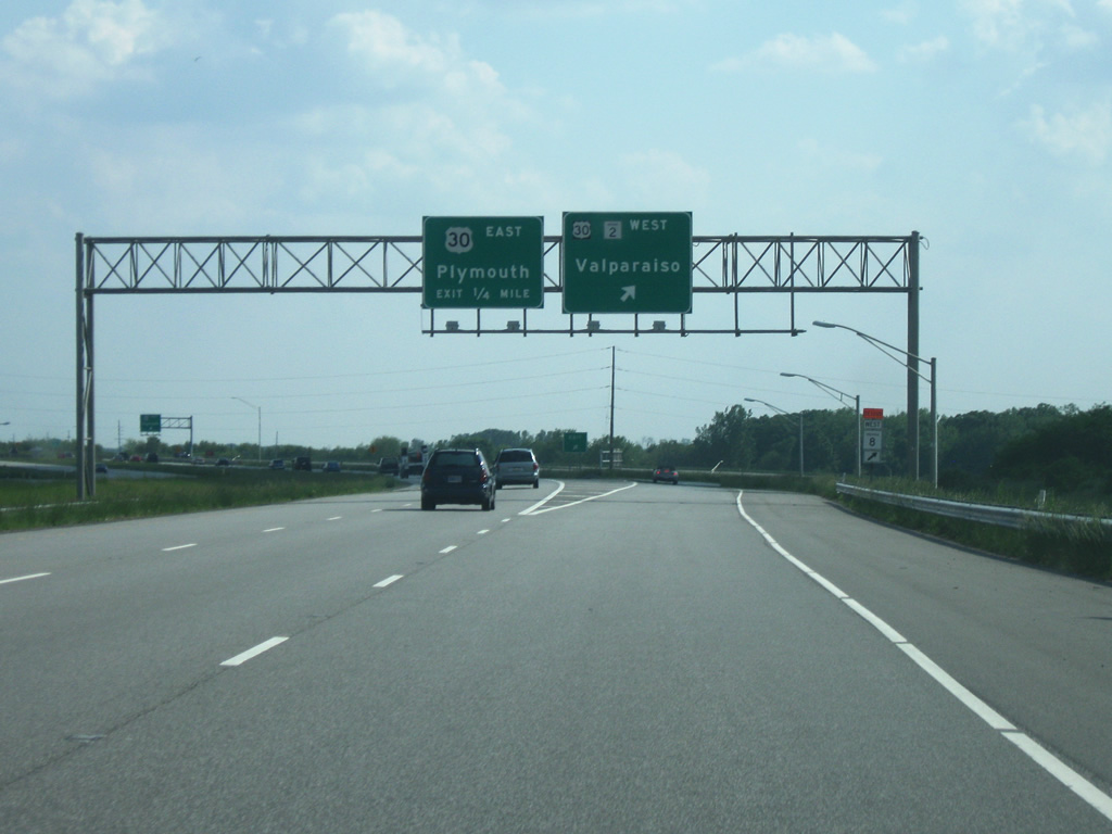
| Looking north on U.S. 31 at the cloverleaf interchange with U.S. 30 to the northeast of Plymouth in Marshall County. Warsaw is the eastbound control city for U.S. 30 while Valparaiso is the westbound control city. 05/30/10 |
|
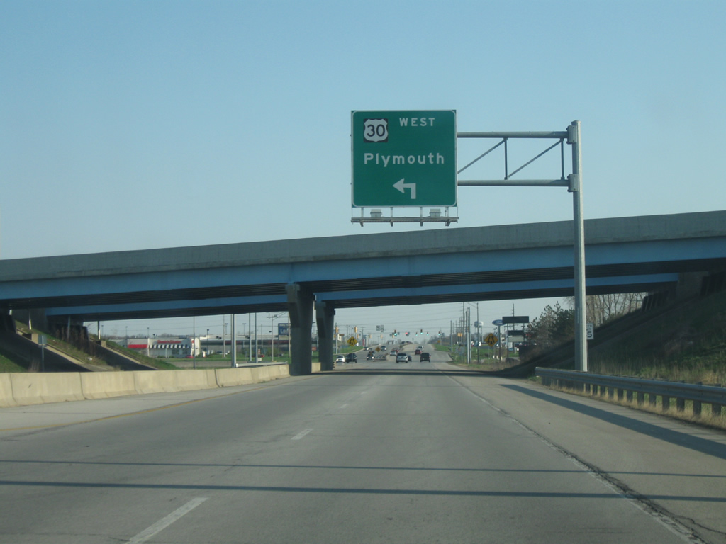
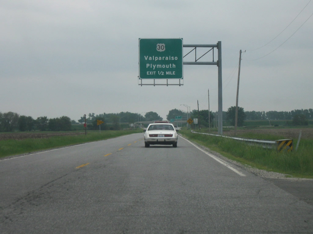
| Looking north on SR 17 (Michigan Street) in Plymouth at the folded diamond interchange with U.S. 30. Valparaiso is the control city for westbound U.S. 30 from Plymouth. 05/30/10 |
|
| Looking south on U.S. 35 in northern Starke County near its interchange with U.S. 30. Plymouth and Valparaiso are the control cities for U.S. 30. 05/28/09 |
|
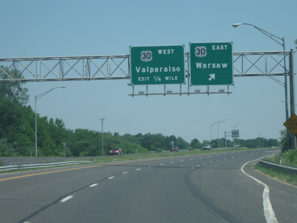
| Looking south on SR 49/SR 2 west, southeast of Valparaiso at its interchange with U.S. 30. Plymouth and Valparaiso are the control cities for U.S. 30, despite already being within the Valparaiso area. 05/24/10 |
|
| A view of U.S. 30 (Joliet Street) in the town of Dyer at the bridge over Hart Ditch. This bridge was a part of the Ideal Section of the Lincoln Highway built between the years of 1922 and 1923 and has remained standing along with the rest of U.S. 30 across Dyer. 05/24/10 |
Photo Credits:05/28/09, 08/16/09, 04/09/10, 05/24/10, 05/30/10 by Thomas Decker
Connect with:
Interstate 65
Interstate 69
Interstate 469
State Road 9
State Road 13
State Road 15
Page Updated 05-02-2013.

 scenes