|
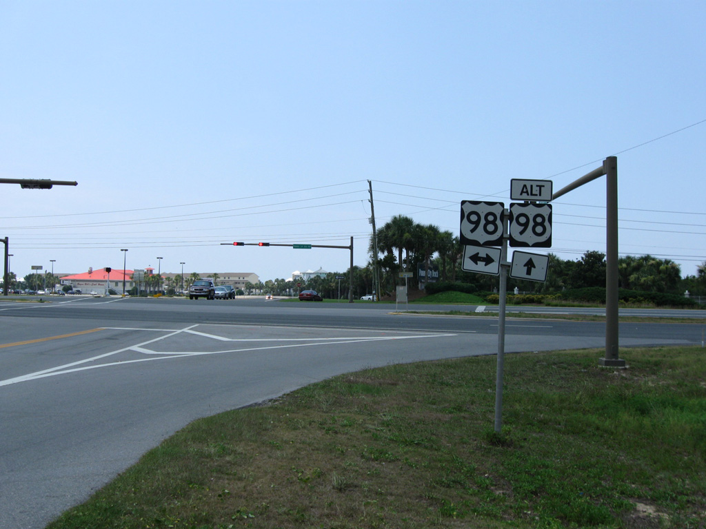
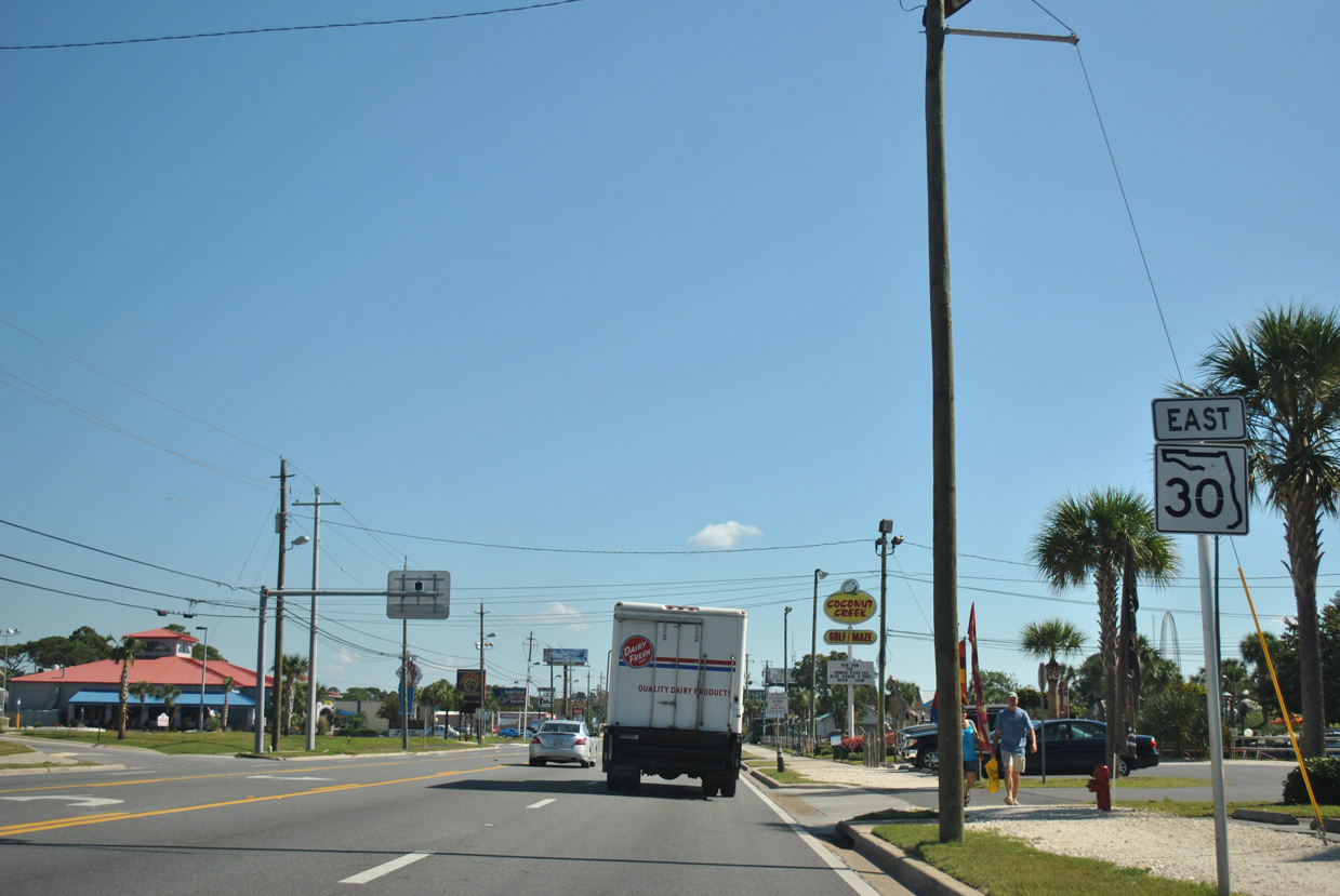
| The exit from Ocean Park Pavilion shopping center ties into the intersection joining U.S. 98 (Panama City Beach Parkway) with SR 30 (Front Beach Road) east. U.S. 98 Alternate remains posted here through 2016. 06/20/09 |
|
| The initial segment of Front Beach Road leading south from U.S. 98 near the Walton County line is still state maintained. A confirming marker for SR 30 east was posted here until 2017. 10/16/11 |
|
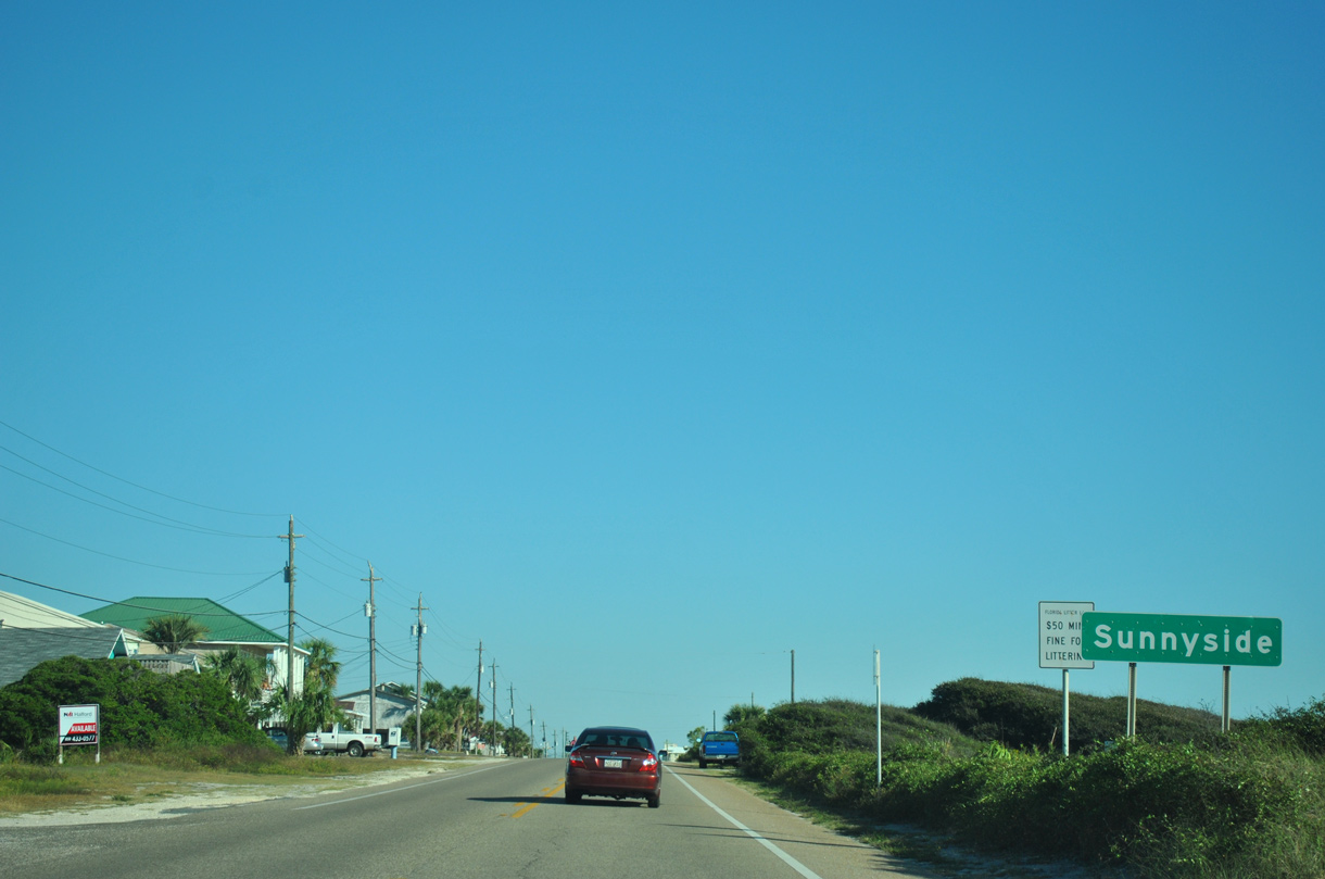
| Front Beach Road curves southeast and enters the unincorporated community of Sunnyside Beach. County Road 30 is unmarked along the 3.8 mile stretch east to the Panama City Beach city limits. 10/16/11 |
|
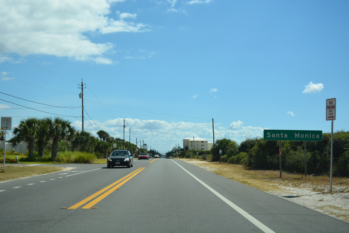
| Front Beach Road (CR 30) continues east along the Gulf beaches to the community of Santa Monica. 10/13/16 |
|
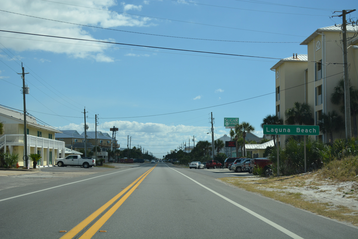
| Front Beach Road passes through Laguna Beach ahead of the Panama City Beach line. 10/13/16 |
|
| County Road 3037 (Wisteria Lane) links CR 30 (Front Beach Road) with U.S. 98 (Panama City Beach Parkway) at Laguna Beach.
This assembly was eliminated by 2017. 10/16/11 |
|
| CR 3037 measures just 0.421 miles along Wisteria Lane. Wisteria Lane is a residential street otherwise. 10/16/11 |
|
| This confirming marker for SR 30 east of Bay County Road 3037 (Wisteria Lane) was removed by 2017. 06/19/11 |
|
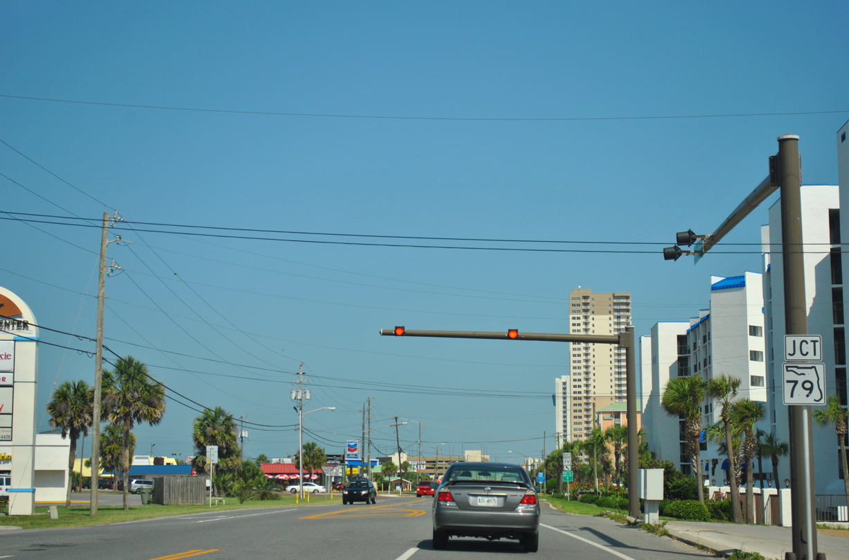
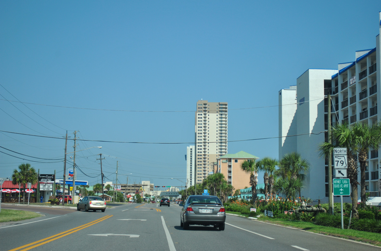
| Crossing into Panama City Beach, SR 30 resumes along Front Beach Road. A wye intersection follows with the south end of SR 79 (Arnold Road). 06/19/11 |
|
| SR 79 travels 60.69 miles north from Panama City Beach to Ebro, Vernon, Bonifay and Esto at the Alabama state line. 06/19/11 |
|
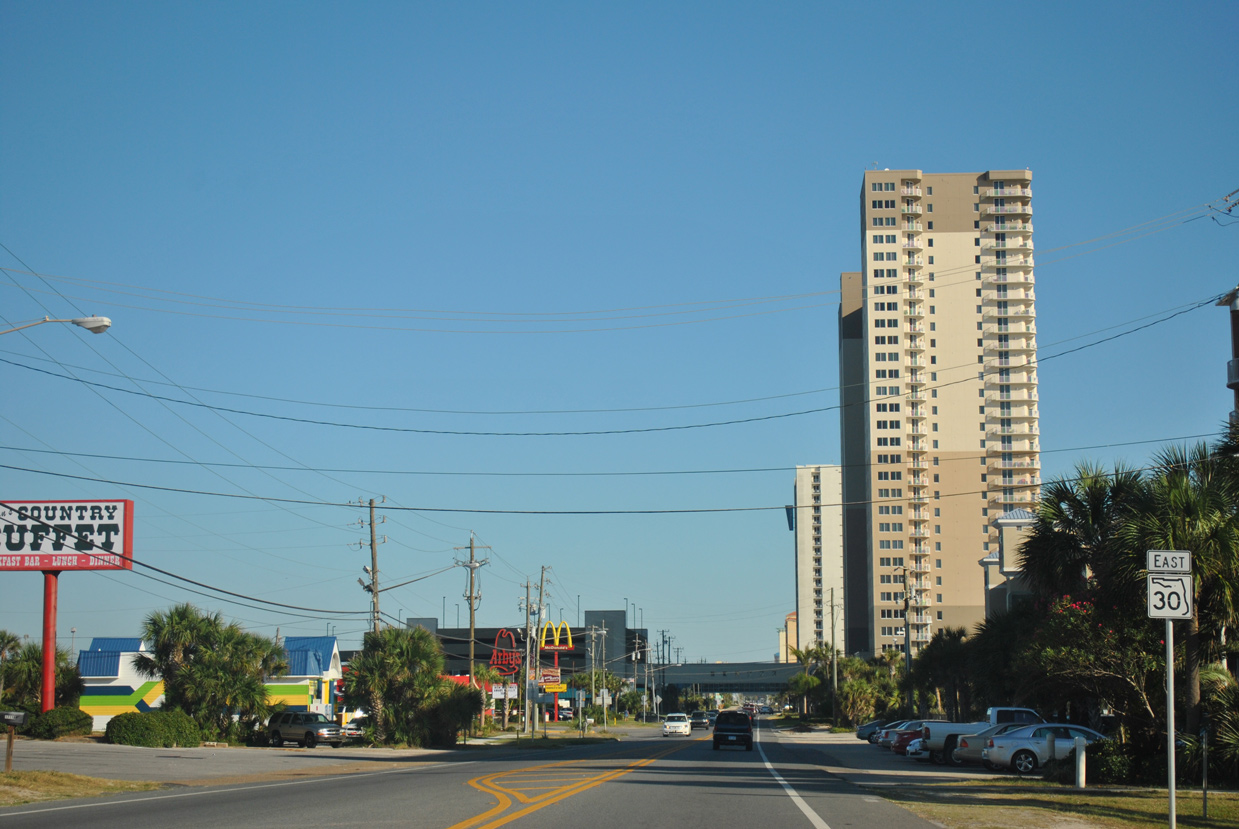
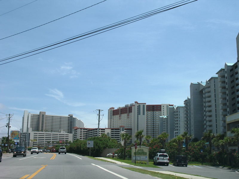
| A cluster of condominium high rises line the south side of Front Beach Road along the ensuing stretch east from SR 79 (Arnold Road). 10/16/11 |
|
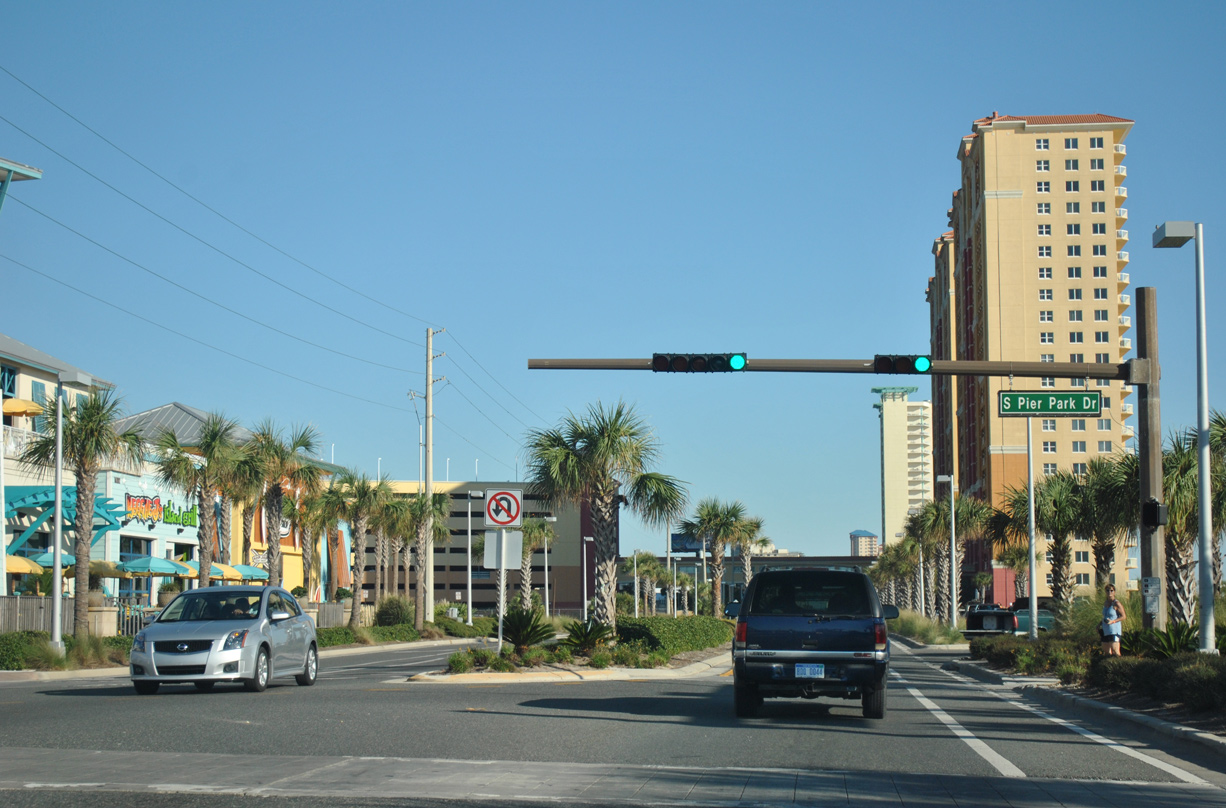
| Front Beach Road east at Pier Park Drive. Pier Park Drive winds north through the Pier Park shopping village between SR 30 at the Dan Russell City Pier and U.S. 98 (Panama City Beach Parkway). 10/16/11 |
|
| Hills Road meets SR 30 (Front Beach Road) at the next eastbound traffic light. 10/16/11 |
|
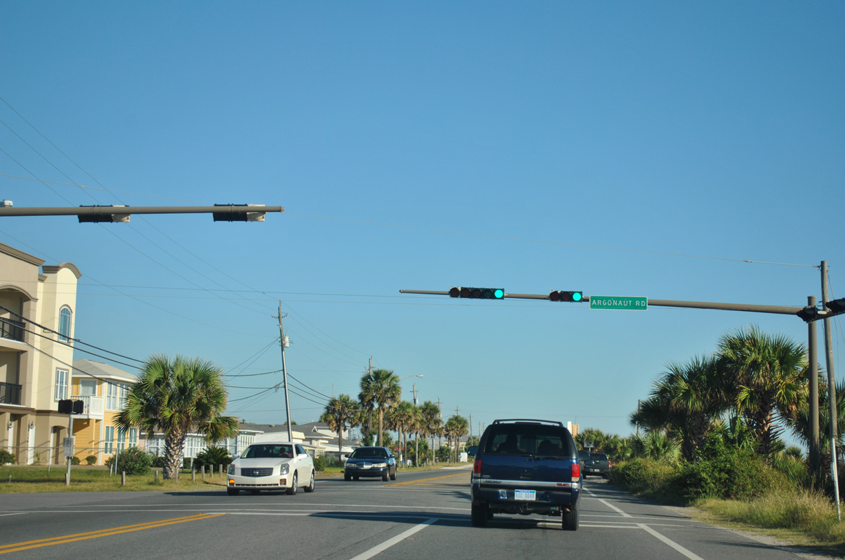
| Argonaut Road ties into SR 30 (Front Beach Road) from the Bid-A-Wee Beach community and U.S. 98. 10/16/11 |
|
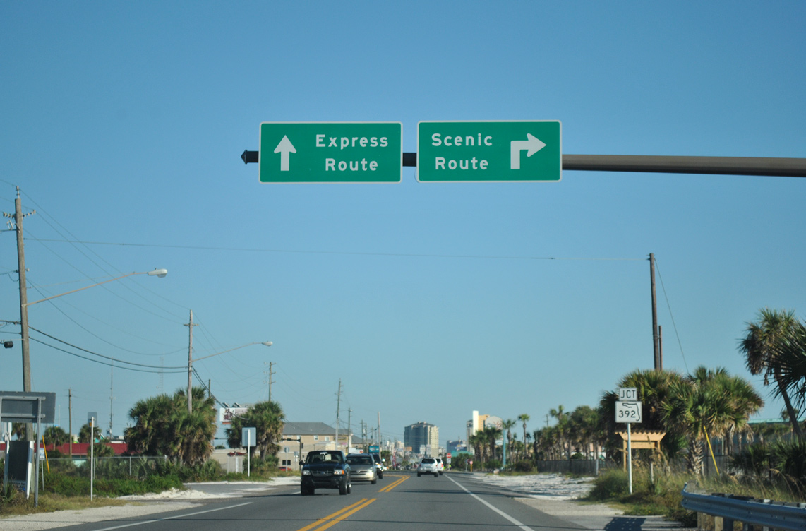
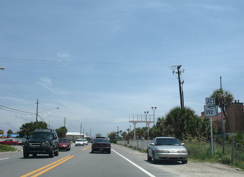
| Approaching the split with SR 392 (Hutchinson Boulevard) on SR 30 eastbound. Signed in the field as SR 392 and formerly named Middle Beach Road, Hutchinson Boulevard is officially designated as SR 392A. 10/16/11 |
|
| Hutchinson Boulevard (SR 392A) provides a four lane bypass of Front Beach Road. The 3.12 mile long state road reconnects with SR 30 ahead of U.S. 98 east into Panama City. 08/03/08 |
|
| The intersection between SR 30 and SR 392 was realigned to give Hutchinson Boulevard priority. Front Beach Road resumes its eastward course beyond a signalized turn. 10/16/11 |
|
| Front Beach Road advances another 1.75 miles southeast from Hutchinson Boulevard as SR 30. 10/16/11 |
|
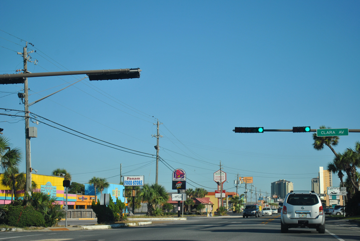
| Clara Avenue (former CR 30C) ties into Front Beach Road at the first of several connections linking SR 30 with the Express Route (SR 392) along Hutchinson Boulevard. 10/16/11 |
|
| SR 30 reassurance shield posted along Front Beach Road beyond Clara Avenue. 10/16/11 |
|
| Alf Coleman Road (old CR 30H) comprises the second route linking SR 30 with SR 392 (Hutchinson Boulevard). CR 30H previously followed Alf Coleman Road 0.935 miles northeast to U.S. 98 (Panama City Beach Parkway) near J.R. Arnold High School. 10/16/11 |
|
| The state maintained portion of Front Beach Road ends a half mile beyond this SR 30 shield assembly at Alf Coleman Road. 10/16/11 |
|
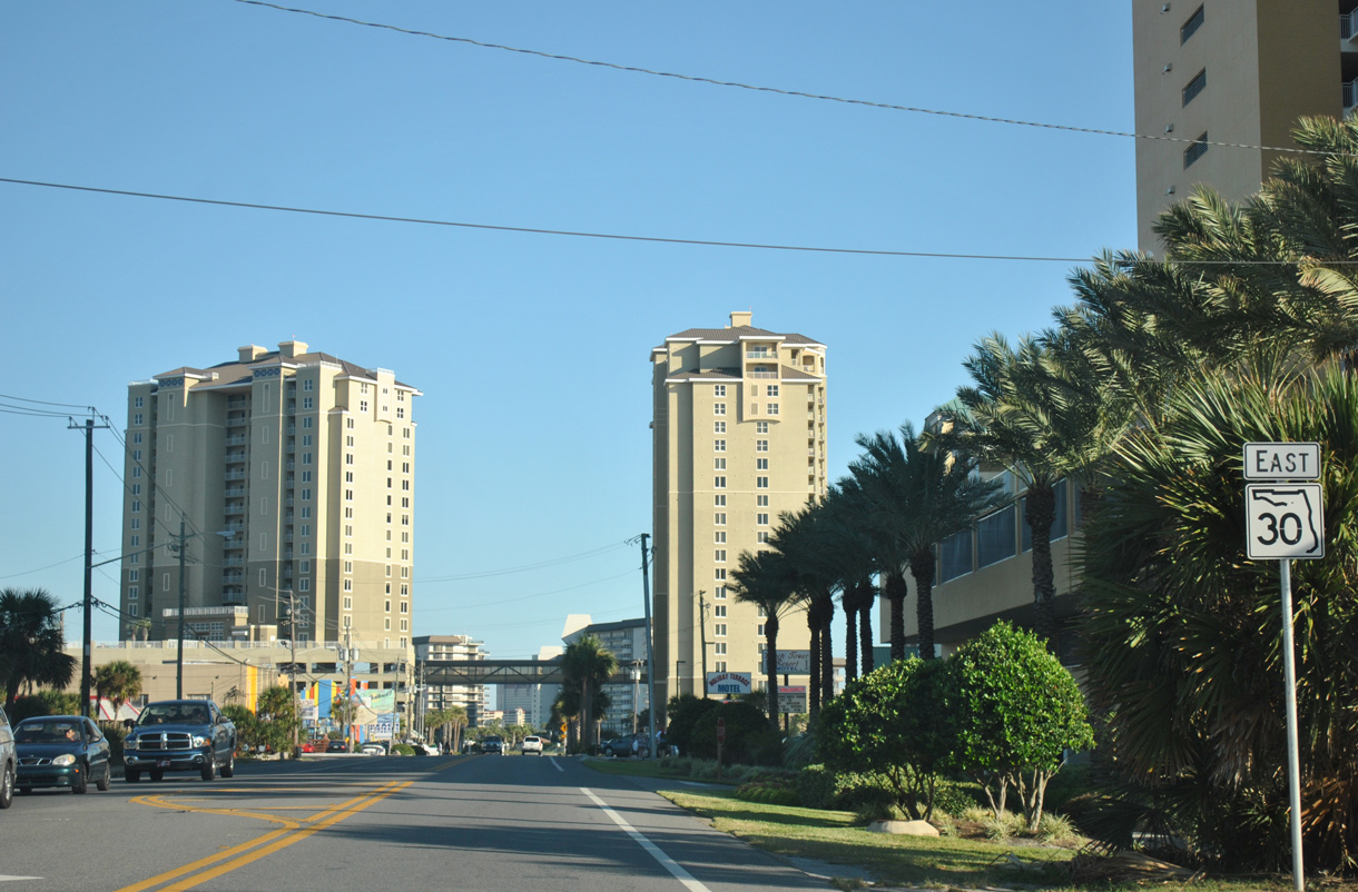
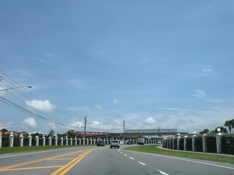
| A sky bridge connects the Grand Panama Beach Resort towers above SR 30 (Front Beach Road) ahead of the S-curve away from the beaches. 10/16/11 |
|
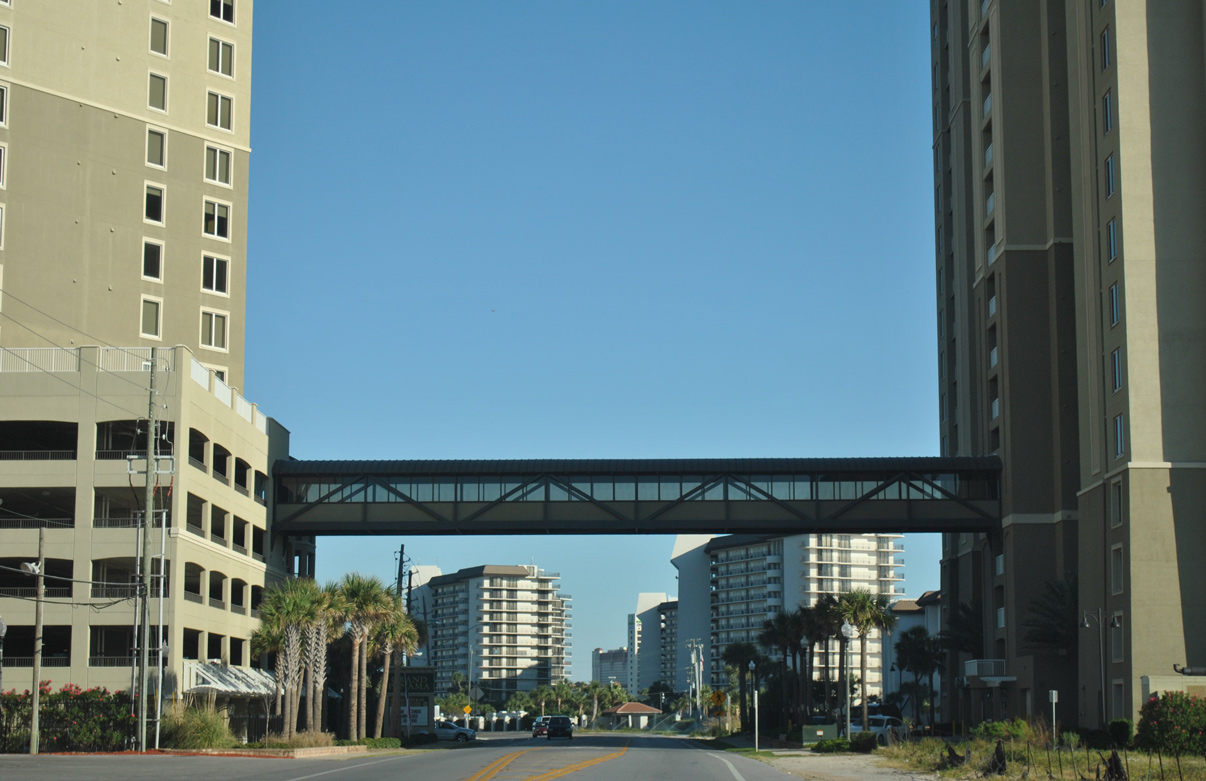
| The state maintained portion of Front Beach Road concludes just beyond the pedestrian bridge joining the Edgewater Beach & Golf Resort complexes west of Richard Jackson Boulevard. 08/03/08 |
|
| Richard Jackson Road (former CR 3033) angles northeast from Front Beach Road at Edgewater Beach & Golf Resort to the Breakfast Point community beyond Panama City Beach Parkway. CR 3033 overlaid the arterial for 0.876 miles between old SR 30 and U.S. 98. 10/16/11 |
|
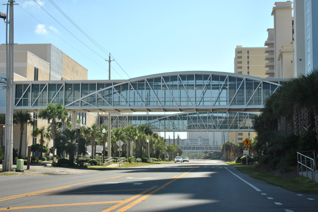
| A series of sky bridges cross Front Beach Road beyond Gulf Highlands Boulevard. Towering condominiums obscure the beach for the most part through here. 10/16/11 |
|
| SR 30 turns inland for its approach to U.S. 98 (Panama City Beach Parkway) by the Long Beach Resort Condominium complex. 08/03/08 |
|
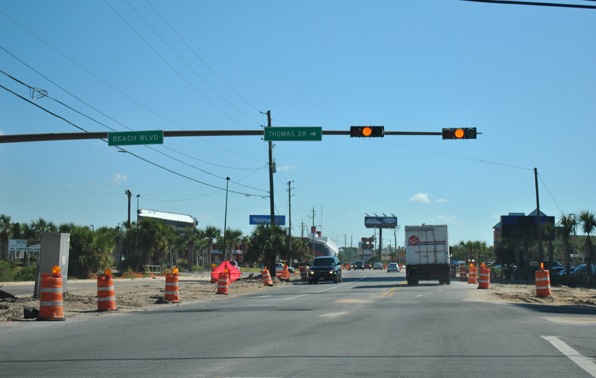
| South Thomas Drive continues the beachfront drive southeast from Front Beach Road (former SR 30) to Thomas Drive (unsigned CR 392). 10/17/11 |
|
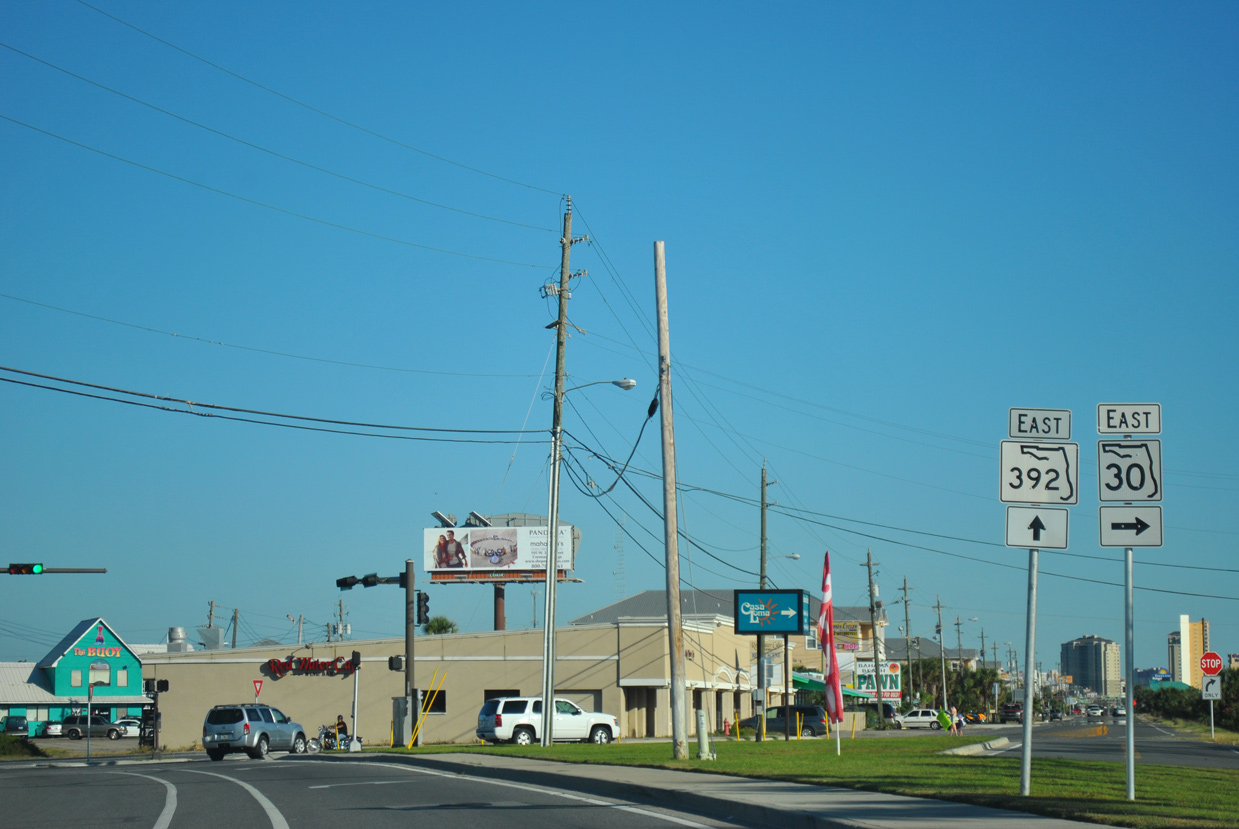
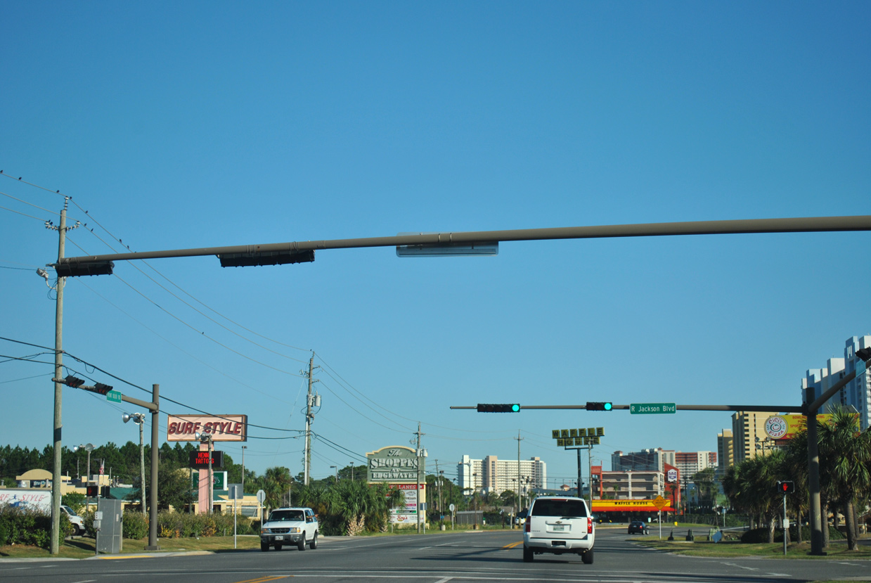
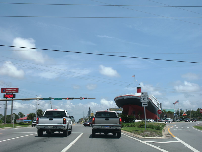
| SR 392 (Hutchinson Boulevard) returns to Front Beach Road at the upcoming signal with Thomas Drive. Thomas Drive extends south as unsigned Bay County Road 392 to Lower Grand Lagoon and St. Andrews State Park. 08/03/08 |
|
| SR 30 resumes along Front Beach Road east from SR 392 (Hutchinson Boulevard). Thomas Drive (CR 392) and Lagoon Drive (CR 3030) encircle Grand Lagoon through a bevy of communities on a peninsula that juts out into St. Andrew Bay. 08/03/08 |
|
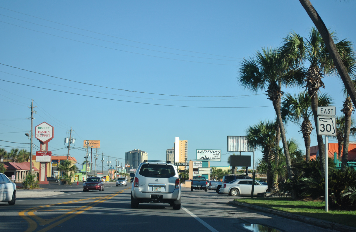
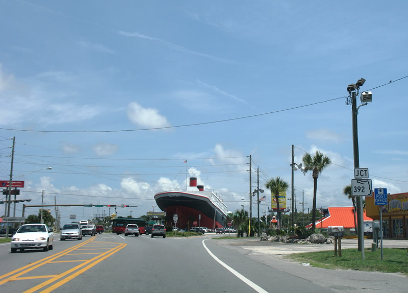
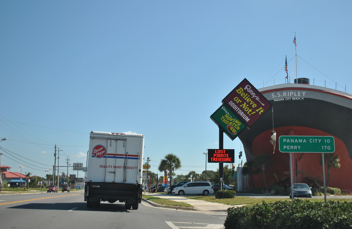
| Distance sign posted east of SR 392 on SR 30 by the Ripley's Believe It or Not! Museum. Downtown Panama City is still ten miles away although the city limits are half that distance. The control city of Perry remains from when U.S. 98 traveled Front Beach Road. 10/17/11 |
|
| Front Beach Road widens to four overall lanes east from SR 392 to the merge with U.S. 98. This section of SR 30 measures 2.075 miles. 10/17/11 |
|
| Joan Avenue (former Bay County Road 30B) travels south from SR 30 (Front Beach Road) to Lagoon and Thomas Drives. 10/17/11 |
|
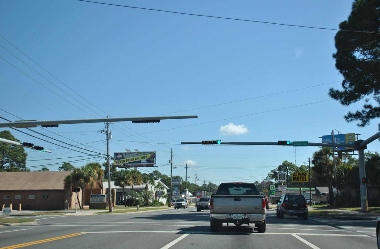
| Traffic lights were added to Front Beach Road at Allison Avenue by 2011. 10/17/11 |
|
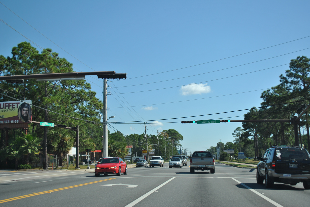
| Passing through residential areas between SR 30 (Front Beach Road) and Lagoon Drive (CR 3030), Laurie Avenue parallels Allison Avenue three blocks to the east. 10/17/11 |
|
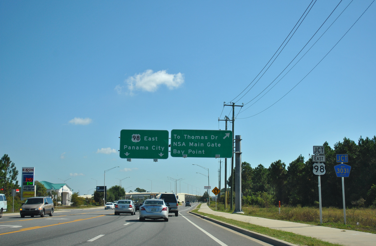
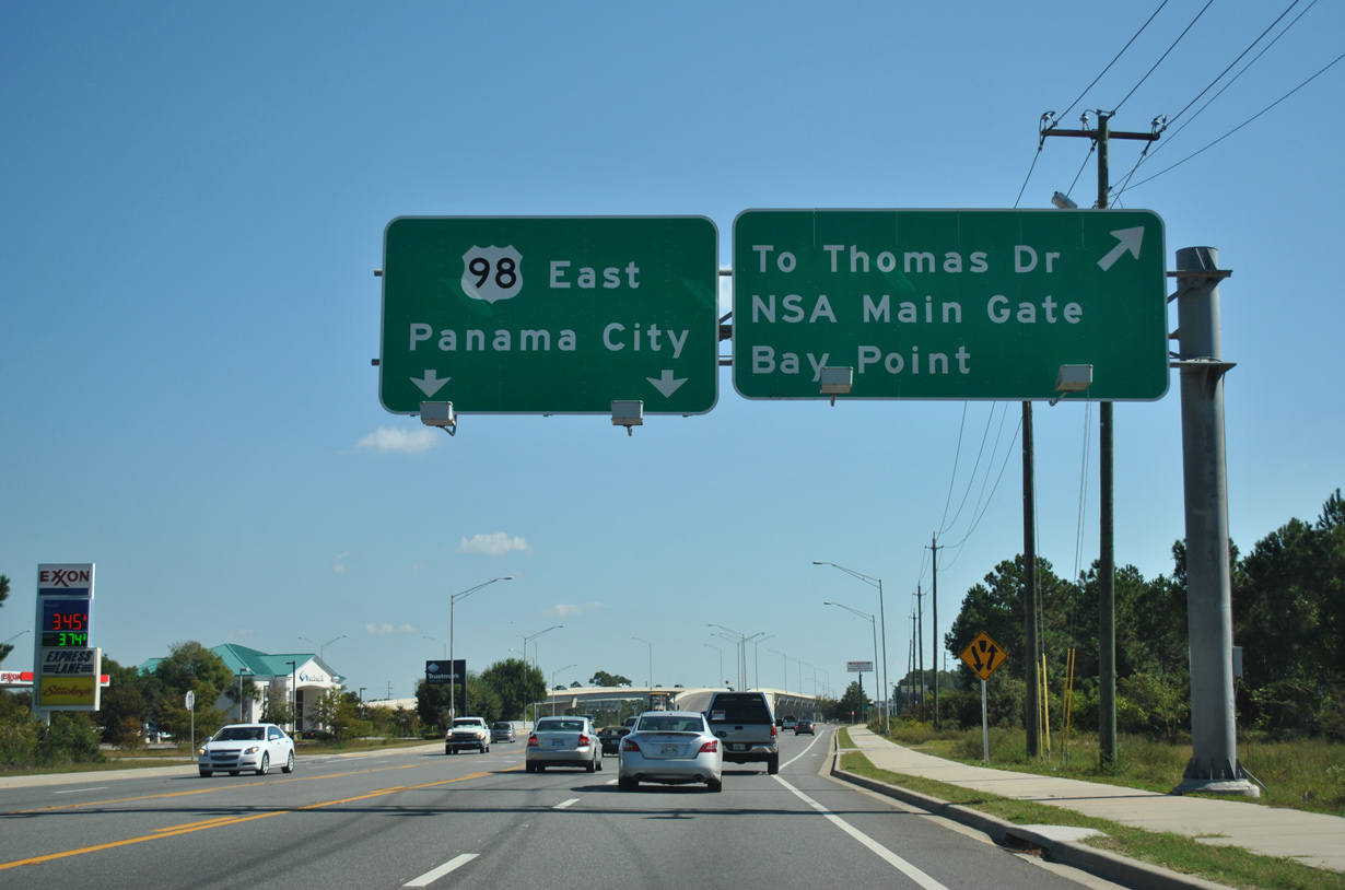
| With U.S. 98 shifting onto a freeway viaduct across Thomas Drive (CR 3031), a two lane off-ramp connects Panama City Beach Parkway east with SR 30 (Front Beach Road) for CR 3031 south. 10/17/11 |
|
| SR 30 rejoins U.S. 98 east at a wye interchange while a frontage road separates to Bay County Road 3031 (Thomas Drive) south. 10/17/11 |
|
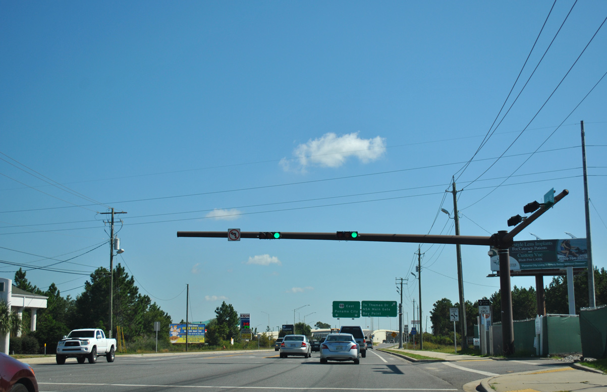
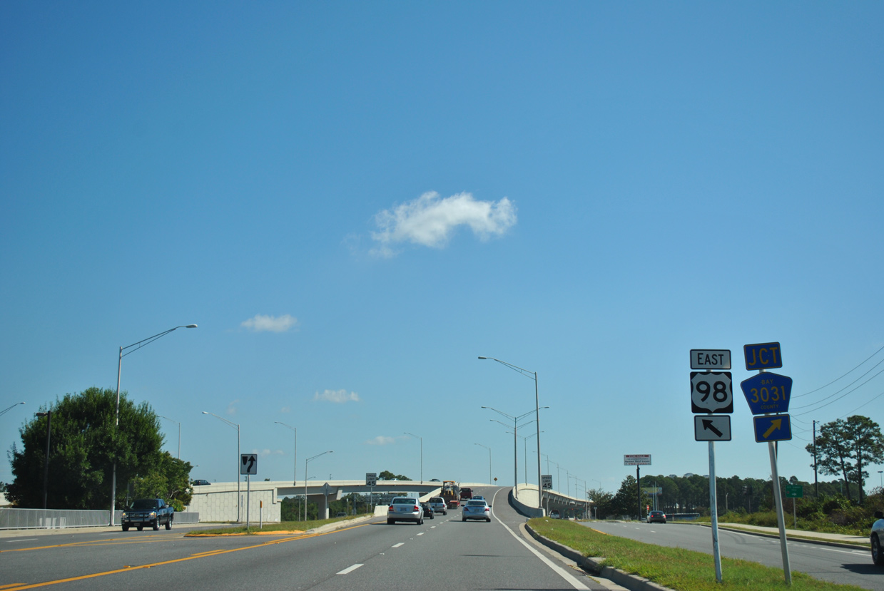
| Traffic splits for the U.S. 98 frontage road eastbound to Thomas Drive (CR 3031) south, Wildwood Road north, and the Naval Coastal Systems Center. SR 30 and U.S. 98 ascend onto the viaduct leading 1.25 miles to the Hathaway Bridge spanning St. Andrews Bay into Panama City. 10/17/11 |
|
| Presently only eastbound U.S. 98 travels the freeway viaduct to the Hathaway Bridge. Westbound U.S. 98 remains on a surface alignment through signalized intersections with Bay County Road 3031 and Woodland Drive. Completion of the Thomas Drive interchange remains unfunded. 10/17/11 |
Page Updated 08-22-2018.