|
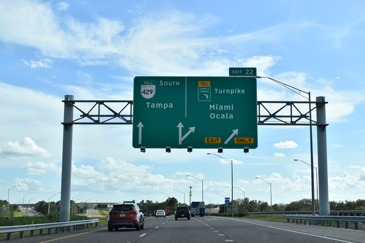
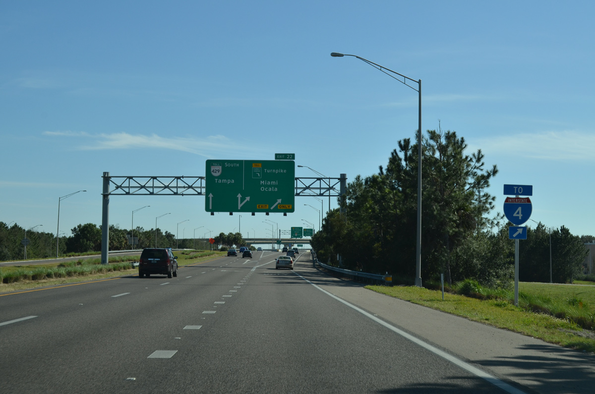
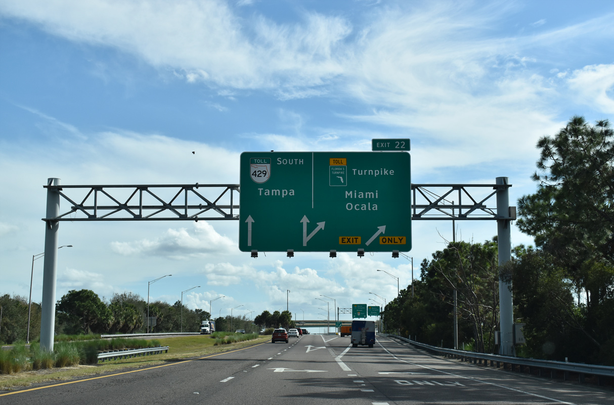
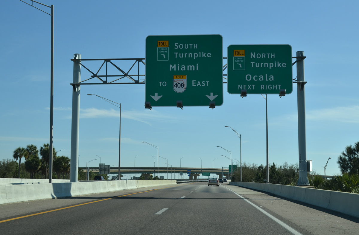
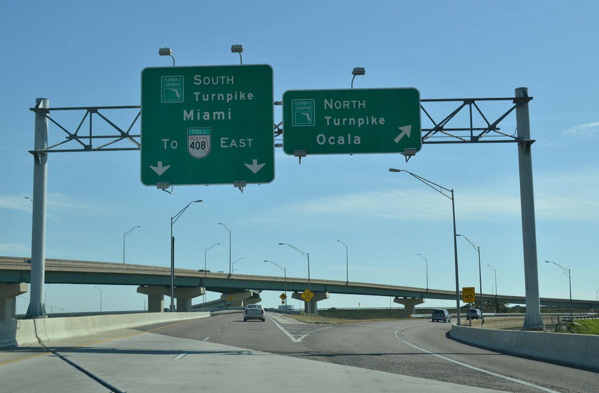
| Sign changes made by 2016 added arrow-per-lane (APL) signs for the ramps to Florida's Turnpike. A four-level interchange (Exit 22) joins the two toll roads to the immediate south of W Colonial Drive. 02/12/21 |
|
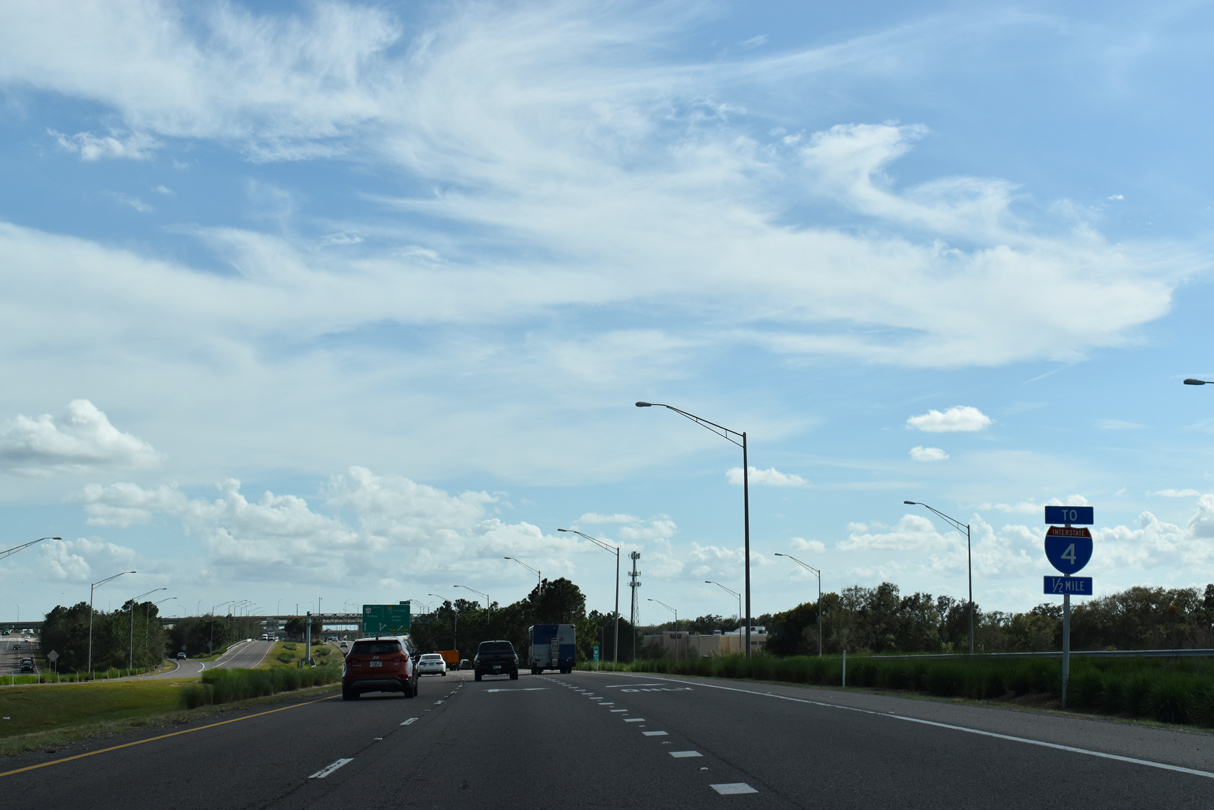
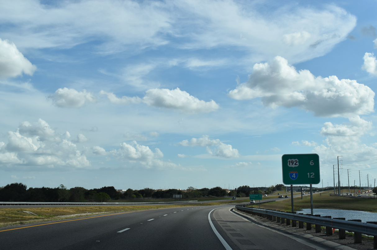
| Motorists bound for Interstate 4 in Orlando are directed onto Florida's Turnpike south. The turnpike meets the ramps with I-4 in 8.5 miles, while SR 408 east connects with ramps to I-4 at Downtown Orlando in 11 miles. 02/12/21, 02/27/16 |
|
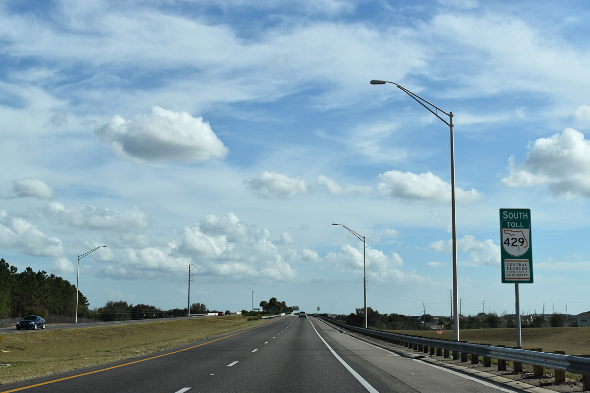
| Two lanes separate from the Western Beltway south at Exit 22 for Florida's Turnpike (State Road 91). 02/12/21 |
|
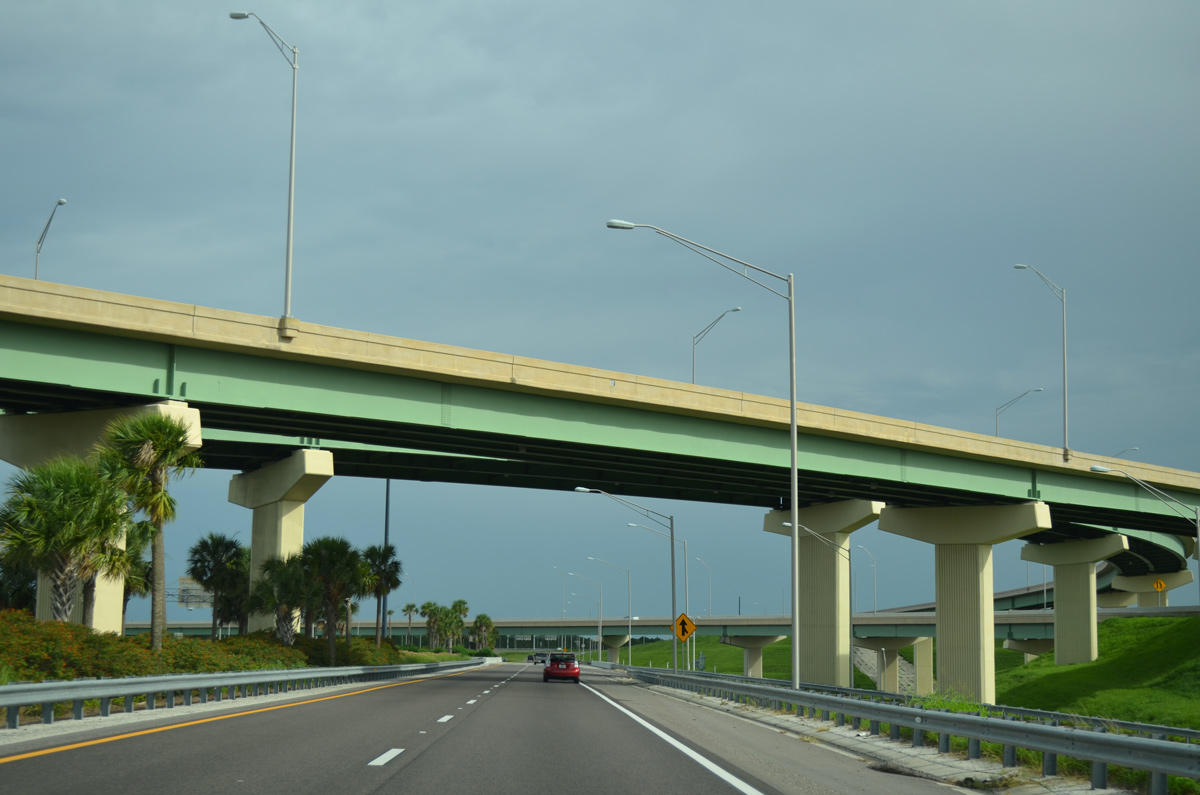
| With growing commuter use west to Clermont and Minneola and east from Winter Garden and Ocoee, construction along Florida's Turnpike expanded the toll road to eight overall lanes. 02/27/16 |
|
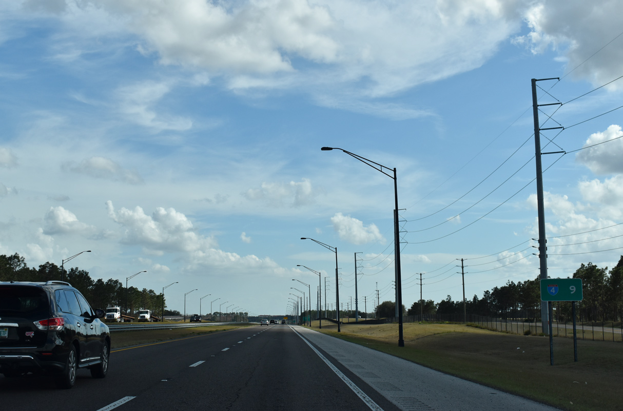
| Florida's Turnpike travels northwest through Lake County to Interstate 75 at Wildwood. South through Orlando, the Turnpike continues to Kissimmee, St. Cloud and South Florida. 02/27/16 |
|
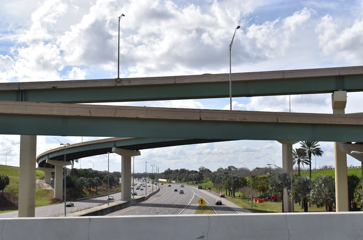
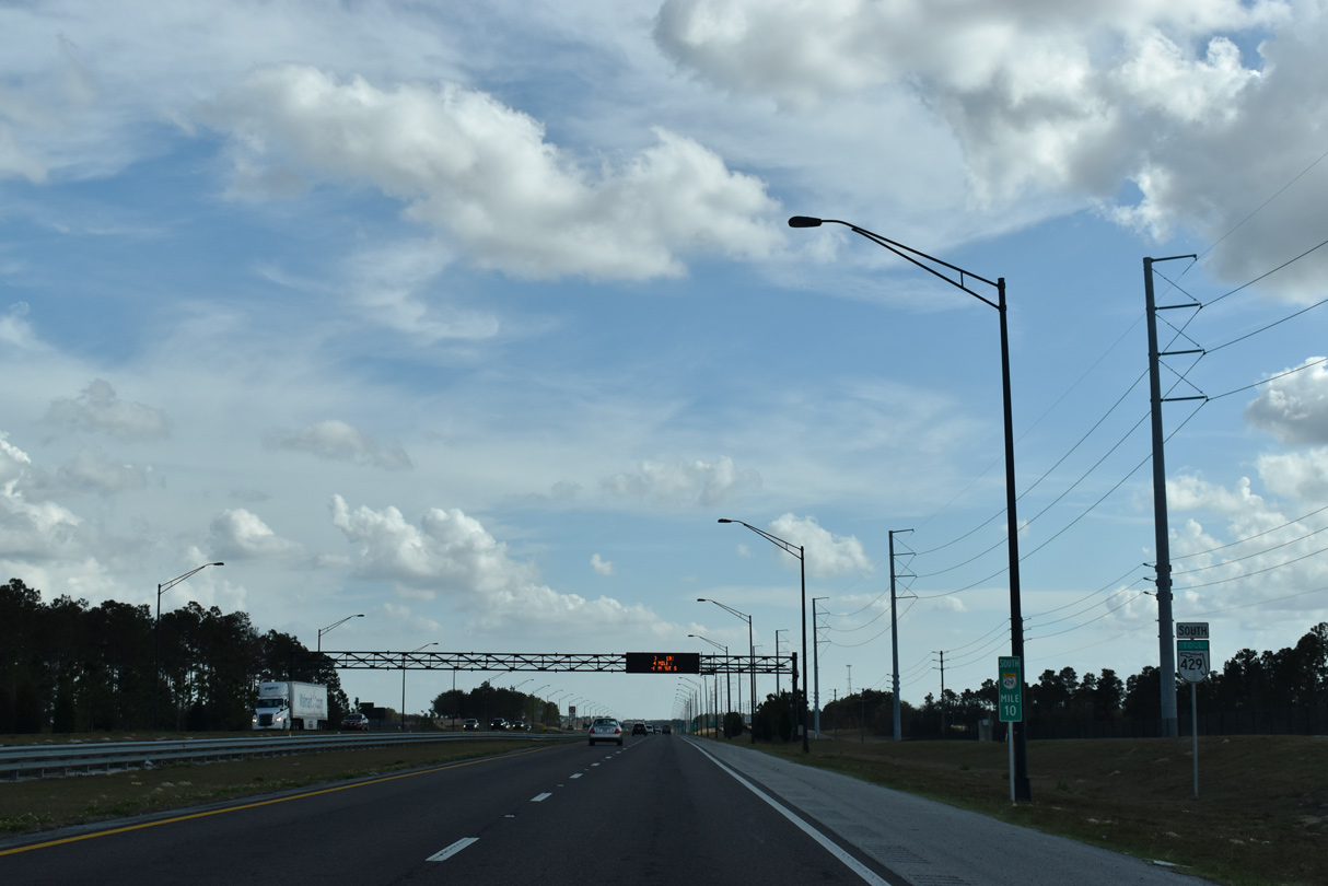
| The systems interchange joining Florida's Turnpike and SR 429 completed in December 2002. 06/29/13, 02/12/21 |
|
| SR 429 reenters the Ocoee city limits briefly at the Warrior Road underpass. 09/02/19 |
|
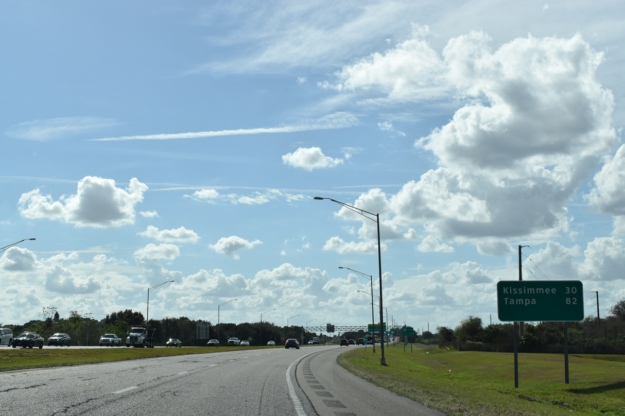
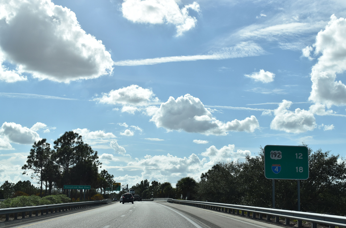
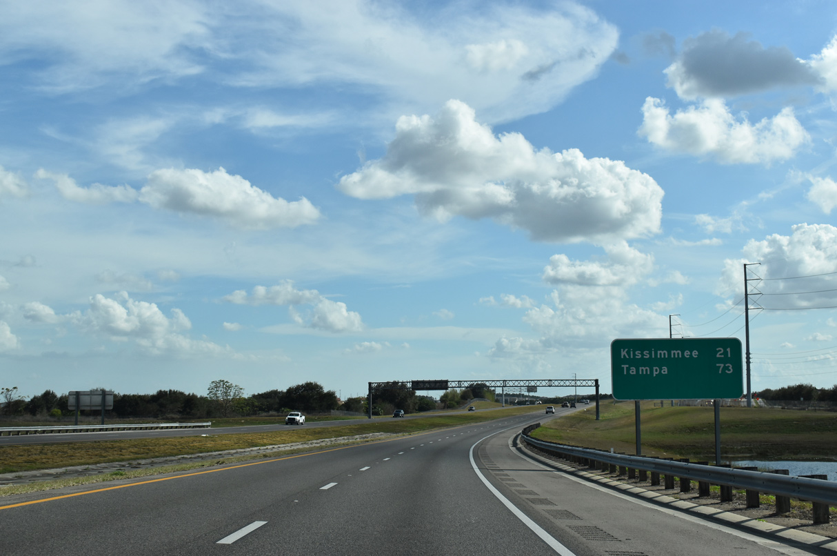
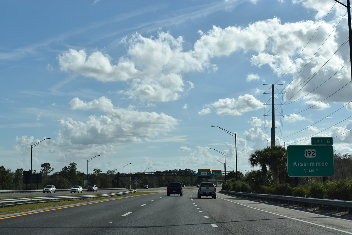
| Kissimmee appears on this distance sign, referencing the interchange with U.S. 192 at the Osceola County line. Tampa is 82 miles to the southwest. 02/12/21 |
|
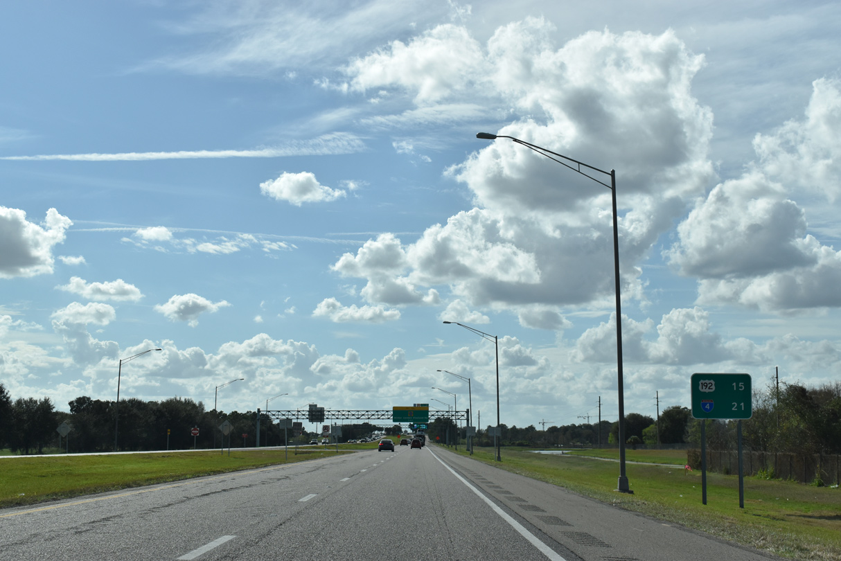
| The Western Beltway meets U.S. 192 in 15 miles and ends at Interstate 4 in 21 miles. 02/12/21 |
|
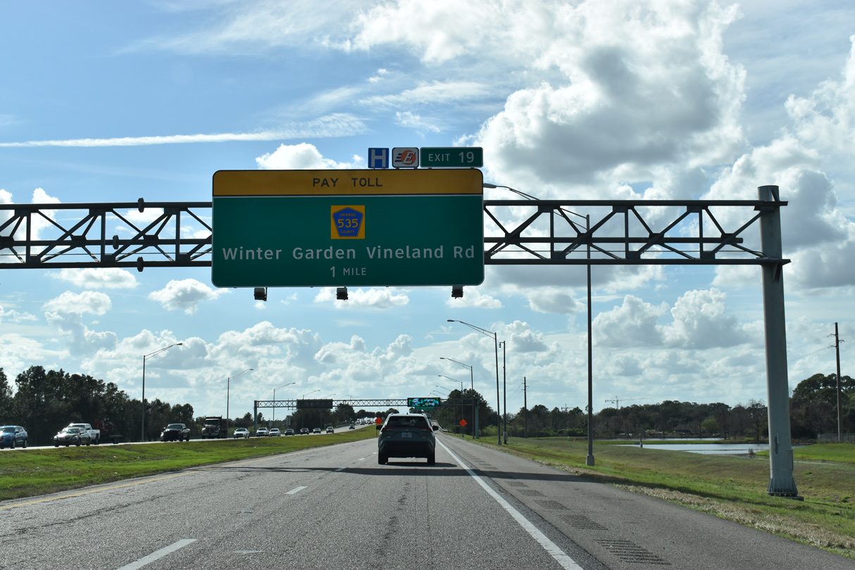
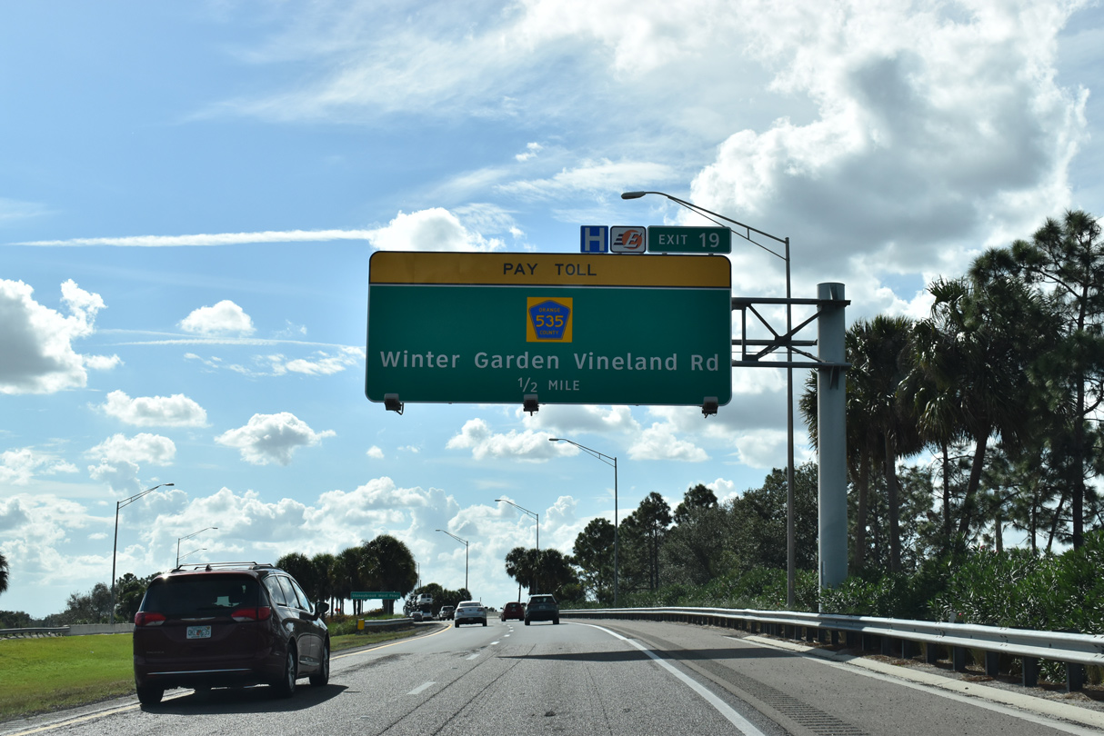
| Curving southwest, SR 429 passes through southern reaches of Winter Garden at upcoming Exit 19. The toll road ended here until December 2005. 02/12/21 |
|
| Winter Garden Vineland Road (CR 535) travels south from SR 50 (W Colonial Drive) in Winter Garden to Lake Butler and Lake Buena Vista. The county road was supplanted by Daniels Road as the primary arterial north from the adjacent Winter Garden Village retail area. 02/12/21 |
|
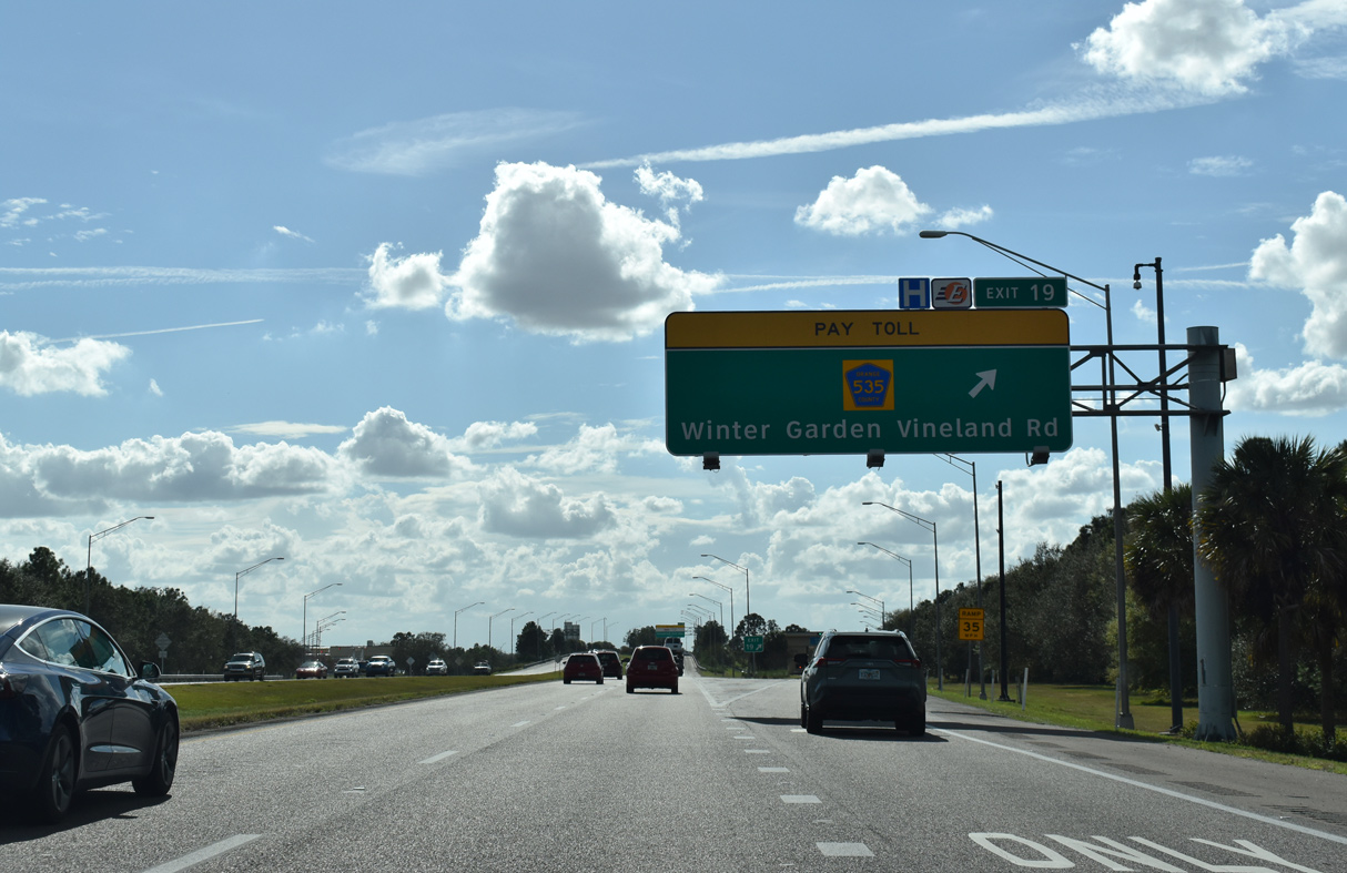
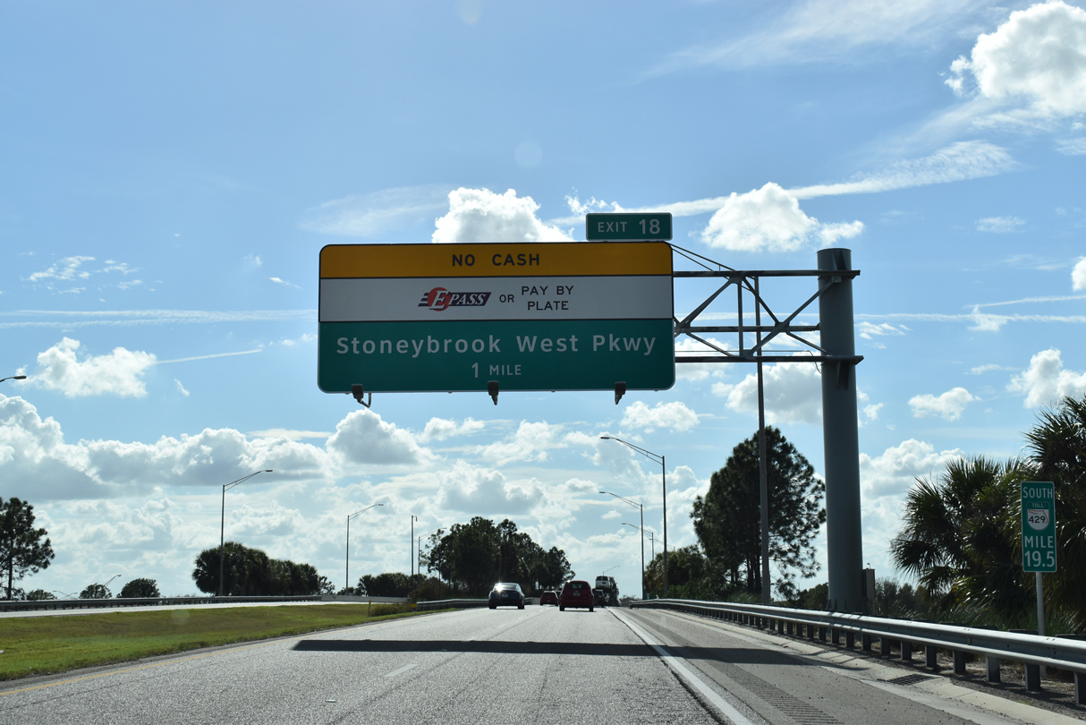
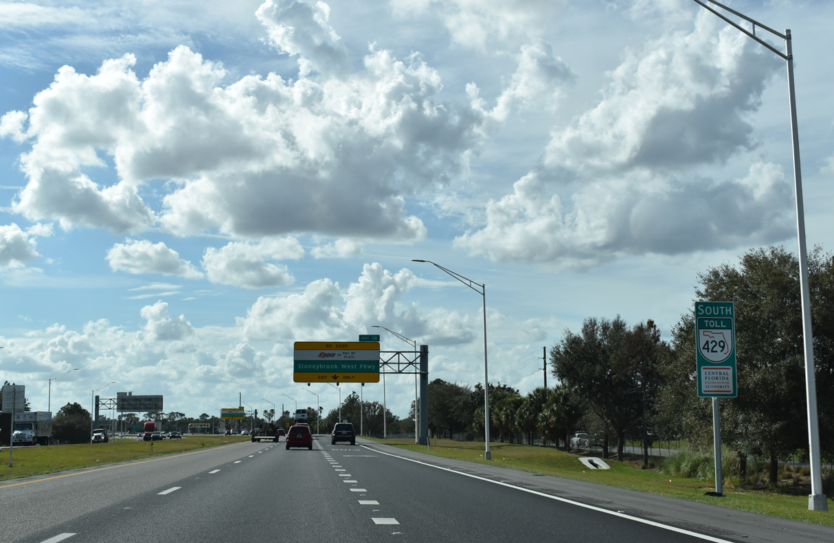
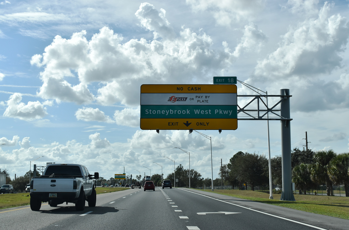
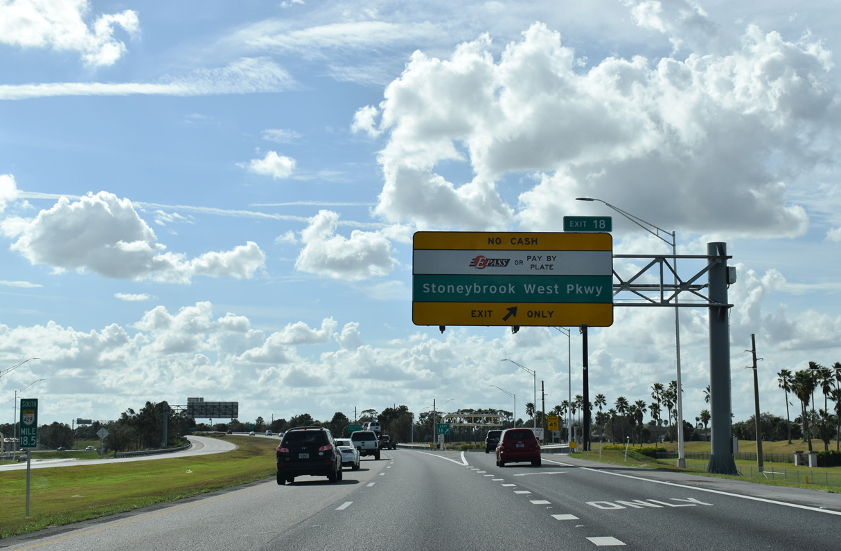
| Stoneybrook West Parkway accompanies both sides of SR 429 as a frontage road system to the diamond interchange (Exit 19) with CR 535 (Winter Garden Vineland Road). 02/12/21 |
|
| Underway from February 2020 to October 2020, a $10.8 million project added an exit ramp from SR 429 south to Stoneybrook West Parkway and an entrance ramp from the parkway east to the Western Beltway north.1 02/12/21 |
|
| SR 429 arcs southwest by the Stoneybrook West community at this reassurance marker. 02/12/21 |
|
| The addition of Exit 18 in 2020 added auxiliary lanes along both roadways of SR 429.1 02/12/21 |
|
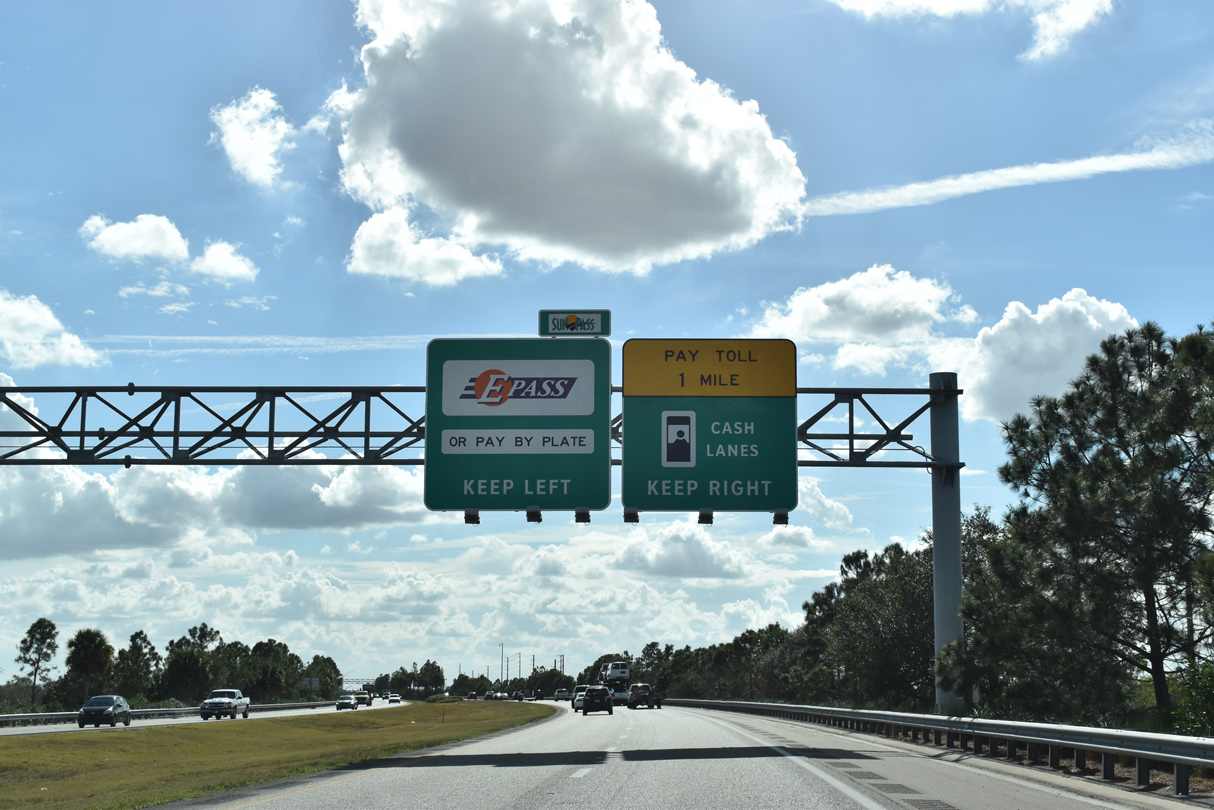
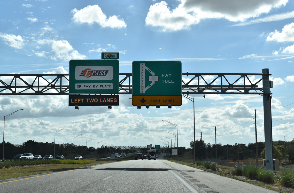
| Exit 18 utilizes all electronic toll (AET) collection. 02/12/21 |
|
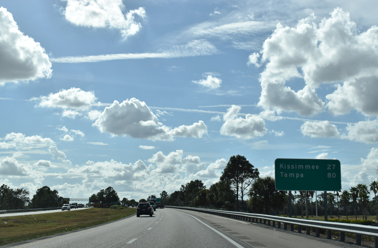
| Distance signs referencing the last two major interchanges along SR 429 and their respective destinations. 02/12/21 |
|
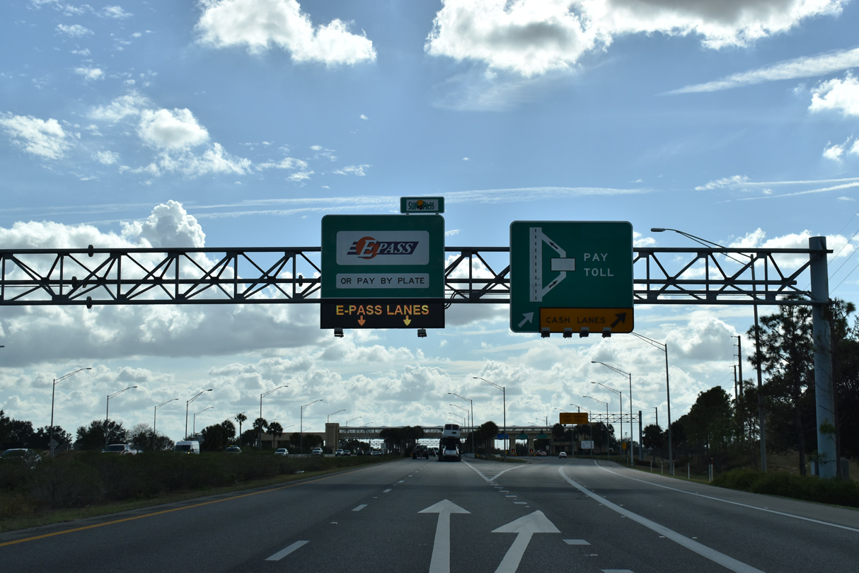
| The Independence Mainline Toll Plaza lines SR 429 south of the Winter Garden city limits and west of Tiny Road. The facility partitions traffic into two open road tolling lanes and three toll booths in each direction. 02/12/21 |
|
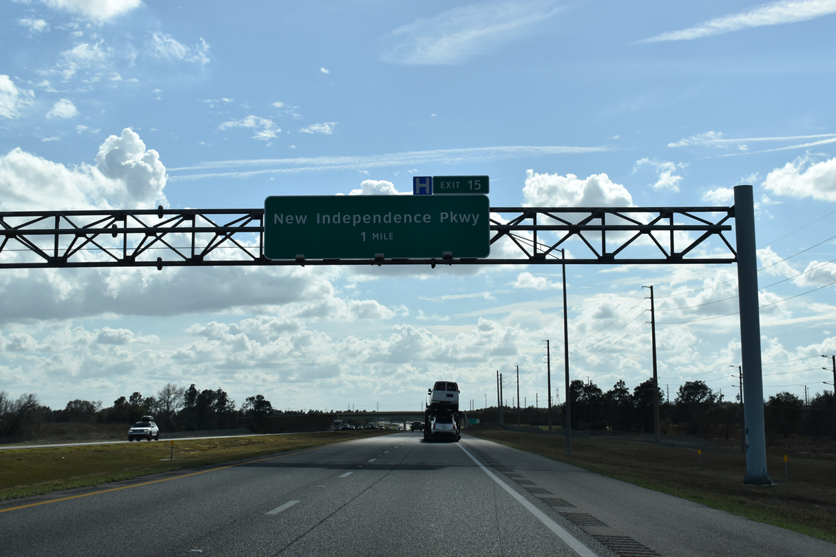
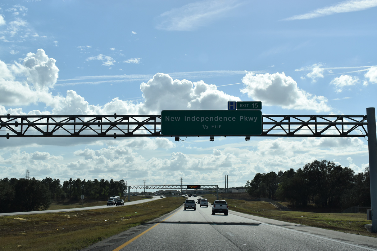
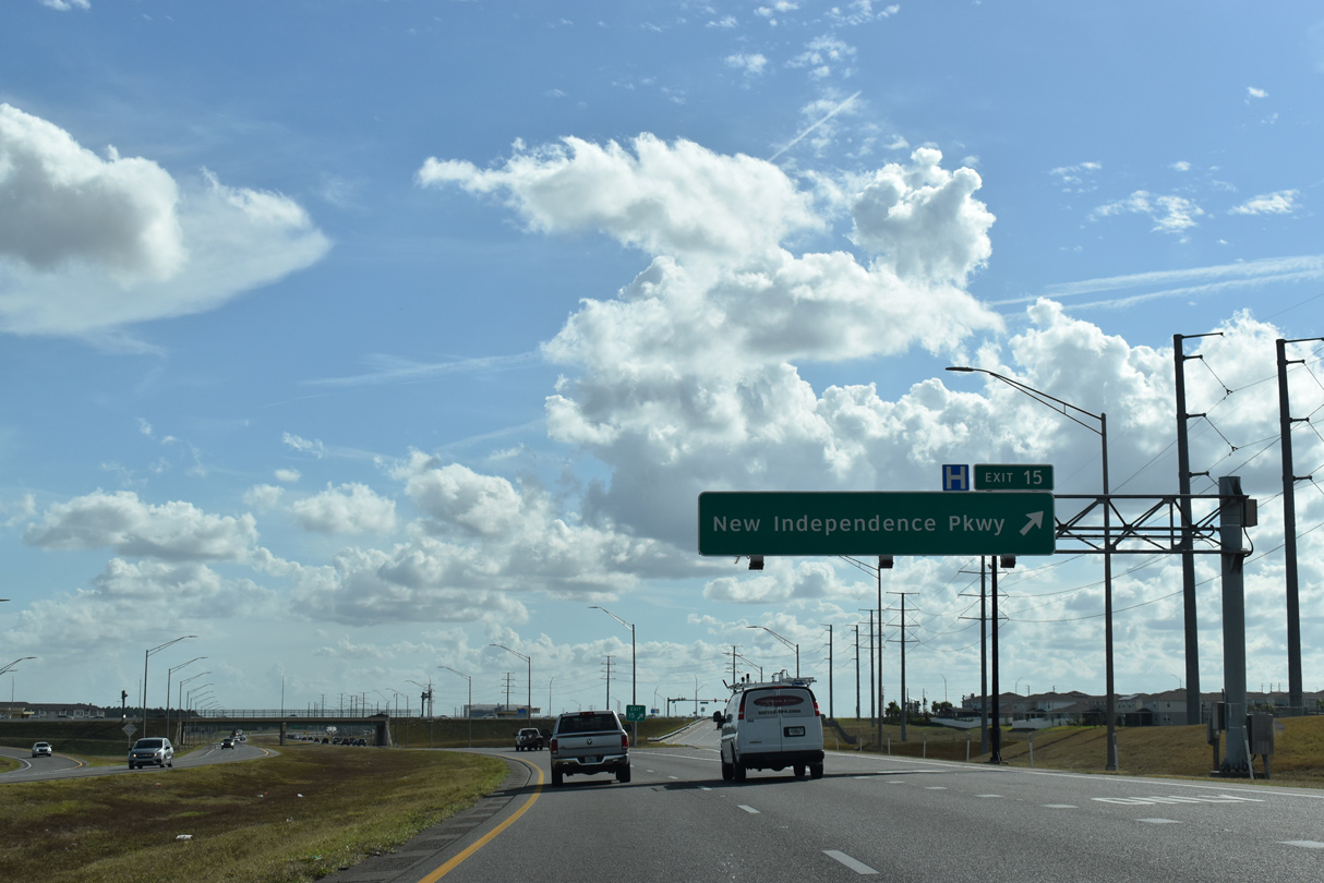
| The first of three exits for the Horizon West area joins SR 429 (Western Beltway) with New Independence Parkway (formerly McKinney Road) in one mile. 02/12/21 |
|
| Meeting New Independence Parkway just west of Exit 15, CR 545 (Avalon Road) parallels SR 429 from Lake Avalon and Winter Garden. 02/12/21 |
|
| New Independence Parkway leads east from the Hamlin retail area developed in 2015-18 to the Signature Lakes community off Lake Hancock. 02/12/21 |
|
| Entering the diamond interchange (Exit 15) with New Independence Parkway on the Western Beltway south. Land clearing to the southwest started in January 2019 for Hamlin Phase 2,2 a mixed use development spreading across 155 acres north and south of New Independence Parkway. 02/12/21 |
|
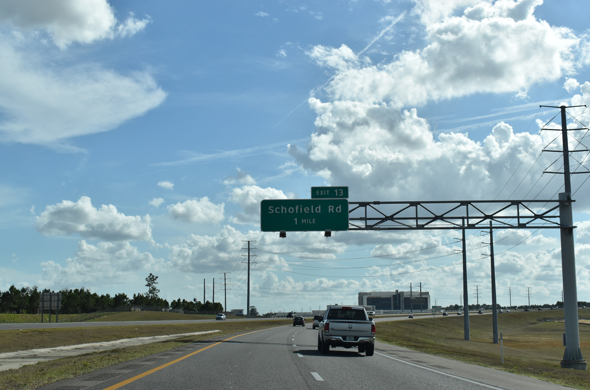
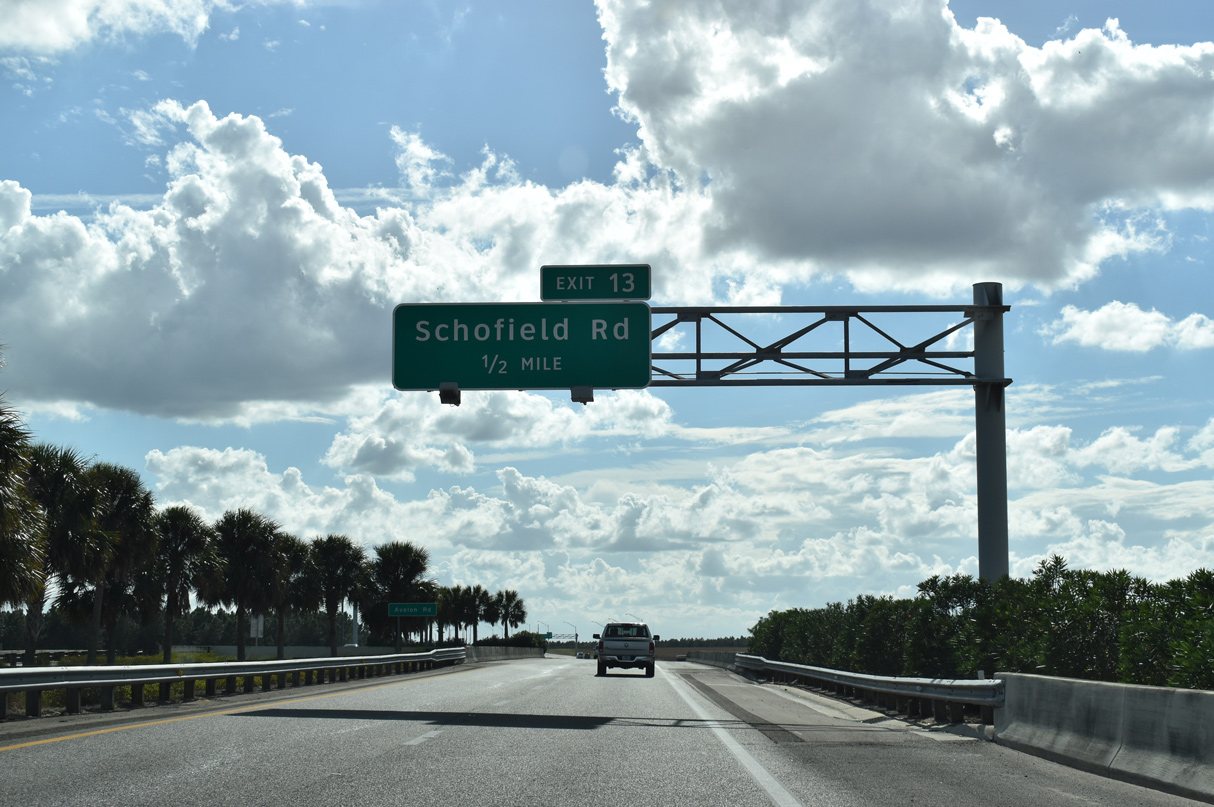
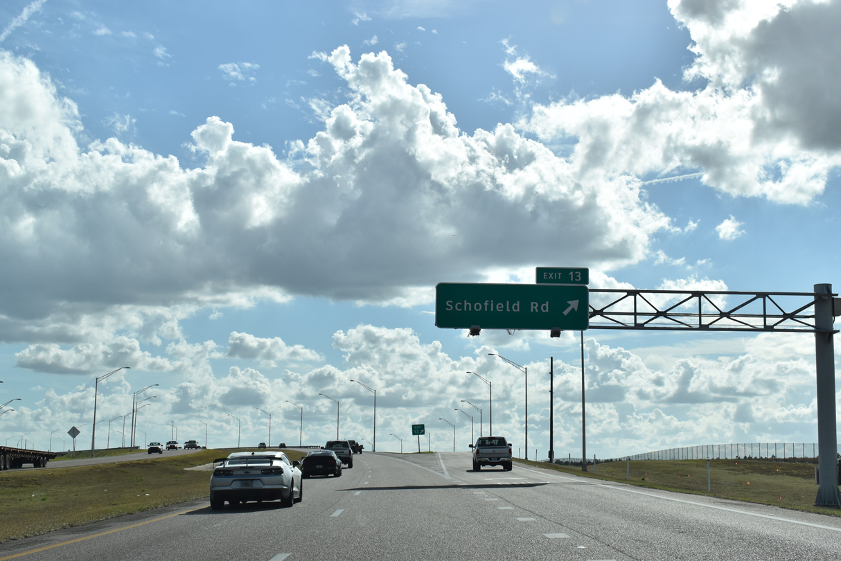
| The Western Beltway makes a gradual western arc through the Horizon West area, next meeting Schofield Road at Exit 13. 02/12/21 |
|
| 12,000 homes were outlined for Horizon West in 2005. By 2015, another 60,000 homes were projected to be built throughout the community.2 02/12/21 |
|
| SR 429 (Western Beltway) south spans Porter Road and CR 545 (Avalon Road) on back to back bridges preceding Exit 13 to Schofield Road. 02/12/21 |
|
| The parclo interchange with Schofield Road opened to traffic on May 27, 2015.3 The $10 million project further enhanced area access for the Horizon West community. 02/12/21 |
|
| Confirming marker posted on SR 429 south between the Old YMCA Road and Avalon Road underpasses. The ensuing stretch runs between Hickory Nut Lake and Panther Lake. 02/12/21 |
|
| Crossing over CR 545 (Avalon Road), another set of distance signs along southbound SR 429 list U.S. 192 / Kissimmee and I-4 / Tampa. 02/12/21 |
|
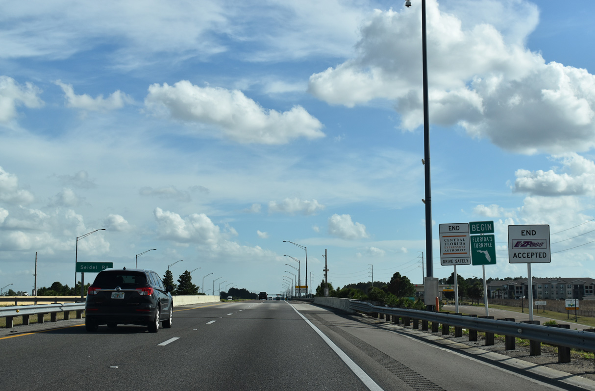
| The CFX portion of the Western Beltway ends at the half diamond interchange (Exit 11 northbound) with Seidel Road. Florida's Turnpike Enterprise (FTE) maintains the remainder of SR 429 southward. 02/12/21 |
|
| Distance sign for I-4 posted south of Seidel Road. The ramps with Seidel Road opened in Winter 2006 to accommodate the future Horizon West town center. 02/12/21 |
|
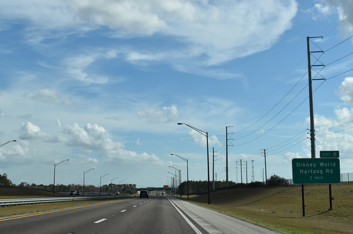
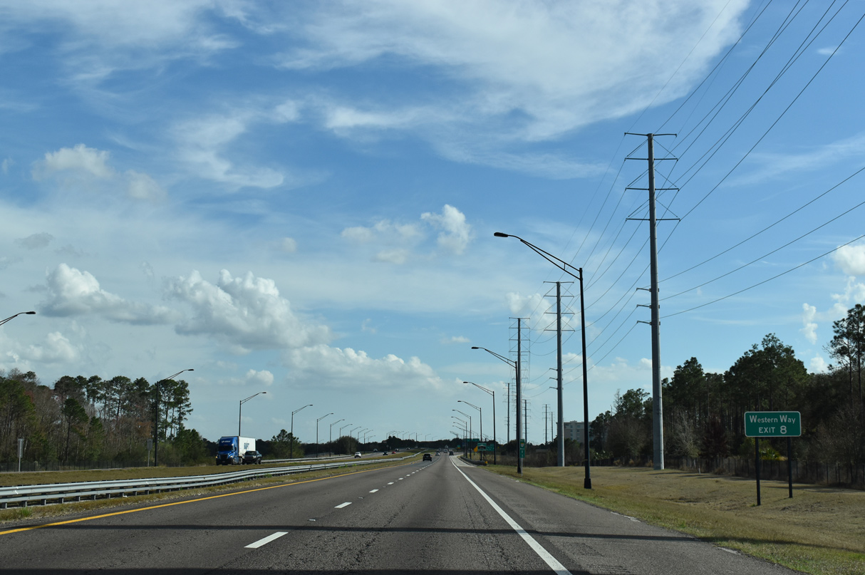
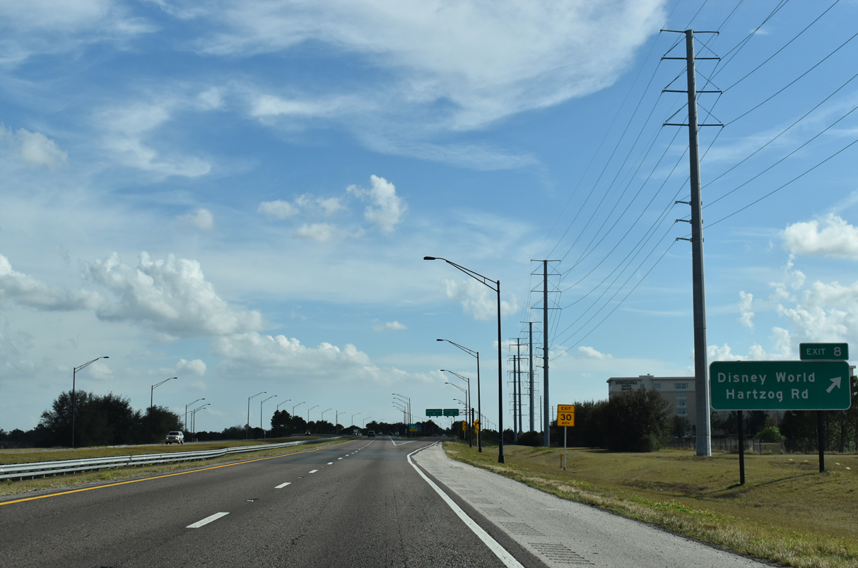
| Flamingo Crossings Boulevard (formerly Hartzog Road) parallels the west side of SR 429 south to the parclo interchange (Exit 8) with Western Way. 02/12/21 |
|
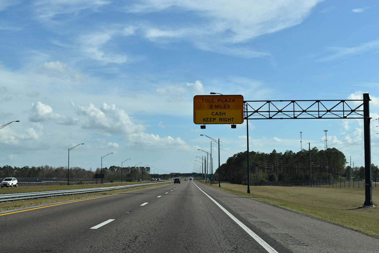
| The final mainline toll plaza for SR 429 lies just south of Western Way at milepost 7. 02/12/21 |
|
| Western Way opened to traffic in Winter 2006 to link the Western Beltway with Walt Disney World. The arterial connects with W Buena Vista Drive west of Epcot. 02/12/21 |
|
| SR 429 south enters the city limits of Bay Lake through the exchange with Western Way. Bay Lake is one of two cities operated by the Walt Disney Corporation. 02/12/21 |
|
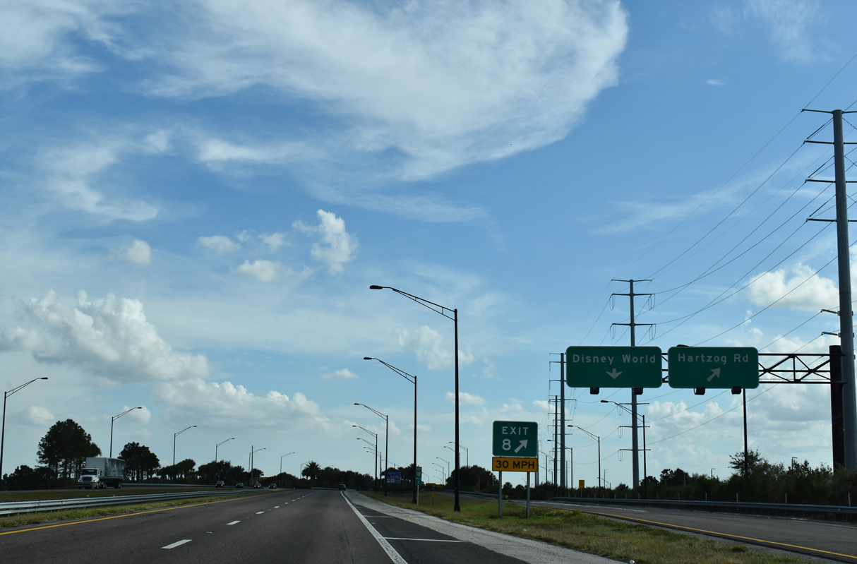
| Exit 8 partitions into separate ramps for Western Way west to Flamingo Crossings Boulevard (Hartzog Road) CR 545 (Avalon Road) and east to Disney World. 02/12/21 |
|
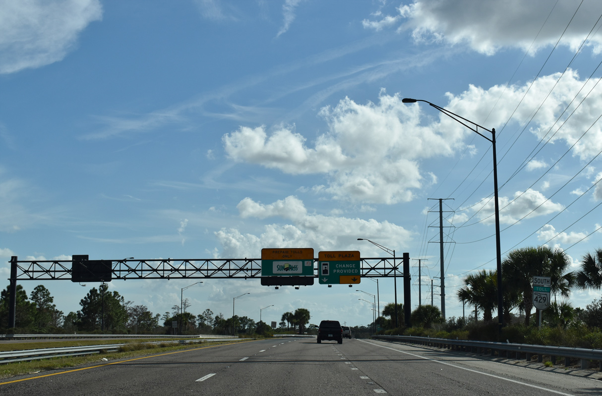
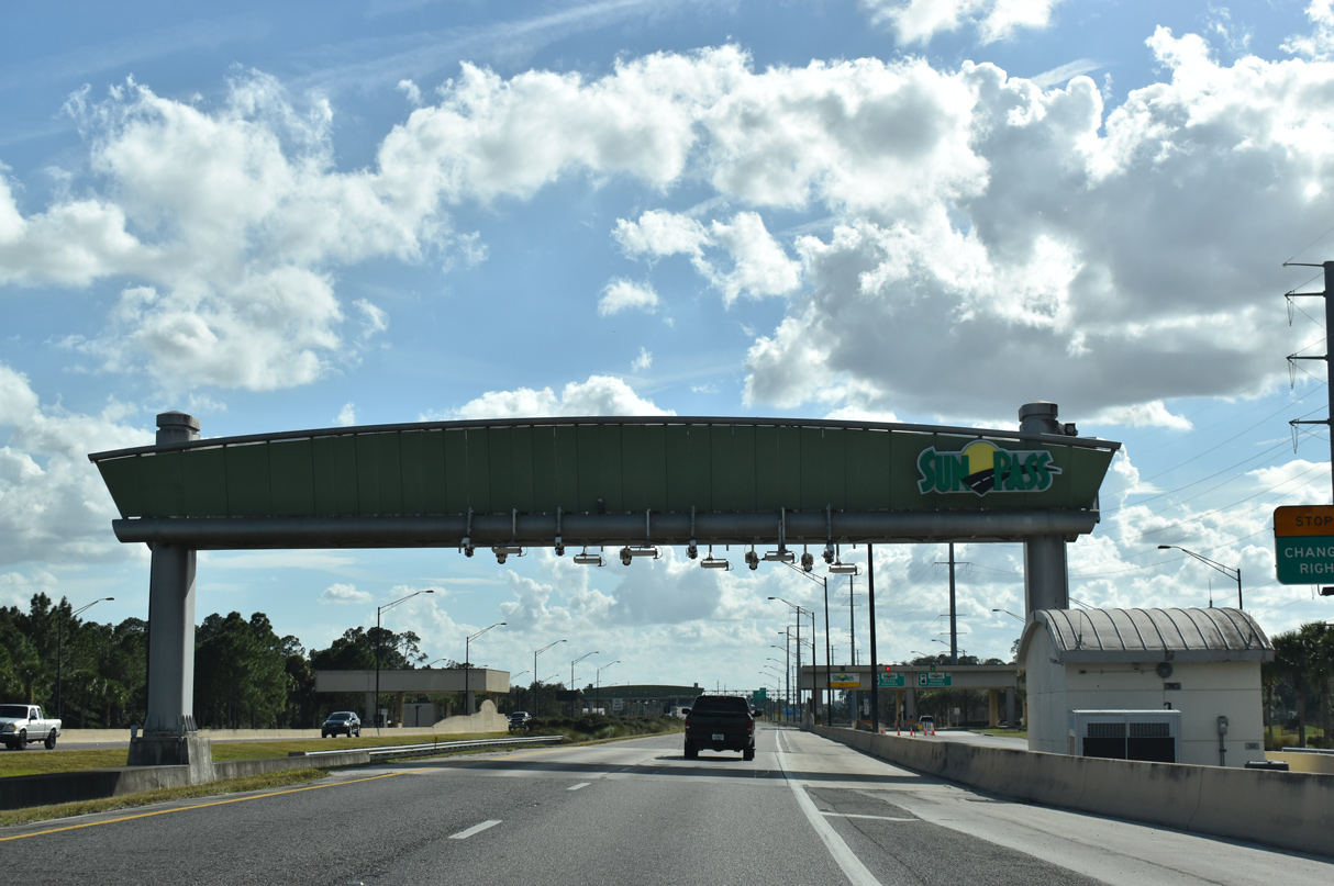
| The FTE Mainline toll plaza lies south of the West Orange Lake Boulevard underpass and alongside Orange Lake Country Club. 02/12/21, 03/31/18 |
|
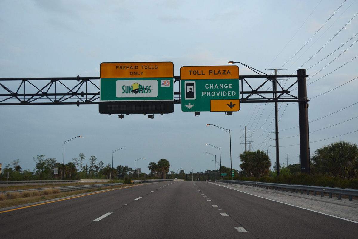
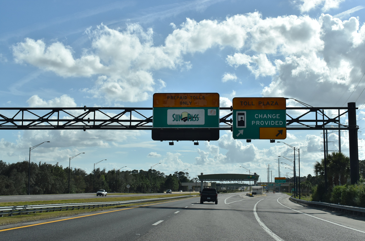
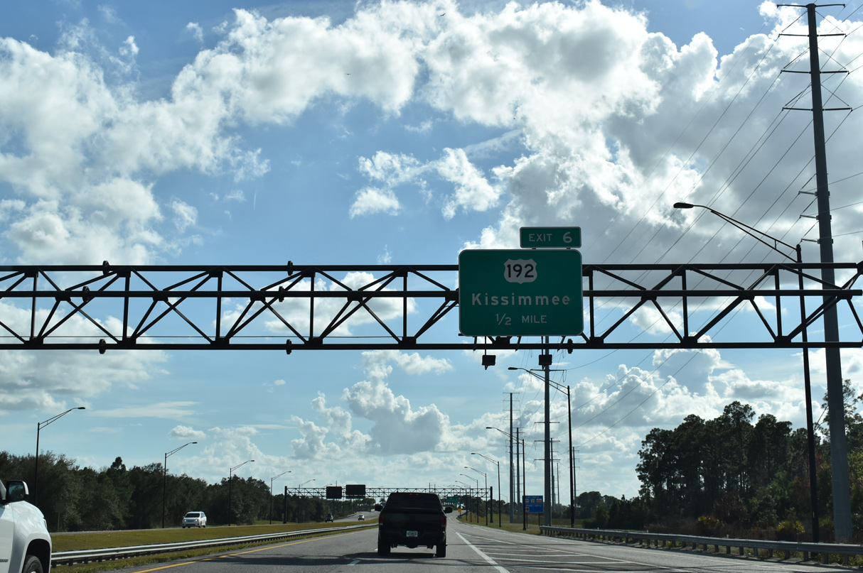
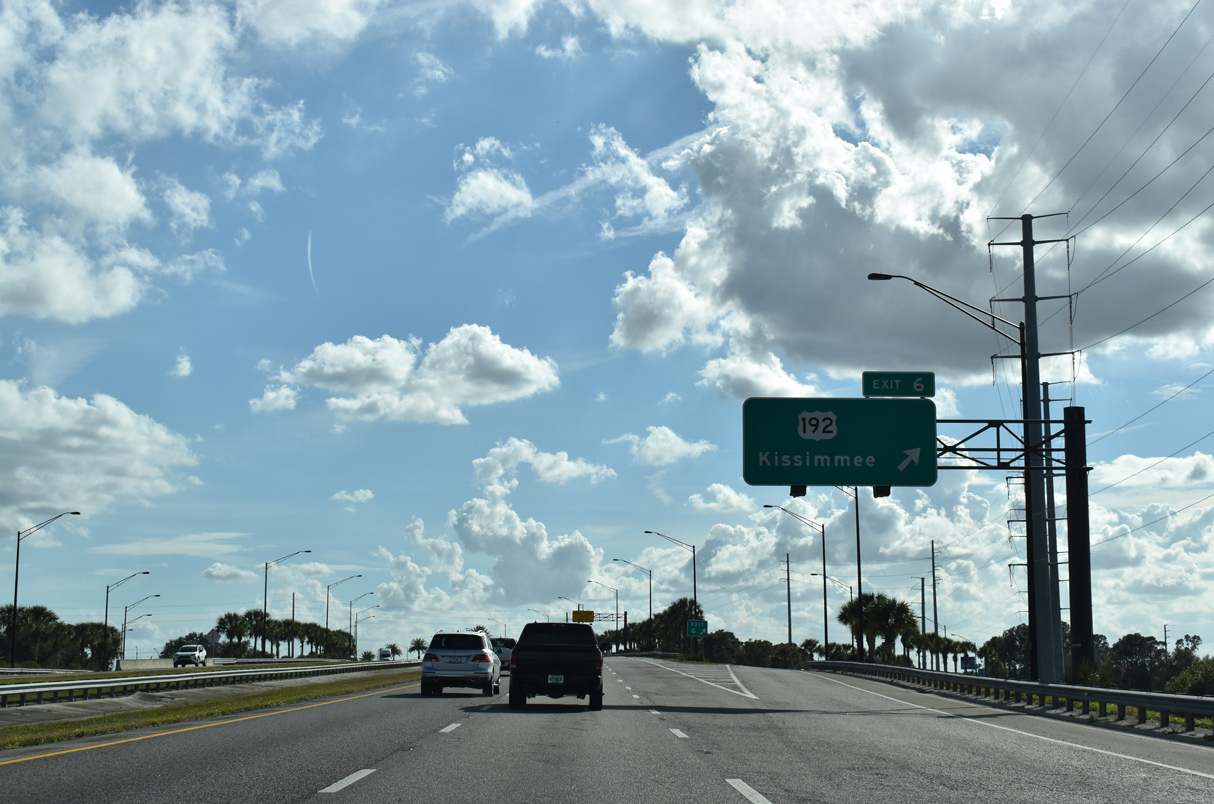
| The diamond interchange (Exit 6) with U.S. 192 (Irlo Bronson Memorial Highway) follows just beyond the mainline toll plaza. 02/12/21 |
|
| The southbound roadway separates into AET lanes and a set of three toll booths. 02/12/21 |
|
| U.S. 192 straddles the Osceola County line west to U.S. 27 and Four Corners, the location where Orange, Lake, Polk, and Osceola Counties come together. 02/12/21 |
|
| SR 429 south ended at U.S. 192 until December 2006. U.S. 192 angles southeast along a heavily commercialized stretch catering to Walt Disney World tourists. 09/02/19 |
|
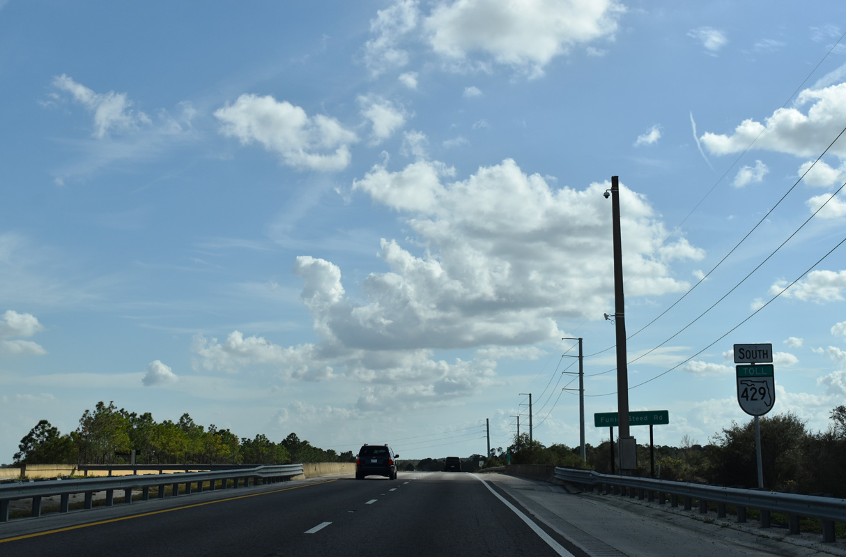
| This confirming shield stands southbound at the Funie Steed Road underpass. Funie Steed Road joins suburban areas both west and east of SR 429. 02/12/21 |
|
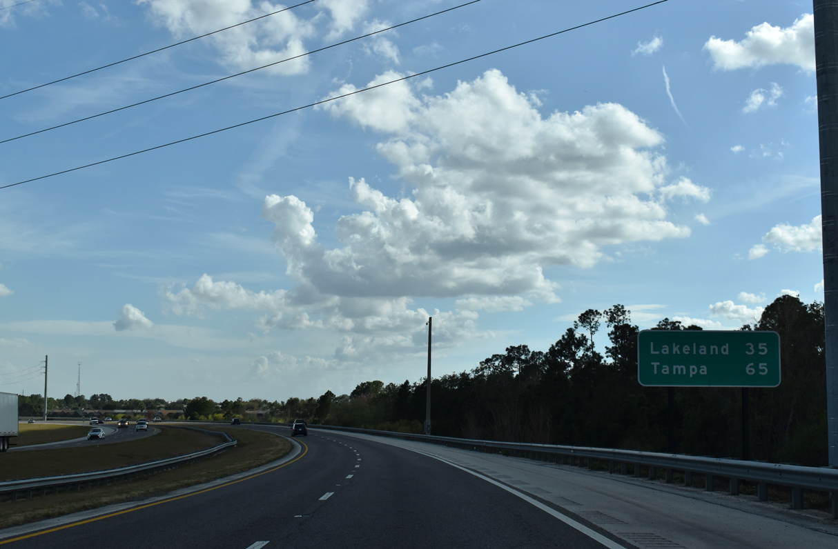
| Lakeland joins Tampa on the succeeding distance sign on SR 429 south for Interstate 4. 02/12/21 |
|
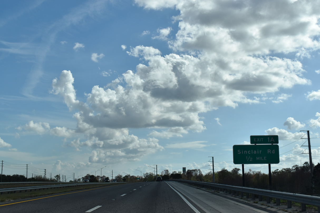
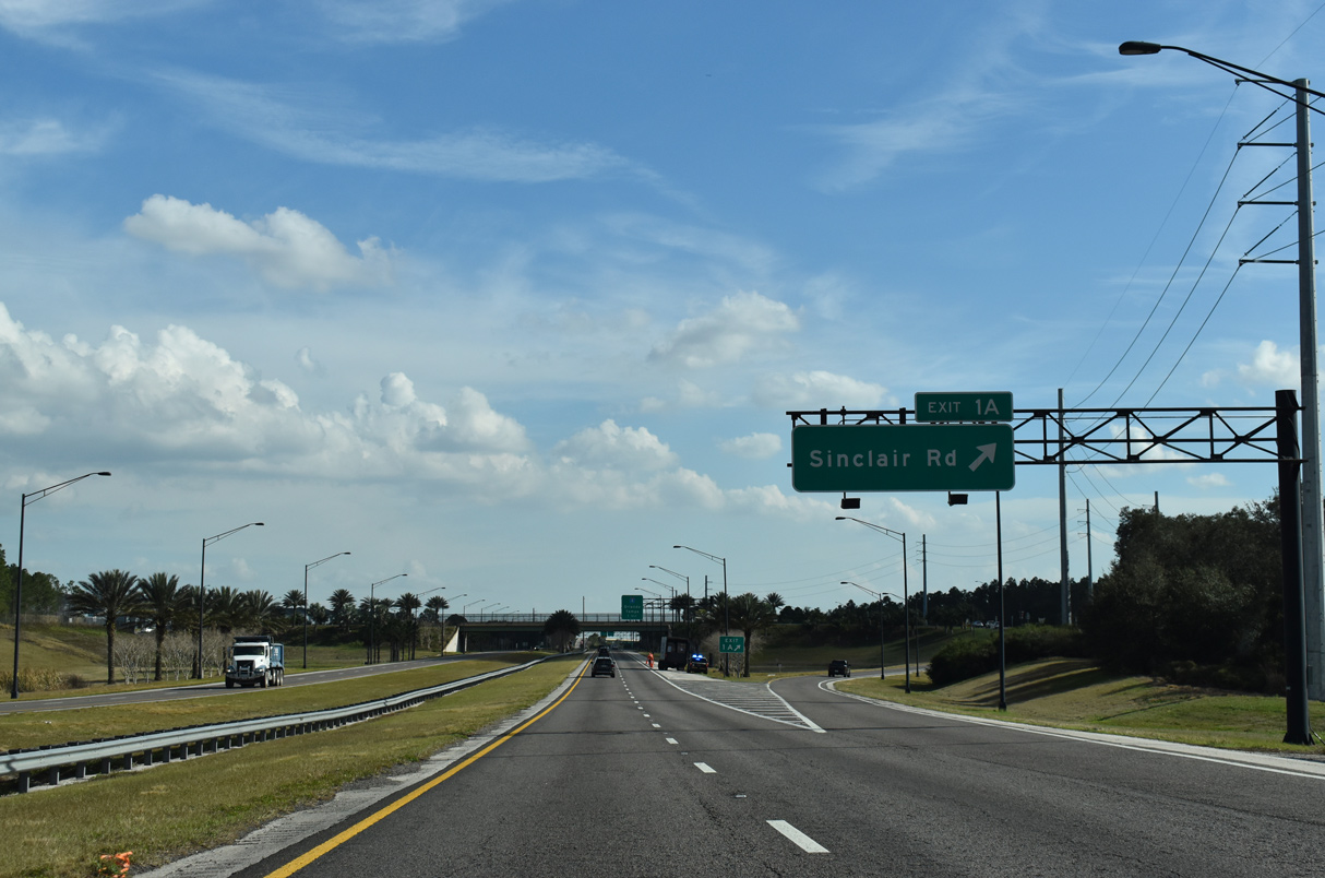
| SR 429 runs alongside Formosa Gardens Boulevard south from the Indian Creek development to Sand Hill Road. Exit 1 A follows with Sinclair Road. 02/12/21 |
|
| Sinclair Road is a four lane arterial serving development east of Exit 1 A along Old Lake Wilson Road (CR 545) and south at Tradition Boulevard. 02/12/21 |
|
| Another reassurance marker for SR 429 south appears ahead of the Sand Hill Road underpass. 02/12/21 |
|
| SR 429 turns southeast toward Interstate 4 through the modified diamond interchange (Exit 1 A) with Sinclair Road. 02/12/21 |
|
| Interstate 4 angles southwest from the Walt Disney World area toward Winter Haven, Auburndale and Lakeland in Polk County. 02/12/21 |
|
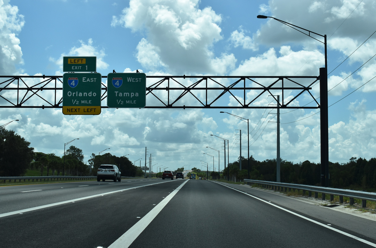
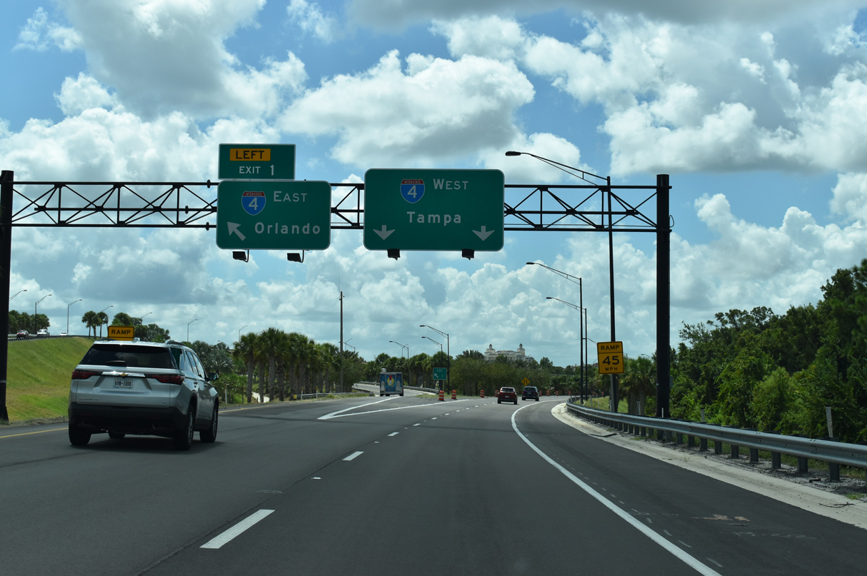
| Left Exit 1 departs in one half mile for Interstate 4 east back toward Orlando. An exit tab was added for I-4 east after June 2018. 08/18/23 |
|
| The flyover ramp for Interstate 4 east is assigned Exit 1 while an unnumbered ramp defaults onto I-4 west toward Tampa with two lanes. 08/18/23 |
|
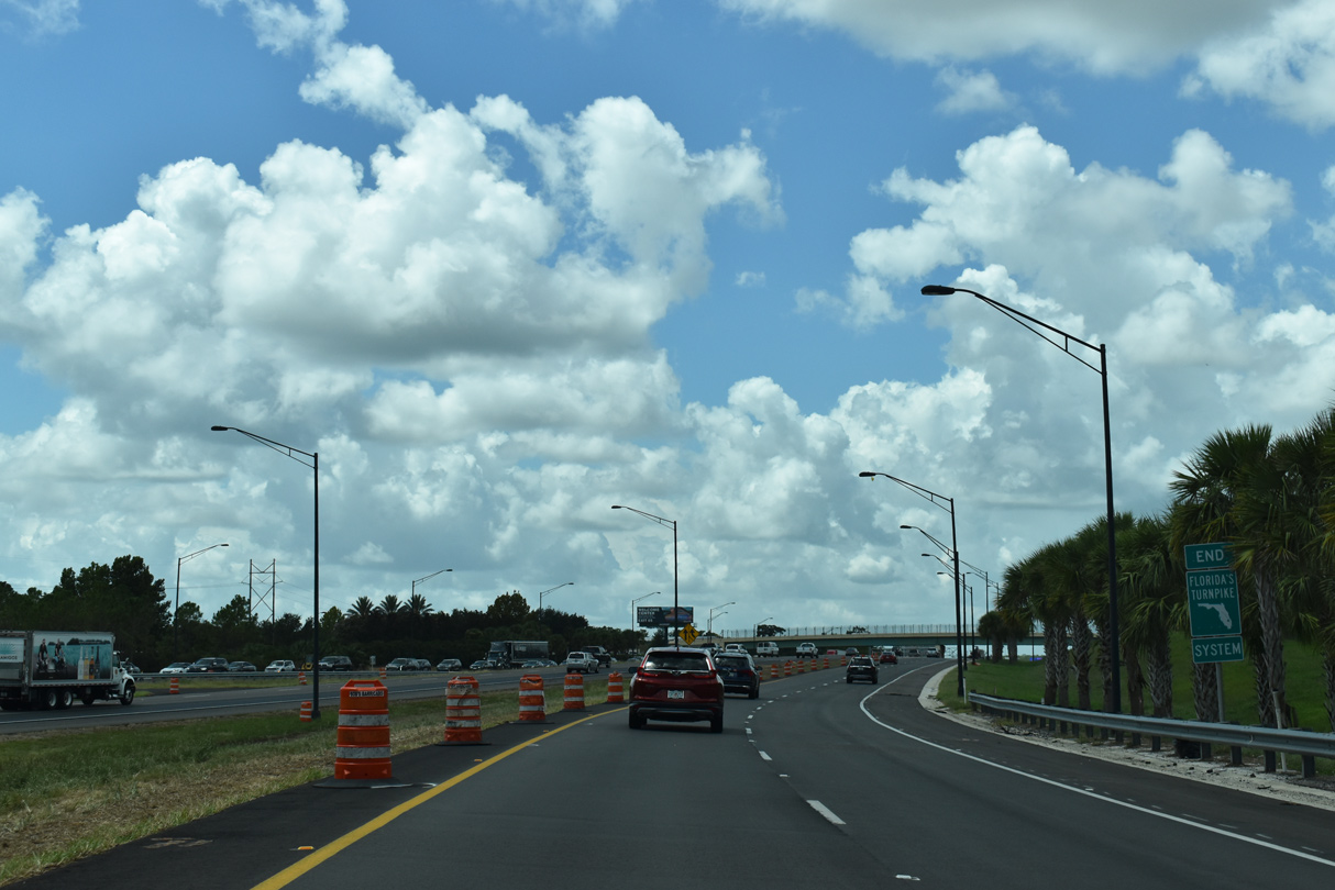
| An end shield for Florida's Turnpike system stands along both the east and westbound entrance ramps to Interstate 4. 08/18/23 |
Page Updated 11-10-2022.

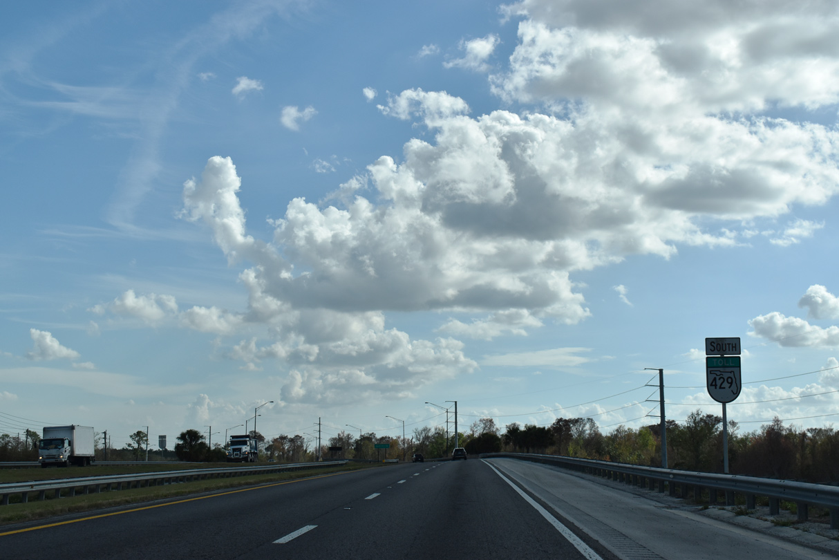
 South
South