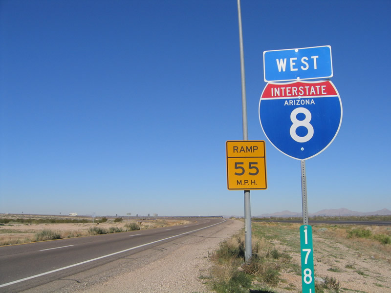
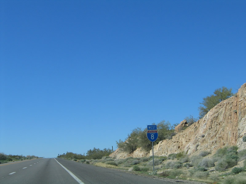
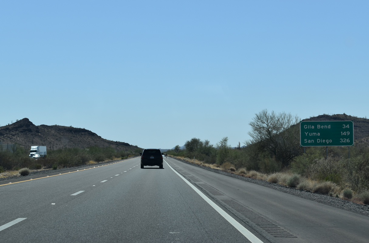
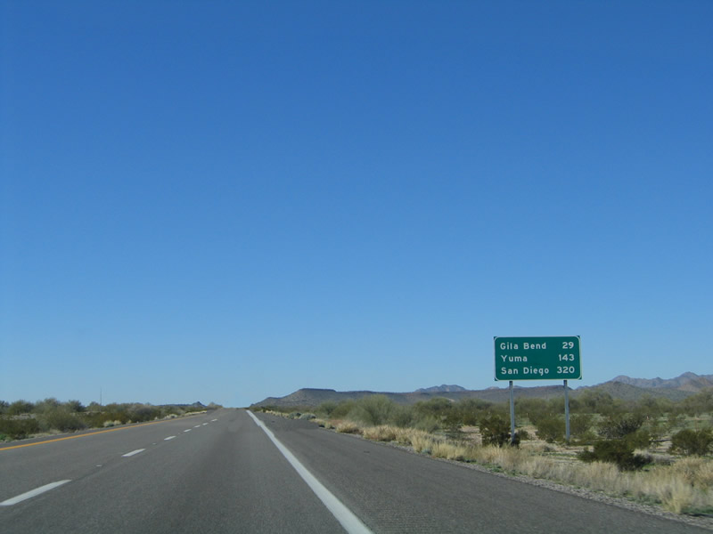
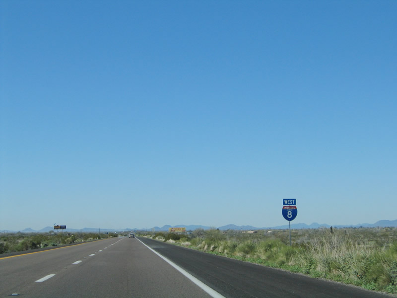
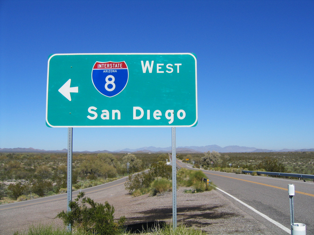
The control city for Interstate 8 west is San Diego for its entire length from Casa Grande, Arizona all the way to the Pacific Coast. This sign is posted on northbound Vekol Valley Road in rural Maricopa County within Sonoran Desert National Monument. 01/17/05
|
| The first confirming marker for Interstate 8 west appears just beyond the exchange with I-10 near Casa Grande. The section of I-8 with the lowest traffic counts is between Casa Grande and Gila Bend. 01/17/05 |
|
| Interstate 8 passes between the Tohono O'odham Nation and the city of Casa Grande along a rural course west toward Gila Bend. 04/26/17 |
|
| Interstate 8 spends six more miles in Arizona (178 miles) than it does in California (172 miles). 04/26/17 |
|
| Founded in 1879 and incorporated in 1915, Casa Grande is one of the largest communities in Pinal County and sits by the crossroads of I-8/10. Sitting at an elevation of 1,405 feet above sea level, Casa Grande grew substantially from 32,855 as of the 2000 Census to 55,653 in 2020. 04/26/17 |
|
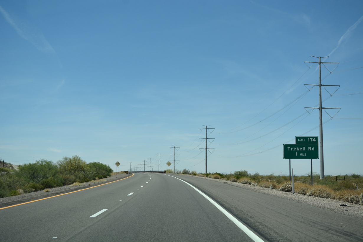
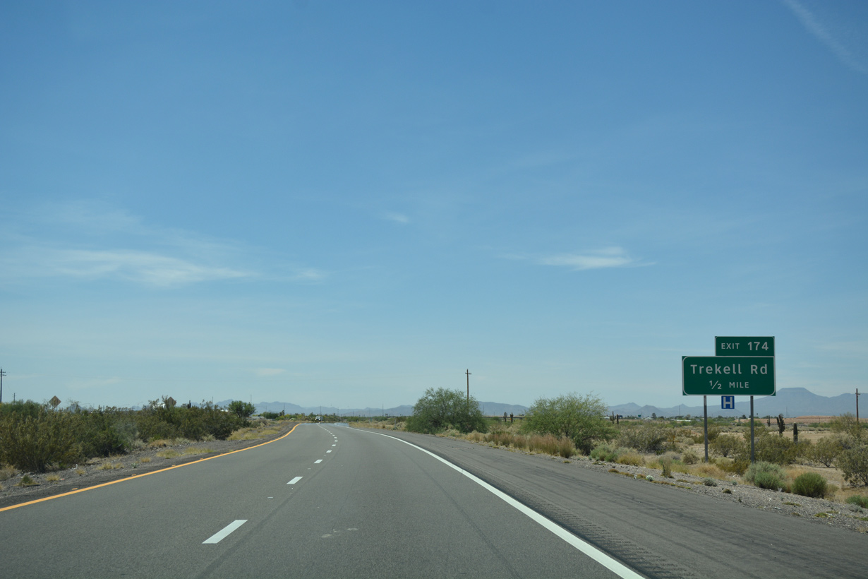
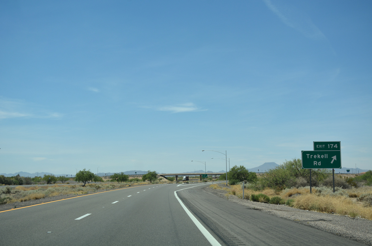
| Interstate 8 circumvents the north end of the Casa Grande Mountains west to the diamond interchange (Exit 174) with Trekell Road. 04/26/17 |
|
| Trekell Road leads 3.4 miles north from Exit 174 to Florence Boulevard (former SR 287) in Casa Grande. 04/26/17 |
|
| Trekell Road extends south from Interstate 8 to ranch land west of the Casa Grande Mountains. 04/26/17 |
|
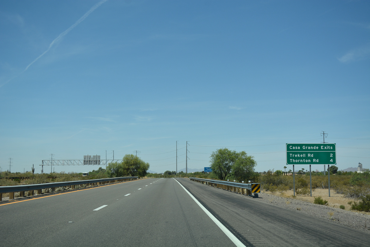
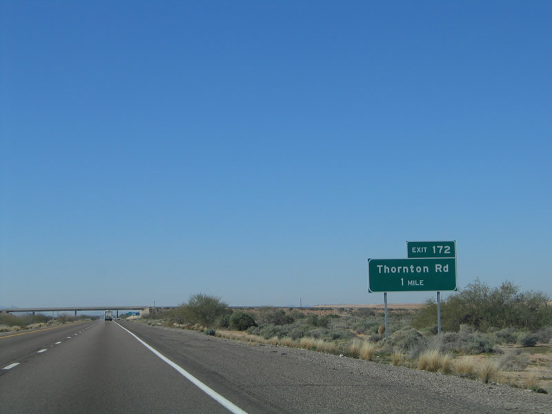
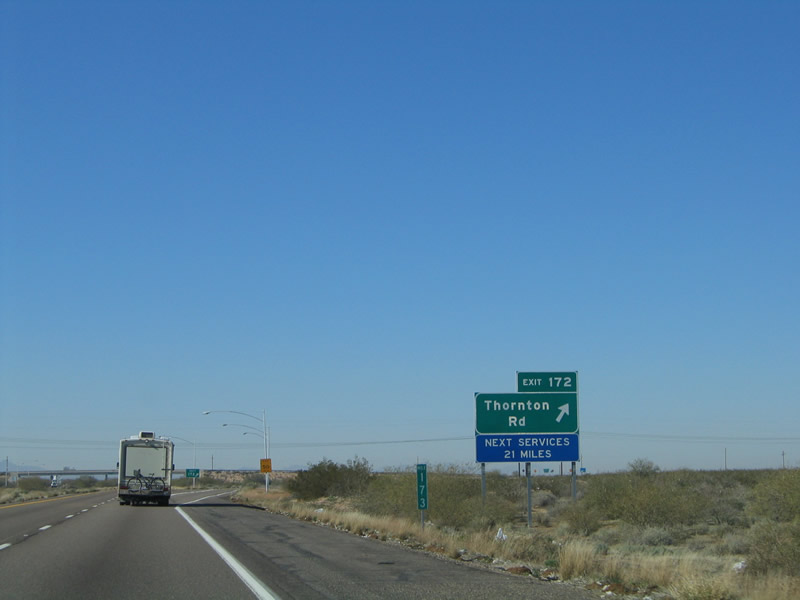
| The next exit along westbound Interstate 8 is for Thornton Road to Casa Grande. 01/17/05 |
|
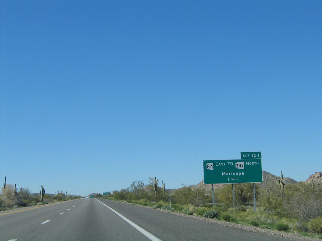
| Thornton Road links I-8 with SR 84 in Casa Grande, 3.5 miles to the north. Prior to the completion of I-8, SR 84 served as the main route between Tucson and Gila Bend. Truncated due to I-8, the remainder of SR 84 connects Casa Grande with I-8 at Exit 151. 01/17/05 |
|
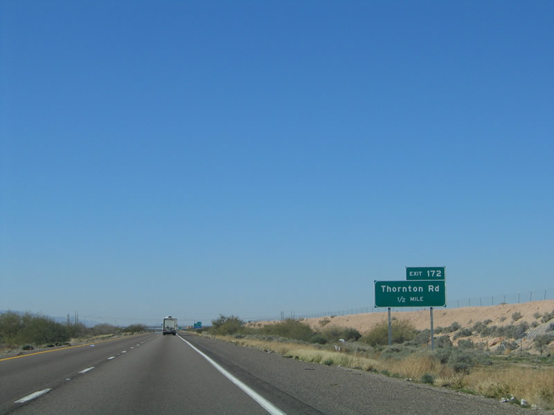
| Entering the parclo interchange (Exit 172) with Thornton Road on I-8 west. No services are available until Exit 151 for SR 84 east. 01/17/05 |
|
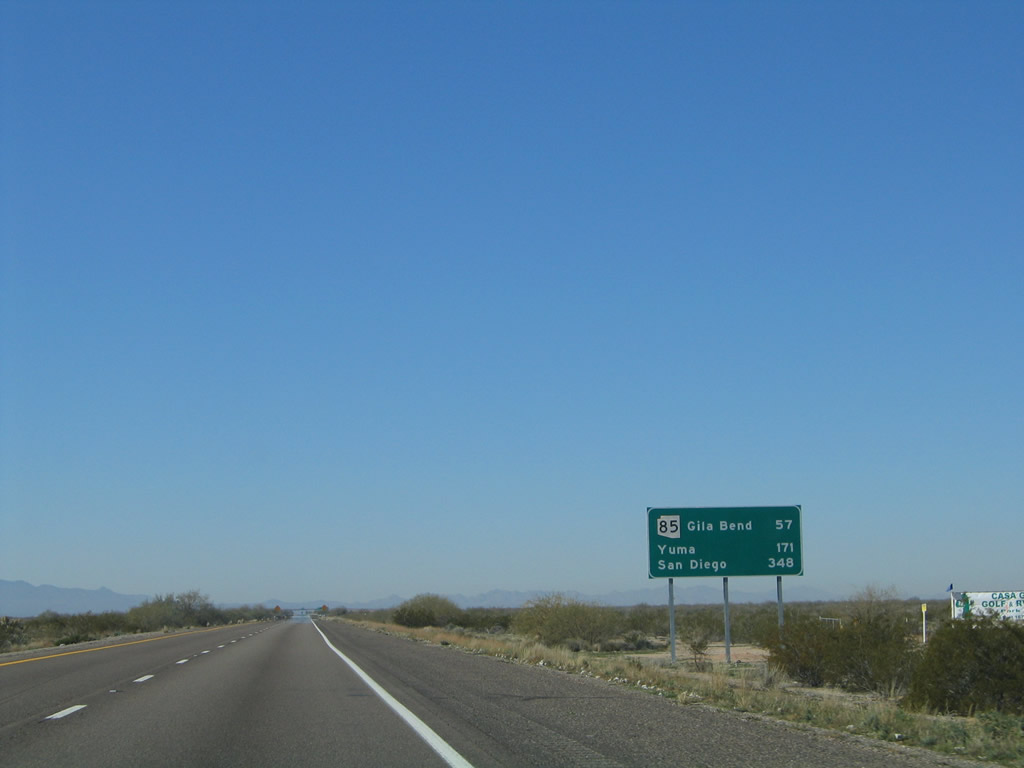
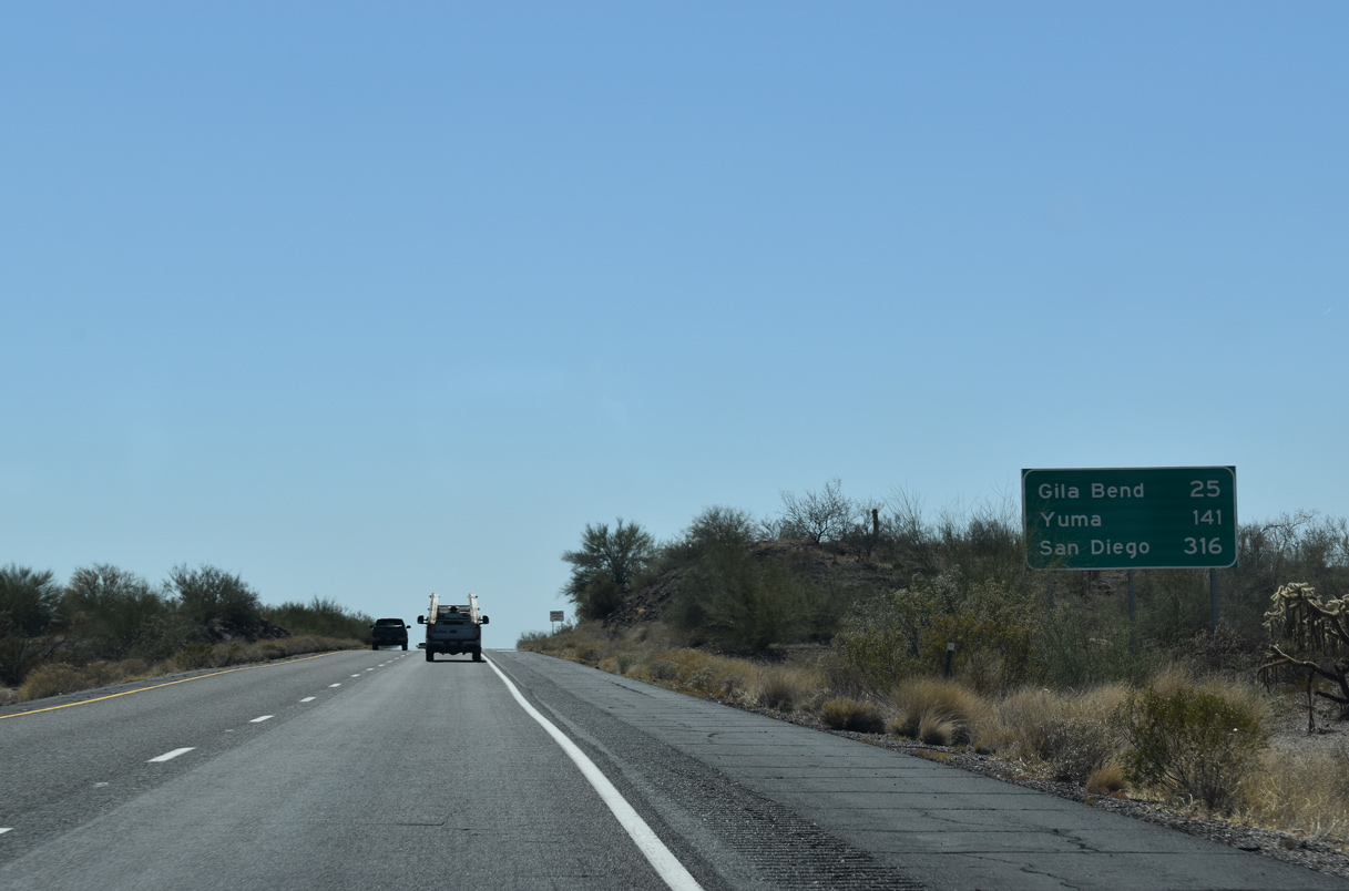
| Leaving the Casa Grande area, I-8 advances west 57 miles to Gila Bend, where it connects with Business Loop I-8 and SR 85. Yuma follows in 171 miles. 01/17/05 |
|
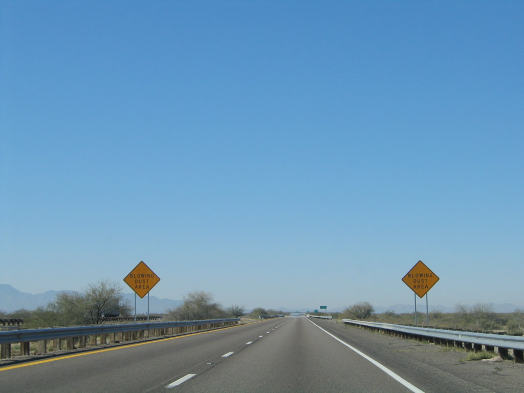
| The bulk of Interstate 8 traverses desert and a warning sign advises of blowing dust, which is especially present during wind storms. 01/17/05 |
|
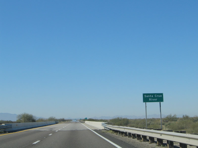
| I-8 spans a wash along the Santa Cruz River at milepost 171. Originating in Santa Cruz County and southeastern Arizona in the mountains east of Sonoita, the river flows northwest through Tucson, skirting Eloy, Arizona City and Casa Grande before combing with Santa Rosa Wash. The Santa Cruz River converges with the Gila River southwest of Downtown Phoenix. 01/17/05 |
|
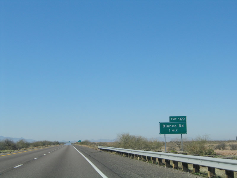
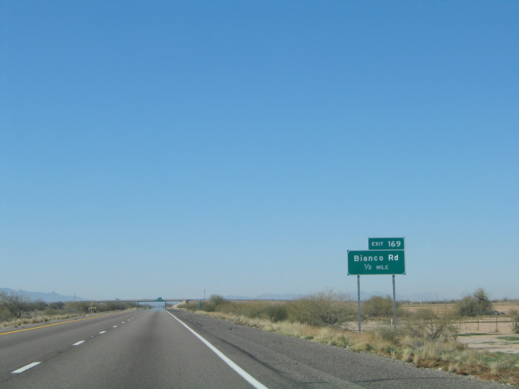
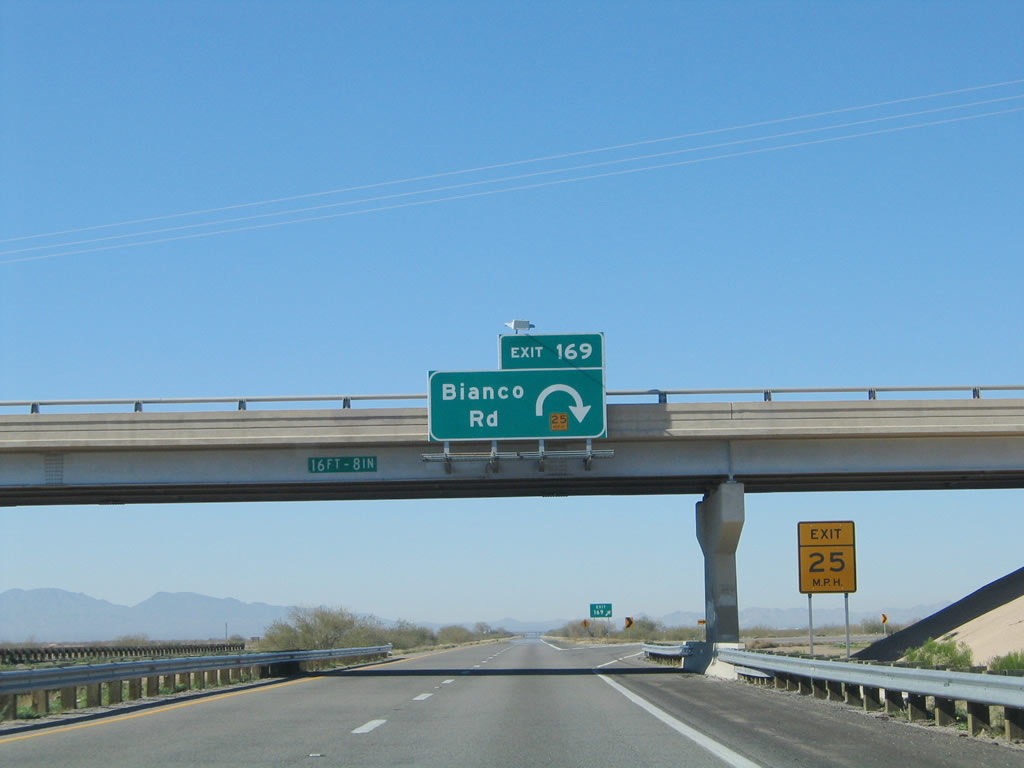
| The succeeding exit along westbound Interstate 8 is for Bianco Road. 01/17/05 |
|
| Bianco Road runs 3.5 miles north to SR 84 (Gila Bend Highway) and spurs south for local ranch access. 01/17/05 |
|
| A parclo B2 interchange links Interstate 8 with Blanco Road at Exit 169. 01/17/05 |
|
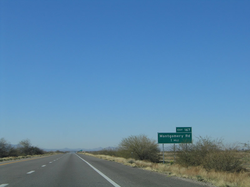
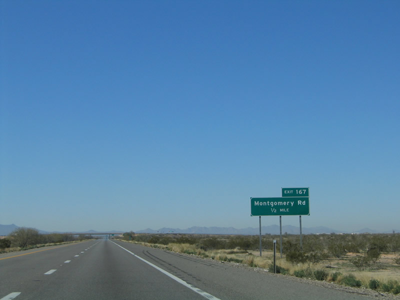
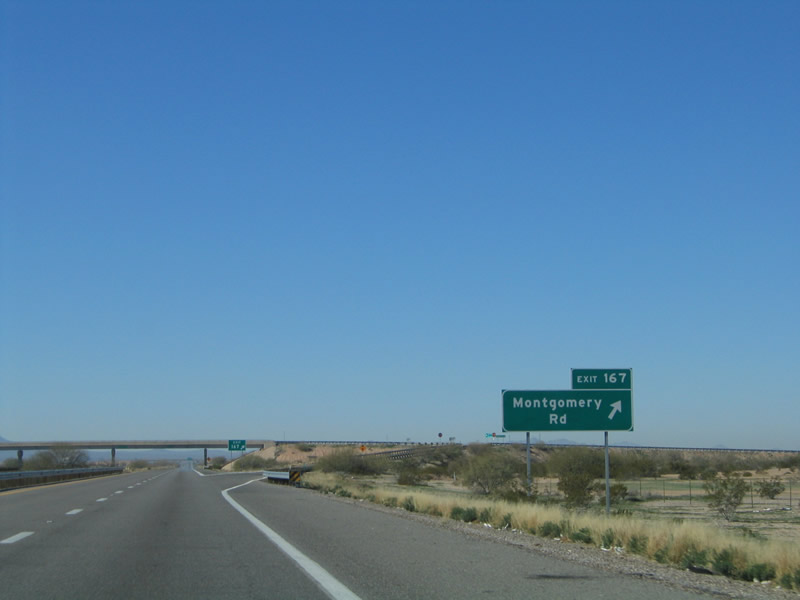
| Interstate 8 advances one mile west to Exit 167 for Montgomery Road. 01/17/05 |
|
| Like Bianco Road, Montgomery Road is a local county road that travels 3.5 miles north to SR 84 and spurs south for local ranch access. 01/17/05 |
|
| Exit 167 leaves westbound Interstate 8 for Montgomery Road ahead of Greene Wash. 01/17/05 |
|
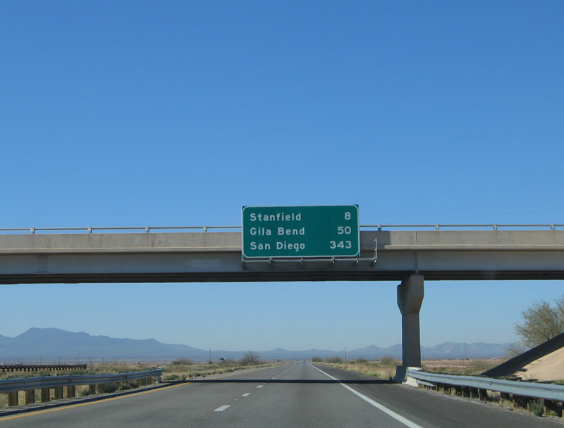
| Progressing west, I-8 heads eight miles to Stanfield, 50 miles to Gila Bend and 343 miles to San Diego, California. 01/17/05 |
|
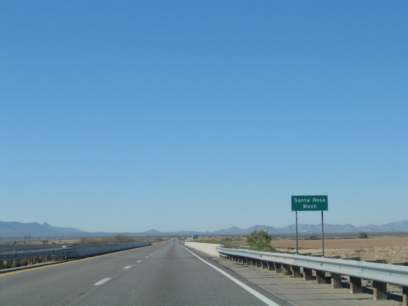
| Interstate 8 west crosses the Santa Rosa Wash, which flows north into the Santa Cruz River. This wash may be dry during much of the year, but it can be a raging river during the monsoonal season after a severe thunderstorm. 01/17/05 |
|
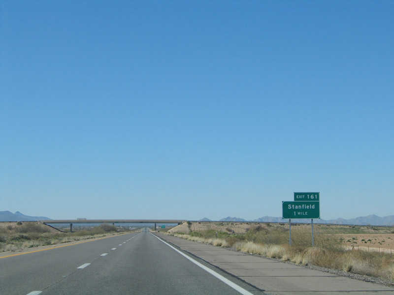
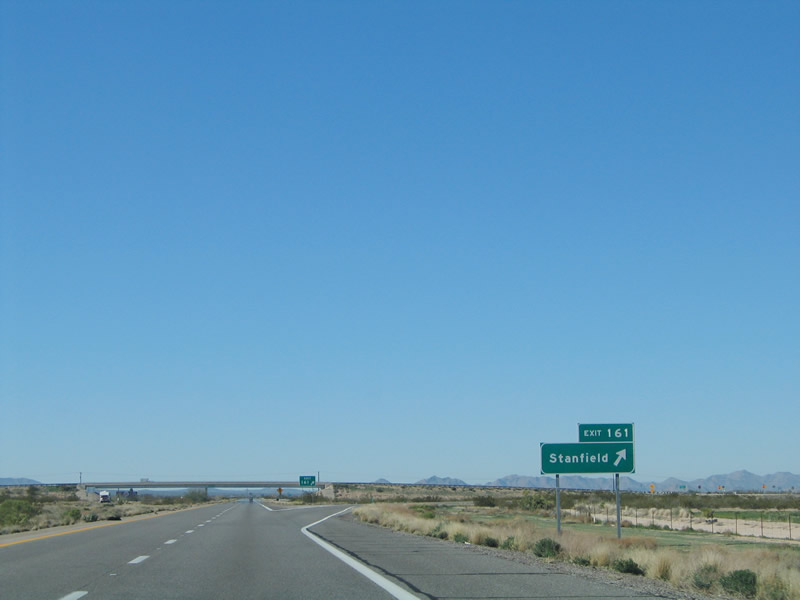
| Forthcoming Exit 161 joins Interstate 8 with Stanfield Road north to SR 84 (Gila Bend Highway) in Stanfield. 01/17/05 |
|
| Stanfield Road crosses agricultural areas north 3.5 miles to SR 84 in Stanfield and south into the Tohono O'odham Indian Nation. Passing east of the Vaiva Hills, Stanfield Road becomes Indian Route 42 south to Kohatk. 01/17/05 |
|
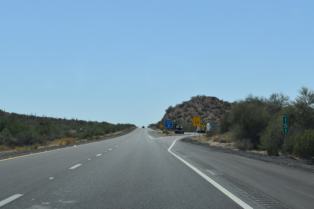
| The unincorporated community of Stanfield was home to 558 as of the 2020 Census, down from 651 in 2000. I-8 continues ten miles from the folded diamond interchange at Exit 161 to the succeeding exit. 01/17/05 |
|
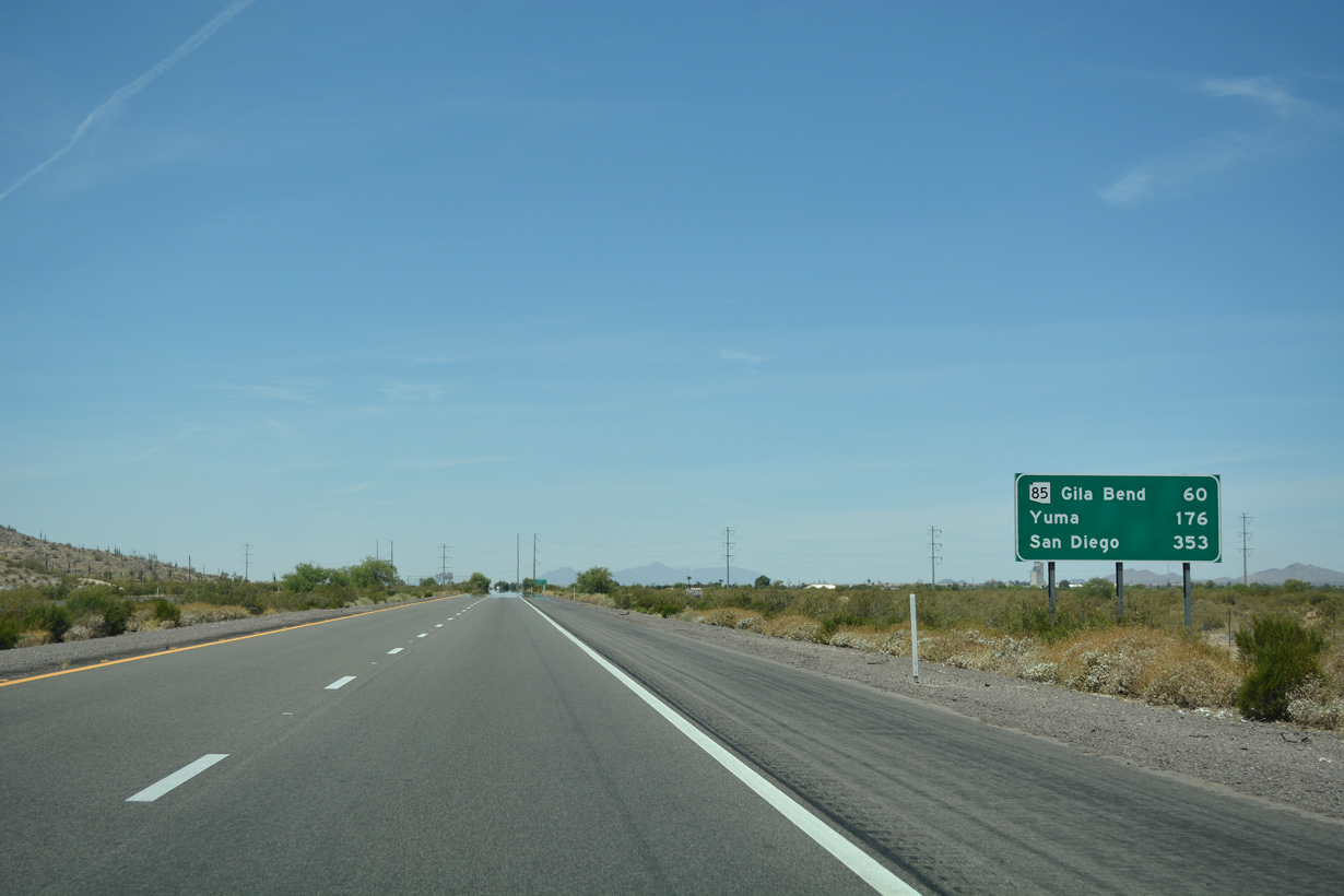
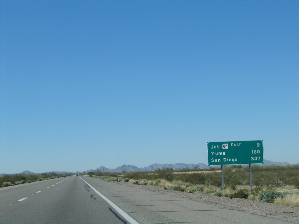
| Interstate 8 converges with the west end of SR 84 in nine miles. Yuma is 160 miles away, followed by San Diego, California in 337 miles. 01/17/05 |
|
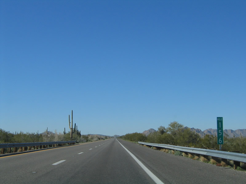
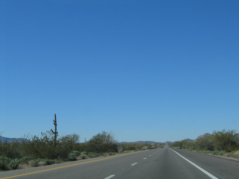
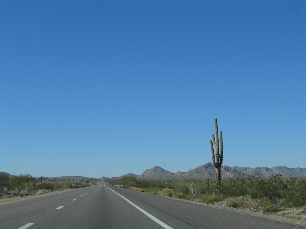
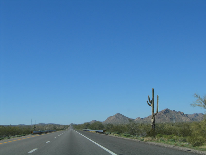
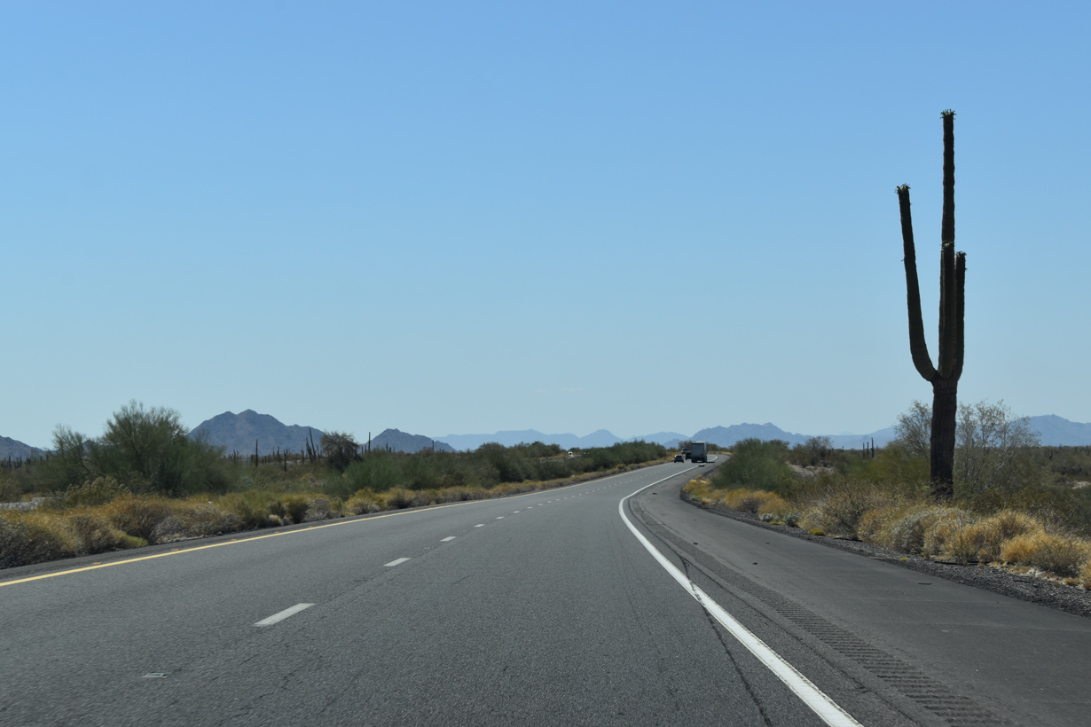
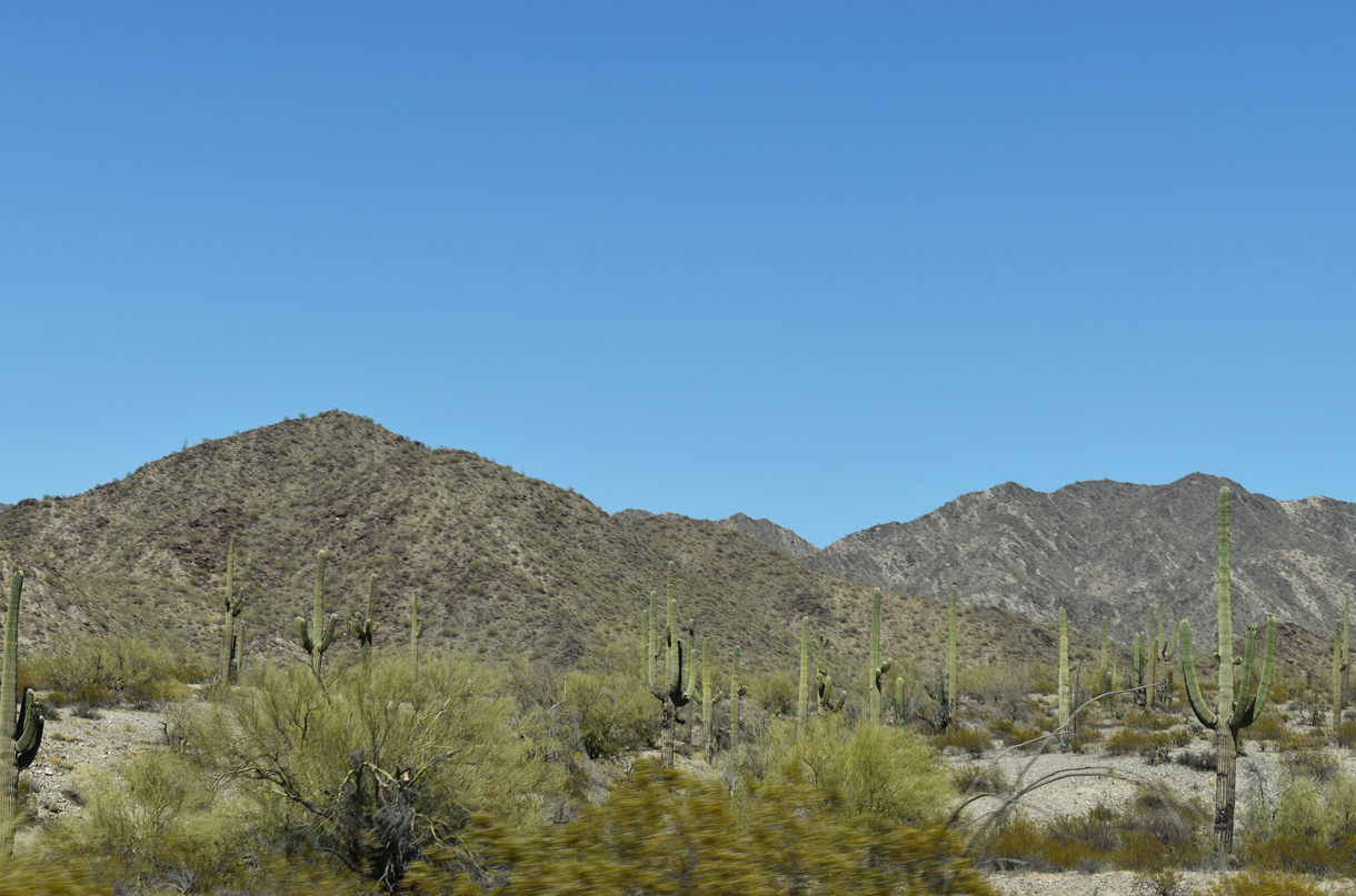
| Interstate 8 straddles the northern boundary of Sonoran Desert National Monument between mile markers 159 and 153. Administered by the federal Bureau of Land Management (BLM), the park comprises over 496,000 acres of pristine Sonora Desert land. 01/17/05 |
|
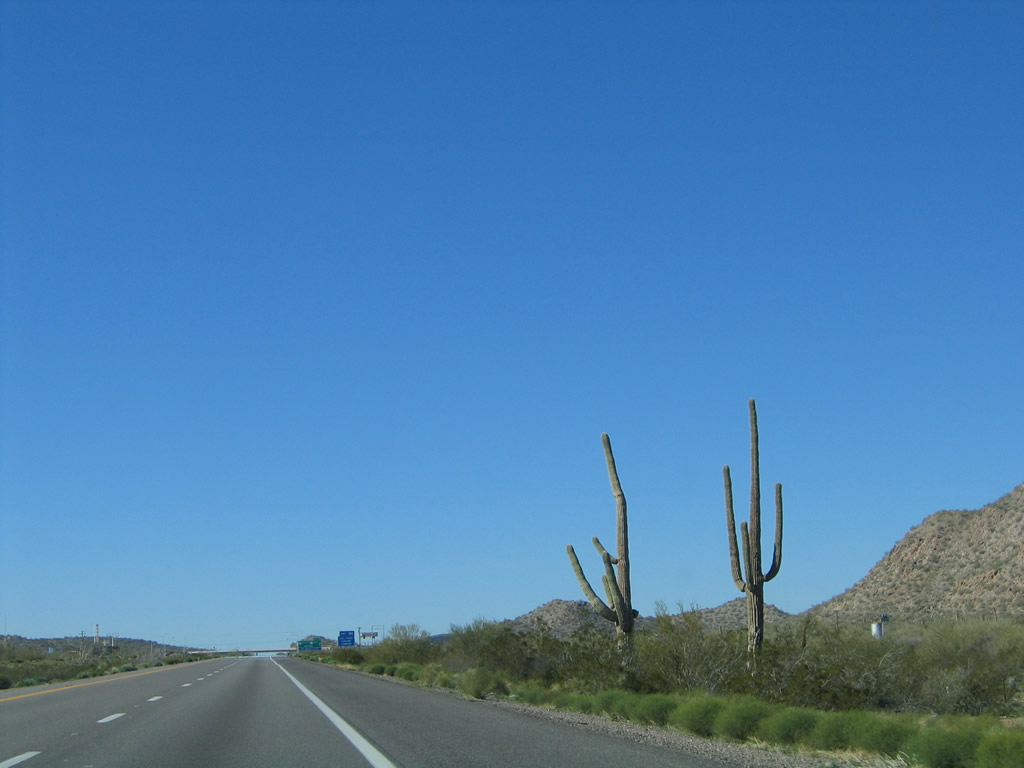
| Several saguaro cacti line Interstate 8 along Sonoran Desert National Monument, which includes the Maricopa, Sand Tank and Table Top Mountains. 01/17/05 |
|
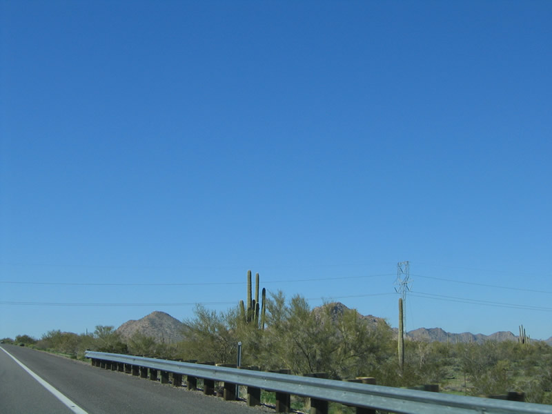
| Connecting Tucson and Nogales with the Phoenix power grid, a 500 kV power line spans Interstate 8 ahead of West Pinal (Kortsen) Park. 01/17/05 |
|
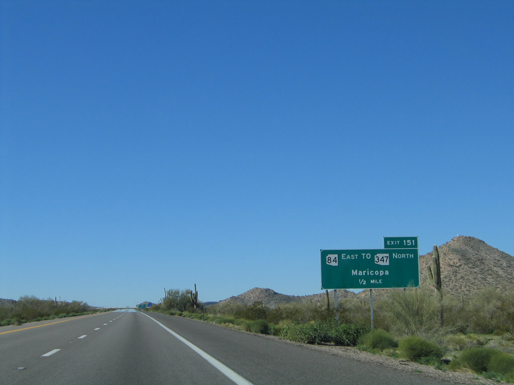
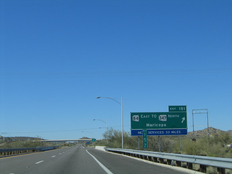
| SR 84 converges with Interstate 8 at Exit 151, 5.77 miles southwest of SR 347 at Peters Corner. 01/17/05 |
|
| SR 84 travels 22.83 miles east to Stanfield and Casa Grande, while SR 347 runs 28.67 miles north to Maricopa and Interstate 10 near the Phoenix suburb of Chandler. 01/17/05 |
|
| Several saguaro cacti stand just north of the freeway by West Pinal (Kortsen) Park. 01/17/05 |
|
| The last motorist services along Interstate 8 west for 33 miles are located off SR 84. 01/17/05 |
|
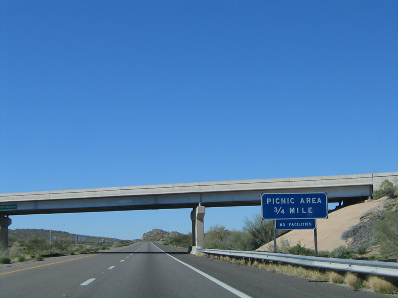
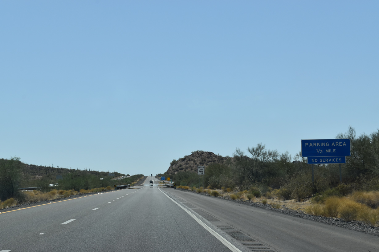
| Formerly signed as a picnic area, a parking area lines the westbound roadway for Interstate 8 just beyond milepost 151. 01/17/05 |
|
| Palo verde trees line I-8 ahead of Antelope Wash and the forthcoming parking area. 05/31/21 |
|
| The Sentinel Rest Area, the first with facilities along Interstate 8 westbound, is 66 miles beyond the parking area by the Hidden Valley interchange. 05/31/21 |
|
| Interstate 8 continues along the northern boundary of Sonoran Desert National west to Exit 144 before fully entering the park around mile marker 143.5. 01/17/05 |
|
| Interstate 8 runs alongside or travels within Sonoran Desert National Monument west for most of the 35 miles leading to Gila Bend. 05/31/21 |
|
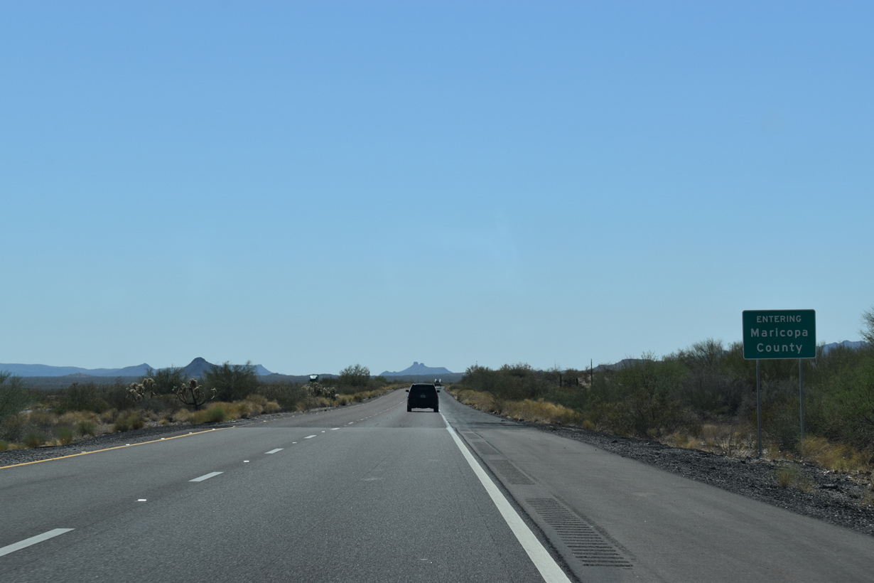
| Interstate 8 leaves Pinal County and enters Maricopa County. The most populous county in Arizona, Maricopa County contains Phoenix and its suburbs as well as Gila Bend. 05/31/21 |
|
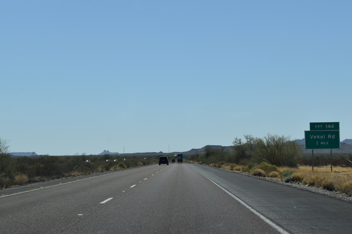
| Interstate 8 traverses the Vekol Valley west to Exit 144 for Vekol Road. 05/31/21 |
|
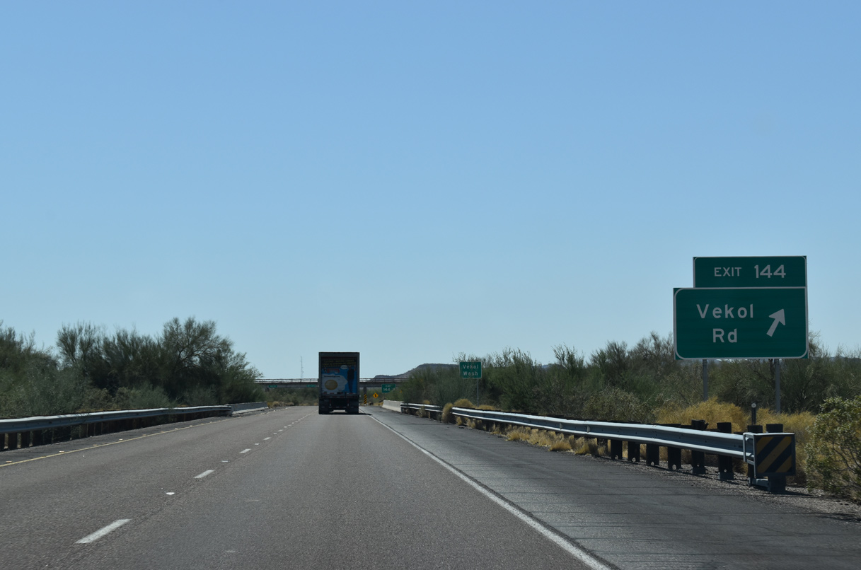
| Interstate 8 crosses Vekol Wash ahead of the trumpet interchange (Exit 144) with Vekol Road. Vekol Road joins I-8 with ranch areas. 05/31/21 |
|
| Interstate 8 continues within Sonoran Desert National Monument for another 23 miles west to a point just ahead of Business Loop I-8 to Gila Bend. 01/17/05 |
|
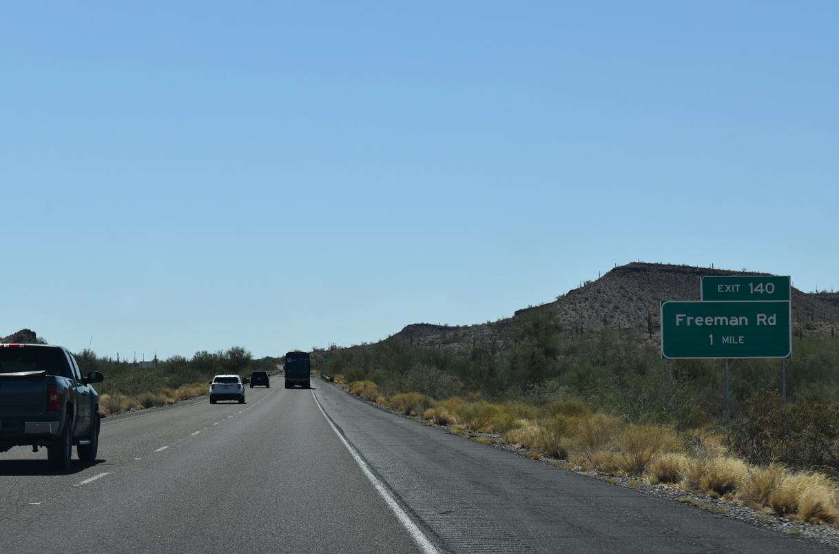
| Southern reaches of the Maricopa Mountains rise along the north side of Interstate 8 by the forthcoming exit with Freeman Road. 05/31/21 |
|
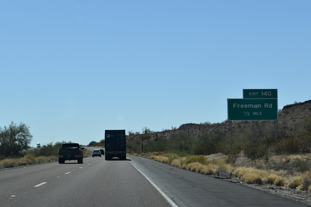
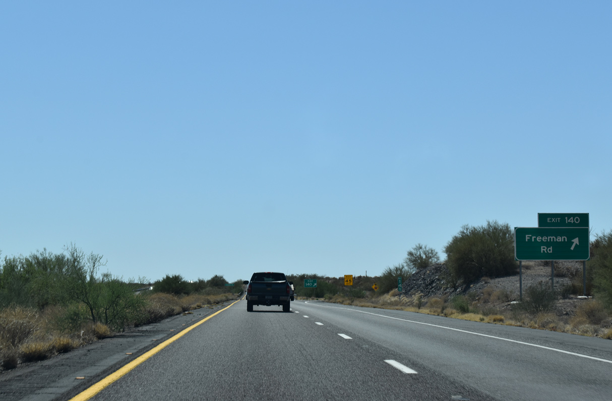
| Freeman Road provides local ranch access south from Exit 140 toward Lost Horse Peak. 05/31/21 |
|
| The 20.7 mile long exit less stretch west from Freeman Road to Business Loop I-8 for Gila Bend is the longest along all of Interstate 8. 05/31/21 |
|
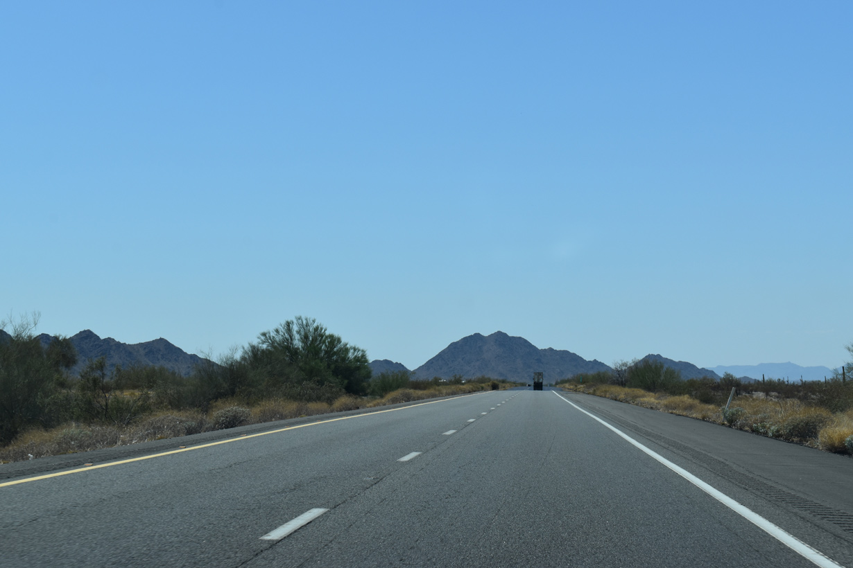
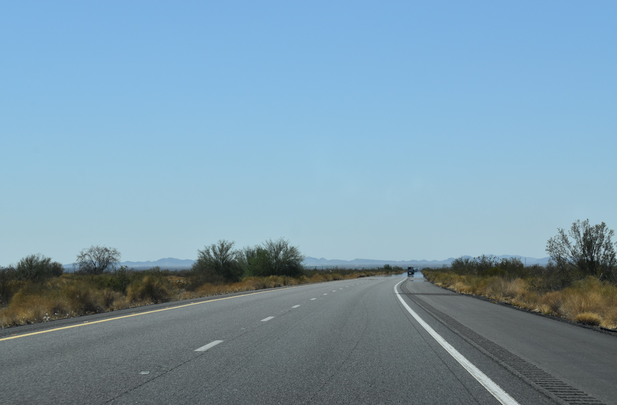
| Continuing west across Sonoran Desert National Monument, Interstate 8 leaves the Maricopa Mountains and passes north of the Sand Tank Mountains. 05/31/21 |
|
| No longer posted, this guide sign preceded the business loop for Gila Bend by six miles. 01/17/05 |
|
| Interstate 8 parallels Bender Wash west ahead of the Sand Tank Mountains. 05/31/21 |
|
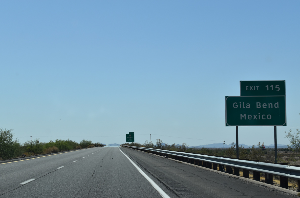
| Interstate 8 generally passes south of Gila Bend, entering the town limits just past Exit 119 with Business Loop I-8 and again at Exit 115 for SR 85. 05/31/21 |
|
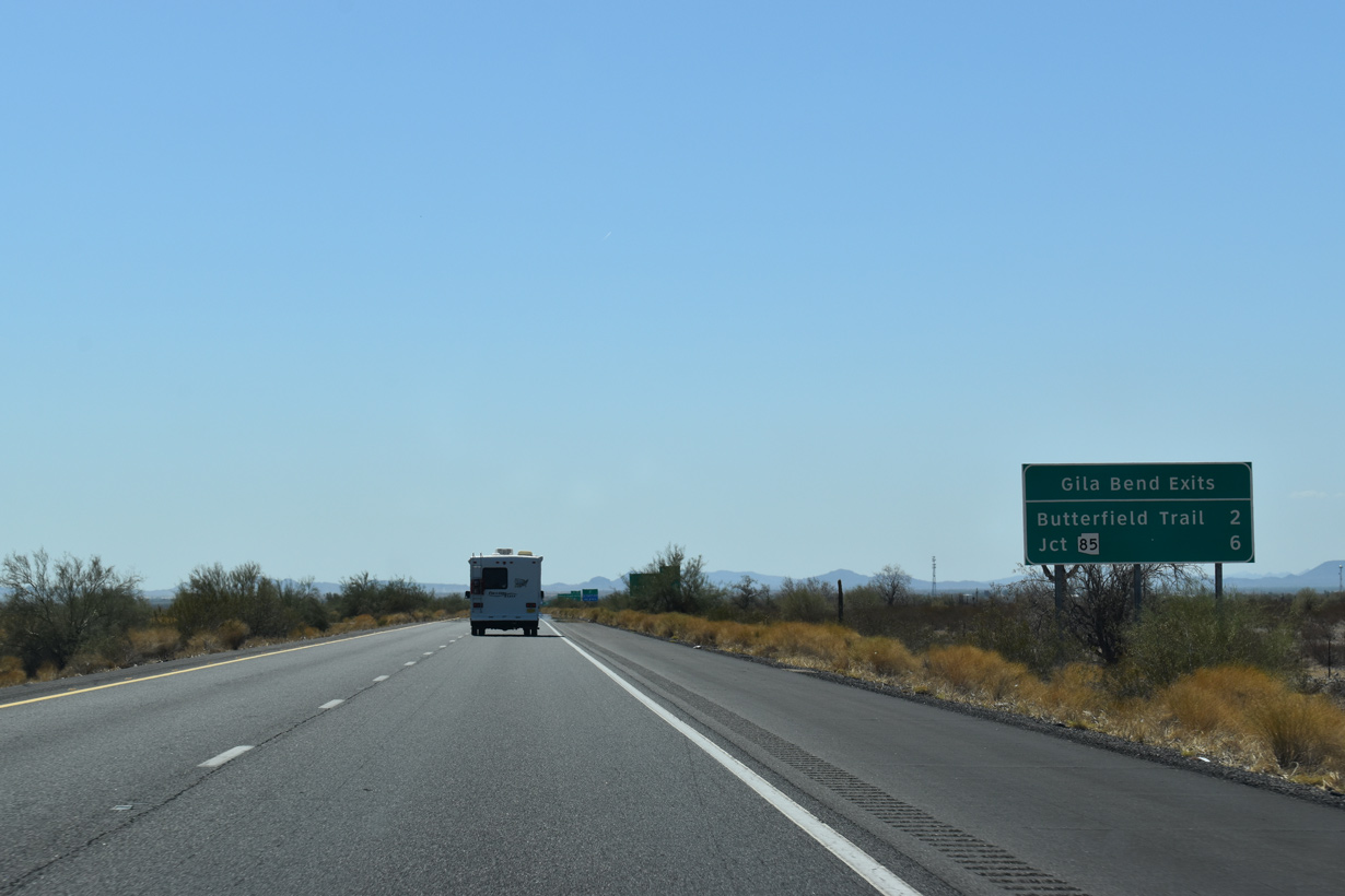
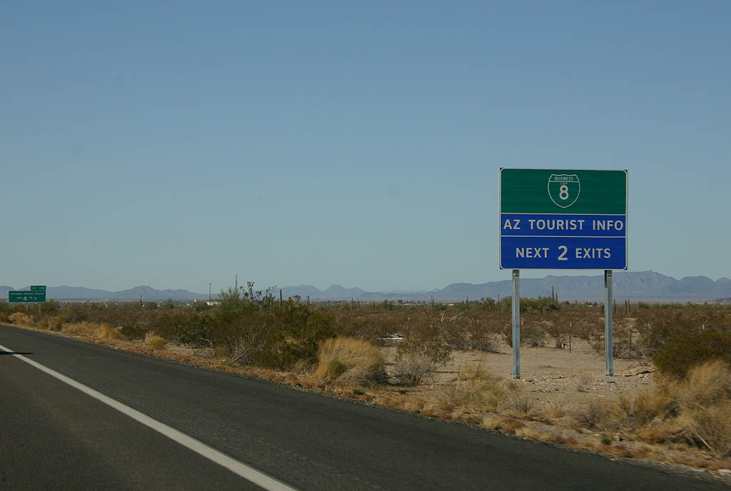
| Business Loop I-8 branches north from Interstate 8 along a 5.96 mile long course through the heart of Gila Bend. 05/31/21, 12/23/09 |
|
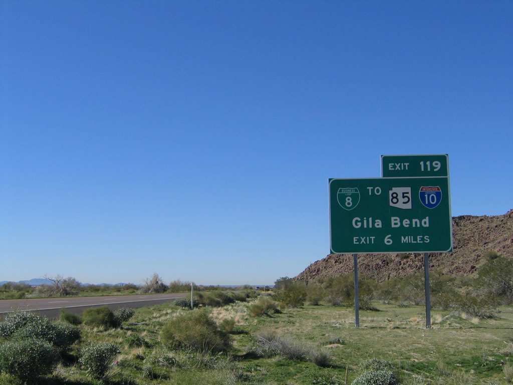
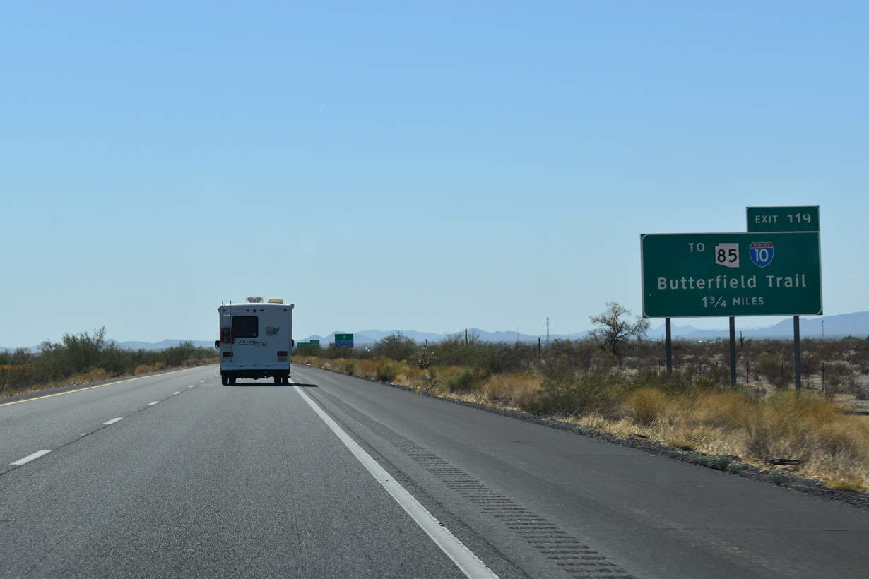
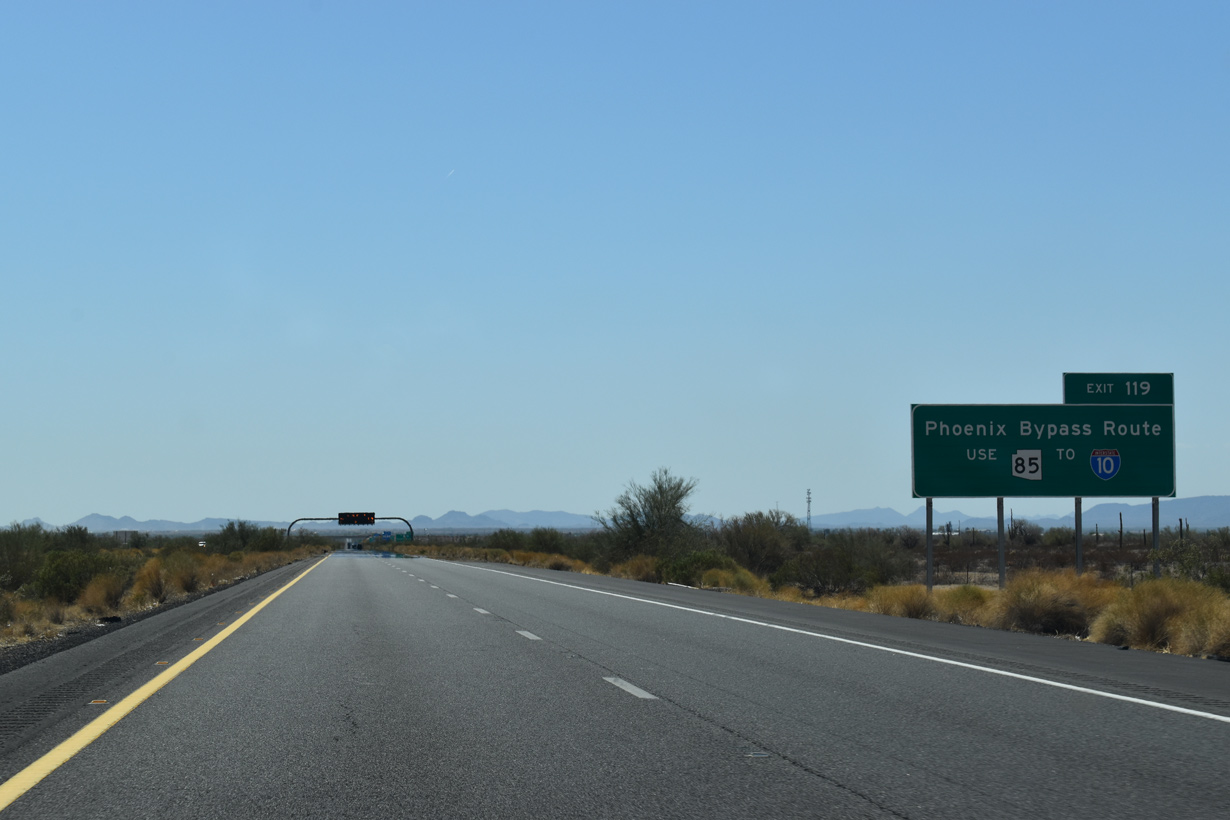
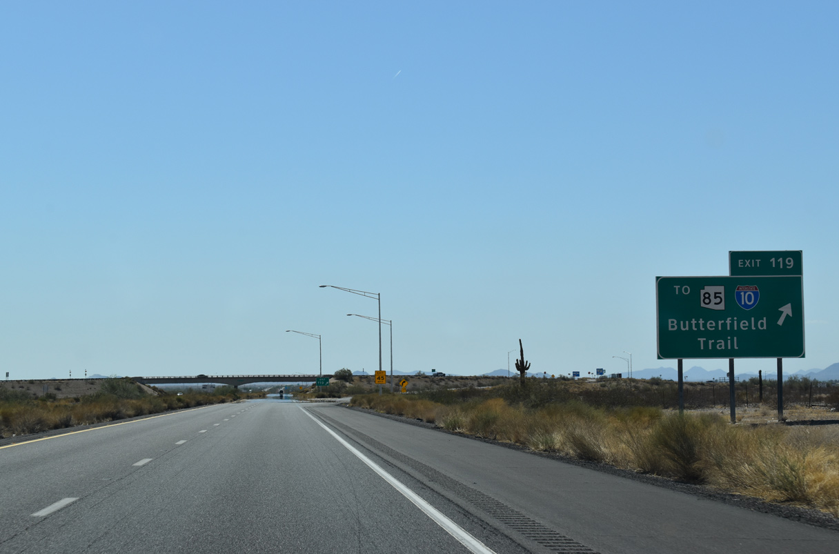
| Forthcoming Business Loop I-8 along Butterfield Trail west connects I-8 with SR 85 north from Gila Bend to I-10. SR 85 completes the Phoenix metropolitan bypass. 05/31/21 |
|
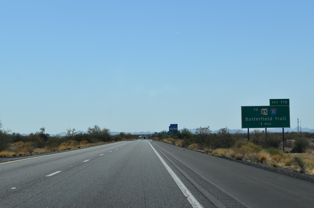
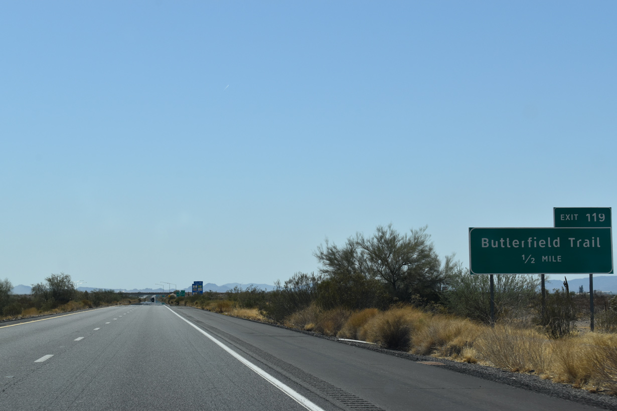
| Westbound Interstate 8 advances one mile to the diamond interchange (Exit 119) with Business Loop I-8 (Butterfield Trail) to Gila Bend, Crossroads of the Southwest. 05/31/21 |
|
| Butterfield Trail leads Business Loop I-8 northwest 2.52 miles to SR 85 at Pima Street. Butterfield Trail historically was part of SR 84. 05/31/21 |
|
| Entering the diamond interchange (Exit 119) with Business Loop I-8 (Butterfield Trail) west and 9 Mile Well Road south to ranch areas. 05/31/21 |
|
| Confirming marker posted west of Butterfield Trail. 01/17/05 |
|
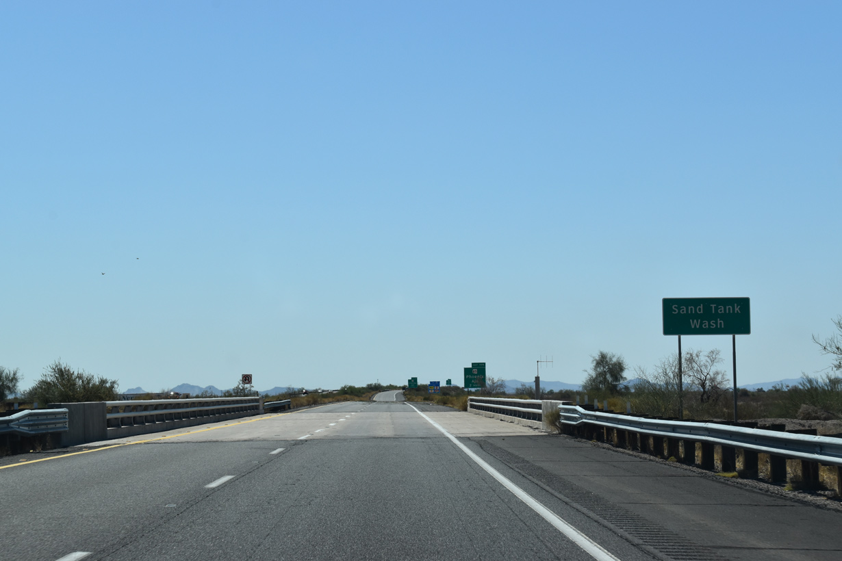
| Interstate 8 crosses Sand Tank Wash west of milepost 118 along the Gila Bend town line. 05/31/21 |
|
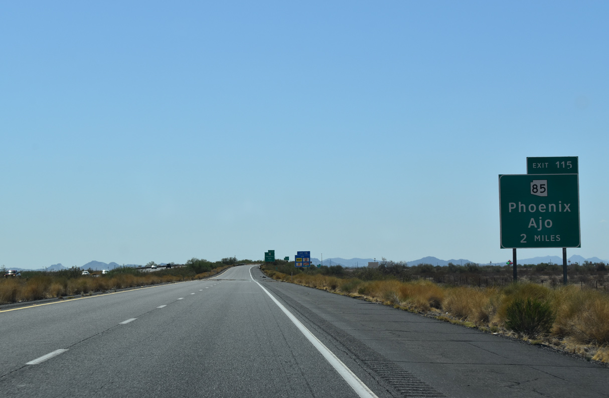
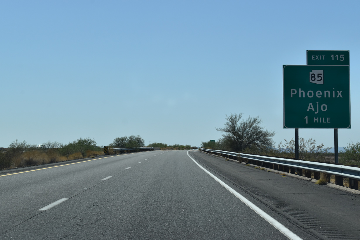
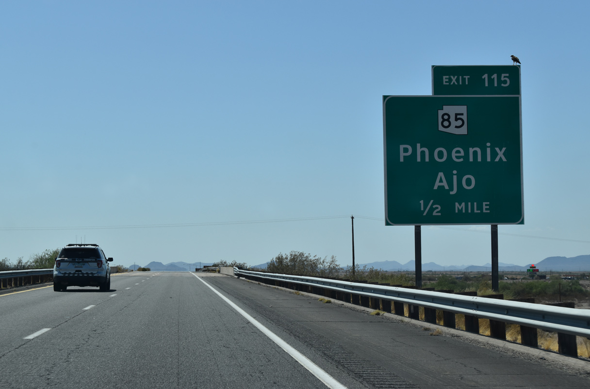
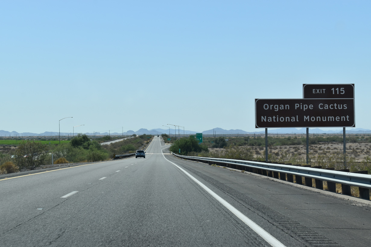
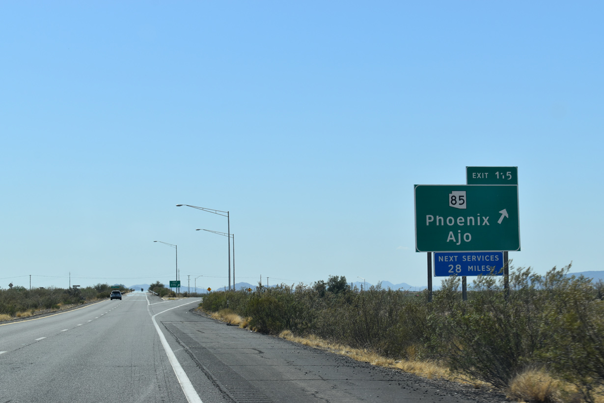
| Exit 115 ties into the southern branch of SR 85 in two miles. 05/31/21 |
|
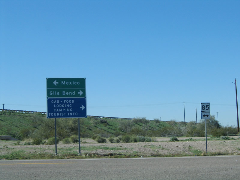
| SR 85 travels 32.15 miles south from Business Loop I-8 (Pima Street) in Gila Bend to the International border at Lukeville. 05/31/21 |
|
| Mexico Federal Route 8 extends south from SR 85 at Lukeville and connects with Mexico Federal Route 2 at Sonoyta. 05/31/21 |
|
| SR 85 leads south to the unincorporated communities of Ajo and Why in Pima County. 05/31/21 |
|
| South from SR 86 and Why, SR 85 continues into Organ Pipe Cactus National Monument en route to Lukeville. 05/31/21 |
|
| No services are available on Interstate 8 beyond the half diamond interchange (Exit 115) at SR 85 for another 28 miles. 05/31/21 |
|
| SR 85 north passes under a Union Pacific Railroad line ahead of a loop connecting with Business Loop I-8 (Pima Street) west of the Gila Bend business district. 01/17/05 |
Page Updated 04-25-2022.

 West
West