|
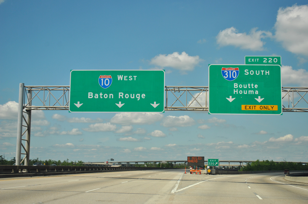
| Two lanes depart for I-310 southbound at Exit 220. The 11.70 mile spur links I-10 with U.S. 90 at the community of Boutte. I-310 spans the Mississippi River between Destrehan and Luling across the Hale Boggs Bridge, a cable-stayed bridge opened in 1983. 04/20/12 |
|
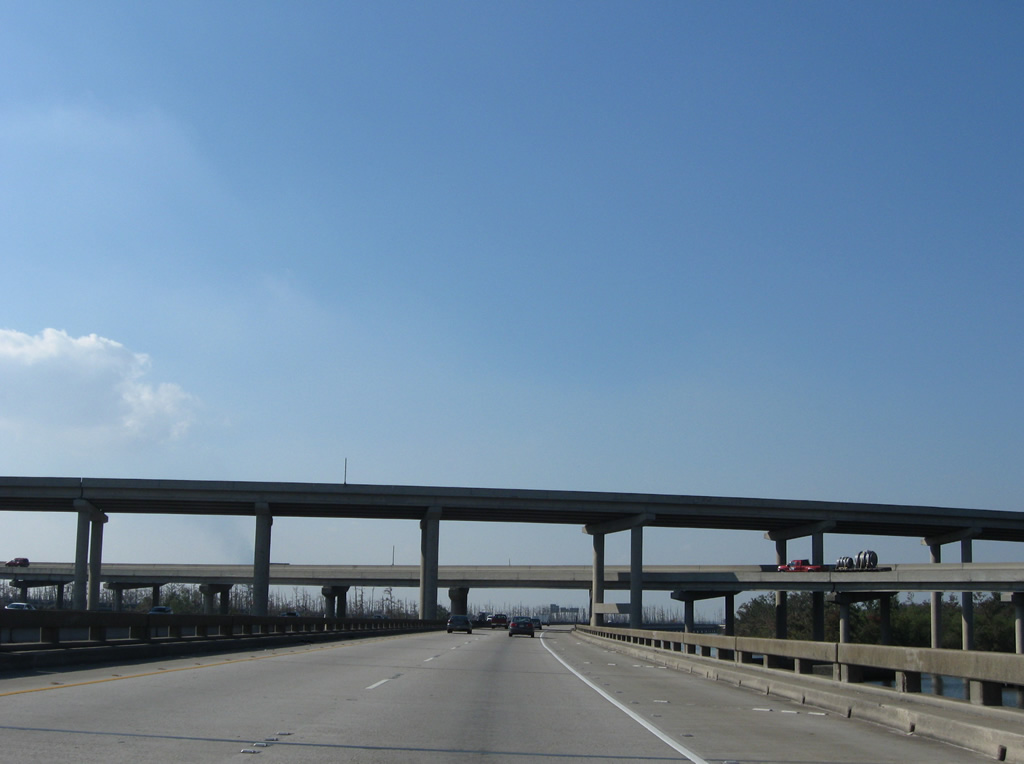
| A directional T interchange connects I-10 and I-310 above prime tupelo and cypress swamp wetlands. The exchange opened on May 7, 1993 with the final link of I-310 south to U.S. 61 (Airline Highway). 11/20/08 |
|
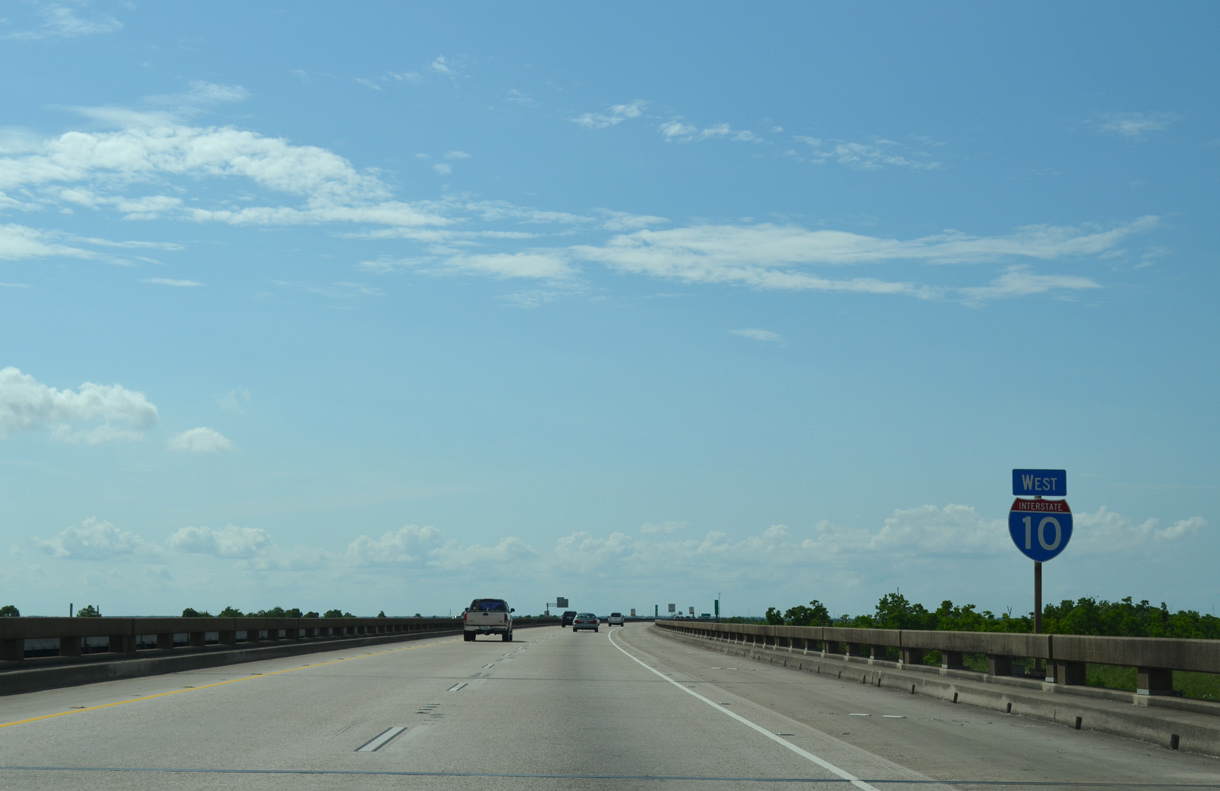
| Interstate 10 runs along a viaduct system nine miles west from Kenner to I-55 north at LaPlace. 05/09/15 |
|
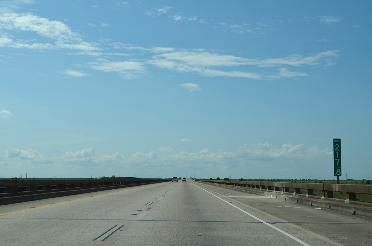
| Interstate 10 rises slightly at mile marker 217.6 across Pipeline Canal. 05/09/15 |
|
| Interstate 10 advances west to Bayou La Branche. A Canadian National (CN) Railroad parallels the freeway to the south along a levee. 05/09/15 |
|
| Passing over a levee beyond LaBranche, westbound Interstate 10 reaches Bonnet Carre Spillway. 05/09/15 |
|
| The Bonnet Carre Spillway was constructed in 1931 as a safeguard against Mississippi River flooding downstream. When in operation, a portion of the water flowing down the Mississippi River is diverted through the spillway into Lake Pontchartrain.1 05/09/15 |
|
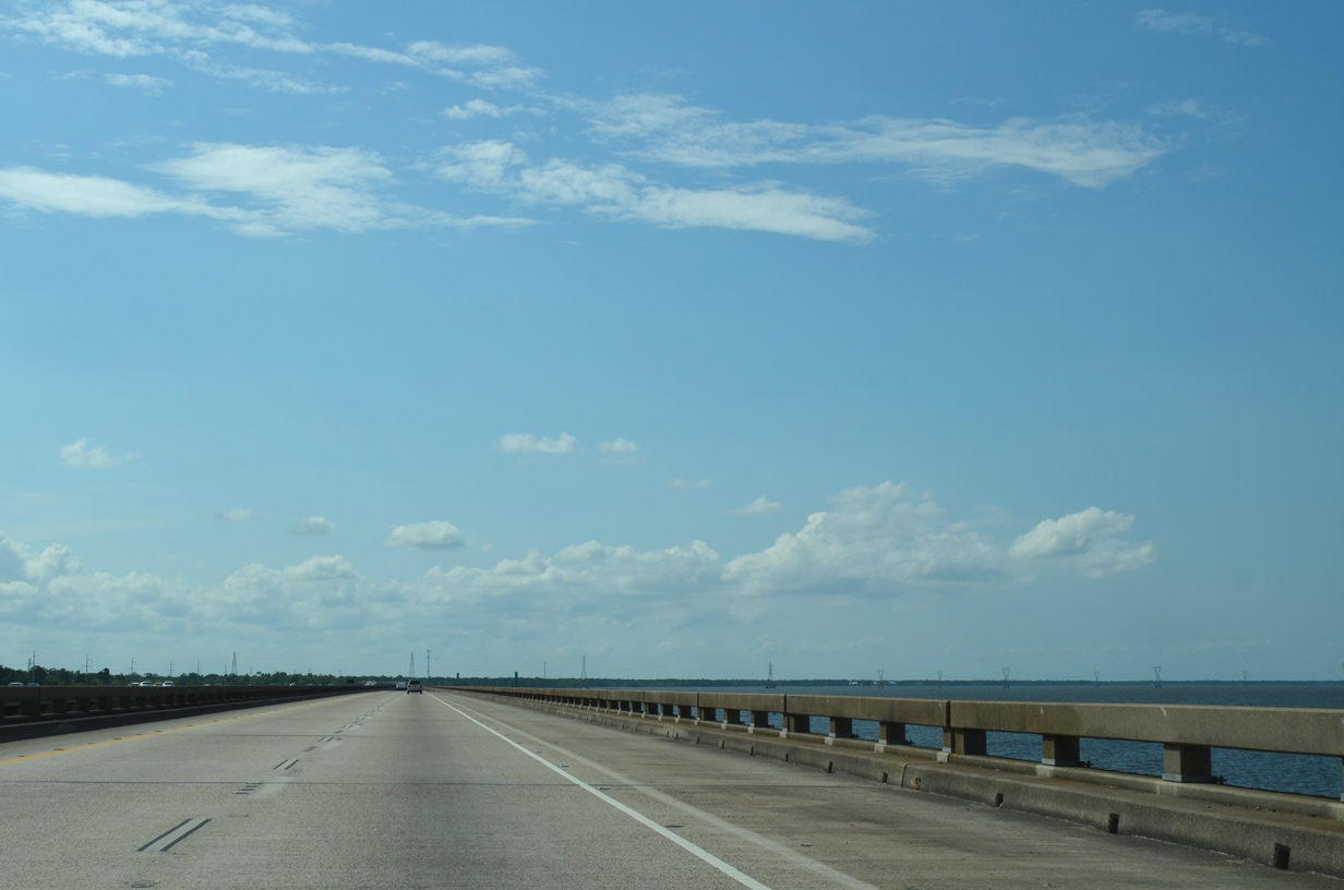
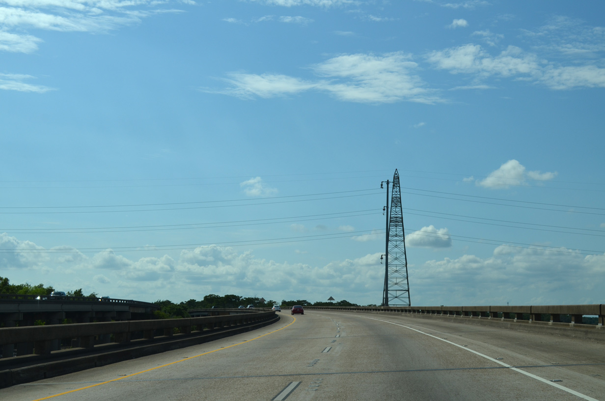
| Interstate 10 straddles the southwestern periphery of Lake Pontchartrain by Bonnet Carre Spillway. A parallel transmission corridor spans the lake from Kenner westward to a junction just offshore. 05/09/15 |
|
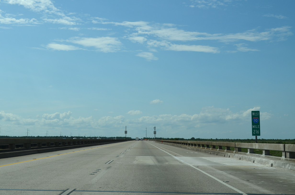
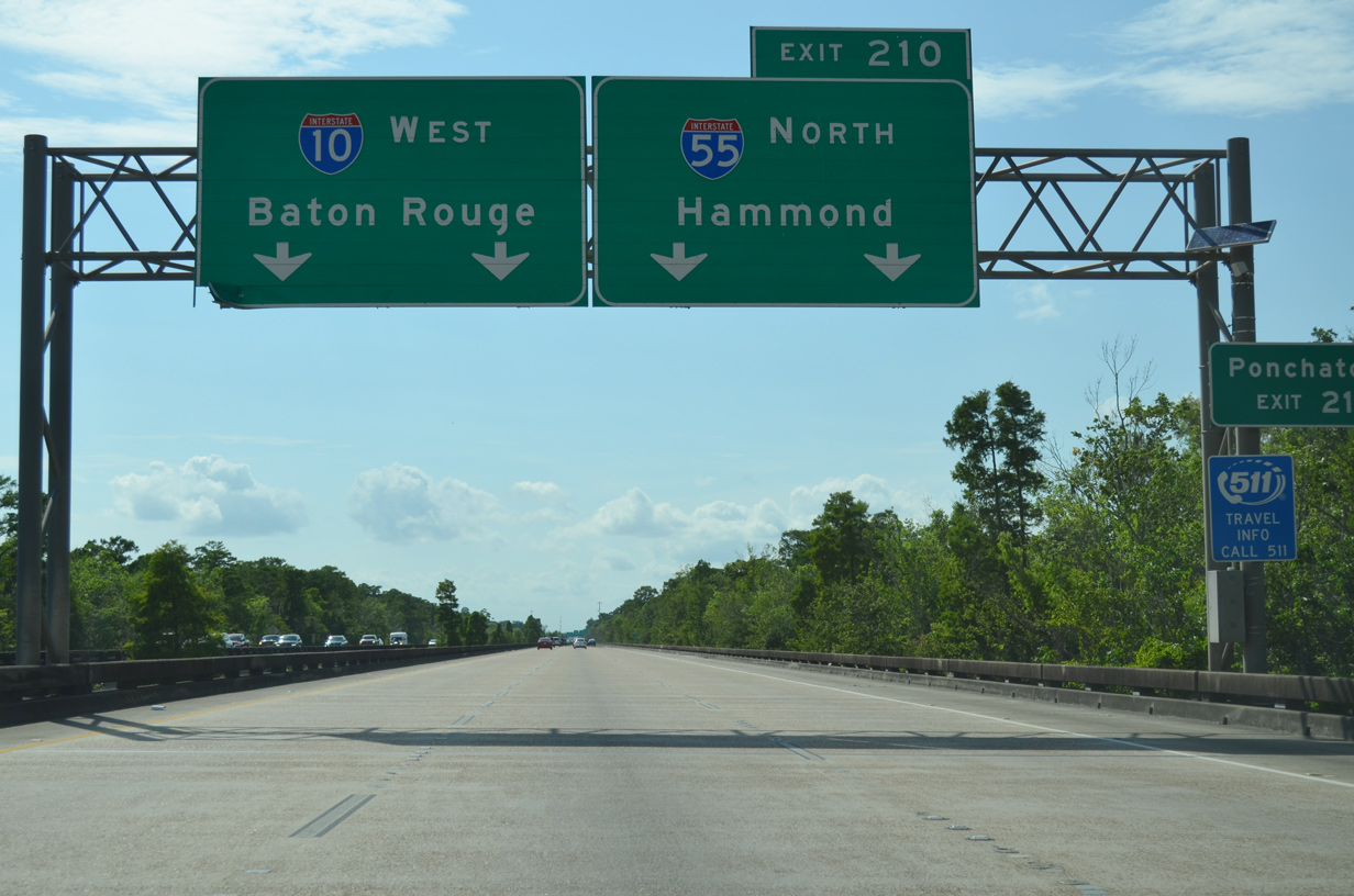
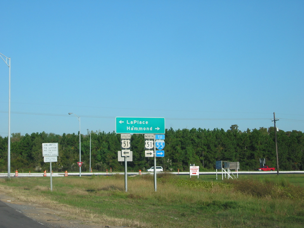
| Interstate 55 stems north from a wye interchange (Exit 210) in two miles. 05/09/15 |
|
| Interstate 10 kinks westward at mile marker 212 ahead of wetlands northeast of LaPlace. A power line corridor linking substations at Montz and Madisonville crosses overhead. 05/09/15 |
|
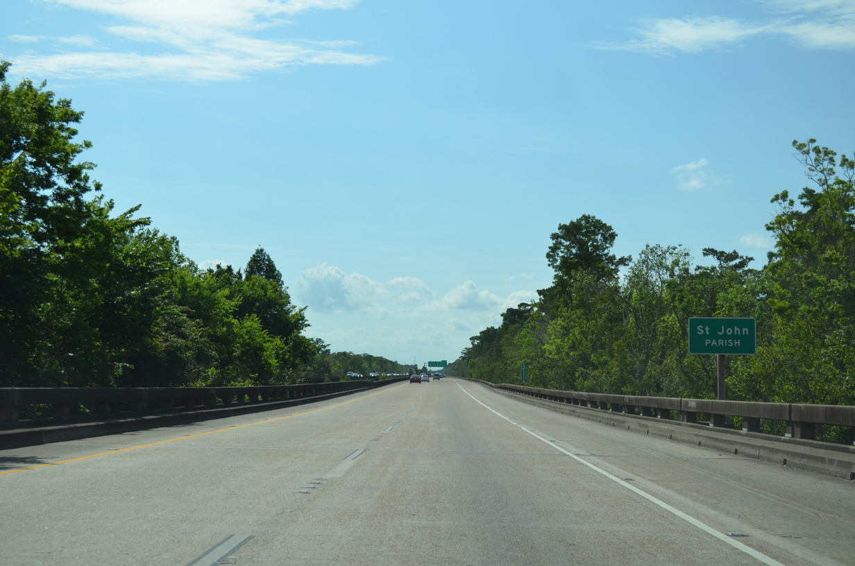
| The 9.48 mile stretch across St. Charles Parish concludes as Interstate 10 enters St. John the Baptist Parish ahead of I-55. 05/09/15 |
|
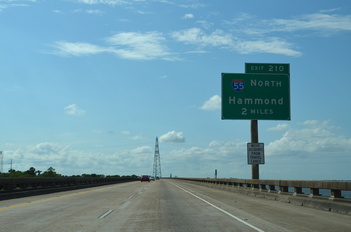
| Interstate 55 leads north from I-10 to Hammond, where it crosses I-12 (Exit 29). Regionally, the freeway connects the New Orleans metropolitan area with Jackson, Mississippi and Memphis, Tennessee. 05/09/15 |
|
| Interstate 55 combines with U.S. 51 just north of I-10 along a narrow strip of land between Lakes Maurepas and Pontchartrain. Paralleling the east side of the elevated freeway to Rudduck (Exit 7) and Manchac (Exit 15) is Old U.S. 51. 05/09/15 |
|
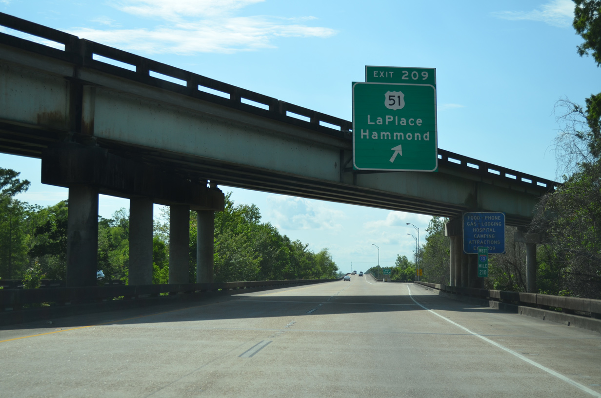
| U.S. 51 (Main Street) branches southwest from I-55 ahead of a diamond interchange (Exit 209) with Interstate 10. U.S. 51 concludes three miles to the south at U.S. 61 (Airline Highway). 05/09/15 |
|
| Signage previously posted along the off-ramp at Exit 209. U.S. 51 north merges with I-55 at a half diamond interchange in 0.8 miles. U.S. 51 south widens to a five lane arterial as it enters LaPlace. Overall U.S. 51 travels 1,286 miles north to Hurley, Wisconsin. 08/23/03 |
|
| Interstate 10 runs along the north side LaPlace over the ensuing two miles. 05/09/15 |
|
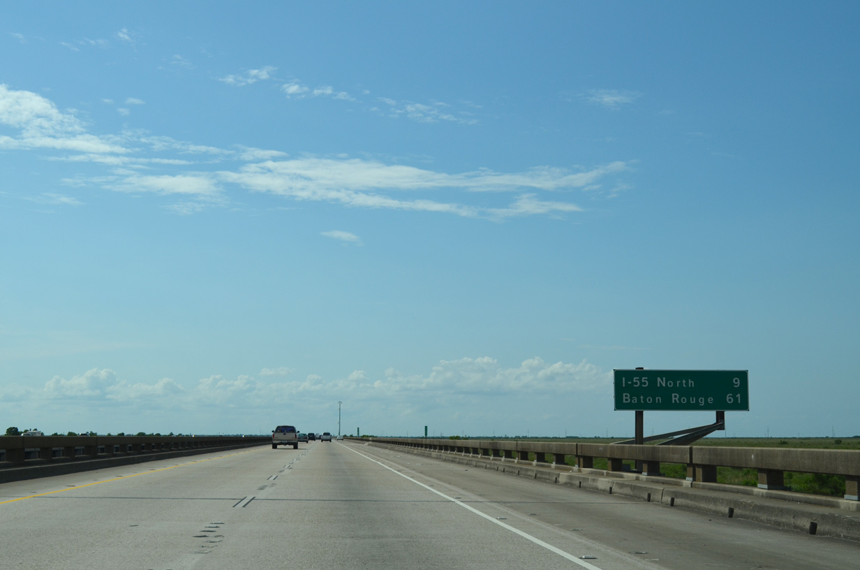
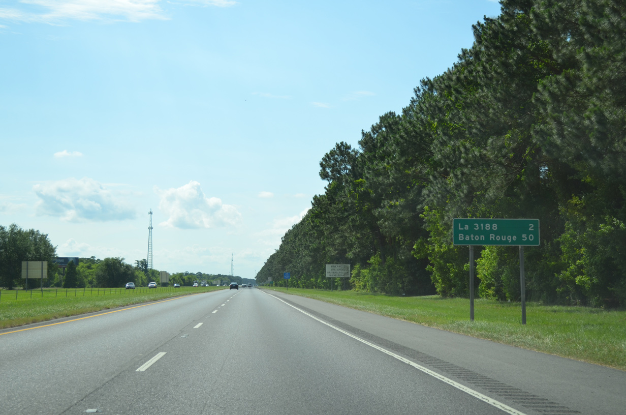
| Baton Rouge lies 50 miles northwest from LaPlace along Interstate 10. 05/09/15 |
|
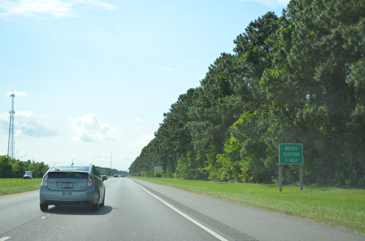
| Weigh stations operate along both sides of Interstate 10 just north of the Live Oak Landing subdivision in the Belle Terre development. 05/09/15 |
|
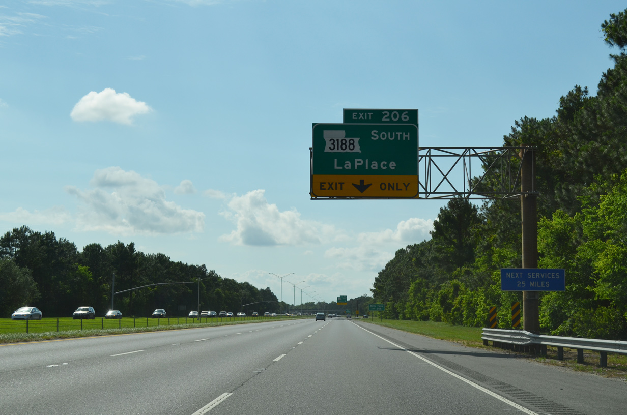
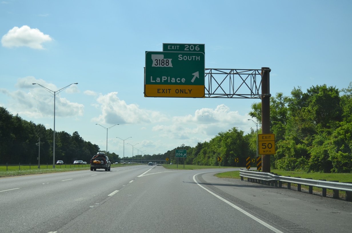
| Interstate 10 meets LA 3188 (Belle Terre Boulevard) at a trumpet interchange (Exit 206) just west of the weigh stations. 05/09/15 |
|
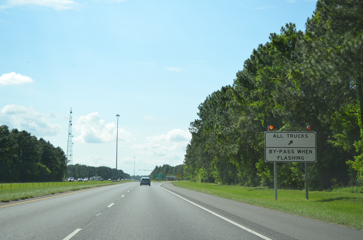
| LA 3188 (Belle Terre Boulevard) at LaPlace provides the last traveler services along Interstate 10 west until Sorrento. 05/09/15 |
|
| LA 3188 (Belle Terre Boulevard) constitutes a 3.11 mile arterial south from Exit 206 to U.S. 61 (Airline Highway) at LaPlace. 05/09/15 |
|
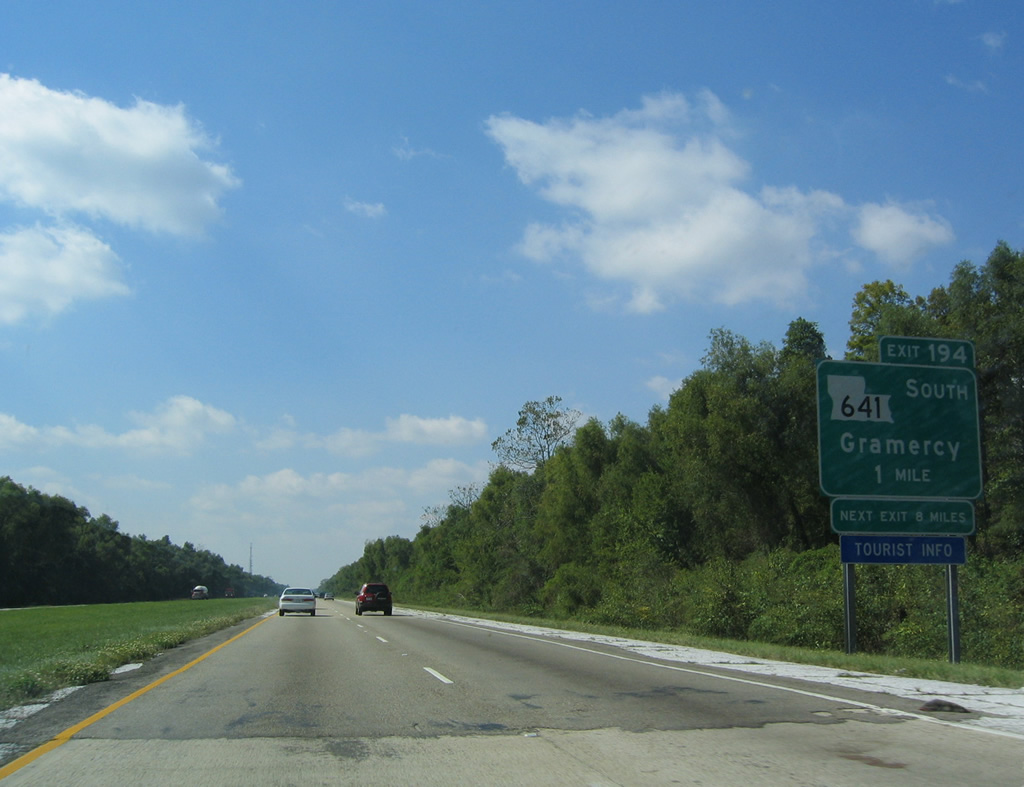
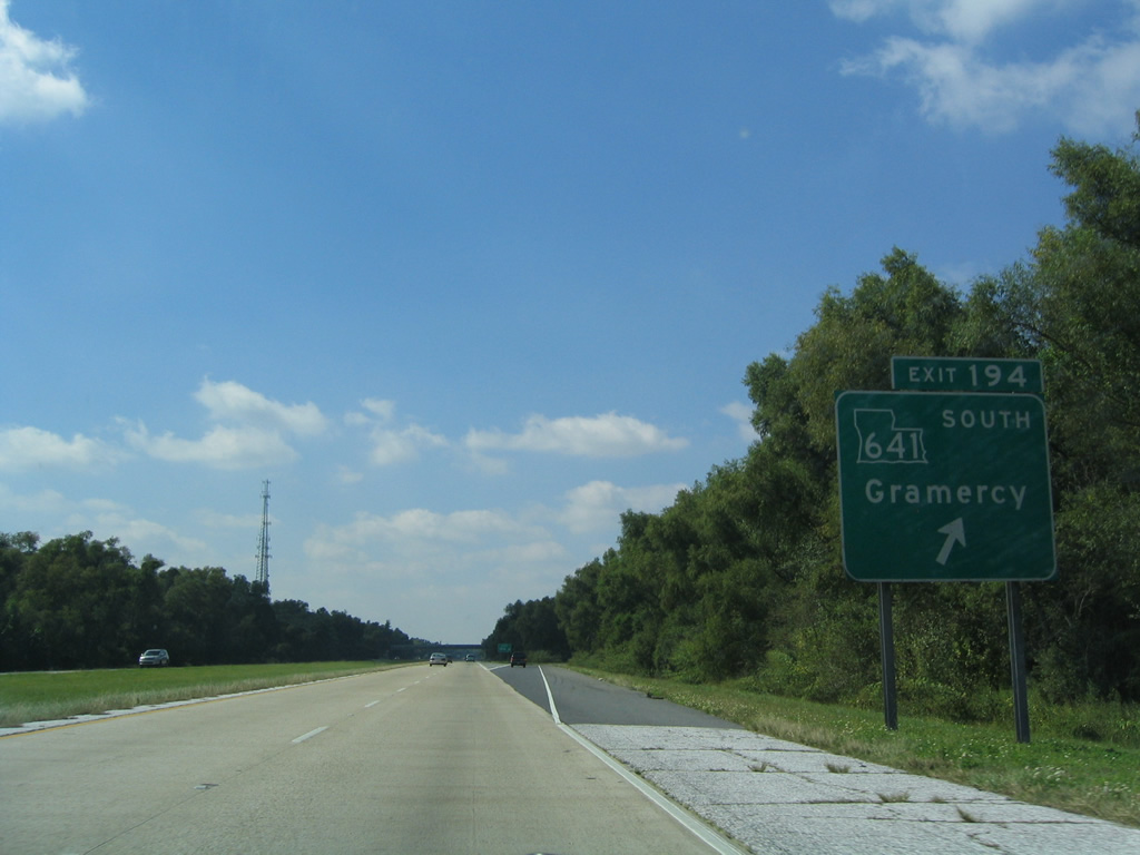
| Interstate 10 advances west across Maurepas Swamp Wildlife Management Area to a diamond interchange (Exit 194) with LA 641. 10/18/03 |
|
| LA 641 is a 6.86 mile long route from I-10 to LA 44 (Jefferson Highway) in the town of Gramercy. LA 641 provides a direct link to the 1995-opened Veterans Memorial Bridge (LA 3213) spanning the Mississippi River south to Wallace and LA 3217 (River Parishes Highway). 10/18/03 |
|
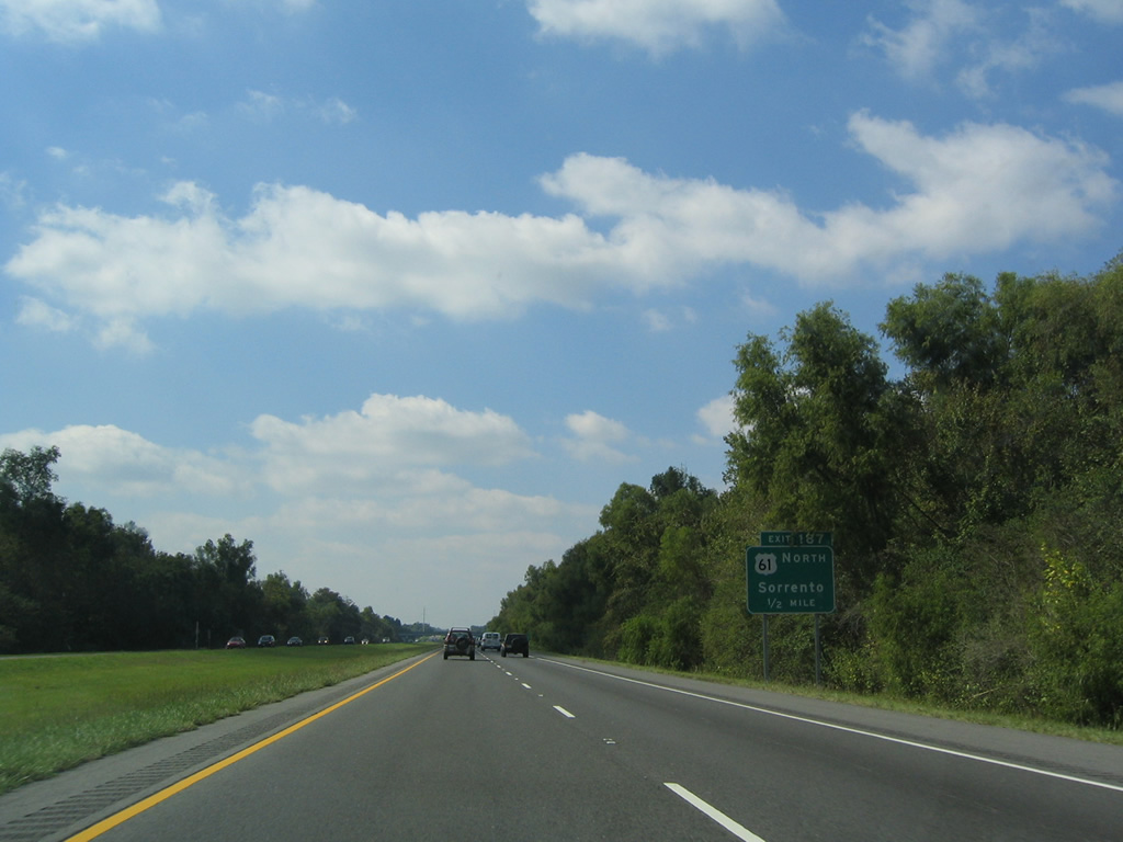
| Continuing west into Ascension Parish, I-10 converges with U.S. 61 at overlapping wye interchanges (Exit 187). U.S. 61 angles northwest four miles to the town of Sorrento. 10/18/03 |
|
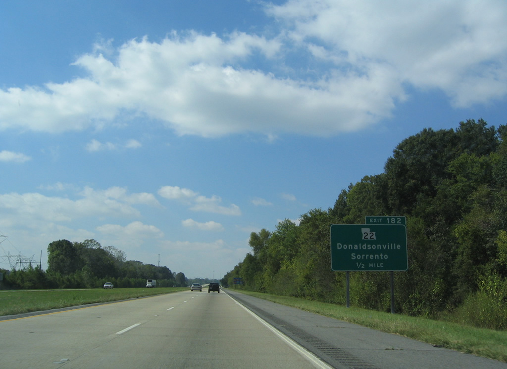
| LA 22 heads two miles southwest from U.S. 61 in Sorrento to a diamond interchange (Exit 182) with Interstate 10. LA 22 travels 71.9 miles between LA 75 at Darrow and U.S. 190 at Mandeville. 10/18/03 |
|
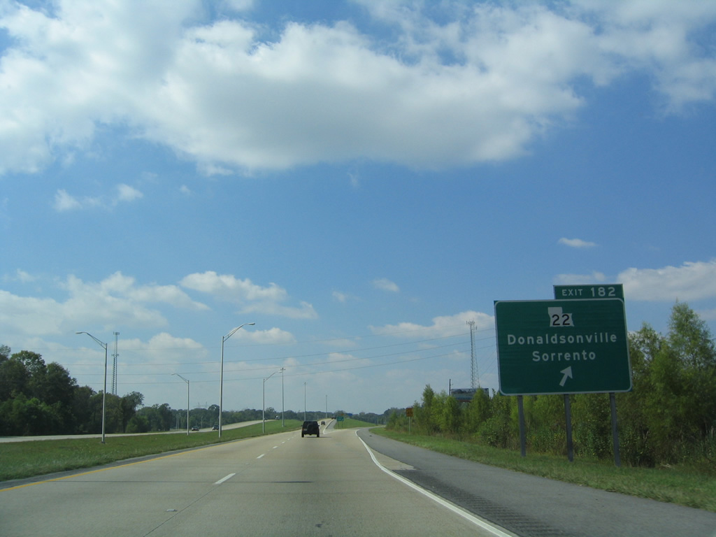
| Exit 182 departs I-10 west for LA 22. LA 70 arcs ten miles southwest from LA 22 nearby to LA 3089 outside Donaldsonville via the Sunshine Bridge across the Mississippi River. 10/18/03 |
|
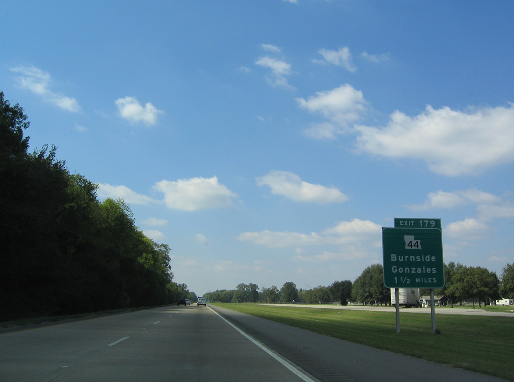
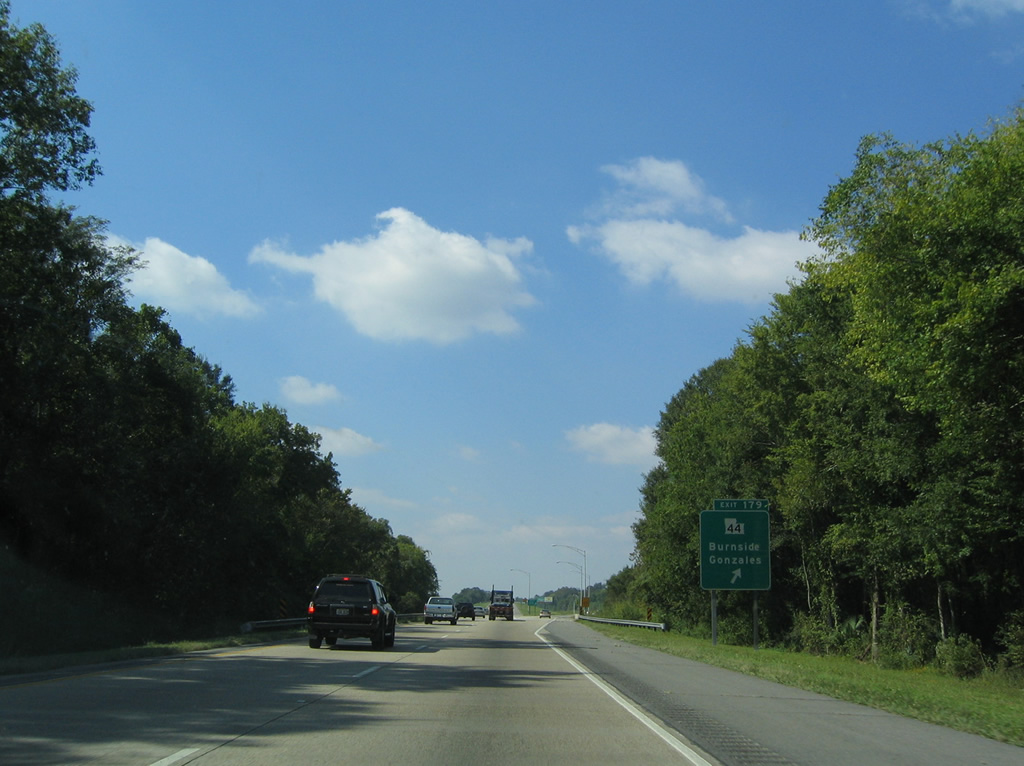
| Rest areas were formerly located 1.5 miles east of the diamond interchange (Exit 179) joining I-10 with LA 44 (Burnside Avenue). LA 44 travels 50.1 miles between LA 42 at Little Prairie and U.S. 61 (Airline Highway) at LaPlace. 10/18/03 |
|
| LA 44 (Burnside Avenue) is the first of two exits from I-10 west for the city of Gonzalez. LA 44 runs south from Gonzalez to LA 942 at Burnside along the Mississippi River. 10/18/03 |
|
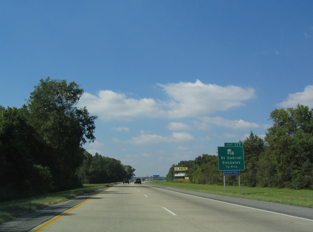
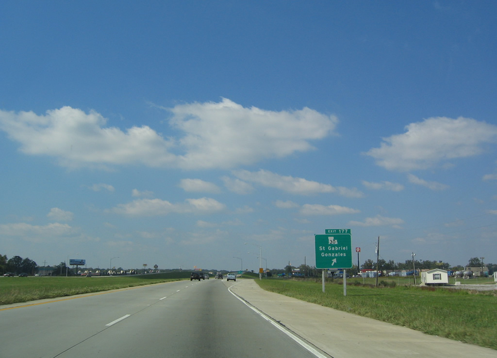
| LA 30 meets I-10 at a diamond interchange (Exit 177) west of Gonzalez and miles east of Saint Gabriel along the Mississippi River. 10/18/03 |
|
| LA 30 begins four miles east of Exit 177 at U.S. 61 (Airline Highway). LA 30 parallels I-10 westward along a 28.7 mile course to Exit 155B near Downtown Baton Rouge. 10/18/03 |
|
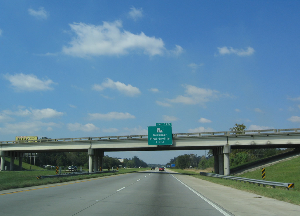
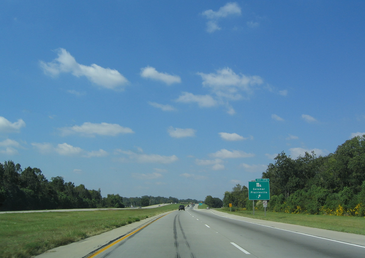
| A diamond interchange (Exit 173) joins I-10 with LA 73 one mile from the LA 429 (Cornerview Road) overpass. LA 73 constitutes a 26.3 mile long route between Geismar and the city of Baton Rouge. 10/18/03 |
|
| LA 73 travels 2.5 miles north from Exit 173 to U.S. 61 (Airline Highway) at the community of Praireville and along Jefferson Highway northwestward into the Baton Rouge metropolitan area. 10/18/03 |
Page Updated 08-31-2020.

 West
West