|
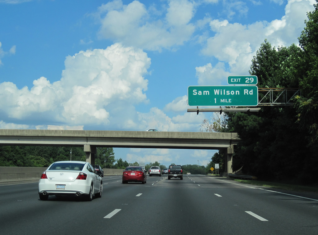
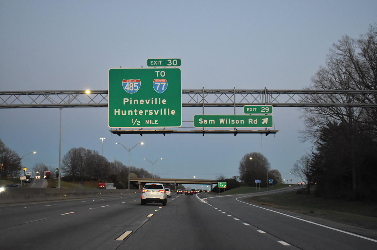
| Interstate 85 rises from the Catawba River crossing ahead of Moores Chapel Road (SR 1601) and Exit 29 for Sam Wilson Road (SR 1625). 08/11/13, 03/12/22 |
|
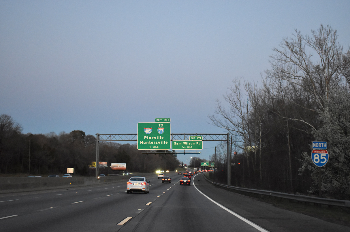
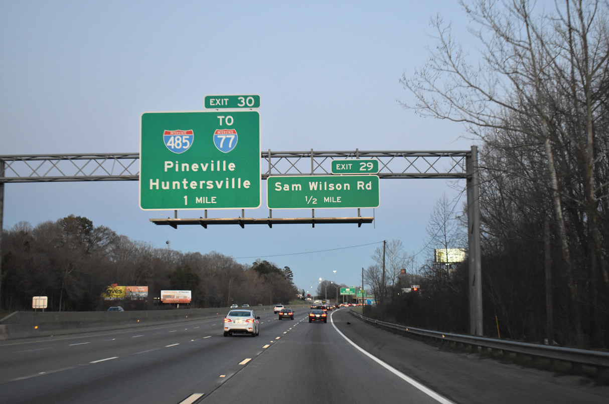
| Ramps at the diamond interchange (Exit 29) with Sam Wilson Road (SR 1625) were extended east to offset weaving traffic with Interstate 485. The Charlotte Beltway runs northeast to I-77 at Huntersville and south to I-77 near Pineville. 03/12/22 |
|
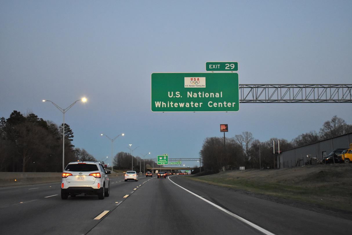
| The U.S. National Whitewater Center, a $38 million facility opened to the public on November 4, 2006,1 lies to the northwest of Moores Chapel Road at the end of Whitewater Parkway (SR 1677). The facility is an official training site for Olympic whitewater slalom racing. 03/12/22 |
|
| Sam Wilson Road travels south to U.S. 29/74 (Wilkinson Boulevard) and Old Dowd Road (SR 1191) and north to Moores Chapel Road (SR 1601) by a series of industrial parks. Completed on June 5, 2015, I-485 encircles the city of Charlotte along a 65.68 mile course. 03/12/22 |
|
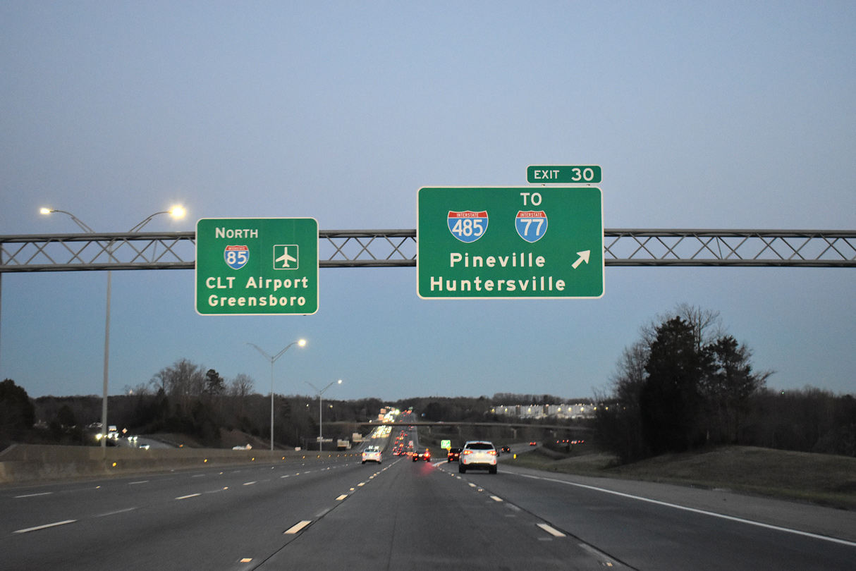
| A cloverstack interchange joins I-85 with I-485 (Charlotte Beltway) at Exit 30. Completion of I-485 northeast to I-77 and NC 115 on December 5, 2008 allowed motorists to bypass central Charlotte for Huntersville, Statesville, and other points north. 03/12/22 |
|
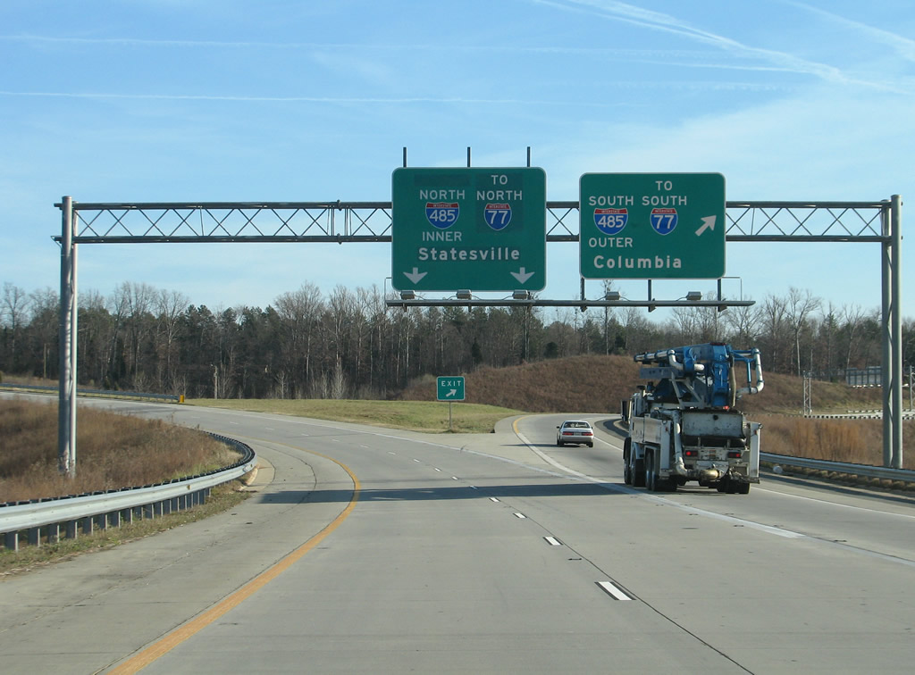
| Opened to traffic on October 19, 2004, the southwest leg of I-485 provides a bypass of Downtown Charlotte from Gastonia to Rock Hill and Columbia, South Carolina. Northward I-485 opened on December 15, 2006 to NC 27 and to NC 16 by May 8, 2007. 12/13/08 |
|
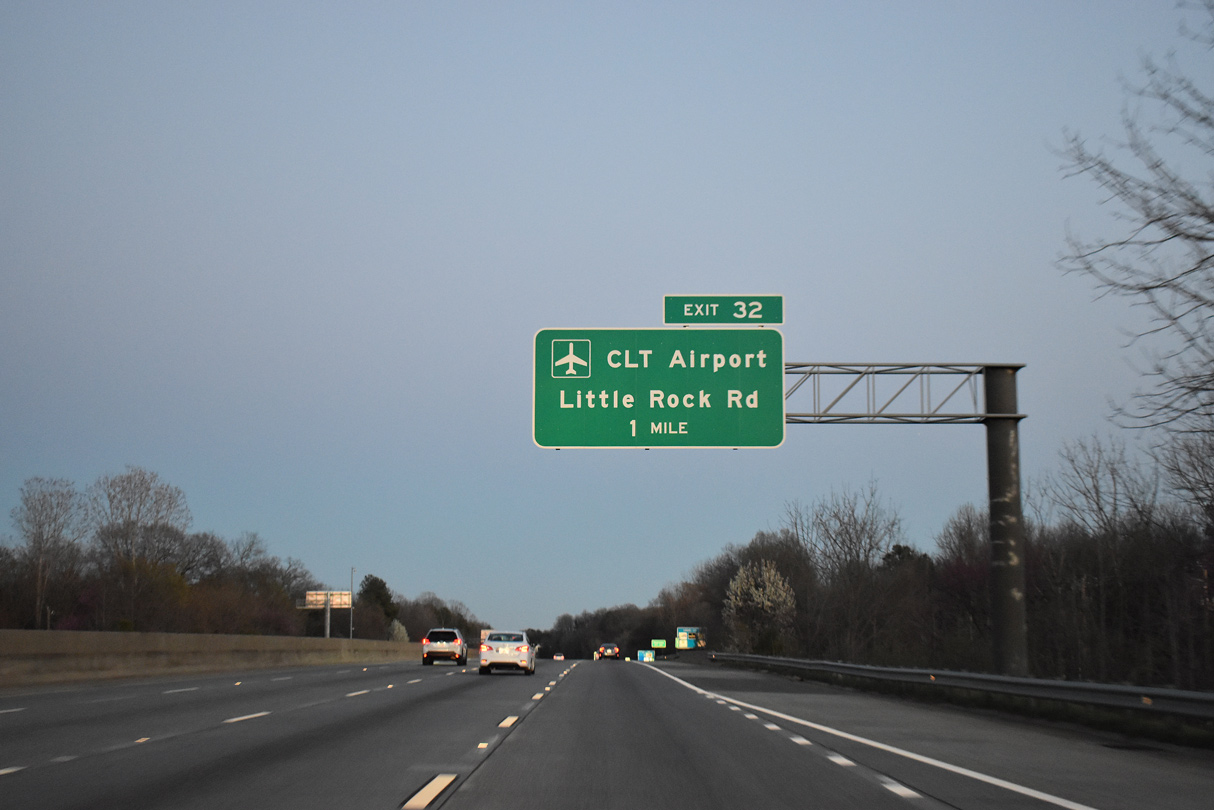
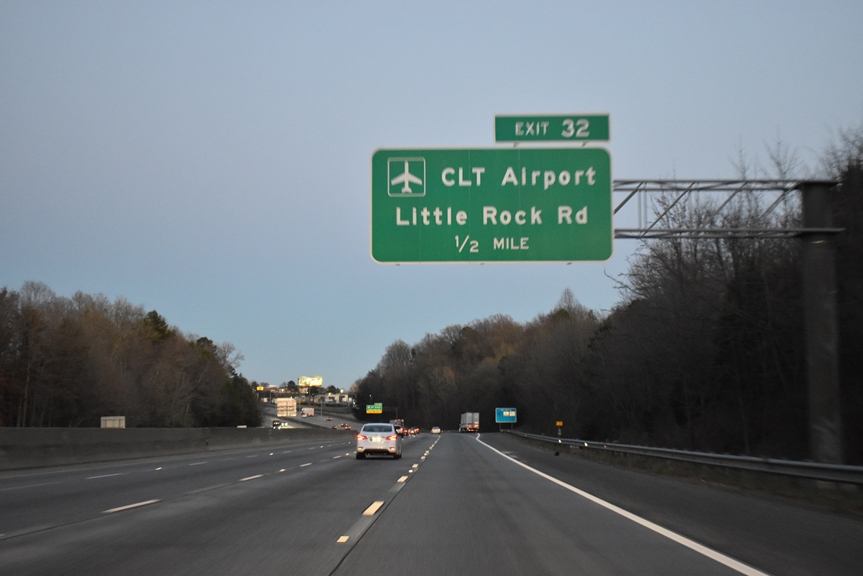
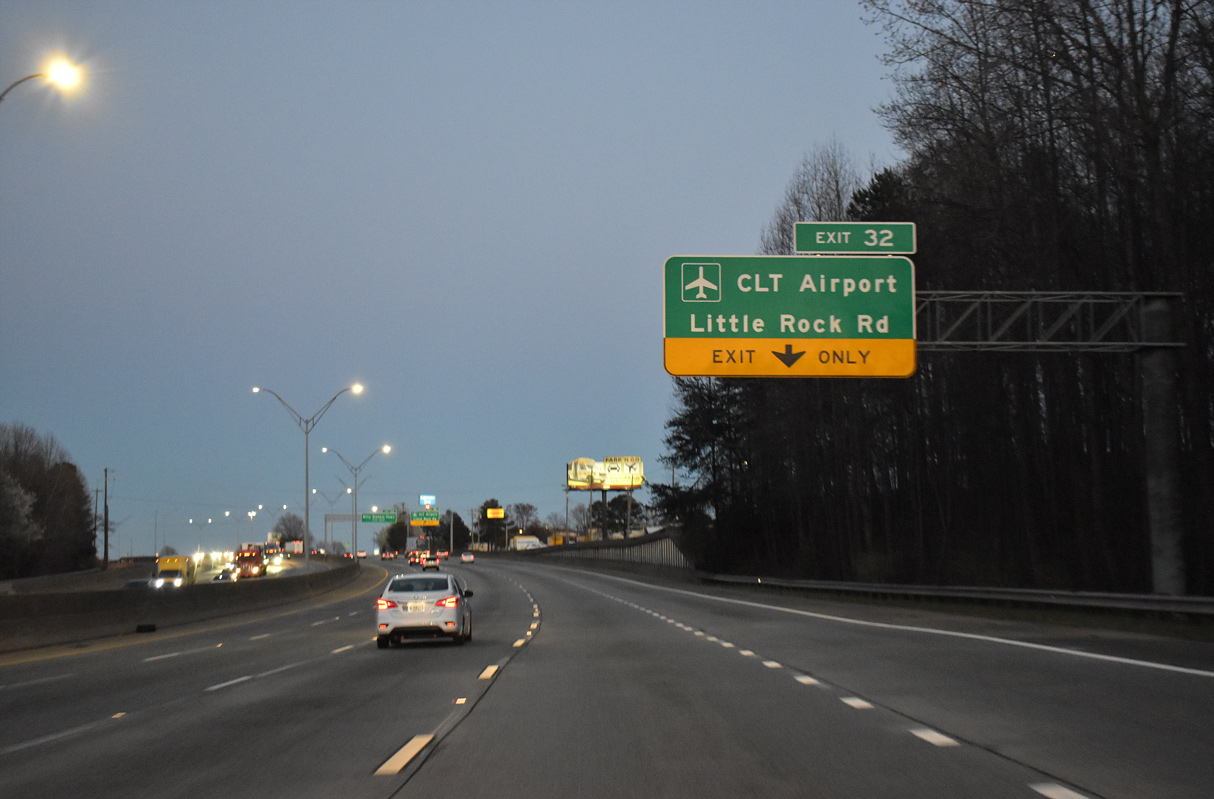
| Interstate 85 next enters a single point urban interchange (Exit 32) with Little Rock Road (SR 1641). 03/12/22 |
|
| Little Rock Road (SR 1641) leads 2.96 miles south from NC 27 (Freedom Drive) at Paw Creek in north Charlotte to U.S. 29/74 (Wilkinson Boulevard) and the passenger terminal at Charlotte Douglas International Airport (CLT). 03/12/22 |
|
| A $21.5 million project started in August 2012 realigned Little Rock Road onto a new roadway leading directly to the passenger terminal at CLT Airport. Work ran to December 2013.2 03/12/22 |
|
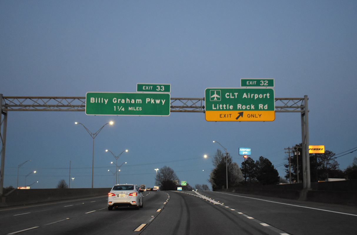
| An array of industrial businesses, traveler services and lodging buffet surround the SPUI joining I-85 with Little Rock Road (SR 1641). The succeeding exit for Billy Graham Parkway was the previous signed route into CLT Airport from I-85. 03/12/22 |
|
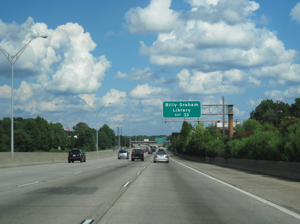
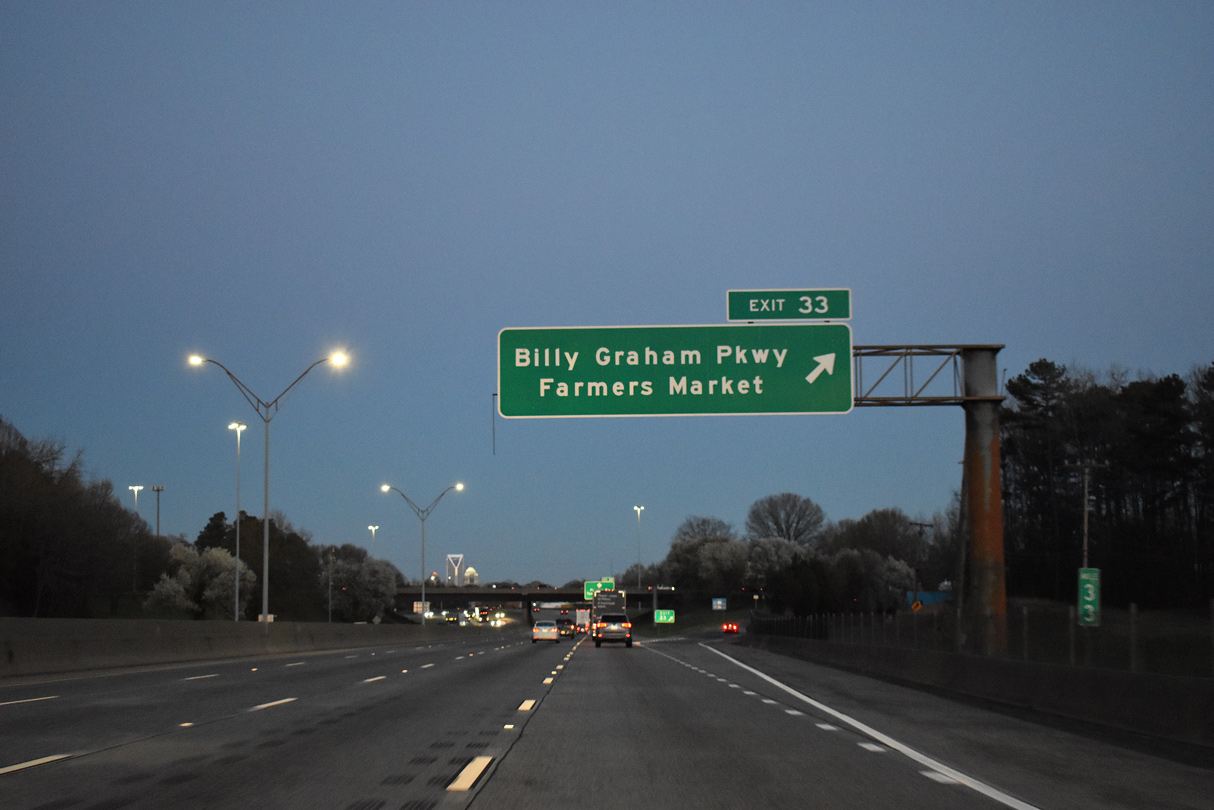
| I-85 meets Billy Graham Parkway (Charlotte City Route 4) south and Mulberry Church Road north at a parclo interchange (Exit 33). Part of U.S. 521 until 2003, Billy Graham Parkway (SR 5901) winds 5.13 miles south to NC 49 (Tryon Street) and Woodlawn Road by I-77. 03/12/22 |
|
| SR 5901 is named after Charlotte native and Christian evangelist Billy Graham (1918-2018). A library documenting the life and ministry of Graham is located off Billy Graham Parkway via Westmont Drive beyond the exchange with Tyvola Road (SR 1576). 08/11/13 |
|
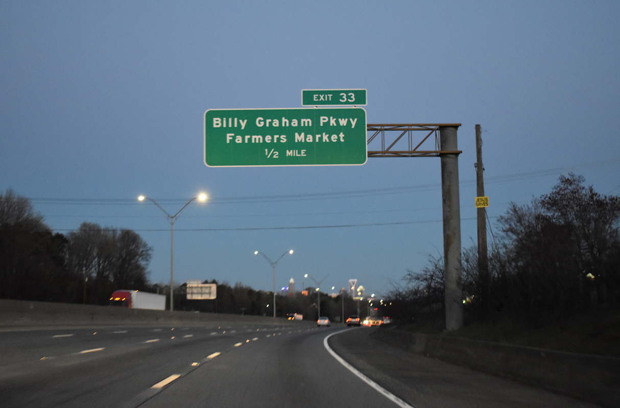
| Billy Graham Parkway carries Charlotte Route 4 southward to W Woodlawn Road (SR 12921) near the Regional Farmers Market. Route 4 encircles central Charlotte along a series of arterials south of I-85 between Exit 33 and 41. 03/12/22 |
|
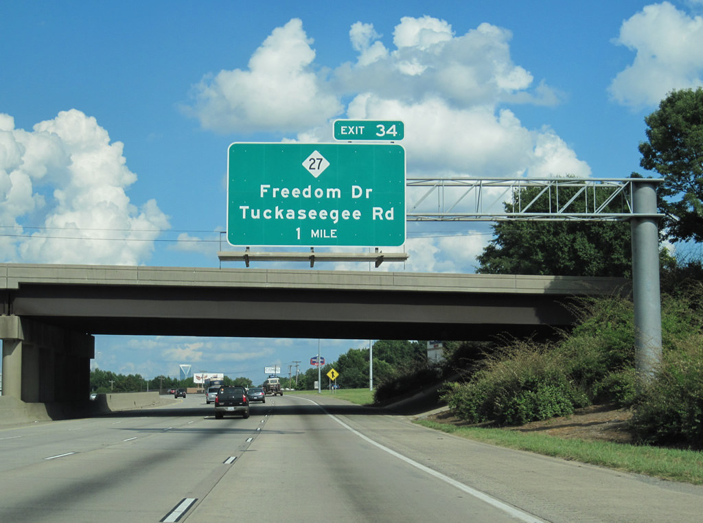
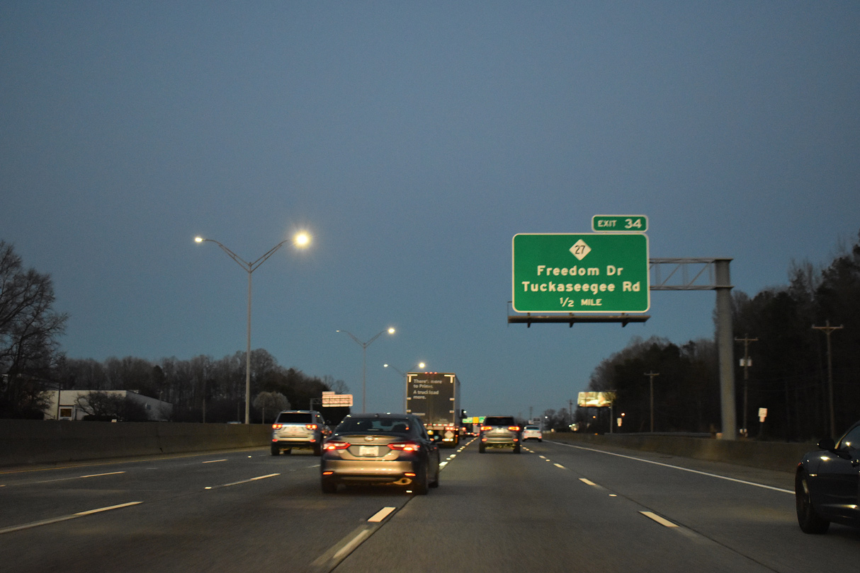
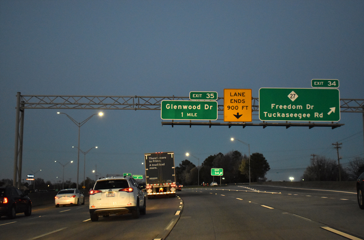
| Interstate 85 shifts northward through an industrial area to a half diamond interchange with Tuckaseegee Road (SR 1984) and SPUI with NC 27 (Freedom Drive) at Exit 34. 08/11/13 |
|
| NC 27 (Freedom Drive) runs southeast from Paw Creek and the northwestern suburbs to Enderly Park and with U.S. 29 (Morehead Street) into Downtown Charlotte. 03/12/22 |
|
| Exit 34 departs Interstate 85 north for Tuckaseegee Road (SR 1984) and NC 27. Underway from 1991 to August 1995, a $70 million project widening I-85 through western Mecklenburg County rebuilt the cloverleaf interchange at Exit 34 into a SPUI.4 03/12/22 |
|
| Tuckaseegee Road joins the freeway with the Freedom Mall commercial area while. With declining sales, the 1964 opened Freedom Mall was purchased by Mecklenburg County in 2003 for $6.6 million. The building was converted into county offices as part of the Valerie C. Woodard Center.3 06/22/05 |
|
| Passing through the SPUI with NC 27. The 1991-95 expansion project brought I-85 up to eight lanes from Moores Chapel Road east to a point just west of the Brookshire Freeway (NC 16).4 03/12/22 |
|
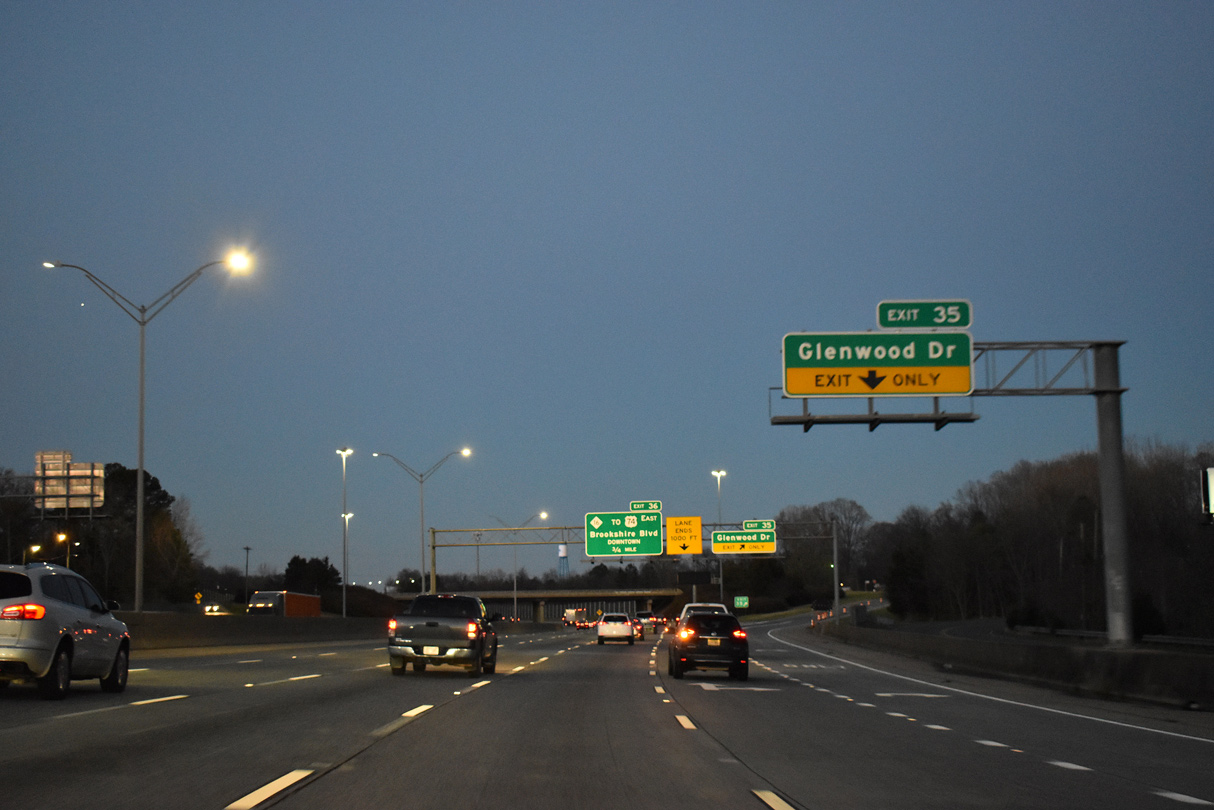
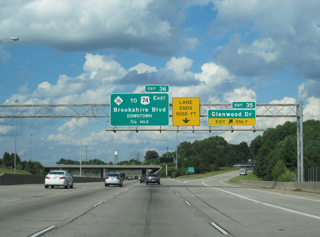
| A diamond interchange (Exit 35) joins I-85 with Glenwood Drive. Glenwood Drive is a local roadway connecting the Enderly Park neighborhood at Tuckaseegee Road with the Thomasboro neighborhood at Hoskins Road. 03/12/22 |
|
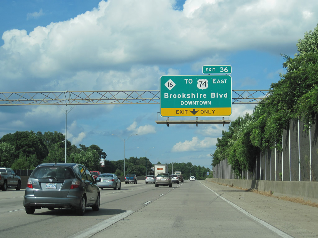
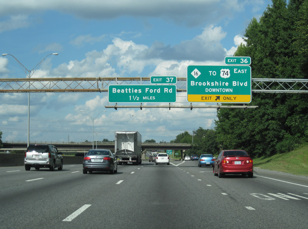
| Exit 35 leaves for Glenwood Drive 0.75 miles ahead of Exit 36 to NC 16 (Brookshire Boulevard). NC 16 provides a direct route southeast to I-277 (Brookshire Freeway) and U.S. 74 (Independence Expressway) east from Downtown. 08/11/13 |
|
| NC 16 (Brookshire Boulevard) meets I-85 at a SPUI (Exit 36). A 462 mile long multi state highway to St. Mary's, West Virginia, NC 16 travels 155 miles in the state from NC 75 at Waxhaw to the state north of Grassy Creek. 08/11/13 |
|
| Exit 36 departs at the Rozzelles Ferry Road (former NC 16) overpass for NC 16 at the Oakview Terrace neighborhood. Leading southeast from the Thomasboro community, NC 16 converges with I-77/U.S. 21 and I-277 in 2.14 miles. Brookshire Boulevard upgrades to Brookshire Freeway at nearby Idaho Drive. 08/11/13 |
|
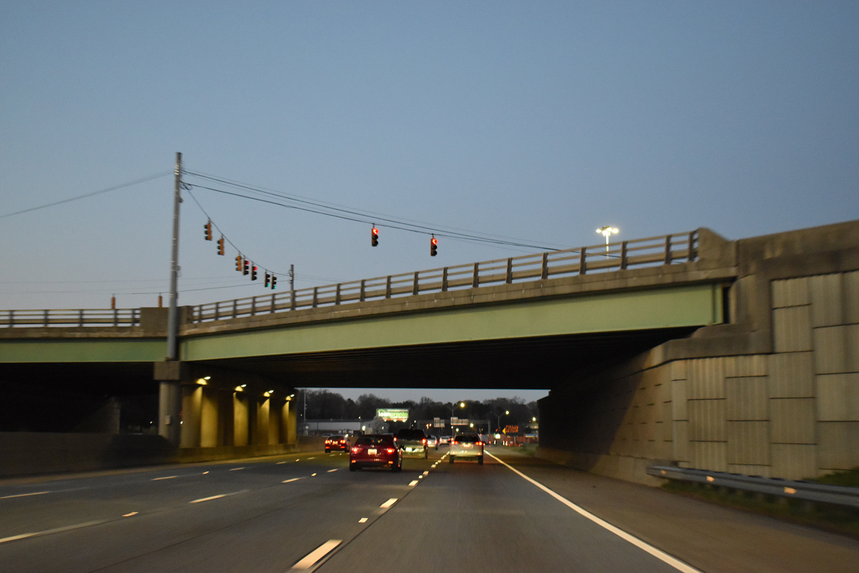
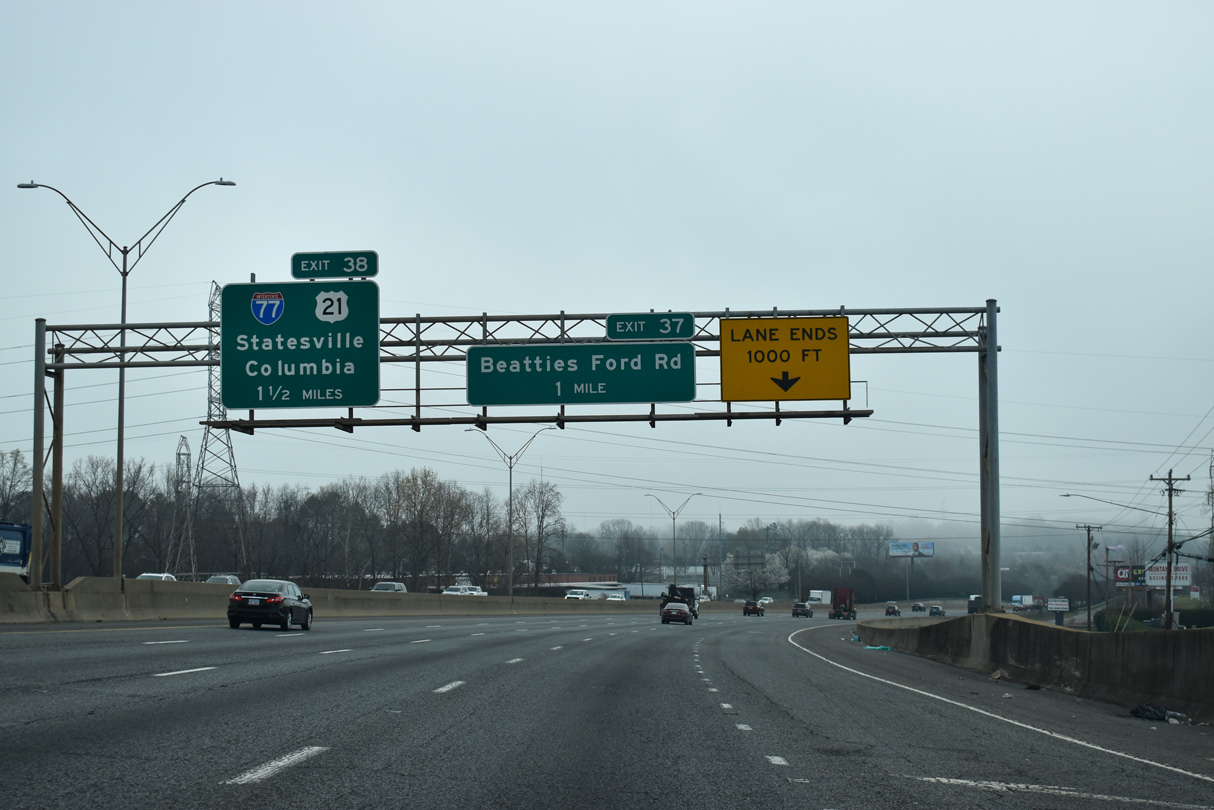
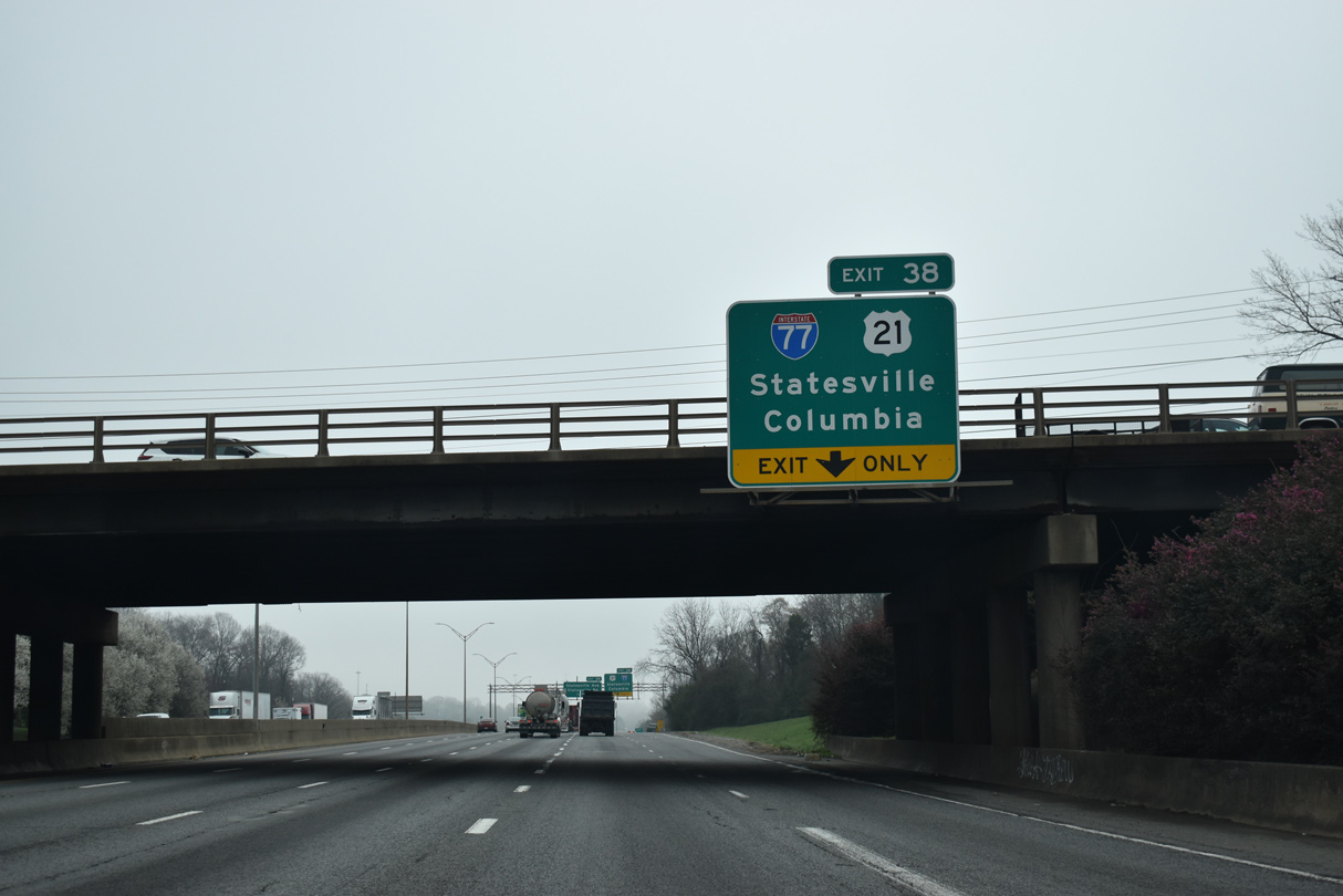
| Curving eastward across Stewart Creek, Interstate 85 advances 1.5 miles to I-77/U.S. 21 at Exit 38. 03/11/22 |
|
| The ensuing exit is for Beatties Ford Road at the Garden Park and University Park neighborhoods. 03/11/22 |
|
| Beatties Ford Road parallels I-77/U.S. 21 to the west from 5th Street and Johnson C. Smith University at the Biddleville neighborhood northward to a folded diamond interchange (Exit 37) with I-85 and NC 73 near Huntersville. 03/11/22 |
|
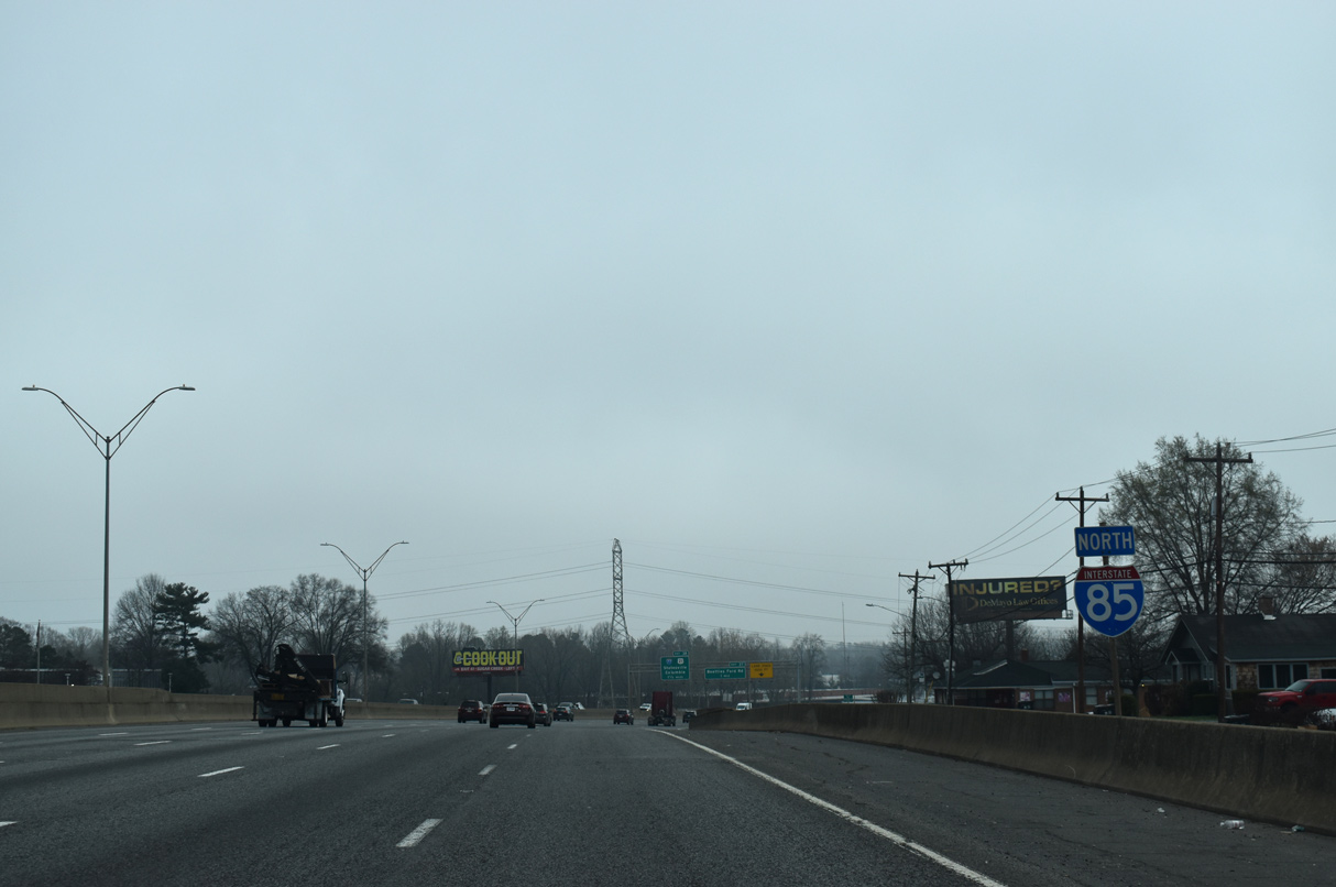
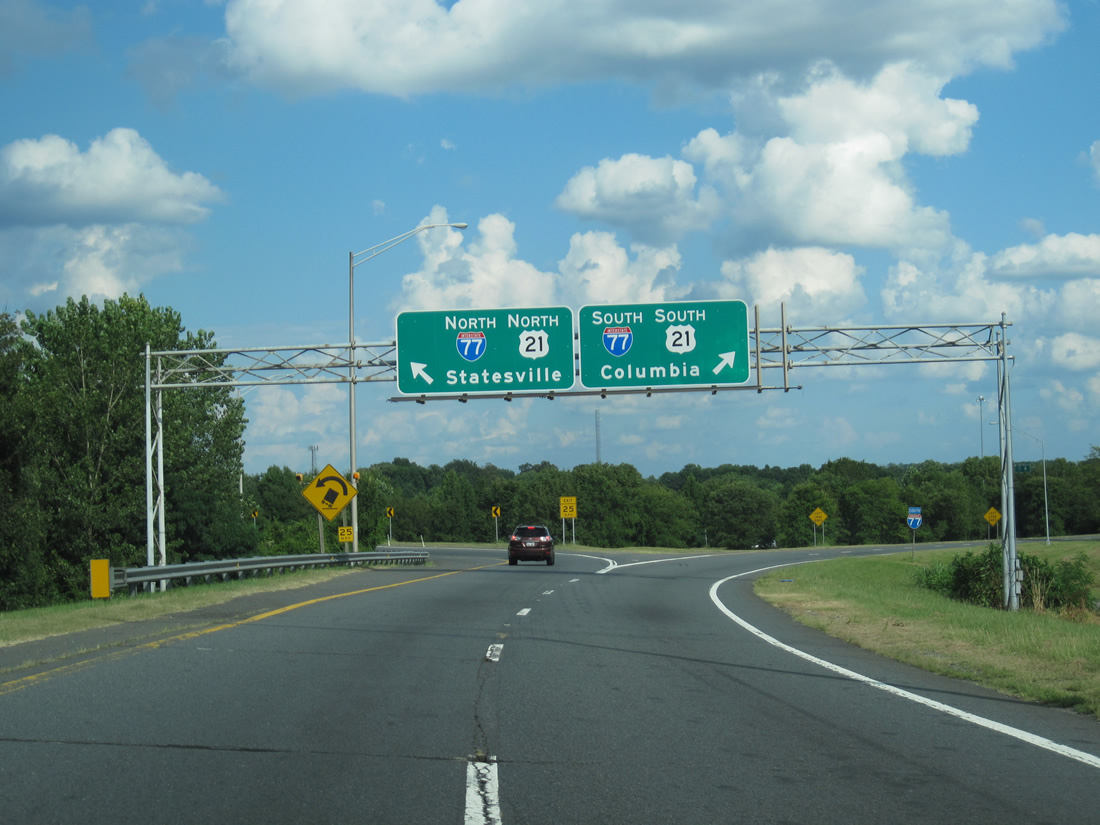
| An auxiliary lane opens northbound leading into the directional cloverleaf interchange (Exit 38) with I-77/U.S. 21. Traveling 102 miles in the state, I-77 links Charlotte with Rock Hill and Columbia, South Carolina to the south and Statesville and Wytheville, Virginia to the north. 03/11/22 |
|
| As part of an $83 million HOV project for I-77 north to I-485, two new overpasses were constructed at the exchange with I-85, including one for Exit 38 to Statesville. The new ramp shifted the merge point to join I-77 north beyond the loop ramp for I-85 south. 03/11/22 |
|
| I-77/U.S. 21 leads south along the western periphery of Downtown Charlotte over the next five miles. Statesville, where I-77 crosses I-40, is 83 miles to the north. 08/11/13 |
|
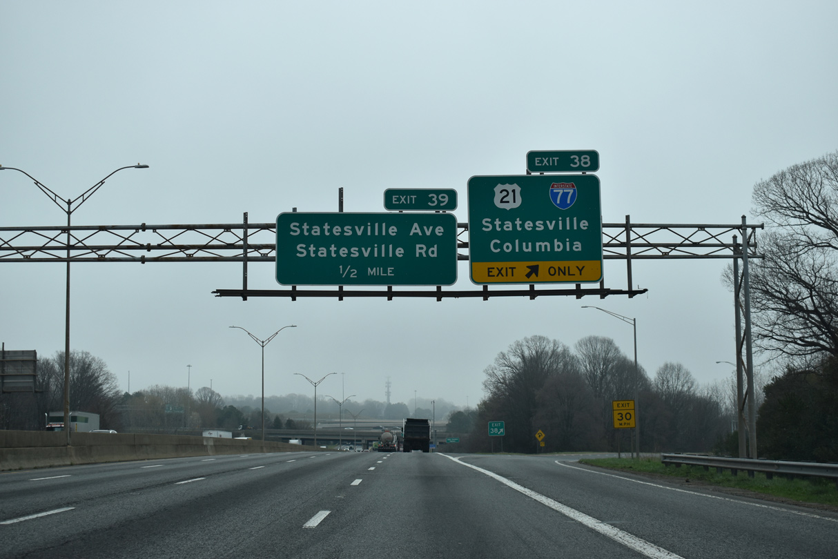
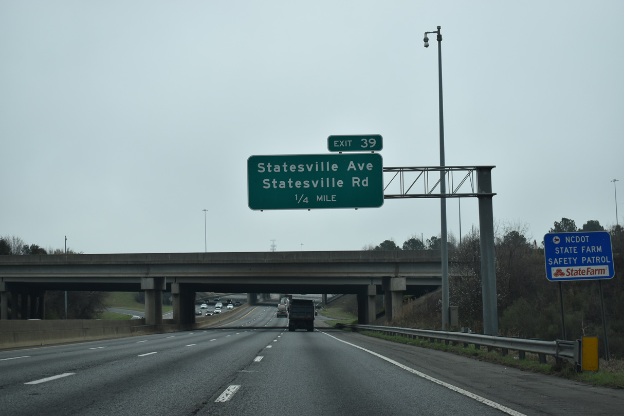
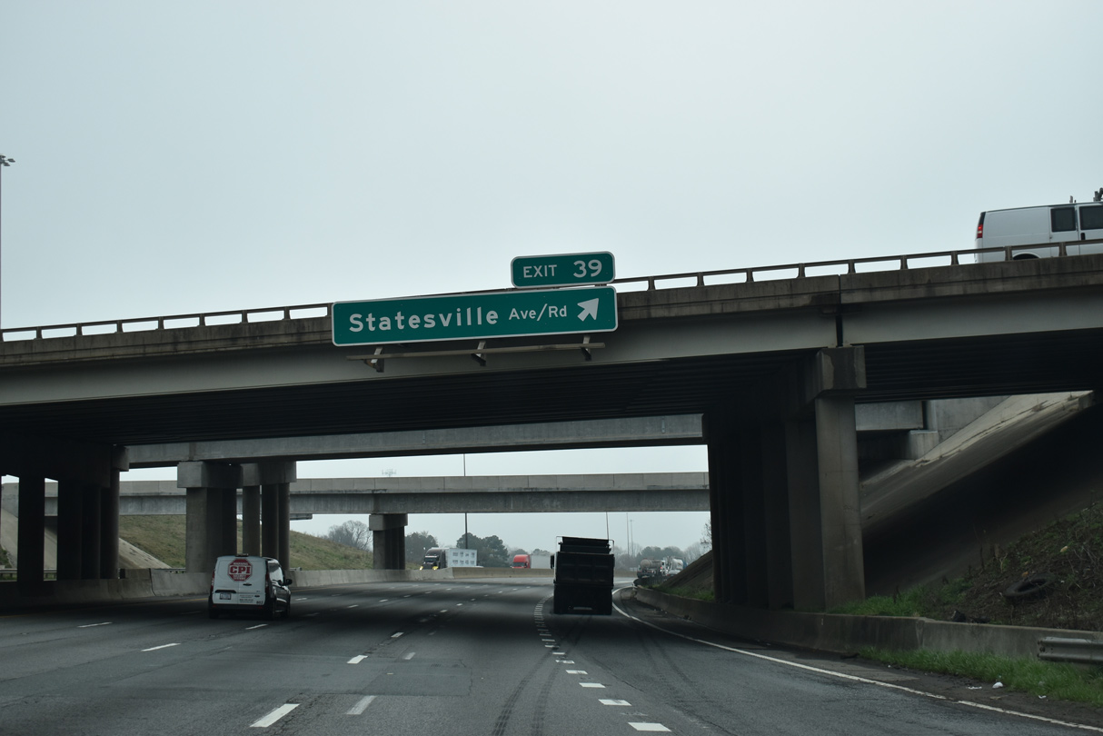
| Statesville Avenue south and Statesville Road north meet I-85 at a parclo interchange (Exit 39) adjacent to the exchange with I-77/U.S. 21. 03/11/22 |
|
| Statesville Avenue and Statesville Road represent the historic alignment of U.S. 21. 03/11/22 |
|
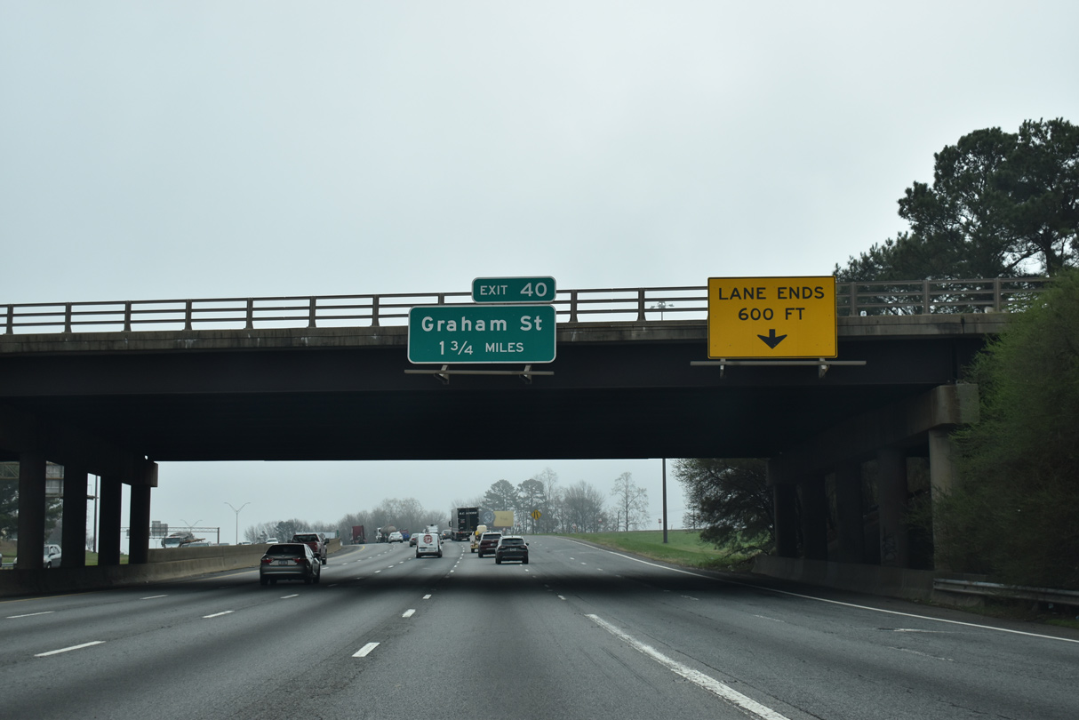
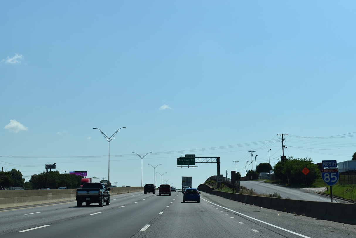
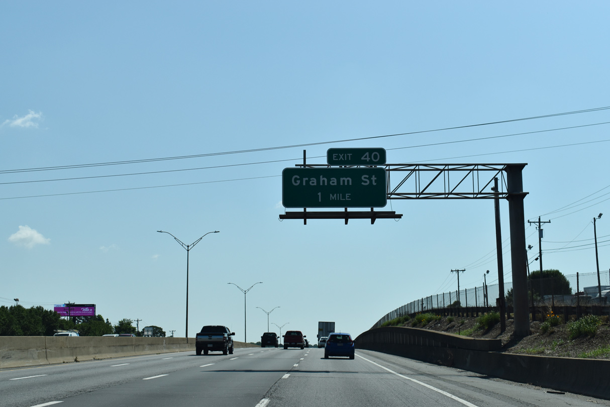
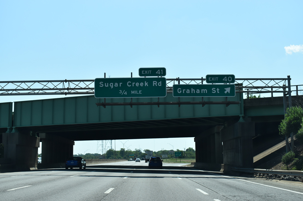
| Exit 40 follows the Statesville Avenue/Road overpass in 1.75 miles at Graham Street (SR 2540). 03/11/22 |
|
| Frontage roads accompany I-85 east at the Druid Hills North industrial area. 05/26/19 |
|
| Graham Street (SR 2540) splits with U.S. 29/NC 49 at the Lockwood neighborhood along a northeasterly course between the Druid Hills and Sugar Creek industrial areas to Exit 40. 05/26/19 |
|
| I-85 enters the folded diamond interchange (Exit 40) with Graham Street at the Norfolk Southern Railroad overpass. Graham Street continues northeast to Sugar Creek Road (SR 2480) at the Mineral Springs neighborhood. 05/26/19 |
|
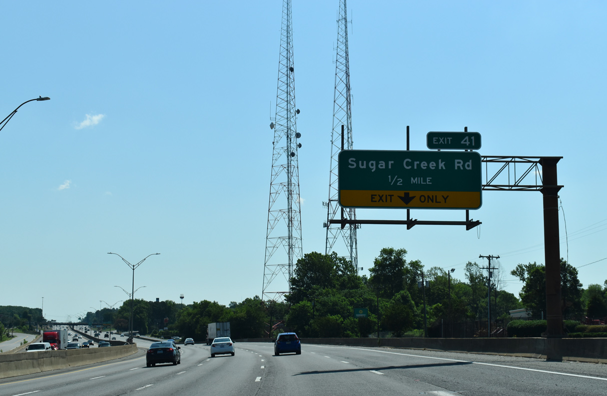
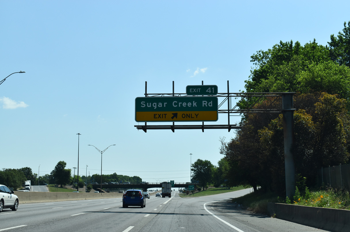
| Sugar Creek Road (SR 2480) doubles as Charlotte City Route 4 north from Eastway Drive at Shannon Park between the Sugar Creek and Hidden Valley communities to Interstate 85 at Exit 41. 05/26/19 |
|
| Sugar Creek Road winds north from the diamond interchange (Exit 41) with I-85 to the Hemphill Heights neighborhood and other northern suburbs to NC 24 (W.T. Harris Boulevard). 05/26/19 |
|
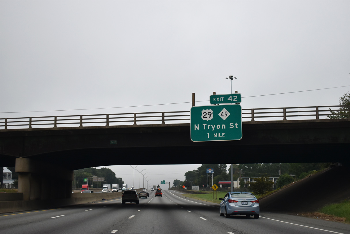
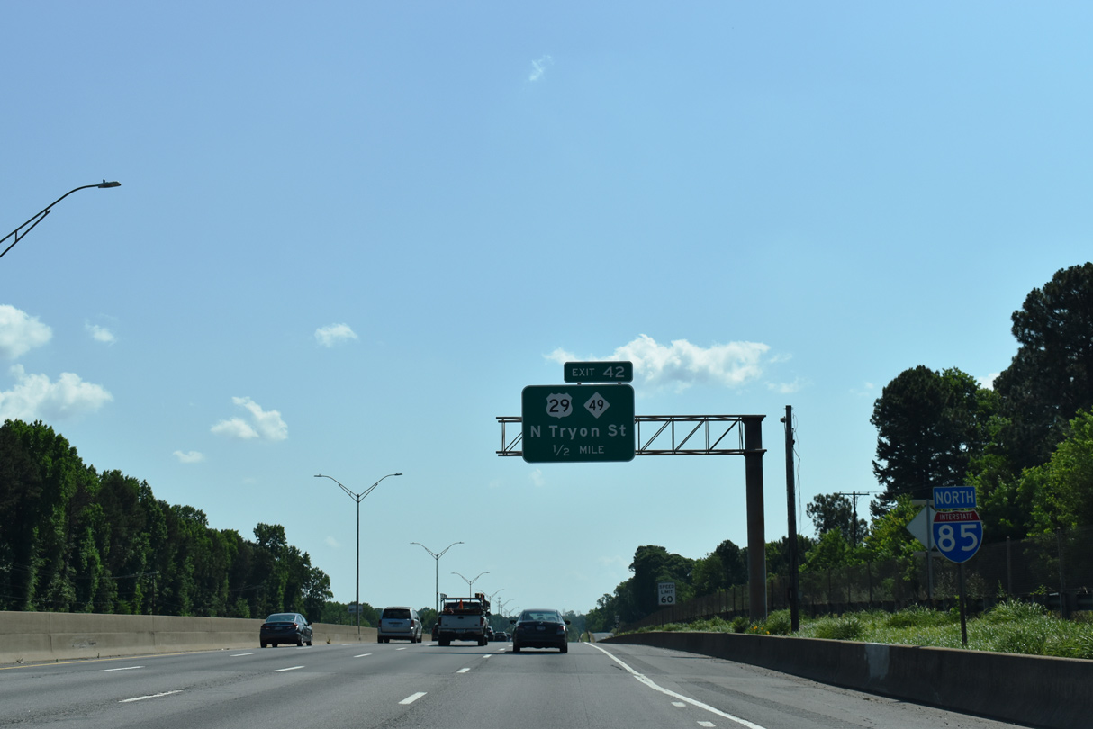
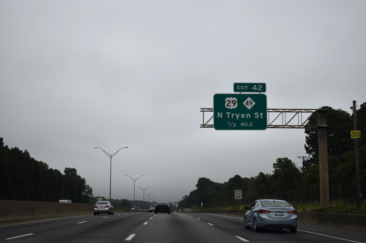
| SR 2772 provides a connection from I-85 north to U.S. 29/NC 49 (N Tryon Street) at Exit 42. I-85 in 1963 ran east from U.S. 29/74 in east Gastonia to U.S. 29/NC 49 east via SR 2772. 09/17/21 |
|
| Underway from 2003 to February 2005, an $87.7 million project expanded I-85 to eight lanes from Exit 42 northeast to I-485. This included the redesign of the wye interchange at Exit 42 to eliminate a left side entrance ramp to I-85 south.5,6 05/26/19 |
|
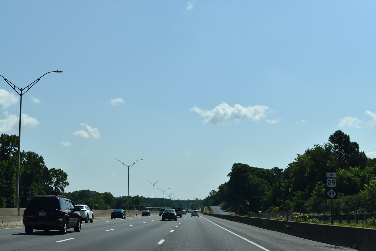
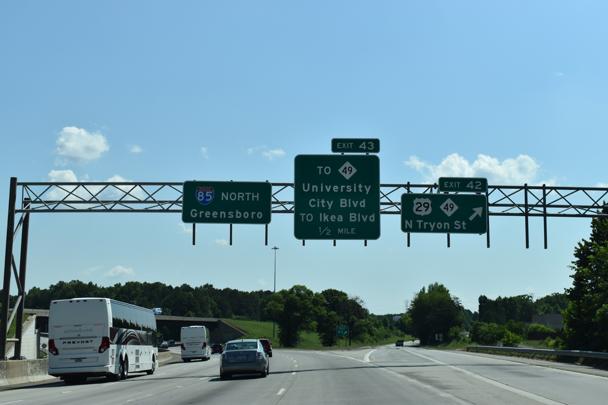
| SR 2772 spurs 1.03 miles east to N Tryon Street at Sandy Avenue. U.S. 29/NC 49 combine northeast from Downtown Charlotte to University City Boulevard (SR 5383). 09/17/21 |
|
| A wye interchange originally connected SR 2772 with U.S. 29/NC 49 adjacent to a second wye at the split of the two routes. Both grade separations were replaced with intersections to reduce weaving traffic patterns during the U.S. 29/NC 49 Roadway Improvement Project from June 2010 to September 2012.7 05/26/19 |
|
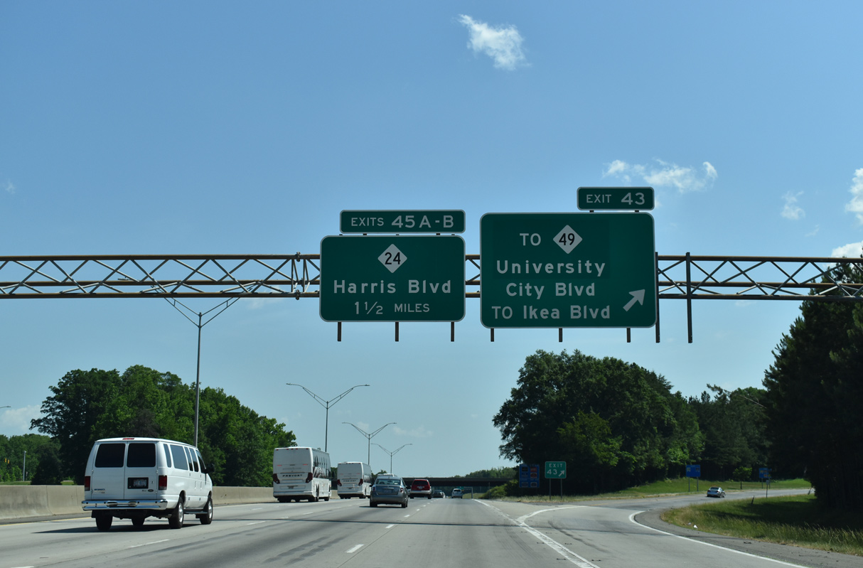
| Exit 42 leaves Interstate 85 north for N Tyron Street. NC 49 continues east by UNC Charlotte to Harrisburg while U.S. 29 remains parallel to I-85 by UNC Charlotte en route to Concord. University City Boulevard stems 0.70 miles west from U.S. 29 (N Tryon Street) and NC 49 to a parclo interchange (Exit 43) with Interstate 85 next. 05/26/19 |
|
| University City Boulevard initially only traveled west from I-85 to Neal Road. An extension east to U.S. 29 (Tryon Street) opened in 2009 as part of the $25.5 million U.S. 29/NC 49 Roadway Improvement Project.7 Ikea Boulevard ties into the arterial from University City retail area. 05/26/19 |
|
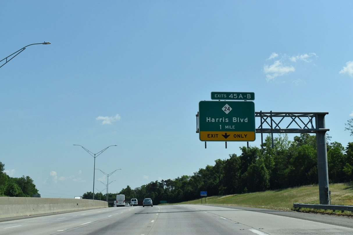
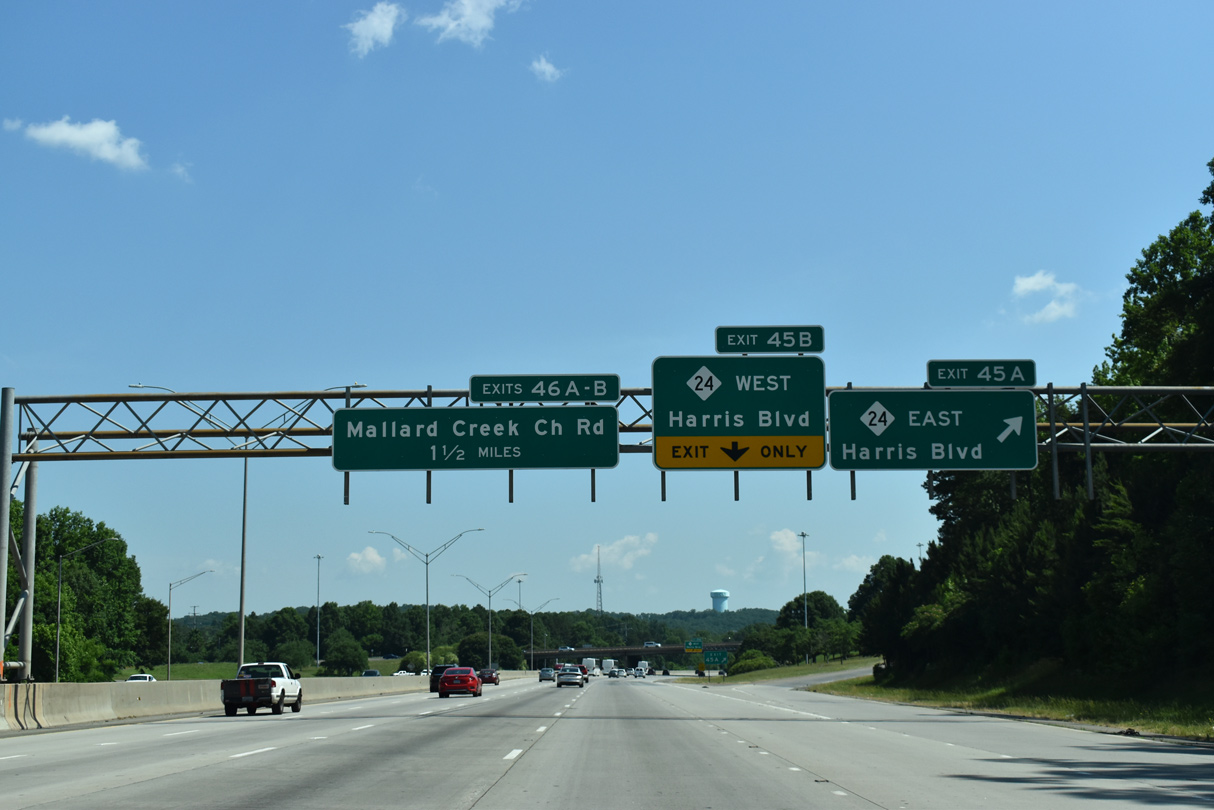
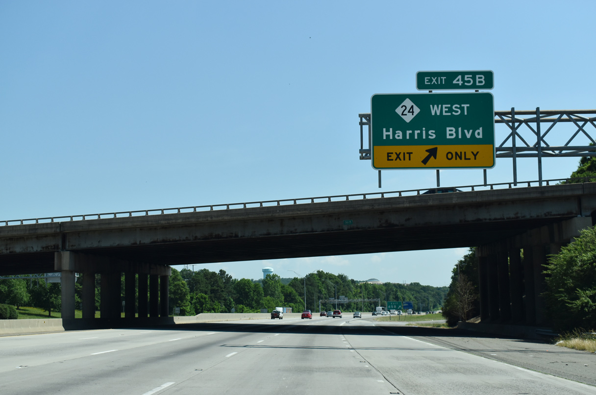
| NC 24 (W.T. Harris Boulevard) meets Interstate 85 at a six-ramp parclo interchange (Exits 45A/B) in one mile. 05/26/19 |
|
| Overhead lighting and an interchange sequence sign for the last three Queen City exits was added to I-85 during the 2003-05 widening through northeast Charlotte. 09/17/21 |
|
| Exit 45A departs I-85 north for NC 24 (Harris Boulevard) east to UNC-Charlotte and the Newell section of the city. 05/26/19 |
|
| NC 24 continues west along Harris Boulevard to University Research Park, Croft, and I-77 (Exit 18) and I-485 by Northlake Mall. 05/26/19 |
|
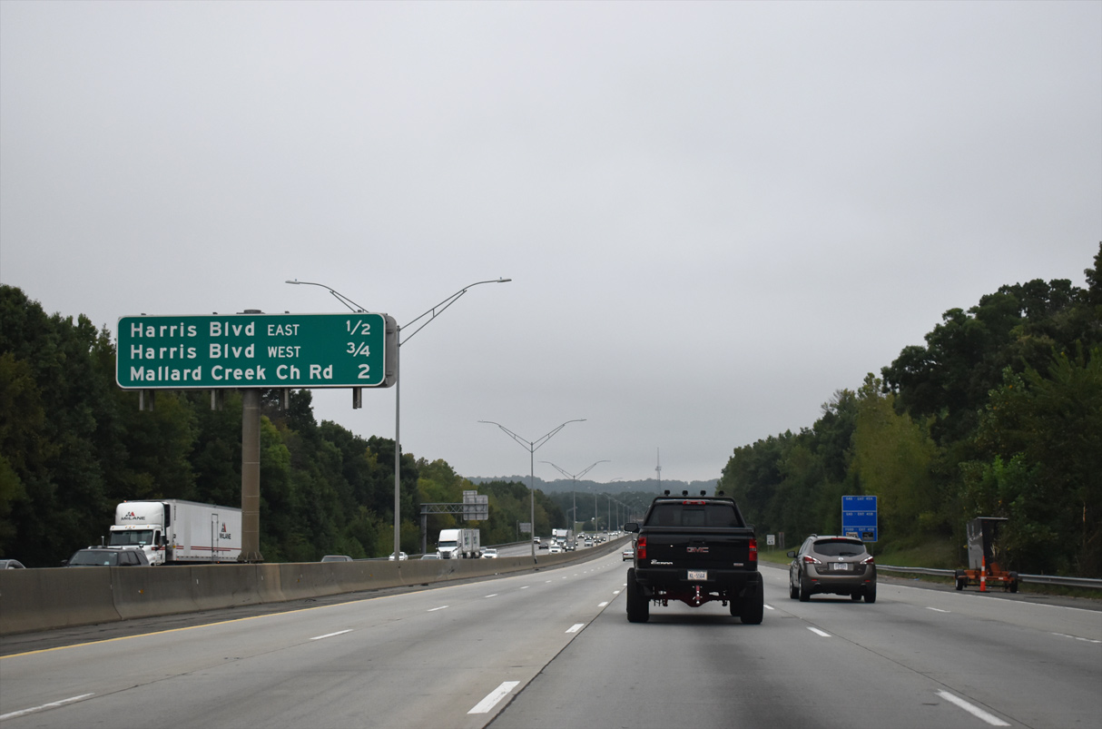
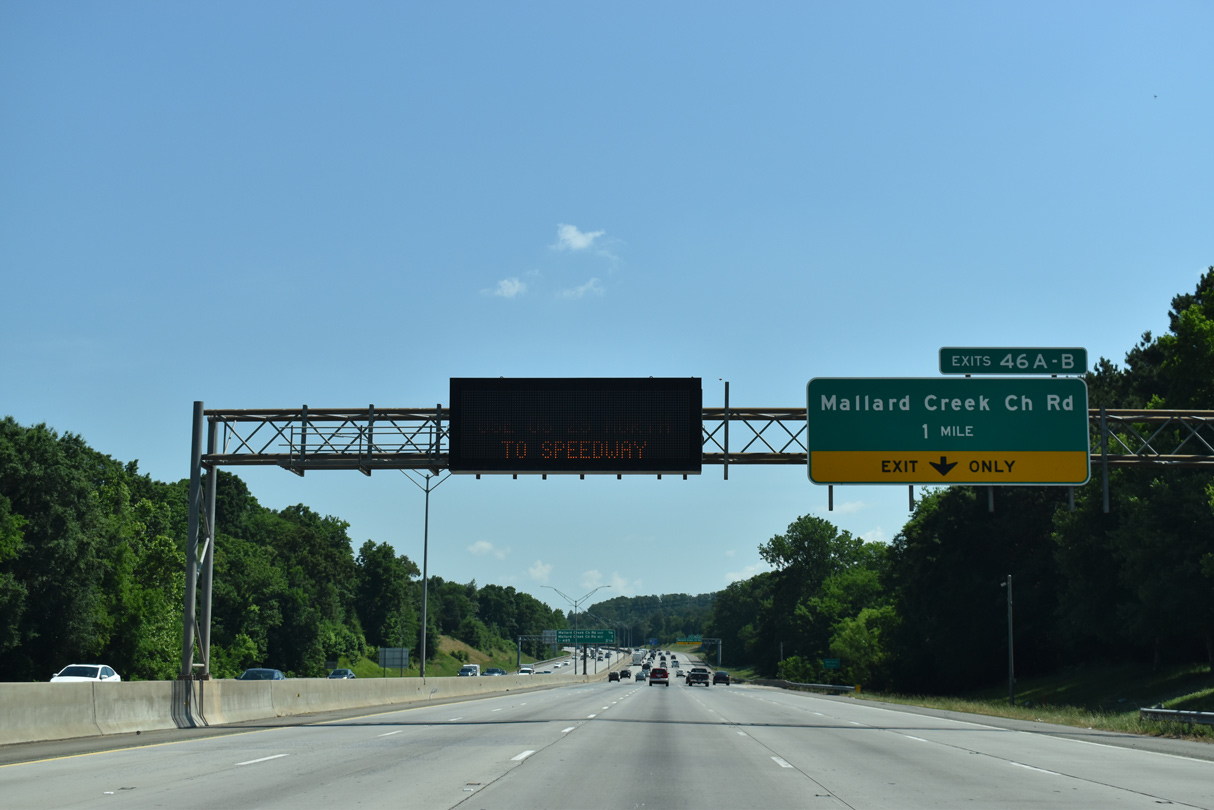
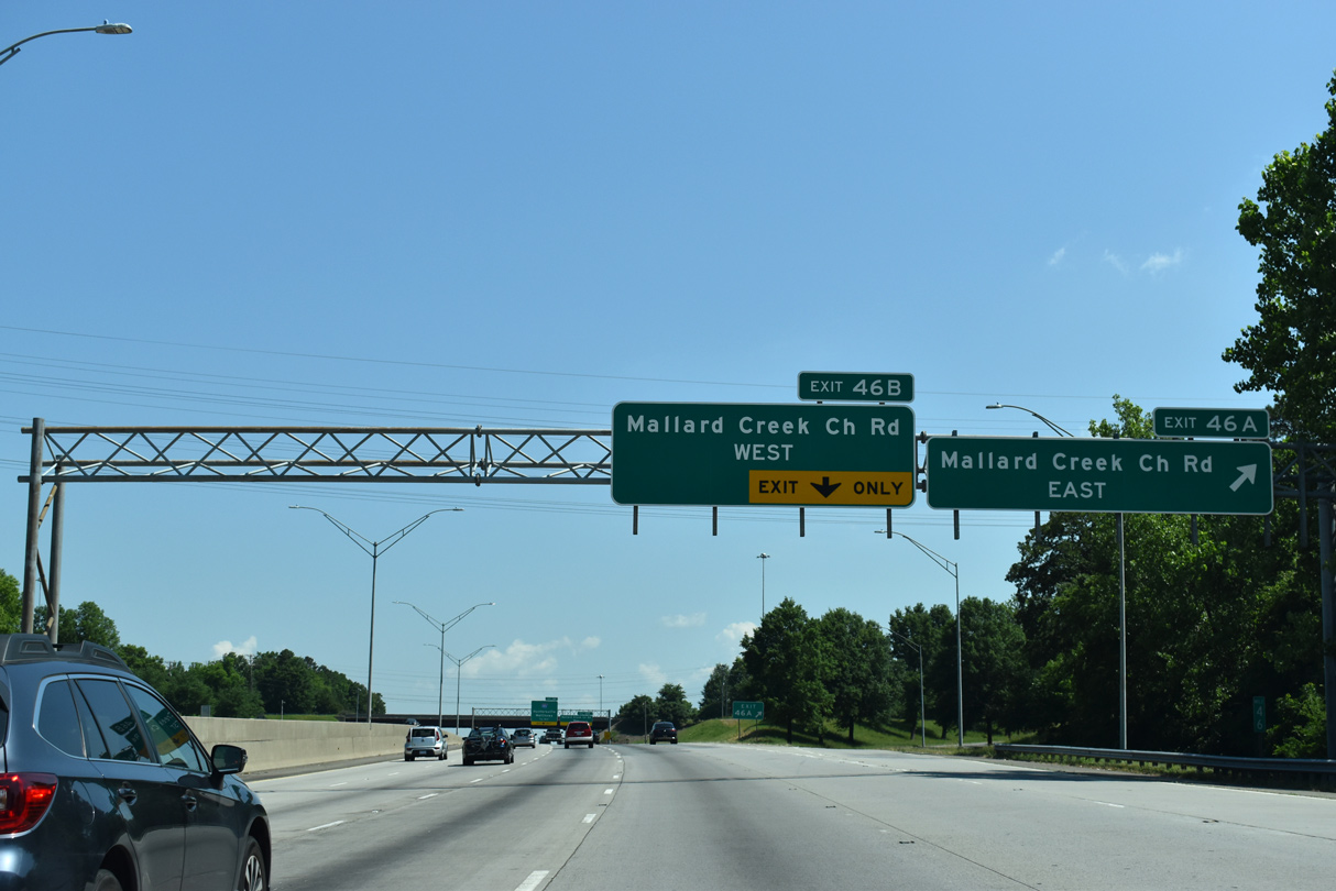
| Mallard Creek Church Road (SR 2472) converges with Interstate 85 by University City North at Exit 46 in one mile. 05/26/19 |
|
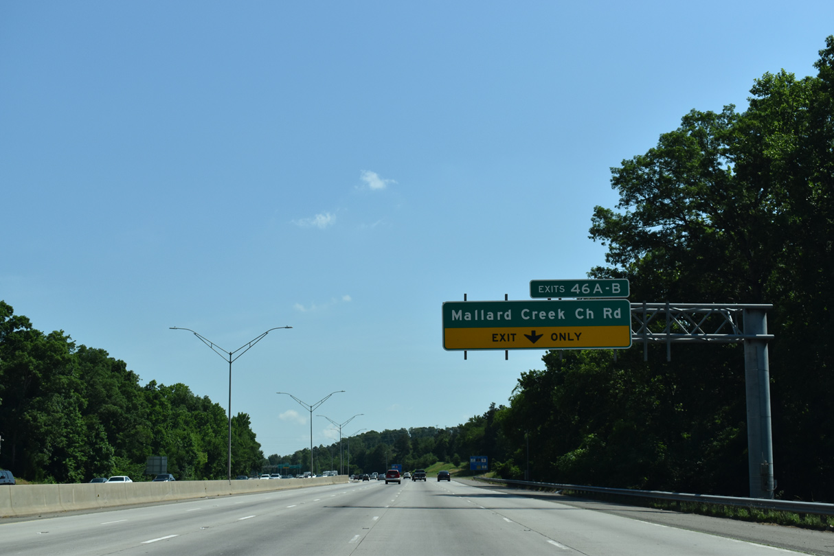
| A parclo interchange connects Interstate 85 with Mallard Creek Church Road at the last Charlotte exit. 05/26/19 |
|
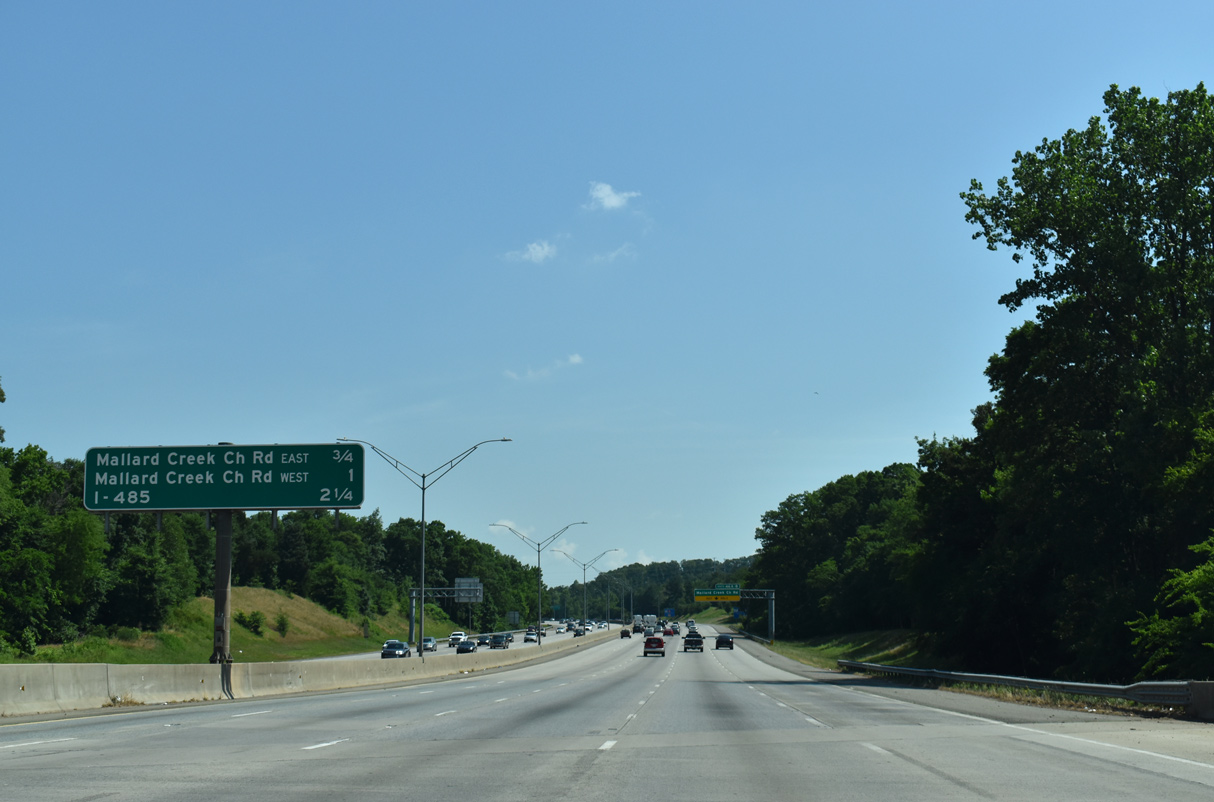
| Mallard Creek Church Road (SR 2472) heads south from Exit 46A to NC 49 (University City Boulevard) east of UNC-Charlotte. 05/26/19 |
|
| Exit 46A leaves I-85 north for Mallard Creek Church Road south to U.S. 29 (N Tryon Street) at the Mallard Creek Greenway. 05/26/19 |
|
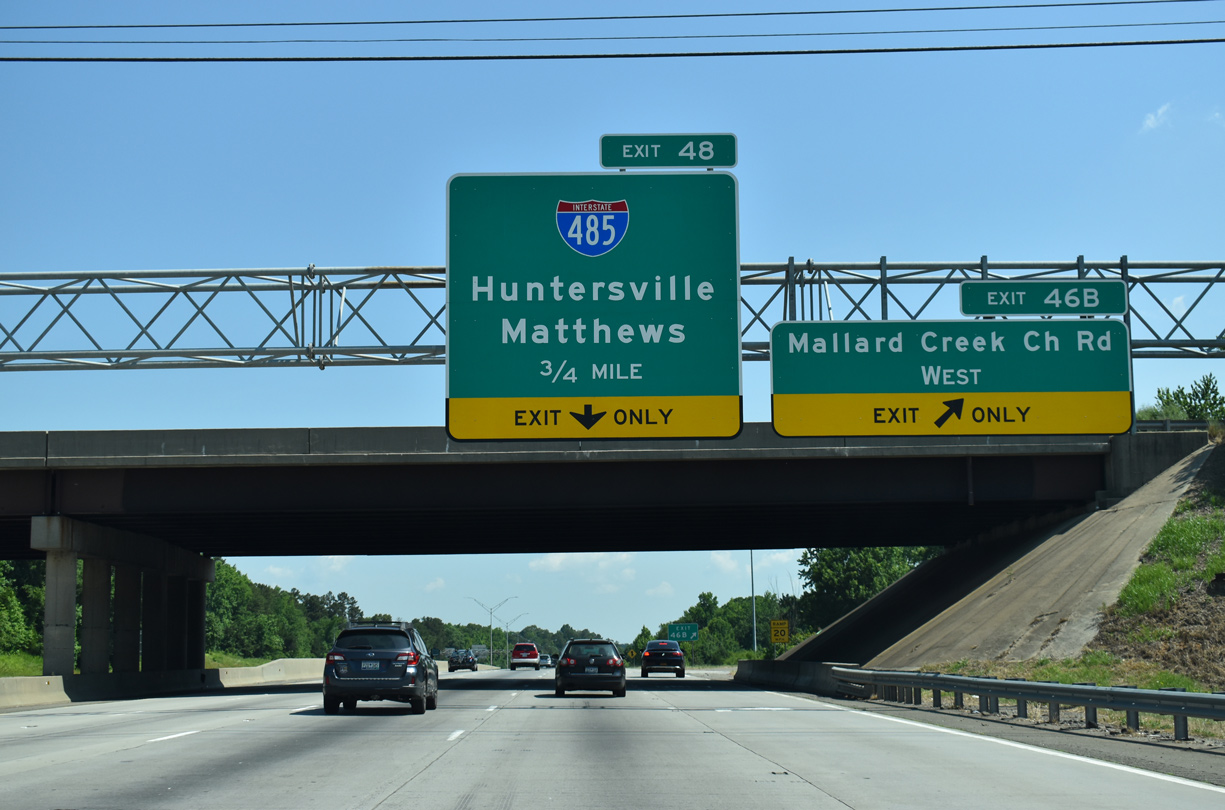
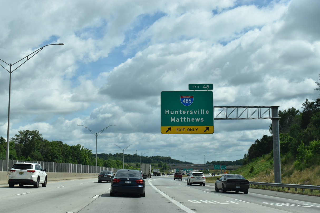
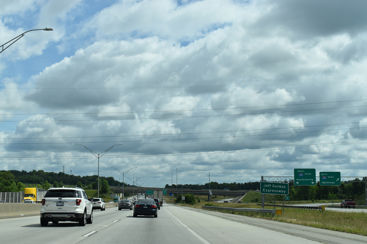
| Mallard Creek Church Road leads 1.49 miles northwest from Exit 46B to Mallard Creek Road (SR 2467) at Prosperity Church Road within a crop of office parks. A lane drop follows on I-85 north for the Charlotte Beltway (Exit 48). 05/26/19 |
|
| $139.5 million in construction on the final 5.7 mile long segment of I-485 west to NC 115 commenced in Spring 2011. Previously slated for completion in June 2014,8 I-485 finally opened on June 5, 2015. 05/31/21 |
|
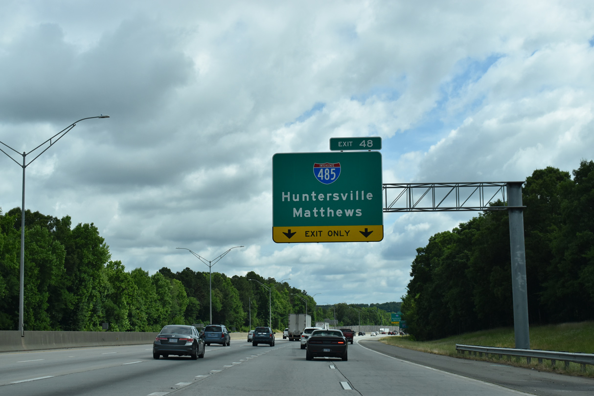
| I-485 previously ran south from a trumpet interchange with I-85. Prior to 1999, Exit 48 connected I-85 with just nearby U.S. 29. 05/31/21 |
|
| $92.2 million in construction for the turbine interchange joining I-85/485 started in late Summer 2011. 05/31/21 |
|
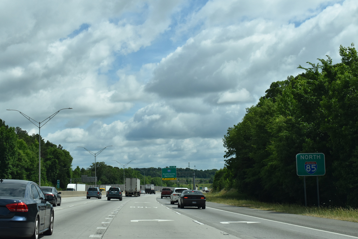
| A 1.6 mile long section of Interstate 85 heading northeast from the Charlotte city limits to the Cabarrus County line is the Jeff Gordon Expressway. Honoring the NASCAR legend, the stretch was dedicated on May 25, 2012 and signed following completion of I-85 widening in November 2013.9 05/31/21 |
|
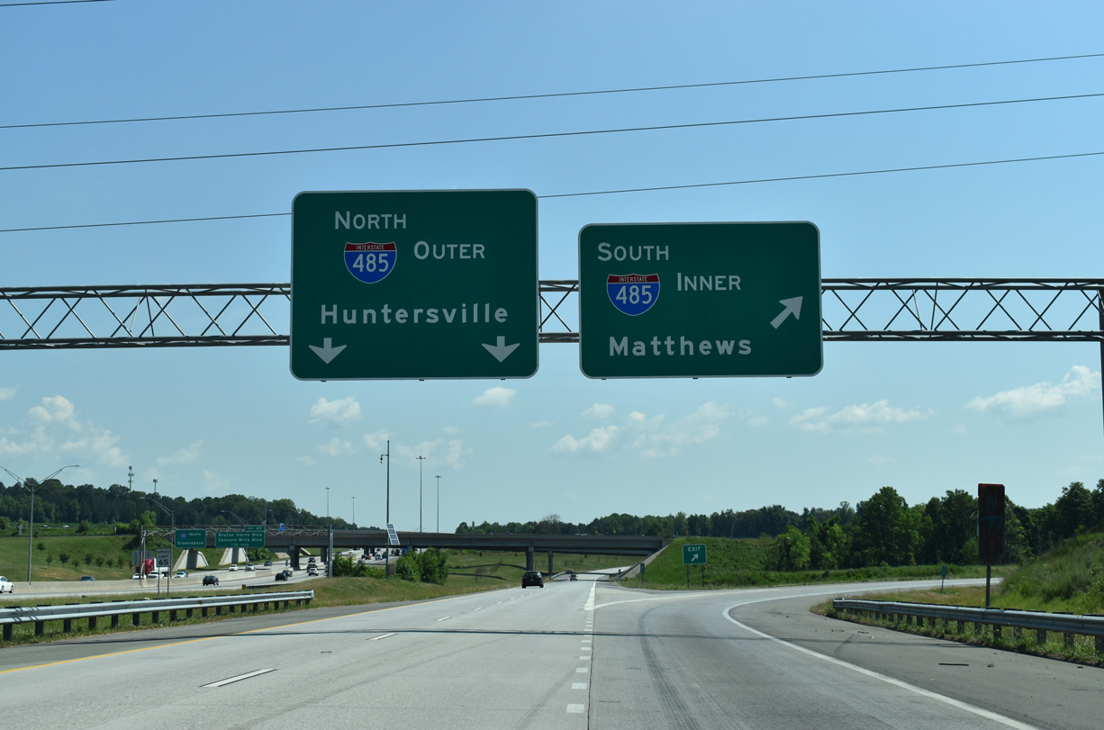
| Interstate 485 leads south through east Charlotte to Mint Hill and Matthews along the Union County line. The outer loop of I-485 connects with I-77 by Huntersville. 05/26/19 |
|
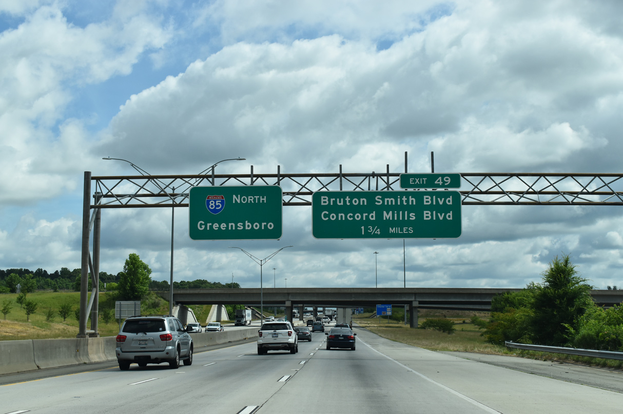
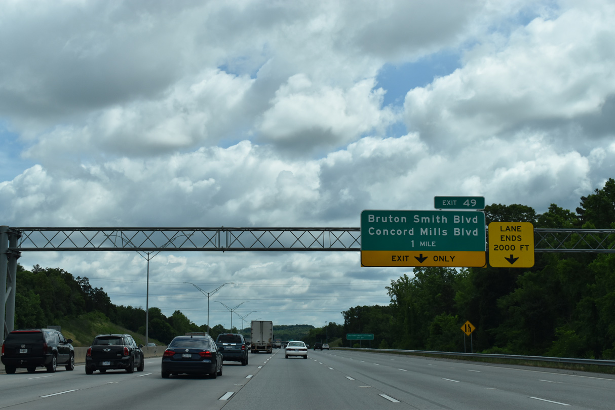
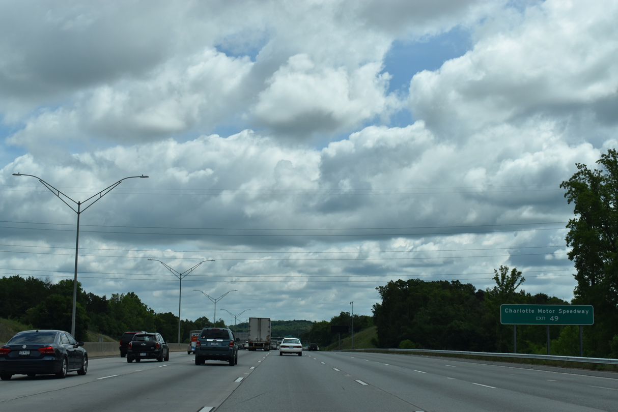
| Concord Mills Boulevard south and Bruton Smith Boulevard (SR 2894) north come together at Exit 49 adjacent to Concord Mills Mall and south of Concord-Padgett Regional Airport (JQF). 05/31/21 |
|
| Speedway Boulevard (SR 2894) was renamed on December 6, 2007 after the billionaire owner of Charlotte Motor Speedway, Bruton Smith. SR 2894 runs 1.90 miles south to U.S. 29 (Concord Parkway) at the NASCAR track. The renaming was made by the city of Concord and Cabarrus County as one of several efforts to appease Smith, who threatened to build a new track elsewhere at the time.10,11 05/31/21 |
|
| The 21.16 mile long stretch of I-85 through Mecklenburg County concludes as the freeway enters Cabarrus County. 05/31/21 |
Page Updated 02-02-2023.

 North
North