
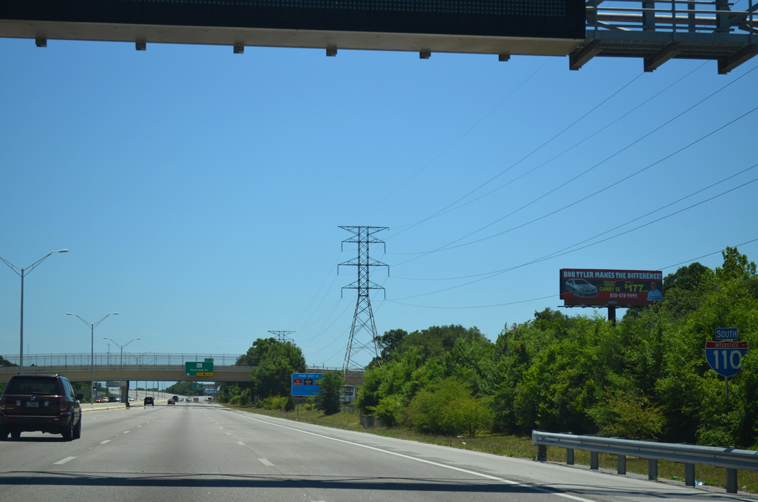
Interstate 110 South

 South
South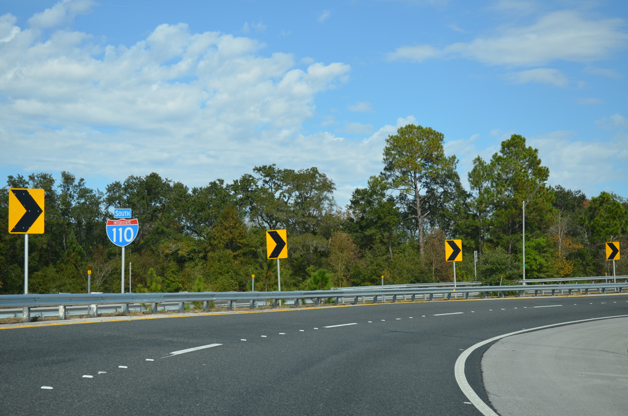
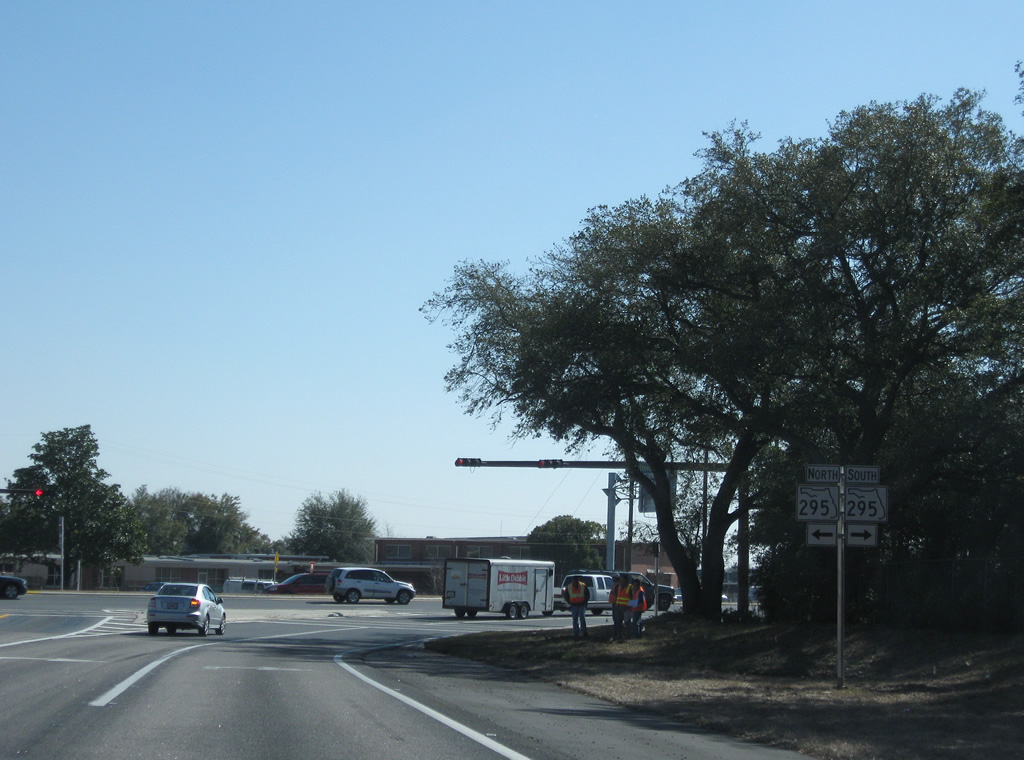
A confirming marker stands along the loop ramp joining SR 291 (Davis Highway) with Interstate 110 south. A two lane flyover bypassed this ramp from the westbound I-10 mainline to I-110 south in Fall 2007.
11/24/14

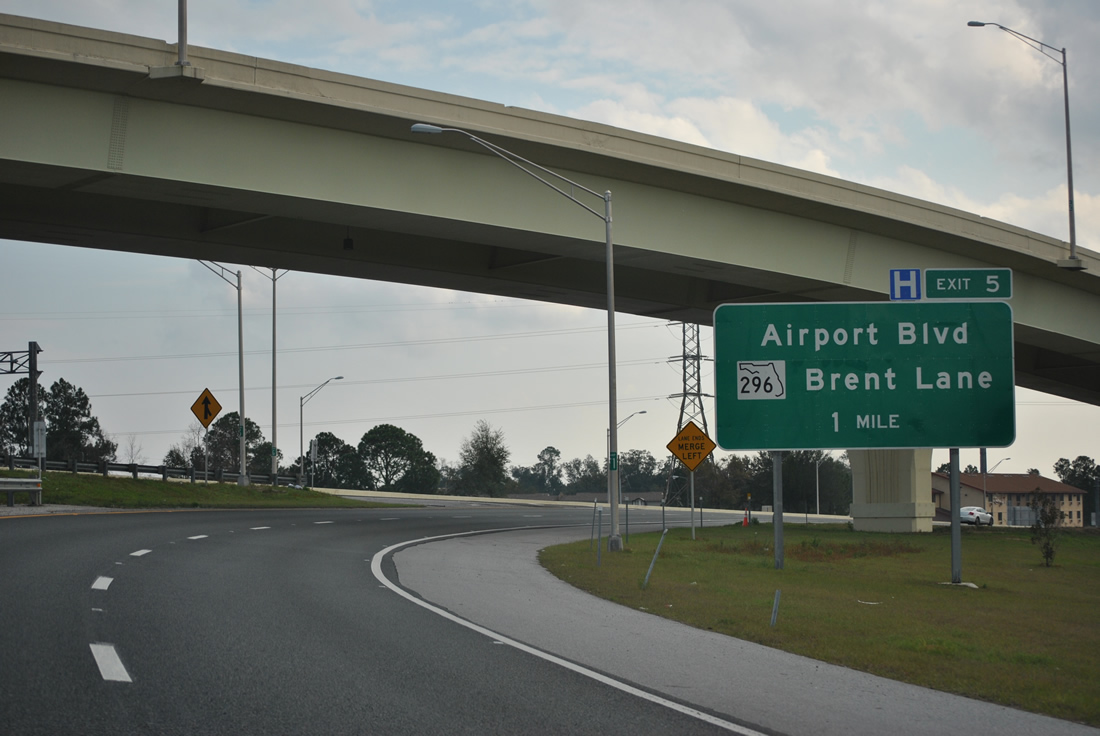
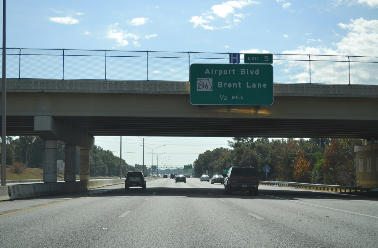
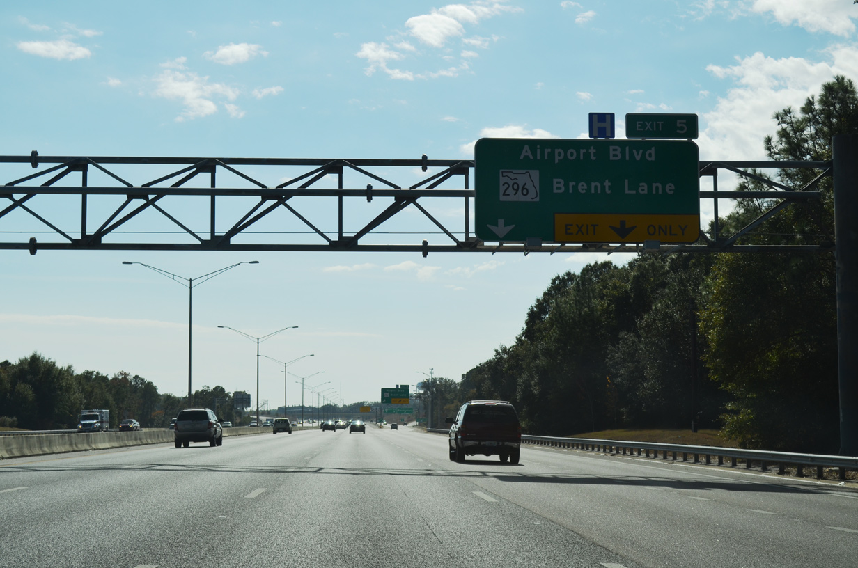
Ramps from SR 291 (Davis Highway) and I-10 east converge one mile north of the split diamond interchange (Exit 5) with SR 750 (Airport Boulevard) and SR 296 (Brent Lane).
11/24/14
01/01/12
SR 742 crosses over I-110 a half mile from Exit 5. Expansion work along I-110 included realigning SR 742 north from Burgess Road onto a new overpass for Creighton Road by University Town Plaza.
11/24/14
The first confirming marker for Interstate 110 south stands at the location where the Burgess Road overpass was located. The overpass was demolished in June 2005.
05/27/13
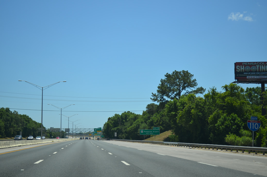
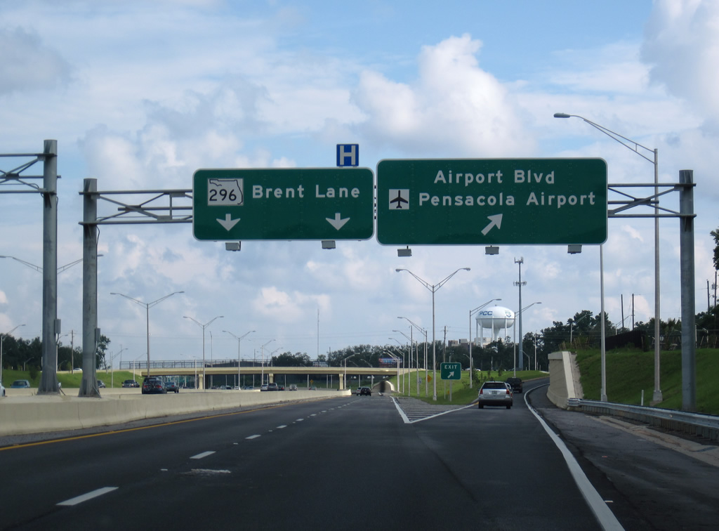
The exchange with Airport Boulevard (SR 750) opened in mid-2009. Omitted from I-110 signs as it was designated in 2011, SR 750 follows the five lane boulevard for 3.27 miles between U.S. 29 (Pensacola Boulevard) and SR 289 (9th Avenue) at Pensacola International Airport (PNS).
11/24/14
Airport Boulevard was widened in the late 1990s. The arterial extends west to CR 453 (W Street) and east to the passenger terminal at PNS Airport.
11/24/14
Interstate 110 reduces to six overall lanes southward through the exchange with SR 750 (Airport Boulevard).
11/24/14
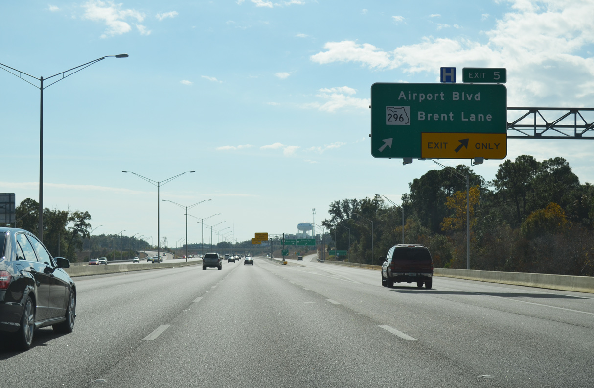
The distributor roadway at Exit 5 continues with two lanes south from SR 750 (Airport Boulevard) to SR 296 (Brent Lane) by Pensacola Christian College.
06/02/10
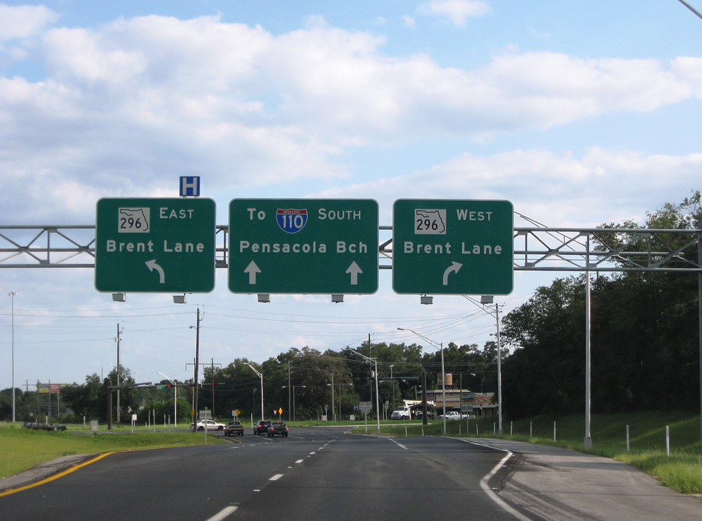
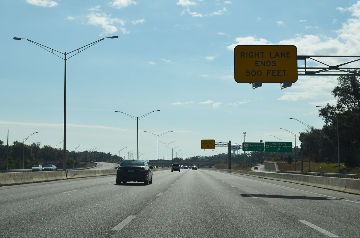
The distributor roadway for Exit 5 continues to a signalized intersection with SR 296 (Brent Lane). SR 296 constitutes a 9.60 mile long belt route west to U.S. 90 and CR 296 (Saufley Field Road) at Belleview and southeast to U.S. 90 (Cerventes Street) in Pensacola.
08/23/09

SR 296 follows Brent Lane west to U.S. 29 (Pensacola Boulevard) and east to Springhill Drive. The arterial route continues west from Brent along Beverly Parkway and Michigan Avenue. Bayou Boulevard leads SR 296 south from SR 289 (9th Avenue) by Cordova Mall to Bayou Texar.
05/29/10
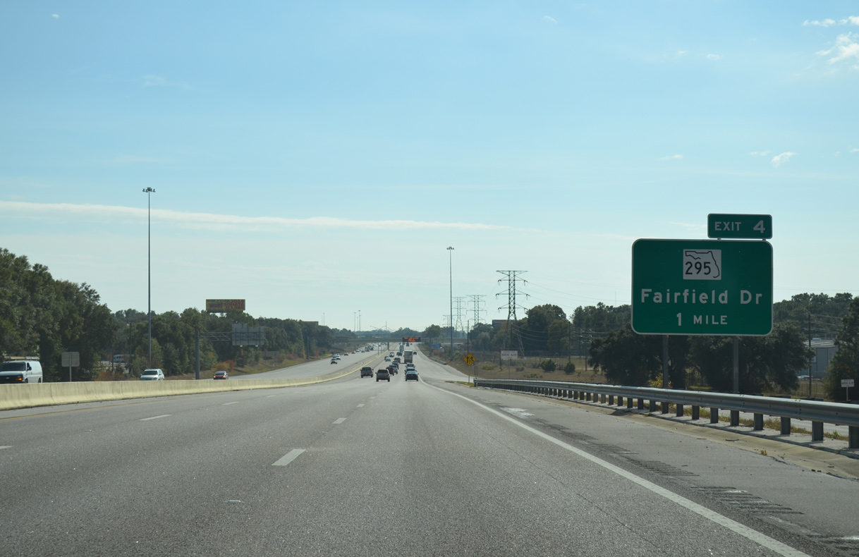
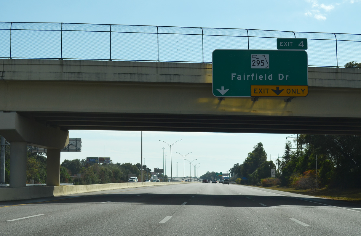
Interstate 110 advances one mile south from SR 296 (Brent Lane) to a parclo interchange (Exit 4) with SR 295 (Fairfield Drive).
11/24/14
Reassurance marker posted ahead of Hyatt Street on Interstate 110 south.
05/27/13
SR 295 (Fairfield Drive) stems west from parallel SR 289 (9th Avenue) to Exit 4 along a 10.04 mile course south to the Main Gate for Pensacola Naval Air Station.
11/24/14
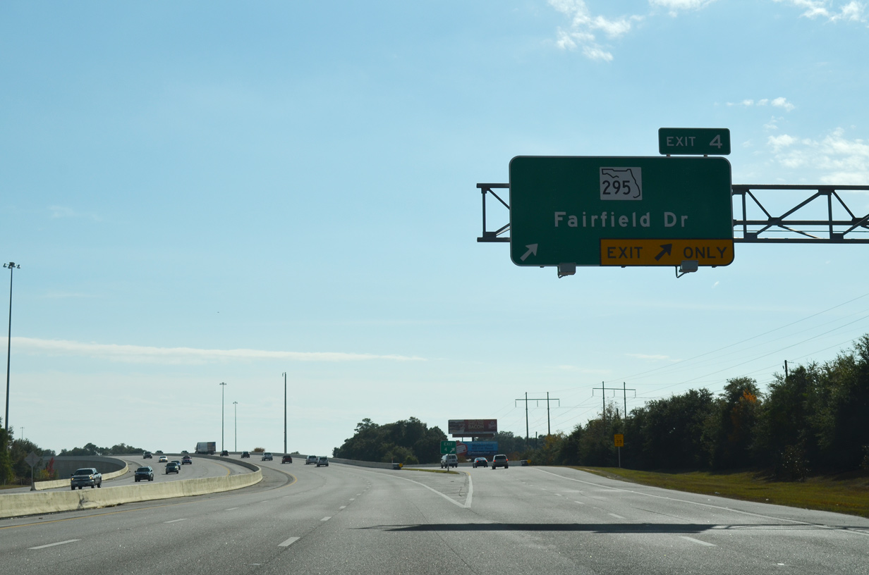
Two lanes depart I-110 south for SR 295 (Fairfield Drive) at Exit 4. The arterial route arcs southwest to West Pensacola, where a short expressway joins SR 295 with U.S. 90 (Mobile Highway), Myrtle Grove and Warrington.
11/24/14
East of SR 289 (Ninth Avenue), Fairfield Drive becomes 12th Avenue. 12th Avenue extends north across Carpenter Creek to SR 296 (Bayou Boulevard) and Pensacola International Airport (PNS).
02/23/10
Interstate 110 spans SR 752 (Texar Drive) beyond this confirming marker.
11/24/14
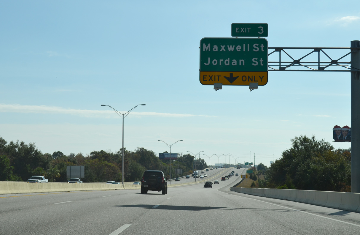
Interstate 110 runs between Hayne Street and SR 291 (Dr. Martin Luther King, Drive) southbound to a half diamond interchange (Exit 3) with the one way couplet of Maxwell and Jordan Streets.
11/24/14
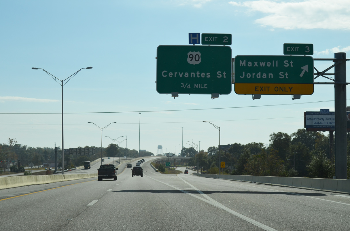
Exit 3 lowers onto Hayne Street south ahead of Maxwell Street west to U.S. 29 (Palafox Street) and Jordan Street east to SR 291 and SR 289 (9th Avenue). I-110 ended here in 1970 and was extended south to Exit 2 in 1978.
11/24/14

Interstate 110 continues with two southbound lanes onto a 1.5 mile long viaduct from Maxwell Street to U.S. 98 Business (Chase Street). The canopy at Cecil T. Hunter Swimming Pool rises between the separate roadways.
05/27/13
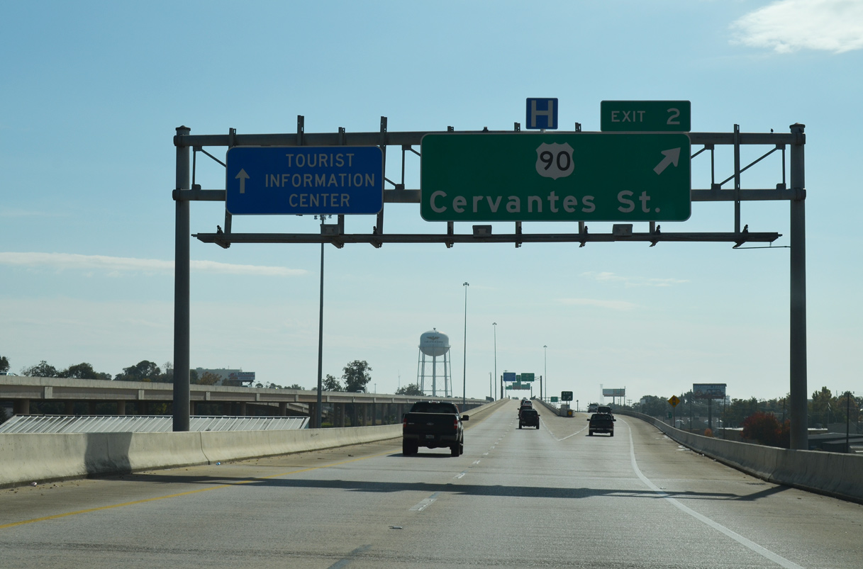
A half diamond interchange connects I-110 south with U.S. 90/98 (Cervantes Street). Guide signs for Exit 2 omit U.S. 98 to avoid directing motorists bound for the Pensacola Bay Bridge onto Cerventes Street east.
11/24/14

U.S. 90/98 overlap along Cerventes Street east to SR 289 (Ninth Avenue) and west to SR 292 (Pace Boulevard). The five lane boulevard spans a CSX Railroad line and Tarragona Street between Hayne Street and the south end U.S. 29 (Palafox Street) nearby on a viaduct opened in September 2005.
05/27/13
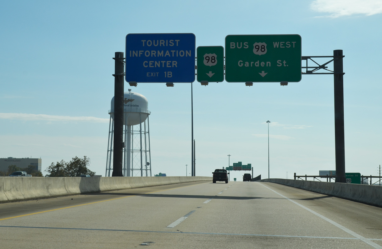
Interstate 110 concludes at a two-wye interchange with U.S. 98 Business at Garden, Chase and Gregory Streets on the outskirts of Downtown Pensacola.
11/24/14
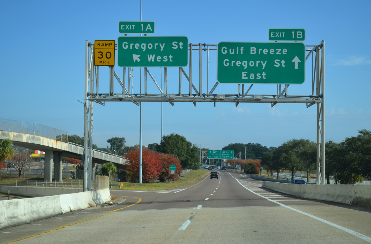
Exit 1C lowers from Interstate 110 south to join U.S. 98 Business westbound along Garden Street. U.S. 98 Business runs 2.42 miles west from Gregory Street alongside Pensacola Bay Center through Downtown Pensacola to U.S. 98 (Navy Boulevard) at SR 292 (Pace Boulevard).
11/24/14
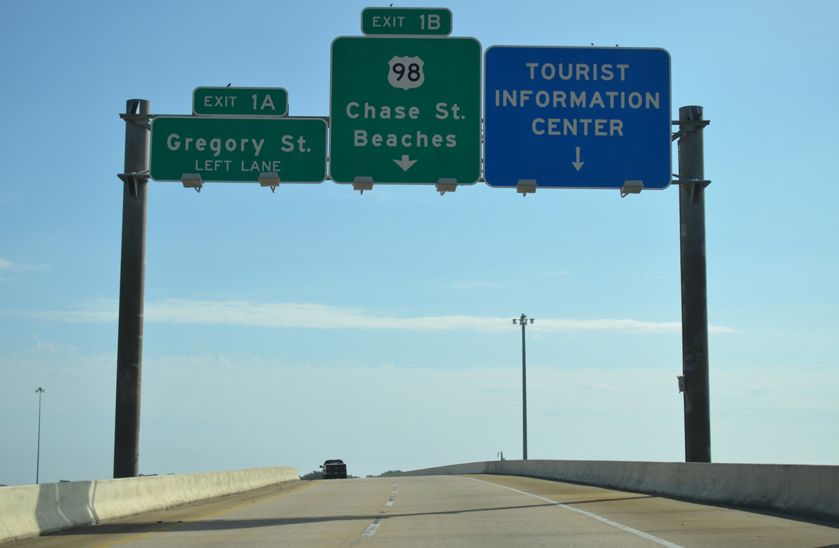
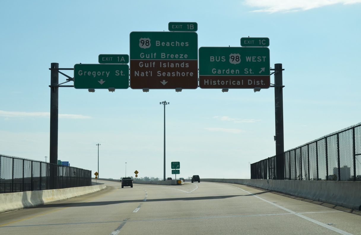
The south end of I-110 partitions with a loop ramp (Exit 1A) to Gregory Street (U.S. 98 Business) westbound ahead of Alcaniz Street (SR 291). Two lanes transition onto Chase Street eastbound just ahead of Ninth Avenue (SR 289).
11/24/14
U.S. 98 crosses Pensacola Bay on the Three Mile Bridge between Pensacola and Gulf Breeze. The 1960 bridge taking U.S. 98 south into Santa Rosa County was replaced with a new span in 2019.
11/24/14
Left Exit 1A encircles the Pensacola Bay Center north to Gregory Street. Eastbound U.S. 98 overtakes Chase Street from U.S. 98 Business at 9th Avenue en route to Bayfront Parkway and the Pensacola Bay Bridge.
11/24/14
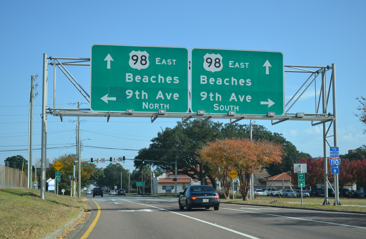
U.S. 98 follows 9th Avenue north from Gregory Street to U.S. 90 (Cerventes Street). Chase Street leads U.S. 98 east 0.36 miles to SR 196 (Bayfront Parkway). U.S. 98 continues east from Gulf Breeze to Navarre and Fort Walton Beach.
11/24/14
Photo Credits:
- Alex Nitzman: 02/23/10, 01/01/12, 05/27/13, 11/24/14
- AARoads: 05/29/10, 06/02/10
- ABRoads: 08/23/09
Connect with:
Page Updated Tuesday November 24, 2020.