|
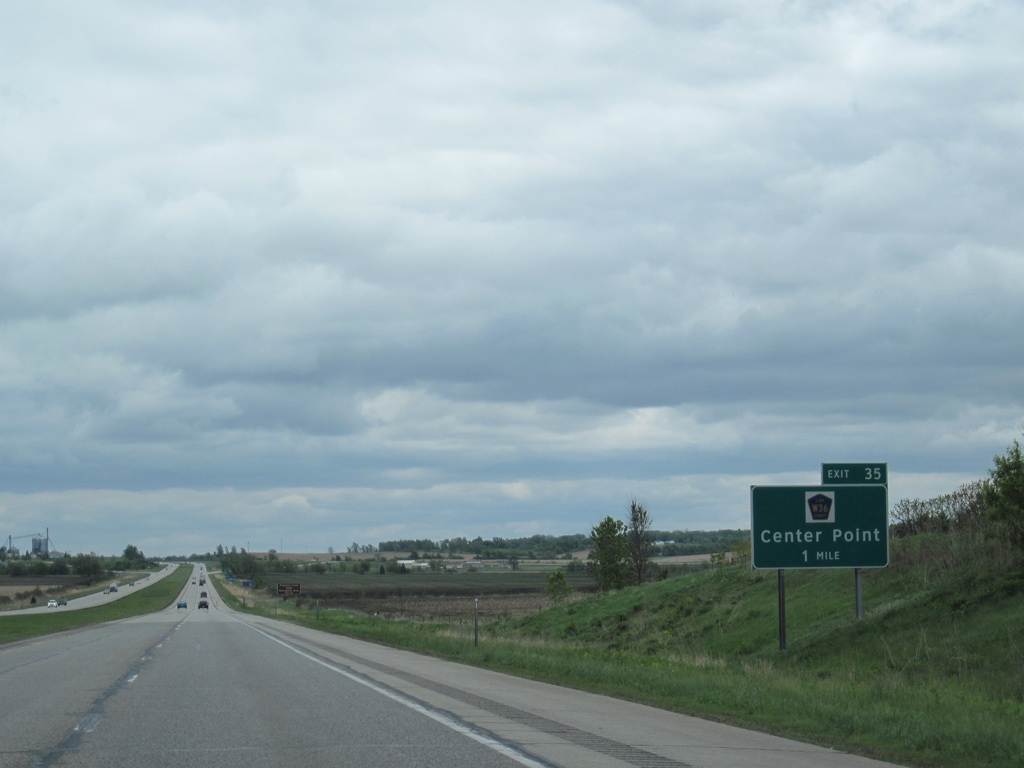
| I-380/Iowa 27 drop 50 feet in elevation on the mile preceding County Route W36 (Lewis Access Road) at Center Point. Lewis Access Road curves northward from Exit 35 to overtake Franklin Street (former Iowa 150) through the city. 05/08/10 |
|
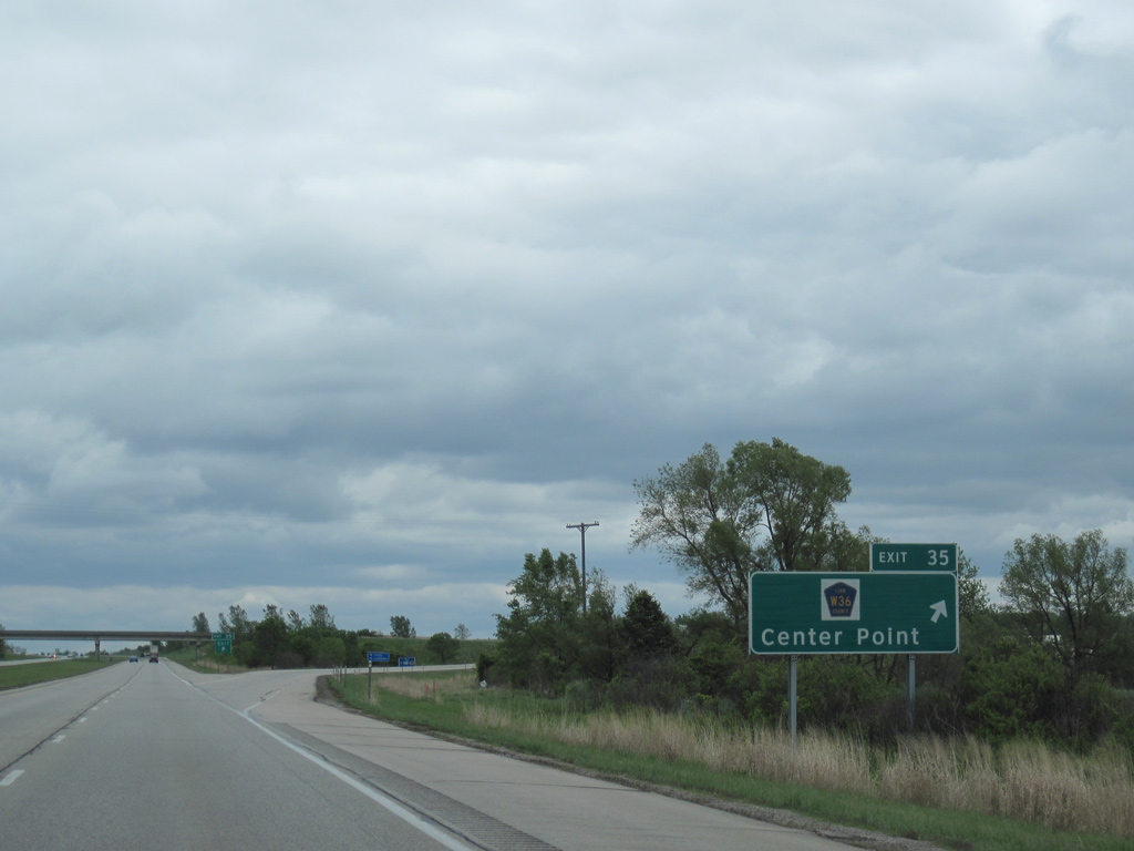
| Lewis Access Road was extended northward in conjunction with construction of the diamond interchange (Exit 35) with Interstate 380. Linn County Route W36 spans the Cedar River southwest en route to Pleasant Creek State Park and the city of Palo. 05/08/10 |
|
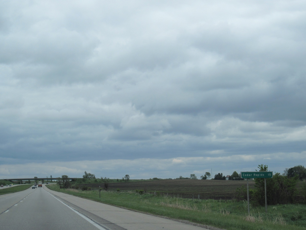
| I-380/Iowa 27 cross Nelson Creek and an abandoned Chicago, Rock Island and Pacific Railroad line south of Center Point. 05/08/10 |
|
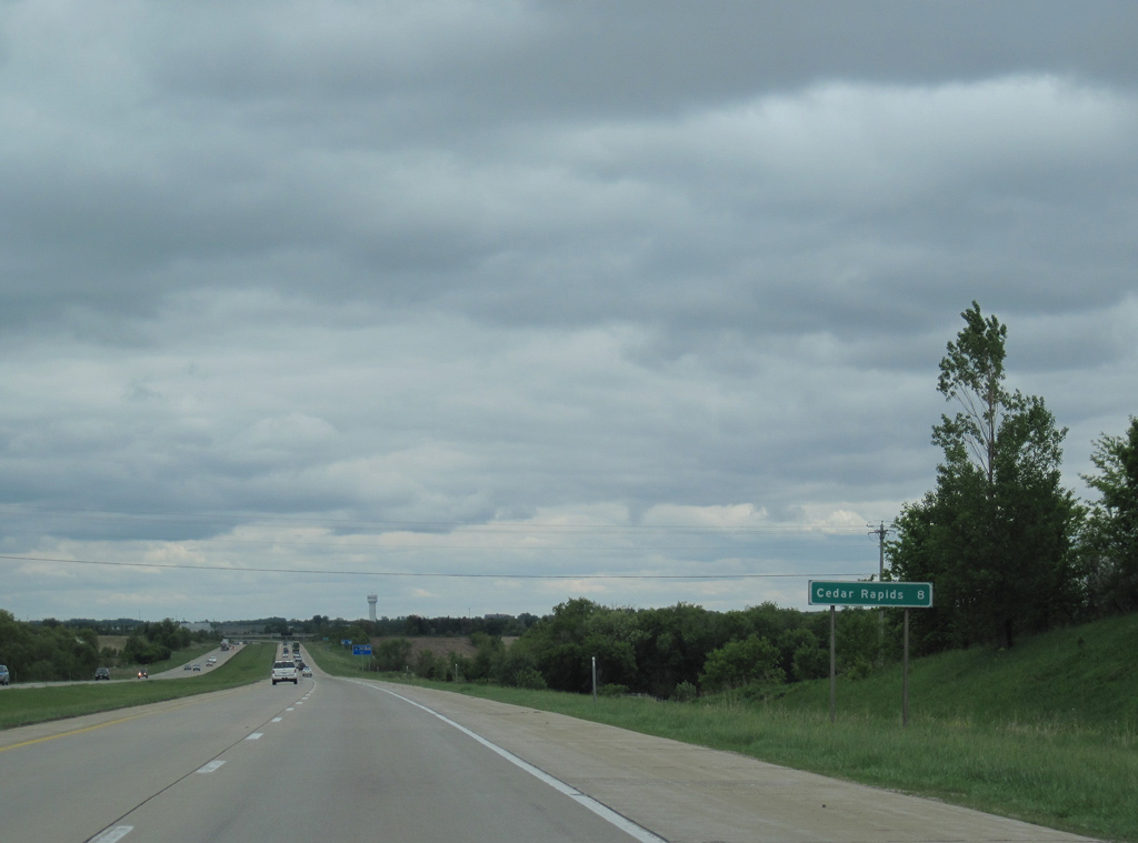
| Downtown Cedar Rapids is 15 miles away. 05/08/10 |
|
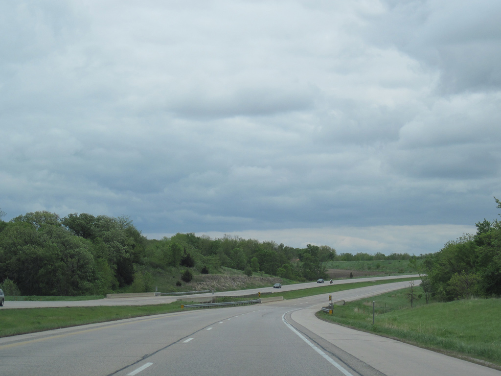
| I-380 parallels North Center Point Road to the west between Center Point and the city of Robins. The adjacent roadway was historically a part of Iowa 150, which originated at the Centennial Bridge in Downtown Davenport as an extension of U.S. 150.
Pictured here is the crossing over West Otter Creek. 05/08/10 |
|
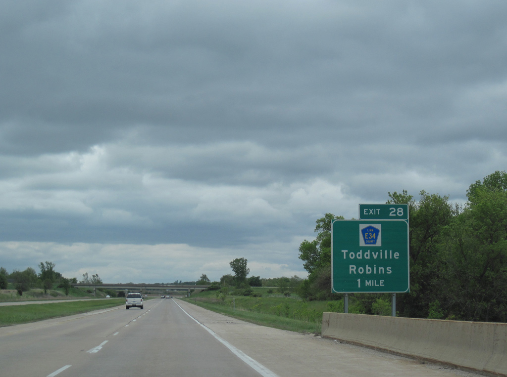
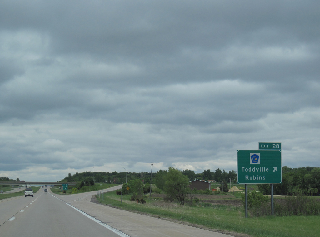
| Interstate 380 spans East Otter Creek near Midway on the mile preceding Linn County Route E34 (County Home Road). CR E34 forms an L-shaped route west from Exit 28 to Toddville and south to CR E36 (Blairs Ferry Road). 05/08/10 |
|
| County Route E34 (County Home Road) comprises a rural route east from the diamond interchange at Exit 28 across the north side of Robins to Whittier and Viola in eastern Linn County. 05/08/10 |
|
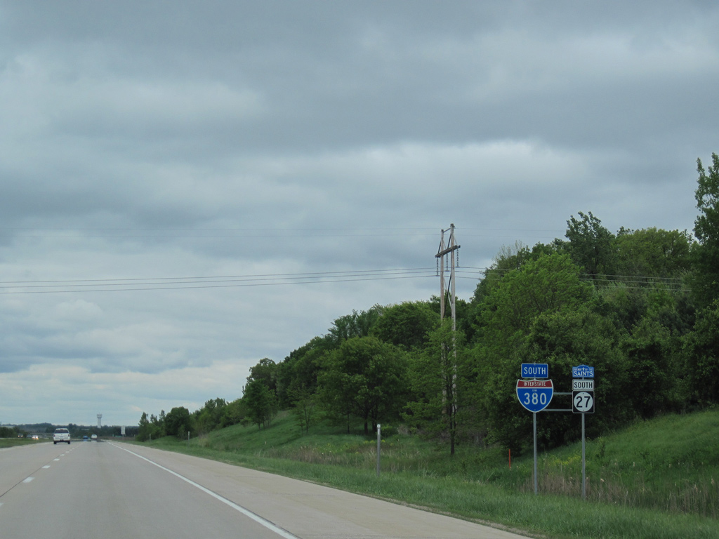
| I-380/Iowa 27 straddle the Hiawatha and Robins city limits southward from Exit 28. 05/08/10 |
|
| I-380 meets Tower Terrace Road beyond this distance sign posted eight miles from Downtown Cedar Rapids. Costing $22 million to build, a new diverging diamond interchange with Tower Terrace Road in Cedar Rapids and Hiawatha opened following a ribbon cutting ceremony held on June 22, 2023.1 05/08/10 |
|
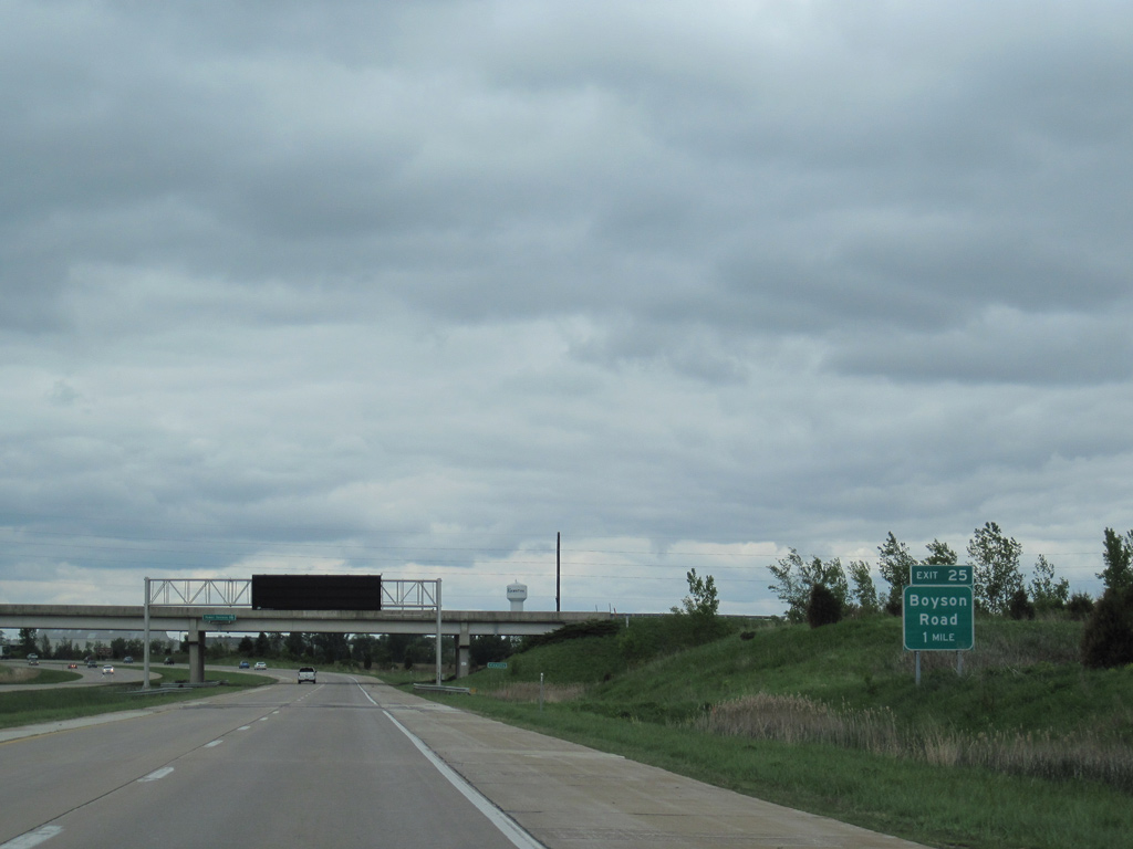
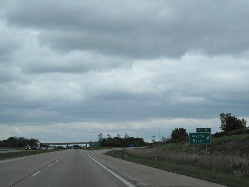
| Curving southeast from Tower Terrace Road / Exit 26 into Hiawatha, I-380/Iowa 27 next meets Boyson Road at Exit 25. $19.9 million in construction scheduled to begin in 2024 rebuilds the exchange with Boyson Road into a DDI.2 05/08/10 |
|
| Boyson Road leads west through a business park area to subdivisions in northwest Cedar Rapids and east to an adjacent industrial park in Hiawatha. 05/08/10 |
|
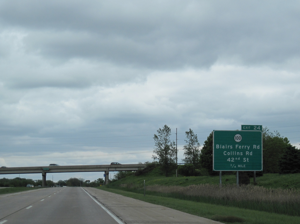
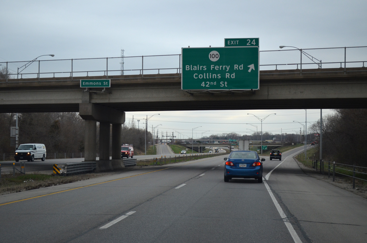
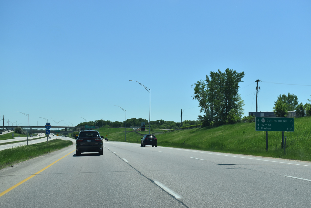
| The diamond interchange at Exit 24 connects I-380 both with Blairs Ferry Road and frontage roads roads leading south to Iowa 100 (Collins Road) and 42nd Street. 05/08/10 |
|
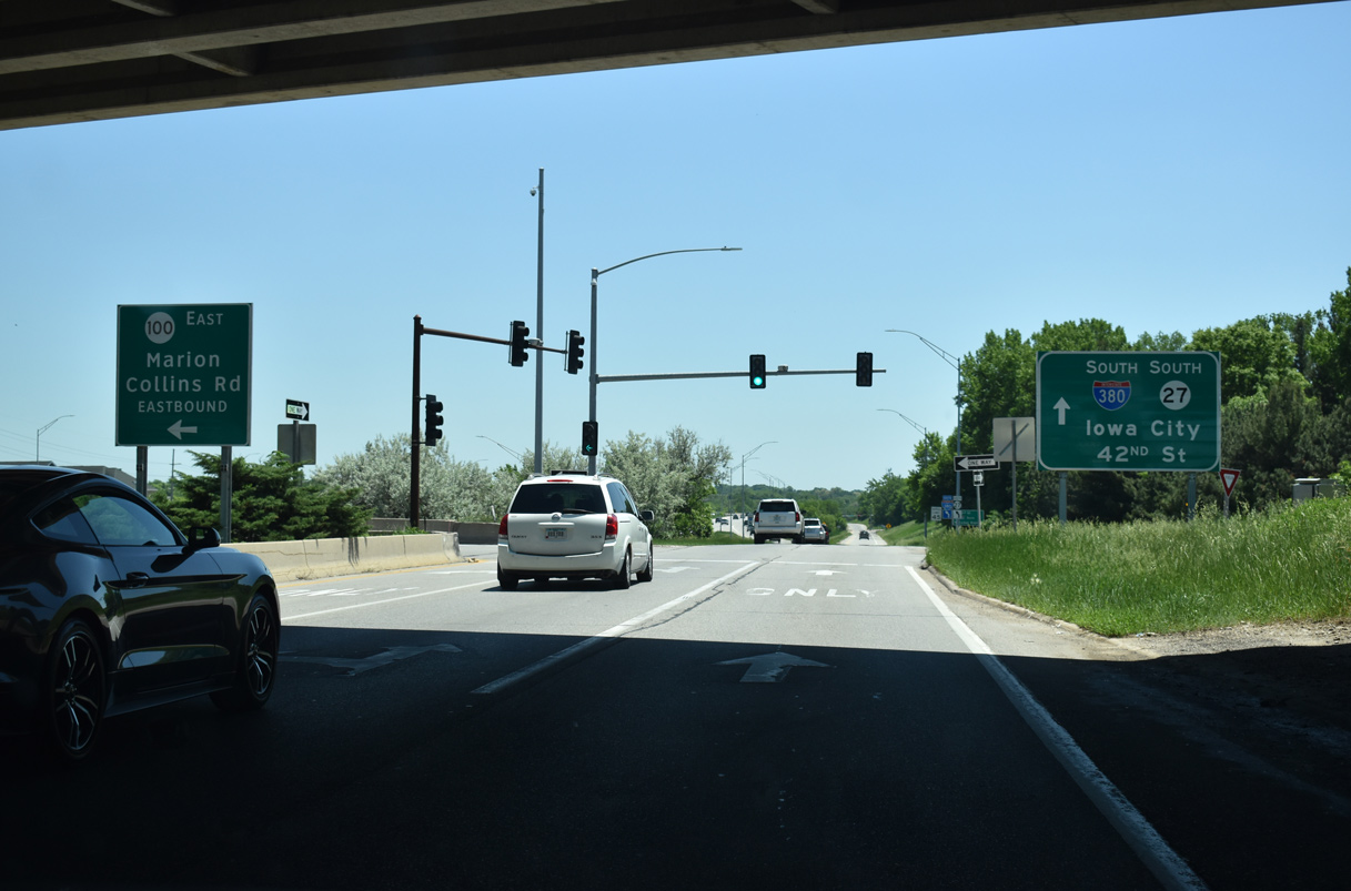
| All traffic bound for Iowa 100 departs I-380/Iowa 27 south at the Emmons Street overpass. Blairs Ferry Road follows as an commercial arterial across north Cedar Rapids. 03/30/16 |
|
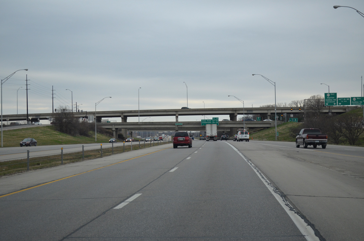
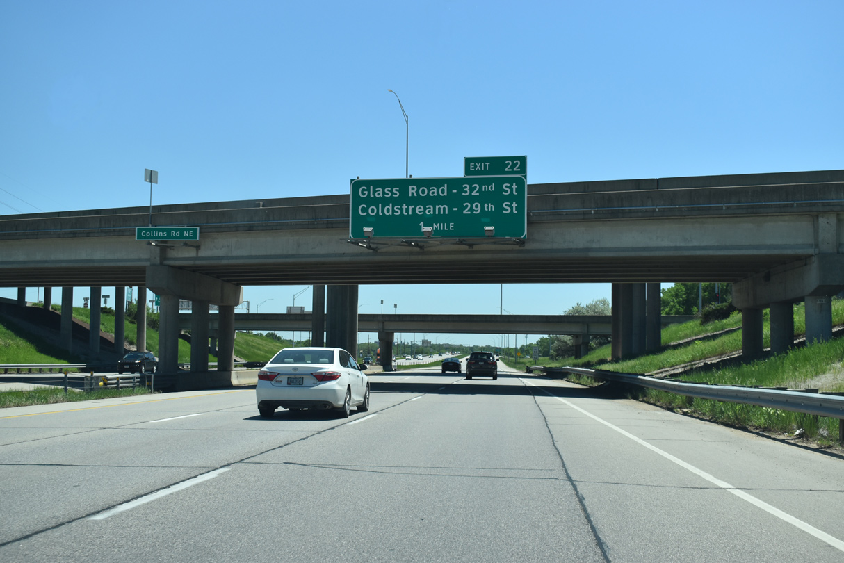
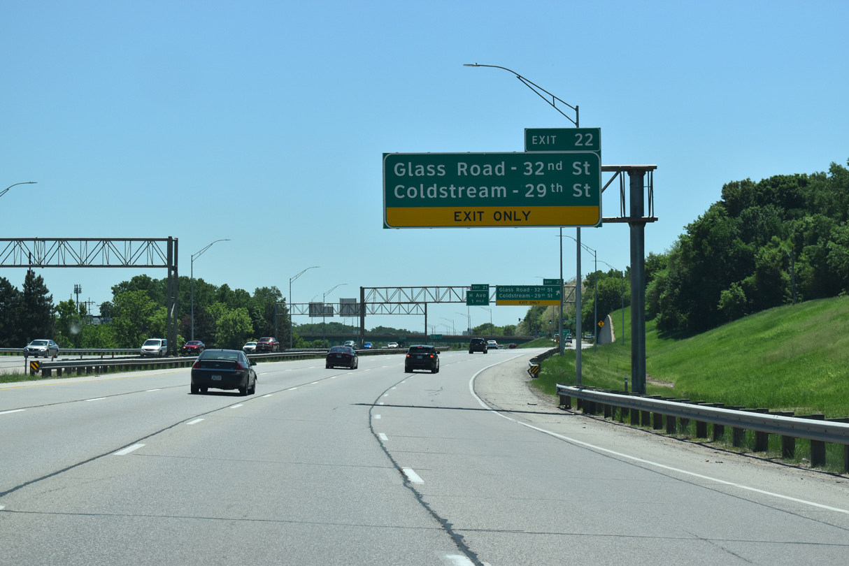
| The I-380 mainline passes below a series of overpasses to 42nd Street and next meets a split diamond interchange with Glass Road west / 32nd Street east and Coldstream Road west / 29th Street east. 03/30/16 |
|
| The adjacent service road advances south from Blairs Ferry Road to a slip ramp for I-380/Iowa 27 south. Two lanes continue to the ramps with Iowa 100 (Collins Road) and 42nd Street NE. 05/26/18 |
|
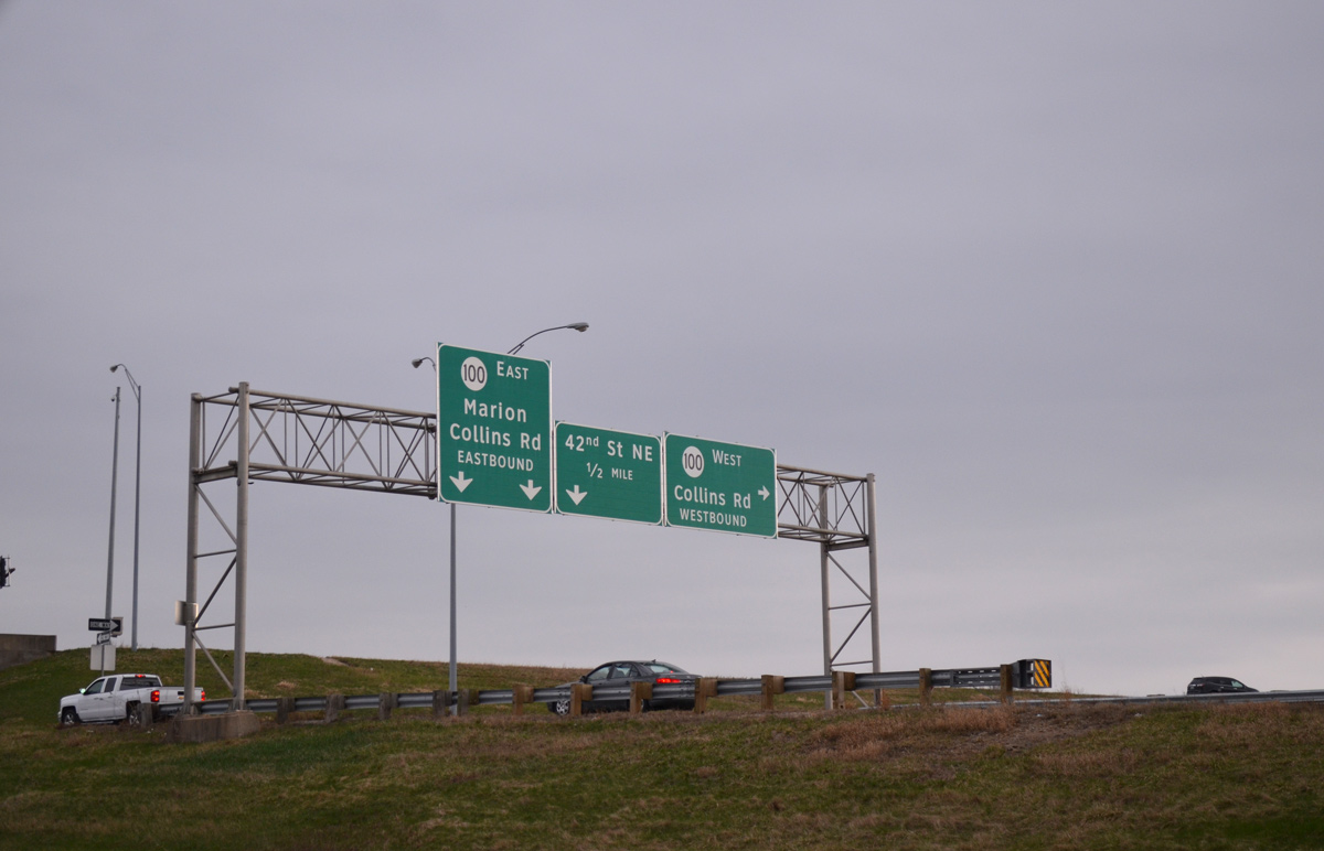
| The three-level interchange with Iowa 100 (Collins Road) on Interstate 380 south. 03/30/16 |
|
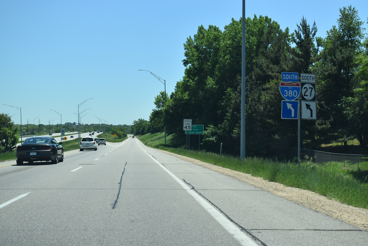
| Iowa 100 forms a 16.14 mile long route southwest to U.S. 30/218 via Covington and east to U.S. 151/Iowa 13 in Marion. The expressway was completed around the west side of Cedar Rapids on December 12, 2018. 03/30/16 |
|
| Iowa 100 (Collins Road) constitutes a commercial arterial east to Lindale Mall and U.S. 151 Business. Shifting southward from there, Iowa 100 bypasses Marion along a controlled access roadway. 05/26/18 |
|
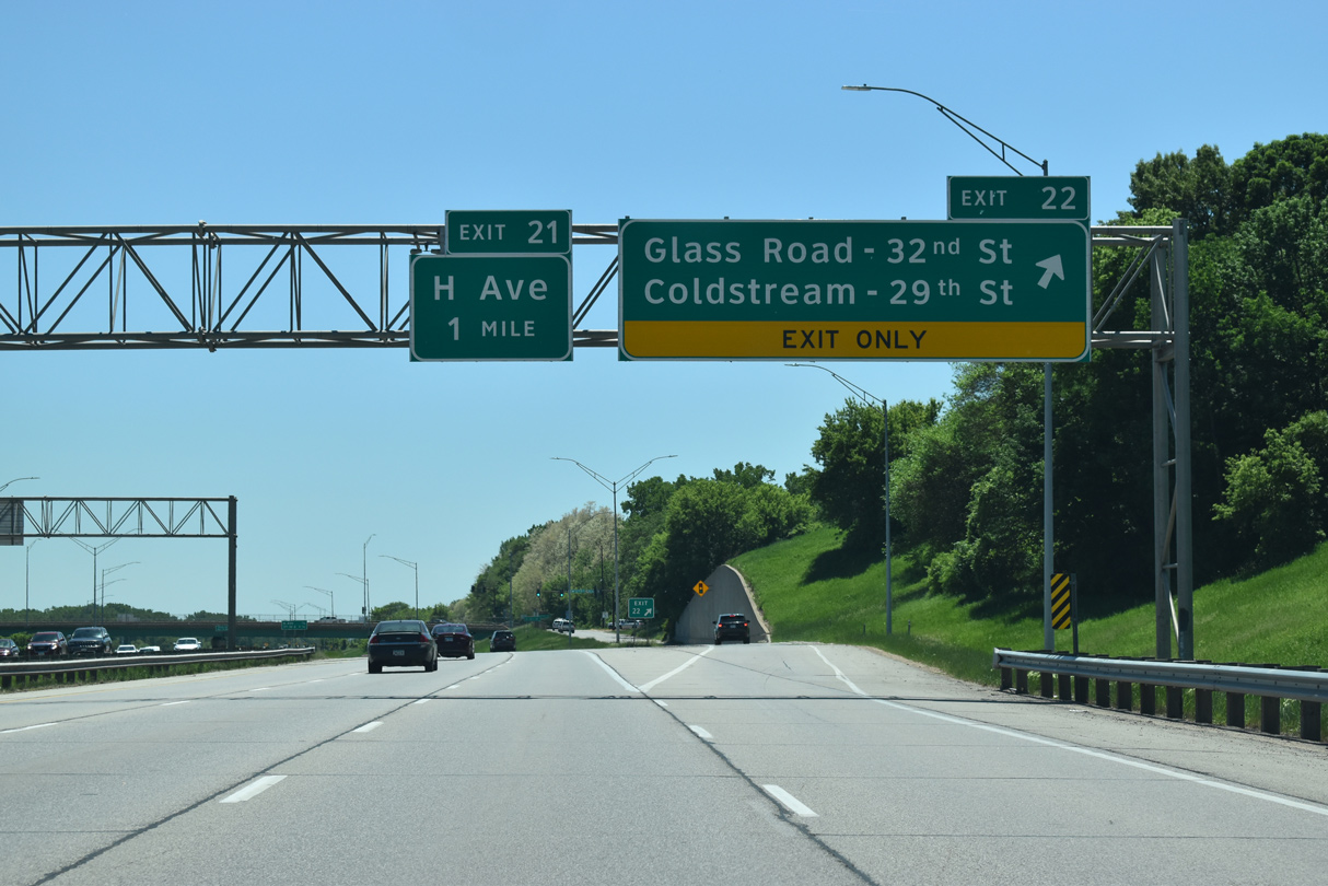
| Exit 22 to Glass Road / 32nd Street and Coldstream Road / 29th Street departs one mile south of Iowa 100. Glass and Coldstream Roads extend their numbered street counterparts from I-380 to leafy residential areas to the west. 05/26/18 |
|
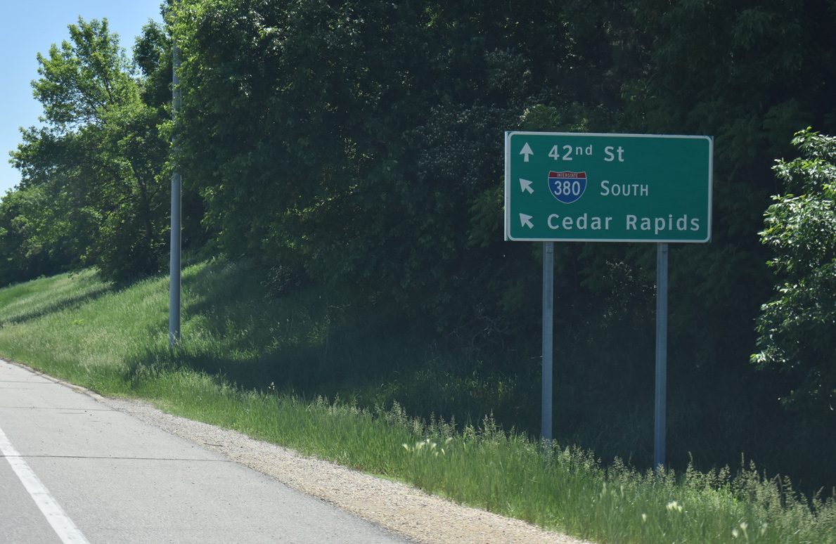
| The c/d roadway system from Iowa 100 (Collins Road) separates with an entrance ramp for I-380 ahead of 42nd Street NE. 05/26/18 |
|
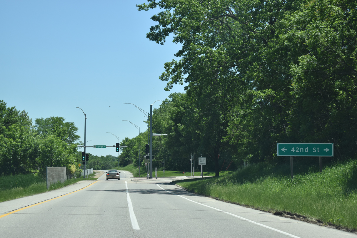
| The entrance ramp from 42nd Street adds a fourth lane along southbound I-380 to Exit 22. 29th Street NE east connects the freeway with Mt. Mercy University and the Brucemore Historic Site off U.S. 151 Business (1st Avenue NE). 05/26/18 |
|
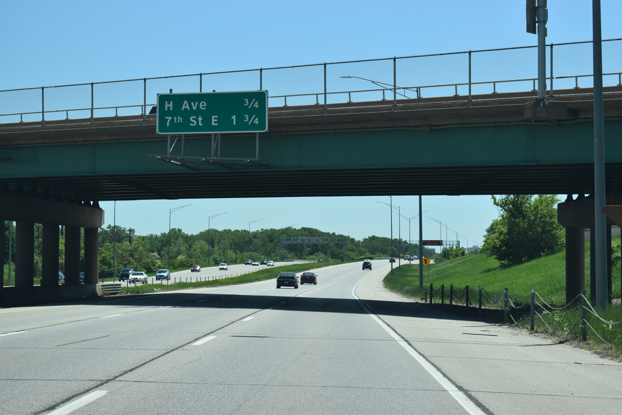
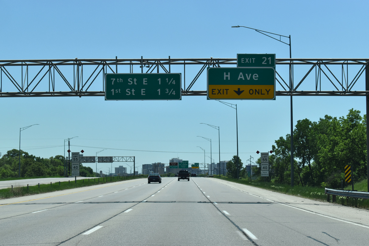
| 32nd and 29th Streets run east from adjacent Center Point Road to U.S. 151 Business (Iowa 922) by the Noelridge and Kenwood Park neighborhoods. The I-380 mainline progresses another mile south to a diamond interchange (Exit 21) with H Avenue. 05/26/18 |
|
| Forthcoming Exit 21 connects I-380 with H Avenue by an industrial area on the north side of Cedar Lake. The freeway encircles the lake southward to 7th Street NE ahead of Downtown Cedar Rapids. 05/26/18 |
|
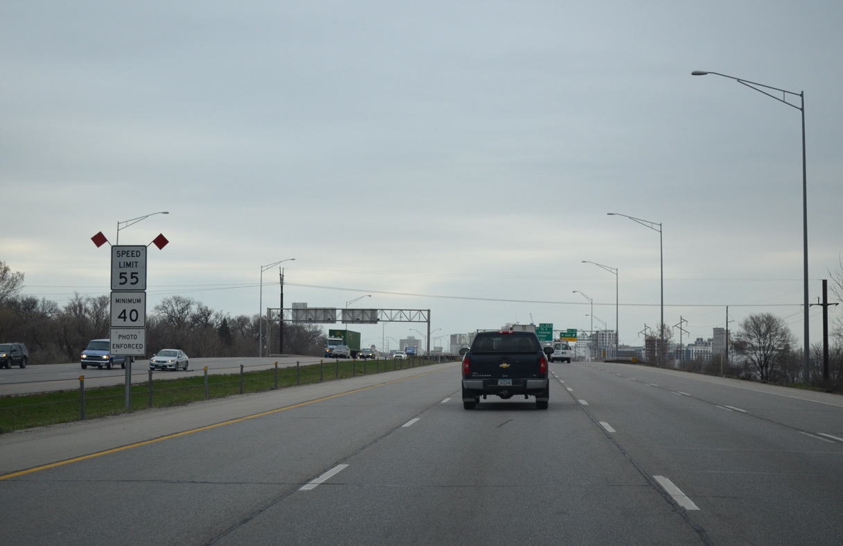
| The Cedar Rapids skyline comes into view as the speed limit reduces to 55 miles per hour. Speed cameras are in use along the ensuing stretch of freeway winding by Downtown. 05/26/18, 03/30/16 |
|
| H Avenue ties into adjacent Shaver Road west from Exit 21. East from I-380/Iowa 27, H Avenue leads toward the Mound View neighborhood. 05/26/18 |
|
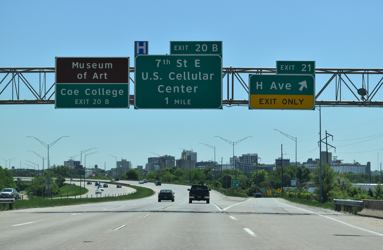
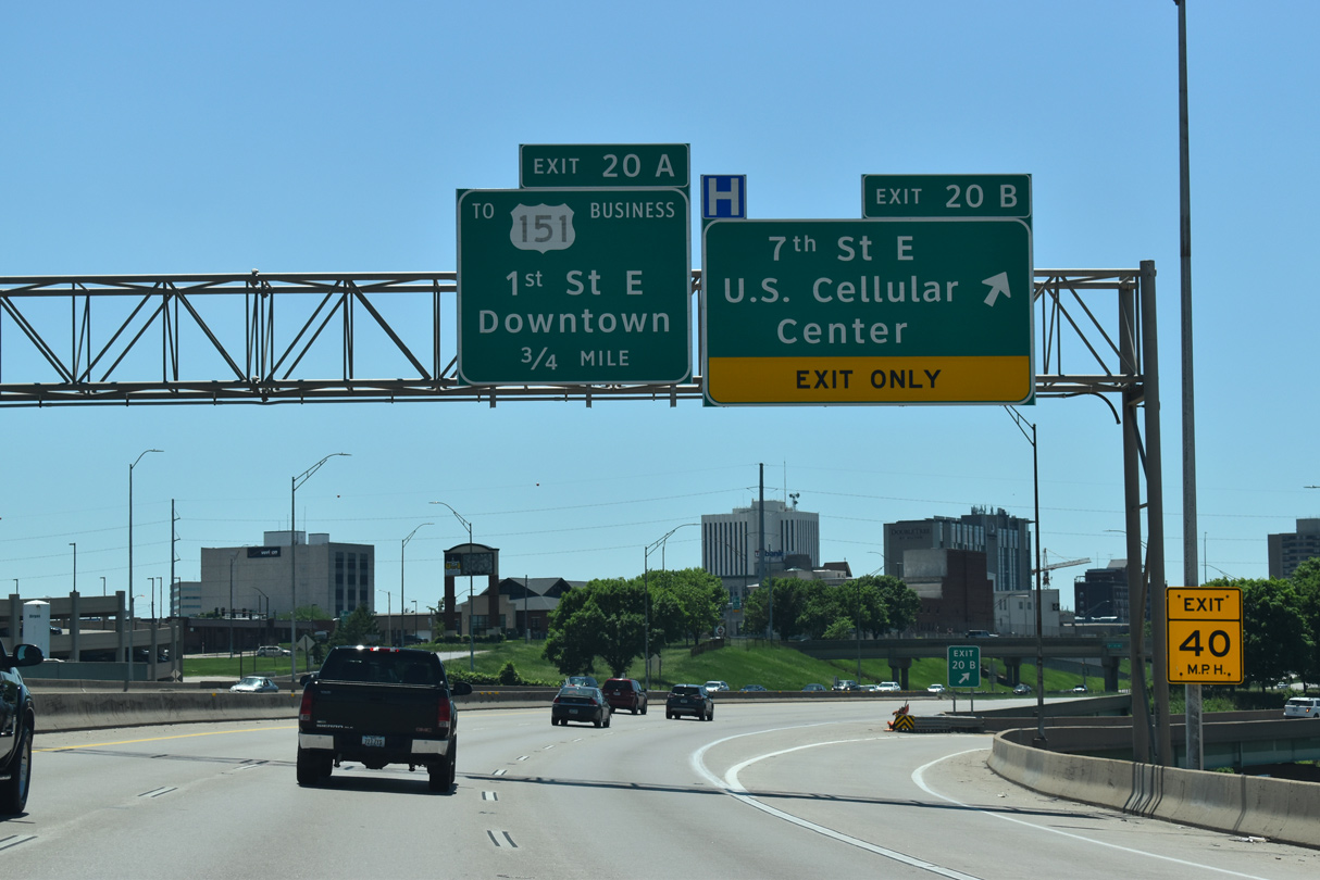
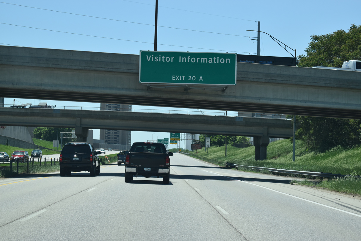
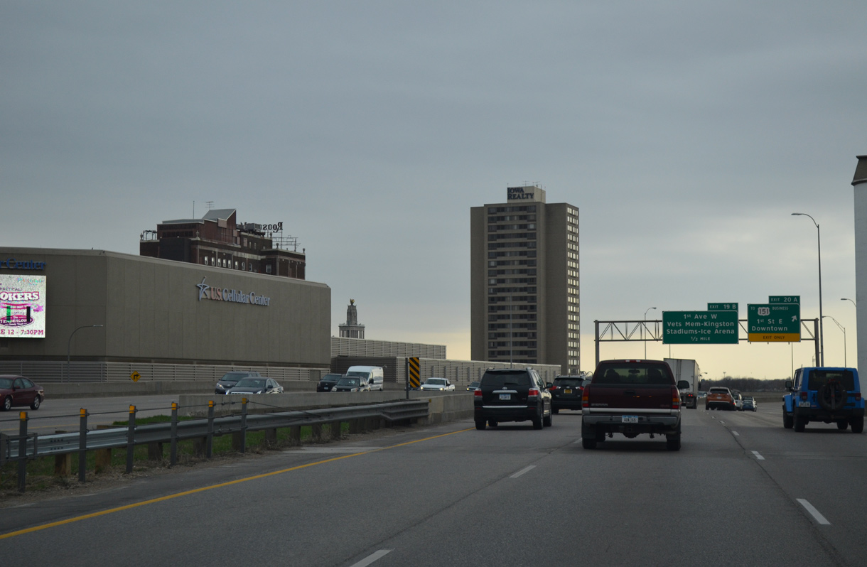
| Exit 20 B joins I-380/Iowa 27 with 7th Street NE to Downtown Cedar Rapids and Alliant Energy Power House (formerly U.S. Cellular Center), a concert and basketball arena opened in 1979. Exit 20 A follows to 1st Street NE and the Downtown Riverfront area. 05/26/18 |
|
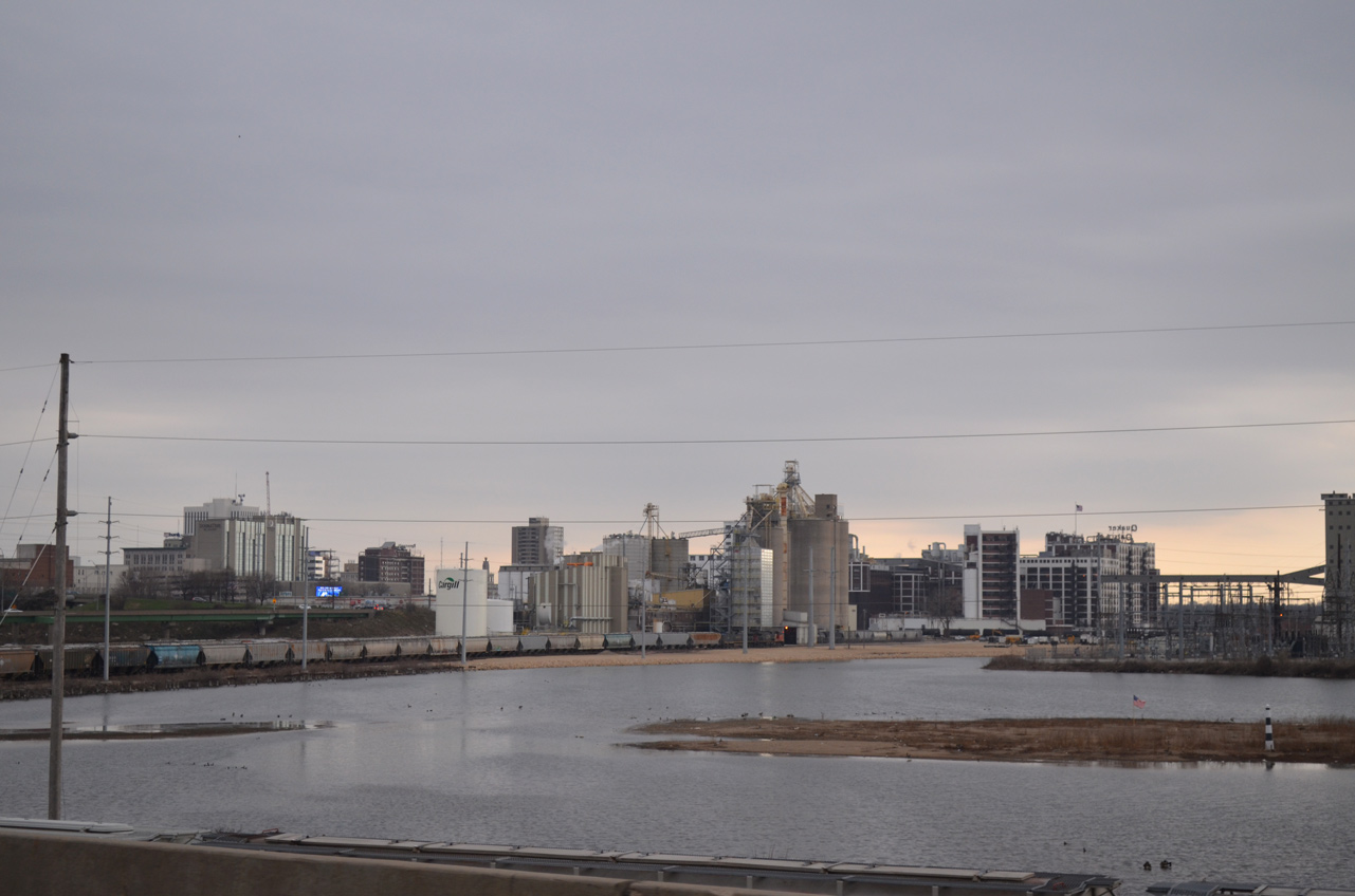
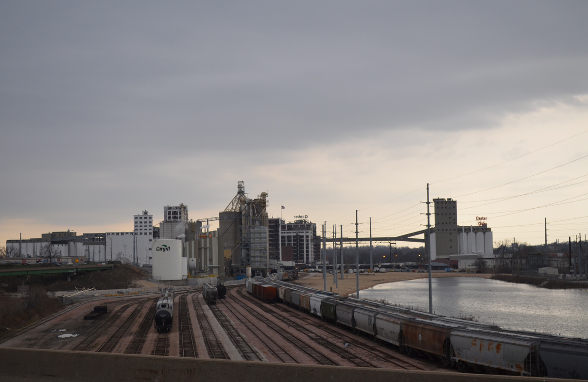
| Looking southwest at Cedar Lake, CN and Iowa Northern Railroad Company lines, and the Quaker Oaks plant. 03/30/16 |
|
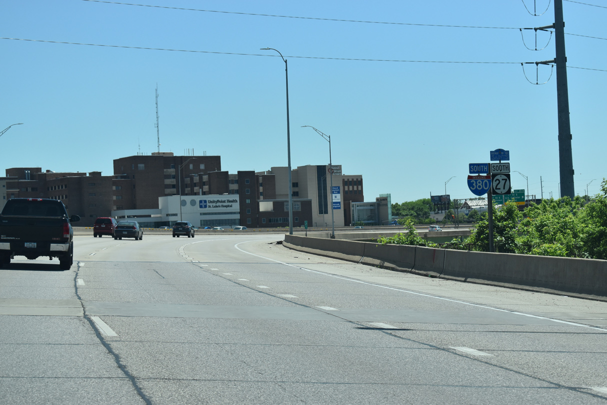
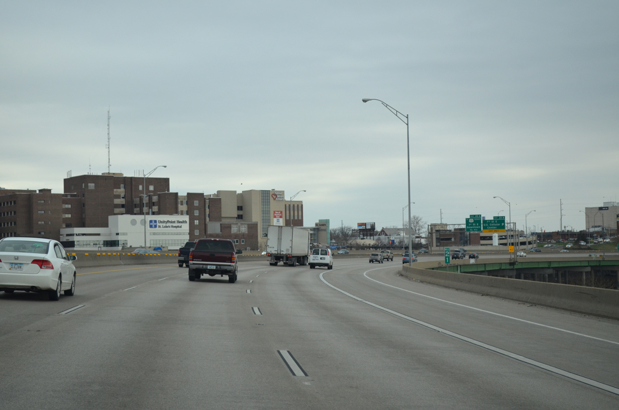
| Interstate 380 elevates onto a viaduct along the western turn by UnityPoint Health - St. Luke's Hospital. 05/26/18, 03/30/16 |
|
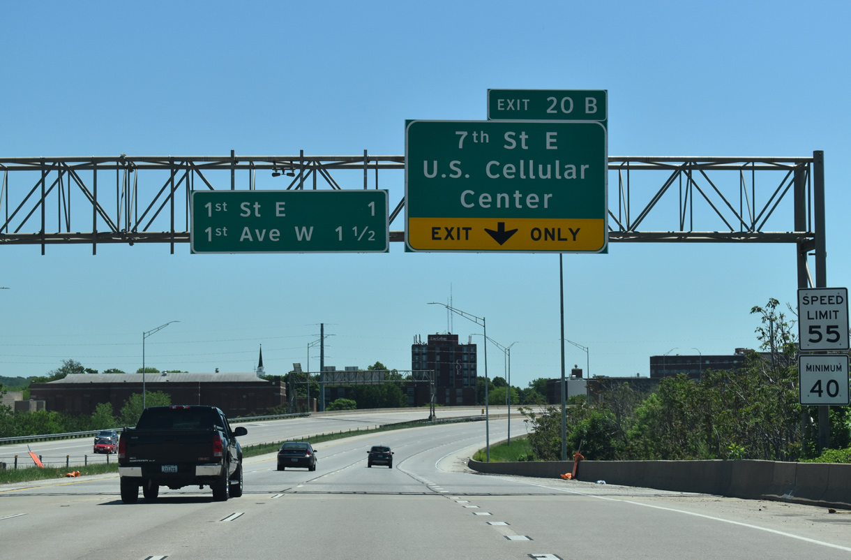
| Entering the parclo interchange (Exit 20 B) with 7th and 8th Street NE on I-380/Iowa 27 south. 7th Street angles southeast to link the freeway with parallel U.S. 151 Business (1st Avenue NE) east of the central business district and Alliant Energy Power House. 03/30/16, 05/26/18 |
|
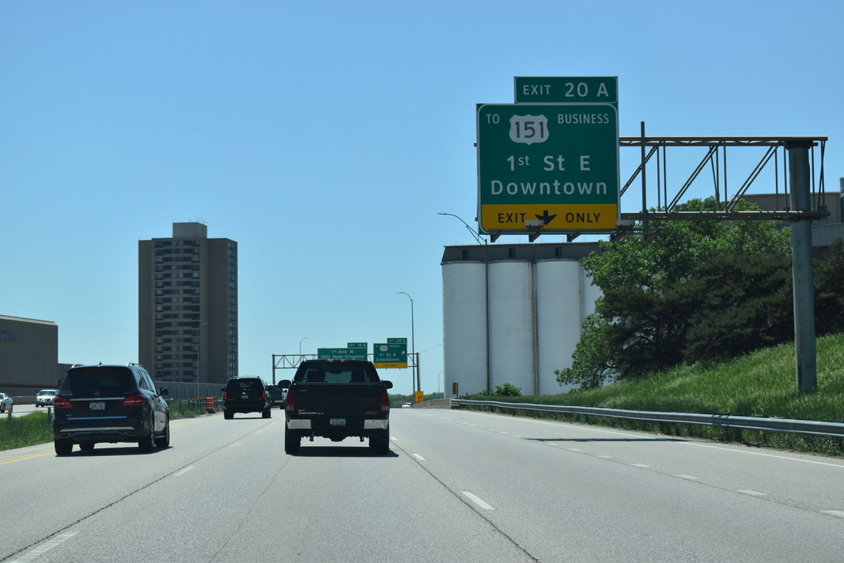
| Exit 20 A departs from the I-380 viaduct above 4th Street SE by the Quaker Oaks plant to 1st Street NE. 1st Street NE runs along the Cedar River southeast to 7th Avenue SE.
U.S. 151 Business (1st Avenue) parallels one block to the south. 05/26/18 |
|
| Alliant Energy Power House rises along the south side of the I-380 viaduct along A Avenue NE. 03/30/16 |
|
| U.S. 151 Business represents the lone signed route through central Cedar Rapids. The multi-lane boulevard doubles as unsigned Iowa 922 as it leads southwest from Iowa 100 (Collins Road) to Wellington Heights, Downtown, Northwest Area and U.S. 30-151-218 in southwest Cedar Rapids. 05/26/18 |
|
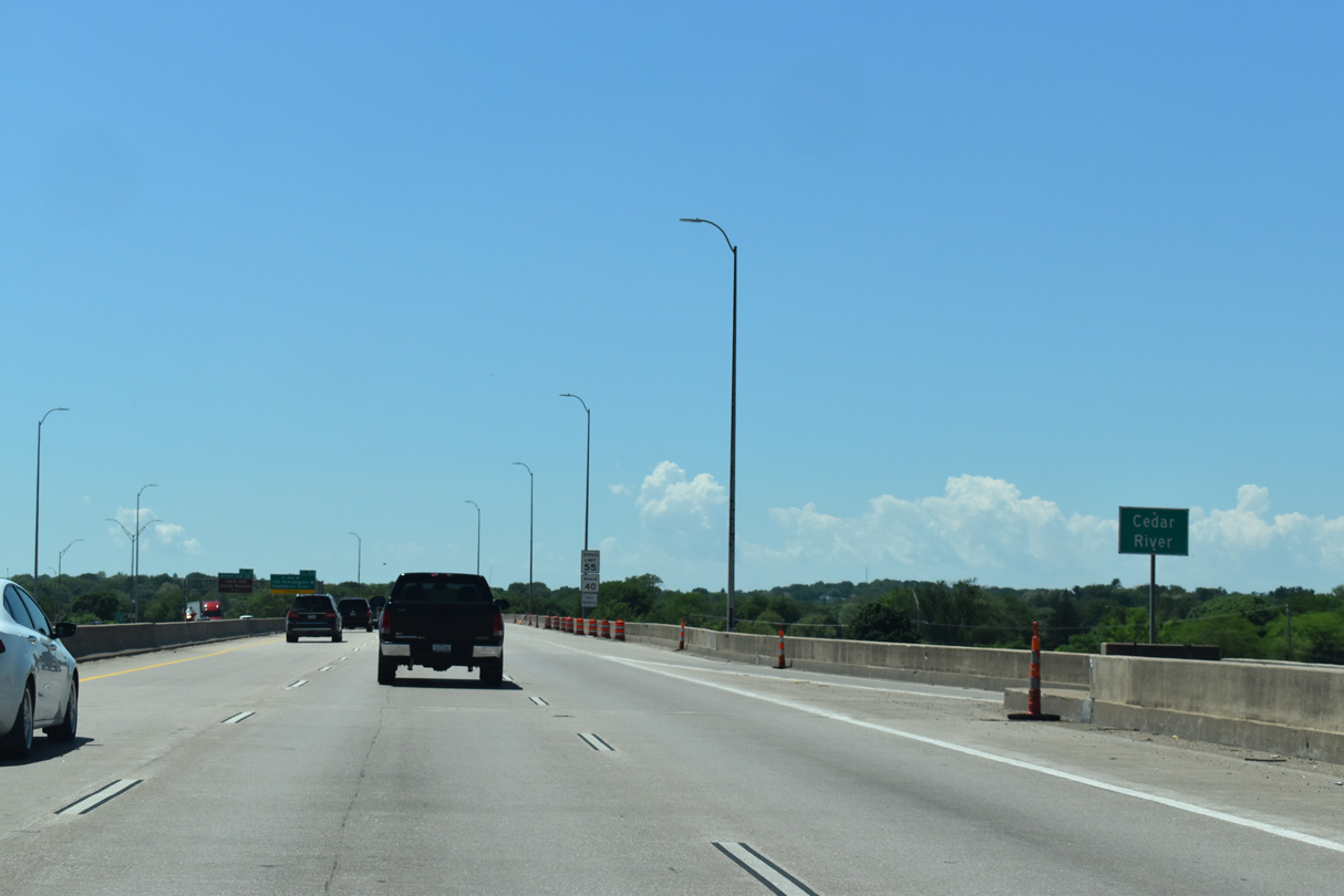
| I-380/Iowa 27 span the Cedar River ahead of Exit 19 B with 1st Avenue SW (U.S. 151 Business). Heavy rains in Spring 2008 resulted in major flooding both in Northwest Area and Downtown Cedar Rapids. 05/26/18 |
|
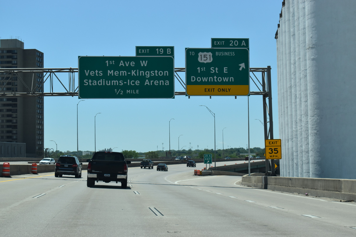
| The freeway curves southeast from the Cedar River as Exit 19 B lowers to the intersection of 1st and L Streets SW. U.S. 151 Business leads south from I-380 toward the Cleveland neighborhood where Veterans Memorial Stadium, Kingston Stadium and ImOn Ice Arena are located. 05/26/18 |
|
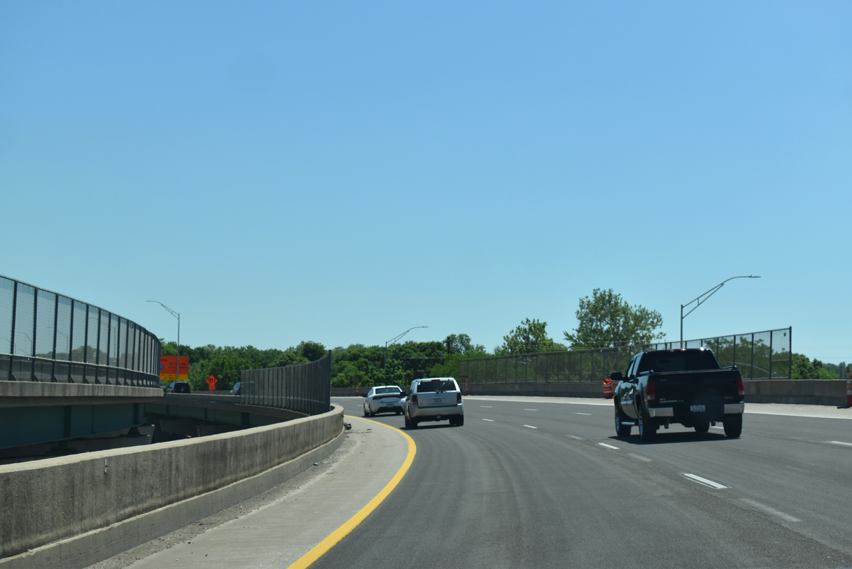
| The I-380 viaduct ends south of 3rd Avenue SW. 05/26/18, 03/30/16 |
|
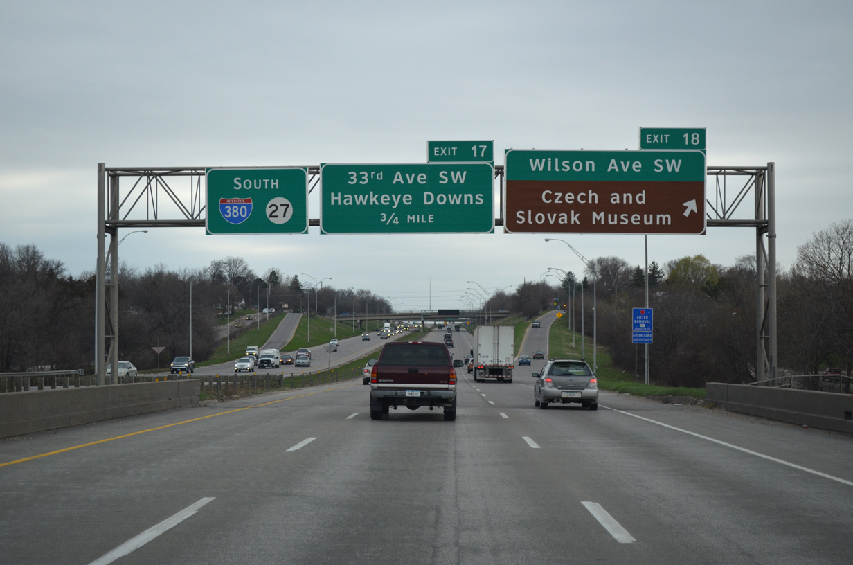
| A diamond interchange joins I-380/Iowa 27 with Wilson Avenue SW in the Southwest Area of Cedar Rapids. Interests to the Czech and Slovak Museum are directed back north to the Taylor neighborhood to reach the attraction off 12th Avenue SW. 03/30/16 |
|
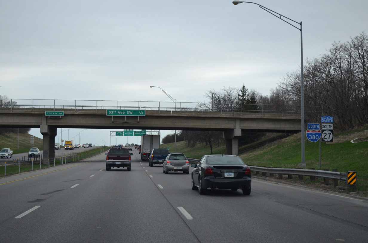
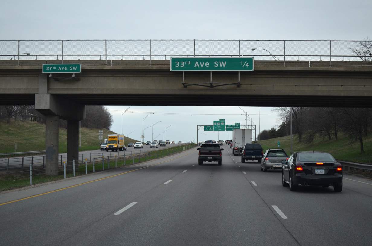
| I-380/Iowa 27 shields posted at the 27th Avenue SW overpass. 03/30/16 |
|
| Forthcoming 33th Avenue SW joins I-380 with Hawkeye Downs Speedway to the west and Richard C. Jones Memorial Park and golf course to the east. 03/30/16 |
|
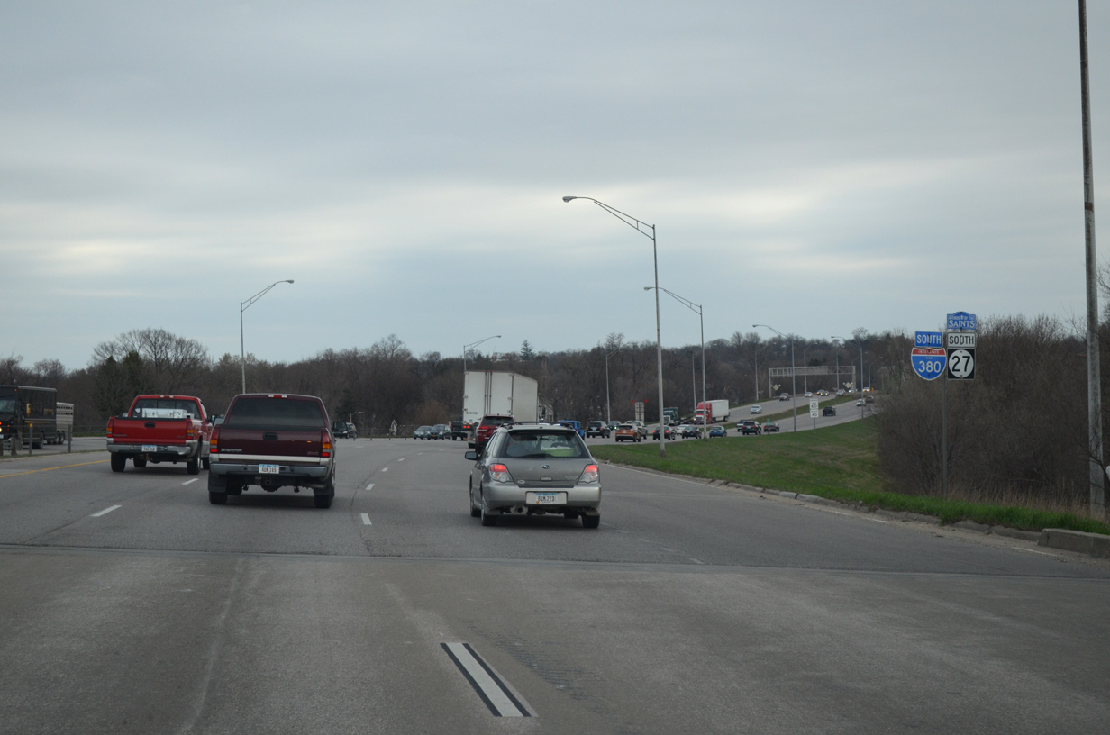
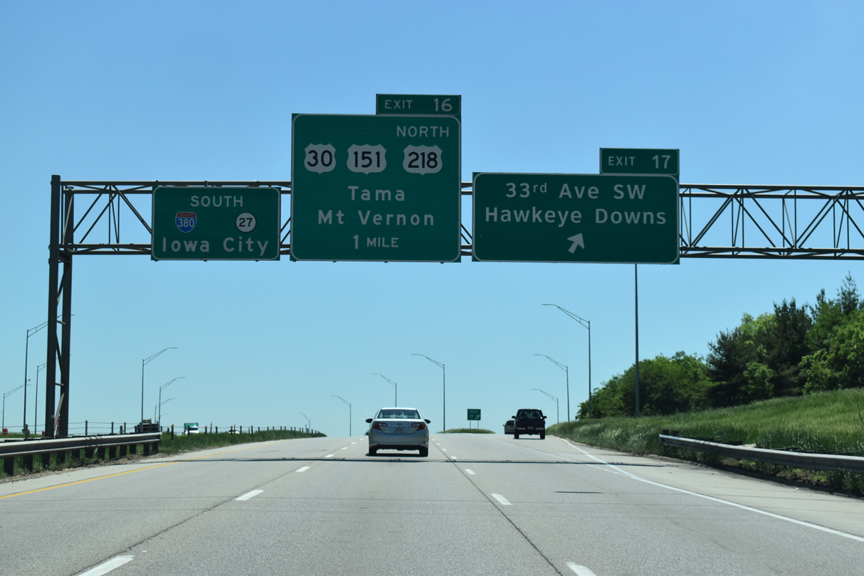
| Southbound at Exit 17 to 33rd Avenue SW. I-380 advances another mile to combine with U.S. 218 south at the Exit 16 and the freeway along U.S. 30/151. 05/26/18 |
|
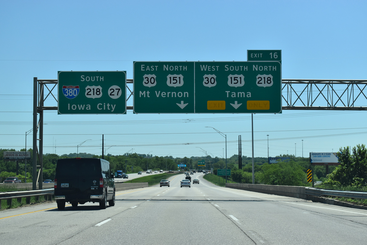
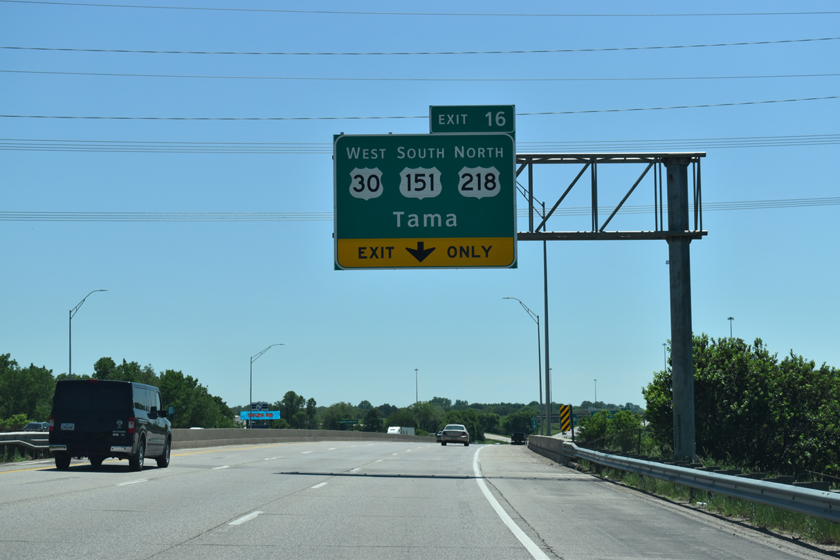
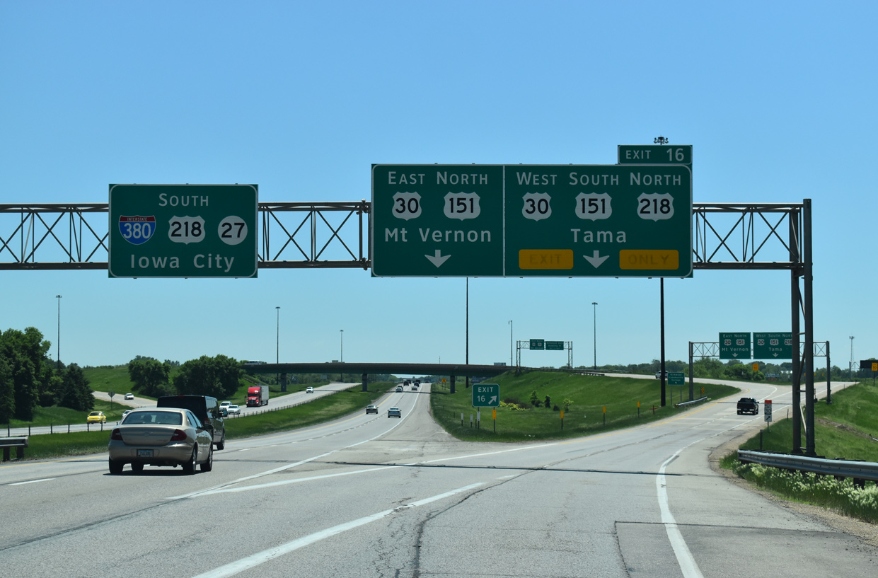
| Spanning a Union Pacific Railroad line, a lane drop occurs along Interstate 380 south at Exit 16 for U.S. 30 west, U.S. 151 south and U.S. 218 north. U.S. 218/30 combine 19 miles west to Benton County, with U.S. 30 reaching Tama in 48 miles. 05/26/18 |
|
| U.S. 30 forms a freeway bypass across south Cedar Rapids. U.S. 151 overlaps with the freeway west to Fairfax before it drops southward to Amana and its south end at Interstate 80. The Lincoln Freeway across Cedar Rapids opened in stages between 1975 and 1981.3 05/26/18 |
|
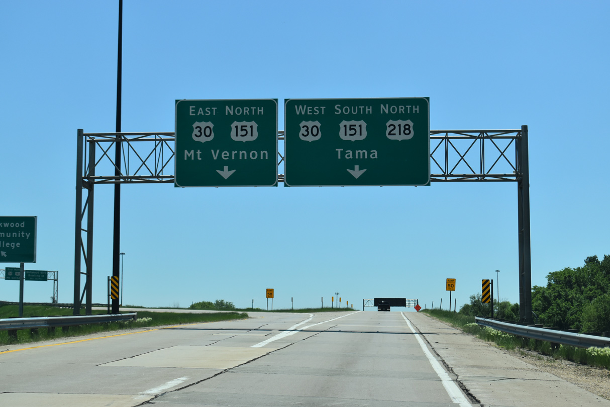
| All traffic to U.S. 30/151 departs in unison from I-380/Iowa 27 at Exit 16. U.S. 30/151 downgrade to an expressway east of C Street SW. The pair split south of Betram while U.S. 30 maintains an eastern heading to Mount Vernan and Clinton. 05/26/18 |
|
| A wye takes motorists from I-380 south onto U.S. 30 east and U.S. 151 north ahead of Bowling Street north and Kirkwood Boulevard south. A cloverleaf interchange links the rest of the movements between the two freeways. Kirkwood Boulevard extends Bowling Street south to the Lincolnway neighborhood. 05/26/18 |
Page Updated 02-08-2024.


 South
South