

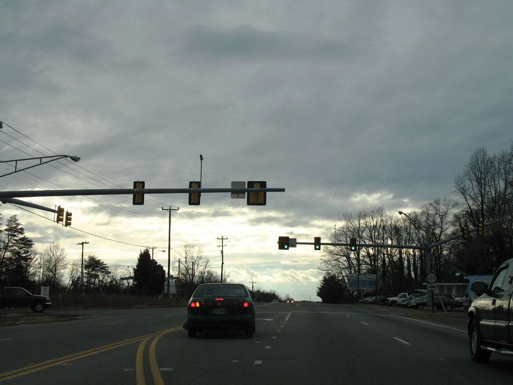
 South South |
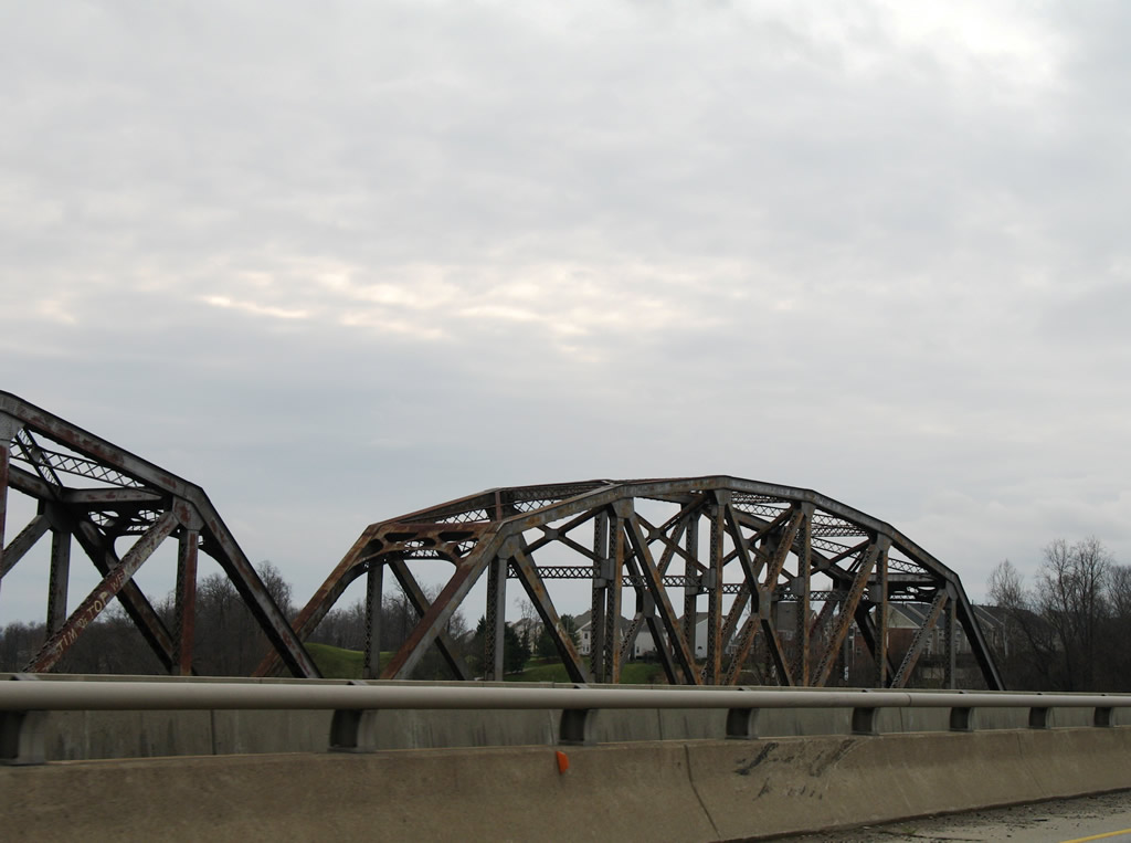
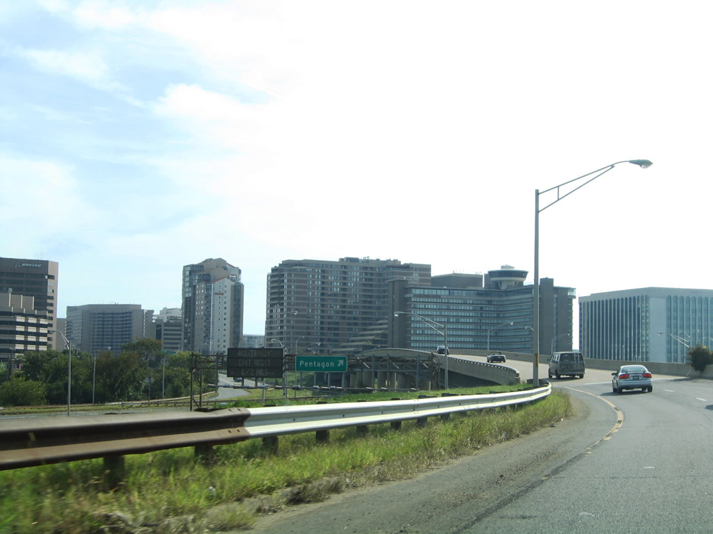 | U.S. 1 overlaps with I-395 south across the George Mason Bridge over the Potomac River between 14th Street SW in Washington and the Left Exit 8C in Arlington. U.S. 1 branches south along a short expressway between Pentagon City and Crystal City to 20th Street. 09/25/04 |
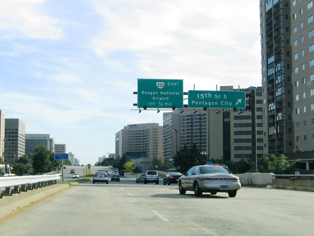 | A diamond interchange joins U.S. 1 with 15th Street S at Crystal City. 15th Street S heads west from Crystal Drive to the Fashion Centre at Pentagon City mall. 09/25/04 |
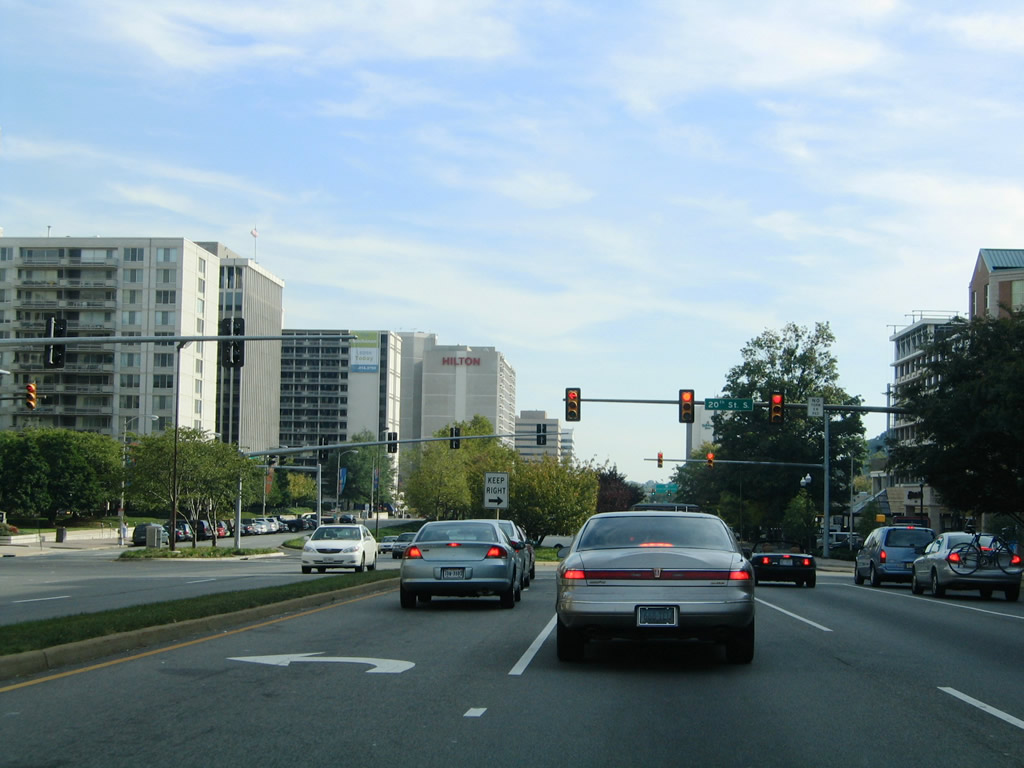 | U.S. 1 (Richmond Highway) lowers onto an urban boulevard at the signalized intersection with 20th Street S by the Crystal Plaza Apartments complex. 09/25/04 |
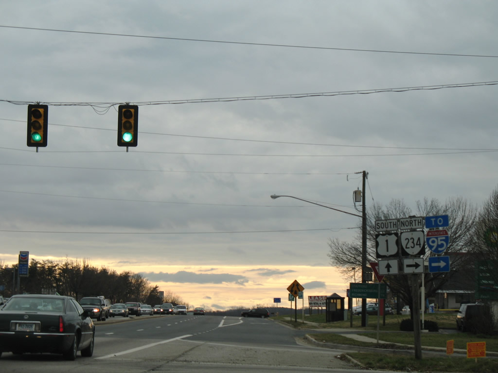
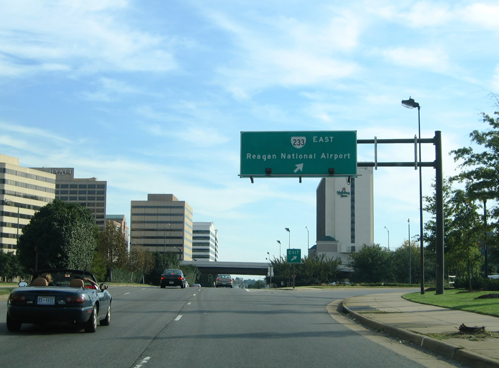 | A trumpet interchange joins U.S. 1 with SR 233 beyond the traffic light at 23rd Street S. SR 233 spurs 0.36 miles east on a viaduct to Abingdon Road and Smith Boulevard at Ronald Reagan Washington National Airport (DCA). 09/25/04 |
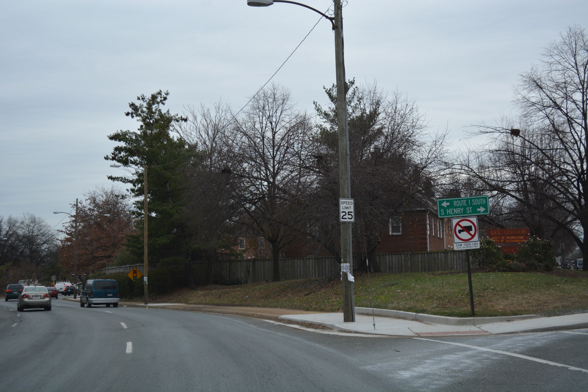
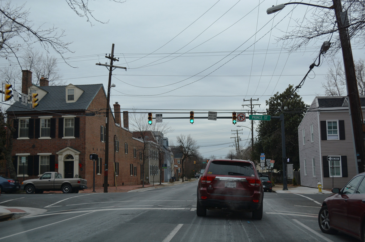 | U.S. 1 (Henry Street) intersects Prince Street one block south of SR 7 (King Street) in Downtown Alexandria. 12/16/16 |
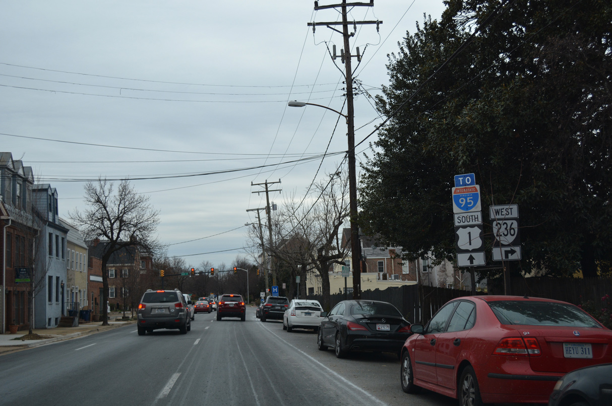 | Forthcoming Duke Street is a part of SR 236 west from Washington Street (SR 400). 12/16/16 |
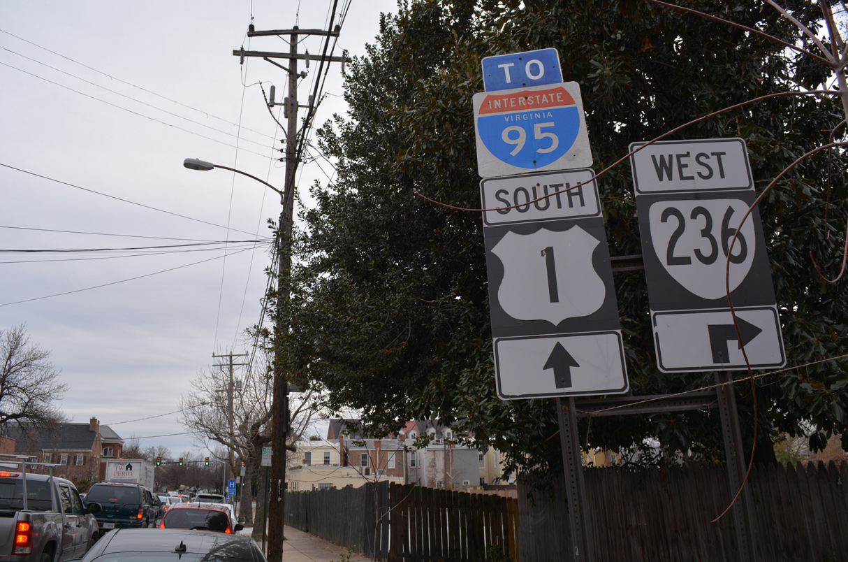 | SR 236 runs 15.54 miles west from Alexandria to U.S. 29/50 in Fairfax. 12/16/16 |
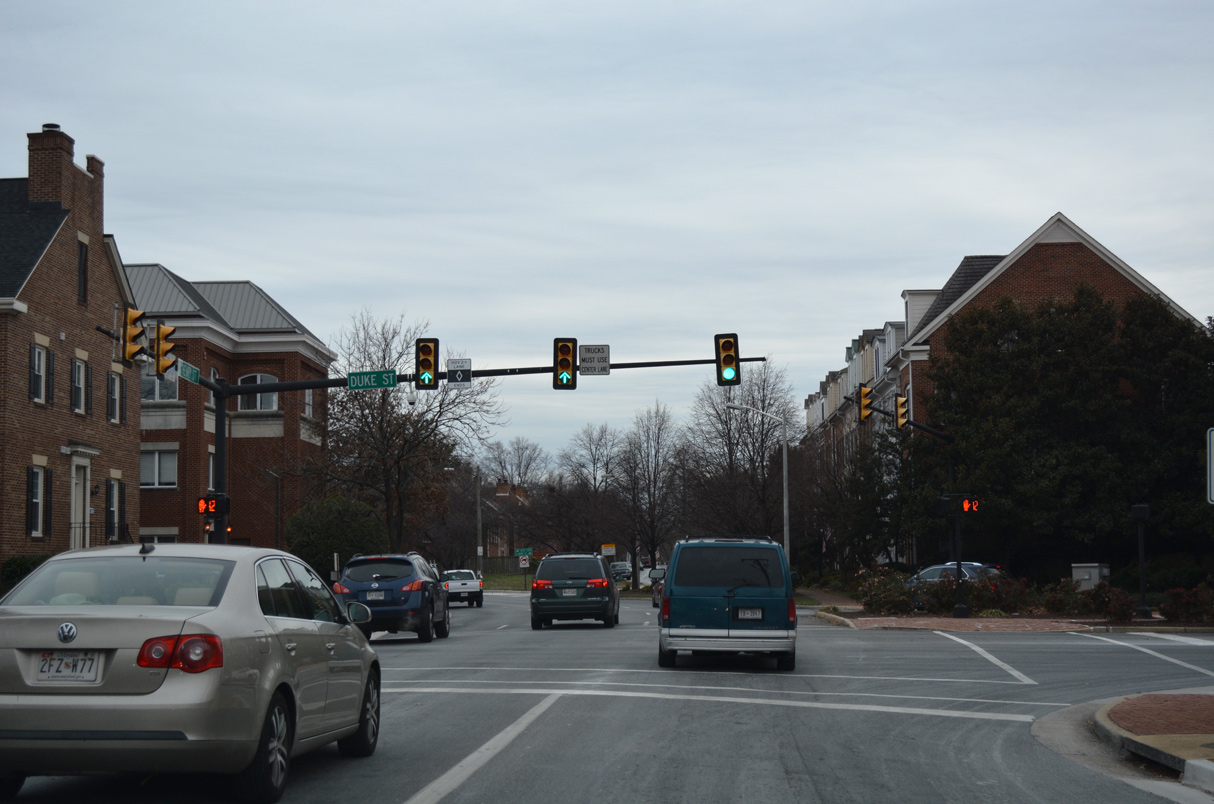 | Duke Street leads SR 236 west across the city of Alexandria to Cameron Valley, Duke Gardens, Landmark Mall and I-395 by the Fairfax County line. 12/16/16 |
 | U.S. 1 shifts onto Patrick Street from Henry Street south beyond Duke Street. 12/16/16 |
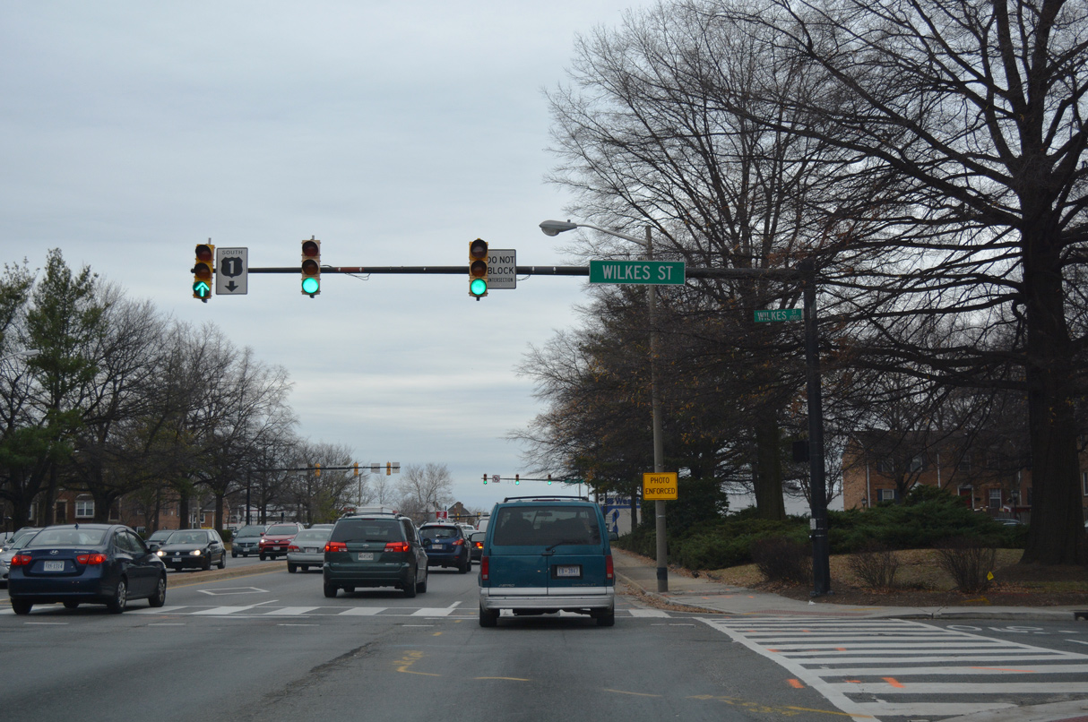 | U.S. 1 (Patrick Street) transitions into a six lane boulevard at Wilkes Street. 12/16/16 |
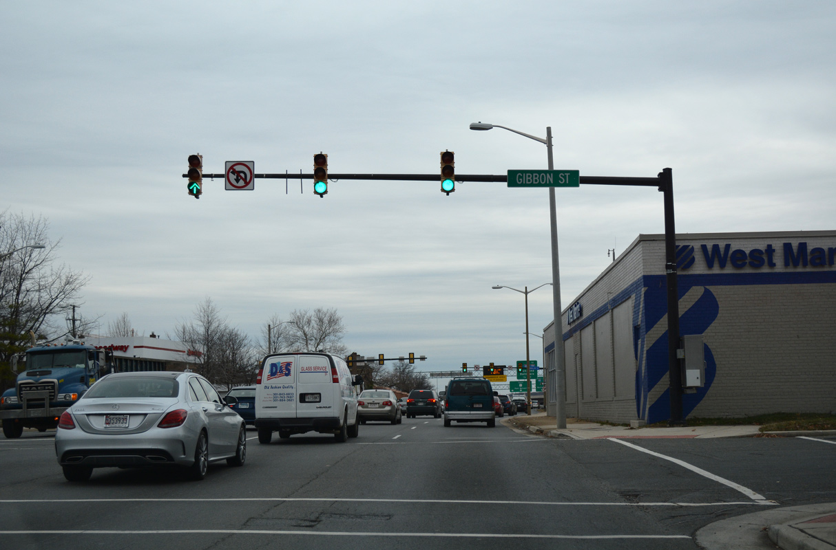 | Patrick Street south at Gibbon Street in Alexandria. 12/16/16 |
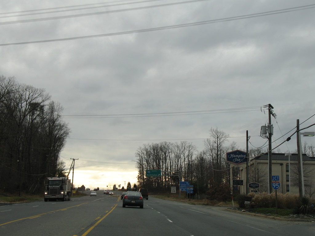
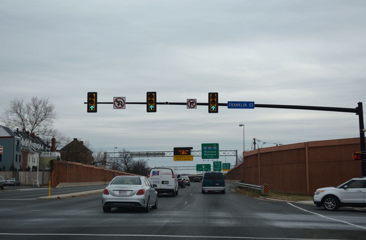 | Franklin Street is the last traffic light along U.S. 1 (Patrick Street) south in Alexandria. The succeeding 0.7 miles is limited access through the exchange with I-95/495. 12/16/16 |
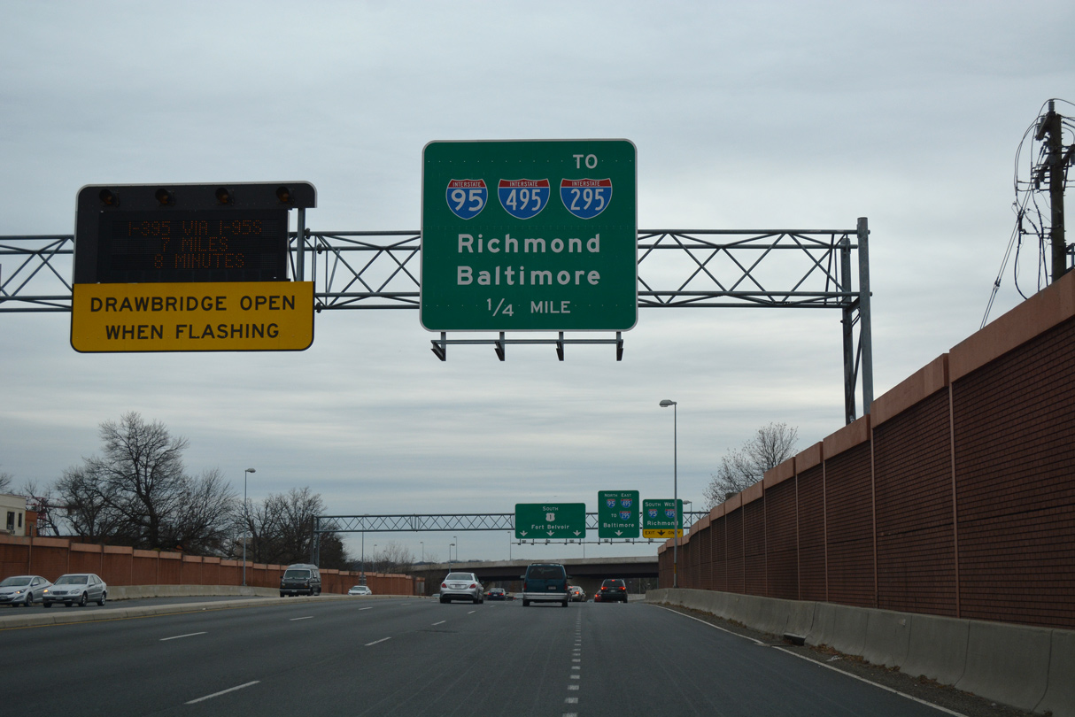 | U.S. 1 enters a cloverstack interchange with the Capital Beltway just west of the Woodrow Wilson Bridge spanning the Potomac River. 12/16/16 |
 | A two lane ramp separates from U.S. 1 (Patrick Street) south for I-95/495 west to Springfield and I-95/495 east to I-295 near Oxon Hill, Maryland. 12/16/16 |
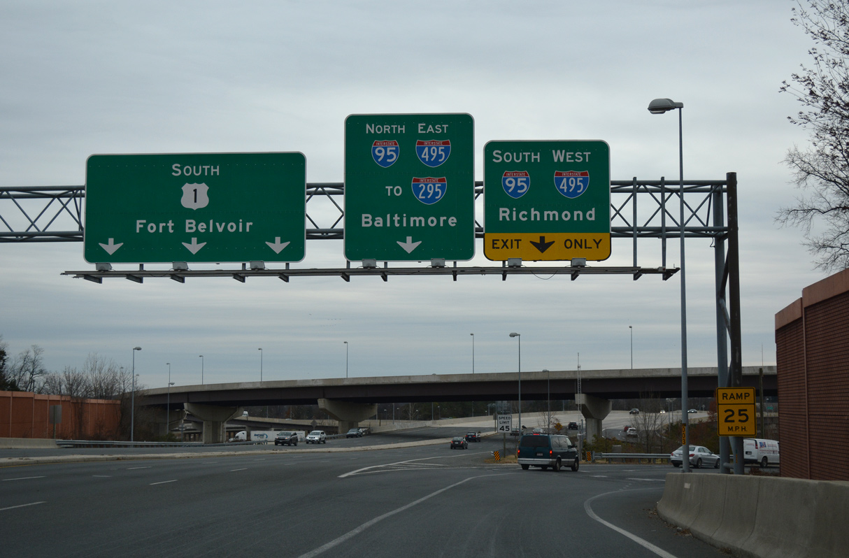
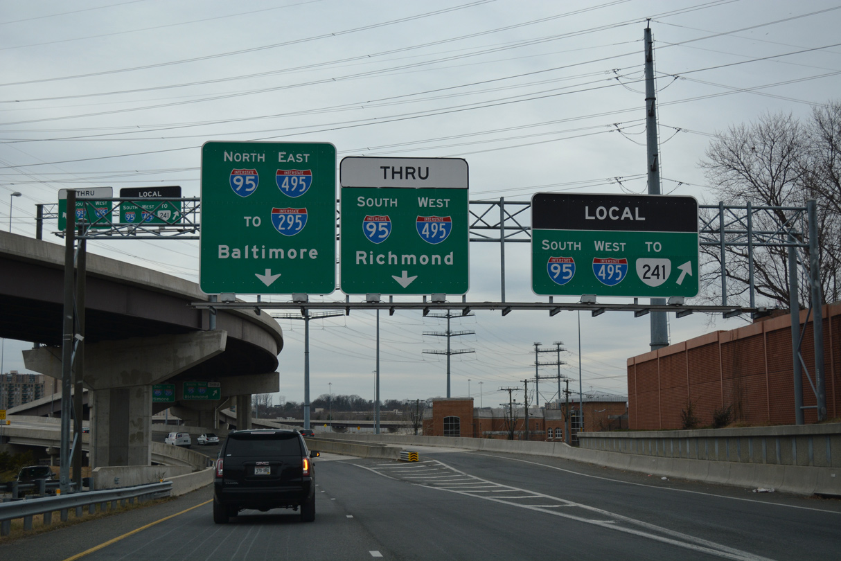 | Traffic headed onto the Capital Beltway west partitions into separate ramps for the Local Lanes ahead of SR 241 (Telegraph Road) and the Thru Lanes ahead of the Eisenhower Avenue Connector. 12/16/16 |
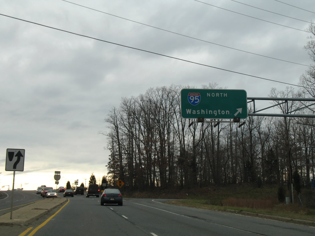
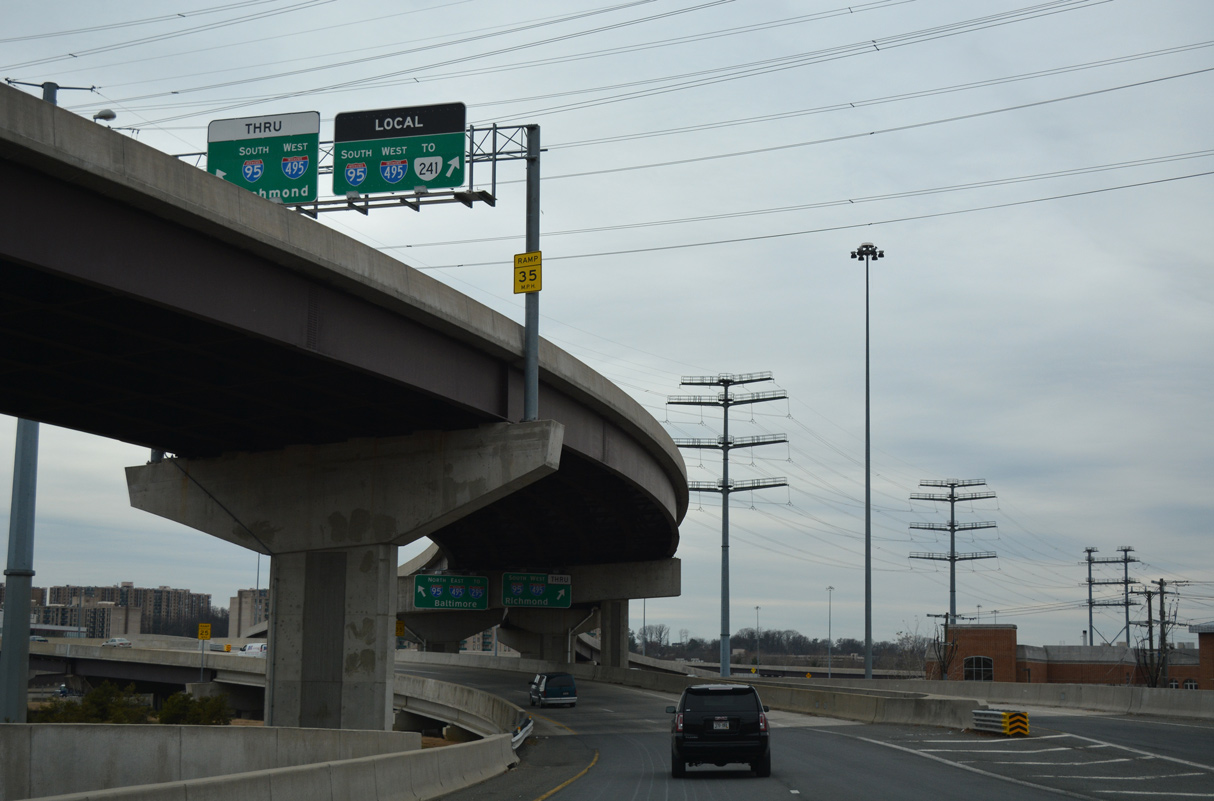 | A high flyover connecting U.S. 1 north with I-95 south and I-495 west separates above the Capital Beltway entrance ramps from U.S. 1 south. 12/16/16 |
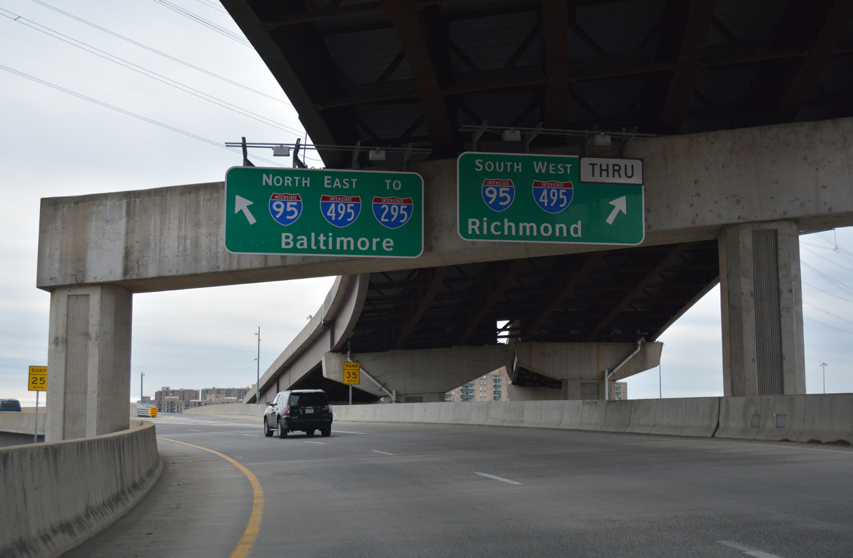 | The flyover for I-95 north and I-495 east to Baltimore extends south across the Capital Beltway. 12/16/16 |
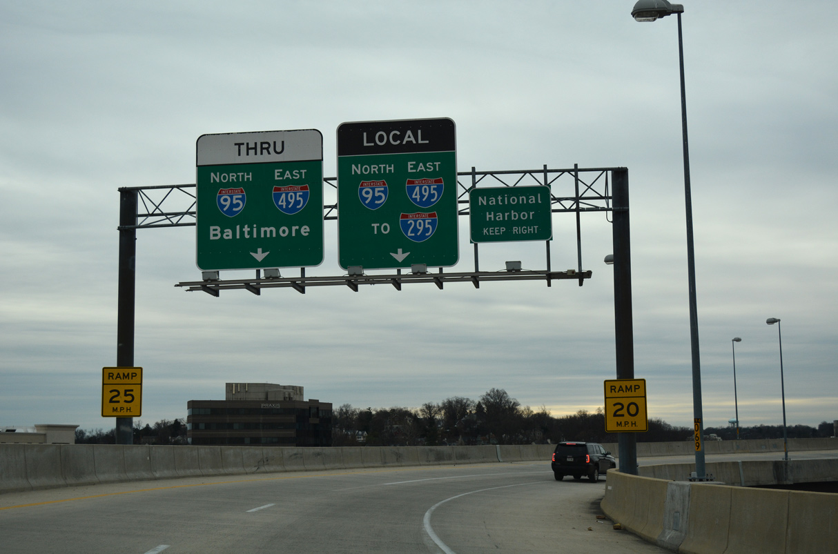 | Separate flyovers connect U.S. 1 with the Local Lanes of I-95/495 across the Woodrow Wilson Bridge to I-295 at National Harbor and the Thru Lanes past MD 210 at Oxon Hill. 12/16/16 |
 | U.S. 1 approaches SR 642 (Lorton Road) south from the Pohick area. Lorton Road provides one of several connections between U.S. 1 (Richmond Highway) and parallel Interstate 95 (via Exit 163). 12/26/06 |
 | Lorton Road stems west from U.S. 1 (Richmond Highway) to Lorton and SR 123. 12/26/06 |
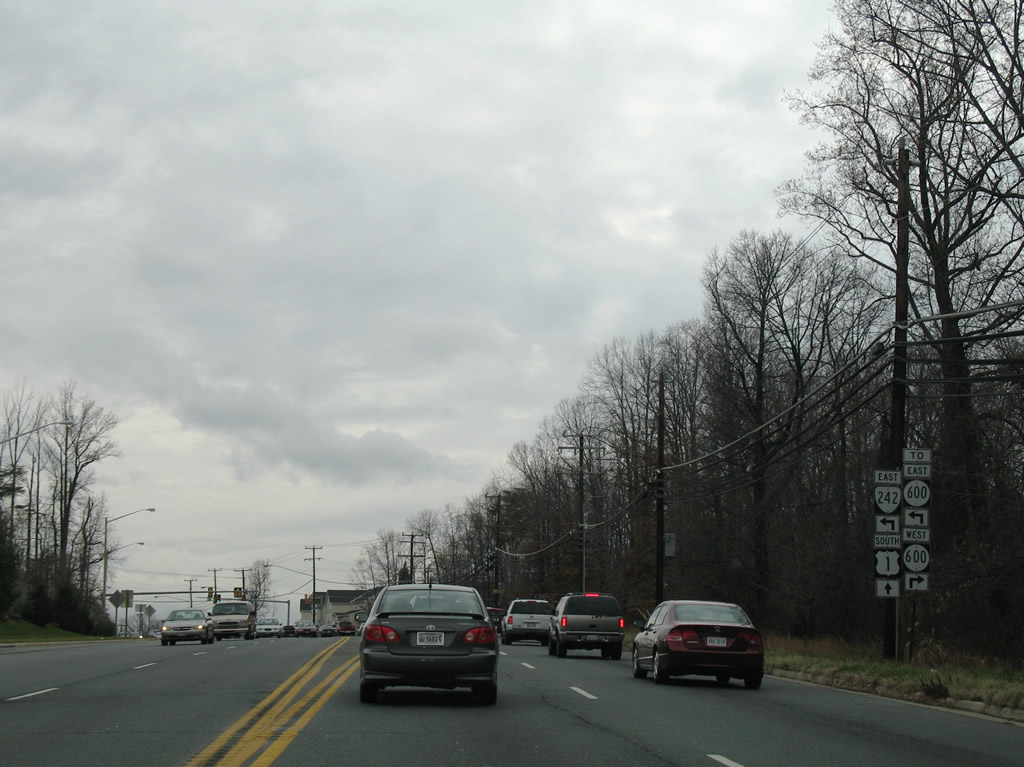 | Continuing south along U.S. 1 (Richmond Highway) to SR 242 (Gunston Road) and SR 600 (Gunston Cove Road) west. SR 242 constitutes a 3.58 mile long route east from Richmond Highway to SR 600 (Gunston Road) at Gunston Hall. 12/26/06 |
 | SR 600 (Gunston Cove Road) leads northward to Lorton Road at a folded diamond interchange with I-95. SR 600 also continues Gunston Road 2.65 miles east from SR 242 to River Drive at Hallowing Point Estates on the Potomac River. 12/26/06 |
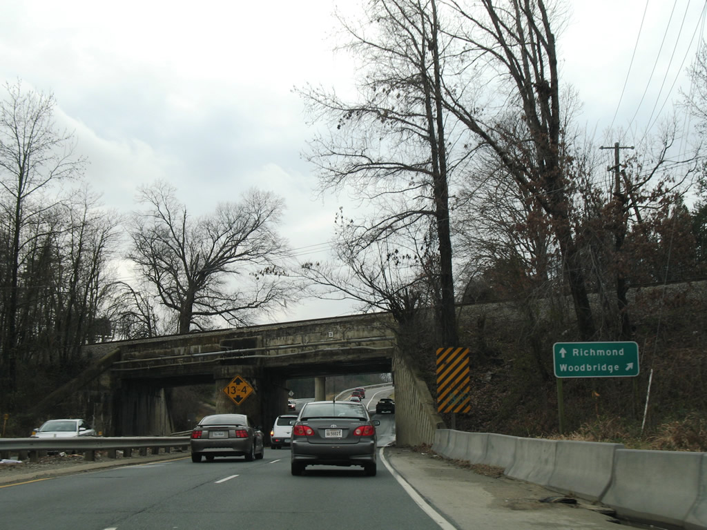
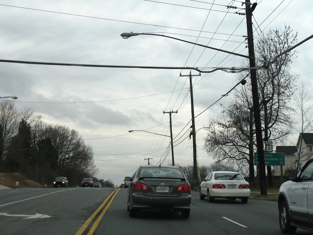 | U.S. 1 advances three miles south from SR 242 to Woodbridge in Prince William County. 12/26/06 |
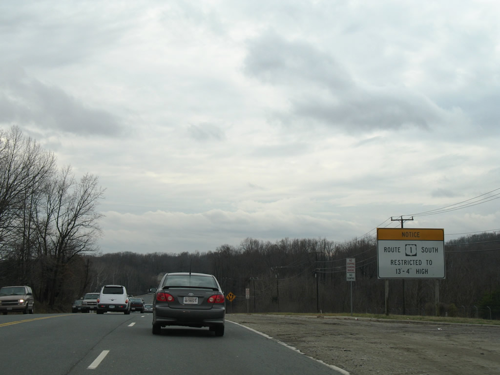 | Vehicles exceeding 13'4" in height are restriction from traveling U.S. 1 under the forthcoming CSX Railroad bridge. 12/26/06 |
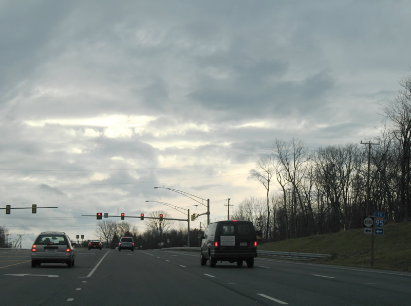
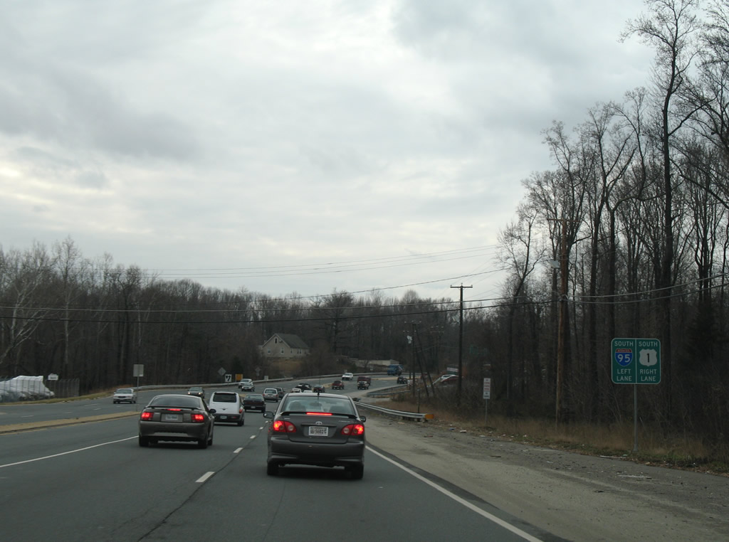 | U.S. 1 (Richmond Highway) converges with I-95 ahead of separate bridges over the Occoquan River. U.S. 1 south merges with the off-ramp (Exit 161) from I-95 south as the Richmond Highway mainline defaults onto the freeway southbound. 12/26/06 |
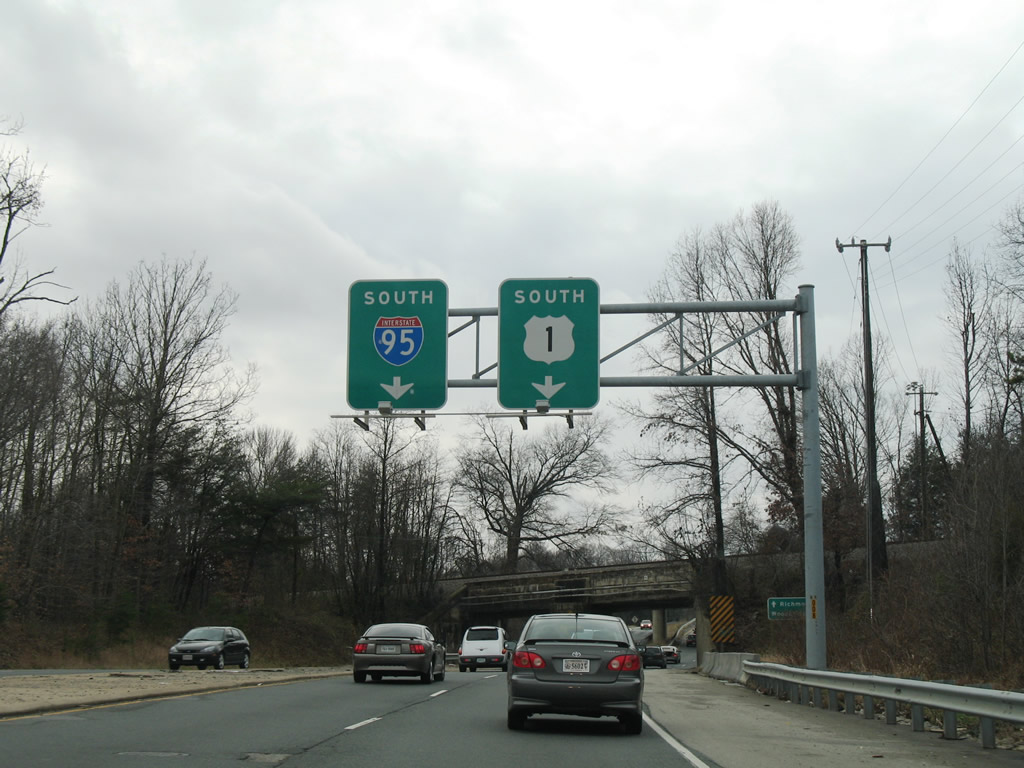 | A three wye interchange joins Interstate 95 and the tolled Express Lanes with U.S. 1 (Richmond Highway) west of the CSX Railroad overpass. 12/26/06 |
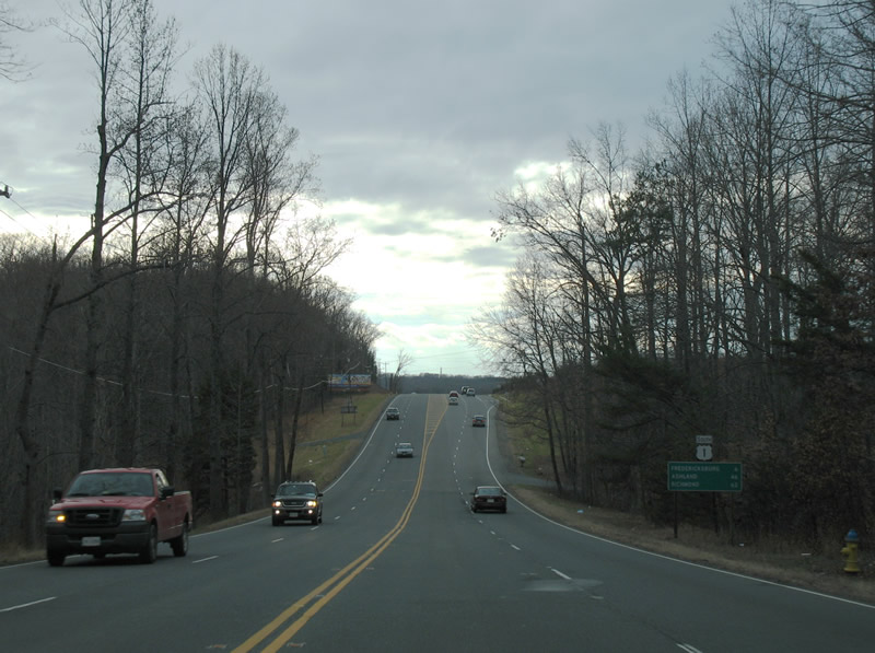
  | Interstate 95 parallels U.S. 1 south to Fredericksburg and Richmond while locally U.S. 1 enters Woodbridge. 12/26/06, 10/10/09 |
 | Furnace Road (SR 611) leads north from U.S. 1 (Richmond Highway) to Lorton Road and SR 123 and south to Old Colchester Road for Colchester and Harbor View. 12/26/06 |
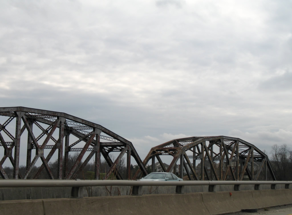   | U.S. 1 spans the Occoquan River parallel to a CSX Railroad truss bridge. The river separates Fairfax and Prince William Counties. 12/26/06 |
| South |
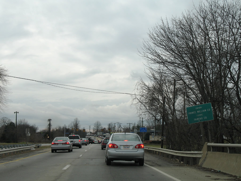
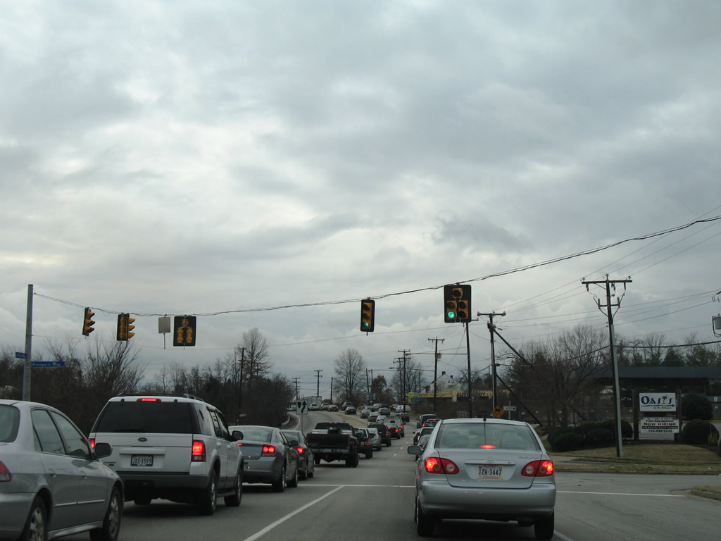 | Annapolis Way (SR 673) spurs north to a local marina as U.S. 1 (Jefferson Davis Highway) enters Prince William County. 12/26/06 |
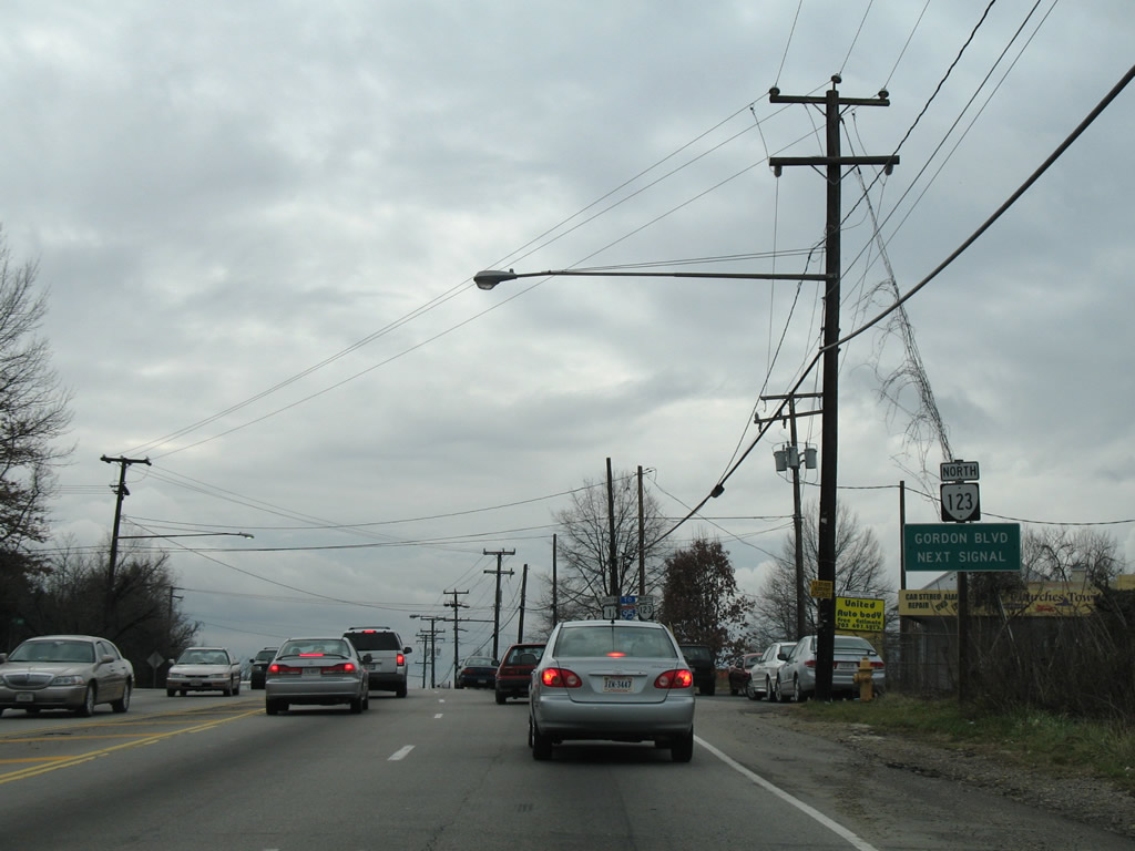 | Amid a heavily commercialized area, U.S. 1 (Jefferson Davis Highway) meets the south end of SR 123 (Gordon Boulevard). 12/26/06 |
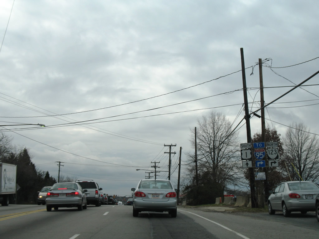 | SR 123 constitutes a 29.27 mile long loop from Woodbridge north to Fairfax, Vienna, McLean and Chain Bridge into Washington, DC. 12/26/06 |
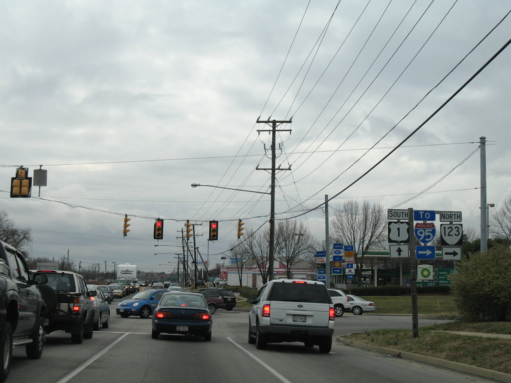 | North from U.S. 1 (Jefferson Davis Highway), SR 123 (Gordon Boulevard) intersects Horner Road (SR 639) ahead of a three quarter cloverleaf interchange (Exit 160) with Interstate 95. 12/26/06 |
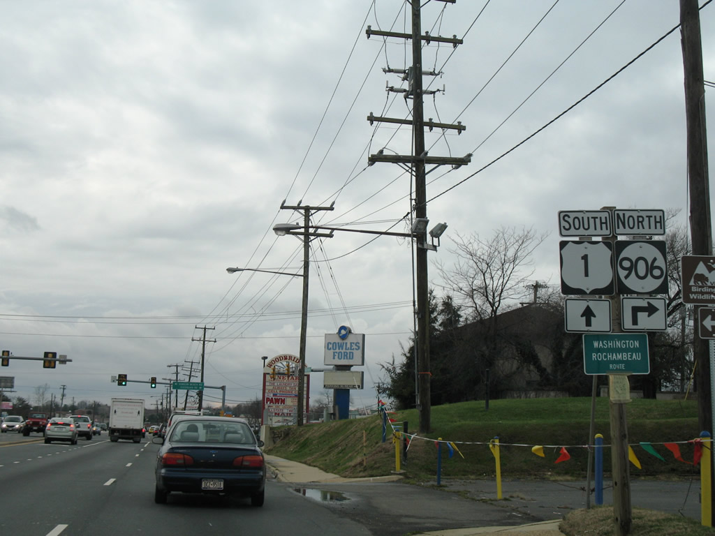 | SR 906 (Occoquan Road) represents the former route of SR 253 north from U.S. 1 at Woodbridge to Occoquan parallel to SR 123. SR 253 was designated between the late 1960s and 1998.1 12/26/06 |
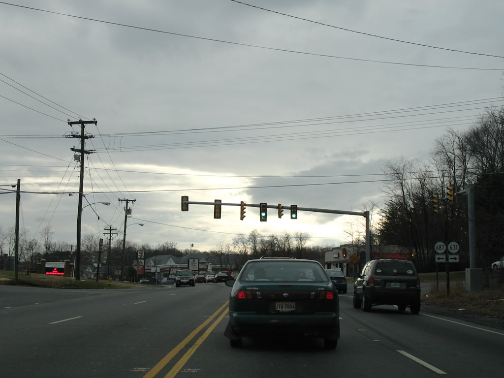
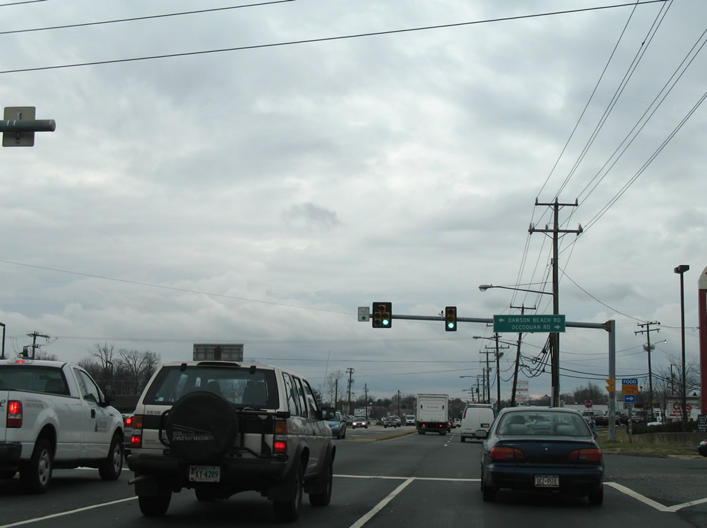 | SR 687 follows Dawson Beach Road southeast from U.S. 1 and SR 906 to Occoquan Bay National Wildlife Refuge. 12/26/06 |
 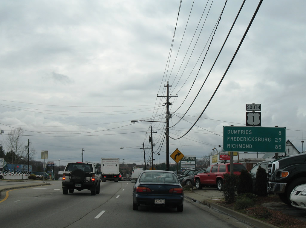 | U.S. 1 continues southwest from Woodbridge eight miles to Dumfries. Interests to Interstate 95 south are directed to Prince William Parkway (SR 294) west. 12/26/06 |
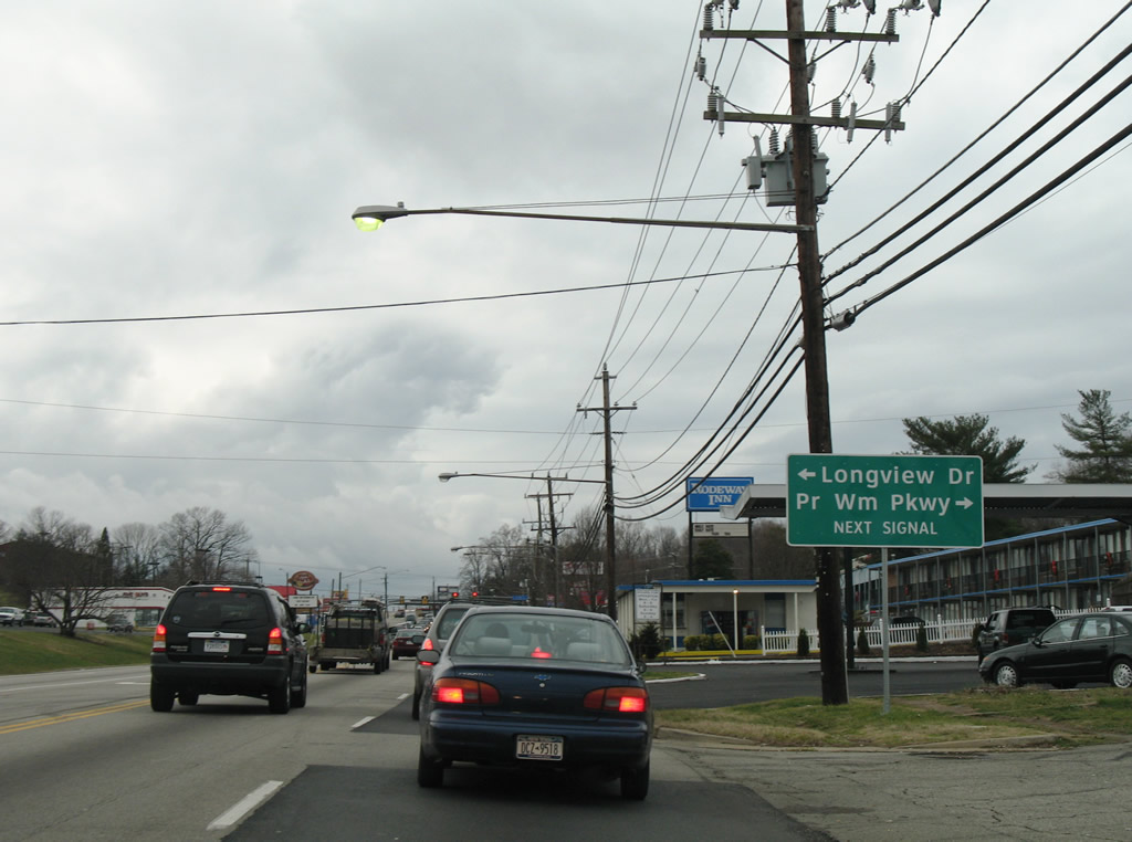 | Prince William County Parkway (SR 294) winds westward from U.S. 1 (Jefferson Davis Highway) to Dale City and Manassas. Longview Drive stems southward from SR 294 to Marumsco Acres. 12/26/06 |
 | SR 294 enters a three quarter interchange (Exit 158) with Interstate 95 a short distance west of U.S. 1. 12/26/06 |
  | Prince William Parkway constitutes a four to six lane arterial with some access control between U.S. 1 and Interstate 66 west of Manassas National Battlefield Park. The route bypasses Manassas as part of SR 234. 12/26/06 |
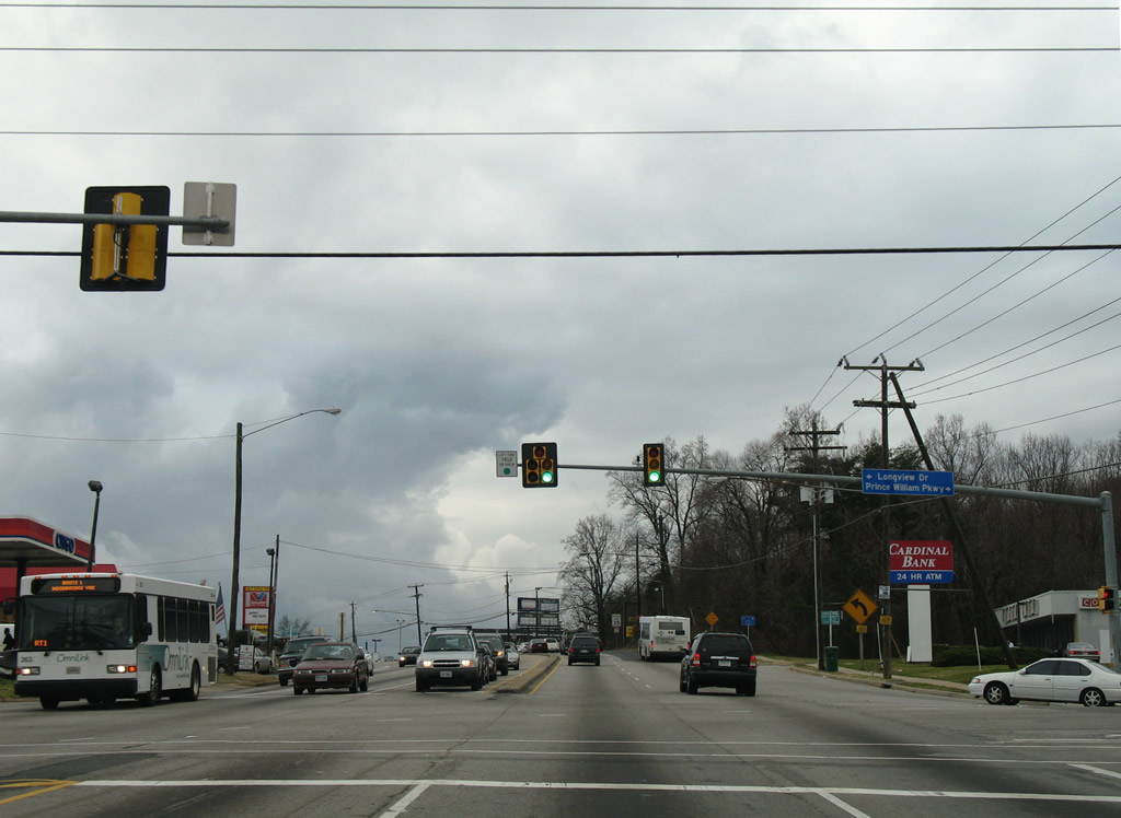
 | U.S. 1 constitutes a busy commercial arterial from Woodbridge southward. Pictured here is the traffic light with Woodside Drive and an adjacent shopping center. Woodside Drive is a residential street linking U.S. 1 with Colchester Road (SR 638) and Featherstone. 12/26/06 |
 | SR 636 spurs east from U.S. 1 (Jefferson Davis Highway) along Featherstone Road to Featherstone Shores and Bayside Park. 12/26/06 |
 | SR 2000 (Opitz Boulevard) is an arterial route west to I-95 at Exit 156 and north along Smoketown Road to Potomac Mills mall and SR 294 (Prince William Parkway). Reddy Drive connects U.S. 1 with Blackburn Road (SR 638) at Marumsco Woods. 12/26/06 |
 | A brief reprieve from the commercialized frontage precedes residential developments along both sides of U.S. 1 south into Dumfries. Dale Boulevard is the next connection with Interstate 95. 12/26/06 |
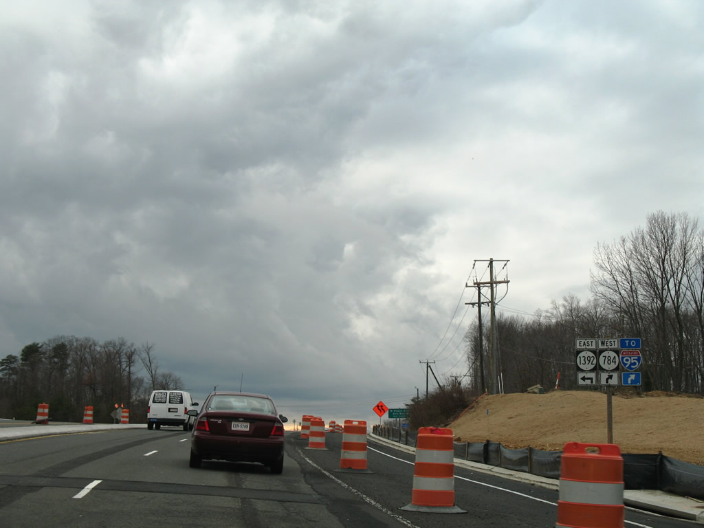 | SR 784 follows Dale Boulevard west to Interstate 95 at Exit 156 and Dale City. Rippon Boulevard (SR 1392) heads east to Farm Creek Road. 12/26/06 |
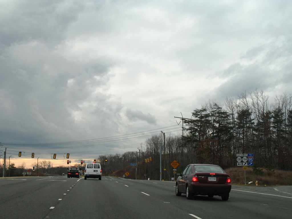 | Dale Boulevard (SR 784) constitutes a busy arterial route through suburban areas of Dale City northwest from U.S. 1 (Jefferson Davis Highway) to SR 642 (Hoadly Road) at Purcell Road. 12/26/06 |
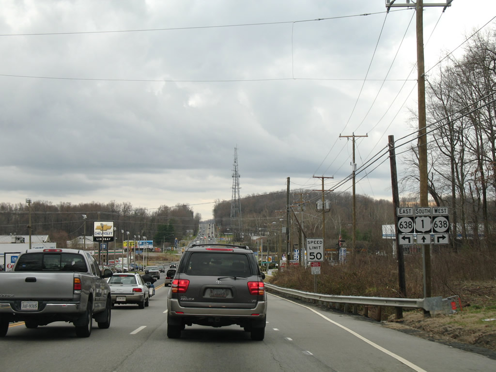 | SR 638 (Neabsco Mills Road north / Blackburn Road east) intersects U.S. 1 ahead of Neabsco Creek. 12/26/06 |
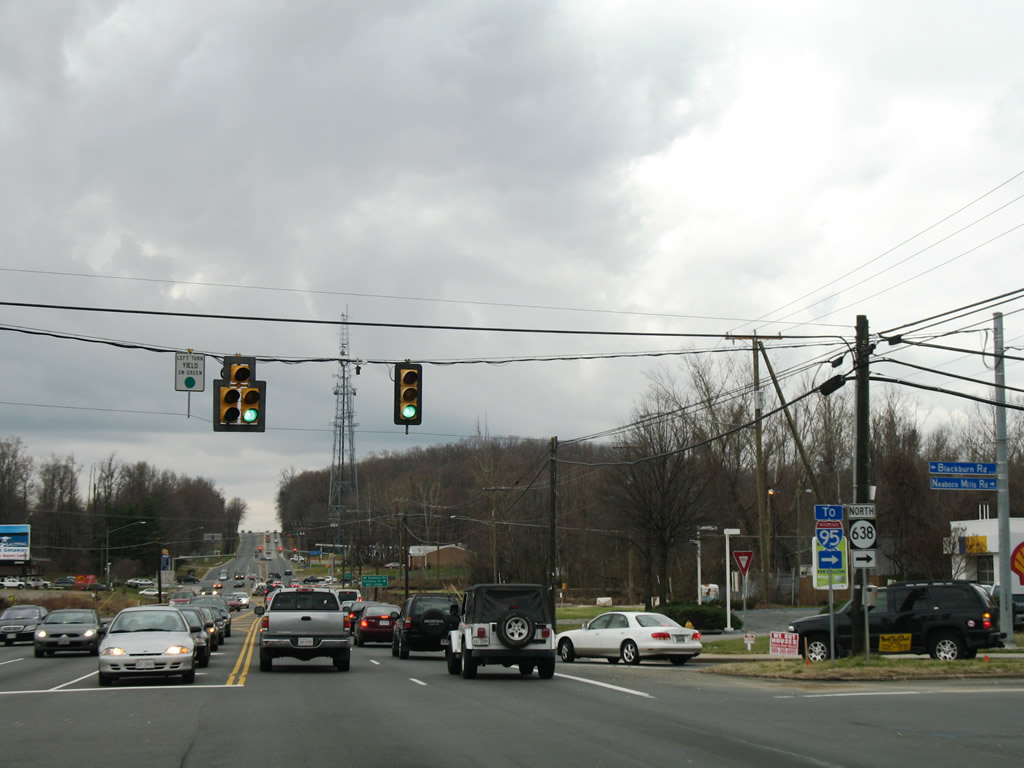 | SR 638 meanders southward from Marumsco Woods along Blackburn Road to U.S. 1 where the route turns northward back to Dale Boulevard and the Woodbridge campus of Northern Virginia Community College. 12/26/06 |
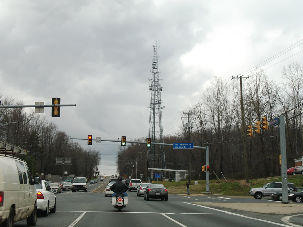 | Neabsco Road heads east from U.S. 1 (Jefferson Davis Highway) to Leesylvania State Park. Cardinal Drive continues SR 610 west to Minnieville. 12/26/06 |
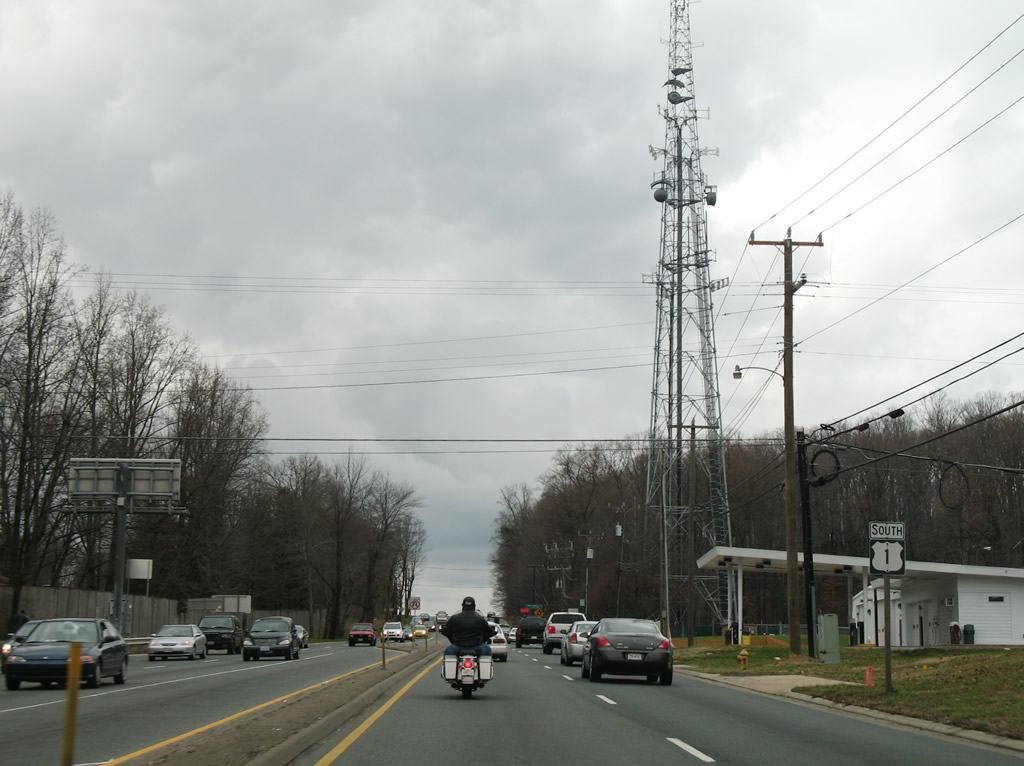 | U.S. 1 ascends from Cardinal Drive to Garfield Estates and a crossing of Powells Creek. 12/26/06 |
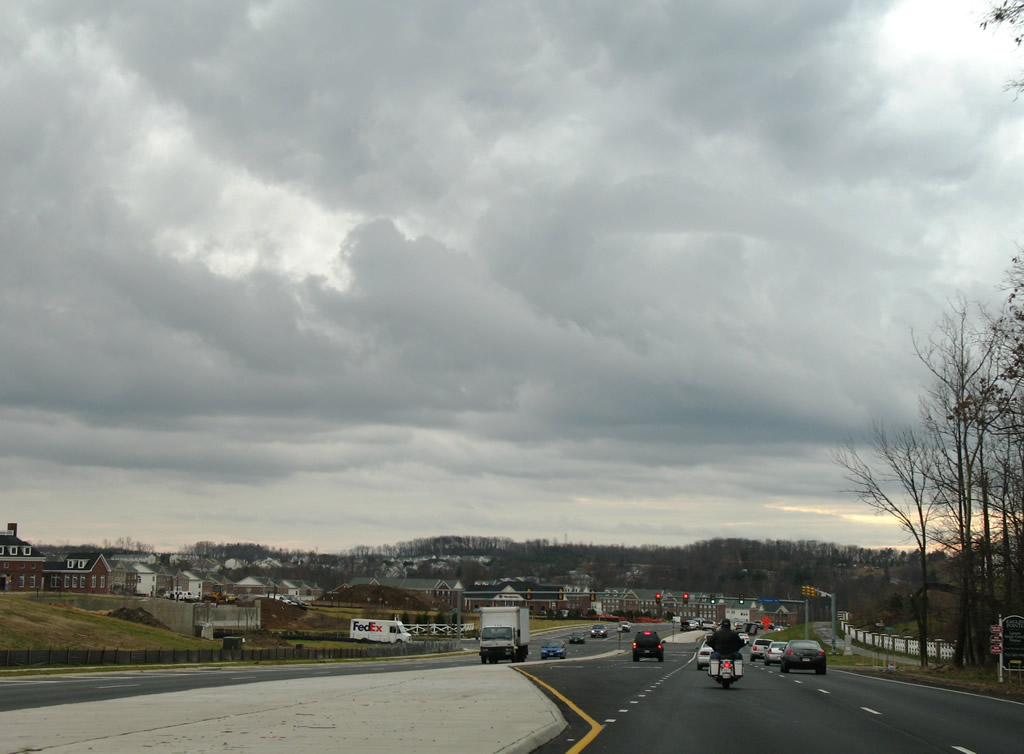 | Heavy development at the community of Port Potomac scours the hillsides above Powells Creek. Port Potomac Avenue stems east from U.S. 1 (Jefferson Davis Highway) as its main route. 12/26/06 |
 | Advancing toward the town of Dumfries, U.S. 1 approaches the south end of SR 234 (Dumfries Road). SR 234 follows a 34.37 mile long route from Dumfries to U.S. 15 at Catharpin. 12/26/06 |
 | SR 234 heads from U.S. 1 directly into the exchange (Exit 152) with Interstate 95. The state route travels northwest to Prince William Forest Park, Independent Hill and Manassas. 12/26/06 |
 | U.S. 1 proceeds south from SR 619 (Joplin Road) into a forested stretch of Quantico U.S. Marine Corps Reservation. 12/26/06 |
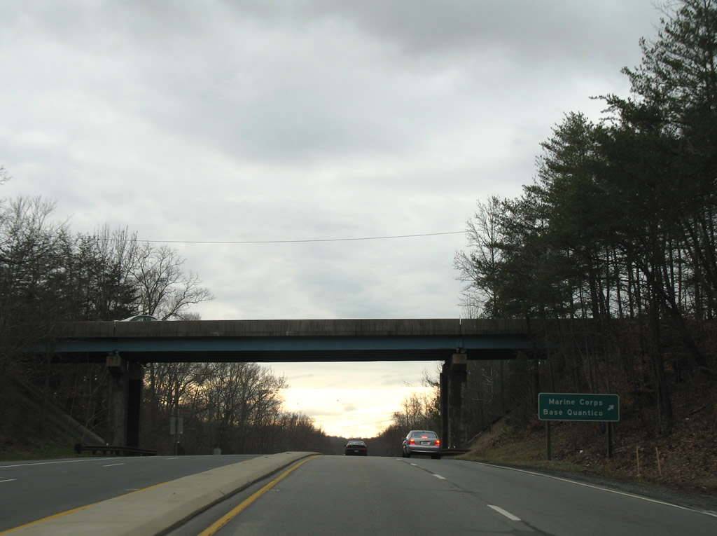 | Russell Road meets U.S. 1 (Jefferson Davis Highway) at a grade separated intersection east of I-95 at Exit 148 and west of a gate into Marine Corps Base Quantico. 12/26/06 |
 | Chopawamsic Creek separates Prince William and Stafford Counties across U.S. 1. U.S. 1 reaches the Stafford County seat seven miles south of Russell Road. 12/26/06 |
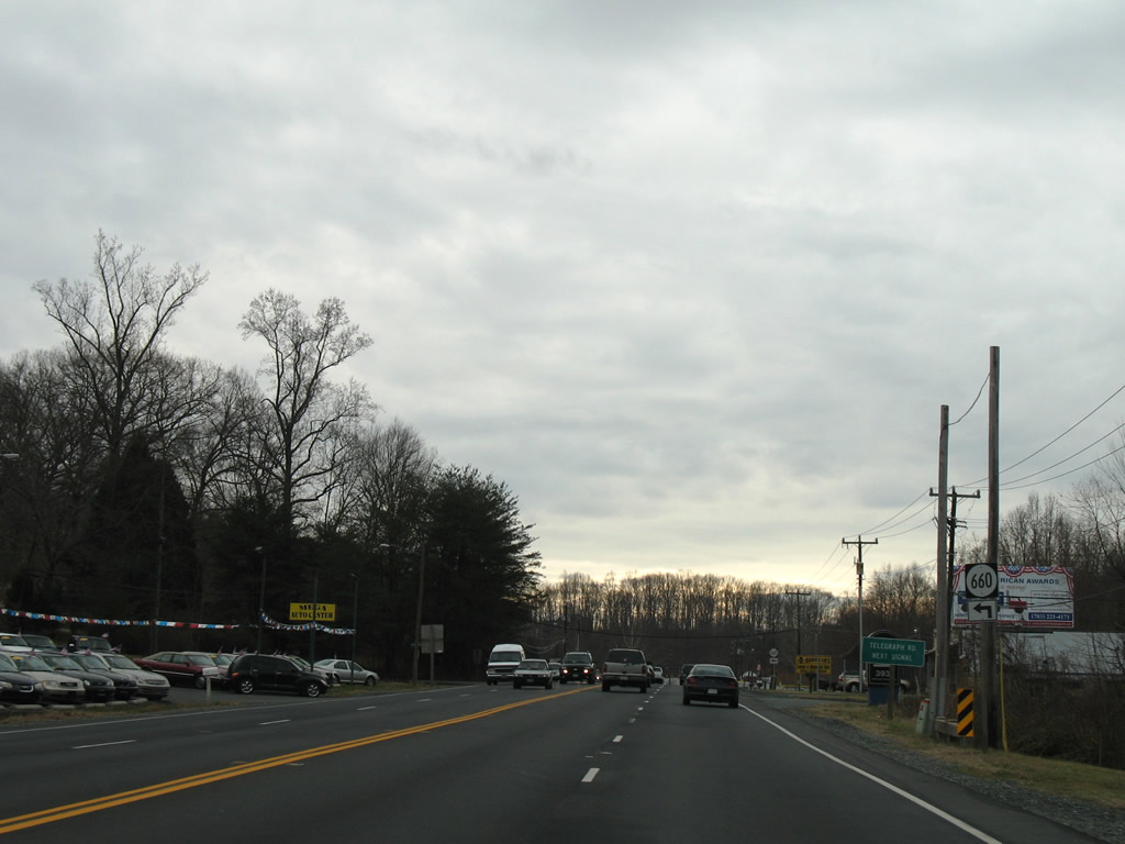  | SR 660 (George Mason Road) arcs northeast from U.S. 1 (Jefferson Davis Highway) to an industrial area south of the Chopawamsic Creek. 12/26/06 |
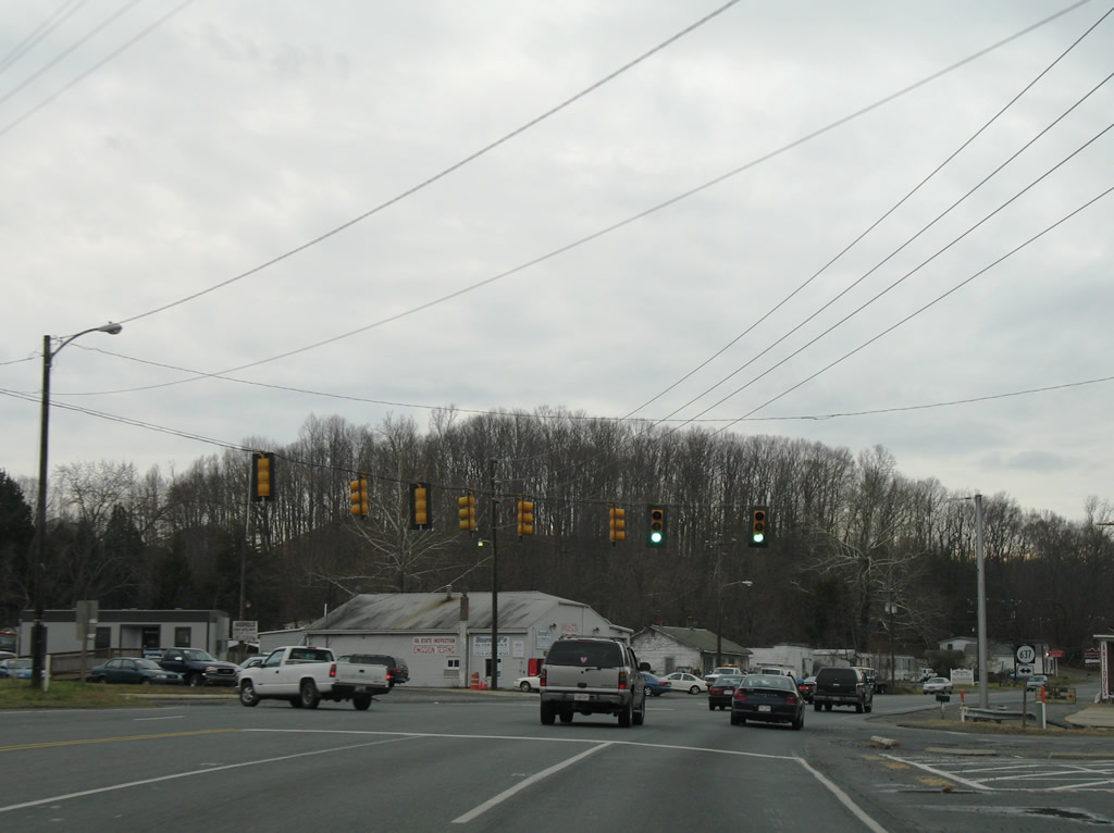
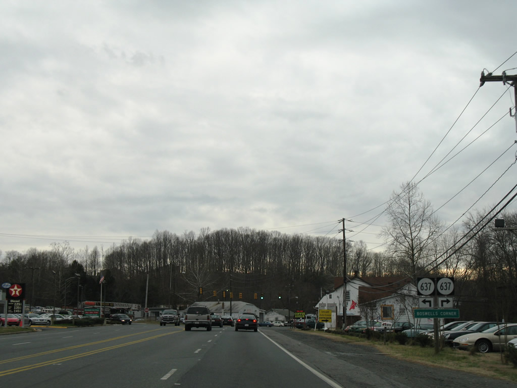 | SR 637 (Telegraph Road) meets U.S. 1 at Boswells Store. SR 637 parallels U.S. 1 south through Midway Island and Aquia. 12/26/06 |
 | Westward from U.S. 1, SR 637 (Telegraph Road) crosses I-95 to Camp Barrett Road; Camp Barrett Road leads to Russell Road within Marine Corps Base Quantico. 12/26/06 |
 | A cloverleaf interchange joins Interstate 95 with SR 610 (Garrisonville Road) and U.S. 1 (Jefferson Davis Highway) at Aquia Harbour. 12/26/06 |
  | The entrance ramp to Interstate 95 north for Washington, DC departs from U.S. 1 directly. 12/26/06 |
 | The southbound ramp to Interstate 95 for Fredericksburg and Richmond is located on SR 610 (Garrisonville Road) north. 12/26/06 |
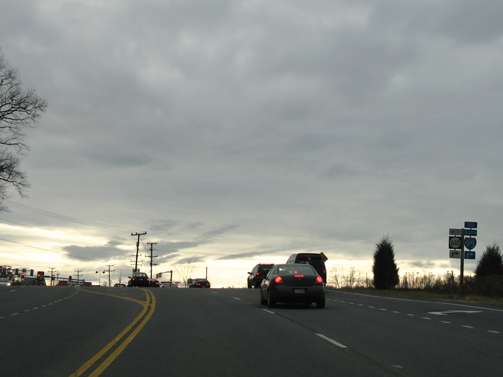
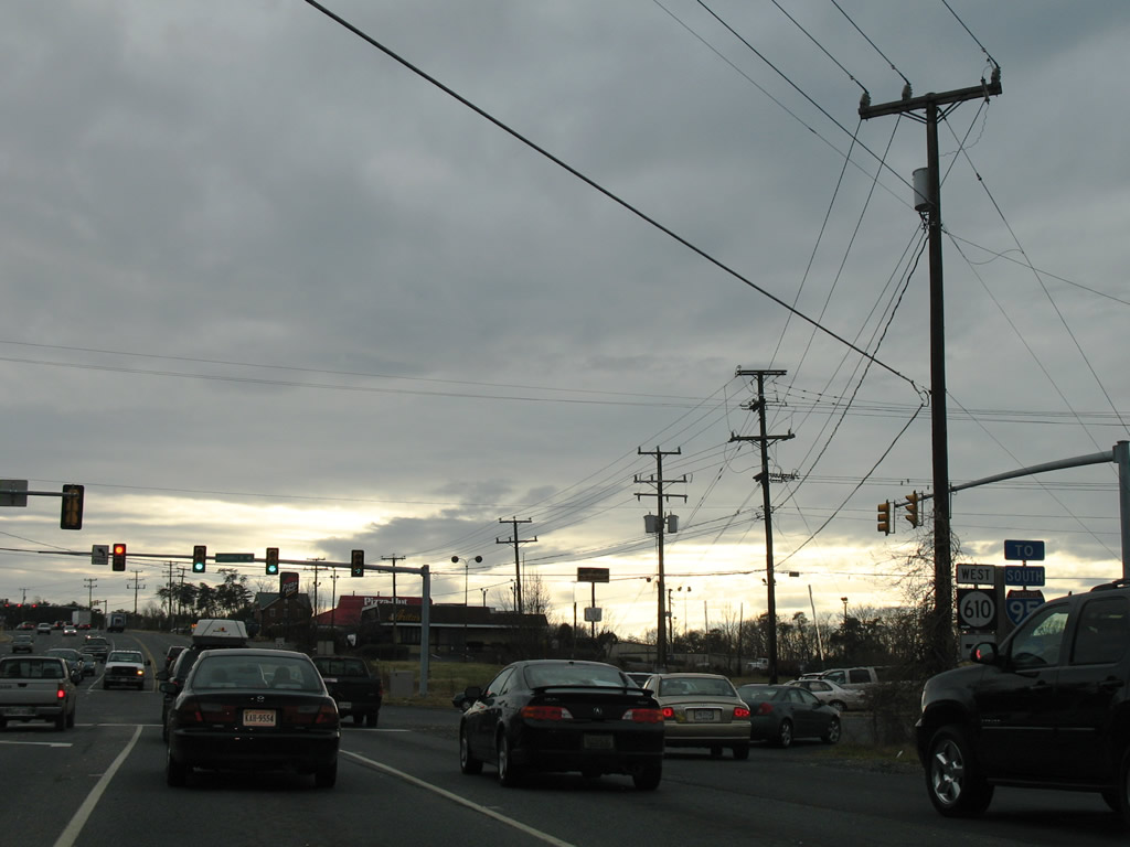 | Leading northwest from U.S. 1 and Washington Drive, SR 610 constitutes a commercial arterial to Garrisonville. SR 610 overall links Aquia Harbour with Somerville and Midland (SR 28). 07/09/10 |
 | Entering Stafford, U.S. 1 intersects SR 687 (Hope Road) east and SR 631 (Bells Hill Road) south. 12/26/06 |
 | SR 630 follows Courthouse Road west to a DDI (Exit 140) with Interstate 95 and east to a rural area north of Brooke. 12/26/06 |
 | Courthouse Road leads northwest from U.S. 1 (Jefferson Davis Highway) and Stafford to SR 648 (Shelton Shop Road) near Moores Corner. 12/26/06 |
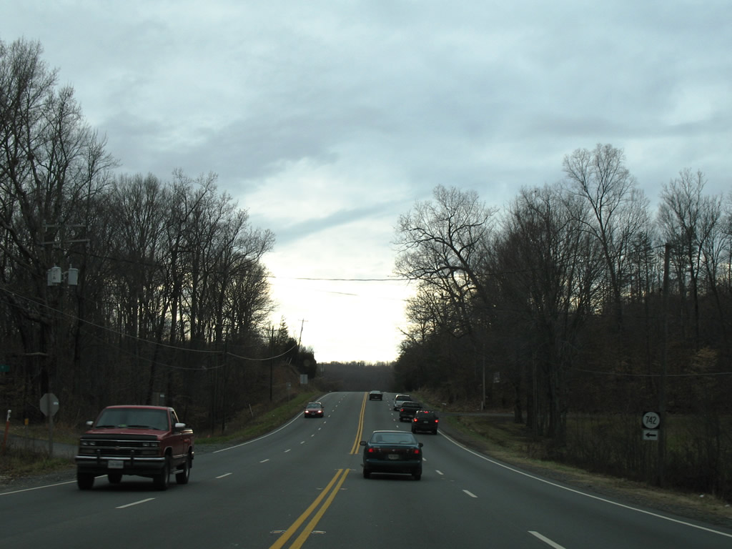 | Jumping Branch Road (SR 742) spurs into a rural area east of U.S. 1 near Accokeek Creek. 12/26/06 |
 | SR 628 (Ramoth Church Road) runs northwest from U.S. 1 (Jefferson Davis Highway) to Centreport Parkway (SR 8900) / Stafford Regional Airport (RMN) and Ramoth, and east to SR 608 (Brooke Road) south of Brooke. 12/26/06 |
 | U.S. 1 south of SR 628 and Eskimo Hill Road. 12/26/06 |
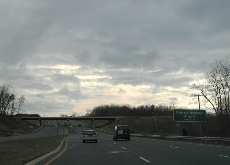 | SR 8900 (Centreport Parkway) links U.S. 1 with Interstate 95 (Exit 136) and Stafford Regional Airport (RMN). 12/26/06 |
 | SR 8900 (Centreport Parkway) stems east from a grade separated intersection with U.S. 1 to a diamond interchange with Interstate 95. 12/26/06 |
 | SR 8900 (Centreport Parkway) arcs north from Interstate 95 to SR 627 (Mountain View Road) and Stafford Regional Airport (RMN). 12/26/06 |
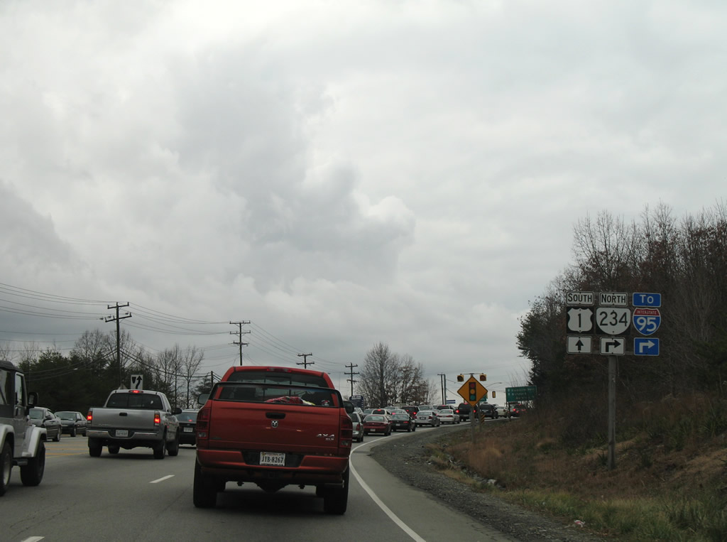
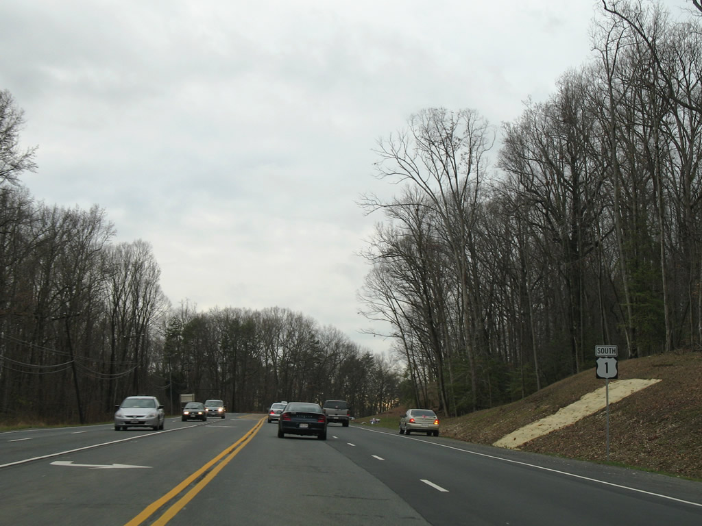
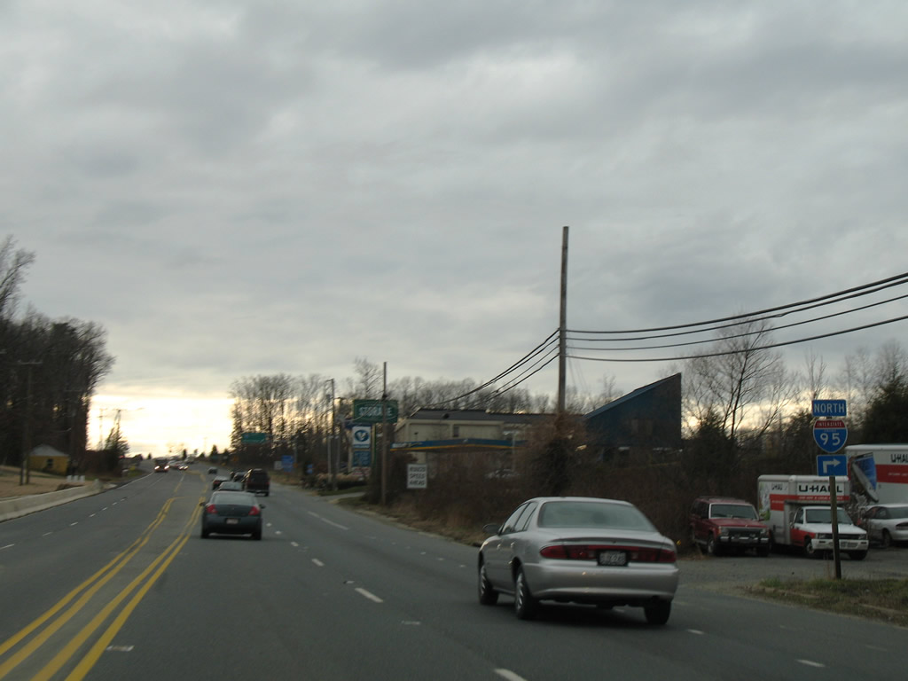
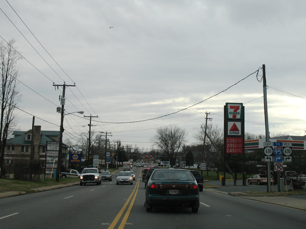
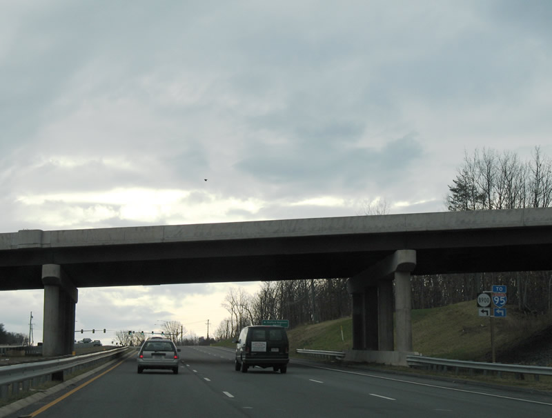
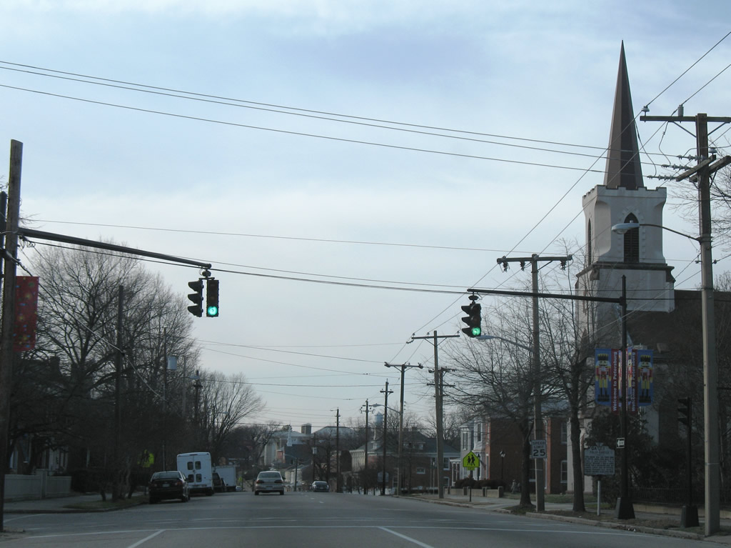
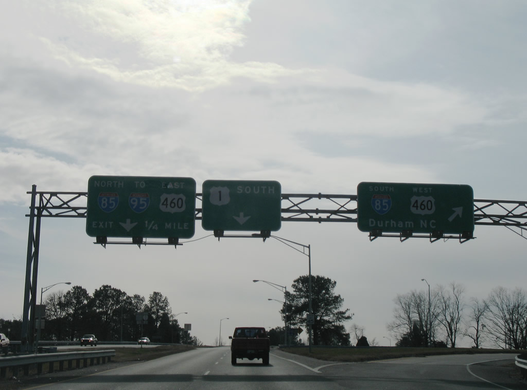
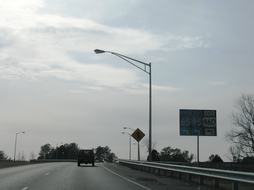
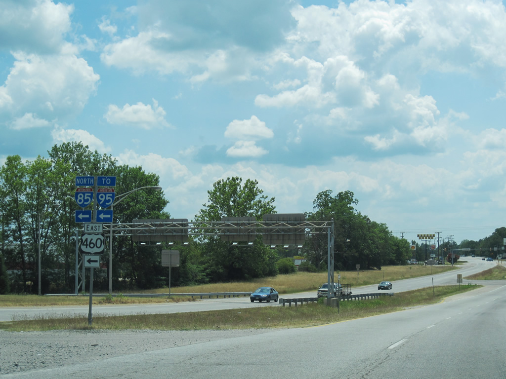
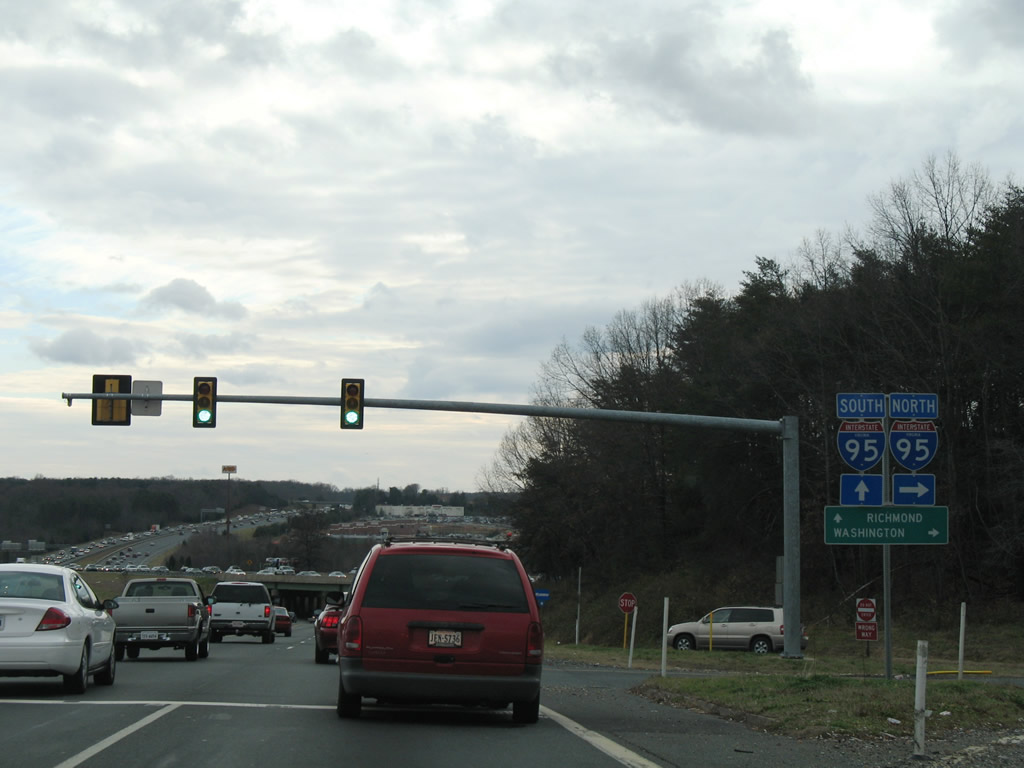 | U.S. 1 (Jefferson Davis Highway) south at the entrance ramp for I-95/U.S. 17 north outside the city of Frederick. I-95/U.S. 17 overlap from Exit 126 here to Exit 133 west of Falmouth. 12/26/06 |
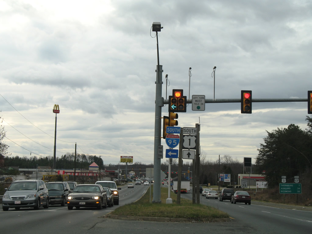 | U.S. 1/17 overlap 1.19 miles south from I-95 to Mills Drive. I-95 south continues independent of both highways to Richmond. 12/26/06 |
| South |
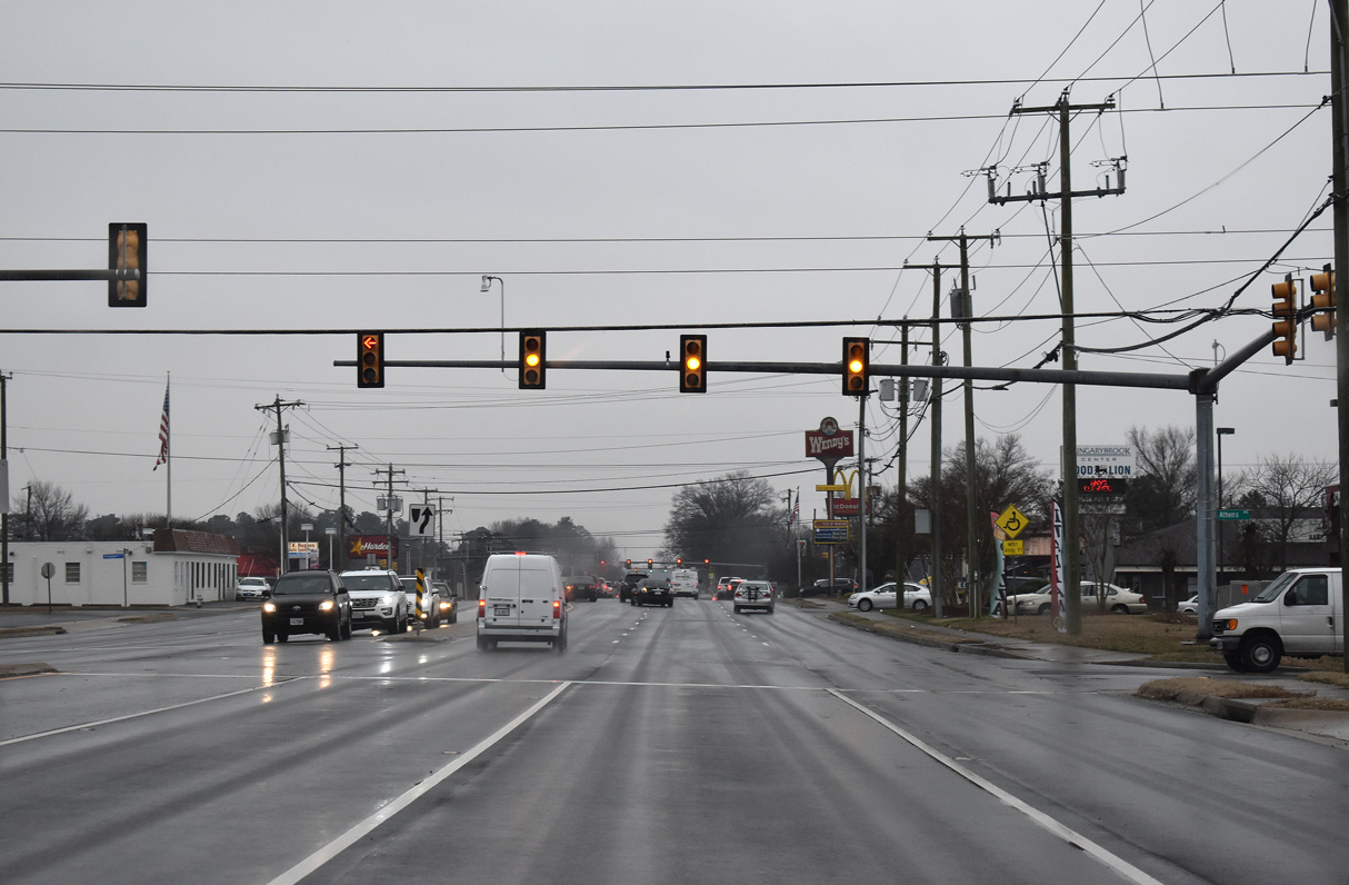 | U.S. 1 (Brook Road) south at Athens Avenue in Glen Allen. 01/04/19 |
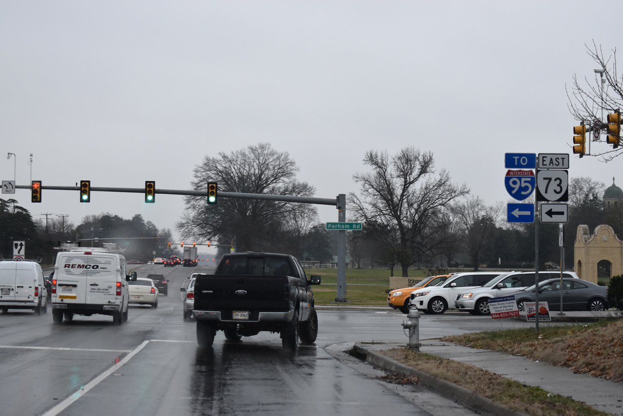 | Parham Road 0.78 miles east from U.S. 1 (Brook Road) to Interstate 95 is Virginia Route 73. 01/04/19 |
 | U.S. 1 (Brook Road) continues south from SR 73 (Parham Road) by North Park shopping center. 01/04/19 |
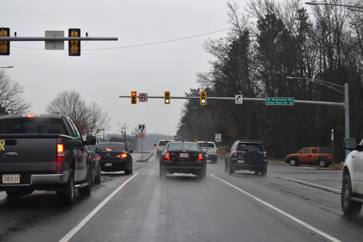 | Wilkinson Road arcs 3.31 miles southeast from U.S. 1 at Villa Park Drive to Chamberlayne and Azalea Avenue near Richmond Raceway. 01/04/19 |
 | Lakeside Avenue stems west from U.S. 1 (Brook Road) to Lewis Ginter Botanical Gardens and SR 356 (Hilliard Road) at SR 161. 01/04/19 |
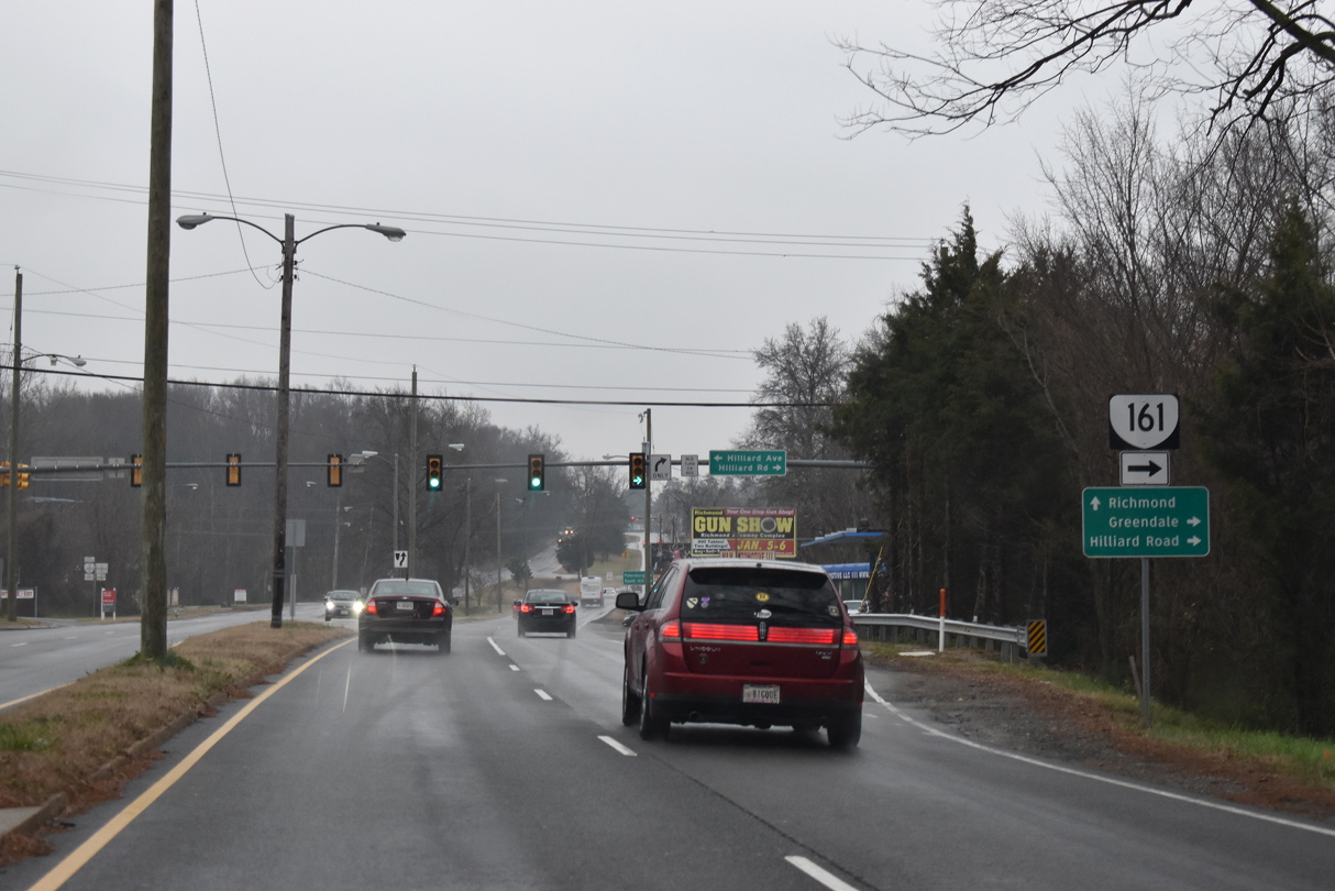 | U.S. 1 meets the north end of SR 161 (Hilliard Road) at Hilliard Avenue. SR 161 runs 14.04 miles south through Richmond, across the Boulevard Toll Bridge over the James River, to I-95 at Exit 69. 01/04/19 |
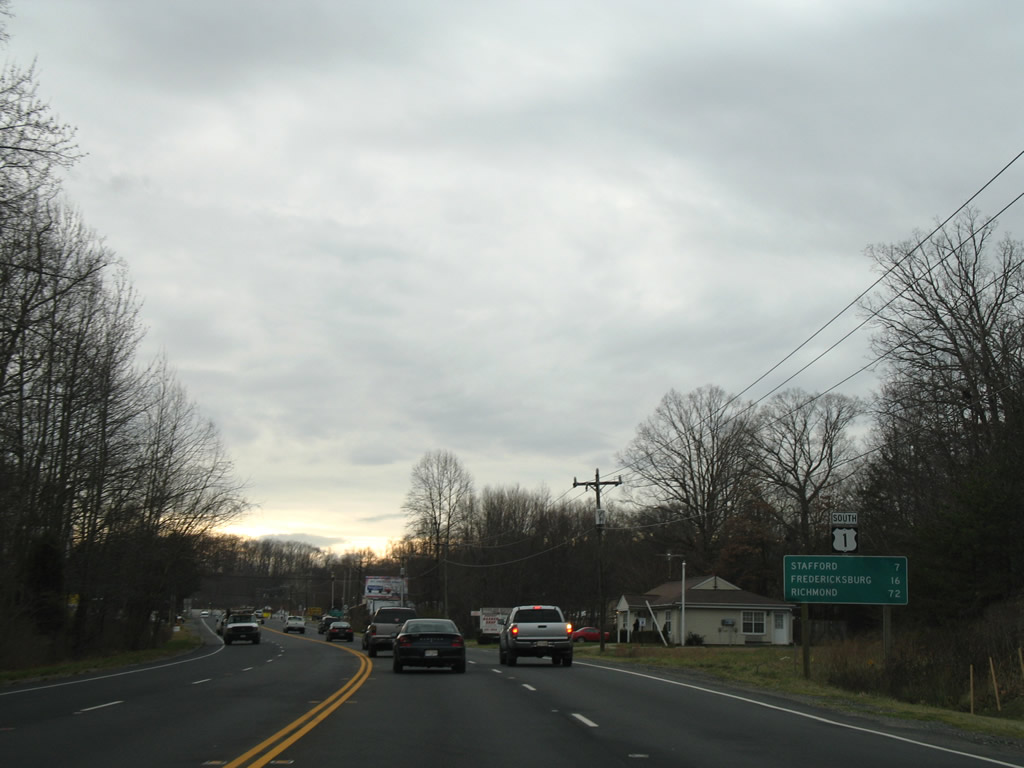
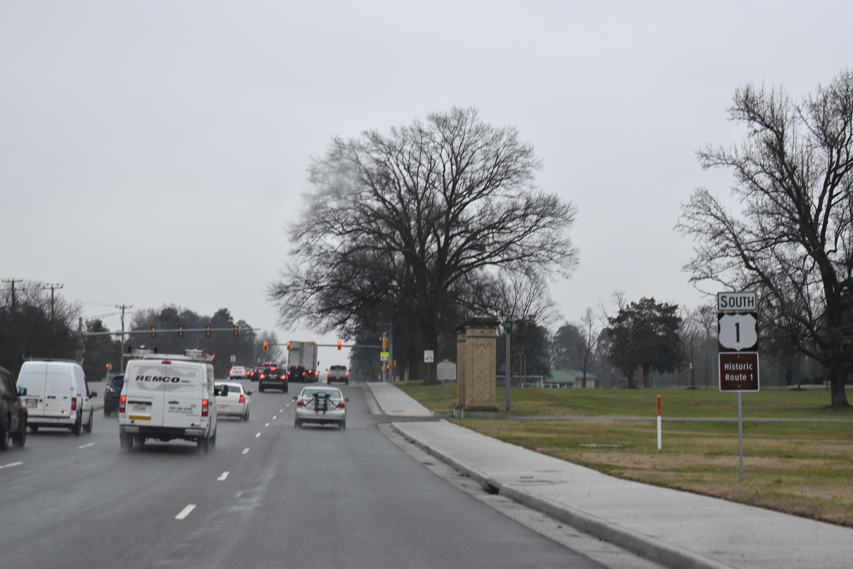
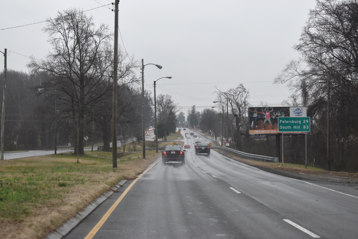 | Continuing south from SR 161, U.S. 1 crosses Upham Brook. Beyond Richmond, U.S. 1 reaches Petersburg in 29 miles and South Hill at U.S. 58 in 83 miles. 01/04/19 |
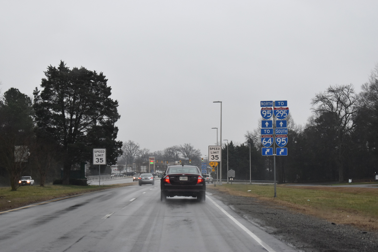 | Passing Brook Run Shopping Center, U.S. 1 (Brook Road) converges with Interstate 95. 01/04/19 |
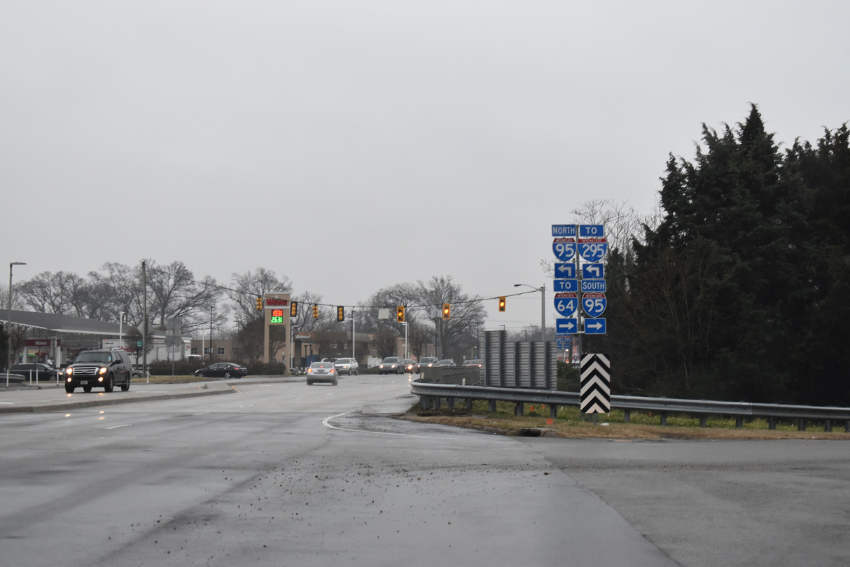 | The southbound entrance ramp to I-95 joins the freeway leading to the exchange with I-64 west and I-195 (Beltine Expressway) south. Wilmer Avenue east to U.S. 301 north connects with I-95 northbound. 01/04/19 |
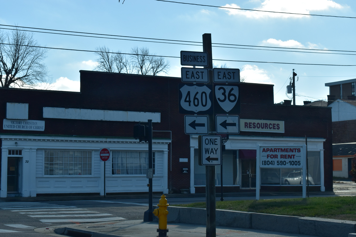
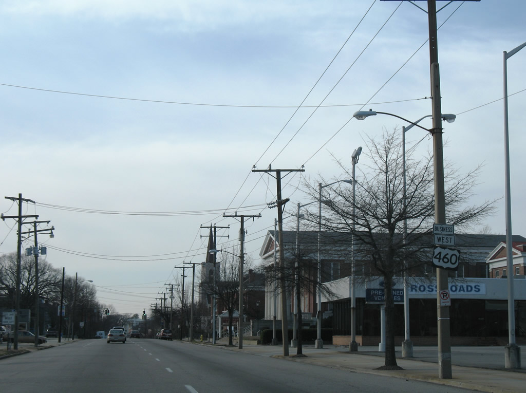
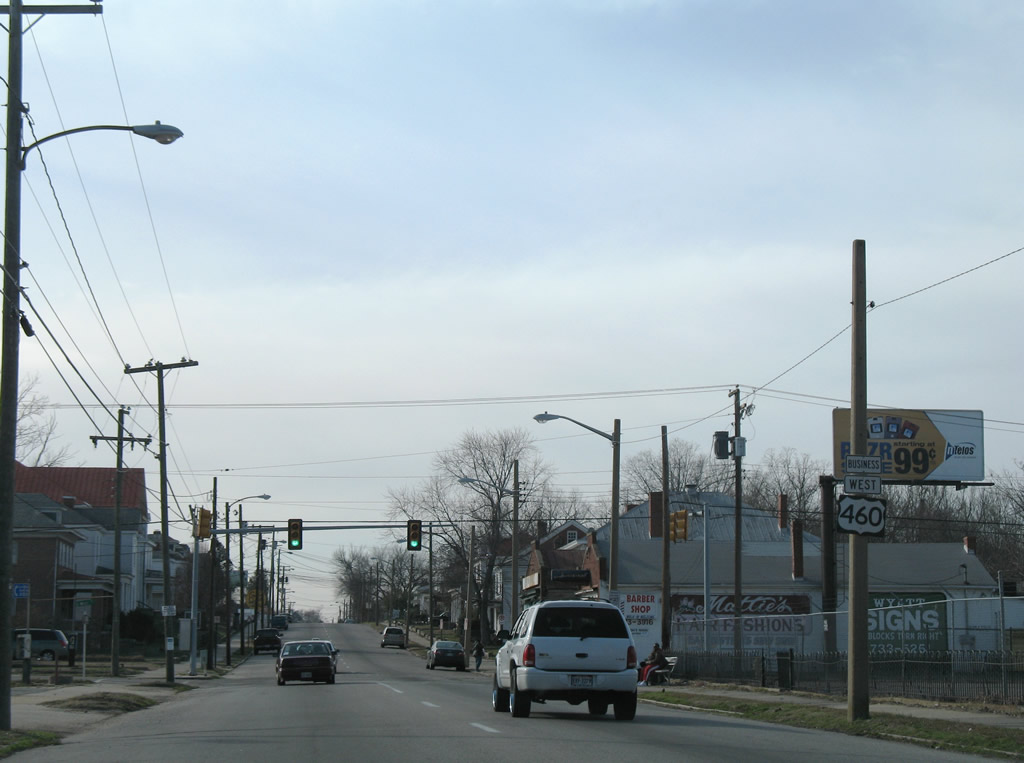
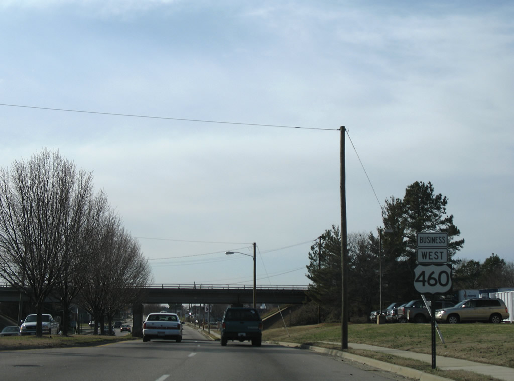
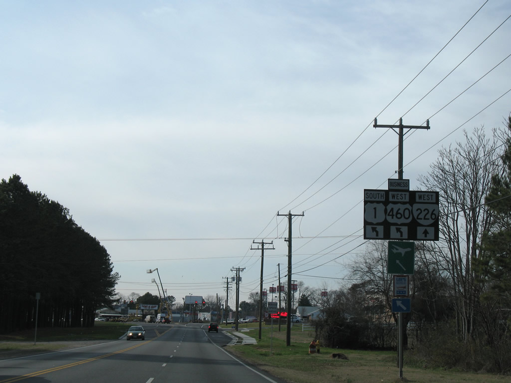
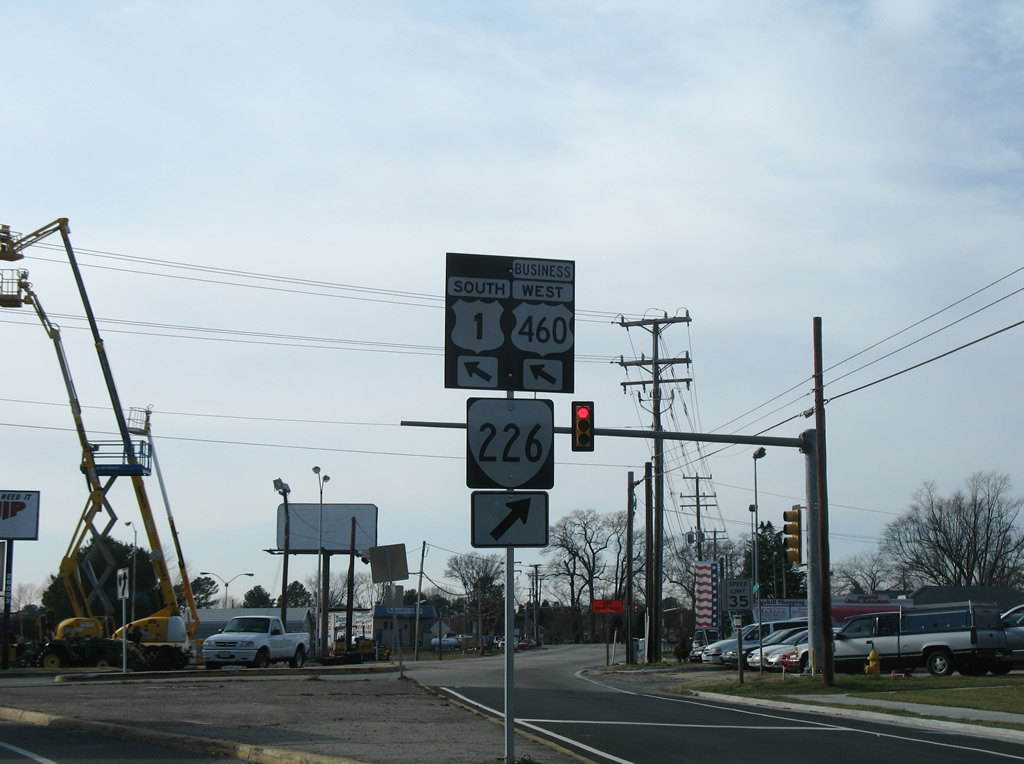
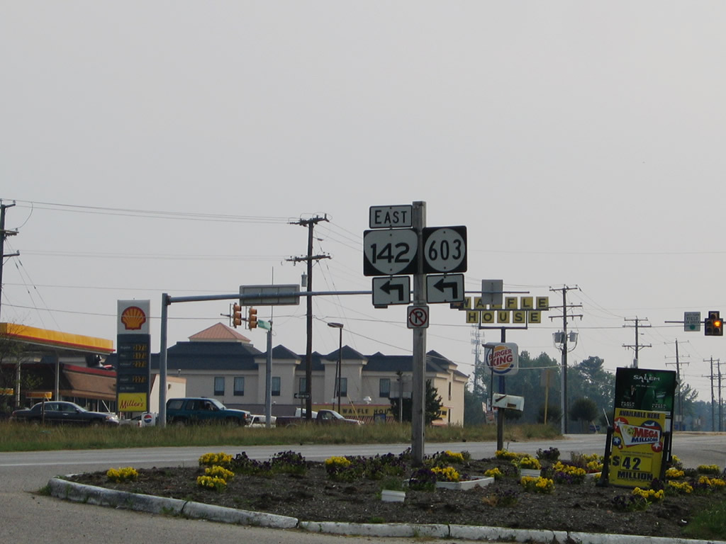
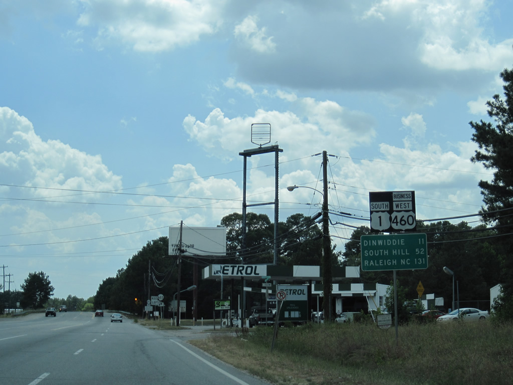
 | Southbound U.S. 1 combines with U.S. 460 Business west along Washington Street at Downtown Petersburg. Adams Street extends 0.10 miles south to connect U.S. 1 with U.S. 460 Business east on Wythe Street. 12/17/20 |
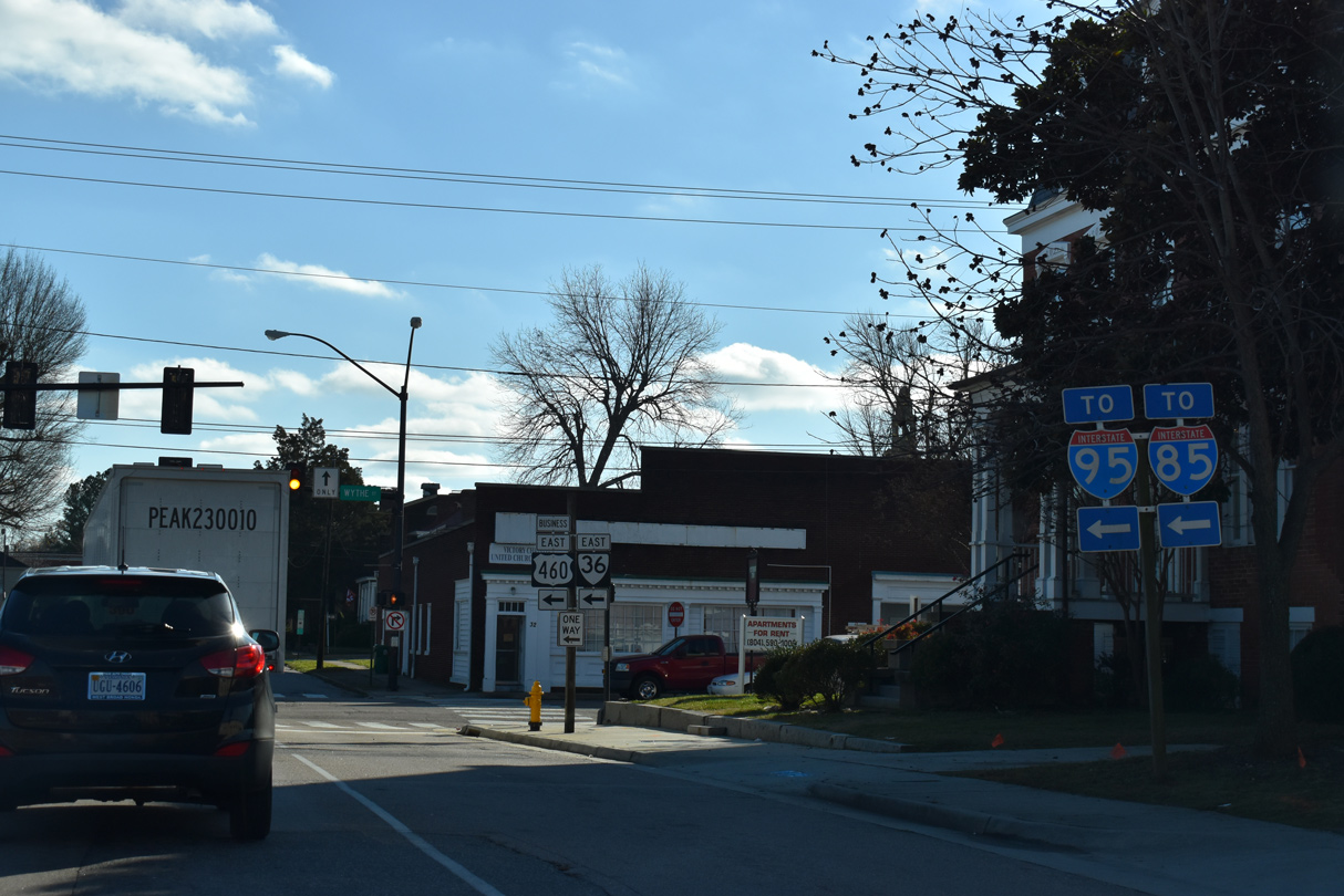 | U.S. 460 Business (Wythe Street) heads 0.34 miles east from Adams Street to Interstate 95. I-85 splits with I-95 south from there. 12/17/20 |
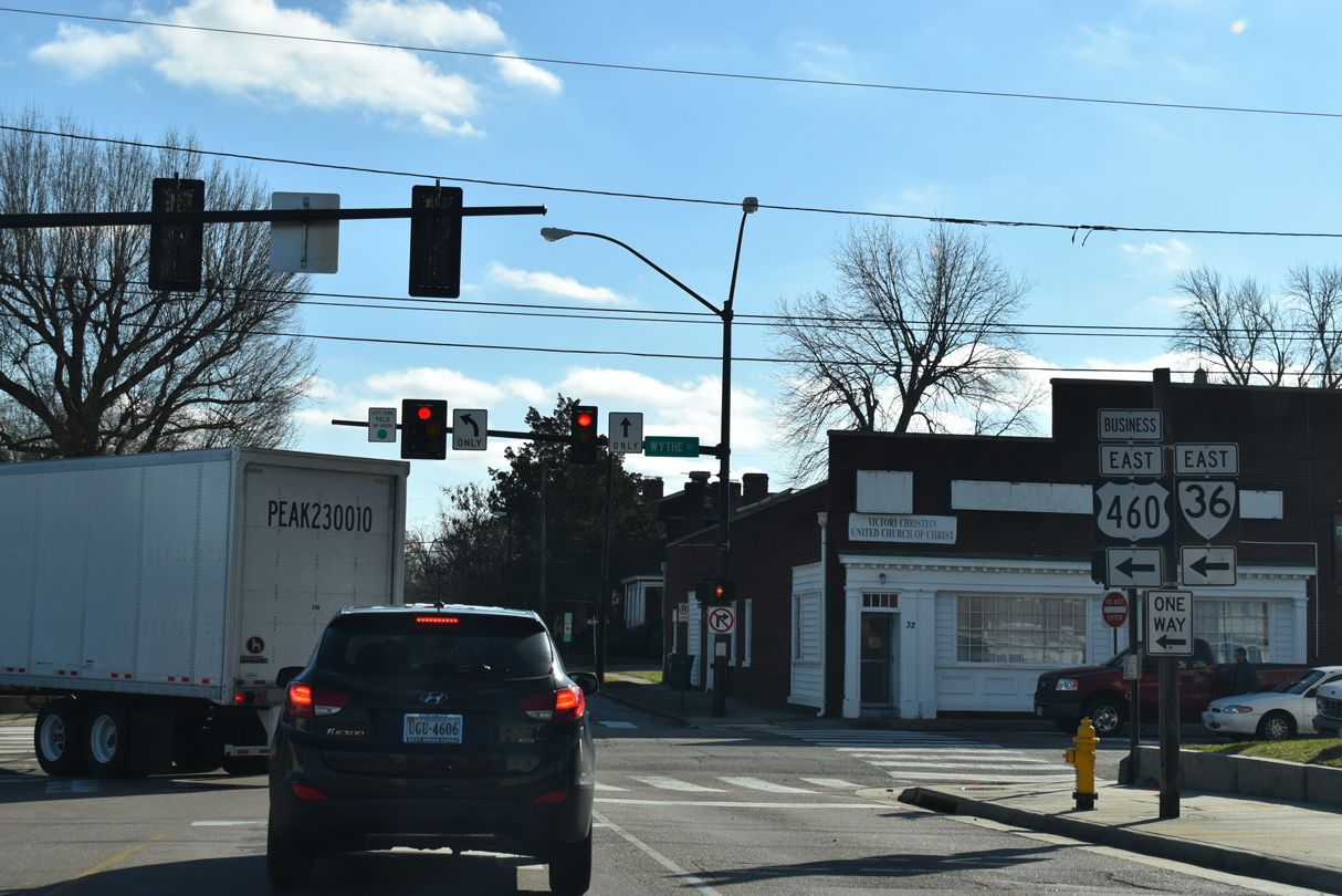 | SR 36 joins Wythe Street east from U.S. 301 (Crater Road) beyond I-95 en route to Fort Lee and Hopewell. 12/17/20 |
| South |
 | SR 36 joins Wythe Street east from U.S. 301 (Crater Road) beyond I-95 en route to Fort Lee and Hopewell. 12/17/20 |
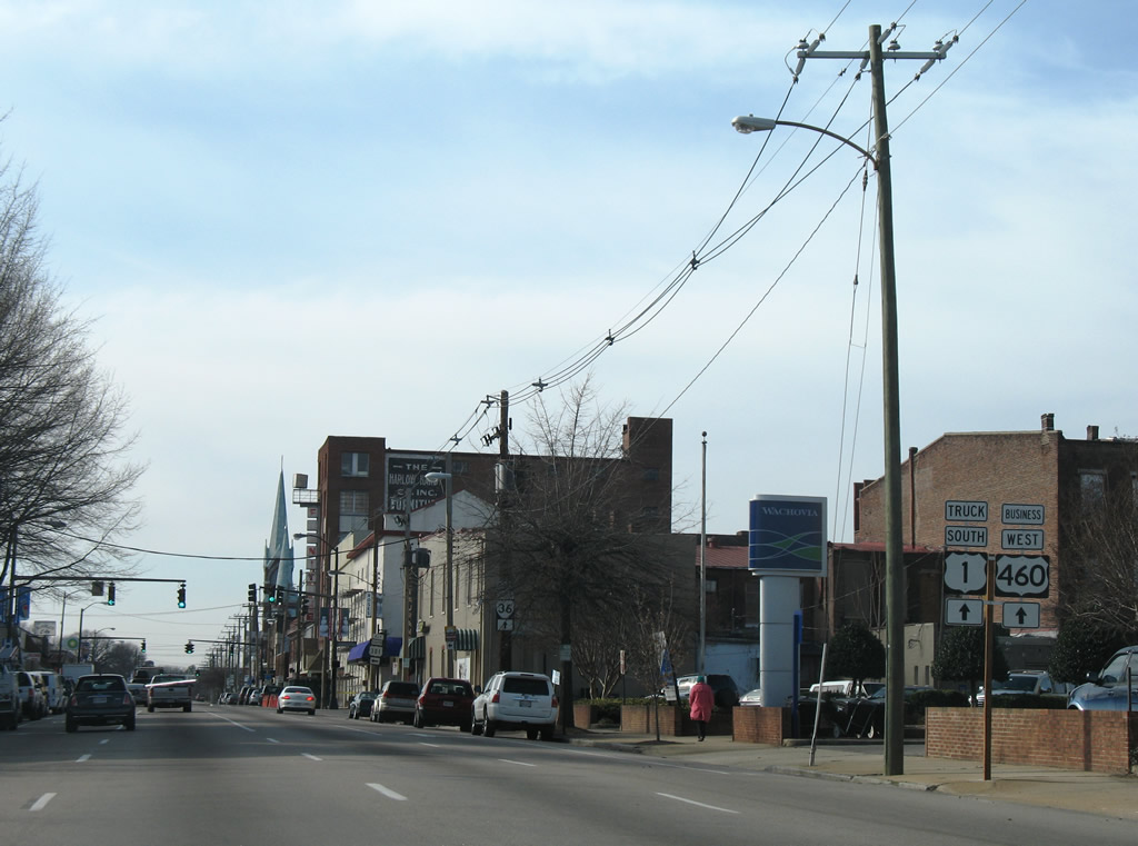 | Southbound U.S. 1 combines with U.S. 460 Business (Washington Street) west from Adams Street. 01/02/08 |
 | Washington Street also represents SR 36 Truck west to South Street. 01/02/08 |
 | U.S. 301 ALT runs 2.32 miles south along Sycamore Street from U.S. 1/460 Business (Washington Street) to Central Park and U.S. 301 (Crater Road) in south Petersburg. 01/02/08 |
 | U.S. 1/460 Business (Washington Street) west at Union Street. Union Street connects with Halifax Street (SR 975) southwest to SR 142 (Boydton Plank Road). 01/02/08 |
 | Washington Street west at Market Street. 01/02/08 |
 | The reassurance marker for U.S. 460 Business posted after Market Street was removed during construction of the Petersburg Public Library at the site of the Crossroads Ford car dealership. 01/02/08 |
 | U.S. 1/460 Business (Washington Street) west at Perry Street. 01/02/08 |
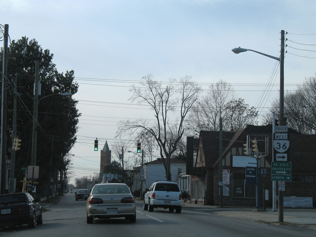 | The truck route for SR 36 lines South Street north to Canal Street. SR 36 (Fleet Street) crosses the Appomatttox River to Virginia State University and the community of Ettrick. 01/02/08 |
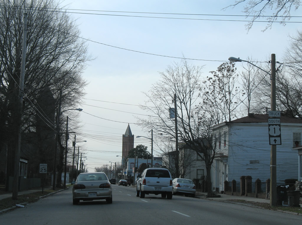 | U.S. 1 Truck shield posted after South Street. 01/02/08 |
 | West Street (SR 1100) heads 1.57 miles south from U.S. 1/460 Business (Washington Street) to Halifax Street (SR 975) and six blocks north into the Batterson neighborhood. 01/02/08 |
 | The one way couplet for U.S. 1/460 Business along Wythe Street east and Washington Street west converges at Atlantic Street. 01/02/08 |
 | U.S. 1/460 Business (Washington Street) passes under a CSX Railroad line beyond Atlantic Street. The route follows an industrial boulevard west toward the Kennelworth section of the city. 01/02/08 |
 | Traffic lights along U.S. 1/460 Business (Washington Street) at Elm Street were removed after 2014. 01/02/08 |
 | U.S. 1/460 Business leave city of Petersburg across the Dinwiddie County line west of Rawlings lane and Rohoic Creek. 01/02/08 |
 | SR 226 (Cox Road) branches 3.38 miles west from U.S. 1/460 Business (Boydton Plank Road) to U.S. 460 (Airport Street) near Dinwiddie County Airport (PTB). 01/02/08 |
 | A roundabout joins SR 226 (Cox Road) with SR 600 (Ferndale Road) north to Matoaca nearby. 01/02/08 |
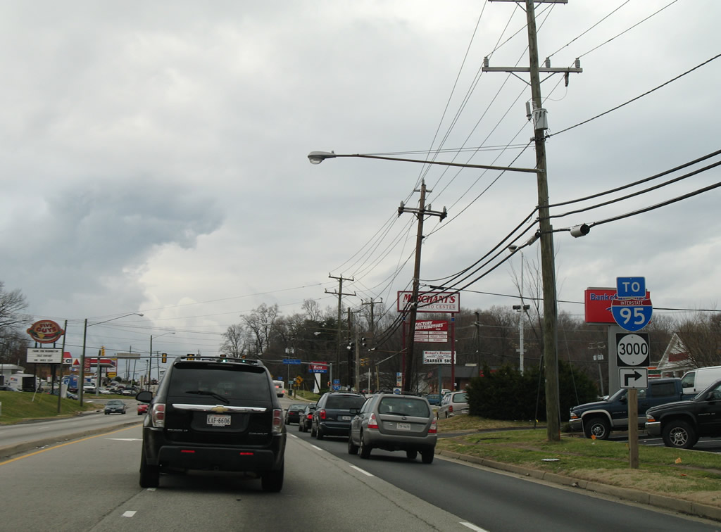
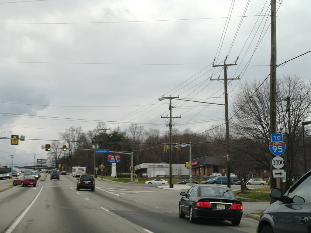
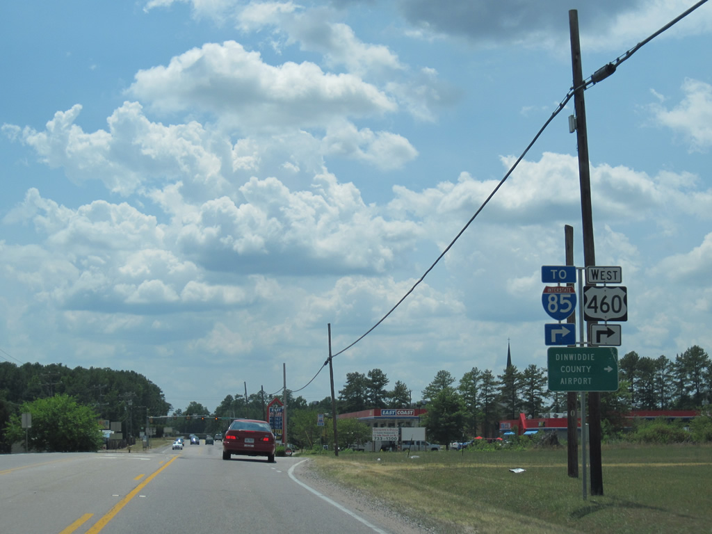
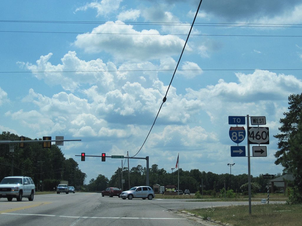
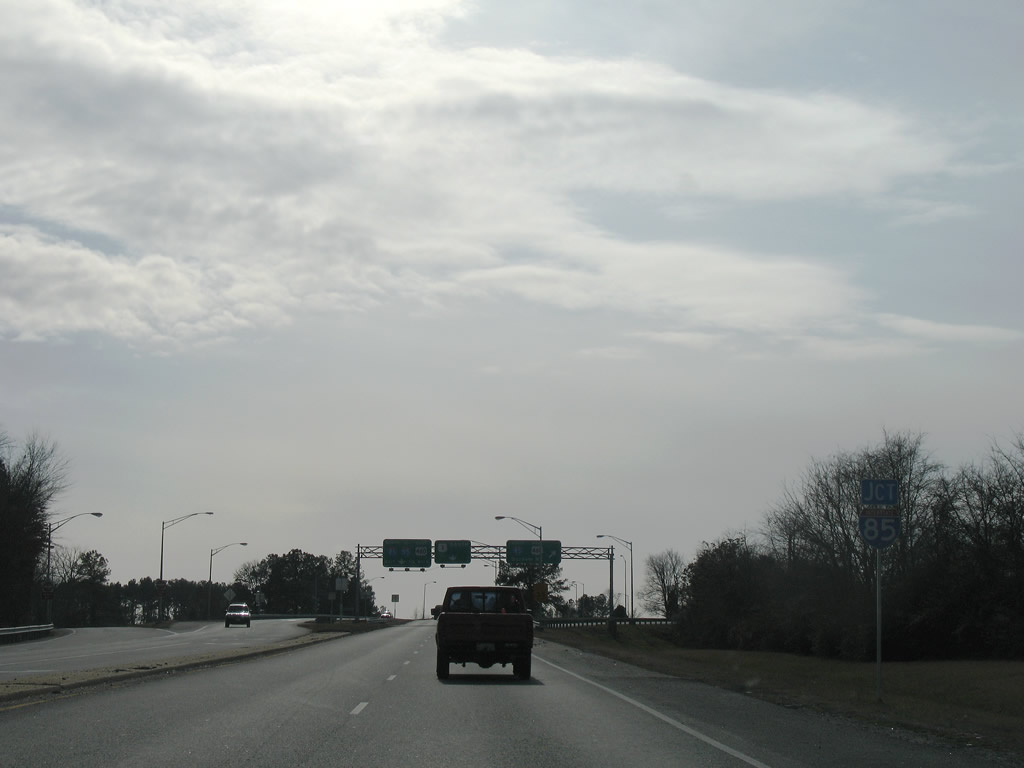 | A six-ramp parclo interchange (Exit 63) joins U.S. 1/460 Business with I-85/U.S. 460. 01/02/08 |
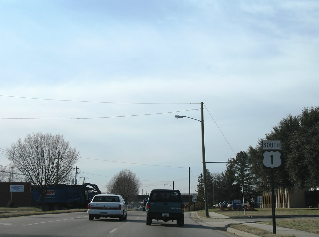
 | I-85/U.S. 460 bypass U.S. 1/460 Business (Boydton Plank Road) southwest to Airport Road. Continuing south, U.S. 1 parallels Interstate 85 to South Hill. 01/02/08 |
  | I-85/U.S. 460 overlap east 4.6 miles to Interstate 95 in Petersburg. U.S. 460 turns southeast from there to Wagner Drive en route to Hampton Roads. 01/02/08, 07/09/10 |
 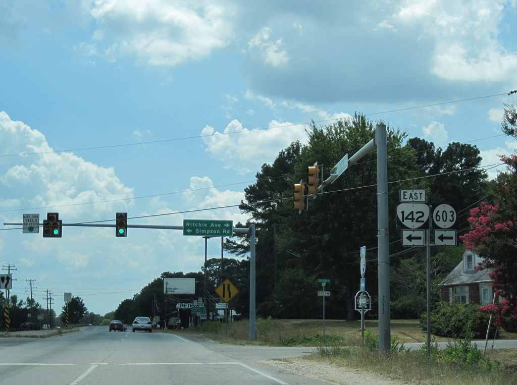 | SR 142 constitutes a 2.73 mile long route along Simpson and Boydton Plank Roads from U.S. 1/460 Business to a point just east of Halifax Road in Petersburg. 08/31/09, 07/09/10 |
 | U.S. 1/460 Business (Boydton Plank Road) continue another 1.4 miles southwest from SR 142 (Simpson Road) to Airport Street. 07/09/10 |
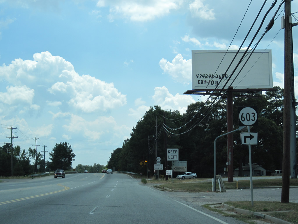 | SR 603 follows Sterling Road 1.68 miles northwest to SR 226 (Cox Road). 07/09/10 |
 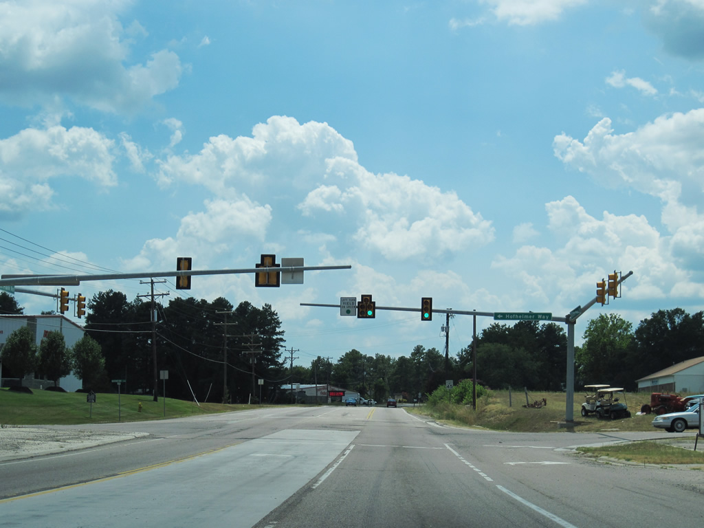 | Hofheimer Way arcs southeast from Boydton Plank Road to SR 623 (Church Road) and the Virginia Steel Mill. 07/09/10 |
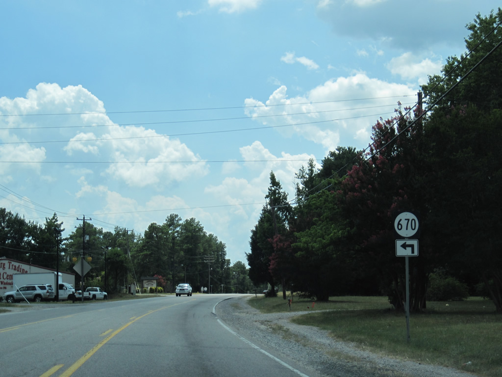 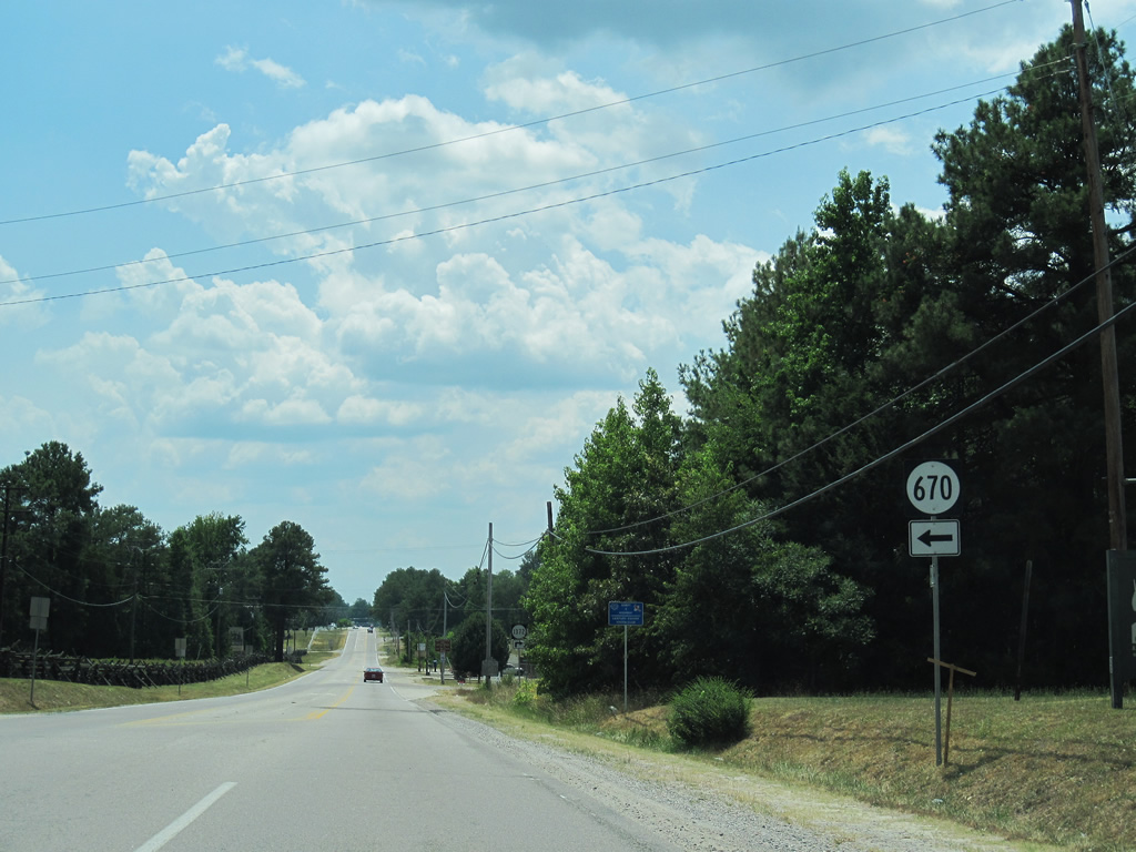 | SR 670 (Duncan Road) stems south from U.S. 1/460 Business (Boydton Plank Road) to Pamplin Historical Park and SR 613 (Duncan Road) 07/09/10 |
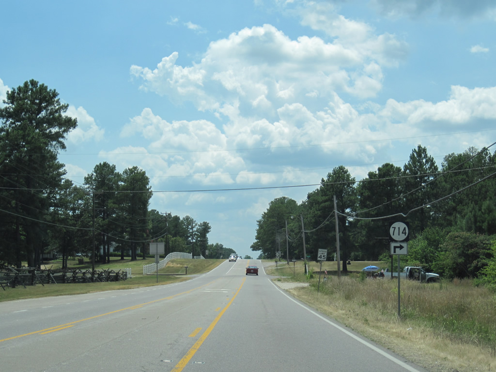 | Lewis Road (SR 714) constitutes a residential street spurring north from U.S. 1/460 Business. 07/09/10 |
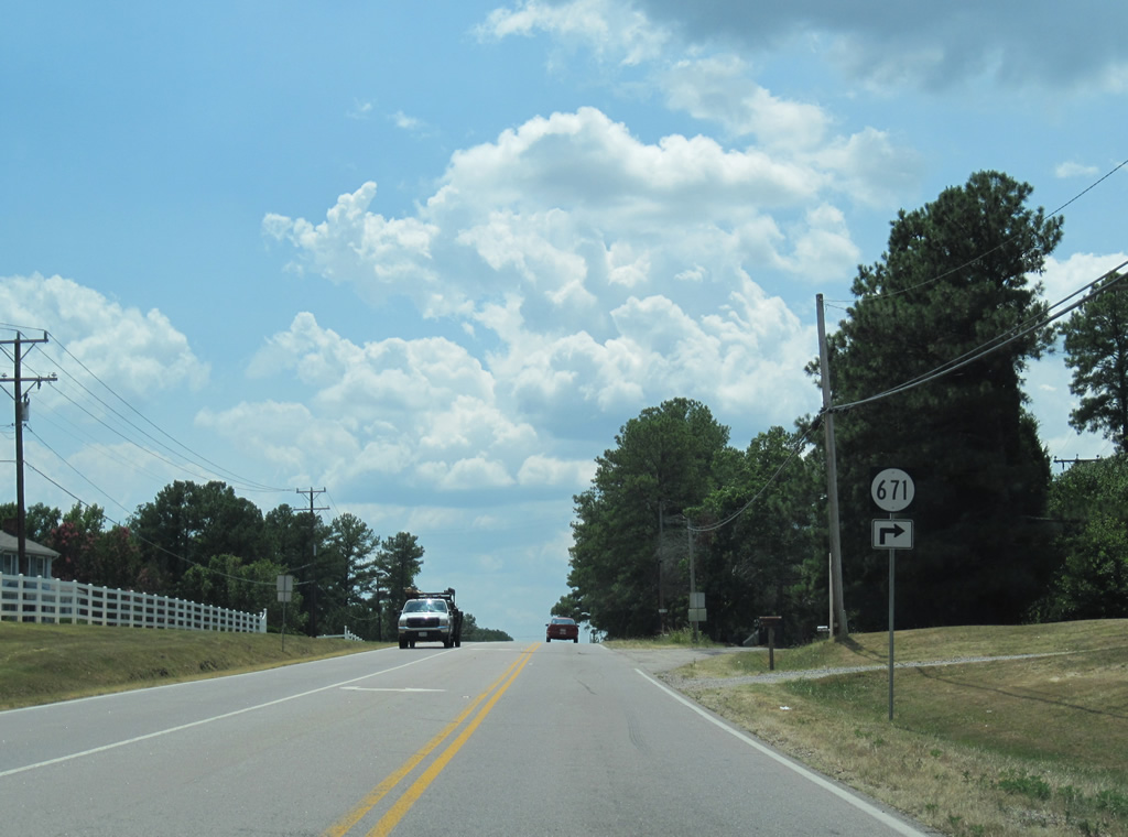 | A short spur west of SR 714, SR 671 (Brownwall Road) represents a former alignment of U.S. 1. 07/09/10 |
 | U.S. 460 Business parts ways with U.S. 1 (Boydton Plank Road) along Airport Street north an the adjacent exchange with I-85/U.S. 460. 07/09/10 |
 | U.S. 460 overtakes Airport Street en route to Dinwiddie County Airport (PTB) and Sutherland. U.S. 1 shifts to the west side of I-85 nine miles southwest to Dinwiddie. 07/09/10 |
Connect with:
Interstate 85
Interstate 95
Interstate 295
Interstate 495 / Capital Beltway
U.S. 17
U.S. 58
U.S. 301
U.S. 360
U.S. 460
State Route 7
State Route 233
Page Updated 05-06-2021.